|
This blog is about a camping trip that Norma and I did over the extended 2006 Independence Day weekend. We had a great time kayaking, hiking, bicycling, and exploring the natural world. |

|
This blog is about a camping trip that Norma and I did over the extended 2006 Independence Day weekend. We had a great time kayaking, hiking, bicycling, and exploring the natural world. |
|
Just a few days prior to our trip, the Maryland area received record rainfall. Hyattsville, the town in which Norma lives, received over ten inches of rain in a 24 hour period. Such heavy rains were expected to occur only once every 200 years. Needless to say, a great deal of damage was done to property and vegetation. We weren't too sure just how feasible our camping plans would be.
Packing was done the night before with my tiny Acura Integra loaded to the hilt with two bicycles, a tandem kayak, kayaking gear, camping gear, and plenty of food. We were up at 0430 and left the house at 0515 to get across the Chesapeake Bay Bridge before the mad holiday rush. After getting to the eastern shore, we stopped at Dunkin Donuts in Denton to purchase breakfast. At a local newspaper stand, we saw how the carnival grounds in Greensboro made the front page due to all the flooding that had taken place recently. That is exactly where we planned to launch that morning. Norma and I set up camp at Martinak State Park and ate breakfast. Despite the long weekend, we had most of the area to ourselves as much of the campground was fairly vacant.  |
|
Next, we drove to the Greensboro Boat Ramp. While the water was a little high, it was clearly no longer flooded. We launched at 1015 and paddled south towards Denton along the Choptank River scenic water trail. A fisherman asked us where we started and when we told him, he asked if the area was still roped off. Apparently, our launch site was just recently opened back up.
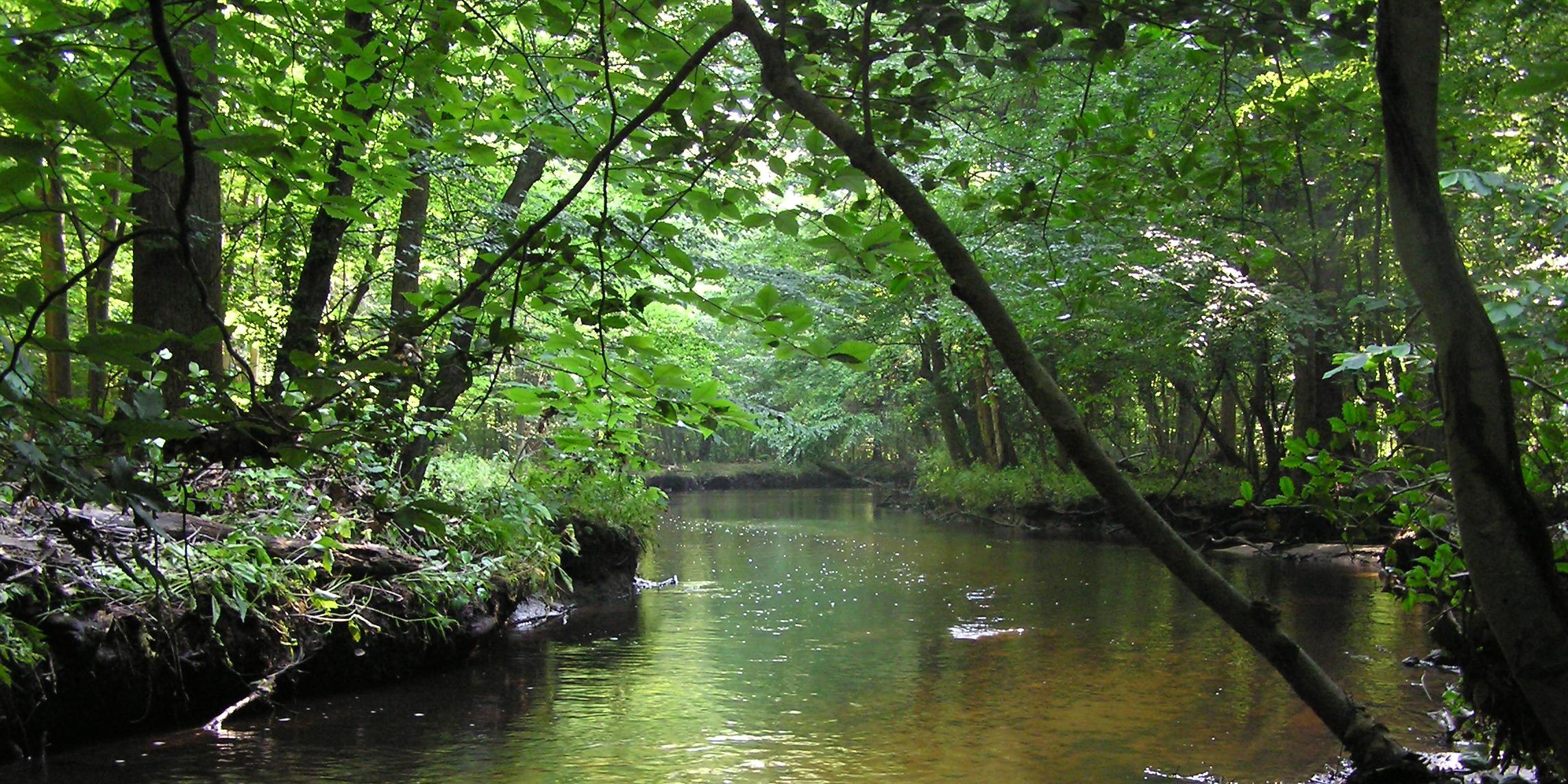
This was Norma's first time kayaking so I brought my Ocean Kayak Cabo, a big, wide, slow, heavy, plastic, sit-on-top kayak. We saw the usual ospreys, herons, and turtles...more than I could count. While the river was scenic, it became especially pretty once we explored the Chapel Branch tributary, which lies 6.4 miles south of the boat ramp on the east side of the Choptank River. 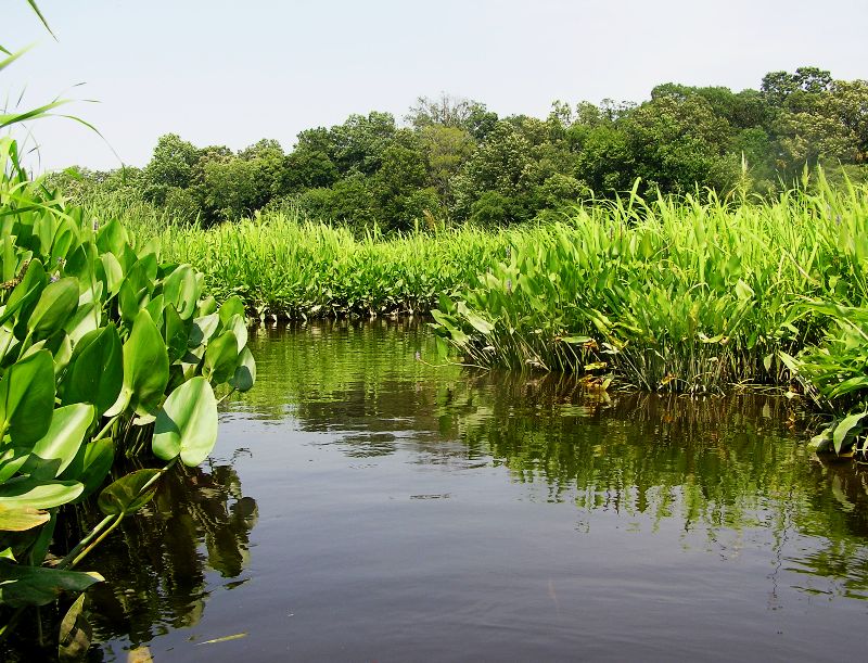
We were stopped by a tree that fell across the creek. This gave me a chance to use my brand new Sven Saw to cut a means for us to pass. 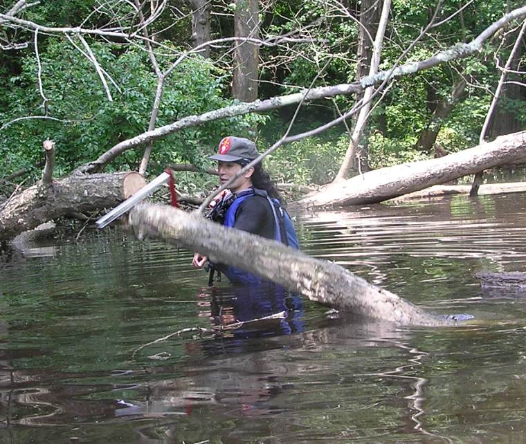
While the area was beautiful, I was a little disappointed that most all of it appeared to be privately owned. Hence, I wasn't too comfortable pulling over and stopping for lunch even though we did. For lunch, we fueled up on meals ready to eat (MREs) which I ate often in the Marines. This was another first for Norma. As with all my friends, she liked it though I think there is a inverse correlation between one's culinary standards and one's level of hunger. I used trioxane compressed fuel (heat tabs) to heat her MRE coffee...another thing from my military past. There were numerous fuzzy caterpillars on the water, wiggling about. Not sure if they wanted to be there or if they just got blown in by the wind. 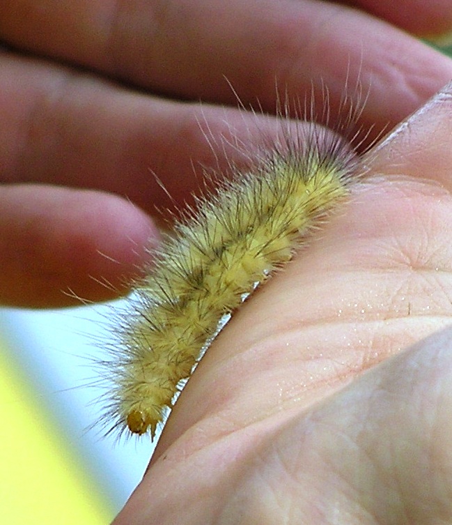
|
|
After paddling 13.2 miles downstream, we arrived back at Martinak State Park. We pulled out my kayak cart, attached it to the bottom of the boat near the middle, and wheeled it back to our campsite. Then, we unlocked our bicycles and rode 9.3 miles through Denton to Greensboro to get back to my car. It felt good to stretch and work our legs after sitting in the kayak for 4.5 hours. We put the bicycles in the car and then drove back to the campsite, finishing our day's adventures at about 1630.
|
|
I picked up a small bundle of firewood for three dollars in the B loop of the campground. Norma gathered kindling and refilled canteens while I got a fire ready for the night. After washing up, we drove to the Denton Plaza Shopping Center just outside of the park and had a great dinner at the Collosseum Italian Restaurant. They had just moved and expanded their business. We spoke with the owner and were pampered like restaurant critics. Their sauces were delicious!
After returning to the campsite, we went for a short walk (maybe a mile or less) around the park on the wooded exercise trail. As the sun set, we sat around the fire for awhile then turned in for the night. |
|
The night was very warm and humid. It is oftentimes a losing situation when trying to find that perfect balance in comfort at night. If you remove the rain fly from your tent, you get good ventilation but then if it starts raining, you'll get wet and have to get up to put on the rain fly. If you leave the rain fly on, you are guaranteed not to have to get up in the night but then you lose some ventilation. I slept fine but Norma was a little too warm at times.
We were up at 0600. Norma found a baby praying mantis. A good omen to start the day. 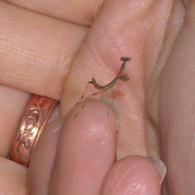
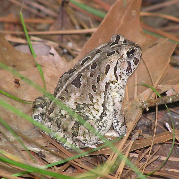
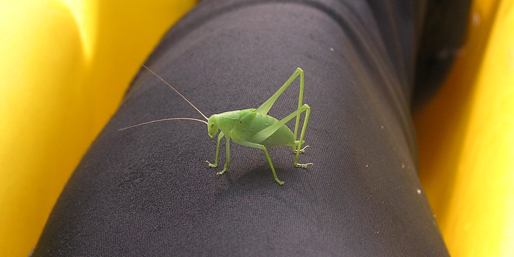
After eating breakfast and getting ready for another big day of kayaking, we drove to Kingston Landing and launched at 0930. We paddled downstream on the Choptank River for about a half mile. Then we turned right (northwest) and paddled up Kings Creek. We saw several bald eagles...or perhaps it was just one. It was hard to tell because it would fly away and then we'd either see it again or see a new one. Unlike yesterday's paddle, this one was much more secluded. I wasn't even sure if we'd be able to get very far since there were no boat ramps or reason for this tributary to be maintained. But this was precisely what kept this area pristine...the lack of human interference. About four miles up from the mouth of the creek, Norma and I encountered a tree that blocked our path and was half submerged in some areas. We got out of the boat, climbed on the log, and managed to pull the boat over the lowest part of the tree. Paddling onward, we encountered a tree that required me to saw our way through. About 5.5 miles from the mouth, the creek became quite narrow with too many trees blocking our route. Time to turn around. Somewhere along the way, a camel cricket hopped on the boat. See photo at the top of the page. We pulled over for a short break and were quickly devoured by mosquitos. Norma and I saw several holes in the mud, each about 1.5 inches in diameter. Some had mud piled up around the sides so they resembled small volcanoes. Later, we found out they were the dwellings of crayfishes. We paddled back downstream then turned north at Beaverdam Brook. Once again, we found the area minimally affected by people and almost left to its natural state. After kayaking up the brook as far as was reasonably possible, we started heading downstream, back to the Choptank River, stopping along the way for lunch. We ate at a small clearing by a road where there had obviously been beaver activity. 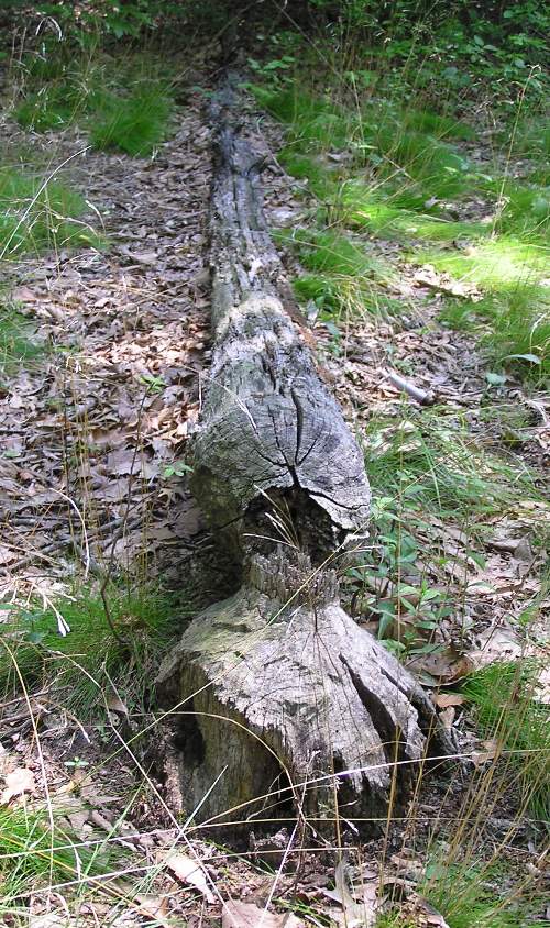
Norma took to kayaking well. I got her started with a standard Euro paddle then had her try a wing paddle. She preferred the latter. Unfortunately, like most beginning paddlers, the skin near the base of her thumbs was rubbed raw which prompted us to wrap her thumbs with bandages and athletic tape. Hence, her thumbs look like that of a mummy. Here she is with her mummy thumbs and another fuzzy caterpillar. 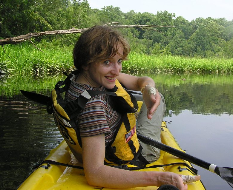
We continued kayaking downstream. After about five hours, we finally saw another boat. By the mid-afternoon, the Choptank was a little windy. Our sheltered little paddle on one of its tributaries was definitely one I will remember for a long time. By the time we landed, we had paddled 12.6 miles in six hours, including breaks. Our moving average pace was about 3.2 mph. I found a small tick on my hand. We started checking each other for ticks. Norma had a few. Fortunately, I had recently purchased a tick remover which I added to my first aid kit. It came in quite handy for removing ticks that have latched onto their host. For the rest of the holiday weekend, we made it a habit to stop and check each other for ticks every few hours. |
|
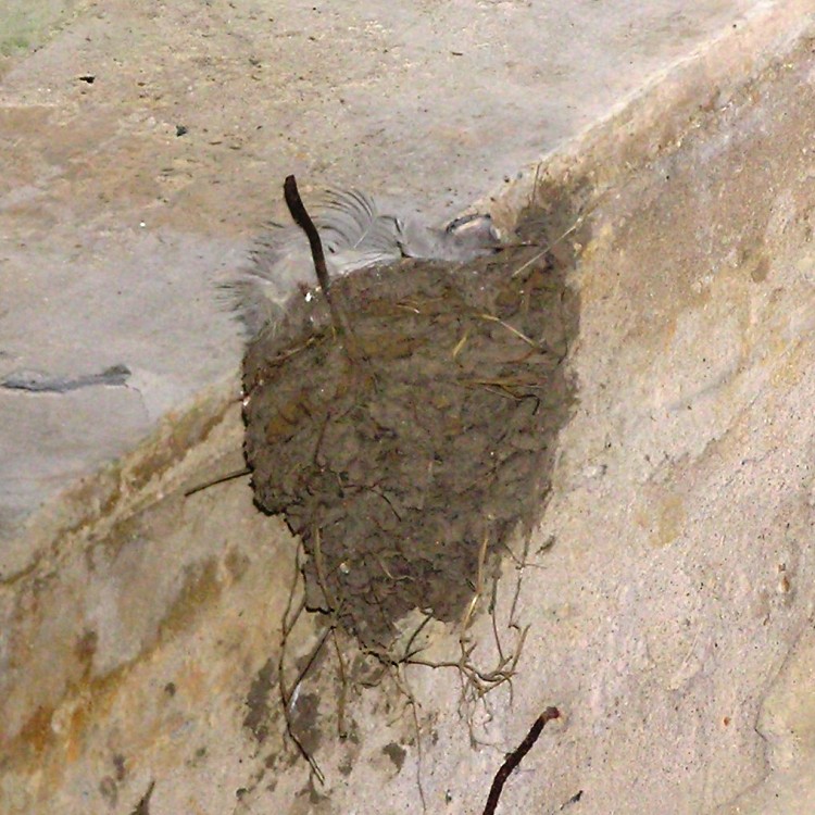
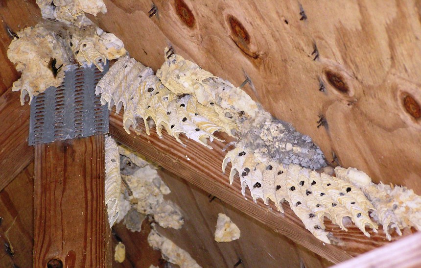
We drove back to the park and launched at the Martinak ramp. Then Norma and I paddled 2.6 miles up Watts Creek. We paddled under Route 313/404, seeing some new bridge construction along with several swallow nests below the old bridge.
We continued paddling a good distance...much further than I originally anticipated. Some of the upstream areas had nice tree cover to protect us from the sun. See photo at the bottom of the page. 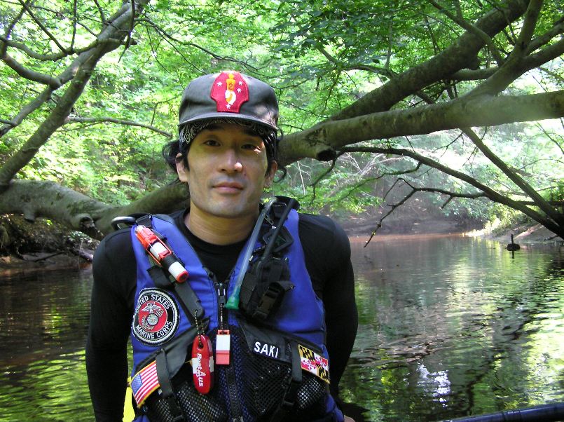
By the time we finished, we paddled a days total of 17.8 miles! Not bad considering we were using a recreational boat. |
|
That night we ate at Snappy's Bar and Grille. Not sure how big their burgers were but I'm guessing it was a good half pound of beef in each patty. We returned to the campsite then turned in early at 2130. We were both exhausted.
|
|
Some light rain had fallen the previous night and that morning. Considering the weather forecast called for 30-40% chance of showers for much of the weekend, we were fortunate to have gotten so little rain over the last few days.
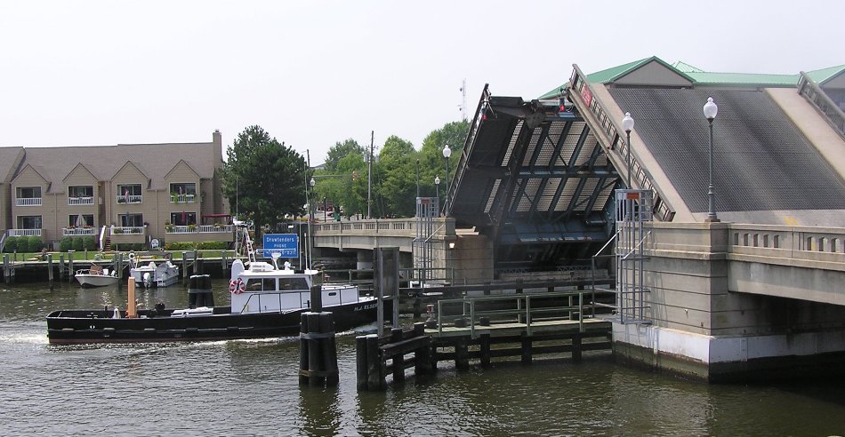
We were up at 0645 and left camp at 0845. Feeling a little fatigued from yesterday's kayaking, we decided to alter the weekend plans just a bit and spend the day bicycling. We drove to Blackwater National Wildlife Refuge. On the way there, we encountered some road detours, most likely due to the heavy rain. There was also a section of the railroad tracks that had completely washed away during the flooding from days prior. 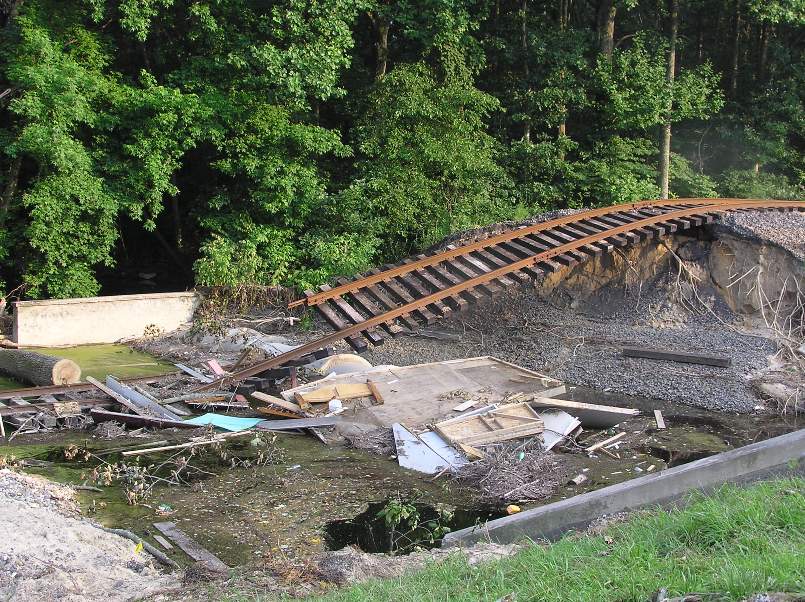
We stopped at the refuge visitor center and decided on a route. Having biked the lower 25-mile loop around the wetlands area back in December 2005, I chose instead for us to explore the 20-mile loop which goes into Cambridge. Key Wallace Hiking Trail
Cambridge
Bicycling on Wildlife Drive
|
|
Norma and I stopped at the Food Lion in Denton where we picked up dinner to eat back at the campsite. We sat around the fire then called it a night at 2230.
|
|
Norma and I were up at 0630. We ate breakfast then started taking down our campsite. I found some strange insect that resembled a small wood chip or large piece of lint. Norma suspected maybe it was an insect version of a hermit crab and chose a piece of camouflage to wear.
Greg and Jenny from the Chesapeake Paddlers Association stopped by to visit. They had been exploring the Wicomico River with Rich and Sue. We left camp at 0915 and then drove to Tuckahoe State Park. Here, we launched at 1000 just south (downstream) of Crouse Mill Lake onto the scenic water trail. The narrow Tuckahoe Creek was pristine and very well shaded with tall trees on both sides. Unfortunately, the flooding from days prior sent some of these trees falling across the creek. Below, Norma sits in the kayak next to a fallen tree where dirt from the roots towers over her while the trunk faces the other direction. 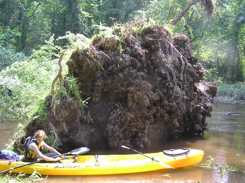
With the water being very high, the current was relatively swift. Hence, paddling upstream back to the car was not an option and walking back with the boat would have taken a long time. We were determined to paddle the entire length of the scenic water trail. If we encountered a low tree that was partially submerged, we were often able to get out of the boat and pull it over the tree. If the tree was a couple of feet above the water, we could paddle under it. We did this several times with some trees so low that we had to turn our heads to the side to fit underneathe. Some trees just had too many branches and were impassible without some cutting. Thus, Norma and I did a good deal of sawing. 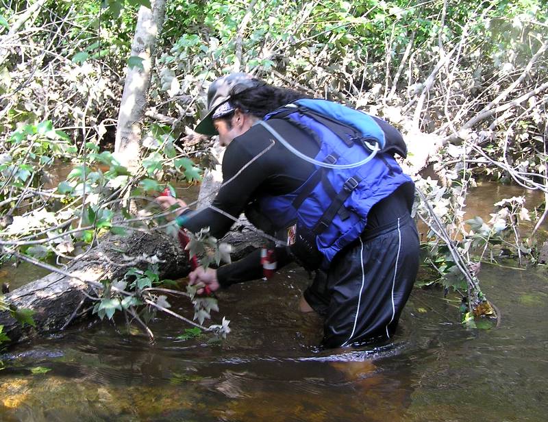
Due to all the obstacles, our little five-mile paddle took three hours due to all the work required to get past the downfalls. We ate lunch at our take out point, the Hillsboro Boat Ramp. Then, we locked up the boat and secured most of our gear in the hatches using plastic ties. |
|
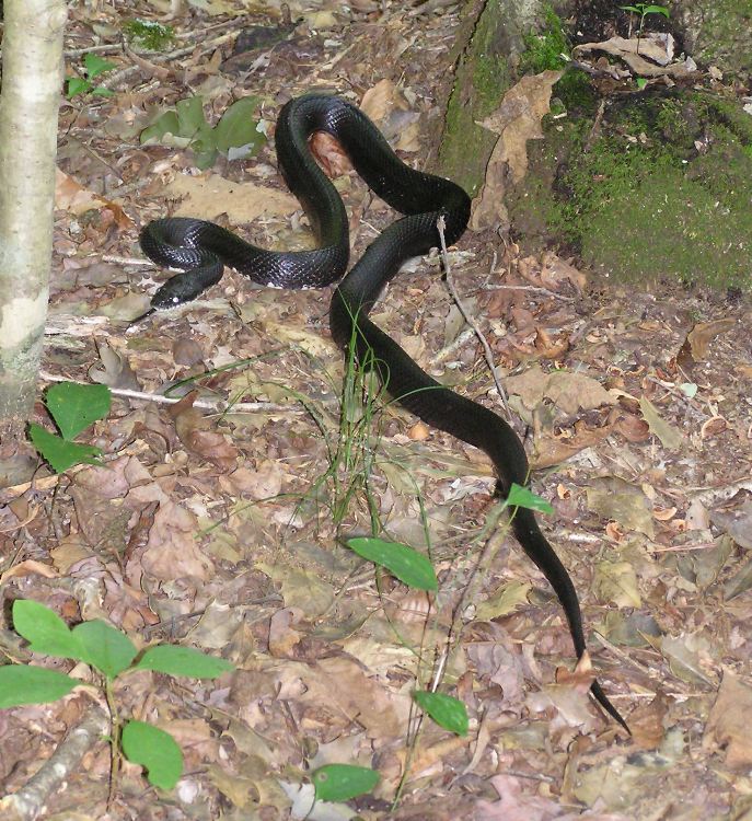
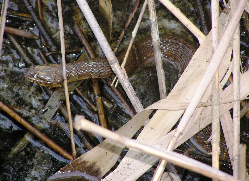
At 1330, we began hiking back to the car, walking through the town of Hillsboro, through Green Mount Cemetery then north through the state park via the Tuckahoe Valley Trail. Along the way, we saw a four-foot long black rat snake.
We also saw a wild turkey and a multitude of frogs. The day was hot and humid but neither of us complained. How could we? We were walking in a pine forest on a carpet of pine needles. By 1530, we were back at the car. We checked each other for ticks. I had none and Norma had many. Perhaps the difference was that I sprayed my clothes with permethrin several days prior whereas Norma did not want her clothes sprayed. I guess the stuff works. |
|
Taking the advice of Greg and Jenny, we avoiding driving on Route 404 as much as possible, instead taking Route 309 northwest to Route 213 (Centerville Road) north, to Route 301 southwest, to Highway 50 west. This got across the Bay Bridge quickly and easily.
It seemed the weather we encountered on the eastern shore of Maryland was much gentler than that in the Washington D.C. area. Norma's town had a downed power line, blackouts, and numerous fallen tree branches. Driving out there was a nightmare because so many roads were closed off. In my town of Elkridge, there was also a blackout. Maybe we should have stayed an extra day. Looking back over the last four days, we accomplished a great deal; we hiked nine miles, paddled 36 miles, and biked 41.3 miles. Believe it or not, it actually was a relaxing weekend, in a stimulating sort of way. |

