|
This page is my blog about a long weekend trip I did with Norma and Daphne to southwestern Ohio. |

|
This page is my blog about a long weekend trip I did with Norma and Daphne to southwestern Ohio. |
|
We had an eight plus hour drive to get to our destination (assuming no stops) and only four days to enjoy it. So we figured we'd do like we'd done in the past and drive all night. After work, I packed things up and then we left shortly after Norma finished working at the Savage Farmers Market.
We took turns driving and then sometime around 0400, we pulled over at a rest stop for a two hour nap before driving into Cincinnati during morning rush hour traffic. That part of our trip was quite slow but maybe no worse than any other big city at that time of day.  |
|
Our first stop was the Cincinnati Museum Center. We arrived a good bit before they opened so we ended up driving a short distance to find a place for breakfast.
What was my initial impression of the city? To me it seemed like just about any other big city. Norma thought it had a different feel from east coast cities, having more of a Midwest feel, but I didn't see it. I didn't think the people were any different than what I'm used to either. Back at the museum, we left Daphne in the car since they don't allow dogs unless they are service animals. Sure, we could say that's what she is but that's not how we roll. Doing so takes away from the folks that really need a service animal. We parked in a shady area and left the windows ajar. It was a cloudy, cool day. 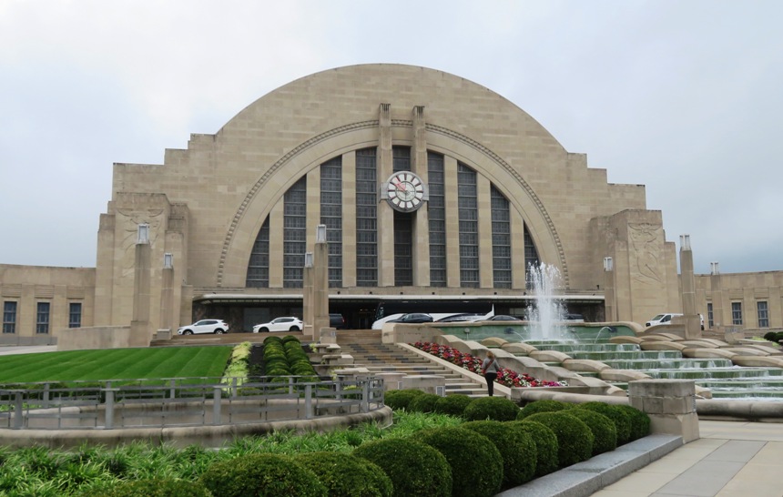
Next, Norma and I hit the Museum of Natural History & Science, stopping first at Dinosaur Hall. This was a big motivation for choosing Ohio. We knew the southwestern quadrant of the state had a lot of fossils, and I was really wanting to find a trilobite...Ohio's official state fossil. Touring this part of the museum would show us the possibilities for what we might find in the wild. We were greeted by Galeamopus, a large sauropod. Sustaining massive bodies probably meant that sauropods grazed whenever food was available. Their weak teeth suggest that, like living reptiles, they did not chew their food, but raked off plant parts and swallowed them whole. Sometimes sauropod skeletons have rounded stones in the stomach area. These may be gastroliths (stomach stones), swallowed to grind up food in their digestive tracts. Some animals today, including chickens and crocodiles, use stones in a similar way to aid their digestion. - from museum sign titled "Plant-eating sauropods" 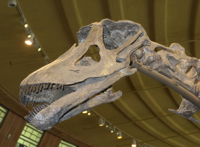
One thing I did not know is that The first recognized dinosaur, Megalosaurus, was named in England in 1824, 18 years before the word "dinosaur" was coined. - from museum sign titled "History of discovery" Moving on past the dinosaurs, we saw some of the local fossils. One of my favorites, which I'd never found, are crinoids. These animals thrived in gentle currents. They avoided drifting away by attaching a stalk to the seafloor. - from museum sign titled "Crinoids" 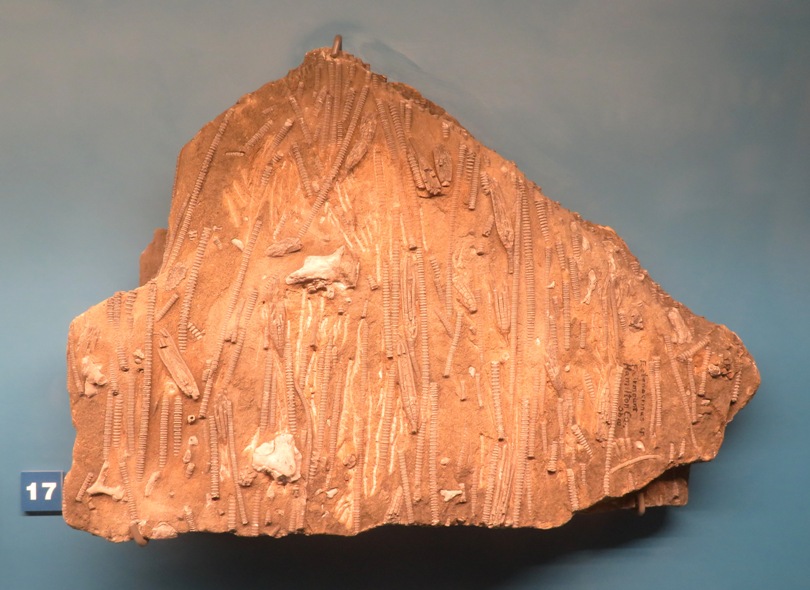
The below assemblage of Late Ordovician (458.2 to 443.1 million years ago) crinoids are from the Fairview Formation in Mason County, Kentucky. An underwater mudslide caused by a violent storm quickly buried this community. Their fast burial resulted in excellent preservation. - from museum sign titled "Crinoids" 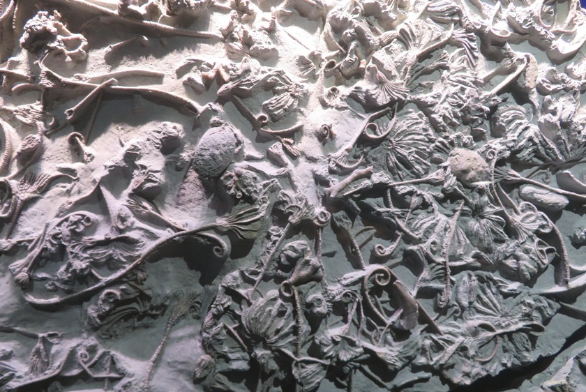
A less exciting but still important fossil I saw was a stromatoporoid, an extinct type of reef-building sponge that lived ~400 million years ago. A few months ago, a contractor with a background in natural history told me there were sponge fossils embedded in the floor of the building where I work. I was skeptical at first, but now think he was probably right. This specimen was found in Warren County, Ohio. Sponges have little structure visible to the naked eye. Because of their unusual shape, they puzzled scientists for some time. A general rule in paleontology is: if you can't identify it, there's a good chance it is a sponge. - from museum sign titled "Sponges" Another sign mentioned ...it is hard to tell algae and sponges apart [fossils, that is]. As a result, it's common for sponges to be mistaken for algae or the other way around. - from museum sign titled "Algae and Sponges, Oh My!" 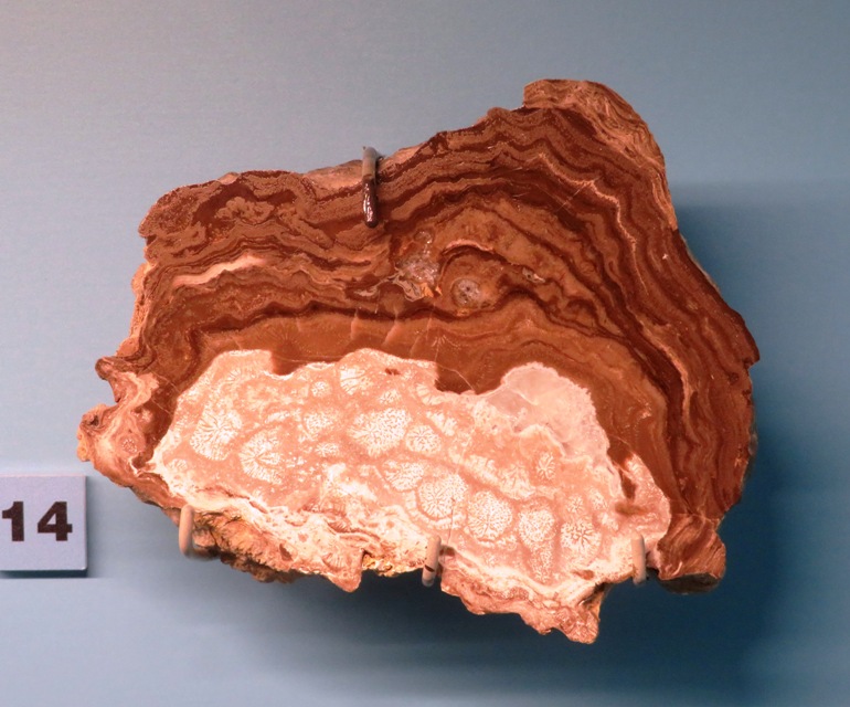
One of the most common fossils in the area are bryozoans. Bryozoans are tiny organisms with hard skeletons, which grow to form colonies of all shapes and sizes. Their feeding structures - called lophophores - are made of a ring of filaments used first to stir up the water then to filter food. There are still more than 5,000 bryozoan species alive today. - from museum sign titled "Bryozoans" The bryozoan fossils at the museum looked nothing like the ones I'd seen in my area, which resemble those shown at Sound Rivers - Is it The Blob? No, it's a bryozoan colony. Eventually, we came to the trilobite section. Finding a fine specimen was one of my goals for this trip. Trilobites are extinct arthropods with a branched appendage on each section of their body, an upper gill and a lower walking leg. They were one of the first sighted animals. With more than 20,000 species, trilobites had many lifestyles, from burrowing in the mud to swimming in open water. - from museum sign titled "Trilobites" The museum had nice models of prehistoric fish such as the armored dunkleosteus which could grow a long as a school bus. They also had a tiktaalik, which was perhaps the first fish to take steps on land. 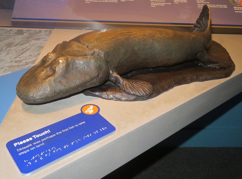
Other models included The dragonfly Meganeura [which] was the largest flying insect ever, with a wingspan 28 inches long. - from museum sign titled "Look Up!" What did I learn about the geology of this area? Tectonic plates collided along the eastern edge of North America 460 to 450 million years ago. The impact compressed and lifted rocks for hundreds of miles. It formed a geologic structure called the Cincinnati Arch. The highpoint was in the Cincinnati region. It was subject to erosion for hundreds of millions of years, eventually exposing the older bedrock we find around us today. - from museum sign We learned about more recent prehistoric animals such as mastodons and mammoths. So what's the difference? Mastodon's knobby teeth crushed aquatic plants, broad leaves and plants with woody stems. The grinding surfaces of mammoth teeth helped them graze on tough grasses. Modern elephants also eat grasses and have grinding teeth. Anatomical and DNA studies find that elephants and mammoths are closely related. Mastodons are more distant relatives. - from museum signs Megafauna such as mastodons and ground sloths lived at the same time as humans. This is likely why they went extinct, according to a docent. This docent also told us where to hunt for local fossils. Before leaving the natural history section, I learned that Scientists call our current geologic age the Anthropocene. The word comes from anthro (meaning human) and cene (meaning recent). Its name reflects that humans have made a lasting mark on the planet. - from sign at Cincinnati Museum Center titled "Anthropocene" The Cincinnati Museum Center is a really big place, and one can spend a lot of time here. My attention span is only so long and we still had another museum to see so it was best to leave...but not before learning something about the city. "Porkopolis." Cincinnati earned this nickname in the mid-1800s, when it produced more pork than any other city in the world. From 1857 through 1860, the local pork industry processed and packed an average of 424,450 hogs each year. - from sign at Cincinnati Museum Center titled "Porkopolis" |
|
Our next stop was the National Underground Railroad Freedom Center. Again, this was a place where Daphne could not join us.
Norma and I have been to lots of African American-themed museums including: While this museum in Cincinnati was indeed impressive, it really didn't teach us very much that we didn't already know. Still, we were glad to have visited. So what did I learn? According to various signs in the museum: In the 1800s, the Underground Railroad flowed to, through, and around this city and state. Many enslaved people crossed the Ohio River to enter the free state of Ohio. They defied laws and risked violence to seek freedom. Some people continued north, while others built their lives in Cincinnati's free Black communities. The Dutch were especially successful in the early years of growing sugar cane in the Americas. Indeed, probably the first enslaved African people to arrive in Jamestown, the first English colony, in 1619 were brought on a Dutch ship. When some Europeans first saw Native Americans smoking tobacco, they through the Indian people were eating fire! During the 1700s, many plantation owners in Maryland and Virginia were able to increase their fortunes by selling tobacco to Europeans and to Africans. Indeed, tobacco was one of the commodities traded for slaves on the Atlantic coasts in Africa and in the Caribbean islands. Regardless of how people consumed tobacco, the vast majority of the crop was grown by slave labor in the American colonies. Between 1619 and 1775, generations of enslaved people of African descent had labored in these colonies to create wealth for their owners. In the Chesapeake, tobacco was the major cash crop. For many decades, tobacco was raised by slave labor at great profit to the slave owners. In the coastal regions of the Carolinas and Georgia, rice was the primary cash crop. Cincinnati developed a reputation as being a magnet for runaways seeking to gain their freedom. However, the maroon community in the Dismal Swamp, located along the border of Virginia and North Carolina, numbered several thousand runaways. The swamp was so inaccessible to those unfamiliar with it that some runaways survived there for years. Additionally, I learned that While the Cincinnati Museum Center had lots of visitors, especially what we think were home-schooled children, the National Underground Railroad Freedom Center was fairly empty. |
|
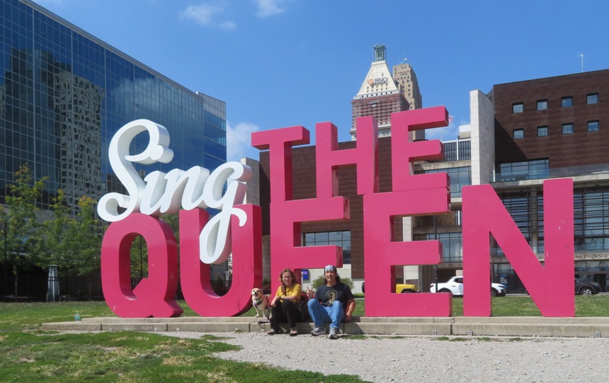
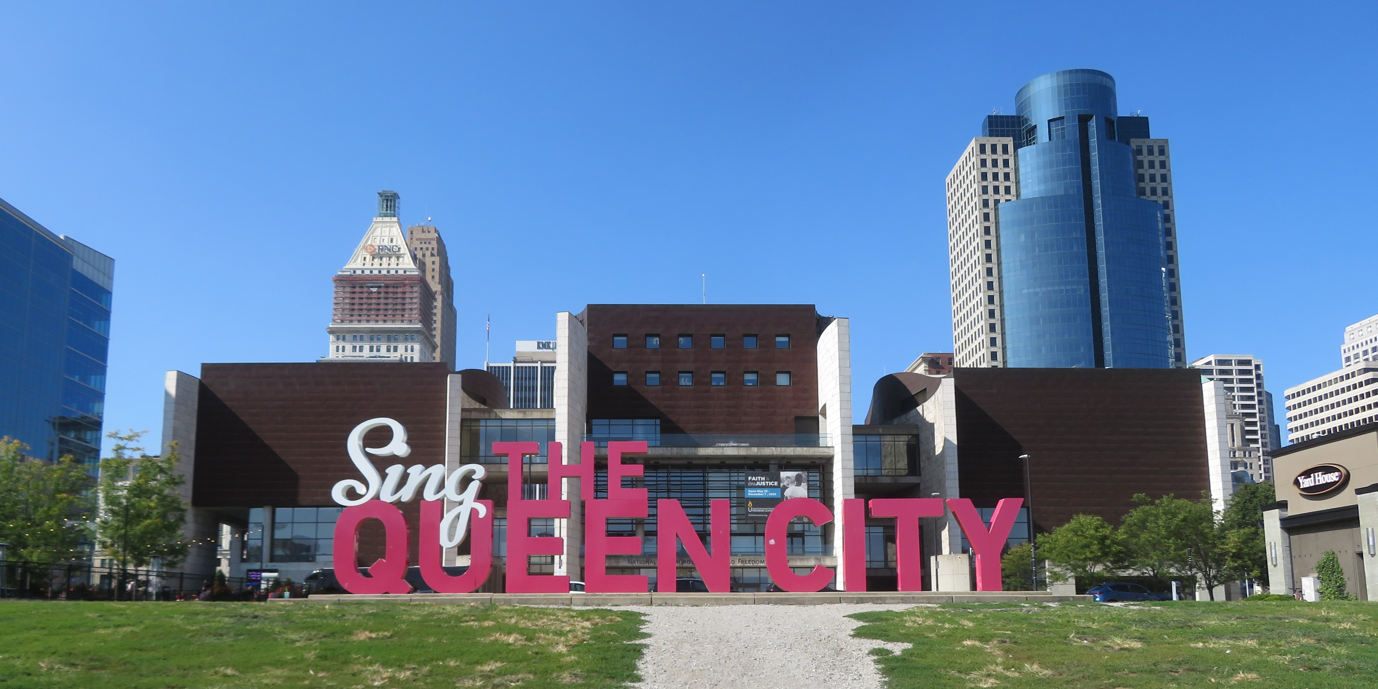
In addition to Porkopolis, Cincinnati was also known as "Queen City." The term "Queen City" is derived from an 1819 article in the Inquisitor and Cincinnati Advertiser, which referred to Cincinnati as the "fair Queen of the West". See photo at top of page. Interestingly, Cumberland, Maryland was known as the "Queen City" as it was once the second largest city in the state.
We walked across the John A. Roebling Suspension Bridge (built in 1867) over the Ohio River and saw a paddlewheel boat. I was disappointed to find that the paddlewheel wasn't even being used to propel the boat. It was just for show. 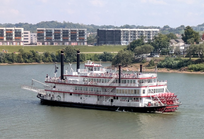
Looking back, we could see the city skyline and the Great American Ball Park, home field of the Cincinnati Reds. 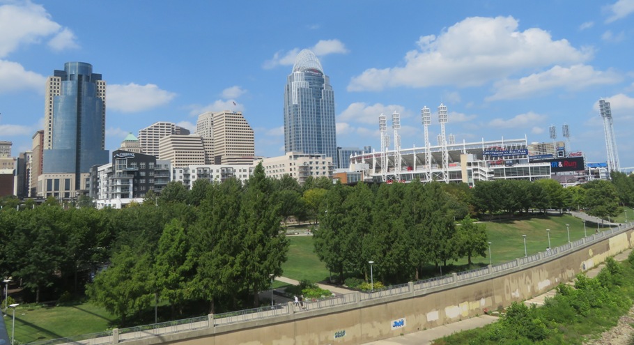
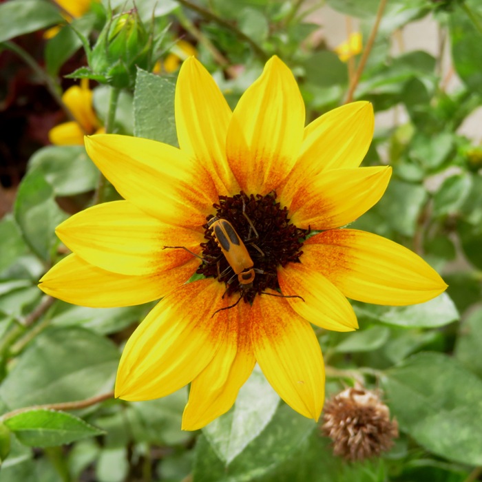
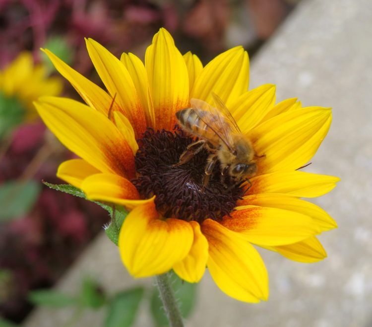
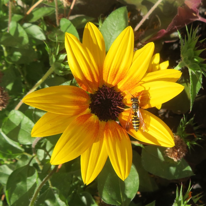
We crossed over the state line to Kentucky, where we stopped for a snack. I spotted various flying insects on sunflowers. Here's Daphne and I at the suspension bridge on the Kentucky side before making our way back to Cincinnati. 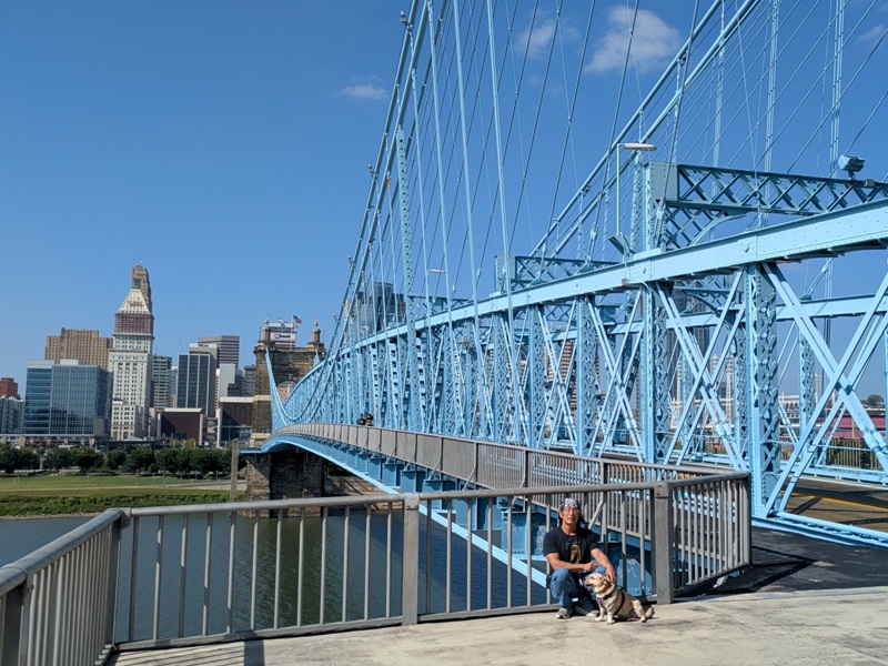
|
|
Norma, Daphne, and I went fossil hunting at Trammel Fossil Park in Sharonville, Ohio. This 10-acre site was created thanks to the generous donation by the R.L. Trammel family. The layers of rock in this location are known to geologists as the "Cincinnatian Series" and harbor fossils that are 445 million years old, dating them to the Late Ordovician Period. At this time, Ohio was covered in a warm, shallow sea. Trammel Park represents approximately two million years of the Late Ordovician times.
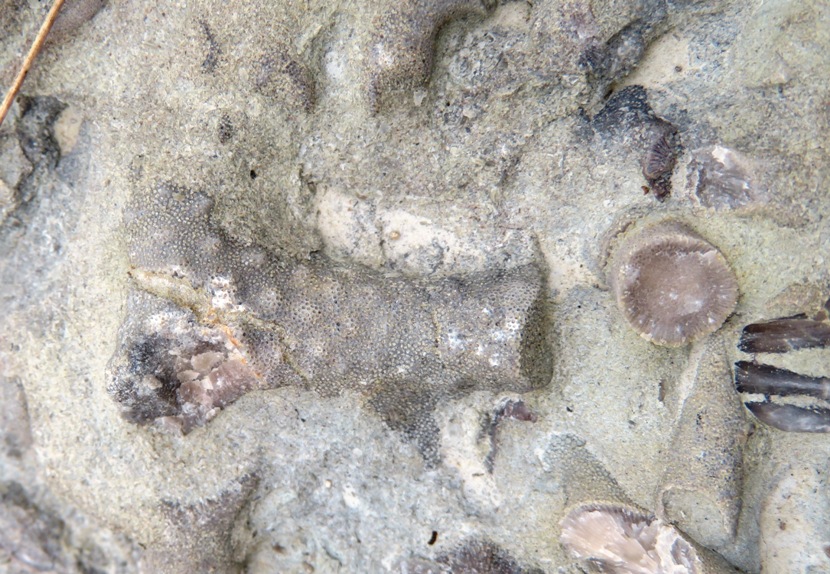
To put things into perspective, the Earth is 4.6 billion years old, and life began as single cells about 3.8 billion years ago. So what do we know about Sharonville? 15,000 years ago, a sheet of ice extended from northern Canada to Sharonville, Ohio. This glacier was up to two miles thick at its origin, although it became thinner as it spread south. The glacier's flow flattened trees and bulldozed the landscape, covering it with ice for thousands of years. Icy winds gusted off the glacier, and the colder climate supported many animals and plants we don't find here today. - from sign at Cincinnati Museum Center titled "The edge of the glacier" Norma and I found several fossils here with bryozoans being very common. Bryozoans, such as the one shown here, have skeletons that resemble twigs or plates. Their skeleton has a porous structure that protected thousands of tiny bryozoan zooids. Each zooid used tentacles to collect food particles from the water. - from sign at Trammel Park 1 / 7

Bryozoan.
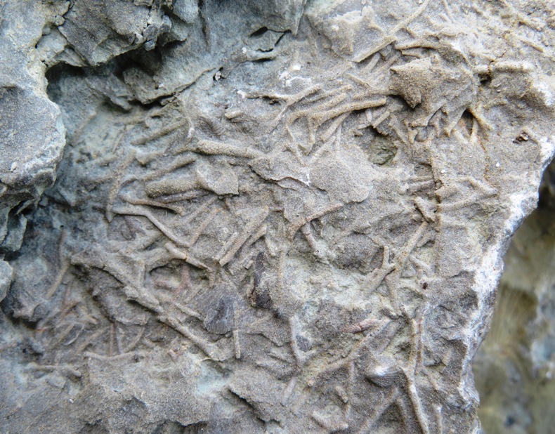
2 / 7
Branching bryozoan.
3 / 7
In my palm.
4 / 7
Bryozoan.
5 / 7
Bryozoan.
6 / 7
Bryozoans.
7 / 7
Bryozoan.
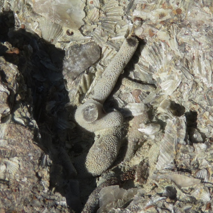
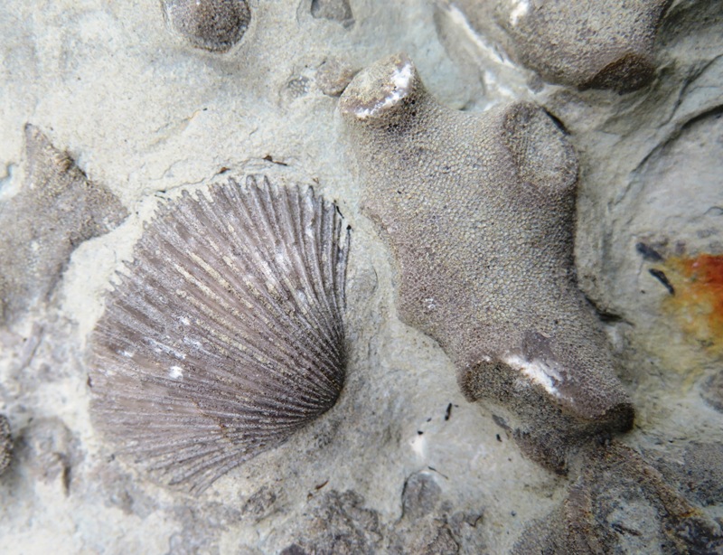
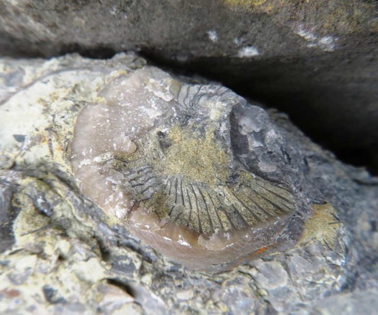
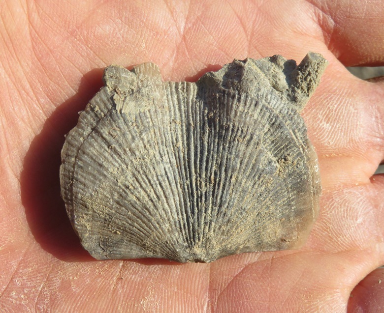
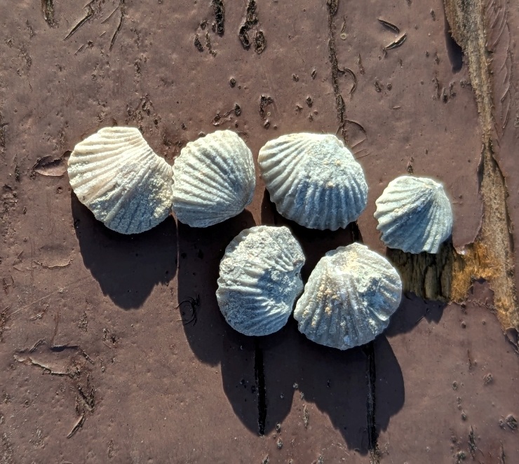
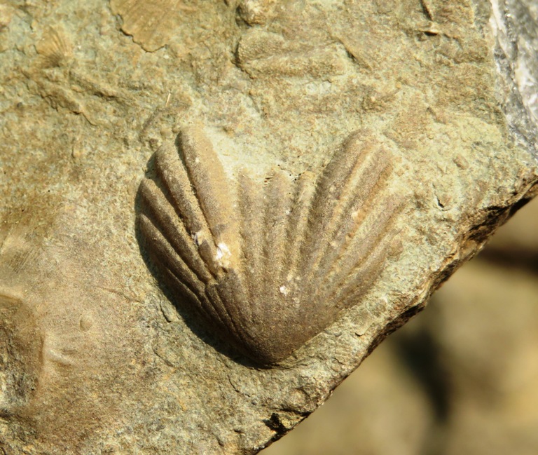
We also spotted several brachiopods. Often confused with clams, brachiopods have two shells that are not similar to one another. - from sign at Trammel Park Crinoids, or sea lilies, are animals related to sea urchins and sea stars. The animal would have had a stem, attaching to the sea floor, and long, feathery arms to filter food from the water. - from sign at Trammel Park The two button-like things in this photo are cross-sections of the stem. 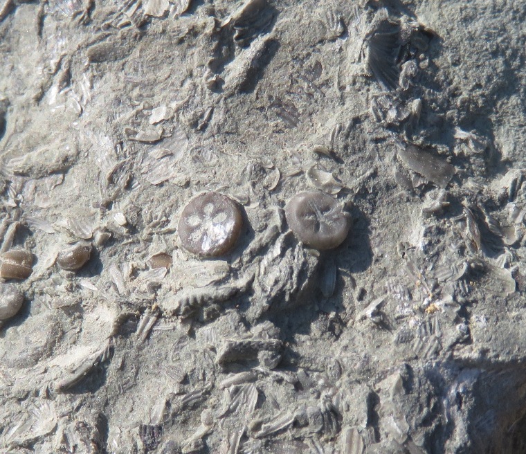
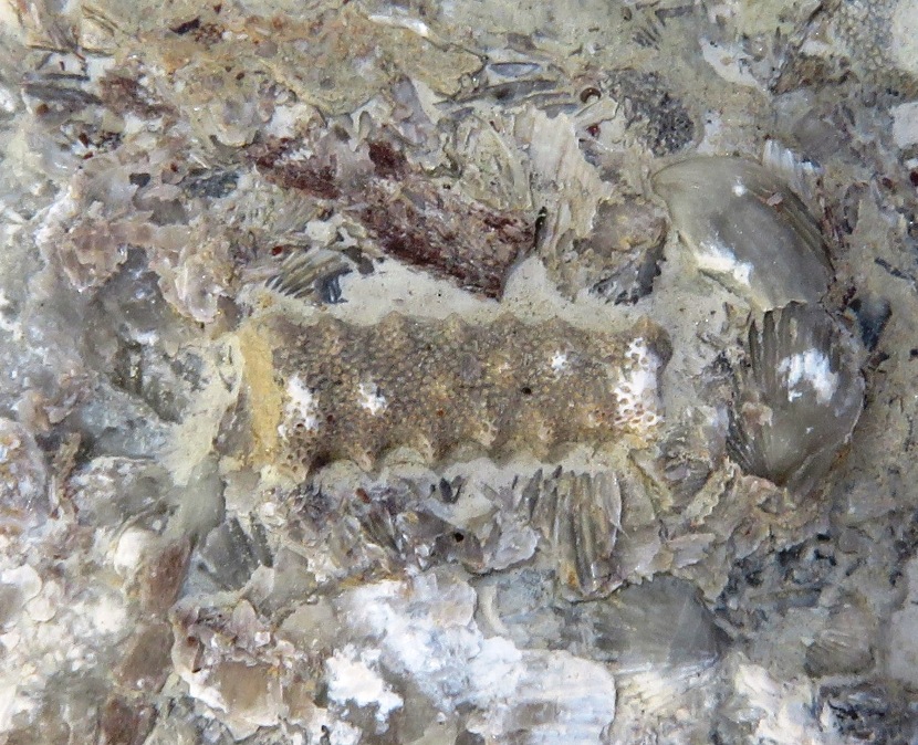
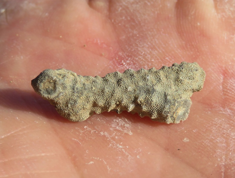
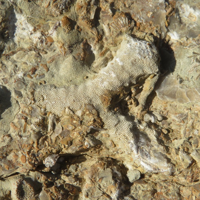
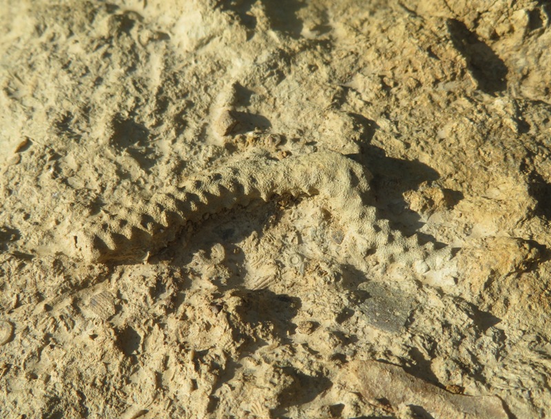
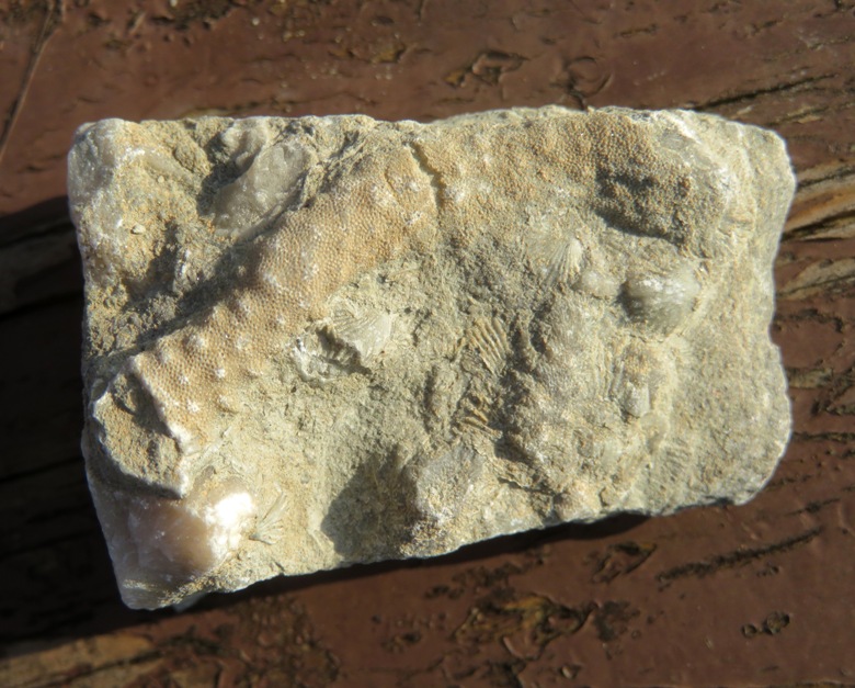
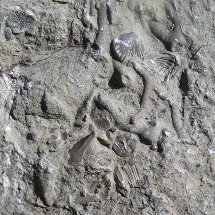
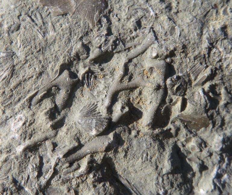
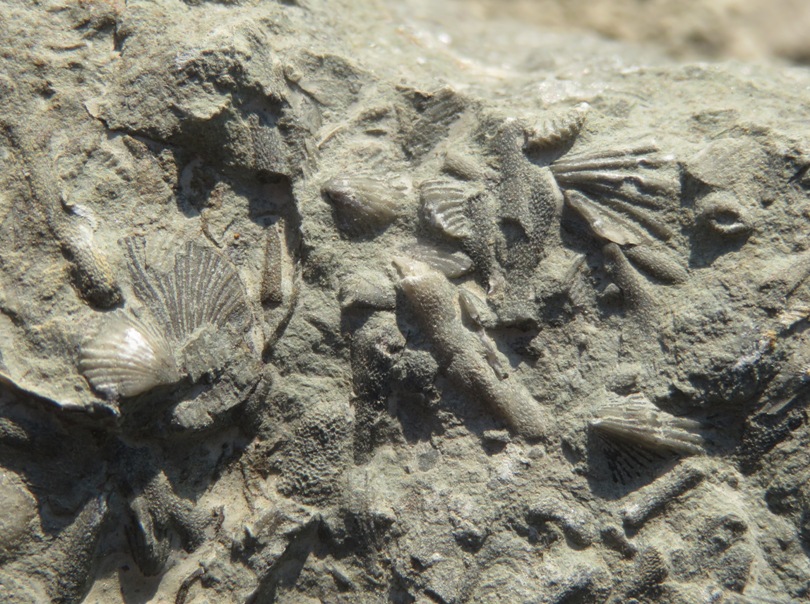
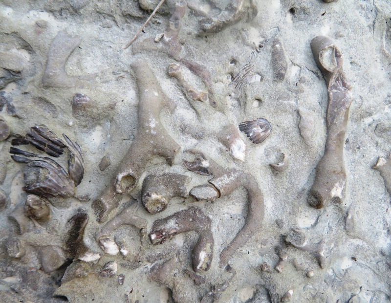
The producers of Matrix got the idea for a Sentinel from the crinoid fossils. That may seem hard to believe from the above photo but you should be able to see a resemblance to the ones at Reddit - Matrix Sentinel Idea. Many of the rocks I found contained an assortment of aquatic fossils, reflecting the high density and variety of life that once lived at this site. In the below, there is a tubular-shaped thing with cross-striations and no dimples. I believe it is tabulate coral. This fossil coral is a cluster of limestone skeletons formed by tiny animals called coral polyps. Each opening in the top of the coral was home to one polyp. As the colony grew, the limestone tubes in which the polyps lived grew as well. Sometimes they grew large enough to form reefs. The polyps had stinging tentacles to capture prey, a trait they share with the related jellyfish and sea anemones. - from sign at the Caesar Creek Lake Visitor Center titled "Tabulate Coral" 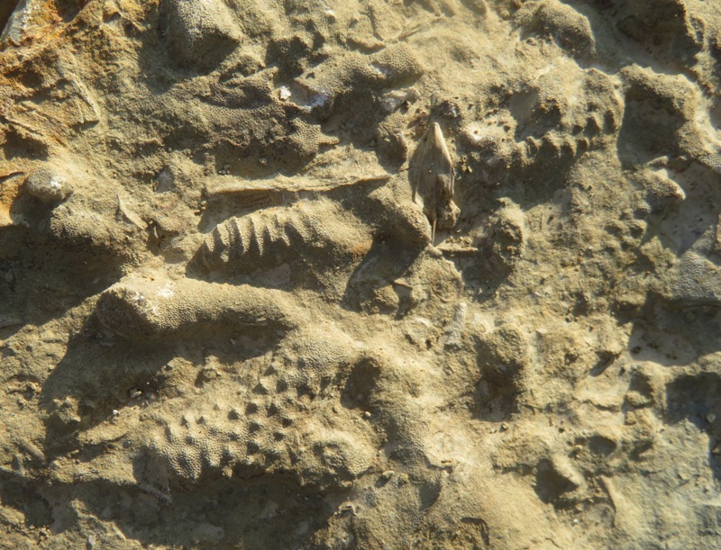
While I tended to focus more on taking pics of fossils embedded in larger rocks, Norma found lots of individual fossils. 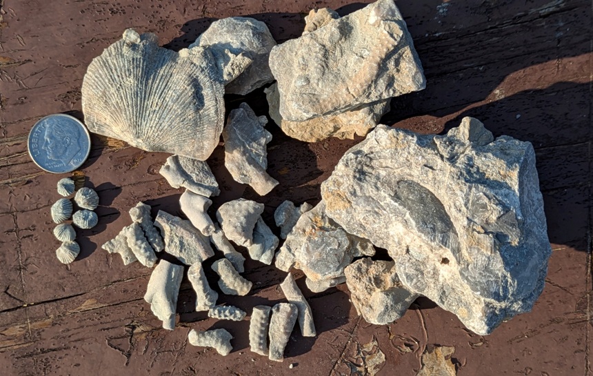
Daphne also helped look for fossils. 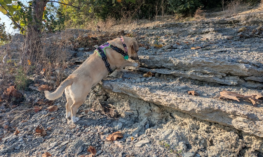
|
|
We pulled into Caesar Creek Lake State Park Campground for the evening. There were many vacant campsites. It was a nice place.
This was the first time we slept in my new used Subaru Outback. I purchased an air mattress that fit in the back, giving the two of us and Daphne adequate space. The only thing is that to make space for the mattress, the front seats have to be moved forward and any gear in the back needs to be removed and either put in the front seats, in the cartop carrier (i.e. turtle shell), or on the picnic table. That's all fine in nice weather but if it was raining, that would not have worked so well. I'm not sure if car camping this way is really any better than sleeping in a tent. |
|
After finding breakfast and coffee, our next stop was the Caesar Creek Lake Visitor Center.
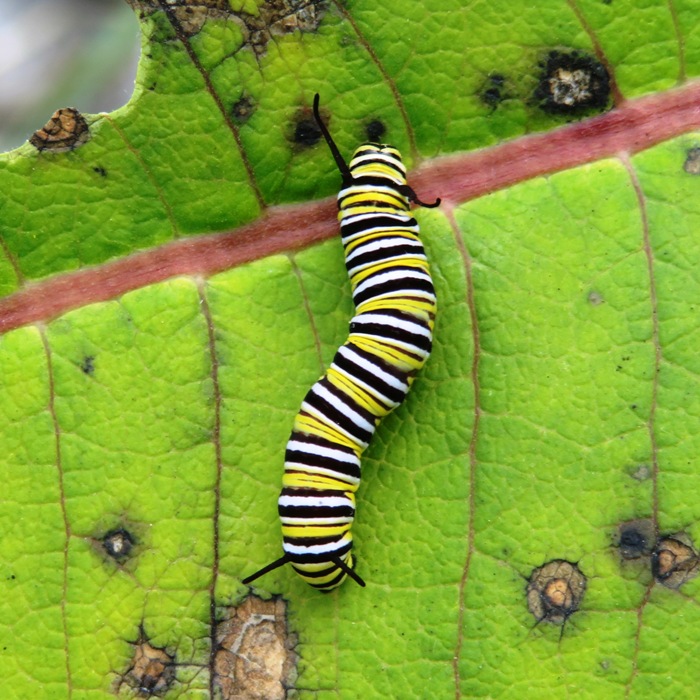
We saw monarch butterflies being grown in captivity to then be released into the wild. Here's a monarch chrysalis. 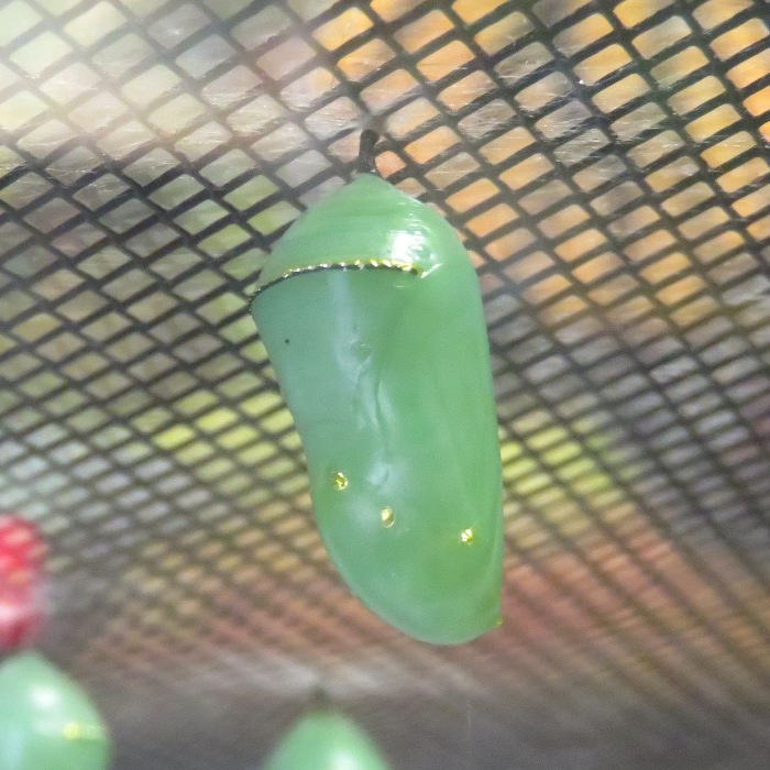
This is a monarch butterfly having just emerged from its chrysalis. 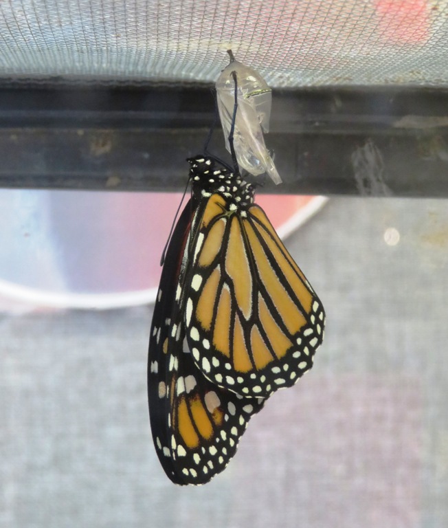
We requested and received free fossil collecting permits so we could hunt for fossils in the park's spillway. Then it was time to see what we could find there. |
|
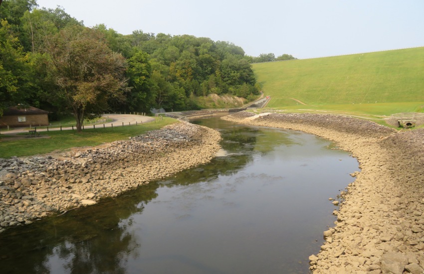
We drove a very short distance to the Caesar Creek Lake Spillway.
...the Emergency Spillway [is] part of the flood control structure at Caesar Creek Lake. The spillway serves as a safety valve for the dam. If the lake were to reach flood levels, additional waters would pass through the spillway, avoiding damage or destruction of the dam. - from sign at Caesar Creek Lake Spillway titled "The 'Safety Valve'" I mentioned that one of my goals for this trip was to find a trilobite fossil. If I were to find one, I figured it would be here. If you were standing here when the fossils were living creatures around 450 million years ago, you would be at the bottom of a warm, shallow sea called the Ordovician Sea. The time when it covered the United States is called the Ordovician Period. Animals much different from those today lived in this ancient sea. One of the most interesting was the trilobite, an animal with a three-lobed body that could roll up like a pill bug to avoid danger. Although the trilobites lived in the Ordovician Sea 35 times longer than people have lived on earth, trilobites became extinct 250 million years ago. No one knows why they became extinct, and maybe that's why they are one of collectors' most favorite finds. - from sign at Caesar Creek Lake Spillway titled "Trilobites were everywhere!" While a sign at the Caesar Creek Lake Visitor Center said No close relatives of the trilobites are living today... a sign at the Caesar Creek Lake Spillway mentioned the trilobite is related to the horseshoe crab. Probing further, Google AI stated ...horseshoe crabs and trilobites are related in that they are both ancient arthropods that evolved in the same Paleozoic oceans and share a similar body plan, with trilobites serving as a living analog and potentially a primitive ancestor to the horseshoe crab lineage. While horseshoe crabs are not direct descendants of trilobites, they both belong to the chelicerate group (which also includes spiders and scorpions), sharing fundamental characteristics as primitive arthropods. Like Trammel Fossil Park, I found plenty of evidence of bryozoans. I also found more brachiopods. 1 / 6
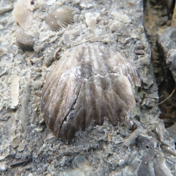
Brachiopod.
2 / 6
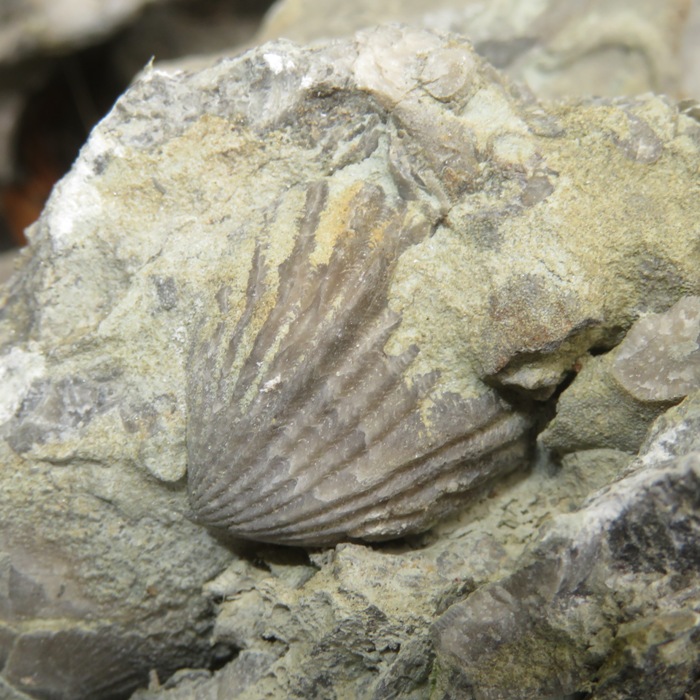
In stone.
3 / 6
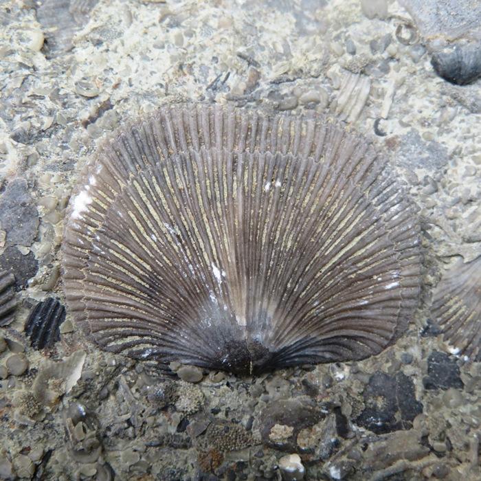
Pristine.
4 / 6
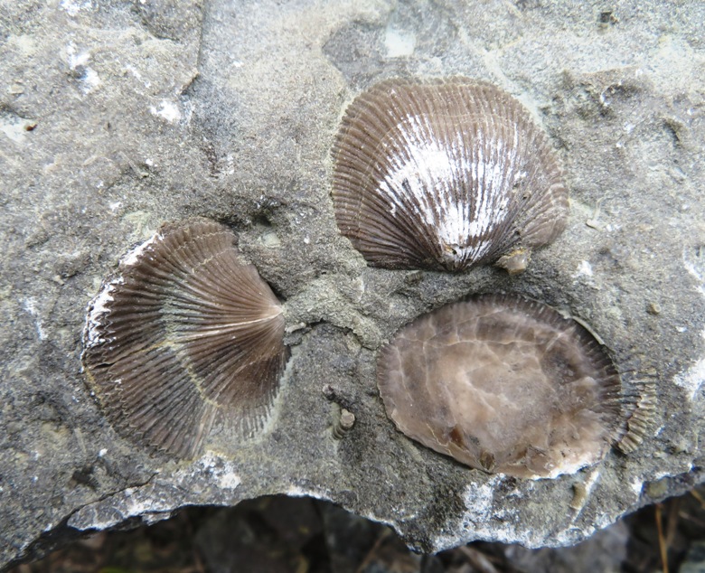
Multiple.
5 / 6
In hand.
6 / 6
With bryozoan.
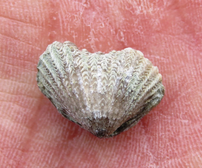
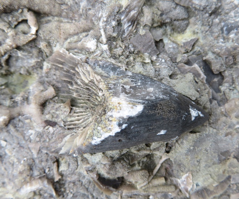
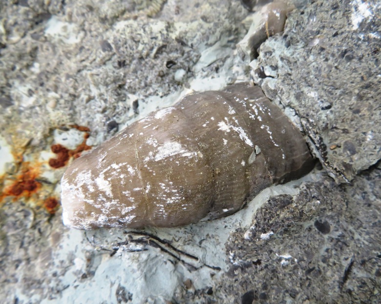
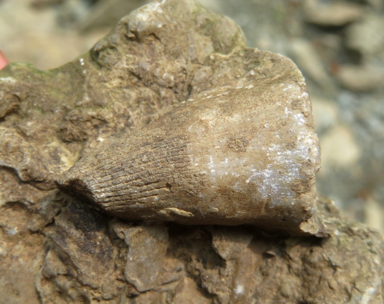
What I didn't expect to find were so many horn corals. This fossil looks like a bull's horn or dinosaur's tooth, even though it was an animal. Most horn corals were attached to the ocean floor in the mud. - from "Common Fossils of Ceasar Creek Lake" by U.S. Army Corps of Engineers 1 / 6
Well lit.
2 / 6
Showing root.
3 / 6
Partially buried.
4 / 6
With shells.
5 / 6
Base.
6 / 6
In stone.
Here's a horn coral with pieces of bryozoan attached to its base. 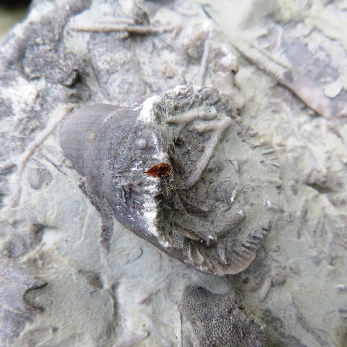
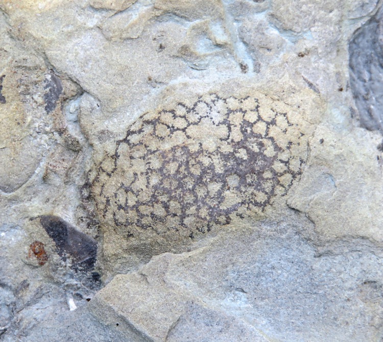
There were a few fossils that I needed help identifying. I found such help in the Dry Dredgers Facebook group. Ron F. and Bill H. identified the below as some type of bryozoan. 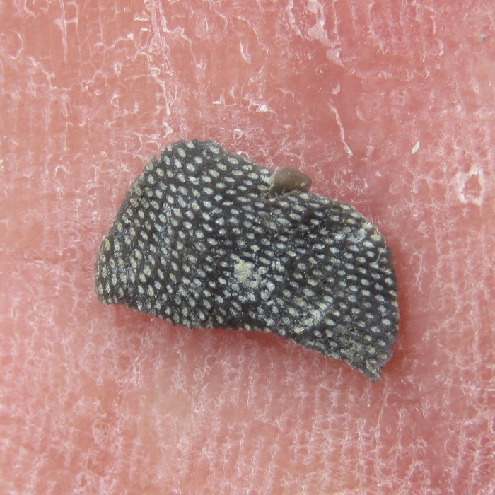
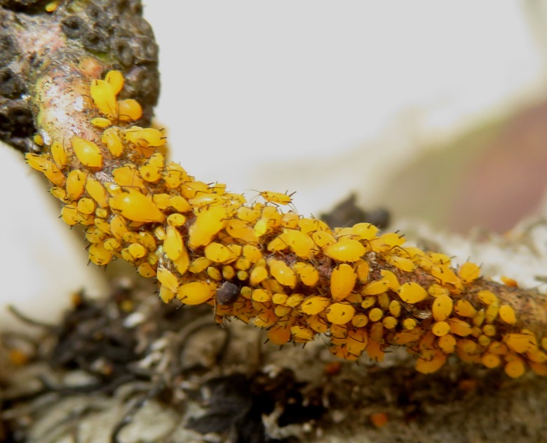
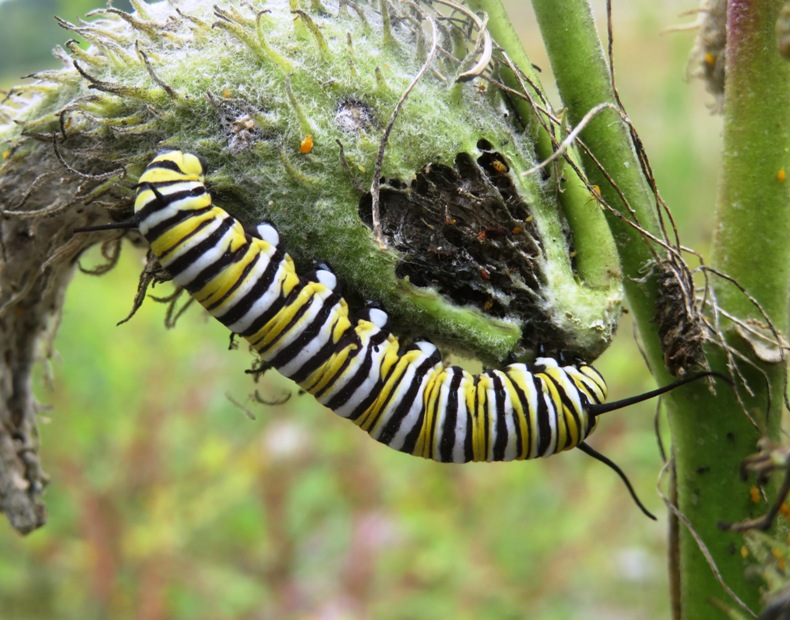
Ron F. believes the following are an encrusting coral called Protaraea richmondensis. The other things I didn't expect to find were so many interesting insects. Seeing monarchs, in any form (e.g. caterpillar), is always a good thing. We had a good time looking for fossils, but unfortunately found no trilobites. I was later told by Marla that Penn Dixie is a good place to find them. It is a little over six hours from Savage so, like this Ohio trip, it could make a nice long weekend road trip. Unfortunately, dogs are not permitted unless they are service animals. |
|
Our next adventure was a hike on the 2.4 mile (round trip) Horseshoe Falls Trail.
It hadn't rained for awhile so when we got to the falls, almost no water was flowing. 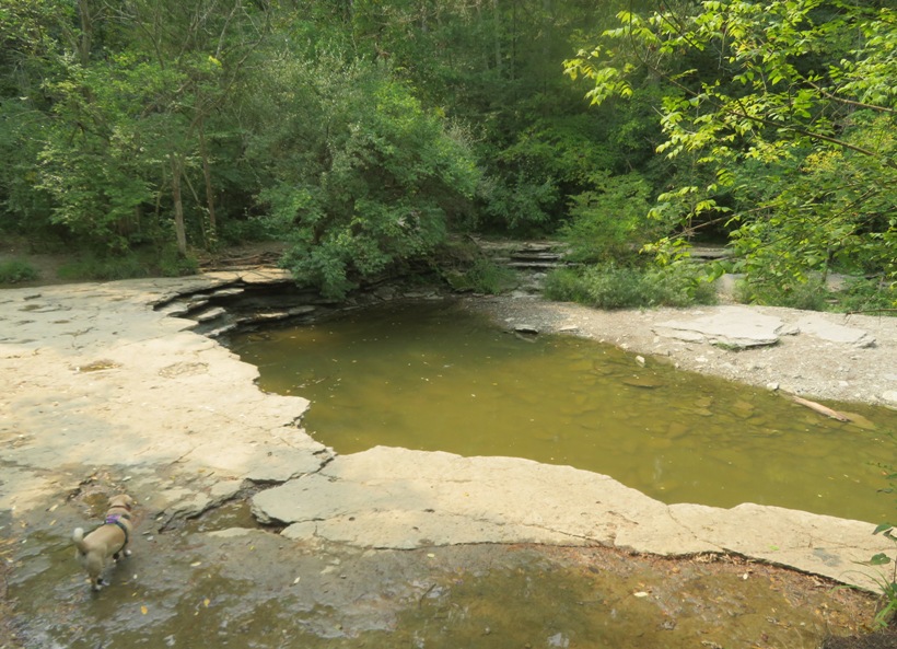
We had no idea if we'd find fossils here but indeed we did. We sometimes like to look in places that others have not. Checking under a dry waterfall fit that description. 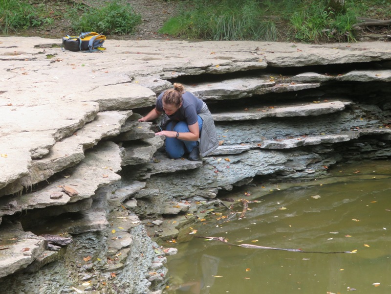
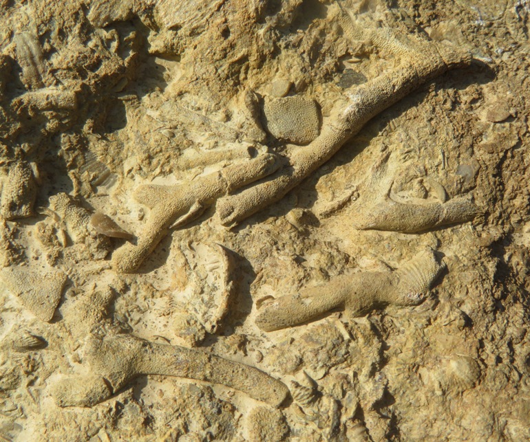
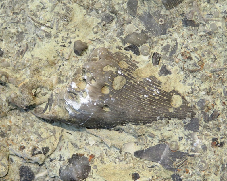
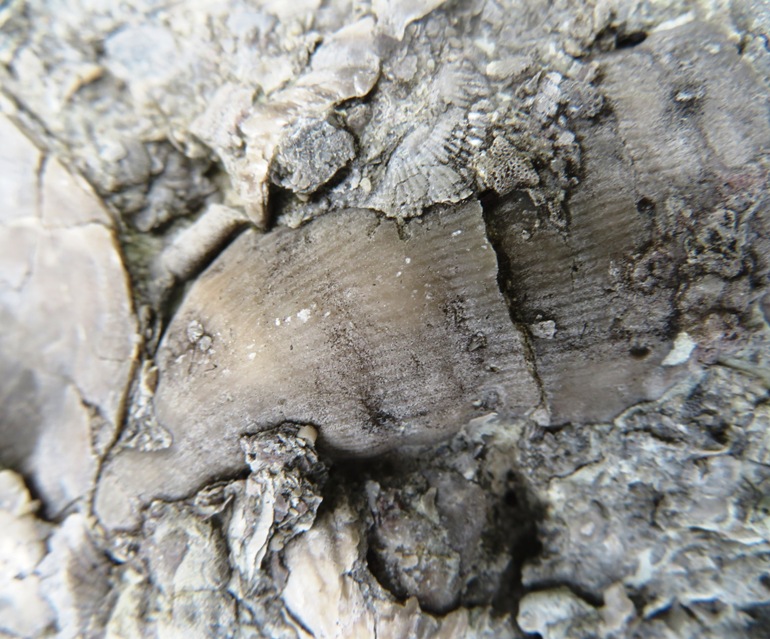
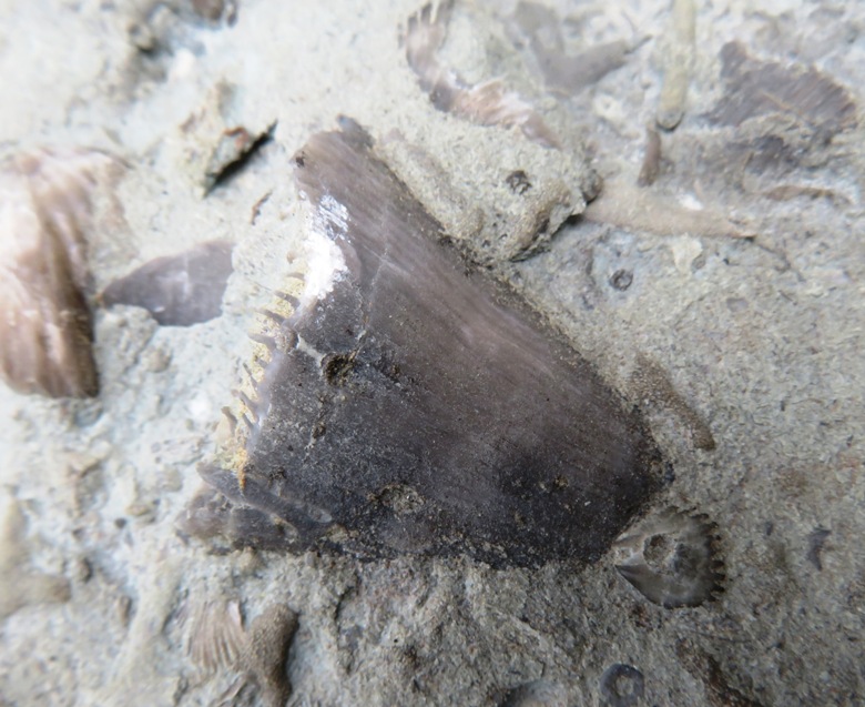
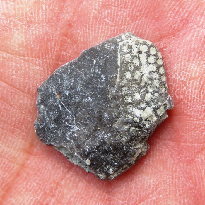
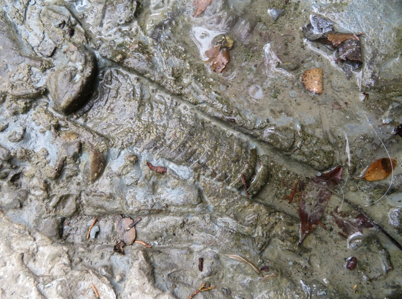
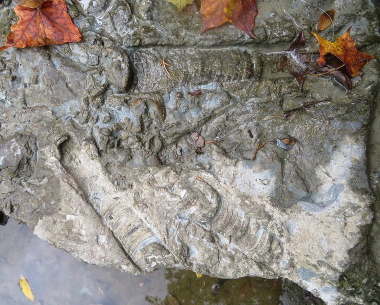
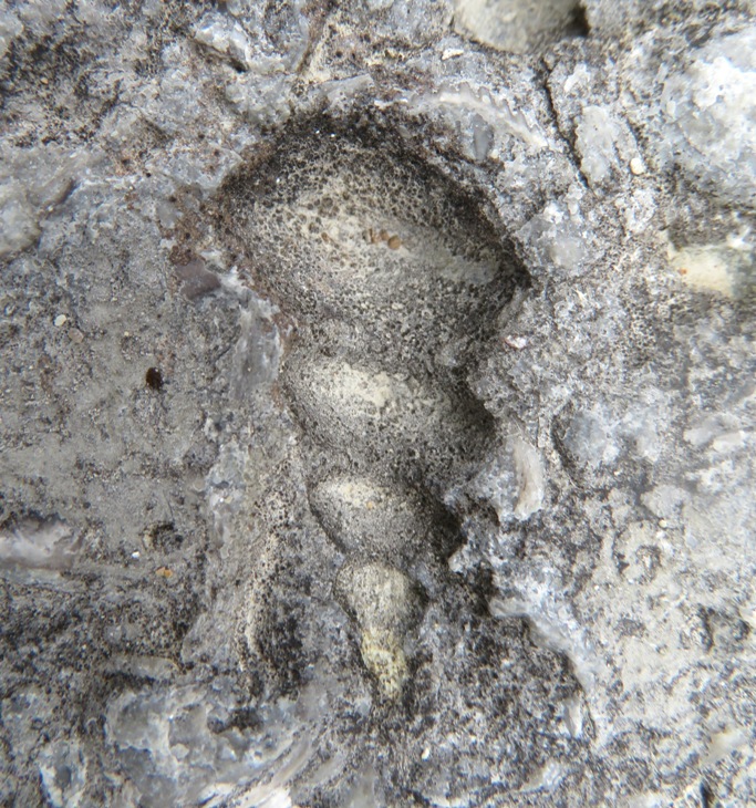
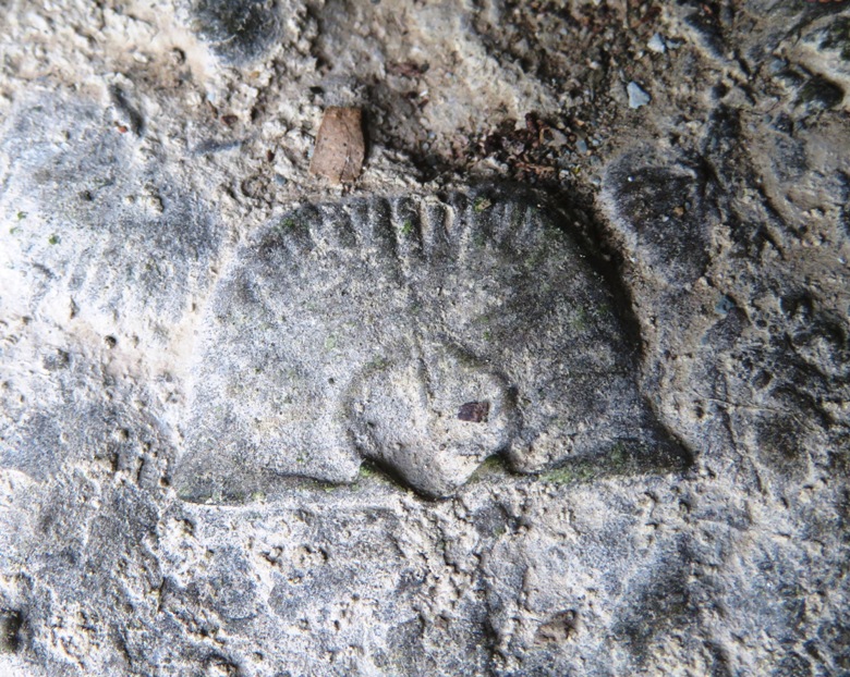
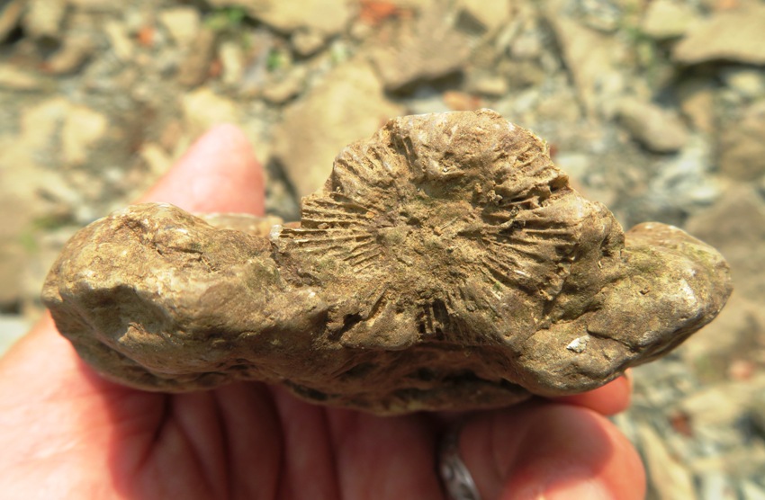
Embedded in the rocks that would have normally had water splashing down on them, I found my best find of our trip...cephalopods. These fossils are in the octopus family and looked much like the octopus that we have today. Of course the cephalopod had a hard cone-shaped shell like an ice cream cone over its body, and only its head and arms stuck out. Because they could fill their chambered shells full of air, these octopi could shoot the water back out thrusting themselves forward. - from "Common Fossils of Caesar Creek Lake" by the U.S. Army Corps of Engineers Cephalopods are formidable predators that use their hard beaks to crush the shells of their prey. Their modern representatives include the shelled nautilus, and octopus, squid and cuttlefish, which either have internal shells or none at all. - from sign at Cincinnati Museum Center titled "Cephalopods" I was really hoping these cephalopods were orthoceras (a type of cephalopod) but I was told such fossils are not found in the Cincinnati region, though orthocerides like Treptoceras are. Some interesting things I found which I did not see at the other sites on our trip were gastropod impression fossils. They resemble turritella but those were only around from about 140 million years ago so it must be some other form of gastropod. I found more brachiopods. I also found more horn corals. Here is my favorite. Here's a piece showing an assortment of fossils. 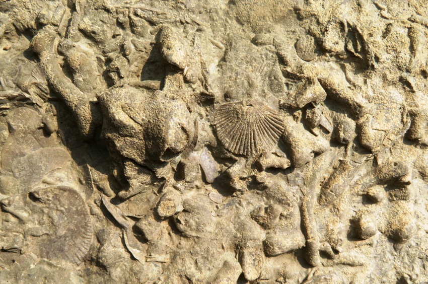
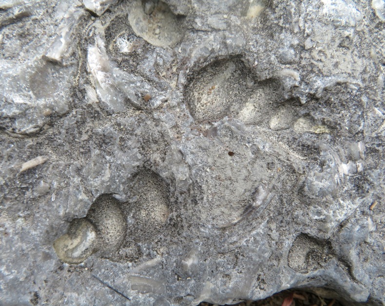
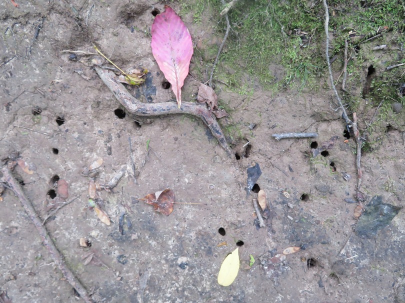
There were a few large boulders containing various consistent patterns resembling notches. Ron F. of the Dry Dredgers Facebook group identified them as boring made by bivalves. 'It appears that any ability to bore into rocks, even to a small degree, offers significant benefits,' Katie says. 'Many bivalves burrow into fluid-filled sediment, which requires extremely high amounts of pressure to get into, and pushes back.' 'Rock doesn't fight back like this, so rock borers can grind them down a little at a time and save significant amounts of energy.' - from Natural History Museum - Boring bivalves are much more diverse than non-boring molluscs 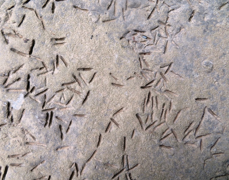
High cliffs by where water would normally be flowing past probably harbors lots of fossils. 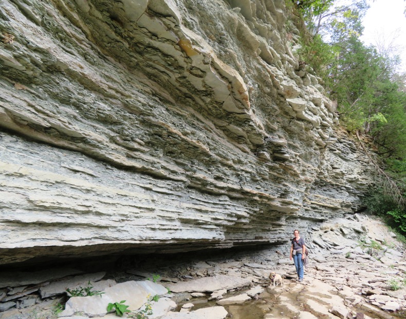
While I was looking for fossils, a snake slithered under a rock on which I was lying. Next to its path, I found a snake skin. 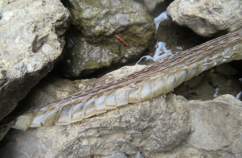
Amongst the fossil-laden rocks, Norma spotted a pair of pearl crescent butterflies mating. 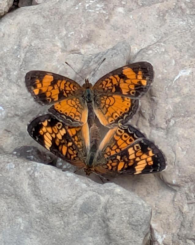
While we spent most of our time fossil-hunting, the hiking trail was nice too. We walked 2.4 miles. |
|
Our next hike was the George Loop Trail, one of the few loop trails in the park. We started by crossing the steel O'Neall Road Bridge over Caesar Creek, the waterway created by the dam overflow.
Next, we walked on the trail, really more of a gravel road, which paralleled the creek. 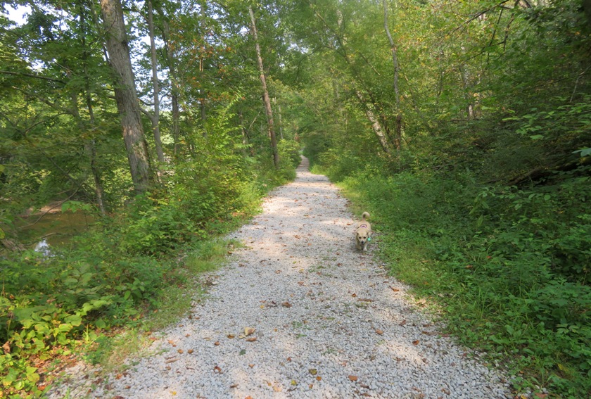
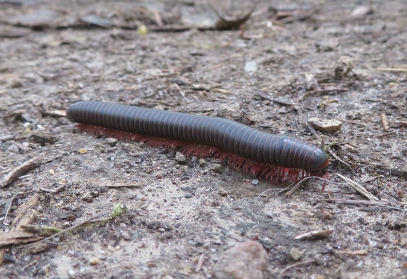
Our loop ended up being an out-and-back hike because the trail was closed due to a bridge outage, which we never saw. At least I got to see a lovely millipede along the way. 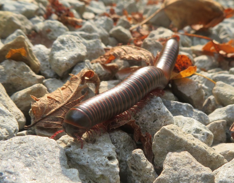
The oldest body fossil of a land animal is a millipede called Pneumodesmus newmani from the Late Wenlock Epoch of the Silurian period in Scotland, around 428 million years ago (Ma). Millipedes, centipedes and their relatives are called myriapods and comprise around 12,000 living species. - from Sci News - The First Animals on Land Evolved in Warm Tidal Nursery Pools 500 Million Years Ago |
|
Our next stop was Caesar's Creek Pioneer Village.
The Pioneer Village is a collection of early 1800s cabins which are all original to the Caesar Creek Lake area. Two of the buildings are original to the property, the Luken's Cabin located in the front of the property and the Luken's Barn. - from sign at Pioneer Village We saw the Luken's Cabin. In 1807 Levi Lukens and his wife, Elizabeth Cleaver Lukens, immigrated to Warren County, Ohio, as part of the exodus of Quakers into the area. - from sign at Pioneer Village titled "Lukens House" 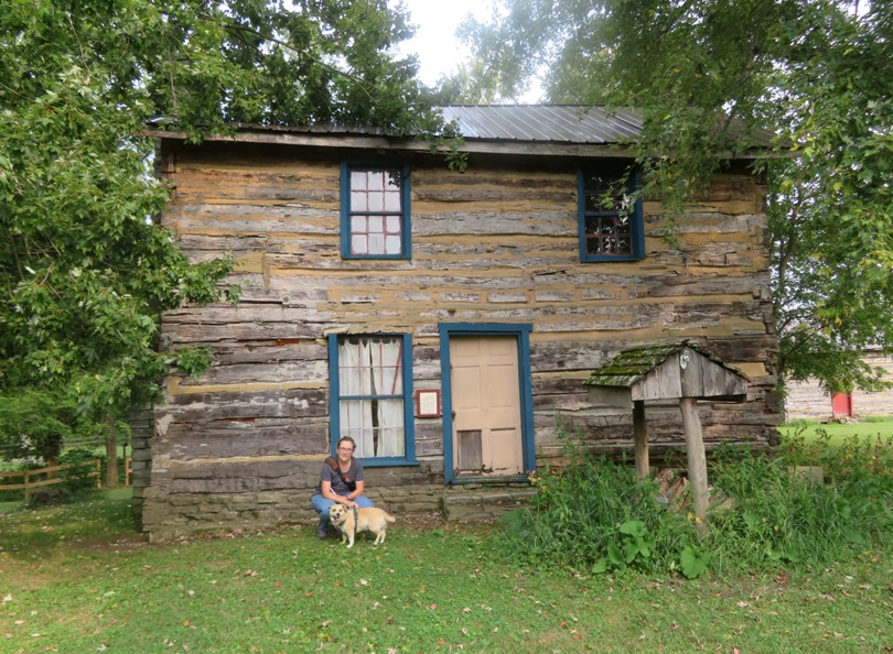
We also passed the Hawkins Cabin, an unusually large saddlebag log house, originally constructed in 1825. 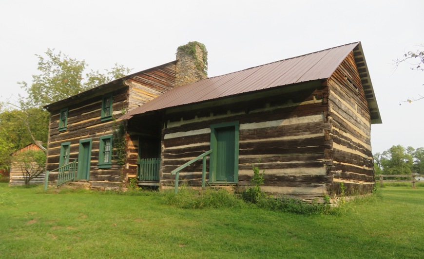
In addition to old buildings, we saw ironweed flowers. 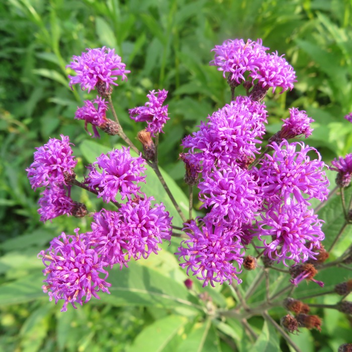
We also spotted several mushrooms. 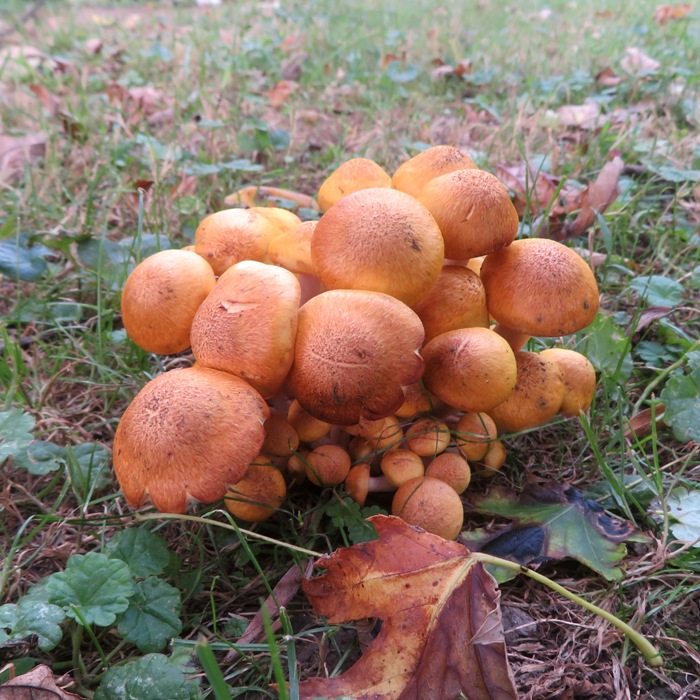
|
|
It was getting late and we still had a pretty good drive to get to the Hocking Hills State Park Campground.
It was dark by the time we arrived. Unlike Caesar Creek State Park Campground, this place was really hopping. It was not a peaceful campground by any means. I much preferred the other location. Our site was near pit toilets which had a strong odor if you were anywhere near them. The showers and running water was a long walk away. Still, the place wasn't terrible...but it could have been much better. It would have been bad if this was our first night but having set up the car for sleeping the night before, we pretty much knew what to do now, so working in the dark wasn't a big deal. Our campsite neighbors were very close so it was time to break out the earplugs. |
|
I pride myself in being prompt when it comes to outdoor trips organized by others. But the uncertainties of traveling threw a wrench into my sense of planning and timing. After leaving the campground, we looked for a place to get Norma some coffee. With such a busy campground and so few coffee shops, we had a long wait. Then, I took us to the wrong outfitter. I was not expecting the place to be so busy during the school year with so much tourism.
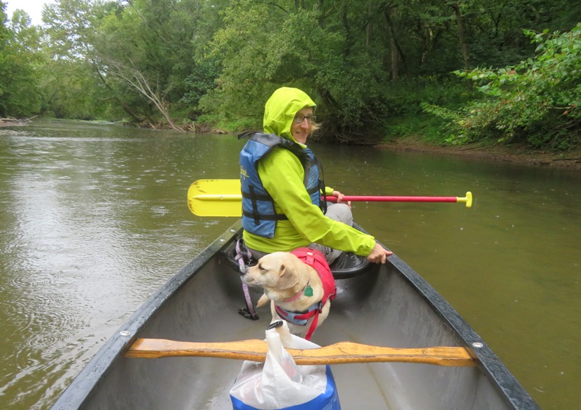
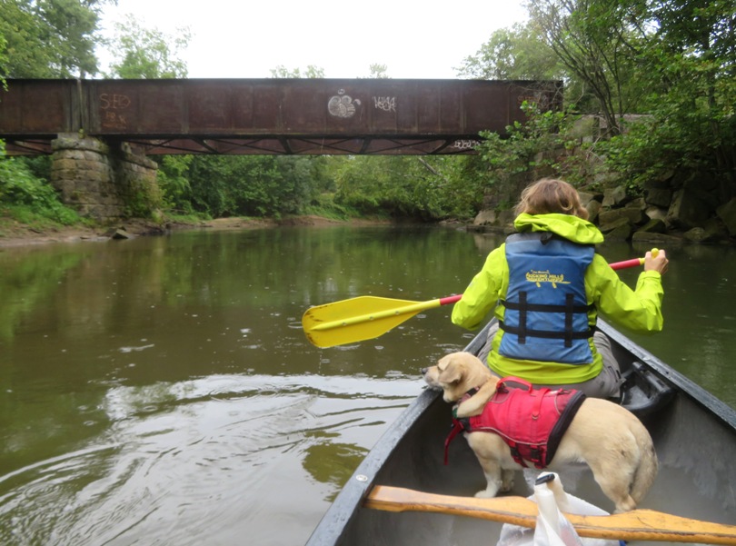
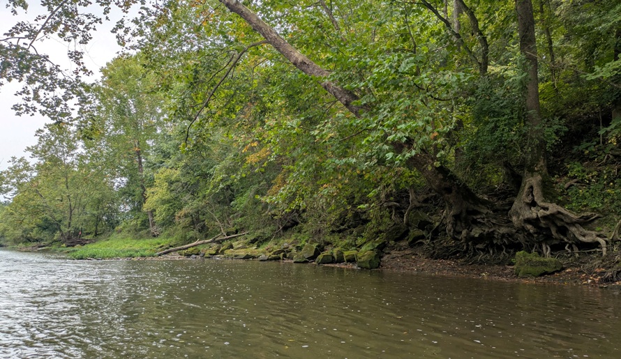
After arriving at the Hocking Hills Canoe Livery, we were pretty late. I don't think our driver or the other folks in our group were too happy with us. We boarded a very old school bus that I wasn't too confident would get us to our destination but it did. A little later, we launched our canoe from a place called "Location D" in the Rockbridge State Nature Preserve at 39.577947649978285, -82.5016620694661 then paddled downstream on the Hocking River. The day was overcast and a little cold with light rain. It was definitely the worst day of our trip but overall, it wasn't all that bad. Natural Rockbridge
Hocking River
|
|
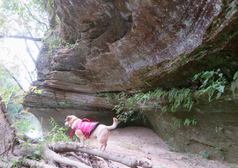
Our next stop was the first of various hikes in Hocking Hills State Park. We started at the Visitor Center.
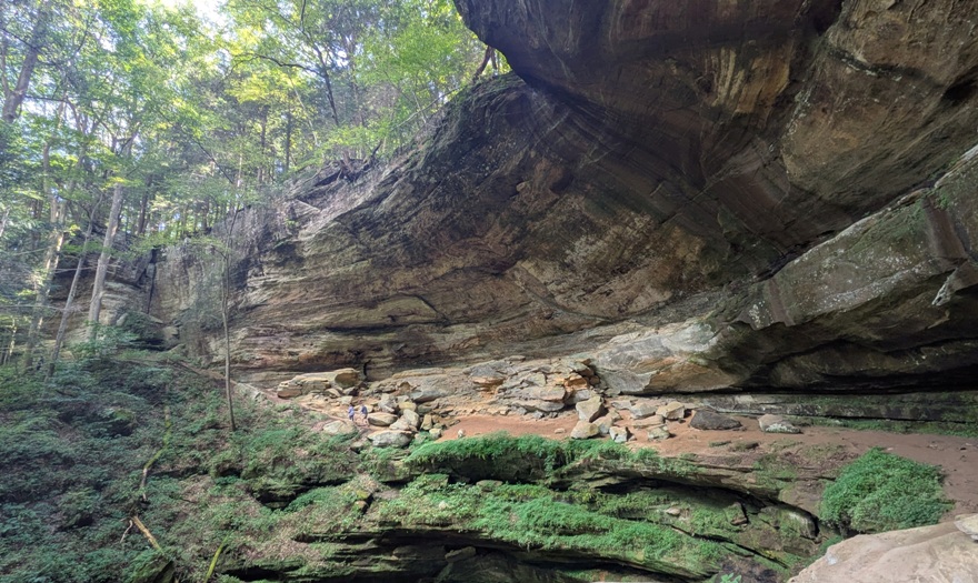
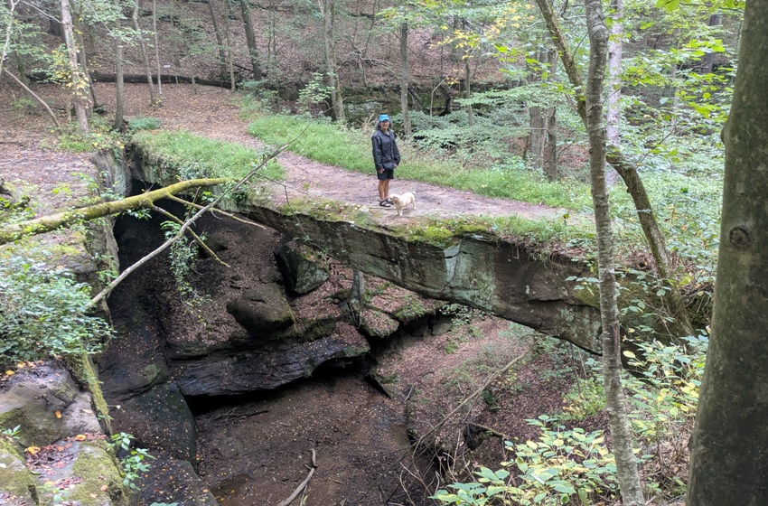
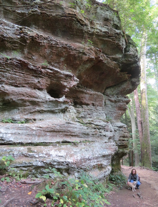
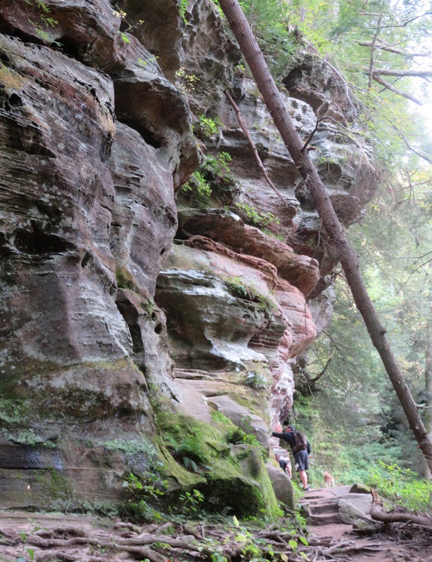
It was late in the day but the place was still packed. Once we commenced walking, I realized why so many people come to this area...it is incredibly scenic. I hate to say it but I think it exceeds Maryland in beauty when it comes to hiking near rock walls, crevasses, and cliffs. So how was such beauty formed? Old Man's Creek has run through the layers of Black Hand Sandstone in this gorge for millions of years. Over time, this small stream has carved away the sandstone to reveal the recess cave in the north wall of the main gorge. - from park sign titled "Old Man's Cave" This is a unique area with an equally unique concrete bridge. In my opinion, it is a work of art that does not detract from the natural beauty of the area. 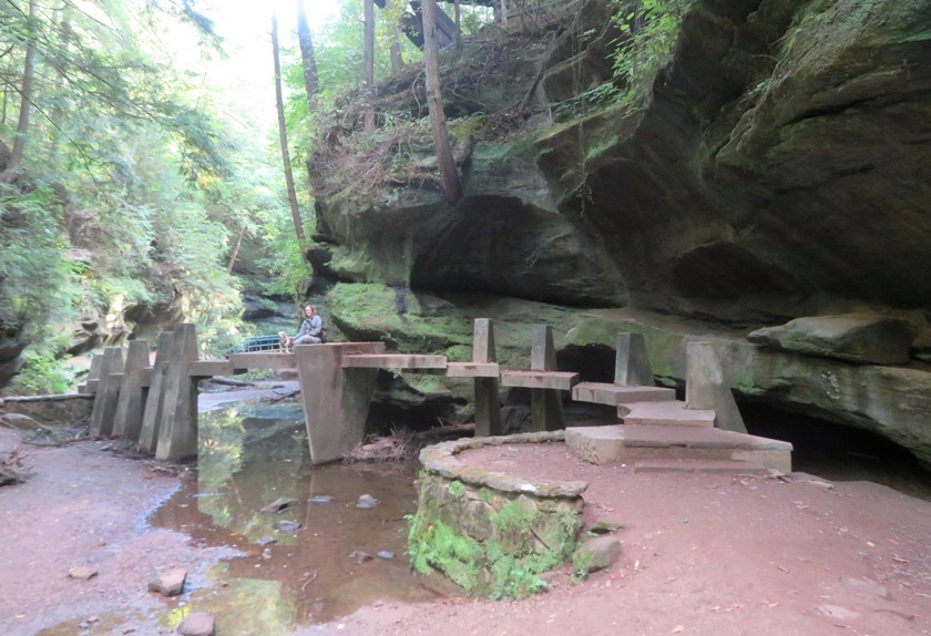
The trail was supposedly one way. I have no doubt this makes it easier to accommodate large crowds and alleviate bottlenecks such as this tunnel. 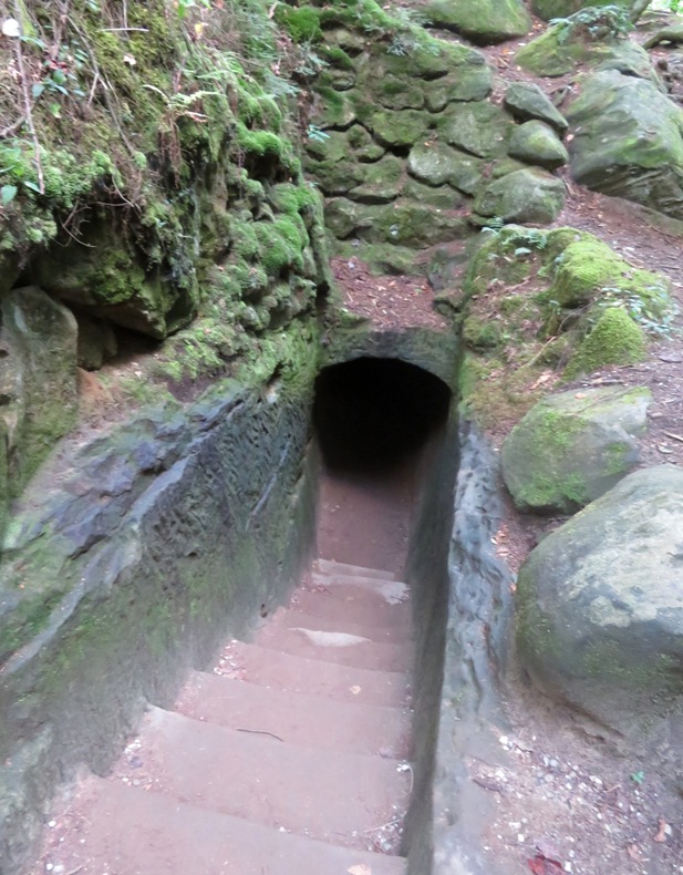
Here's Norma on the other side of the tunnel. 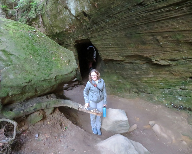
We passed another bridge, this one more traditional than the last. Like Horseshoe Falls, Old Man's Creek was dry. 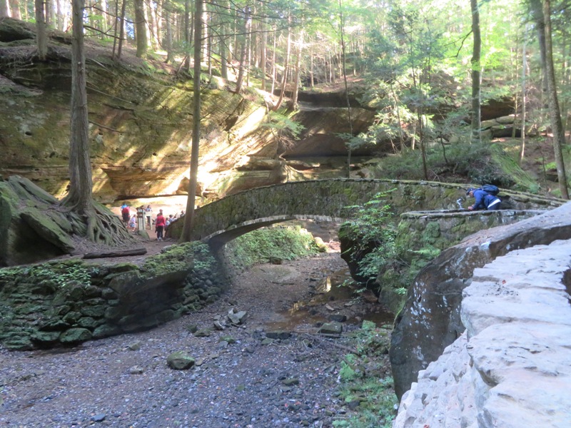
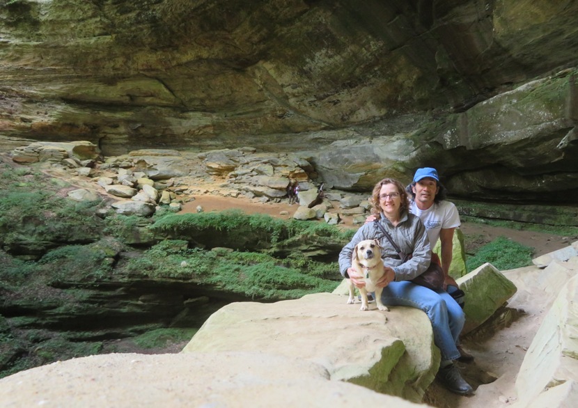
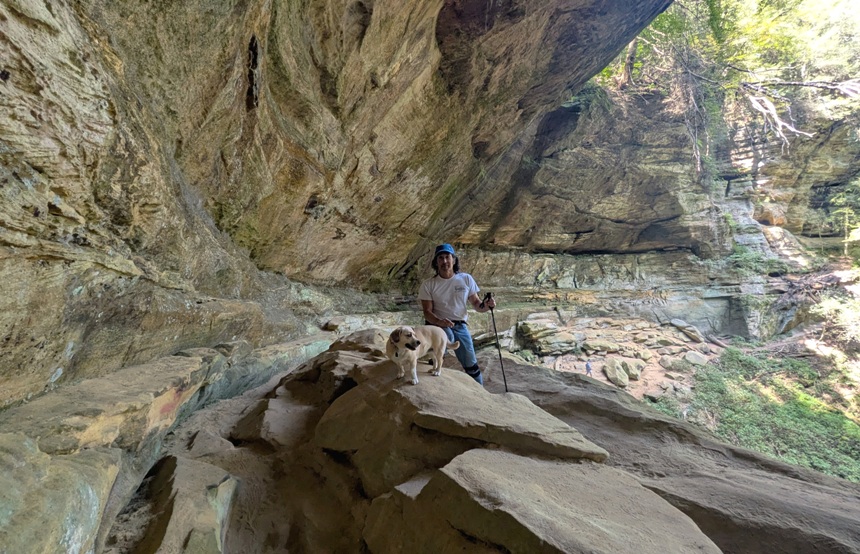
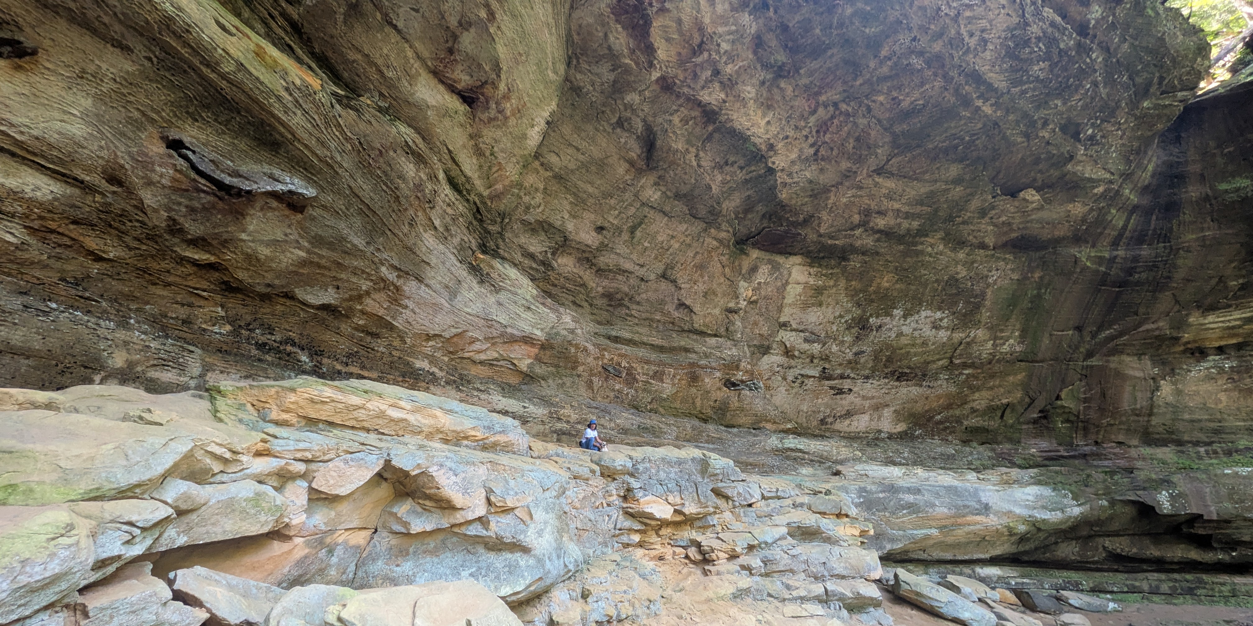
I'm not really certain what part of our hike was the actual cave but I'm guessing it is here. 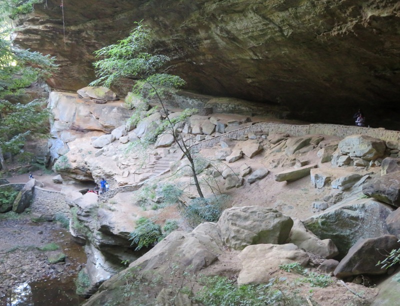
What do we know about the cave? Old Man's Cave is a geologic wonder created over thousands of years by glacial activity and the flow of Old Man's Creek which have carved a half-mile gorge into Black Hand Sandstone. Spanning 200 feet across and 50 feet tall, the cave stands as a testament to the power of nature and the enduring allure of a place where history, geology, and legend converge to create a truly unique and captivating destination within Hocking Hills State Park. - from park sign titled "Welcome" So who is the old man? This recess cave was named for the "old man" Richard Rowe, a recluse who made the cave his home in the 1800s and is a part of scenic Hocking Hills State Park. Hocking comes from the Wyandot Indian work "hockhocking," referring to the Hocking River's bottle-shaped gorge near Lancaster. Streams and percolating groundwater carved the hollows and caves in this area from layers of sandstone bedrock that vary in hardness. - from Ohio Historical Marker titled "Old Man's Cave" We crossed over yet a third bridge. 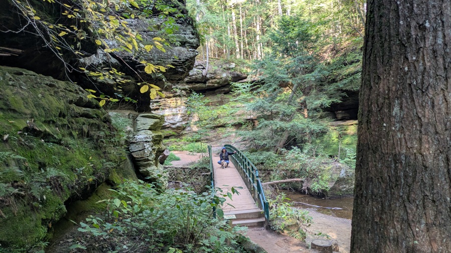
In some ways, the dramatic rock walls reminded us of Swallow Falls State Park in Maryland. 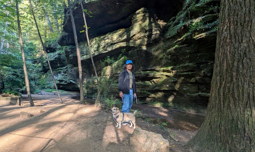
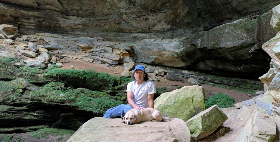
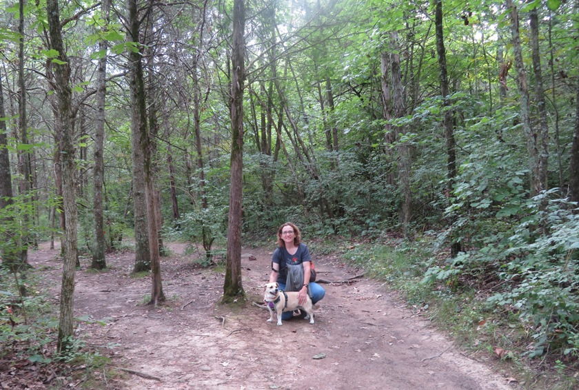
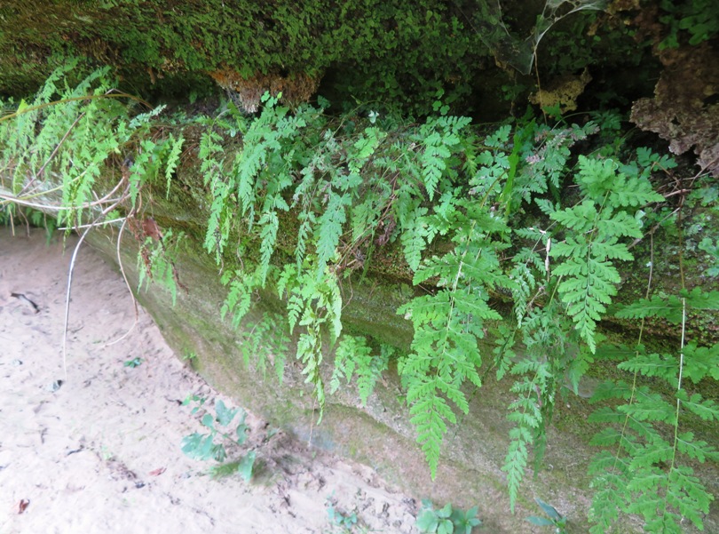
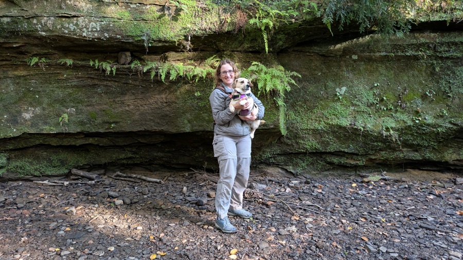
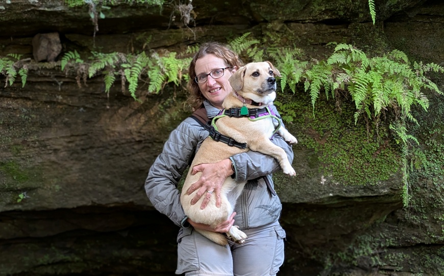
I took some pics of Norma, Daphne, and the ferns growing out of the rock wall behind them. |
|
On our final day in Ohio, Norma was thinking of going to Columbus or to the Serpent Mount but we decided to try to minimize our driving by continuing to explore Hocking Hills State Park.
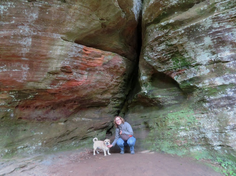
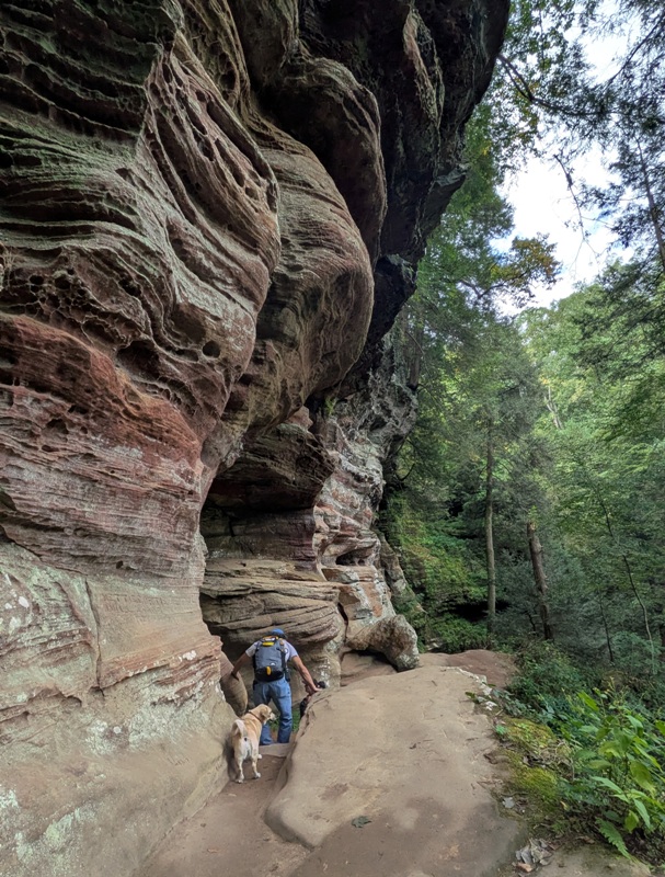
Our next stop was Rock House. How was this area formed? Much of the Hocking Hills State Park geology is a direct result of moving water causing the erosion of loose sandstone particles little by little over long periods of time. In most areas of the park, the erosion of the rock takes place on the exterior surface. Here at Rock House, the water began its work deep inside the porous bedrock. The many layers of materials making up the rocks like sand grains, iron ore, silica, and quartz make for an inconsistent strength in the rock, and allowed easier erosion. Water quietly flowing and seeping down for millions of years found a seam in the sandstone. This seam is readily visible as the "crack" seen when looking directly overhead inside the cave. Little by little, the water began to carve out an opening in the side of the cliff face. As the opening became larger, more water could fill the gap to slowly create the true cave structure hikers see today. - from park sign titled "Rock House" This place has lots of tall, vertical rock formations. We came to a natural bridge, similar to Natural Rockbridge. 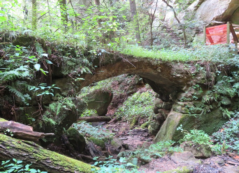
Norma and I have seen a lot of orange jewelweed flowers but this was perhaps the first time we'd seen yellow ones. 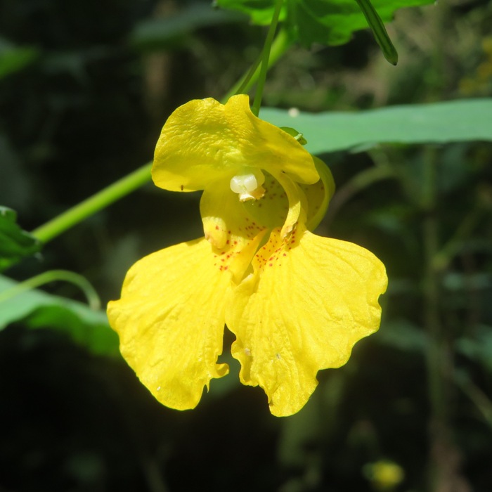
We found a tiny little cave, if you can even call it that. 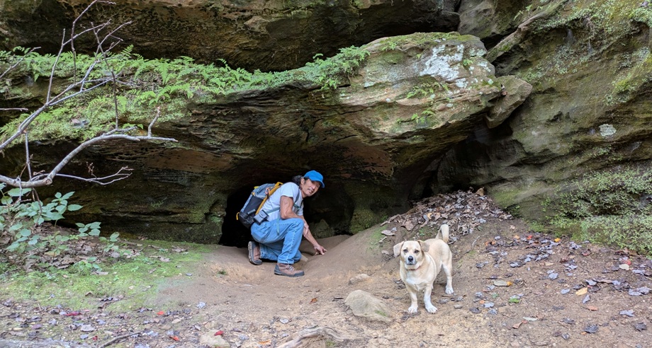
Norma took a lot of pics of Daphne and I at various interesting rock formations. Rocks weren't the only interesting things to see on our hike. Norma found sweet knot mushrooms growing on the side of a tree. 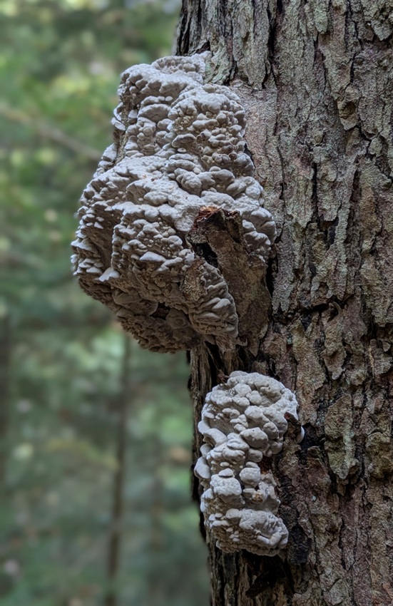
The trails were fairly well-maintained and easy to follow. 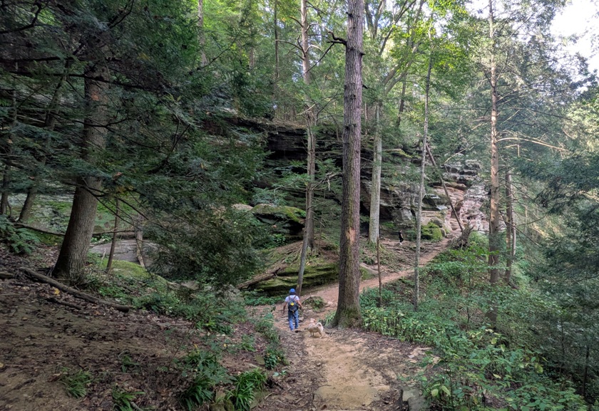
Eventually, we finally made it to Rock House. Rock House stands out as the only true cave in Hocking Hills. Nestled midway up a 150-foot cliff of Blackhand sandstone, this tunnel-like corridor boasts a 25-foot-high ceiling, stretches 200 feet long, and spans 20 to 30 feet wide. Nature has sculpted Rock House with seven Gothic-arched windows and impressive sandstone columns that support its roof. - from Hocking Hills State Park sign titled "Welcome" Here's one more view of a rocky wall because you can never have too many of those. 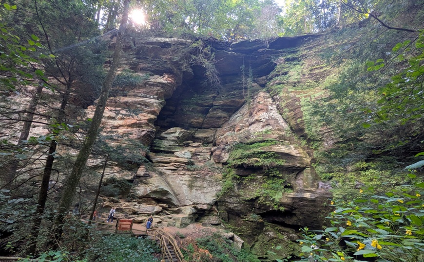
We walked a total of 1.5 miles. |
|
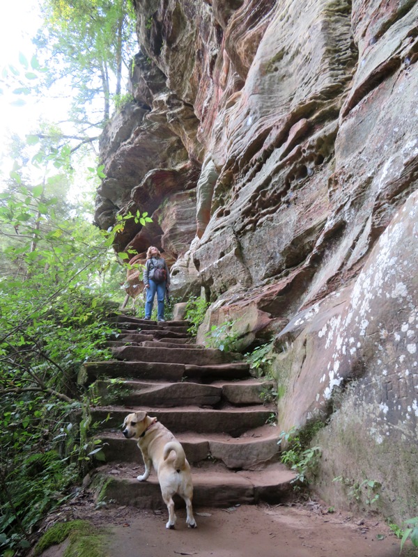
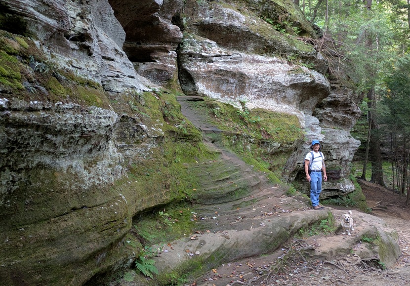
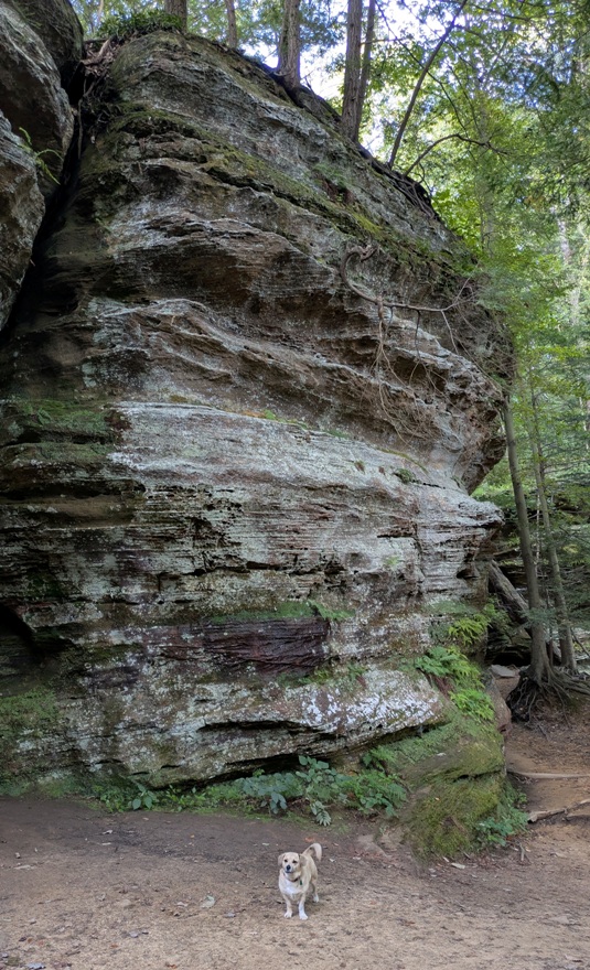
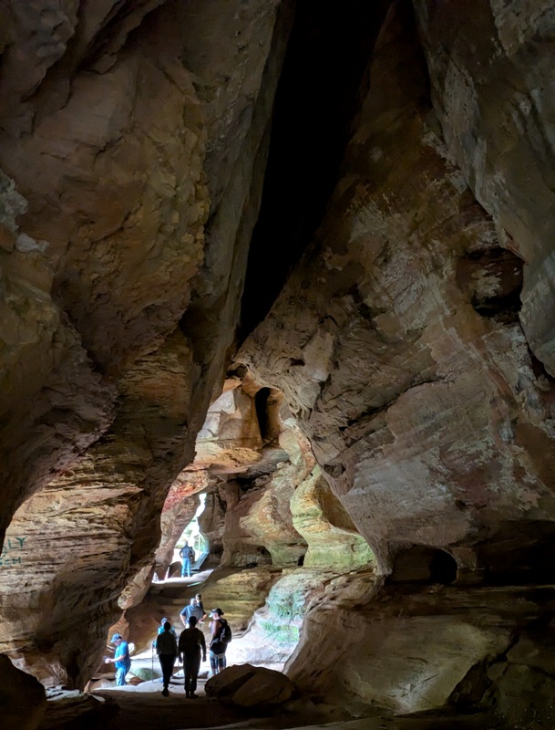
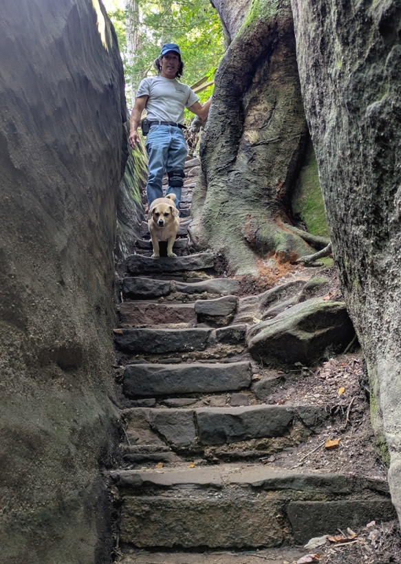
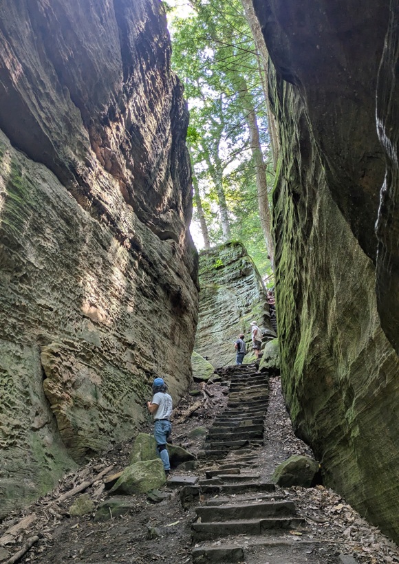
Out next hike in Hocking Hills State Park was at Cantwell Cliffs.
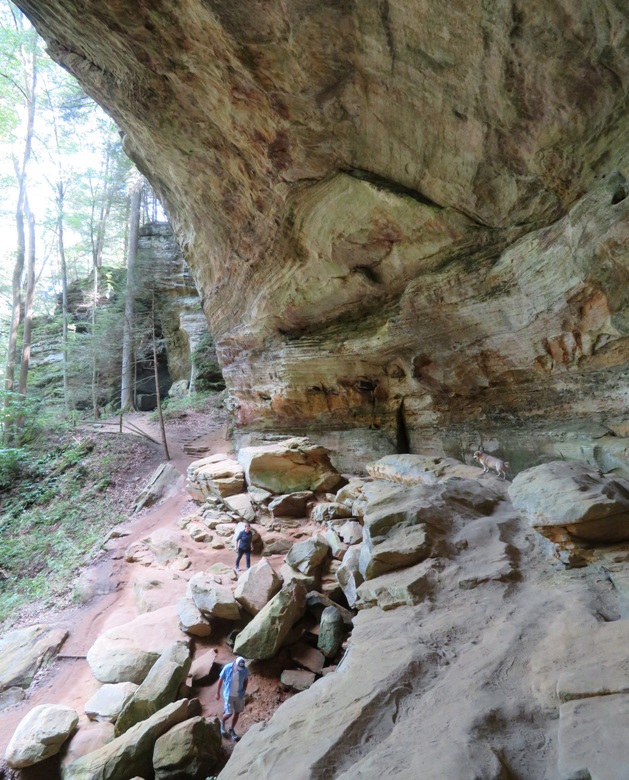
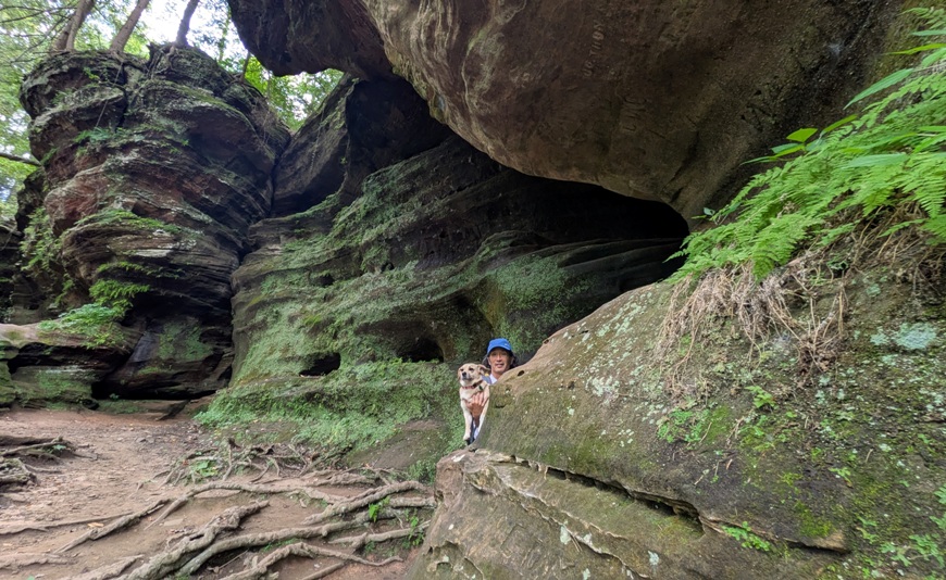
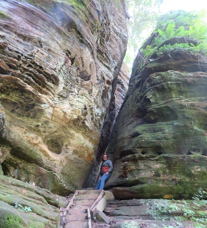
Many trails require one to walk a pretty good distance before you get to the scenic stuff but not here at this park. The hikes we did here were short and got right to the pretty stuff quickly. At Cantwell Cliffs, the first interesting feature was the stone stairs that took us between steep rock cliffs. One narrow section of the trail is called Fat Woman's Squeeze. Eventually, we came to the actual Cantwell Cliffs. See photo at bottom of page. Cantwell Cliffs embraces the erosional efforts primarily from the Buck's Run drainage that begins above the cliffs that overlook this magnificent gorge and ravine. The cliffs are near 150 feet tall and form the three sides of the gorge. Buck Run drops as a waterfall from the cliff with a rock shelter formed as a backdrop to this cascade. - from Dusty Blues - Cantwell Cliffs 1 / 7
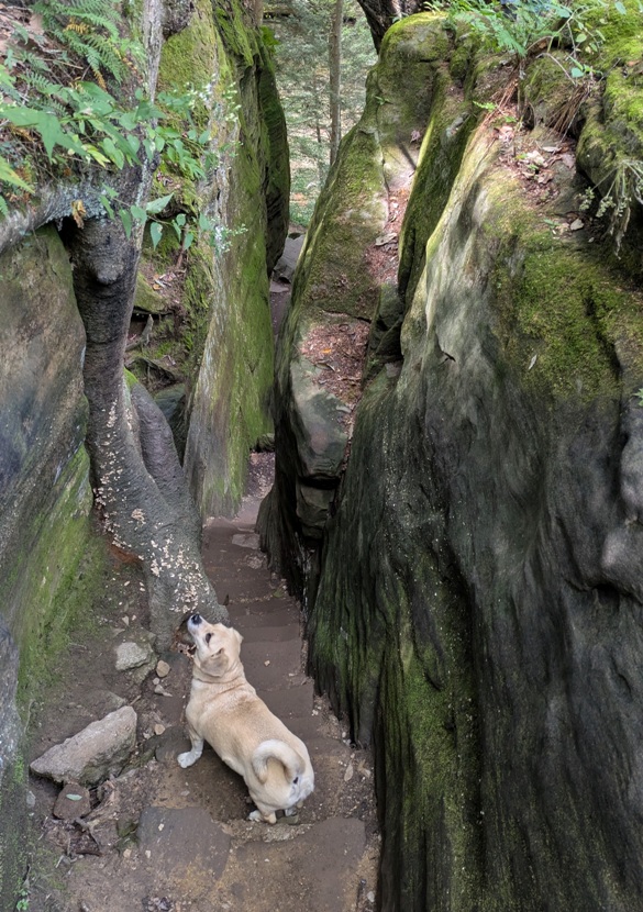
Daphne watching from above.
2 / 7
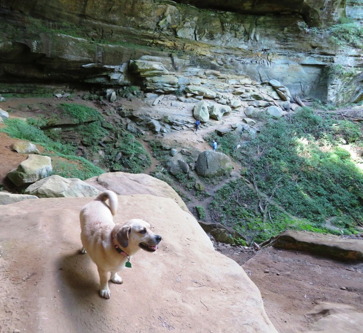
Daphne on the rocks.
3 / 7
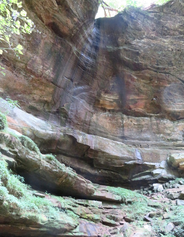
Dry waterfall.
4 / 7
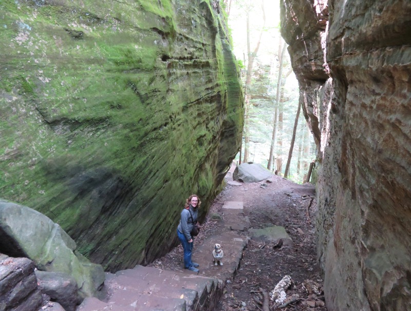
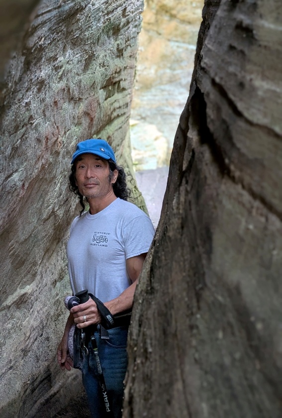
Daphne, Norma, and I.
5 / 7
Daphne and I.
6 / 7
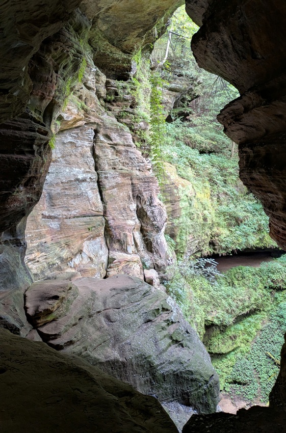
Greenery below.
7 / 7
Feeling tired.
Once we left the cliffs, the views were less dramatic but still very nice. We saw a log shelter. It was a... CCC [Civilian Conservation Corps] cabin located along the Cantwell Cliff trail. This shelter was used to rest during the construction of the trail steps and paths during the CCC era. Later it was used for Boy Scout trips. - from Instagram - myhockinghills 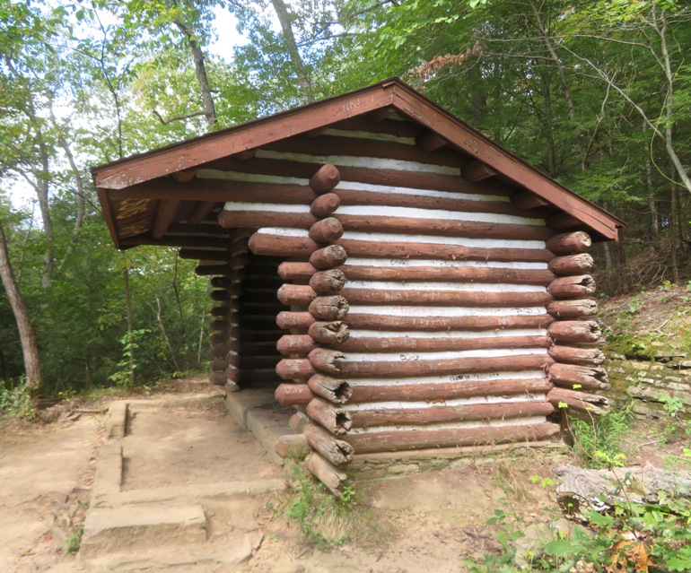
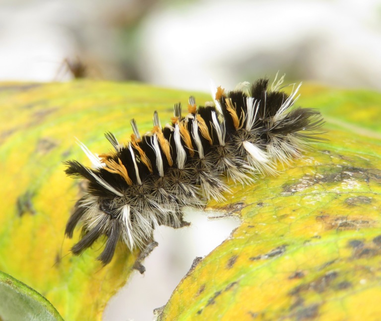
I spotted a banded tussock moth caterpillar. 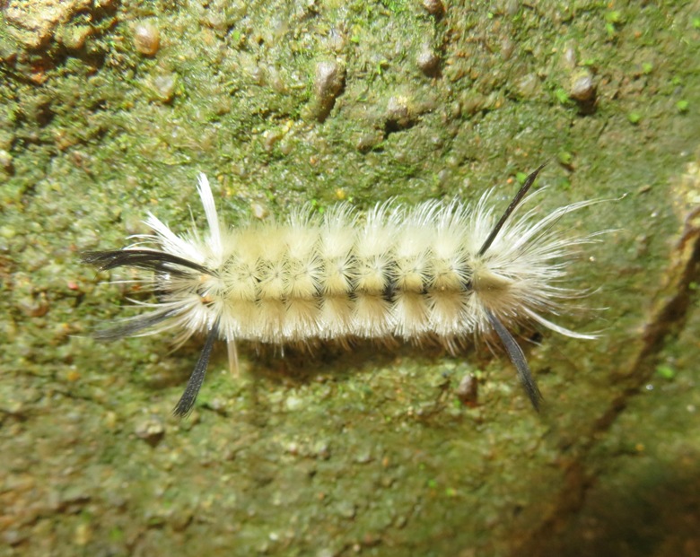
We walked a total of 2.3 miles. |
|
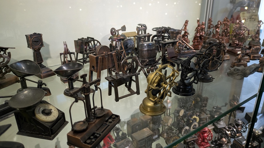
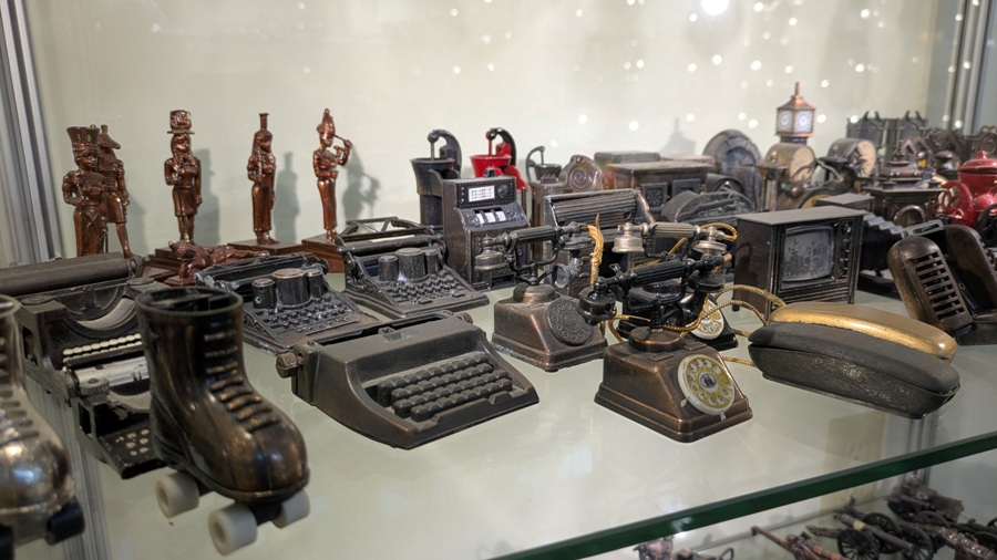
Our final stop before leaving the area was the Paul A. Johnson Pencil Sharpener Museum which is attached to the Hocking Hills Regional Welcome Center.
Reverend Paul Johnson began his collection more than 20 years ago. This amazing collection of more than 3,400 pencil sharpeners has been featured in national magazines and is reputed to be the largest collection in America. We recently added the collection of Frank Parades. Together the two collections are estimated to have about 5,000 Pencil Sharpeners. - from Explore Hocking Hills - Pencil Sharpener Museum 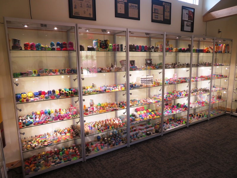
Many of these pencil sharpeners were what I would call miniature sculptures with a little functionality added. |
|
Our drive home was uneventful. Had we not stopped, it would have taken a little over six hours.
We never made it to Columbus so there is a good chance we will return and check out that part of the state. It would also be nice to return to the Hocking Hills area and do some of those hikes when the creeks aren't dry so we could appreciate the beauty of the waterfalls. The hiking scenery was much nicer than we expected and the fossil hunting was also great. Overall, I think we had a fantastic road trip. |
