|
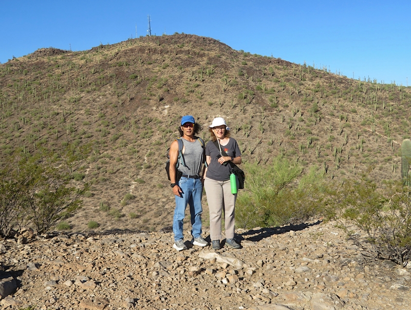
This page is my blog about a Team SNaCk trip I did to northern Arizona. But unlike previous activities, this one was a little different because Carmen brought her partner, Robin, making our group Team SNaCkeR. |

|
This page is my blog about a Team SNaCk trip I did to northern Arizona. But unlike previous activities, this one was a little different because Carmen brought her partner, Robin, making our group Team SNaCkeR. |
|
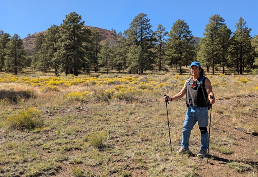
Norma did most of the planning for this trip, followed by Carmen, and then me. Norma and Carmen already did a trip to "The Grand Canyon State" a few years ago. Interestingly, they did not visit the Grand Canyon and we also would not see it on this trip. That was fine with me. We would be doing a lot of driving, never staying in the same place for more than two days. I figured the Grand Canyon deserved much more time.
Norma and I flew into Phoenix a couple days prior to Carmen and Robin. We rented a white Jeep Compass, a very common vehicle for this area. Loaded with the latest technology, it took awhile for us to get used to but eventually, we figured it out. It handled well.  |
|
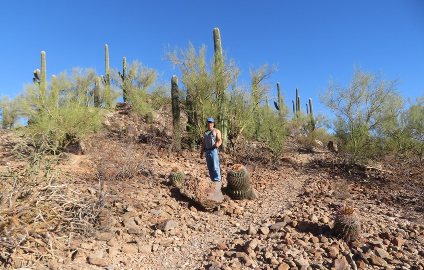
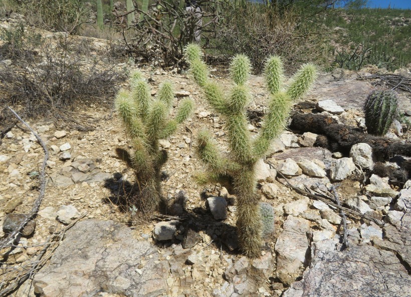
Our first stop was the Red Hills Visitor Center where we received an introduction to the Sonoran Desert. It is...
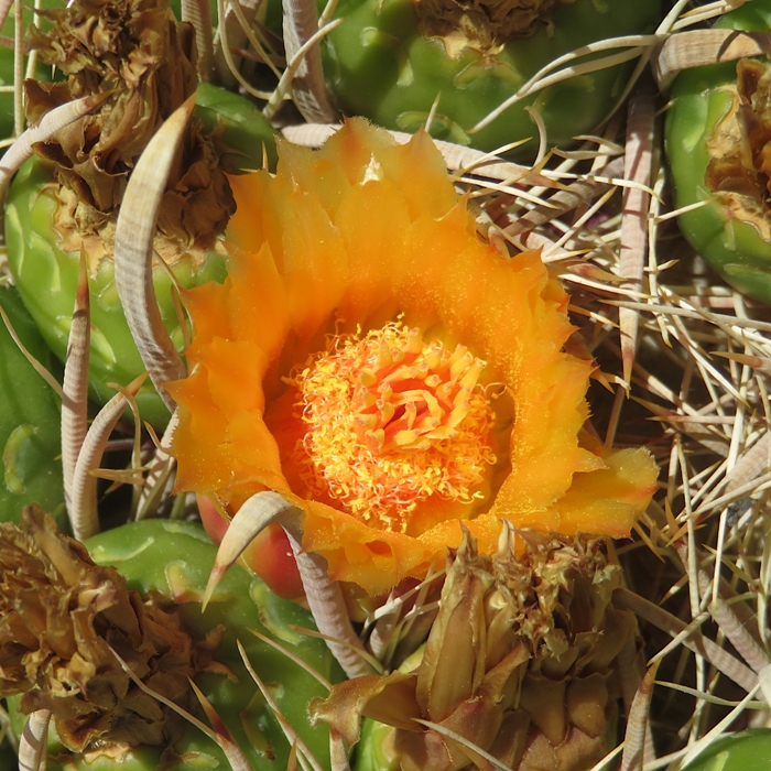
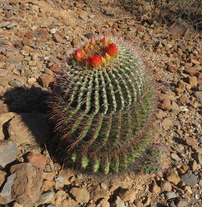
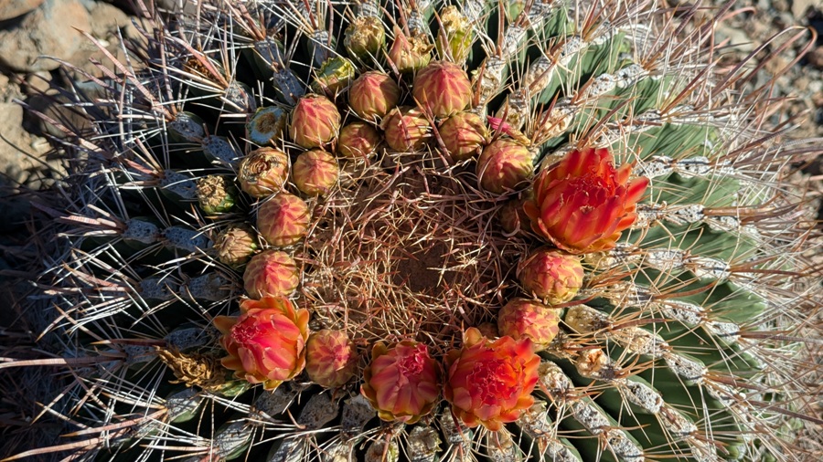
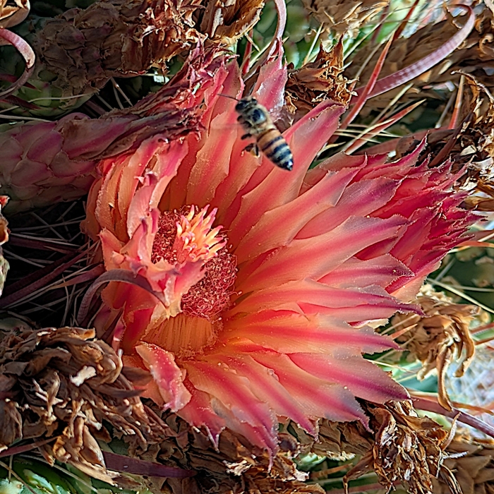
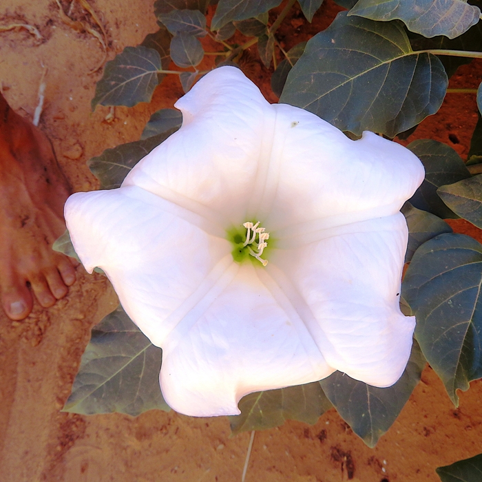
...described as a "desert jungle" because more than 200 species of animals and 600 species of plants live here. Saguaros - with their branching arms and accordion-like pleats - dominate this scene. - from sign titled "Desert Life" With so little rain, many things in the desert grow slowly. Look for young saguaros growing low to the ground. Those that are about the size of your thumb may be several years old. In contrast, tall saguaros with many branching arms can be 175 to 200 years of age. - from sign titled "Seed to Sentinel" While saguaros were the most prominent cacti in the area, the flowers of the barrel cacti took the award for the most beautiful, in my opinion. Norma and I walked on one of the trails. I think it was called Javelina Wash. A "wash" is a shallow channel or gully that collects and carries water after rainfall. 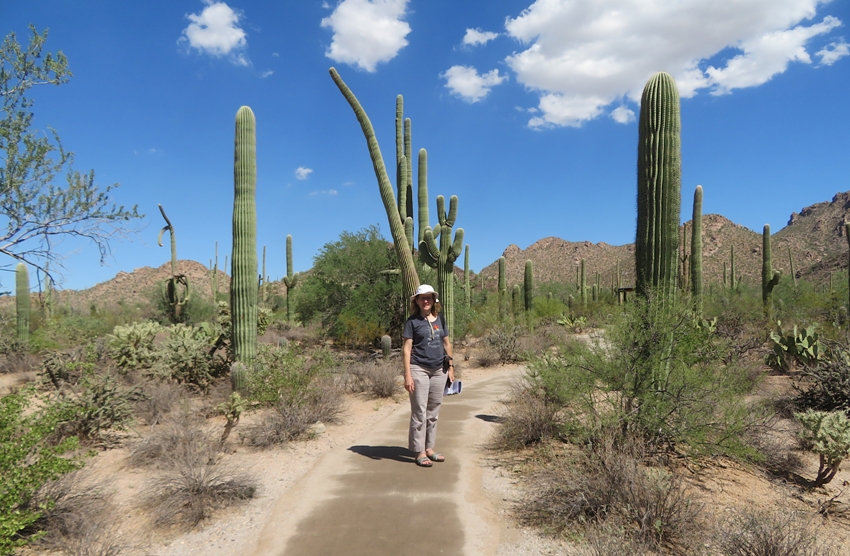
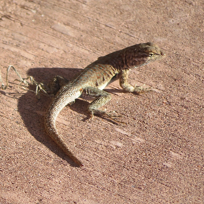
We didn't see much wildlife but I did find a mature antlion. In the past, I've only seen larval antlions, also known as a "doodlebugs." This was a real treat for me. 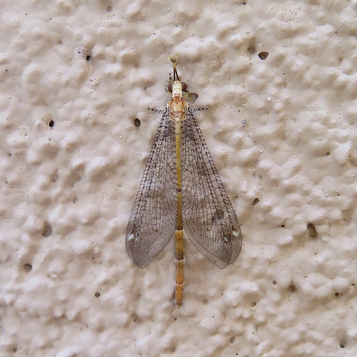
|
|
Our next stop was the Arizona-Sonora Desert Museum.
The Desert Museum interprets the Sonoran Desert, one of the most diverse deserts on earth, and the surrounding biological communities. - from museum pamphlet Arriving not at the best time, we rushed to catch the ongoing Live Animal Theatre Program. Here, we saw a variety of local animals including a gila monster and a rattlesnake. 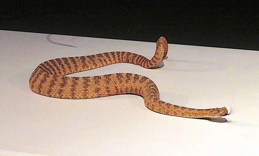
After the program, Norma and I satisfied our appetite at the on-site Ironwood Terraces Restaurant before continuing our tour of the museum...it is really more of a zoo, showcasing mostly native animals. 1 / 5

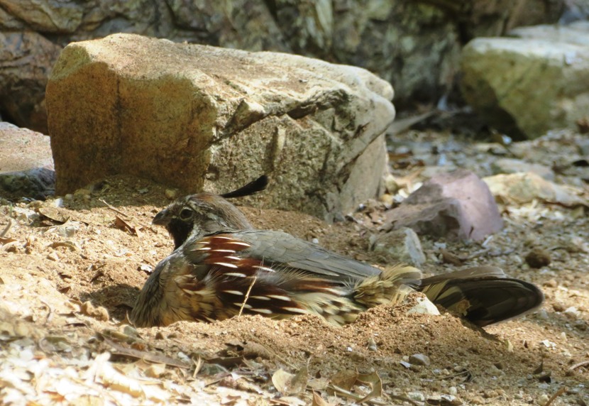
Gambel's quail.
2 / 5
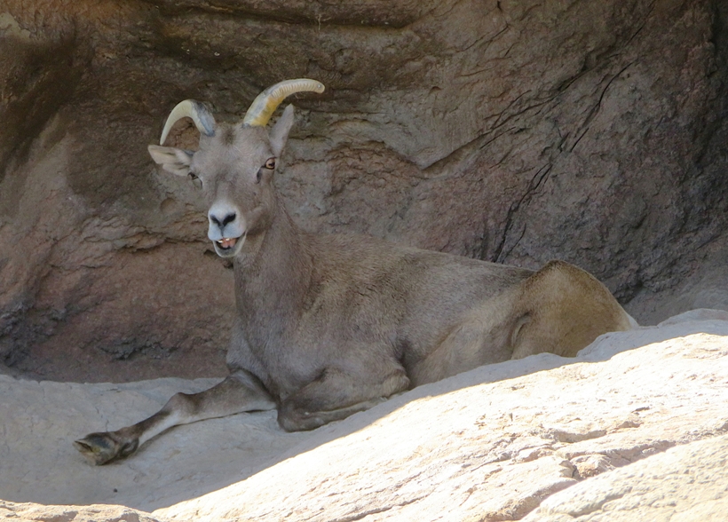
Desert bighorn.
3 / 5
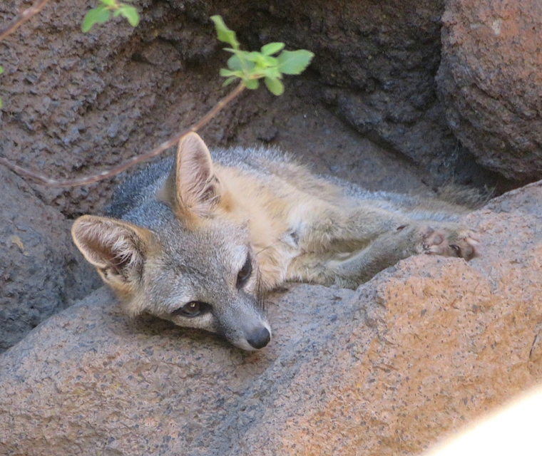
Gray fox.
4 / 5
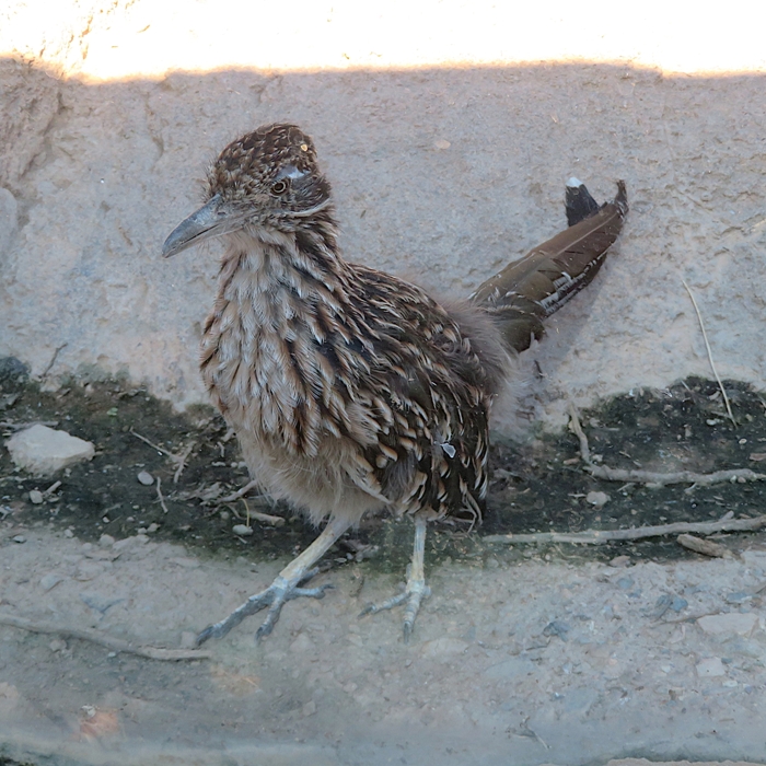
Roadrunner.
5 / 5
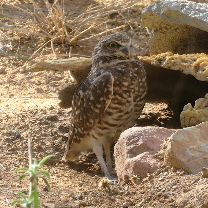
Burrowing owl.
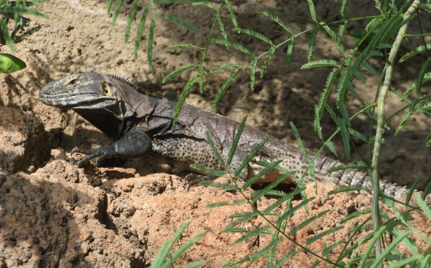
We saw a couple spiny-tailed iguanas which were found both within and outside of enclosures. The museum did a good job in recreating structures that resemble the desert. Many appeared to be painted concrete shaped into rocky formations. I found one where someone embedded an ammonite. 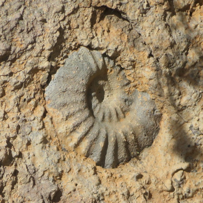
Here's a more authentic desert scene showcasing some of the native flora. 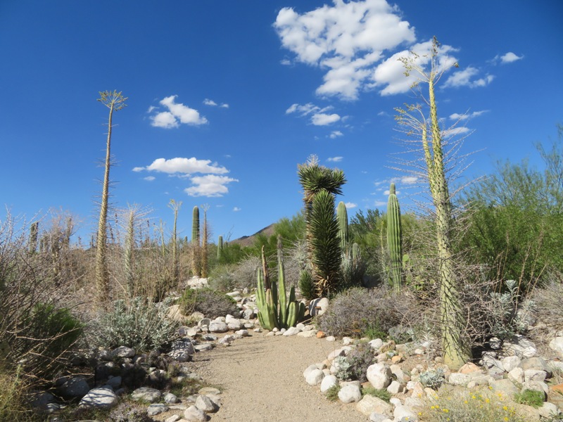
While most of the museum was outdoors, some parts, like a man-made cave, were inside. The cave set the stage for an introduction to bats. It is a well-known fact that bats have great hearing, partly due to the shape of their large ears. Here's Norma trying on a pair. Do you think she would make a good bat? 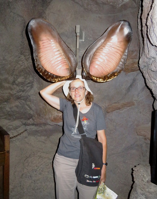
Appealing to my taste in paleontology, we saw a display about Sonorasaurus, Arizona's state dinosaur. It... ...was a Sauropod (long-necked dinosaur) that lived about 100 million years ago during the Cretaceous Period. Like all Sauropods, it was a plant-eater. Sonorasaurus was one of the last sauropods to roam North America before a long absence from the fossil record. - from sign titled "Sonorasaurus Traits" The museum closed a little sooner than I liked but I did manage to get in some last-minute shots of what I thought were monarch butterflies. I later learned they are actually queen butterflies. 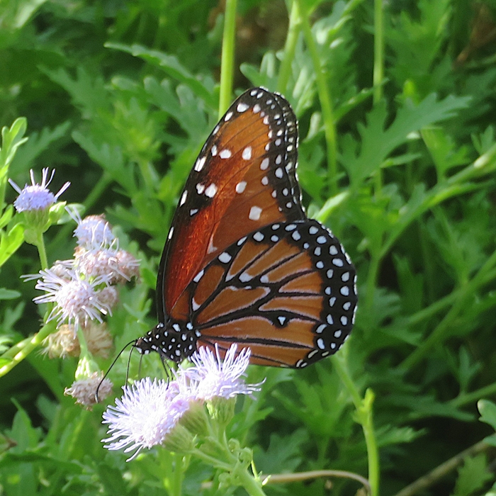
|
|
We didn't make reservations for lodging but managed to find a not-too-bad room at a Motel 6 near the airport. For us, motels are just for cleaning up and sleeping so cheap is fine as long as it is reasonably clean. After unpacking, we went out for dinner at Seis. I had prickly pear juice which was quite good.
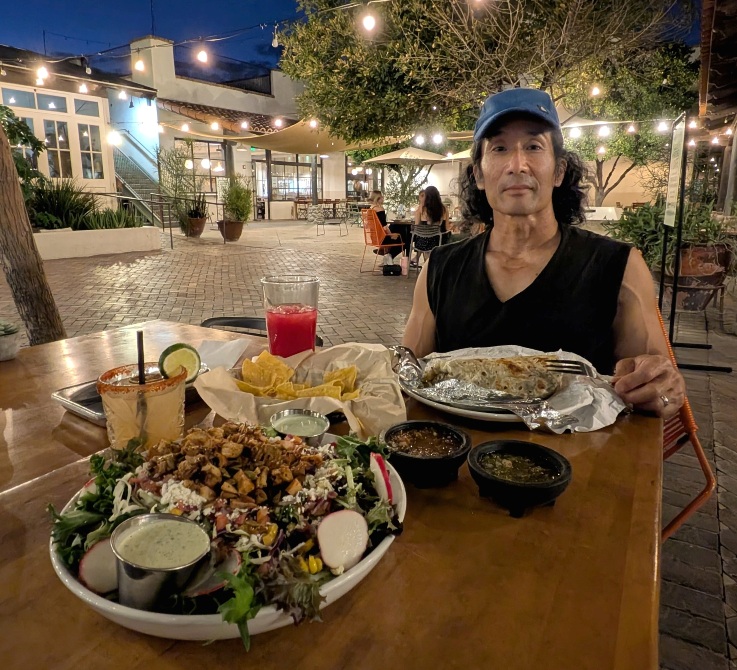
The weather was perfect for sitting outside. |
|
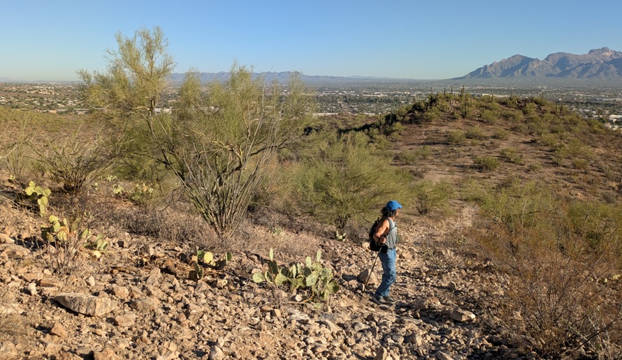
After fueling up on a motel breakfast, we drove southeast to Tucson, where we spent the day. There we found a city park called Sentinel Peak Park.
I was on the lookout for snakes but unfortunately, we saw none in the wild during our stay. Following our visit to the Red Hills Visitor Center, I saw a cactus and wondered how old it might be. Maybe older than me? No, not this one. Pincushion cacti only get about a foot tall and typically live 5-20 years. 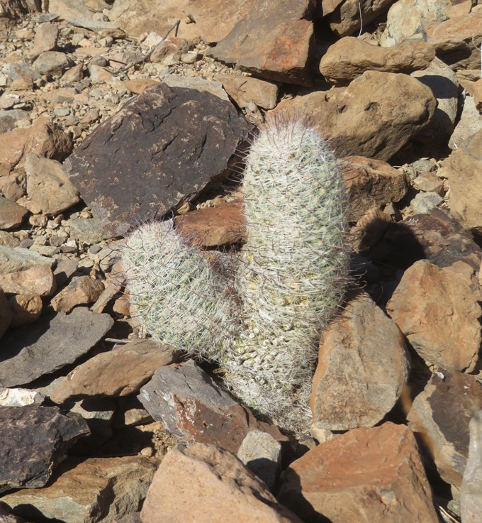
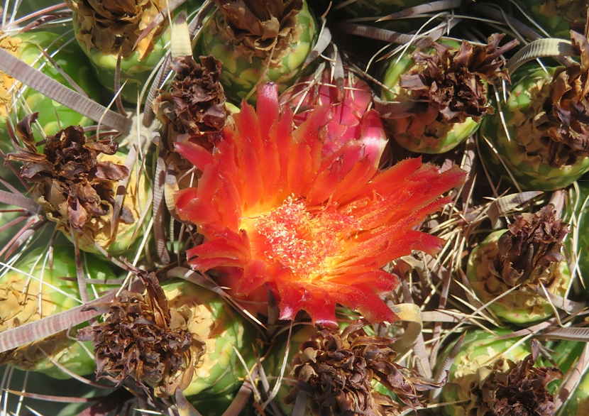
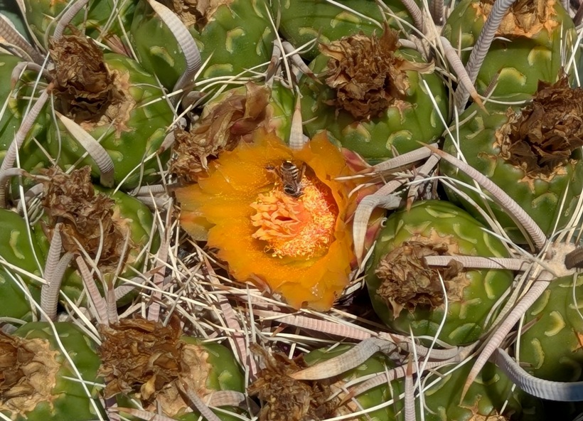
Many barrel cacti were blooming. They typically flower from August through September so we were fortunate to catch them at the end of their season. It was great to get out and explore the natural desert landscape. From some areas, we had a scenic view of the city below. 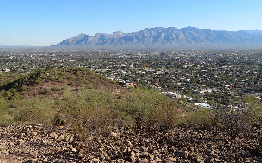
It was interesting how the plants have evolved to handle such a dry environment. There were no big leaves. The ones on this milkvetch use small leaves to conserve moisture and reduce water loss through transpiration. 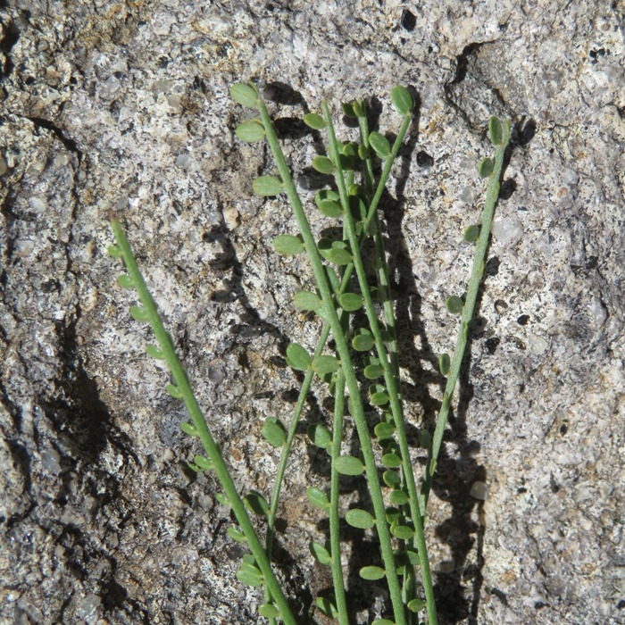
Another plant that has learned to adapt to the Sonoran Desert is the palo verde which has green bark. This is the state tree of Arizona. A palo verde tree's bark is green because it is filled with chlorophyll, which allows the tree to perform photosynthesis through its bark. This is a key adaptation for surviving in arid environments, as the tree can still produce food even when it sheds its small leaves during dry or cold periods. - from Google AI 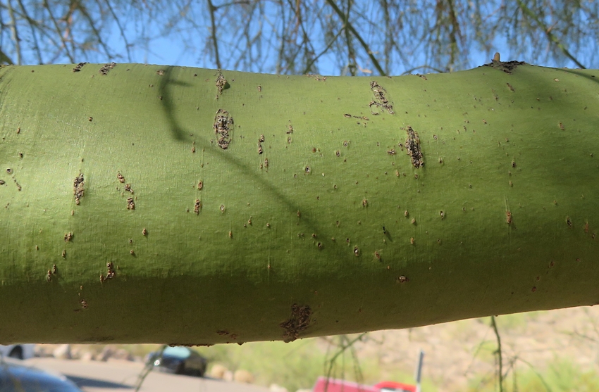
|
|
Carmen insisted that we stop at Barrio Bread for lunch. Looking at their website, the place certainly sounded appealing.
Barrio Bread is a community supported bakery grounded in the grains and traditions of the Sonoran Desert. The place was very popular and I could see why. Their bread was very tasty in a wholesome sort of way. Based on the name, I expected Barrio Bread would be in a rough area but that was definitely not the case. We stopped at Safeway to buy some groceries, including lots of Diet Pepsi and Diet Mountain Dew for me. How I love my fizzy caffeine. |
|
This was our only challenging hike but it was also my favorite. I was concerned that my tarsal tunnel syndrome would be an issue but fortunately it was not.
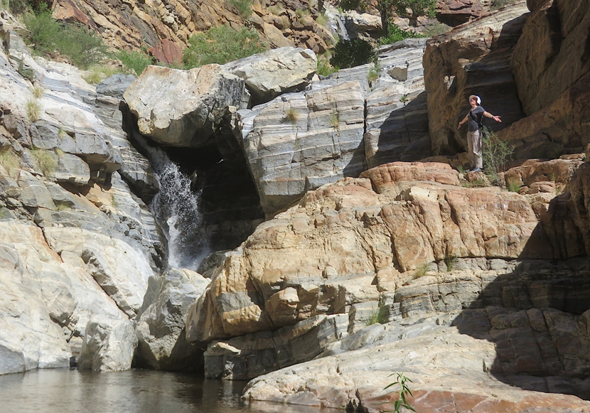
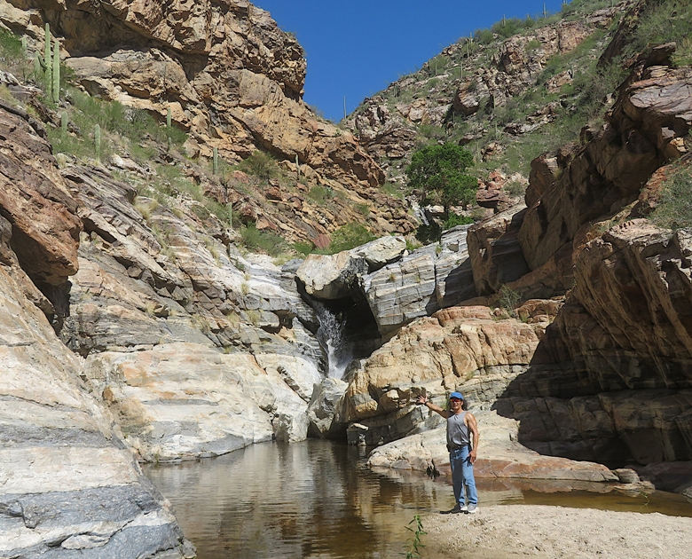
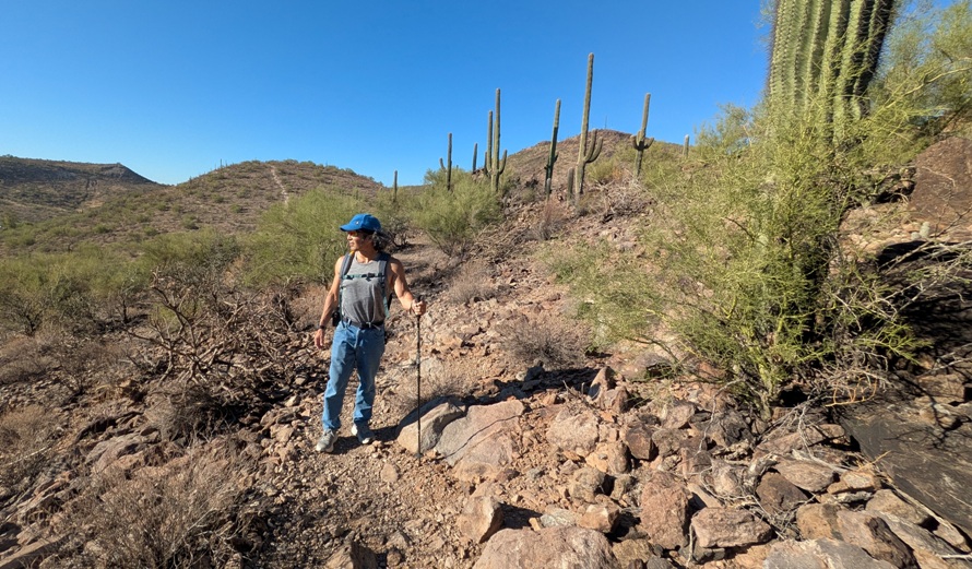
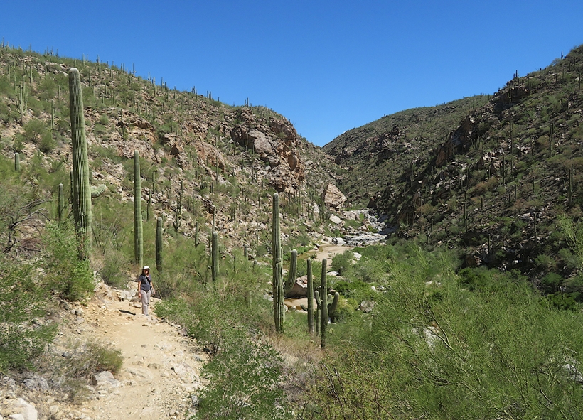
We drove to the Coronado National Forest where we started our trek from the Lower Tanque Verde Trailhead. There, we made our way down Tanque Verde Canyon and then followed Tanque Verde Creek upstream. Tanque Verde Creek cuts through the saguaro-studded slopes and banded gneiss and granite of Redington Pass, creating a series of seasonal pools and waterfalls. - from sign titled "Welcome Coronado" We saw lots of cacti, both big and small. It didn't take long before we were at the bottom of the canyon at the creek, along with some other folks. 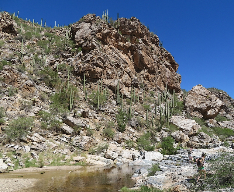
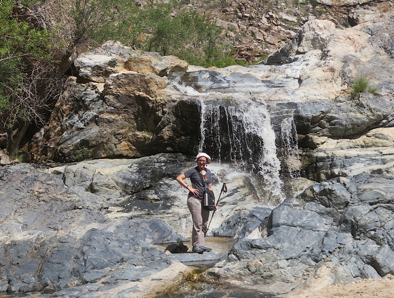
There wasn't a defined trail. We pretty much just rock scrambled where we could on either side of the water. Deciding the better side was totally subjective. I expect we could do this hike a dozen times and choose a different route each time. Eventually, we made it to our first waterfall. Clearly, it hadn't rained for awhile. Being in the canyon was much more impressive than being at the top looking down because we could truly appreciate the depth and the rocky terrain. 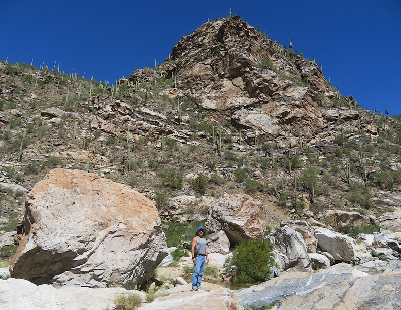
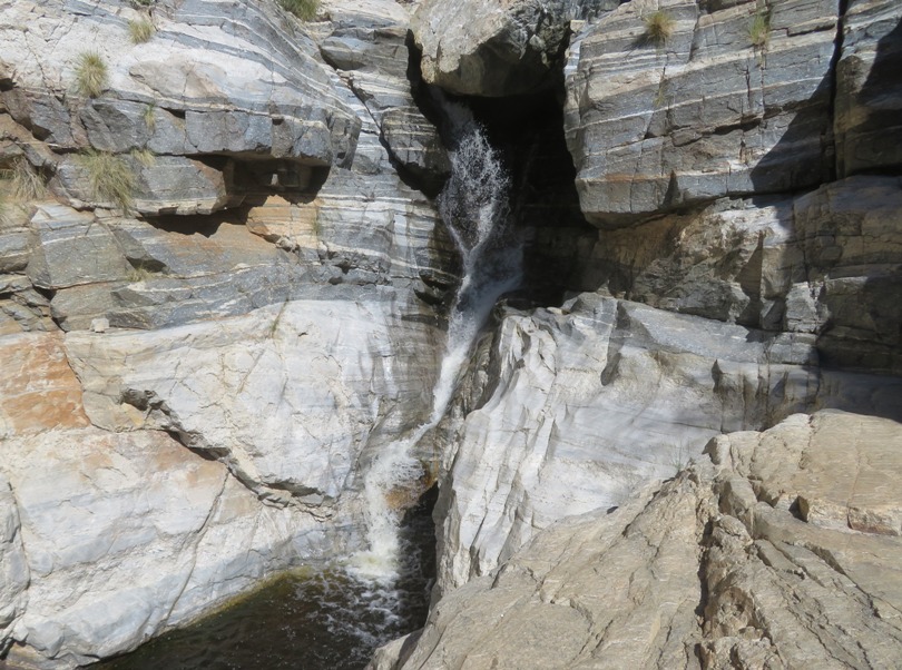
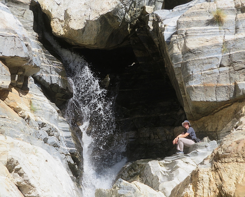
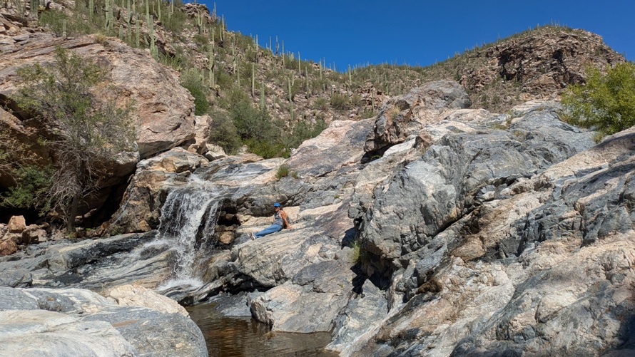
While we saw various people, we didn't see any that made it to the second waterfall. Getting there was not easy and required us to tap into our inner billy goat. But the view made it all worthwhile. 1 / 5
Second waterfall.
2 / 5
Norma waving.
3 / 5
Catching some mist.
4 / 5
Catching some rays.
5 / 5
Me presenting.
If I had to do this hike again, I would wear my hiking sandals. Trying to keep my feet dry limited the routes I could take. 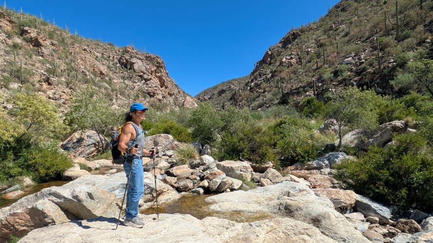
As we made our way uphill and out of the canyon, we saw two women whose paths we crossed earlier. They were sitting on the side of the trail looking exhausted. One asked if we had any water to spare. I knew our car was not far so I gave them the rest of what we had, which was a little more than half a bottle. Norma was pretty tired but I still had a lot of energy. I think all the upper body work involving scrambling was more taxing for her than me. Back at the car, we had no water but we had plenty of warm Diet Pepsi and Diet Mountain Dew. Norma normally hates both but she was thirsty enough to drink one. I grabbed two and walked back down the trail where I saw the two women that I gave my water to. I offered them both sodas and they gladly accepted. I felt I did my good deed for the day. Back near the top of the canyon, I looked back and felt a sense of accomplishment. We probably only hiked about four miles but it was very rugged terrain. |
|
Back in Phoenix, we had a nice dinner at a quirky place called Welcome Diner and then went back to our room.
Driving around town, we saw several Waymo driverless cars. I knew such things existed but I did not expect to see them and certainly not so many. Later that night, Carmen showed up. She stayed with us that night. What I liked about our motel were the lizards that congregated around the light outside. They knew the light attracted insects so it was an easy free meal for them. We encountered the same thing but with frogs in Florida back in 2010. |
|
We picked up Robin from the airport. This was the first time Norma or I met her. She pretty much seemed what I expected except younger. After I got to know her, I felt she was more like me than either Norma or Carmen.
The four of us drove out to Petrified Forest National Park. After seeing what a petrified forest is supposed to look like on cartoons, I was really looking forward to this. Unfortunately, it was closed due to the federal government shutdown. Norma planned for us to spend a lot of time here so this really threw a monkeywrench into our schedule. Fortunately, there was cool stuff to see at the two shops just outside the entrance. 1 / 4
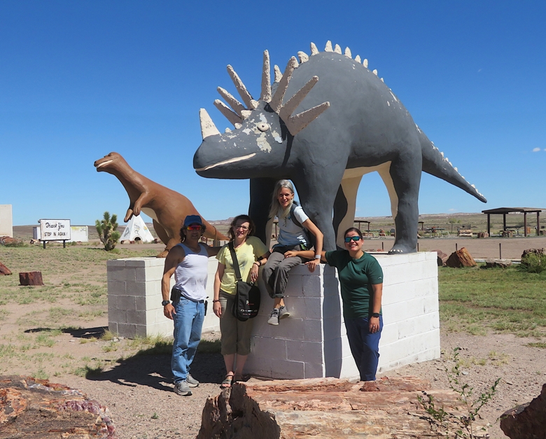
Styracosaurus.
2 / 4
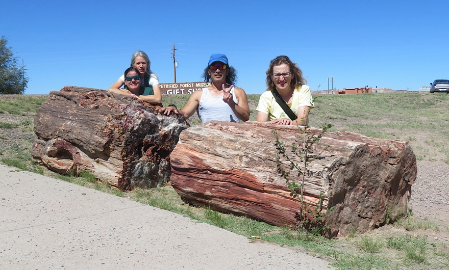
Team SNaCkeR & petrified log.
3 / 4
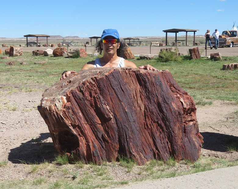
Me & petrified log.
4 / 4
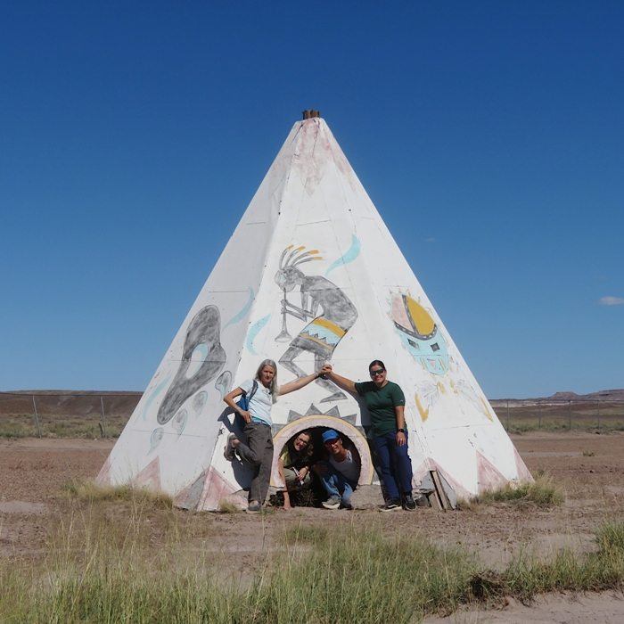
Teepee.
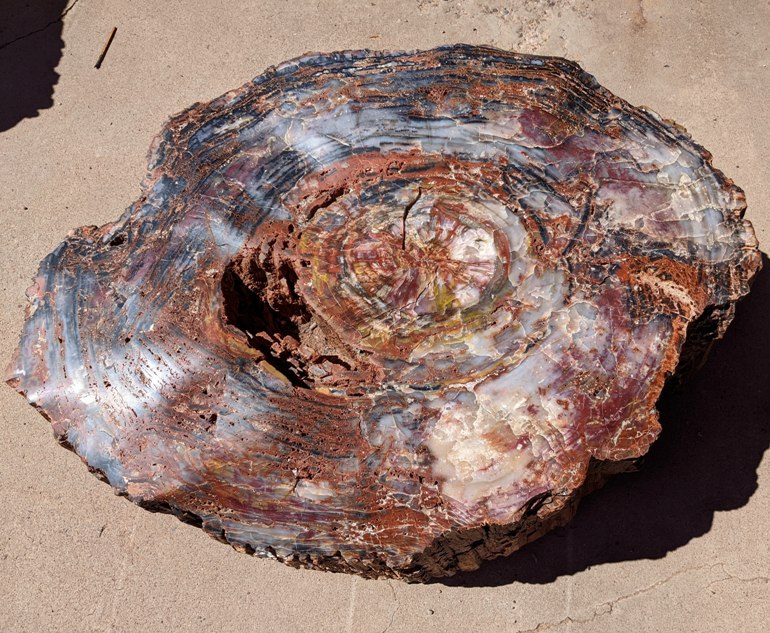
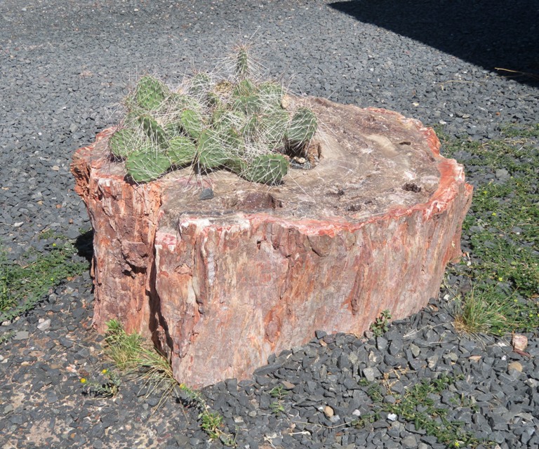
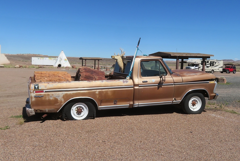
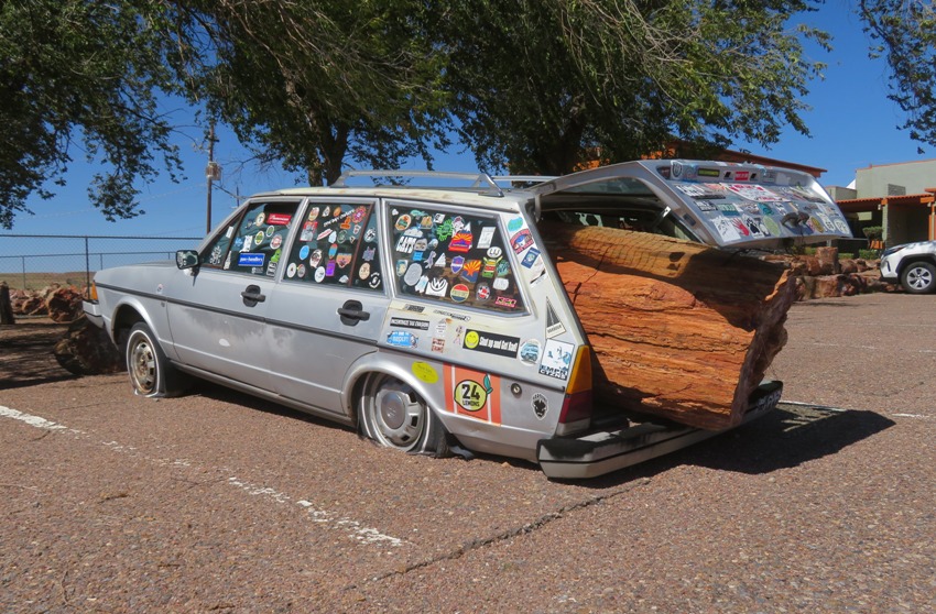
There was lots of petrified wood to see. While I'm sure the park would have been far better, I was at least glad to see what we did. The formations of petrified wood that you see today began over 200 million years ago when this area was a swampy flood plain, and home to some of the first dinosaurs on earth. The trees were transported here by violent floods caused by torrential rains. In time the trees became water logged and sank to the bottom of this swamp and were quickly covered by sand, gravel, and mud rich with volcanic ash. Water containing silica absorbed from the volcanic ash seeped into the logs and the silica reacted with the wood fiber and formed microscopic quartz crystals. Eventually the crystals replaced nearly all the wood. Trace minerals like iron, copper, and manganese stained the quartz crystals giving the wood the beautiful colors that you see today. Araucarioxylon or rainbow wood is the most common wood and accounts for about 92% of the wood found in this area. - from sign titled "The Story of Petrified Wood" I liked how they used old vehicles to show how big and heavy these petrified logs are. Not sure how they got it in the back of the station wagon. According to one source, Petrified wood is about 2.58 times more dense than water. The desert can be a beautiful place. I saw one formerly wet area of ground which was now peeling from dryness. 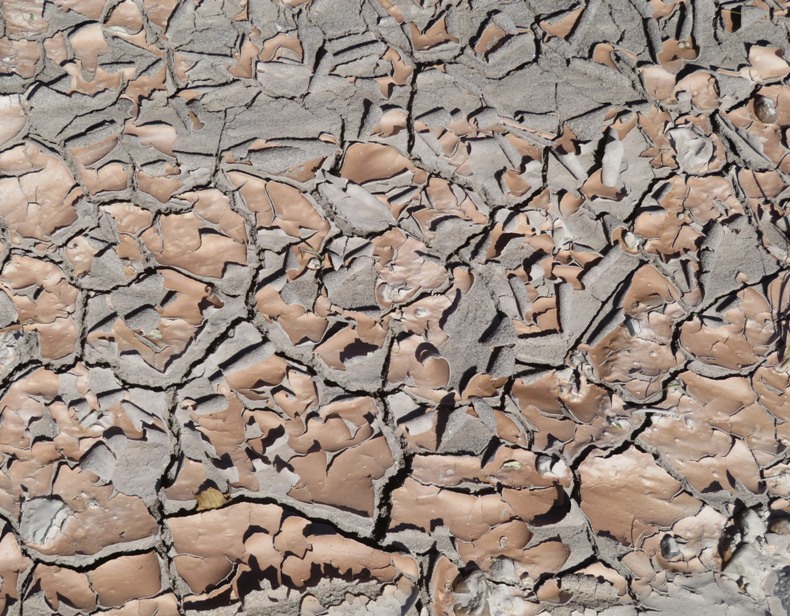
We were disappointed that we could not get into the park but I felt we made the best of our situation. |
|
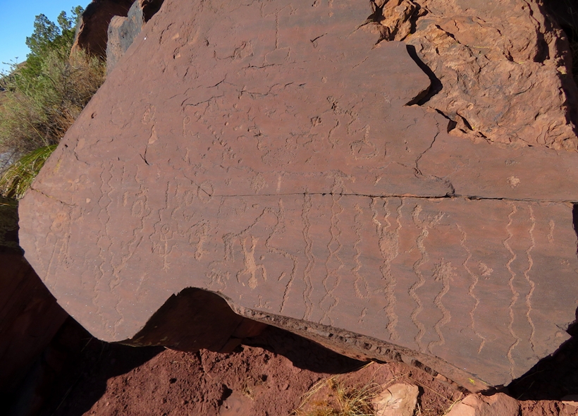
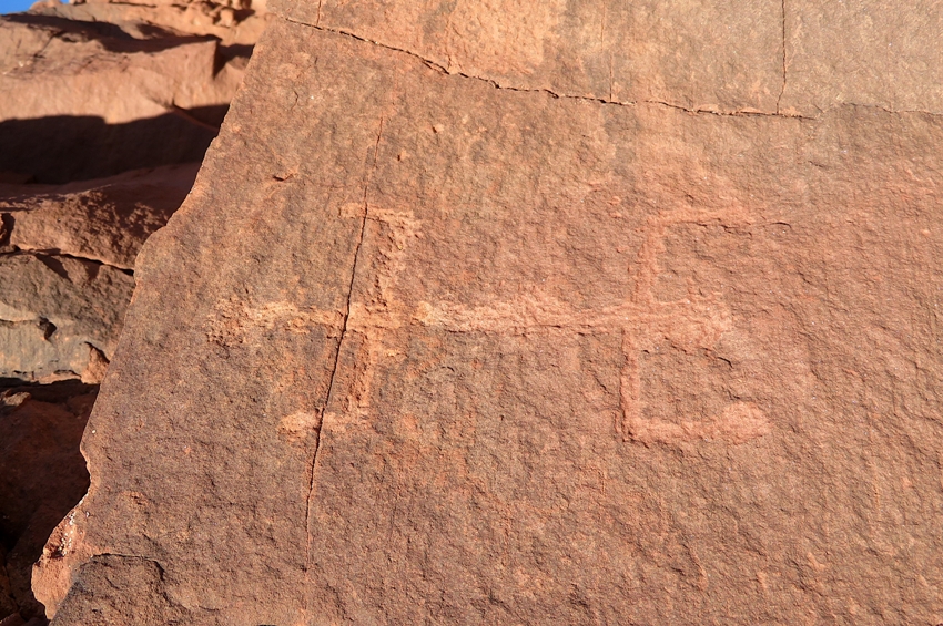
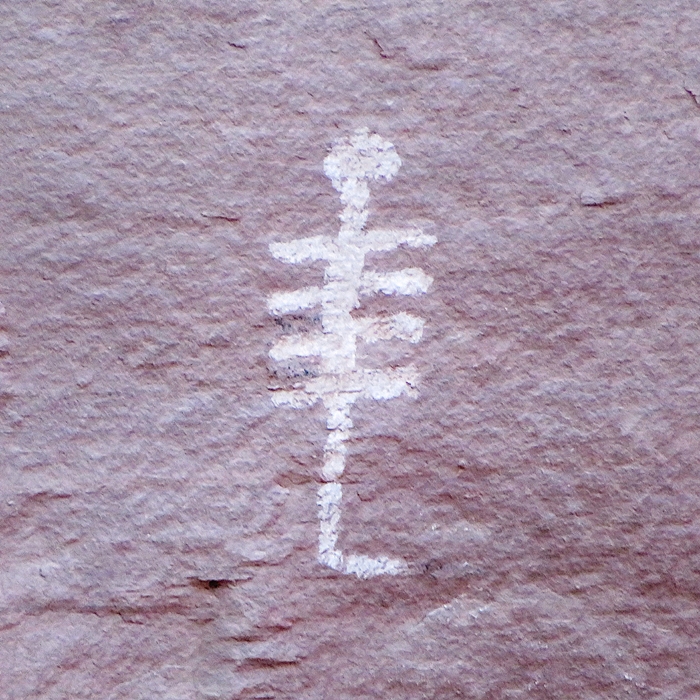
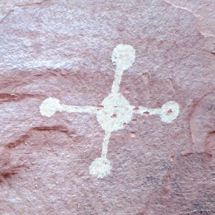
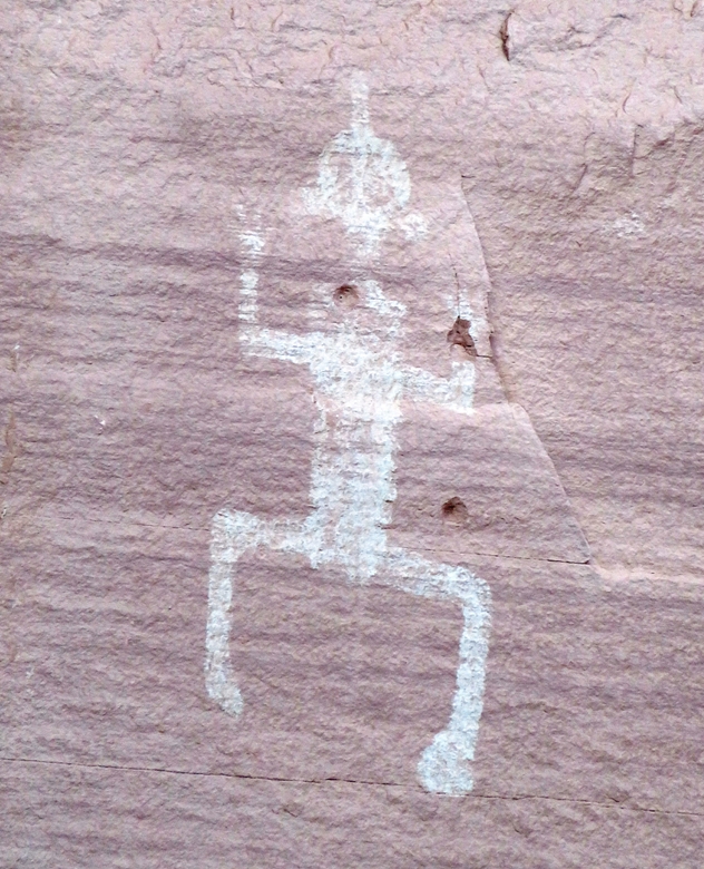
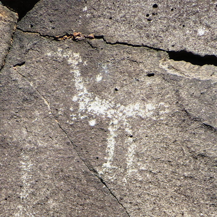
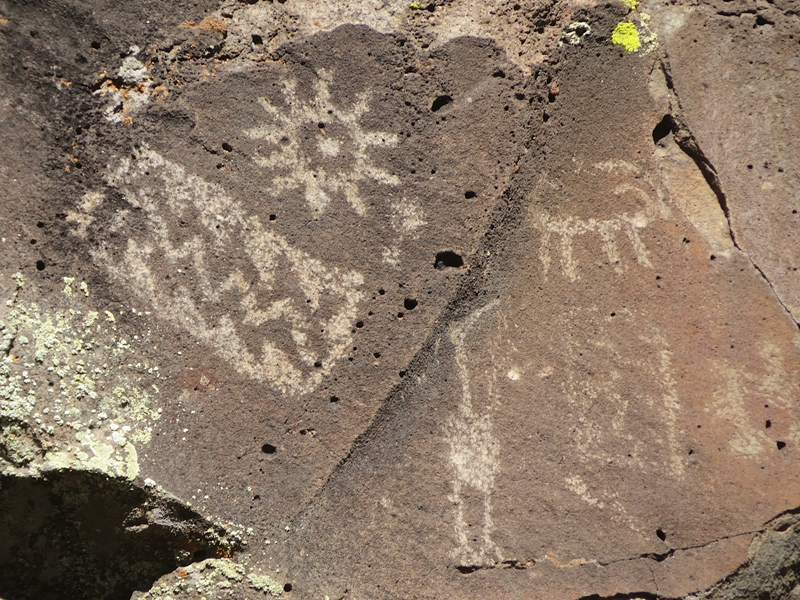
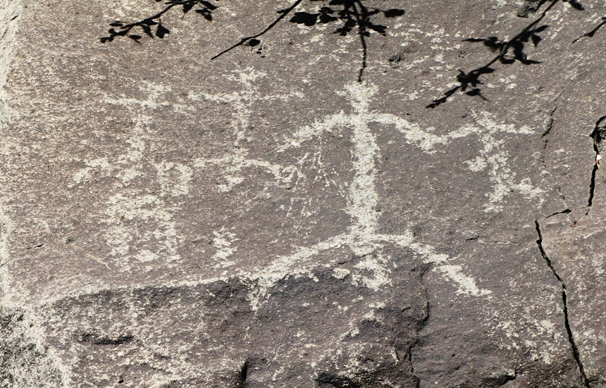
Looking for things to do in the area that were not affected by the government shutdown, I searched my phone and found Lyman Lake State Park. We drove there and then walked on the 1.3-mile Peninsula Petroglyph Trail.
This trail leads you to thousands of years old petroglyphs, originating from the Hopi people. - from trail sign titled "Peninsula Petroglyph Trail" Here's Robin on the trail. 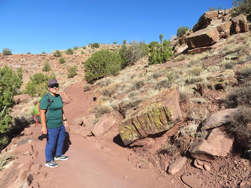
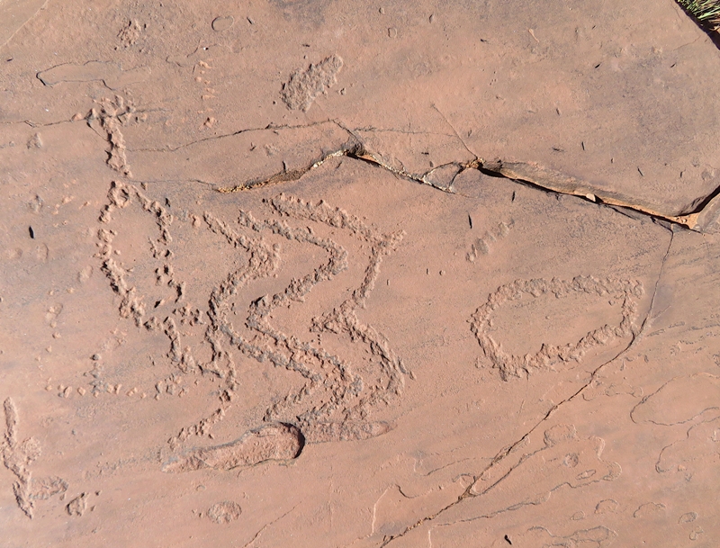
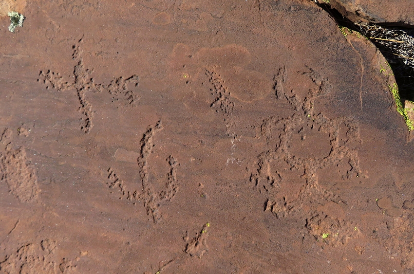
Rock drawings or petroglyphs are made by chiseling through the thin layer of desert varnish (patina) that occurs on the surfaces of weathered sandstone and basalt. They can be found throughout the park. The older weathered petroglyphs are believed to be from the Archaic period, while the newer more defined art is Anasazi (500-1300 A.D.). Numerous attempts have been made to classify rock art according to subject matter. Many theories...have been suggested, but none provides conclusive proof as to the meaning of these strange writings. - from sign titled "Rock Art" 1 / 7
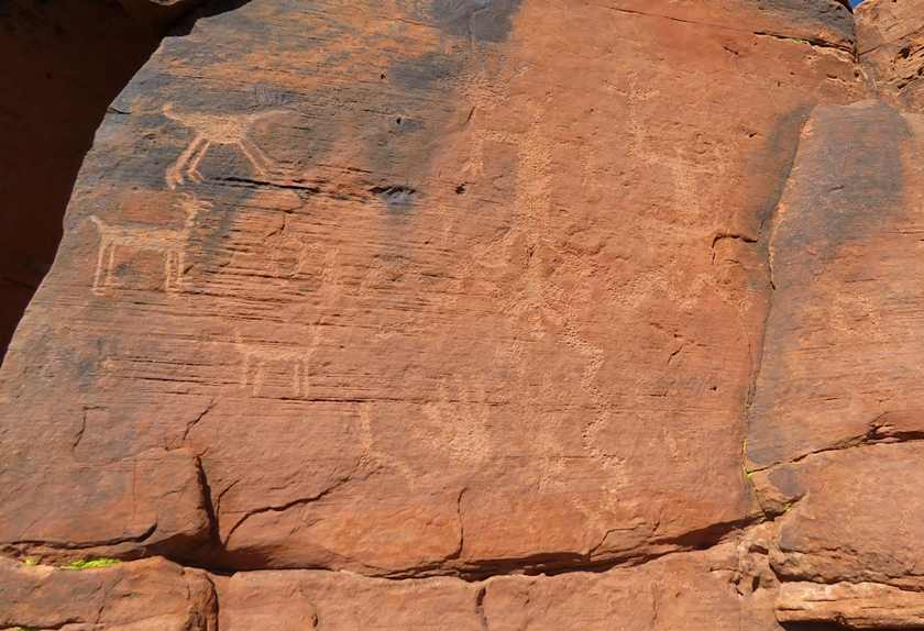
Animals and people.
2 / 7
Lots of snakes.
3 / 7
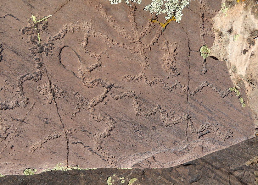
Snakes and menorah?
4 / 7
Snakes and circles.
5 / 7
Crab on the right?
6 / 7
Man?
7 / 7
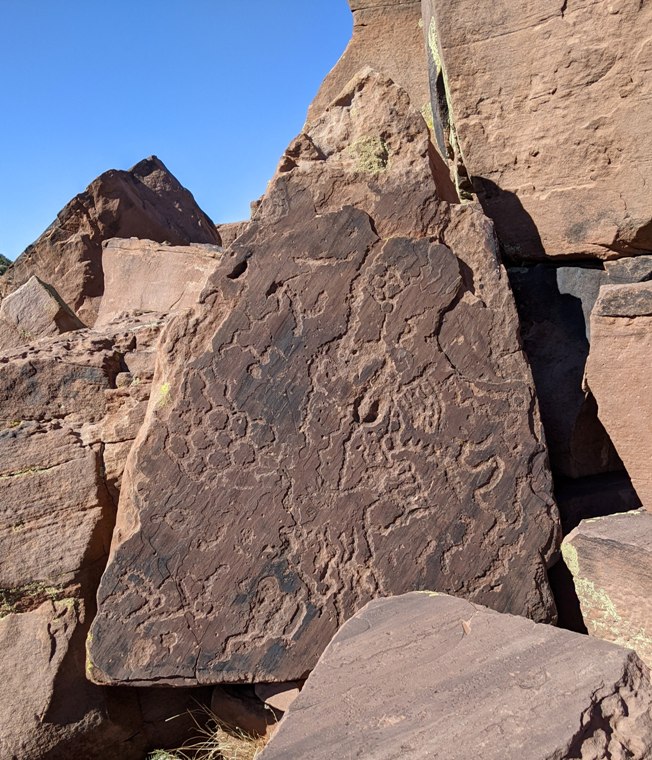
I see honeycomb.
We found one vandalized stone in that someone decided to add their own name to the prehistoric carvings. 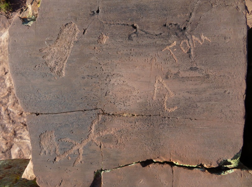
I came across one stone with interesting patterns that were clearly not made by humans. One AI source says it is a fossilized trackway or trace fossil. 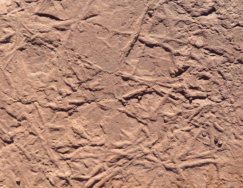
We had plenty of nice views of the lake. The girls walked down to the water and said it smelled bad. |
|
Other than the Petrified Forest, there wasn't a whole lot to do in the area so we searched for trails using various phone apps. This wasn't very reliable and some took us into places that we weren't sure were open to the public.
In one spot just off the side of the road, we found lots of volcanic rock. 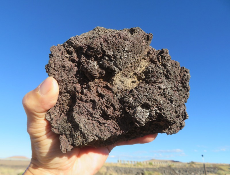
Another route took us driving off-road for a long distance. I'm glad we had a Jeep. This was clearly a pasture for grazing cattle. I found a walking stick insect but nothing else. 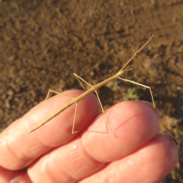
It was getting cold and dark so we decided to call it a day. We drove out to Ganado, checked into our motel, and then had dinner at Denny's because that was about the only thing open. |
|
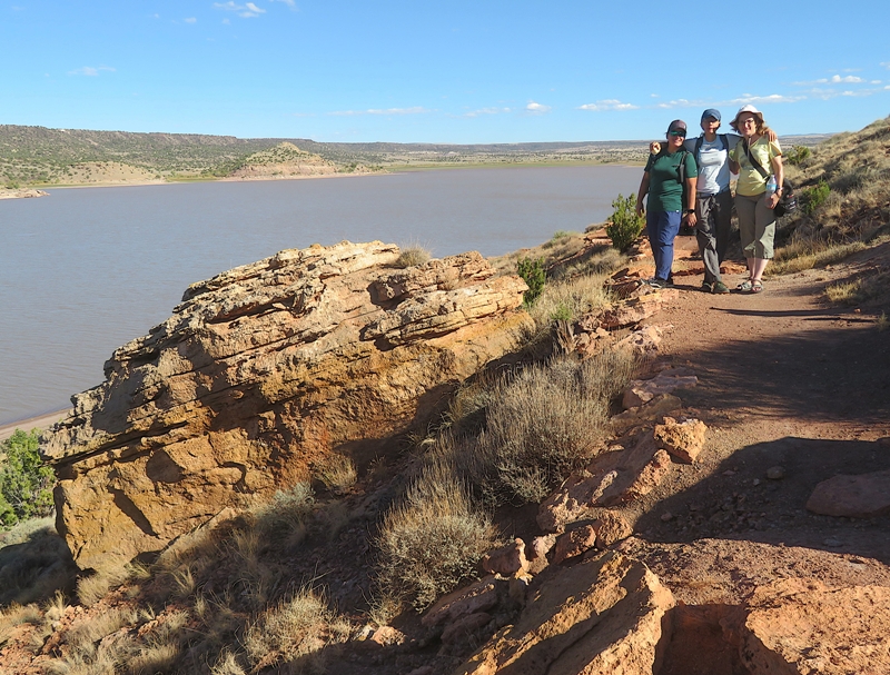
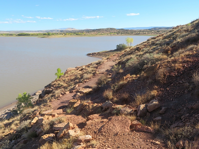
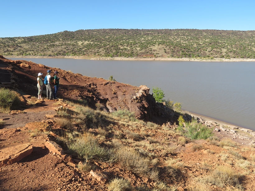
Ganado is a small town on the Navajo Nation. Norma used to live here when she was a school teacher. It was a very important and transformative time in her life that she wanted to share with me.
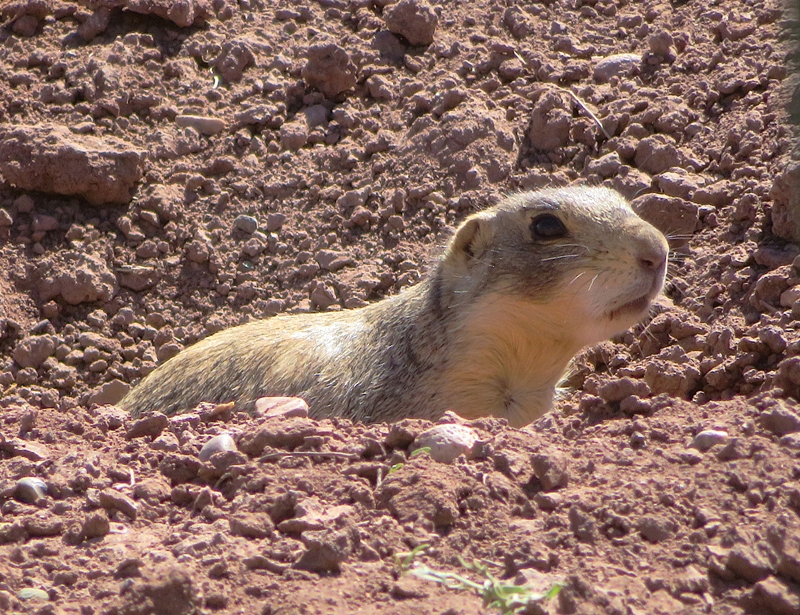
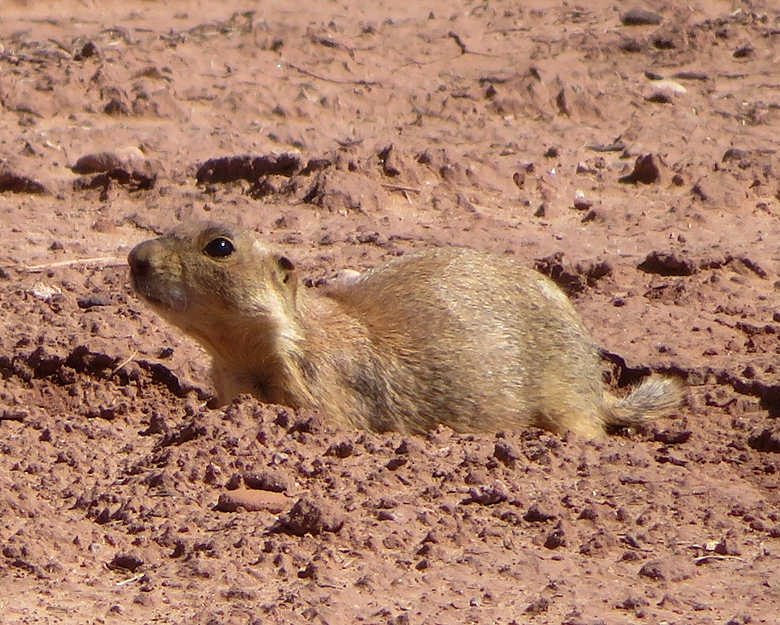
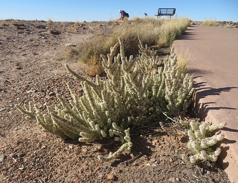
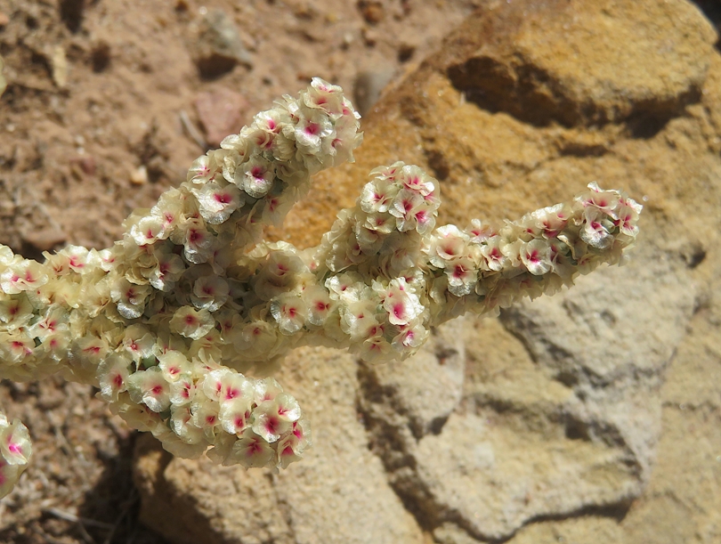
We tried to visit the Hubbell Trading Post National Historic Site but it was closed due to the federal government shutdown. While that was disappointing, we stumbled across something almost just as good...a field full of prairie dogs. Here we saw perhaps ten of them coming out of or running into their holes and interacting with one another. They are somewhat used to people but once we got out of our vehicle, they went into hiding. We saw a roadrunner but none of us were able to get a photo of it. They are every bit as fast as depicted in the cartoons. In and just outside of this field were several rabbitbrush plants which I found have an unusual scent that is hard to describe. 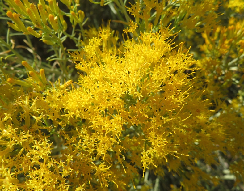
|
|
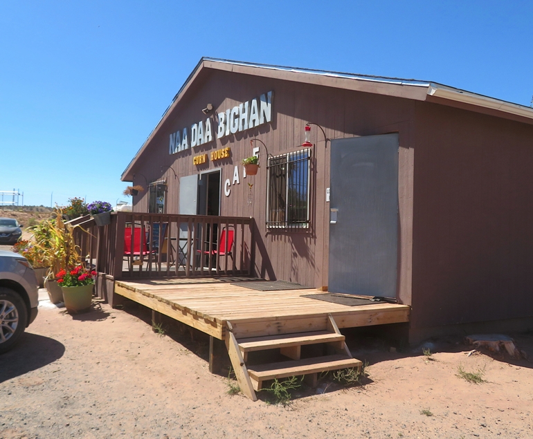
We ate lunch at the Corn House Café. I had the elk burger.
|
|
Our next stop was Ganado High School. The kids were let out early so this gave us a chance to meet Norma's former co-worker who works as a teacher on the reservation, Tjasa. She spoke about how much she likes the kids and that people keep moving away from Ganado. I figured it is like a lot of small towns in that when young people pursue certain careers (e.g. electrical engineering), they can only work in that field in other locations. Unfortunately, the town doesn't seem to attract people to work.
We walked around the perimeter of the school. In the agricultural area, we saw some pigs. 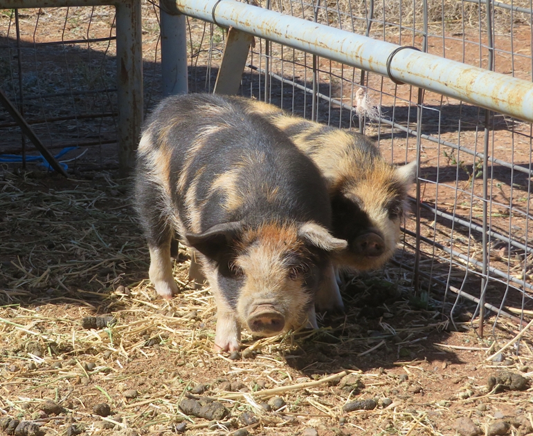
I don't know why but none of us thought to get a photo of Tjasa. |
|
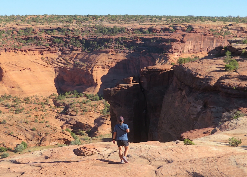
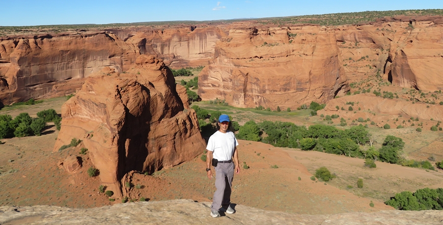
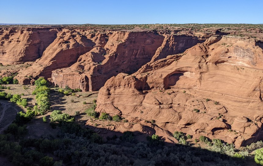
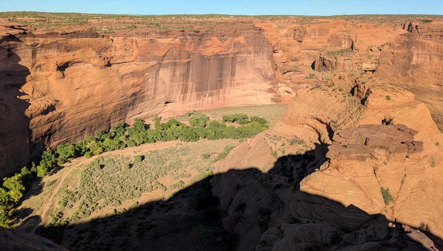
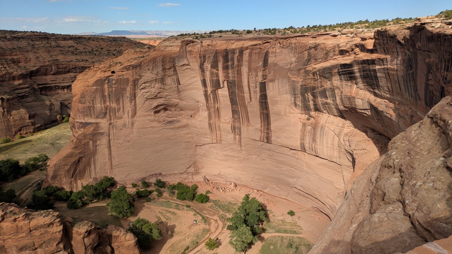
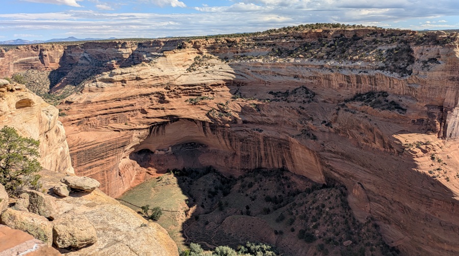
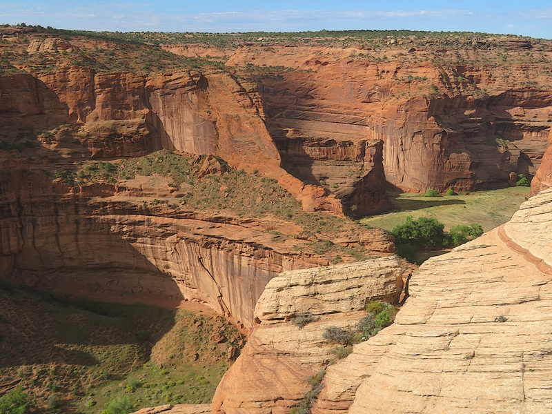
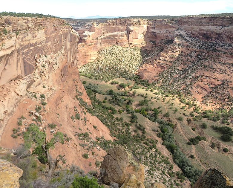
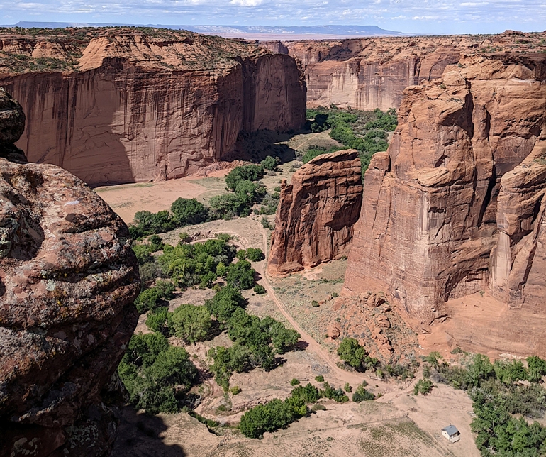
Despite the federal government shutdown, Canyon de Chelly National Monument was still open, so we spent the rest of the day and much of tomorrow seeing the views at this beautiful place where many generations of Native Americans have called home.
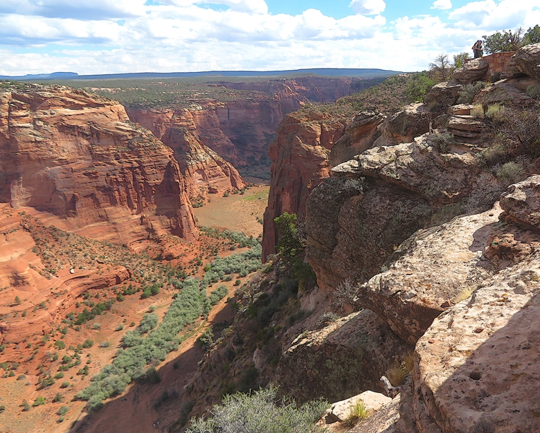
Millions of years of land uplifts and stream cutting created the colorful sheer cliff walls of Canyon de Chelly. Natural water sources and rich soil provided a variety of resources, including plants and animals that have sustained families for thousands of years. The Ancient Puebloans found the canyons an ideal place to plant crops and raise families. The first settlers built pit houses that were then replaced with more sophisticated homes as more families migrated to the area. More homes were built in alcoves to take advantage of the sunlight and natural protection. People thrived until the mid-1300's when the Puebloans left the canyons to seek better farmlands. Descendants of the Puebloans, the Hopi migrated into the canyons to plant fields of corn and orchards of peaches. Although the Hopi left this area to permanently settle on the mesa tops to the west, the Hopi still hold on to many of their traditions that are evident from their homes and kivas. Related to the Athabaskan people of Northern Canada and Alaska, the Navajo settled the Southwest between the four sacred mountains. The Navajo, or Diné as they call themselves, continue to raise families and plant crops just as the "Ancient Ones" had. The farms, livestock and hogans of the Diné are visible from the canyon rims. - from Chinle sign titled "Canyon De Chelly - The placed called Tseyi'" In my opinion, what makes this place visually appealing is the sharp changes in elevation created by water which has carved out canyons. 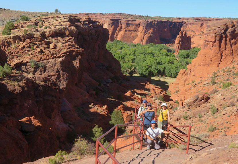
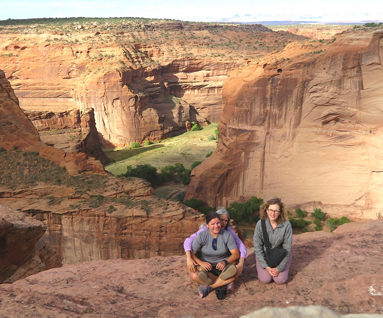
Some of these differences between high and low land is very dramatic. One more group shot with me giving the "thumbs up" approval. 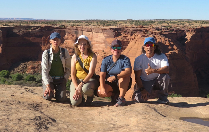
At most overlooks, there were Navajo selling jewelry they made. Norma purchased a couple of necklaces from one of them after hearing their story about how the bead pattern represents their "house" (ancestral lineage). |
|
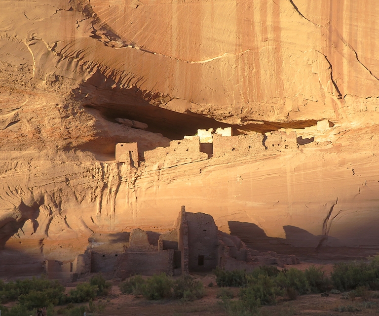
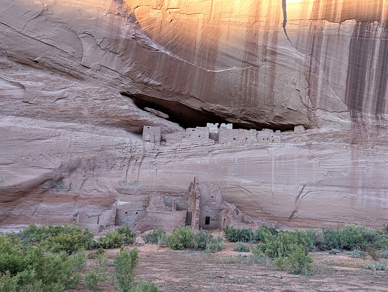
While the overlooks are nice, I much prefer being able to spend some time to get more familiar with an area by doing a hike. We had such an opportunity at White House Ruin. Here, we got to hike down into Canyon de Chelly.
Hiking to the bottom of the canyon was a little like paddling up a river in the Chesapeake Bay. If you start at the mouth of the river, you might be surrounded by brackish water and bay grasses. But as you paddle upstream, the salinity of the water may drop and if so, the vegetation will also change. By the time you are far upstream, you're likely surrounded by big trees. Today, we also got to see the change in vegetation as we made our way down into Canyon de Chelly with the greenest and most lush plants at the bottom, where the water collects. Here's some views near the top. The walk down can be tiring for some. So it is good someone (maybe Mother Nature) carved a bench into the wall. 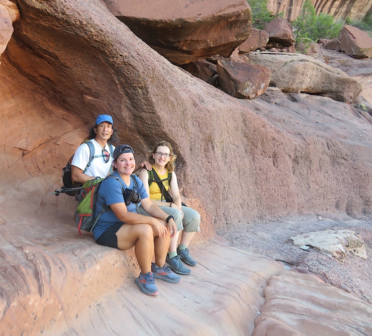
Here's Robin and Carmen near the bottom of the canyon. 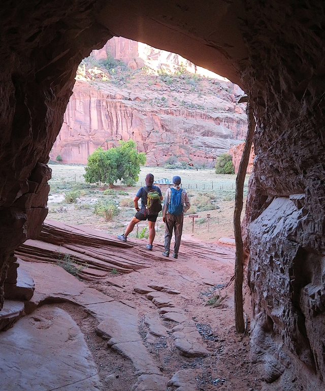
The flora and fauna at the bottom of the canyon was interesting. 1 / 5
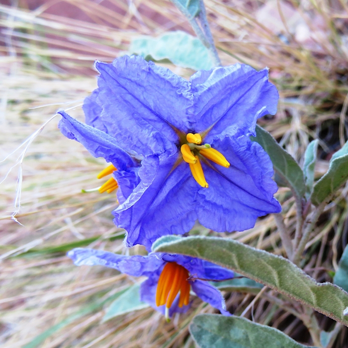
Silverleaf nightshade.
2 / 5
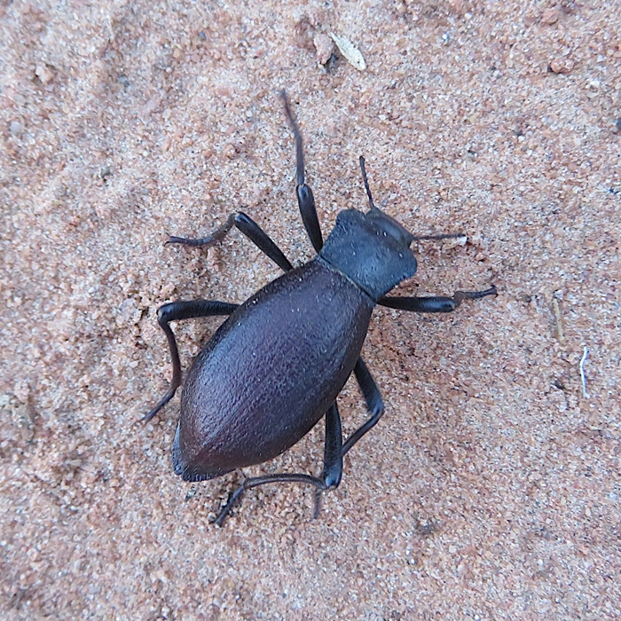
Darkling beetle.
3 / 5
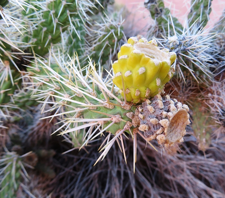
Cholla cactus.
4 / 5
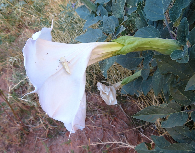
White moth on datura.
5 / 5
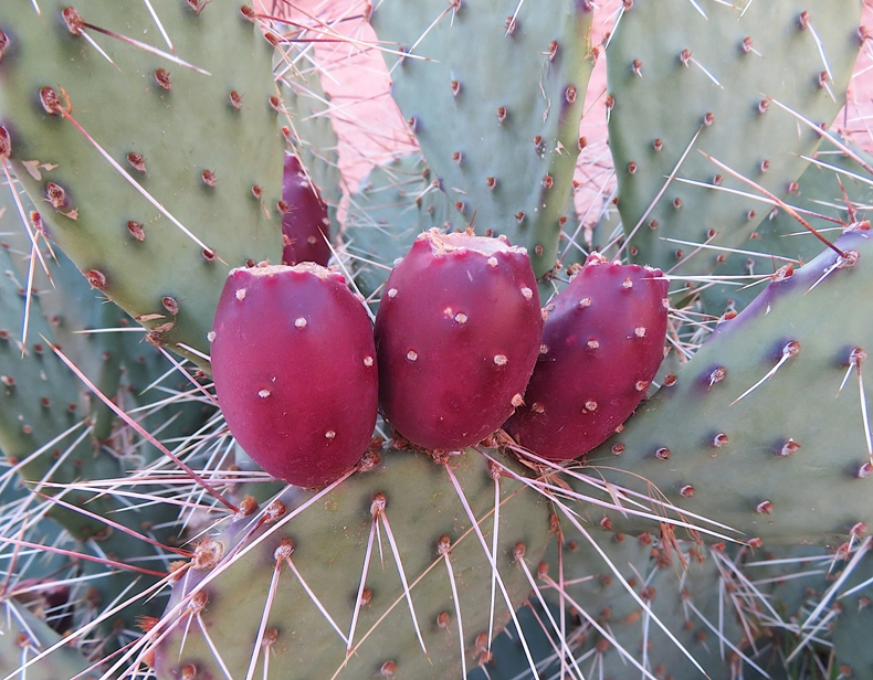
Prickly pear.
Given the dry climate, I was not expecting to see fungi, but I did. 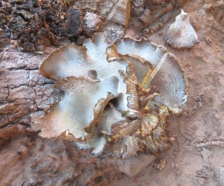
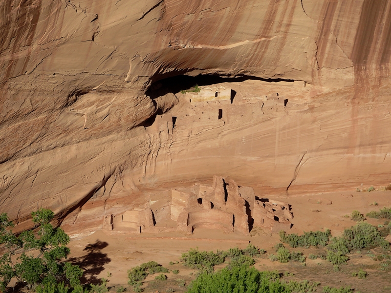
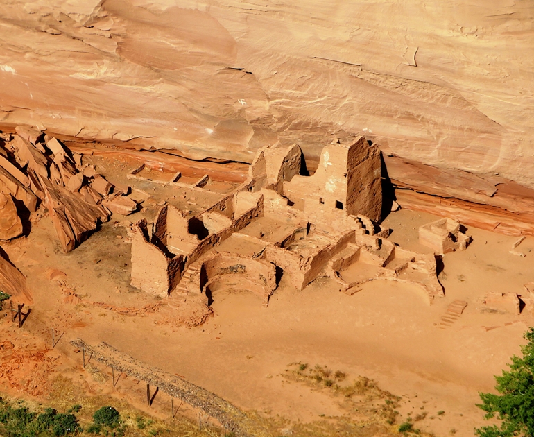
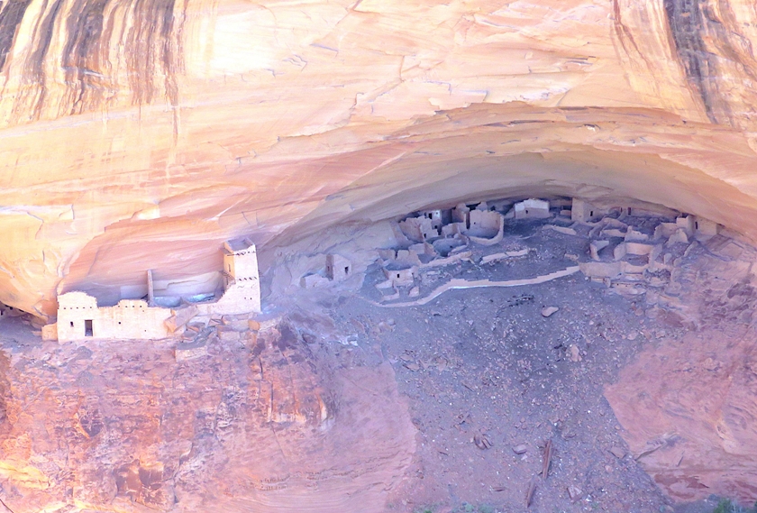
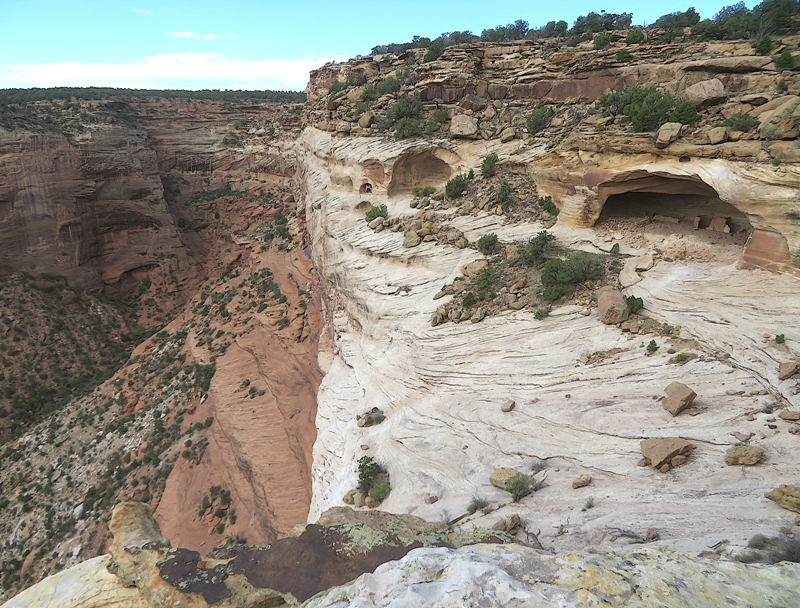
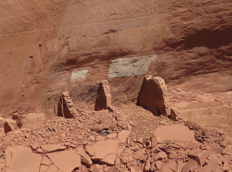
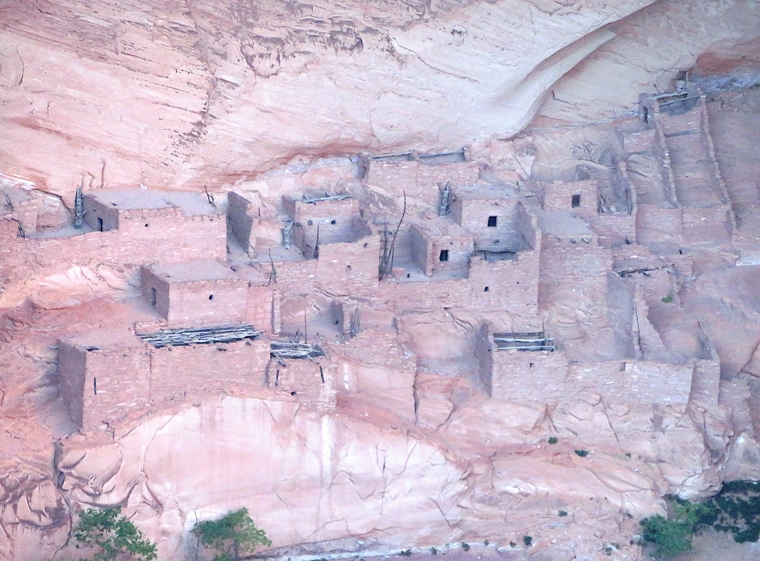
After some walking at the bottom of the canyon, we reached our goal...the White House Ruin. Although people have lived in Canyon de Chelly for more than 5,000 years, it was Ancestral Puebloans who built White House around 1060 AD. More rooms were added during the next 200 years, and archaeologists estimate there may have been up to 80 rooms and four kivas when it was most heavily used. - from Grand Canyon Trust - White House Ruin 1 / 5
Seen from above.
2 / 5
Ground-level view.
3 / 5
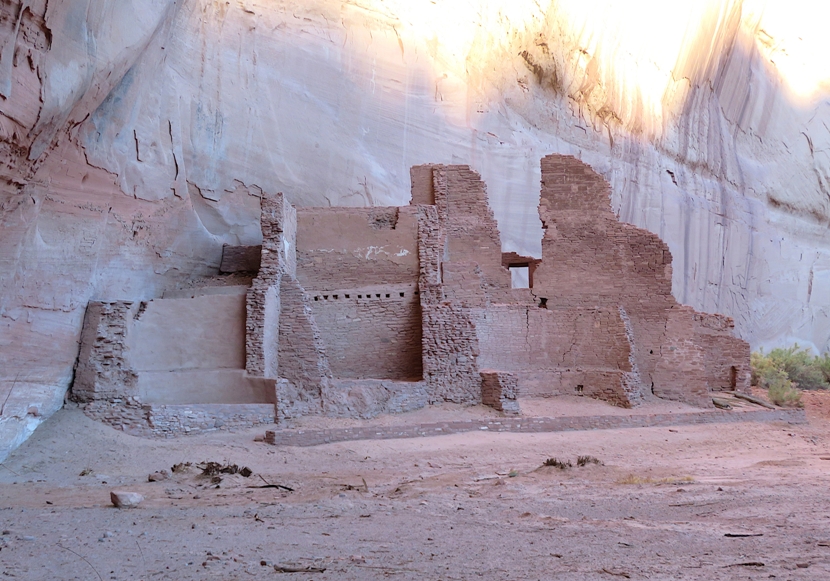
Lower ruin.
4 / 5
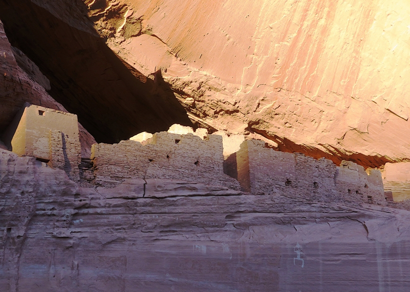
Upper ruin.
5 / 5
In the shade.
Zooming in on the upper ruin, I could read carvings on the wall dating back to at least the 1800s. 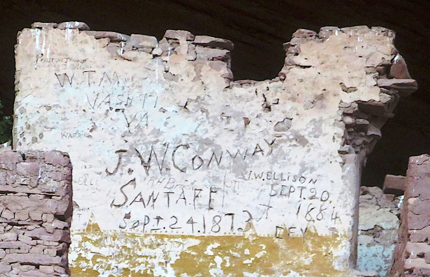
Along with the ruin, we saw some painted petroglyphs. I assume this was not the original paint. We saw a small group arrive via a motorized vehicle. These tourists were shown the site and then were driven away a few minutes later. I much preferred our method of seeing the ruin. We hiked out of the canyon as the sun started to set. |
|
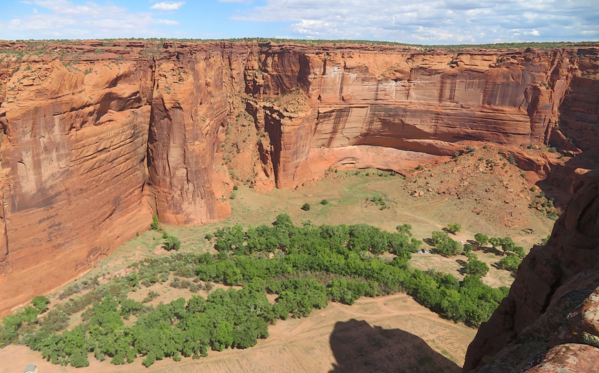
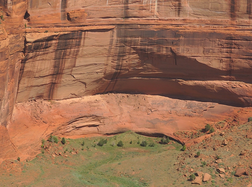
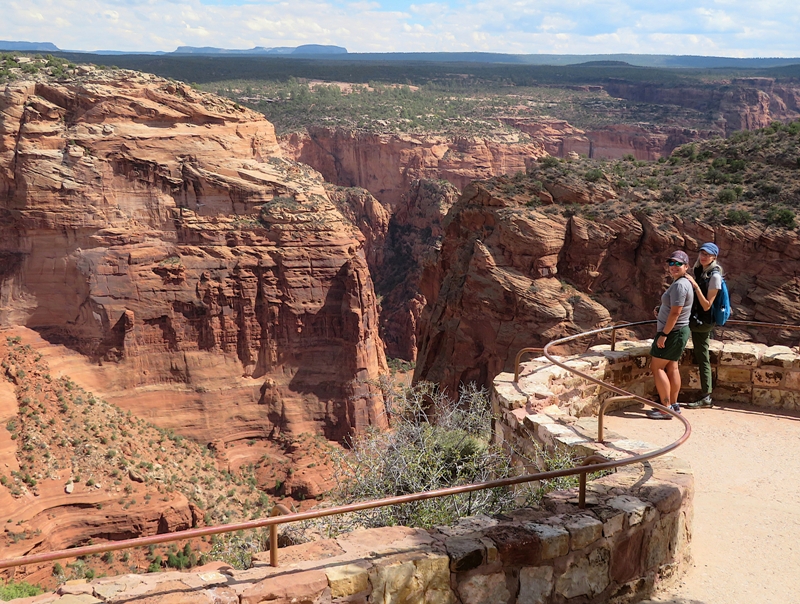
We continued where we left off yesterday...exploring Canyon de Chelly National Monument.
Canyon de Chelly National Monument was authorized in 1931 by President Herbert Hoover in large measure to preserve the important archeological resources that span more than 4,000 years of human occupation. The monument encompasses approximately 84,000 acres of lands located entirely on the Navajo Nation with roughly 40 families residing within the park boundaries. - from Chinle sign titled "Canyon De Chelly - The placed called Tseyi'" While there are countless scenic views in Canyon de Chelly, the ones highlighted are where Native American ruins lie. I did find the ruins at this particular stop but I can't say for certain which were associated with Fortress Rock versus Antelope House. Signs were not as abundant as I prefer. Here is one of the two ruins. This is another. This is a great place to appreciate the canyon sights. Happy couple. 
|
|
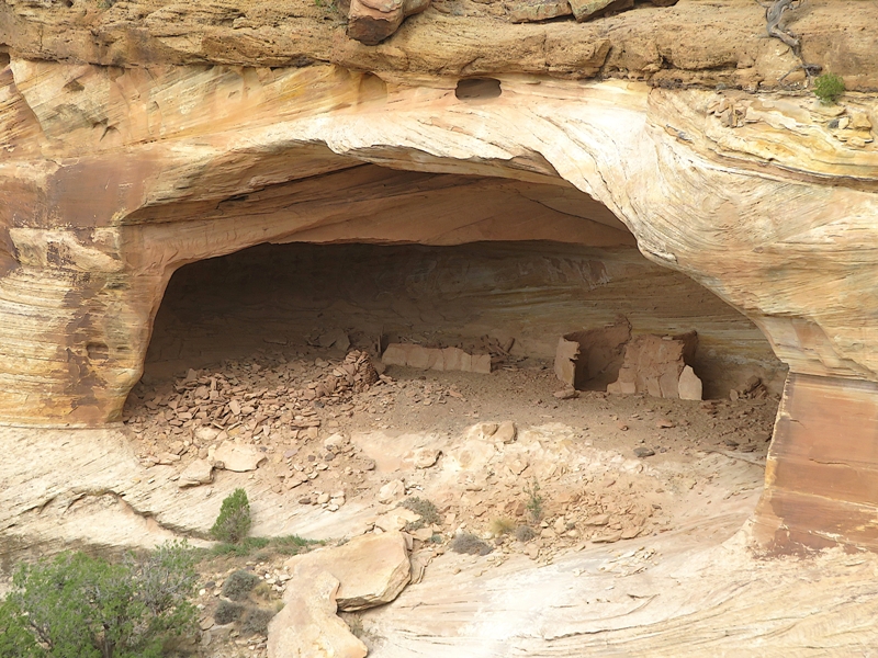
Our next stop was Mummy and Massacre Cave. Regarding the latter,
The cave is the site of a rock shelter where in 1805 a group of Navajo had fortified themselves in a battle against a Spanish military expedition led by Lt. Antonio Narbona. - from GJHikes - Massacre Cave Overlook This was a place where we could clearly see the valley below along with a building and a dirt road. We came to one cliff with ancient structures inside a shallow cave. |
|
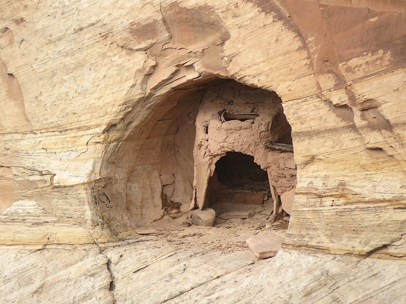
The ruin at this location was pretty far away.
From a distance, one rock formation looked like a castle. 
We had a mix of dark clouds and bright sun which sometimes made for dramatic photos. 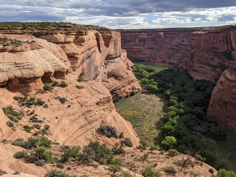
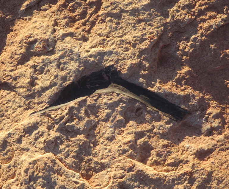
While most of the best stuff was down in the canyon, we managed to find a footprint petroglyph up top where we were walking. 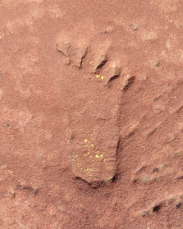
|
|
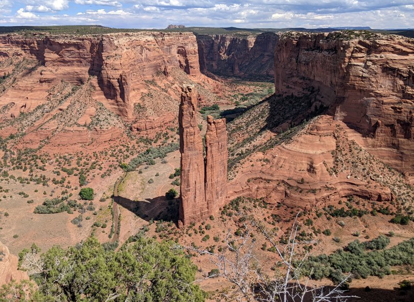
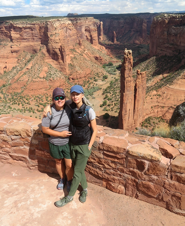
One of the more spectacular views was from Spider Rock, a prominent geologic rock formation towering 750-830 feet (depending on source) from the canyon floor.
We did not see archeological ruins at this site. I think the sheer beauty of Spider Rock and the surrounding area was justification to make it a designated overlook. From the viewing area, Carmen impressed us with her athletic skills. I very much admire her agility. 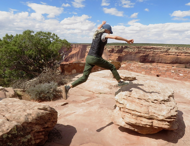
|
|
Heading northwest, we passed some interesting rock formations where two distinct colors were displayed in the same outcropping.
In Kayenta, we saw a sign for a Navajo code talker exhibit at the Burger King so we made a quick stop. The Navajo Code Talkers story is historic. During World War II the [U.S.] military in the Pacific had an urgent need to confuse the Japanese when sending and receiving secret radio communications. They came up with the idea to have the Navajo tribe use their own language to send and receive messages to the troops. They created a special code based on the Navajo language, which the Japanese were never able to break. - from "WanderAZ Northern Arizona" Fall 2025 issue In the restaurant, there were lots of historic photos and relics used by these heros who served in WWII. I actually purchased a book the previous day at the Thunderbird Lodge titled Code Talker Stories. Just outside the Burger King were various Native American structures on display. Shade houses [shown below] are built by most of the Southwestern tribes. It is apparently the only remaining Puebloan vestige of a construction technique once commonly used in the building of "pit houses." - from sign titled "Shade House" 
Water in the desert is a scarce resource. So how does one use little water yet still take a bath? Many desert cultures and cold climate area cultures have answered this same question with a sauna. The Navajo Sweathouse [shown below] is simply a sauna house. - from sign titled "The Sweat Lodge" 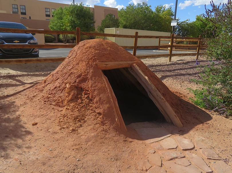
This particular type of Hogan [shown below], called the "Fork Stick Hogan" has now vanished. They were initially used as ceremonial places, but as the Navajo changed, they allowed ceremonies to take place in "female" Hogans which is the common practice today. Fork Stick Hogans were built in the same fashion as the Sweathouse Lodge and are limited in space. - from sign titled "Hogans" 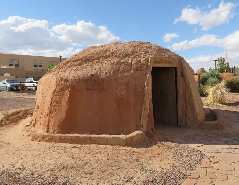
We did a lot of driving this day. I believe around this time, a rock made a small crack in the windshield of our rental Jeep. |
|
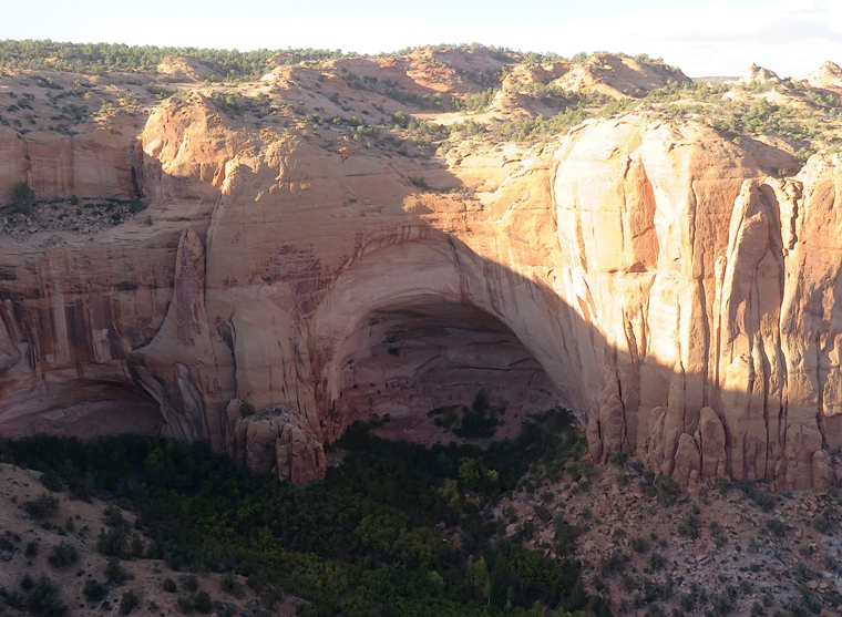
Our next stop was the Navajo National Monument.
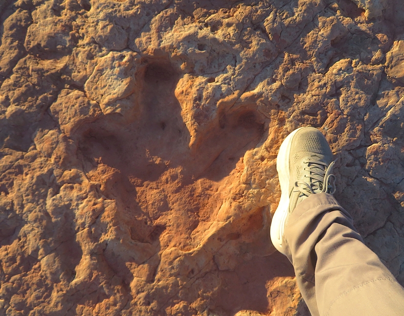
Named for the people who now occupy the region, Navajo National Monument protects Betatakin, Keet Seel, and Inscription House - remarkably well-preserved dwellings built hundreds of years ago [approximately during the years 1250-1300] by Ancestral Puebloans. Nomadic hunters-gatherers came and went from this area for thousands of years. Around 2,000 years ago people became increasingly adept at farming, and a distinct culture emerged in the Four Corners region - the Ancestral Puebloans (sometimes called Anasazi). By 1200 the land surrounding today's national monument was dotted with the farms of the Ancestral Puebloan people. Modern Navajo people are not Puebloans, but some traditional Navajo trace their ancestry back to the prehistoric cliff dwellers through clan ceremonies and oral histories. - from "National Park Service - Navajo National Monument" We walked on the Sandal Trail. Near the start, we saw a dinosaur footprint. About 180 million years ago, he left a lasting signature by walking through the mud. The print then filled with sediment, and both print and cast eventually turned to stone. Tracks of these three-toed Jurassic reptiles are very common in the limestone formations of the Navajo Country. - from sign titled "Dinosaur Footprint" 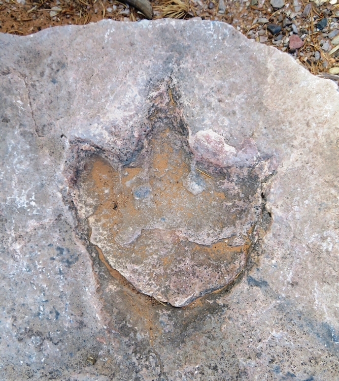
This trail leads through vegetation typical of the plateaus of northern Arizona. Although the trees are small, they make up a true forest - the pinyon pine-juniper forest. The stunted trees and plants here may seem an unlikely source of food, tools and clothing. But for the people of Betatakin, their Hopi Indian descendants, and the Navajo Indians, it was a natural storehouse of these things. - from sign titled "The Pygmy Conifer Forest - An Indian Store" 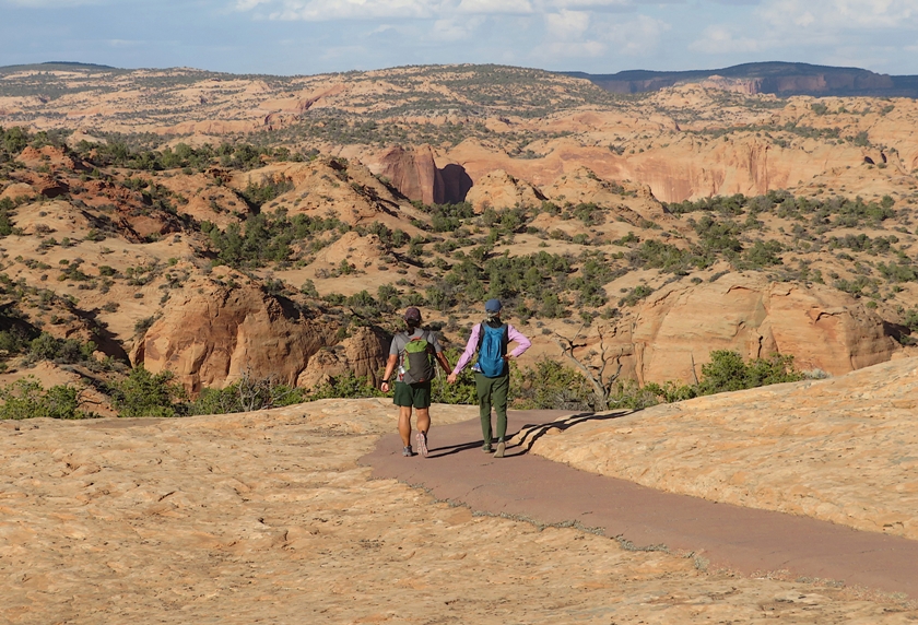
We walked to Betatakin Overlook where we had a nice view of Betatakin Canyon. "Bétatakin" is a Navajo - or, Diné, as they call themselves - word, meaning House on a Ledge. - from sign titled "Into the Memory" In the canyon, we could see ancient ruins. Walking back out of the canyon, I saw gambel oak. The most common oak in Navajoland has a hard, durable wood, which is still used for ax handles, weaving battens, and cradleboard hoops. The leafy branches are favored for shade ramadas in the summer. Solutions of root bark are used to dye wool and as purifying drink during Navajo ceremonies. - from sign titled "Gambel oak" 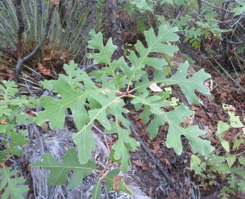
Here's a view of the canyon from afar. 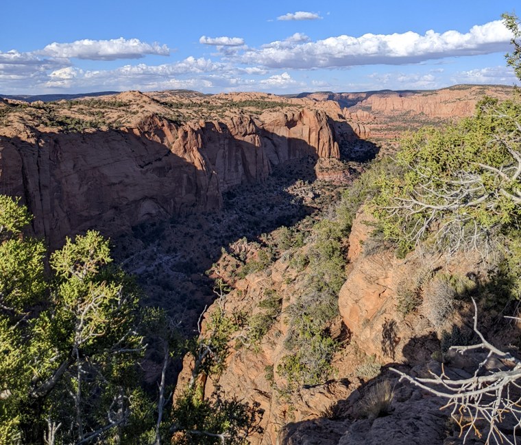
While the visitor center was closed due to the federal government shutdown, we were fortunate that the trails remained open. I think it was different for Petrified Forest because they have so many more things of great monetary and historic value. |
|
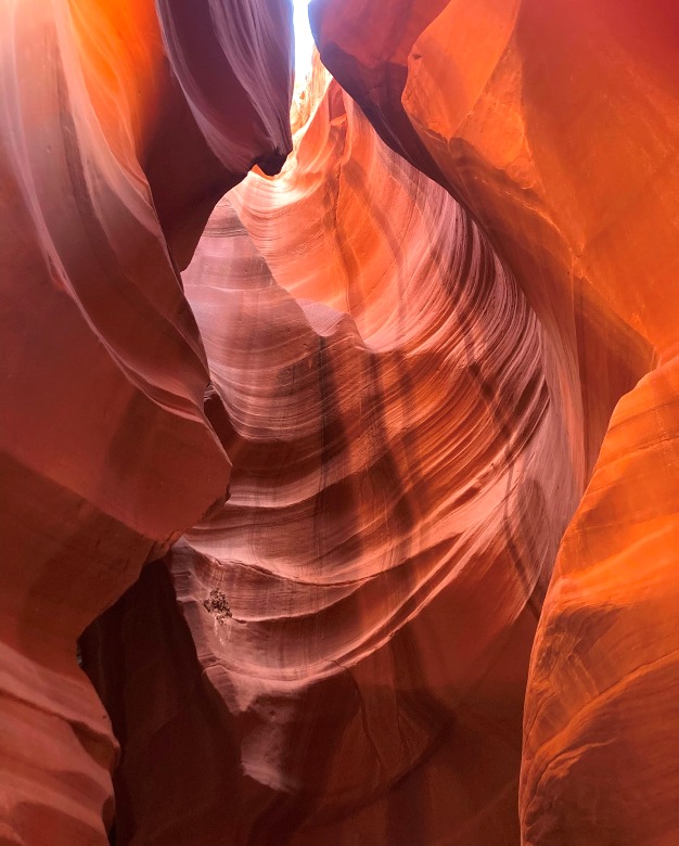
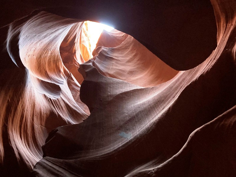
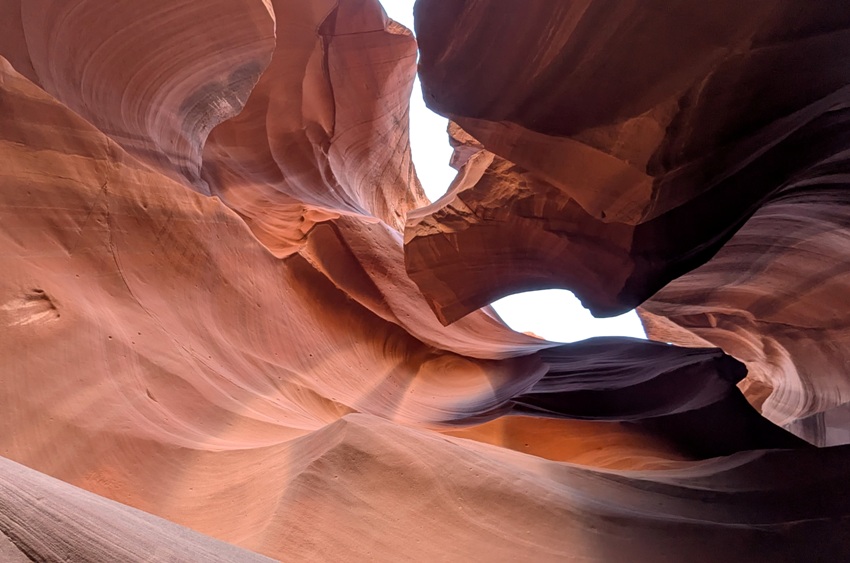
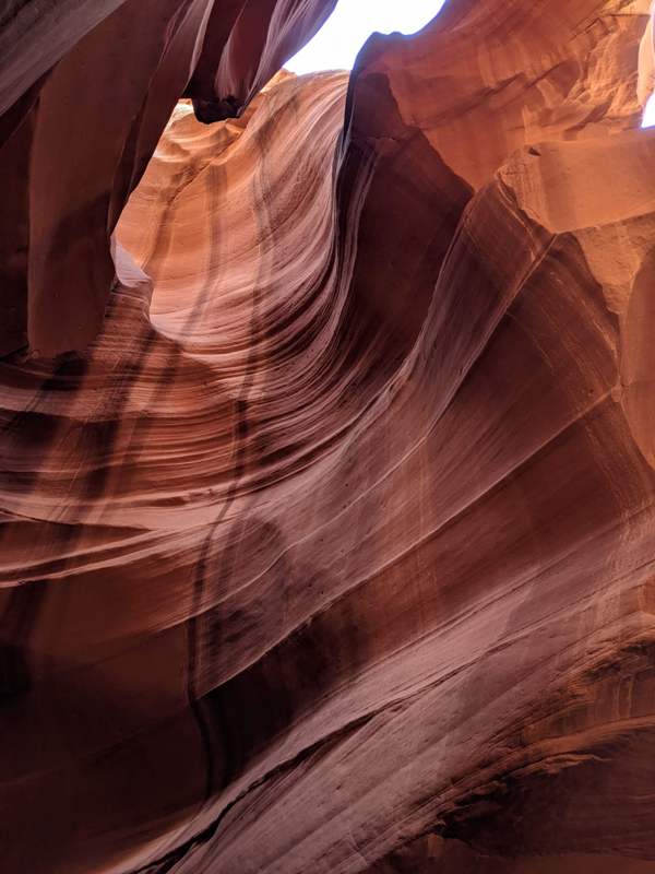
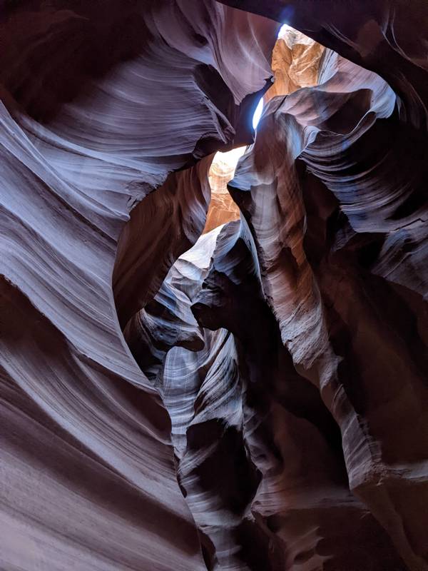
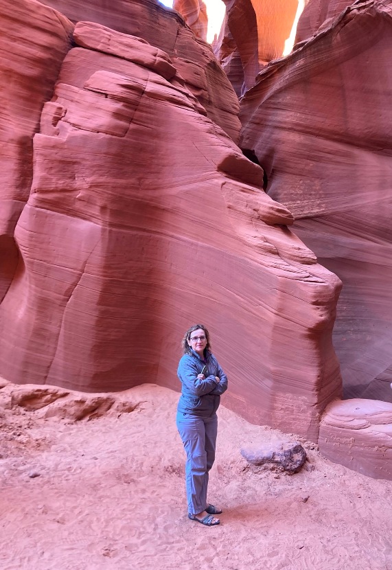
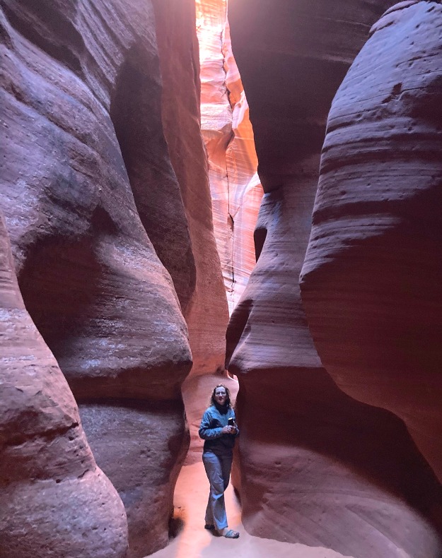
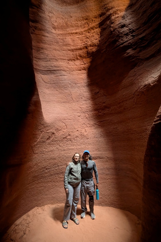
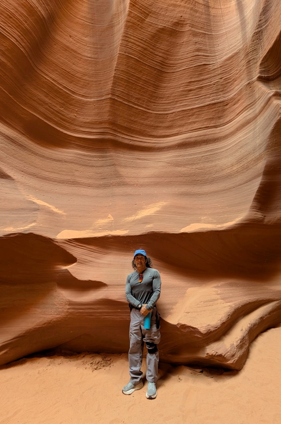
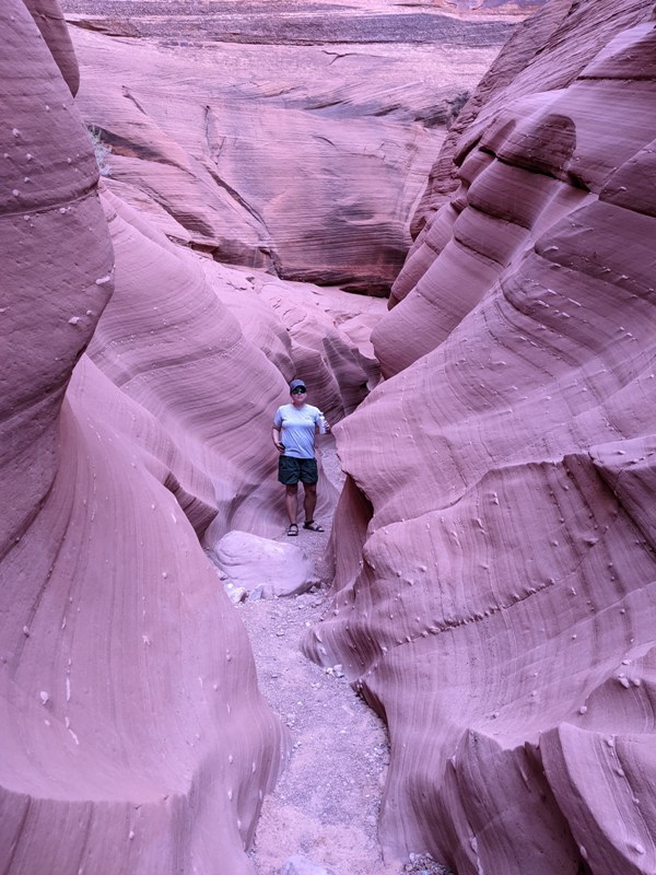
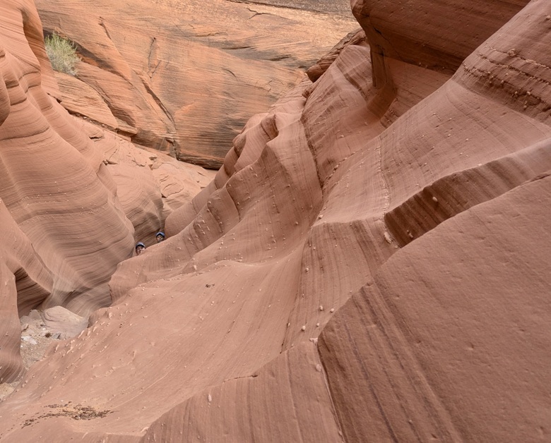
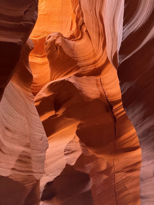
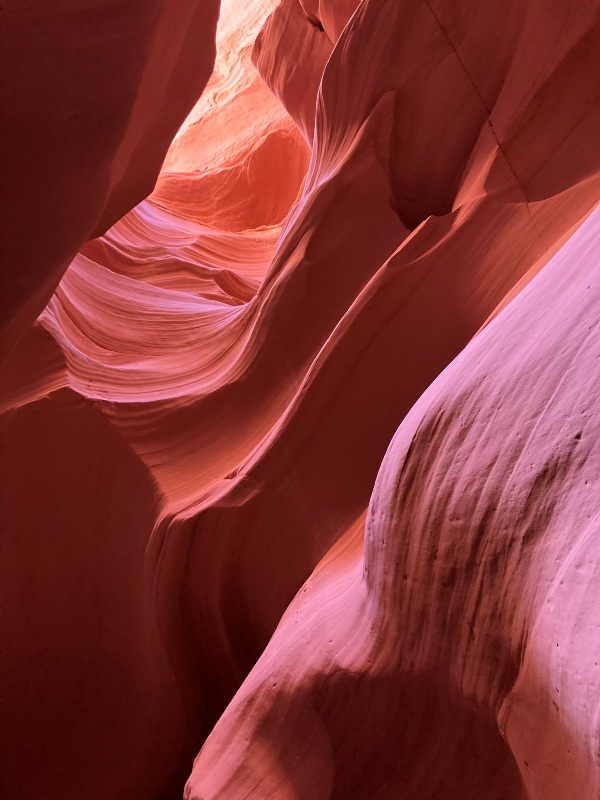
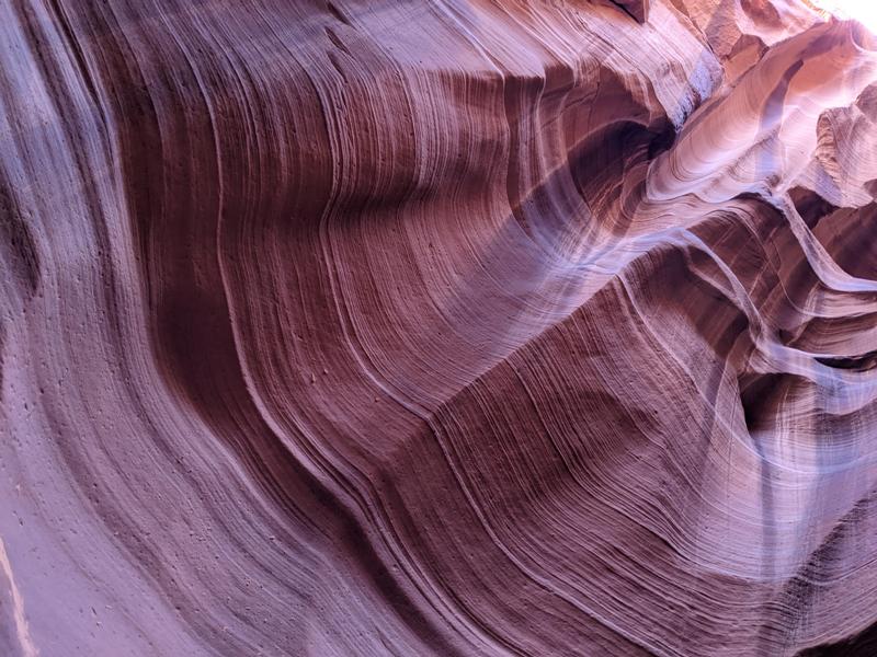
The thing I looked forward to the most on our trip was seeing Antelope Canyon.
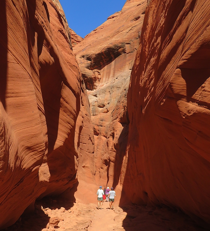
Navajo Upper Antelope Canyon is a slot canyon in the American Southwest, on Navajo land east of Lechee, Arizona. It includes six separate, scenic slot canyon sections on the Navajo Reservation, referred to as Upper Antelope Canyon (or The Crack), Rattle Snake Canyon, Owl Canyon, Mountain Sheep Canyon, Canyon X, and Lower Antelope Canyon (or The Corkscrew). Antelope Canyon was formed by the erosion of Navajo Sandstone due to flash flooding and other sub-aerial processes. - from Wikipedia - Antelope Canyon While it would have been great to see this area on our own,... A permit and a tour guide are required to explore this special place. - from Visit Arizona - Antelope Canyon Hence, we booked a tour with Antelope Slot Canyon Tours. We met the tour company in the town of Page which is as touristy as Ganado is not. Much to my surprise, I saw a roadrunner racing by as I drove past. After a bit of a wait, several dozen of us boarded buses outfitted with off-road tires which took us on rough dirt roads to the slot canyon entrance. Was Antelope Canyon everything I expected? Yes. How would I describe it? Breathtaking, magical, and otherworldly come to mind. 1 / 7
Red rocks.
2 / 7
Sandy floor.
3 / 7
Looking up.
4 / 7
Red, orange, and yellow.
5 / 7
Sandstone above.
6 / 7
Vertical stripes.
7 / 7
Dramatic shadows.
While our guide was very good at telling us about the slot canyon, what I did not expect was her to be so tech-savvy when it came to using smartphones for taking pictures. She really knew how to make use of features that many of us (myself included) knew nothing about. Our guide mentioned that someone recently spotted a great horned owl. A few minutes later, I looked up and saw something moving. I zoomed in with my camera and took some crappy photos (not good enough to post) which positively verified that I saw the owl. I showed it to the rest of our group. After we passed through the canyon, we returned on a path and boardwalk outside. Along the way, I found what I call a "bubbly boulder." Not sure what makes it this way. 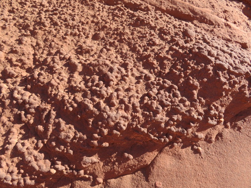
At times it felt like we were being a bit rushed but with such a large group, I sort of expected this. Still, it was most enjoyable and I would recommend a tour with this company. |
|
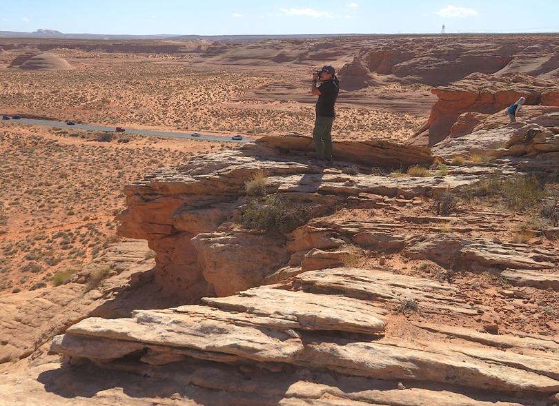
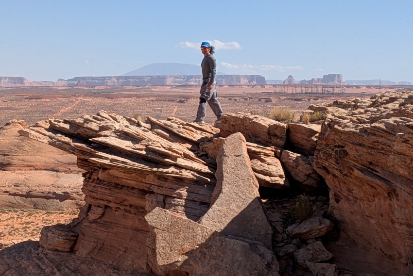
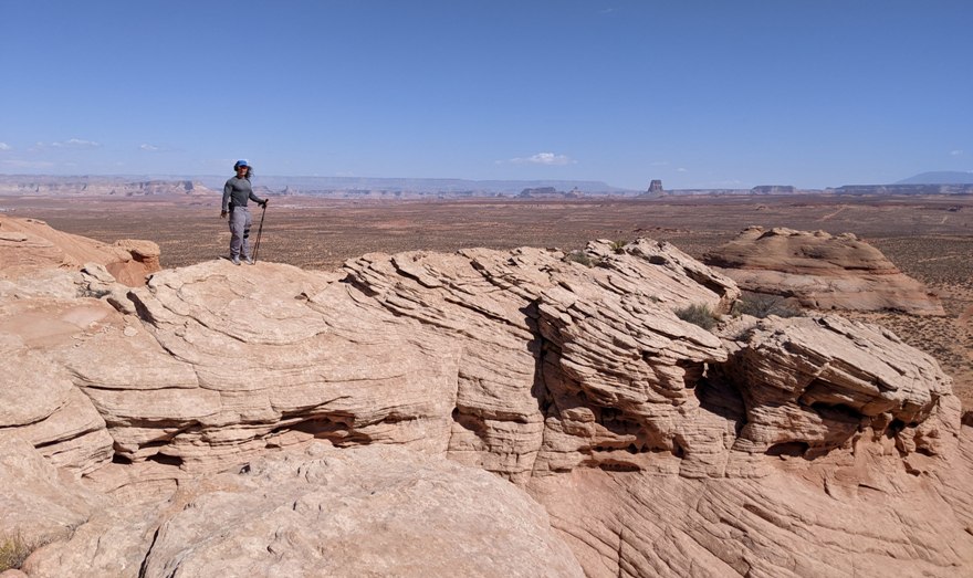
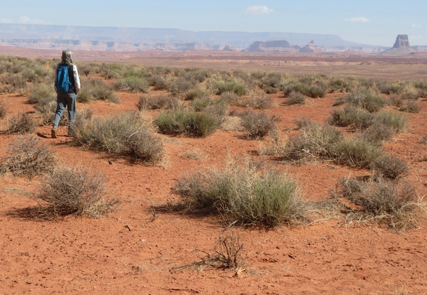
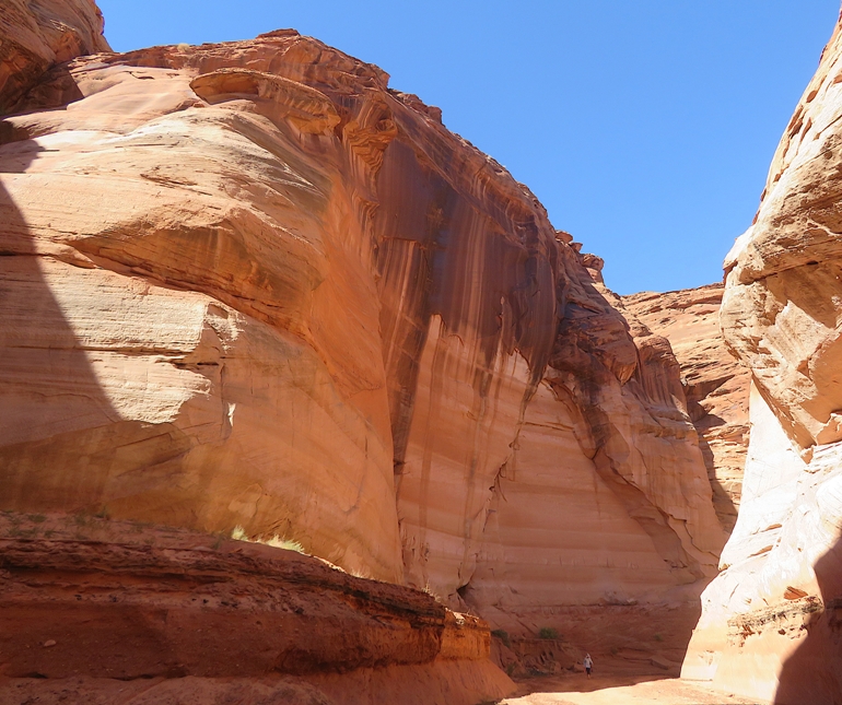
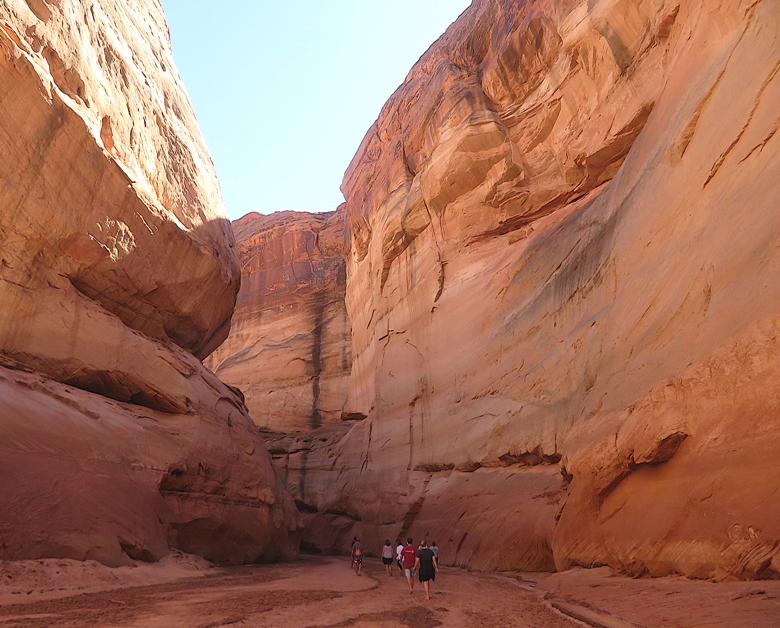
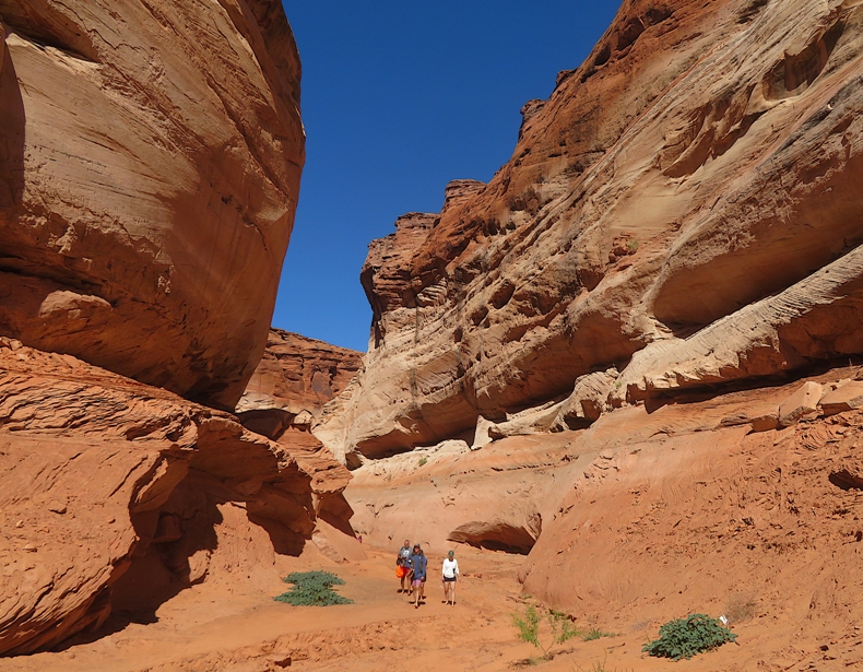
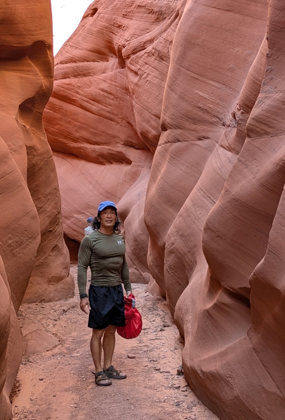
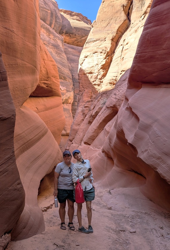
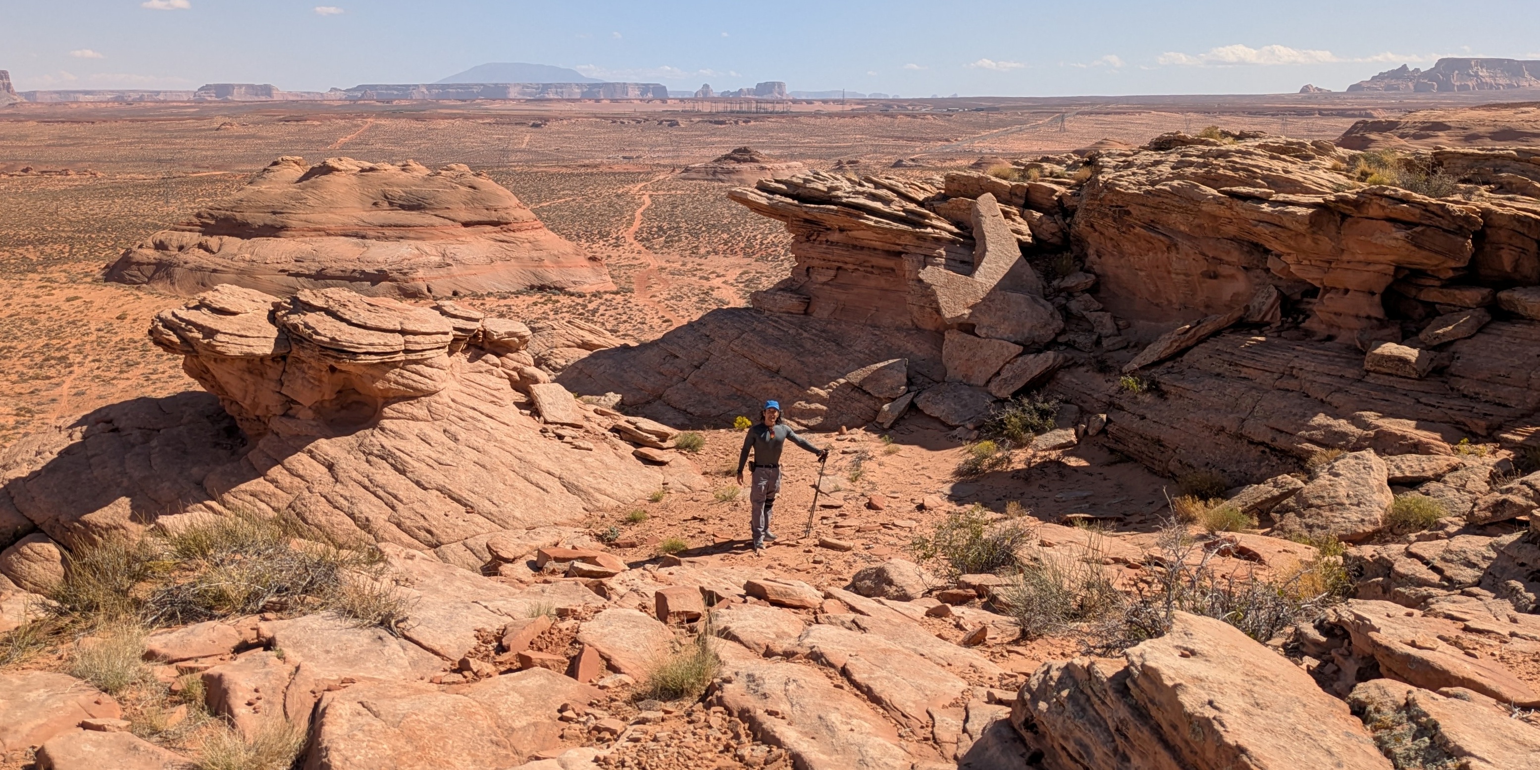
Also in Page, we parked behind a Shell station that sold lots of jerky and then explored a placed called Biidi the Arch.
The Navajo word biidi can be understood as "the arch." It is often used to describe the graceful, curved stone formations that appear across the Navajo homeland, shaped over thousands of years by wind and water. - from sign titled "Biidi 'The Arch'" I believe this land is private property but open to the public out of the goodness of the owner. Most people walked around the big rocks, staying at ground level. Perhaps the nicest (and most photographed) view in the lower portion was a big concave area, partially shown below. 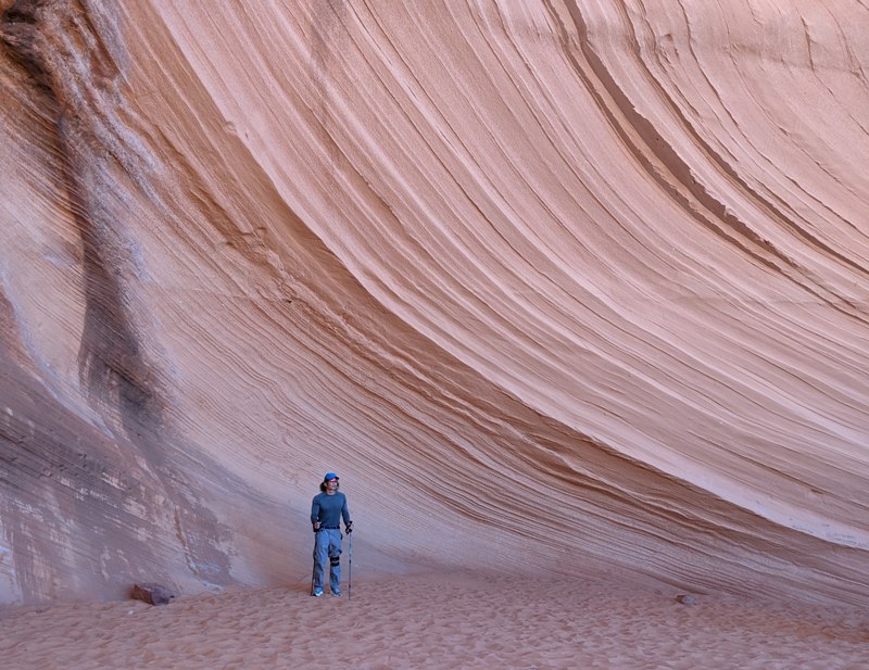
Getting to and from the higher parts wasn't difficult but some routes were easier than others. Up top, there were lots of opportunities for rock scrambling and scenic views. Not everything was rocky at the top. The central portion was a plateau with lots of desert scrub. I much preferred the higher terrain, if for no other reason than to get away from the crowds. Be sure to also check out the photo at the top of this page. |
|
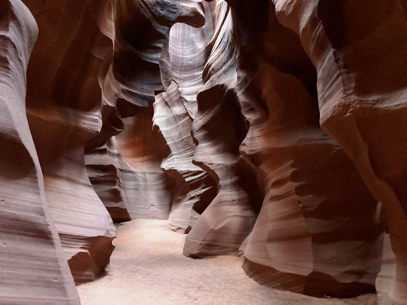
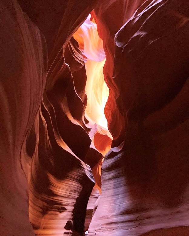
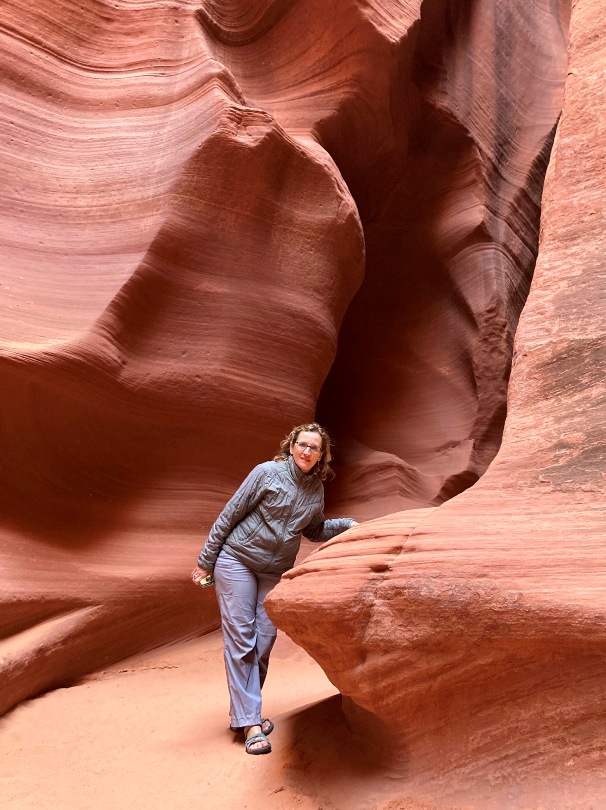
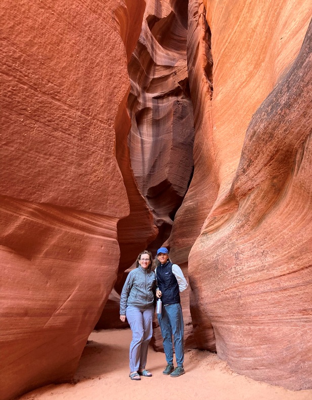
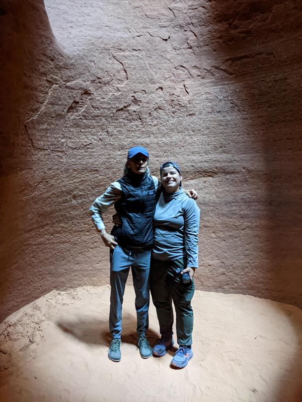
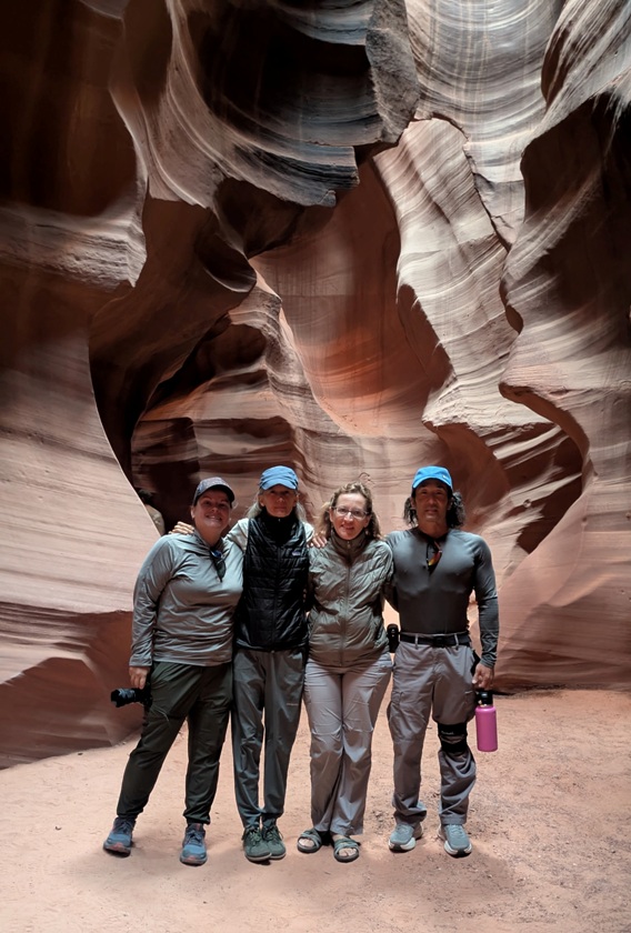
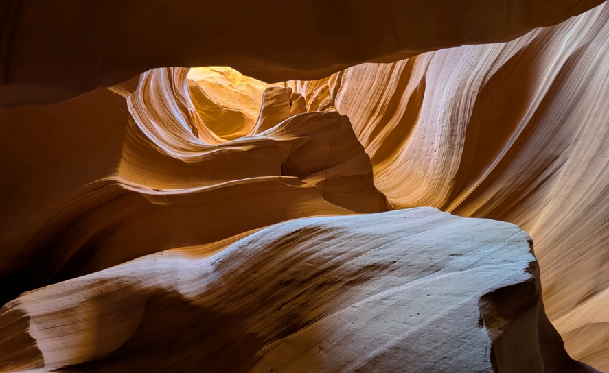
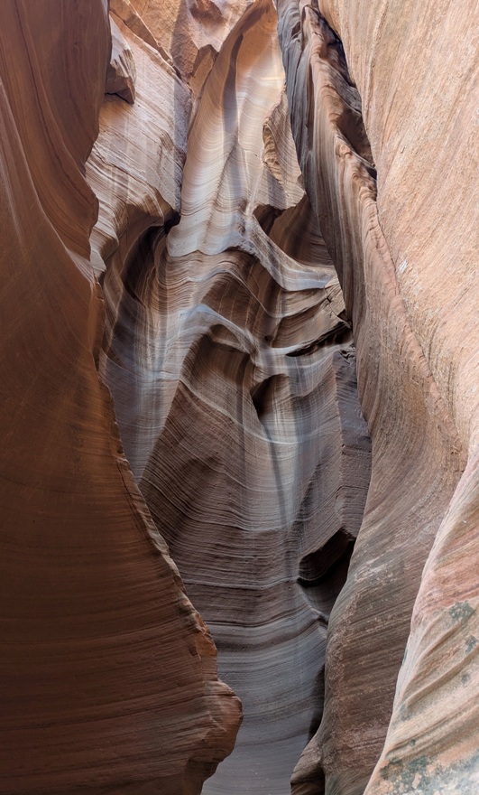
With the numerous walking tours available at Antelope Canyon, we figured it would be good to get a more complete picture by doing a second tour at a different section of the slot canyon.
Antelope Canyon X is a hidden treasure in the heart of the Navajo Nation. It offers a quieter, more personal encounter with nature away from the hustle and bustle of Upper and Lower Antelope Canyon. Limited foot traffic and one tour operator [Taadidiin Tours] ensure that every moment is yours to savor! - from Antelope Canyon X Hiking Tour For this tour, we didn't have to do any offroading so it was much easier to access. Our guide, Brandon, didn't have the energy of our previous guide but he was still good, and like the other guide, he really knew how to use the phone cameras. He took some shots that we (or at least I) would have never known how to take. How did Antelope Canyon X get its name? If you look up at one section of the canyon, you can see that the light forms an 'X'. 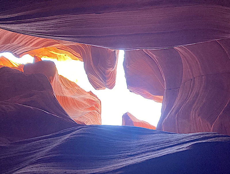
Did we prefer Upper Antelope Canyon or Antelope Canyon X? Both were very nice but the latter had the advantage of midday sun which did a better job of illuminating the rocks. Feeling less rushed than our other tour, we got more photos of each other. 1 / 7
Norma.
2 / 7
In the shadows.
3 / 7
Leaning.
4 / 7
Norma & Carmen.
5 / 7
Norma & me.
6 / 7
Carmen & Robin.
7 / 7
Me.
Outside of the canyon, we saw a section of wall with lots of soft sandstone that folks had rubbed with their fingers. But that was o.k., according to our Navajo guide. 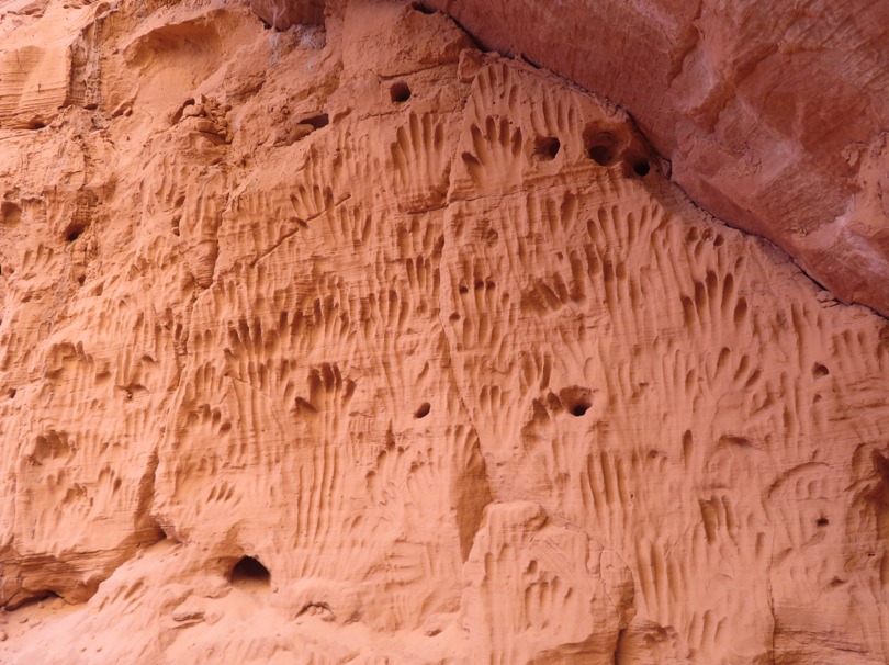
I'm really glad we got to do both tours and see them at different times of the day. |
|
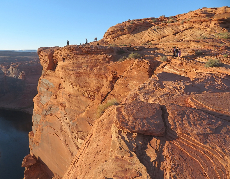
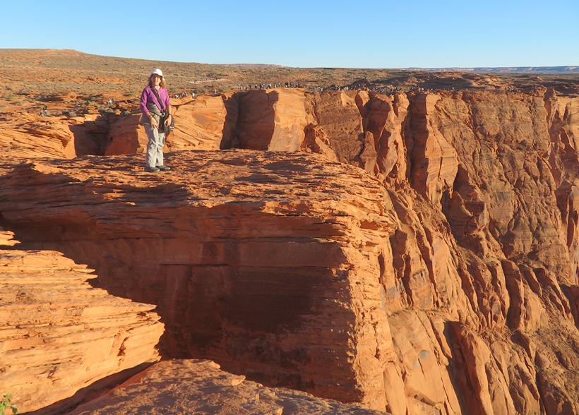
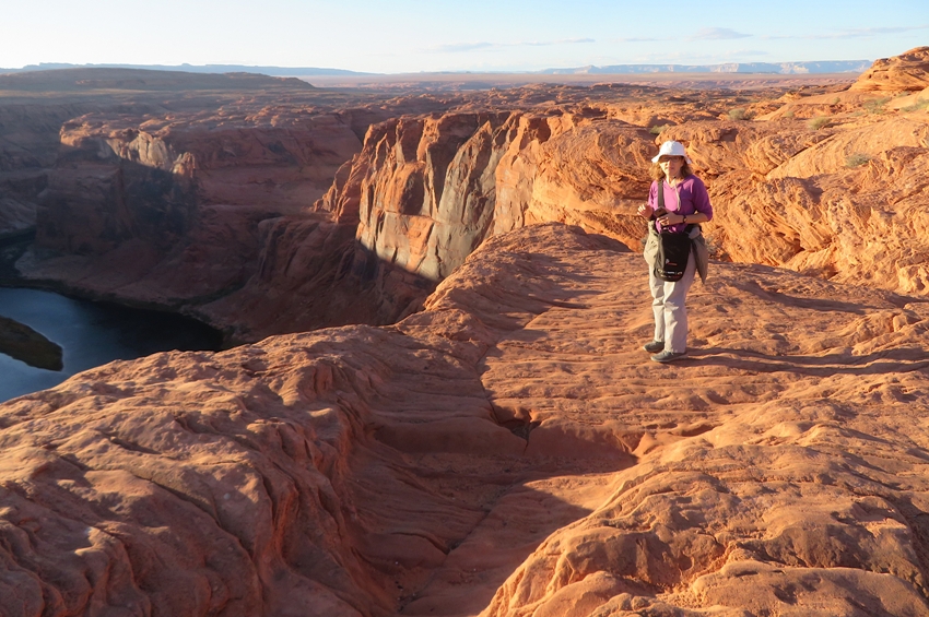
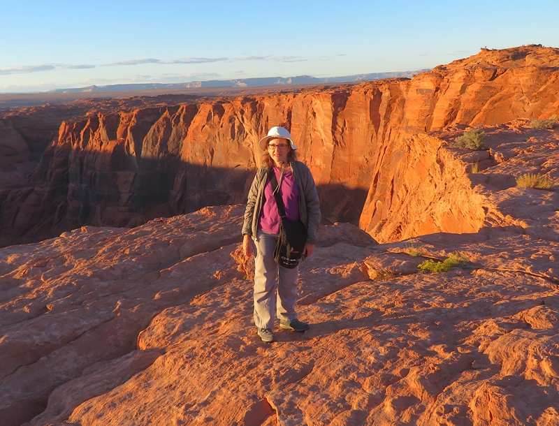
Our final trip of the day was to Horseshoe Bend.
This iconic landmark is a horseshoe-shaped incised meander carved out by the mighty Colorado River over millions of years. As you stand at the overlook, which is about a 1,000-foot drop, you're treated to a breathtaking panoramic view of the Colorado River winding its way through the red-hued sandstone canyon. - from Welcome to Horseshoe Bend If you hate crowds, then this place is not for you. But there is a reason why it is so crowded and in my opinion, the view is well worth being part of such a big group. I think morning is the best time to visit. The afternoon sun (which we had) was not in a good position for getting a picture of the horseshoe shaped section of the river. My camera did poorly. But fortunately, we had four cameras in our group and each had their own strengths so we managed to get some pretty good shots. 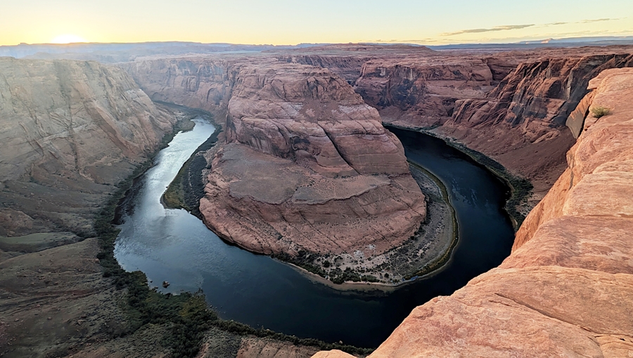
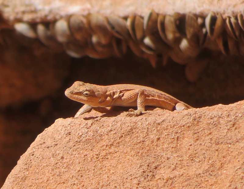
My camera's biggest strength was its 40x optical zoom. This helped me get a close view of small wildlife far away, like this tree lizard. 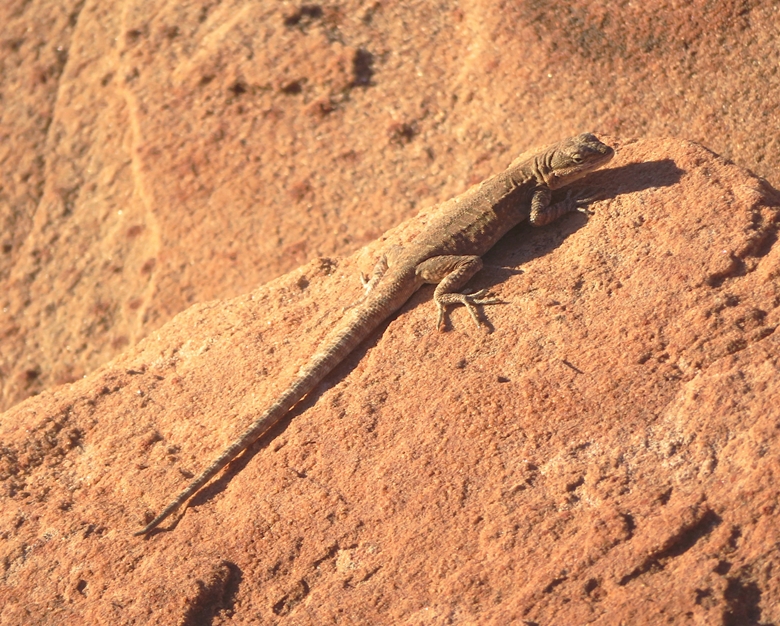
The low afternoon sun really set the rocks aglow. We saw a couple posing for their wedding photos. 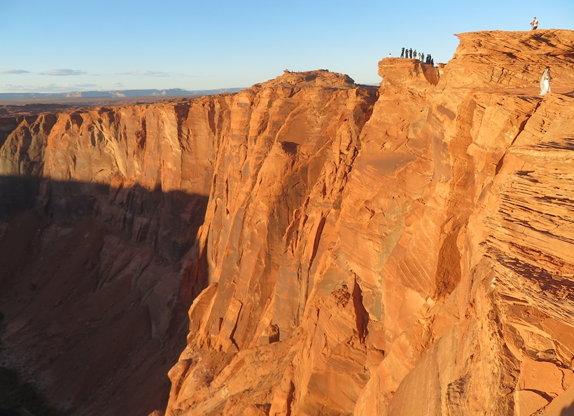
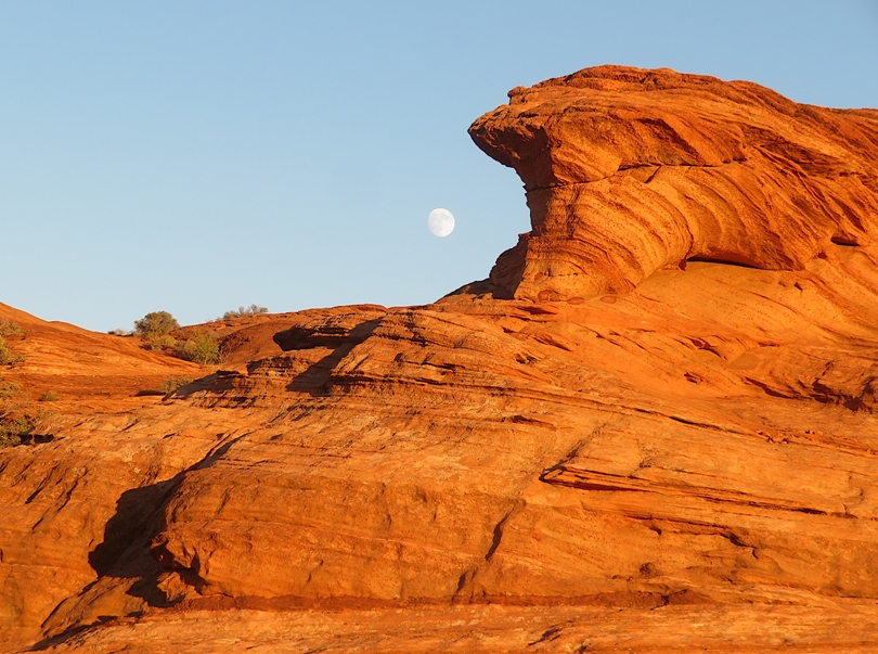
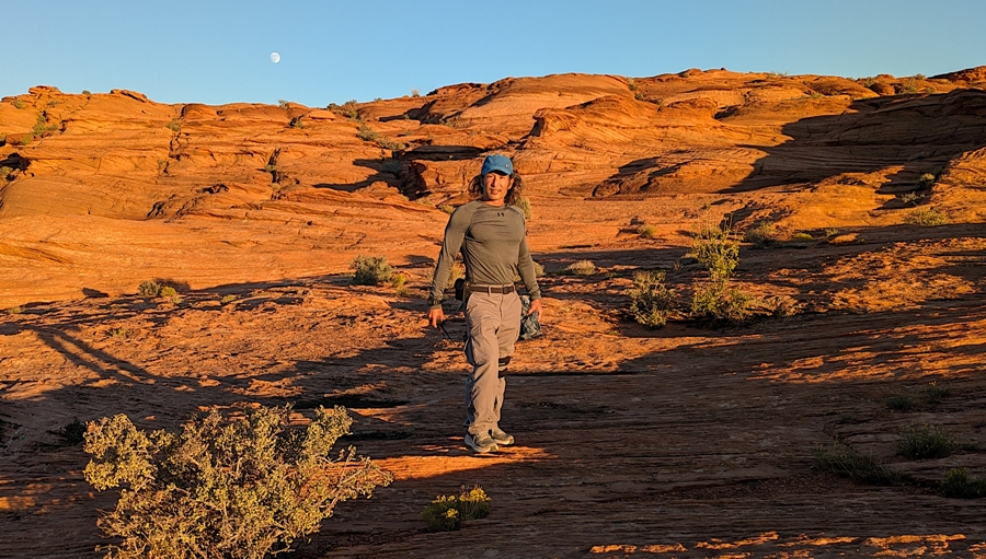
As the sun got lower, the moon began to rise. Here's Carmen and Robin. 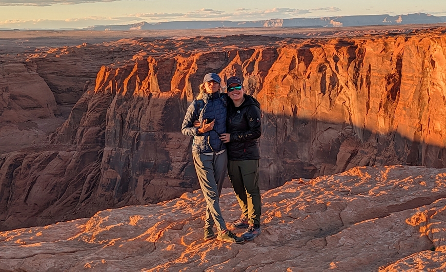
Looking down into the river, I saw several kayaks and a few SUPs. I was told this route makes for a great kayak trip. Maybe I will return someday to find out. There were a large number of foreign tourists, particularly from Asia. |
|
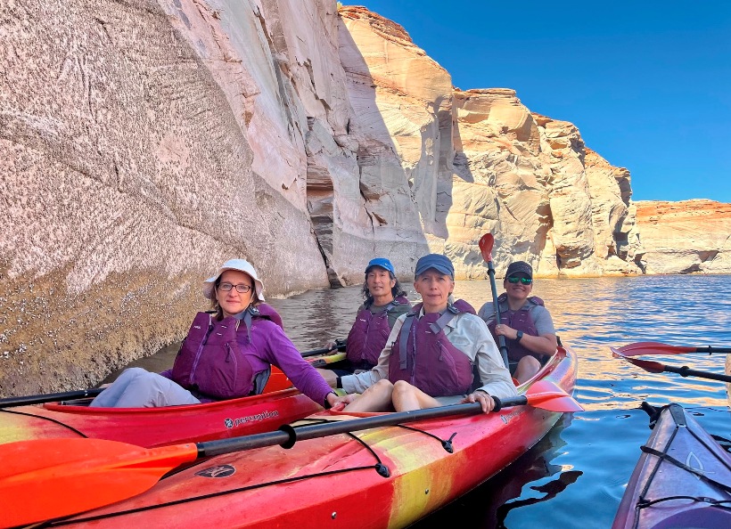
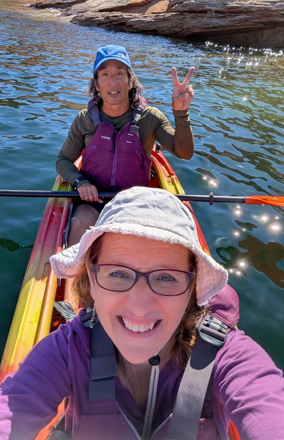
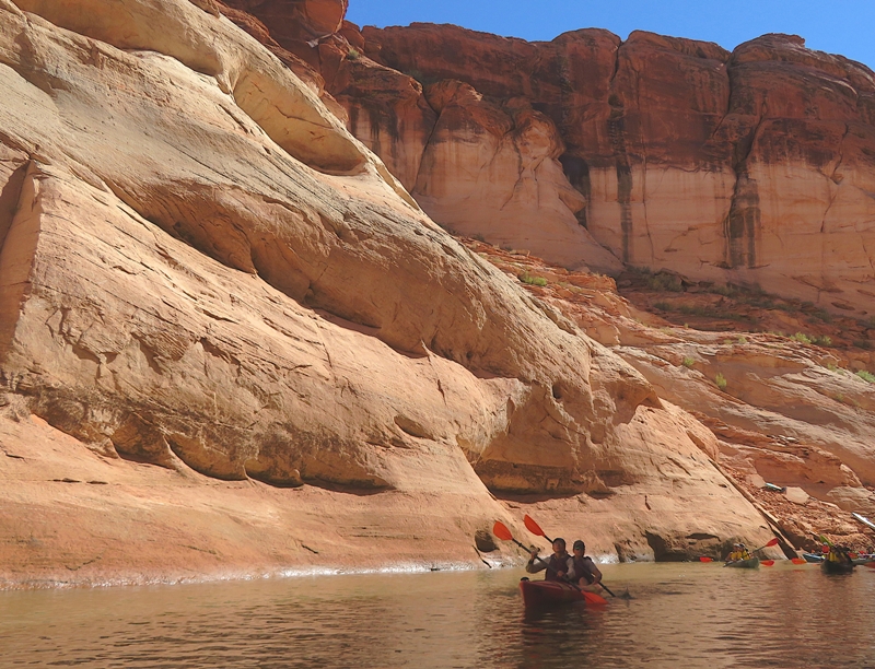
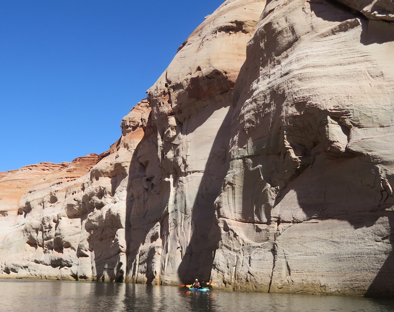
I am no longer able to find the website but a few years ago, I read someone's opinion about the most scenic places to paddle in the world. One of the top ones was the Apostle Island, which I paddled with Team SNaCk back on August 7-11, 2017. Another was Antelope Canyon. So when Norma suggested we go to northern Arizona, this was top on my list of things to do.
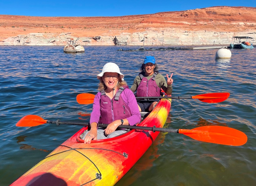
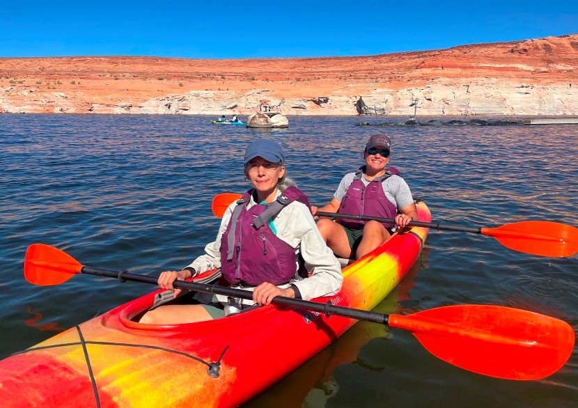
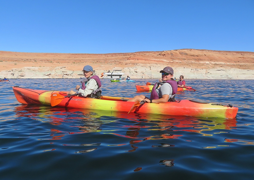
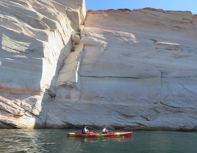
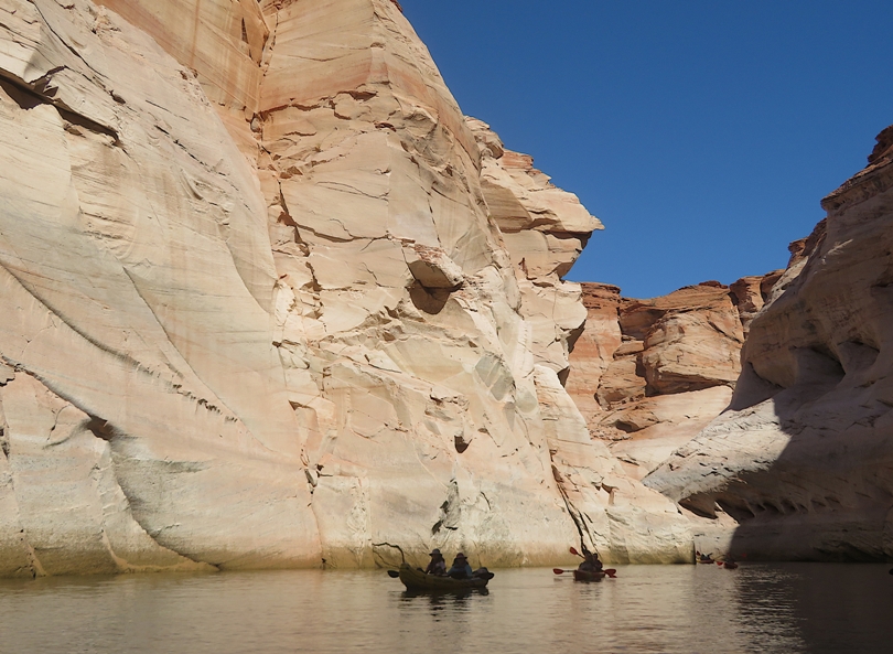
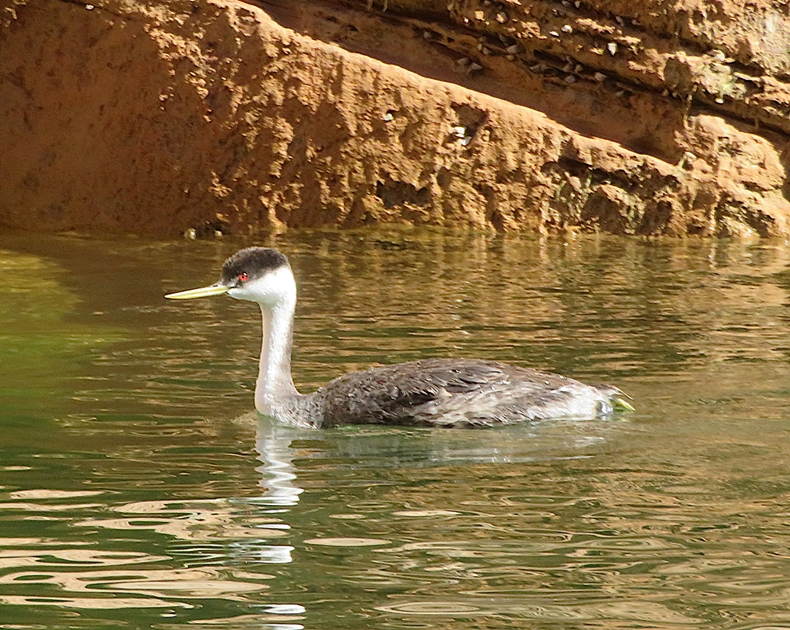
I spent a lot of time looking for outfitters. Many offered a similar route that launched from the Antelope Point Public Launch Ramp. SUP tours were offered but I opted not for that given the tendency of wind to be such a big factor and the bigger range of skills in paddleboarders (e.g. some fast and some extremely slow) as compared to kayakers. In the end, I chose Lake Powell Adventure Company. We met our guide, Zack, near the launch ramp. He's an ultramarathoner standing about 6'4". We had a small group of I think eight people. He got us in our Perception Cove 14.5 cockpit tandem kayaks, then we paddled west and then south on Lake Powell. Lake Powell is created by the Glen Canyon Dam. While it provides water storage, hydroelectric power, and recreation, it has its drawbacks. The canyon was once home to Native American petroglyphs which are now underwater. Here's our group kayaking in the lake. After about a mile, our group started paddling up Lower Antelope Canyon. We saw more lizards than we could count along with a few birds and lots of clams or mussels. Zack went ahead of us a bit. Then we started hearing what sounded like a Native American flute. Zack was playing this instrument like a pro from his kayak. It really set the mood: peaceful, tranquil, and serene. 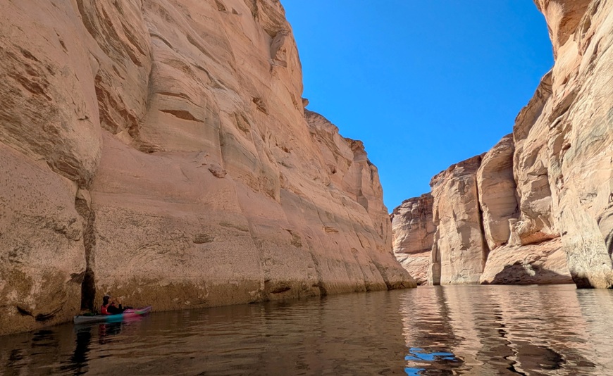
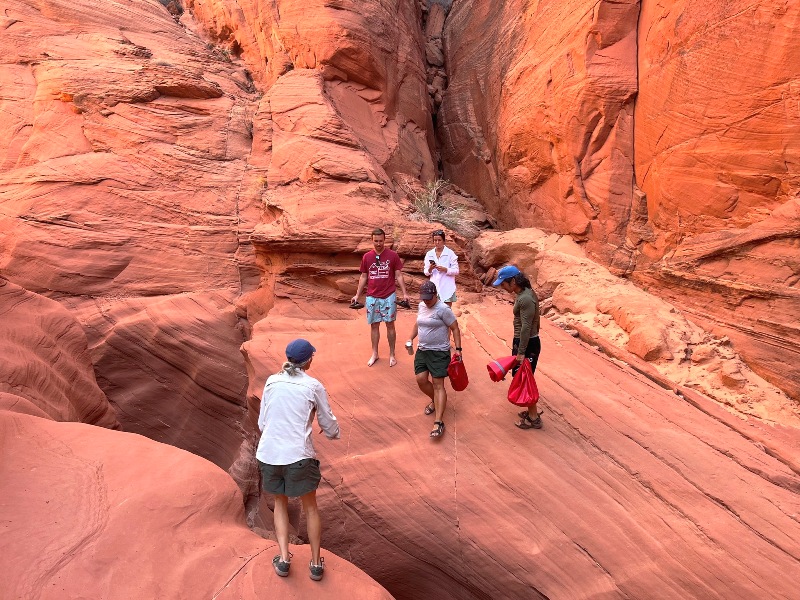
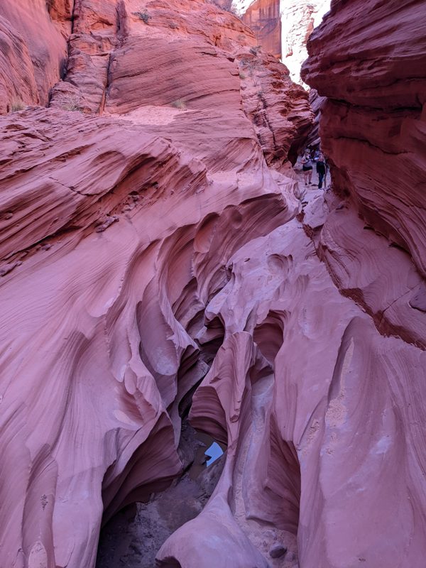
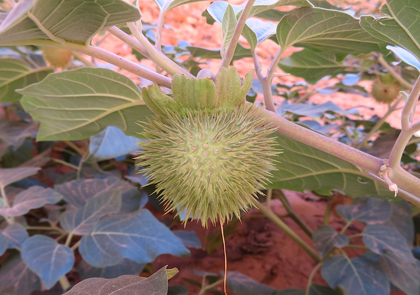
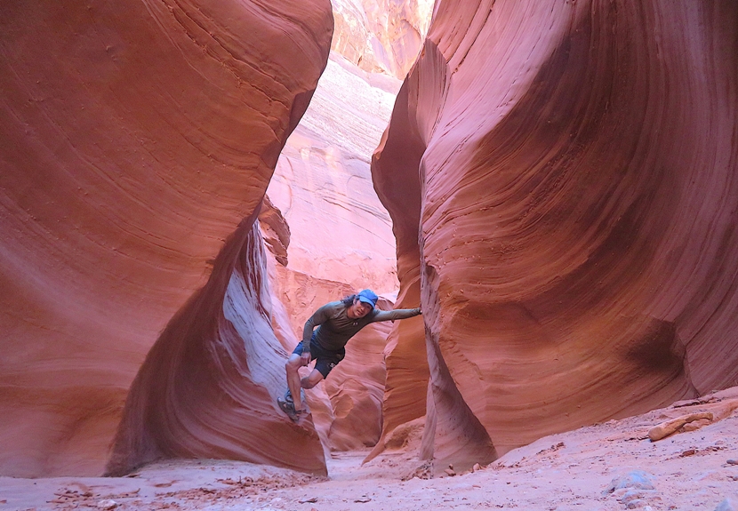
We paddled upstream as far as we could and then parked our boats with a couple dozen others. Then we set out to explore on foot. Zack was walking barefoot and so were a lot of the tourists. While Zack was used to it, I think it slowed the others down. I know I would not have enjoyed being barefoot out there. Fortunately, Team SNaCkeR brought water shoes so we were prepared for a vigorous amphibious slot canyon hike. The slot canyon started out wide with really tall, steep walls. Zack pointed out a datura flower, the same kind that we saw on our White House Ruin hike. Eventually, the canyon got narrower and our hike started to look more like yesterday's walks through the slot canyons. As the canyon narrowed further, we had to do some fun rock scrambling to continue. Zack made this fun and challenging. 1 / 5
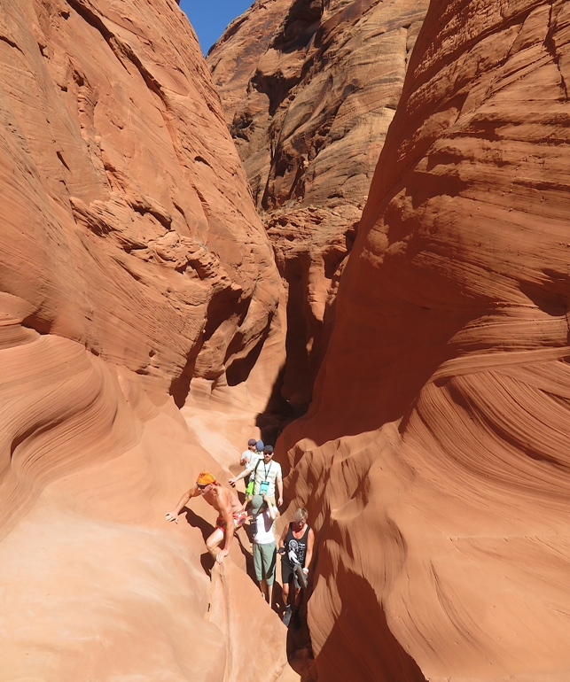
Rock scrambling.
2 / 5
Robin ready to jump.
3 / 5
Difficult section.
4 / 5
Robin in narrow area.
5 / 5
Peek-a-boo.
Zack gave us a time limit to explore. Getting near that limit, I thought he was ahead of me so I ran to catch up. I didn't find him so I turned around where the canyon split. Making my way back, it turned out he didn't get as far as I thought and I saw him on the return. On the walk back, a bat flew out of a crevice in the wall and almost hit Zack in the head. We made our way back to our kayaks and prepared for the 2.5-mile paddle return to where we started. 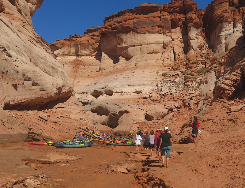
One great thing about this trip was that it was scheduled for 1000-1400 which meant we had the overhead sun. This often kept us out of the shadows so we weren't too cold. It also illuminated the tall canyon walls, but not always. Back in the lake, Norma and I raced past everyone else to get back to the launch area. The wind picked up and I was glad not to be on a SUP. We bid farewell to Zack. This is a place I would definitely consider returning for a multi-day trip. I went for a swim in Lake Powell. The water looked clean, felt refreshing, and it wasn't too cold. Nobody else joined me. |
|
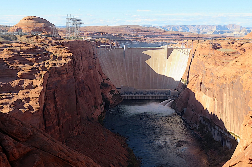
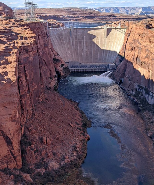
I mentioned that Lake Powell is created by the Glen Canyon Dam.
The 710-foot-high (220 m) dam was built by the Bureau of Reclamation (USBR) from 1956 to 1966 and forms Lake Powell, one of the largest man-made reservoirs in the U.S. with a capacity of more than 25 million acre-feet (31 km3). The dam is named for Glen Canyon, a series of deep sandstone gorges now flooded by the reservoir; Lake Powell is named for John Wesley Powell, who in 1869 led the first expedition to traverse the Colorado River's Grand Canyon by boat. - from Wikipedia - Glen Canyon Dam There wasn't much space to walk...it was just an overlook. But we did have a nice view of the dam and the water below. |
|
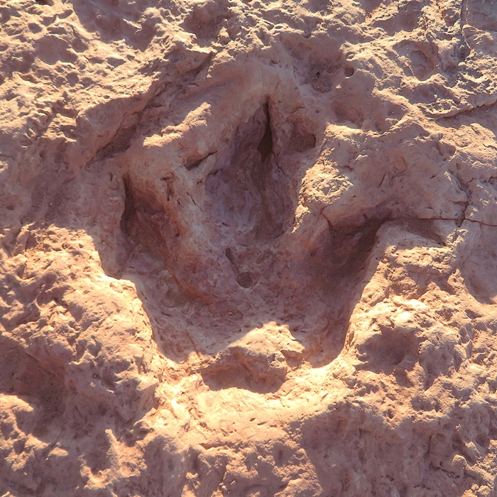
Our next stop was the Moenave Dinosaur Tracks. There, we were greeted by a strange Navajo guide who showed us the paleontological discoveries.
These dinosaur tracks were formed in the early Jurassic period, approximately 200 million years ago and have been verified by paleontologists from Northern Arizona University. The specific type of dinosaur that left these footprints cannot be determined, therefore these are called "trace fossils". Trace fossils are classified by the shape of the prints and the type and layer of the rock the fossil is found on, which determines its age. With this information, it can be assumed these footprints belonged to the carnivorous dinosaurs Eubrontes, Grallator, Coelophysis kayentakatae or Dilophosaurus wetherilli. - from Flagstaff - Moenave Dinosaur Tracks Our guide pointed out the footprint of a Tyrannosaurus Rex. I was a little suspicious of his claim. On a more believable note, he showed us small jasper rocks just lying out in the open. 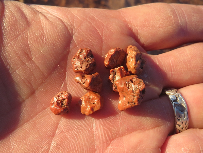
Here are the girls with Carmen imitating a flamingo. 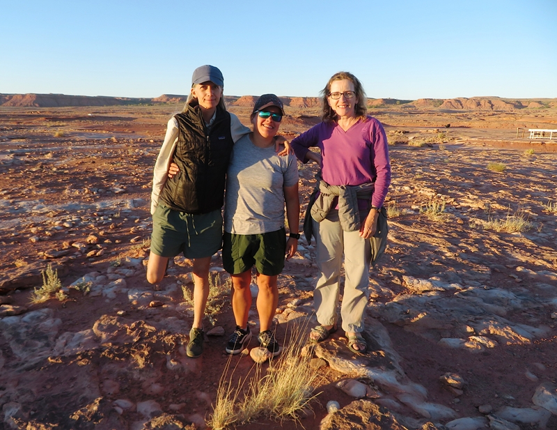
It was getting late in the day and the moon was rising. One more day until the Harvest Moon supermoon. 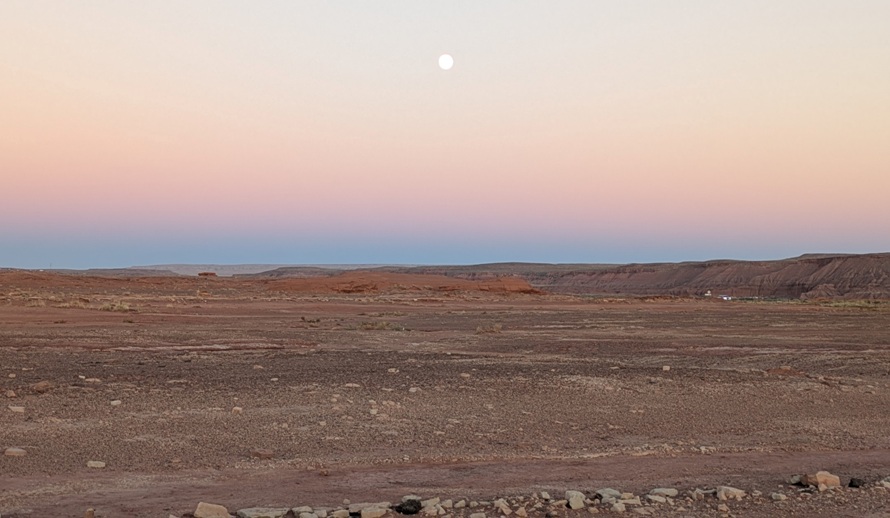
|
|
During some of our long drives, we did singalongs. A Team SNaCk tradition is to sing "The Gambler." We did this several times. It is an unwritten requirement if Robin is going to join and be part of Team SNaCkeR. We also sang various other songs that I keep loaded on my iPhone: Don't Stop Believin', Livin' on a Prayer, and the Eagles' "Take It Easy" which mentions a town we drove near...Winslow.
Well, I'm a-standin' on a corner in Winslow, Arizona Such a fine sight to see It's a girl, my Lord, in a flatbed Ford Slowin' down to take a look at me This was our last night with Carmen and Robin. We drove into Flagstaff which looked like a nice town...not too big and not too small. Then we checked into Motel du Beau. "Du Beau's Motel Inn" opened its doors in 1929. It is one of the first Motels built in America! The project began in 1927, when Canadian entrepreneur Albert E Du Beau relocated to Flagstaff to materialize his vision of a posh "Motor Hotel". He enticed customers with luxuries intended for "the better class of motorist" including carpeting, double beds and tiled indoor bathrooms...for an all inclusive price of $2.50 per night! - from Motel du Beau 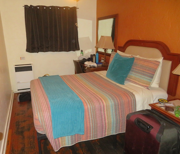
Just a short walk from the motel was Pizzicletta, which Carmen chose as our evening restaurant. I had the diavola pizza which was most flavorful. Carmen and Robin would take an early train to Phoenix the next morning so we bid them farewell that night. It was great having them along with us and meeting Robin. |
|
I got up early and did some much needed laundry at the motel.
Next, Norma and I drove to Meteor Crater, the... world's best-preserved meteorite impact site on Earth. Meteor Crater is the spectacular result of a collision that rocked the American Southwest approximately 50,000 years ago with the energy of more than 20 million tons of TNT. - from Visit Arizona - Meteor Crater Natural Landmark This crater is... ...nearly a mile wide and over 550 feet deep. - from "Meteor Crater - A Must-See Landmark Along Route 66" in the Flagstaff, AZ - Route 66 commemorative magazine Norma had to talk to her mom on the phone so I went in and toured the museum area by myself, posing with an astronaut statue. Training at Meteor Crater led to a safer space suit after one of the astronaut trainees ripped his suit on a rock in the crater - an accident that would have released oxygen and caused death on the moon. The suits were then redesigned with a thicker material to resist tears. More recently a suit designed for missions to Mars was tested at Meteor Crater. - from sign next to astronaut statue 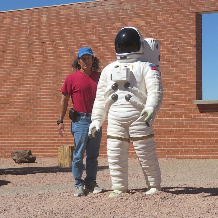
Norma came in later and joined me for the guided tour where we actually saw the crater. 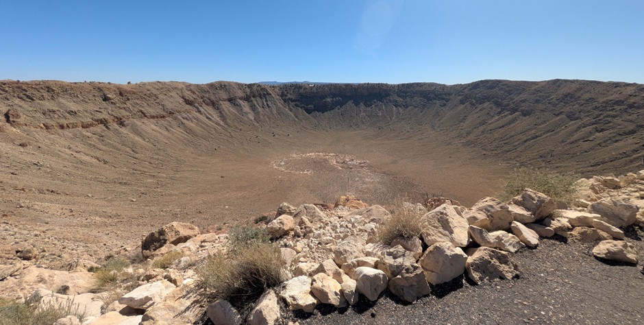
I found the Meteor Crater logo interesting. I've been living in Maryland for 30 years and as such, I've grown very attached to the Chesapeake Bay. So even though I know the 'o' in "Meteor Crater" is supposed to represent a meteor falling from the sky, I see a horseshoe crab. 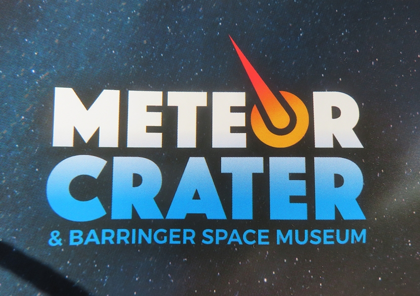
|
|
Norma asked what I was interested in seeing. I said that while seeing Native American ruins from afar was nice, it would be good to also see them up close. So she suggested we visit Homolovi Ruins State Park.
We spent quite a bit of time at the Visitor Center learning about the various native peoples that lived in the area over several centuries. In the high grassland of the 14th-century northern Arizona, an ancient people found a home along the Little Colorado River. These people, the Hisat'sinom [known to archaeologists as the Anasazi], paused in their migrations to till the rich flood plain and sandy slopes before continuing north to join people already living on the mesas; people who are today known as the Hopi. The park serves as a center of research for the late migration period of the Hopi from the 1200s to the 1300s. - from "Arizona State Parks & Trails" 2024/2025 Next we set out to explore the park on foot, starting at the Homolovi II Ancestral Pueblo site. Two things really stood out to me at this park. The first were the lizards. 1 / 5
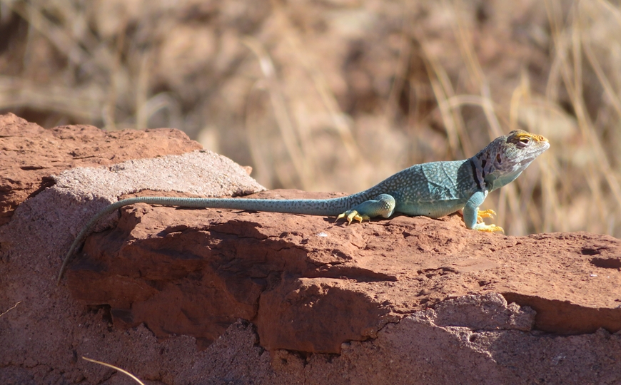
Collared lizard.
2 / 5
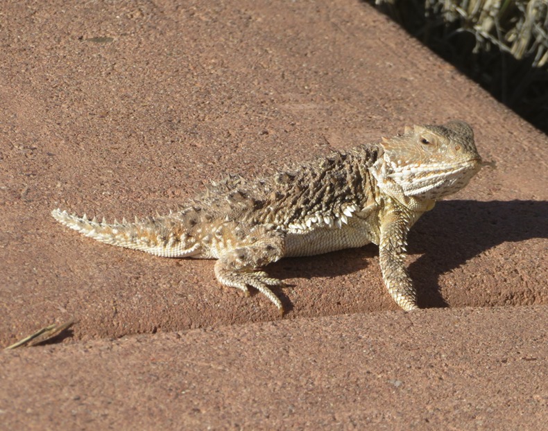
Horned lizard.
3 / 5
Side-blotched lizard.
4 / 5
Different view of same lizard.
5 / 5
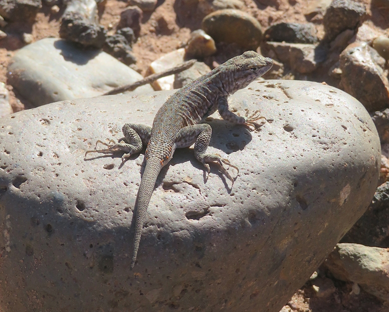
Another side-blotched lizard.
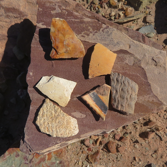
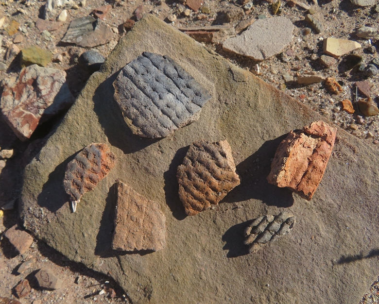
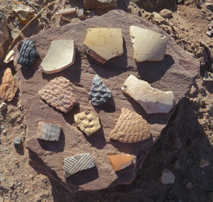
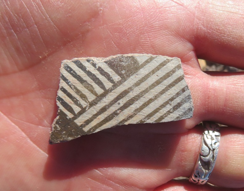
The other thing that stood out were all the pieces of broken pottery, which we were not permitted to take. Why was it here? How do you say goodbye to a home filled with memories? Before moving, they [the Native Americans] left in their old homes personal objects that could not be taken with them. Traveling long distances on foot limited what could be carried. Some pottery vessels were deliberately broken and left in rooms. - from sign at Visitor Center titled "Breaking & Burning" There were also several stones which had been chipped, leaving a sharp edge. 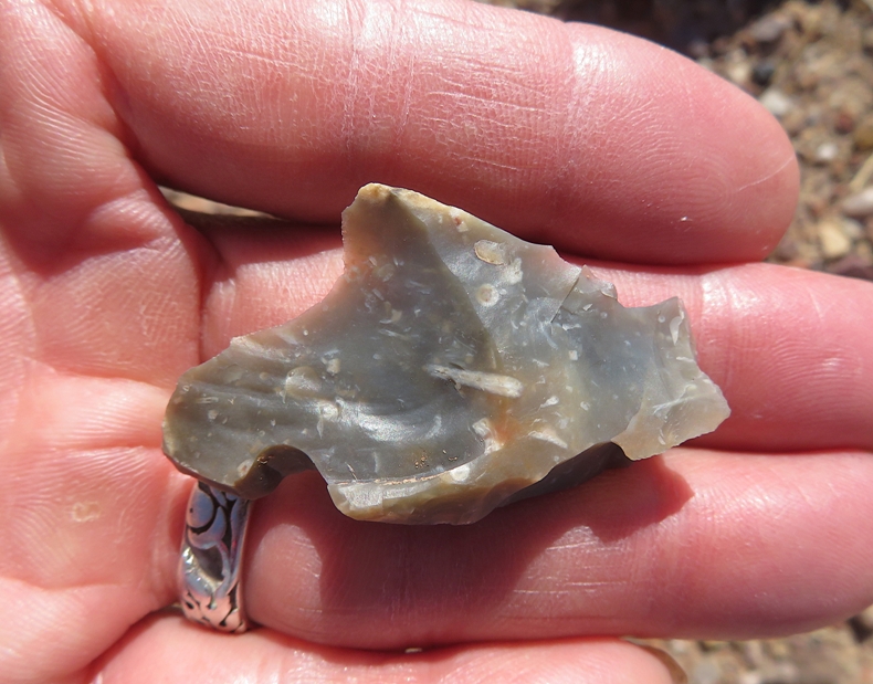
One other fascinating thing I was not expecting to find was an invasive plant called saltlover (aka halogeton). Saltlover (Halogeton glomeratus) is an annual that will grow to about 61 cm tall. Bluish-green succulent leaves are high in water content but accumulate salt, making them resistant to most herbivores. Considered a noxious weed in most areas of the United States. It is salt-tolerant and confined to mostly salty, sandy areas. Saltlover causes serious poisoning by ingestion, potentially leading to death. Poisonous parts include leaves and above-ground parts containing sodium oxalate. - from PictureThis - Saltlover After seeing so many interesting things on the path leading up to the ruins, we finally came to the ruins. 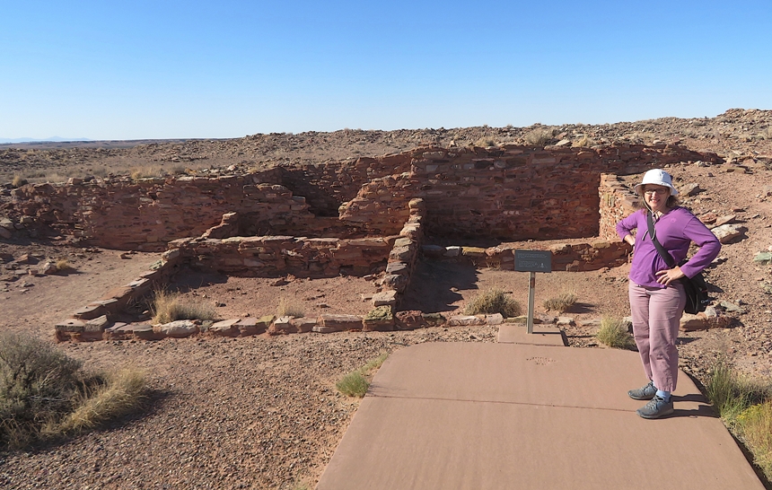
Looking across the landscape, we saw a dry section of the Little Colorado River. Below you is Paayu, the Hopi name for the Little Colorado River, a year round source of water. Even when dry, water can be found a few feet below the sand. The inhabitants of Homol'ovi II used the floodplain of the river to plant crops and harvest native plants for food, medicinal herbs, and ceremonial use. - from park sign At another ruin, we saw a kiva. In the depression is a kiva. Kiva means "cellar" or "underground house." Men are primary users of kivas; women and children have access during certain ceremonies and seasons. - from sign at park 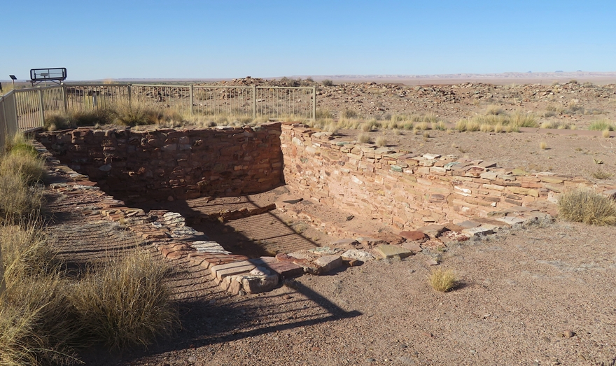
Next, we drove south to walk on the Tsu Vo Loop Trail which means "path of the rattlesnakes" in Hopi. Here's Norma next to some big stones with our rental car off in the distance. 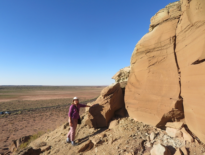
We saw a few petroglyphs. 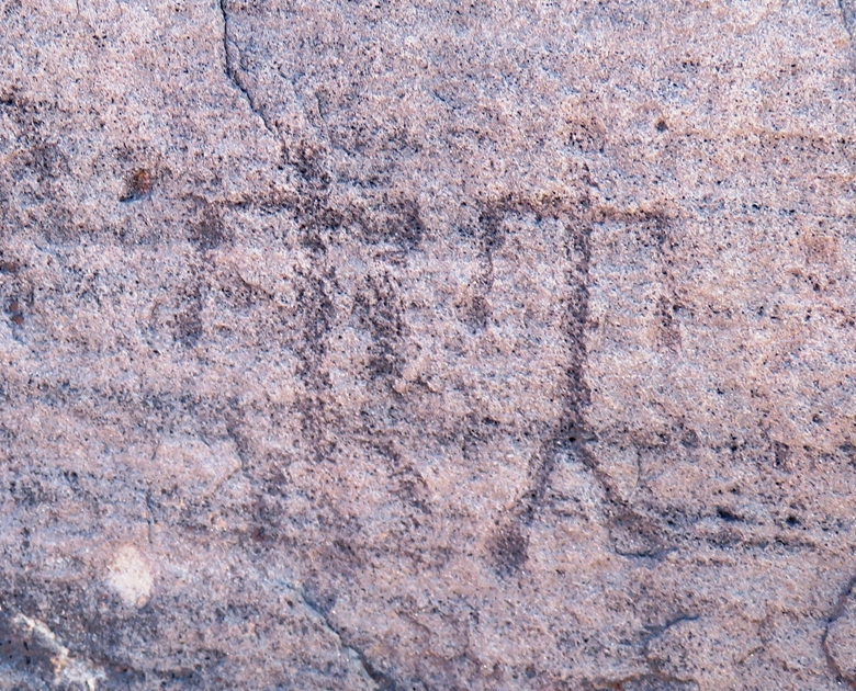
It would have been nice to stick around a little longer but the park was closing so we had to leave. |
|
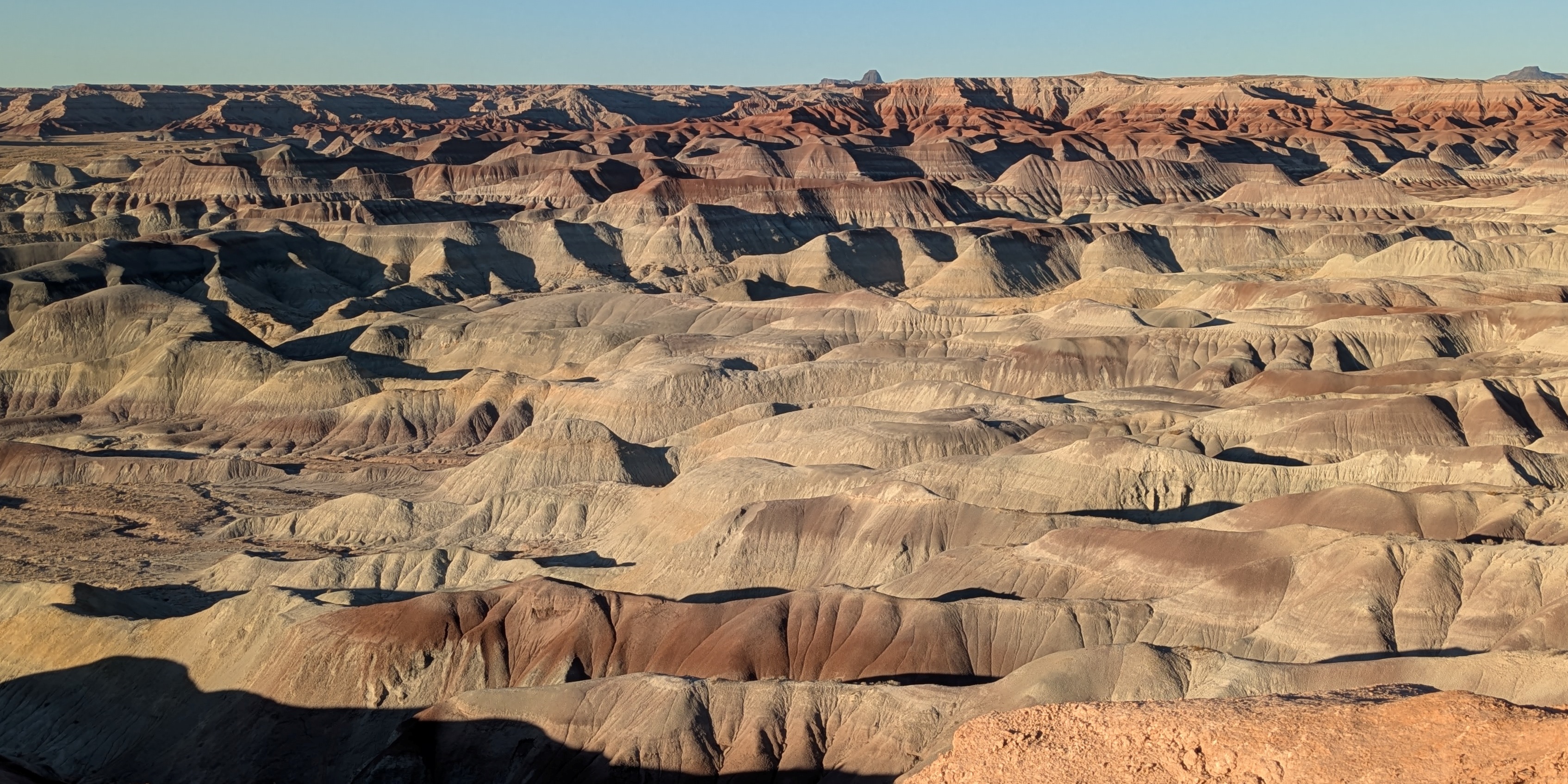
We drove on a dismally-maintained road called Painted Desert Rim Drive to 35.155674880842604, -110.47369724658341 where we got a spectacular view of the Little Painted Desert.
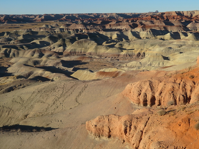
Unlike Horseshoe Bend, the afternoon sun at this location made for great viewing. 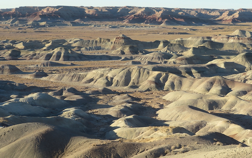
We took pics of each other in front of the mountain view. Norma came out much better than me. 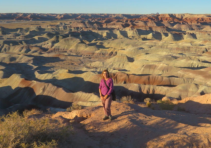
Be sure to also check out the photo at the bottom of this page. |
|
Norma and I drove into the town of Winslow, which we both view as an important part of American culture, thanks to the song "Take It Easy" written by Jackson Browne and Glenn Frey.
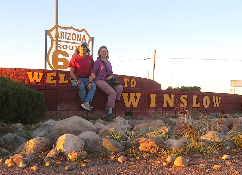
Winslow is also famous for having Route 66 pass through it. U.S. Route 66...was one of the original highways in the United States Numbered Highway System. It was established on November 11, 1926, with road signs erected the following year. The highway runs from Chicago, Illinois, through Missouri, Kansas, Oklahoma, Texas, New Mexico and Arizona before terminating in Santa Monica, California, covering a total of 2,448 miles (3,940 km). It was recognized in popular culture by both the 1946 hit song "(Get Your Kicks on) Route 66" and the Route 66 television series, which aired on CBS from 1960 to 1964. US 66 was a primary route for those who migrated west, especially during the Dust Bowl of the 1930s and it supported the economies of the communities through which it passed. - from Wikipedia - U.S. Route 66 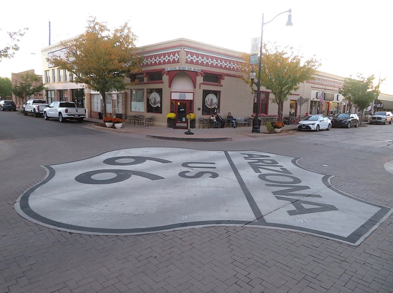
At Standin' on the Corner Park, we posed with some metal eagle wings that commemorate "Take It Easy." 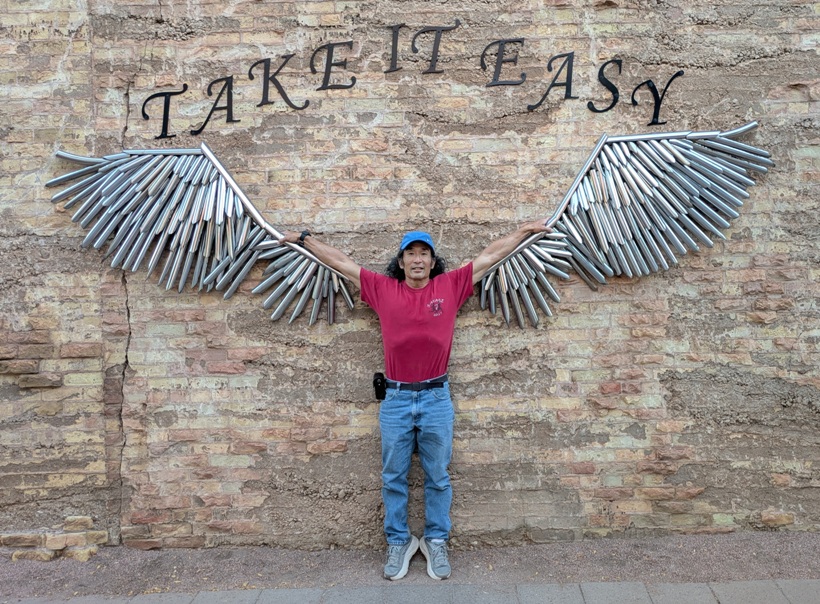
|
|
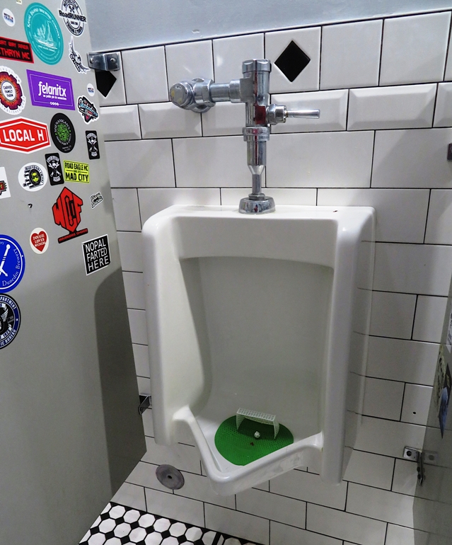
I would like to say Winslow has a lot going for it, but it does not. Maybe we missed something but it seemed like just a place to pass through and not spend a lot of time at. In contrast, Flagstaff was much nicer. Still, we managed to find a good restaurant called Relic Road where I had their delicious "Southwest Burger." It was definitely one of the best burgers I've eaten...and I've eaten a lot of burgers.
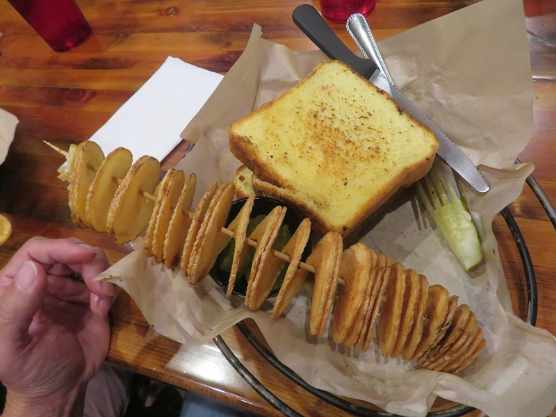
I thought the chips were particularly interesting. They were cut like a spiral-cut ham and presented on a skewer. The Marylander in me thought they looked like a mermaid's necklace which is the egg case of a whelk. We sat at the bar where we struck up conversations with others. I sat next to a train conductor while Norma sat next to a fellow touring the country with his wife. We noticed how the customers were almost all very manly-looking men. They really got into the football game showing on television. The restroom urinal paid tribute to football...not American football but rather soccer. |
|
After dinner, we walked around town, stopping at the La Posada Hotel. This historic hotel is beautifully decorated to blend well with the southwestern desert terrain.
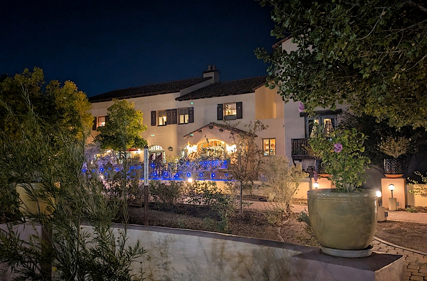
Gift shopping has never been my forte but here I found some nice butterfly magnets that I thought would look well on any refrigerator so I purchased several. We walked through the hotel's garden but since it was night, we really couldn't see much. |
|
We checked out of the motel and then explored Flagstaff. Of the different towns we visited in Arizona, this was my favorite in terms of liveability. We stopped in at the Visitor Center where we were given some great information about local hikes.
One hike option we followed up with was Picture Canyon. Picture Canyon is a unique feature formed by the gap between two lava flows along the Rio de Flag east of Flagstaff. It has been the focus of conservation interest in the community for decades given its archaeological, geological, and wildlife resources. The Northern Sinaugua occupied the region from 700 AD - 1200 AD and pecked nearly 800 petroglyphs into the Canyon walls and nearby boulders. - from AZ Watch Wildlife - Picture Canyon Natural and Cultural Preserve We started our walk on the Tom Moody Loop. This took us to a waterfall in a basalt canyon created by the Rio de Flag. The Rio de Flag originates from springs on the southwestern slopes of the San Francisco Peaks, the mountain range just north of Flagstaff. It flows through Flagstaff and Picture Canyon before reaching San Francisco Wash, a tributary of the Little Colorado River. - from sign titled "Going with the Flow: The Rio de Flag" 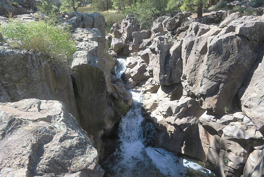
We saw some kids (I'm guessing home-schooled). One of them caught a horned toad lizard that he showed me. It appeared to be quite content resting on his hand. 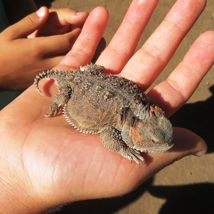
We saw lots of grasshoppers, including this two-striped grasshopper. 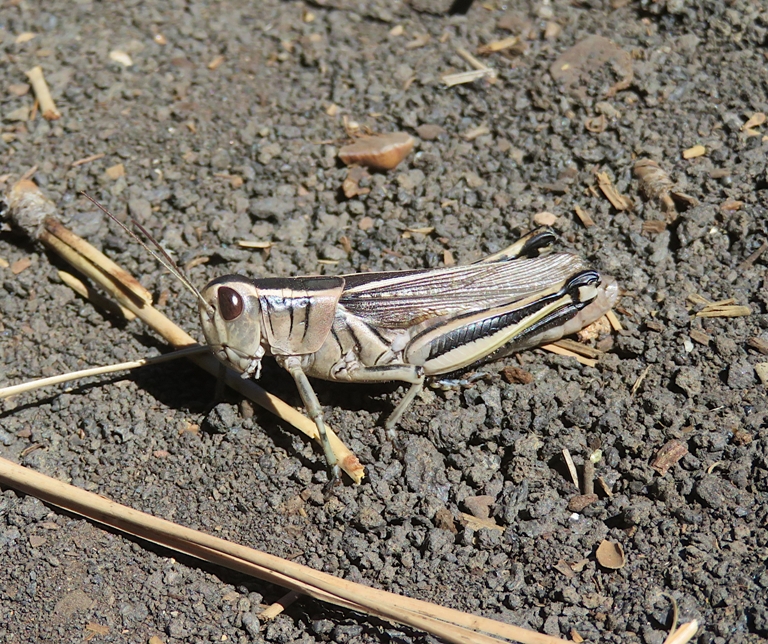
Continuing our hike, we came to a rocky area containing many petroglyphs. The Northern Sinagua people occupied the area from 700-1300 AD and Picture Canyon is home to the greatest concentration of Northern Sinagua petroglyphs in the region. - from flyer titled "Welcome to Picture Canyon Natural and Cultural Preserve" In addition to petroglyphs, I was hoping to find fossils but did not. Approximately 275 million years ago, this region was periodically beneath a vast ocean. The whitish-tan rock you see throughout Picture Canyon is Kaibab Limestone, which also forms the rim of the Grand Canyon. This layer contains numerous fossils indicative of a warm and shallow aquatic environment, including corals, mollusks, sponges, and even shark teeth. - from sign titled "A Story of Vast Seas and Violent Volcanoes" Perched on a stump, we passed a western fence lizard with a distict blue underside. I remember catching these in Sacramento as a kid. They are also known as "blue-bellies." 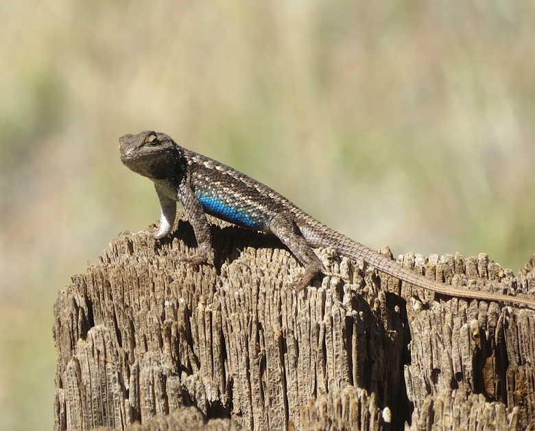
It was interesting seeing how the landscape changed so much as we traveled north from Phoenix. While Phoenix looks more like a stereotypical southwestern desert, Picture Canyon reminded me of the Sierra Nevada mountains of northern California. This is probably due to Flagstaff's 7,000-foot elevation which made me glad to bring a jacket for the cool nights and mornings. Today's weather was about as perfect as it could be. |
|
Norma and I visited the Museum of Northern Arizona where we learned more about the ancient peoples that inhabited this land.
Humans have lived on the Colorado Plateau for at least 15,000 years. The earliest people, the Paleo-Indians, hunted large and small game animals and collected wild plant food in a hunting-and-gathering way of life. By 8,000 B.C., the big game of the Paleo-Indians had disappeared. It is not known if overhunting, climatic change or some combination of both was responsible. - from sign at museum titled "Paleo-Indian 15,000 to 8,000 B.C." Following the extinction of the large game animals, the people continued to hunt smaller game such as deer, antelope, mountain sheep and rabbits. They collected wild plant foods such as nuts, berries and seeds. The Desert Culture people lived in small bands - groups of related families - which moved over vast territories in a seasonal migration pattern. - from sign at museum titled "Desert Culture 8,000 to 100 B.C." We also learned about some of the prehistoric animals that once roamed here. The Therizinosaur skeleton (shown below) was found in southern Utah and lived 93 million years ago. It is a sloth-clawed theropod. Theropods...were all carnivorous except for the therizinosaurs. - from sign at museum titled "Therizinosaur - Graffam's Sloth-Claw Dinosaur" 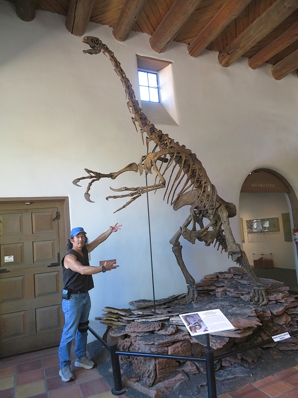
Regarding modern fauna, they had an insect exhibit where I saw butterflies that one might mistake as monarchs...recall that I made that mistake at the Arizona-Sonora Desert Museum. 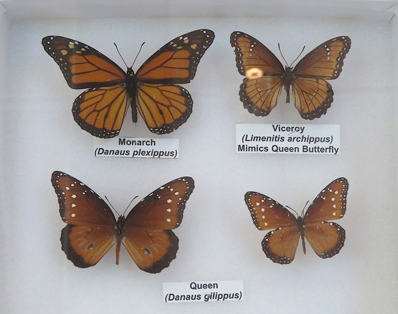
Next, we walked outside the museum on the not-so-well maintained Rio de Flag Trail. About six million years ago a low-sloped volcano ten miles to the southwest erupted and the lava flowed north, then east. The Rio de Flag began flowing about 330,000 years ago, eroding a channel through the basalt [shown below] that is now 20-30 feet deep and 80 feet wide. - from sign at museum titled "Rio de Flag Trail" 
|
|
We drove through the dark back to Phoenix. In the city, we passed 18 billboards with lawyer advertisements while driving to our Motel 6 in the sketchy part of town.
To celebrate our 13th wedding anniversary, we went into the city that night for dessert at Rosso Italian. This restaurant appeared to be in the heart of Phoenix where we saw hundreds of people, mostly well-dressed for a night on the town. It was definitely not a place we would normally be. By now, the crack in our rental car windshield grew from one inch to 20 inches! Something tells me the rental car company is going to notice it. |
|
Norma and I returned our rental car and then flew out of Arizona. She returned back to Maryland while I went to Sacramento to visit my mom.
Our time spent in Arizona was most excellent. The weather was perfect and we really enjoyed meeting Robin and spending time with her and Carmen. I think the only thing that would have made our trip better is if the federal government hadn't shut down. Speaking of the government, one very relaxing thing about this trip was the lack of attention to politics. Unlike Maryland, we didn't see flags, signs, or bumper stickers of folks mentioning what candidate they supported or who they disliked. I rarely checked my phone for the news. Current events was one stressor we didn't need. Will we return to this area? Yes, definitely. Here are some things on our to-do list for when that happens. I might even want to come back for a multi-day kayak trip in the slot canyons and/or the Horseshoe Bend area. |
