|
Norma and I considered a winter vacation in Florida. We could fly but that would mean traveling without Daphne or subjecting her to a lot of stress. Not an option. |

|
Norma and I considered a winter vacation in Florida. We could fly but that would mean traveling without Daphne or subjecting her to a lot of stress. Not an option. |
|
We left in the wee hours. I think we were on the road by 0400-0415. The plan was to beat the northern Virginia rush hour traffic. We were successful.
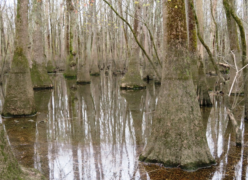
It took us six hours to drive to Ivanhoe, where we launched on the Black River in the Black River Preserve at 34.604861, -78.242611, 3681 Ivanhoe Road. There, we met a very friendly 90+ year old man that lives nearby who chatted with us for awhile. The first thing we noticed was the color of the river. It is very dark because as vegetation decays, tannins leach into the water, making a transparent, acidic water that is darkly stained, resembling tea. Most major blackwater rivers are in the Amazon Basin and the Southern United States. - from Wikipedia - Blackwater River 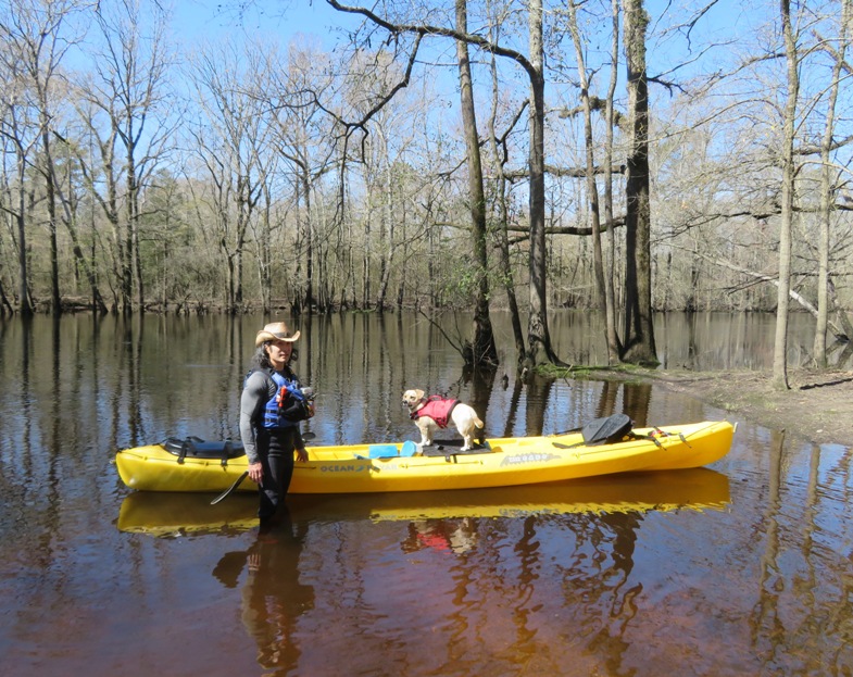
Despite the dark color, the river is very clean. In 1994, the river was recognized as one of the cleanest, high-quality waterways in North Carolina when the state designated the river an Outstanding Resource Water. - from Mahanaim Adventures - Black River Norma and I paddled up a very scenic dead end tributary but were able to carry the boat across a narrow spit of land to the main part of the river. 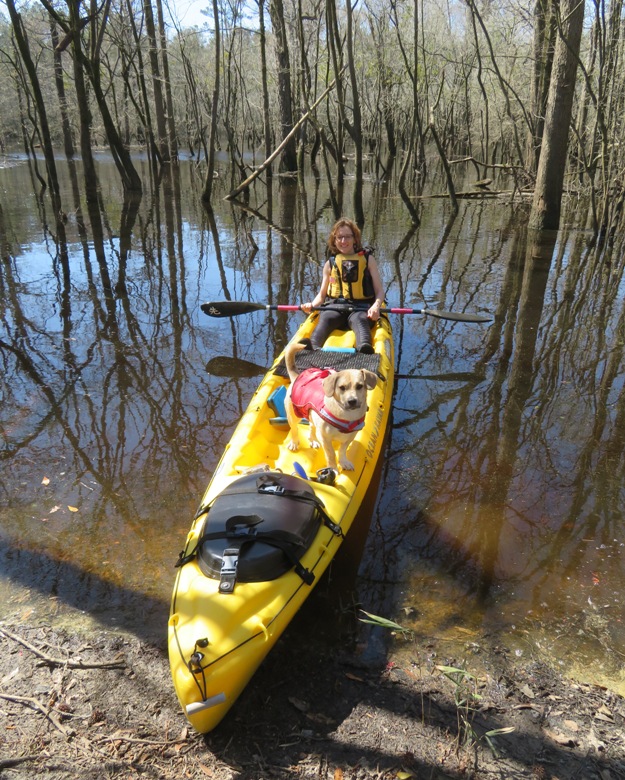
We saw lots of red maples with seeds ready to helicopter their way to the ground. 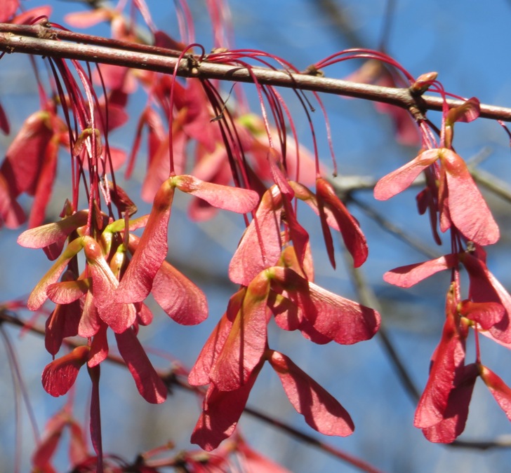
There was also lots of mistletoe and Spanish Moss hanging from the trees. 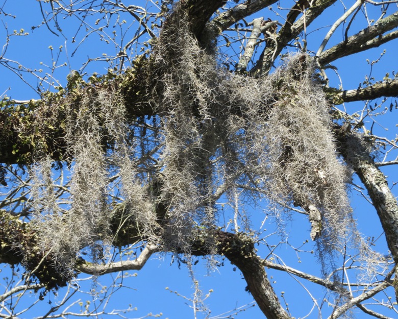
We stopped for lunch and turned around at an area where some development was taking place. Lots of trees had been torn down and we could see and hear heavy landmoving machinery in the distance. Not a pretty sight. It didn't take long to go downstream due to the strong current. Along both sides of the river, we saw huge, concrete bridge supports, each at least two stories tall. They seemed out of place. 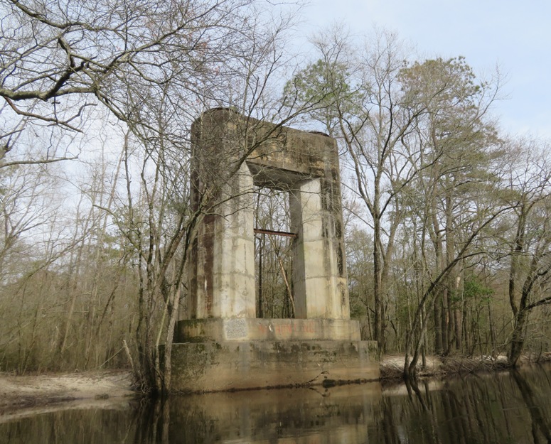
We saw no other boats, little trash, and few signs of civilization, other than our turnaround point. Unfortunately, not much wildlife either. The river was nice but wider than what I expected. We were fairly far upstream and it was slightly wider than the Monocacy River at the mouth. One reason I chose this place is because The Black River is home to the oldest trees east of the Rocky Mountains. - from Three Rivers Land Trust - Black River Ancient Bald Cypress Unfortunately, we did not notice any trees that seemed unusually old or large. But we only paddled 11 miles (5.5 miles each way) and the river is 50 miles long. So it is likely the old trees are on another part of the river. Back at the launch site, the old man was back but this time with his wife. We chatted again. He told us about the flooding a few years ago. Very friendly folk.  |
|
Every night, we stayed at an AirBnB house in Wilmington. Our first was in a modest suburb. We were expecting a little more southern hospitality from the hostess but after an introduction, she and her husband kept to themselves.
The best thing about that location was that it was within walking distance to Rucker Johns, a moderately priced restaurant with outdoor seating so Daphne could join us. |
|
One of the things on my "to do" list was to visit the USS North Carolina battleship in Wilmington. I had Marine buddies stationed on the USS Wisconsin and USS Iowa battleships that I visited back in the day, so this was the third battleship I got to board. It was Norma's first.
Touring this ship brought back memories of when I was stationed on the USS John F. Kennedy from 1988 to 1990. It was once the largest and last conventionally (non-nuclear) powered American aircraft carrier. I served as part of the Marine detachment. Detachments of Marines have served aboard American naval vessels since the beginning of the Continental Marine Corps in 1775. That stretch of more than two centuries ended May 1998 when officials at Marine Headquarters in Washington, D.C., opted to scuttle the detachments to free more Marines for Fleet Marine Force duty. - from Naval History and Heritage Command - The Corps' Salty Seadogs Have All But Come Ashore: Seagoing Traditions Founder as New Millennium Approaches This ship is armed with nine 16-inch guns. Three of them are behind me. It shot a projectile weighing up to 2700 pounds for a distance of up to 23 miles. With modern ships and air power having much greater precision, such guns have become obsolete. 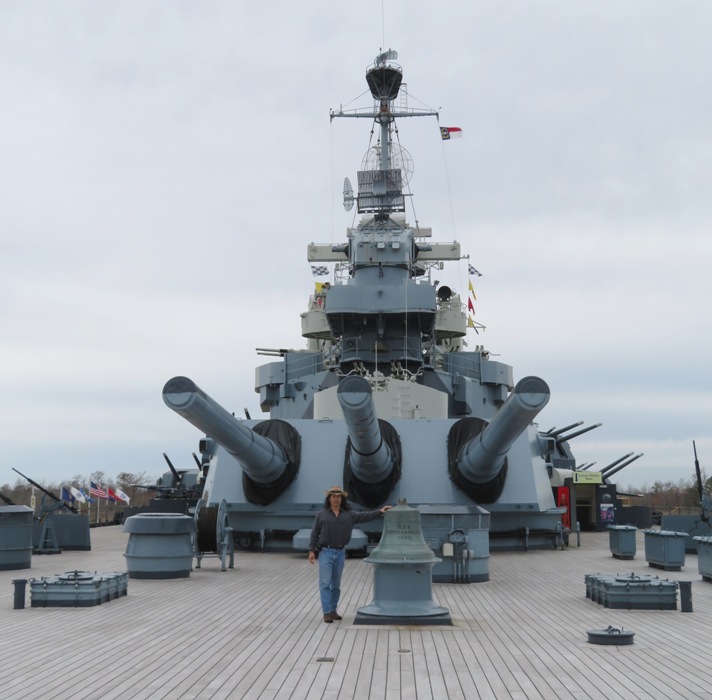
In 1937, the Navy called for a rugged and dependable observation/scout plane for use on battleships and cruisers. The aircraft would provide "eyes in the sky" to search for enemy ships and submarines. It would also spot and direct gunfire, making sure that a ship hit its target. This plane is called a Kingfisher. It is catapulted from the plane and then lands in the water, where a crane lifts it back onto the ship. - from information sign on ship 
This ship has a long history of supporting Marines. The USS North Carolina took part in offensive operations in support of the Battles of Iwo Jima and Okinawa in 1945, including numerous attacks on Japan. Following the surrender of Japan in August, she carried American personnel home during Operation Magic Carpet. - from Wikipedia - USS North Carolina (BB-55) 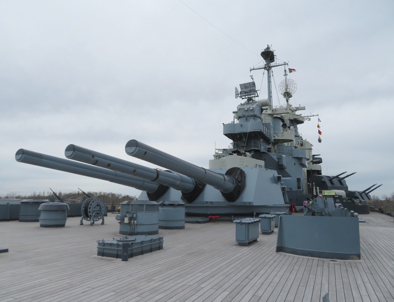
The anchor of the USS North Carolina was cast in Norfolk, Virginia in 1938. It weighs 25,883 pounds. - from Waymarking - Anchor - USS North Carolina 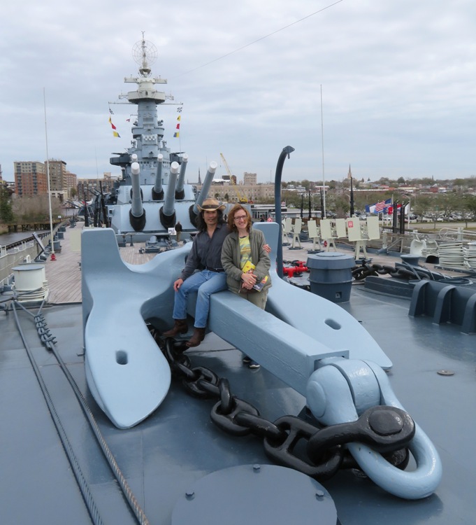
In contrast, the weight of an aircraft carrier anchor is around 30,000 pounds, with each link in the chain weighing 136 pounds. - from Popular Mechanics - You Don't Want To Get in the Way of a 100,000-Ton Aircraft Carrier's Anchor The USS North Carolina is 728 feet and 9 inches long. 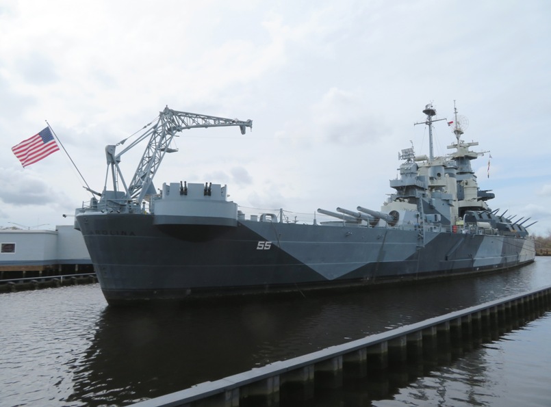
It held 2339 people. In contrast, the aircraft carrier on which I served was 1072 feet long and held over 5000 people - from information pamphlet and Wikipedia - USS John F. Kennedy (CV-67) We spent most of our time below decks, learning about how the crew lived and worked. But those photos are not as interesting. We didn't tour everything. It would have taken quite a bit of time to do so and we were wanting to get back to Daphne, who had to wait in the car. |
|
After visiting the battleship, Norma, Daphne, and I toured Wilmington and walked on the River Walk.
We ate lunch at a riverfront restaurant called The George and saw an osprey fly by. No, not the raptor...it was the Bell Boeing V-22 Osprey tiltrotor military aircraft. We never saw any of the bird ospreys during our visit but saw several V-22s. 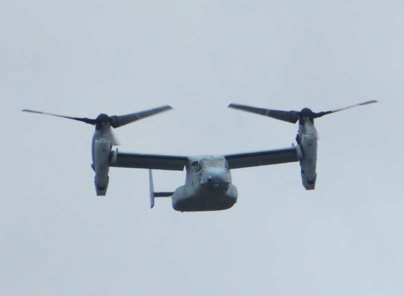
We walked through the gardens at the Latimer House where we saw this plant and sign which reads "Winter Daphne." 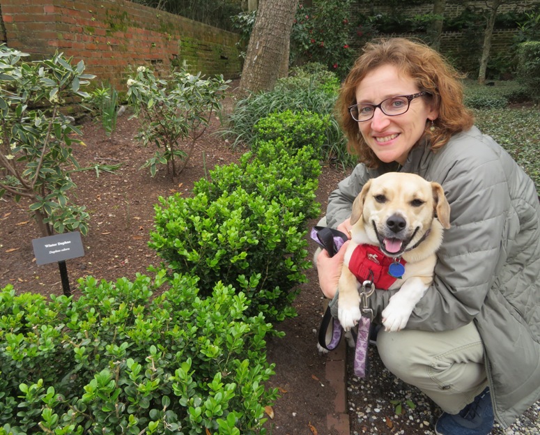
Nearby, we saw a green anole. 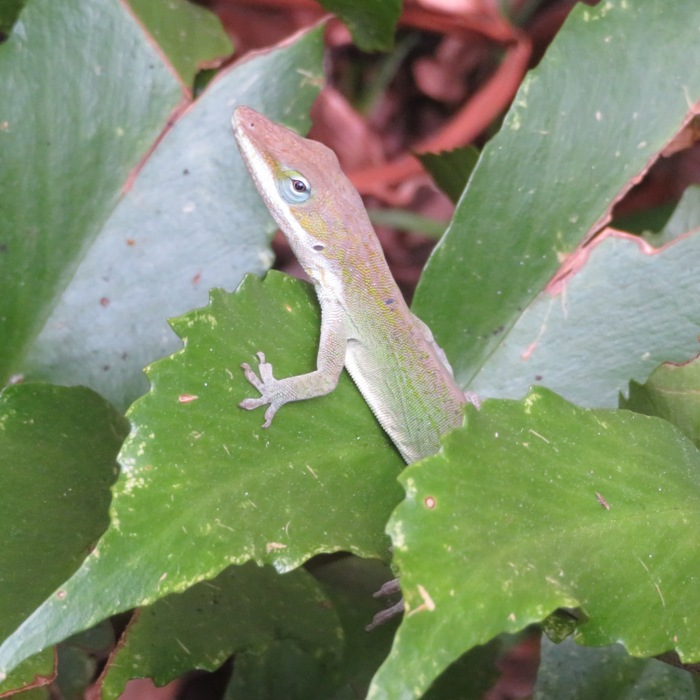
Strolling through town, we came across a vehicle with several stickers on one of the side windows. I was really curious about one particular sticker that displayed a chicken on a SUP. I was hoping to meet the person who owned it to see if they take their chicken paddleboarding. That would be cool if they did. I later found out from Trudy S. that this surfing rooster is the logo of Beach and Barn. I have since ordered some of these stickers and put one on my car. 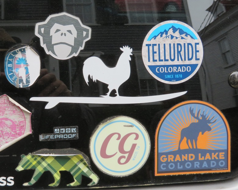
It would have been nice to spend more time in town but we had to get to our next destination before the low tide. |
|
Norma, Daphne, and I drove to 34.440944, -77.518222 in Surf City to do a little fossil hunting at public beach access #5, Broadway Street, 1700 N. Shore Drive. Janie and Pat C. recommended this place. It looked like any other beach town, but if you spent a little time looking around, you might find shark teeth! It was a day after the Worm Super Moon so the tide was lower than normal...a good condition when you're looking for fossils. The tide was actually much lower in the early morning but with daylight savings time having recently taken effect, the light was better in the late afternoon.
We found interesting shells, 19 shark teeth, two pieces of ray dental palates, and six pieces of coral (the smallest one shown here was found in another part of the state). We also found a pull tab from a can. Not quite a fossil but pretty close. We searched for about an hour. 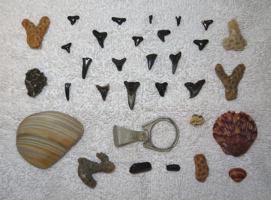
In my opinion, the fossils in Maryland have better detail, possibly because there isn't as much wave action. Norma found this interesting thing, which I'm guessing is a rock. Not sure why it has this pattern. Almost looks like something was fossilized inside of it. 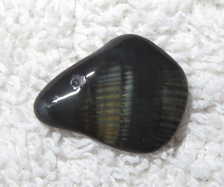
|
|
Jacksonville is the home of Camp Lejeune, where I was assigned to my unit, 2/2, from September 20, 1990 to November 1, 1991. During that time, we were deployed to serve in the first Gulf War from December 18, 1990 to April 11, 1991. So my actual time in Jacksonville was about 10 months.
I was never fond of Jacksonville. Returning to it 29 years later, nothing looked familiar. We could not go on base but we could visit some of the more recently built veterans memorials and walk on the trails that link them. 1 / 4

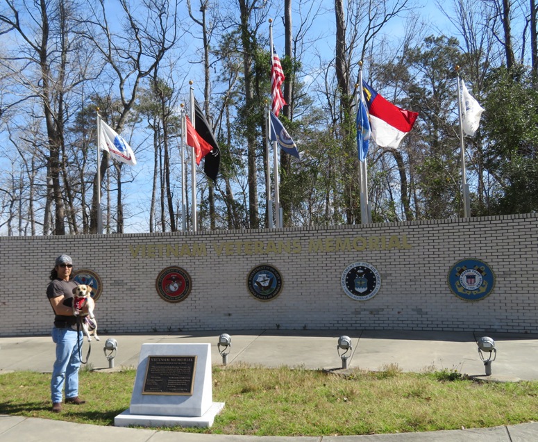
Vietnam Veterans Memorial.
2 / 4
Vietnam Veterans Memorial.
3 / 4
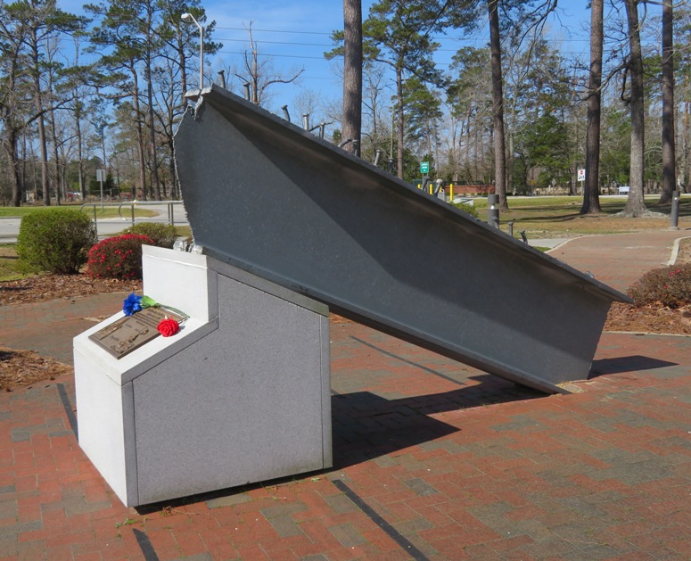
Beam from World Trade Center.
4 / 4
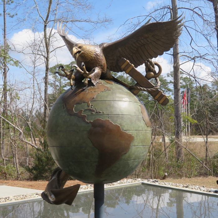
EGA sculpture.
Though I never learned about it when I was in the Corps, Montford Point is a place that I find fascinating, partly because some of my relatives faced similar discrimination in the military during WWII. 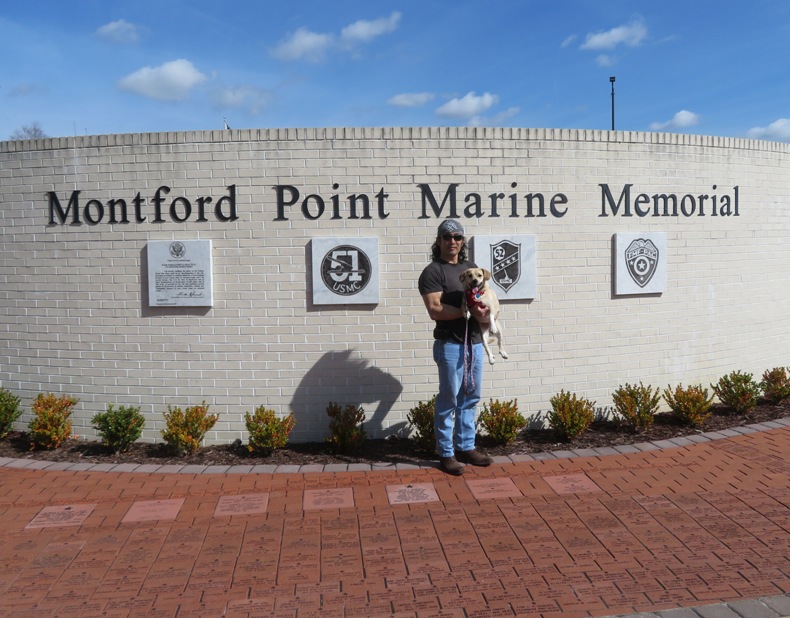
Acquired by the government with the rest of Camp Lejeune, Montford Point became the site of the first training camp for African American Marines. Executive order 8802, issued by President Franklin Roosevelt on June 25, 1941, ensured full participation in the nation's defense, opening the door for blacks to enter the United States Marine Corps. Instruction began in the summer of 1942 for a small number of eager recruits such as Arnold R. Bostic, who later recalled that after the first tough day of training, his platoon "decided we were going to complete boot camp and become Marines no matter how hard they made it for us, or what anyone said." The training site for more than 22,000 African American Marines, Montford Point was deactivated on September 9, 1949. President Truman's Executive Order 9981, issued earlier that year, effectively ended racial segregation in the armed forces. In 1974, in honor of Sgt. Major Gilbert H. "Hashmark" Johnson, Montford Point became Camp Johnson, the first military installation to be named after an African-American Marine. - from information sign at memorial |
|
Norma, Daphne, and I paddled on the White Oak River in North Carolina.
This is a blackwater river that supposedly has bald cypress trees over one thousand years of age. - from Wikipedia - White Oak River We launched from the White Oak River Campground. It only cost two dollars per person to launch. This is the northernmost launch site on the Onslow County White Oak River Paddle Trail. Just outside the bath house, along a sunny wall, we saw several green anoles. 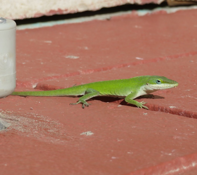
We also saw a five lined skink. 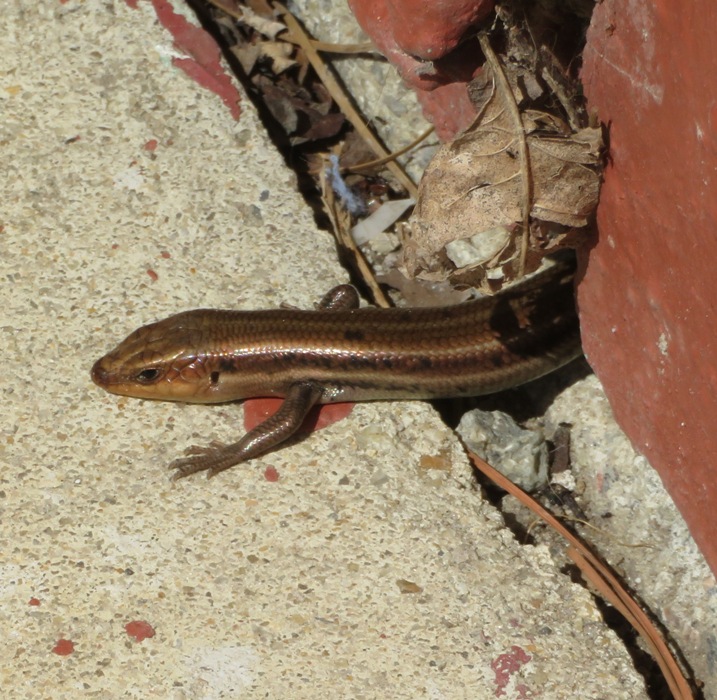
We put in under New Bern Highway (highway 17). 
Just on the other side of the river, some people were taking their dogs out for a walk. Daphne felt pretty brave barking at them. But she didn't count on one of them swimming across the river and the others walking across the bridge in the pic above. Fortunately, they were friendly dogs but it was funny how Daphne's attitude changed once she realized the river was no longer a boundary. She changed from fearless to humble. There was lots of wildlife on the water. We saw at least two beavers, a wild turkey, various turtles, and several snakes. Below is what I believe to be a brown water snake. 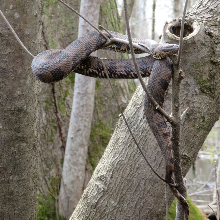
We saw lots of small palm plants. None were more than just a few feet tall. 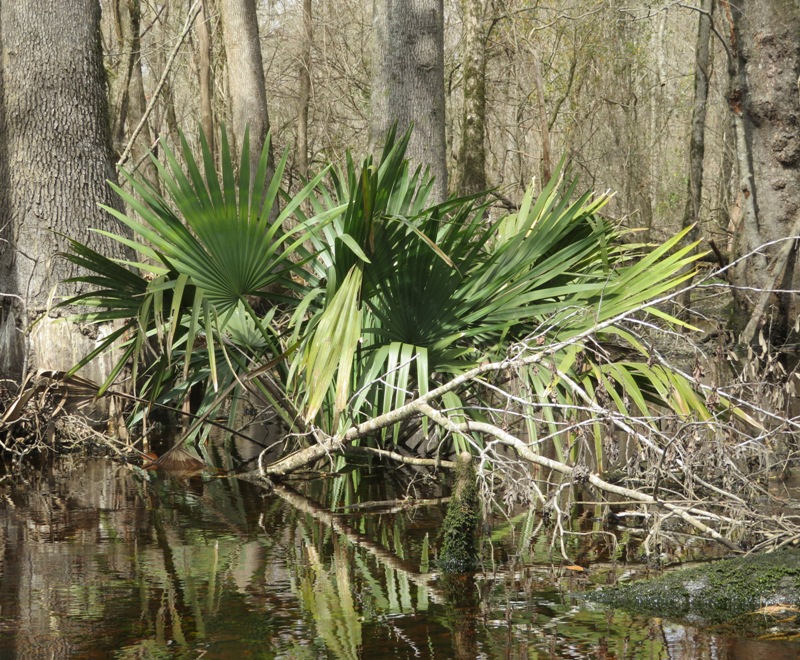
Here's another water snake. 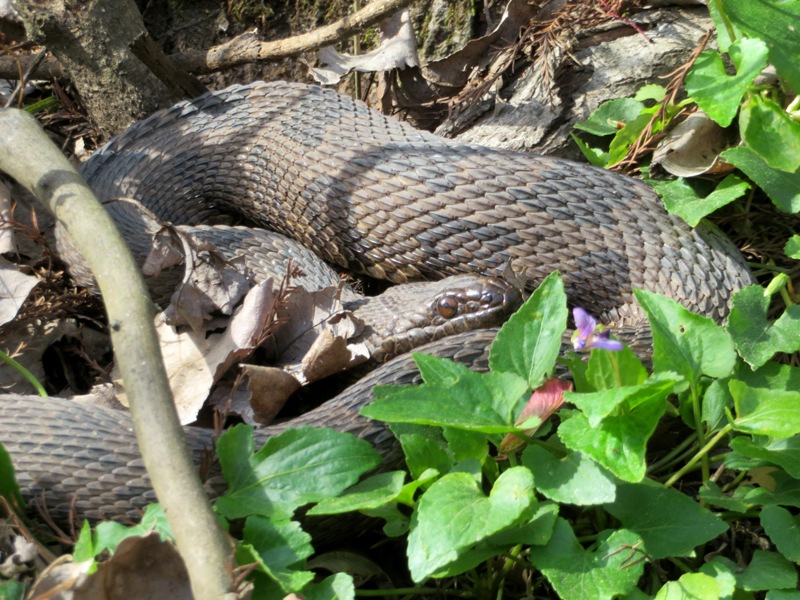
This is about as wide as the river got in the section we paddled. It remained amazingly clear of downfalls except for one, which was huge. The current was sometimes pretty strong. Norma and I had to coordinate more than usual to navigate up many of the fast flowing river bends but it was all worthwhile. 
We saw lots of Spanish moss. 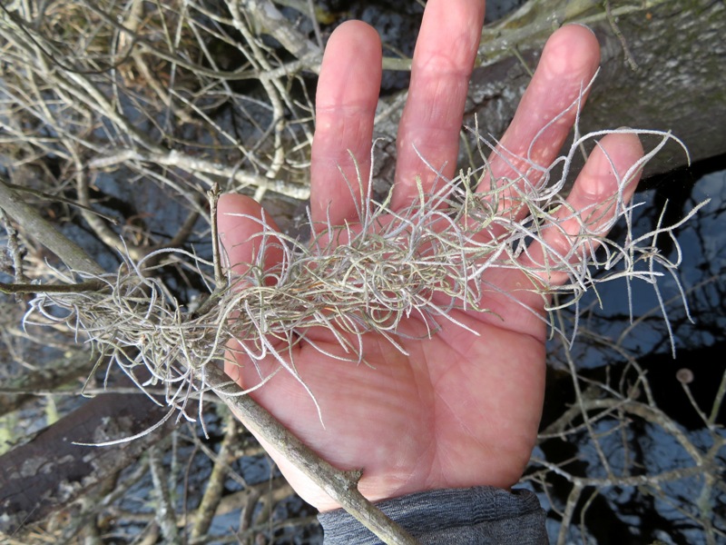
Norma and I paddled upstream until we were stopped by a large fallen tree. Here, Norma decided to take a siesta after our lunch break. 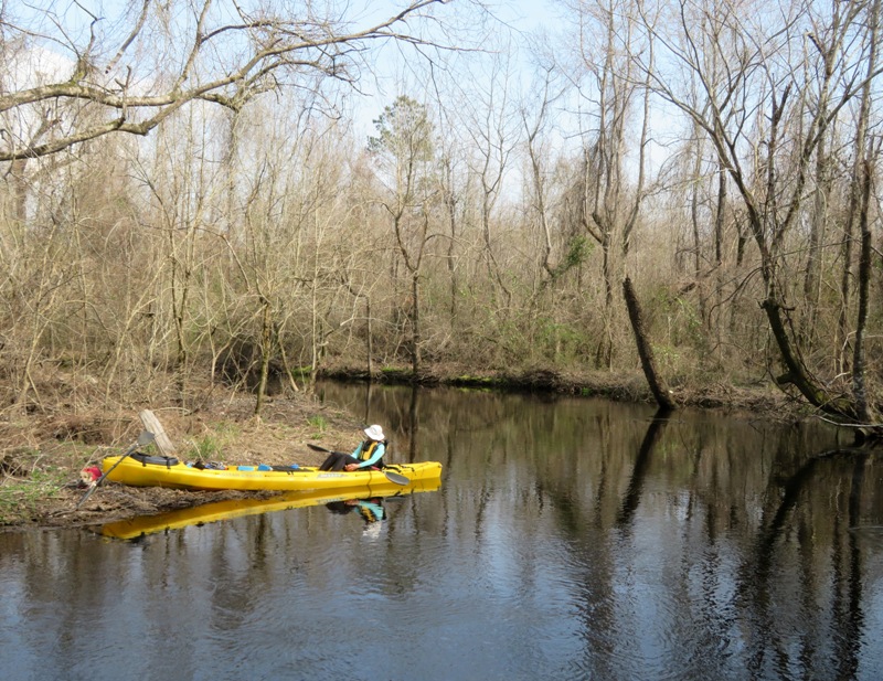
Paddling downstream, we both took a nap on the boat as the current took us where we wanted to go. We never saw anyone else when we were on the water. Sue M. identified this as a ratsnake. 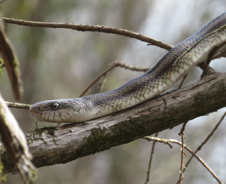
Notice the bulge in its mid-section. It looks like it recently had a good meal. 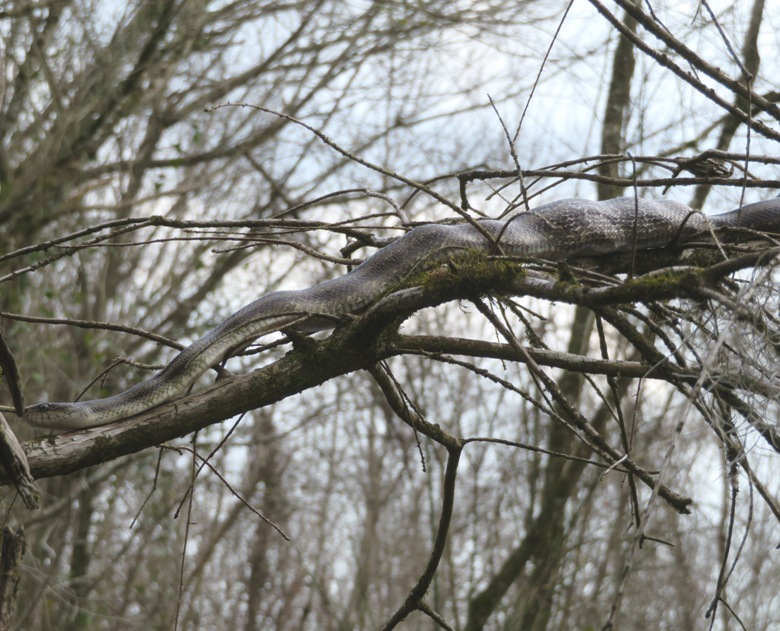
We got in four days of kayaking in North Carolina and this was my favorite trip, largely because we saw so much wildlife and the river was narrow and deep. We paddled a total of 6.6 miles. 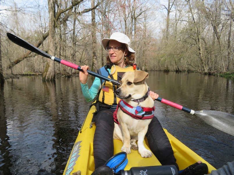
If I were to return to eastern North Carolina for kayaking, I wouldn't mind doing the entire 18.35 mile long paddle trail which ends at Boondocks Landing at Stella Road. But we'd either need another couple to do a car shuttle or bring the bikes to do a bike shuttle with the car. |
|
That night we stayed at a nice AirBnB house in Beufort. It was a huge house owned by a woman who does stained glass work.
Beaufort is located in North Carolina's "Inner Banks" region, is the third-oldest town in North Carolina, and was ranked as "America's Coolest Small Town" by readers of Budget Travel Magazine in 2012. - from Wikipedia - Beaufort, North Carolina |
|
In Beaufort, we toured the North Carolina Maritime Museum where we learned about Blackbeard, an English pirate who operated around the West Indies and the eastern coast of Britain's North American colonies before running aground on a sandbar near Beaufort.
After lunch, we launched at Lynn Eury Park, paddling 7.1 miles in the Rachel Carson Reserve. The Rachel Carson Reserve is part of the North Carolina National Estuarine Reserve system, which is a collection of coastal regions that have been preserved and protected to safeguard the wide variety of wildlife that these regions support. - from Rachel Carson Reserve For more information about the reserve, see North Carolina Environmental Quality - Rachel Carson Reserve. My plan was to circumnavigate Town Marsh, though I was skeptical it could be done since the tide was going out and the tidal fluctuation was about 4.5 feet. Still, it was worth trying as long as I knew when to give up. When it comes to the tide, timing is everything. But reading the time was difficult because my water resistant watch was no longer water resistant. Not bad for something that I only paid $16.24 for which lasted six years. 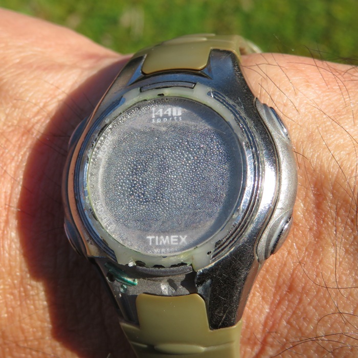
The first interesting thing we saw at Town Marsh was a wild horse. These weren't like the small wild ponies of Chincoteague. These were full-sized horses. A local physician introduced horses to this site in the late 1940s. Years later, the animals were allowed to roam the entire site, eventually becoming feral. The reserve is now home to a small herd (less than 35) of such horses. - from flyer 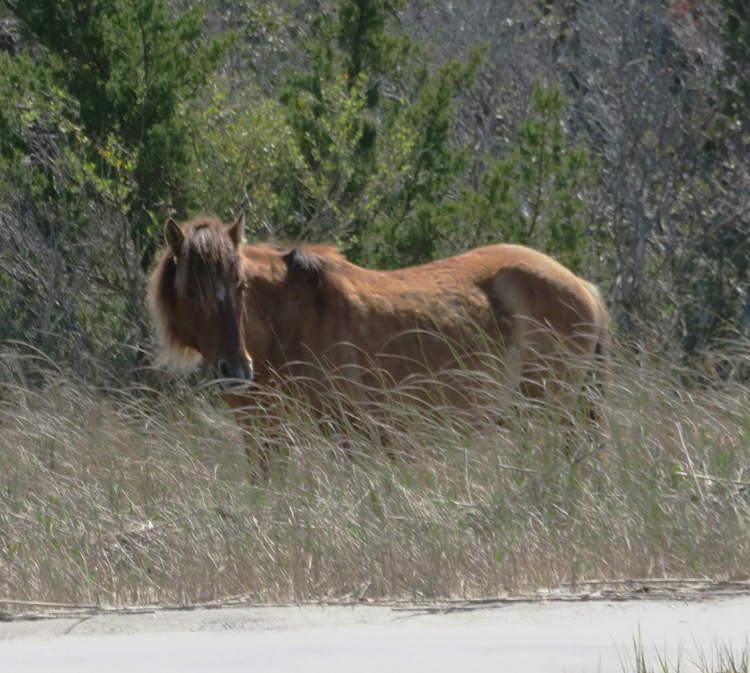
Later, we pulled ashore and saw horse footprints. I found it strange that wild horses were wearing shoes. 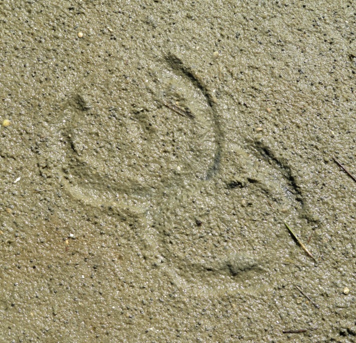
Here's a view from Bird Shoal. 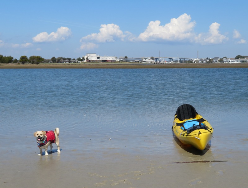
Behind Daphne are the tidal flats, Town Marsh, and Beaufort. Nothing interesting to see there except for an oystercatcher bird. 
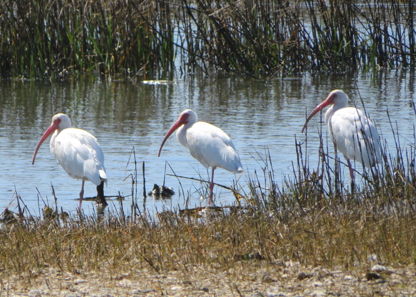
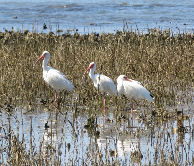
We paddled to the west end of Town Marsh and then started walking on the Outer Loop Trail. We saw some white ibises. The most striking thing about Town Marsh were the thousands of sand fiddler crabs that lived along the edge of the island. They seemed to be everywhere. It was difficult to not step on them. 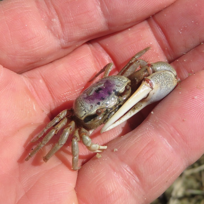
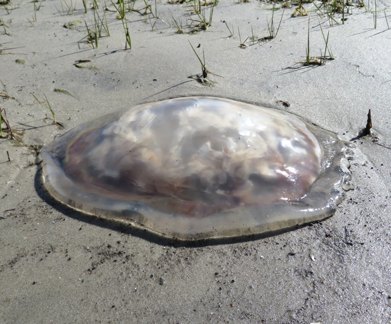
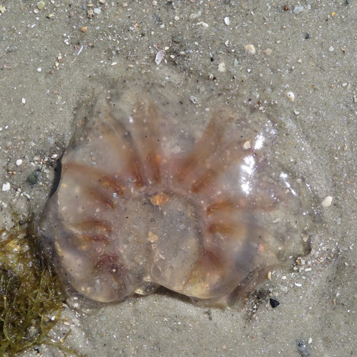
There were also numerous periwinkles. On the north side of the island, I saw something I had never seen before...salps. These are pictured at the top of this page. Although salps appear similar to jellyfish because of their simple body form and planktonic behavior, they are chordates: animals with dorsal nerve cords, related to vertebrates, animals with backbones. This means they are more closely related to humans than jellyfish! - from The News & Observer - These odd, gooey blobs on Outer Banks beaches aren't jellyfish. They're even weirder Each salp is about the size of a lima bean. The dark dot in the snapshot below is its digestive system. 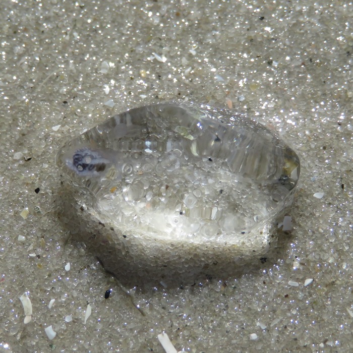
They are sometimes called "the ocean's vacuum cleaners." [They] can exist either singly or in "chains" that may contain a hundred or more individuals... [Salps have an important] role in cycling carbon from the atmosphere into the deep ocean. As they eat, they consume a very broad range of carbon-containing particles and efficiently pack the carbon into large, dense fecal pellets that sink rapidly to the ocean depths, Madin said. "This removes carbon from the surface waters," Sutherland said, "and brings it to a depth where you won't see it again for years to centuries." And more carbon sinking to the bottom reduces the amount and concentration of carbon in the upper ocean, letting more carbon dioxide enter the ocean from the atmosphere. - from Ocean US Magazine - Salps Catch the Ocean's Tiniest Organisms Below was my most unusual find. We saw about a dozen, each about 3-4 inches long. Most were underwater but I saw this one as the tide was going out. They were very loose like a water balloon. Dr. Paul F. identified it as eggs sacs of a bubble-shelled sea slug. Haminoea solitaria is the common East Coast shallow water species. The fragile shell of the animal is covered by the soft, squishy mantle, and they deposit many masses of eggs on the mud. Under the microscope, the developing larva; snails (veligers) swim around inside the eggs - the motion may increase the oxygen inside the egg mass. 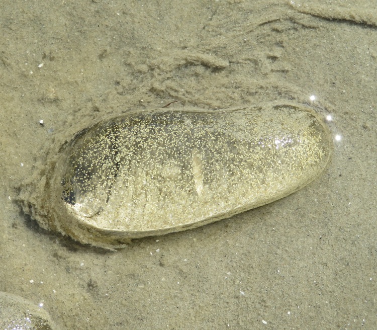
We paddled over to Carrot Island where we saw these red-breasted mergansers. 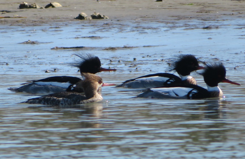
We also saw a kingfisher. 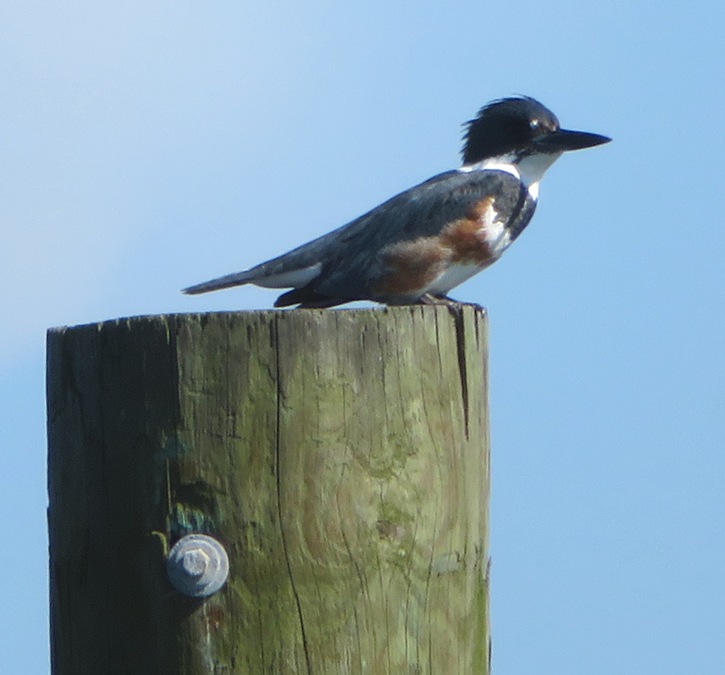
Norma and I found a few jellyfish that were stranded as the tide went out. Oysters are always a welcome sight. Wish we had more in Maryland. Oyster shell reefs were constructed in the Rachel Carson Reserve. Young oysters or "spat" settle on the shells, cementing them together to form a reef that reduces wave energy and protects the shoreline behind the reef. The reef also provides food and habitat for many species of invertebrates and fish. The live oysters on the reef clean the water by filtering out small plants and debris; one oyster can filter more than 50 gallons of water per day. - from sign at North Carolina Maritime Museum 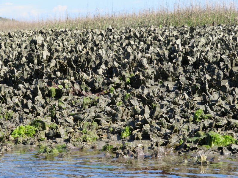
We found some cacti, some coral, and the thing below. It is not a flower but rather a fungus called barometer earthstar. 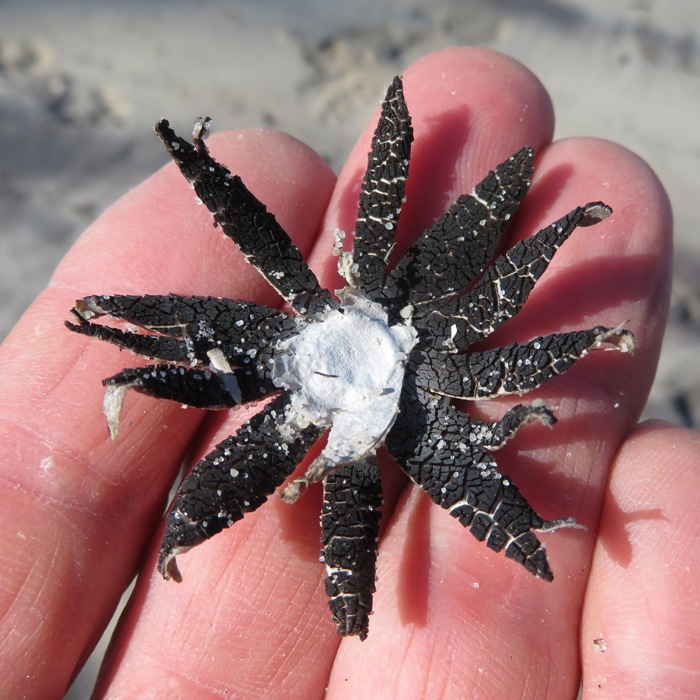
In Taylor's Creek, we saw this brown pelican. These are one of my favorite birds, partly because they are often so willing to pose for the camera. 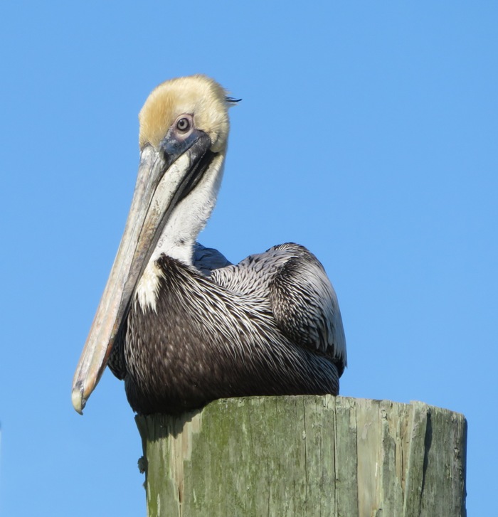
Landing was pretty messy. It was near low tide and we had to carry the boat through some mud. But with all the cool stuff we saw in the Rachel Carson Reserve, it was all worth it! |
|
We drove to our final AirBnB location in Greenville...a small horse farm.
Along the way, we passed Marine Corps Air Station Cherry Point. |
|
Our first stop was 324 acre River Park North, home of the Walter L. Stasavich Science and Nature Center. We walked on all the trails in the park and checked out the Tar River. In this picture below, water tupelo trees thrive.
|
|
In 2008 and 2010, Greenville was named one of the nation's "100 Best Communities for Young People" by the America's Promise Alliance. But we didn't see all that many people, probably because Eastern Carolina University was on spring break. There were a lot of bars and places to get tattoos and body piercings.
We stopped for lunch at a place called Sup Dogs. They were voted "Best college bar in the country." I thought Daphne would be at home there but apparently, the "Sup" in Sup Dogs has nothing to do with standup paddleboards. I had one of their famous hot dogs which wasn't as good as Five Guys. But they gave Daphne a free hot dog so they are alright with me. After lunch, we walked in the downtown area and took a nap on a public hammock. 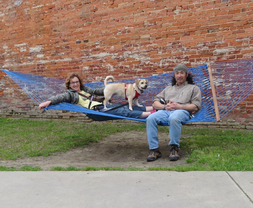
We saw some colorful and artistic graffiti. 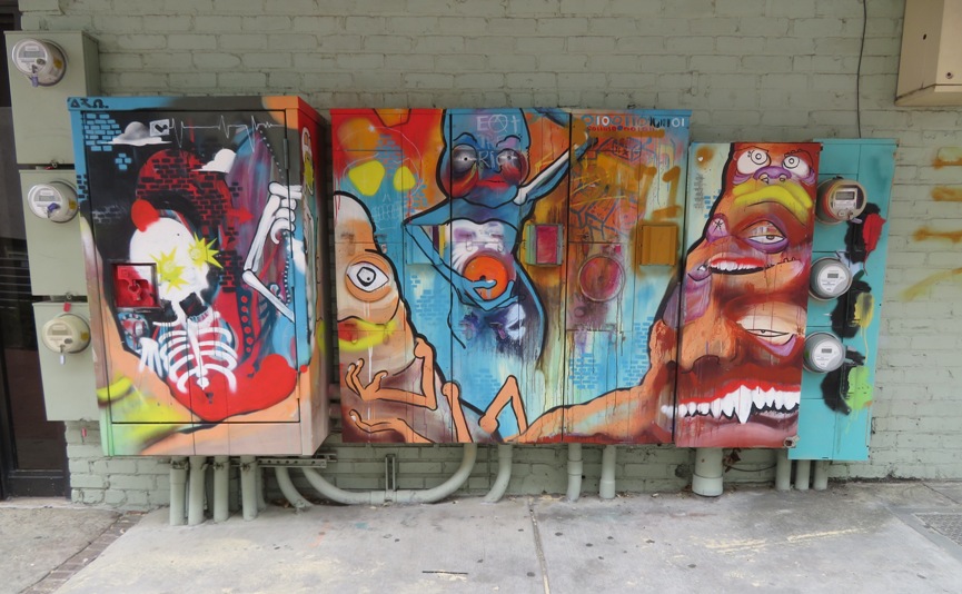
Norma, Daphne and I walked along the Tar River Park walkway in the Town Common. There were lots of love locks hung from the fence along the Tar River. 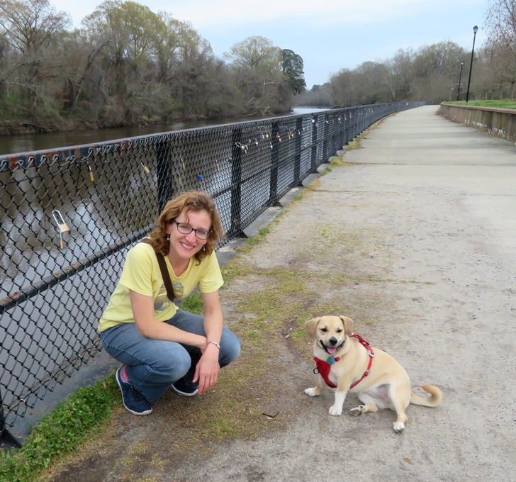
We walked to the Greenville Offleash Dog Park where Daphne had a chance to make some new friends. 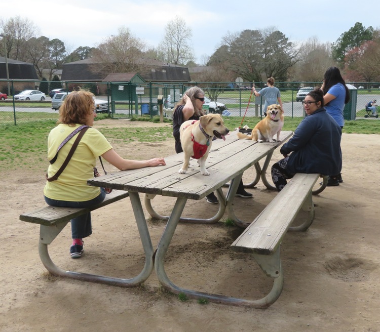
We saw a Rhodesian Ridgeback puppy that looked like Rufus, our neighbor dog. Not all the dogs at the park were real. 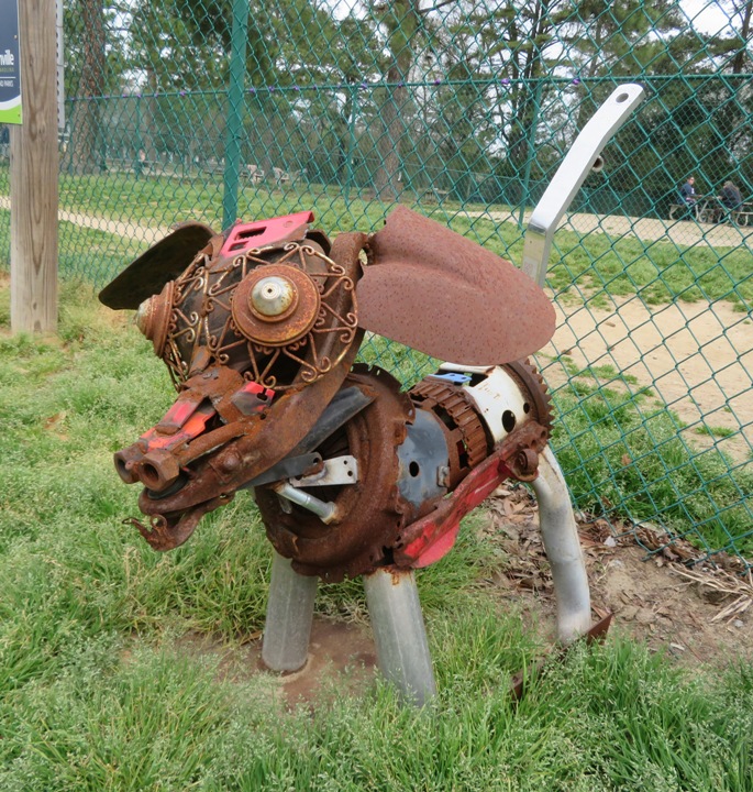
Lots of red maple seeds were getting ready to disperse. 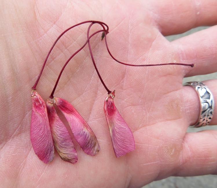
In Greensprings Park, Daphne found a big tree that would have made a nice dwelling except for the drainage issue. 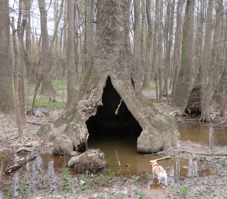
Green Mill Run passes through the park. This waterway is famous for its fossils. Numerous shark teeth and belemnites have been found here. Belemnites are similar to the modern day squid and were predators that captured and ate small fish with their beak-like jaws. Their fossils are small, brown, hollow cylinders that resemble a long pointy bullet. Norma and I found several belemnites in England with Sara on July 27, 2016. Unfortunately, we were not prepared to look for fossils so we might leave that for another visit. Walking through Eastern Carolina University, Daphne found a bat. I don't know my bats well but it looked more grayish than brown so I'm thinking it is a silver-haired bat. 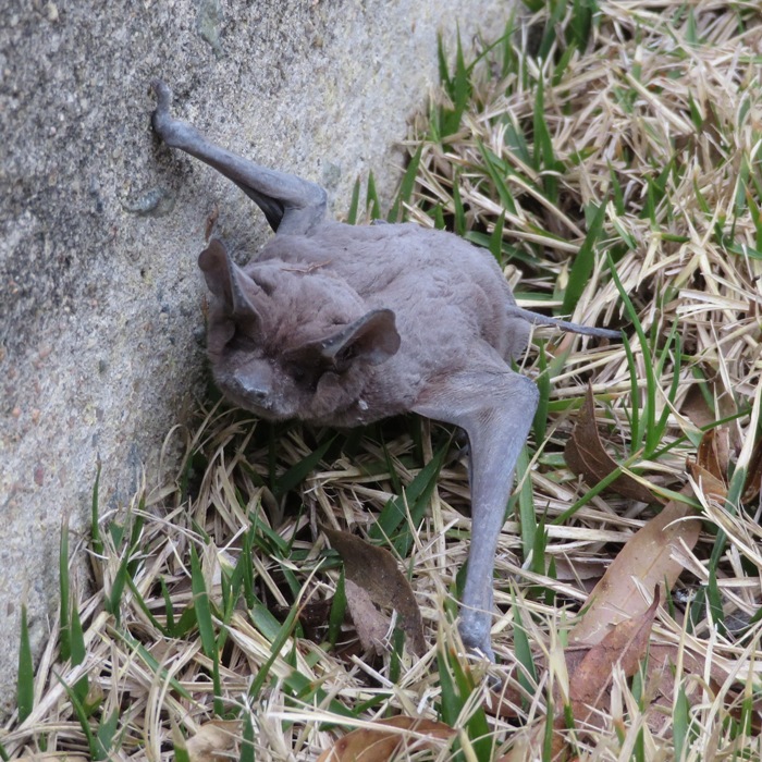
It was trying to climb up a small concrete foundation. I assume it was doing this because Most bats cannot take flight from the ground. They must drop 2 or 3 feet before they can fly. - from Habitat for Bats - Bat Facts 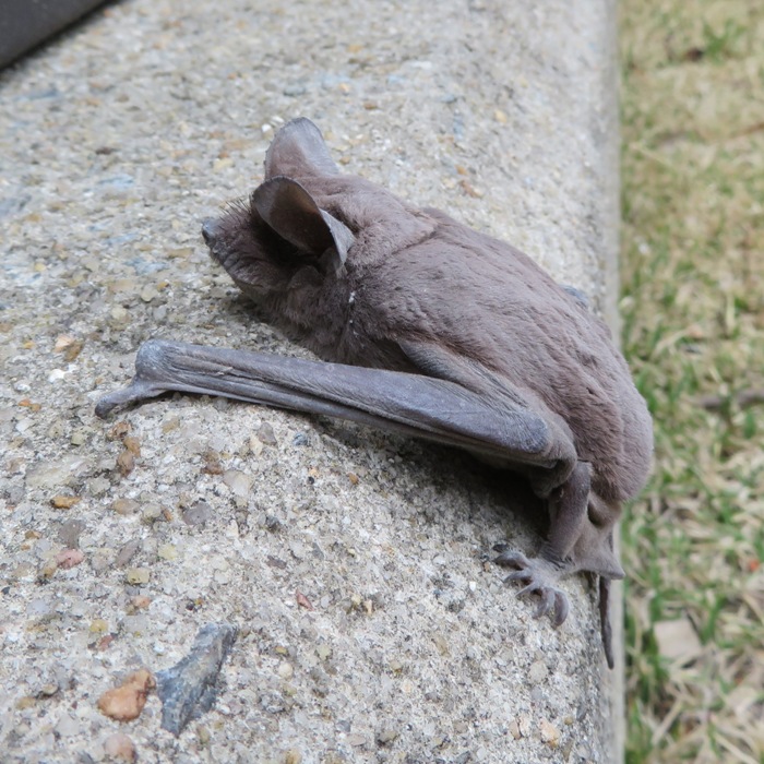
The concrete foundation would have only put the bat about eight inches above the ground. So I took out my handkerchief and used it to grab the bat and put it on top of a brick wall about four feet high. We didn't stick around to see what it did next. I reckon we walked at least seven miles in Greenville. I was a just o.k. town but I was impressed with the abuandance of trails. We picked up dinner at Sam Jones BBQ. I had been looking forward to getting some classic North Carolina BBQ. The food was fine though I think I prefer Mission BBQ. By now the coronavirus thing was really taking hold. It was obvious that it was going to be a big problem in the states. But we tried our best to not let the bad news spoil our vacation. |
|
Norma, Daphne, and I went kayaking at Merchants Millpond State Park in North Carolina. The place reminded me of Trussum Pond.
Merchants Millpond is a scenic coastal pond peppered with bald cypress and tupelo gum trees. The pond was created in 1811 by the construction of a dam on Bennetts Creek. Water impounded by the dam powered a mill and eventually became a center for mercantile trade, thus earning the name "Merchants" Millpond. At the launch area, we saw a guy set up and paddle off in an ORU origami kayak. He had enough room for camping gear. Seems like a novel idea. I am curious how durable it is compared to an inflatable kayak. Thia place is a haven for eastern painted turtles. 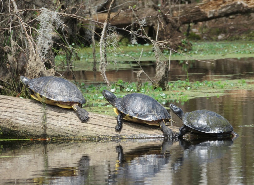
We paddled under Spanish moss which hung from many of the trees. But this plant is neither Spanish nor moss. It gets is name from its gray, moss-like appearance and its abundance in Spanish America (Florida). Spanish moss produces flowers and fruits and is North Carolina's only native member of the pineapple family of plants. - from sign created by Friends of Greenville Greenways (FROGGS) 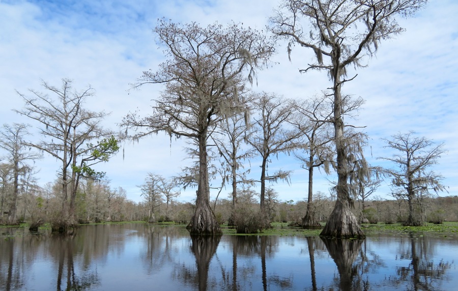
We paddled upstream, towards Lassiter Swamp. But we turned around before we got there. 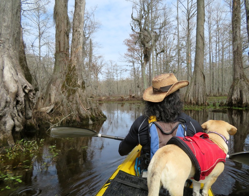
Along the way, we saw lots of knees. Swamp cypress tree (Taxodium distichum) knees are woody projections that sprout above water level, growing vertically from the knobby roots of bald cypress trees. - from Lewis Ginter Botanical Garden - Trees with Knees? 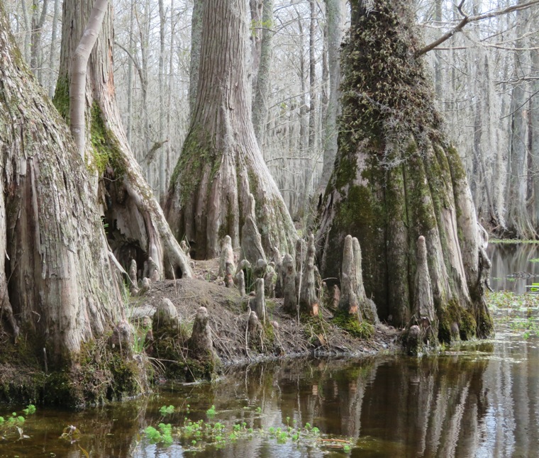
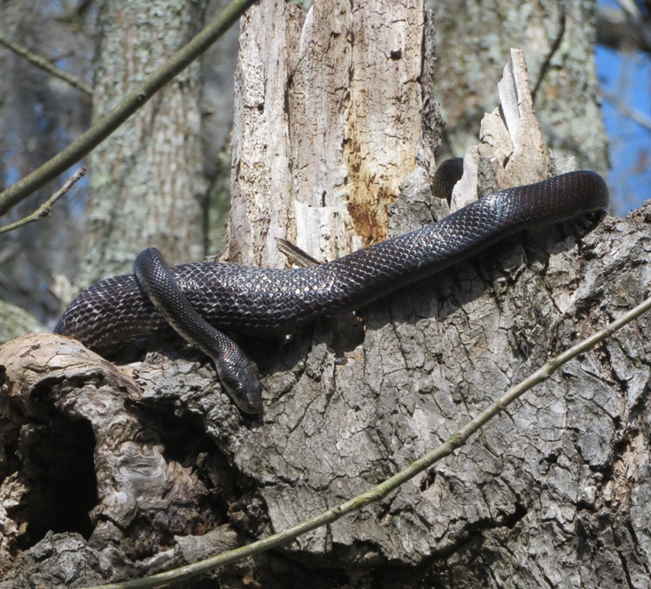
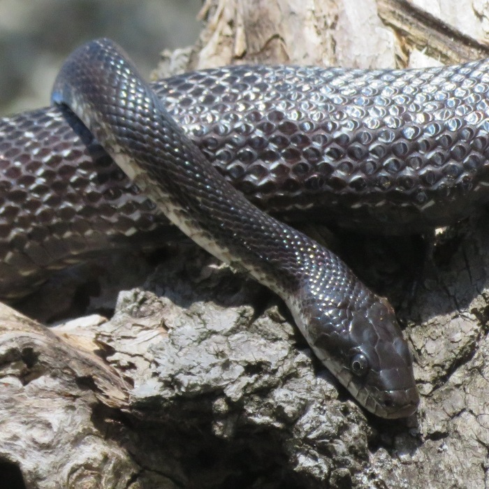
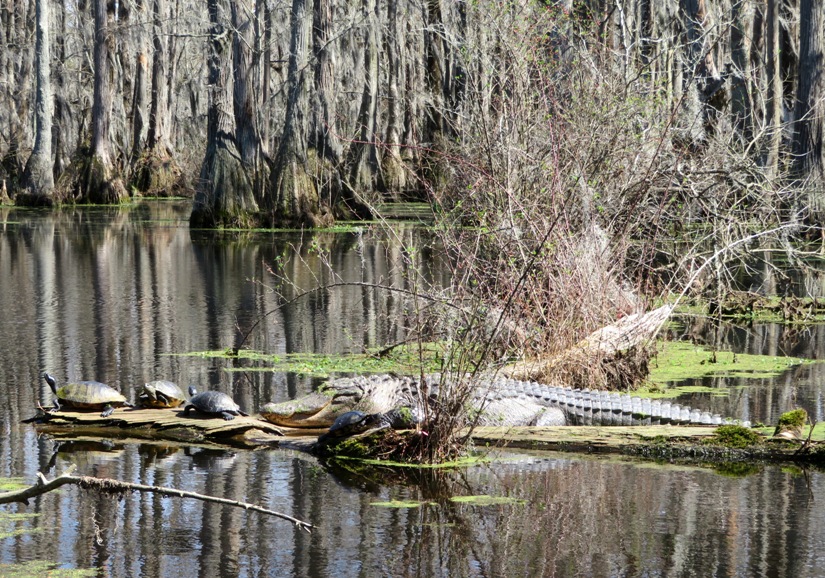
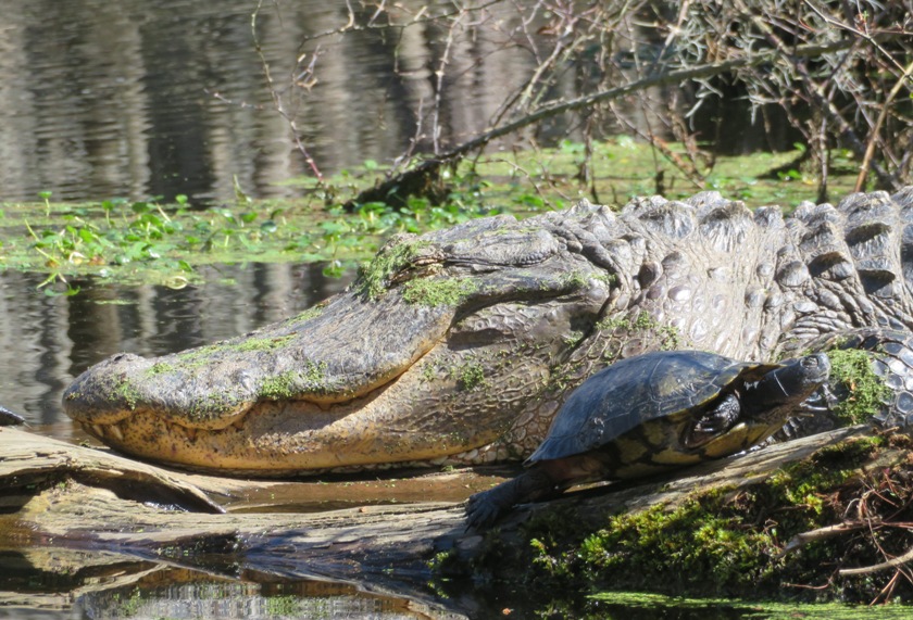
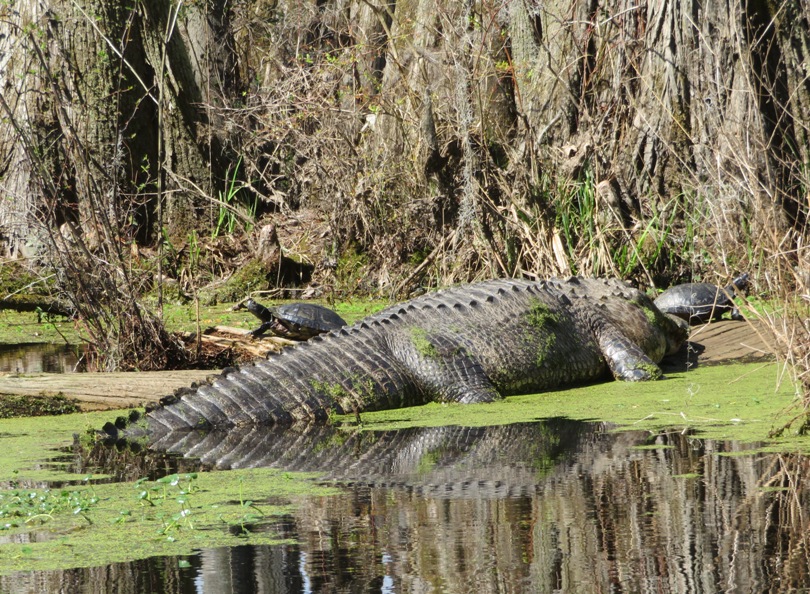
I saw a couple beaver lodges. The sun played peek-a-boo with us. It was a little cold when the sun was out of sight. Norma spotted our only snake for the day, a black snake perched up in a tree. We saw one alligator. I'm guessing it was about 12 feet long which means it is likely a male. What I found interesting were all the turtles that felt comfortable around it. Normally, turtles in this pond will jump into the water once they see people approach. But these did not. I think they felt safe with their "big brother" taking care of them. I never saw the gator move but Norma saw it blink. What is interesting is that alligators eat turtles. Maybe the turtles saw the gator eat recently. How far north do alligators live? I think Mercants Millpond might be about as far north as you'll find them but according to Slate - Alligators in Your Backyard some say that climate change may push them further north. After paddling 5.5 miles, we put our boat up on a cleaning stand by the ramp and hosed it off. I'd never seen a kayak rinse-down station before but thought it was pretty cool. There were quite a few other paddlers that made use of it too. I spoke to a scout master about the area. He said that Merchants Millpond is a terrible place in the summer with all the bugs. |
|
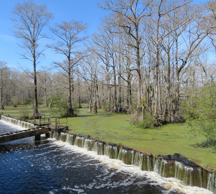
Norma, Daphne, and I went for a short hike on the two mile long Bennetts Creek Trail. Near the trailhead, we saw the dam that separates Bennetts Creek from Merchants Millpond.
Having seen the gator, we were hesitant to let Daphne run off leash. Not sure what this is but we saw it on Bennetts Creek Trail. Some kind of fungus I assume. 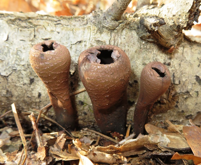
This was the final day of our North Carolina vacation. From here, it was a four hour drive back home. |
|
During our week in North Carolina, the Novel Coronavirus (covid-19) outbreak was becoming big news. Every day, we heard of new outbreaks in the U.S. Some schools had closed but social distancing wasn't yet the norm. However, less than a week after our return, government shutdowns were taking place in our area. |