|
This page is about a road trip that Norma, Daphne, and I took to central Pennsylvania and western Maryland in 2018. |

|
This page is about a road trip that Norma, Daphne, and I took to central Pennsylvania and western Maryland in 2018. |
|
Norma and I kicked around various ideas of where to go during the late summer. We also included Carmen in the discussions but she ended up deciding not to join us. We considered Cape Cod, West Virginia, and Pennsylvania. We ruled out the former because we figured it would be touristy and therefore not as dog-friendly as the others. Norma had really hyped-up West Virginia and Pennsylvania because she spent a lot of time in or near there when she was visiting her mother, Hazel, earlier in the summer. I was very much wanting this trip to be focused on Daphne. I wanted her to be able to run off leash as much as possible. So Norma and I decided on West Virginia and Pennsylvania. But as it turned out, we just visited Pennsylvania. That was fine by me. It seems that when we go to multiple states in one vacation, I have a hard time remembering what we saw in which state.
 |
|
In the weeks prior to this trip, I let Norma do the trip planning. I didn't contribute much when it came to that.
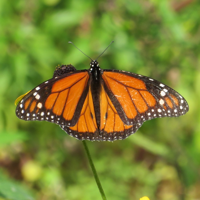
We had been getting a ridiculous amount of rain in July and August. My solar panels were showing that the period between mid-July and mid-August were the darkest we've had since I've had panels (since 2010). But the next few days were supposed to be drier. Norma was running late (as usual), so I took photos in our yard while I waited. I found a male monarch butterfly and another giving me a nice profile view. Sometimes the best things in life are just outside your own front door. |
|
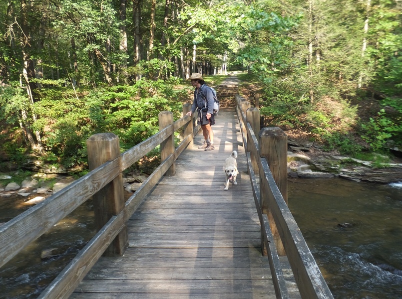
Eventually, we departed on our week long Pennsylvania road trip. Our first stop was Shady Grove to attend a reunion for Hazel's side of the family. Then we drove to WaterSide Campground and RV Park (Locust Campground) where we pitched our tent. The campground runs along the Juniata River and a remnant of the Pennsylvania Main Line Canal (1831) and towpath. This was once a valuable transportation link between Pittsburgh and Philadelphia.
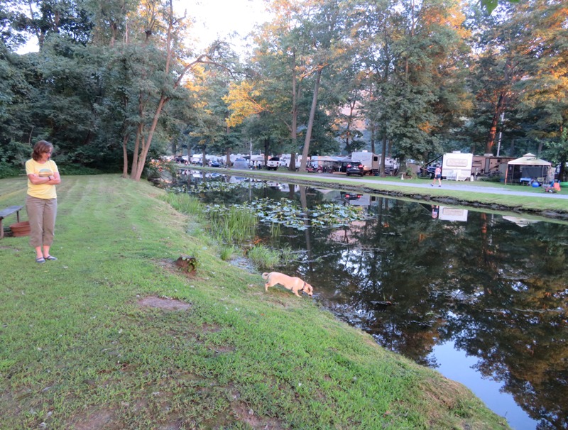
We were the only tent campers at the campground. This worked out great for Daphne because we set up in a location not near the road which was bordered by the woods and the water so she could run free. A resident muscovy duck stayed near the canal. Our tent overlooked this waterway. Unfortunately, the stagnant water meant there were lots of mosquitoes. 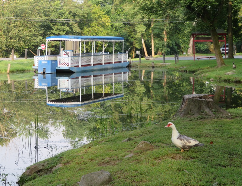
|
|
Norma packed food so we generally only went out to eat for dinner. That gave us more time to devote to outdoor activities. Sitting in a restaurant is overrated.
Today, we planned to kayak on the Juniata River. We didn't prepare much for this so we spent a good part of the morning scouting things out and setting up a bike shuttle. We locked the boat up at a place just east of Victory Park in Lewistown. Then we drove to Central Juniata Park in Mifflin. From here, we biked back to Lewistown. The biking scenery wasn't terrible and neither was the traffic. But the 14.5 miles of hilly terrain kicked my butt. Normally, it wouldn't have been so bad but I was pulling a 33 pound dog trailer and a 21 pound dog (Daphne). Next time I need to remember to bring my shoes with the pedal clips. |
|
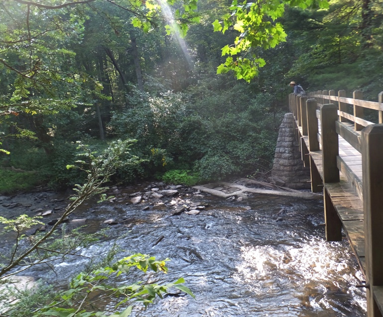
Upon reaching Lewistown, we unlocked the boat, locked up the bikes, and then did 12.5 miles of easy downstream paddling. Edward Gertler says that the river
...slowly and deliberately advances through a mountainous maze. My Pennsylvania DeLorme map indicates the route we did is the start of a 30-mile scenic canoe trip where Clear, quiet river leads down through high ridges. Looking upstream from the launch area, we saw a couple of old bridges. 
The scenery wasn't bad but it wasn't all that spectacular either. It would have been much nicer had the day not been hazy so that we could more clearly see this "maze," as Gertler calls it. 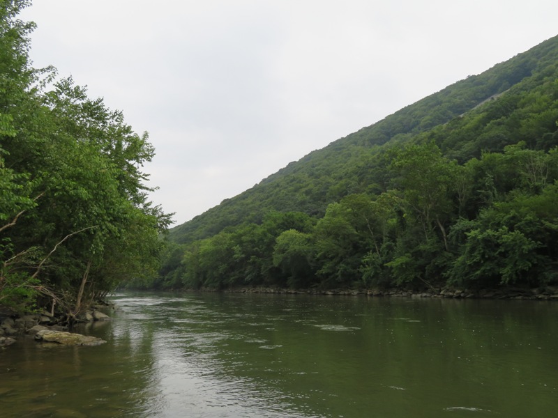
Daphne and I briefly pulled ashore at a rocky outcrop. 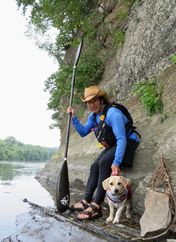
In Mifflin, we took out, loaded the boat, and then drove back to Lewistown to retrieve the bikes. There, we saw a couple of young men looking at bats on a tree. 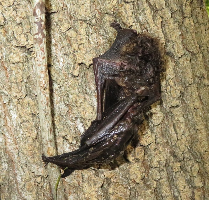
If we were to paddle on the Juniata again, I might prefer to paddle upstream and then back down rather than have to do a bike shuttle and face those hills again with the dog trailer. |
|
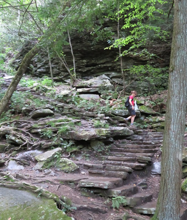
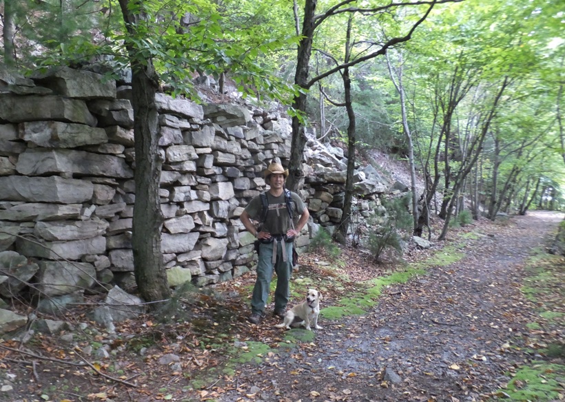
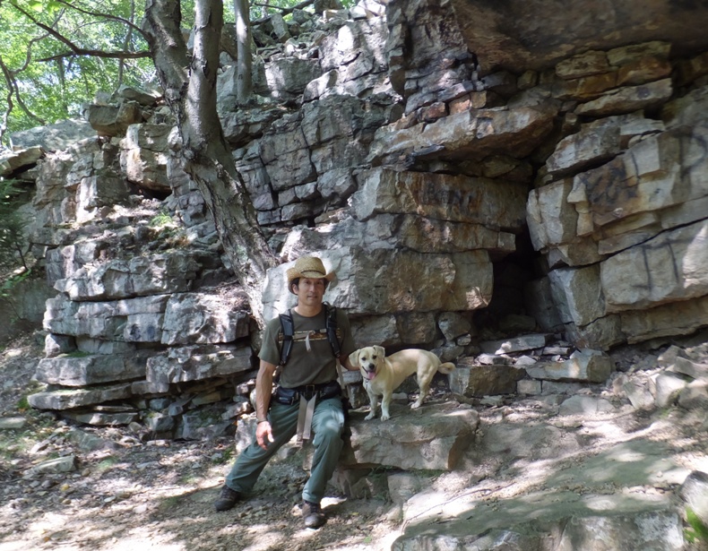
The three of us spent the day at Trough Creek State Park.
The 541-acre Trough Creek State Park is a scenic gorge formed as Great Trough Creek cuts through Terrace Mountain before emptying into Raystown Lake. While most Maryland kids were still on summer vacation, the children in this part of Pennsylvania were in school so we had most of the park to ourselves. This was most awesome! We did a 6.7 mile circuit hike, starting on the Ledges Trail. This took us uphill and then to the ruins of an old home. 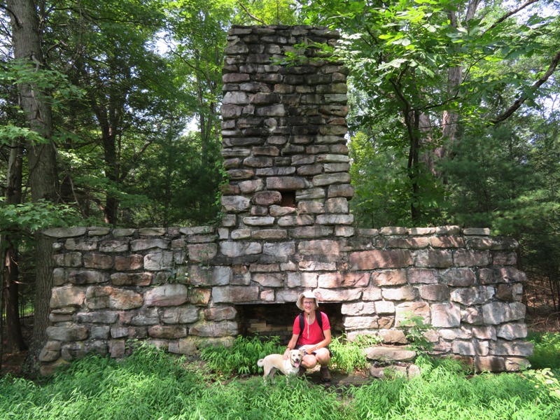
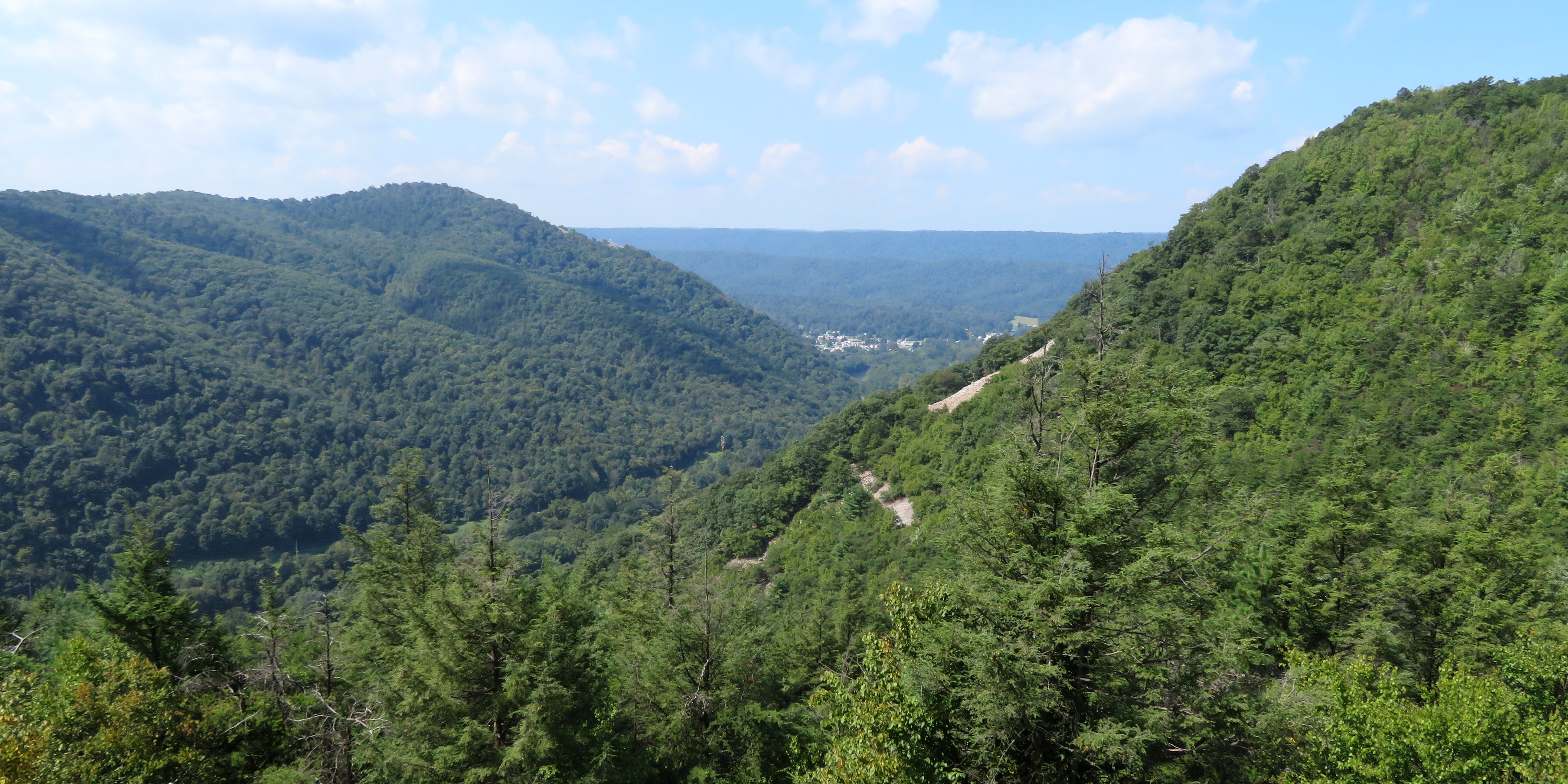
Eventually we came to a beautiful overlook. 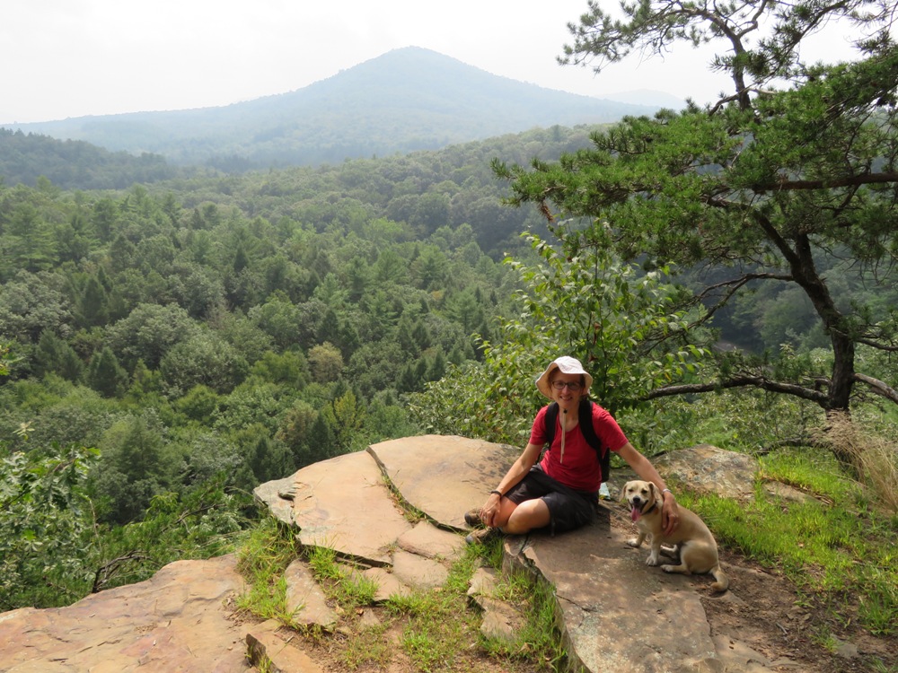
Next we walked on shaded paths amongst the pines. 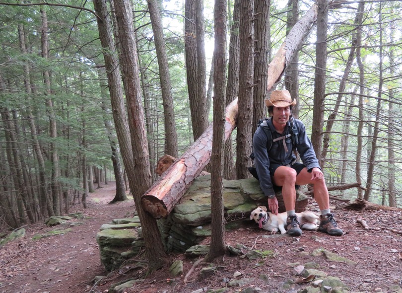
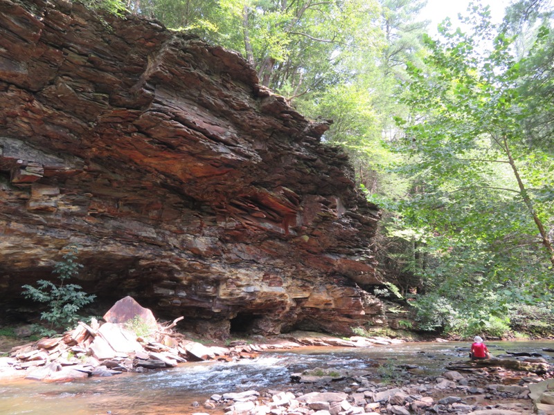
Continuing on, we walked on the Copperas Rock Trail which took us to Great Trough Creek and Copperas Rocks. Copperas Rocks is named for the ferrous sulfate, "copperas," that leaches from a small seam of coal sandwiched between the layers of sandstone. Local settlers collected the ferrous sulfate to set color in dyed cloth. - from information sign We saw one of several Banded Tussock Moth Caterpillars. 
The three of us walked up Laurel Run Trail which passes along Laurel Run. We saw several mushrooms: 1 / 5


Like little buttons.
2 / 5
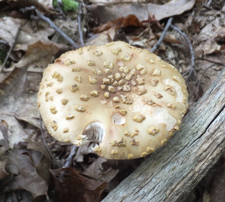
Granola on a cookie.
3 / 5

Spongey.
4 / 5
Old war helmet.
5 / 5

Better days passed.
Norma did most of the navigating, studying her book and map to make sure we were on the right track. 
Daphne had no problem on this hike. In fact, her high level of energy and enthusiasm made Norma and me look like slugs. 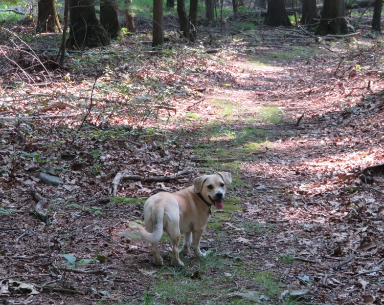
|
|
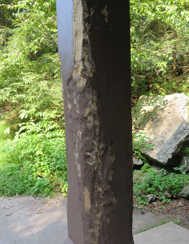
Near Great Trough Creek, we came to an Ice Mine where one of the wooden posts had been gnawed by a porcupine (according to the sign).
More rock cave than mine, frigid air is trapped by the cave and surrounding rocks along the slope of the mountain. Ice forms during the winter months and lasts through mid-May. - from information sign We went down just a few feet into the Ice Mine and believe you me, it was quite frigid. 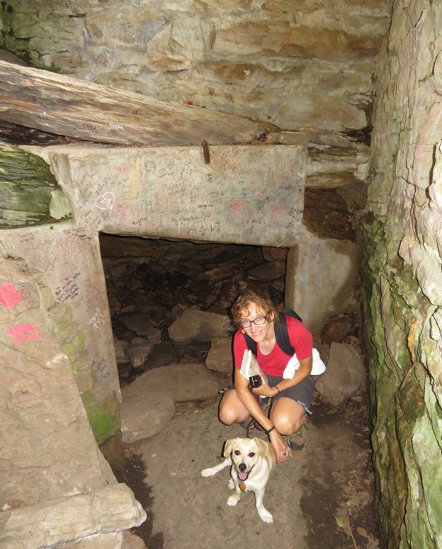
|
|
Crossing over Great Trough Creek via a foot bridge, we came to the Savage Forge Site.
According to "A Pennsylvania Recreational Guide for Trough Creek State Park" by the Pennsylvania Department of Conservation and Natural Resources, Nicholas Crum traveled to this area from Baltimore in 1785. He harnessed the power of the creek with a turbine grist mill to grind grain. Iron ore was eventually found. That, along with limestone, trees, and water power enabled Rueben Trexler to build Trough Creek Furnace which produced pig iron. John Savage, of Philadelphia, leased the furnace in 1832, renaming it Mary Ann Furnace, and built Savage Forge to process the pig iron into bar iron. In 1835, for the first time in the United States, good iron was produced using coke as fuel at Mary Ann Furnace. The process lasted for one month, then ceased, likely due to the lack of coke or the high cost. Mary Ann Furnace continued smelting iron with charcoal until the 1850s or 1850s. John Savage of Philadelphia is also the namesake of our town, Savage, Maryland. We looked for the remains of Savage Forge and Mary Ann Furnace. Perhaps the below photos were part of it? This was all we could find. From the footbridge over the creek, we spotted a snapping turtle in the water. 
We walked on Old Forge Road and then down some trails that took us to Balanced Rock. 
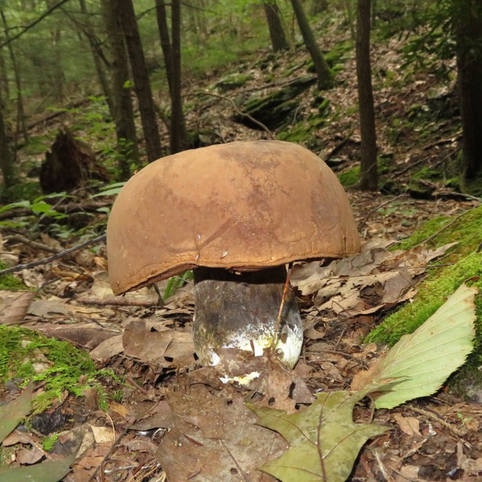
Nearby, we saw more interesting mushrooms. 
|
|
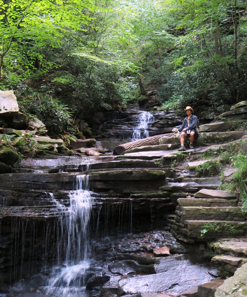
A little further downhill, we came to a very rocky area that led to Rainbow Falls. It was looking a little dry but still very scenic.
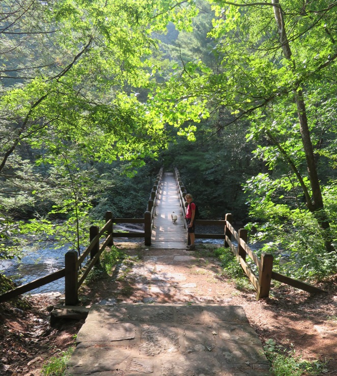
We crossed the Suspension Bridge over the creek. 
Finally, we walked back to the car on Trough Creek Drive, completing our 6.7 mile hike. On my backpack, I found a Silver Spotted Skipper Caterpillar. 
That night, we stayed at the park campground. It was peaceful but unfortunately there was no shower. It has been quite humid and sticky. I didn't mind going without a shower for one night but not two in a row. We spoke to the park ranger about other state parks in the area. Their parks are nice but many don't have the amenities that Maryland state parks have. At least the mosquitoes weren't as bad as the last place. |
|
We decided to do another kayak trip with a bike shuttle. The Juniata River is pretty big and we were thinking something smaller would be better. The problem is that at this time of year, many of the smaller creeks are too low unless it has rained significantly in the last 48 hours. It had not. But we had my tandem Ocean Kayak Cabo which is 76 pounds and nearly indestructible so if the water was low and we hit a few rocks, it would not be a problem. We figured we'd chance it with the low water level and do a bike route where I wouldn't get my ass kicked like the bike ride two days ago.
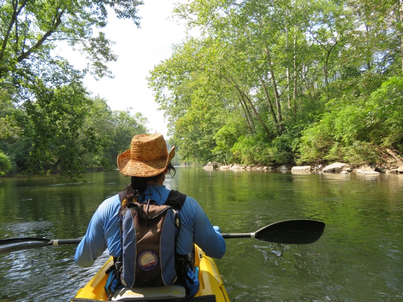
We chose a section of the Frankstown Branch of the Juniata River which runs along Lower Trail, a rail trail. In this case, "lower" rhymes with "flower" which is what we saw on the trail. 
The Lower Trail is a 16.5 mile recreational trail that is open to the public. It follows the abandoned Petersburg Branch of the old Pennsylvania Railroad. - from information pamphlet Unlike our last kayak trip, we did the paddling first and the biking second. We locked up the bikes at the Alfarata Trailhead and then drove to the Mount Etna Trailhead where we launched. The trail isn't often set up with kayaking in mind so we had to carry the boat rather far. A kayak cart would have been handy. Before launching, we ate lunch and found a walking stick and a Catawba Worm. The latter, shown below, will grow up to be a type of Sphinx Moth. 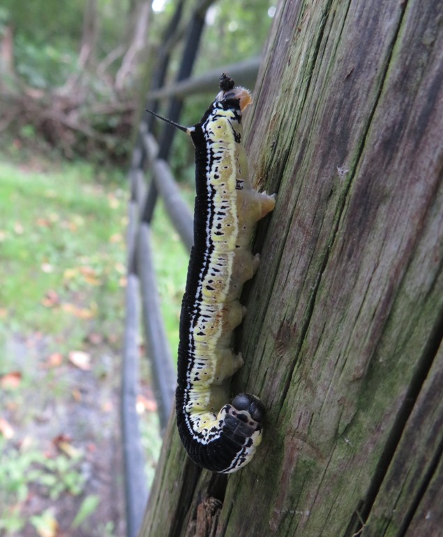
|
|
The water was cool and clean. I ended up going for a swim more times than I could remember. Even Norma went in.
Daphne got her first taste of some class one riffles which she was a little apprehensive about. This trip was much more scenic than the section of the Juniata River we paddled. We did hit quite a few rocks but it wasn't bad. Gertler recommends that the USGS gauge at Williamsburg read at least 300 cubic feet per second (3.4 feet) but we were closer to 200. We've paddled in much worst conditions. As long as you have a rugged boat and are paddling downstream, you should be fine. 
We spotted a mink, or perhaps I should say it spotted us. 
We also saw a Red-breasted Merganser and some eagles. The three of us enjoyed the pristine and natural views. 1 / 6

Clear skies.
2 / 6

Tree shade.
3 / 6
Clean water.
4 / 6
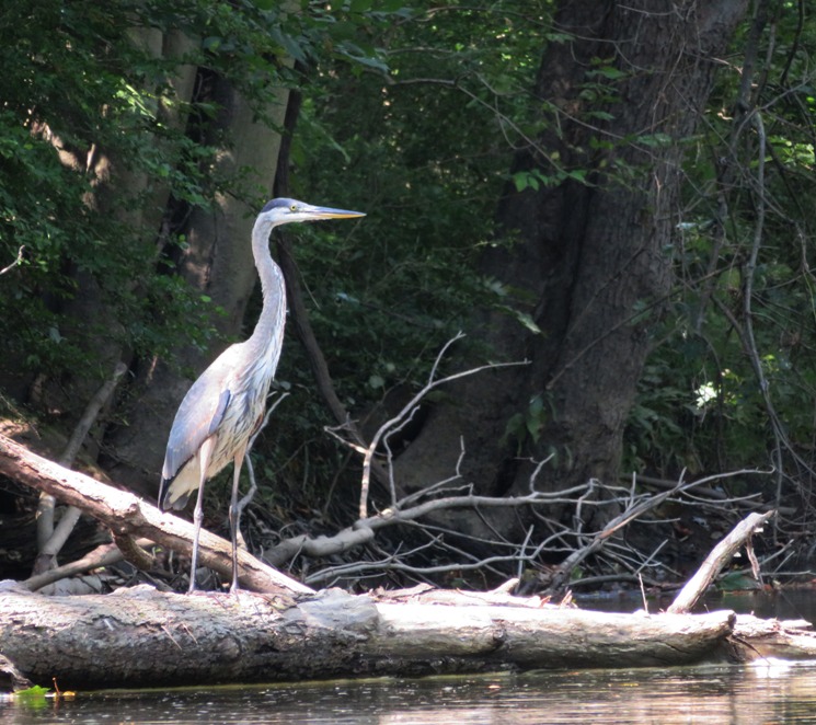
Great blue heron.
5 / 6
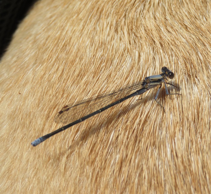
Damselfly on Daphne.
6 / 6

Near falling tree.
While the river ran along the trail, we couldn't tell and didn't see any bicyclists. Near the take out, I saw the biggest snapping turtle I'd ever seen. The shell was about 22 inches long! 
The first portion of our trip ended with us paddling 6.4 miles. |
|
We unlocked the bikes, locked up the boat, and then rode back. The packed, crushed, level gravel made for an easy 5.1 mile ride.

That night, we ate fast food. At Subway, I had their new Cuban Pulled Pork sandwich which I very much enjoyed. The next two nights, we stayed at the Lake Raystown Family Camping Resort. They had clean showers and the mosquitoes were not too bad there. The staff was friendly and helpful. At times, it seemed we were the only ones there. It was definitely the off season. |
|
We awoke to a deflated air mattress. We found the hole and then went to WalMart where we bought a $5 repair kit. We glued on a patch and let it dry in the car.
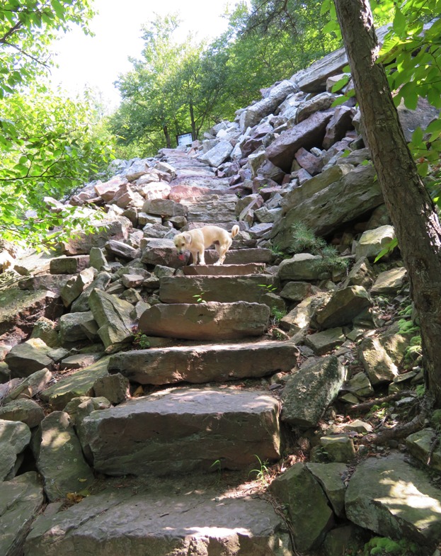
Norma, Daphne, and I set out to do the Thousand Steps circuit hike described in her "50 Hikes in Central Pennsylvania" book. The first part was the actual thousand plus steps to the Ledge Quarry, climbing 800 feet. The Thousand Steps is a giant stone staircase leading up to the quarries on Jack Narrows. The steps [slightly more than 1,000] were built in 1936 by workers who were idled by the flood that swept away the bridge to the factory in Mount Union. To keep them from leaving before the bridge could be replaced, the men were enlisted to build the steps. Workers later used the Thousand Steps to get to their jobs at the top of the quarry. - from "50 Hikes in Central Pennsylvania" Climbing the thousand steps was not easy. 1 / 5

Starting out fresh.
2 / 5
Daphne leading the way.
3 / 5
Daphne and I.
4 / 5

Taking a break.
5 / 5
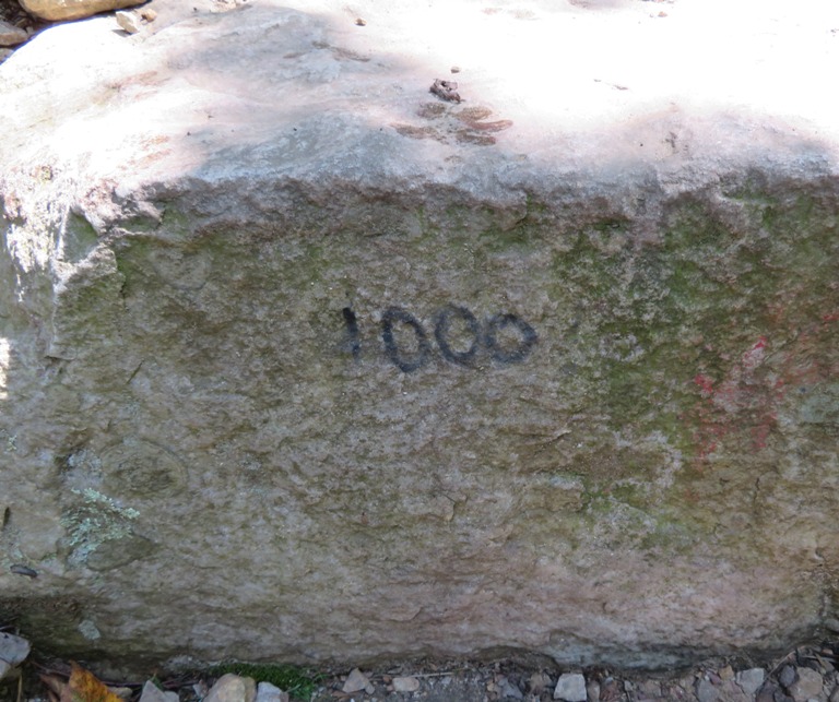
Step 1000!
This area is known for having fossils. I'm guessing this is one of them. 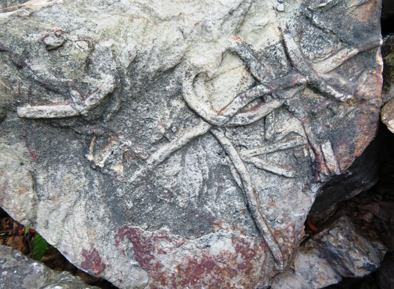
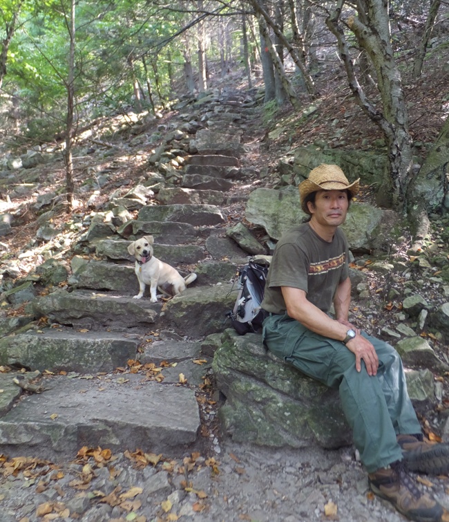
What else can I say about the geology of the area? The mountain hosts "abundant reserves of ganister, a Tuscarora sandstone used in the production of silica bricks, [which] led to the construction of three refractories and Mount Union's position as the 'Silica Brick Capital of the World.'" Ganister is an attractive stone, sometimes laced with pinks and tans. - from "The First Muse - 1,000 of 'em" (a broken link as of 2024) After climbing the thousand steps, we stopped at an overlook on a side trail that lead to a quarry. A couple other hikers took the pic below. For the next several hours, we saw nobody else. 
|
|
The trail leveled off for awhile. We saw lots of rectangular stones.
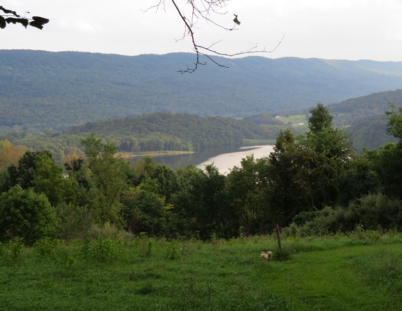
We stopped briefly at the Dinkey House which was once used as a train shed. In the distance, we saw the Juniata River below. 
Most of the trail was shaded and not very open but there was a nice view at Mill Creek Quarry. 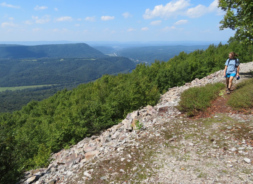
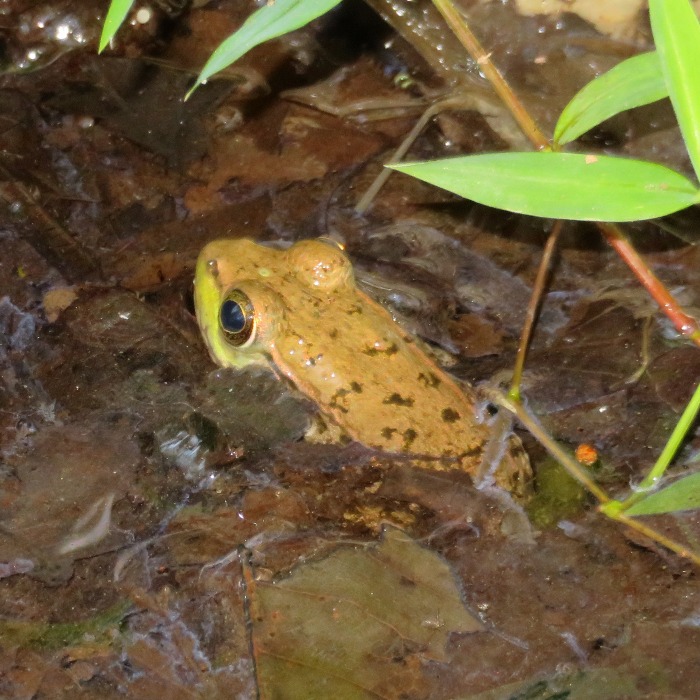
We made it to Shorb's Summit, elevation 2,265 feet, and continued past that. This was a circuit hike that was supposed to connect with the Link Trail but we never found it or the landmarks. Even though Norma's book was from 2001, the landmarks were not trivial and we expected they would be easy to find. So instead of completing the circuit, we turned this into an out and back hike. We didn't encounter much wildlife though we did see another tussock moth caterpillar and a frog. The hike ended up being 10.3 miles long with a 1,700 foot vertical rise. It was by far the most challenging hike Daphne has ever done. There were two things I learned on this hike: For dinner, we had fast food again, I ate another Cuban Pulled Pork Sandwich at Subway. It was still great. That night, we inflated our air mattress. No more leak! But the 12v outlet in my dashboard blew a fuse so I was no longer able to use it when plugging in the mattress pump. This has happened before. Instead, I used the 12v outlet in my center console. |
|
Norma, Daphne, and I decided to bike on the remainder of the Lower Trail. Actually, Daphne didn't have a decision in this...it was a proxy vote. Recall that we biked on 5.1 miles of it two days prior.
Today, we started from the Flowing Spring Trailhead, near the westernmost terminus. We rode east, paralleling the Frankstown Branch. 
Along the way, we stopped to look at a bat box. I used my camera flash to see what was inside but it was just wasp nests. I think I've only seen bats in a bat box once in my life. Daphne still doesn't much care for being in the bike carrier. Once in awhile, she will stick her head out the top. But we keep her tethered to the carrier so she can't jump out. 
We stopped at the Mount Etna trailhead. Here we found two snakeskins that someone hung up at the pavilion. One was about five feet long and the other six feet. I'm guessing they were from a black snake. We ate a snack, took a nap, and then rode back. Along the way, some chickens crossed our path. It was a pretty easy ride, though we were feeling the effects of yesterday's hike. We completed 22.2 miles. |
|
We stopped at Canoe Creek Church to see the 20,000 little brown bats that live in the attic.

I assume a few also live in the bat box outside the building too. 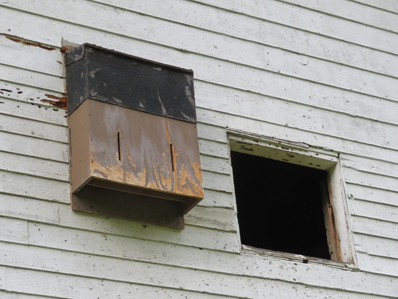
A sign told us that this now retired church is [or was] one of the largest nursery colonies in the eastern United States. Unfortunately, a sign informed us that White Nose Syndrome has wiped out over 90% of the bats at this location. Previously, one could view the bats at dusk throughout most of the summer but now they are mainly seen at the end of June or the beginning of July. We waited for a half hour near dusk but did not see any. |
|
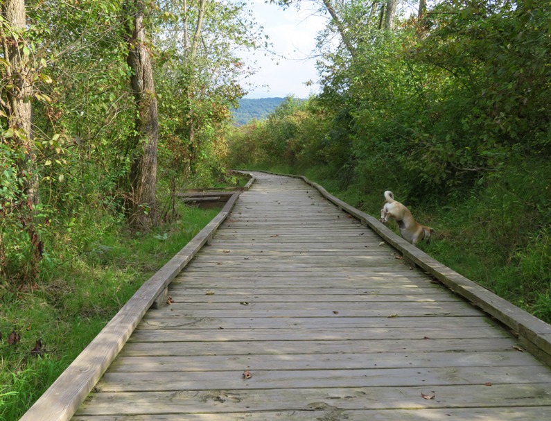
The three of us did a hike at Canoe Creek State Park. We walked on the boardwalk on the north side of Canoe Lake. Park rangers didn't want us venturing off the boardwalk but Daphne didn't heed their warnings.
Then we walked to the historic Blair Limestone Kilns where limestone was processed during the early 1900s. This limestone was used to make steel. 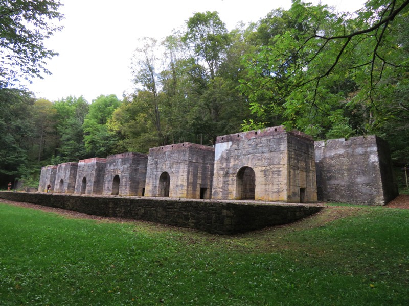
Another hiker told us about caves further north. We looked for them but didn't find them. But we did get a nice view of the lake and saw various caterpillars. We ended up walking 3.9 miles. That night, we slept in a pet-friendly Motel 6. That was our first night of not tent camping. As luck turned out, it rained that night. We did take out at a nearby restaurant called Eat 'n Park. It is a chain that we'd never heard of. Not bad. |
|
Today was our final day in the Keystone State. We were in no rush to leave so we meandered through some small towns before making our way across the Mason-Dixon Line back to the Old Line State (Maryland).
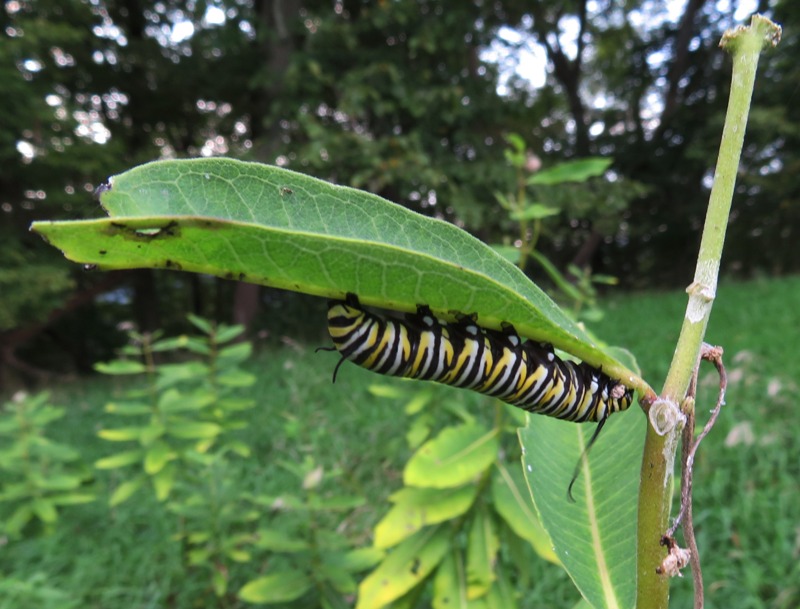
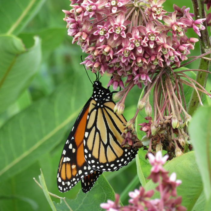
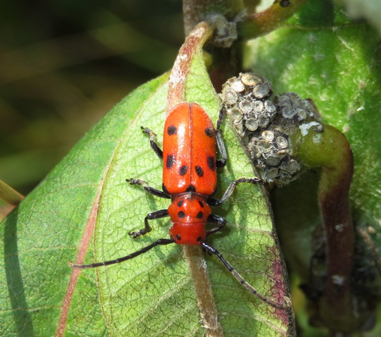
In Maryland, the three of us did a short 1.3 mile walk in Cunningham Swamp Wildlife Management Area in Garrett County. This 258 acre tract encompasses the majority of Cunningham Swamp, a rich wetland with exceptional habitat for wetland and bog related species. We saw several monarchs (both caterpillars and butterflies) and a few Red Milkweed Beetles. That afternoon, we arrived at Hazel's house. Norma worked with her to prepare for Hazel's birthday celebration while I cleaned out the car. |
|
Norma continued preparing for her mother's birthday party.
I took Daphne for a walk at Broadford Park. Jimmy and I worked on fixing a child's bike. I figured out that my dashboard 12v outlet uses a 10 amp fuse whereas the one in the center console has a 20 amp fuse. Hence, the latter is better for pumping up the air mattress. I replaced the burnt out fuse with a 15 amp one. |
|
That evening, Norma, Daphne, and I had dinner at Sherry and Phil's house in Oakland. Sherry is a high school friend of Norma's. Joining us was another high school friend, Becky, along with her husband, Scott.

|
|
The day was dedicated to celebrating Hazel's belated 80th birthday at Broadford Park in Oakland, Maryland. Friends and family came together to make this a truly memorable event. We had a lot of good food to include burgers, hot dogs, salmon, fried chicken, and various salads. Norma worked hard to put together a bingo game where various events of Hazel's life were used to fill in spaces on the card. Folks really enjoyed playing it.
Below is Hazel with her daughters: Laah, Joyce, and Norma. 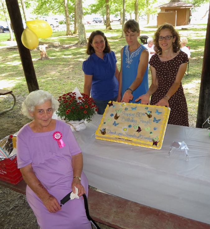
In this pic is Scott (Laah's husband), Norma's cousin's son, me, and Scott's son. 
|
|
Norma and I went to Laah and Scott's farm where we picked fruit. We brought home apples from their tree. Apples on the ground were fed to the pigs. We would have liked to have stayed longer but it started raining really hard so decided it was a good time to leave.
|
|
This trip was one of many firsts.
I think I really pushed my car in terms of carrying capacity. Could we have brought along a fourth person? I think so if we had stayed in motels instead of camping. We ate out once a day and only stayed in a motel one night. Norma estimated the total cost for our seven days of road tripping including gasoline was $450 ($64.29 per day). Not bad. |