|
This page is about a kayak trip that Norma, Daphne, and I did during May 24-27, 2019. |

|
This page is about a kayak trip that Norma, Daphne, and I did during May 24-27, 2019. |
|
The New Jersey Pine Barrens is a place I've known about since at least 2008. I heard about lots of great kayaking in this area from Ralph and Greg W. I saved all their correspondence about the waterways and finally put it to good use on Memorial Day weekend 2019.
Would it live up to its reputation? I would soon find out.  |
|
Norma, Daphne, and I drove out to the garden state to spend time in a vast natural area called the "Pine Barrens."
At first glance, it is no wonder the early settlers called it the "Pine Barrens." Its dry, sandy soil and frequent fires seem inhospitable for most plants and animals. However, the dark green forests of pitch pine, oak, Atlantic white cedar, and the abundant streams and rivers prove that it is anything but barren. - from sign at the Batsto Visitor Center The ecological significance of this area cannot be understated. Because it represents one of the world's major ecosystem types, the Pinelands [aka the Pine Barrens] was designated a Biosphere Reserve by the United Nations Educational, Scientific, and Cultural Organization (UNESCO) in 1983. - from sign at the Batso Visitor Center |
|
The three of us arrived in the late afternoon. Traffic was slow and we should have been on the road much earlier. But we arrived with enough time to visit Batsto Village, whose roots can be traced back to 1766. Then we went for a short hike on the blue-blazed Batsto Lake Trail in Wharton State Forest.
We saw some cool things at Batsto: We saw the Batsto Village post office which opened in 1852. Behind it is the 32-room Batsto Mansion. 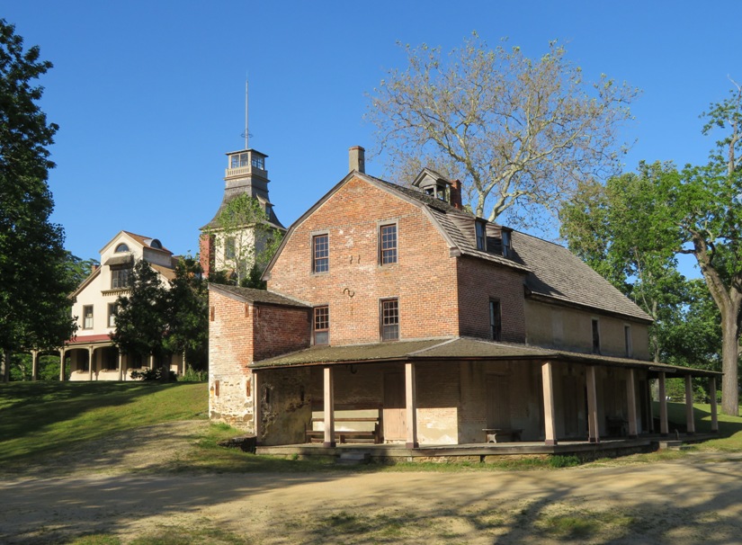
Here's Daphne on the blue-blazed Batsto Lake Trail. Part of this trail merges with the 53.5-mile Batona (BAck TO NAture) Trail. 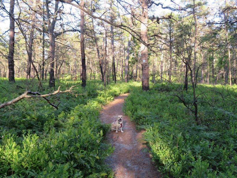
The holiday weekend weather was expected to be very good with lots of sun and maybe just a little rain. Norma and I aren't as rugged as we used to be in that we are less likely to camp and more likely to stay in a cheap motel. Having Daphne has helped solidify this change because she sometimes has a tendency to bark when she hears noises outside the tent. She is our watchdog but we suspect other campers might find her annoying. Hence, we decided to stay at the pet friendly Rodeway Inn at 524 Route 73, Hammonton, New Jersey 08037. |
|
Norma, Daphne, and I did a lot of stuff on this fine day. Our plan was to
We checked out a launch site at Crowley Landing but decided not to put in there. At this location, the Batsto River is wide and not very natural. But we did get a chance to learn a little more about the area. The 1.1 million acre New Jersey Pinelands National Reserve covers nearly 22 percent of the state. It is home to over 1,350 plant and animal species, many unique natural environments, and a rich folklife heritage. In recognition to its special resources, Congress established the Pinelands as the first National Reserve in 1978. - from sign at Crowley Landing Next, we stopped in at the Batsto visitor center where we picked up some very helpful documentation. If you plan to visit the Pine Barrens, I highly suggest you take a look at this. |
|
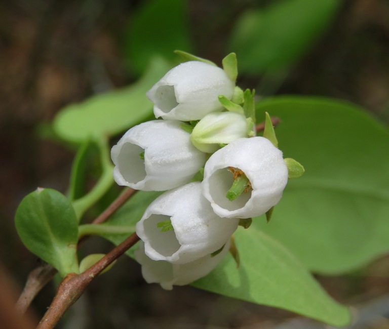
We visited Tom's Pond Trail to see the carnivorous plants.
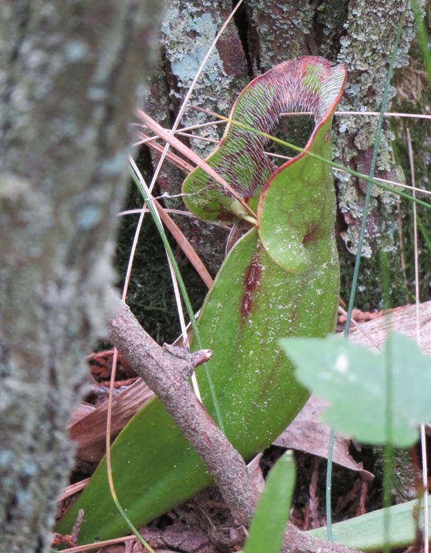
The scent and colors of the pitcher plant lure small insects to the opening in its vase-shaped leaves. The downward-angled hairs and the slippery sides of the leaves prevent escape. The insect slides down into the reservoir of rainwater laced with digestive enzymes, bacteria, and fungi where it eventually is absorbed by the plant. - from sign on Tom's Pond Trail At this trail, The forest at first is pine and oak with lots of huckleberry gradually descending to an Atlantic white cedar swamp along the Mullica River [shown below]. - from Wharton State Forest Hiking Trails brochure 
I spotted an eastern fence lizard on the trail. 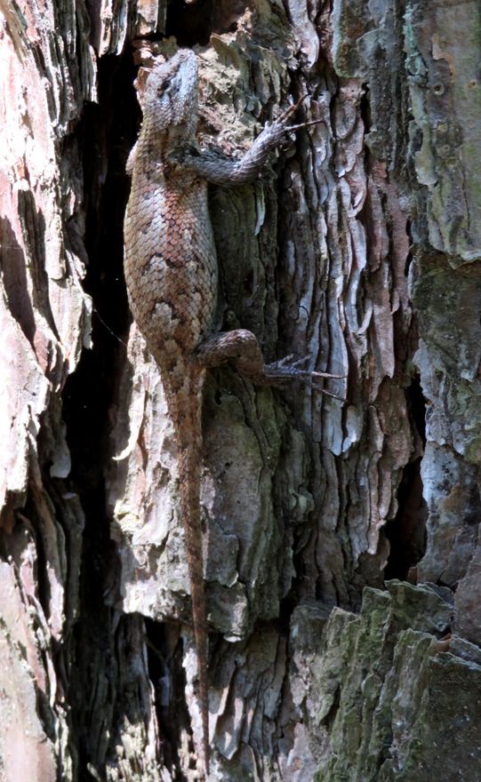
After walking on Tom's Pond Trail, we spent a little more time in Batsto Village where we spotted another eastern fence lizard. This one is resting on a pile of bog ore. 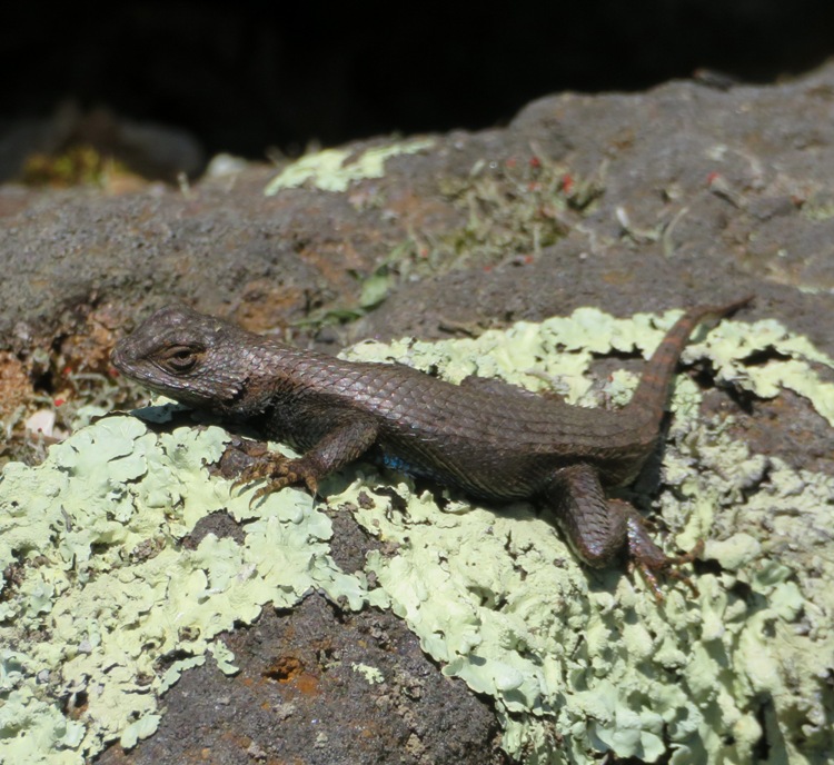
Ore of this type was used in the Batsto Furnace. It can still be found in the coves, swamps, and bogs of the Pine Barrens. - from sign at Batsto Village |
|
Next, we started our kayak trip. The below pic shows our launch site, the Mullica River canoe landing at Pleasant Mills. This is just south of Hammonton Road (route 542).
One critter we spotted shortly after launching was this baby red belly slider. Its shell was only about two inches long. 
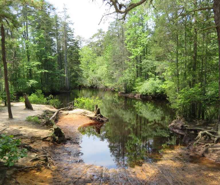
After paddling downstream on the Mullica, we then headed upstream on the Batsto River. Going against the current wasn't difficult. Navigation was the biggest challenge. This area starts to become tidal and I think the flood tide was canceling out the downstream current. So I could not read the river and determine which waterway was a tributary and which was the main part of the river. We took a break at a scenic spot on the Batsto River. 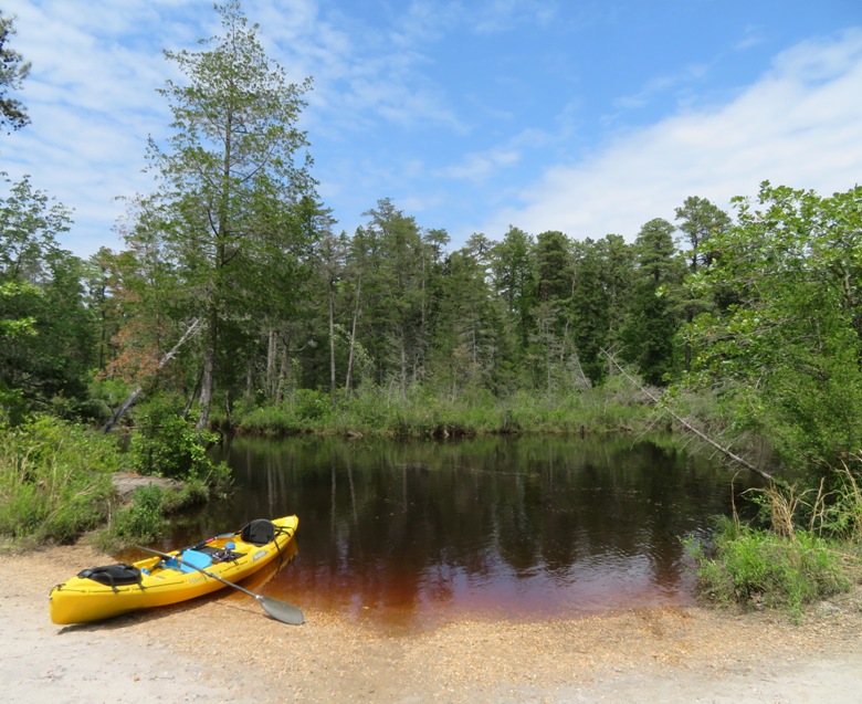
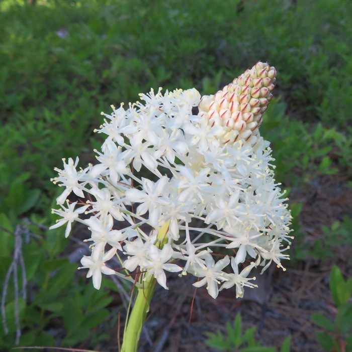
Where does all this water come from? Half of the rainwater falling on the 2,250 square mile Pine Barrens region seeps through the porous sandy soil and into the Kirkwood/Cohansey Aquifer. This 17-trillion gallon aquifer supplies most of Southern New Jersey's potable water. Surface runoff and seepage from this aquifer are also the primary sources for all of Southern New Jersey's rivers. - from sign at artesian well near Annie M. Carter Nature Center At our break area, I spotted leatherleaf flowers while Norma took a siesta. We saw several trees with an unusually dense mass of pine needles. It is a common phenomenon in this area called witch's broom. Witches' [typically spelled "witch's"] brooms are abnormal growths caused by infection, usually with a fungus, virus, or mistletoe. Pitch pine is sometimes parasitized by dwarf mistletoe, but the cause of this broom is uncertain. - from Alamy - Witches' broom in a pitch pine, Lebanon State Forest, New Jersey pine barrens 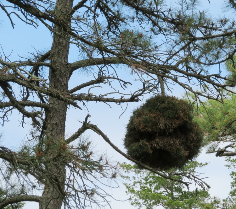
In the below snapshot, Norma and Daphne walk on one of the dirt roads near where we took a break. 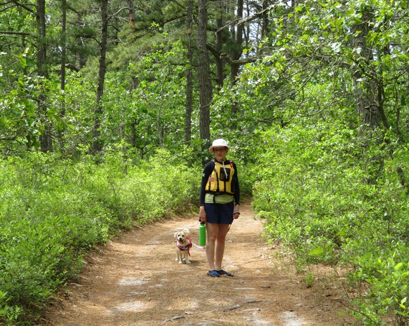
Back on the water, we spotted an interesting flower from a plant called golden club. Golden club is a medium sized immersed plant. It grows from stout rhizomes in the shallow waters of streams, ponds and swamps and is frequently found growing in the northern counties south to the central peninsula. - from "Center for Aquatic and Invasive Plants - Orontium aquaticum" (a broken link as of 2024) 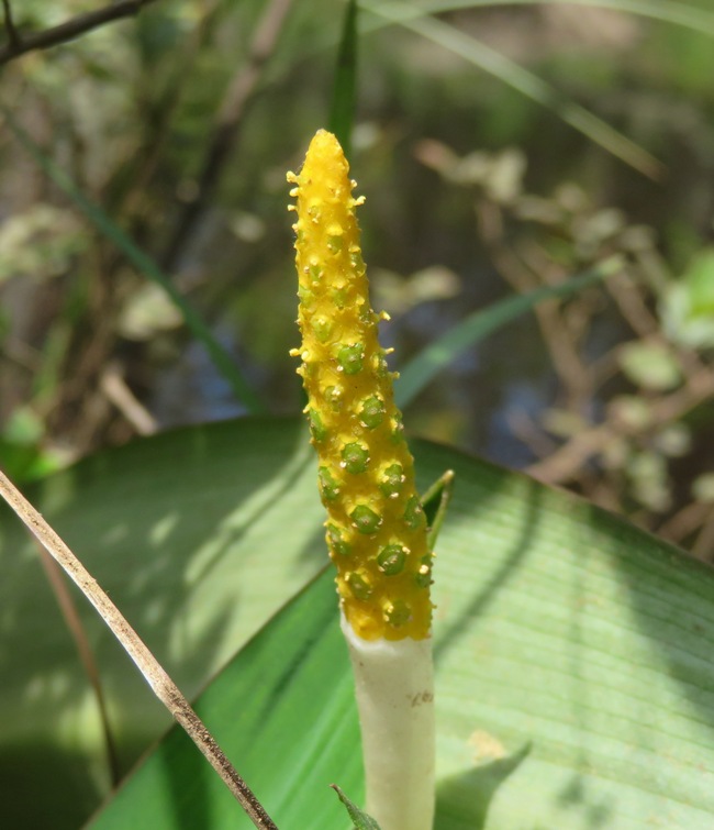
We had stopped at Tom's Pond Trail to see the pitcher plants. But we saw far more while kayaking on the Batsto River. Here's a pitcher plant flower. 
Unlike the pitchers, which are deadly to visiting insects, pitcher plant flowers are perfectly harmless. In fact, the flowers function like regular flowers by providing insects (mostly bees) with nectar and pollen. - from Gardening Know How - Do Pitcher Plants Bloom: Learn About Pitcher Plant Flowers 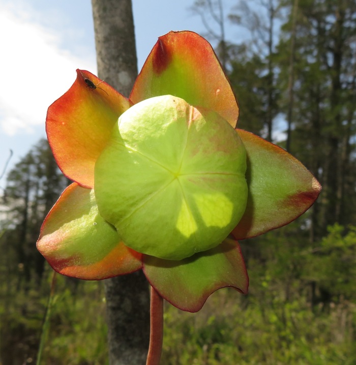
Flowers of pitcher plants may be purple, red, burgundy, white, yellow or pink, which also varies depending on the type. - from "Gardening Know How - Do Pitcher Plants Bloom: Learn About Pitcher Plant Flowers" 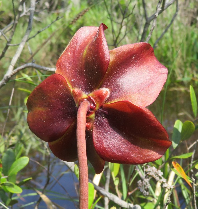
Sometimes, the colorful blooms are sweetly scented, but may, on the other hand, have a less pleasant odor reminiscent of cat urine. - from "Gardening Know How - Do Pitcher Plants Bloom: Learn About Pitcher Plant Flowers" 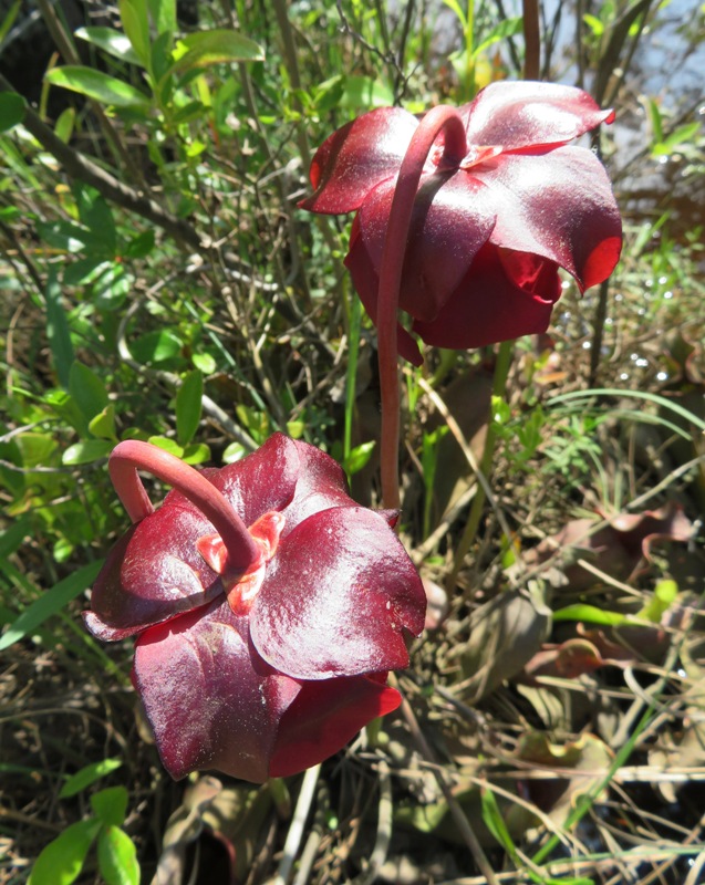
Carnivorous plants the world over evolved in wet, nutrient-poor environments, often where soils are so acidic that conventional plant foods are inaccessible. Places such as the New Jersey Pine Barrens, [are] home to three native species of carnivorous plants. - from Inside Jersey - Predator plants: Meet the carnivores in the garden 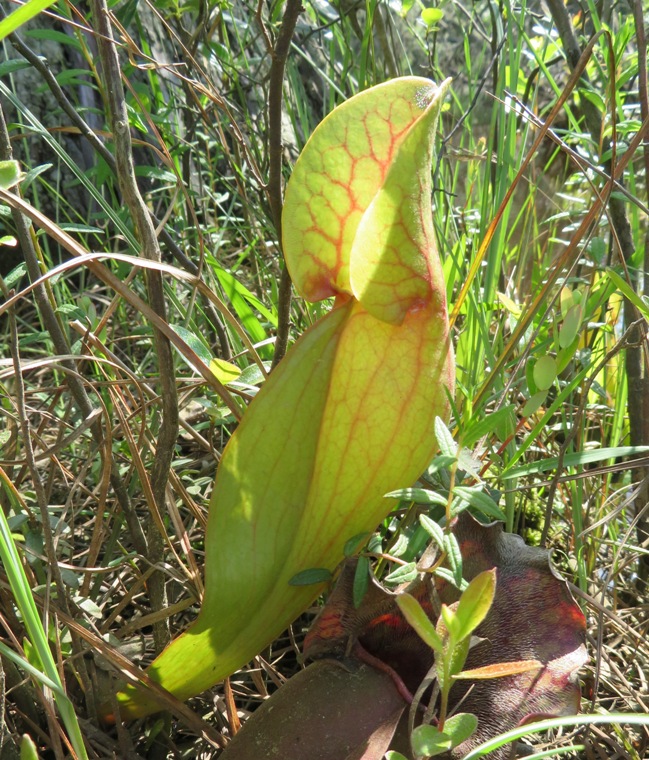
Recent studies show that purple pitcher plants, along with at least 19 other species, lure insects with a florescent glow invisible to humans. The pitcher rim glows blue when placed in ultraviolet light, which appears green to us under normal conditions. When the rim is painted, masking the fluorescence, the plants capture far less prey. Purple pitcher plants can be found from Virginia to Newfoundland and inland to the Great Lakes region and large parts of Canada. In New Jersey, they're common in the bogs and swamps of the Pine Barrens. - from "New Jersey Herald - These New Jersey plants have an appetite for insects" (broken link as of 2024) 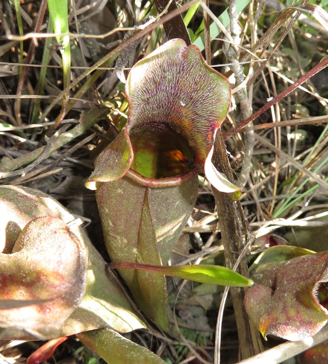
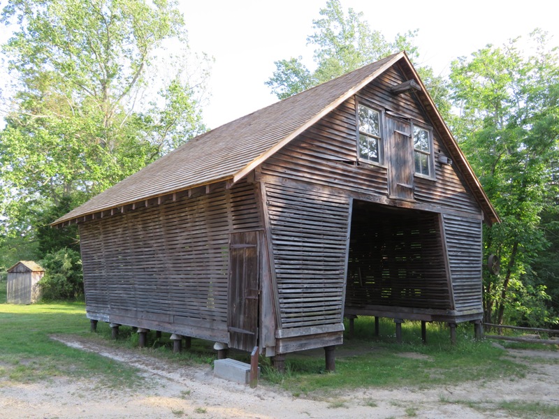
We kayaked to the dam at Batsto Lake. Notice the brown water flowing over the dam shown below. 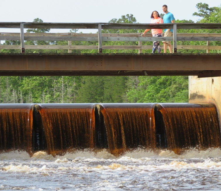
The unique tea-colored (or "cedar") water that flows through the Pinelands is evidence of the area's biodiversity. The water's light-brown hue is a result of the tannic acids present in the Pine Barrens' plant life - especially the Atlantic white cedar - as well as naturally occurring iron in many of the streams. - from New Jersey Monthly - Pinelands Odyssey This is the sawmill in Batsto Village. We paddled into it to get a better look. 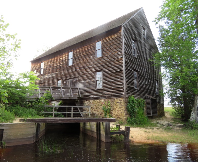
This is our view of the inside of the sawmill via kayak. 
There was a small beach next to the sawmill where we removed our boat. Then we carried it to the road. I walked a short distance to retrieve my car at Pleasant Mills. We loaded the boat and were done. |
|
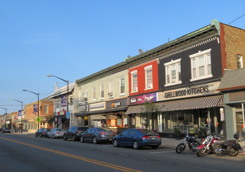
Hammonton is the biggest city near the Batsto area. It is known as the "blueberry capital of the world."
All Hammonton blueberry farmers will give the same answer when asked what makes Hammonton such a prime location to grow blueberries: the soil, the weather and the geographic location. New Jersey's Outer Coastal Plain makes up nearly all of southern New Jersey. Its soils are more fine, sandy and acidic compared to the regions to the north due to its relatively young geographic age. These soil conditions allow the berries to thrive. - from NJ.com - What makes Hammonton the 'blueberry capital of the world?' A look inside during season's peak |
|
Norma, Daphne, and I spent the day kayaking just over 12 miles on the Mullica River from Atsion to Pleasant Mills. The original plan was to put a bicycle at the takeout and then bike back to the car. But it turns out that most of the roads in this area are not paved, full of potholes, and sandy. So the bicycle shuttle would have taken far too long. Fortunately, I was able to get a ride back with Pineland Adventures Outfitters. If you only have one car, I suggest working with an outfitter.
We bought most of our breakfasts and our last dinner at Mr. Bill's. This dog-friendly establishment in Winslow Township makes good old-fashioned all American food the way it should be made. They even have a frozen dessert for your pooch. Best of all, it was just up the road from where we were staying. 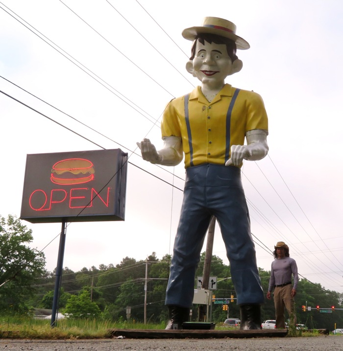
I think Mr. Bill bears a strong resemblance to Alfred E. Neuman. |
|
Near the launch site just downstream from the Atsion dam, the Mullica River is only about 12 feet wide. Here, the current pushed us along at about two miles per hour. So most of the time, all we had to do was maneuver our boat around obstacles. Short, lightweight recreational kayaks would have been great for this rather than my 20 year old, 76 pound, 16.25 foot long tandem Ocean Kayak Cabo.
Today was the hottest day during our stay but the river kept us cool and comfortable. We saw several people launching from the same place as us but it didn't take long before we were spread out. 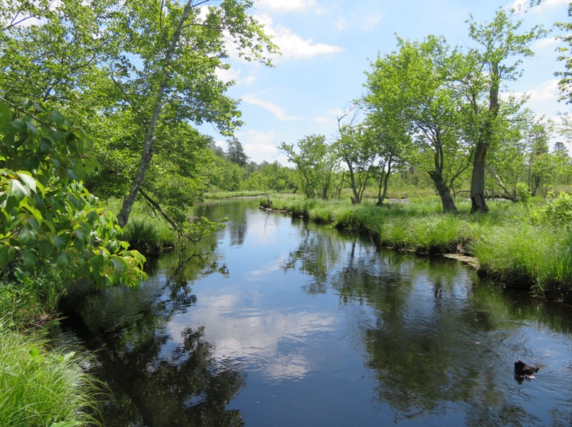
Edward Gertler, the author of "Garden State Canoeing" describes the Mullica River: Variety keeps this "river" especially interesting. There is a maple swamp, then open tree-studded marsh, the latter caused by beaver flooding. There are cedar-lined corridors and cranberry-covered banks. There are high, sandy banks and bluffs topped by the typical Pine Barrens forest of scrubby pine and oak. Finally, a particularly nice feature of this stream is its glades - walls of impenetrable cedar forest. When you behold these scenes, you must repeat to yourself, "I am not in Canada..." How did this fine, scenic waterway get its name? The [Mullica] river is named after Eric Pålsson Mullica, an early Finnish settler born in 1636 who founded a homestead on the river after moving there from the vicinity of Philadelphia. - from Wikipedia - Mullica River 
We saw several fragrant water lilies (Nymphaea dorata). The leaves float and the flower petals get smaller toward the center. The seeds can be roasted and ground into flour or fried like popcorn. The leaves and flowers are edible if gathered before they are fully open. - from "Sagerus - Pine Barrens Wildflowers NJ" (broken link as of 2024) 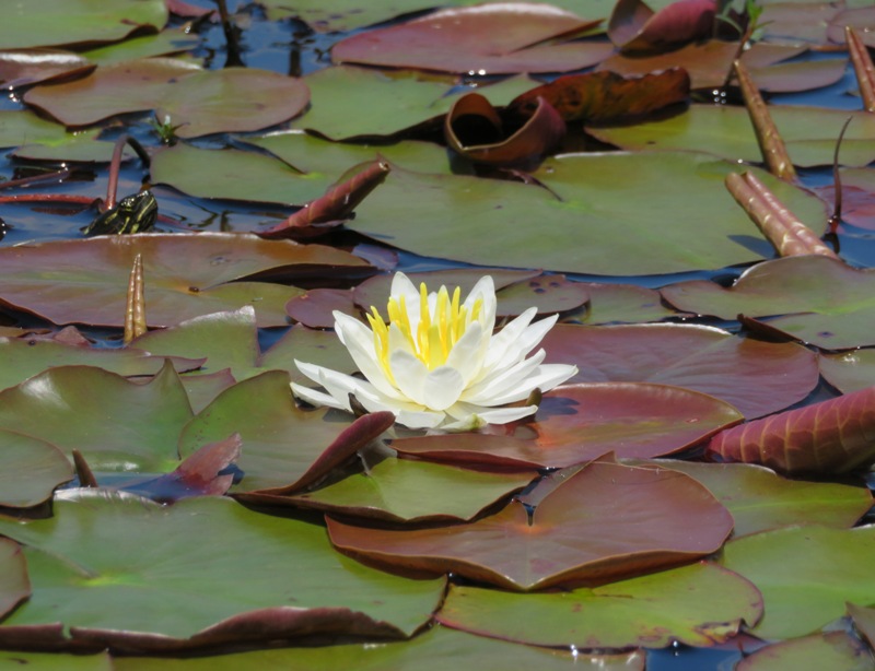
Here's a closeup of this beautiful flower. The rhizomes [of the fragrant water lily] were...used by first nations to treat coughs and colds. The stem could be used to treat tooth aches if placed directly on the tooth. - from Wikipedia - Nymphaea_odorata 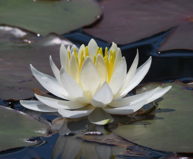
We encountered various wildlife such as this tree swallow who thought it would be good to rest in a wood duck box. 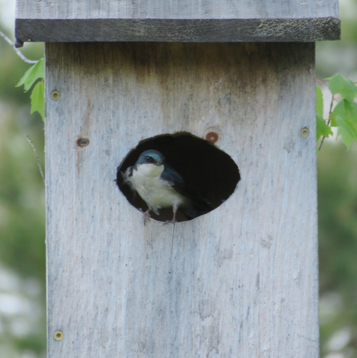
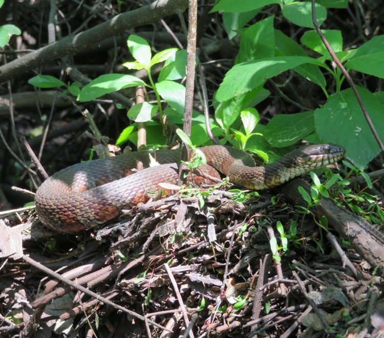
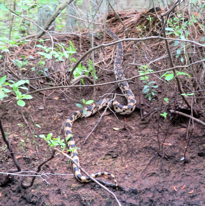
Other wildlife we found included this northern water snake and a northern pine snake. The latter started swimming across the river just as we paddled by. I pulled out my camera as it slithered up the shore on the other side. It was 4-5 feet long and pretty thick. This was the first time I've seen such a snake. A large, but isolated [northern pine snake] population occurs in the Pine Barrens of southern New Jersey. - from "Savannah River Ecology Laboratory - Pine Snake (Pituophis melanoleucus)" (broken link as of 2024) We eventually arrived at our takeout at Pleasant Mills. Notice Daphne on the left below. 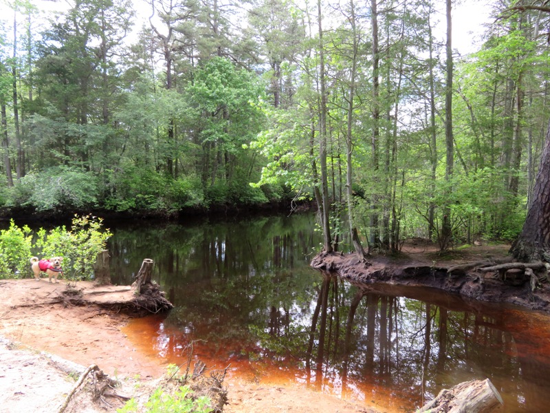
The [Mullica] river provides one of the principal drainages into the Atlantic Ocean of the extensive Pinelands. Its estuary on Great Bay is considered one of the least-disturbed marine wetlands habitats in the northeastern United States. - from Wikipedia - Mullica River This was an exceptional trip in terms of scenery. I highly recommend it for any kayaker with at least moderate skills that visit the area. I would not recommend this trip for beginners. We never had to portage but we did have to carefully navigate around a few downfalls. Fortunately, all had been sawed...though not so thoroughly that navigation was easy. We did run into a couple that I assumed were beginners who were having problems. They were on a canoe that the outfitter rented to them. Either the outfitter didn't tell them what to do or they ignored what they were told. Their canoe flipped and they lost their valuables and their drinking water. We provided them with a full canteen of water and told them how much further the takeout was. Luckily, they were paddling a much shorter route than us. I ensured they made it to the takeout. They were a good example of one of my fundamental rules of kayaking: Keep all valuables tethered and in a waterproof case because you never know when your boat will capsize. |
|
On our final day, Norma, Daphne, and I kayaked 6.8 miles downstream on the Batsto River from Quaker Bridge to Batsto Lake. Then we walked 5.5 miles on dirt roads, the Mullica River Trail, and the Wilderness Camps Connector Trail to get back to the car. Recall that on May 25, we paddled on the Batsto River upstream to Batsto Lake. Now we paddled downstream to it. Rather than spread ourselves thin and kayak on several different creeks, I figured it would be better to focus our efforts on the Mullica and Batsto for this trip.
Pictured below is a caterpillar hunter beetle (Calosoma scrutator) which Daphne found at the Quaker Bridge launch site. Guess what they eat? A few times now, Daphne has alerted us to camera-worthy things. 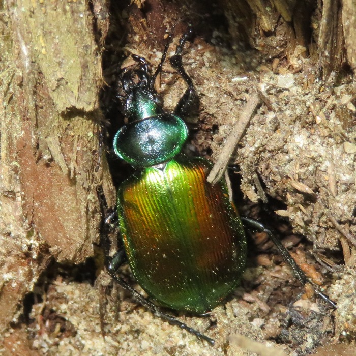
We paddled under Quaker Bridge. We had to drive 4.2 miles on dirt and sand roads to get here. I was glad to have my all wheel drive Subaru Impreza though something with more vertical clearance would have been better. The roads out here are not the best maintained and my car bottomed out when crossing this bridge. Yesterday, we tried to get here from the opposite direction and never made it. Neither did the vehicle in front of us which got stuck in the sand and mud. I offered the guys a ride but they had someone on their way to help them. 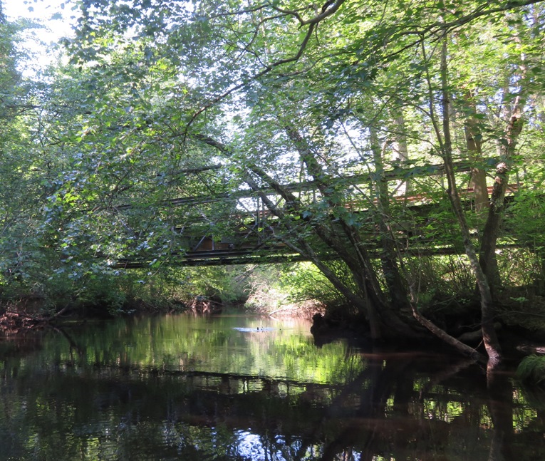
The three of us made our way downstream on the Batsto River. From where we started, it is easier to navigate than the Mullica River at the Atsion launch. Had we started further upstream on the Batsto at Hampton Furnace, I might think differently. I would say that given the same conditions, today's route would be sufficient for someone with little experience...but not an absolute beginner. 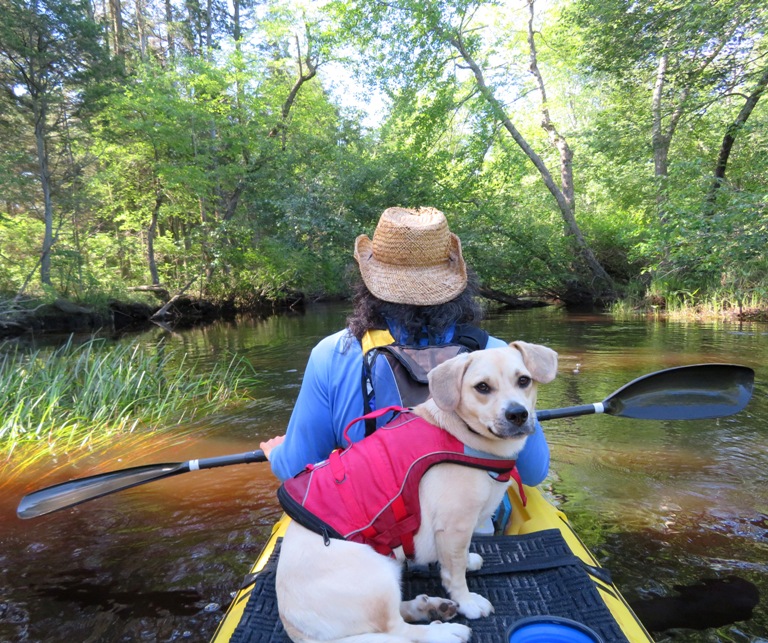
I believe this is a garter snake. Let me know if I am mistaken. I never got to see its pretty face. 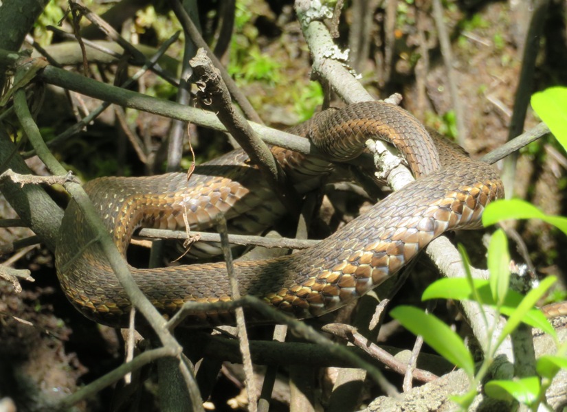
The scenery on the Batsto is lovely. Much of it is shaded but a lot is not so be sure to bring sunscreen. If I had to compare its views with the Mullica River, I'd say it is in the same ballpark. Edward Gertler agrees with me, giving them both an "excellent" rating in terms of scenery. 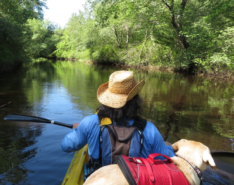
Both the Batsto and the Mullica are heavily used and generate money for the local outfitter. This means they are kept clear, though I don't know who clears it. That doesn't imply downfalls are totally removed. Rather, they are cut enough to allow a kayak to pass by with some simple maneuvering. That helps keep things interesting. We found a nice sandy beach to pull out for a rest stop. 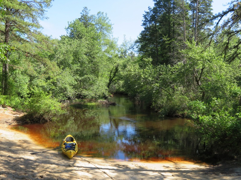
This spotted turtle was gracious enough to pose for us while I snapped its picture. I think this was my first time seeing one of these critters. 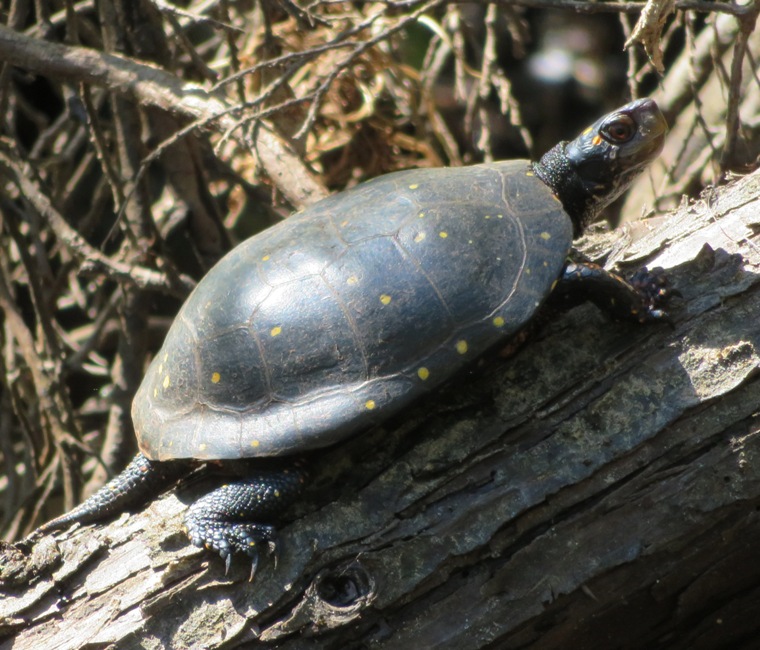
We had lots of very scenic views on the Batsto River. According to Gertler, ...it offers the standard range of Pine Barrens scenery, maple swamps, cedar-bound banks, and high, sandy bluffs topped with pines, oaks, and their blueberry understory. This is a good stream for finding cranberries and, down towards the end, for finding those carnivorous pitcher plants. Like Maryland, there were lots of spatterdock flowers on the Batsto River. Do you see the pollinator on top of this one? 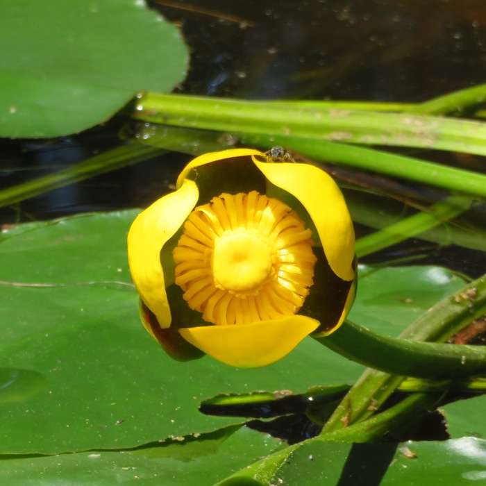
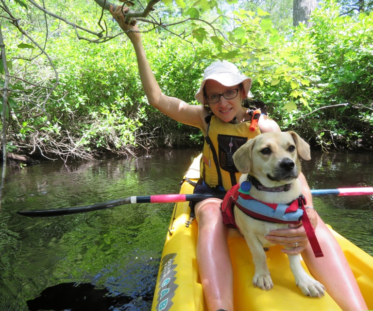
Daphne enjoys the calm, flat water creeks as much as Norma. 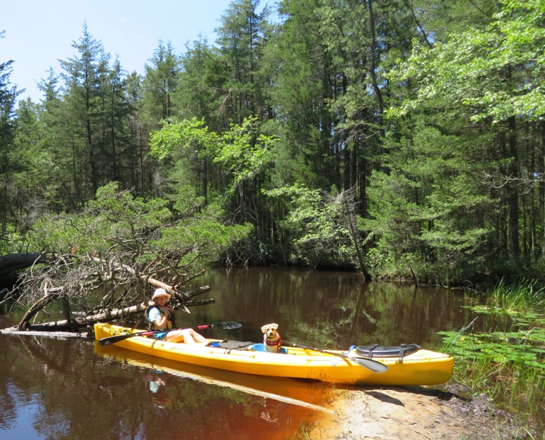
When I think of New Jersey, a place like this is usually not what comes to mind. I guess that just goes to show how diverse the garden state actually is. Gertler writes Needless to say, the Batsto's tea-colored waters are pure, and they are clear enough to expose the luxuriant stands of aquatic grasses that carpet the sandy bottom. Litter and other user damage are less evident here than on other popular Pine Barrens streams. We chained the boat to a tree near the takeout and then started walking back to the launch site on the Mullica River Trail. After a few miles, it was obvious that Daphne was starting to overheat, despite drinking plenty of water. So at the Mullica River Wilderness Campsite, I put Daphne in the water...against her will. Sometimes a father needs to do things that his children do not enjoy. But he does it out of love and for their own good. This campsite is a good place to stop to use the outhouse or refill your canteen. 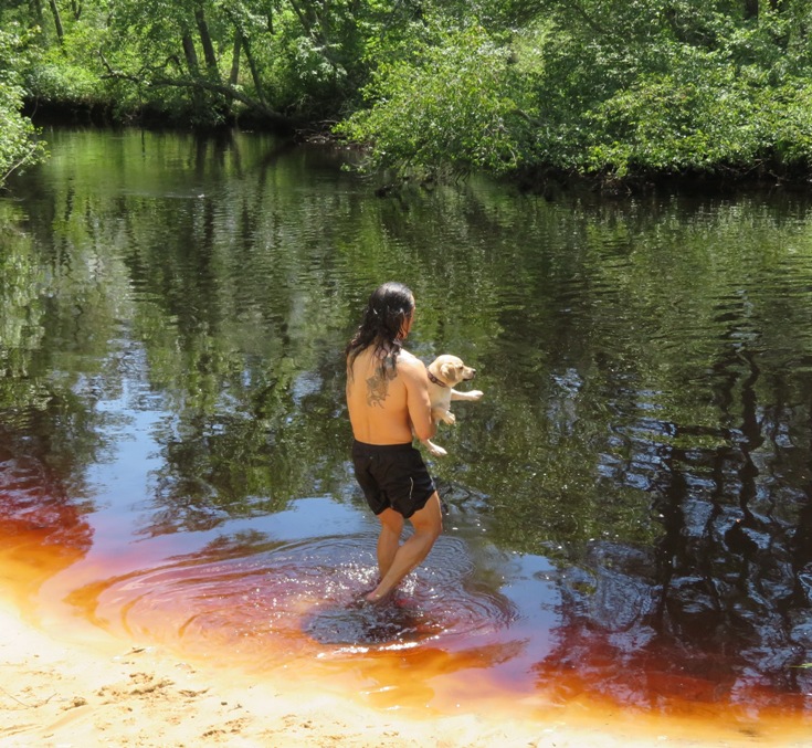
Daphne spends a lot of time on kayaks and stand up paddleboards (SUPs). She always wears her personal flotation device (PFD). But just because she is "on" the water doesn't mean she likes to be "in" it. But that all changed today. After forcing her to swim a little, both Norma and I went out into the water and called her. She likes being with us and was already soaked. So she swam to Norma from the shore! This is the first time we've ever seen her choose to swim. Norma and I agree that this was the most memorable part of our trip. After having cooled off in the Batsto River, Daphne was like a fresh puppy. It really made a huge difference! From now on, if we plan a hike on a warm day, I'll be looking for a river or creek in which I can soak Daphne. 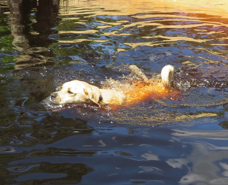
Norma and Daphne stopped on the Mullica River Trail under witch's broom. 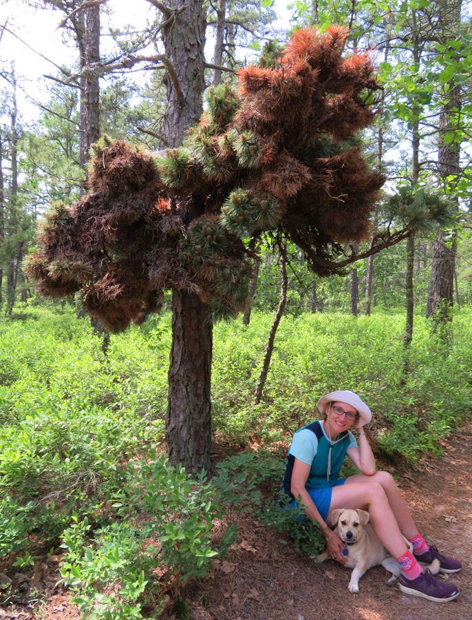
The mosquitoes weren't bad but the ticks most certainly were. Every day, we pulled multiple ticks off Daphne. Her short corgi legs keep her torso low to the ground where ticks have easy access. But at least her short, light colored hair makes them easy to find. I always carry Tick Nipper which works great on both humans and dogs. After finishing our hike, we drove to Batsto Lake to retrieve our boat. I love it when a plan comes together. We stopped at a blueberry farm that was selling blueberry plants. Up until now, everyone we met on our trip was friendly or at least not unfriendly. But the fellow at this farm was the exception. We never actually saw him. He communicated to us through a radio that one of his non-English speaking workers carried. It should have been an easy sale for him but Norma and I don't like to give business to rude people so we left. He was babbling about being very busy and running an efficient operation. As we drove off, I thought to myself, "Northern efficiency, NOT southern hospitality." |
|
After kayaking and hiking, we ate at Mr. Bill's and then drove to a town called Norma. We stopped at the Norma School and Norma Mennonite Church.
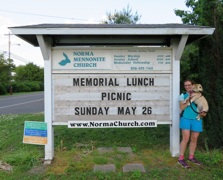
This church posted the same green, blue, and orange sign that we have in our front yard. It reads: No matter where you are from, we're glad you're our neighbor. I'm still looking for the Saki church. Maybe I'll have to start my own. After all, I am ordained. |
|
In the town of Norma, the three of us also paid a visit to the Alliance Cemetery where many Holocaust survivors were laid to rest. This place is very well maintained.
In 1882, 43 families escaped the pogroms of Russia and settled in this rural Southern New Jersey community as the first Jewish agricultural colony in the United States. They belonged to the Am Olam Movement that believed in a "return to the soil." They organized a Chevra Kadisha and built a synagogue and in 1891 they founded Alliance Cemetery. - from Alliance Cemetery At the cemetery, I saw several tombstones with a particular hand symbol engraved on them. I learned from a co-worker that this is a priestly blessing known as raising of the hands. This priestly blessing is the origin of Mr. Spock's "live long and prosper" Vulcan salutation from the original Star Trek. - from Wikipedia - Kohen |
|
After we got home, I took a look at some rock-like items I found a few days prior in Batsto Village. These chunks were lying on the ground just downstream from the dam on the east side of Batsto River. They are slag.
Slag is the glass-like by-product left over after a desired metal has been separated (i.e., smelted) from its raw ore. - from Wikipedia - Slag 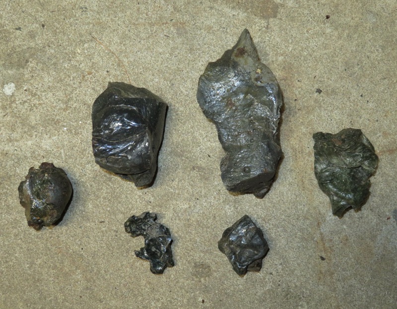
I'm guessing this slag is from the iron furnace which was built in the village in 1766. |
|
The drive home was fairly fast. I figured a lot of people would want to get an early start so instead, we didn't leave the area until dusk. I took the next day off from work to get things cleaned up and put away.
We never made it out to Oswego River or Wading River. These lie east of Batsto. There doesn't seem to be as much hiking out there but I'm sure the kayaking is spectacular. Guess we'll plan that for a return trip to the Pine Barrens. |