|
file:///C:/Users/sakiR/Documents/Web/SAKISWORLD_ARCHIVE/Saki%20230220%20-%20launchLinksWithCountyPrefix/hiking2018.html |

|
file:///C:/Users/sakiR/Documents/Web/SAKISWORLD_ARCHIVE/Saki%20230220%20-%20launchLinksWithCountyPrefix/hiking2018.html |
|
SAKI RESUME HERE
I left work early and then took Norma and Daphne hiking in the Hilton Area of Patapsco Valley State Park. We parked at Hilltop entrance and then walked on the Buzzards Rock and Sawmill Trails from Ilchester Rocks to the Patapsco River.
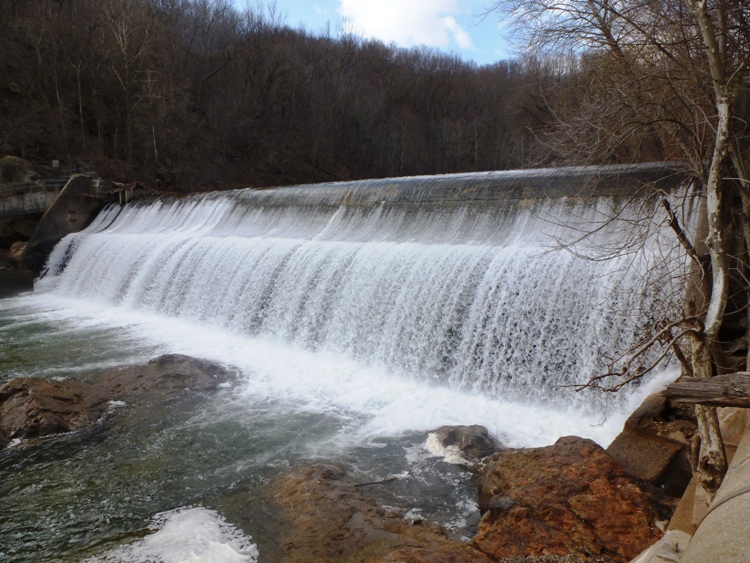
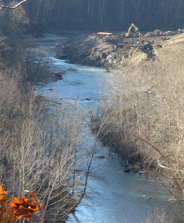
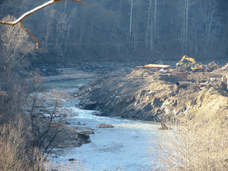
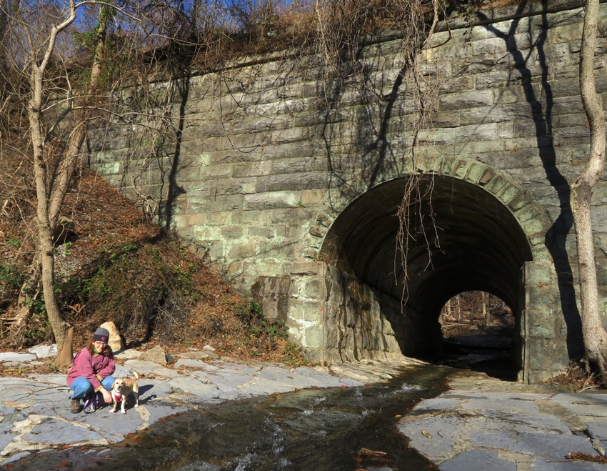
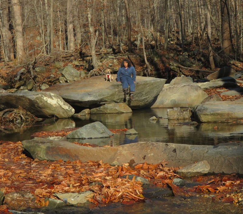
The main reason I picked this route is so we could see what the place looks like since Bloede Dam was removed on September 11, 2018. The dam was built in 1907. Here is what it looked like in 2012 (first photo). It was deemed to have a negative impact on the ecology of the river, being an obstacle for fish passage and fragmenting river continuity and aquatic habitats. Another factor is the number of drownings that have occurred at the dam. Work is not expected to be complete until 2019. For more information, see Maryland Department of Natural Resources - Bloede Dam. The three of us walked west from the parking lot on Buzzards Rock Trail but the trail was closed after a short distance so we couldn't get anywhere near the dam. We checked out the Ilchester Rocks climbing area and then headed east on the trail. It was a good day to let Daphne run off leash. We only saw one other person on the trail during the time we were out. We reached the northern junction where Buzzards Rock and Sawmill meet. Walking south on Buzzards Rock, we had a couple nice views on the ridgeline. It was a cold but sunny day. Eventually, we came to a spot where we could see construction where Bloede Dam once resided. See second and third photos. After awhile, the trail blazes disappeared and with all the fallen leaves, it was very difficult to tell where the trail was. But we stuck to the ridgeline with the nice view of the river. That was the right choice. We came to the southern junction where Buzzards Rock and Sawmill meet. Then we walked through a tunnel under the train tracks. It was built so a creek (Sawmill Branch?) could flow into the Patapsco River. See fourth photo. Norma, Daphne, and I walked north on the Sawmill Trail, which follows the creek. It was a lovely place (fifth photo). The Sawmill Trail met the Santee Trail at several large boulders (sixth photo). Leaves covered the trail and some pools of water. Running quickly, Daphne didn't distinguish between the two and as a result, ended up going for a very unpleasant swim. But she didn't complain. I'm guessing we walked three miles. Not long ago, I ordered several maps of the different sections of Patapsco Valley State Park. These were published in 2015. I think they are terrible. I much prefer the old maps. My favorite is from 2002. The new ones provide very little context such as local roads and small creeks. It lists parking lots but leaves out some such as the one where we started today. I looked online for some of the older maps but didn't find them. My 2002 map lists the source but that led nowhere. I know there are on-line maps but there is nothing quite like having a paper maps that you can hold in your hands. Daphne Norma 
 |
|
Today, the first Savage Strolls event took place. This is the brainchild of a couple of our neighbors and Norma. The goal is to build a stronger sense of community by getting outdoors together.
We walked out and back on the Savage Mill Trail along the Little Patuxent River. Along the way, I spoke about various historic spots along our route such as where the granite and oak dam once resided that directed water into the millrace to power the cotton mill. This was a dog-friendly walk. Our four-legged friends included Daphne, Rufus, and Cassi. 
Our group stopped briefly at the Bollman Truss Bridge. From left to right standing: me, Suzanne, Jason, Nicole, Annette, Katie, and Norma. In front from left to right are Sara, Dominic, and Sammie. 
Wendall Bollman (inventor of the Bollman Truss Bridge) was a self-taught Baltimore civil engineer and the first to evolve a system of bridging in iron to be consistently used on an American railroad. He became one of the pioneers to user in the modern period of structural engineering. We passed Savage Mill and then made our way to the Mansion House on Commercial Street. Afterwards, we enjoyed lunch at the Rams Head Tavern in Savage Mill. That evening, many of us returned to the bridge for its annual holiday lighting ceremony along with other festivities at the nearby Carroll Baldwin Hall. It was a good day to appreciate small town living. 
|
|
Norma, Daphne, Sara, Cassi, and I walked an easy 4.5 miles in Patapsco Valley State Park between Alberton Rocks and Daniels Dam. The dogs probably walked/ran twice that distance. Starting from Alberton, we headed west on the old Alberton Road, passing about two dozen Cub Scouts and their leaders. After that, we saw nobody for over two hours! We viewed the majestic Alligator Rock and then walked past a lot of ghost town ruins.
Daniels, Maryland has gone through three different names in 109 years due to the popularity of the mill. It was originally known as Elysville in 1829, then Alberton in 1839, and then finally Daniels in 1938. - from "The Urban Historians - Daniels, Maryland" (broken link as of 2026) It was a fairly sunny day with light wind. The air was cold but we were dressed for it and quite comfortable. This time of year can be very depressing with the short days and cold weather. Having dogs forces us to get outside for them. But in the end, we benefit just as much. Like the town where we live, Savage, this area has its origins in a cotton mill. The original settlement that would become the town of Daniels formed in 1810 when the family of Thomas Ely came to the area and built a textile mill. - from Wikipedia - Daniels, Maryland This mill had 228 looms and seventy company buildings which were built on 820 acres of land around the factory. There were 118 homes, two churches [which we would see], and a general store. Like the Savage Mill, supplies were transported by the Baltimore and Ohio (B&O) Railroad. Perhaps the main reason why Daniels never became the town that Savage is today is because of Hurricane Agnes, which flooded the area in 1972. In 1973, Daniels Mill was added to the National Register of Historic Places, two years before Savage Mill. The area is closed to traffic but it is clear that Alberton Road was once a very active route that fed the town. We saw a lot of old car wrecks. This would be a great place to ride a hybrid bicycle. The road ran about 2.1 miles to Daniels. 
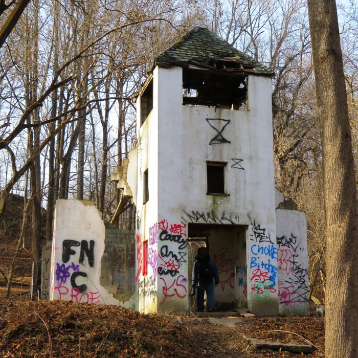
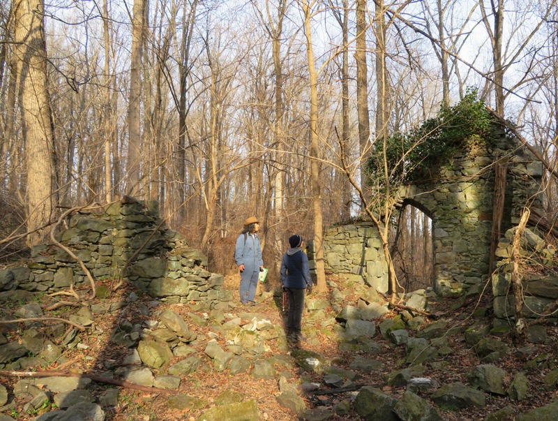
We passed lots of rusty car wrecks. There was also a lot of old stone and mortar construction. 
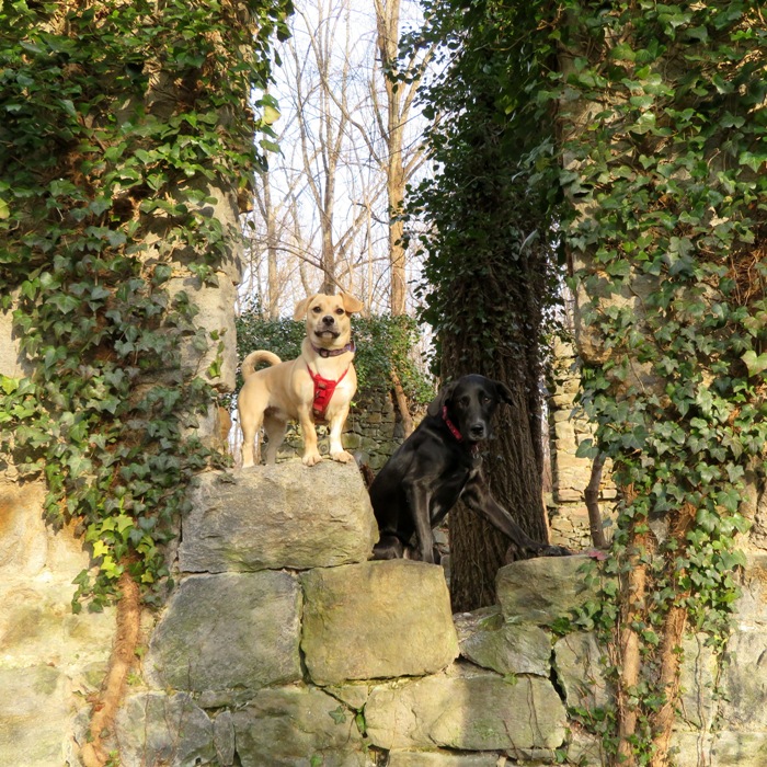
Norma, Sara, and I found the ruins of the Pentecostal Holiness Church at 39.316184, -76.816566. The five of us turned around at the west side (Baltimore County) of Daniels Dam. That's me on top of the dam in the pic below. Looking down, I could see ice growing in the shady areas. 
In this view, Sara, Cassi, and I perch atop Daniels Dam, facing upstream. This dam furnished 400 horsepower for canvas and denim mills and also generated surplus electricity for Baltimore Gas and Electric. - from Maryland DNR - Daniels Area Dam 
Earlier, we tried to follow a path on my 2002 map that led us away from the river near the power lines. But we could not find the trail. However, we did find where it links up again with the route along the river at Path to Church Ruins. So we walked up the hill on this path. It took us to the ruins of what was clearly once a beautiful church. In 1878, Saint Stanislaus Kostka Catholic Church was designed by John Stark and then later built on the northern side of the Patapsco River. It stood till it was hit by lightning September 24, 1927. After the fire, it was left to decay on its own. There is a graveyard behind the church which still has many headstones ranging from dates in the late 1800s to early 1900s. - from "The Urban Historians - Daniels, Maryland" (broken link as of 2026) Next time we're there, we'll have to try and find the graveyard. Here are some photos of what the Saint Stanislaus Kostka Catholic Church used to look like. Put on your hiking boots and go see it for yourself at 39.317089971642346, -76.80870146078664. For more information, see "Memory, native to this valley": Exploring Daniels, MD. |
|
I left work a little early to get out and enjoy some sunny weather with Norma and Daphne at the Hilton Area of Patapsco Valley State Park.
This looks like a great area to get kids interested in hiking because there is stuff to see nearby such as a nature center, an "All Sensory Trail" for blind kids, campgrounds, cabins, and a big playground. The three of us started walking west on the Santee Branch trail. Where the Santee Branch and Sawmill Branch trails meet, we saw several trees decorated for Christmas. 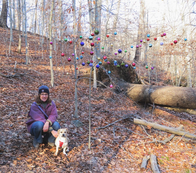
I tried to make this a lollipop hike but we could not find where the Forest Glen trail meets the Sawmill Branch trail. So we did our second crossing of Sawmill Branch (shown below) and then bushwhacked our way up the clearing under the power lines until we picked up the Santee Branch. 
We also walked for a bit on Pigs Run which was partially closed. After our 3.2 mile walk, we explored the kid-friendly section. 
I expect this place could get pretty busy on the weekend when the weather is nice. But today, there were so few people, we were comfortable letting Daphne off-leash. |
|
Norma thinks Swallow Falls State Park is the most beautiful place in Maryland. I might have to agree. She has been visiting this area since she was a child. Today was at least my sixth time here, but it was Daphne's first trip.
According to Wikipedia, The park is notable for its stand of old hemlock trees, some more than 300 years old, "the last stand of its kind in Maryland." The three of us arrived the day prior. There was a good bit of snow in Garrett County but little or none in all the other Maryland counties. This county has the highest elevation in the state and is also the coldest, so winter usually brings plenty of snow. Fortunately, the roads were clear of ice. It was warming up and the sun was starting to melt the snow which fed Tolliver Run (sometimes spelled "Toliver"). 
Just downstream, Daphne and I posed for a photo at Tolliver Falls. 
We saw a couple other dogs and a fair number of people. But we were able to let Daphne run off-leash most of the time. She has good sense in terms of what areas are safe and what are not, staying away from steep drop-offs. There was some ice on the ground at the Upper Swallow Falls overlook. In the summer, this is a popular swimming area. Behind us, in the pic below, is the Youghiogheny River. 
The park is well-maintained and the trails are easy to follow. The place gets a lot of use so the staff do their best to make sure things are easily accessible and safe. 
This area has some very interesting rocks from the Conemaugh formation. The Conemaugh contains claystones, siltstones, shales, sandstones and several coal beds and contains fossils. These rocks date to the Pennsylvanian Period and are about 300 million years old. - from Maryland Geological Survey - Swallow Falls, Garrett County 
Near the end of the hike, we saw the magnificent Muddy Creek Falls. This waterfall is the result of Muddy Creek falling into the gorge carved out by the Youghiogheny River. The height of the falls is 53 feet, making it the highest waterfall in Maryland according to some. Cunningham Falls, also located in Maryland, is over 70 feet high but does not fall in a single drop. - from Go Waterfalling - Muddy Creek Falls 
The next few days included a light refreshing of snow, ensuring we had a nice white Christmas, but still a safe drive home...the best of both worlds. |