|
This page describes my hiking adventures in 2026. |

|
This page describes my hiking adventures in 2026. |
|
I took a lot of time off from work in late December and early January. I planned to do an overnight trip with Daphne somewhere along the Atlantic Ocean if I had at least two consecutive days with sunny weather and light wind. But that never happened. So instead, I did short, local trips when the weather was nice.
I was almost done with We saw some waterfowl at the Tidal Marsh looking south, but the sun was not at a good angle to get good photos. I think the afternoon would have been better for that. But the lighting was great for taking pics of the Chesapeake Bay Bridge. 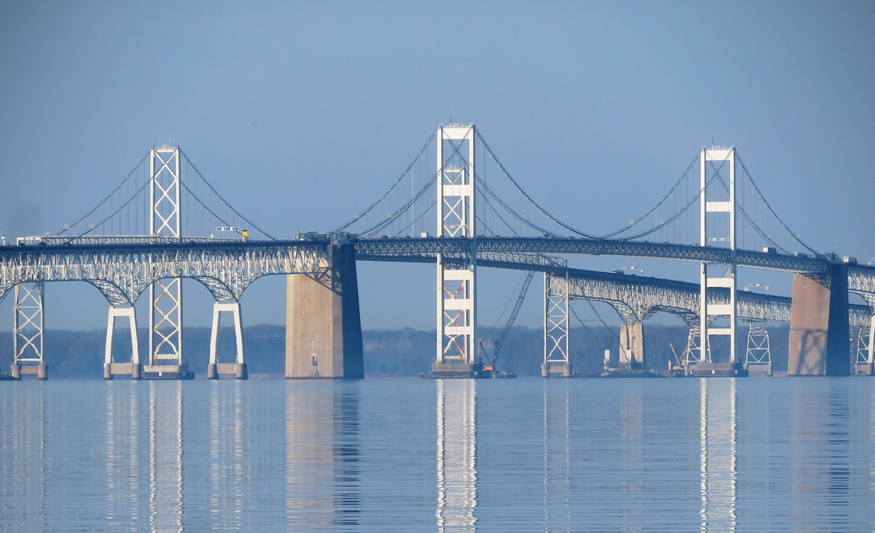
At the south side of the park, we walked parallel to Highway 50, which was just a few feet away. After completing the south loop, we walked back along the beach again, retracing our steps. 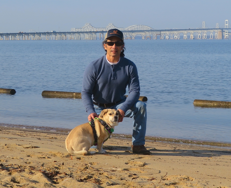
I'm guessing we walked about three miles. Upon arriving home, I finishing my house projects.  |
|
In the autumn of 2025, my office was affected by the longest federal government shutdown in U.S. history, lasting 43 days. Some of us worked reduced hours while others were told to not come in. During this time, we were not paid, though we did eventually receive back pay. People were not happy with all the uncertainty. To try and boost morale, I led a couple of local hikes. One was at Wincopin while the other was on the Savage Mill Trail and through the historic section of Savage. For the latter, I included a lot of information from my Savage 7k run and one mile historic walk. Both hikes were well-received.
December and January ended up being cold, windy, and dark. The short days and long nights were not good for anyone's morale, including my own. So I planned another hike, this one for the WatersEdge Kayak Club. I wrote up a detailed description and then posted it on the club's Meetup page, under Historic Savage Hike. It filled up quickly. I guess a lot of others were also looking for ways to beat the winter blues. I knew my route well but I figured I'd do some scouting just to make sure. Here's Daphne and I on a blustery New Year's Day. 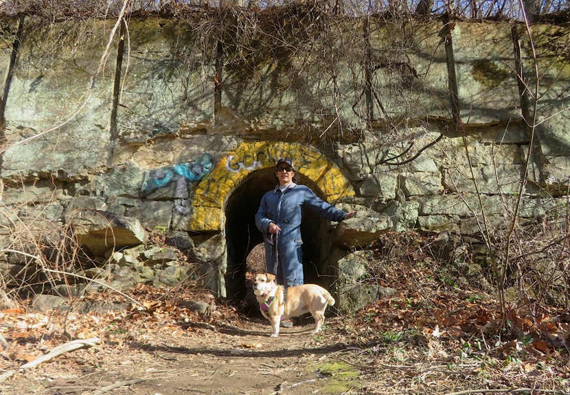
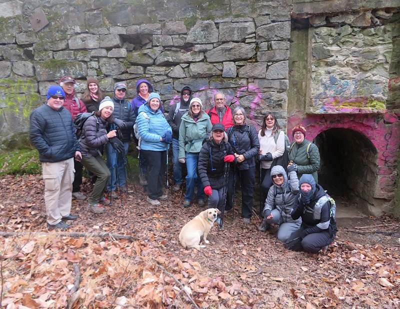
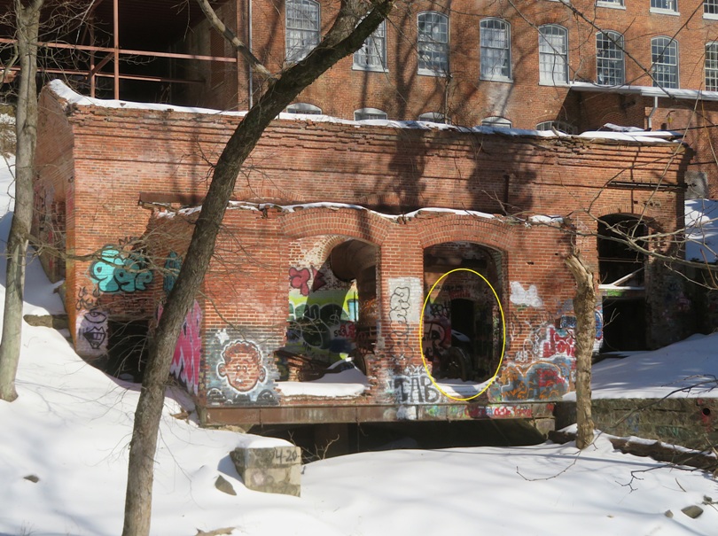
One reason I chose the weekend I did was to take advantage of the Santa Heim display at Savage Mill. The following is from the Mill's website: Harry Heim purchased the mill and turned it into a year-round Christmas village! He owned two ornament factories, one in Baltimore and one in San Diego, and was one of the country's leading Christmas ornament manufacturers. Heim always wore a Santa suit while in the mill. He wanted to change the name of Savage to Santa Heim, Merryland. Some local families still have some of the original ornaments! Unfortunately, the display was taken down early, despite my request to leave it up through the weekend. As the day of the event approached, I noticed that heavy rain was forecast so I moved the event to a day later. Many had to drop out but in the end, I still managed to have 20 participants! We met in the New Weave Building at Savage Mill. I deemed this is good meeting spot because there is plenty of parking in the Big Lot, a restroom, and it is warm. I had folks introduce themselves and then I took them through the Mill to the Paymaster's Office. There, I pointed out the vault (shown below) and told them about the jail under the conference room floor that is now used for storage. The vault is now the staff coffee mess. 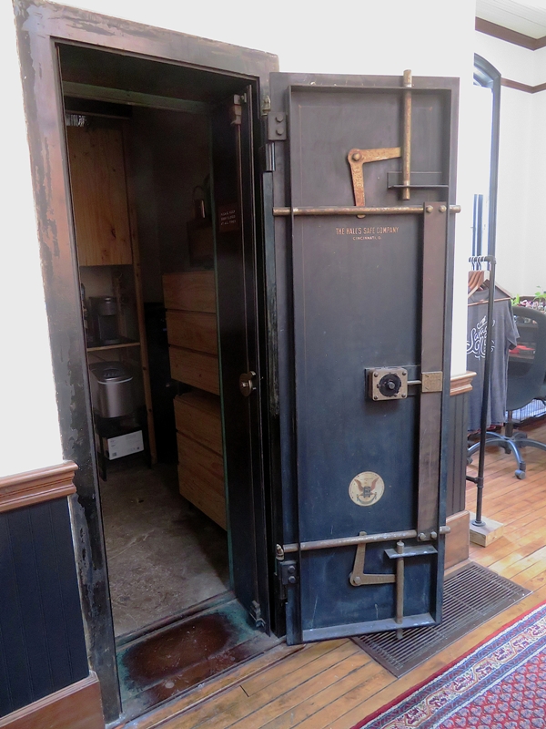
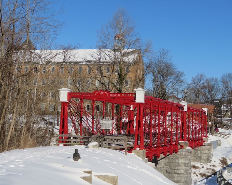
I led my group across the recently painted Bollman Truss Bridge and then to the start of the Savage Mill Trail where I spoke about the train line that ran from Savage to Guilford. 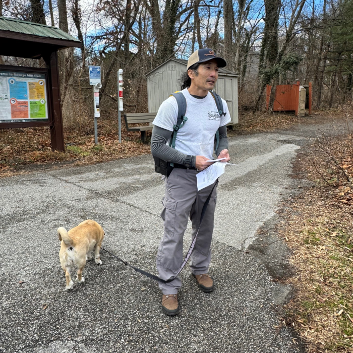
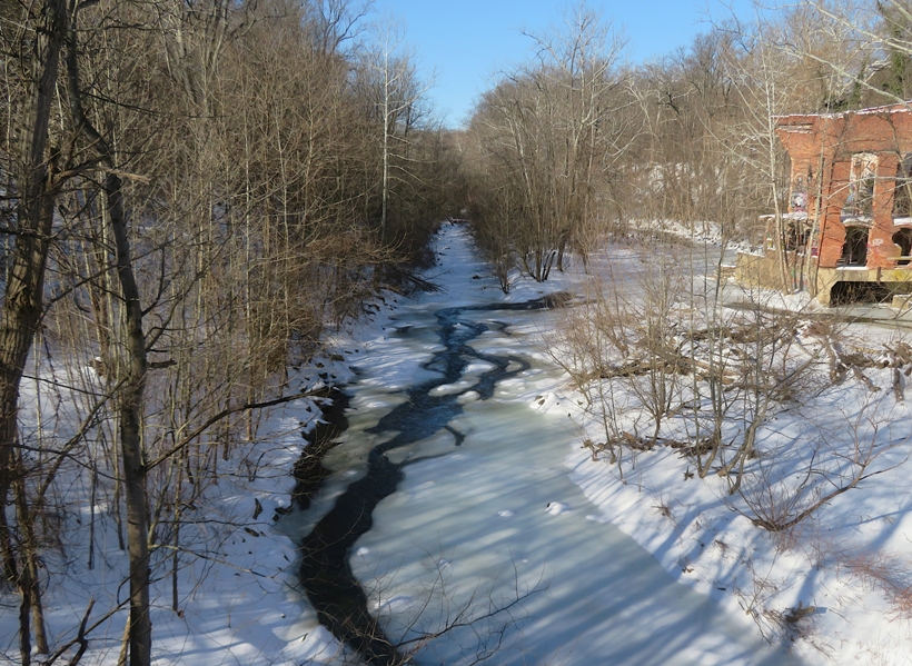
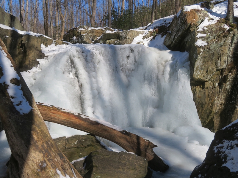
I took people to The Falls of the Little Patuxent River (shown below) and told them how the land near it was owned by Commodore Joshua Barney. He gave it to his son-in-law, Nathaniel Williams, who, along with his brothers, built Savage Mill using money borrowed from John Savage, our town's namesake. 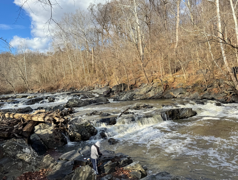
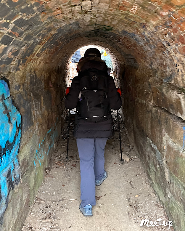
Continuing along the trail, we came to a vertical rising sluice gate used to control the level and flow rate of water back when the river was dammed. 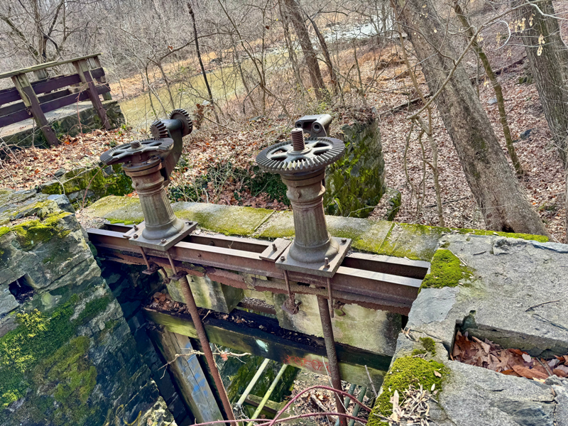
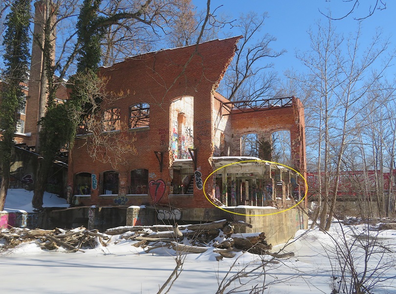
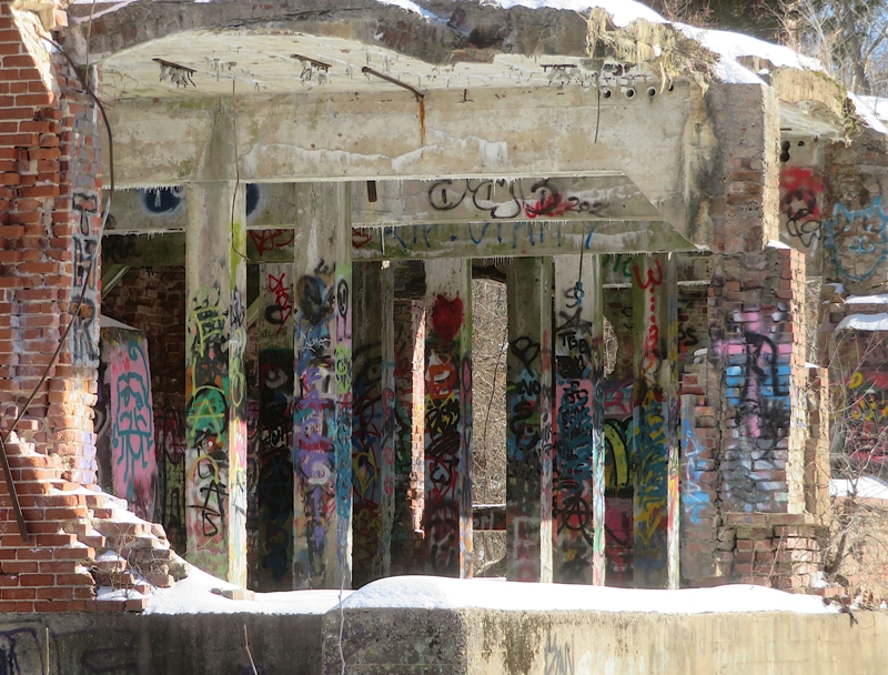
We walked to the water where I pointed out steel rods once used to support the Savage Mill dam. I said they are like the "Sword in the Stone" in that if someone could pull any of them out, they would be deemed the "King of Savage." Nobody was successful. The legend of the Sword in the Stone, central to Arthurian lore, features a magical blade stuck in an anvil/stone, foretold to be removable only by the true, rightful King of Britain. Young Arthur famously pulls it out, proving his destiny and divine right to rule. - from Google AI We returned back to town and I led folks along Washington Street, pointing out the Baldwin House Mansion and the old company store. I showed them Savage Mill scrip and local pickers' checks which were used by farm owners to keep track of how many bushels their workers harvested. I led my group to the dam ruins on the east side of the Little Patuxent River. There, we walked through a tunnel to the "mill race" where we posed for a photo. A mill race is a man-made channel or canal designed to carry water to and from a waterwheel, providing the power needed to operate a mill. Our hike ran a little long and we never walked on the River Trail or Patuxent Branch Trail like I planned. I scheduled this to take three hours but at the rate I was going, it could have been four and a half hours. If I do it next year, I should plan for four hours and talk less. But everyone seemed to enjoy it. Three people left reviews on Meetup and gave me five stars (out of five) with positive feedback. Here is our route. 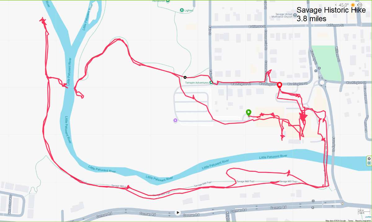
We had a tiny bit of rain at the end as the sun disappeared. Overall, I feel it was successful. Most of us gathered for a meal afterwards at the Dive Bar and Grille. Special thanks to my hike participants who provided most of the above photos. |
|
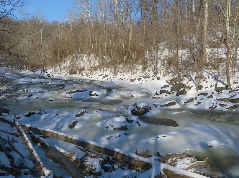
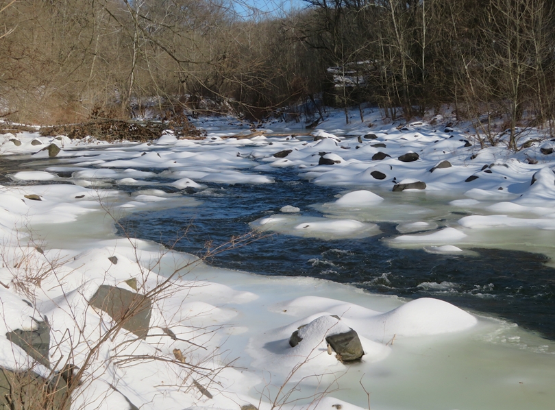
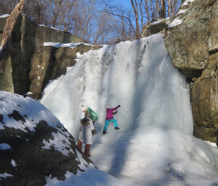
Over the last few days, our town received ~7.5 inches of snow. But now the sun was out and the wind was low. I figured it was a good time to go for a walk. So I donned my crampons and headed to the Savage Mill Trail with Norma and Daphne.
We walked across the Bollman Truss Bridge where we were able to look down on the icy Little Patuxent River. Here's Norma and Daphne at the start of the Savage Mill Trail. 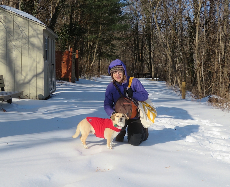
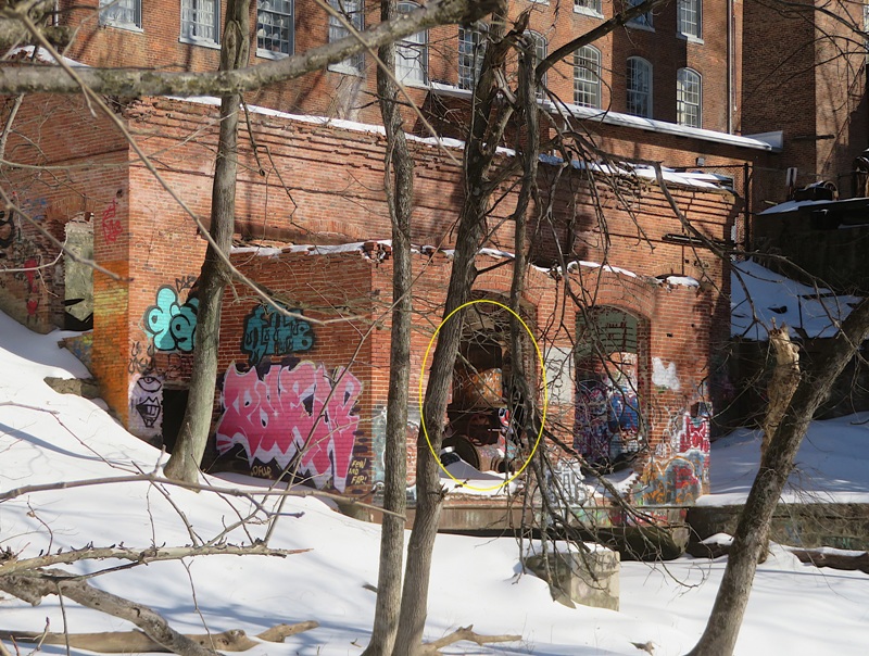
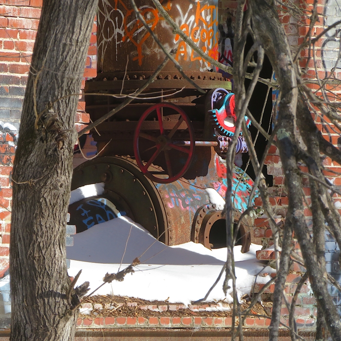
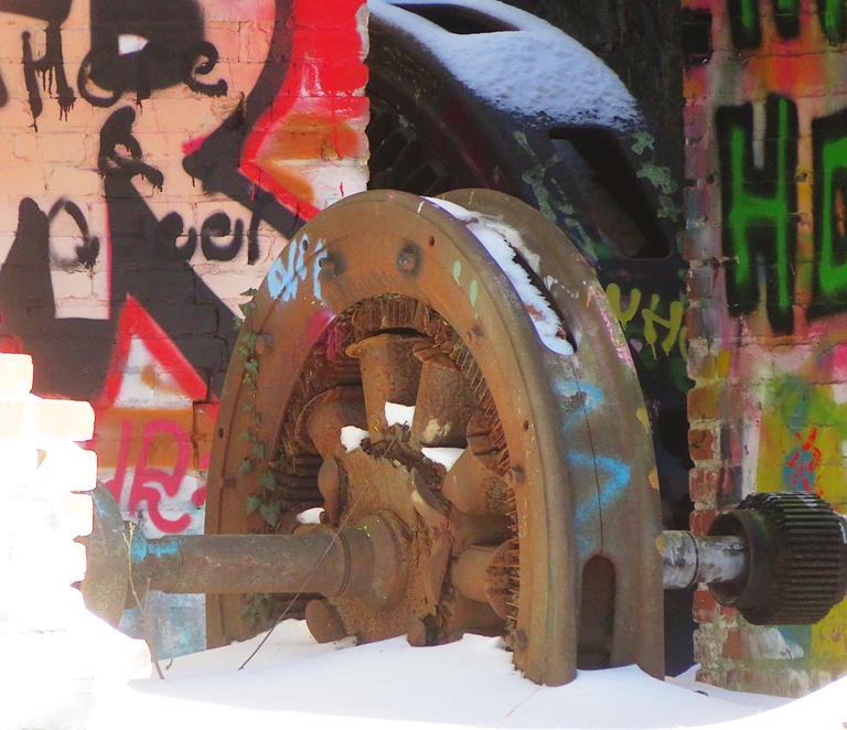
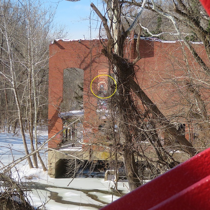
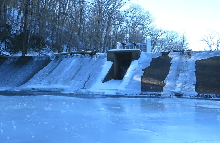
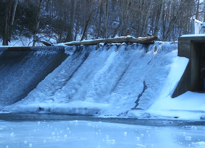
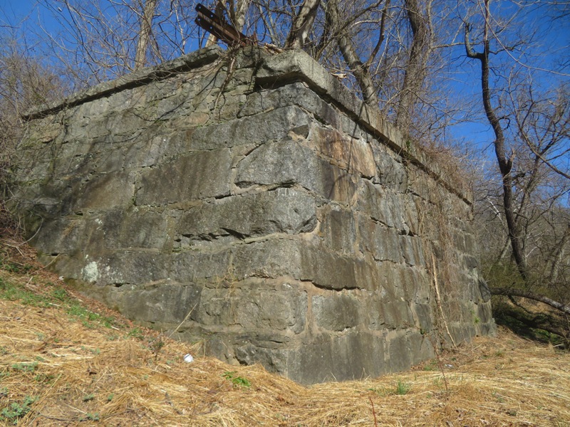
Walking along, we had some nice views of the Little Patuxent River, but I think it has looked more dramatic in the past with thawing and refreezing. Snow isn't as interesting on water as ice. Walking was a little frustrating. The top layer was ice because we had a lot of sleet and some freezing rain. Below that was snow. So in several places, one could walk just fine on the ice until it caved in suddenly and you sank four inches into the snow. I found taking short steps and walking flat-footed helped minimize cave-ins. Eventually, Norma headed back and went to work while Daphne and I continued exploring along the river. We walked across a low area that sometimes creates an island that provides a better view of Savage Mill's powerhouse ruins. We're not supposed to explore the ruins so I made use of my camera's 40x power optical zoom to get up-close and personal. I'm thinking this is some sort of boiler. Next to it is a generator. According to Google AI: A boiler and a generator worked together to power factories, forming the basis of steam-electric power generation. In this setup, the boiler produces high-pressure steam, which drives a turbine or engine connected to a generator to create electricity. In the larger powerhouse building, I could see the spray-painted walls and columns inside. Walking upstream, I saw a heavy-duty structure that I'm almost certain housed the Savage Mill waterwheel at one time. This waterwheel was 30-feet in diameter. It would have needed something very strong to support its shaft. 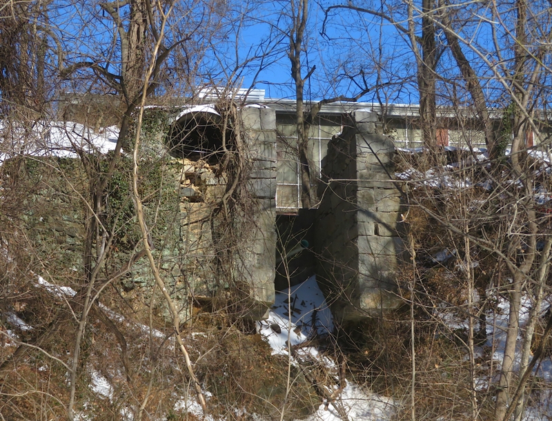
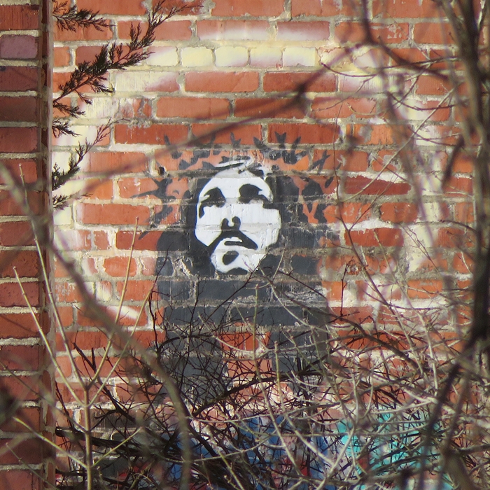
I typically let Daphne run off leash in this area if there is nobody around. But when I called, she did not come. I kept calling and searching...nothing. She doesn't like being away from Norma so I feared that she would try to find her. Daphne knows the layout of Savage so I'm sure she could get home or anywhere else in town. But she isn't smart enough to stay out of traffic, which was my biggest fear. As I started walking back, I eventually saw her waiting for me at the trailhead. She waited in the last spot she saw Norma. I was greatly relieved. Walking back across the Bollman Truss Bridge, I saw Jesus in the powerhouse. I met Norma at the Mill and we picked up lunch at Roggenart. Then I walked home, leaving Daphne with Norma. |
|
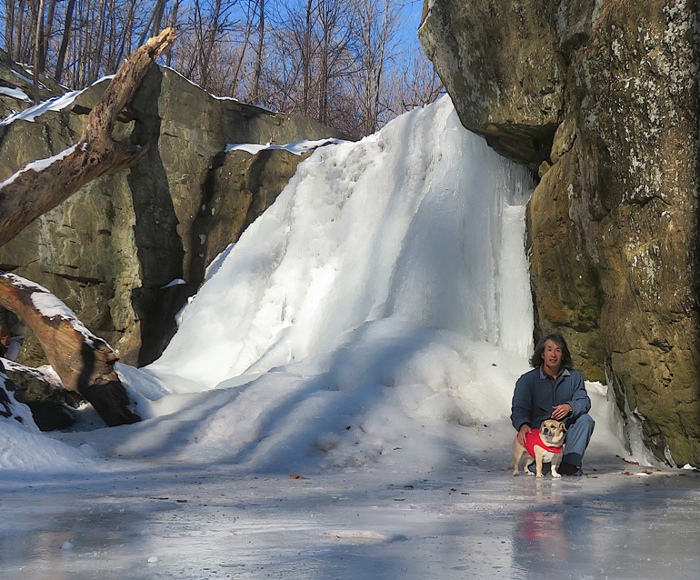
I had some free time in the afternoon so I decided to take advantage of the sunny weather and see a frozen waterfall with Daphne.
I drove out to Falling Branch / Kilgore Falls. The parking lot and roads were clear, though some of the less-traveled two-lane roads were really more like one-and-a-half lanes. That was true of some of the bridges too. You just need to be patient and yield right-of-way. The trail to the 17-foot high Kilgore Falls was surprisingly good for walking. It has been getting a lot of use and I think all the footsteps have broken up the ice, leaving packed snow. Today was the end of a ten day streak of high temperatures below freezing. Thus, Falling Branch was frozen solid enough to walk across at the trail without fear of falling through. Unfortunately, it was also very slippery. The day prior, someone fell and broke his arm near the falls. The following day, there was another accident, this one requiring emergency personnel. Even with crampons and a hiking pole, I made sure to walk slowly, taking baby steps. I don't think it would be unreasonable to crawl across. Here's a view of the creek upstream of where it meets the trail. 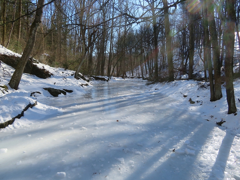
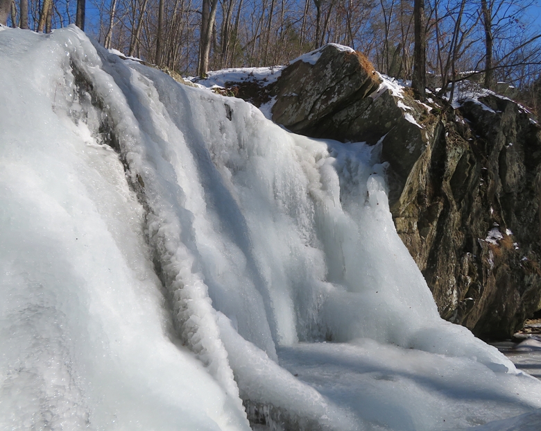
Walking parallel to and upstream along the stream quickly took me to the falls. I know a lot of folks had been visiting it recently so I'm glad I was able to see it on a weekday when it was less busy. Despite that, there were still several people here. Daphne was very much enjoying the snow and ice. I think that is the husky in her. 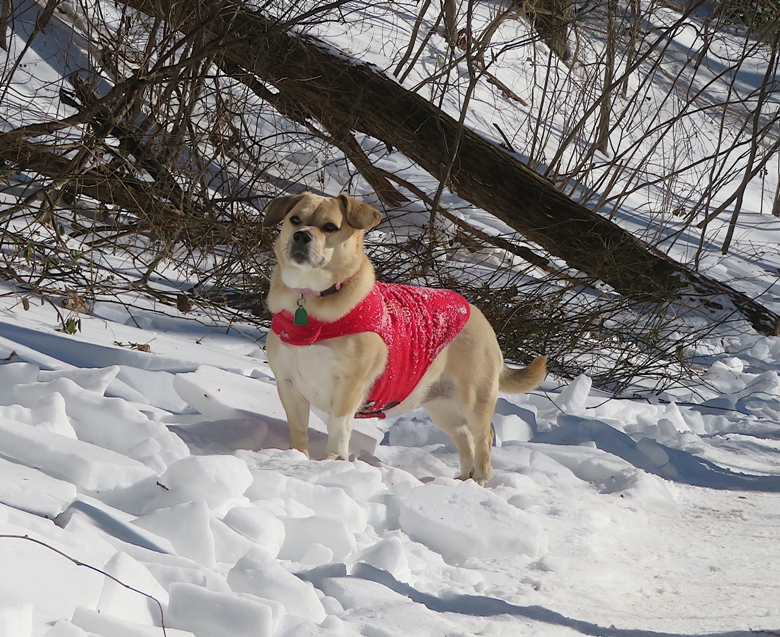
Next, I drove to the Eden Mill Nature Center, a mere five miles from the falls parking lot. According to some sources, this former grist mill was built in 1798 and operated until 1964. The mill area has about three miles of hiking trails, but as far as I could tell, they are still very icy and not well-suited for walking. At least they have plenty of easily accessible parking. Our first stop was the mill dam on Deer Creek. Daphne was enjoying rolling on the snow and ice. 
Deer Creek is frozen over. In warmer months, I've kayaked here. There is a launch site just upstream of the dam. 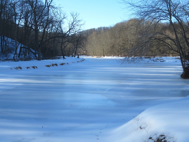
Here's the mill. Inside, you can see old machinery. An adjoining building houses the Nature Center, a great place to visit, especially if you have kids. Unfortunately, dogs are not allowed so Daphne and I did not enter. 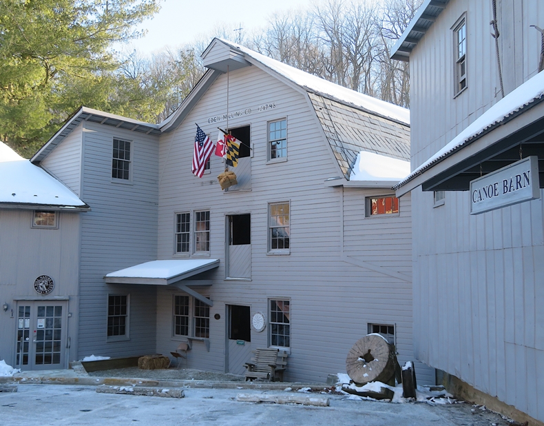
Outside, they have a "Little Free Pantry" with food, clothes, and blankets for the needy. What a clever idea! 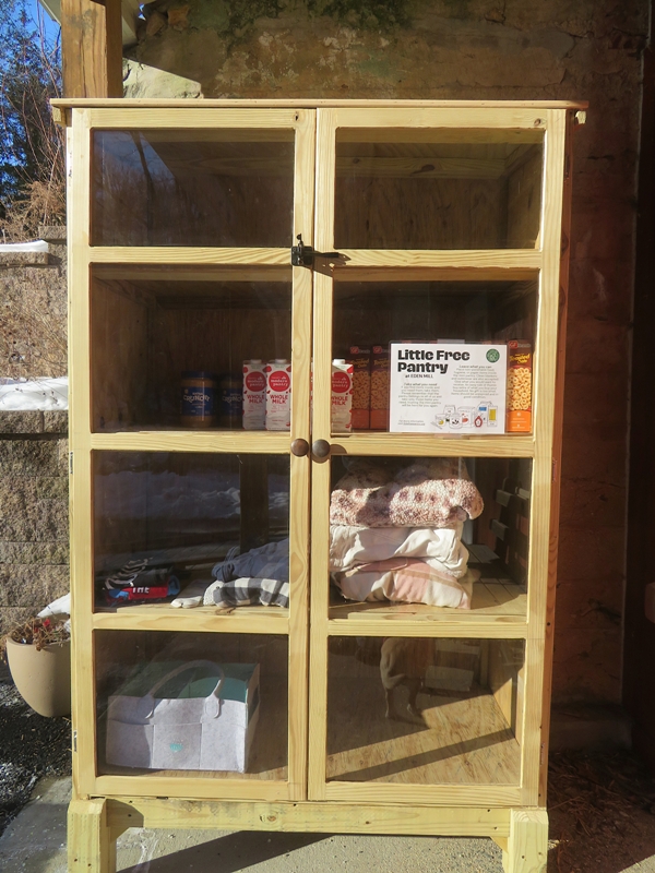
Here's Daphne and me at one of the barns. 
Driving home was difficult due to heavy traffic and a low, bright sun shining through bare trees casting harsh shadows. For more information about hikes in this area, see Hibernal Hikes at King and Queen Seat, Eden Mill Park, and Kilgore Falls. |
|
Norma, her nephew, Daphne, and I drove out to Marriottsville Train Track to do a short hike out to an abandoned feldspar mine. I learned about this place just a few days prior on Facebook.
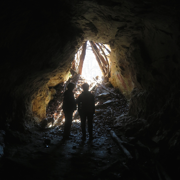
This place in Patapsco Valley State Park was easy to find. From the parking lot, we walked north, crossed the river, and then headed west (upstream) along the river for 0.15 mile. Looking to our north, the ground rose sharply. It was along here that we found the entrance to the mine. 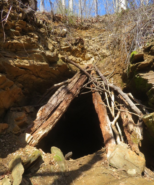
Inside, we shined our lights on the ceiling and saw the reflection of feldspar. Feldspar is the most abundant group of rock-forming minerals in the Earth's crust (approx. 60%), comprising aluminum silicates with potassium, sodium, or calcium. - from Google AI 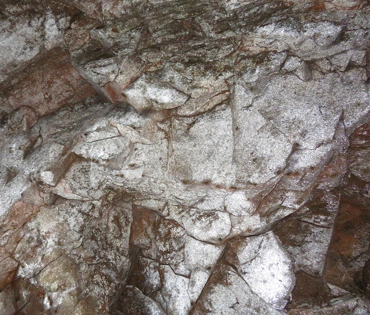
The place is a mine but it felt like a cave. Between the mine and the road, we found the stone ruins of something, of what I know not. 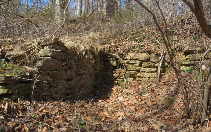
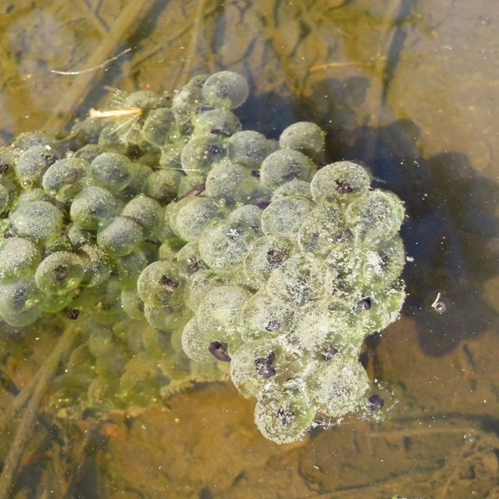
Just off the main road, we found lots of frog eggs in a shallow pool of water. Since we were in the area, we checked out another spot nearby...Henryton. |
|
After visiting the abandoned feldspar mine earlier in the day, Norma, her nephew, Daphne, and I drove about a mile to Henryton, another trailhead in Patapsco Valley State Park.
I was hoping we could see/explore some old ruins from the hospital but we saw none. Henryton State Hospital was originally founded in 1918 as the Maryland Tuberculosis Sanatorium for African-Americans, and later was renamed Henryton Sanatorium. Around 1962 it was converted to a state hospital that could accommodate 400 patients. It closed in 1985 and during the years that followed became a popular place for locals, ghost hunters, and urban explorers to hang out. Henryton was finally torn down in 2013. - from Abandoned America - Henryton Sanitarium Some big trees fell across the trail during one of the more recent storms. 
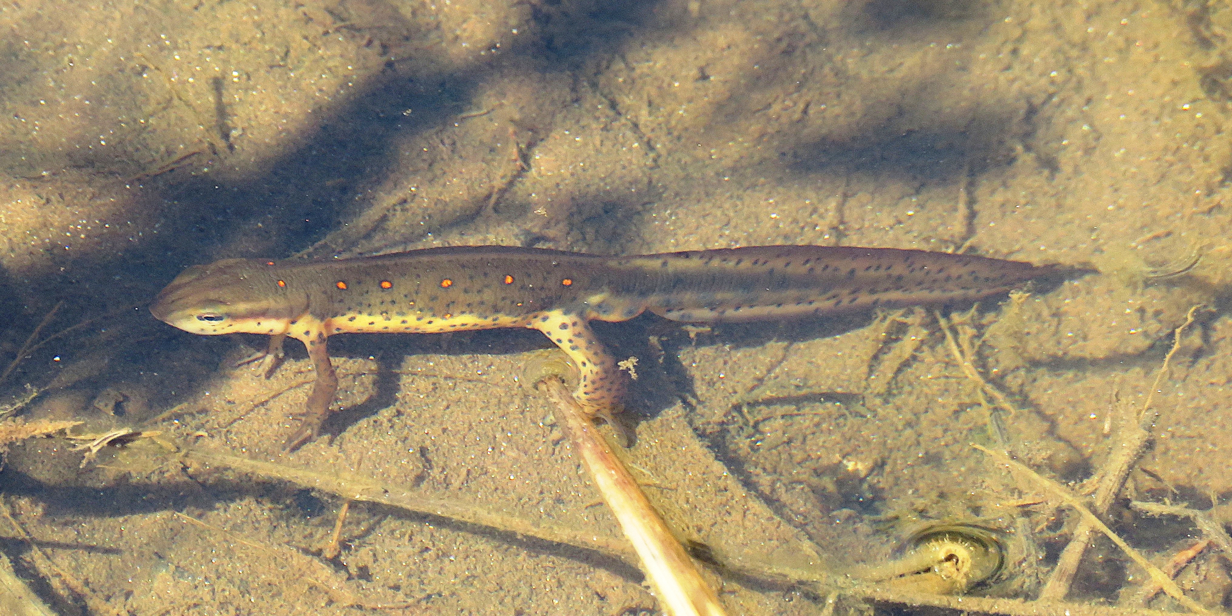
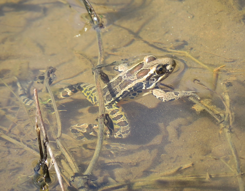
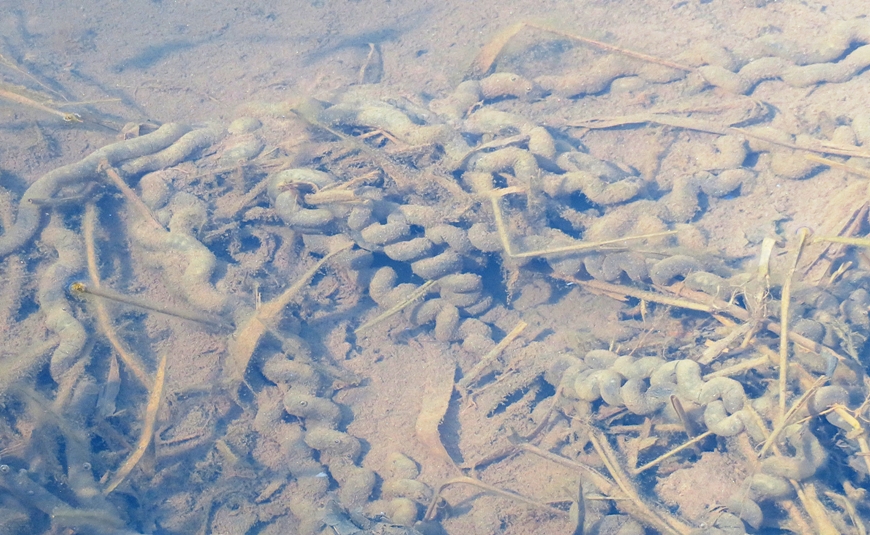
We heard pickerel frogs nearby. Some describe their call as sounding like a short, quiet snoring sound. I thought it sounded more like a buzz. Following this sound led us to a small pond at 39.35420407290317, -76.91359718961054 that was full of amphibians. It was just off the trail down a steep hill where we had to duck low to get under some foliage. The area around the pond is not very solid so expect to get a little wet if you want a close look. The big find were eastern newts, of which I saw five. See photo at the bottom of this page. In a couple other places with standing water, we found more frog eggs. Some were just puddles that might dry up in a few days if it doesn't rain. 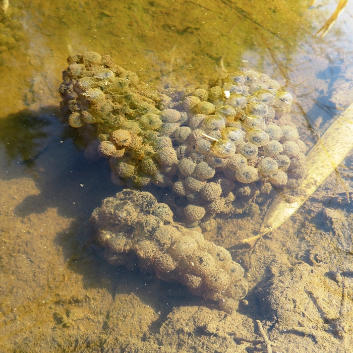
Walking south eventually took us to some train tracks and then the South Branch of the Patasco River where I found remnants of what I originally thought was a dam, but now think was just a bridge. Continuing along the river, we saw several rope swings. 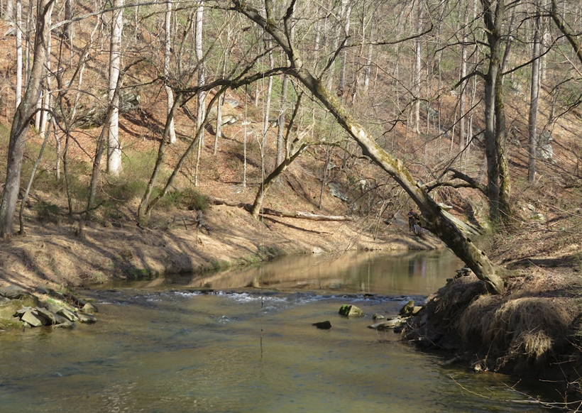
The trail was not always well-defined. Sometimes it felt like we were bushwhacking. Fortunately, at this time of the year, vegetation isn't too thick. We saw a fairly large hole that appeared to have been recently dug. I'm guessing it is the home of groundhog. 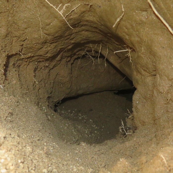
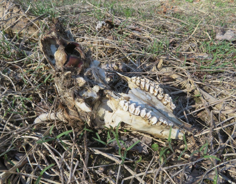
I found the skull of a young buck. We had a nice view of the Henryton train tunnel which claims to be ...the third oldest operating train tunnel in the world. - from Next Gen FM Radio - The Henryton Tunnel 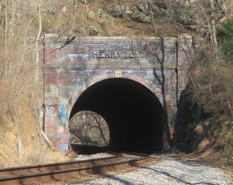
The four of us headed out to the Woodstock Inn, about six miles from the trailhead. This is a place that Norma and I have been wanting to visit for a long time. Was it everything we expected? 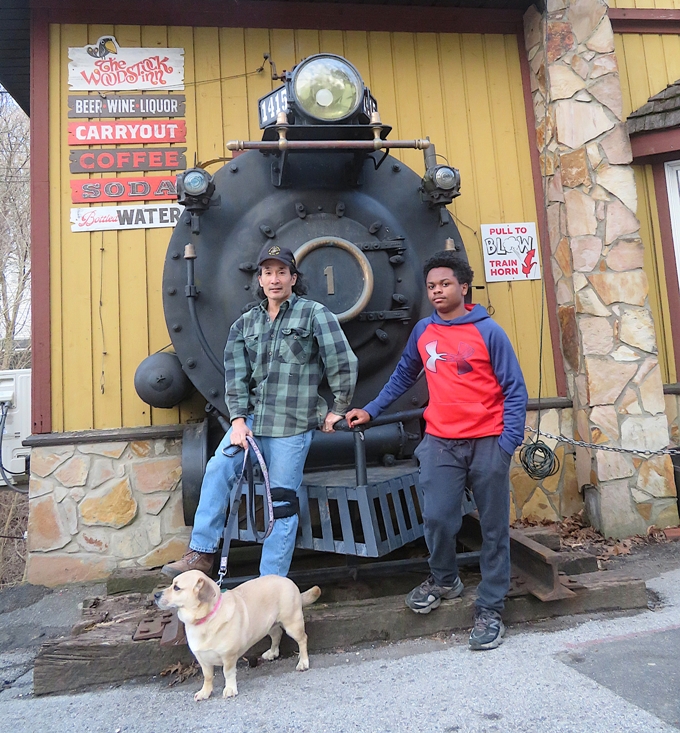
|
|
Yesterday's weather was nice. Today was even better.
Norma, her nephew, Daphne, Malar, her daughter Nidhiksha, and Nidhiksha's dog Raja, met at Orange Grove in Patapsco Valley State Park to hike Garrett's Pass and Cascade Falls Trail Loop. Though not part of the route, Norma led our group across the Swinging Bridge over the Patapsco River and then back. 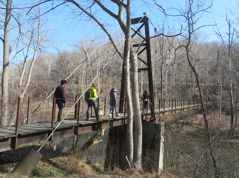
We saw several spring flowers. We stopped at Cascade Falls, which was looking a little dry. 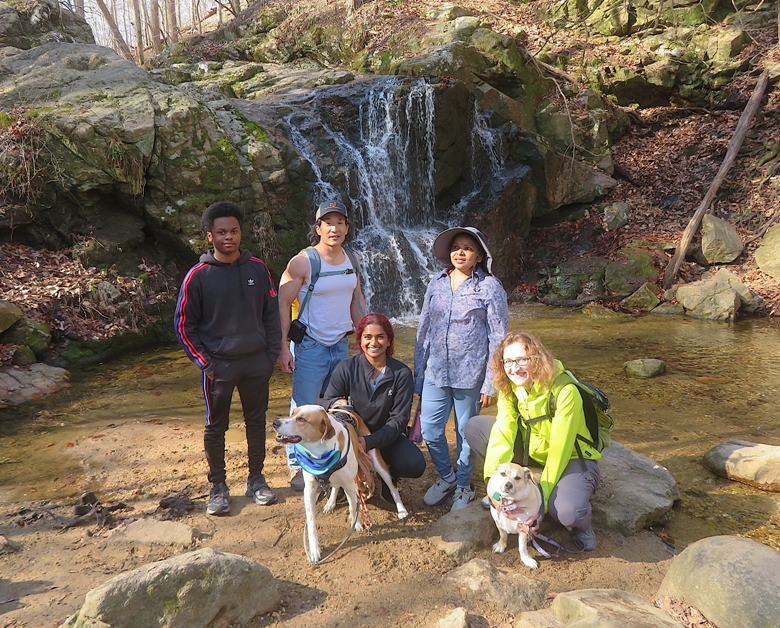
Norma spotted some feathers which Google image search tells me might be from a turkey vulture. 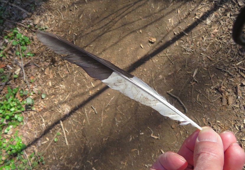
Our hike was pretty slow because we kept yielding to all the mountain bikes. But I'm not complaining because they have just as much of a right to be there as us. 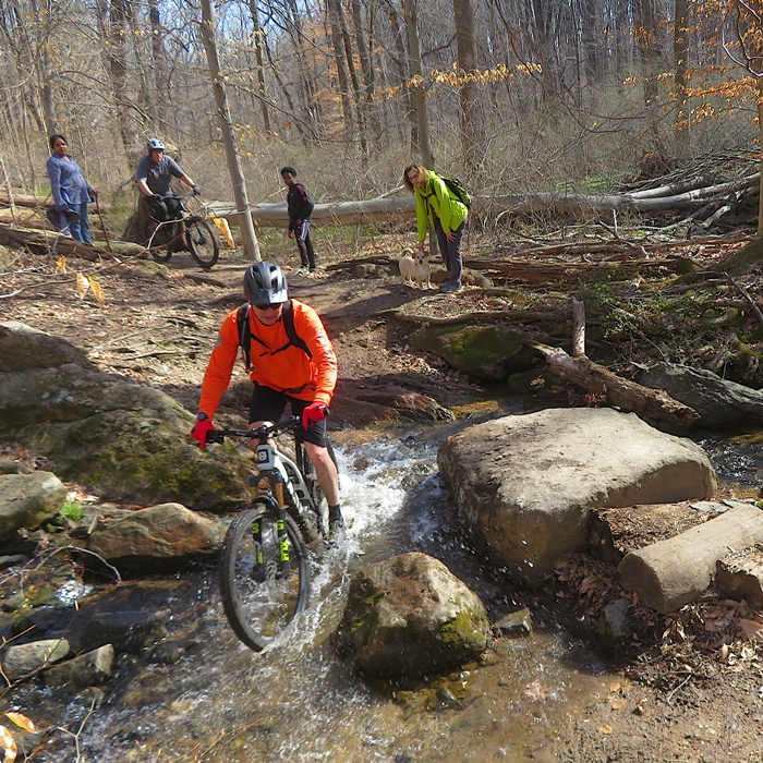
We didn't see many mushrooms but we did come across some turkey tail fungi. 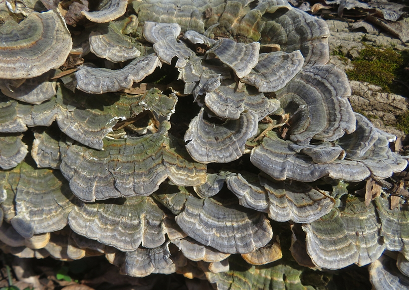
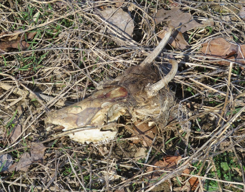
I found the skull of a small animal. 
We walked a total of 4.8 miles. I think we started around 0900 and finished around 1130. There was a decent amount of parking left when we started but upon completion, there was very little. 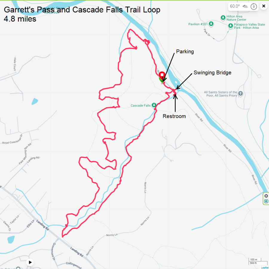
It was a great day to be outside: warm and sunny. It felt like May. We bought lunch at the Taqueria Los Primos Food Truck in Jessup. Like yesterday, the service was very slow. |
|
I planned to lead this WatersEdge Kayak Club - Wincopin / Huntington hike a couple months in advance. Lots of people signed up quickly. But as the date approached, many dropped out. In the end, I had ten participants.
I did a lot to prepare for this hike. I printed out lots of historic information and info about flora and fauna. I collected and purchased photos. The day prior, Daphne and I did a scouting trip so I could refresh my memory about the sections I was less familiar and mark the trail for one part requiring bushwhacking. Norma took her mom home from her winter visit. Hence, she was not available to participate. The group arrived promptly at Wincopin by the 0900 start time. After some brief introductions, we were off. The weather was nice for this time of year but in the latter half, it was a little warmer than some preferred: 82 degrees and humid. I led folks on the Green Trail to the various historic sites: 
We stopped at the vernal pool and saw several green frogs, tadpoles, and spotted salamander eggs. We moved on to the south end Red Trail loop. Here, we stopped for a break/snack/lunch along the Middle Patuxent River. In this area, we also saw more green frogs. We walked under Highway 95 to the Huntington area to continue our walk. Finding the marker I tied to a tree yesterday, we walked uphill for about an eigth of a mile to see the gravesite of John Francis Wyman. He served as a quartermaster sergeant during the Civil War. 
I found some sooty mold on a beech tree and told people that it might be the result of the presence of beech blight aphids. 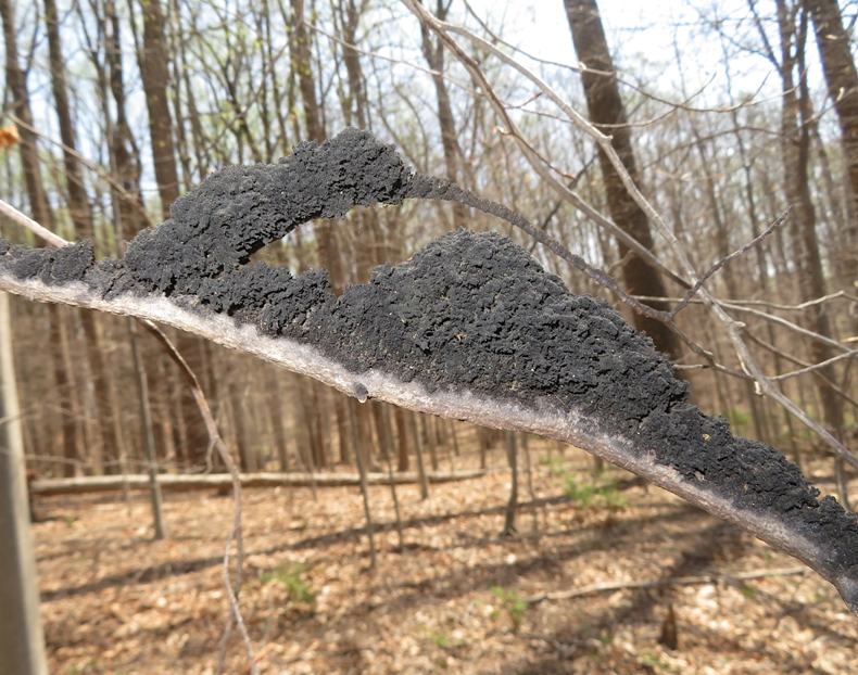
Helena, who said she was afraid of snakes, managed to find a garter snake. Based on how she reacted, I would not have guessed she was afraid. Next to the snake was a rue-anemone flower. 
We completed our 6.8 mile hike at 1300, which is exactly when I told folks we'd be done. Here's our route. 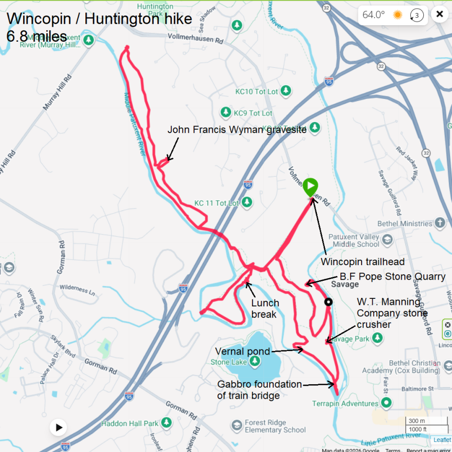
I was hoping we'd see paw paw flowers and caddisfly larva nets but we saw neither. But we did see mayapples, a turkey vulture, a bald eagle, trout lilies, and lots of skunk cabbage. I still had lots of daylight left so I went paddleboarding at Galesville. |
|
After spending the previous day doing lots of yard work, Norma and I decided to reward ourselves by hiking with Daphne from Jerusalem Mills to Harford Road and back. We started our adventure at Jerusalem Mill.
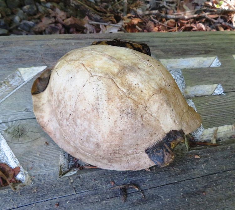
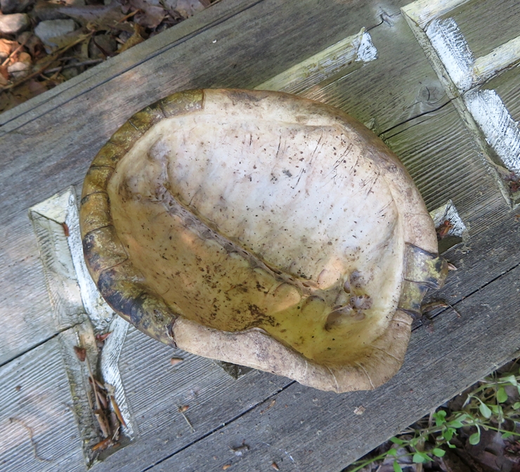
Founded in 1772 by David Lee, Jerusalem Mill served as a merchant mill along the Little Gunpowder Falls for nearly two centuries. The rebuilt mill today serves as Gunpowder Falls State Park Headquarters. - from information sign We've done a good bit of hiking at Gunpowder Falls State Park but this was our first visit to Jerusalem Mill. We arrived in the late morning and found the place packed. We took the last legal parking space in the lot. Norma and I couldn't have asked for nicer weather. It was sunny and not hot. The first part of our hike was in the sun but it didn't take long before we were under tree cover. The remainder of our hike was in the shade. No need for sunscreen. Near the first road crossing, we found a turtle carapace. We saw all the vegetation we expected to find at this time of year such as sassafras, tulip poplar, beech, holly, and other plants. Here's Norma and Daphne at our lunch stop. 
Norma saw two snakes. I only saw the tip of the tail of one of them. The most interesting wildlife I saw was a dragonfly perched atop a snapping turtle. 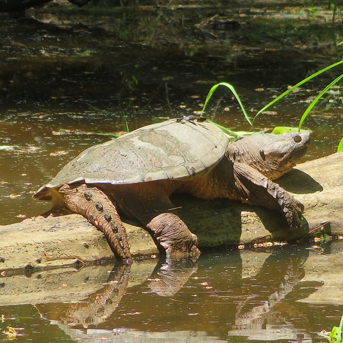
I also saw a couple of insects I was not familiar with. Here's a net-winged beetle. 
This one is a robber fly. It is a bee mimic, designed to trick other insects, but can be identified by its large compound eyes and stout, spiny legs. - from Google AI 
Most of the trail ran along Little Gunpowder Falls. I've paddled up it from the mouth but would never get this far upstream due to all the rocks. 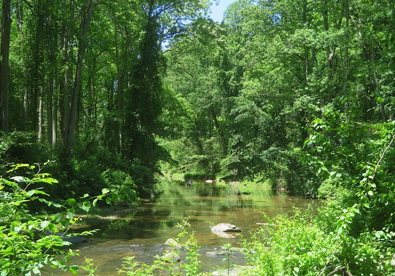
We passed some stone ruins which were likely active when the mill was in operation. What else was there from the days of the mill? A timber dam was built here to redirect water 0.4 of a mile to the mills. It also created a place for families to wade and swim! - from sign titled "Jerusalem Mills Dam" A large pool was created here in which to harvest blocks of ice for the preservation of perishable foods. Site of ice pond depicted on 1860 map. Ice ponds were used to harvest ice prior to the invention of electric refrigerators and freezers. - from sign titled "Ice Pond" Our route was a slight modification of one I found in AllTrails.com. I changed it to be a figure eight route. This required us to walk on Harford Road to get to the other side of Little Gunpowder Falls. Doing so is quite dangerous due to all the traffic and non-existent shoulder. It is best to do this particular route early in the morning, start from the west side, and get this part done with first. 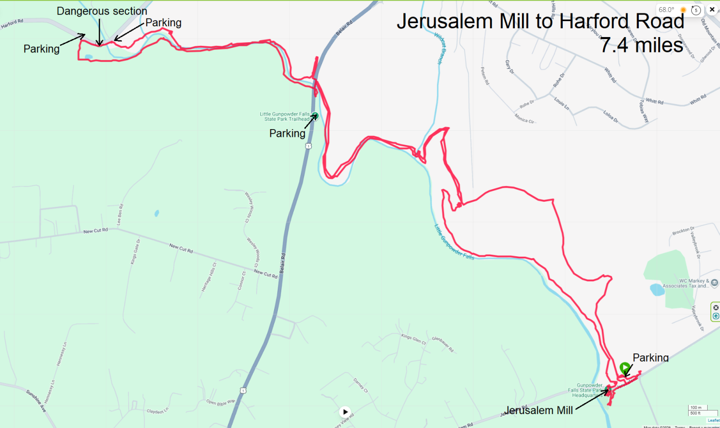
After our hike, we spent some time exploring the village. Here's the mill building. Jerusalem Mill used two interior water wheels for power. This permitted year round operation versus the more common external wheel which was vulnerable to freezing. - from sign titled "Mill Race Entry" 
This is the blacksmith shop. There was a blacksmith inside working. On certain days, folks come out and dress up in period costume to recreate the town back when the mill was being used. 
Jerusalem Mill is a very active place. They host various summer concerts. I am sure we will return. |
|
On June 8, 2026, Norma, Daphne, and I hiked to Devil's Nose in the Sleepy Creek Wildlife Management Area, West Virginia.
|
|
Norma and I had some business to take care of in the Waldorf area so rather than just drive there and back, we decided to make a day of it by exploring Chapman State Park, following the Chapman State Park Loop.
Norma, Daphne, and I arrived at a small dirt parking lot in an upscale residential area. Then we walked around a locked vehicle gate on a dirt road to the main trails. Purchased by the Chapman family in 1750, the 550 acre property was known as "Grymes' Ditch." It consisted of cleared fields and pastures, bordered by one and one-half miles of of Potomac shoreline. The Chapmans build their first home on the river shore in 1750. - from sign titled "Mt. Aventine Keys to History" This park is home to lots of invasive wineberries. In a few weeks, these plants will be full of tasty red fruit. 
We saw various old ruins including this one on the Coastal Woodlands Trail. 
This is the Chapman family cemetery. The first recorded burial here was in 1773. 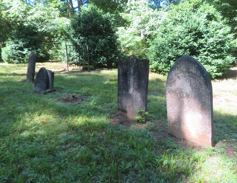
There were lots of paw paw trees but only a few were bearing fruit. 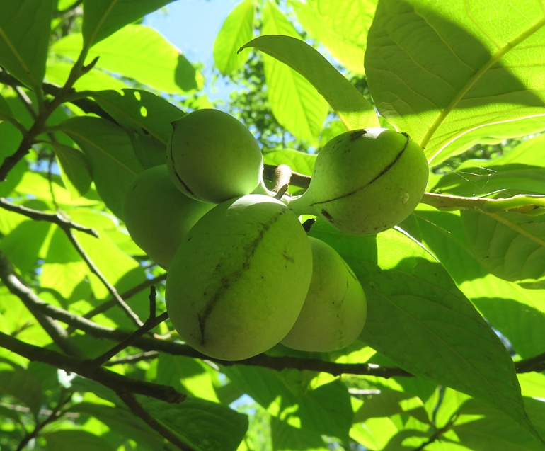
Part of our walk was along the Potomac River where were found the remains of some invasive mystery snails. 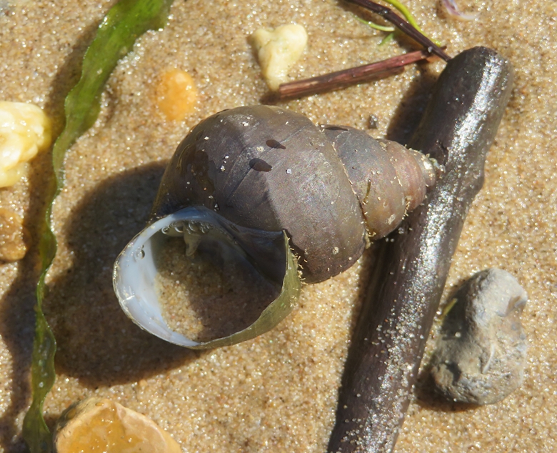
At numerous places, we came across pieces of turtle egg shells. I don't know if these hatched naturally or were eaten by a predator. 
Here's Norma and Daphne with a HUGE grape vine on the Marsh Trail, the biggest we'd ever seen! A little west of here, I saw a big black snake. 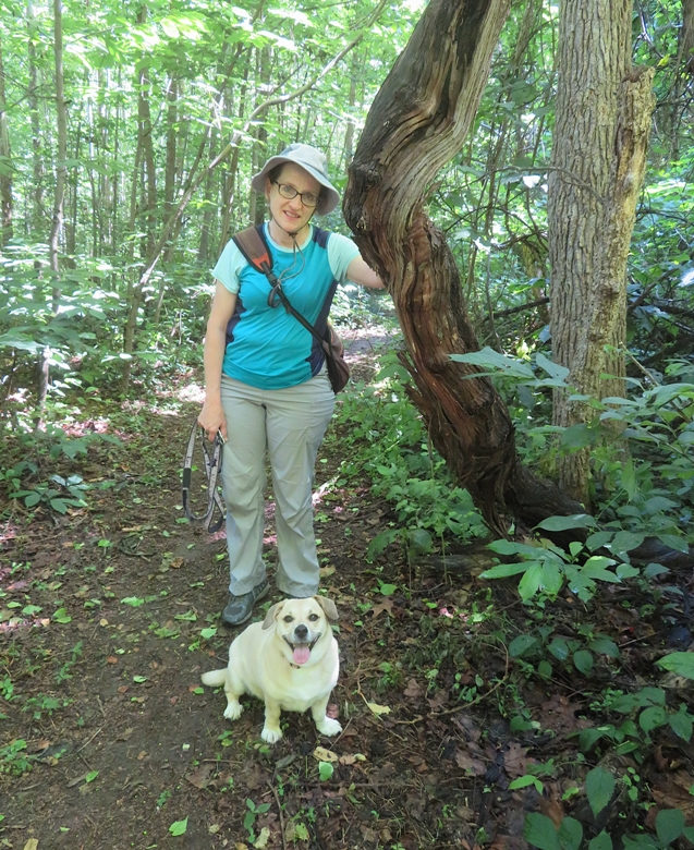
We saw quite a few mayapples. The fully ripe fruit can be used in marmalades, jellies, and drinks, but the rest of the plant and unripe fruit is poisonous. - from Cornell Botanic Gardens - Mayapple 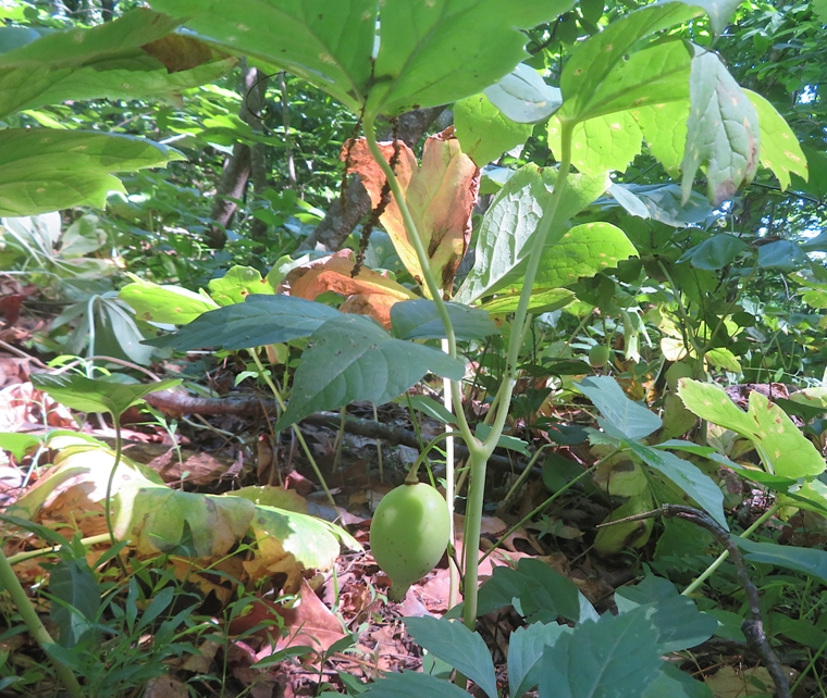
The west end of the Marsh Trail took us to a beach where I found some shark teeth. The outer teeth are from sand sharks. I'm guessing the middle one is from a mako shark. 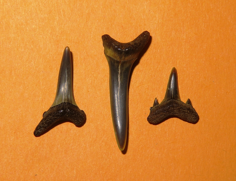
We saw a tobacco barn, circa 1900, on the Potomac River Trail. Here's our route...five miles. 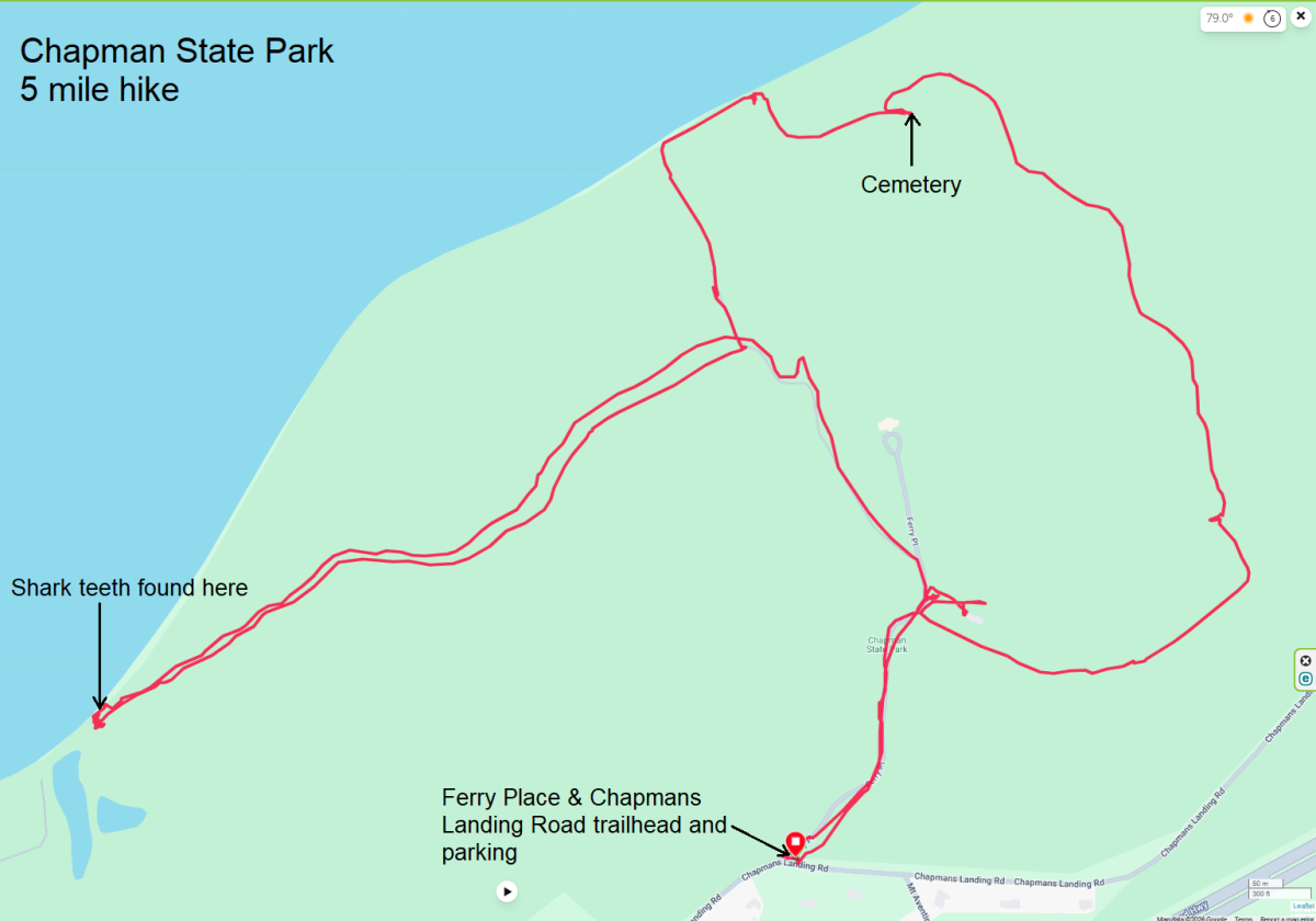
I came home, recharged, and then went paddleboarding. |
|
To celebrate the summer solstice, Norma, Daphne, and I did a 6.3-mile hike in Cromwell Valley Park.
We drove to the Willow Grove Farm entrance. There was a lot of construction going on but still a good bit of parking available. We chose to walk the Loch Raven and Meadow Trail Loop. A nice shaded trail along Minebank Run led us to three lime kilns: Shanklin (closest), Risteau (middle, not very visible), and Jenifer (far right). 
The Risteau Kiln [the oldest of the three] is thought to have been built out of local field stone before 1785. This type of kiln is known as an intermittent burn box kiln and it greatly increased the production of lime over its predecessor, the "pit" or "field" kiln. - from sign titled "Risteau Kiln" At a stop near a sign titled "Amphibians & Things," we saw bullfrogs in a small, manmade pond full of duckweed. At the Willow Grove Nature Education Center, we saw lots of chickens, two ducks, and wild turkeys, including this gobbler with two hens. 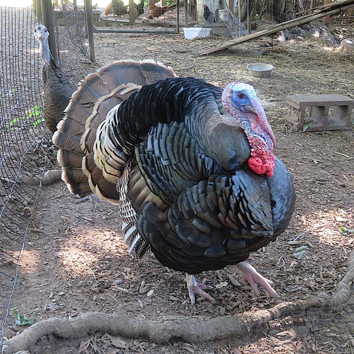
We saw various songbirds, including this northern mockingbird. 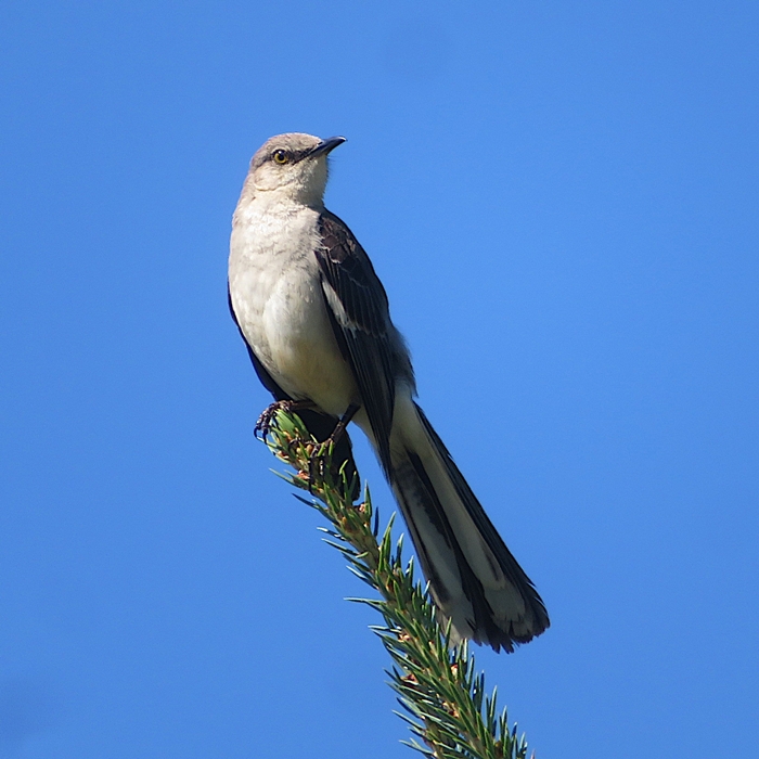
While there was plethora of milkweed plants, we only saw one monarch butterfly. I was also searching for chrysalises but found none. 
A small toad, only about an inch long, hopped across the trail in front of us. 
I found some beech blight aphids. I usually see them later in the year. 
There were lots of rocks with shiny flecks. 
Due to all the construction, we retraced our path a bit. On our second pass near the Willow Grove Nature Education Center, we saw this cider house. I like how stones are used in the daubing between the logs. The Cider House or or log storage house is a converted corn crib and an excellent example of a log structure that would have been found on a farm in 1800's Baltimore County. - from Cromwell Valley Park - Sherwood-Eck Trail 
Here's our route. Hopefully we can return to this park in the near future and explore some of the other trails. 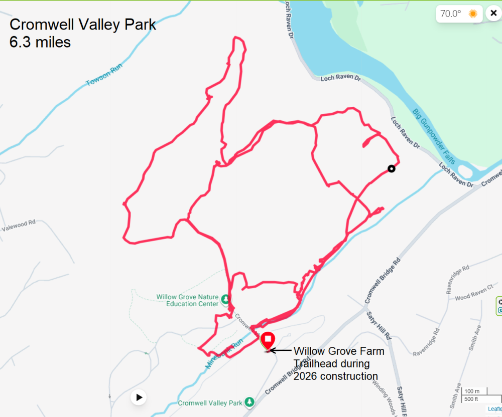
|
|
It rained a good bit the previous night and part of the morning so I suggested to Norma that we take a hike at Gwynns Falls because it is a paved trail. Hence we wouldn't get muddy. She agreed but only if we could bring a container so we could forage for wineberries, which are now in season.
We headed out with Daphne to the trailhead at the Carroll Park Golf Course. Ironically, it looked like it hadn't rained there for awhile. Carroll Park lies in the historic Washington Village-Pigtown neighborhood in southwestern Baltimore. Pigtown, Baltimore got its name in the mid-19th century because it was the drop-off point for livestock arriving on the Baltimore & Ohio (B&O) Railroad. - from trail sign The last time we were here was in 2010 for the Tour dem Parks, Hon! organized bike ride. On a fallen tree, I found a mydas fly, which is one of the largest flies in North America. While they resemble wasps and can be intimidating due to their size-often over an inch long-they are harmless to humans and do not sting. - from Google AI 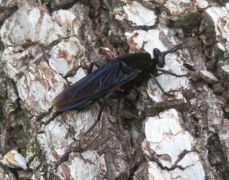
It didn't take long before Norma found several wineberries. 
Nearby, I saw a northern watersnake but it slithered away before I could snap its picture. Baltimore has a lot of prominent litter and graffiti. We saw much of both during our walk. 
Perhaps just as bad as the litter and graffiti were the spotted lanterfly nymphs, of which I saw well over a hundred. The spotted lanternfly first appeared in Maryland in 2018 (in Cecil County). However, it became a widespread, highly noticeable problem across central Maryland and most of the state between 2022 and 2025 as populations boomed and the state expanded its quarantine zones. - from Google AI 
We crossed several old vehicle bridges over Gwynns Falls, a stream named for Maryland settler Richard Gwinn, who in 1699 established a post, probably at Gwynns Run, to trade with the Indians. Gwinn made plans for a 'New Town' and built a stone fort - one of the first in an ongoing series of human imprints on the landscape. - from trail sign One bridge we did not cross, because it is still in use, is the Amtrak Northeast Corridor Railroad Bridge. We had a clear view of it at our turnaround point on the West Baltimore Street Bridge. 
On the West Baltimore Street Bridge we ate our lunch and watched the U.S. Navy Blue Angels performing for the Sail250 Maryland airshow. 
While it wasn't hot, it was extremely humid with overcast skies. I expect this weather along with the Sail250 Maryland event kept a lot of people away from the Gwynns Fall trail so we hardly saw anyone. This seemed very strange considering we were in such a densely populated area. One section of the trail was on a vehicle road that was closed to traffic. I wondered if Baltimore could ever gentrify this area and make it like Rock Creek Park in Washington, D.C. Atop a small cliff above the road, I could see brick ruins that made me think of the history of the area, especially the Mill Hill neighborhood. A three mile long millrace on the Gwynns Falls provided power for over twenty mills that sawed wood, ground flour, wove cloth and smelted iron. - from trail sign titled "Gwynns Falls Valley - From Work to Play" I kept looking for another snake but never found one. But at a creek that flows into Gwynns Falls, I spotted a black-crowned night heron. 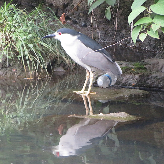
The three of us ventured off the main trail near the golf course. The trail indicated in AllTrails didn't quite match what we encountered. We were hoping to do a circuit in this area but changed it to an out-and-back. By the time we finished, we walked 5.5 miles. 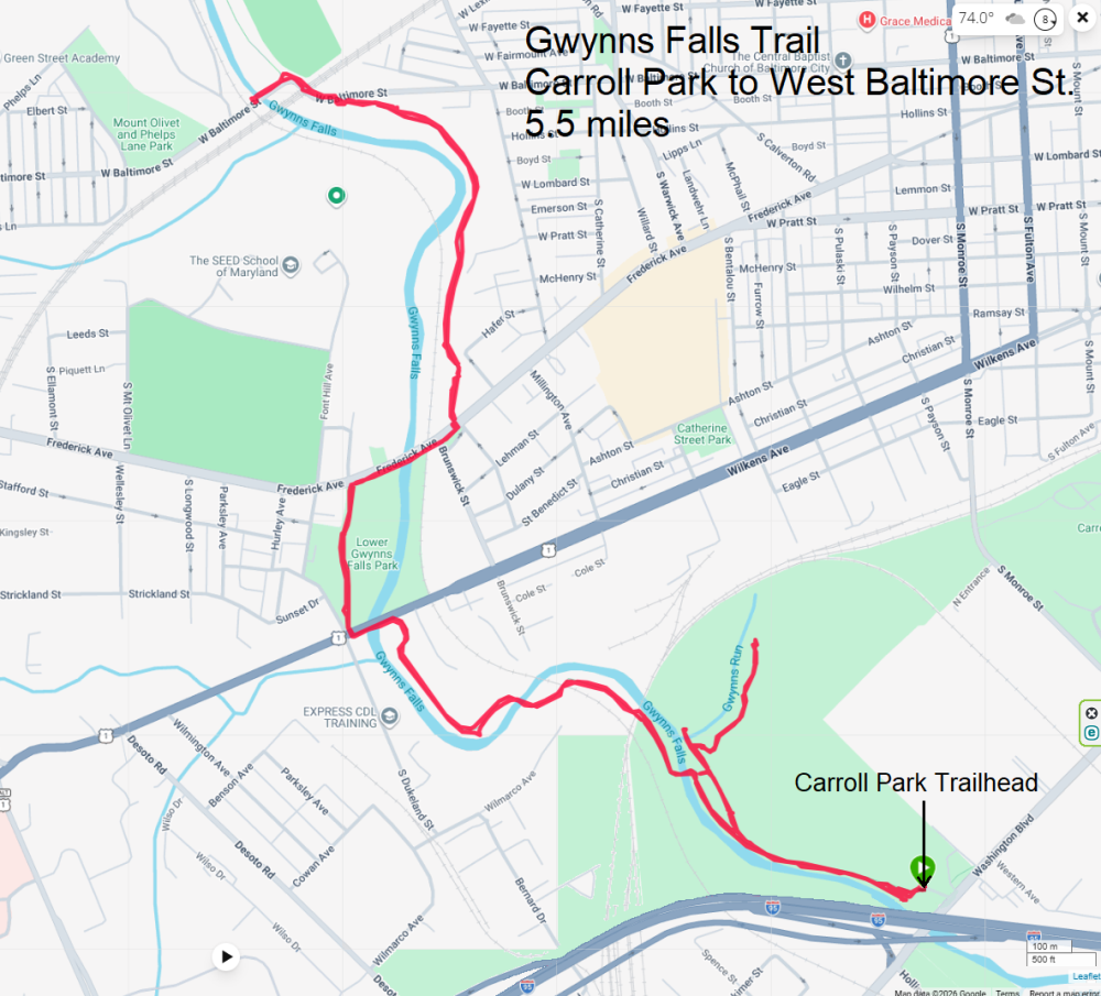
It was a great day for foraging. We picked a half gallon of wineberries along with a few blackberries. 
I'm certain we'll return to the Gwynns Fall trail, either for a hike when the dirt trails are muddy or for bicycling. |
|
Norma recently told me about Cheltenham Wetlands Park. Parks are great, but in my opinion, wetland parks are better because I am more likely to see interesting wildlife. Hoping to see a snake, we headed out there with Daphne for a morning hike.
It rained a good bit last night so I didn't know if we'd be walking through lots of mud puddles. Fortunately, that was not the case. There are small dirt trails through the woods that branch off a gravel road. Drainage is not an issue so even though things were a bit damp, there was little standing water on the trails. The place is full of trees and grass. 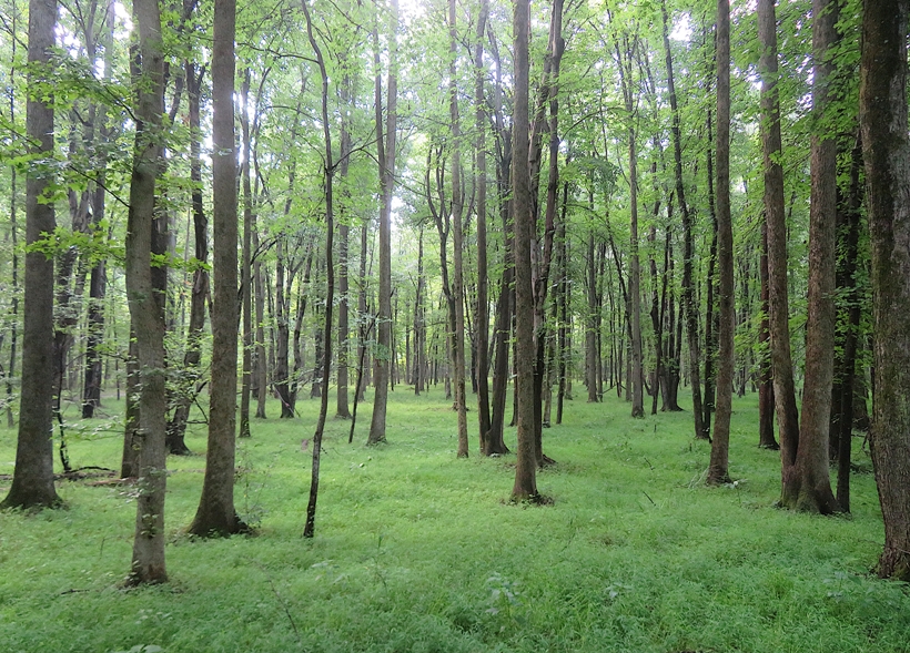
In one spot just off the gravel road, we found extremely big grapevines. 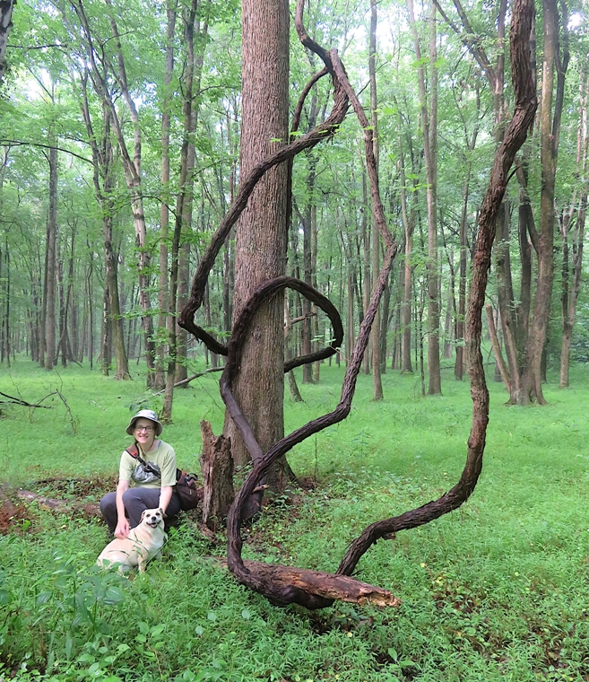
The park is not big, but they make really good use of their space to get the most mileage from their trails by making them meander around a lot. In the wetlands area, we saw a pair of mating snapping turtles. This is only the second time I've seen this. It is quite a sight. 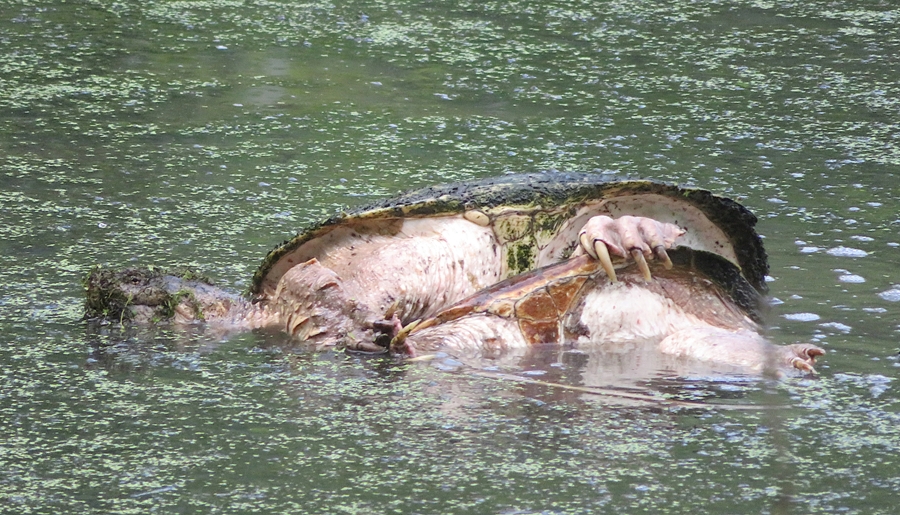
We saw lots of curious smaller turtles sticking their heads out of the water as we walked past. 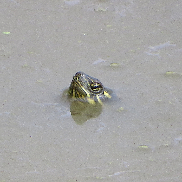
The park looks fairly new. At the entrance are very nice wooden sculptures. The signs are in excellent shape. Most of the bridges and boardwalk look new. We found some paw paw fruit, a few wineberries (not many), and something that we didn't recognize...blue vervain. Blue Vervain (Verbena hastata) is a native North American perennial wildflower known for its candelabra-like spikes of blue-purple flowers. Reaching up to 5 feet tall, it blooms from mid-summer into early fall. It thrives in full sun and moist to wet soils, making it highly attractive to pollinators and a staple in rain gardens. - from Google AI 
Here's a map of our route. We had no idea what to expect of this place. It is quite the secret. Nobody else was there. It is definitely worth a visit. 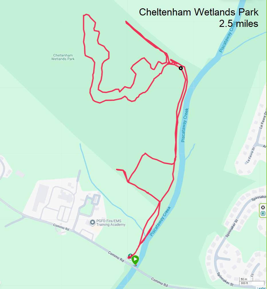
Since we only walked 2.5 miles, we figured we'd do another walk and hopefully see a snake. |
|
After finishing an easy 2.5-mile walk, Norma, Daphne, and I drove out to Rosaryville State Park for another short hike. We started at the Horse Trailer Parking, which was empty.
One of the first things I noticed was the abundance of blackberries. The ripe ones were not very sweet. 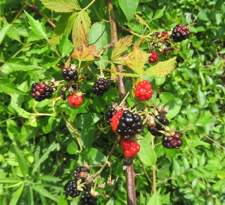
We walked on some paths comprised mowed grass that were very exposed. It was getting pretty hot and we preferred the shade so we altered our route a bit to stay under tree cover. Eventually, we found ourselves at the Mount Airy Mansion. George Washington attended the 1774 marriage of his adopted son, John Park Custis, to Eleanor Calvert at Mount Airy. - from Maryland DNR - Rosaryville State Park - Mount Airy Mansion 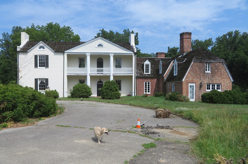
I found some wood ear mushrooms, which we've also found in our back yard. Wood ear mushrooms, also known as black fungus or tree ear, are gelatinous, ear-shaped fungi widely used in Asian cuisine. Prized for their signature snappy, cartilaginous crunch rather than their mild flavor, they easily absorb surrounding sauces and seasonings in stir-fries, hot pots, and soups. - from Google AI 
This looks like some shell-like creature one might find in the lower part of the Chesapeake Bay, but these are actually deflated puffball mushrooms. I guess the heat got to them. 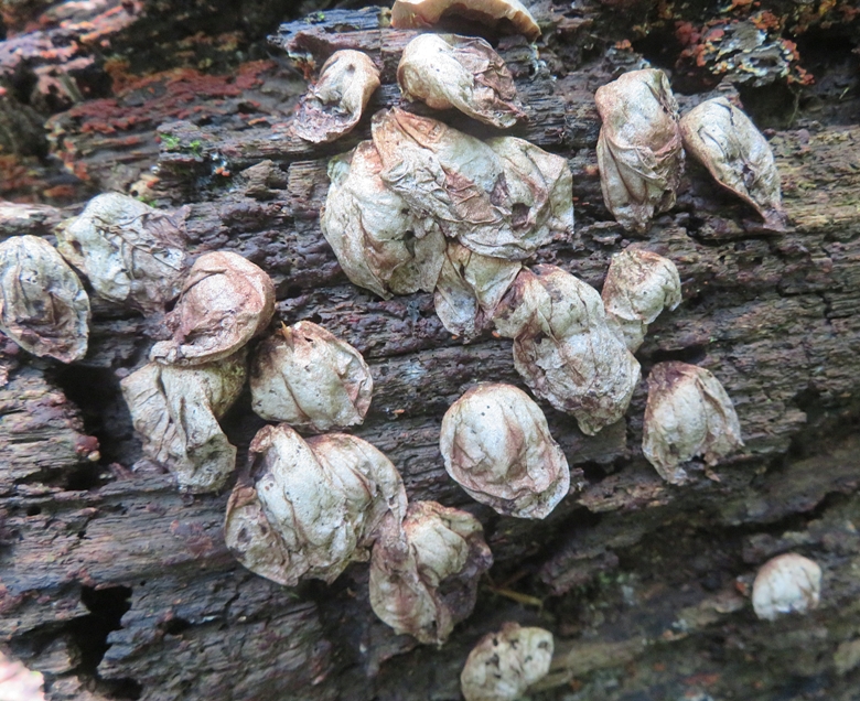
Here's some ink cap mushrooms. 
Here's our route. We hiked 3.5 miles here for a day's total of six miles. 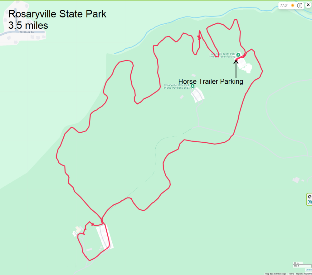
No snakes were seen. We were hoping to catch the Bowie Farmer's Market but we would have likely arrived near their closing time. So instead, we picked up lunch at Chipotle. |
|
This is probably the shortest walk that I would bother to blog about. With a round trip of 1.2 miles, it may seem insignificant in terms of distance, but this route might hold great importance from a historic point of view.
Back on January 17, 2026, Norma and I attended a talk given by members of the Piscataway tribe. One of the speakers, David, from the Anacostia River Watershed, mentioned a quarter mile-long "land bridge" connecting two separate watersheds: the Anacostia River and the Patuxent River. Looking at maps, I think I found the route that David described in Lanham, Maryland. So on this day, Norma, Daphne, and I retraced it. The three of us started at Brier Ditch which eventually flows into the Anacostia River. 
From here, we walked 0.6 mile, mostly on Good Luck Road, to Bald Hill Branch. This eventually flows into the Patuxent River. 
Why was this route so significant? Prior to the arrival of Europeans, trade and travel by Native Americans in the Chesapeake watershed was often done via water, so having a waterway navigable by canoe presented many opportunities. Depending on the destination, one could paddle downstream on Brier Ditch to the Anacostia River, then to the Potomac River, into the Chesapeake Bay, then back upstream on the Patuxent River and its tributaries to get to Bald Hill Branch. But that would be a trip of well over a hundred miles. These two waterways weren't as close as the land bridge that David described. I suspect a lot has changed over the last 500 or so years. Even as late as 1843, the last large sailing ship could still reach Bladensburg. After that, silt made the Anacostia River too shallow. In later years, dredging was employed to maintain depth. So these two waterways we saw might have at one time been easily canoeable. I can't say for certain that the route we walked was indeed the land bridge once used by the Piscataway but it is likely very close. Just knowing something like this existed is something that makes me more appreciative of Chesapeake Bay history. Here is our route. 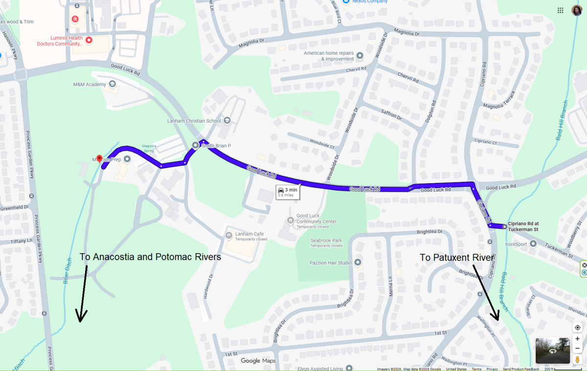
Having completed our "micro-hike," we set out to do some bicycling. |