|
This page describes my kayaking and standup paddleboarding adventures in 2026. |

|
This page describes my kayaking and standup paddleboarding adventures in 2026. |
|
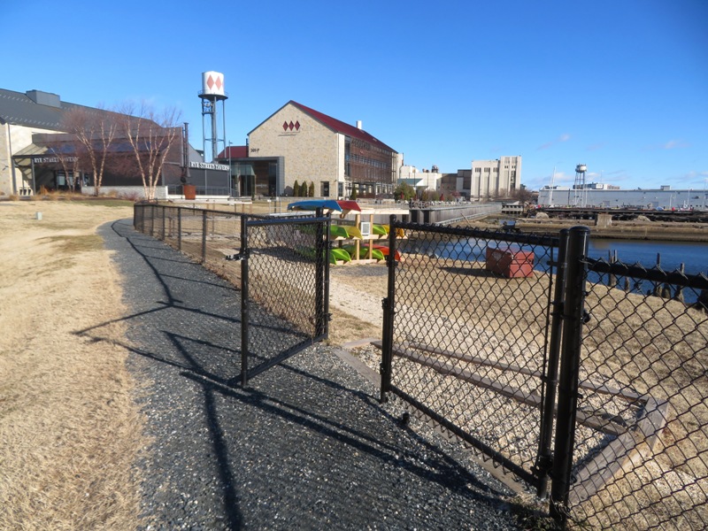
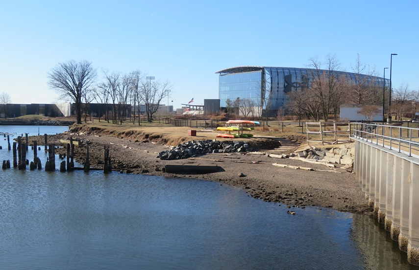
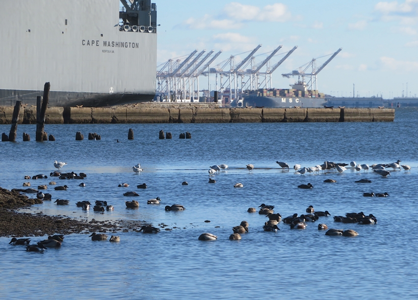
Many people start off the New Year with a "First Day Hike." But with gusts creating a wind chill of 14 degrees Fahrenheit, it was not a good day to be outdoors for an extended period of time. So instead, Daphne and I scouted launch sites.
Baltimore Peninsula
Sparrows Point
 |
|
After leading a WatersEdge hike at Wincopin and Huntington, I figured I'd make use of the remaining daylight to get out on the water. Normally, I would have brought Daphne but after hiking 6.8 miles today and about five miles the day prior, I figured she had enough.
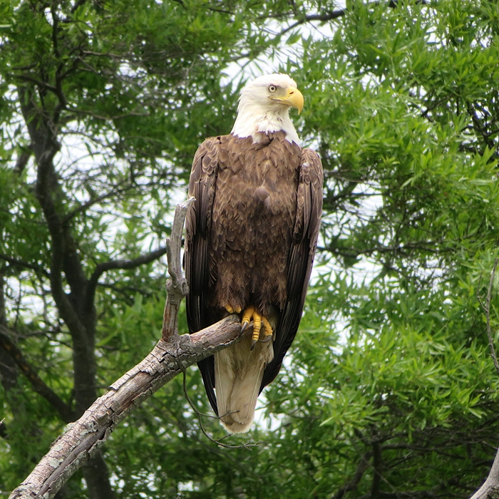
It was fairly windy (9-10 mph) and the tide wasn't high anywhere nearby. So I decided to launch at Galesville where I knew at least some of the dredged waterways would be sheltered from the south wind. This was my first paddling trip of the year. It wasn't particularly memorable. I saw some bald eagles but I was really hoping to see a great blue heron rookery. No such luck. But it was great just getting out on the water. 
It seems the Canada goose population has really been taking off. In certain areas where the human population spikes, there is often a housing shortage. One might interpret this to also be the case with this goose that decided to take refuge on an osprey platform. 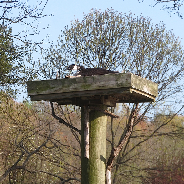
Nearby, a pair of osprey were looking disapprovingly at their new neighbor. 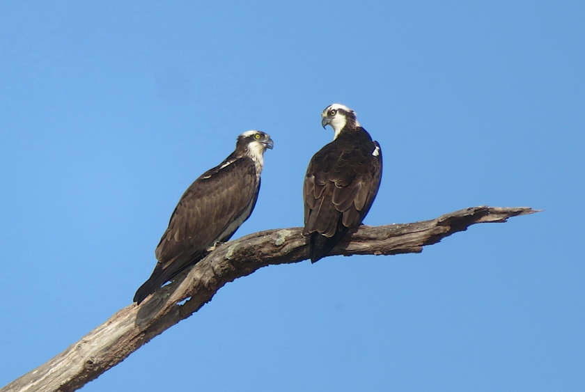
Normally, I see jellyfish in the summer but what I saw today were lion's mane jellyfish. The lion's mane jellyfish is more common in colder northern oceans, but can be found in lower Chesapeake Bay during winter and early spring. [It is] The world's largest jellyfish, with a bell up to six feet wide and tentacles exceeding 100 feet, although it grows much smaller in Chesapeake Bay. - from Virginia Institute of Marine Science - Lion's Mane Jelly 
I ended up paddling 7.6 miles...at least that's what my GPS said. But after this morning's hike, I am starting to question its accuracy. Someone else said our walk was 6.8 miles while my GPS said eight. So maybe I paddled something more like 6.7 miles. 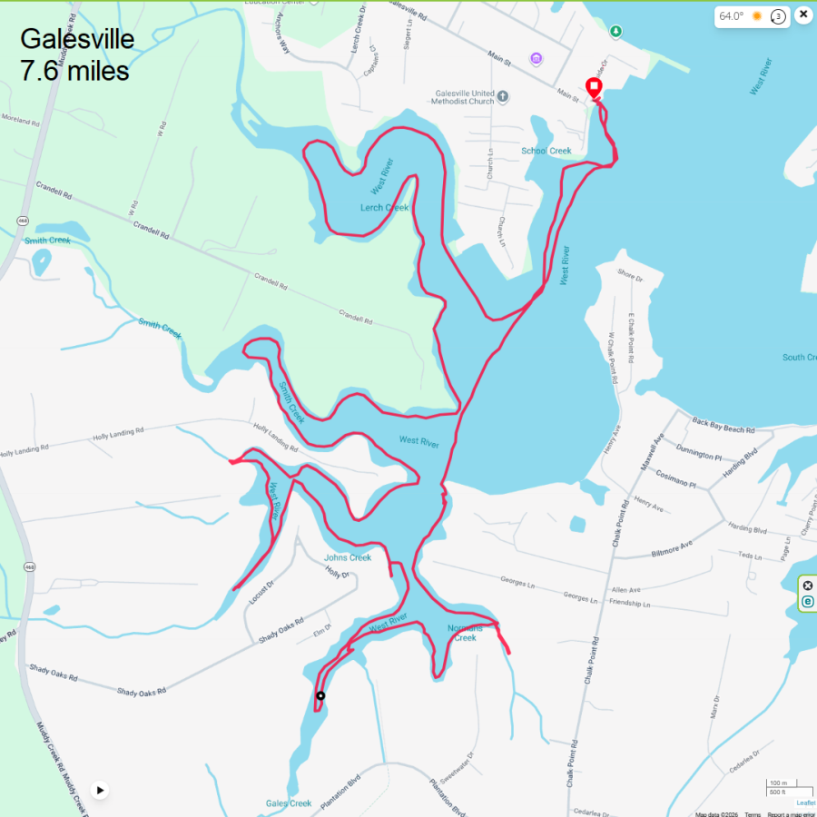
I drove home and then mowed the front yard. Not enough daylight to do the back. |
|
Norma and I dogsat Sophie, who is the pet of Erin, our friend and Norma's co-worker. Sophie is also a good friend of Daphne. During her visit, I offered to help entertain Sophie by taking her paddleboarding at Patuxent River Park.
Sophie had never been paddleboarding and she tends to be skittish so I chose a route that was easy and where I could ensure she would have plenty of opportunity to go ashore. The three of us launched onto the Patuxent River via Selbys Landing. Within about 15 minutes, Sophie fell off. I pulled her back onto the SUP. The water was cold so I took off her PFD and let her shake off. Then I put Daphne's wetsuit on her before putting her PFD back on. Daphne is very stable on the SUP and the air wasn't cold so I didn't think she would need it as much as Sophie. Sophie sometimes has a tendency to go limp as if she isn't making much effort to stay balanced. She is rather frail and slight compared to Daphne. I really had to make an effort to keep the SUP from tilting, which meant I had to go pretty slow. One thing that worked to keep Sophie balanced was to put her between my feet. That gave her sort of a wall to keep from falling left or right. Continuing on, we paddled up Mataponi Creek. It was a sunny and peaceful day. Except for a walker out in the distance, I never saw another person while we were out on the water once we got away from the pier. We saw a few beaver lodges. On the one shown below, if you look closely, you can see a turtle on the right side. On the left side (out of view) is a snake. A few times now I've found snakes sunning themselves on beaver lodges. 
I put my camera on a wood duck box to snap some selfies. 
We pulled ashore and I let them explore and sniff around. I saw some frogs and lots of small fish and tadpoles at one of the stops. 
I saw a few turtles, including this eastern painted. 
I watched an osprey hover as it searched for fish. Once it picked one out, it then dived into the water to grab it. 
I pulled over at least two more times to let the girls go ashore. Here we are at White Oak Landing. 
I ended up paddling a mere 4.7 miles. 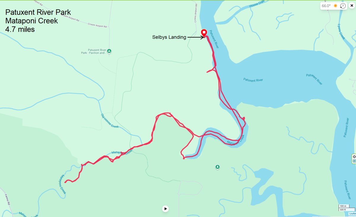
I can't say Sophie necessarily enjoyed being on the SUP but I do think that she could grow to like it. She shook most of the time but there were also times where she relaxed and lied down. I then took the girls on a fast, three mile out-and-back hike on the Red Trail, starting from the Blue-Red Connector. Again, I chose this spot with Sophie in mind. It was a scenic, wooded route where we saw absolutely nobody. I was comfortable letting her off leash once we got away from the road. Having Daphne as an example, she knew what was expected of her. |
|
I had a few hours after work to get out on the water and enjoy the 92 degree temperature. Leaving straight from a class, I drove to Southwest Area Park and was on the water by 1640. A sign said the ramp closed at 1900 so I didn't have a lot of time, but I had enough.
The sky was clear. It was a great day for taking photos. As those thoughts came out of my head, I saw a red-winged blackbird land on a pile by the boat ramp. Someone put out some food for it. Its hunger outweighed its natural fear of me so it gracefully posed while I snapped its picture. 
I paddled downstream on the "Little" Patapsco River. On the east side, I saw a marshy area with lots of stakes and string, as if indicating it was a place that was being improved with vegetation. Tied to these strings were lots of silver strips. I don't know the purpose of these strips. I have since named this spot "Tinseltown." 
I paddled under Route 2 and then into the "Big" Patapsco River. Heading east, I saw other spots resembling Tinseltown but without as much tinsel. I pulled ashore at a small, sandy beach near one of these places. I found vegetation that was clearly planted by people. A turtle with unusually long front claws posed for me. It reminded me of Freddy Krueger. 
I encountered very strong wind which slowed my pace to a crawl. Still, I reached my destination, Captain Trash Wheel in Masonville Cove. 
I consided portaging over the containment boom used to direct trash to the trash wheel. Then I could explore upstream of it. But I didn't have enough time. Still, I was able to determine that the best place to portage would be on the southwest side. 
Returning to the "Little" Patapsco River, I shot an urban selfie under Route 2. 
I paddled through a culvert under Highway 895 where I found a very large fishing spider. 
I saw something scurry away into a crack between two concrete slab walls. I used the flash on my camera to find it and then capture its image. Google AI says they are marsh crabs or ghost crabs. 
I was off the water by 1850. Here is my route. 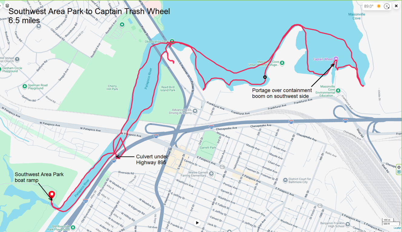
I stuck around a bit to look for amphibians or their eggs but found neither. |
|
During April 18-25, 2026, I did a group kayaking trip in Savannah, Georgia where 16 of us stayed at an AirBnB house.
|
|
After work, Daphne and I went paddleboarding, launching from Jonas and Anne Catharine Green Park. Driving there in rush hour traffic was a bitch.
On the water, we crossed the Severn River to the south side and then explored everything between the Baltimore Annapolis Boulevard (route 450) Bridge (aka Naval Academy Bridge) and the Severn River Bridge (highway 50). The best part of my trip was on Weems Creek because it was so sheltered from the wind. Here we are under Rowe Boulevard (route 70). 
I was lucky to capture a view of a great blue heron taking flight. 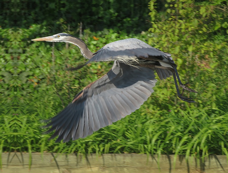
On the north side of the Severn, we spent some time in a small cove where we saw two muskrats. But by that time, it was getting dark so I couldn't get a good pic. 
I ended up padding 8.3 miles, leaving the park about 10 minutes before it closed at 2000. I could tell the ranger was ready to close on time. 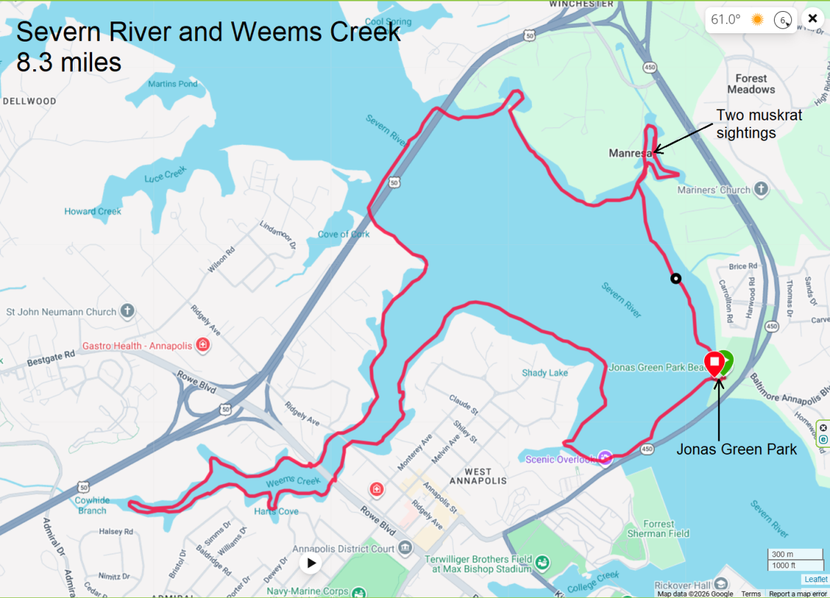
|
|
I went paddleboarding after work on the "Little" Patapsco River, launching from Southwest Area Park. I really like all the trees, islands, and narrow waterways. But there is also a lot of trash and traffic noise.
Today was sunny and cool with a moderate to light breeze. We've been having lots of dark or windy days so I didn't want to pass up this opportunity to enjoy the weather. I left Daphne at home because I headed out straight from work and didn't want to go home first to pick her up. I saw various birds. I also saw a turtle with a two-inch wide shell. Notice the fishing line next to it. This is a very popular place for fishing and there is a lot of monofilament hanging from the branches. Best to bring a knife or scissors so you can cut yourself free if you get tangled. 
I pulled over near at the base of a power line tower and then walked a bit on an overgrown trail. A few days later, I realized I had brushed up against some poison ivy. I turned around after exploring a creek just beyond the Annapolis Road (route 648) bridge. On the return, I took this selfie because I like the way the light reflects off the water onto the bridge support. 
Here's my route. I called this a "leave no stone unturned" trip because I explored every paddleable waterway. 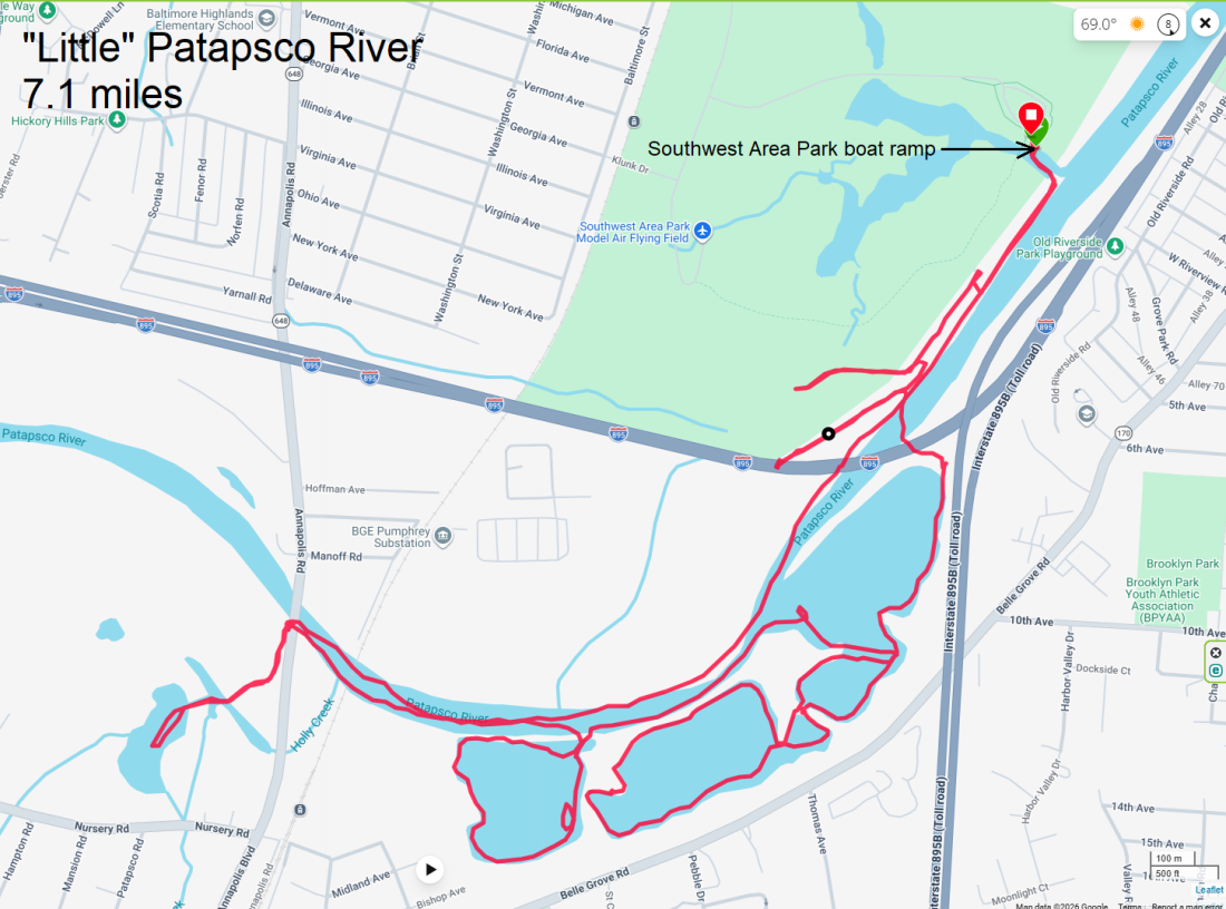
I forgot to bring my watch but somehow managed to finish just ten minutes before the ramp closed. But I don't think they actually enforce that rule. |
|
Daphne and I launched my SUP from Discovery Village. A few months ago, there was a lot of hype because Anne Arundel County claimed to have lost this public access site. People complained and after a few weeks, things were resolved. So it remains a public launch area.
It was a very warm and overcast day with very little wind so the water was fairly calm. We saw Canada geese in Parish Creek. Three adults were taking care of 17 little ones. After paddling out into the Chesapeake Bay, I then spent some time near Horseshoe Point exploring a narrow waterway. Here's what the entrance looks like in case you want to check it out for yourself. 
This is a fun place to explore early or late in the year when there aren't so many biting insects. Today was not such a day. But it was still worth checking out. We saw two muskrats. 
Paddling south in the bay, we turned around at Franklin Point and then headed back north. At Jack Creek Park, I saw two bald eagles. One was willing to pose for me. Back on the water, from a distance I spotted what I thought was a bird I'd never seen before. But zooming in with my camera, this is what I saw. 
I ended up paddling 10.6 miles. Here is our route. 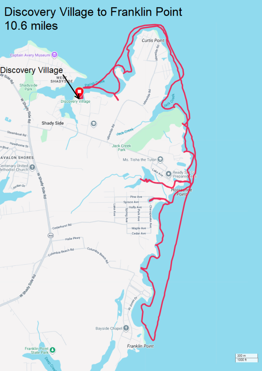
|
|
Daphne, Sophie, and I launched my SUP from Commander John L. Dunning, Jr. USNR (Retired) Memorial Pier at Mill Creek Cove. We've visited this place before but this is the first time I've put in.

Here's a view of the marina and boat ramp from Mill Creek. The beach where we launched is behind the walkway on the left. 
Paddling upstream, we passed under Saint Margarets Road (Route 179). We saw lots of straw stalactites. Also known as soda straws, straw stalactites are thin, hollow, cylindrical tubes that hang from cave ceilings. They represent the very first, delicate phase of all stalactites and are formed drop by drop as minerals (usually calcite) are left behind by seeping water. - from Google AI 
After the Saint Margarets Road bridge, Mill Creek got quite shallow. Being out near low tide didn't help. We made it a little further until we came to a fallen tree that I didn't think was worth portaging. 
Near the turnaround, we heard lots of gunfire. Someone wasn't hunting...they were preparing for the zombie apocalypse. Lots of double tapping. Daphne was not happy. If Sophie wasn't, I couldn't tell. On the return, we saw three juvenile tundra swans. Trumpeter swans (Cygnus buccinator) are the largest native waterfowl in North America. - from Google AI 
I made sure the girls got to go ashore whenever they could, which wasn't very often. This creek has lots of private property. Not much public space. The scenery wasn't very impressive unless you like big, expensive homes. Sophie did far better on this trip than the last one we did on April 10. She did not fall in and was fairly stable. She usually didn't look confident but that is just how she is. 
Here's the three of us near the launch area. 
My GPS battery was low so I used my phone. But it was overheating so it didn't map my whole route. I'm guessing I paddled about seven miles. 
After paddleboarding, I took Daphne and Sophie for a walk in the woods, mostly on Poet's Nature Trail. I found this raccoon skull near the trailhead behind Greenbury Point Nature Center. 
We saw evidence of a spittlebug. I may be known for making big bubbles but I can't compete with these critters for number of bubbles. These small insects get their name from the globs of foamy "spit" they create along the stems of plants. They produce the frothy mixture by mixing air with fluid excretions, but not out their mouth, so it technically isn't spit. The immature bugs feed face down on the stem, and as excess sap is excreted out the anus, it is mixed with a substance secreted by epidermal glands that enhances surface viscosity and stabilizes the foam to make it last longer. This mixture is forced out of the abdomen under pressure and as it is mixed with air, it forms bubbles. Some species can produce as many as 80 bubbles per minute. - from Wisconsin Horticulture - Spittlebugs 
From one section of the trail near Carr Creek, we saw three iconic radio towers, once used for communication with submarines. 
Here are the besties, ready for the ride home. 
|
|
After hiking that morning, I decided to continue to take advantage of the great weather and get out on the water. I figured Daphne had enough physical activity for the day so I went solo, launching from Broening Park and heading to the Baltimore Inner Harbor.
Along the way, I did a short detour to get a view of the Peacemaker, which I last saw on January 1, 2026. 
In the Inner Habor, the lighting was good for seeing the USS Constellation. 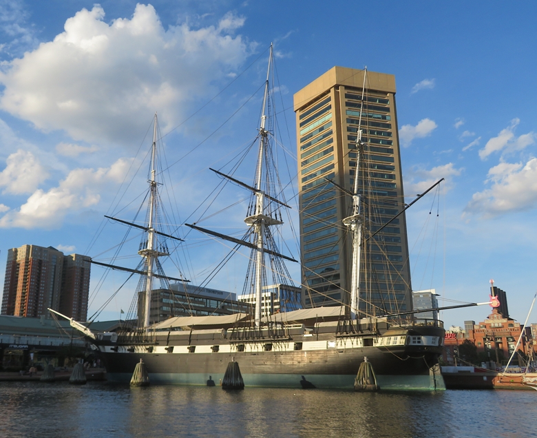
Here's a sight that everyone in the Baltimore area should know. 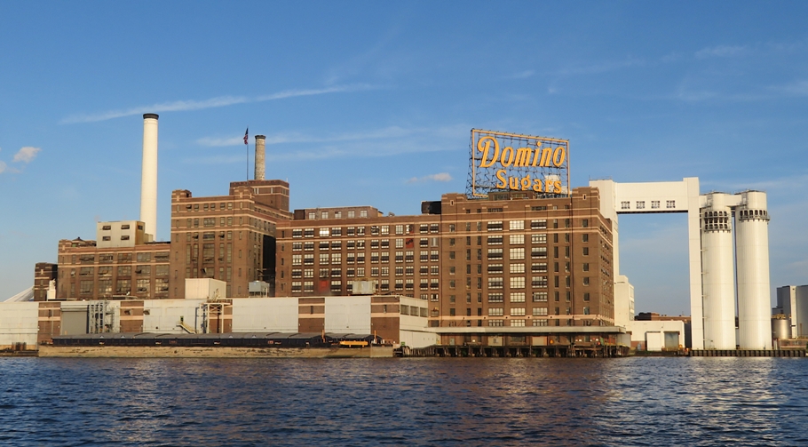
I got an up-front, close, and personal view of the bow of a ship near Silo Point. Look at how it dwarfs the cormorants perched on its mooring line. 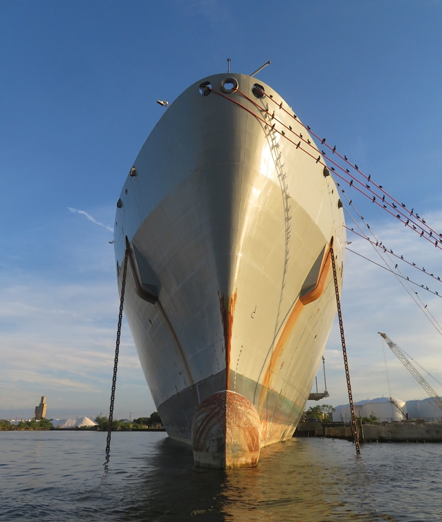
I saw the Danzigeracht, a cargo ship from the Netherlands. To its left is the Lazeretto Point Lighthouse. To its right is the remains of the Francis Scott Key Bridge. 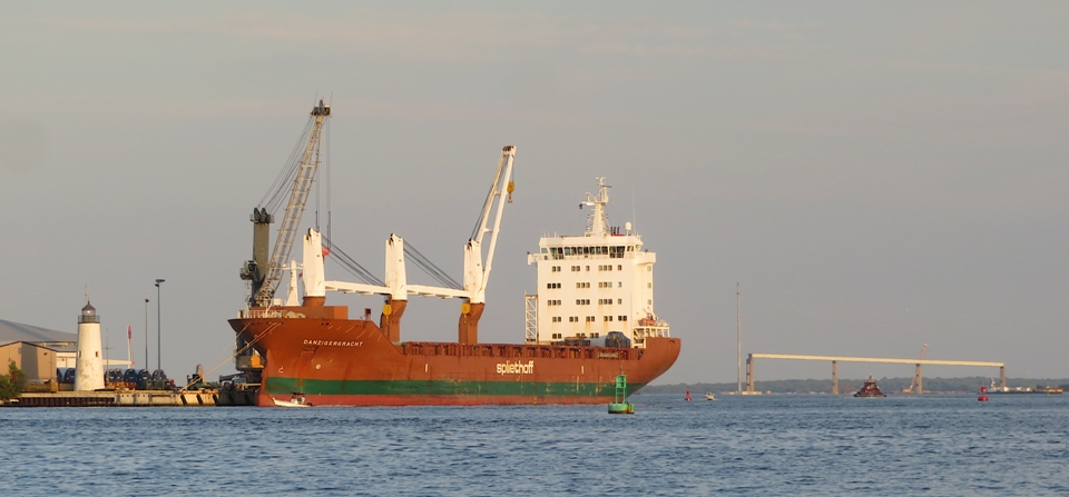
I saw a condom floating in the water. Unfortunately, this is too common of a sight in this area. A sight I would like to be more typical are rays, which I spotted. 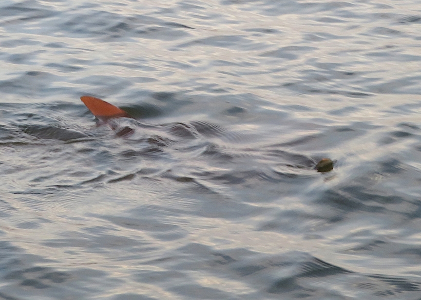
I saw a nice sunset over the Baltimore Peninsula. 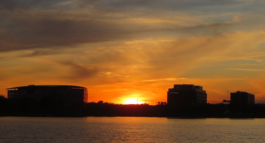
Here's my route. 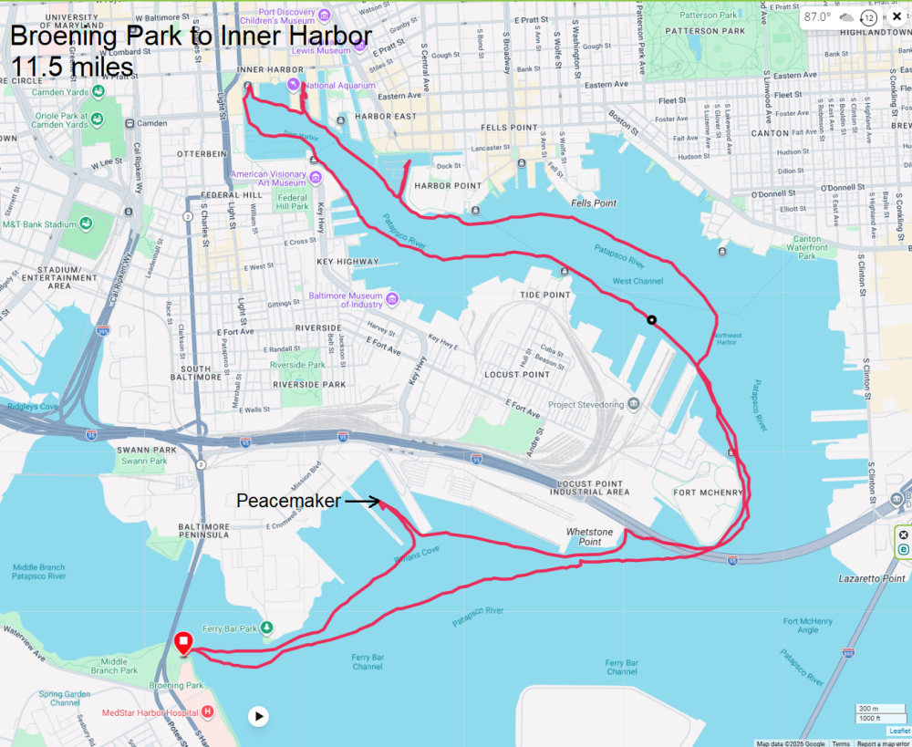
|
|
The weather was supposed to be pretty good early in the morning with strong wind picking up later. So I decided to get an early start by waking up at 0500 and driving to Cambridge where I launched my SUP onto Cambridge Creek from the Trenton Street Boat Ramp with Daphne.

Today was a special day in Cambridge because the 1877 tall ship Elissa was arriving. They said it would be around 0800 so I made sure to be on the water about a half hour prior. Towards the mouth of the creek, I saw the remains of the schooner Mist of Avalon from Nova Scotia, Canada. If it had been maintained, I am sure it would have been quite a sight but it might be too far gone by now. 
On the other side of the creek, I saw the YP677 which was sold for $88k. That might sound like a good deal but I think this boat needs a lot of TLC. It was launched in 1984. YP boats, or Yard Patrol craft, are United States Navy vessels designed for at-sea training, seamanship, and navigation. - from Google AI Where the creek flows into the mighty Choptank River, I saw the Choptank River Lighthouse. It is a replica housing a small museum. 
Right around 0800, I saw the Elissa heading up the Choptank. This ship is huge...big enough to be deemed the official tall ship of Texas. 
Elissa was built and launched in 1877 in Aberdeen, Scotland. Elissa also sailed under Norwegian and Swedish flags. In 1918, she was converted into a two-masted brigantine and an engine was installed. She was sold to Finland in 1930 and reconverted into a schooner. In 1959, she was sold to Greece. In 1970, she was rescued from destruction after being purchased for the San Francisco Maritime Museum. However, she languished in a salvage yard until she was purchased for $40,000 in 1975 by the Galveston Historical Foundation, her current owners. - from Wikipedia - Elissa (ship) One great thing about being on a SUP or kayak and seeing the ship as it arrives is I can maneuver around it to get the best and most well-lit views. Daphne and I continued upstream, passing under the Frederick C. Malkus, Jr. Bridge (Highway 50). Then we explored an unnamed creek by the Cambridge Waste Water Plant. There, I had a close encounter with a muskrat that I almost hit with my SUP. I also saw two bald eagles here. Heading back downstream, we now had a fairly strong wind to our back. We pulled ashore at Sailwinds Park to take a break on the beach and admire the "Flying Geese" Grand National Waterfowl Association monument fountain. By the time I paddled back downstream on the Choptank River, the Elissa was moored. For more info about this ship, see Galveston Historic Seaport – Home of the 1877 Tall Ship Elissa. 
Back on Cambridge Creek, I saw a black-crowned night heron. Here's my route. I got in eight miles. 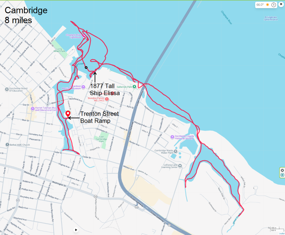
I did some exploring in Cambridge. There are definitely some very nice areas. On the way out, I saw a famous mural I'd seen dozens of times before. "Reflections on Pine" is the name of the mural on Maryland Avenue in Cambridge which recognized "Maryland's rich African-American history, culture and heritage, particularly in the community around Pine Street, home to one of the oldest African-American communities in the country dating back to the mid-1800s. - from Michael Rosato - Cambridge African American Heritage 
I thought it was interesting how this is the Juneteenth weekend and the tall ship Elissa is based out of Galveston, Texas. Galveston is the official birthplace of Juneteenth, as it was here on June 19, 1865, that Union Major General Gordon Granger issued General Order No. 3, officially proclaiming freedom for enslaved African Americans in Texas. - from Google AI I spent 2.5 hours on the water. While the drive to the eastern shore was easy, heading back was slow. I spent a total of 3.5 hours driving to and from my destination. My rule of thumb is to never spend more time driving than on the water. So one could say this was a fail. Still, I did manage to see a lot of cool stuff so maybe I'll make an exception. Back home, I attended the second half of the Savage Bluegrass Festival which was really good. |
|
I've paddled at every Maryland Fleet Week since the first in 2016. At first, I figured Sail250 Maryland would be just another fleet week until I saw the schedule. This one would be HUGE! Celebrating our nation's 250th anniversary, Maryland decided to go all out and invite lots of tall ships and air show performers. I think part of what makes this all possible is that Baltimore's celebration ends just a few days before the Sail4th event in New York City. So the ships and planes visiting us can just pack up and head north once they are done.
Watching the weather, opening day looked fantastic in terms of low wind and lots of sun for taking pictures. So I worked a short day, came home to get Daphne, and then drove to Canton Waterfront Park. I figured Baltimore would go all out to cater to visitors but they didn't even bother to unlock their public restroom or provide porta-johns at the park. My first stop was Tide Point where I saw three very tall ships: Here's the three of them. 
This is the Juan Sebastian de Elcano. I'd like to return in the morning when the lighting is better. This photo doesn't do it justice. 
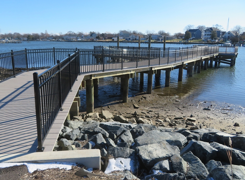
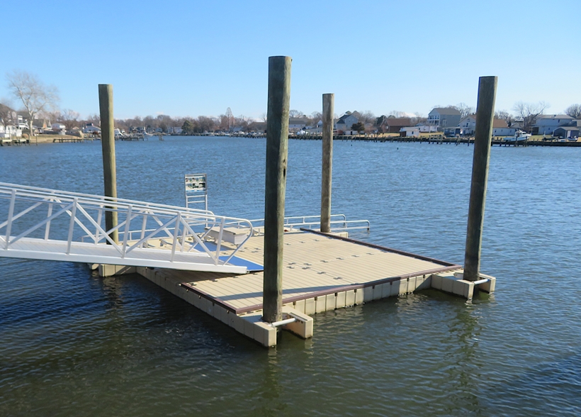
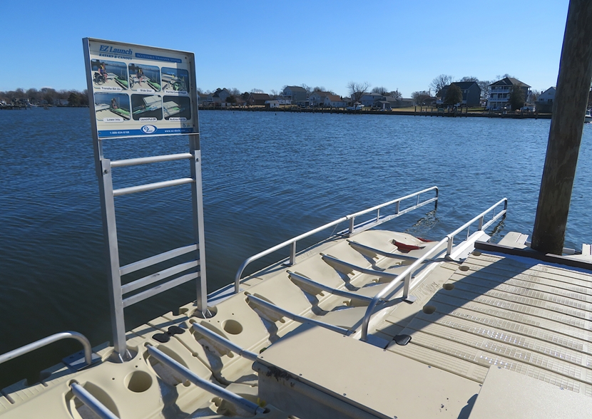
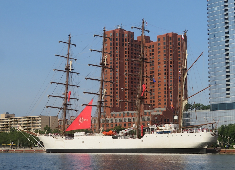
I paddled into the area where folks go to catch the water taxi. Then I got someone to take my pic in front of the ARA Libertad. The rest of my time at Tide Point was spent near the Amerigo Vespucci. On June 5, I read on social media about ...the opening of Baltimore's newest public kayak launch at Rash Field Park on Wednesday, June 10 at 9am! This new ADA-accessible launch expands public access to the harbor and officially completed the Inner Harbor Heritage Water Trail, a unique paddling route connecting Baltimore's waterfront parks, historic landmarks, museums, and maritime heritage sites by water. Investigating more closely, I found an aluminum pier with kayaks for rent at 39.28203984064535, -76.6077030941094. Maybe someone could launch their own personal boat here but there would be no place convenient to park. Making my way around to the west side of the Inner Harbor, I saw the BAP Unión from Peru. This is another one that I'd like to photograph in morning light. 
Near the National Aquarium, I saw: Here's the BAE Guayas. Between Pier 4 and 5, I found the Gorch Fock. I saw various sailors and Marines. Of the latter, I spoke to four of them stationed on the USS Arlington (LPD-24). When I was in the Marines, I was stationed on the USS John F. Kennedy (CV-67). We spoke to each other about training and what it was like being on ship. They asked for recommendations of things to do in Baltimore. Hearing myself rattle off some suggestions, I quickly realized that my interests and those of a 20-something year old are probably quite a bit different so my suggestions probably didn't appeal to them. I got to see the NRP Sagres come into port. Tug boats guided it to its assigned location. I made sure it was properly secured to the pier before venturing close. I know it isn't a ship, but I just had to take a selfie with Mr. Trash Wheel. 
In Fells Point, I saw our own Pride of Baltimore II. 
Here's Daphne and I feeling Baltimore proud! 
I knew there were several kayakers from the WatersEdge group that were launching at 1900. My plan was to cross paths with them so I could take their photo. I guessed that they would stay along the shoreline during the first part of their trip and then do an open water crossing at the end. I was wrong. That meant we were heading the same direction so I only saw them from a distance. Here's a few of them with the MV Gary I. Gordon and the MV Charles L. Gilliland in the background. 
I ended my day feeling on top of the world. I saw more tall ships in one day than I'd ever seen before. Being able to see them via SUP with Daphne was the greatest feeling. Today was without a doubt one of the best outings I'd ever had. Here's our route. 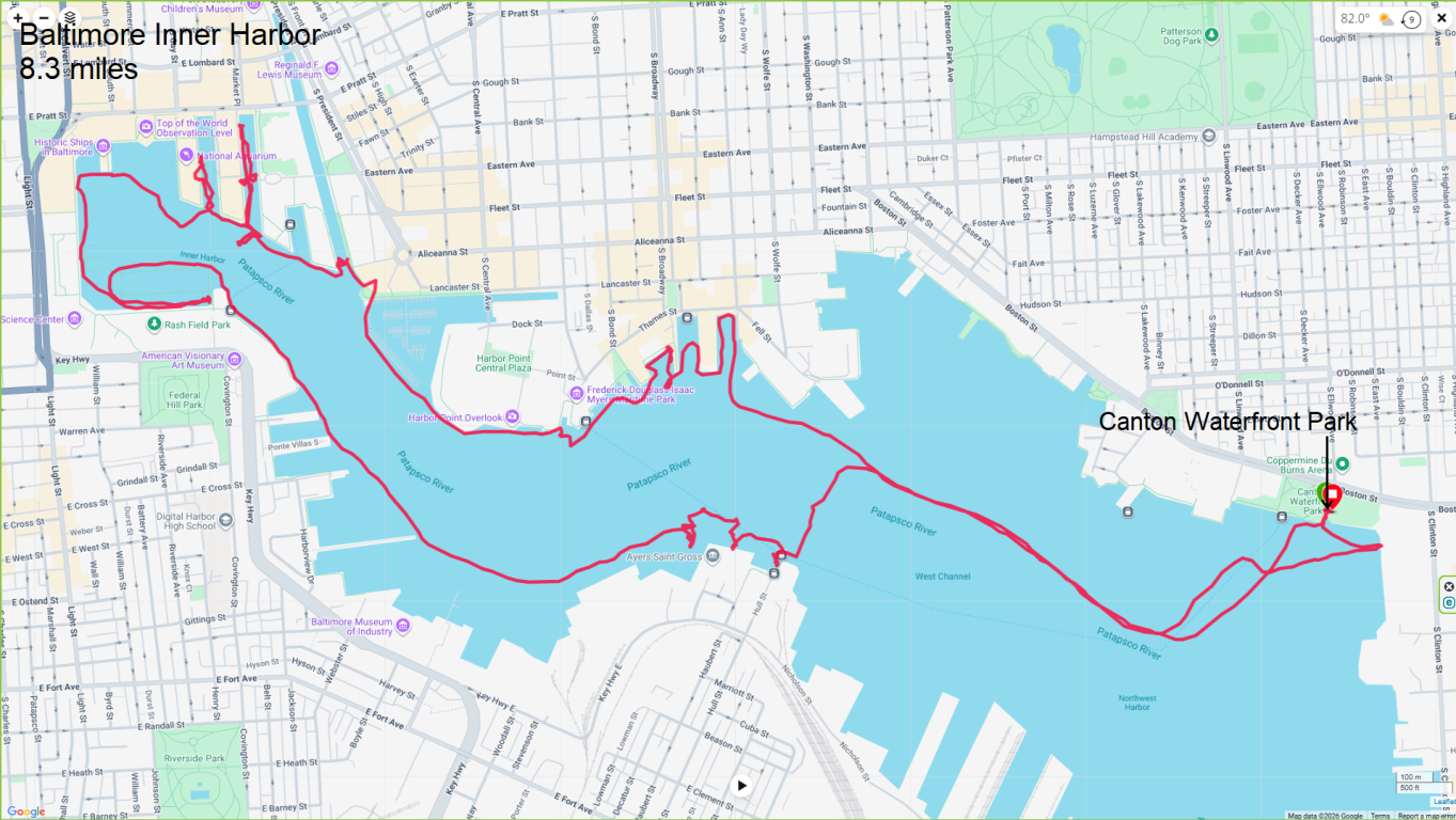
There were a lot of other ships at Sail250 that I didn't mention, mainly because I wasn't able to get a good picture due to the afternoon lighting. To see and read about all of them, check out Sail250 Visiting Ships. |
|
Don and Sara invited me to join them out on the water to watch the Sail250 Maryland Airshow. Joining was a special guest, Franz, who I met about 13 years ago.
I've never been big into airshows so I wasn't expecting much, but this event really changed my opinion. It was fantastic! In the past, when I've seen airshows, it was just one flight group performing. But this one had three! We launched at Broening Park. There were a couple other kayakers that were not with us. Daphne and I were the only ones on a SUP. The first group we saw were the British Royal Air Force Red Arrows. I find it amusing that anything British and military has the word "royal" in it...seems rather redundant. These guys were tight. I loved how they made use of colored smoke. It definitely made it easier for me to find them with my camera...just follow the colored smoke trail. 
I don't know if I took these pics from my SUP. It was taking awhile for our group to launch so I took a few photos while standing on the pier, waiting for the others. Eventually we got out on the water and paddled east to Winans Cove. Here's Franz, Sara, and Don, shown below from left to right. 
This is Sara and her carbon fiber Epic wing paddle. Notice the distinctive Lehigh Cement silos behind. 
I led them to the Baltimore Peninsula area near the Under Armour buildings so they could have a fairly clear view everywhere except to the west. Most of the action would be to our east by southeast. I ventured closer to land because I was very much wanting to get a better view of the two visiting U.S. military ships: The four Marines I met on June 24, 2026 were stationed on the USS Arlington. The photo at the bottom of this page shows this ship in the background. The much smaller USS Marinette was parked just in front of the USS Arlington. I found the best place to photograph these two ships from the water is near the small isthmus connecting Baltimore Peninsula to the concrete pier ruins at 39.26338278724572, -76.60603084379073. There might be a better spot but given tight security restrictions, this was a good place where the police didn't bother me and the pier ruins didn't block my view. 
So how close could one get to the ships without getting in trouble? The police did approach Don, Sara, and Franz and told them not to get closer. I'm guessing at that time, they were about 660 feet away. I was much closer but I think I was not considered a threat because of the concrete pier ruins that stood between me and the ships. I did paddle a bit in the water held in by the concrete pier ruins. The next group to perform was the French Air & Space Force Patrouille de France. Like the Red Arrows, they used colored smoke. 
Here they are flying in a formation of seven. Our group went back to the launch site so Don and Sara could swap boats with their son Matt and his friend Andrew. I led them back to the spot that I took Don and Sara. The final group were the U.S. Navy Blue Angels, who I'd seen many times before. Maybe I am biased but having lived on an aircraft carrier for two years, I have a deep appreciation and respect for Navy and Marine pilots because they can take off and land from a moving ship in rough conditions. There was a collapsed pier with a concrete structure at 39.25897239368779, -76.6045469150888. Rusty metal rings were attached to some of the sides but not the side facing northeast, so that is where I pulled up my SUP. I sat on the concrete platform with my feet on the SUP to keep it from floating away. I invited Daphne to join me on the concrete structure but she preferred the SUP. The concrete structure was my seat for the rest of the show. The others stayed in their kayaks further south. I don't think there was a better place to view the Blue Angels. They made countless runs directly overhead. I felt like they were a mere 100 feet above me at times. The Blue Angels didn't use colored smoke. That might be a good thing, especially for folks that were right below them like me. 
Here's some shots of them flying in formation. In a classic bomb burst, a group of planes flies upward together in a tight formation and then, upon reaching the top of the climb, they fan out and separate in different directions as they dive downward, mimicking the visual explosion of an aerial bomb. - from Google AI 
I especially liked being able to capture shots of the planes as they flew low, near recognizable structures. After the show ended, we paddled back to the launch site. The air was filled with jet fumes. Daphne doesn't like loud, sudden noises but the planes didn't seem to bother her. She might think differently if they did a sonic boom near her. What we saw today was just a practice run. The main event would take place over the next two days. But what I saw looked absolutely perfect. I highly recommend it. After driving back, Sara fixed us all a nice crabcake dinner. What a great way to end the day! |
|
Daphne and I were last here on June 24, 2026. At that time (the opening day of the event) we had nice afternoon light and all the ships hadn't yet arrived. We returned today (on the closing day of the event) with nice morning sun. Many of the ships had already left but most of them were ones we'd already seen.
We launched from Canton Waterfront Park and stuck to the north side because that's where all the ships were that I wanted to see. The sun was lower than I like for photography so while I waited for it to get higher, I paddled to the far west end of the Baltimore Inner Harbor and started there. I saw the BAP Unión from Peru on the 24th but it looked much better today in the morning light. The figurehead of this ship reminded me of the Hulk. The figurehead on the Peruvian Navy tall ship BAP Unión is a bronze sculpture of the renowned 15th-century Inca emperor Túpac Inca Yupanqui. - from Google AI 
I got a passerby to take our picture. 
Parked just south of the BAP Unión was the much smaller HMS Gladan from Sweden. Compared to the former, the HMS Gladan didn't look all that special. But once it left port, it really stood out. 
Zooming in, I could see the crew perched on a yard, saying good-bye to observers. 
On the opposite side of the BAP Unión was the INS Sudarshini from India. 
Here's all three ships. From left to right are the HMS Gladan, BAP Unión, and the INS Sudarshini. 
My next stop was Pier 1 and the National Aquarium where I paddled close to the ARC Gloria from Colombia and BAE Guayas from Ecuador. Here's the BAE Guayas next to the National Aquarium with Colombia's ARC Gloria in the background at Pier 1. 
Had we been there before today but after the 24th, we might have also seen the USCG Eagle, which I've seen many times before. In the slip between Pier 4 and Pier 5, we saw the Bello Poule from France, the ROU Capitán Miranda from Uruguay, and the Gorch Fock from Germany. I like the colorful bunting hanging on the Bello Poule. 
This is the Bello Poule with the ROU Capitán Miranda behind. 
As we approached the ROU Capitán Miranda, I saw Norma and our neighbor Terri walking on Pier 5. I knew they would be out getting in an early morning stroll before it got hot. Daphne was ecstatic to see Norma. Here's a photo she took of Daphne and me in front of the ROU Capitán Miranda with the Bello Poule on the left. 
This is another pic she snapped showing, from left to right, the Gorch Fock, Bello Poule, and ROU Capitán Miranda. 
Here's the Gorch Fock and Bello Poule. 
In the slip between Pier 5 and Pier 6, I found the Gazela Primeiro from Philadelphia and the NMS Mircea from Romania. This is the Gazela Primeiro with the Gorch Fock in the background. Also in the background is the Seven Foot Knoll Lighthouse, which was built in 1856. 
Here's the port side of the Gazela Primeiro. 
The final tall ship was the NMS Mircea. 
The figurehead on the NMS Mircea represents Mircea the Elder (Mircea cel Bătrân), the historic Voivode (ruler) of Wallachia who expanded his realm to the Black Sea. - from Google AI 
I ended up paddling 6.9 miles. Here's my route. 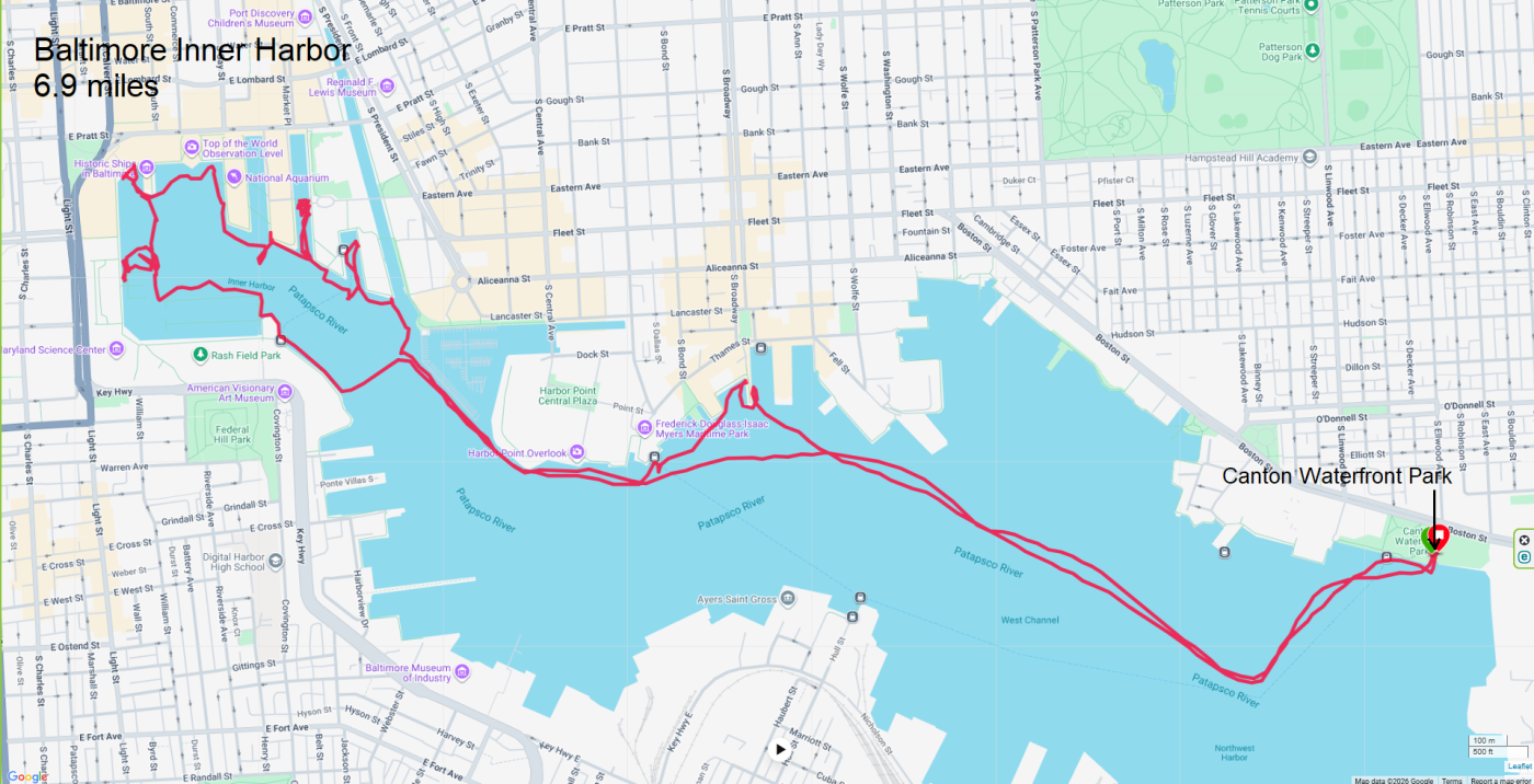
I went home, got washed up, and then headed into work. To see and read about all of these boats, check out Sail250 Visiting Ships. |
|
Norma, Daphne, and I were up at 0430 and launching at Patuxent Wetlands Park at 0640. Why so early? Mainly to finish before the hottest part of the day, which was expected to reach a heat index of 110 degrees.

We were the first ones at the park but soon after we arrived, some fisherman and another paddleboarder showed up. Upon launching, Daphne quickly hopped onto Norma's boat but then later switched to my SUP. 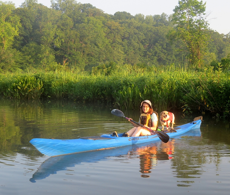
It was a hazy and humid morning. 
Making our way downstream on the Patuxent River (aka Pax), we then paddled upstream on the spatterdock-lined Galloway Creek as far as we could, which wasn't far. 
Continuing downstream on the Pax, we explored the South Fork of Old Galloway Creek which led to the Chris Swarth Boardwalk in the Parris N. Glendening Nature Preserve. 
We saw three muskrats. This one was carrying some vegetation back to its den. It almost collided with Norma's boat. 
A fish jumped on my SUP. I was able to throw it back in before it expired. 
Back on the Pax, we paddled upstream, pulling ashore at a vacant fishing area so Daphne could have a chance to cool off. She doesn't like to swim, but we made her. Continuing on, we passed where we started and then headed into Back Channel, just north of Route 4. We were looking for wineberries. Instead, we found mostly unripe blackberries. 
Here's our six-mile route. We were off the water by 0920. 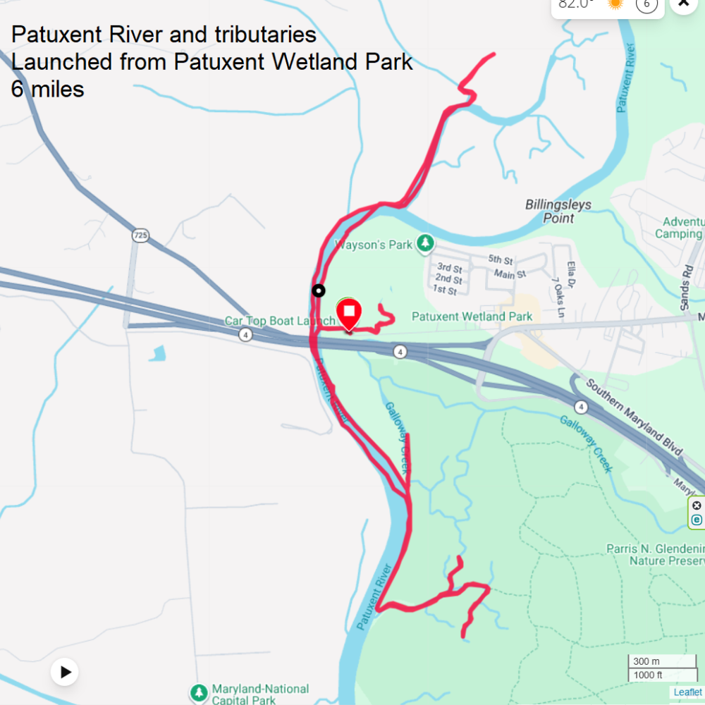
Norma looked to see what was in the area and ended up finding the Croom Community Market, which was very close. We visited and Norma really enjoyed talking to the organizer, vendors, and buying stuff. Their lemonade was really good. Unfortunately, they had no savory food because of a cancellation. Because of the weather today, a lot of stuff was canceled, including local parades. |
|
It had been over two weeks since I'd been on the water. For this time of year, that is a very long time for me to not paddle. So despite it being a Monday, I made a special effort to get into work early, put in a full day, and then take my SUP out to Marley Creek.
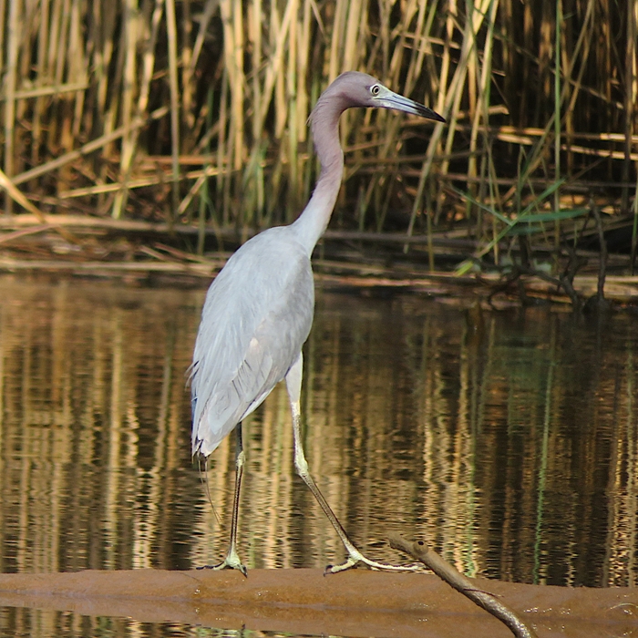
I launched from Solleys Cove with Daphne and her good friend, Sophie. It was a slow, easy trip. I just needed to get out in nature to detox. It was a good day for doing so. Before I even launched, a bald eagle flew overhead. Paddling south (upstream), I eventually entered Tanyard Cove where I spotted a mature little blue heron. This was only the second time I've seen a mature one this far north. The other time was in Back Creek, which is nearby. I've seen various juveniles but the adults are more elusive. The last time I took two dogs here, it was high tide and the beaches were underwater. That was not the case today so there were plenty of places for them to go ashore. 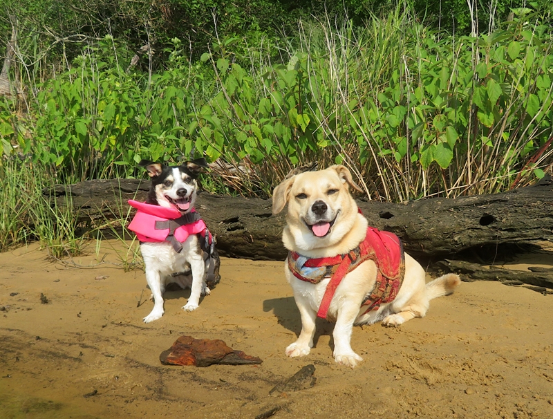
Here they are, ready to continue our journey. 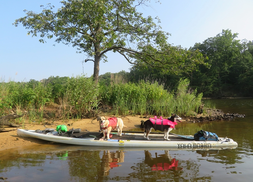
It isn't easy getting both dogs to look in the direction of the camera. Part of the problem is that I try to angle things for good lighting but they don't like to look towards the sun. I can't blame them. 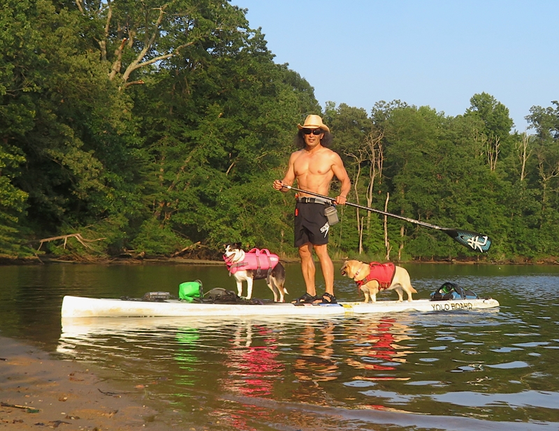
Here's our route. 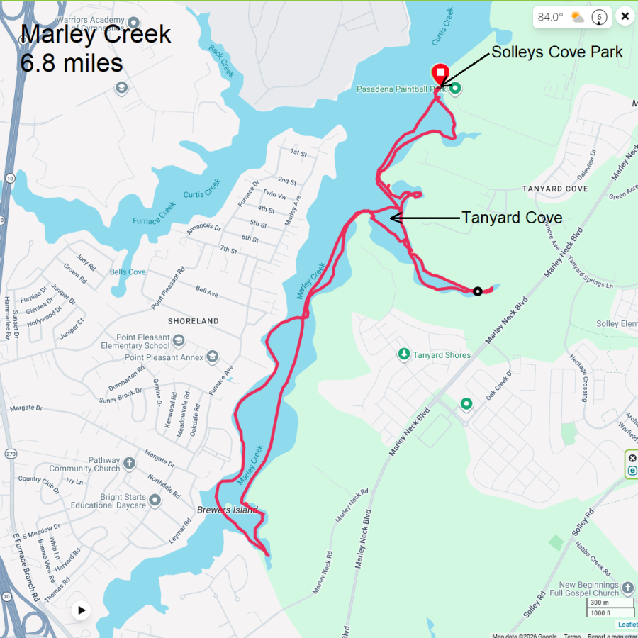
Sophie and Daphne had a good day and are ready for the drive home. 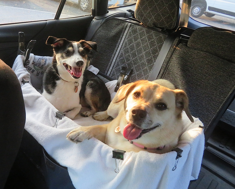
|
|
I launched from Bladensburg Waterfront Park, putting in on the Anacostia River. After bicycling on July 19, 2026 to Kenilworth Aquatic Gardens, I read that someone saw a mature yellow-crowned night heron at that same location. I only saw a juvenile. I've never seen a mature one so far north so I figured I'd try to find it.
I timed my visit to Kenilworth with the high tide. I gave myself plenty of time so I decided to do some casual exploring. I was hoping to find a snake but did not. I paddled up Lower Beaverdam Creek which is just downstream of the Amtrak bridge. Some maps show it as Beaverdam Creek. I've paddled up it before but I always encountered a downfall that forced me to turn back. Today, there were no such blockages so I was able to get further upstream than ever before. What did I find? A hidden world. Most of the creek is very lush with greenery. Unfortunately, there is also a lot of litter. Nothing about that is unusual on a tributary of the Anacostia River. As I continued paddling on the creek, I encountered an abrupt change. Everything became concrete. Below me was concrete with water flowing on top of it. The wall on either side of me were graffiti-covered concrete. Above me was steel and concrete that formed the Baltimore-Washington (B-W) Parkway, also known as MD 295. This 29-mile highway connects Baltimore, Maryland and Washington, D.C. The parkway has carried visitors to and from the capital city since 1954. - from National Park Service - Baltimore-Washington Parkway 
Not a lot of water flowed in this area. I expect if it weren't near high tide, I would have had to portage. 
I'm not a big fan of graffiti, but a lot of the stuff here was really well done. 
Below is my favorite piece. It brought back fond memories of Sesame Street. I like how the artist gave Cookie Monster (or some Muppet resembling him) bat wings. I am looking to see if there is anything in that big pipe. There is not. 
Eventually, I reached a spot where I could go no further. Nearby, a single strand of barbed wire ran across the waterway around head level for a normal-sized man. Fortunately, I am much shorter than normal. 
I managed to get 0.7 mile upstream on the creek without having to portage. Now it was time to head back downstream. 
Norma took Daphne for the weekend so I was paddling solo. That might have been a good thing. There was broken glass that was hard to see in the water. It could have cut her paws. 
Back on the Anacostia, I continued downstream to Kenilworth. I looked for the yellow-crowned night heron but never saw it. But I did see a plethora of great egrets. 
Paddling back upstream on the Anacostia, I checked out Dueling Creek which is not properly named on some maps. I got a half mile up this scenic creek. I saw lots of wild rice and some paw paw fruit. In less than two months, they will be ripe. 
It was a great day to get out on the water. Here is my route. 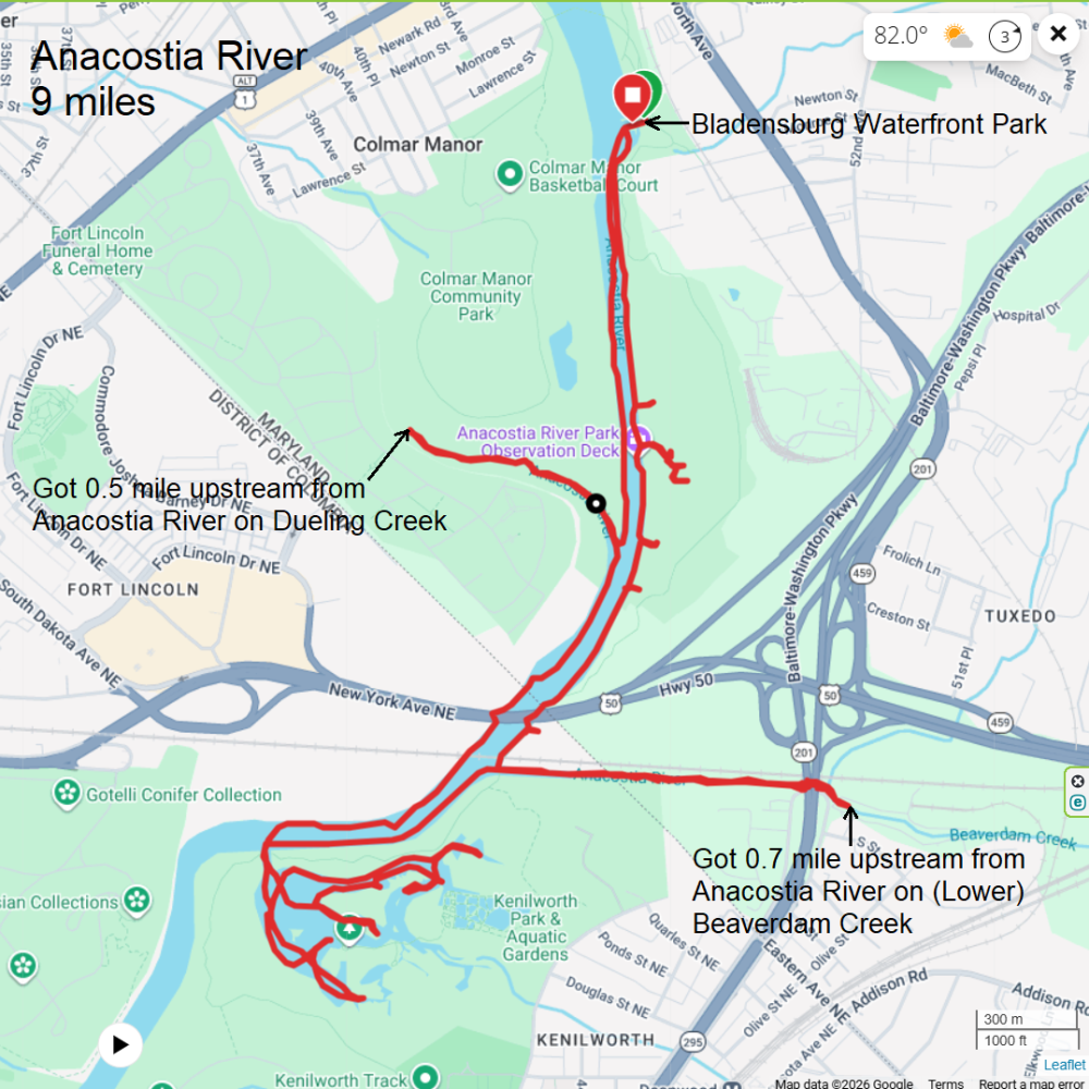
|
|
This was my third day in a row of paddleboarding. Needless to say, it has been an awesome weekend. Why so much paddling? Partly because of the weather. Also because Norma and Daphne were away.
I reached out to Sara a few days prior and asked if she wanted to join me for an early launch. She said yes. So this morning we were on the road around 0530 and on the water a little before 0700, putting in at Shore Park. My plan was to hug the west shoreline and head upstream and see how far we could get up Swan Creek. High tide would be around 0820. On the return, we'd stay on the east side. The day was nothing short of spectacular. We saw a LOT of wildlife with some new "firsts." There were more bald eagles than we could count. Of course there were the usual ospreys and great blue herons. Here's the latter with a view of its tongue. 
We saw a carp splashing and decided to investigate because it wasn't moving from its spot. Upon closer examination, we found it to be the meal of a snapping turtle. 
Nearby, we saw cardinal flowers. 
We passed some lotus groves but saw no flowers. Eventually, Swan Creek narrowed significantly. That's where it got really scenic. Sara and I saw a lot more birds. We weren't able to get as far upstream as I would have liked due to downfalls. I did bring cutting tools but the extent of downfalls on the main channel were more than I was willing to deal with. So we spent some time exploring the tributaries, which were all very scenic. The area was lush with greenery, including wild rice. 
On one of the narrow creeks, we encountered a beaver. That was quite the sight! 
A little later, we found its dam, which we had to portage over. 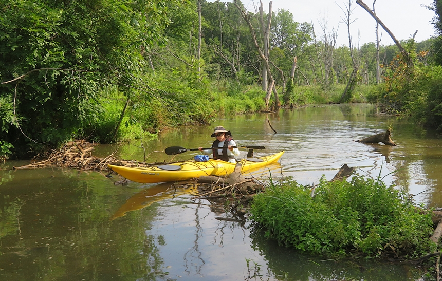
Slightly further upstream, Sara and I encountered two river otters. They were very curious about us. They dove under, popped back up, and huffed at us. One was as close as four feet away from Sara but hidden in the vegetation. A river otter "huff" is a sharp, forceful exhale of air through the nose that otters make when they feel annoyed, startled, or curious. - from Google AI 
We saw various flowers with pollinators including a swamp rose mallow. 
Nearby, I saw pickerelweed flowered with a tiger swallowtail butterfly. 
Paddling back downstream on Swan Creek on the east side, we hit the jackpot when it came to lotus flowers. I'm calling the place the "gold mine." It is just northwest of Swan Creek Point. 
A few flowers hadn't opened up... 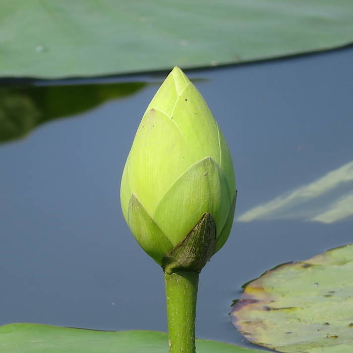
...and a few had started to seed... 
...but it seemed most were at their peak bloom. I don't think we could have timed our visit any better. Here's Sara and me in the gold mine. Unlike the pink Asian lotus flowers that Norma and I saw last week on July 19, 2026, these are yellow American ones. They are native to this area. 
Sara and I paddled from Swan Creek Point to Plum Point. Note that this is nowhere near the Plum Point where I've found shark teeth in Calvert County. The one thing that I've never found at either location are plums. Next, we paddled into what some call the "Secret Cove." Quite a few people know about it now so the secret is out. I think a better name is "Hidden Cove" because it has a very small entrance that is easy to miss. Paddling into it, we were greeted by a really serious-looking guy fishing with a bow and arrow. This cove has either gotten shallower or more vegetation has grown over the years. It was definitely not as paddleable as it used to be. After a few minutes, I ran into some SUPers from the Tortilla Flotilla. From left to right are Clare, Denny, Regina, and Ellison. 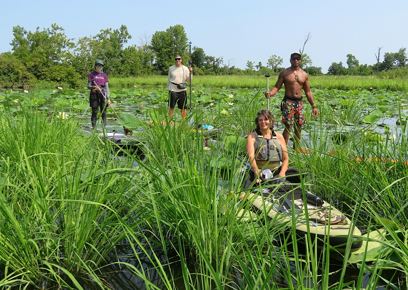
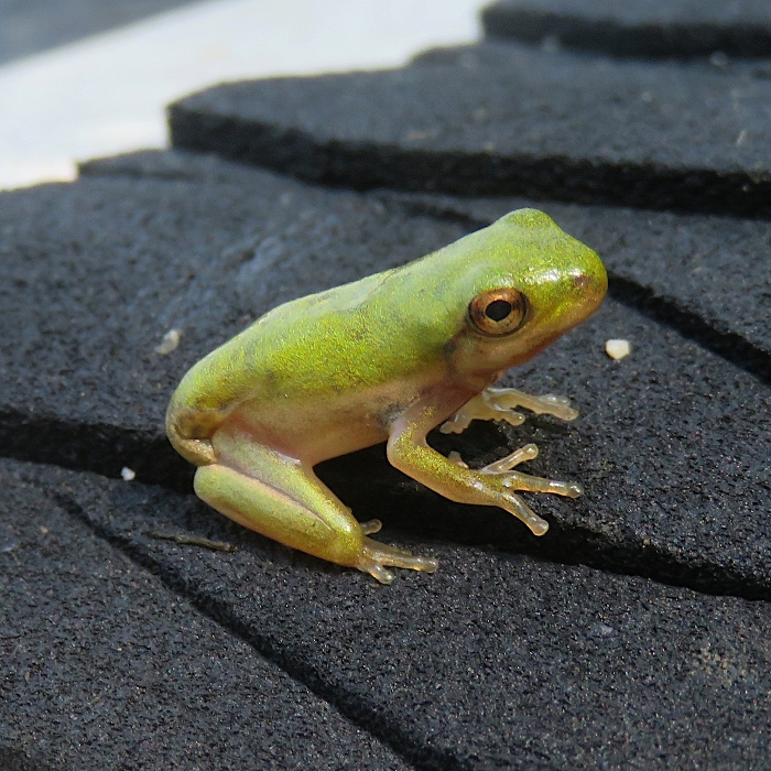
Leaving the cove, Sara pointed out a tiny tree frog on the edge of her cockpit coaming. It then hopped to my SUP. I took it to shore and released it. We paddled south and then saw the four Tortilla SUPers. They were checking out some lotus flowers in a creek. I pointed out where they should go to see the gold mine and that's the last I saw of them. 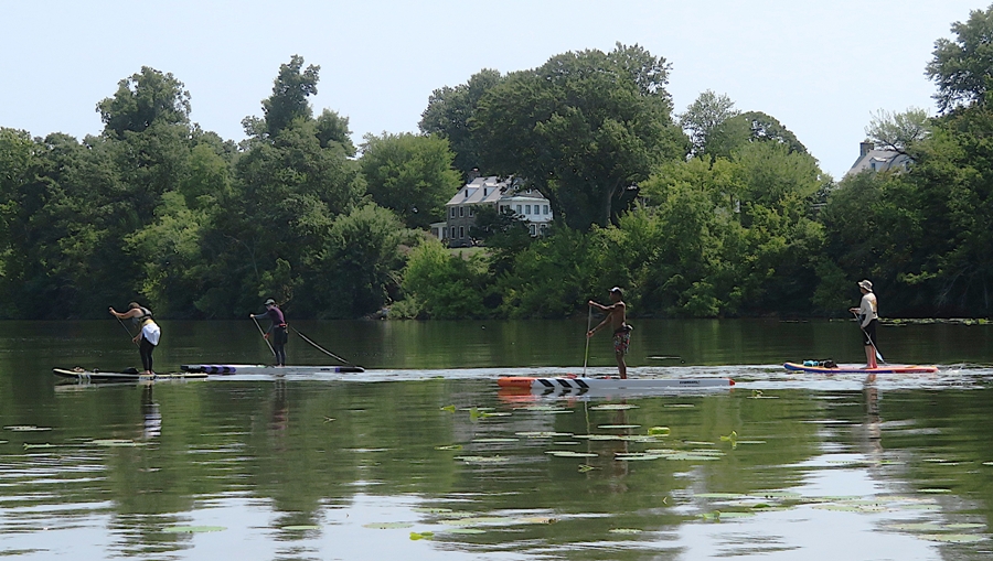
Sara and I landed back at the beach where we started almost 4.5 hours after we started. We only covered 9.5 miles so we were averaging a snail's pace, but we were really savoring all the flowers and wildlife. This trip is a hard one to beat in terms of scenery. 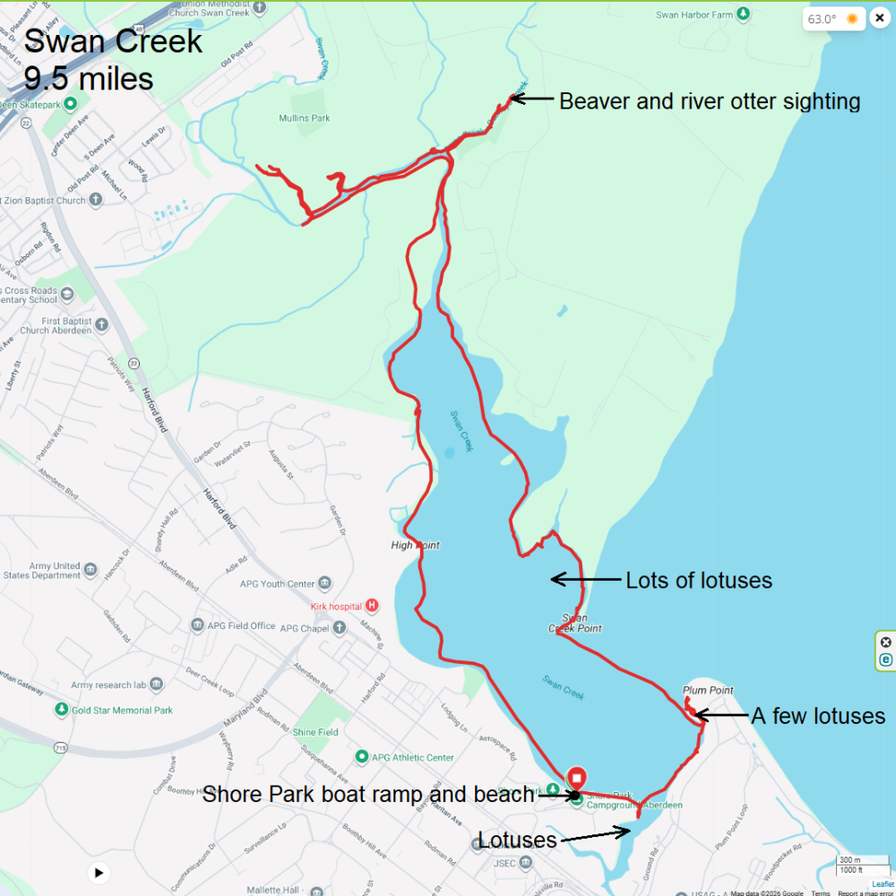
During our trip, I saw the exuvia of a small insect on my SUP. I didn't know what it was. 
After we landed, I found an insect I didn't recognize crawling on my SUP. I got Sara to take a picture of it. She used her phone to identify it as a damselfly. 
At the time, I didn't put them together, but once I started looking at my photos, I realized that a damselfly nymph has come out of the water onto my SUP, shed its skin, and emerged as a young adult. A damselfly nymph leaves an exuvia during its final molt (metamorphosis into an adult), which typically happens during daylight hours in spring or summer after spending one to three years growing underwater. - from Google AI I later learned that a newly emerged damselfly is called "teneral." For more information with awesome photos, see Life in a Southern Forest - Emerging Damsels and Dragons. This was definitely one of my favorite SUP trips of the year. |
|
Daphne and I drove out to Mallows Bay Park. The plan was to scout a route that a producer at Maryland Public Television suggested. This involved SUPping to Nanjemoy Wildlife Management Area to look for fossils and then visiting the shipwrecks. I expressed concern about paddling a SUP at the shipwrecks but after studying their position in satellite photos, I thought it might be reasonable to do so if staying away from the center. I figured I'd give this a try.
After launching at 0650, we paddled out into the Potomac River. Then we headed downstream to Liverpool Point, Douglas Point, and then Wades Bay. We stopped in various places to look for shark teeth. Even though I brought a sifter, I did not use it. I just looked on the surface, mostly in the shallow water. The wind was calm and because it was so early, there was no boat traffic to create waves. Thus, it was easy to look through the perfectly flat water and find teeth. I ended up finding 98 teeth! 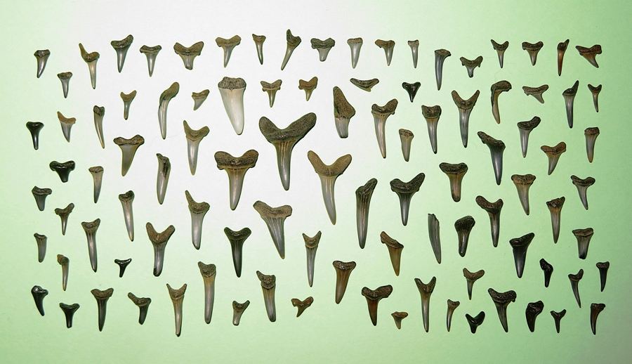
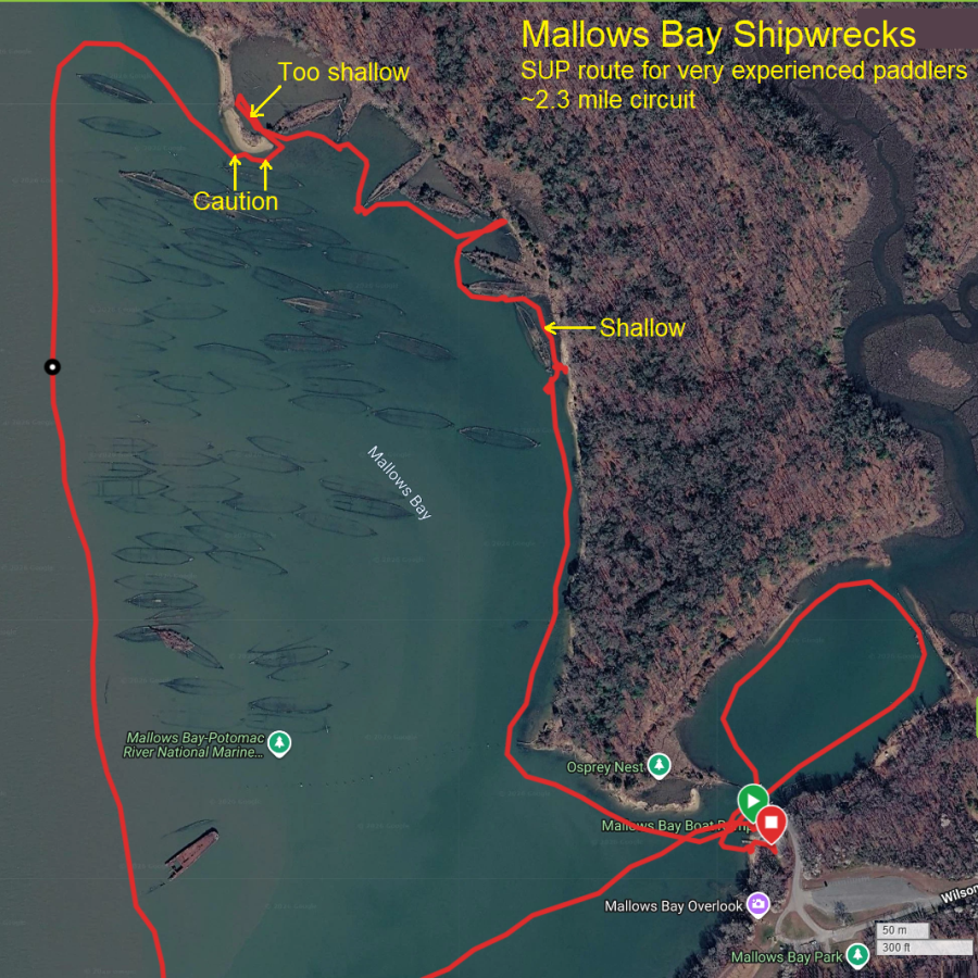
Low tide was around 0900. Paddling back upstream, I had an eight mph tailwind giving us a push. A little before 1000, we were on the west side of the "Ghost Fleet." It was pretty easy to stay just outside of the wrecks in deeper water. On the north side, I paddled very slowly because there was ship debris just below the surface. I made sure to frequently check for any obstructions. Looking south, I could see the metal ship Accomac far in the distance. 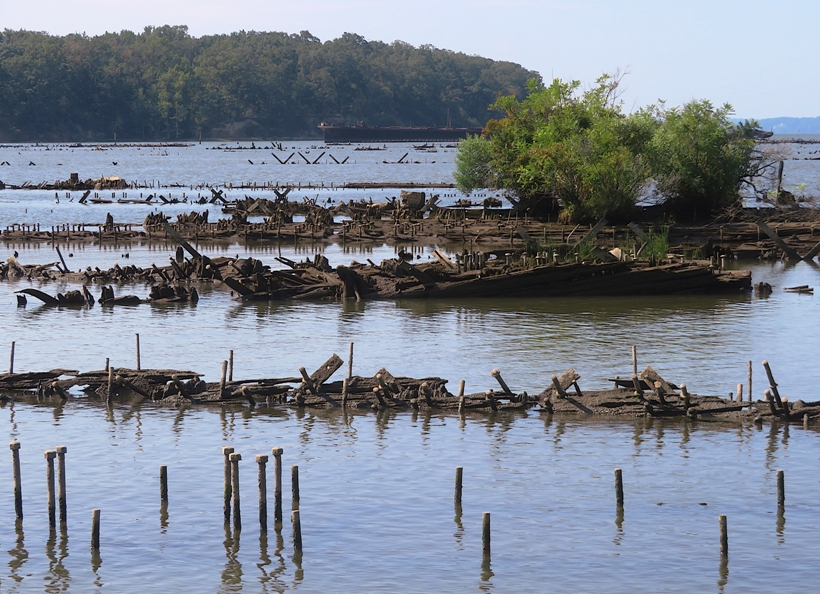
On the northeast side of Mallows Bay, I had a nice view of the Moosabee, one of the "Three Sisters" wrecks. 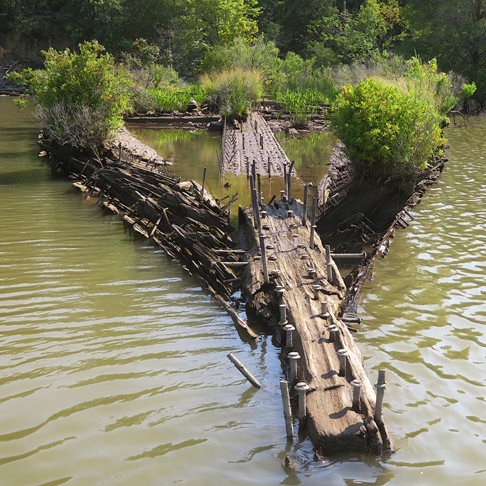
On the east side, I paddled near the Afrania. 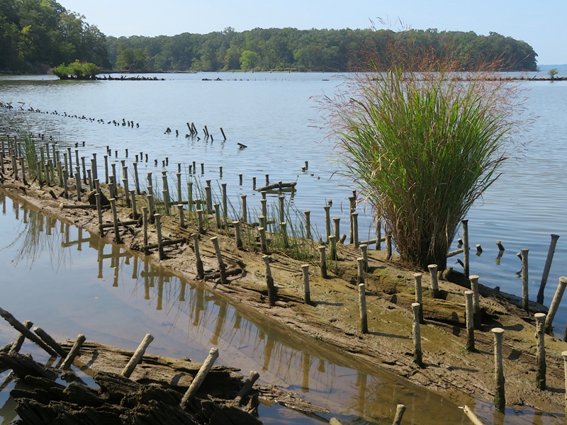
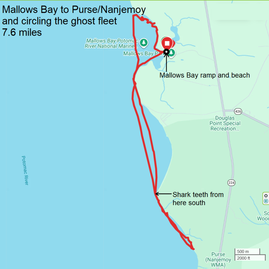
If you want to learn more about the placement of specific ships, read Nature - Mapping the "Ghost Fleet of Mallows Bay", Maryland with drone-based remote sensing. We were off the water ~1050. So what I do think now about paddling a SUP at Mallows Bay? Put simply, don't visit via SUP unless you are very experienced and are using a hardboard. Furthermore, stay out of the center of the wrecks, paddle very slowly, and frequently look down. Here's a couple of maps of my route. |
|
I went paddling with a producer, Stefanie, and videographer, Danielle, who work with Maryland Public Television. They are filming a show about paddleboarding. I took them to see the lotus flowers on Turners Creek.
The two of them, Daphne, and I launched from Turners Creek Landing. There were severl lotus flowers just west of the launch site. I told them there would likely be far more just south of it. So they let Daphne and I paddle to it while Danielle had a drone follow us. Unfortunately, I was totally wrong. There were no flowers where I expected. But I could see them much further upstream on the creek. That was too far for the drone to follow me at the slow pace I was moving so I just headed back to the launch site. The spot that I told them would be really great was the cove near Ponds Bar where Turners Creek meets the Sassafras River. They got in their tandem kayak and we paddled north (downstream). 
Along the way, we stopped and Stefanie interviewed me about paddleboarding. We pulled over at a beach at Ponds Bar. Danielle set her video camera on a tripod while Stefanie fit Daphne with a GoPro camera. 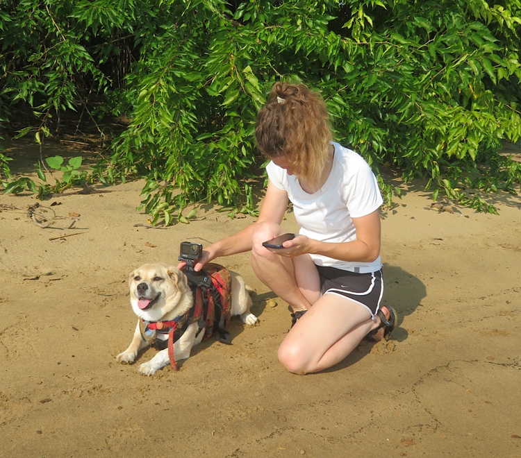
Walking around on the sand, I saw some osage oranges (aka hedge apples). 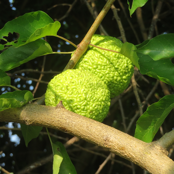
They filmed Daphne and I on the SUP paddling into the cove. It was ebb tide and the water was rushing out quickly, making it a bit challenging. They had me do it again while Danielle filmed from above with the drone. The cove was lush with flowers. I think it was a little after their peak bloom but not long after. 
They spent a lot of time filming me paddling on the north side of the cove. Here's Danielle getting into position for this. 
High tide was around 0630 and low tide would be around 1400. This cove is definitely a place to visit at high tide. There were some areas where we got stuck and had to walk. Fortunately, the bottom is sandy, not muddy. The south side of the cove had the most scenic flowers. 
We saw a beaver lodge. Recently, a kid got bit by a rabid beaver but it was nowhere near here. Still it makes us more cautious about them. Based on what I know, rabies is the closest thing to the zombie virus. Here's one more lotus pic, this one with a pollinator. 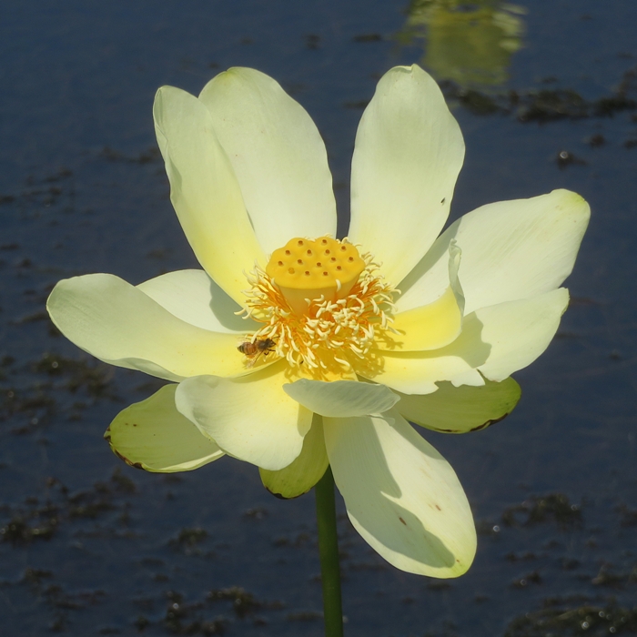
We paddled across the Sassafras to Ordinary Point and took a look at Money Creek. There were lots of lotus flowers further upstream but I told Stefanie and Danielle that this probably wouldn't look much different than what we saw in the cove so we didn't venture further. We crossed the Sassafras to Turners Creek. There was a good bit of boat traffic and Stefanie was impressed at how Daphne handled the wakes. We were off the water after about six hours, having only paddled 6.3 miles. Stefanie warned me it would take a long time and I was prepared for that. I very much enjoyed the whole filming process and introducing them to the lotus flowers on the Sassafras. 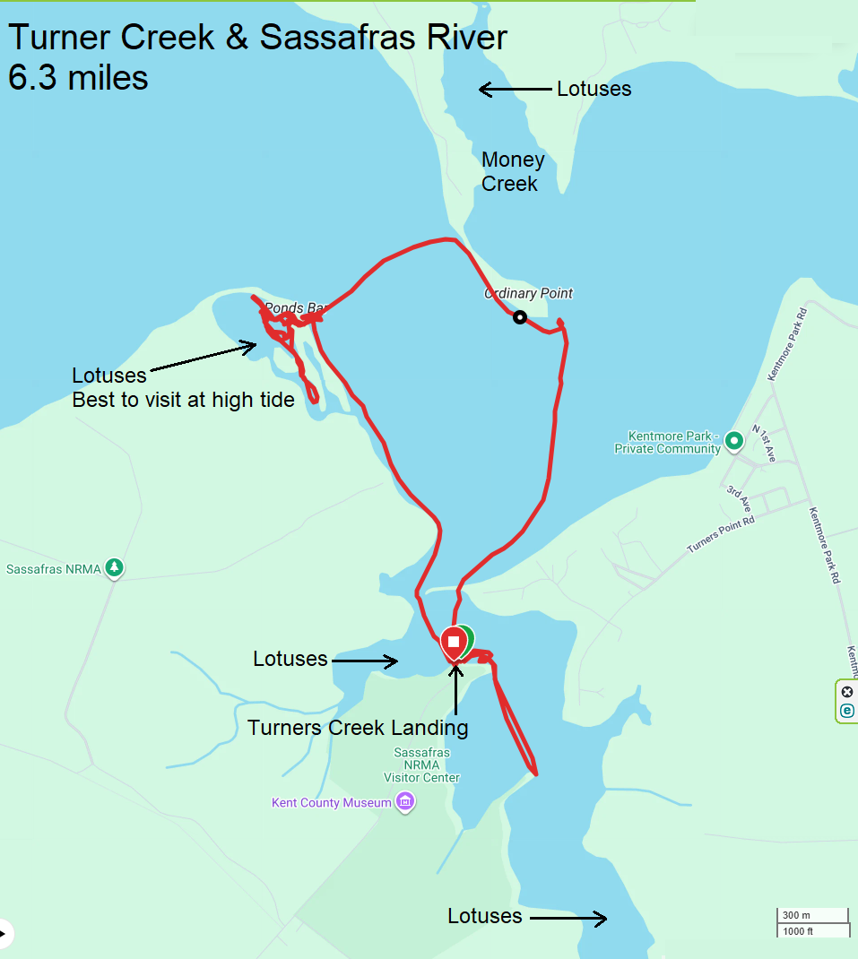
I believe Stefanie said one day's worth of filming often yields about seven or eight minutes of actual show footage. They are allocated ten days for this show but I don't know if that means just filming or also editing. I would tend to think the latter would take far longer. Each episode appears to be 26-27 minutes long. Google AI says Reality TV / Docuseries require three to five days of editing per shoot day. There's a good chance I will appear in the show quite a bit but I suspect Daphne will be the real star. |
|
I left work a little early to go paddleboarding with Daphne and Sophie (Daphne's dog friend). Unfortunately, Erin forgot to bring Sophie's PFD so she did not join us.
The two of us arrived at Spriggs Farm Park after driving a somewhat frustrating, circuitous route that my phone app had me take. Actually getting to the launch site was also a bit of a problem. It used to be I'd access the park's website and they would then email me the combination to their lock so I could drive in. I think they decided that wasn't very secure so they switched to sending folks a QR code that gets scanned in at the gate. If that doesn't work, then you enter a code onto a touchpad. If that also fails, then you push a button and talk to a person. I tried the QR code several times and that clearly didn't work. Maybe it was the glare from the sun. Then I attempted the touchpad. No dice there either. Finally, I pushed a button to call someone. I could hear the phone ringing. It rang for what seemed like a long time and nobody answered. During this time, I contemplated launching from a different site. Eventually, after entering the code in the touchpad again, the gate finally opened. I feel like this new system has a lot of bugs that need to get fixed. 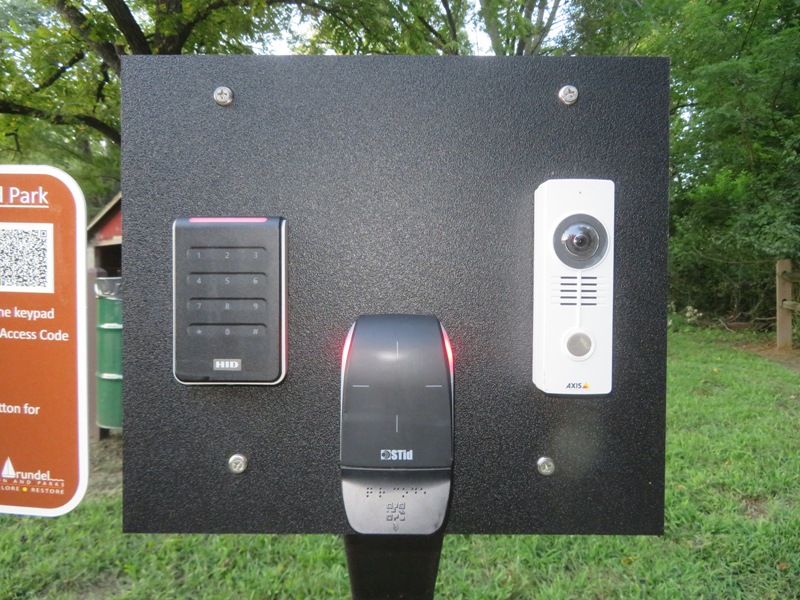
Some people were leaving as we arrived. Otherwise, the place was empty. Maybe others found the gate control too frustrating. It was supposed to be a six mph wind but it ended up being nine mph from the northwest so it created some chop coming from across the river along with some headwind since I was paddling upstream. After paddling around Ulmstead Point, we went into Forked Creek and Cool Spring Cove which were sheltered. Here we could relax and explore. I saw more blue crabs that I'd ever seen before. It seemed every third pile had at least one crab on it. Here's a pair mating on a pile. According to Google AI: Blue crabs mate from May to October in the brackish waters of the Chesapeake Bay, with activity reaching a high point during the late summer months. 
I saw plenty of other wildlife such as this green heron which wouldn't let me get close. 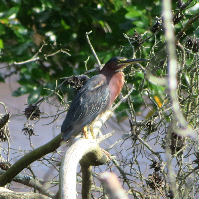
I passed the affluent Broadwater Beach neighborhood. At the entrance of the elusive Bohdal Pond, I saw a one foot-long northern water snake. That made my day. 
Next, we checked out Spriggs Pond. At the entrance to this was a fake, but properly sized alligator that gave me flashbacks to Georgia. 
In this area, I saw even more crabs. 
One peculiar action I've never noticed before was that a few of them were moving their front claws in a way that reminded me of a spider spinning its web. When a mature male encounters a female that is about to molt to sexual maturity, the male will perform a rather elaborate courtship ritual, or dance, to get the female's attention. Upon initial contact, the male will stand up high on the tips of his walking legs. He will then wave his claws, stretching them out wide, extending them fully outwards, and will begin to fan pheromones (a chemical scent which attracts females) contained in his urine towards the female with his swimming paddles. - from BlueCrab.info - Blue Crab Mating Click on the below image to start a video. 
Near my turnaround point, I saw a fellow riding an electric hydrofoil surfboard, aka eFoil. This device uses a battery-powered motor and a submerged wing to lift the board completely above the water's surface. It looks like a lot of fun and he was moving very quickly. According to Google AI, Most eFoils reach average top speeds of 20 to 30 mph. Lift-off speeds start much lower at around 11 to 15 mph, while specialized high-performance or racing models can push maximum limits up to 34 to 35 mph. An eFoil battery lasts between 60 and 120 minutes of continuous use on a single charge. A complete new eFoil setup typically costs between $4,500 and $15,000, heavily depending on the brand, board material, and battery capacity. 
The wind died down a bit for my return trip. We got in 7.6 miles. 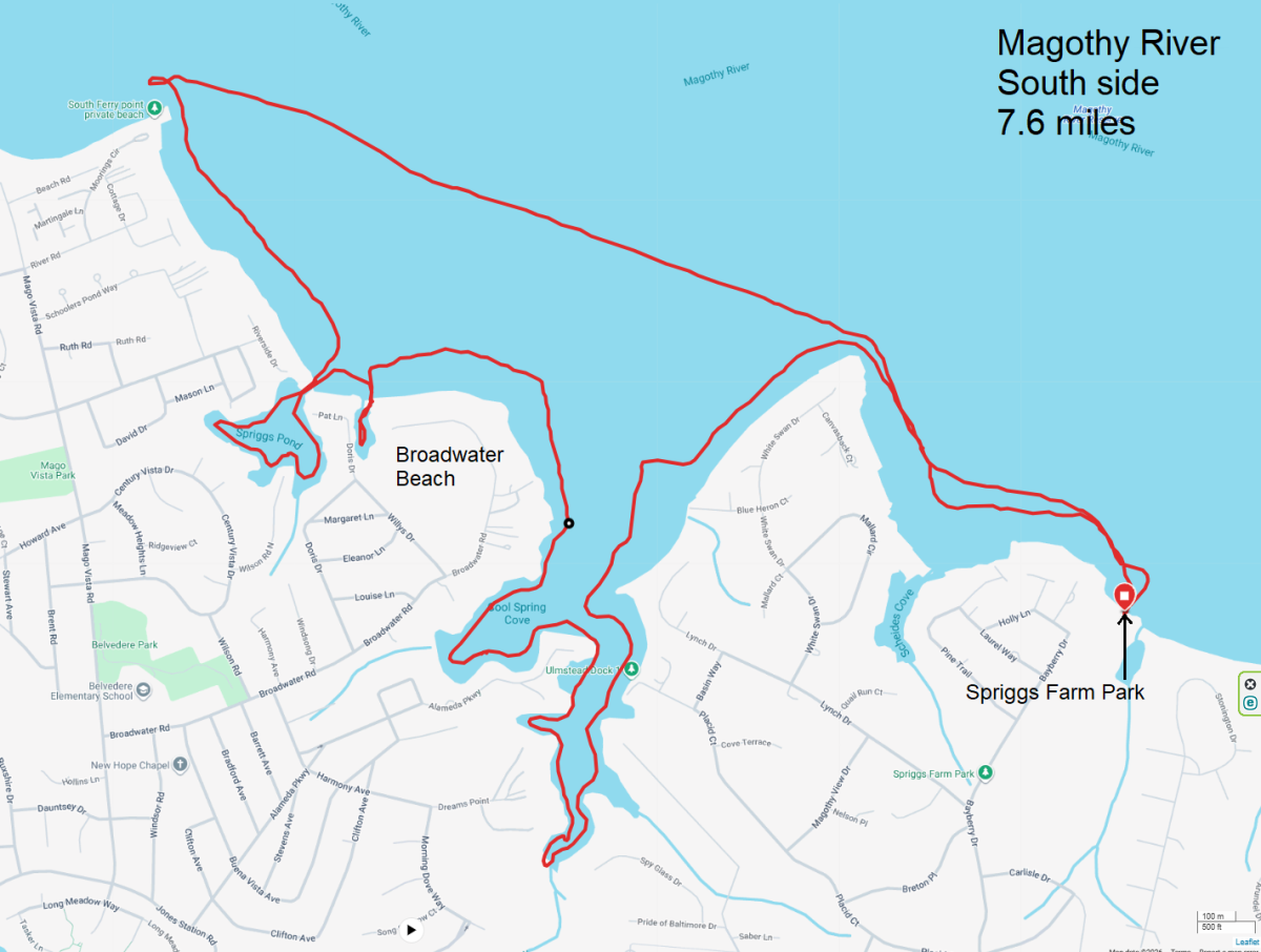
|
|
I scouted this trip on August 8. But today was the real deal.
I was up at 0430. Sunrise was 0626. I arrived ~0650 at Mallows Bay Park and we launched ~0730. Who does "we" refer to? Of course Daphne was with me. So was Stefanie, Brian, and Carl. Stefanie is the producer of Outdoors Maryland, a television show on Maryland Public Television. Brian is a videographer and drone pilot. Carl works for the park and drove the power boat that shuttled Stefanie and Brian in the morning. With his help, they were able to move a lot faster than if they were in a kayak. I paddled south on the Potomac River past Liverpool Point and Douglas Point, stopping near the duck blind at Wades Bay in the Nanjemoy Wildlife Management Area. On the way there, Brian filmed Daphne and me, while Stefanie asked me a few questions. We arrived at the duck blind well before low tide, which was ~0950. I started looking for shark teeth while Brian did some filming. The river was higher than normal due to a recent rain so there was less beach exposed. If the water is flat, I'll often just look through it for shark teeth, but it was windier than forecast so there was a bit of chop when we launched. But after a couple of hours, the wind died down. I used my sifter to look for teeth. I found a decent number of them but not a lot. I also found pieces of ray dental palate and a section of internal mold from a turritella. Often called a steinkern, it is a solid, rock-like fossil that preserves the corkscrew-shaped inner cavity of the snail. Can you find it in the below photo? 
Based on the forecast, I suggested we head back to Mallows Bay before the wind picked up. Daphne and I started paddling upstream. Along the way, I stopped to take a snapshot of one of the numerous bald eagles overlooking the river. 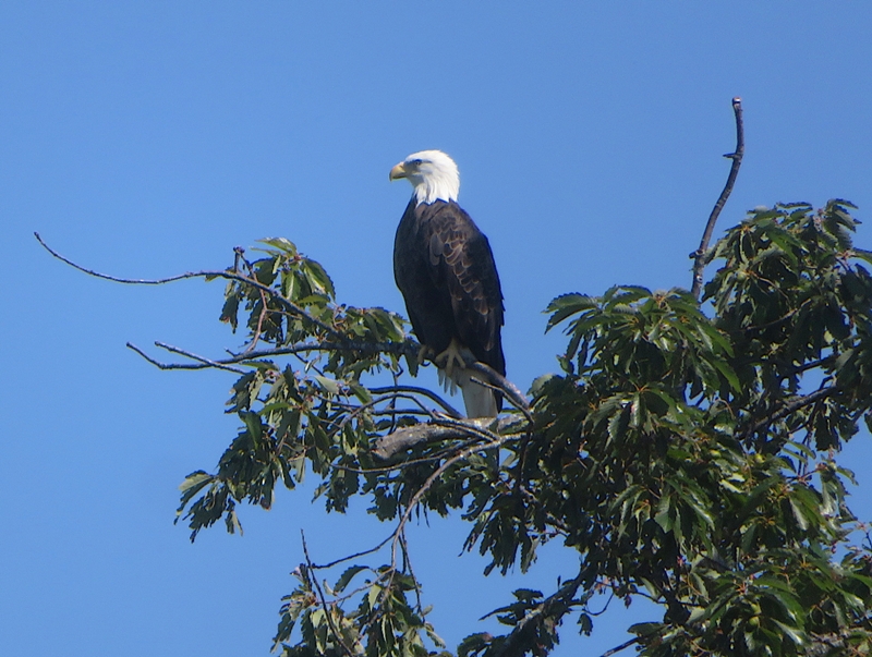
Carl started a little after me, taking Stefanie and Brian. He dropped Brian off at a beach on the north side of Mallows Bay so he could start filming via drone. He had to get permission from the Marine base at Quantico to fly here due to its close proximity. 
Carl took Stefanie back to the launch site where the two of them loaded up a tandem kayak. Then Carl dropped off the kayak and Stefanie where Brian had set up. Daphne and I were already there with Brian when Carl and Stefanie arrived. 
We bid farewell to Carl and thanked him for his help. We ate lunch. During that time, the wind really picked up. I was glad to be in more protected waters. There were a few whitecaps out on the Potomac. I saw kayaker Tom who I paddled with on my Tangier Island 2025 trip. Stefanie fitted Daphne with a GoPro camera to get a different view. 
The four of us paddled clockwise around the east side of the wrecks. Brian did lots of filming and Stefanie interviewed me some more. Back at the launch site, a big truck got stuck on the ramp after it dropped off a pontoon boat in the water. That meant we, or anybody else, could not use the ramp. It wasn't too difficult for us to get out of the water elsewhere but other powerboats were pretty much stuck, unable to land. I saw at least one monarch butterfly at the beach and another near the launch site. Here is the latter. 
I was out with Stefanie and Brian for ~eight hours. I had a lot of fun. 
I figured Daphne would be exhausted, but after we got home, she rested up and was fine. Here is our route. 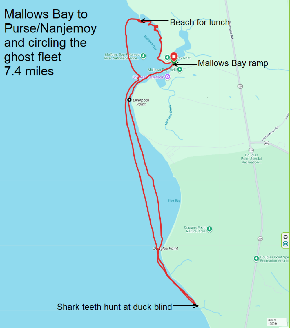
|