|
This page describes my kayaking and standup paddleboarding adventures in 2014. |

|
This page describes my kayaking and standup paddleboarding adventures in 2014. |
|
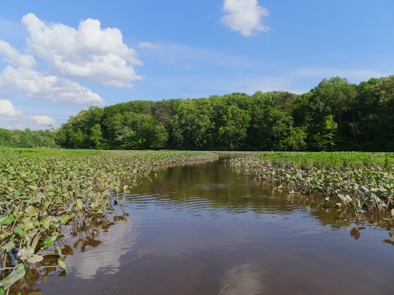
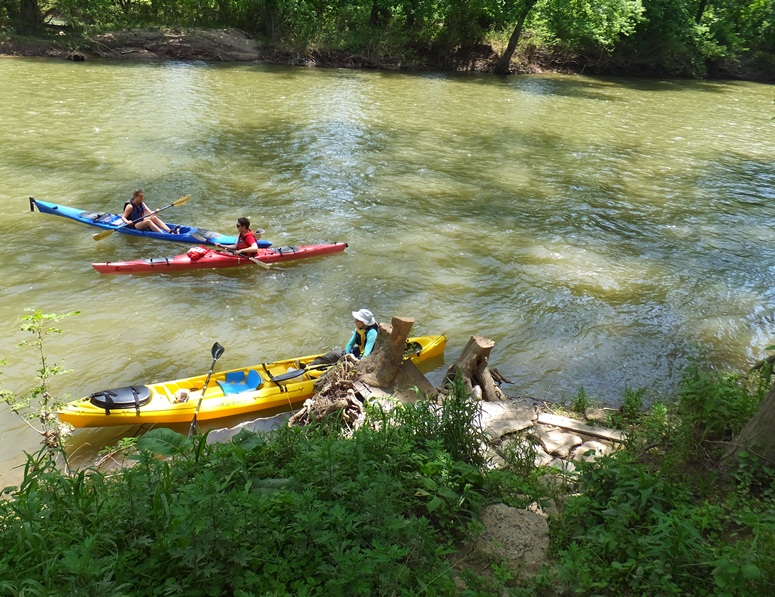
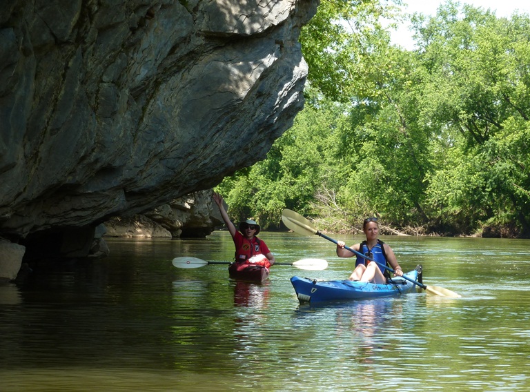
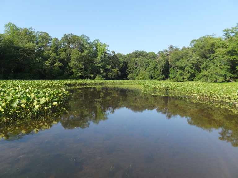
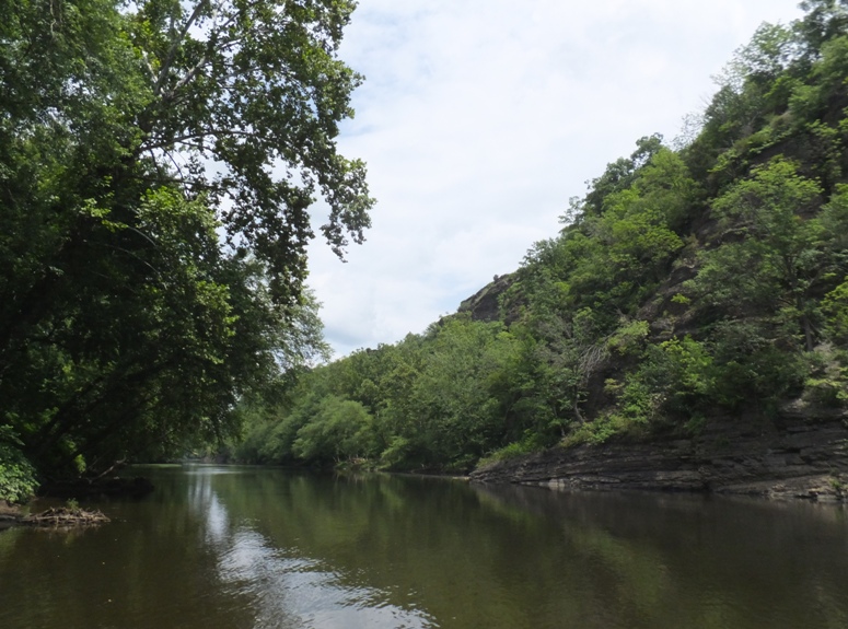
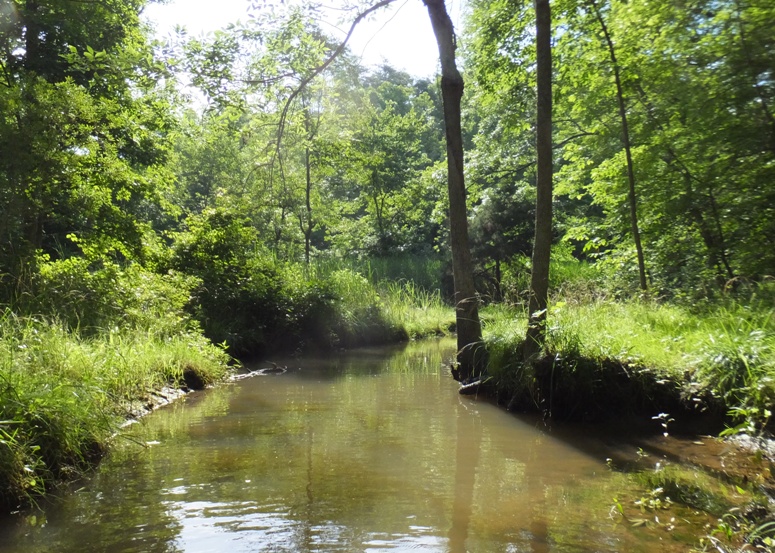
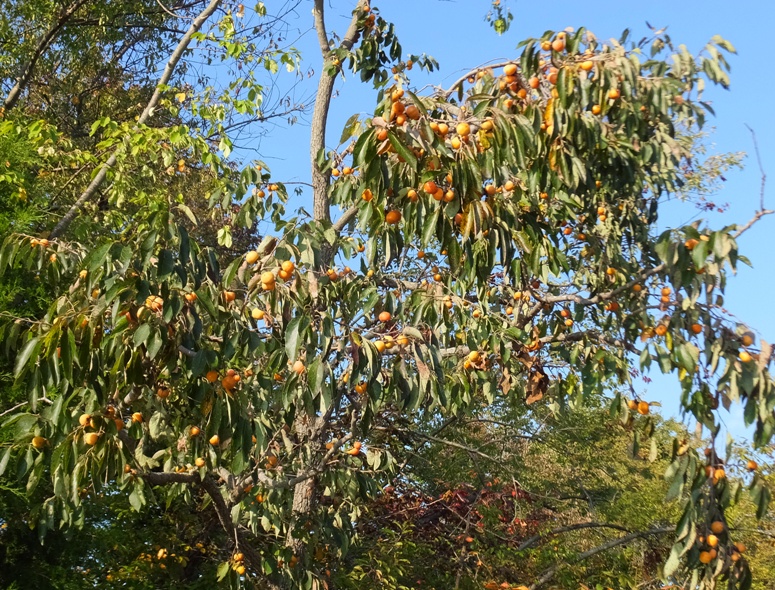
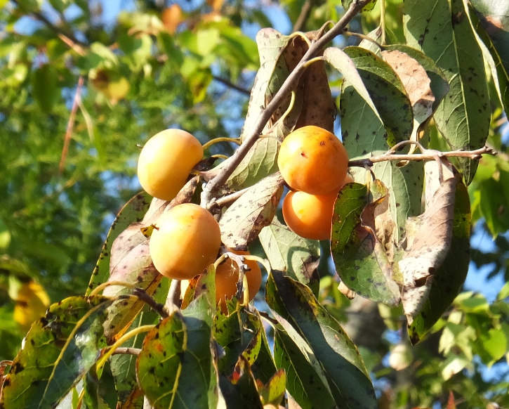
On January 20, 2014, Norma and I did a little hike at the Daniels Area of Patapsco Valley State Park. We found a boat ramp there and figured it might be worthwhile to return with kayaks on a warmer day.
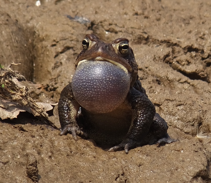
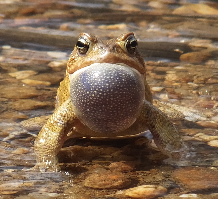
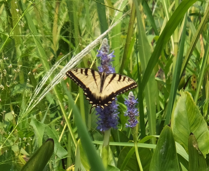
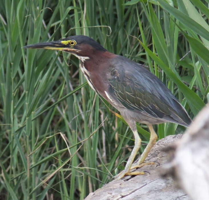
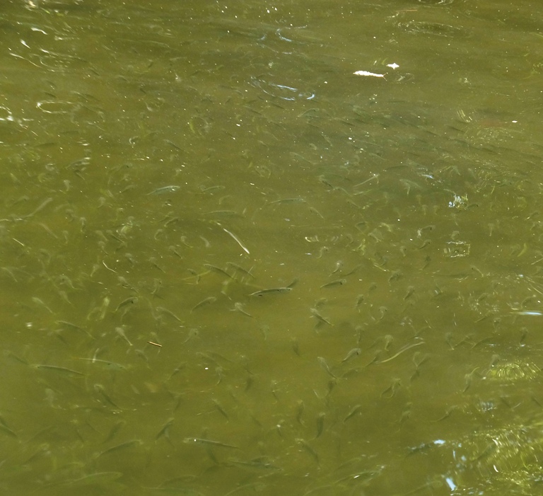
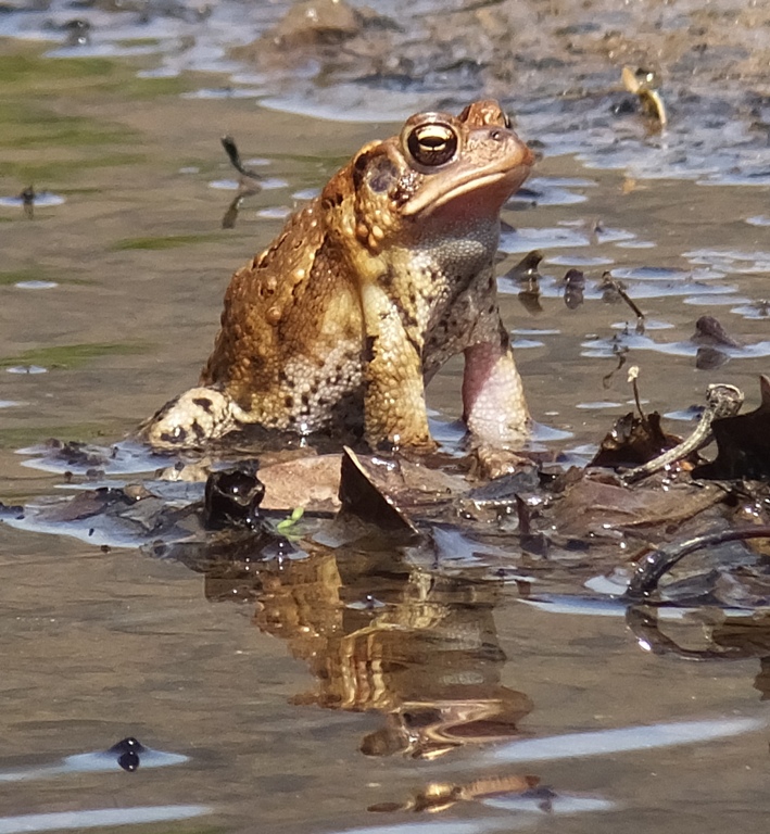
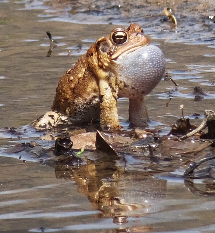
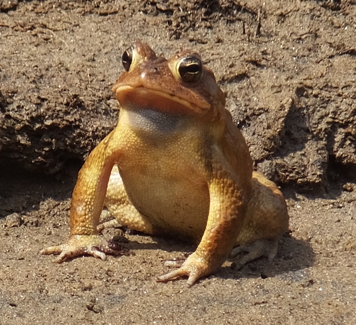
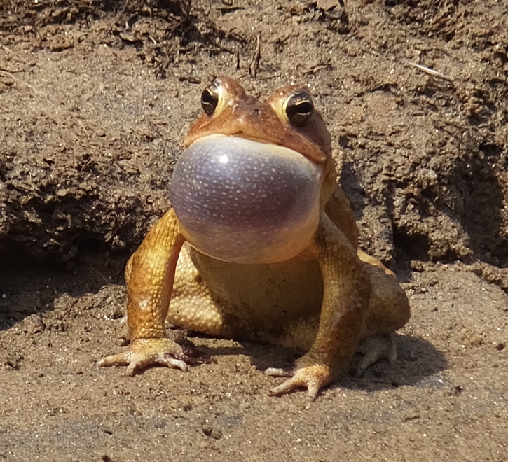
Today was that day. The high temperature was in the low 80s and it was rather sunny. It was also windy but we were in a valley so it didn't affect us too terribly much. It was a great day to be outside. Having shown my "built from scratch" chicken coop the day prior as part of the Howard County Conservancy "Coop-to-Coop Tour," I was ready to relax, take it easy, and do what I enjoy most. We weren't the only ones wanting to do a little boating. Numerous other kayakers were out. Many were in recreational boats and a few were on SUPs. Norma and I started out by paddling across the Patapsco River. We heard a lot of croaking (not really croaking but it was a call from frogs or toads) and wanted to investigate further. What we found was a whole slough of American Toads. It was prime mating season. Individual males inflated their chests and let out a loud call to attract a mate. 1 / 6

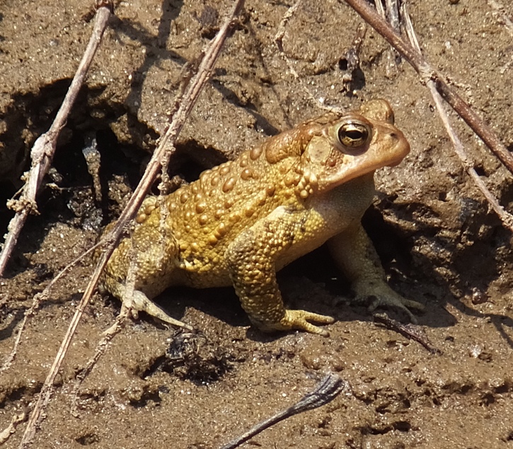
Toad A before call.
2 / 6
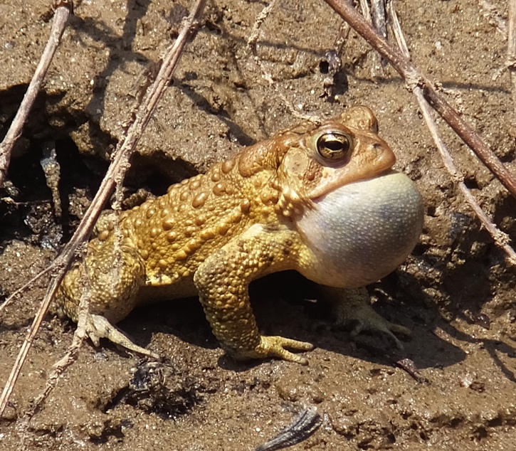
Toad A during call.
3 / 6
Toad B before call.
4 / 6
Toad B during call.
5 / 6
Toad C before call.
6 / 6
Toad C during call.
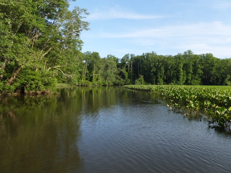
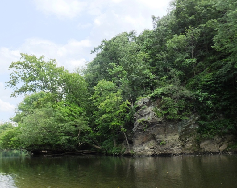
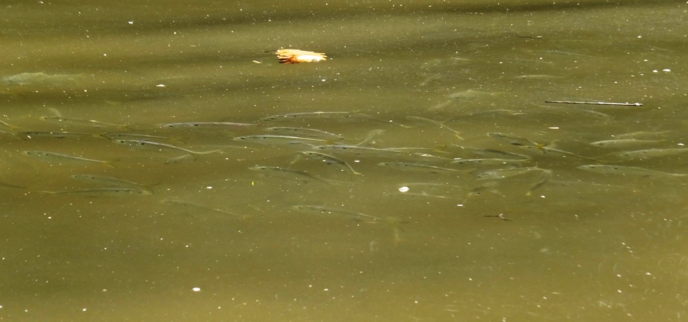
The two of us spent a good bit of time just within a stone's throw of the launch area looking at and listening to the toads. We paddled to downstream to the dam and then turned around. Then we were kayaking upstream. The water was clear and deep enough so portaging was not necessary, though I think the fin on my SUP would have been too long had I brought it. Like people, toads come in different colors. Further upstream, we encountered more toads. I'm guessing we saw them off and on for a 1.5 mile stretch. We saw well over 100 of them. Perhaps 200! After awhile, we pulled over for a snack. I couldn't have picked a better spot. This was the jackpot for a toad hunter. We stuck around for a long time watching them. That's one thing I love about Norma. Hardly anyone else I know is willing to sit and watch wildlife for so long. 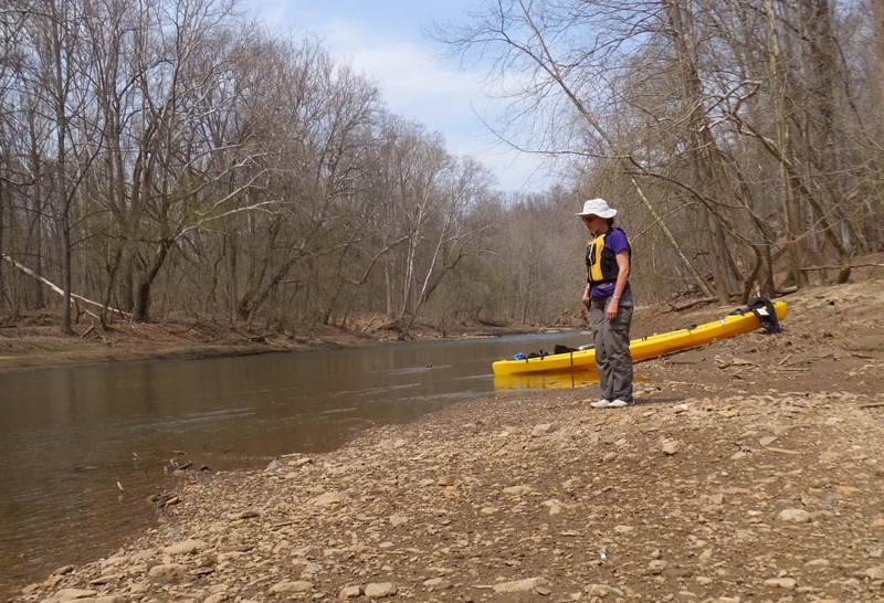
Where mating actually occurred, it was sometimes an orgy of as many as five or six toads. I was reminded of seeing several male horseshoe crabs trying to mate with a single female. And like the horseshoe crabs, the female is generally larger. No, you're not seeing double. 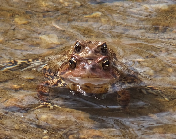
Just like riding a bull in a rodeo. 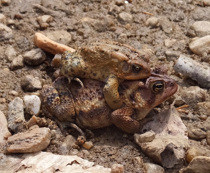
Is that one on the right waiting for his turn? 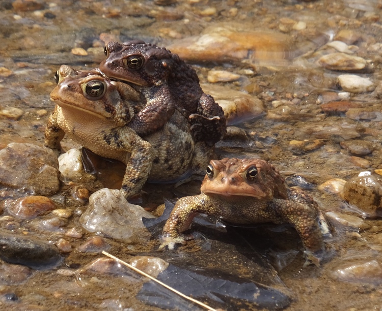
Three on one! 
The toad below reminds me of a bulldog with the way he's standing. Actually, he's got a rock under him. 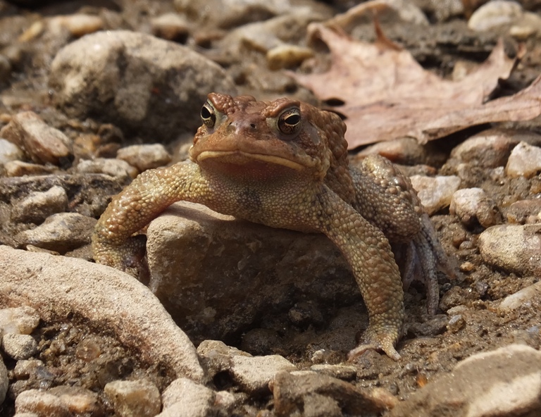
At one place, Norma had me paddle closer to the shore. I held onto a branch to keep the boat in place while she took photos. Then I dropped the blade of my wing paddle into the water and when I pulled it out, there was a toad at the other end. Maybe they like carbon fiber. 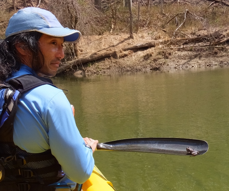
I took some short videos of toads mating. Click on the image to start a video; make sure you have your sound turned up. 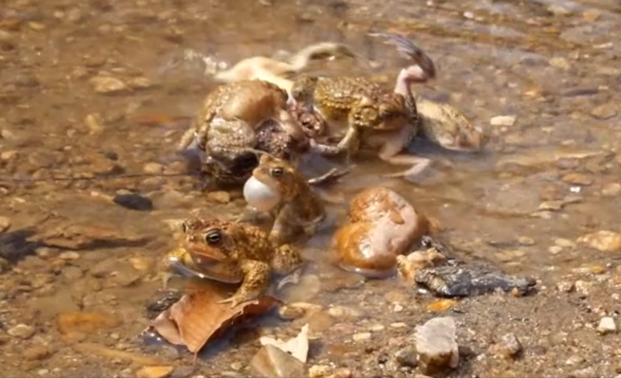
This video looks more like a wrestling match than mating. 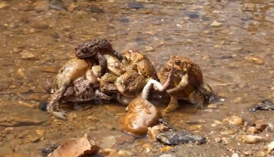
A few turtles were out and about. But unless they were going to entertain us with headstands and back flips, our attention was on toads. This is some kind of slider turtle. 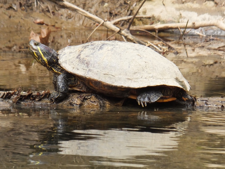
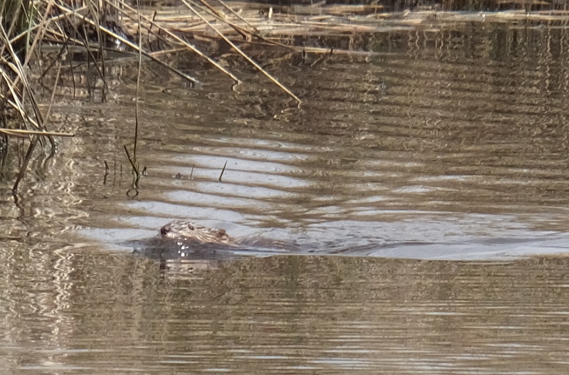
But there were a few non-toad creatures that caught my attention. And I'm not just talking about the SUP chick in the bikini. Out of the corner of my eye, I saw at least two large mammals dive into the water from a muddy shelter at the edge of the shore. I wasn't certain what they were but they looked to be larger than muskrats. About a minute later, we saw another mammal. This one had just the top of its head sticking out of the water. It wasn't moving but it was keeping a close watch on us. We thought it might be a nutria. Eventually it dove under. As it swam underwater, I saw its tail and confirmed that it was a beaver. I'm guessing the other mammals we saw prior were also beavers. 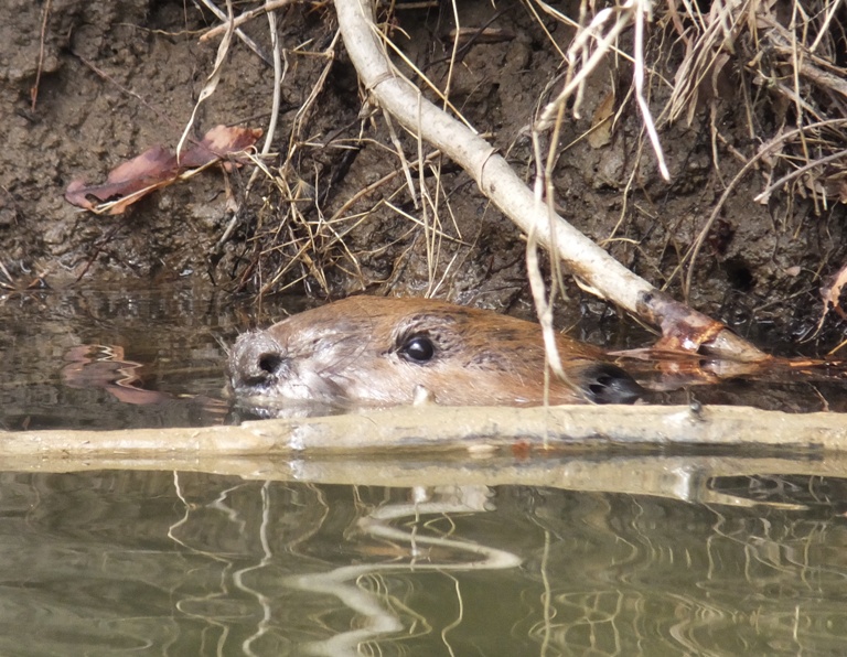
There were a couple of parts on our trip where we had to put it in fifth gear to get up the class one rapids. But the rest of the time, it was a slow, easy going trip. We turned around at an island just below a railroad bridge. It was the same one we had lunch at on our January 20 hike. 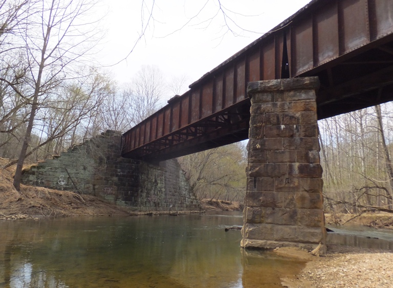
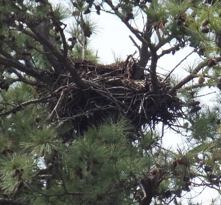
If we wanted to go further, we would have had to portage...the current was just too strong. Needless to say, our downstream trip went by very quickly. The short rapids were easy to navigate though we did hit a rock or two. I recommend a plastic kayak for this route. On an old bridge foundation, a Canada Goose sat on its nest. The mate did not appreciate us slowing down to take photos. 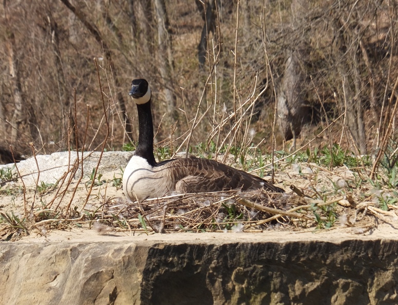
We saw no fish or snakes. Going upstream, we paddled on the Baltimore County side and heading back, we hugged the shoreline of Howard County. There were very few toads on the Howard County side. The shoreline is steeper and there are a lot more people because that is where the trail is. The toads seemed to prefer muddy/sandy shoreline that very gradually sloped down to the water. Anything steep, rocky, or heavily vegetated would not do. By the time we finished, we paddled 5.25 miles. The whole toad thing was a very unexpected and a welcome surprise. I'll have to mark my calendar to do it again next year. I'm really glad we got out when we did. Later that week, temperatures dropped a lot and in my town it even snowed.  |
|
Norma and I hiked at this location on March 21, 2012 and December 25, 2012 but I had never launched here until today.
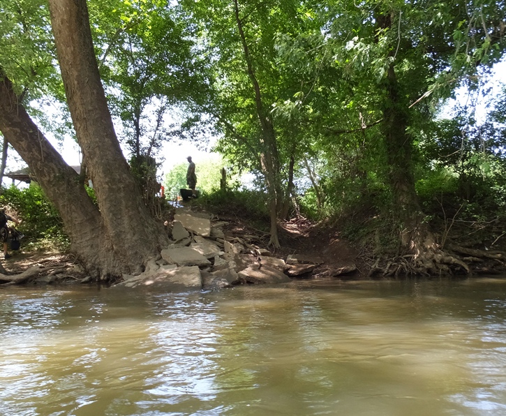
I started by walking from my house to the take out. I locked my kayak cart to a tree and noted its location. Then I got Norma to drive me and my Prijon Catalina to Old Columbia Road - Gorman Stream Valley - Gorman Park, where I launched. It was a little steep getting down to the water but otherwise, not bad at all. 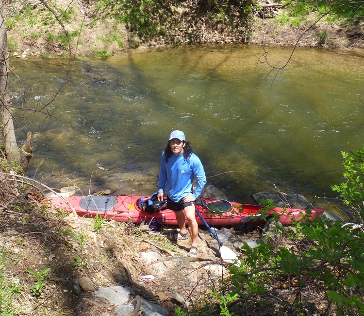
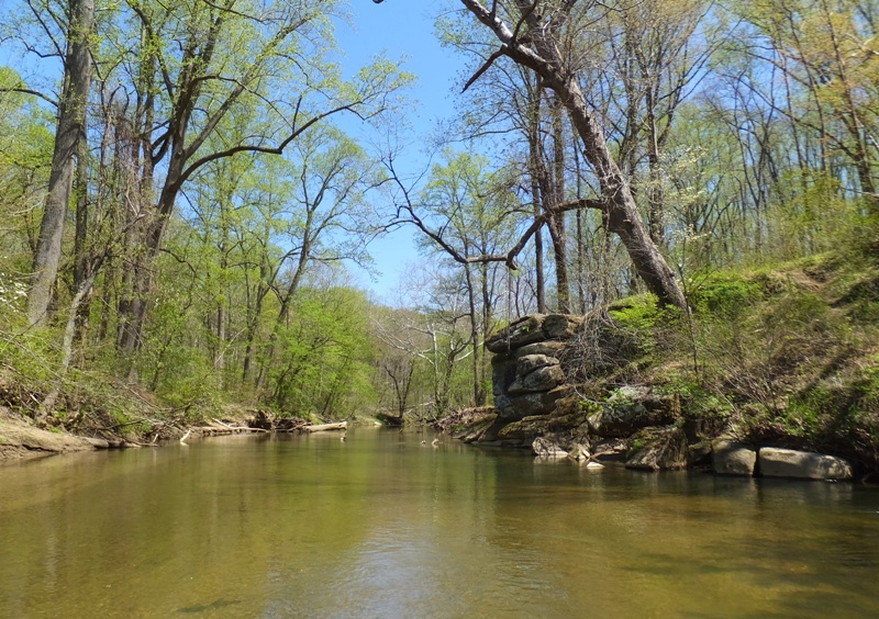
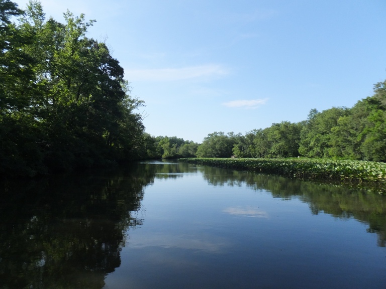
By 1320, I was on the Middle Patuxent (Pax) River. Upstream was Old Columbia Road (shown below) and downstream was wooded serenity. It was sunny and the air temperature was comfortable. Still, the water was cold so I wore a wetsuit. 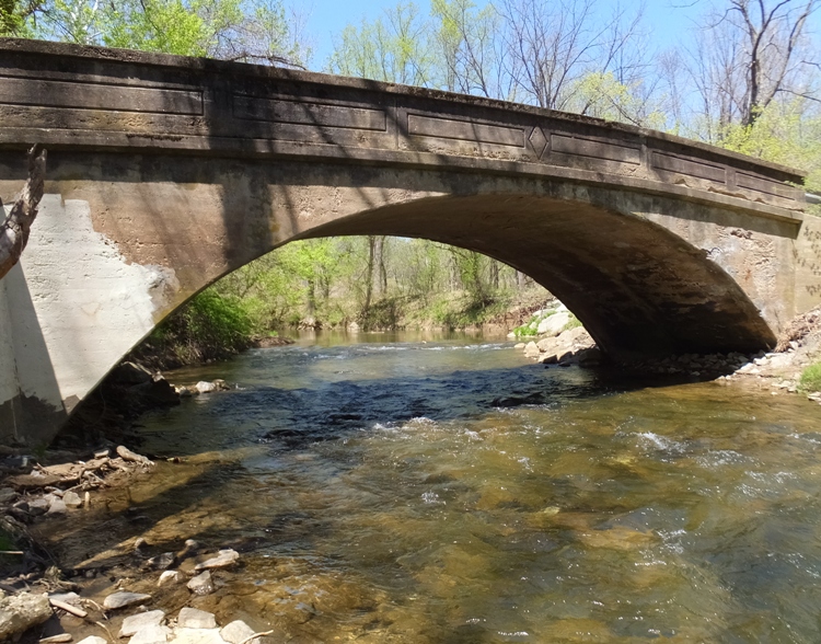
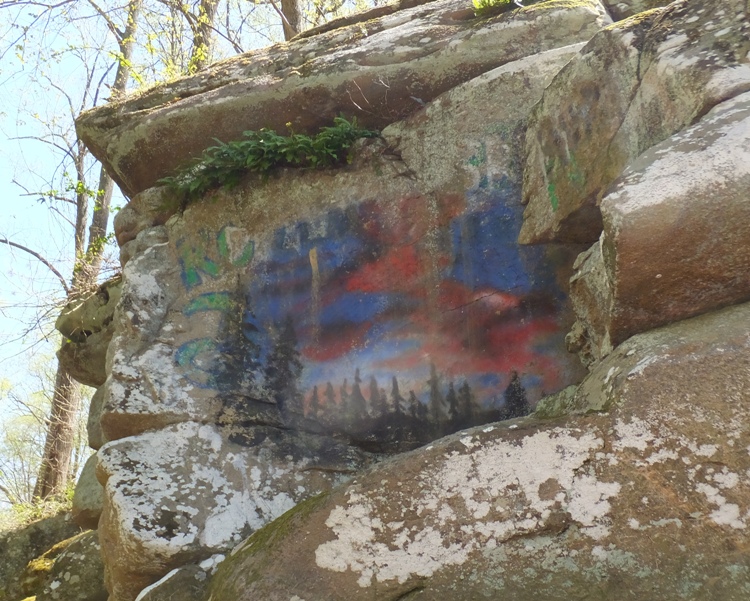
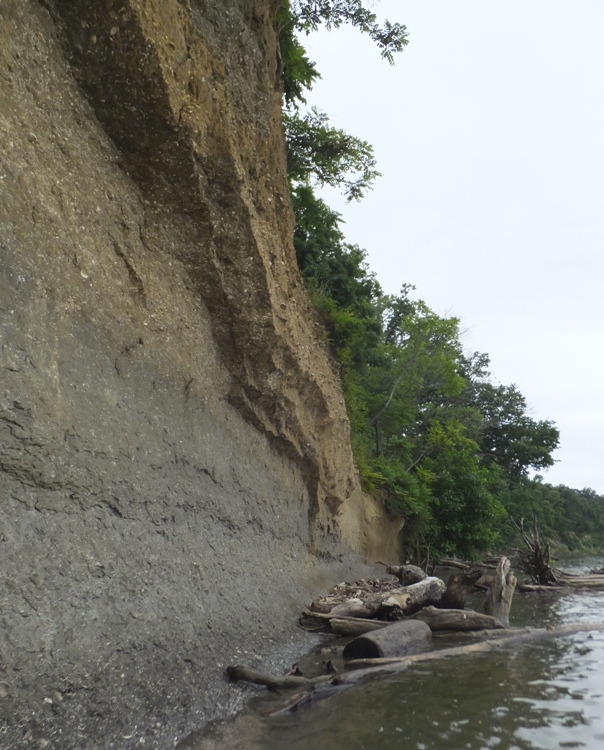
As I paddled downstream, I recognized things I'd seen on my two previous hikes in the area. In particular was a rocky overlook on the right (south) side. Getting closer, I realized that not only was the view nice from the top of this rock but also at the water level. Normally I don't much care for graffiti but in this case, someone painted a very nice sunset scene on the rock. I had never seen it before because I had only been on top of the rock. Many of the trees were just starting to grow leaves. I thought about future kayak trips and realized that I didn't have much time left if I wanted to see a heron rookery. In a few weeks, the trees would be thick with greenery and the heron nests would be mostly hidden. 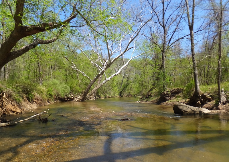
I expected to do quite a few portages on this trip but I only did two and they were both easy. On one, a tree had fallen completely across the river. On another, I simply ran out of water when things got too shallow. But otherwise, I was able to stay in my boat, though I scraped bottom quite a bit in the shallow areas. I could have used more water. The best metric I have for water flow information is USGS 01594000 - Little Patuxent River at Savage, MD, which records information downstream at the take out. By 1500, the discharge at this point was 137 cubic feet per second while the height in feet was 3.92 feet. In comparison, Ed Gertler reports in Maryland and Delaware Canoe Trails that his Little Patuxent River trip starting at Savage should be done when this same gauge reads at least 90 cubic feet per second and 3.8 feet. I was hoping to see a lot of wildlife like I did recently on April 13, 2014. Sadly, I saw very little. But I did see a wasp nest hanging from a tree above. 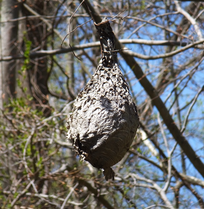
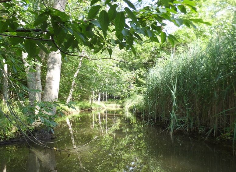
I passed Wincopin Park on my left (east) side. I saw where I had marked on my GPS something I call Salamander Pond. I pulled ashore and walked to it. It was indeed full of what appeared to be Spotted Salamander (Ambystoma maculatum) eggs (see below photo). To learn more about these, scroll down a little in Amphibians: Then and Now. The last time I saw eggs in this pond was March 31, 2010. 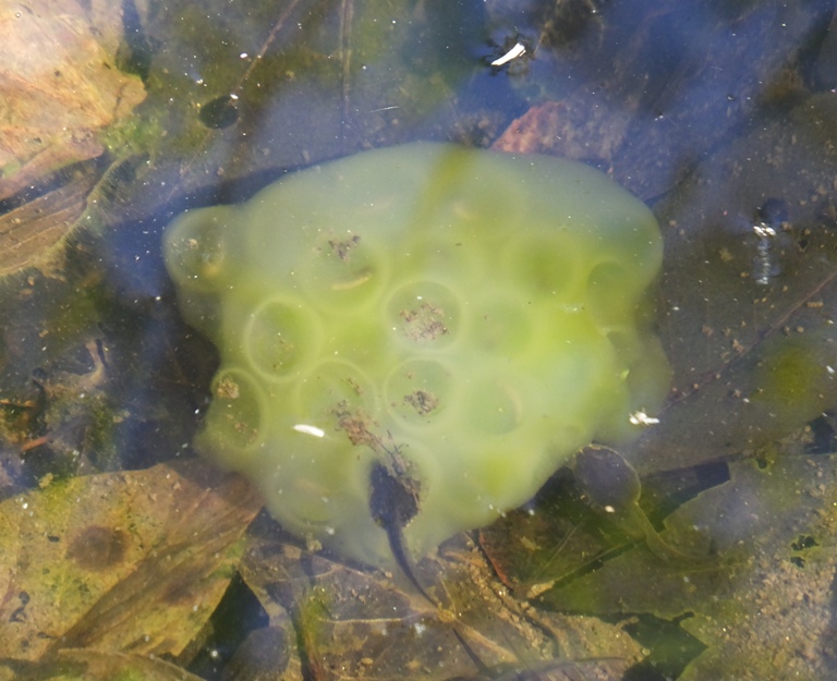
In addition to salamander eggs, I also saw hundreds of polliwogs (tadpoles). 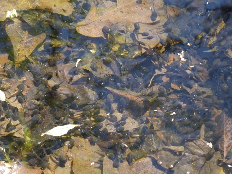
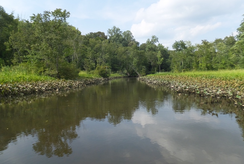
I continued paddling downstream. I passed Wincopin Point, where the Middle and Little Patuxent Rivers merge and continue as the Little Patuxent River. I knew the take out was near. But as I kept on kayaking, I began seeing things that looked like what I might see downstream of my take out. The water got rougher. Up to then, everything was easy class one rapids. But now I was definitely hitting whitewater and my boat started to take on some water. I pulled ashore and set out on foot. I soon realized that my take out was upstream. The reason I missed it is because I locked up my kayak cart on a section of the Little Pax upstream of Wincopin Point. So it was before the two rivers merged. I walked a half mile upstream and retrieved the cart then walked back to the kayak. I had to carry the boat over some very rocky terrain before I could use the cart. Then I wheeled it for about a mile and a half until I was home. Having inflatable tires on the cart made for a much smoother transport. I was home by 1700, having paddled 6.25 miles. It was a nice trip though I don't expect I will do it again for at least a couple of years. |
|
It seems like every day in the spring so far had been windy until today. So I loaded up my stand up paddleboard (SUP) and worked a half day at work.
After work, I drove north to Conowingo Dam. It should have taken an hour to get there but due to a traffic accident and road construction, it took two hours and 40 minutes! It was not my day. Needless to say, I was very stressed by the time I reached my destination. The last time I was at the dam was December 3, 2011. I was there for a hike and to see bald eagles. One of the people there pointed to a heron rookery just across the Susquehanna River that I had not seen before. I vowed to return. But before I went to check out the rookery, I visited the Conowingo Visitor Center. They had a lot of great photos of eagles and historical information about the dam. When the Conowingo Dam was completed in 1928 - producing 252,000 kilowatts (kW) - it became the second largest hydroelectric project in the United States, behind only Niagara Falls. - from display at visitor center I spoke to a very cheerful lady at the visitor center and asked her about the heron rookery. She was well aware of it but said it is on private property. This rookery is between the Susquehanna River and Susquehanna River Road (route 222) in Cecil County. It is just downstream of the dam but upstream of Octoraro Creek. She said I might be able to see it from the park on the south side of Octoraro Creek. So Octoraro Creek was my next destination. This took me to Conowingo Community Park just off Susquehanna River Road (route 222). The only launch area I could find here was very muddy. 
If I put in at this site, I would have quick access to the mouth of Octoraro Creek. 
I expect I will return later, launch a kayak, and explore the creek, though I may not launch here. I will also check out the rookery which I was not able to see from the park. I drove south on route 222 and into the town of Port Deposit. It seems like a quaint, historic town. I passed the Historic Port Deposit Marina Park which looks like a good place to launch. 
I passed through Perryville and then drove across the Hatem Memorial Bridge (route 40) over Garrett Island and into Havre de Grace. I launched my SUP at the Jean S. Roberts Memorial Park at 1645. It was dark and dreary but at least the wind was calm. I actually had two goals for the day. One was to see the heron rookery. The other was to see the goats of Garrett Island. Last year, someone posted something on the Chesapeake Paddlers Association (CPA) forums page about seeing goats on Garrett Island. He included a photo. I figured it would be worth checking out. I made my way to the island. I paddled through what looked like motor oil covering some of the water. I also saw several dead fish. Not a good start. At the island, I saw signs stating that it is a national wildlife refuge. These same signs told me not to land. The place was pretty scenic and undeveloped. I paddled very slowly so I could spot any wildlife. I paddled to the southern tip of the island. This section was rather shallow. As I made my way up the east side of the island, I saw a sign that read Welcome to the Garrett Island Division of Blackwater National Wildife Refuge. This beach area is open from sunrise until sunset for wildlife observation, photography, environmental education, and fishing access. In order to protect the cultural and natural resources of Garrett Island, areas beyond this beach are closed to all public access. - from sign on central eastern side of island In Perryville, I saw the Perryville Boat Ramp.. 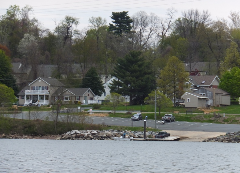
I saw a goose sitting on a nest. Nothing unusual about that at this time of year. But what makes this interesting is that this goose did not build its own nest. It took over what looks like an old osprey nest. 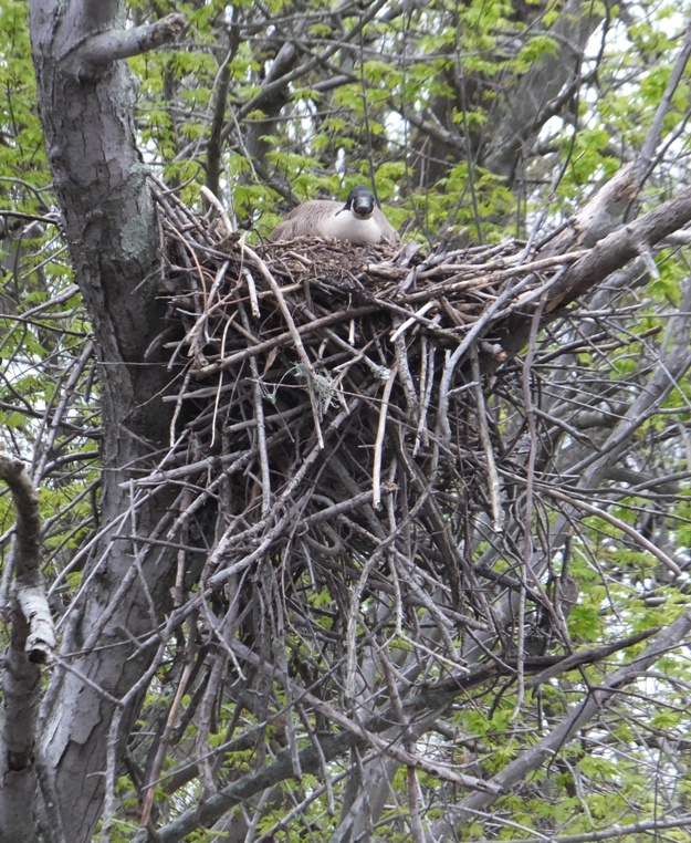
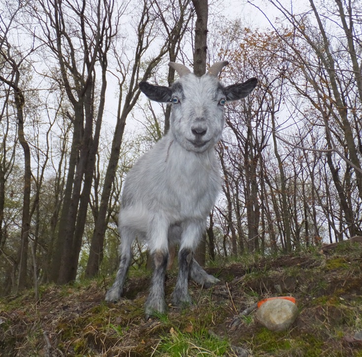
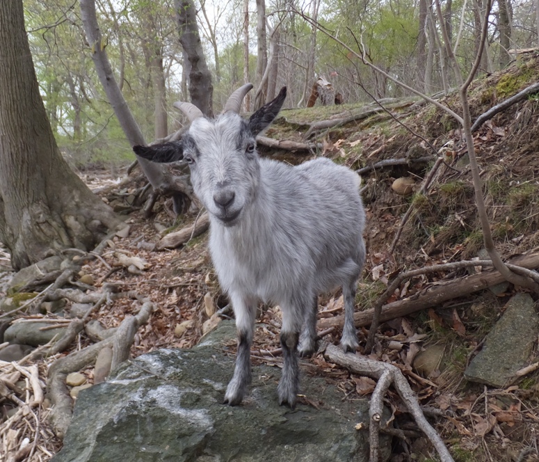
I looked this up on-line and found that this is not the first goose to do this. Apparently, a goose in Missoula did this too. On the northeast side of the island, I saw what I was looking for. It was a goat. It stood only about 18 inches high at the shoulders. It was not the least bit shy. I don't know how it got there but my guess is that the owner could no longer keep it (or just didn't want to) and rather than set it free to eat up the neighbor's garden, he decided to release it on this island. The CPA forums photo showed more than one goat but I only saw this singleton. Further north, I saw a raccoon. It hid before I could get a photo. Several vultures rested in a tall tree. I could smell something rotting. I rounded the north side of the island then headed south. I saw another raccoon. It too did not want to pose for me. It started to rain lightly. I would have been uncomfortable had I not worn a wetsuit. I finished my circumnavigation then did a little bit of an overlap before returning. I saw what looked like some ruins of something. 
Near the launch area, I saw a boat that had sunk. I wondered if the oil spill came from it. 
I completed a mere 4.6 miles around dusk. The drive home wasn't so bad though it did rain pretty hard. |
|
I drove to Angler's and purchased a Queen Anne's County launch permit for $35. This is good for the calendar year. My plan is to do a lot of paddling in Queen Anne's County this year...at least $35 worth.
Next, I headed to Goodhands Creek Public Landing on Kent Island. I saw an official truck scoping the area out. I'm guessing he was looking for vehicles that did not have a launch permit. By 0800, I was on the water. I paddled south and explored all of Kirwan Creek. On a northern tributary, I saw a muskrat up close and personal. My SUP got within five feet of it. Further west on the creek, I saw a house with an airplane in the yard. Not something you see every day. 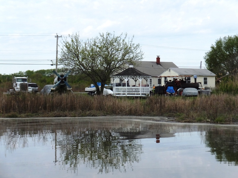
There was a lot of yellow stuff on the water, especially near the shore. I'm guessing it was pollen. 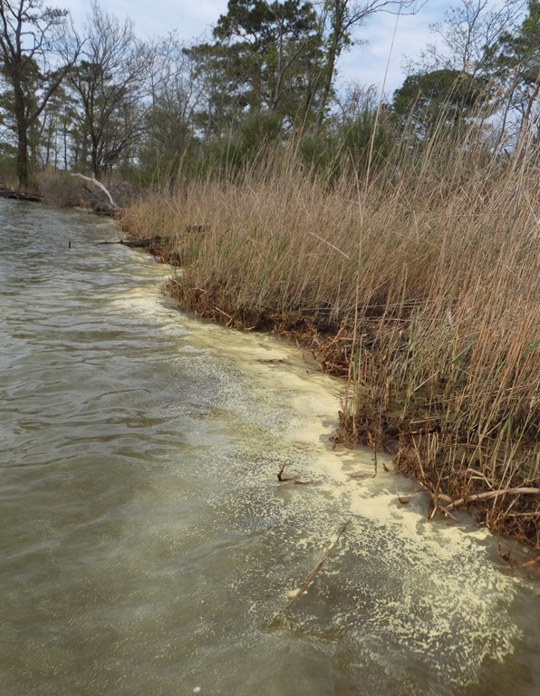
One thing I found around the island that was unusual were jellyfish. I saw about five of them with the largest no bigger than my fist. I've never seen jellyfish in this area so early in the year. I paddled about a mile across Prospect Bay to Hood Point and then to Piney Point and finally to the north side of the mouth of Cabin Creek, my easternmost destination. Sticking close to the shoreline, I paddled all around the Chesapeake Bay Environmental Center, which Norma and I visited on February 6, 2011. This place is nice to paddle near being that it is so undeveloped and natural. 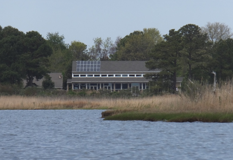
Amongst the bay grasses, numerous red-winged blackbirds flew about. 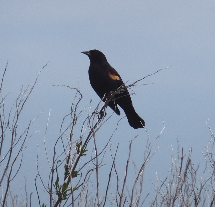
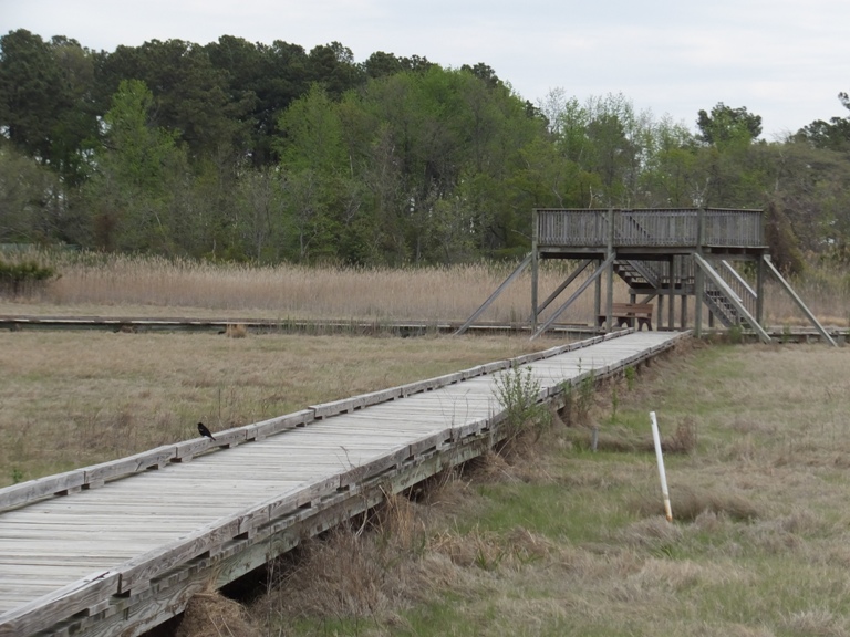
Along the Center's beach on the west side, I saw several pink flags marking an area. I wondered if there might be turtle eggs there. I stopped for a snack at a larger beach near the boardwalk terminus just north of the beach with the pink flags. I sat at a bench that commemorated the life of Bernard "Bud" Halla a wildlife biologist that lived from 1933 to 1996. At the bottom of the plaque, it said, "Semper Fi" so I know he was a Marine biologist. I paddled into a lagoon on the north side of the Environmental Center and on the south side of Marshy Creek. There were several plants with cages around them. I suppose they must be special plants and the cages were there to shield them from muskrats. 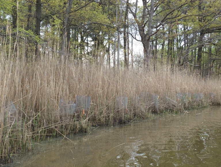
Eventually, I came to the kayak launch in the Environmental Center. 
There was a small unnamed creek just south of the launch site that I tried to explore, but I couldn't get far due to lack of depth. I saw a bald eagle nest and a couple of eagles further east on Marshy Creek. Throughout the day, I saw about five eagles. I also saw several herons. Some were rather small. Ospreys were abundant and just starting to build their nests. It looked like many couples were just claiming their nesting platforms. It was mostly overcast and not windy in the morning but it cleared up in the afternoon as the wind picked up a bit. Near the east side of Marshy Creek, I saw about a hundred small birds with white on their faces. I believe they are ruddy ducks. 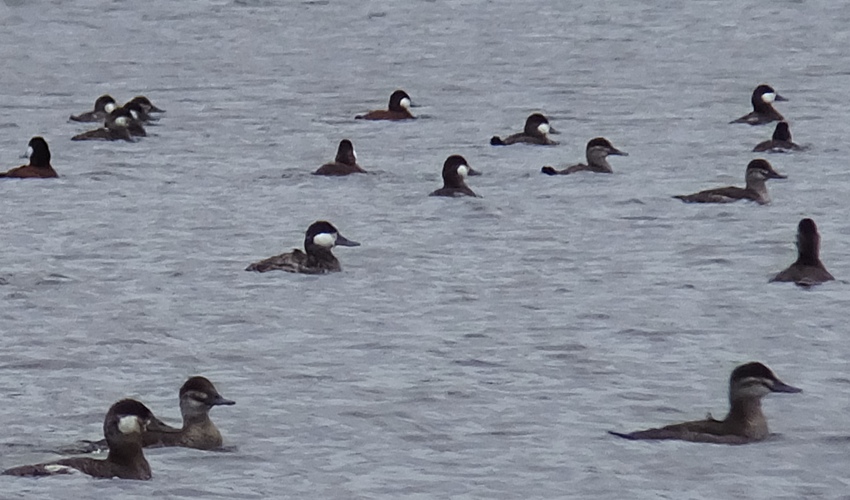
On a small tributary on the north side of Marshy Creek, I saw a muskrat. It was swimming in my direction. I got out my camera and started taking photos. Then I noticed something swimming in front of it. It was a northern watersnake. The muskrat was quickly catching up with the snake. I took photos of the snake. As they both got close to me, the muskrat didn't want to go to its right because that was land. It didn't want to go to the left because then it would get too close to me. So instead it dove and swam under the snake, passing it. That's the first time I've seen anything like that. I saw a few turtles with their heads sticking up out of the water along with a snake doing the same. It is easy to tell the difference because the snake heads are smaller and they can't hold their breath for long so they swim a short distance then come up not too far from where they started. At the most northern side of Marshy Creek, I saw a snapping turtle. Its shell was about a foot long. That might be the first time I've seen a snapping turtle in brackish water. I explored the highly developed Wells Cove. I only saw two other SUPs on the water and no kayaks throughout the day. Not a whole lot of power boats either. It seems everyone was at one of the restaurants in Wells Cove. I crossed Kent Narrows to get back to Kent Island. Hog Island marked the mouth of Goodhands Creek so it was easy to find my way home. I landed at 1510 after having paddled 23.6 miles. |
|
I was feeling a little stressed, having not gotten out on the water on what was (in my opinion), the nicest day of the year to date, Sunday, May 11. In fact, I didn't get out all weekend. Instead, I was catching up on things...mostly doing volunteer work. So getting in a little water time was high on my list of priorities. I decided to get out on the afternoon of Tuesday, May 13. The weather was far from ideal but it would be far better than the next few days of rainy weather. This spring has been pretty wet so far.
I launched at Thompson Creek Public Landing (shown below) at 1600 and paddled south to Cox Creek. 
I hit some ten mph headwind. Where the two waterways meet, I found a baby turtle. By comparing its size to the 1 3/16" gap between the foam floor on my SUP, I estimate its shell is 1.4 inches long. As I picked it out of the water to take photos, the wind blew me quite a distance in a short period of time. I forwarded the pic to Sue M., who works for Howard County Recreation and Parks. She identified it as a diamond-backed terrapin and forwarded my finding to the proper authorities that record such information. 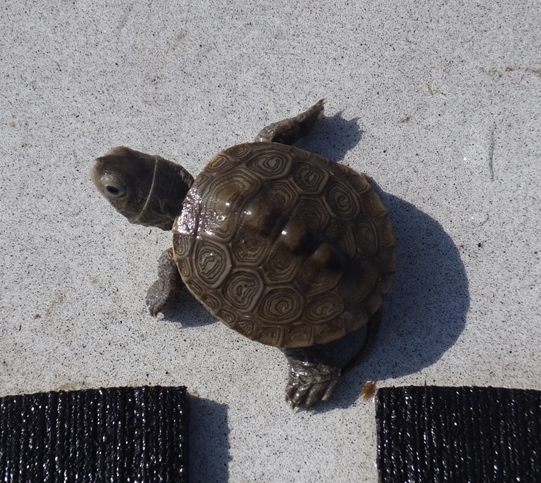
I saw a dead fish that was about 3.5 feet long. I paddled upstream on Cox Creek. The west side of the creek was pretty undeveloped. I found a culvert under highway 50. I was tempted to go through it but it wasn't much wider than my SUP and I didn't want to get stuck. 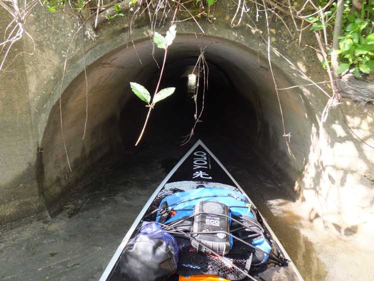
I paddled under three bridges: highway 50, Main Street (route 18), and the Cross Island Trail, the latter shown below. 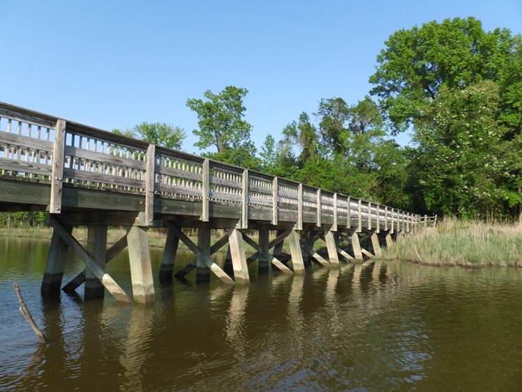
Under the first two bridges were a lot of barn swallows. I was exploring every nook and cranny of Cox Creek, leaving no stone unturned. I was surprised at how far I was able to get up some of the narrow sections. Paddling in the shallows was very slow but the feeling of being totally alone made it all well worthwhile. I only saw one other boat out all day. I saw an osprey nest that was built on someone's boat. Maybe not the best location. 
I also passed a really big metal heron sculpture in someone's back yard. 
I saw four muskrats, which is a one-day record for me. 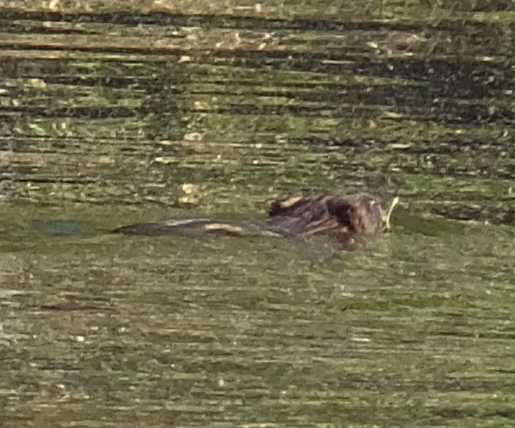
Unfortunately, I saw no eagles or snakes. Once the wind died down, everything was perfect. I found a really big feather, about 14 inches long. Towards the end, I was working on my technique and felt pretty strong and fast. Part of the reason I wanted to go fast is that I wanted to get back before nightfall to take care of my chickens. I was done by 1915 having paddled an easy ten miles. Next time I need to explore upstream on Thompson Creek and all of Warehouse Creek. |
|
It was partly cloudy, somewhat cool, and a little breezy. It was a good but not a great day to be on the water.
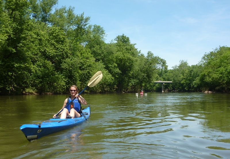
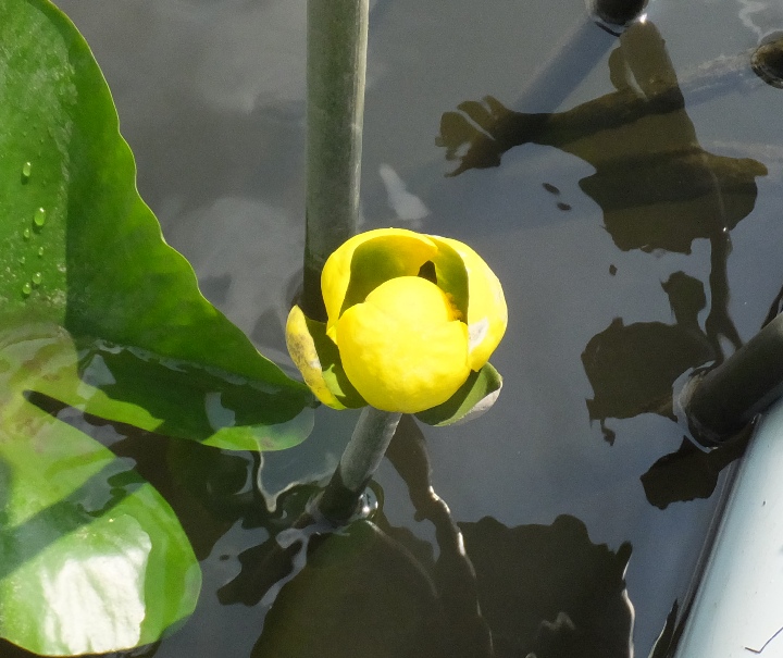
I helped Norma with some chores in the morning, then headed out to the eastern shore in the afternoon with my Yolo Prowler stand up paddleboard (SUP). On the way, I picked up a hot dog and a cherry-flavored Diet Pepsi. About ten years ago, I had the lemon-flavored Diet Pepsi and then the lime-flavored Diet Pepsi. I really liked both of them...especially the lime. But those drinks were short-lived. I tried the cherry-flavored and found it to be excellent. Hopefully, that will stick around. I launched from Hillsboro on Tuckahoe Creek at 1530. Usually, I paddle in the morning but I'm finding the late afternoon is also nice since the wind often dies down and the low sun offers some great views. Some wildlife is also more active late in the day. The air was clear and visbility was excellent. Spatterdock flowers were in bloom. 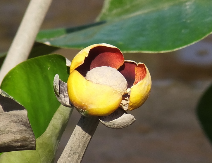
Heavy rains over last few days meant the water was moving faster than normal. I found a nery nice, scenic creek about a mile downstream of Stoney Point Landing on the north (right) side of Tuckahoe Creek. I highly recommend exploring this. I was out in this area last year on July 13, 2013 but back then I wasn't exploring all the side creeks. Unlike that day, today was a "leave no stone unturned" day. 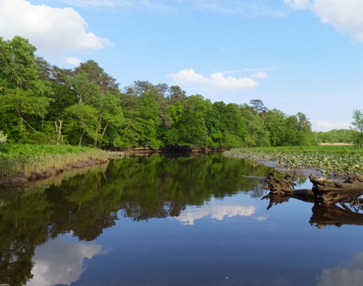
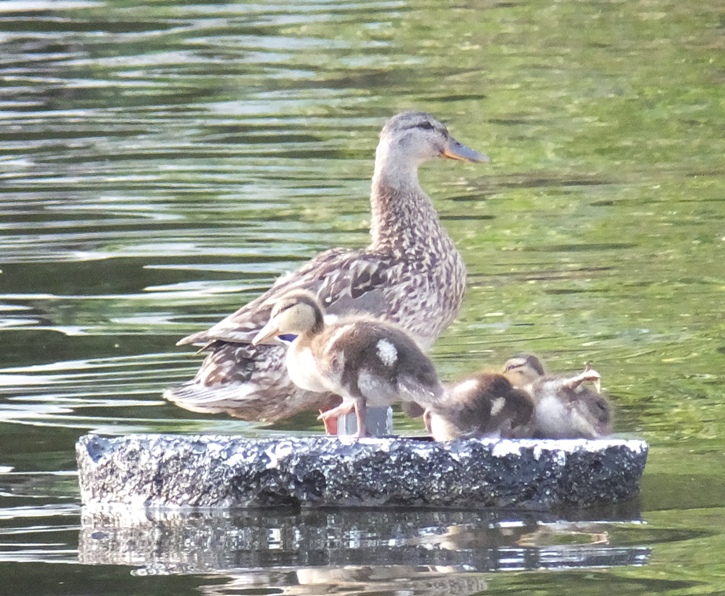
A mother duck was playing lame to try to lure me away from her babies. Low tide was around 1730 so at that point I started paddling back. I put it into high gear, worked on my form, and got back to Hillsboro in about an hour. I would have liked to have known how fast I was going but the part of my GPS screen that indicates speed is cracked from my fall after cross country skiing on March 3, 2014. I had plenty of time before dusk and I was having a really good time so I continued upstream past Hillsboro into the water trail section, which I last did on May 1, 2011. The current was pretty strong in some sections but it certainly wasn't whitewater. I passed under several bridges including an old railroad bridge. 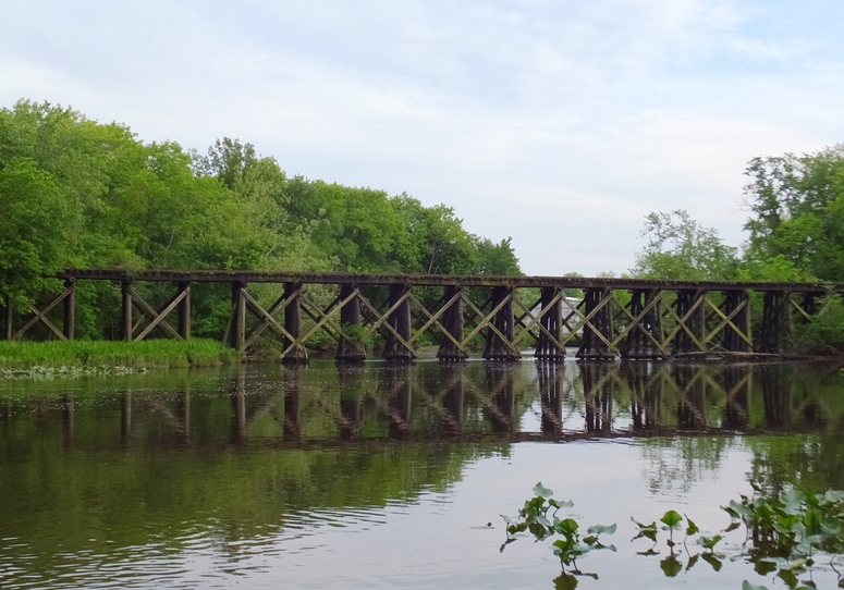
I saw a big mammal crawling along the east bank. I knew it was either a nutria or a beaver. I'm guessing it was the latter because it looked to be too big for a nutria. It was even big by beaver standards. It went into the water and swam away. I turned around 1.1 miles upstream of Hillsboro at a downfall. On the return trip, I paddled in stealth mode so I could see that mammal again. Indeed I did see it before it saw me. I took out my camera and turned it on. But my camera makes an electronic noise when it gets turned on which scared the animal. It slapped its tail on the water really hard and dove. At that point, there was no doubt in my mind that it was a beaver. They slap their tail on the water as a sign of warning. Further downstream, I think another beaver dove into the water as I passed. I didn't see it, but it made a really big splash. I saw a muskrat swimming which looked tiny compared to the beaver. The sun was low in the sky and cast a glow on some of the bridges on my way downstream. I finished 12.7 miles at 1920. |
|
Though I had been on the water just two days prior, I wanted to get out again before the big rain. So I left work a little early and then drove out to Little Creek on Kent Island.
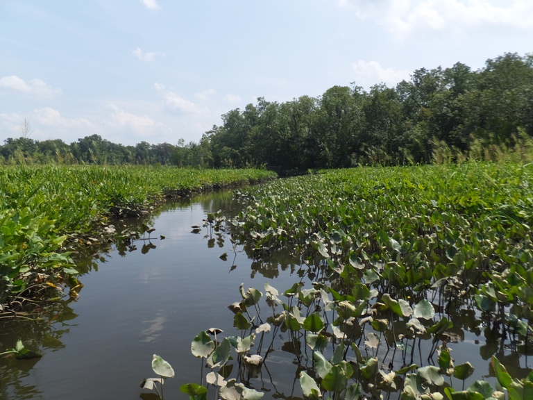
There were a lot of police there, some carrying M16s. But it didn't look like anything was going down so I just went about my business. It was a little windy (nine mph) so I explored the narrow sections first. I headed east to check out a small, unnamed creek between the launch area and Crab Alley Bay. Here, I found the water to be pretty clear (by Chesapeake Bay standards). I'm guessing this was due to a lot of vegetation in the water. I saw a couple dozen carp. Many were three feet long. 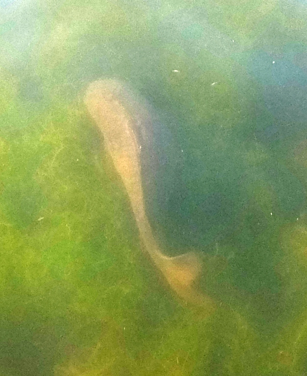
Next, I explored Crab Alley Creek. This was pretty nice. There was some development but otherwise, it was mostly trees. I headed south to Johnson Island and circumnavigated it. I was hoping to land but it is private property. The water around it was pretty clear. I could see white shells about three feet down into the water. According to my 1998 map, Little Island is supposed to be just southeast of Johnson Island. But it was nowhere to be seen. I've come across this before; small islands just seem to erode away after awhile. Not sure if it has anything to do with global warming...maybe it is just entropy. Or maybe not. The wind was pretty strong so I decided to call it a day. Maybe next time I'll paddle south to Turkey Point and check out Long Marsh Island and Bodkin Island. I only got in 8.3 miles for the day. |
|
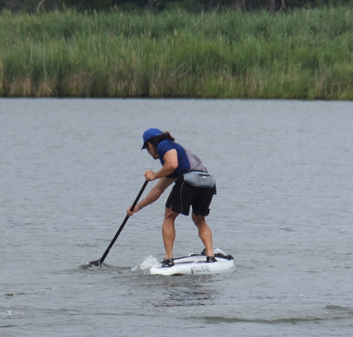
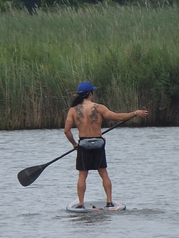
Eastern Bay is the big section of water between Kent Island and the Saint Michaels peninsula. It is fairly unprotected...not the type of place to take a SUP unless the winds are calm. Today that was the case...so that is where I went with my Yolo Prowler stand up paddleboard (SUP).
The Memorial Day weekend of 2014 was beautiful. Lots of sun and warm weather. It was a great time to be outdoors. It got out on my bicycle the day before. That was an easy trip. I was wanting to do a little something more strenuous today. I was thinking of other places to go bicycling with friends. Perhaps it was just wishful thinking but I just happened to find the Kent Island South Trail bike path on the way to my destination. It looks like a good non-summer trip since there isn't a whole lot of tree cover. I launched on Shipping Creek at 0815. I explored the section around an area called Kentwood. There, I saw carp spawning. At first I thought it was aerators but all the splashing was too random. There were a few dozen carp. Click on the image to start a video. 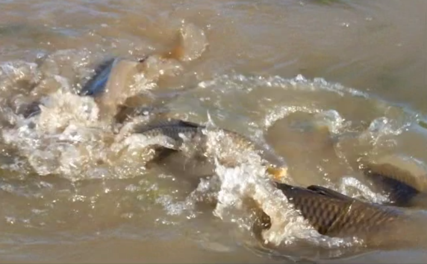
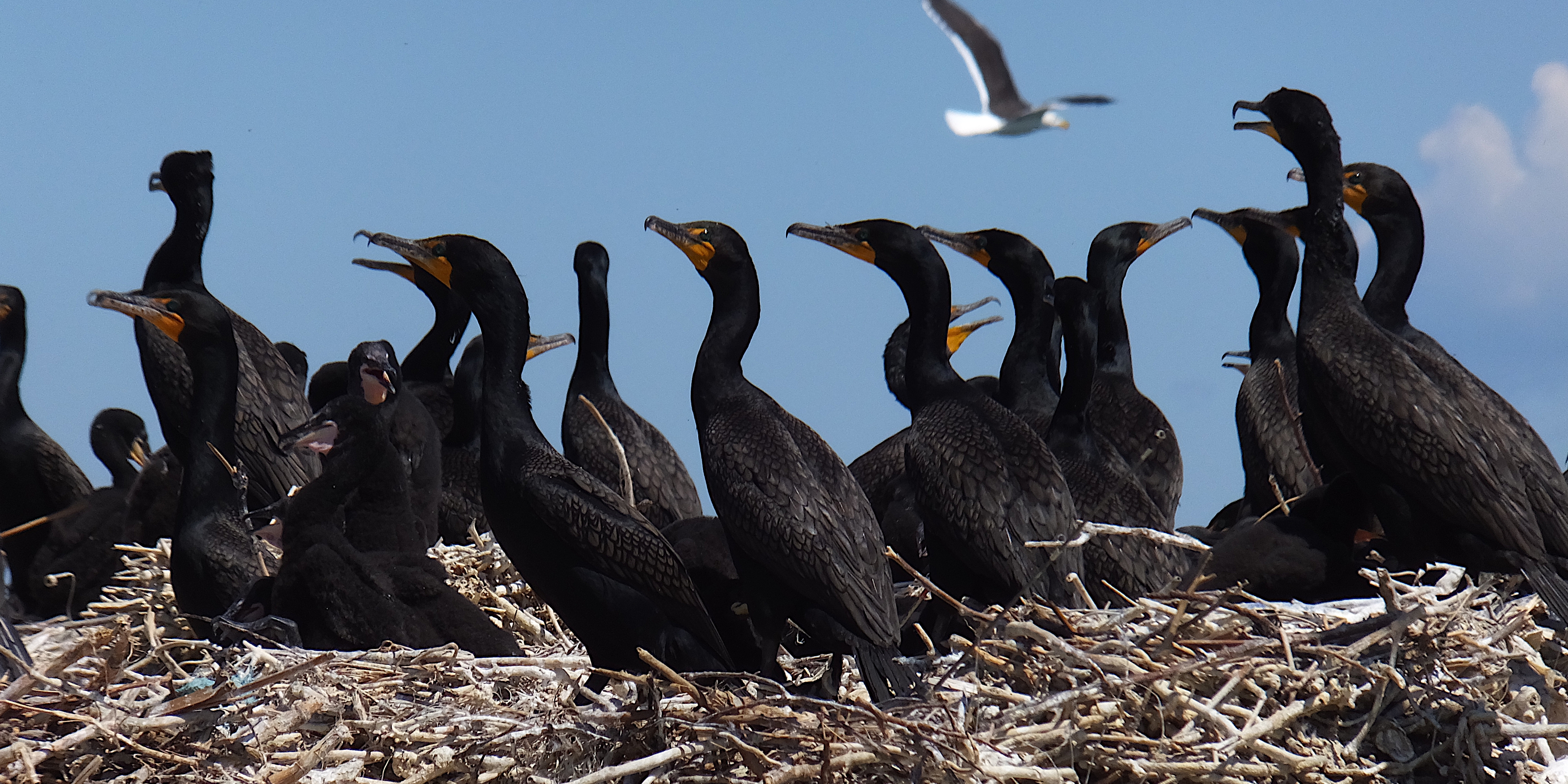
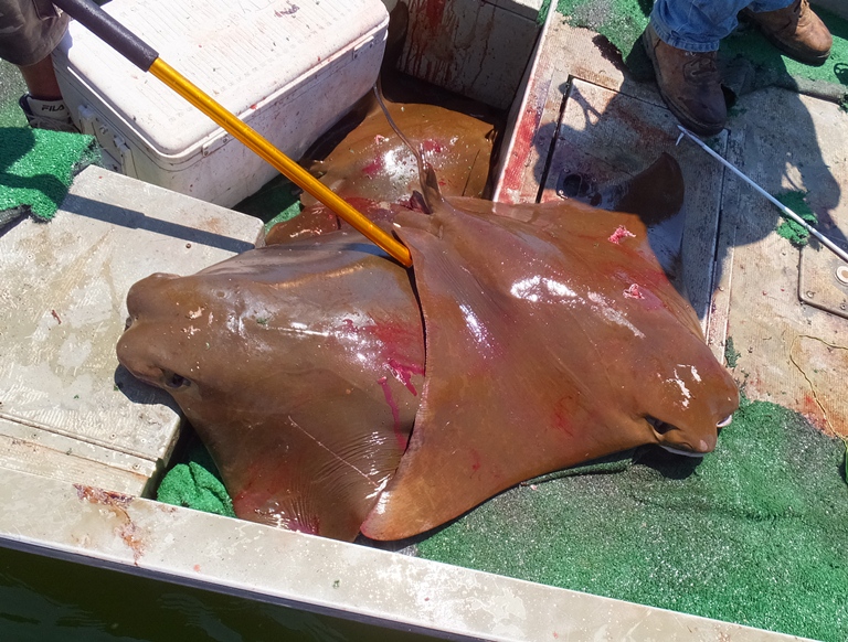
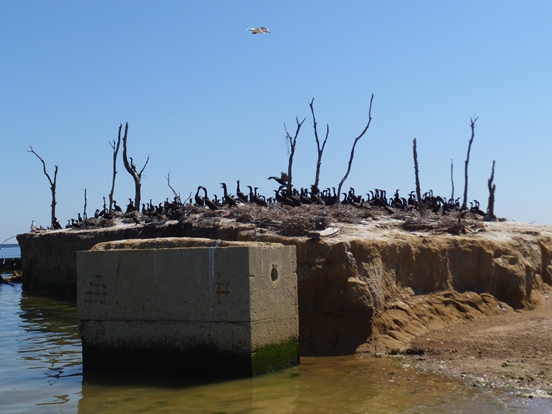
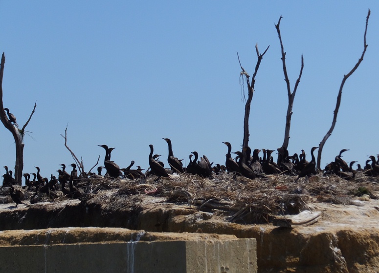
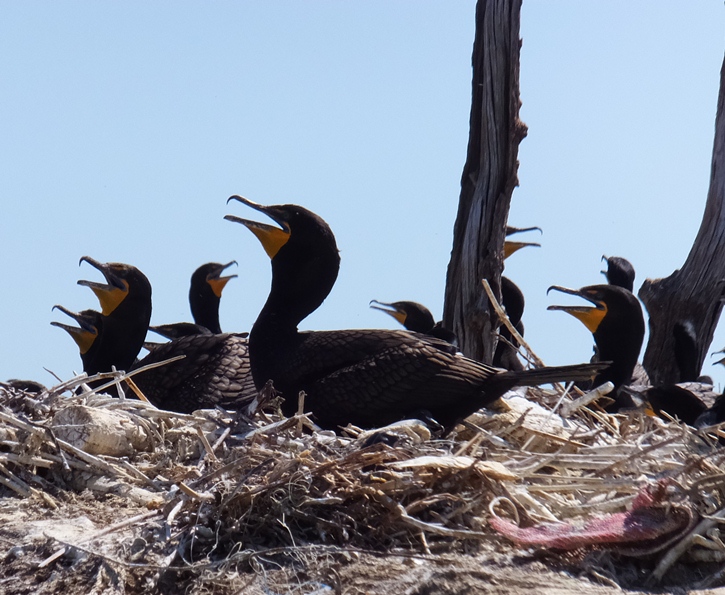
I paddled south to No Name Creek. Some residents told me that is the name of this creek, which doesn't appear on my map. The map shows that Philpots Islands are there but instead I found what was clearly an island that was connected to land with rip rap. I explored this creek. Making my way into Eastern Bay, I saw six cownose ray at the bottom of a four-foot deep section. They just looked like dark disks at first until they started to swim and I could see their wings flapping up and down. I paddled east just south of Turkey Point. I looked for Long Marsh Island but it was not there. But when my GPS said I was there, I looked down and saw stumps or piles. The water was pretty shallow and it was obvious that it was once dry land. I continued east to Bodkin Island. I had been there before several years ago where I saw a lot of bird nests and a variety of birds. Some of the nests were very tall, about two feet thick. Today almost all the birds were cormorants. I moved quietly (yes, I turned off my stereo) and slowly so as not to scare them away. I saw some nests with eggs but never more than one egg per nest. One egg was not in the nest and instead it was at the edge of a big piece of rip rap. I put it back in the nest. The sounds the cormorants made was very interesting. Some had a very deep growl, almost like an elephant seal. Click on the image to start a video. 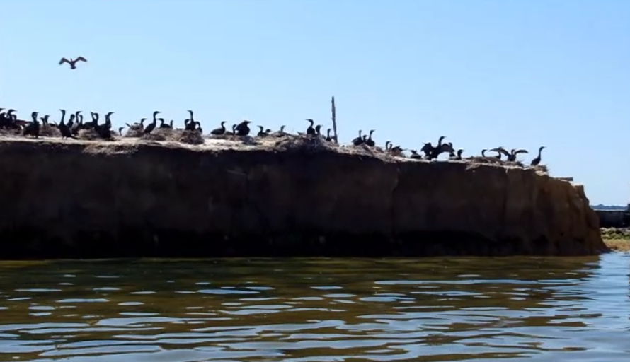
Here's a view from the short side of the island; click image to play video. 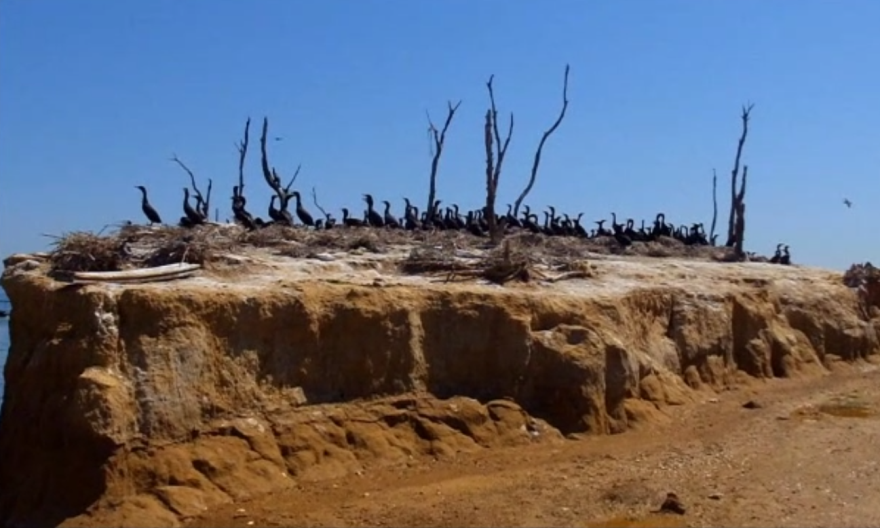
Turn your sound on for this one. Listen closely for the elephant seal sound. Also observe all the nests. 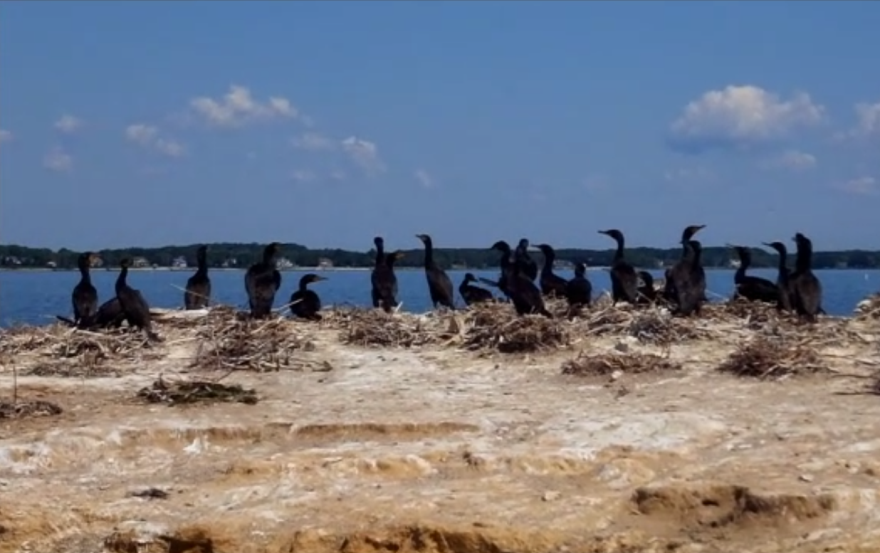
My guess is there were a few hundred cormorants. Here is a satellite photo of the island. 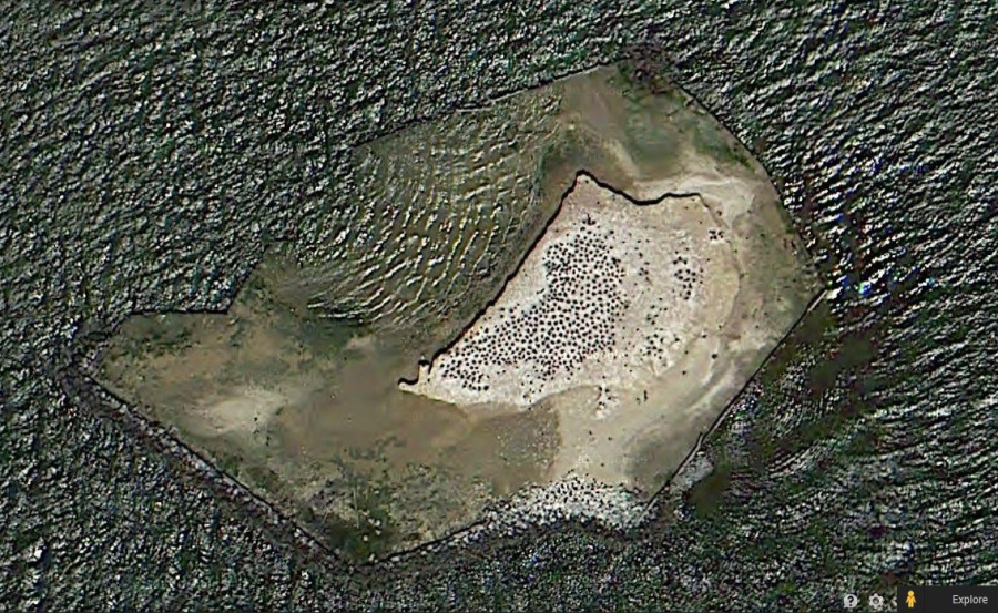
They seemed unaffected by my presence. 1 / 4
Narrow side of island.
2 / 4
Closer-up view.
3 / 4
Sitting on the nests.
4 / 4
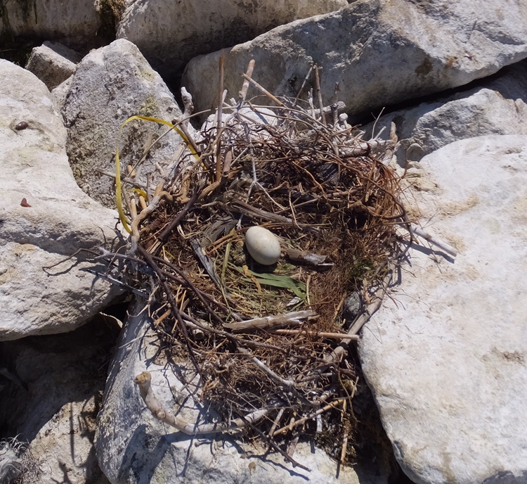
Single egg.
In addition to the cormorants, there were a few seagulls and a few sandpipers...at least that's what I call them. 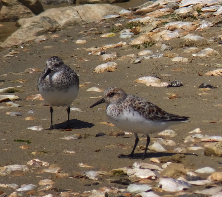
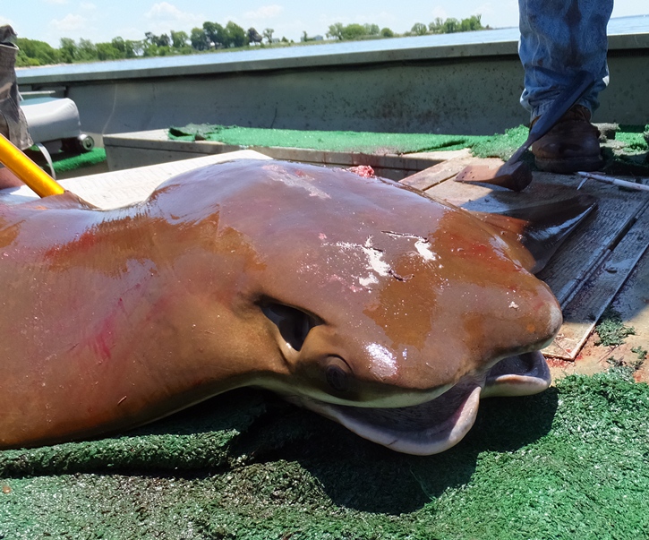
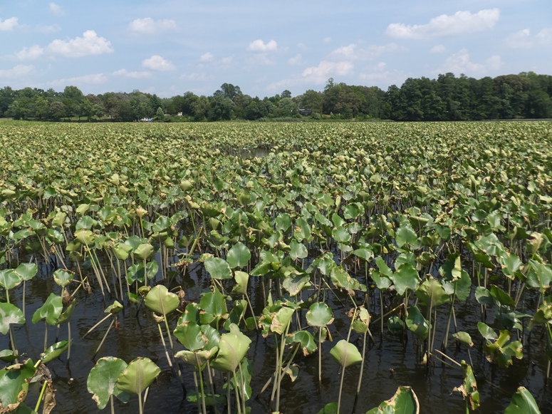
The water was unusually clear. I saw white shells at the bottom then stuck my paddle in to measure how deep it was. It was five feet. I headed south to Tilghman Point on the Saint Michaels peninsula. That was a 2.7-mile open water crossing. The wind was only about four mph and I figured that if I ever wanted to do this crossing on my SUP, now was the time to do it. The water was calm until I got closer to the point. Then there was a lot of boat traffic and things got rougher. I landed at the point, took a short break, then turned around. Next, I paddled 2.7 miles to Parsons Island. Along the way, I saw a school of eight rays swimming near the surface. The sun shined on them in a way that made them look somewhat golden. My heart raced with all the excitement. I paused for a second, staring in awe. Then I reached for my camera and started taking photos as they passed by. The photos don't do justice for what I actually saw. 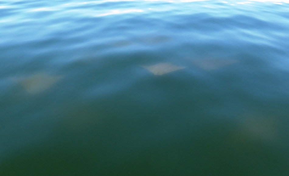
I saw several more schools of rays. I rarely saw a singleton. Most of them were seen on the southeast side of Parsons Island within 75 yards from the shore. Almost all swam along the bottom. None swam with its wings sticking out of the water at any time which is usually how I spot them in a kayak. I kept counting. Eventually I got to 50 and then stopped counting. I reckon I saw about 65 throughout the day. I landed on the north side of the island at a small sandy area. I found a big (11" wide) horseshoe crab skeleton in excellent condition. I put it on my SUP to take home. I also found a coconut. Not sure how it got there. I also took that home. Continuing on, I saw three guys in a John boat that were fishing. They pulled a ray on board. I asked if they were going to eat it and they said yes. While I love seeing rays, I don't have a problem with people killing them as long as they eat them. I just hate to see things go to waste. I went over and spoke to them. They were using a compound bow to catch them. Obviously Parsons Island is the place to see rays. I found a very small grassy island on the southwest side of Parsons Island. I don't expect it will be there in a few years. 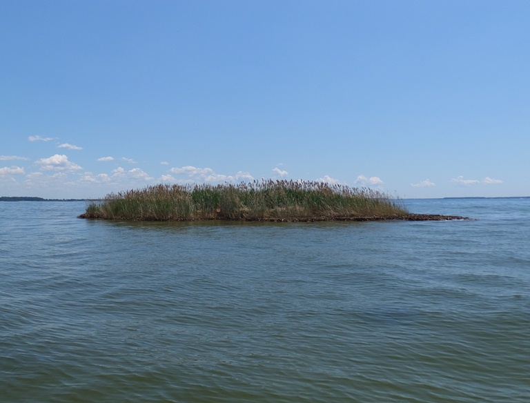
I paddled back, passing Bodkin Island along the way. I continued west. The water was a little rougher but still not bad. Two kayakers were heading my way. I went to say hello. Surprisingly, on perhaps the nicest paddling weekend day of the year, these were the only kayakers I saw all day. No other SUPers. It is a shame more folks weren't out. I was done at 1500, having completed 24.2 miles. It was good finishing so early. I ran into very little traffic on the way back. Most of it was going the other way. I had plenty of time to go home and work on my chicken coop. To say I had a good day of paddleboarding would be an understatement. On a scale of 1 to 10, today was a 10! |
|
Norma was wanting to take the interns in her office, Alex and Francisca, on a little outing. They were thinking of hiking Old Rag on Memorial Day but I wasn't so keen on the holiday traffic. So instead, I proposed a kayak trip.
Kayaking the lower Monocacy River is a scenic route I last did on March 31, 2006. It is natural, scenic, and at this time of year, generally has enough water to make paddling enjoyable. The 2014 Memorial Day weekend was the nicest I could ever remember. It wasn't just the fine weather. It was being with friends and being outdoors doing what I love. Today was a chance to share some of this with others. In Ed Gertler's Maryland and Delaware Canoe Trails, he says that for this section, the minimum amount of water needed for kayaking is 214 cubic feet per second (1.7 feet). As of 0700 on the morning of our trip, the flow was 1,140 cubic feet per second while the stage is 3.52 feet, according to "National Weather Service - Advance Hydrologic Prediction Service - Monocacy River Near Frederick at Interstate 70." Clearly, we would have plenty of water. Norma picked up Alex and Francisca and then we all met at Buckeystown Community Park. We unloaded the boats and gear, then Norma and I drove to the take out at Monocacy River (Mouth), where we left one car. The launch area was a little steep and rocky but it was sufficient. I put Francisca in my Cobra Expedition while Alex was in my Prijon Catalina. Norma and I paddled my Ocean Kayak Cabo. It was sunny and comfortably warm but if we wanted to get out of the sun, we could just paddle closer to the tree line. We saw some interesting rock formations. Francisca had a good eye for spotting wildlife. She spotted at least one of the two muskrats we saw along with a small snake swimming on the surface. About 5.5 miles from the start, we pulled over on the right (west) side just before some class one whitewater. Here, we had a snack and watched some other kayakers go down the rapids. There was enough water so hitting rocks wasn't much of an issue. I helped Francisca portage around the rapids while Alex, Norma and I went through it. Alex had a lot of fun on this. Click on the image to start a video. 
About a half mile after the rapids, we passed the Monocacy Natural Resources Management Area - Park Mills. 
An overwhelming majority of our trip was on very flat, calm water that gave us a gentle push downstream. 
Just 0.4 mile before the aqueduct, we paddled under an old railroad bridge with big, stone supports. 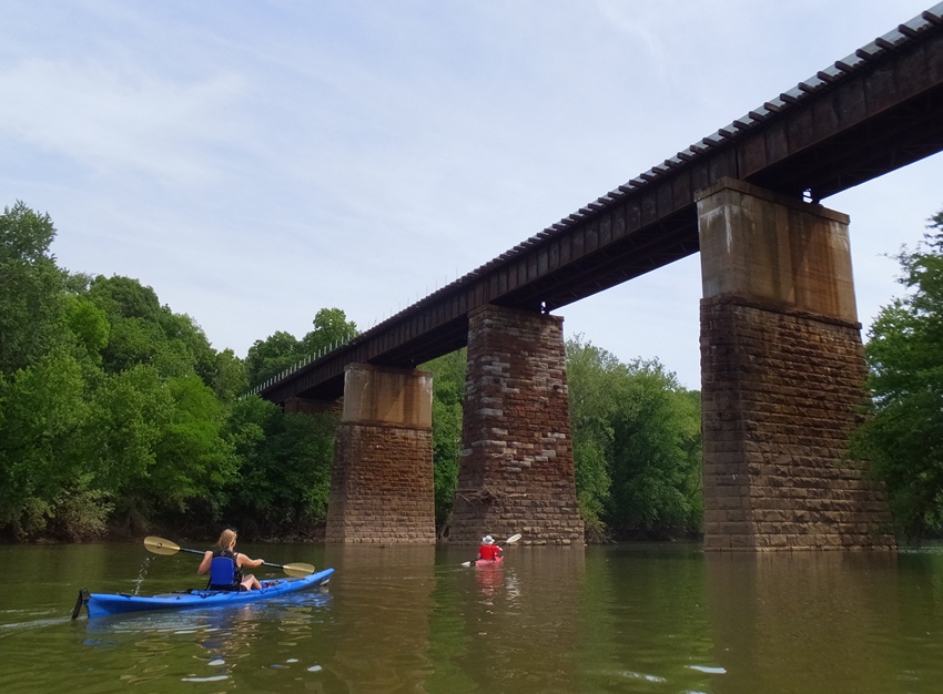
We completed our ten-mile adventure. Next time, I'd like to stop at Lilypons Water Gardens which is only 0.6 mile from the river and three miles downstream from the start. But I didn't see any place to get the boat ashore there so we'd just have to drive there. Norma and I retrieved the other car while Alex and Francisca guarded the boats. To avoid the highway 70/270 intersection, we took some back roads to Historic Mount Airy. Unfortunately, everything was closed except for a small upstairs sports bar. Just outside of the historic district, we found the Mount Airy Inn which serves good food and has outdoor seating. Back at the house, I showed off my chickens before Norma took the interns back to the Metro station. |
|
I worked a half day, went home to mow, and then headed out with my SUP to enjoy the rest of the day. It was sunny and the wind never got above six mph so I figured some open water paddling was in order.
Since I got a late start on the water, I didn't want to spend a lot of time driving so I went to Downs Memorial Park. I got in free by showing my Veterans of Foreign Wars (VFW) card since veterans get in for free. Others pay six dollars. I was on the water by 1610. There were a lot of dead fish lying around, both on the beach and on the water. I saw them for about the first half mile. There was also a lot of debris (e.g. driftwood). I saw a few needlefish and lots of small fish. Eventually, I came to the mouth of Bodkin Creek. Here, about seven weeks ago, on April 12, 2014, a kayaker was shot. The victim lived but his attacker is still at large. For more information, see Later, it was reported that the gunshot wound may have been self-inflicted. I landed at Fort Smallwood Park, my turnaround point. The ranger at the park wasn't too keen on me landing at first since I didn't launch there but I said I just wanted to use the restroom and she was fine with that. I really love the solitude of being on the water. I was at least a quarter of a mile from shore most of the time. I could see all the way to the eastern shore or to the horizon. Lots of big ships were out but not a single kayaker or any other paddleboarders. I fought the tide and a mild wind on the way back. I was done by 1850. I spent the next two days at my in-laws place which meant I wasn't on the water. But I was on the water for four out of the last eight days so I was fine to be a land-lubber for the weekend. |
|
Yesterday was a very successful Savage Fest. I organized my Marine Corps League detachment to sell Italian sausages as a charity fundraiser while I displayed chickens at my Savage Chickens booth.
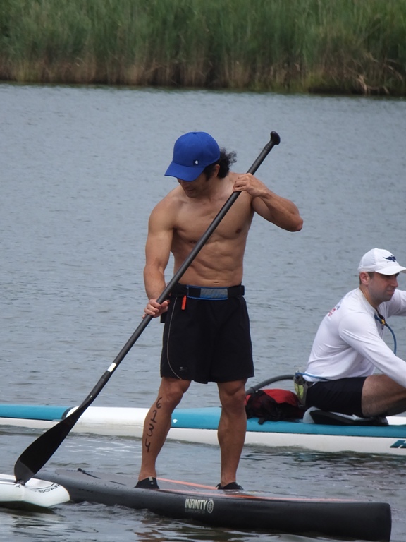
This morning, I decided to take out the SUP to look for rays. Previously on May 25, 2014, I saw several dozen rays around Parsons Island. So I headed back there to see if I could find more. It was supposed to be a little windy and I was expecting guests for lunch so I woke up early and launched at 0615 from Little Creek. I made a beeline for Parsons Island. There wasn't much wind but what there was, was from the south so it blew unobstructed for several miles, creating more chop than one might expect on such a calm day. Once I reached the island, I went around the shallow east side very slowly, looking for any signs of movement. I saw not a single ray. I don't know enough about their habits to explain why there were so many just two weeks ago and none today. Thanks to Rich of the Chesapeake Paddlers Association (CPA), I learned a little about the history of Parsons Island and how it was involved in the "Great Turkey Escape." Parson's Island, was once attached to Kent Island and was known as Parson's Point or Parson's Neck. The peninsula was first recorded as an island in 1847. In the early 1900's the DuPont family of Delaware rented the island for hunting. Henry Bryer, of Breyers Ice Cream, owned it briefly, but sold it after two years to the McCormick Spice Company. They utilized the island for testing their line of pesticides and for testing spice production. They briefly used it to grow turkeys but that enterprise failed when the one cold winter caused the river to freeze over and all the turkeys walked off. McCormick later used the island as a hunting lodge for executives and corporate guests. The island was then owned by Parsons Enterprises, a development company. Parsons Island loses 4.5 acres per year to erosion. - from "MD - Half Delmarva - 2004/06/16 to 2004/06/27 - 316 miles" (broken link as of 2026) I find it interesting that McCormick made spice and pesticides. Hopefully, they never got the two mixed up. I paddled back along the shoreline of Kent Island. I explored Crab Alley Bay. It was very shallow and fairly clear. I could see horseshoe crabs walking along the bottom along with some small fish. I checked out the little unnamed tributary next to the Little Creek launch site where I saw so many carp a few weeks ago. Not a one. But I did see a muskrat. I ended up paddling an easy 9.4 miles over about three hours. |
|
One might think that after yesterday's June 14 hike at Old Rag and being on the water the previous morning, I might be content just to stay at home and get stuff done. But with the weather being so lovely, I decided to spend more time outside.
The weather was as perfect as it could be today. At 1500, the forecast called for sunny weather with a northwest wind of five mph. By 1900, it would drop to three mph. Temperatures during this time would be between 75 and 76 degrees. On June 8, I paddled out to Parsons Island. Not long after, I shared my experience with some folks from the Chesapeake Paddlers Association (CPA). One of them told me about the "Great Turkey Escape" where the farm turkeys that lived on the farm walked away when the water between Parsons Island and Kent Island froze. I later learned about a similar story where cats living on Poplar Island walked away after a cold winter (I don't know if it was the same winter) that prevented boats with fish from landing. The hungry cats simply walked off the island on the frozen water that connected it to the mainland. This piqued my curiosity so I decided to paddle out to the island to see if I could learn more. Poplar is only a few miles south of Kent Island, the location of the first permanent English settlement in what is now Maryland. By about 1630 or so, William Claiborne, the man who established the small outpost at Kent, had named the island "Popeley's Island" after an explorer friend of his named Richard Popeley. In 1632, Claiborne's cousin, Richard Thompson, settled on Poplar Island with his wife, children, and seven indentured servants. In 1637, Thompson left the island to go on a fur-trapping expedition. When he returned, he discovered a horrific tragedy: his family, servants, and livestock had been slaughtered, and his home and plantation had all been burned. The blame has traditionally been placed on a marauding group of Nanticokes [a Native American tribe], which is certainly a possibility, since it was probably their island and they had plenty to be angry about. A succession of prosperous farmers occupied the island through the remainder of the 1600s, and by 1670, the name "Popeley's Island" had been forgotten/mispronounced frequently and had become "Poplar Island," as it has been known ever since. The 18th century was peaceful at Poplar, but the 19th century got interesting. In 1813, several crews from the invading British fleet [remember the War of 1812] established an encampment there, where they did what people usually do in that area - they ate thousands of crabs and made nuisances of themselves. In 1847, the island belonged to Charles Carroll, [who] heard that the Chinese were paying top dollar for black cat fur, so he set about acquiring every black cat he could lay hands on and had them all sent to Poplar Island. He paid local watermen to drop off loads of fish on the island, and let the cats roam freely there, since the bay provided a natural barrier that prevented their escape. Things were looking pretty grim for those cats until the winter happened. The bay froze, which pretty much stopped the fish deliveries to the island. The cats got wise, and hungry, and promptly escaped over the frozen bay to the mainland, where their descendants laugh at Charles Carroll - and continue to persuade watermen to part with their fish - to this very day. - from "Mongoose of Mystery: Poplar Island" (broken link as of 2026) After loading up, I put my chickens in the run and then drove out with my SUP to see this island firsthand. My first stop was Truxton Heights Park in Annapolis. The CPA was having their annual "Gear Day and Fall Out Of Your Boat Day." I decided to stop by and say hello. I saw several familiar faces: Suzanne, Ralph, Rich, Sue, Mitch, Greg, Jenny, Marla, and Steven. I don't see these folks too often so it was good for me to stop by. 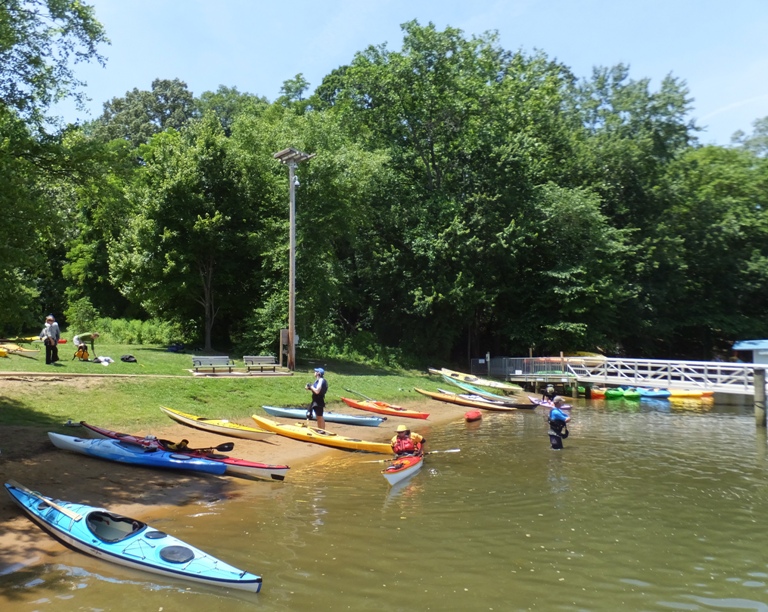
I continued east to the Saint Michaels peninsula. I launched at Lowes Wharf in Sherwood. This put me due east of Poplar Island. I paddled south and explored Cabin Cove. This was a very serene place. 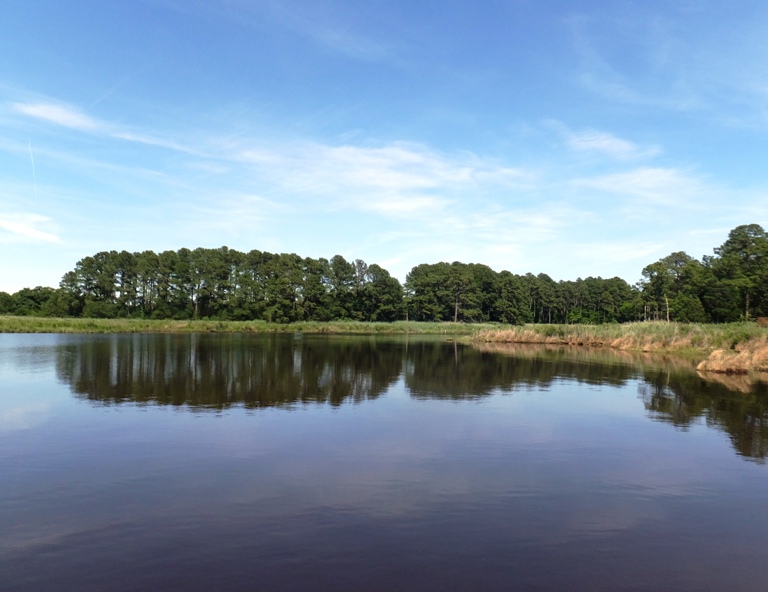
As I headed upstream, the water got darker. Eventually it was black due to tannic acid which reminded me of the Pocomoke River. As I started heading downstream on the cove, I lost control of my SUP. I started going in circles. I crawled to the aft side of my board and reached underneathe. As I expected, my fin was gone. It had fallen off. I looked behind and didn't see it floating. I slowly paddled around, hoping to see it somewhere but it had sunk to the bottom in the murky, black water. Fortunately, I was less than a mile from where I started but getting back was not easy. If I used a power stroke, I would go in circles. I had never realized before just how essential the fin was for tracking. It reminded me of the first time I paddled a whitewater boat. To say that I was sad is an understatement. If I was one to cry, I would have, but I am not so I didn't. I loaded up my SUP and started heading home. It took over 90 minutes to get there. The Sunday afternoon traffic would surely mean a much longer drive back. As I passed through Saint Michaels, I stopped in at Shore Pedal and Paddle. I knew it was a long shot but at this point, I had nothing to lose. I asked if they sold Yolo SUP parts. A guy working there said they did not. He asked what I needed and I said that I lost my fin. He said they might have one that fit. In a few minutes, he came out with one that did indeed fit. It turns out that many of the SUP fins are interchangeable...something I did not know. The one he attached is what he calls a "hatchet fin." It offers a lower profile so I can paddle more efficiently in shallow water. He didn't feel there was any drawback to using a hatchet fin as compared to a standard one. To say I was ecstatic is an understatement. This guy saved my afternoon. I asked him his name (which I now forget). When I told him mine, he said, "I have a friend that met you last year. You paddled 30 miles on a SUP in one day!" I told him he was right. That was my June 22, 2013 circumnavigation of the Saint Michaels peninsula. I returned to the marina and launched again. I felt like a cat with another life. I paddled through Ferry Cove and then out to Punch Point. After that, I did a one mile open water crossing to the island. Comparing the island as it appears on my 1998 Talbot County ADC map with how it looks in satellite photos, it is surprising to see that unlike most islands in the area, this one has increased in area rather than eroded. This is a result of human intervention. 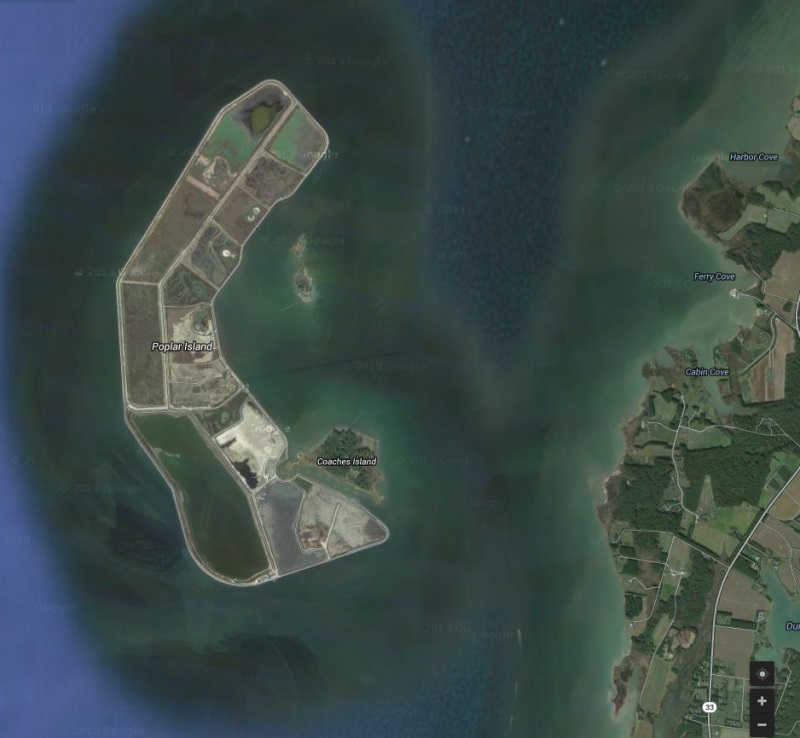
[The island is] currently being rebuilt by the U.S. Army Corps of Engineers using dredged material from the Chesapeake Bay's approach channels to Baltimore, located approximately 30 miles north/north-west of the island. The project's current estimate of cost is $1.2 billion and is, according to schedule, going to be completed in the year 2039. Only "clean" material, dredged from approach channels, is being used on Poplar Island. The Poplar Island restoration project will not use material dredged from close to Baltimore, which may be contaminated with heavy metals. - from Wikipedia - Poplar Island When I paddled out to the island, I first passed Jefferson Island. My map shows a single island but there were in fact two. One had a house on it. 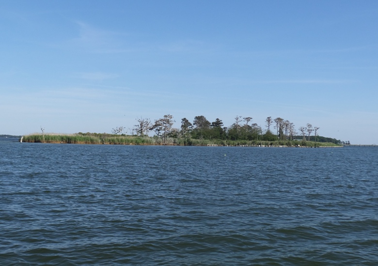
Poplar Island was not impressive. There were almost no trees and it was surrounded by rip rap. It looked very artificial. I didn't bother to land. It wasn't until I got home that I realized just how wildlife-friendly the place actually is. The island is the home of approximately 175 different species of birds, including terns and osprey. More than 1,000 diamondback terrapins have been reported hatching annually on the island in recent years. Chesapeake Bay biologists consider Poplar Island's restoration to be a huge success for the diamondback terrapins, a brackish water turtle - and Maryland's "official state reptile." Terrapins started laying eggs on the island almost as soon as construction workers started building the sand berms and beaches, and the island now hosts the nation's largest terrapin research and propagation project. Terrapins here enjoy a nearly 99 percent survival rate (compared with 10 percent or less elsewhere) because there are no fox or raccoon, their major predators. This prompted the Fish and Wildlife Service to undertake an active environmental education and volunteer program on in the island, including the popular Terrapin Bay. - from Wikipedia - Poplar Island I paddled the narrow section between Poplar Island and Coaches Island. It isn't easy to see this waterway between the two unless you are close. Just look for where the rip rap ends. Coaches Island was very scenic. There were lots of trees. I saw two bald eagles. 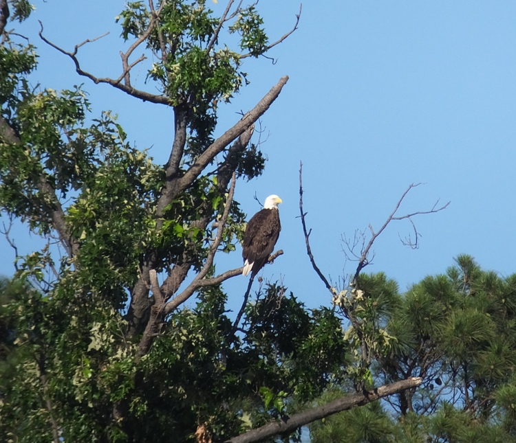
I made my way to the South Bar Point then paddled out to see what was around the corner on Poplar Island. All I saw was more rip rap. I was going to circumnavigate the island but it didn't look very interesting so instead I just went around Coaches Island and then back to the mainland. I paddled out to Lowes Point and then back to the marina. Along the way, I saw three more eagles. There were also three kayakers out. I made sure to point out the eagles to them. 
I only ended up paddling about 11.7 miles. I intended to explore Goat Island just 1.25 miles south of where I launched but I forgot. Looking at the satellite photo of it after, I don't think I missed much. It looks like it is just four sections of rip rap in the shape of a cross. |
|
Awhile back, I told my friend, Sara, about the ship graveyard at Mallows Bay on the Potomac River. She made sure to put this on her bucket list. Then today, she led a few people on a trip to visit this amazing place. Norma and I were two of those lucky few to join her.
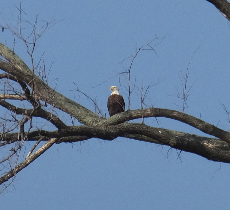
My previous visits to this "ghost fleet" were on September 23, 2007 and June 12, 2011. On the drive up, we passed the 13-mile Indian Head Rail Trail. Norma and I are big into rail trails so we'll definitely return to bike this. Sara was wanting to see some wildlife. She picked a good day for it. Once in the park, we saw a wild turkey with several babies walking along the side of the road. We also saw a bald eagle. We were on the water in time for the 0856 low tide at Liverpool Point. In addition to Sara, Norma, and me, we had Samantha (Sara's daughter), Chandler (Samantha's friend), and Chris (a friend of Sara). The six of us started out by kayaking northeast to Inner Mallows Bay. Here we saw a few fishermen and a couple of wrecks. 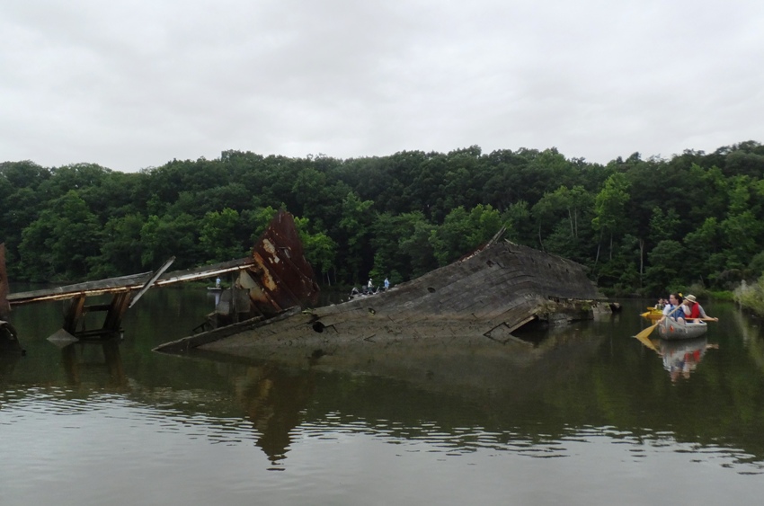
Wild roses grew along the shoreline. 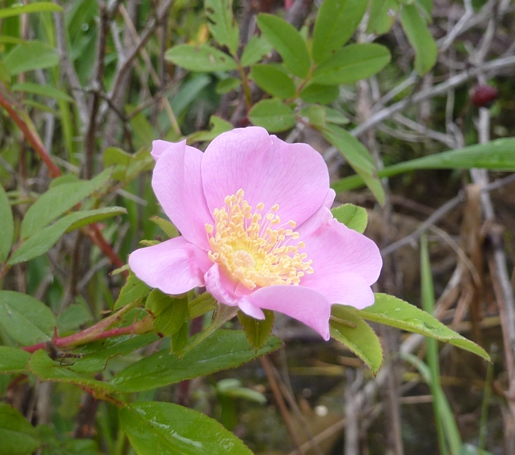
Heading west out into the deeper water, we saw an eagle, heron, and a few osprey. 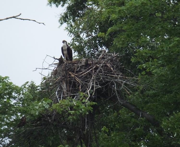
We headed out to the most noticeable feature in the bay...a large metal hull ship that protruded prominently out of the water. Atop was an osprey nest. 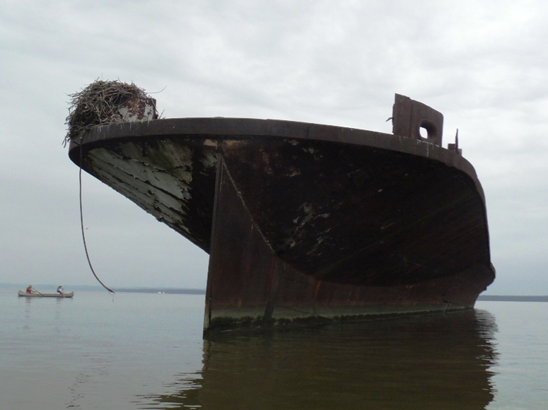
The water was exceptionally calm. The sky was dark and it rained off and on. 
The temperature was cool and with the rain, it was a little cold. It was not what one would expect on the summer solstice. But we were having a good time. 
Next, we paddled north and meandered around the other wrecks. We paddled slowly and cautiously to avoid damaging our boats on the debris. Nearly 90 wooden skeletons of World War I cargo ships [were] discarded by the U.S. Shipping Board, sold for salvage, and then burned to their waterlines. - from sign at park 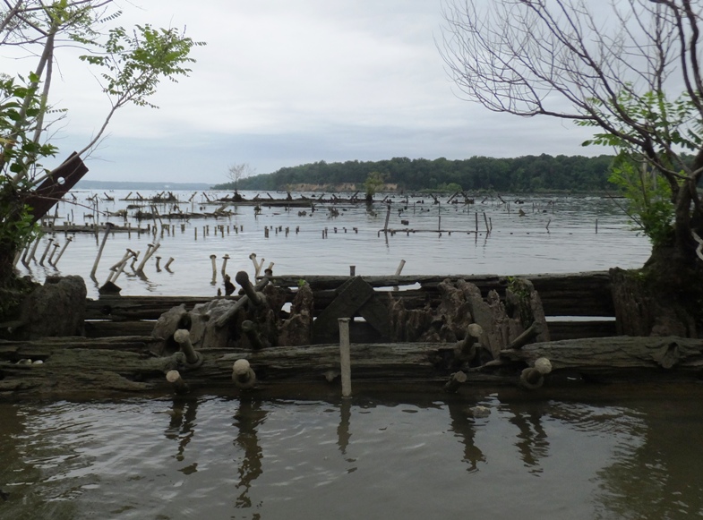
Osprey took advantage of good vantage points on the wrecks to build nests. 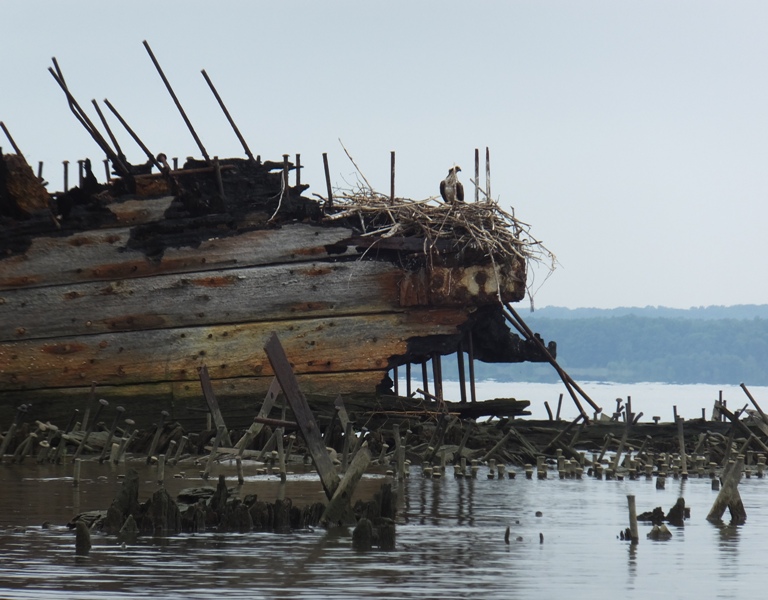
Walking amongst the wrecks, we spotted a green heron. 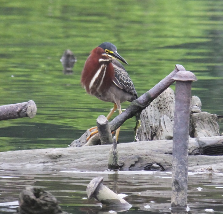
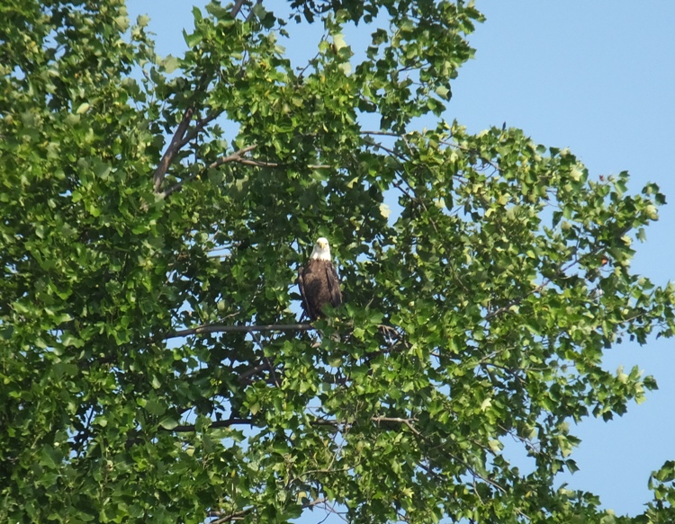
Continuing clockwise, we made our way along the shoreline back to where we started. Sara, Samantha (Sam), and Chandler headed home while Chris joined Norma and me for some more kayaking. Chris swapped boats with Sara so now he was paddling her Necky Chatham 16. A park worker told us about how people would come out at night and shine a light on the water. Then gar would come to the surface where they would be shot with a bow. But the shooter wouldn't eat these Maryland native fish. They were just hunting to kill. I hear they would also shoot snakehead fish. I hear the latter are a delicacy. At the launch site, we were watching an eagle fly about. Then a small bird flew towards it as if trying to chase it away. The park worker told us they do that if the raptor gets too close to their nest. The smaller bird looked no bigger than a blue jay, yet it fearlessly attacked the eagle. Then it did something really amazing. The eagle was gliding and the smaller bird was flying just above it, matching its speed. For only a couple of seconds, it landed on the eagle and rode it in flight! I could tell because it tucked its wings in while it was on top. I had actually seen a photo of this earlier this year at the Conowingo Visitor Center. But later, the folks that I thought saw it with me said they didn't see it. Was my memory being clouded by the photo I saw at the visitor center? I was starting to question my sanity. The three of us kayaked three miles south to Purse State Park. I was expecting to see several homes along the way but it was very natural and undeveloped. There were lot of trees and eagles, many of whom didn't mind posing for a photo. 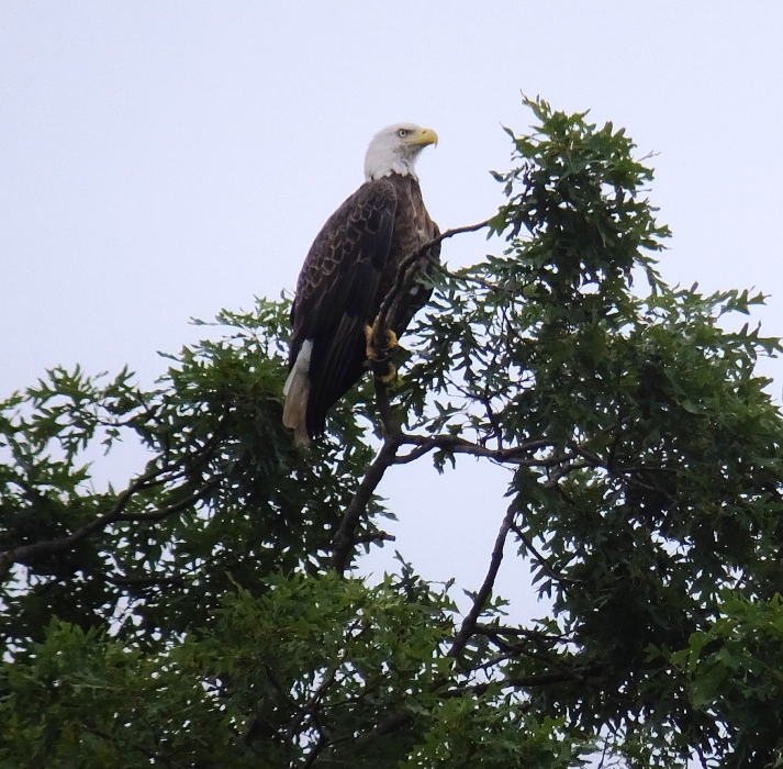
The park didn't stand out by any means. There were no signs. The only landmark was a duck blind. We landed at the beach near the blind and had lunch. 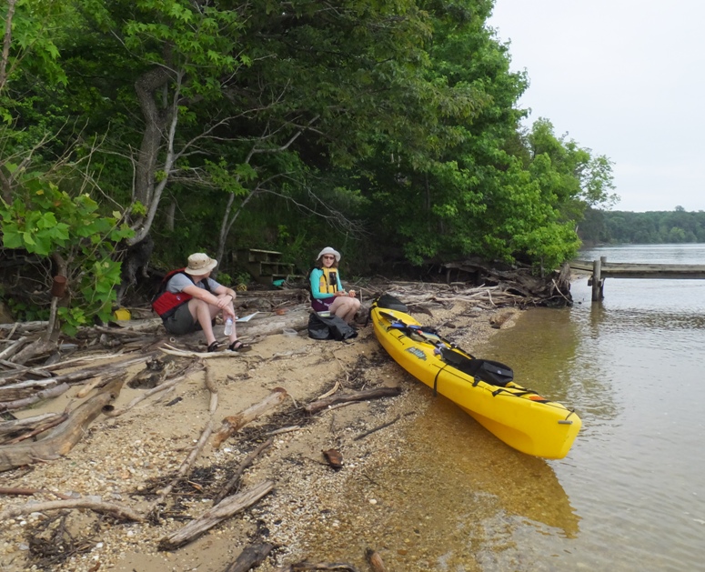
Next, we set out to look for fossils. Purse is a part of the Aquia Formation which formed in the Paleocene Epoch about 60 million years ago when a gigantic meteor hit the earth. This area was covered with warm shallow water which made it a suitable habitat for sand tiger sharks, mackerel sharks, Turritella (snails) and Eagle Rays, more specifically Cownose Rays which all lived during this time period. Fossil hunting has become a popular activity at Purse. Fossilized shark teeth, bones and shell fragments are often found at low tide in the rocks and sand along the waters edge. - from "OhRanger - Purse State Park" (broken link as of 2026) The previous day, I made a screen sifter to look for fossils. I used 1/4" hardware cloth and wood to make something that resembles the ones in Fossil Hunting in a Box. While Norma and Chris were on the shore, I was in the water, shoveling sand and small rocks into my sifter. It took awhile but I found two shark teeth. I then let Chris and Norma use my sifter while I looked on land. I actually had more success looking on land. There was all sorts of cool-looking stuff. I found a total of eight shark teeth. I also found three pieces of ray palate, a snail fossil, a couple of large fish vertebrae, and what I think might be coral. All over the place were interesting rocks and things that resembled Turritella plebia shells. Fossil hunting can be addictive. I felt like I was digging for gold or gambling. The more I found, the more I wanted to keep searching. I was hoping to find a coveted megalodon tooth but the only shark teeth I found were small. Norma found two teeth and Chris found none. I don't know what it is but I seem to have a knack for finding them. We paddled north to return to where we launched. Norma and I stayed along the shore, looking for wildlife, while Chris paddled further out. We saw a fellow with a large floating sifter and big shovel looking for fossils in thigh-deep water. He was there as we paddled south and still there on our return. I saw no boat so I don't know how he got to where he was. Many of the steep cliffs along the water were embedded with lots of shells from millenia past. Just south of the launch area, we explored Mallows Creek. It was narrow and very scenic. We were able to paddle up it for at least a half mile. 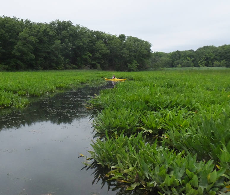
Along the way, we saw one deer and heard another scurry away in the water. We also saw a dead gar. It was about 2.5 feet long. The scales on this fish didn't resemble other fish I'd seen. It had lots of needle-like teeth. Here in the Potomac River, the gar can be up to three feet long. 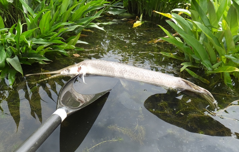
We landed, having paddled 8.3 miles. At the launch site, I saw a zebra swallowtail butterfly. 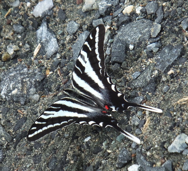
Chris headed off while Norma and I took a nap in the car. After we awoke, Norma and I walked on the 0.8-mile trail around the park. We saw a lot of interesting things along the way, including this paw paw. Some people describe this fruit as tasting like a mix between a banana and a mango. I agree. 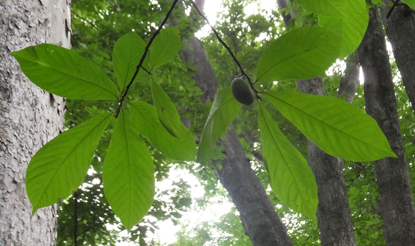
Sue M. identified these bugs below as American carrion beetles. We found them devouring a dead lizard. They were about an inch long. In the lower left is some other bug that Norma thought looked like a scorpion. It is brown and you can only see the back half. I'm thinking it might be the larva of the beetle. 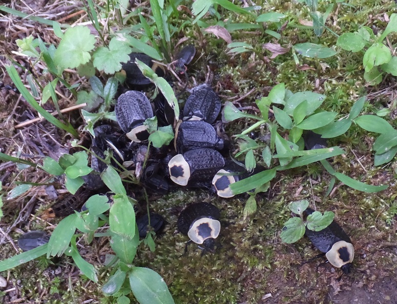
At an overlook, we saw a pond filled with water lily flowers. 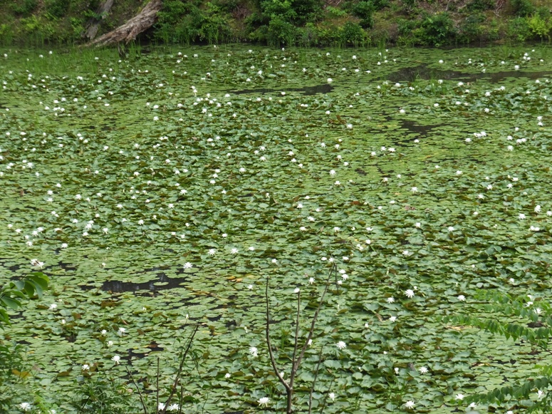
Here's a box turtle...much like the kind we find in our back yard. 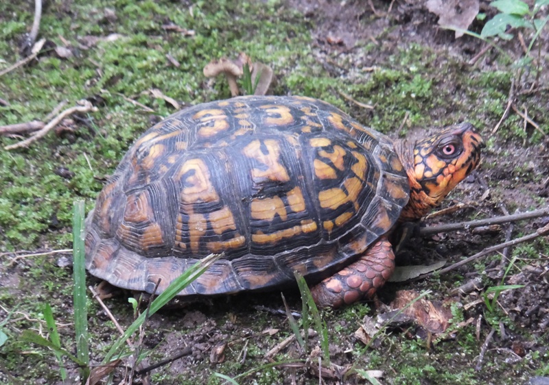
There are two turtles in this picture. Can you find both? 
I found this turkey feather. 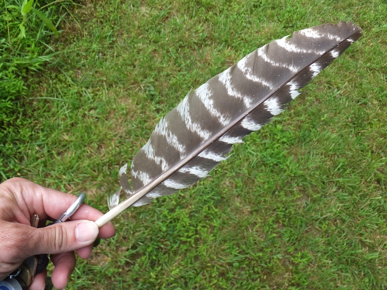
Norma and I saw these strange-looking exposed roots. 
We saw a sign at the park that mentioned the Nanjemoy Creek Rookery. I've paddled the Nanjemoy a few times but haven't seen the rookery. I later learned that the preserve is not open to the public. The official bird of Charles County is the Great Blue Heron. During the week of Valentine's Day, the Nanjemoy Creek Great Blue Heron Rookery, one of the largest on the East Coast, sees the dramatic reappearance of nearly 1,800 great blue herons from their wintering grounds as far south as Central America and Cuba. Documented for the last 50 years, the herons have returned to these nesting sites in the treetops, sometimes 100 to 150 feet above the ground. The herons pair up, reinforce their nests, and lay and incubate a clutch of eggs. The Najemoy Creek Heron Rookery is protected by the efforts of the Nature Conservancy. By July, the young will fledge and the colony will scatter to their summer and fall breeding grounds throughout the Southern Maryland Potomac River region. The nests remain in the treetops year round, a silent yet striking reminder of the preserve's springtime clamor. On one part of the trail, we saw the first area we paddled to in Inner Mallows Bay. Had we continued north, we could have ventured upstream on this scenic creek for likely quite a distance. We couldn't see it from the water but on land, it was obvious. 
From the trail, we had a different view of the first wreck we saw. 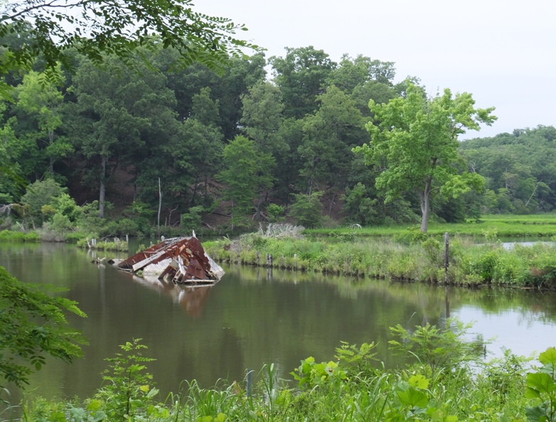
The trail met at the launch area, just under some very exposed tree roots. 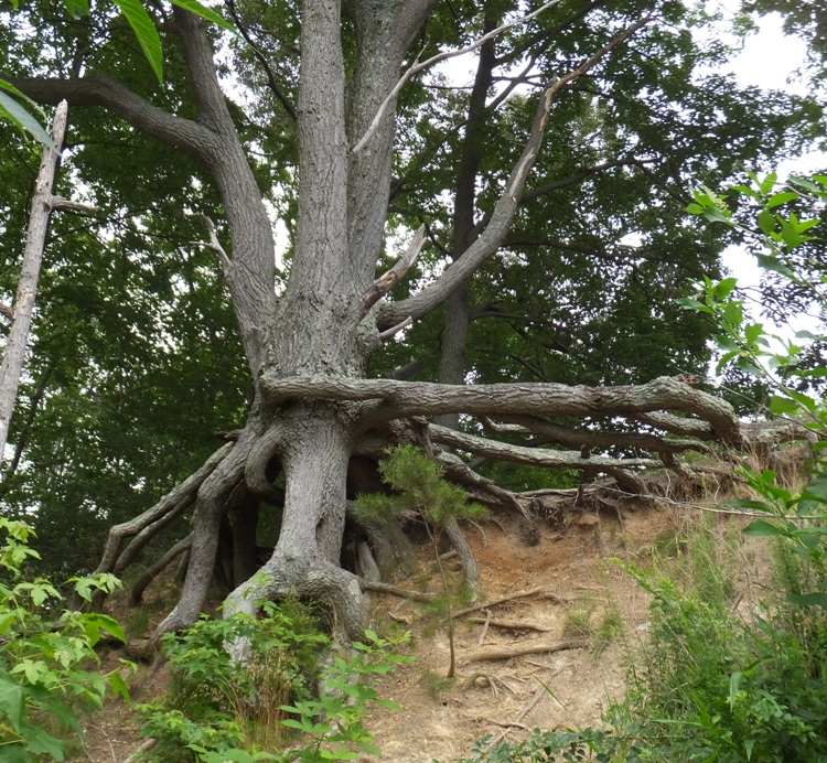
As we were leaving the park, we saw the turkey (I'm assuming it was the same) that greeted us on our arrival. But we didn't see any chicks. I'm assuming they were nearby. 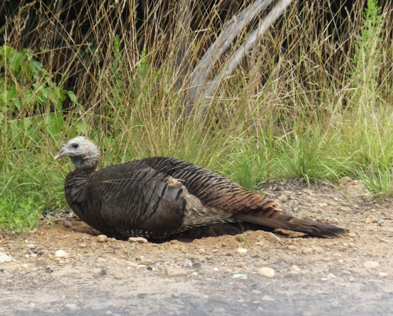
I also saw about eight dead gar along the side of the road. It smelled horrible. Such a waste! After our trip, we drove to where Norma works to use the shower and then went to a party. It was a very full day. I was planning on getting out on the water the next day but I figured I'd had enough outdoor time for awhile. I had actually got in 14.5 miles the day prior on my SUP. So on Sunday, I decided to stay home and get stuff done. Later, I laid out a few of the treasures we came home with from Purse State Park. The three black things at the top are pieces of dental palate from rays. The long, red thing on the right is coral. 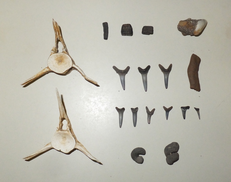
|
|
I worked a half day then headed out to the eastern shore on a lovely Friday. I made it to the Bay Bridge by 1300. One would think that I wouldn't run into much traffic at that time but apparently, a lot of people had the same idea as me. What should have been a 90 minute drive took two hours to get to the Greensboro boat ramp. Guess I'll have to leave earlier next time.
It seems like a long drive just for a day trip. But this was no ordinary day trip. If I created a list of my top ten kayak/SUP day trips, this would definitely be in that list. The first time I was there was with Norma on July 1, 2006. After that, I kayaked there on May 25, 2012. What makes this place so special? I saw a few turtles towards the beginning of my trip but no snakes. This year has been a bad year for seeing snakes. I saw a couple of eagles but they were not willing to pose for a photo. Spatterdock flowers were in bloom. Just south of where River Road makes its closest approach to the water, I turned around. The river really opened up and I was exposed to a lot of wind around there. But upstream, I hardly noticed the wind at all. On the return trip, I checked out Spring Branch. One nice thing about doing an out-and-back trip is that near Spring Branch, there are long, narrow islands and one can paddle on one side going downstream and on the other side coming back upstream. I also explored Forge Branch which was very scenic. I highly recommend checking this out. I was surprised that despite the nice weather and the fact that there were so many people heading east, like me, there were no other boats on the water. Not a kayak, fishing boat, or SUP. I saw maybe seven people on the shore. Sometimes it felt like I was the last man on earth...like a Twilight Zone episode. I was enjoying being alone. When people ask my why I enjoy SUPing and kayaking so much, several things come to mind. Here are my main reasons, listed in order of importance. I was out for almost four hours and paddled a total of 14.6 miles. That included lots of exploring on narrow tributaries and making my way through a few shallow parts. Towards the end, I was really working on my technique and moving fast. They say the Japanese are really into perfection. They make an art of it and apply it to everything: flower arranging, martial arts, calligraphy, etc. I think the Japanese in me really comes out when it comes to paddleboarding. I am in search of the perfect stroke. A few times I believe I have found it but to do it consistently is the challenge. And then to do it consistently on rough water and during adverse weather is the ultimate challenge. I am far from that. But any goal worth obtaining is never easy. |
|
Norma and I did a bike shuttle on the Chesapeake and Ohio (C&O) Canal Towpath so we could paddle one way on the upper part of the Potomac River, starting at the Gene Mason Sports Complex in Cumberland. See my June 30, 2014 biking blog for more information.
The launch site was unlike others I'd seen in Maryland. There were big, rocky walls that shot straight out of the water. Different types of rock formed layers that were pushed up at various rates, creating curved lines in the cliffs. Just upstream was an old railroad bridge. Downstream was thick foliage. The gentle flow gave our Ocean Kayak Cabo a one mile per hour push downstream. According to the Potomac River water level at Cumberland, we had 663 cubic feet per second of discharge along with 2.8 gage height feet. This was a good bit more than the 334 cubic feet per second and 2.4 feet minimal recommendation for kayaking so we were sitting pretty. According to Ed Gertler, ...the river now flows by high, wooded banks and bluffs and through some small mountain gaps in a thinly populated area. A few big junk piles are its worst flaw. The water retains some of that papermill odor, but it is tolerable. Most of the water is now flat with the only excitement being at a three-foot rubble dam, runnable on the right, about eight miles below the start. - from "Mayland and Delaware Canoe Trails" Gertler gave this route a "good" rating in terms of scenery. I would say it was "very good." We never saw the three-foot dam. My edition of his book is dated 2002 so perhaps it got torn down. There were lots of riffles but nothing above a class one. I think a novice would be fine on this route although I would not recommend bringing a boat that couldn't handle bumping into a few rocks. It will inevitably occur. The weather was warm (but not hot) and it was partly cloudy. 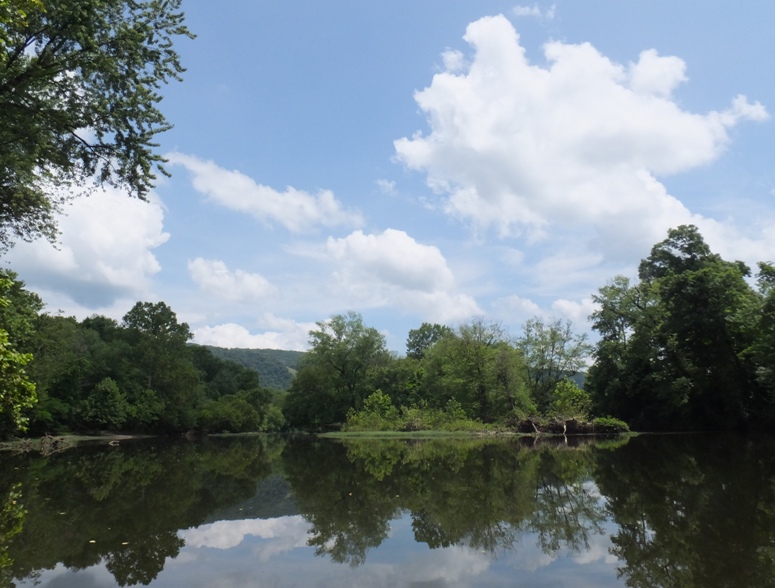
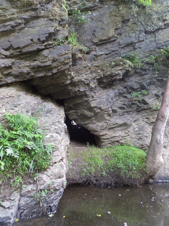
There were a few islands. We just randomly picked which side to paddle on. I think in most cases, either would have been fine. Along a rocky beach, we stopped for lunch on the Maryland side. There were lots of good skimming stones so I commenced to try to skip a rock across the river. After about seven attempts, I was successful. I reckon it skipped about 16 times and made it about 25 yards, all the way from Maryland to West Virginia. I was quite proud. But my right shoulder was also sore. It would remain sore for the next two days. I put a lot of force into skimming stones and I don't do it enough for my body to be conditioned for it. On the West Virginia side of the Potomac, we found a small cave that went clean through the rock. I explored it. While the opening was small, it got much bigger inside. We saw and heard lots of trains. Some of the box cars were labeled with "Southern Pacific" which is the company my father worked for a long time ago. 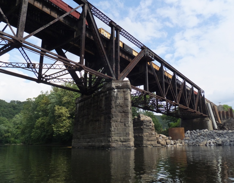
Even further downstream, there were big vertical rock walls, though none as big as the ones at the launch site. 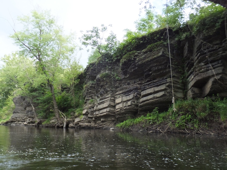
There wasn't a lot of wildlife out but we did see an eagle, a garter snake, and a muskrat. Up ahead, we could see our destination in Oldtown. 
We paddled under the left (north) side of the broken bridge. 
Upon lifting the boat out of the river, we realized it had taken on a lot of water. I expect the boat sprung a leak on our June 21, 2014 trip at Mallows Bay. We drained out the boat, loaded it up, then retrieved the bikes. It was a long (but good) day. In addition to our biking earlier in the day, we paddled 17.5 miles. |
|
Stand up paddleboarding is very weather-dependent. Much more so than kayaking. Thus, if I want to get out on the water, I have to be very selective in terms of time and location. Today, the wind was supposed to pick up around 1100. The morning would be much calmer than the late afternoon. So I set my alarm, got up early, and arrived at Carrs Wharf at 0645. Much to my surprise, the parking lot was nearly full. Some paddlers get up early but nowhere near as early as fishermen.
There were about ten black vultures on or near the beach launch area. I've paddled this area a few times, but I don't know if I'd actually "explored" it in the sense of "leaving no stone unturned." That was my goal for the day. I headed to the right (north), hugging the shoreline, keeping it always within a stone's throw. I paddled up Bear Neck Creek and Whitemarsh Creek. The latter had a lot of expensive homes while the west side of Bear Neck Creek was undeveloped. It is actually the property of Camp Letts. I made my way into the Rhode River where I circumnavigated two islands: Flat Island and Big Island. My map actually shows another called High Island but I didn't see it. I think it no longer exists or maybe it is only there at low tide. I paddled up Sellman Creek. 
Heading upstream, I paddled into the Alexander Branch where I spotted a muskrat. This area was very scenic and narrow. It started out shallow and got deeper as I went up. There was a wild persimmon tree with a few unripe persimmons that were about an inch in diameter. I usually find wild persimmon trees on the uppermost reaches of creeks. I'm guessing they prefer water with low salinity rather than brackish. Eventually, the creek got so narrow that I had to get off my board and lift it out of the water to turn it around. I think I only made it about a third of a mile up the creek but it was a very nice third of a mile. Near Sheephead Cove, I came to the Smithsonian Environmental Research Center (SERC). It is closed on Sunday but the other days, it is open to the public. They have a boat ramp. I plan to return sometime in the near future (with Norma) and do a little exploring there on the Java History Trail and whatever other trails we might find. The wind was starting the pick up and the sun was getting high so I decided to call it a day. From the SERC, I made a bee-line back to Carrs Wharf. I'll explore the south side of the Rhode River area when I return to the SERC. I saw two eagles throughout the morning. Even though I was paddling in an area where real estate is quite valuable, there wasn't much development. Mostly just a lot of woods. But if I looked out to the water, I almost always saw a sailboat or powerboat to remind me that I was still very close to civilization. I forgot to bring my GPS but I estimate I paddled 9-10 miles. I was done by 1020. |
|
In Maryland, the summer weather can be a little unpredictable in July. It seems that most days are partly cloudy with a chance of showers. Even on the day of, the meteorologists have a very hard time determining if it will rain. I had the SUP loaded on my car on Wednesday, July 9 with the intention that I would go out after work. But a short intense storm hit that reminded me of our 2012 derecho. The next day after work also ended up looking stormy though it just passed over. Friday the 11th looked the best so I took off a little early and headed for the water.
The last time I left work early on a Friday and tried to head to the eastern shore, I hit some bad traffic, even though I was at the Bay Bridge by 1300. So this time, I decided to stay on the western shore. I launched at Smith's Marina on the Severn River. 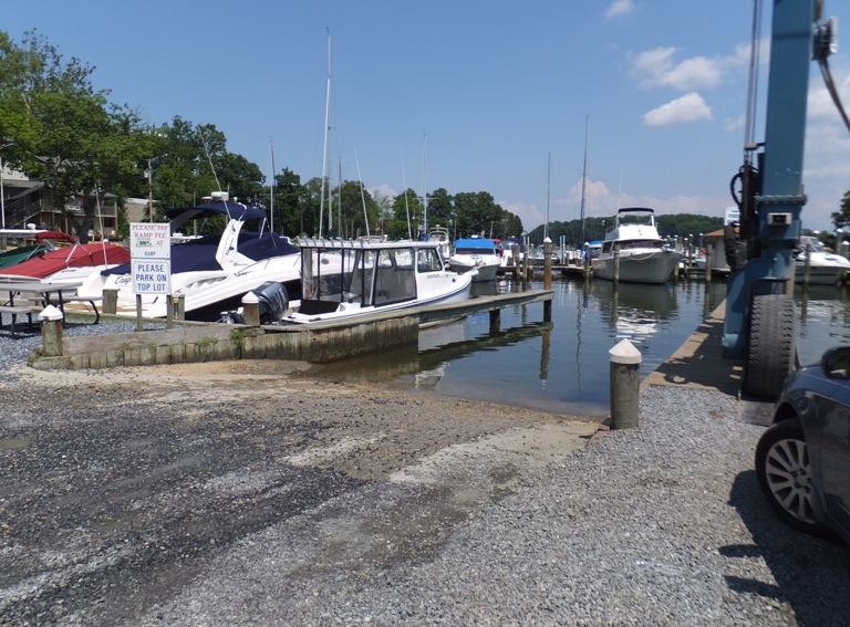
There are only two launch sites on the Severn River that I know of. The other is near the mouth while this is about midway, just across from Saint Helena Island. The Severn and the Magothy are known for not being very kayak-friendly. That is, they have an incredible amount of shoreline but very little kayak access, compared to other sections of Anne Arundel County. My theory is that the real estate in these areas are extremely valuable. The county would rather have land be sold to homeowners and businesses so they can collect the tax money. But what about putting a public park that everyone can use, including kayakers? My guess on that is that the people that own waterfront property don't want outsiders coming into their neighborhoods. There are plenty of places to launch a kayak on these rivers but they are community beaches and not open to the public. If there were public launch sites, they might decrease the value of the waterfront communities. But this might change over the next few years. My friend, Lisa A. has been doing a lot of work to get important people in the county to give kayakers better public access to waterways. Go Lisa! Low tide was at 1239 at Brewer Point while high tide was at 1739. I was on the water around 1430 so my plan was to ride the tide upstream for three hours, exploring every nook and cranny of the Severn, and then ride the tide back down. I'd have some help with a gentle breeze pushing me up and hopefully the wind would die back a bit on the return. It seemed like a good plan. Smith's Marina is in a small cove in Little Round Bay, which is in Round Bay. The latter is very large. It had been several years since I launched here before so I wasn't too familiar with things. I should have paid closer attention to my map and GPS. My plan was to paddle to the other side of the island then turn left to go upstream. But instead, I paddled from Mathiers Point across the mouth of Hopkins Creek and thought I was on the other side of the river. Obviously, I wasn't thinking clearly. I turned left and paddled, thinking I was heading upstream. When I rounded Brewer Point, I saw the Severn River Bridge (highway 50) and knew that I was going the wrong way. But by this time, I figured I would just contine on. If the number of fish in the river is any indication of its health, then the Severn River is very healthy. I saw thousands of small fish and no dead fish. I saw many needlefish too. For a split second, I saw either a very big fish or a ray. After three hours, I finished exploring Saltworks Creek and decided to head back. So I crossed the Severn and started exploring the northeast side, starting with Chase Creek. If you want to get out in nature, see wildlife, and get away from the crowds, then the Severn River is a place you should NOT go. It is full of power boats and sail boats. Not many fishing boats. I think the Severn is a little too white collar for that. After exploring Asquith Creek, I continued northwest for a bit and then cut across Round Bay and returned to the Marina. I ended up paddling 21.6 miles in five hours and 20 minutes. Considering the tide was against me the whole time, I felt I made very good time. I've been working on my technique and I think it is paying off. Despite having been out on the water for so long, I saw no eagles, but I did see two muskrats. One was in Ray Pond. I brought a half gallon of water but I could have easily used another quart. Next time, I'll explore the upstream section, like I originally planned. |
|
It all came much too fast. I read an article titled "The Catamaran Group buys Pier 7 Marina for $4.5 million" and knew the days for the Chesapeake Paddlers Assocation (CPA) "Pirates of Pier 7" were numbered, but I figured those numbers were at least in double digits.
I showed up to Pier 7 on July 16 because Suzanne said she might be there and I wanted to say hello, catch up, and exchange information that could be useful for my upcoming Norway trip. She ended up being busy at work so she couldn't make it. Not a problem. I launched my S1-A surfski and paddled around the island at Turkey Point. Then I paddled out and around the Thomas Point Shoal Lighthouse. I had a light wind to my back and a gentle push from the tide that kept me moving at six mph for the whole first half of the trip. But on the return, the wind picked up once I got to the south side of the mouth of the South River. This slowed me down considerably, making my overall pace 5.3 mph for this 16.7 mile trip. Back at the beach, I hung around and spoke to Robin (who I had never met before) and Marla. I also saw Sue, Rich, Stephen J., and Chip. It seemed like a typical Wednesday, not unlike those that I have spent there over the last 10+ years. I was surprised when Sue said this was Pier 7's swan song. Not only did I not expect this to be our last meeting at Pier 7, but I had never heard this term before except when used in context with Led Zeppelin's record label. This was my first Pier 7 launching in 2014. I did not expect it would be my last CPA paddle there forever. I was told that people can still launch there but it will cost $20 per boat...a price very few kayakers would be willing to pay. Since then, the Pier 7 piracy has been renamed Pirates of Arundell and, at least for now, is a roving piracy. The spelling of Arundell is historic in nature. See Anne Arundell, Lady Baltimore (1615-1649). |
|
In previous years, I found a physical challenge to keep me goal-oriented and focused. I was inspired to do this after reading about Jack LaLanne, who died on January 23, 2011 at age of 96. My previous personal challenges include the following:
I decided to make this challenge SUP-related. I've been doing a lot of open water paddling and I figured I would try a route that I've considered over the last year or so...Baltimore to Annapolis. This is mostly in the Chesapeake Bay and a few sections that are mostly unprotected. Originally, I wanted to do this as a race against a co-worker that is a long distance runner. I figured that if he ran and I was in my surf ski, I might have a chance but this never materialized. The last couple of days have been unusually comfortable. We have a polar vortex taking place that is bringing cool air from the north to make our typically hot and humid July weather warm and dry instead. On Friday, July 18, 2014, the wind was expected to be fairly calm. With all this taking place, I decided to do the Baltimore to Annapolis route. One question was how to make this a one-way route. I could do a bicycle shuttle but I would not feel comfortable leaving my SUP at the take out. Maybe if it was a plastic boat but this SUP is my baby and I wouldn't want anyone to steal or vandalize it or my paddle. Fortunately, Norma was working from home and was fine with picking me up at the take out. I launched at Fort Armistead Park at 0950. The park is very popular with fishermen but not kayakers or SUPpers. It certainly isn't one of my favorite places to launch but it is in Baltimore City limits and right across the Anne Arundel County border. So if you want to do the Baltimore to Annapolis paddling route, this will put you as close to the finish line as possible. 
From Armistead, I could see Fort Carroll and the Francis Scott Key Memorial Bridge, the latter shown below. 
The forecast read as follows: In Pasadena, wind would be below six mph and from the northeast until 1600. Then east by northeast and six mph at 1600. Mostly sunny, with a high near 84. In Annapolis, wind at five mph from the northeast until 1200, then east by northeast at five mph until 1500. Then six mph at 1600. High tide at Hawkins Point (the launch area) would be at 1203. So for the first couple of hours, I would be paddling against the tide. I paddled out into the Patapsco River. I headed straight to White Rocks. Shortly after passing White Rocks, I heard a big splash. I looked behind and saw a ray skimming the surface before it dove under. I was trying to keep a good pace but I often find that I don't get my best form until I am on the SUP for several miles. I think I would have to warm up for a long time on the SUP if I ever wanted to do any racing. If I needed to use the head, I could have stopped at Fort Smallwood Park but I was fine. As I got further from Baltimore, I started to see less trash. It is a shame the water in Baltimore is so polluted. Another bathroom break (if I needed it) could have been taken at Downs Memorial Park. Rather than stay along the shore, I stayed further out. If there was something interesting to see, I'd remain closer to land but in that area, things are very developed. I got much further from land as I made my way to the Baltimore Harbor Light. 
Next, I paddled to the Sandy Point Shoal Lighthouse. At the lighthouse, I changed the playlist on my boombox. I was listening to running music but I decided to switch it to modern country. This got me more motivated. Maybe I think of my SUP as a horse. 
Around Sandy Point State Park, I encountered a lot of boat wakes. It was now early afternoon and I think a lot of people left the office early to get out on the water. The heavy boat traffic continued until I got past the Chesapeake Bay Bridge. 
I made sure to stop and drink fluids every hour. I brought three liters: two of Gatorade and one of water. I also brought plenty of snacks. Boat traffic died down until I got to Greenbury Point at the north side of the mouth of the Severn River. I crossed the mouth to Eastport. I had to wait a few times for boats to pass. One kicked up four foot waves that I rode over like a pro. But some others caught me off guard and I fell into the water. The water couldn't have been a more ideal temperature for falling into. I quickly got back on, stood up, and continued. This is the first time I have ever fallen off the SUP. I was surprised how easy it was to remount. I felt like I was keeping a pretty good pace on fairly rough water. I could have ended my trip in Eastport at Horn Point Street End Park. But I had plenty of energy left so I ventured on. I contined onto Spa Creek and passed the historic section of Annapolis. Now, kayakers and SUPpers were everywhere. I rarely see SUPs on the big open water in which I paddle, even on calm days like today. I finished my trip in five hours and 55 minutes at Truxton Heights Park. 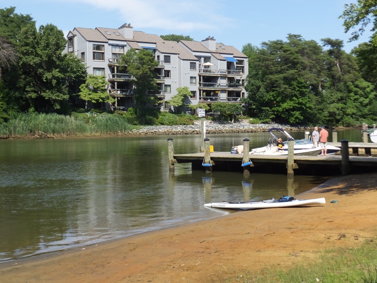
I completed 25.25 miles, maintaining an average pace of 4.2 mph. My average and moving average were the same when rounded to the nearest tenth of a mile. I could have taken off at least 2.5 miles if I didn't paddle out to the lighthouses and if I had stopped at Eastport. I called Norma to come pick me up. While I waited, I saw a guy paddle to shore with a medium sized dog. I spoke to him, Mark, for a long time. His dog is a Blackjack...it is half Black Labrador and half Jack Russell Terrier. It loves the water, is very smart, weights about 39 pounds, and is fully grown. It sounded like everything I want in a dog except he didn't think it would be naturally good around chickens, though he thought one might be able to train it to be. Right next to the beach at Truxton was a kayak outfitter called Kayak Annapolis. A couple of guides were taking out about 18 people on tandem sit-on-tops for a historic guided kayak tour of the city. Seems like a novel idea. I still had plenty of energy left but I was definitely sore. What was sore? Mostly my abdominal muscles. Norma drove me to pick up my car and we headed home. Mission accomplished. |
|
I got most of my hours in at work so I was able to put in a short day and then head out for a little fun. I drove to the Eastern Shore and launched my SUP in Denton at the G. Daniel Crouse Memorial Park. This put me on the Choptank River. I was last on the Choptank on June 27, 2014 but further upstream. Ideally, I would have paddled upstream to where I turned around before to complete the stretch of the upper section but the wind and tide were not in my favor so instead, I headed downstream (south).
I've paddled this stretch of the river a few times now but never with the level of detail that I chose to paddle today or on June 27. This is what I call a "leave no stone unturned" trip. The goal is to explore every part of the river, never straying further than a distance I can throw a stone to the shore as long as the water remains deep enough. This proved to be most interesting since at this time of the year, the spatterdock are very dense. It formed an obstacle course that made exploration much like navigating through a corn maze. On a kayak, I might have got bored of this quickly but with my "view from above" on the SUP, it held my attention. In this maze, I saw a few interesting things like a tiger swallowtail butterfly on pickerelweed. Eventually, I made it to Martinak State Park. Here, I paddled east, going up Watts Creek as far as I could. A few turtles watched as I crept past. I passed under Shore Highway. There were a good number of barn swallows living under Double Hills Road. This area is fairly undeveloped, natural, and very scenic. At my turn around point, I saw a very damp log with a lot of stuff growing on it. It almost looked like it was glowing. I pulled over at the park for a short break before finishing my trip. Back at Daniel Crouse Memorial Park, I found a little inlet just south of the Franklin Street (route 404 business) bridge. It was near low tide and I could only enter through the north side. At the northeast side of this inlet, there was a boat ramp. I'm guessing this was the boat ramp before the main one at the park was built. This older boat ramp was clearly unmaintained. I can't picture anyone ever using it though I suppose a kayaker could if they didn't want to wait in line to use the main ramp. 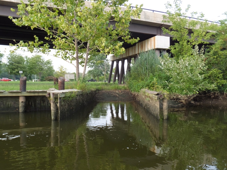
|
|
Doug H. at work had been trying to talk me into competing in a SUP race with him. I'm not much of a racer but if someone I get along with is doing it, then I might participate just for fun. This race was the Stand Up Paddle Annnapolis & KIOCC Holo Niu Race at the Kent Island Outrigger Canoe Club (KIOCC).
I never quite committed to this event until the morning of. The weather was a little unpredictable, but that morning, the forecast was calling for no rain the first half of the day and a wind not to exceed 11 mph. Having no excuses as to why I should not race, I decided to compete. Norma drove out with me. I promised to take her bicycling after. In addition to a cheering section, I also wanted a photographer. I have very few photos of me on the SUP and I wanted to analyze my technique. At the race, I saw Neil. He has been training regularly for the last few years and was racing in the same category as me...the 14-foot long SUPs in the six-mile race. This was my first SUP race but Neil was a racing veteran. He introduced me to his cousin Chip who was also racing. There were a lot of people at this race...some from other states. I think this race is a pretty big deal for folks in the mid-Atlantic region. 
I arrived with plenty of time to warm up on the water. 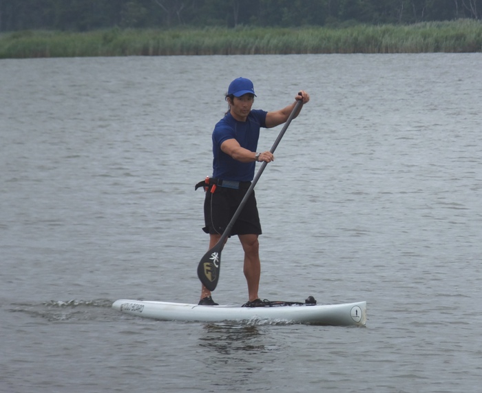
The outrigger canoe and surf skis started first. 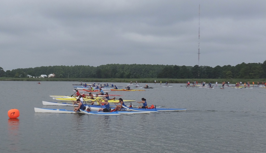
Shortly after, the SUPs started. 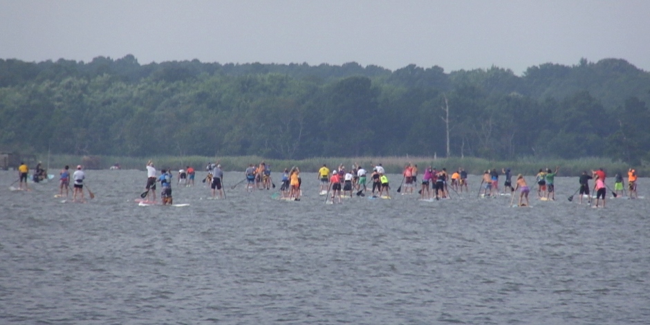
The start was rather abrupt. Things began faster than I expected. Many of us (myself included) scrambled to get in front. That being the case, there was a lot of turbulence in the water. There were a few minor collisions but I don't think anyone fell as a result. For the most part, everyone seemed professional. After the first ten minutes, I found my place in the pack. We had an 11 mph tail wind starting out. I managed to do a little surfing. For awhile, I was too far out to the left and I had to work pretty hard to get back with the herd. Neil was ahead of me the whole time. I tried to catch up but it seemed like the distance between us just grew. Paddlers associated with SUP Annapolis wore Maryland flag shorts which I thought looked pretty cool. Around mile one, we had to make a 180 degree turn. I had never practiced the pivot turn and this really hurt me. I made a wide aircraft carrier turn using the nose rudder technique. This is fine for small angle changes but for racing, it is totally not suitable. A shaggy-haired blonde kid who mastered the pivot turn passed me. But a few minutes later, I passed him and stayed ahead. Around mile two, I turned into the wind. This really sucked but it was at least as bad for anyone else as it was for me. I figured being short might have given me a small advantage since I caught less wind. I maintained a lower stance which probably lessened my resistance further. I finished the first three mile lap. For many of the paddlers, this was their finish but I was in the six mile group so I had to do this twice. Fortunately, the wind died down a bit for round two. A big guy with a shaved head and tattoos asked if we could take turns drafting each other to try and catch up with the next guy in front of us. I was game for that. He drafted me for awhile and around mile four, I tried to draft him. That didn't work so good. I was not able to keep my SUP going straight enough to draft. I ended up passing the big guy and maintaining my lead. But I never caught the guy in front of me. 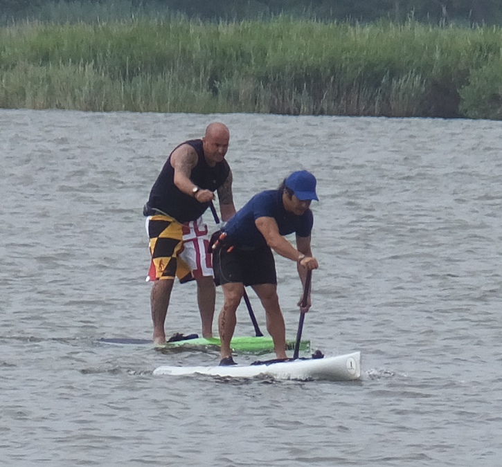
Doug finished the three mile course on his Starboard SUP. He showed considerable improvement over his last performance. A few folks were there more to have a good time than to race. A couple of them brought their dogs to stand on their SUP while they competed. 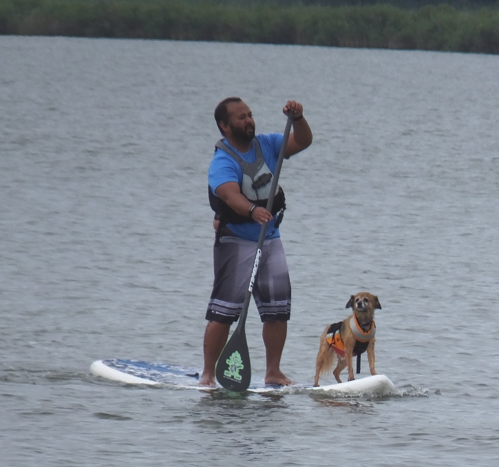
My biggest challenge was maintaining my grip on the paddle. In the second lap, my hands started to sweat. This made the shaft of my paddle slippery. So I put a death grip on the paddle to avoid slippage. I did lose my grip a few times but never fell. I actually found going upwind easier because I could straighten my fingers as I took the blade out of the water and let the wind dry my palm. Needless to say, my forearms were exhausted from gripping so hard. I placed 10th out of 19 with a time of 1:16:25.23. This equates to an average of 4.7 mph. 
Neil placed 7th with 1:14:00.25. What was amazing was the three winners who finished in 1:05:15.00, 1:05:24.00, and 1:05:40.00. The difference between 3rd and 4th place was 5:41.25! Clearly, these three guys are in a league of their own. Norma got a good video of them; click on image to view. 
Racing an outrigger canoe was the famous Pam Boteler who I read about a few years ago. She is truly a world-class athelete so the fact that she was competing in this race testifies to its significance. Not surprisingly, she won her division. Looking at the photos of me, I think I need to stand further towards the bow. Oftentimes, the nose of my SUP is out of the water which shortens the waterline contact and makes me slower. 
I spoke with Neil for awhile out on the water. I mentioned that I need to put hockey tape on my paddle. But I noticed that his paddle had no tape. He told me how his KeNalu paddle has grippy indentations molded into the shaft ("reverse wrap"). He let me try it out and it really made a big difference. His paddle also has a smaller blade than mine. He says that the newer race paddles are heading in this direction. It allows a faster cadence. 
Then Neil and I talked about boards. I was really impressed with the carbon fiber Infinity SUPs. Maybe it is partly because I am a math guy and the boards have the horizontal '8' symbol. He has a 28" wide board and let me take it for a spin. I tried that out and absolutely loved it. It was much less stable but also much faster. It certainly doesn't help to race a SUP like mine that can handle someone 100 pounds heavier than me. Maybe after another year or two on my 27" wide board, I'll try this less stable Infinity. There is a 25" wide Infinity made for a smaller person. But first I need to work on my pivot turn. Infinity will make SUPs to various width, volume, and recessed deck depths to order for an additional fee. Here's me on the Infinity. Norma and I joined Doug and his family for lunch after the race. KIOCC served a nice pulled pork meal. After the winners were announced, I said farewell to Doug and Neil. I'm sure I'll do another race with them. But probably not this year. As promised, I took Norma bicycling after the race. See August 2, 2014. |
|
I wanted to get in a little SUPing after work so I headed out to Beachwood Park in Pasadena. It had been a couple years since I was there and it looks like some improvements were made in terms of signage and parking.
After my August 2, 2014 race and mediocre finish, I decided to work on my pivot turn. I have a long way to go but there is no way I am buying a faster SUP until I develop proficiency with this skill. I saw a green heron and a few baby ducks. I explored many of the tributaries of the Magothy River to my west. I made it as far as the Kris-Leigh Assisted Living home at 831 Ritchie Highway in Severna Park. I figure this would be a good place for me to live if I ever went into assisted living since I could launch my kayak or SUP from there. I got in about 14 miles and ended the day with a clear head. |
|
On September 1, 2012, Norma and I did a naturalist-led kayak/canoe trip at Westmoreland State Park in Virginia. The naturalist took us out on the Potomac River to an area full of fossils and then gave us a little lesson in paleontology. While we were there, I spoke with a fellow fossil hunter who told me about a place called Plum Point in Calvert County, Maryland. She said I would surely find a lot of shark's teeth there.
So today, I launched at Breezy Point Marina, just south of Chesapeake Beach in Calvert County. This put me right at Plum Point. I paddled south in the Chesapeake Bay. I pulled over by cliffs that were far from any beach access. I figured that I'd have less competition that way. There are certain things I look for in a place to hunt for fossils. A steep cliff often holds several millions of years of life. A gently sloping beach helps keep fossils from washing away. 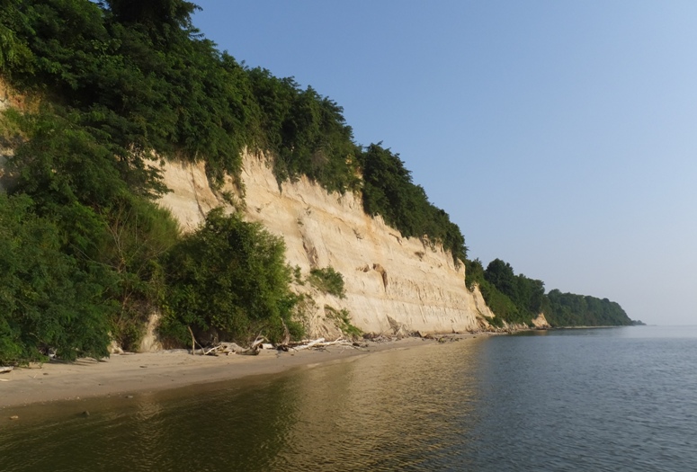
Here I found numerous fossils. I also saw a lot of shells...some of which were embedded in rock-like structures. 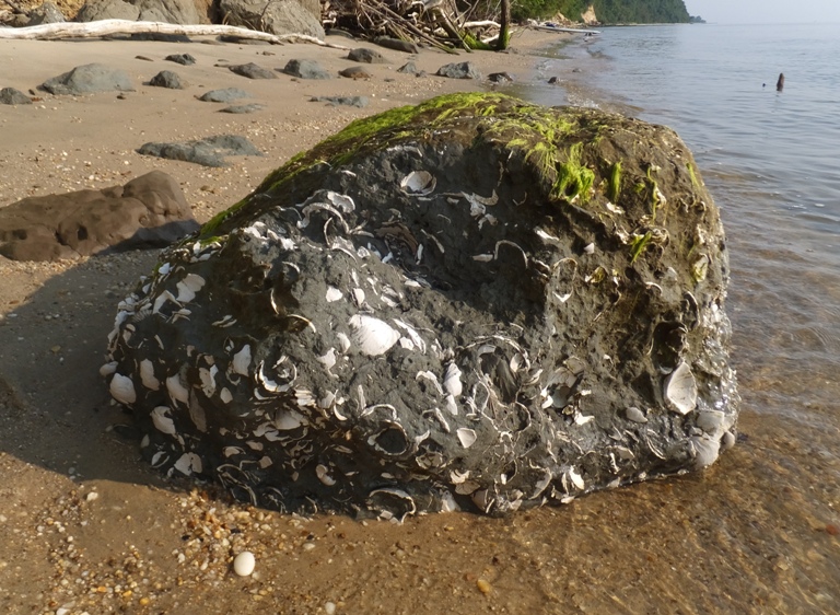
I continued paddling south and pulling over every 30-60 minutes. I passed Scientists Cliffs which is also known for its fossils. However, I found the area to be a little too developed and less likely to harbor many hidden treasures. I tried to time things with the tide so that I could do most of my fossil hunting at low tide and have some help with the current on the return trip. The wind was unusually calm which made it easy to see stuff in the water. I saw six rays, about a dozen bald eagles (shown below), numerous crabs, dozens of needlefish, and thousands of small fish swimming in schools that stretched across 20+ feet. In the shallow sections, the schools were obvious because they looked like dark patches in the water. You wouldn't know they were fish until you were almost right over them. Then they would take off. Sometimes I would chase them. I would see some glimpses of silver as larger fish made their way through the schools, looking for a meal. I also saw hundreds of sea nettle jellyfish and comb jellies. Up until now, I really hadn't been seeing many jellyfish. I didn't see much litter. I guess a lot of it gets washed out to sea. But some is just too big and heavy for any wave action to move. 
The slowly eroding cliffs are a constant source of new fossils on the beach. But they also spell death for the trees that rely on their support. 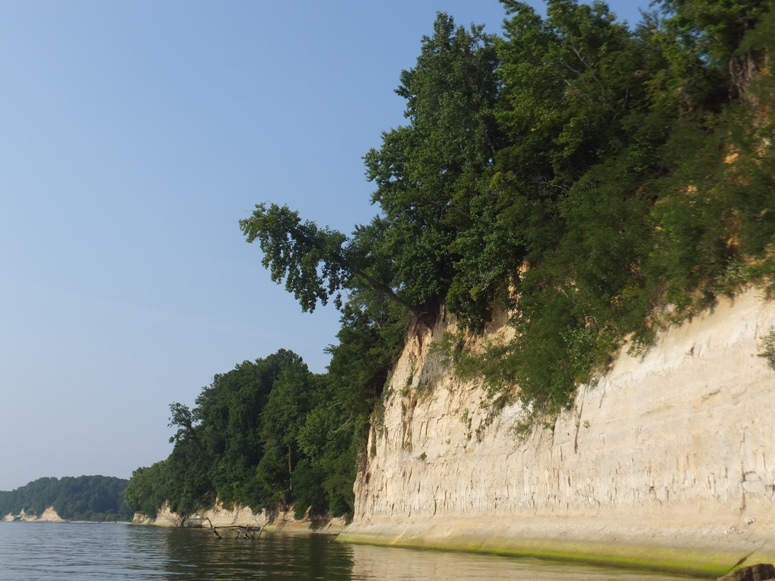
I turned around at Calvert Beach and headed back north. Along the way, I came to Parkers Creek which I was able to paddle up for 2.1 miles. This creek was very scenic and natural with no development for as far as I could see. 
While I had never paddled here before, I did do a hike at the surrounding American Chestnut Land Trust back on November 13, 2011. It looks like some of the trails were a bit overgrown. There were a lot of marshmallow flowers and a few egrets. 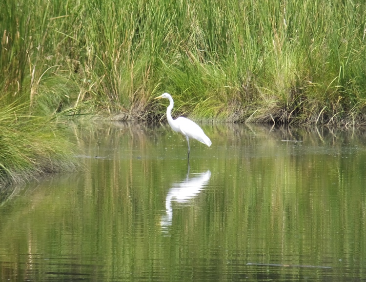
Around where I turned around, I found a wild persimmon tree just loaded with unripe fruit. I thought a combined fossil hunt and Parkers Creek trip would be nice but the ebb tide that makes for good fossil hunting would be bad for Parkers Creek, which is often shallow when wide. Parkers Creek Watershed Nature Preserve protects one of the last remaining pristine watersheds on the western shore of the Chesapeake Bay. Located just north of Calvert Cliffs in southern Maryland, nearly 3,000 acres are conserved and managed here by the American Chestnut Land Trust. The brackish tidal stream known as Parkers Creek meanders through salt marsh to the Bay's shoreline. Visitors to the preserve may walk more than 15 miles of trails, exploring hardwood forests, farmland, wetlands, salt marsh, Chesapeake shoreline and the Creek itself. Guided canoe trips of the Creek are also offered. - from "ACLT - Master Plan for Facilities and Interpretation" (broken link as of 2026) In the end, I found the Plum Point area to be best for fossil hunting...every bit as good as Purse State Park which I visited on June 21, 2014. Over the course of the day, I found ten shark teeth (one not shown below), nine ray dental plates, six pieces of petrified wood, two bone fragments, a piece of coral, an ephiphysis (vertebrae end cap) likely from a dolphin, and numerous scallops. I figure the scallops aren't fossils but they look cool. I tried to find the smallest in-tact scallop. I found one just nine millimeters at its longest point. 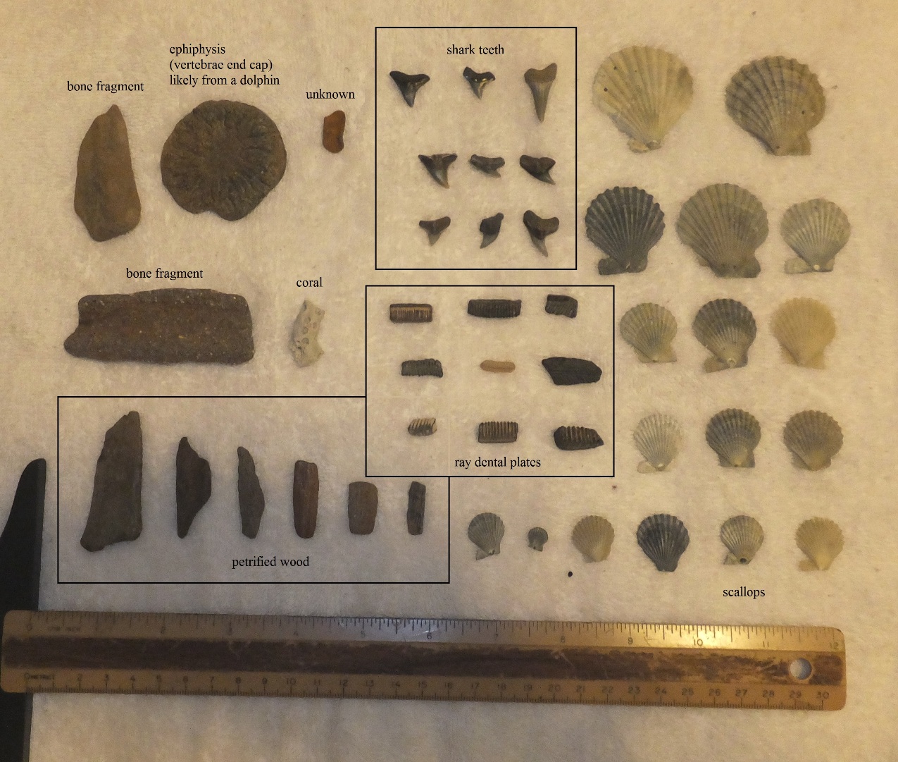
I paddled 25.6 miles. I did not explore Plum Point Creek near the launch area. Maybe next time. I was pretty tired and a little dehydrated once I finished. It took me awhile to identify my fossils. I found Vertebrate Fossil Identification Along the Chesapeake Bay and the visitor center at Flag Ponds Nature Park to be most helpful. |
|
I wanted to continue my August 10, 2014 fossil hunt which left off at Calvert Beach. But I didn't need to resume there since that section was fairly developed and unlikely to have many fossils that haven't already been claimed. So instead, I would resume at Flag Ponds Park. The park didn't open until 0900 which wasn't too bad since low tide wouldn't come until sometime in the early afternoon. I hiked here back on April 9, 2006 but had never launched here.
After re-familiarizing myself with the park, I loaded up my kayak cart and wheeled my SUP to the beach. Walking down the road between the beach and my car, I saw numerous paw paw trees with fruit that was out of my reach. 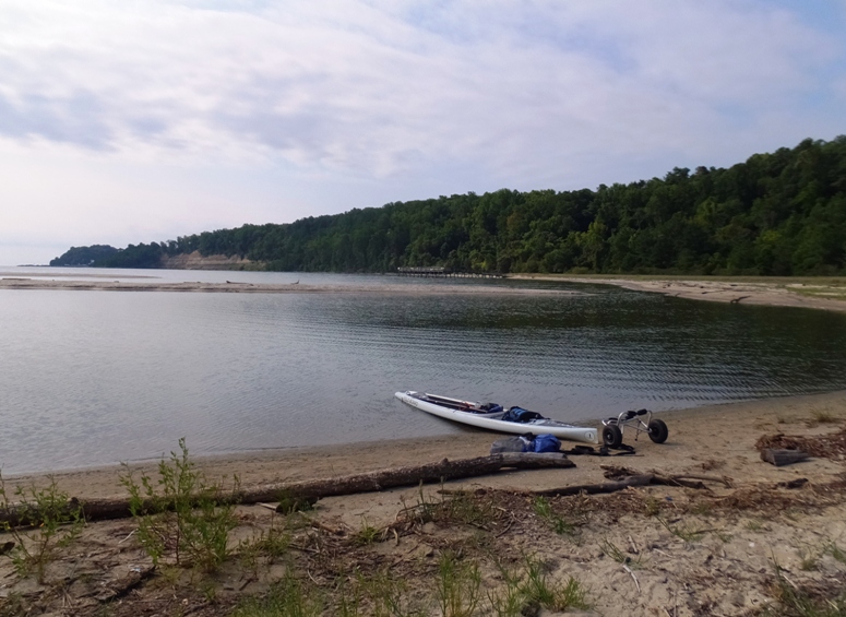
By 1000, I was on the Chesapeake Bay heading south with help from the tide and the wind. Conditions were not as calm as last week but they weren't bad either. However, the wind did create enough chop so that I couldn't see much in the water. I passed the Calvert Cliffs Nuclear Power Plant. Near it, I saw a section about a quarter mile out from shore where it looks like water is sent out from the plant into the bay. It created very turbulent conditions, shown below. For a very skilled kayaker, it might be fun to play in such fast water but on the SUP, I was less confident so I paddled close to shore as I made my way around it. I was surprised there were no warning signs or buoys. The water is returned to the bay no more than 12 °F (6.7 °C) warmer than the bay water. Unlike many other nuclear power plants, Calvert Cliffs did not have to utilize water cooling towers to return the hot water to its original temperature. As the water comes out very quickly and creates a sort of artificial rip current, it can be a dangerous place to fish. - from Wikipedia: Calvert Cliffs Nuclear Power Plant 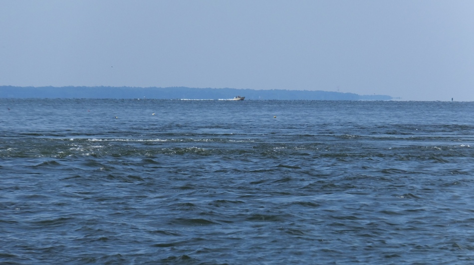
I made numerous stops along the way to look for fossils. I pulled ashore more than I did last week but that was largely because I knew I wouldn't be paddling as far today. There are not many options for paddling in this area. One can launch at the Calvert Cliffs State Park beach but that would require carting in 1.8 miles on the red trail. On the map, there is a youth group camp at the end of Camp Conoy Road in the state park which is near the water but I don't believe it is open to the public. I also have no idea if one can get a kayak or SUP down to the water from there. I searched for marinas in the area with a boat ramp. Breezy Point Marina was the closest and that is way up north in Chesapeake Beach. So Flag Ponds Park is the best option in this area. There is a quarter of a mile portage if you drop your boat off at the handicapped parking area and then park in the main lot. I found a pink bucket with the name "Katie" written on it. It was floating out in the water. I attached it to my SUP and gave it to a mother with a young daughter at the Calvert Cliffs State Park beach. Like last week, I saw several eagles, schools of small fish, needlefish, and a few crabs. No rays this time. But I did see an eagle nest. 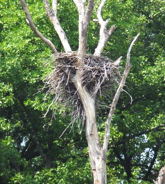
I passed a big structure out in the water for harvesting natural gas. It is the Cove Point liquefied natural gas plant. This has become the topic of great controversy. ...opponents argue that the economic benefits are short-term and not worth the permanent environmental sacrifice. They worry about the increased greenhouse gas emissions from liquefaction - the process of chilling the gas until it becomes liquid releases carbon dioxide and nitrogen oxide into the atmosphere. They're concerned that more demand for gas will lead to more horizontal drilling and hydrofracking [fracking] in the Marcellus Shale, a practice that has already damaged streams, killed fish, jeopardized local water supplies and fragmented forests. - from Bay Journal: Plan to export liquefied gas at Cove Point divides community (a broken link as of 2020) 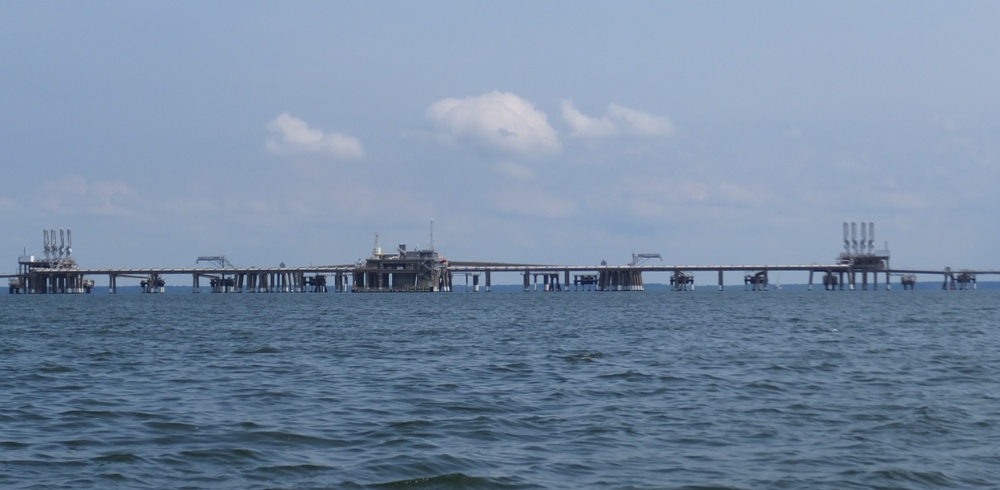
Eventually, I reached my destination, Cove Point Lighthouse. 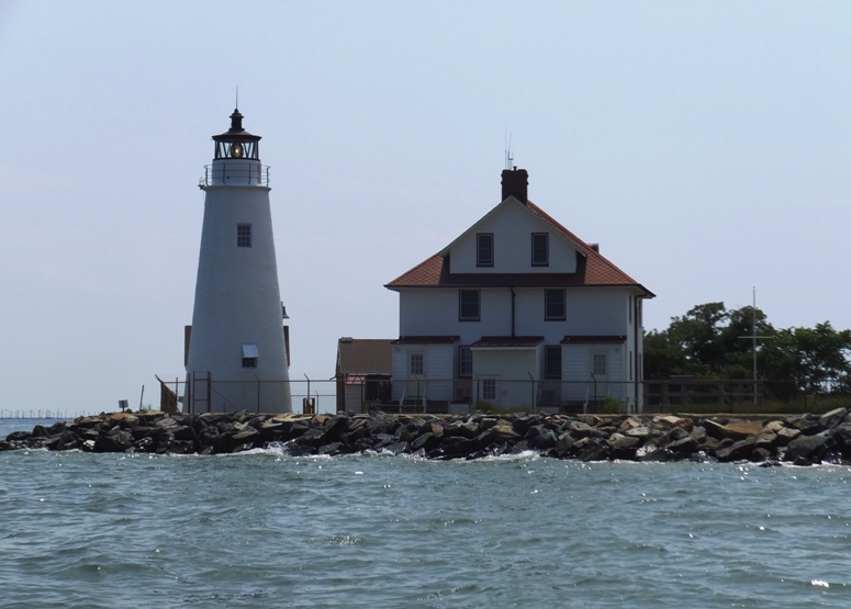
I turned around and made my way back, paddling against the wind. I generally try to do my fossil hunting where nobody else is looking. But I did run into a couple at a remote section. They found some pretty nice fossils...every bit as good as what I found today. 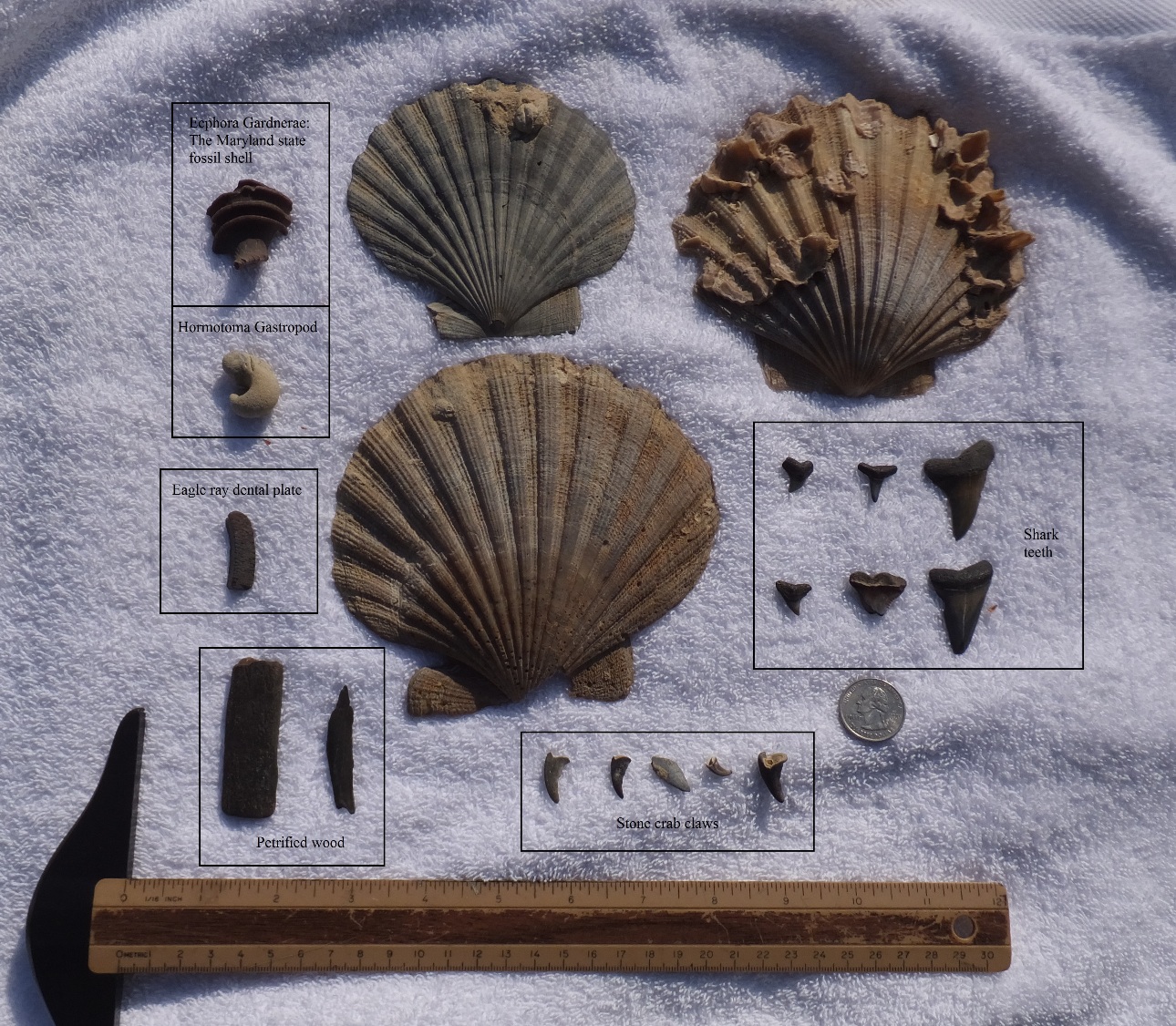
My treasures include the following: I ended up paddling a modest 12.7 miles. |
|
On August 21, 2014, Norma, Carmen, and I did a little kayaking in a fjord called Nærøyfjord in Norway.
|
|
Norma and I met her intern Alex at the MARC Penn Station for a day in Baltimore. The last time I saw Alex was May 26, 2014 for some kayaking on the Monocacy River.
We started by walking through the city and viewing various urban graffiti sites. We also stopped at an urban garden and spoke to a fellow with several chickens. Later in the day, we went kayaking in the Baltimore Inner Harbor area, launching at Canton Waterfront Park. This is a trip I've done countless times but it was Alex's first chance to see the area. Seeing the Navy ships up close was quite an experience for him. It is hard to appreciate their size unless you're right next to them. We ended up paddling about 6.5 easy miles at a very casual pace. Afterwards, we checked out the Inner Harbor on foot and then went home for some frozen pizza. This was our farewell to Alex whose internship will be ending very soon. We'll miss his positive attitude and fun demeanor. |
|
It was git-er-dun weekend for me. Here is what I did from the evening of September 12 (Friday) to the afternoon of September 14 (Sunday).
Having accomplished my weekend goals, I took the SUP out for some well-deserved paddling. I hadn't been on it since August 16, 2014, which is an extremely long time for me. I launched at Beachwood Park in Pasadena, launching from a different section of the park than previously. It was just a short distance south of the previous place. Doug H. at work informed me about it. It is in many ways a better launch area because it is a shorter carry and I don't have to make any sharp turns in the trail. Such turns are rough on a long SUP or kayak because there are a lot of trees to bang into. One drawbacks of the south launch is that there isn't a parking lot. One must park on the side of the road and there isn't a whole lot of room for that. There is no break in the wooden guard-rail (like with the north launch) so you have to carry your SUP or kayak over a three-foot barrier. The trail isn't as smooth or obvious as the other route but it certainly isn't bad. Towards the end it is a little steep but still easier than the north route. If you go here, be sure to watch for rocks and cinder blocks that may be submerged near the beach. Look for a wooden bench with some graffiti. 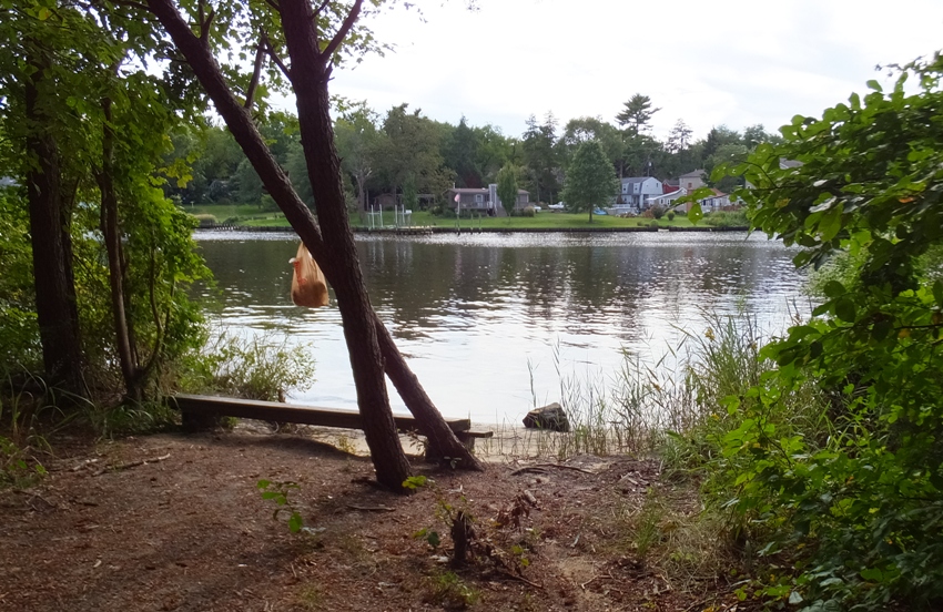
I only had about three hours before dark so I started out at a pretty good pace. The speed limit in these tributaries of the Magothy River is six mph so boat traffic is slow. But there were a lot of boats out. I passed several on my SUP. I crossed the Magothy River and explored the south side, skipping over sections I'd already explored on August 8. I think I made it to Ulmsteads Point. From here, I headed north, back across the river to Rock Point. I hit a big three-foot boat wake that I rode over like a pro and then saw the lighthouse at Little Island. 
I didn't bother exploring any tributaries on the north side. The sun was getting low and it the air was starting to cool. The rest of the trip wasn't so good because I was paddling west, right into the sun. If I had reversed my loop route, I would have hit the heavy boat traffic earlier in the afternoon but would have otherwise had a more scenic trip. I ended up paddling 12.4 miles. |
|
On September 19, 2014, my brother-in-law Jimmy and I went kayaking. We launched from Chincoteague and paddled to Assateague where we found a boatload (literally) of shells.
|
|
I launched at Smith's Marina last on July 11, 2014. Back then, my goal was to explore the upstream section of the river. But I got disoriented and headed the wrong direction. Today, I would do the route I originally intended.
I was on the water by 0830. I paddled around the south side of Saint Helena Island and then across the Severn River, landing somewhere near where I left off on my return trip in July. Then I paddled upstream on the northeast side of the river. Things were very quiet and the water was calm. I guess lots of boaters sleep in. It was a bright, sunny day...the kind that makes you glad you're alive. After my August 2, 2014 race, I knew that I needed to do something to improve the grip on my paddle. It kept slipping when my hands got sweaty. The last option would be to buy a new paddle with grippy grooves. That would run me at least $400. The first option was to wrap my paddle with hockey tape. So the night before, I did just that. It definitely gave me the kung fu grip that I wanted. My power strokes never felt so strong. But unfortunately, it was too sticky. I was moving slower when it came to switching sides. It felt like my paddle was wrapped in fly paper. I had to peel the shaft from my hand. Eventually it started to hurt. It actually tore off one of my callouses. I paddled along the shore, exploring every nook and cranny along the way. This was one of my "leave no stone unturned" trips. After about 2.5 hours, I passed a very small island. I don't expect this one will be around for long. 
Continuing upstream, I landed at another island, shown below. Though not much bigger, this one had quite a bit of vegetation to hold the ground together. It was also more rocky. So I expect this might last. I ate a snack and looked for relics. I found what looked like two fossils and something that I thought was a piece of iron that had been partially melted. One of my co-workers told me that folks have found shark teeth on the upper part of the Severn River though I could find nothing on-line to indicate that any shark teeth or fossils had been found in this area. 
Venturing still further upstream, it didn't take long before the water got too shallow to continue. I was now as far up the Severn as one could paddle. I was looking at the Severn Run Environmental Area, shown below. I saw a few people on the shore. They obviously walked some trail to get where they were. I thought maybe one could cart a kayak or SUP and launch from here but it looked too shallow for that. Still, I might return and scout the trails on foot just to see if there is a launch-able site. Such a find would be even better than a megalodon shark tooth since there appears to be no public launch site upstream of Smith's Marina on the Severn. 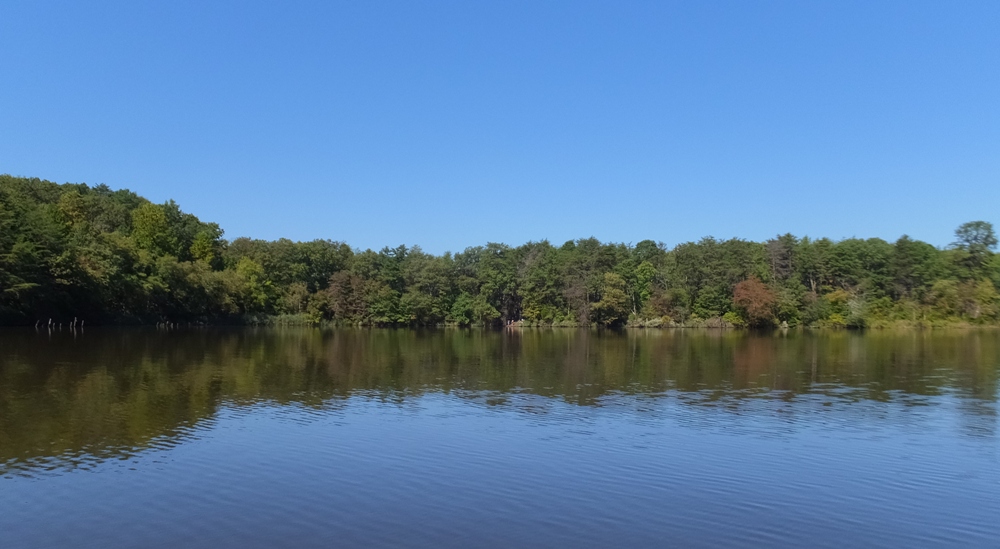
Heading back downstream, I saw the largest of the three islands I saw that day. 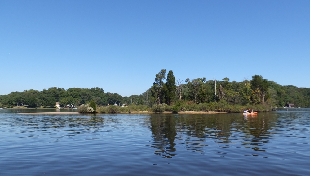
I saw a great egret, shown below. I don't see many of them. These are about as big as great blue herons. With egrets, I tend to see the much smaller snowy egrets. 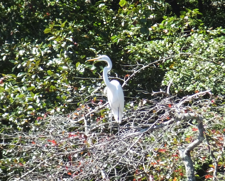
I saw two bald eagles, a few kingfishers, and a big water snake that I almost ran over with my SUP. I also spotted four kayakers throughout the day and no other SUPs. The Severn looks to be a pretty clean river. I don't know the bacterial count but just by looking, it appears to be much clearer than the water in many other nearby rivers. I saw several fish, including needlefish, along with some jellyfish and a few comb jellies. As the morning turned to afternoon, some parts of the river got a little rough with all the boat traffic. Like me, there were a lot of people that weren't quite willing to give up their summer. At mile 19.5, my triceps started to cramp up. At that point, I decided to abandon the "leave no stone unturned" plan and just get back to the marina. I was almost done anyway. After six hours, my trip was complete after having paddled 21.8 miles. I went home and cleaned off some of my gear. I found a toad in the place I put a bucket when drawing water from my rain box. 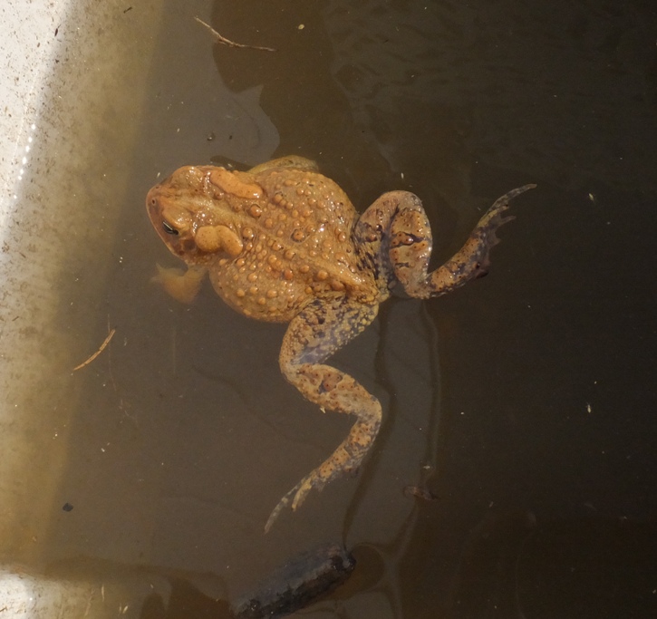
I brought home the two things that resembled fossils and the object that looked like iron. The first thing I did was stick a magnet to the latter (shown on the left, below) which I will call melted rock, because that's what it looks like. It was not the least bit attracted to it. So that rules out iron. 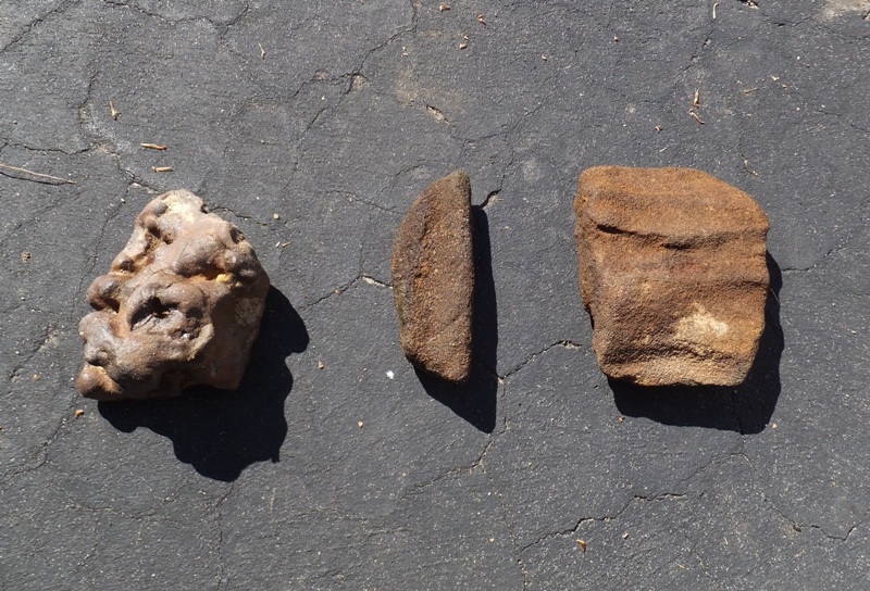
I remembered something I found a year or two ago, probably while digging in my back yard. It is something that reminded me of the clay cylinders we used to make in pottery class in college. The professor would have us start with making cylinders because this is a very basic skill one must master on the potter's wheel to be proficient. But many of us just didn't have the right touch so it would cave in. This is what the thing looked like that I found in my back yard, which I'll now call imploded clay cylinder. I tested and determined this to be non-ferrous also. When you feel the melted rock and imploded clay cylinder, they feel very similar in density and hardness. They also have some similarities in appearance. I took the melted rock to work and someone thought it might be the result of lightning hitting the ground. The word for this is fulgurite. Fulgurites are formed when lightning with a temperature of at least 3,270 °F melts silica on a conductive surface and fuses mineral grains together; the fulgurite tube is the cooled product. This process occurs over a timespan of around one second, and leaves evidence of the lightning path and its dispersion over the surface or into the earth. Sometimes they are referred to as petrified lightning. The color varies depending on the composition of the sand in which they formed, ranging from black or tan, to green or a translucent white. The interior normally is very smooth or lined with fine bubbles; the exterior generally is coated with rough sand particles and is porous. Fulgurites are rootlike in appearance and often show branching or small holes. Fulgurites formed in sand or loose soil are mechanically fragile, making the field collection of large specimens difficult. - from Wikipedia - Fulgurite Looking at photos of fulgurites, I noticed that most did not look anything like what I found. But a few did. The imploded clay cylinder fits the description better for a standard fulgurite. It is indeed a tube. The interior is fairly smooth and also has some fine bubbles. The exterior is coated with rough sand particles. I'm not totally certain these are fulgurites but until I am told otherwise by someone with more knowledge in this field than me, that is what I'll assume. I showed them to various people and nobody could give me a definite answer as to what they are. |
|
Galesville is one of my favorite places to put in so when I heard that the Pirates of Arundell were launching there, I figured I'd stop by. The Pirates of Arundell is a Chesapeake Paddlers Association (CPA) group. They were formally known as the Pier 7 Piracy until its fateful end. For more information, read about my final paddle at Pier 7 on July 16, 2014.
I left work early and was on the water just after 1600. I headed out across the West River to South Creek. On my last trip (September 27, 2014), I paddled with hockey tape on the shaft of my paddle. That was too sticky. So today, I had white athletic tape wrapped on top of the hockey tape. It was much better but still pretty sticky. I wonder if some of the stickiness from the hockey tape soaked into the athletic tape. I expect it will be less sticky over time. Even after soaking my hands and the paddle in water, I was still able to retain a good kung fu grip. I saw a pair of mute swans. 
Paddling up one shallow section, I came to a persimmon tree loaded with a plethora of little orange fruit about the size of ping pong balls. They were just out of my reach, even while standing on the SUP. I knocked one down with my paddle but it sank into the water. I saw one partially-sunken wreck by the name of "Aladdin." 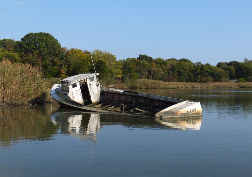
There were a few narrow sections that looked like they might be worth exploring, but I couldn't get very far up any of them. 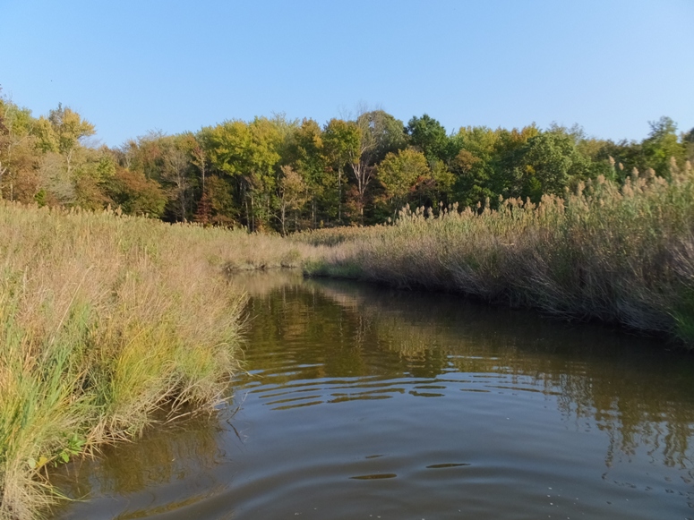
After exploring South Creek, I checked out the upstream section of the West River. I made it up to Holly Landing before heading back. I ended up paddling ten miles. Back at the launch area, I chatted with Ralph, Marla, and Dr. Paul until it got dark. It was a good last trip of the season. |
|
Last year, I wrote a kayak/SUP blog called Plans for 2014. Prior to that, I wrote something called Future Trips. Looking back on this, it is obvious that I really need to get more focused if I ever plan to accomplish these goals. Since then, there are a few trips I'd like to add to this "bucket list" (things to do before I "kick the bucket"). Here are some of them.
Kiptopeke Breakwater
Ghost Fleet of the James River
Arthur Kill Shipwrecks
|