|
This page describes my hiking adventures in 2019. |

|
This page describes my hiking adventures in 2019. |
|
Lots of parks sponsor hikes led by rangers, naturalists, or volunteers on New Years Day. Most of these are too short (about two miles) for our liking so instead, Norma and I did our own hike in the Woodstock area of Patapsco Valley State Park. Several friends joined us.
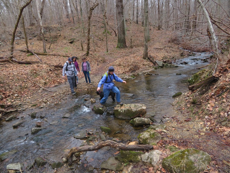
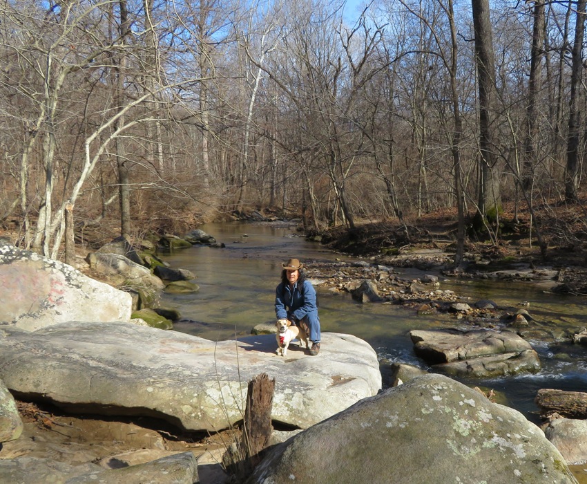
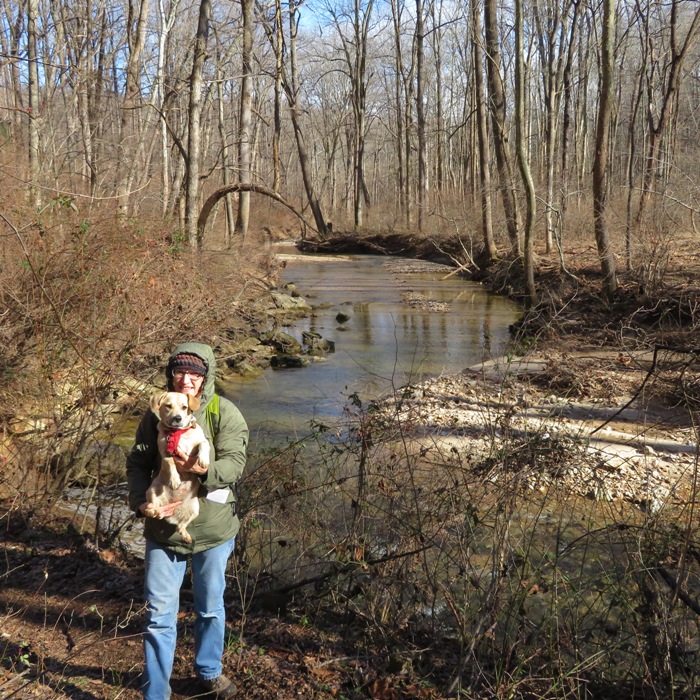
Norma, Daphne, Sara, Cassie, Jason, Nicole, Bob, Cosch, Suzanne, and I caught the trail at Woodstock then headed east on the Thru Trail. I kayaked on the Patapsco River in the early spring of 2018 near this area but I had never hiked it. Bob, however, was quite familiar with it so we followed his lead. He modified the route slightly to help keep us drier. It rained quite a bit the day prior and things were muddy. But perhaps that was a good thing. That meant we had the place to ourselves. For at least the first four miles, we saw nobody else. So it was a good place to let the dogs run off leash and be themselves. This meant Cassie went for a swim and rolled around in smelly stuff. The ten of us did several stream crossings. We saw some interesting rock formations and a big pile of junk. Near the halfway point, we took a break at a vista on the Overlook Loop at overlook location. The trees were a little too thick to get a good picture of the valley below. From left to right in the back are Cassi, Sara, Jason, Nicole, Cosch (dark dog), Bob, and Suzanne. From left to right in the front are me, Daphne, and Norma. The dogs weren't very interested in looking at the camera. 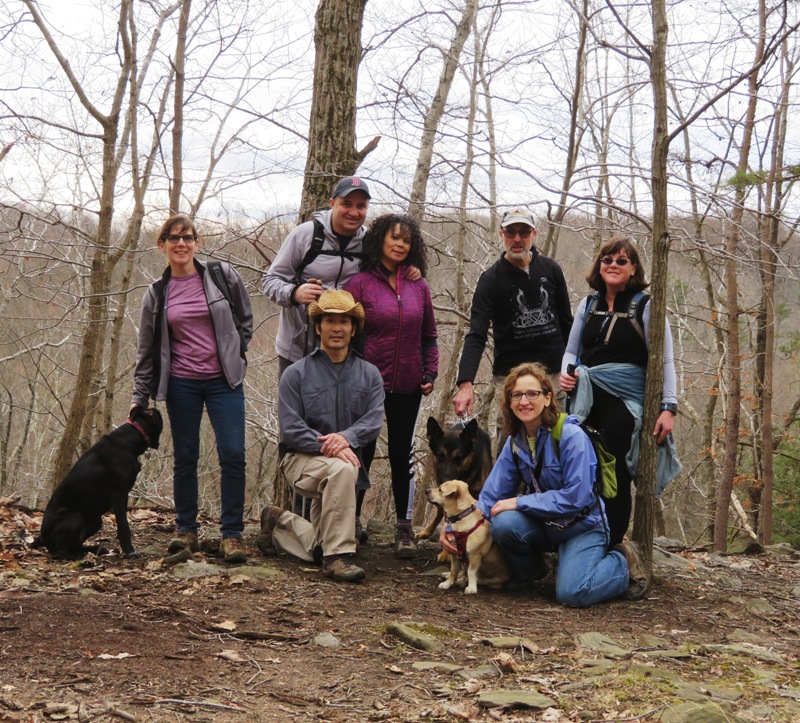
Most of the hike was through woodlands but there were a few open areas such as this one under the power lines. 
As shown below, the Patapsco River was running very high and looked fun for kayaking. We saw maybe six other people during the whole time we were out. What are the chances I'd see someone I'd know? Not likely, But we ran into kayaker Chip who was canoeing down the Patapsco with a friend. They pulled over for a break. 
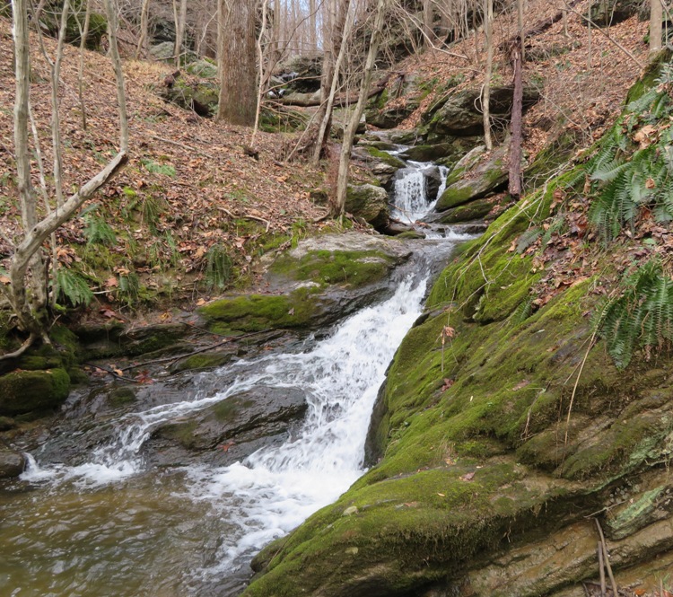
The place was scenic but there weren't many features that were particularly interesting. But one was the falling water just north of the Thru Trail. The sun played peek-a-boo but remained hidden for most of the hike. It was supposed to get to 61 degrees but with 30 mph gusts, it never felt warm. 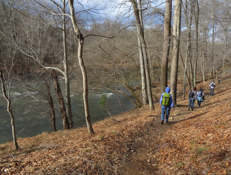
About 0.7 and one mile downstream of the trailhead, along the river and just off the Thru Trail, we saw two ponds that I suspect might be a good place to find amphibians in early April. I've been quite successful in locating mating toads in this area so I'll definitely return in a few months. I tend to find a lot of shiny stuff in the park. I'm guessing it is mica. On January 27, 2018, I found out what it really is. 
After walking 6.9 miles, we loaded up the dogs and said our farewells. It was a good way to spend the first day of the new year. Walking through the mud sometimes made me feel like a pig which is appropriate since 2019 is "Year of the Pig."  |
|
Back on December 8, 2018, some friends and I hiked in Patapsco Valley State Park between Alberton Rocks and Daniels Dam in Baltimore County. We were not successful in finding one of the old loop trails shown in my map, which was published in 2002.
Today I returned with Norma, Daphne, Sara, Cassi, Allison, and Steve. Allison and Steve are Sara's friends. Sara organized and led this trip. We hiked west, passing Alberton Rocks. This is a popular place for rock climbing and is just short distance from the trailhead. 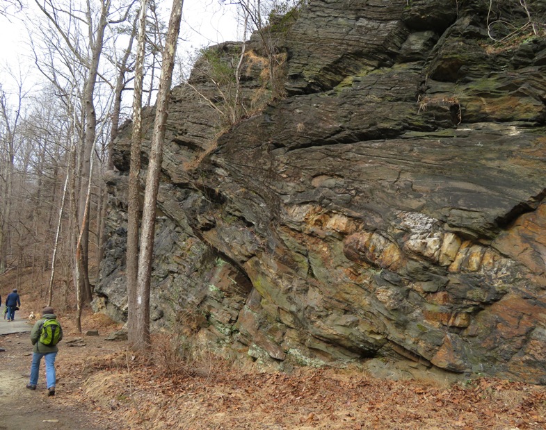
In the photo below is a view from the top of Alberton Rocks which is 50 feet above the trail. There is a gentle trail to the top on the east side and a scenic flat spot up there that is great for taking a break. 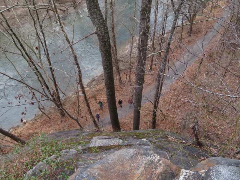
The trail in this area is pretty well defined. Here's Steve. 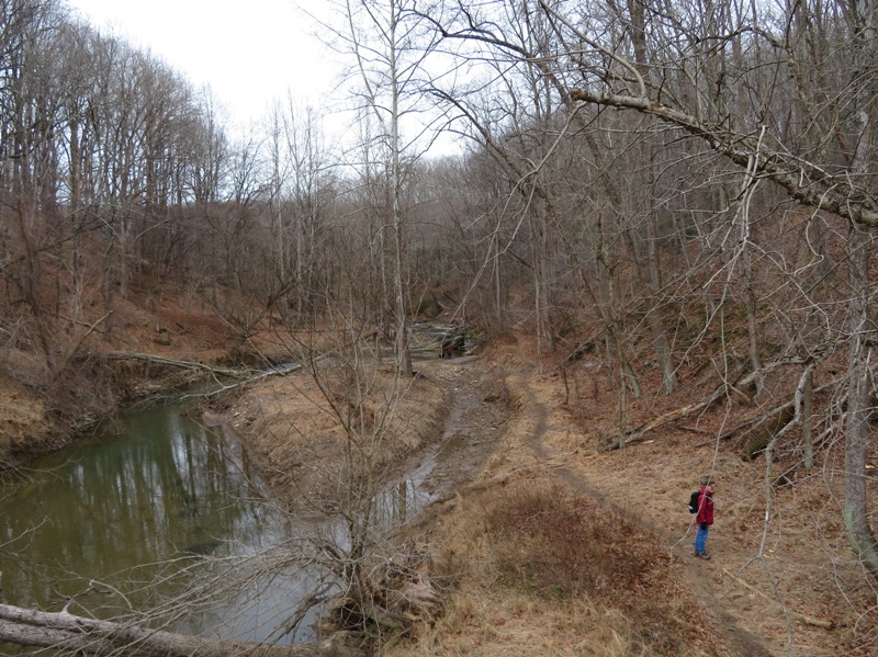
We hiked past where we stopped the last time, continuing up the east side of Brice Run to our turnaround point at Wrights Mill Road. 
Very often, when I hike in this area, I find shiny rocks. I used to think they were mica. Now I think they are muscovite. It usually has a whiteish hue but if you have really thin pieces like I am holding below, it is clear. Here's a sample of muscovite collected from a pegmatite outcrop along the Patapsco River in Baltimore County, Maryland. Our location was just north of Oella, which is associated with muscovite. The Oella Formation is a Late Proterozoic or early Cambrian [500+ million years old] schist in Howard and Baltimore Counties, Maryland. It is described as "Medium-grained biotite-plagioclase-muscovite-quartz schist...commonly bearing muscovite but less commonly garnet." - from "Wiki Visually - Oella Formation" (broken link as of 2026) 
On the return trip, we took a path to the Saint Stanislaus Kostka Catholic Church. This is part of the old loop trail. Last time, we only took it to the church and back rather than completing the loop. Here is Norma, Daphne, Allison, Cassi, and Sara at the ruins. It was built in 1878; it was struck by lightning and burned down in 1927. - from Outdoor Muse - Daniels, Maryland; The Churches 
Here's a view looking west through two windows at the church ruins. 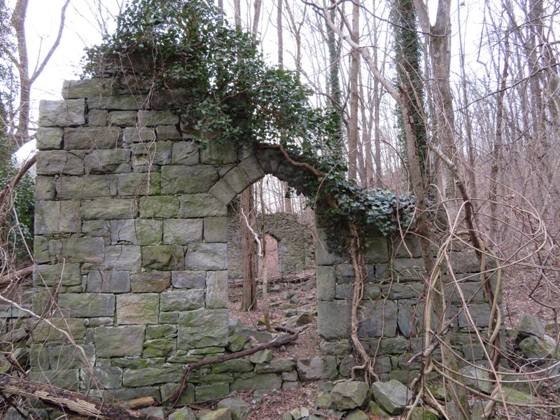
The Saint Stanislaus Kostka Catholic Church Cemetery resides just north of the church. There are "many headstones ranging from dates in the late 1800s to early 1900s." - from "The Urban Historians - Daniels, Maryland" (broken link as of 2026) 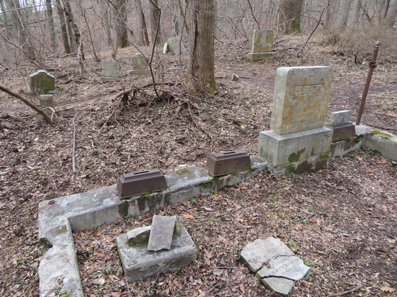
Rather than head back the way we came to reconnect with the main trail along the river, we decided to try and complete the loop. We were successful! I now call this loop the Power Line Trail because some of it passes through a cleared section under the power lines before it picks up again on the east where some trees are marked with purple ribbon. It is very hard to find. Some of this trail was overgrown and we had to bushwhack a bit to complete the east side of the circuit. I don't know if I would try to bushwhack again unless it was winter. All the snow had melted but in some shady areas, there was still a good bit of ice. Here are some ice-covered rocks across Patapsco River, on the Howard County side. 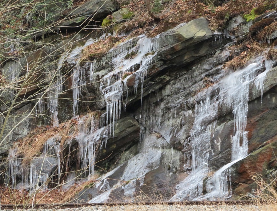
We would have gone out to eat after but my neighbor contacted me to let me know that Gretchen, one of my chickens, had flown over our fence into his yard. I wanted to retrieve her before it started getting dark. So we went home. As it stood, Gretchen had flown back to my yard before we got home. |
|
I took the day off from work to go hiking with Norma and Daphne. I found a great place that is only 16 minutes from home. It is the Middle Patuxent Environmental Area (MPEA). At 1,021 acres, the MPEA is the largest parkland in Howard County's system of parks, open space and natural resource areas.
The MPEA is comprised of the South Wind Trail and the Wildlife Loop Trail which are connected by the Connector Trail. Part of the Wildlife Loop Trail resides in the Geis Woodcock Habitat Management Area, named after Al Geis, a wildlife biologist with the U.S. Fish and Wildlife Service. We commenced our hike at the South Wind Circle Trailhead. Then we walked on the blue-blazed South Wind Trail to Cricket Creek, the largest tributary to the Middle Patuxent River. On the red-blazed Wildlife Loop Trail, at marker 16, we spotted an old concrete wading pool that was converted to an amphibian habitat by local students. We love finding amphibians so I expect we will return in April to see what we can find. 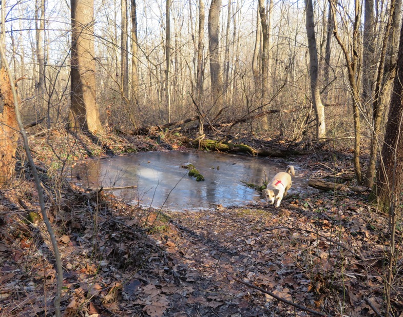
At the edge of Glegg's Meadow, we found a Chinese mantis egg sack. The Chinese mantis was introduced to the U.S. in 1896 as a means of pest control. - from Maryland Biodiversity Project - Chinese Mantis 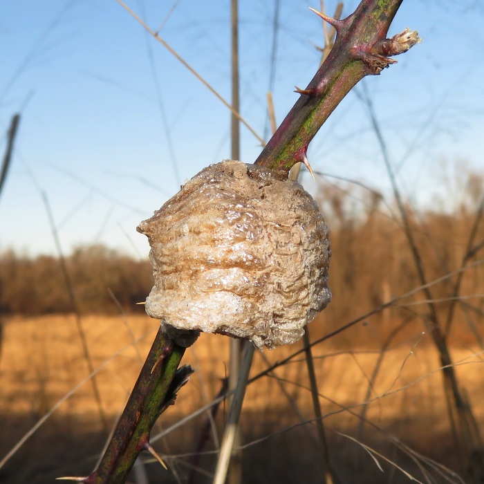
Most of the Middle Patuxent River looked deep enough for kayaking. I just need to figure out where to launch. Many of the trails were quite muddy. I recommend going when it is a little colder so that the mud will be solid. Or visit after a dry spell. We walked 6.2 miles. How would this place be for cross country skiing? Some parts would be great though I would definitely stay off the smaller side loops and stick to the widest trails as much as possible. The Wildlife Loop Trail has logs placed across to prevent erosion in the steeper sections. These would make for a bumpy ride. The area doesn't drain well so I don't recommend skiing unless it is really cold so the wet spots are truly frozen solid. |
|
Winter storm / polar vortex Jaden was expected to drop the temperature down to zero degrees fahrenheit in my town on the early morning of January 31, 2019. If it were one degree, then at two degrees, it should be twice as warm; while at zero degrees, two degrees should be infinitely times warmer, right? Not quite. I think it might be more meaningful if we used the kelvin temperature scale where there are no negative values. Zero degrees kelvin (K) is defined as absolute zero. At absolute zero, a hypothetical temperature, all molecular movement stops. So the low temperature in Savage on January 31, 2019 should be 255.372 kelvin, which is zero degrees fahrenheit. After I initially wrote this, it turns out it only got down to five degrees fahrenheit.
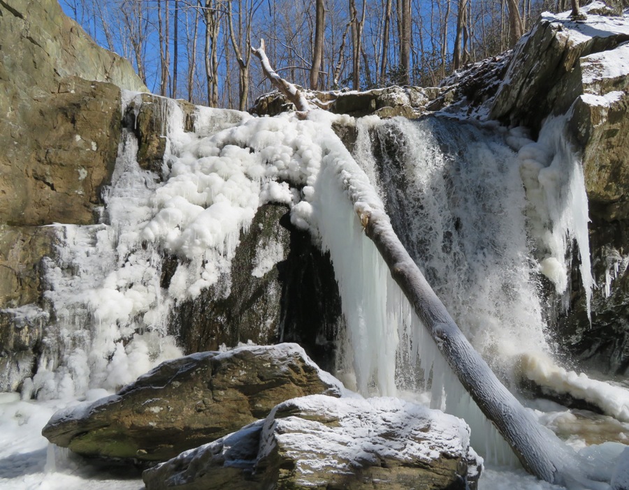
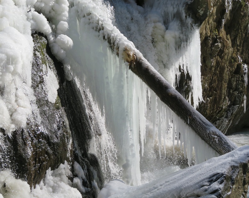
What should I do when it gets so cold? Go hiking, of course. But not just any ordinary hike. I want to see a frozen waterfall. Muddy Creek Falls is too far away so instead I chose the next best thing...Kilgore Falls. Kilgore Falls is the second highest free-flowing waterfall in Maryland at 17 feet. It resides in Harford County just south of the Mason-Dixon Line and is an hour and 15 minutes from my house. I've seen pictures of the frozen falls but never witnessed it for myself. My car was the only one in the parking lot when I arrived. I took the trail to the bottom of the falls but couldn't get across Deer Creek safely. I need to cross it to get a good view of the falls. But I could see some of the ice that it produced. 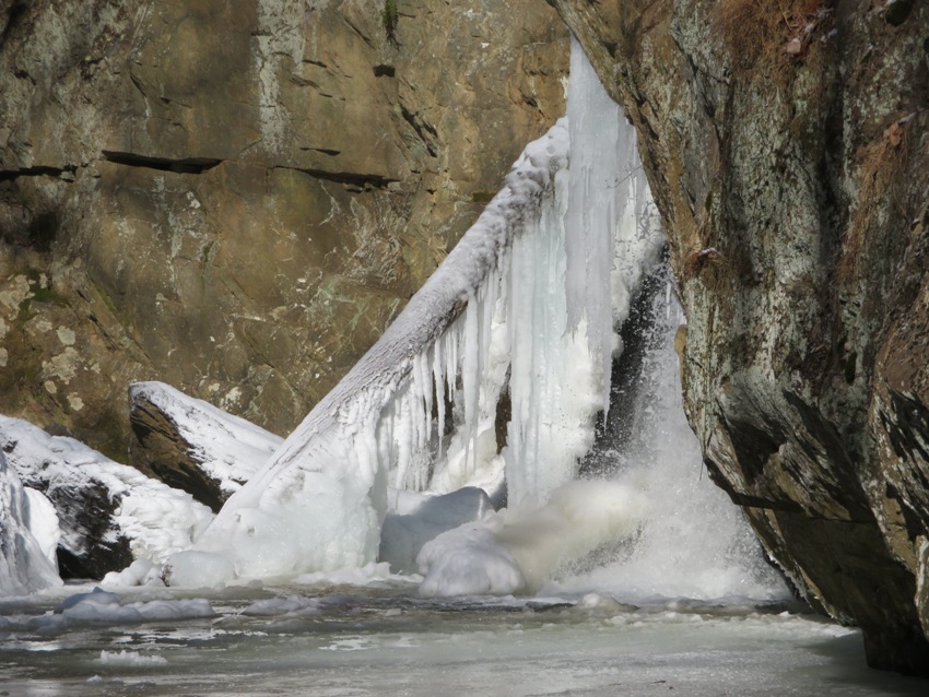
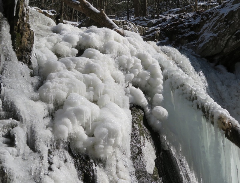
So I headed to the top of the falls and then followed the creek upstream until I found a tree that had fallen across it. I wasn't confident enough to walk all the way across the tree so halfway through, I straddled it and then scooched across. The frozen falls were everything I expected. I reckon there was at least a ton of ice immediately around it. Water still flowed but I think there was more ice than falling water. Looking close, mother nature created beautiful ice sculptures that were illuminated in today's cloudless sunny day. I moved around the falls to get a different view. 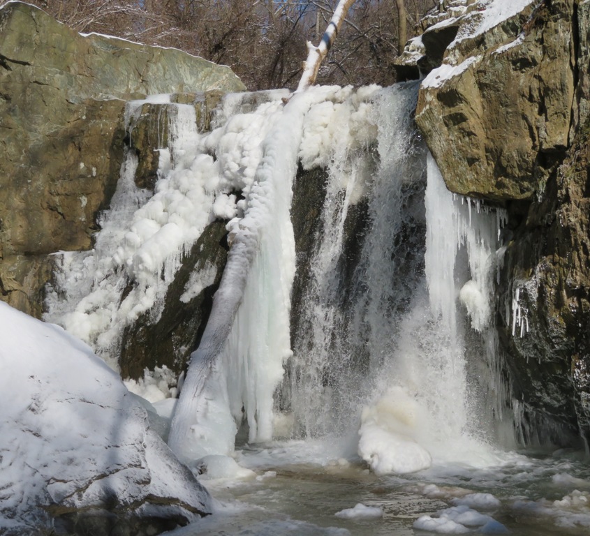
I was carrying my drone in its backpack but I never took it out. Too many trees for flying it. I really didn't need it either. I could climb up the cliff to get an overhead view. 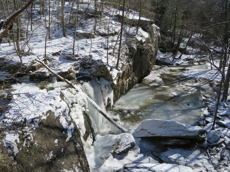
It was a lovely, sunny day. I wasn't cold...I've learned how to dress properly in frigid weather. Wanting to make the most of a long drive, I headed out to Eden Mill Nature Center to look around. Then I headed back to Savage to take more photos. Such clear weather doesn't occur too often. I have to take advantage of it while I can. |
|
On Groundhog Day, a group of ten adventurous humans and three dogs embarked on a hike in Wincopin Park. This was our second Savage Stroll. We commenced our walk around 1000 in freezing temperatures. But there was very little wind and it was sunny. Our trail was sprinkled with a light coat of snow.
The Wincopin area is full of history. In 1722, a surveyor by the name of Henry Ridgely married Elizabeth Warfield, whose father had patented for her the land between the Little Patuxent (Pax) River and the Middle Pax River above their confluence and named it Wincopin Neck. Over the years, a significant amount of granite was excavated, finished, and transported to other locations. This area is now owned by Howard County. It resides just outside of Savage in Jessup. Our group walked on the Green Trail along the Little Pax. On one part, we encountered the walls of a stone and earthen dam that was built between 1802-1804. This type of Crib Dam was typical of dam construction used in Maryland in the 1700s and early 1800s. This dam provided water power for the Savage Grist Mill, located 0.4 miles downriver. Grist mills ground corn and wheat into flour products. - from information sign at trailhead 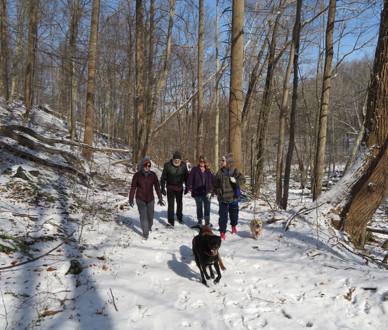
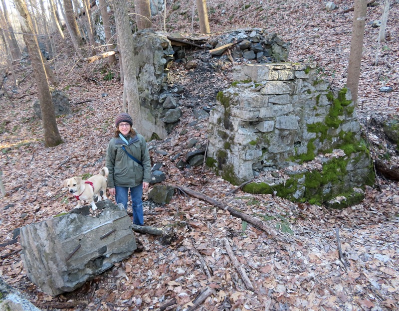
We stopped for a picture at a place with large stone and concrete walls, and a variety of concrete pillars; the remains of a large stone finishing plant that operated in the late 1800s until about 1925. Raw blocks of granite from local quarries were delivered here by rail. Stone finishers used special hand tools to cut the raw granite into measured stones to construct buildings, bridge abutments, and monuments. - from information sign at trailhead 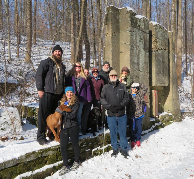
From left to right above are Dominic, Rufus (dog), Samantha (Sammie), Bethany, Kevin, Cassi (dog), Sara, Dale, Wayne, Daphne, Norma, and Cindy. Wayne is extremely knowledgeable about the history of the area. Near the confluence of the Little and Middle Paxes, we had a scenic view of the Middle Pax from a granite bridge bier that once supported the east end of the Gabbro Bridge. In 1888, the B&O [(Baltimore and Ohio)] extended a railroad spur from Savage Mill northward along the Little Patuxent River. A Gabbro bridge (a Pratt Truss bridge) carried that spur across the Little Patuxent River here and continued northward along the west bank of the Little Patuxent River. This bridge was prefabricated in Baltimore and hauled to the site for assembly. This rail spur carried granite stones from Guilford Quarry and other private granite quarries and finishing operations along the B&O tracks in Wincopin, to the B&O mainline tracks at Savage Station. The rail spur was removed in 1925 after the Guilford Quarry flooded. - from information sign at trailhead 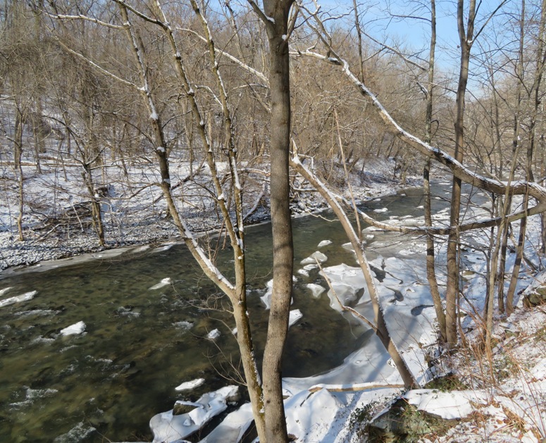
Here's our four-footed hikers back at the trailhead. From left to right are Rufus, Cassi, and Daphne. 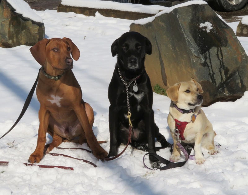
After completing our 2.4-mile hike, most of us headed over to the Ram's Head for lunch. |
|
On Groundhog Day, Punxsutawney Phil predicted an early spring in 2019. This might well be true. On January 31, the low temperature in our area was 5 degrees. But on Superbowl Sunday, February 3, the high temperature was 50 degrees.
Since Norma and I are not the least bit interested in football or pre-game festivities, we did a hike in the Pickall and Oella sections of Patapsco Valley State Park. I chose a figure eight loop route that took us both along the water and higher up. We mainly had to make sure our route came together (the junction of the figure eight) near the water so we could pass under the Baltimore National Pike (route 40) bridge. The two of us, Daphne, and my neighbor, Jason, started at Old Frederick Road. Then we crossed the Old Frederick Road Bridge into Baltimore County where we spent the rest of our hike. The four of us walked through the Pickall area which was closed to traffic. Then we headed south towards the historic town of Oella. The wind was calm and even though there was snow on the ground, it wasn't very cold as long as we stayed in the sun. What normally would have been stream crossings were instead ice crossings. At 25 pounds, Daphne just walked across the ice. Jason did not have this luxury; he had to rock-hop. 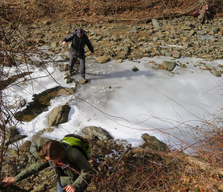
Just south of Baltimore National Pike is a culvert where Miller Run flows into the Patapsco River. Things were still very frozen here. 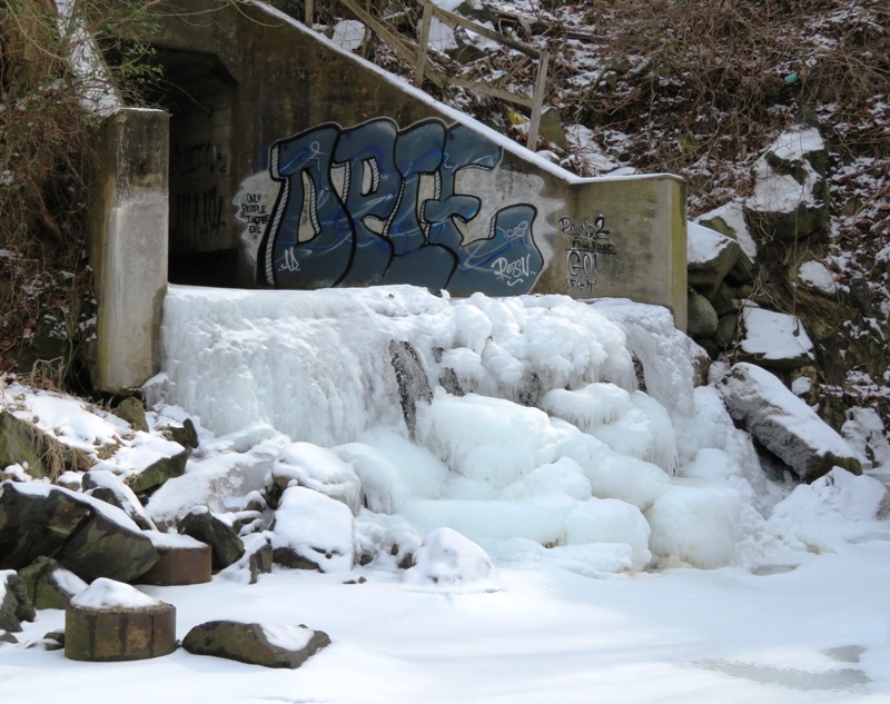
The Baltimore National Pike bridge was originally built in 1936. It was reconstructed between 2010 and 2014. Our trail ran under it on the right side. 
Norma, Daphne, and I posed in front of the Union Dam ruins, just downstream from Miller Run (shown below). According to "Gannett Fleming - Demolition of Union Dam" (a broken link as of 2020), Union Dam was a concrete dam built around 1912. This is what the dam used to look like. It originally supplied water power for the W. J. Dickey Textile Mills on Oella. - from Maryland Department of Natural Resources - Patapsco Valley State Park 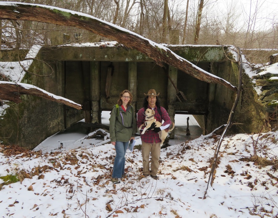
Prior to Union Dam, there was a dam at this location which was built by the Union Manufacturing Company about 1808. - from Trainweb - B&O Old Main Line Here's another view of the dam ruins. 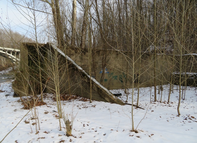
The Mill Race Trail runs from the ruins of Union Dam to Oella. Though it runs close to the Patapsco River, it stays fairly dry because it is elevated. Why is it elevated? Because like the name implies, this trail was part of the millrace that transported water from the dam to power the Union Manufacturing Company which was the first textile company to be chartered by the State of Maryland. Founded in 1808, the company briefly achieved renown as the largest cotton mill in America. - from "Oella Company - Oella History" (a broken link as of 2026) 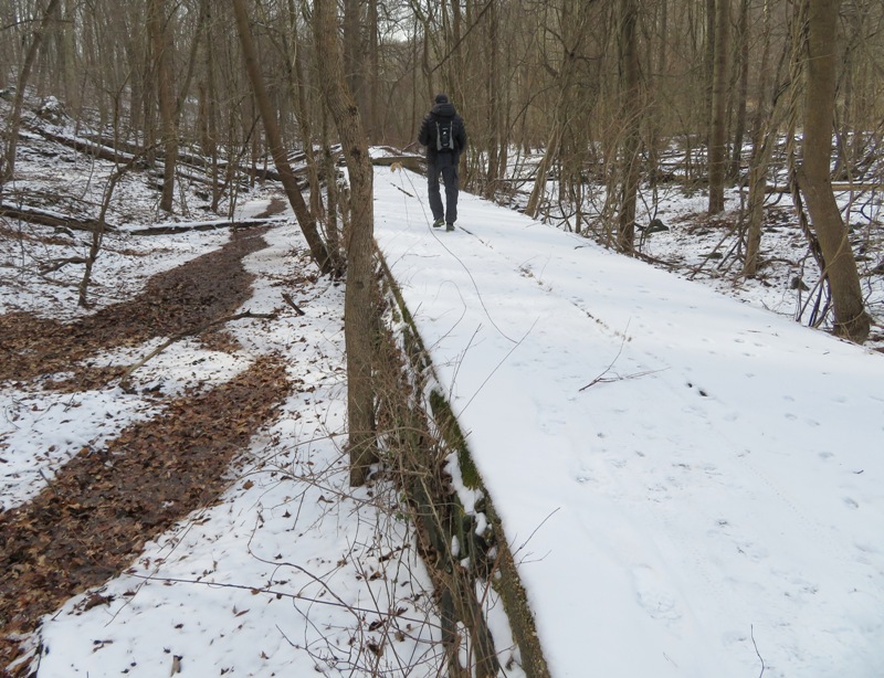
The 1.5-mile millrace on the east side of the river was said to be the longest serving a single mill in the USA. - from Trainweb - B&O Old Main Line North of the Union Dam ruins, the Mill Race Trail becomes the Pickall Trail. But since the Pickall Trail isn't elevated, it was quite muddy with all the snowmelt. 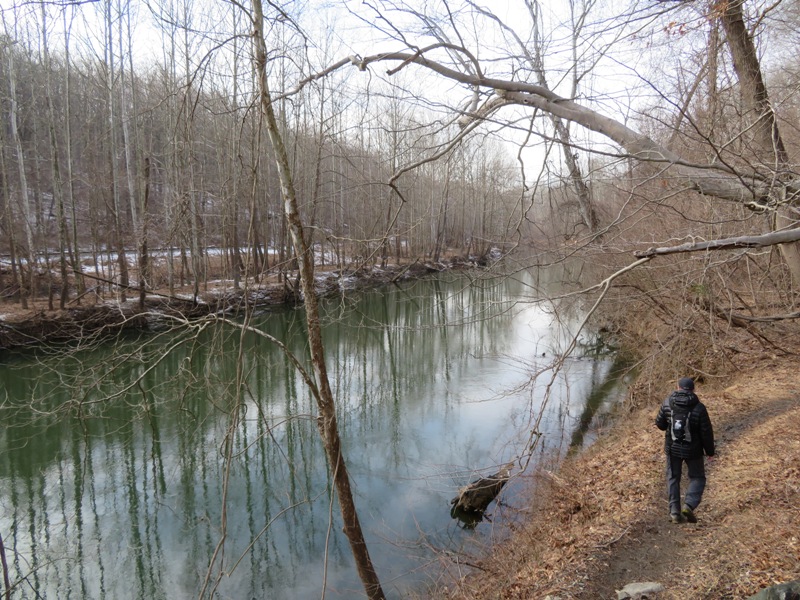
Much of our hike was along the Patapsco River. This was my first time hiking this section. I'm hoping to return when it gets warm and kayak from the Daniels Dam to at least Oella. I haven't determined the best place to take out yet. I found some puffball fungi of the genus Lycoperdon growing on some rotting wood. 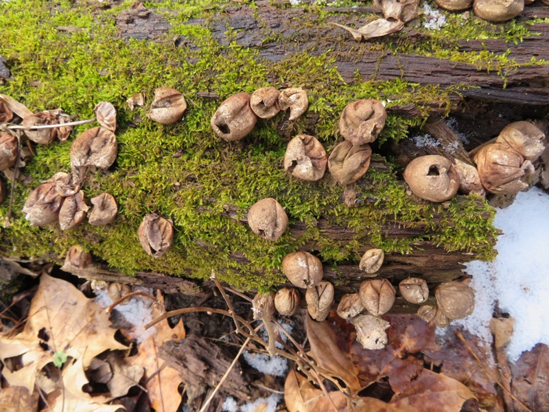
We got in a good 7.9 miles of hiking though Jason's GPS said we did a little more. |
|
Norma, Daphne, and I enjoyed today's clear, sunny skies before tomorrow's inevitable snow, sleet, and freezing rain. We did a 4.7 mile hike in the Hollofield Area of Patapsco Valley State Park.
The three of us explored the trails south of Baltimore National Pike (route 40) along with the Old Ranger Trail and Peaceful Pond Trail on the north side. My big find was a trail not on maps that connects from the east side of the route 40 bridge in Howard County to Park Drive on the north side of route 40. It parallels route 40. Taking this trail avoids backtracking and makes for a nice circuit hike. One reason I chose this route is because it was a work and school day and I know this area is pretty popular. But not many people were there today. It was a good day to take pictures. In 1902, the Baltimore and Ohio Railroad cut this tunnel through the steep stone ridge next to the Patapsco River. It is still operational. 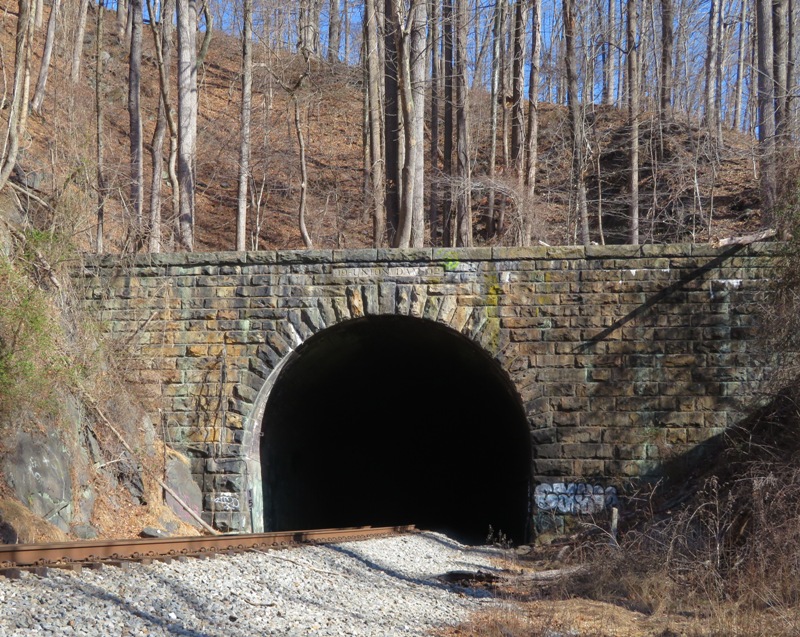
Here's a view of the B&O rail line from above the tunnel looking southwest. This is near the River Ridge Trail. 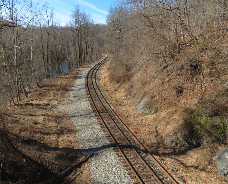
This is looking downstream on the Patapsco River from the Hollofield Area overlook towards Oella. 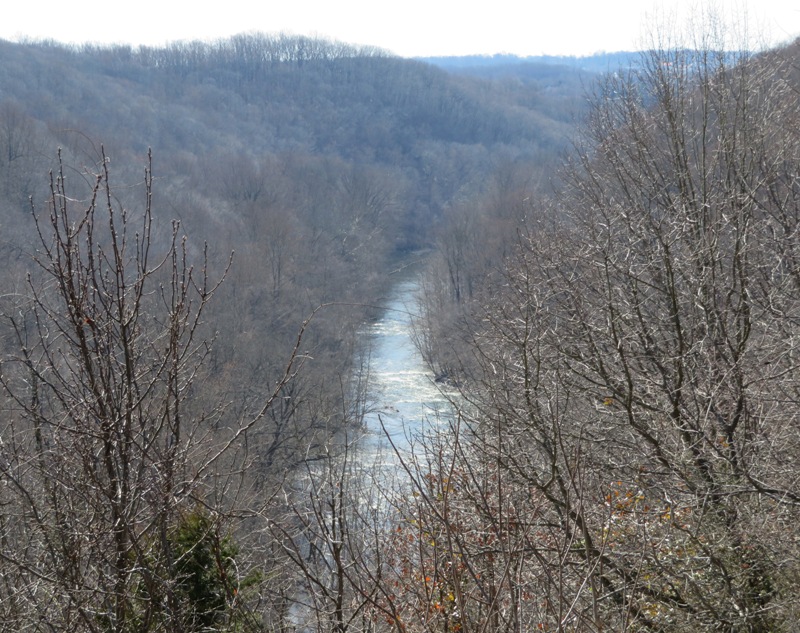
On February 3, 2019, we saw this structure on the other side of the river (the Baltimore County side) when we went hiking with Jason. It is the ruins of Union Dam, a concrete dam built around 1912. 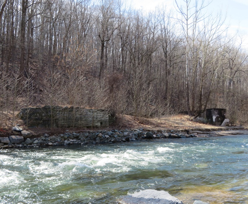
Here's Daphne next to some of the remains of Union Dam on the Howard County side. Behind is the Baltimore National Pike (route 40) bridge. 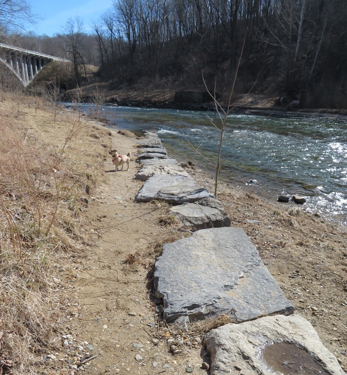
After our little walk, we drove out to Oella to look around. We were going to get some lunch at the outdoor pizza stand near The Breadery but it was closed. Oella is a litle like Savage in that it is an old mill town. But it has a much different feel...claustrophobic. Public parking is hard to find and the roads are narrow. Not very walkable. It is obvious they tried to fit as much as possible into too a small space and in doing so, lost some of the charm. I was looking at the paddleability of the Patapsco River in this area. There is quite a bit of whitewater which isn't surprising since it is the fall of the river that makes for a good mill. The whitewater starts around route 40 and is off and on at least to Ellicott City. It is more whitewater than I prefer. I did not find a suitable kayak take out anywhere between route 40 and Oella. |
|
Norma, Daphne, and I went for a walk in Wincopin Park. We took the Green Trail to the Little Patuxent River and then headed north to the remains of the B.F. Pope Stone Company Quarry. This was actually the first time we had seen this part of the park.
Next, we headed to the confluence of the Little and Middle Patuxent Rivers. Here's Norma at the gabbro bridge support. This once supported a rail line that passed over the Middle Patuxent River. It was built around 1888 for the Baltimore and Ohio Railroad. 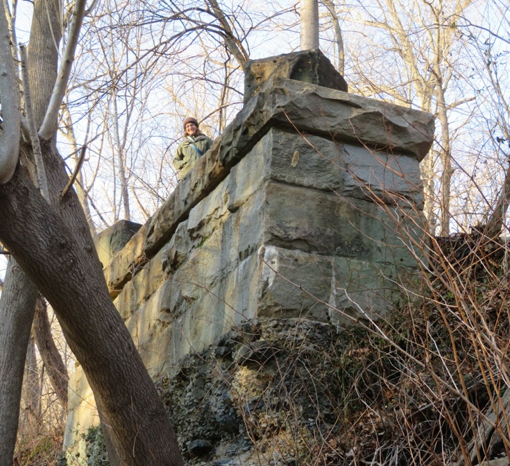
This is a drone's view of the confluence of the Little (right) and Middle (left) Patuxent Rivers. If you were to zoom in on a high resolution photo, you would see the gabbro bridge support on the right side of the Middle Patuxent River. 
Continuing on the Green Trail, we stopped at a vernal pool near the Middle Patuxent River where we heard lots of wood frogs. Spring is just around the corner! I say that half-jokingly because we are supposed to get 2-4 inches of snow tonight. Daphne helped us look for frogs. 
The frogs became quiet and motionless once we got close. I saw some ripples in the water and zoomed in to get this photo of what I initially thought was just a blob. It wasn't until I got home that I realized there is at least once frog in the picture. 
We saw some wood frog eggs. Since these eggs have some white and are very compact, they were very recently laid. Nearby, we saw some eggs that were a little more mature. 
These eggs below reminded me of the Cheron people on "Star Trek." 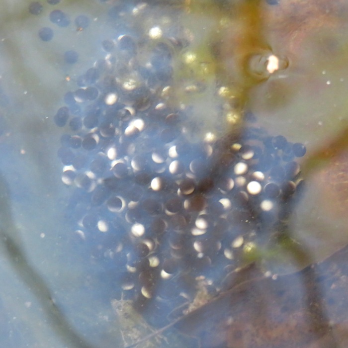
I learned a little more about these critters once I got home. Wood Frogs only call and mate during a narrow window of time in early spring. They are usually the first amphibians to emerge, congregating in shallow ponds and vernal pools in large numbers. Frog enthusiasts await that first evening in February or March when the temperature will be 50 degrees or higher, with wet or rainy conditions to herald the beginning of the frogs' movement. It is not uncommon to hear a male Wood Frog calling from a pond still partially covered with ice. - from "ArlingtonVA - The Wood Frogs Have Emerged!" (broken link as of 2026) I sent Sue M. the photos I took of the frog eggs. She works for Howard County Recreation and Parks. She replied, That is the first confirmation for Howard [County]. Surely we will return to the vernal pool to see how these eggs and new ones are doing. |
|
Eleven people and four dogs participated in the third Savage Stroll which commenced at Carroll Baldwin Hall. We walked east past the Masonic Lodge and then north to Savage Park. From here, we picked up the Patuxent Branch Trail and then made our way to Patuxent Valley Middle School. Then we followed Savage Guilford Road back to the start. Our stroll was 2.5-3 miles. Most of us stuck around after for lunch at the Rams Head Tavern in Savage Mill.
In the photo from left to right in the top row are Norma, Daphne, Dale, and Nate. In the next lower row are Stacy and Wayne. Below them are Dominic, Rufus (dog), Kelley, Bethany, and me. In the front are Kevin, Cassi (dog), Thor (dog), and Sara. 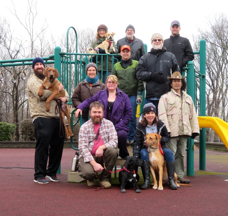
|
|
I took the day off from work today. Why? Various occupations are recognized every year. There is an Administrative Professionals' Day. There is a Teachers' Day. Engineers get a whole week of recognition. But to the best of my knowledge, there is no Mathematicians' Day in the United States. If we were to create one, I feel it should be on Pi Day, which is March 14.
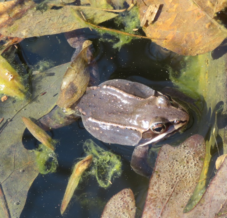
I celebrated "my" day by spending a lot of time outside. I headed out to Wincopin Park with Norma and Daphne to check out the vernal pool. The last time we were there, we found wood frog eggs. Today, the pond was full of more eggs and wood frogs. There were so many eggs, I reckon one could fill up a three gallon bucket with them! 1 / 9


Thousands.
2 / 9
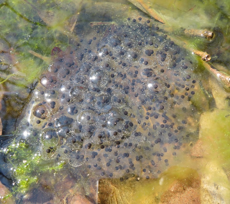
Hundreds.
3 / 9
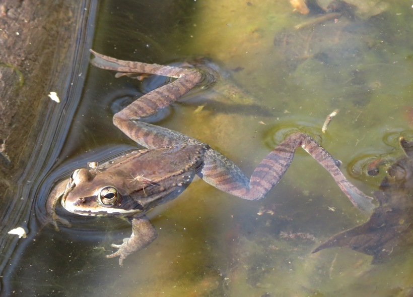
Wood frog.
4 / 9

Another wood frog.
5 / 9
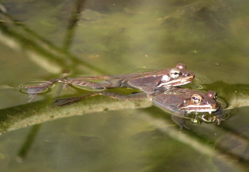
Caught in the act!
6 / 9

Eggs & algae.
7 / 9

Ready, set, mount!
8 / 9
Nostrils.
9 / 9
Daphne.
The different colors of these eggs indicate different stages of development. 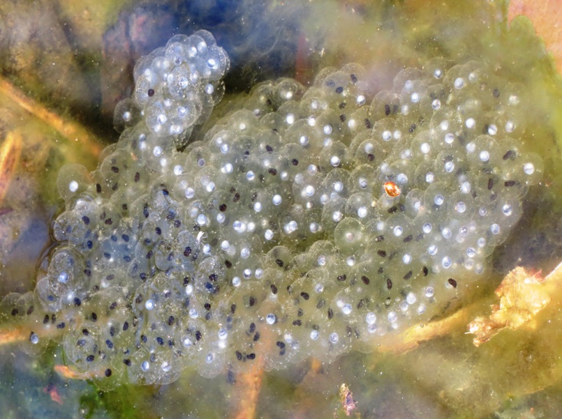
We found these in a second pool, slightly further out from the trail. 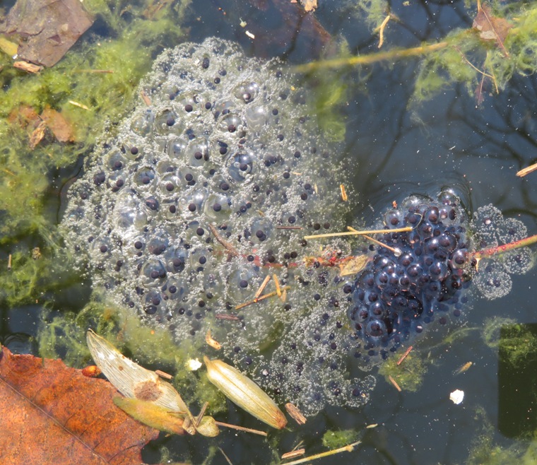
Later that day, I found more wood frog eggs just south of Savage Park at 39.137056, -76.829917. I did not see or hear any wood frogs. But I did hear spring peepers (Pseudacris crucifer). Turn up the volume and listen to this recording I made of them by clicking on the below image to play a video. 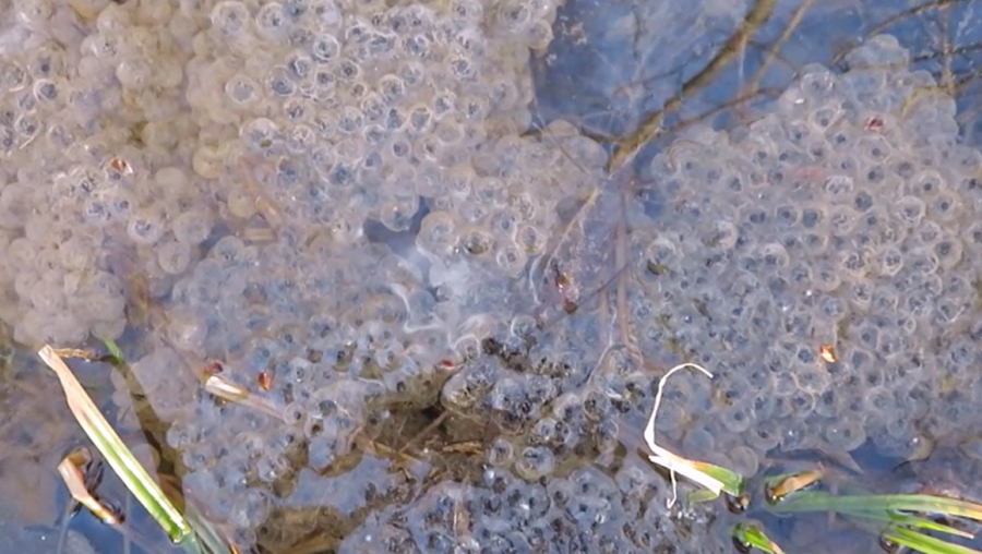
|
|
Norma, Daphne, Adam S. (a co-worker), April (Adam's friend), and I did 6.5-mile a hike in the Daniels Area of Patapsco Valley State Park on the Howard County side. We started at the Gary Memorial United Methodist Church and then headed east. Unlike some of the previous hikes Norma, Daphne, and I did in this area, the trails were not muddy. We turned around once we got to Old Frederick Road. I managed to get us off the desired route but we survived.
We found the Never-Ending Spring. One of us came across a garter snake...the first snake of the season for me! Snake is a symbol of wealth and money to the Japanese. They also say that if you meet or see a white snake, you will be lucky in life. - from Snake in Chinese Mythology 
Skunk cabbage is a perennial wildflower that grows in swampy, wet areas of forest lands. This unusual plant sprouts very early in the spring, and has an odd chemistry that creates its own heat, often melting the snow around itself as it first sprouts in the spring. - from Gardening Know How - Skunk Cabbage Facts: Growing Skunk Cabbages In Gardens 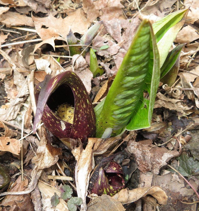
We found these old stone ruins just south of the Gary Memorial United Methodist Church cemetery. 
There were quite a few people out enjoying the nice weather. I think folks are tired of winter and are very willing to experience spring. I know I am. This was the last section of trail for Norma and I to complete a huge section of Patapsco Valley State Park exploration between Woodstock and Oella. Not to say that we've explored all the trails between these two towns...we've just walked on sections that complete a route between the two. I hope to explore the numerous trails between Woodstock and Marriottsville Road once kayaking season ends. |
|
Today we had our biggest turnout yet for a Savage Stroll. Perhaps the sunny spring weather made folks want to get outside and meet their neighbors.
We started at the Carroll Baldwin Hall and then headed west on Baltimore Street. Our group stopped at the old dam ruins and then walked on the River Trail along the Little Patuxent River to the Fisherman's Trail. Then we strolled through Savage Park and the residential section to the Savage Cemetery where some cemetery volunteers spoke about the history of the place. Daphne, Cassi, Rufus, and Thor got to enjoy some off-leash time. Here they are busy sniffing logs and completely ignoring the alcoholic beverages that someone left behind just south of Savage Park. 
Our group poses on the southeast side of a stone structure that once supported the dam that directed water along a millrace to the waterwheel at Savage Mill. 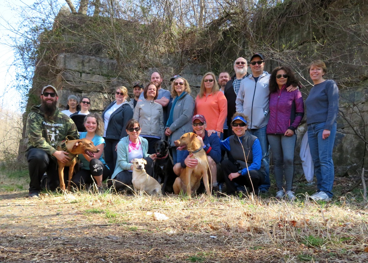
Savage Cemetery is a very popular place. People are just dying to get in. 
If you're wondering why I'm not standing with Daphne in the above photos, it is because I had my camera set on timer so I just ran to an open position after setting it to go off. |
|
Growing up in Sacramento, I remember a pond that would form during the rainy season (winter) near my grandfather's farm. I would go there frequently and encounter various critters such as clam shrimp and leeches. I would also find eggs that would hatch into polliwogs. After awhile, they would grow legs. Then their tails would shrink. Eventually, they became mature tree frogs.
Now, here I am in Maryland experiencing it all over again. I guess you can say I am going through my second childhood. Today I took Daphne for a walk on the Green Trail in Wincopin Park after work. Back on Pi Day, I saw a lot of wood frogs and wood frog eggs in the vernal pool near the Middle Patuxent River. But now, the wood frog eggs have hatched and the pool is full of polliwogs. There are still eggs but not laid by wood frogs...these new eggs are from spotted salamanders. This species has relatively long incubation time in comparison to other salamanders. It takes 4-7 weeks for the eggs to hatch, depending [on] both the temperature of the water they are in, and whether the eggs are laid in shady or sunny areas. - from "BioKids - Spotted Salamanders" (broken link as of 2026) 
One can see below that these polliwogs have clearly defined eyes but haven't yet sprouted legs. Maybe I'll see legs on my next visit. 
Getting photos of the eggs and polliwogs is not easy. There is quite a bit of glare and reflection from the water while the sunlight doesn't very well illuminate things underneath. In this photo, I took a very powerful flashlight and submerged it just below the surface to provide sufficient light. Next time, I'll try to remember to bring an umbrella to block bright reflections. |
|
I took Daphne for a walk along the Middle Patuxent River at Wincopin Park.
I saw a very pretty flower hanging from a lone plant about three feet tall. I later learned it is a paw paw flower. I've never seen one growing in the wild so close to home before. 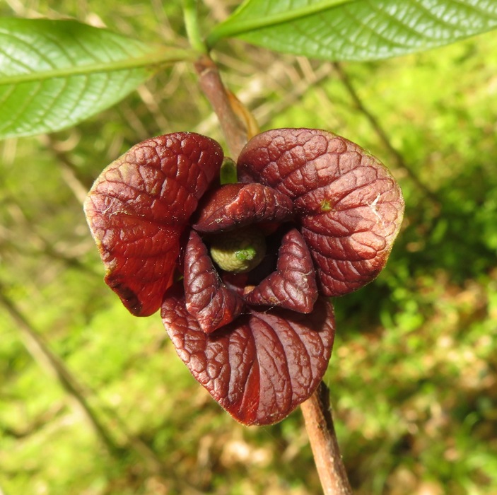
We spent a lot of time on the Red Trail. I think this is the best part of the park if you want to meditate and feel at peace. There are some very serene water views. 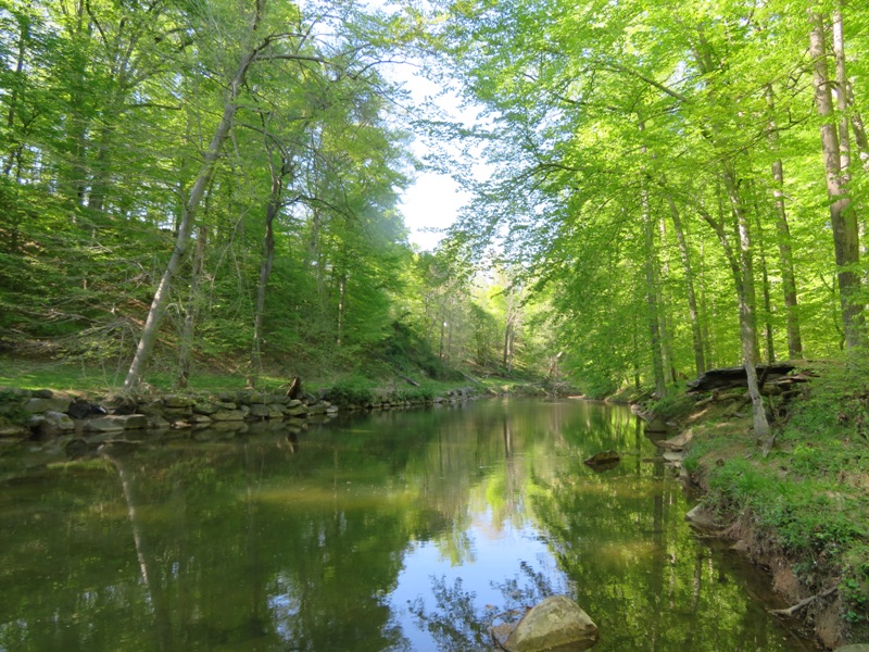
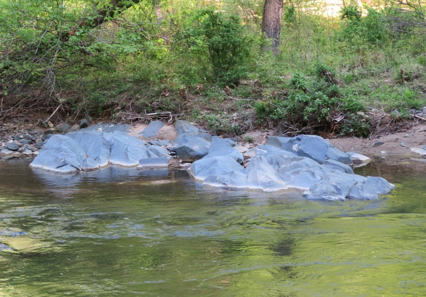
I saw a sign on this trail that reads: From where you're standing, look across the river and see the famous Wyncopin Blue Rocks. It is a mystery why only these rocks acquired their blue tint. We speculate that the heavy rains, high water, and foreign matter in the resulting flood water from Hurricane Sandy, in October 2012, was the culprit. Question is, however, why didn't other nearby granite rocks also turn blue? I found it interesting that Wincopin was spelled with a 'y'. It was also obvious that this was not a Howard County (or other government entity) sign. The best answer I received was from Ned T., who I consider a top notch naturalist and environmental expert: They are not granite. Probably amphibolite. The ocean floor from the proto-Atlantic Ocean was pushed up onto the North American continental plate. All of the basalts/gabbros from the mid-Atlantic ridge spreading enter were squeezed and metamorphosed into meta-basalts and meta-gabbros, i.e., amphibolite. The Middle Patuxent River...this is where Norma, Daphne, and I were kayaking just ten days ago. Beautiful place! |
|
On Armed Forces Day, Norma, Daphne, Carmen, and I (Team SNaCk plus D) drove out to the Logan Lane Tract of the Ted Harvey Conservation Area in Delaware to see the horseshoe crabs come ashore. They do this in May and June. The best time to see them is at the high tide on the new or full moon. I invited a few other people to join us but they had other commitments.
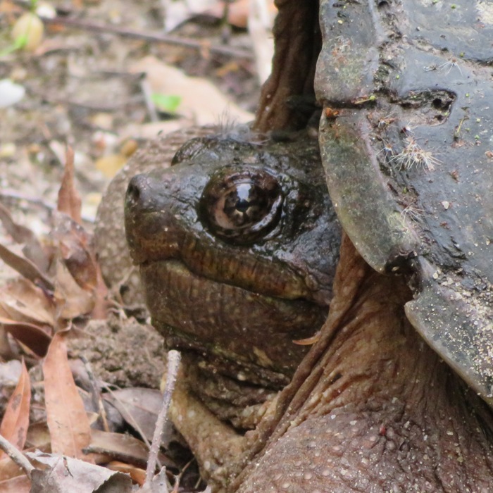
If you plan to see the horseshoe crabs at this same location, you will need to purchase a Conservation Area Pass. As of the time of this writing, it costs $10 for Delaware residents and $20 for everyone else. It took just over two hours to get there from Savage, assuming no stops are made. Driving to our final destination in the Ted Harvey Conservation Area, Carmen spotted a couple of snapping turtles laying eggs. Snapping turtles rarely leave their aquatic habitat except during the breeding season, at which time females travel great distances in search of a place to dig a nest and lay eggs. Some turtles have been found as far as a mile from the nearest water source. One clutch of eggs is laid in May or June. With powerful hind legs, the female digs a shallow bowl-shaped nest in a well-drained, sunny location. Over a period of several hours, she lays approximately 20 to 40 creamy white, ping-pong ball-sized eggs. After covering the eggs, the female returns to the water, leaving the eggs and hatchlings to fend for themselves. Turtle nests are often preyed upon by raccoons, skunks, and crows. As much as 90% of the nests are annually destroyed by predators. Snapping turtles have temperature-dependent sex determination. Eggs maintained at 68 degrees fahrenheit produce only females; eggs maintained at 70-72 degrees fahrenheit produce both male and female turtles; and those incubated at 73-75 degrees fahrenheit produce only males. Hatching takes approximately 80 to 90 days, but the hatch date can vary depending on temperature and other environmental conditions. Generally, hatchlings emerge from their leathery egg in August through October by using a small egg tooth to break open the shell. - from "State of Connecticut - Department of Energy and Environmental Protection - Common Snapping Turtle" (broken link as of 2026) We parked at 39.085571, -75.405029. There is a launch site here that connects to a maze of waterways full of wildlife although I don't believe it is navigable to the Delaware Bay. This area is primarily for duck hunters. Here, I spotted a snake swimming. To say that Carmen is not fond of snakes is an understatement. 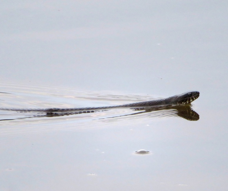
The four of us walked to the Little Creek Wildlife Area Logan Tract, where the Saint Jones River empties into the Delaware Bay. The Bay is huge in this area. I told Norma and Carmen to keep and eye out for dolphins but we were clearly focused on what was on the ground. The mouth of the Saint Jones River is much calmer than the Delaware Bay, so one can actually see the horseshoe crabs walking around. 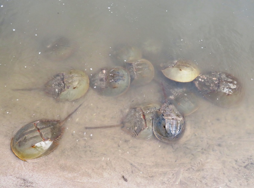
This wasn't Daphne's first time seeing horseshoe crabs but she still finds them peculiar. 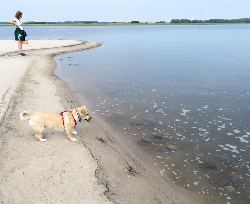
Usually, when people see horseshoe crabs, they are dead. Some people see then alive, walking on the beach. But few actually get to see them moving around in calm water. Seeing this was fascinating. Do you remember those TV shows that depicted homemade robots doing battle against each other? That's what this reminded me of. Hoseshoe crabs are very slow on land but they move much better in the water. But they don't see like we do so very often, they bump into things. Someone said they reminded him of a Roomba robot vacuum. Click on the image below to start a video. 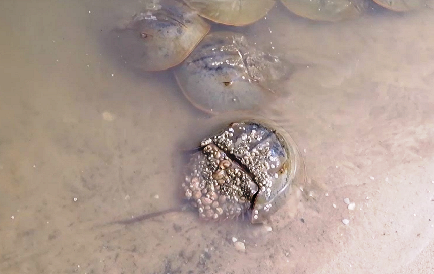
They come ashore en masse at high tide but I find the best time to see them is slightly after. As the high tide starts to pull away, they are much easier to see. So be in place at high tide and plan to stick around for an hour after. 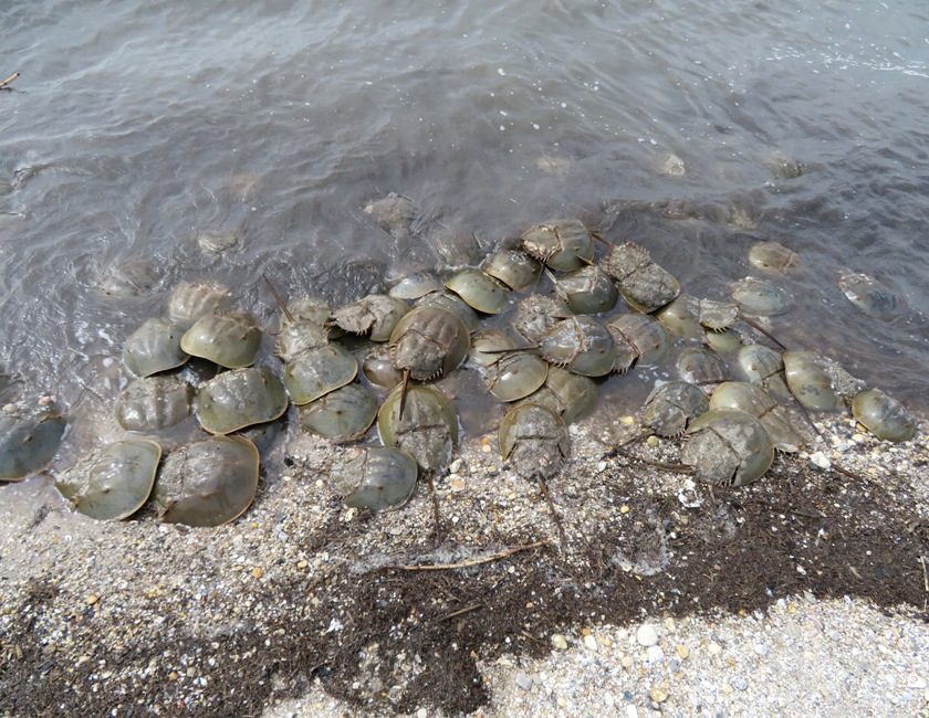
Does the tide make much difference? Well, it isn't like Maine where the difference between low and high tide can be 20 feet. Instead, Delaware Bay tidal fluctuation is often around five feet whereas Chesapeake Bay tidal fluctuation in my area is closer to one or one and a half feet. Good to know if you're planning a kayak trip. Norma took a picture of Daphne and me at the mouth of the Saint Jones River. She's still not sure about these critters. 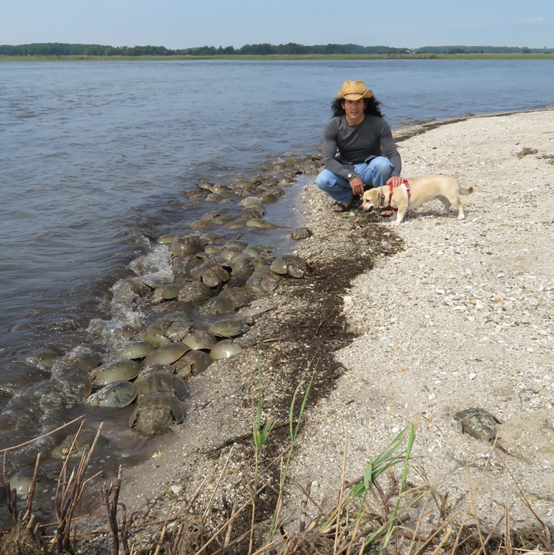
I've come to Delaware several times to see horseshoe crabs spawn. One year, I found two that had tracking tags. If you find such tags, you can call in and report on the condition of the horseshoe crab and where you found it. You will then be sent a certificate and a horseshoe crab pewter pin. But such tagged horseshoe crabs are rare. I've seen thousands of horseshoe crabs but have only found two that are tagged. Today, I did not find any. I wonder if they are still being tagged. 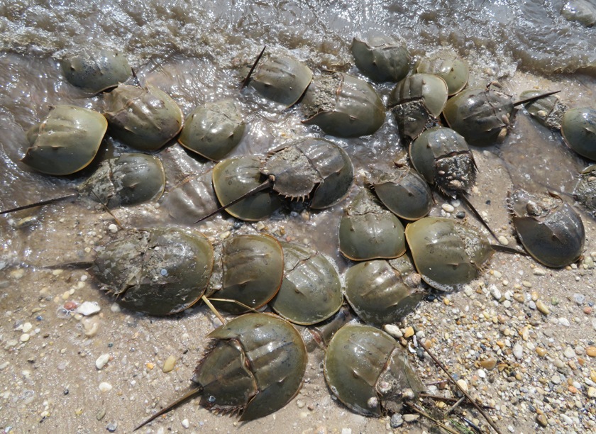
This mating pair were flipped over. At the top is the female. Below her is the male, gripping on tightly. Males are generally smaller than females and their first pair of appendages are quite different from the females. Instead of normal pincers, males have a special set of mating claws. These are commonly referred to as "boxing gloves." These claspers allow the male to hold onto the female during mating. - from "Sacred Heart University - Horseshoe Crab History" (broken link as of 2026) 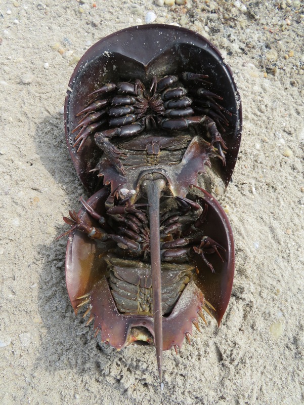
The smells at the beach are much different than at home in Savage, Maryland. Here, Daphne is sniffing around the horseshoe crabs. I often wonder what she is thinking when she is on a scent. 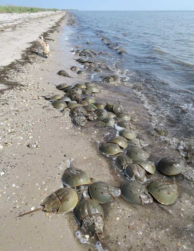
I took this shot of Norma, Daphne, and Carmen with the town of Bowers to our south. 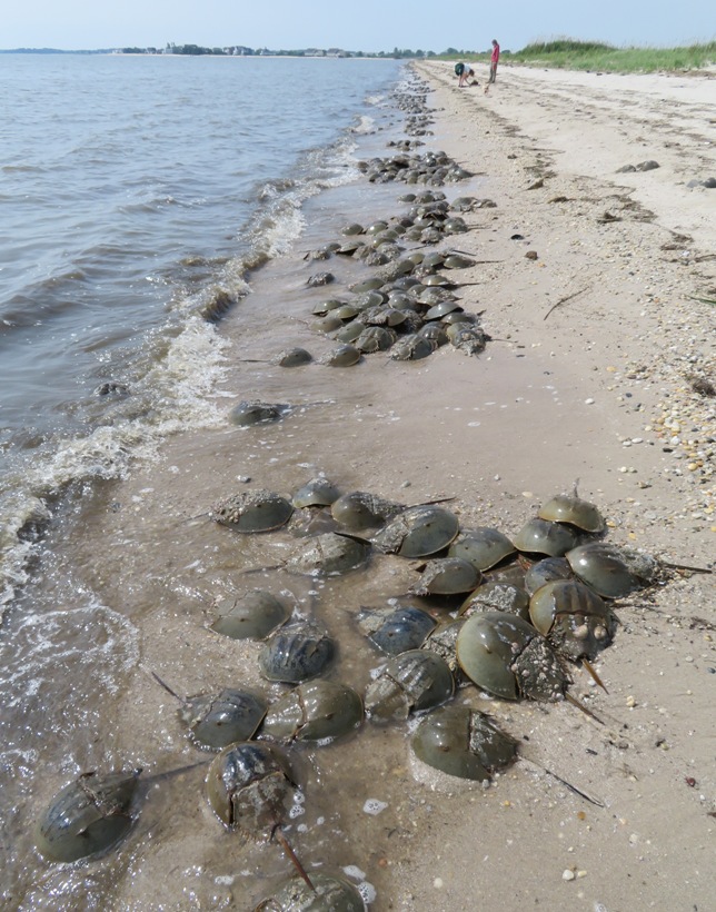
How did today's viewing compare to previous visits in terms of the number of horseshoe crabs? I would say it is similar to my best trips and certainly much better than my worst. They say that more come ashore at the evening high tide but of course it is hard to get photos of that. I think I'll stick with my daytime visits for now. 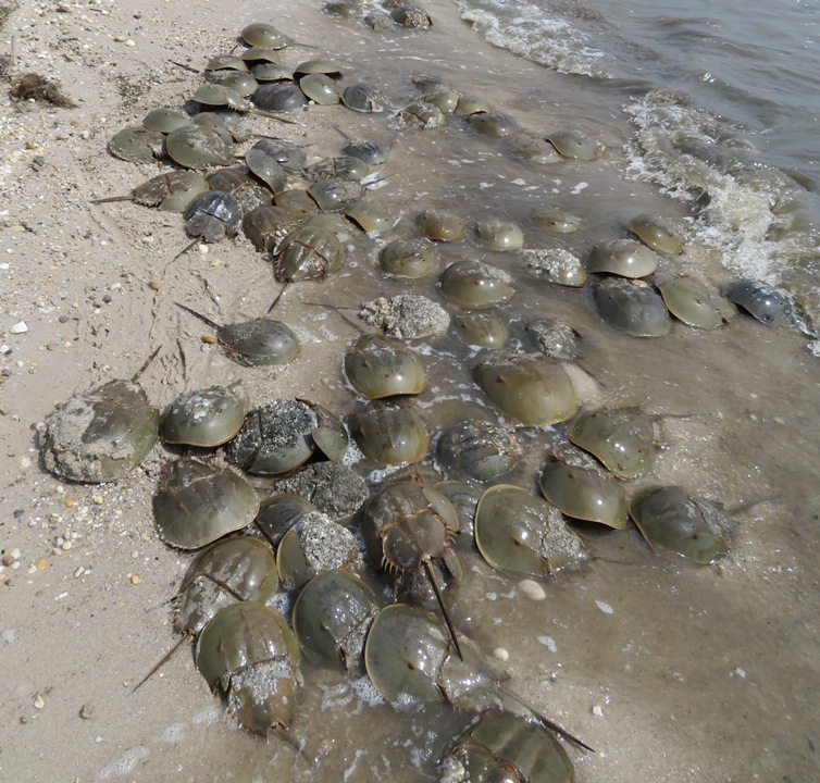
The sun faded in and out during much of the morning. Like most things, horseshoe crabs photograph best in bright light. Here's a more overcast view of Norma, Carmen, and the horseshoe crabs with Daphne running behind. 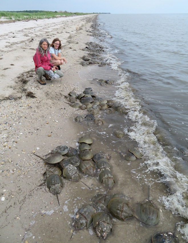
The really big horseshoe crab in the middle is female. Most of the smaller ones around her are male. There might be another female buried underneath. The female horseshoe crab is typically 25% to 30% bigger than the male horseshoe crab. - from "Investigation: Limulus polyphemus" (broken link as of 2026) 
This mating pair is carrying quite a bit of extra baggage. Very often, barnacles and other critters will find a home on the horseshoe crabs. This usually isn't a problem unless they cover their eyes. How many eyes does a horseshoe crab have? Ten...which is also how many legs it has. For more information, see Nature - Horseshoe Crab Anatomy 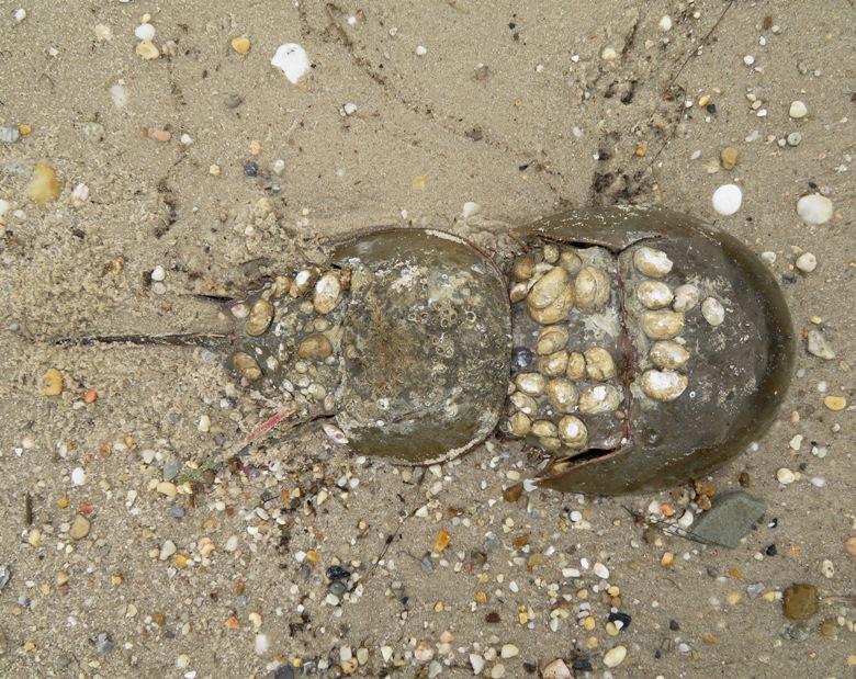
This is one of the larger horseshoe crabs I found. Yes, it is female. It is probably about 18 inches wide. They can get about two feet long. 
Carmen had a lot of questions about horseshoe crabs, particularly about their spawning. Even though I've read so much about them, I only remember very vague details. So this paragraph is especially for Carmen: The horseshoe crab reaches sexual maturity at 8-9 years for males and 10-11 years for females. The mating season is determined by light sensors on the body of the horseshoe crab which detect a change in hours of light per day. The peak of the mating season is synchronized with the moon cycles of late May and early June. The horseshoe crabs move from deeper waters to the edge of the beaches at this time to find mates. The males arrive several weeks earlier and scan the beaches for females. When the females arrive, they release a chemical which attracts the males and stimulates a sexual response. When the male finds its mate it uses its front set of claw like legs to attach itself to the female, who then drags them both onto shore. The female digs a nest in the sand. This is to prevent waves or predators from disrupting the hatching process. She will place around 5 to 7 clusters of several thousand eggs. With one mate she may lay around 20,000 eggs. This process is repeated multiple times in a spawning season. She may lay as many as 90,000 eggs in a year. An average egg takes 14 days from conception to birth. - from "Investigation: Limulus polyphemus" (broken link as of 2026) 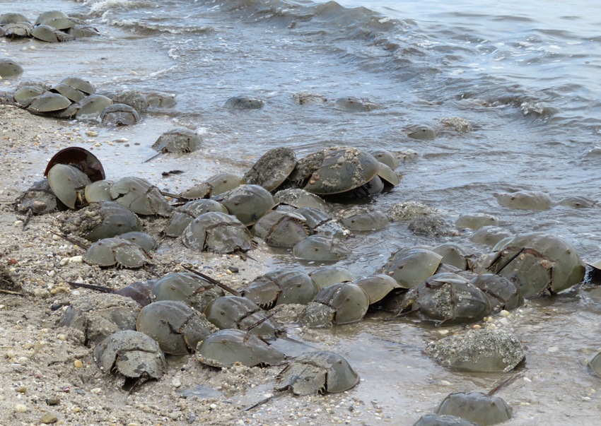
Horseshoe crab spawning attracts a multitude of birds. Why? The Delaware Bay is the site of the largest horseshoe crab orgy in the world. Mating season brings millions of crabs onto the beaches, and tens of thousands of migratory shorebirds, who gorge themselves on crab eggs on their way to the Arctic. - from National Public Radio - Birds' Survival Relies On World's Largest Crab Orgy In the snapshot below, the larger bird on the left is a ruddy turnstone. 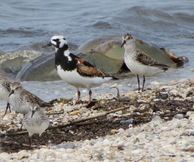
Thousands of birds dot the beach, waiting for the horseshoe crabs to lay their eggs so they can eat them. 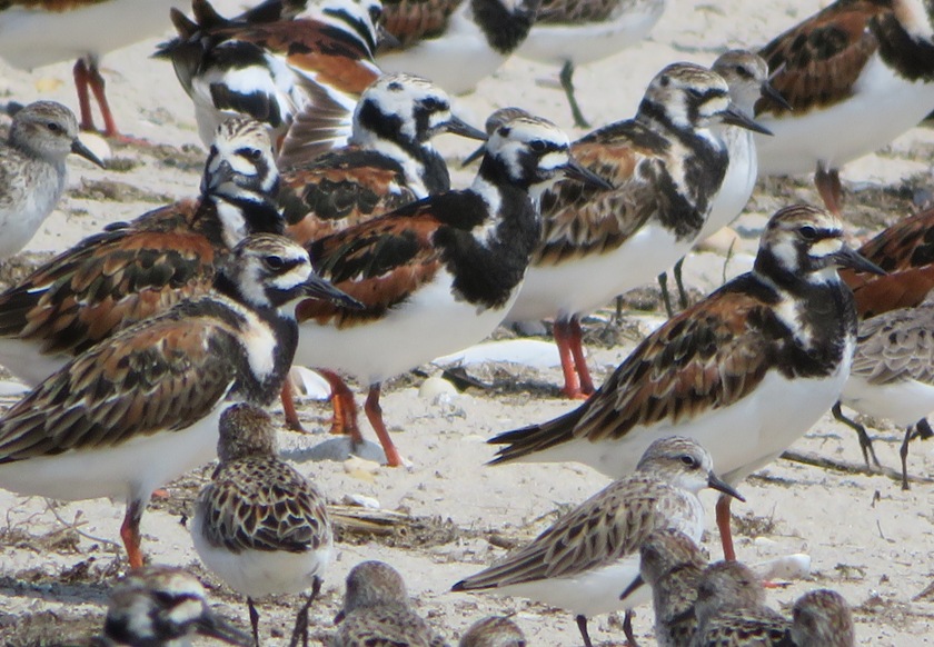
Red knots are easily distinguished by their red chest. But the juveniles and non-breeding adults don't have this feature. So I can't tell the difference between a sanderling and a young red knot. Later, I was told by Mike B. that the big one with the black spot is a dunlin. The black spot is its breeding plumage. 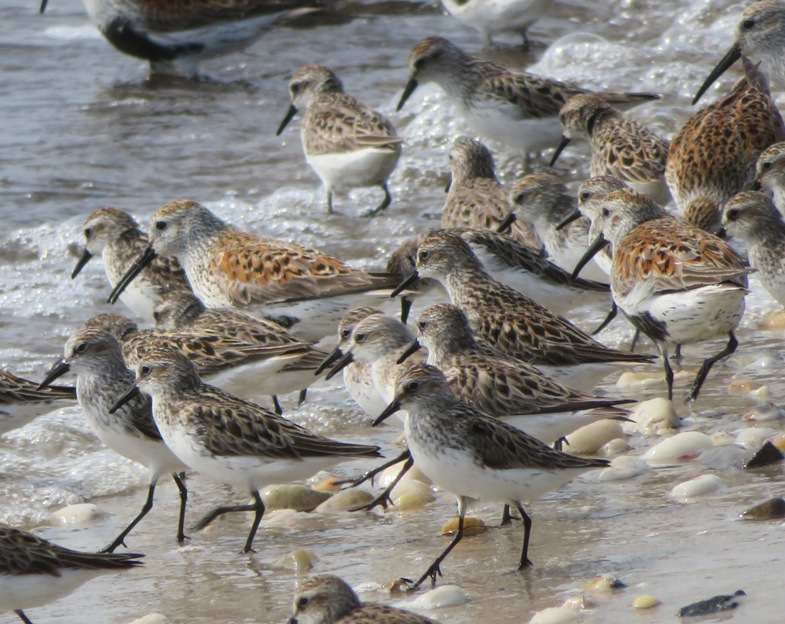
It is still early in the horseshoe crab spawning season. Right now, I think there are more hungry birds than there are egg masses. So these guys just need to wait while the horseshoe crabs prepare their lunch. 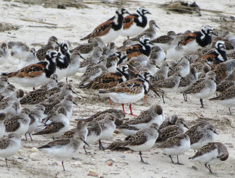
Real estate on the beaches of Delaware gets sparse when the horseshoe crabs come ashore to spawn. For non-humans, it is the biggest party in town. 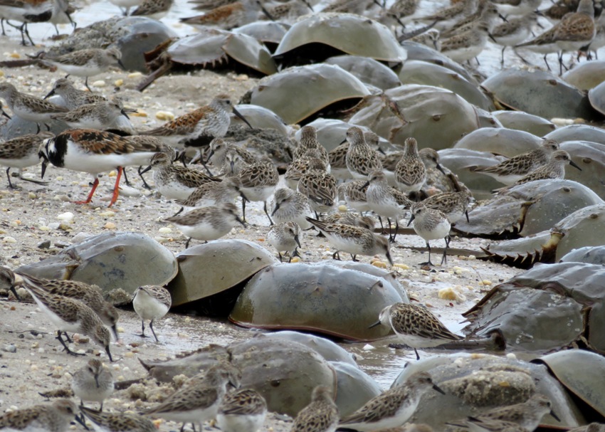
I'm guessing there are some red knots here amongst all the horseshoe crabs and other birds in the photo at the top of this page. So let me tell you about them. The red knot - a small sandpiper weighing no more than a coffee mug - flies an extraordinary 19,000 miles, practically from one side of the earth to the other and back, every year..from their winter home in Tierra del Fuego, along the Strait of Magellan, up into their nesting grounds in the icy Arctic. On their migration, the birds stay aloft for days, sometimes a week at a time, flying 5,000 or 6,000 miles without stopping. ...in 10 days, red knots double their weight eating horseshoe crab eggs. When the knots couldn't get enough horseshoe crab eggs, they couldn't make their flights to the Arctic and their numbers in Delaware Bay dropped precipitously - by 70 percent, leading the U.S. Fish and Wildlife Service to list them as threatened under the Endangered Species Act... - from "The Millbrook Independent - The Intertwined Life of the Sandpiper and the Horseshoe Crab" (a broken link as of 2020) 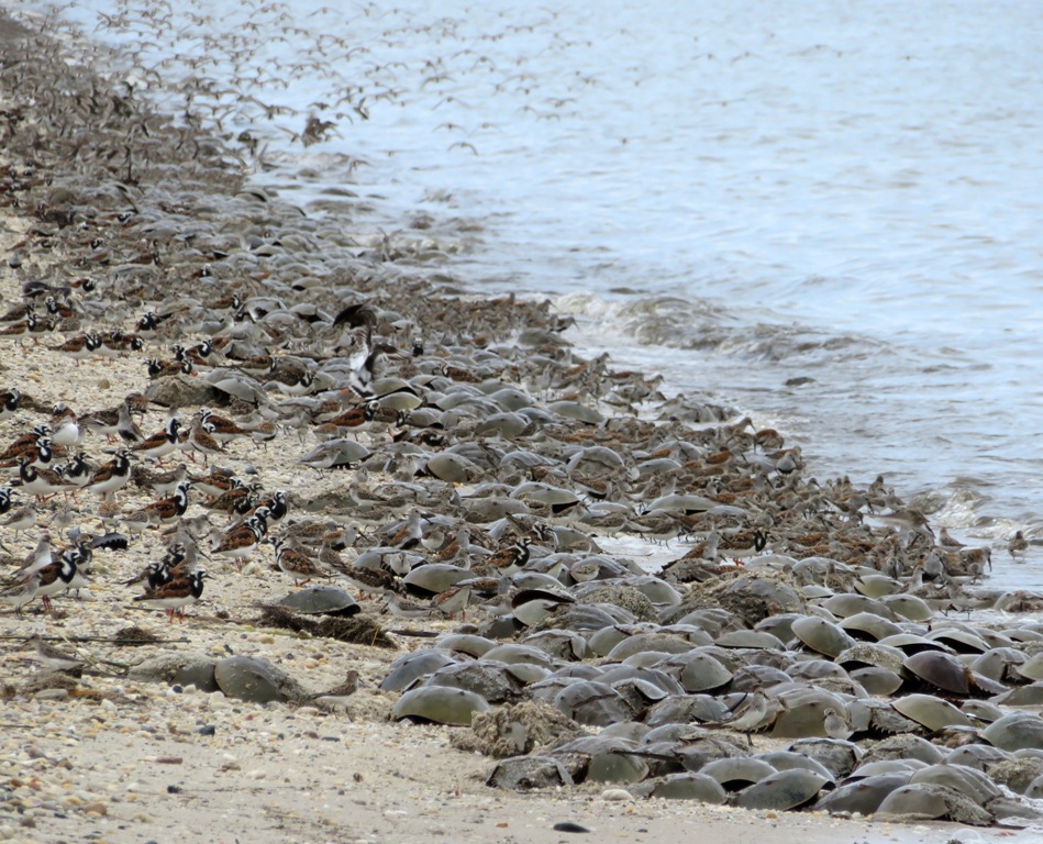
Looking north is the town of Kitts Hummock. One might think that the birds and the horseshoe crabs attract a lot of tourists but I have found that NOT to be the case. We were there for a few hours and only saw one other person at the beach. 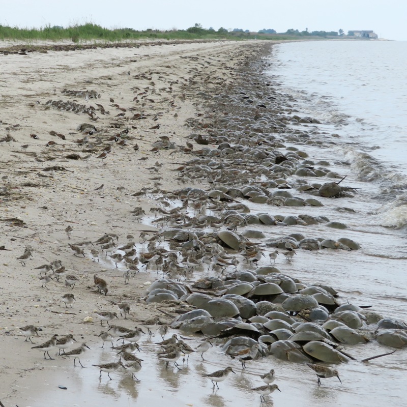
Many horseshoe crabs get flipped over and die. Carmen spent a lot of time saving the ones that were flipped over and still alive. Norma and I helped too but not with the passion that Carmen did. Getting flipped over by waves is something that has been taking place for a VERY long time. I doubt the population is in danger due to that. The horseshoe crab has been on Earth for 350 million years. - from Nature - Horseshoe Crab Anatomy 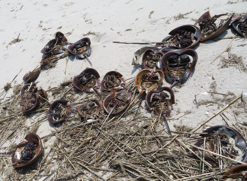
How long do horseshoe crabs live? According to The National Wildlife Federation - Horseshoe Crab, A horseshoe crab can live for more than 20 years. So assuming they haven't changed, there have been at least 17.5 million generations of horseshoe crabs. Last year, I saw the horseshoe crabs spawn in June. Back then, there were eggs all over the place. But they are much harder to find in May because the birds are eating them. Not so many birds in June. Below are some that Norma found. A single crab may lay 100,000 eggs or more during a season. - from "Bay Journal - Migratory birds shore up appetites on horseshoe crab eggs" (a broken link as of 2020) 
Red-winged blackbirds will eat horseshoe crab eggs though it is not an essential part of their diet. 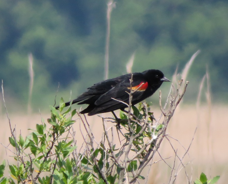
I spotted a few razor clam shells. This animal is considered a delicacy. For more information on them, see Edible Cape Cod - A Sharp Dressed Clam. 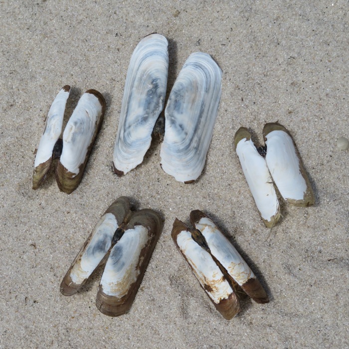
I found a lot of shells. At the top are knobbed whelk, the New Jersey state shell. In the second row from the bottom are common Atlantic slippers. At the bottom left is an apple snail shell. 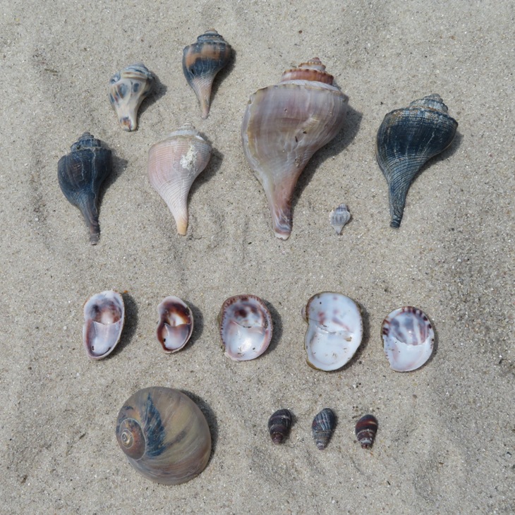
I also came across several egg cases from knobbed whelk. Females lay a string of eggs in deep water twice a year, usually from September to October and April to May. Strings of eggs are anchored on one end to the sand and consist of up to 40 capsules, with each capsule containing up to 100 fertilized eggs. These eggs develop slowly and hatch in three to 13 months. Adults are thought to start out as males and change into females as they age, which could explain why females are almost always larger than males. - from "Chesapeake Bay Program - Knobbed Whelk" (broken link as of 2026) 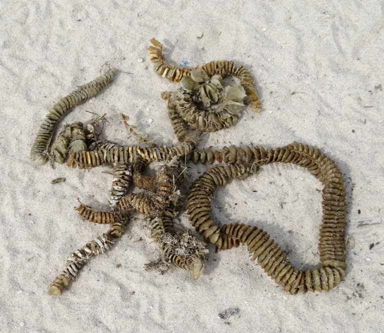
This guy hopped by me on the beach. I'm guessing it is an American toad. 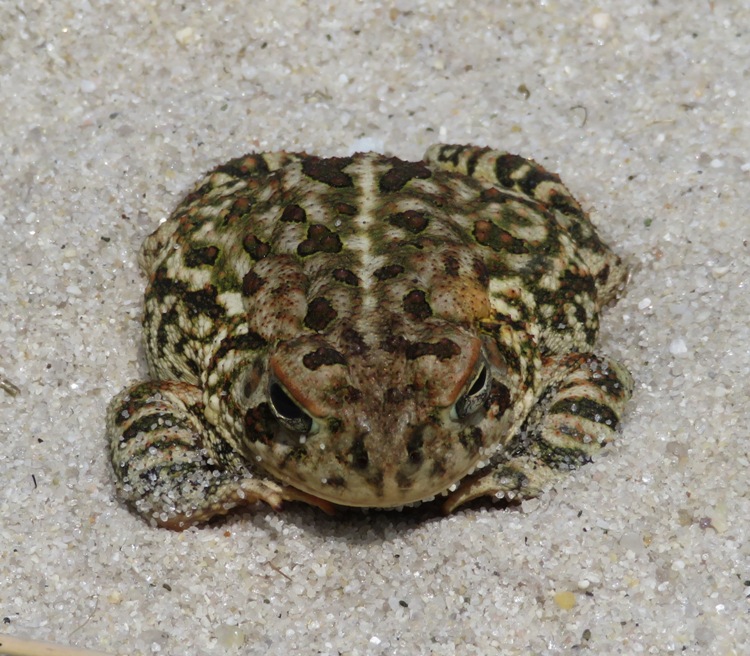
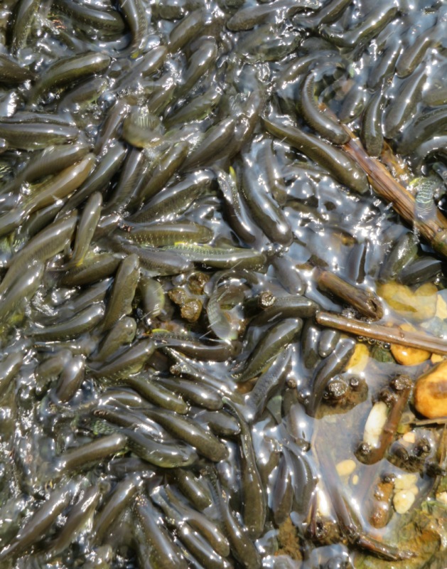
Near where we parked, there are various waterways. At one spot, the water travels through a pipe under the road. On the north side of it (the water was flowing south), we saw thousands of fish. Each was about six inches long. There were so many crowded together, they were starting to pile up in the shallow sections. Originally, I had planned for us to go kayaking on the Murderkill River after seeing the horseshoe crabs. But Carmen needed to catch a flight and we were running short on time. So instead we did plan B. I was fine with this. I'm really glad she found them so interesting. Later, Carmen shared some really interesting horseshoe crab links: |
|
This was plan B. Instead of kayaking on the Murderkill River, Norma, Daphne, Carmen, and I did a hike at Killens Pond State Park. Norma and I were last there in 2006.
The four of us walked 2.6 miles on the Pondside Nature Trail loop around the pond. The park is very well-maintained and the trail is pristine and wooded. No need for sunscreen with all that shade. It is a great place to spend a hot summer day (even though it isn't yet summer). 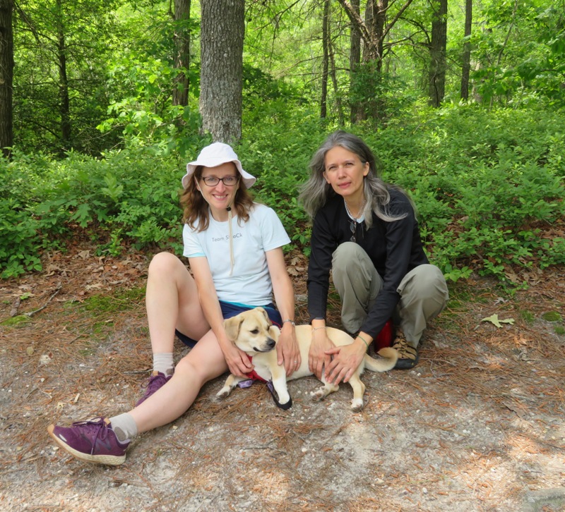
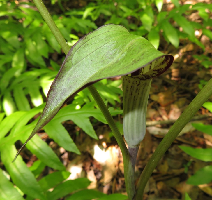
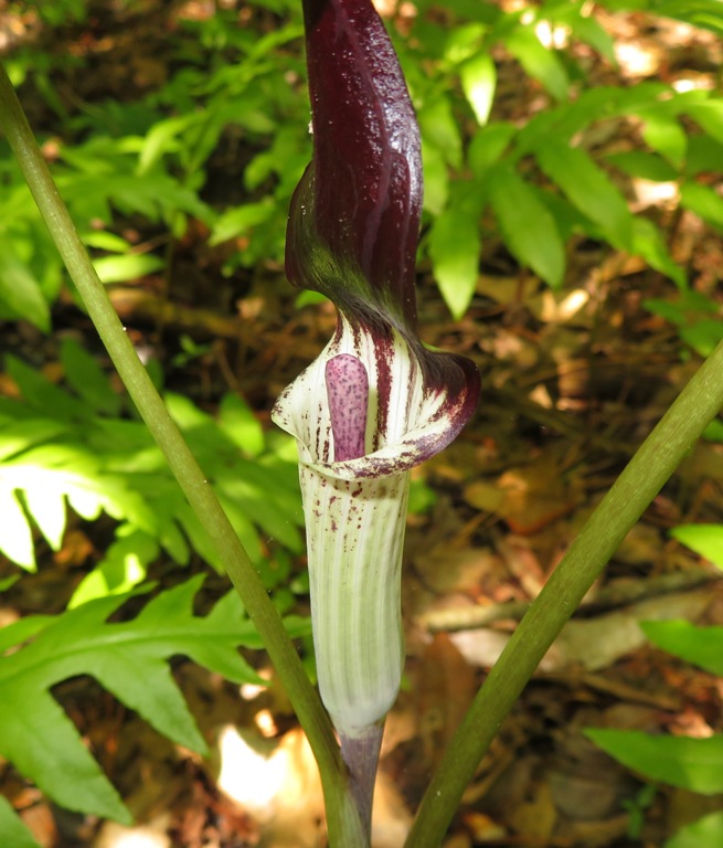
I found several Jack-in-the-pulpit (Arisaema triphyllum) plants. It is also called Indian turnip. We saw several mayapples. I was hoping to see their flowers but instead, I only saw their fruit. ...the leaves, roots, and seeds are poisonous if ingested in large quantities...[but] the edible, ripe, golden-yellow fruits can be used in jellies. - from Ladybird Johnson Wildflower Center - Plant Database - Podophyllum peltatum 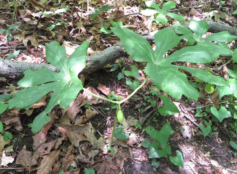
I think this is a flower from a strawberry bush plant. 
We spotted a broadhead skink and a few five-lined skinks such as the one shown below. Five-lined skinks have blue tails but this one lost it, perhaps for defense. Once broken off, the tail twitches for a period of time, distracting the potential predator further. This increases the probability that a juvenile will survive to maturity. - from "Virginia Herpetological Society - Common Five-Lined Skink" (broken link as of 2026) 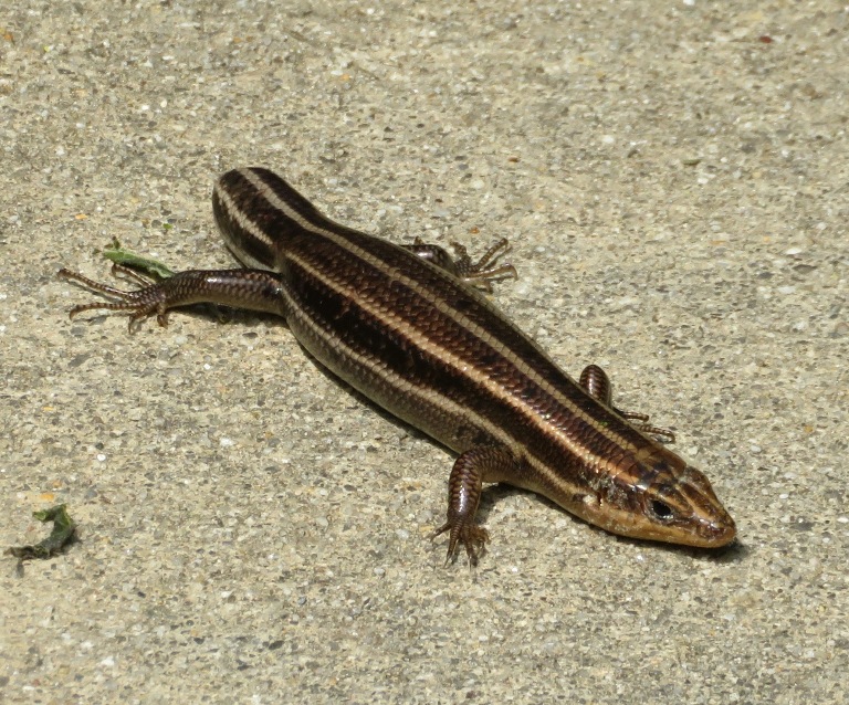
Afterwards, we had lunch at Bullock's Deli in Denton, Maryland. They had a best milk shake I'd ever tasted. It was blended with fresh strawberries. Norma and I managed to get Carmen to the airport right on time. Another fine Team SNaCk day. |
|
Norma, Daphne, and I explored the trails at the Howard County Conservancy at Mount Pleasant. This was my first visit.
This scenic place has about four miles of trails. I'm guessing we walked at least three of them and only ran into two other people. 
In the Davis Branch, I spotted this five-inch long polliwog. The Davis Branch flows into the Patapsco River near Woodstock. 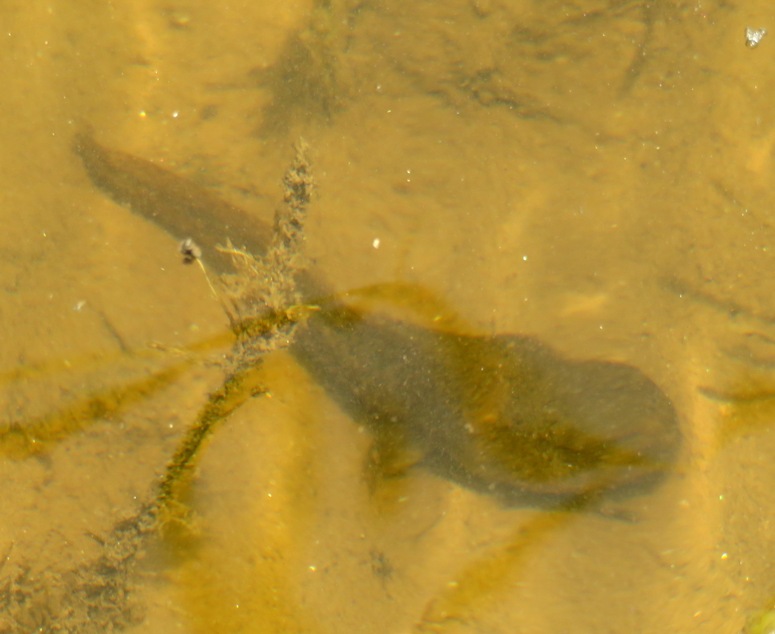
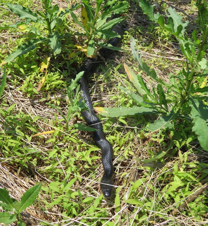
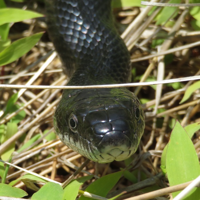
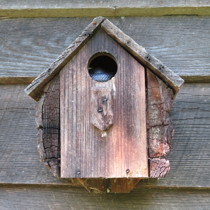
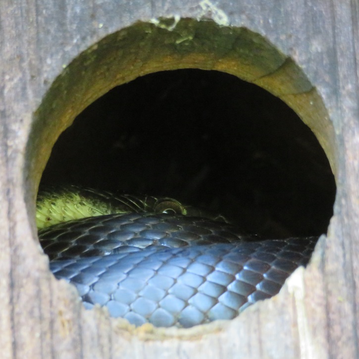
On the side of the trail, I encountered this four-foot long black snake. At the Hodge Podge Lodge, we saw this bird house. Inside the butterfly garden, I found a bee block. Look where it was made...Savage, Maryland! Our town. 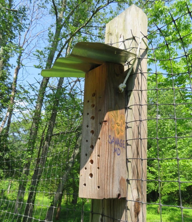
Here's some other interesting stuff we came across. The temperature was in the high 80s and it was a little humid. It was the first day this year that it really felt like summer. The Howard County Conservancy is a great place. But the trails are mowed grass so there are a lot of ticks. With Daphne's short legs, she attracted several. At least her fur is almost white so they are easy to spot. |
|
After work, Sara and I took Daphne and Cassi kayaking on the Patuxent River. We launched from Patuxent Wetlands Park and paddled upstream to Back Channel. Then we hiked in Glendening Nature Preserve, accessing the Plummer Road Entrance.
I hadn't been to the Preserve for quite a few years and since then, lots of improvements were made. I think it was expanded. Previously, I didn't think it was all that great. But now I think it is very nice for not being so far away from home. The trails are wooded and shady so it would make a great summer hike. The Preserve is part of Jug Bay Wetlands Sanctuary. Here's Sara and the dogs in a teepee-like structure alongside the Cliff Trail. 
Daphne, Cassi and I stopped at the Chris Swarth Boardwalk. This connects the South Fork of Old Galloway Creek to the Glendening Nature Preserve. 
We found several egg shells. I am pretty sure they are from a reptile because unlike a bird egg shell, these did not crack. Instead, they folded over. 
It is great that the days are so long now. We didn't leave until 2000. I thought the place was open until dusk but I later read that it closed earlier. I guess that's why we didn't see anyone else on the trail. Much to my surprise, Daphne did not get any ticks. She usually gets a few when she runs off-leash for so long. |
|
On May 24-27, 2019, Norma, Daphne, and I went hiking in the New Jersey Pine Barrens.
|
|
I can't tell you how many times I've been to Patuxent River Park in Prince George's County. But I'd never been to Patuxent River State Park...until today.
It was a hot and humid day. Norma, Sara, Mike B., Daphne, Cassi, Marz, and I did a short exploratory hike at the park starting near the Visitor Center. This place is only a 28 minute drive from Savage. Residing in Montgomery and Howard Counties, it was established in 1963. We walked about 3.5 miles. We hit each of the trails, spending most of our time on the yellow-blazed Flowing Free Trail but we made sure to hit all the trails. Here, we're hiking through a pine forest. 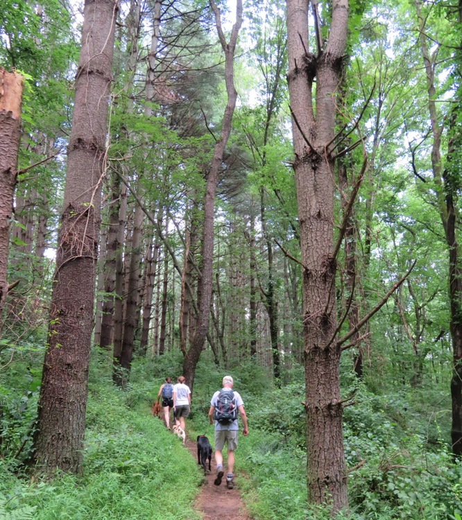
Have you ever seen this plant? I bet you have, but maybe not in this form. This is the unripened fruit from a Jack-in-the-pulpit. It will eventually turn red. 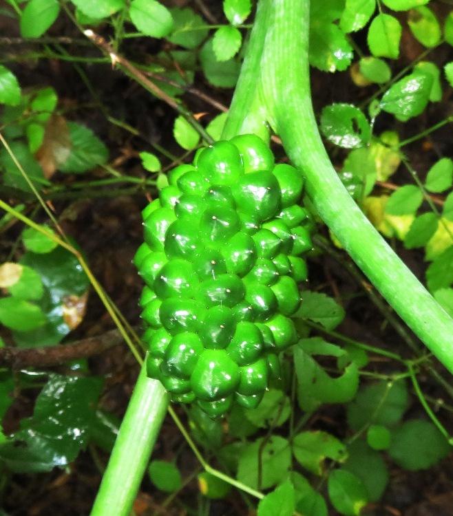
We took a break where the Patuxent River meets Howard Chapel Road and then cooled off in the water. 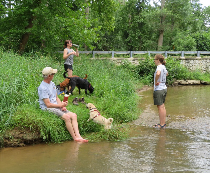
Sara gave the dogs a little more exercise. In this picture, she winds up to pitch while Marz and Cassi wait. 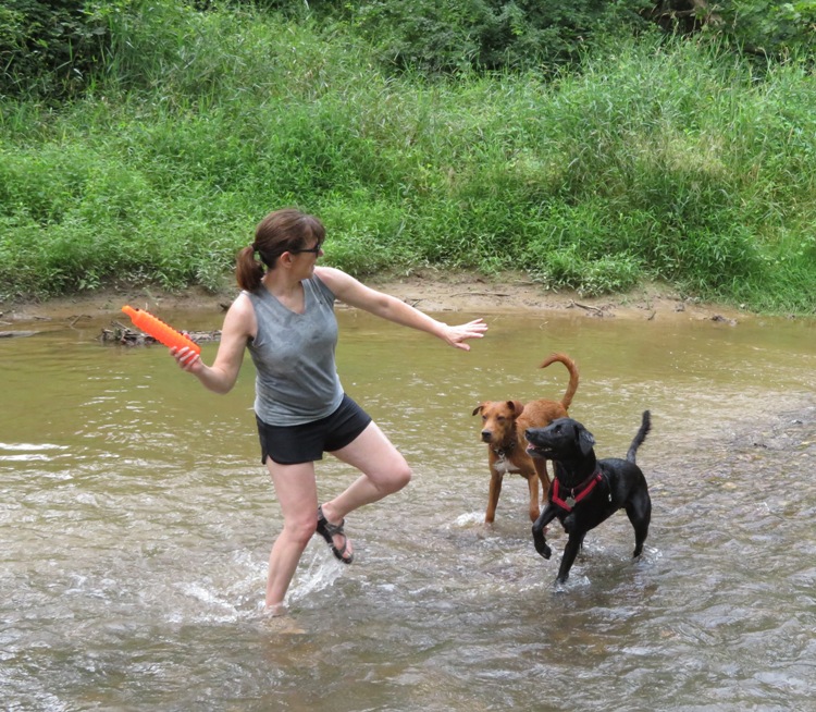
The key to throwing one of these floating dog retriever toys on a river is to always pitch it upstream so if the dogs can't get to it in time, it will float back to you. Daphne isn't much of a swimmer but today she actually got in the water! I was so proud of her. 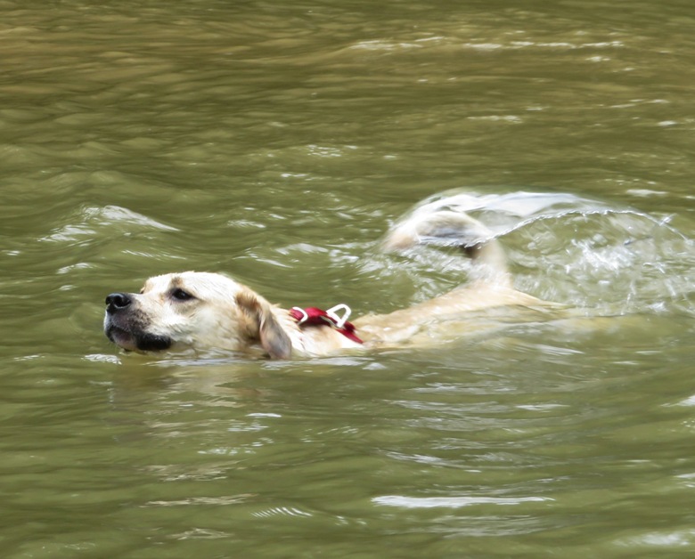
On the way back, we passed one serious grape vine. 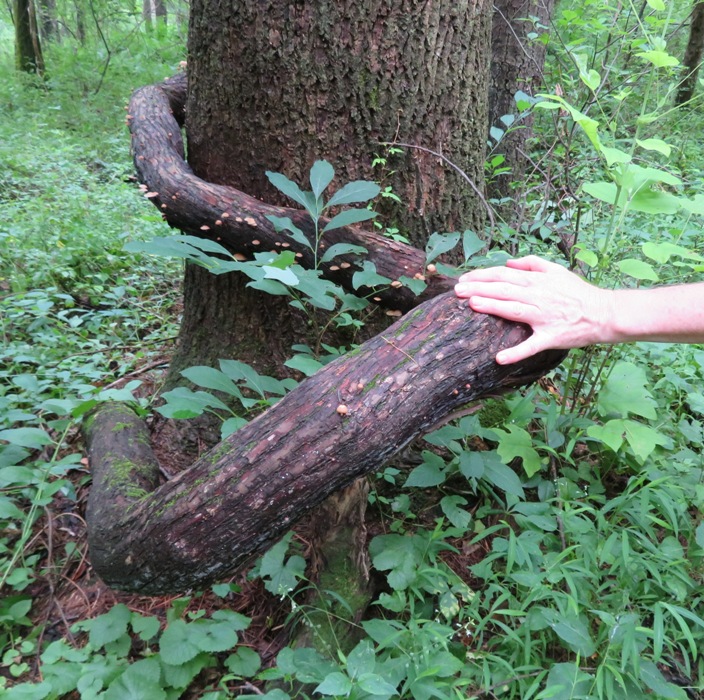
I like how this wavyleaf basketgrass looks like someone took a crimping iron to it. 
We found this Patuxent Challenge sign #4 on the Blue Trail. Sign #16 resides in our town, Savage. Participate in a variety of outdoor activities throughout the Patuxent River watershed. Document your participation by taking a selfie with each activity's Patuxent Challenge sign. Prizes of different levels are awarded to participants who complete 5, 10, or 15 activities within the calendar year. - from Patuxent Challenge 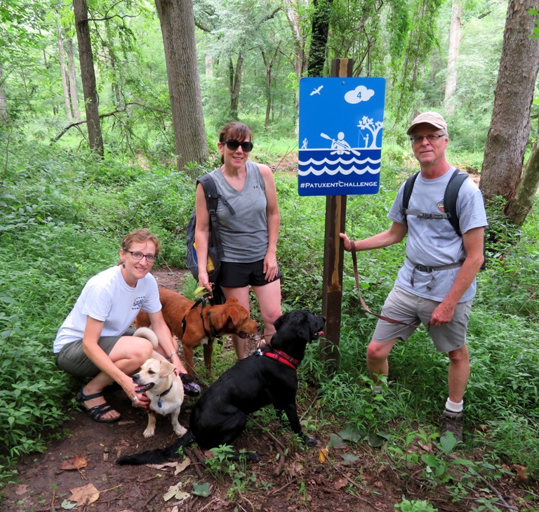
We saw several bee balm flowers growing wild. 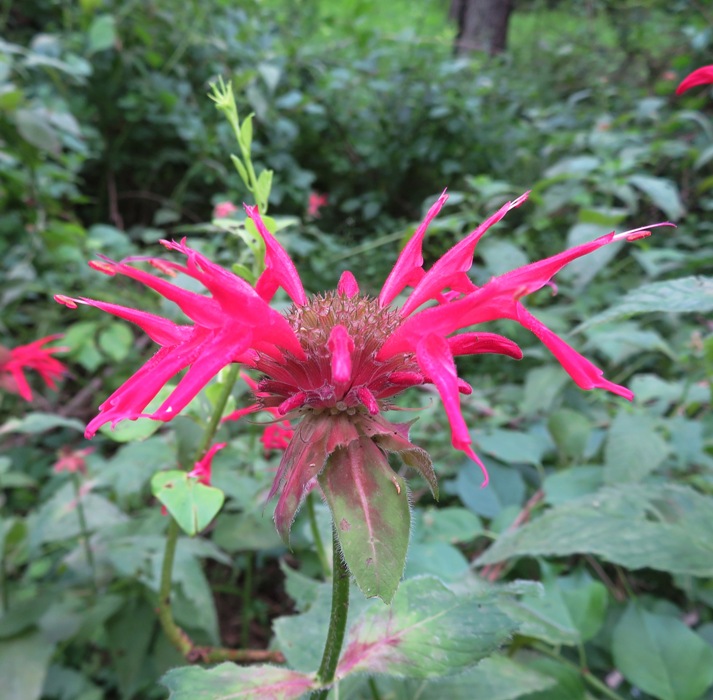
I spotted this red spotted purple butterfly, near the nature center, which was not open. 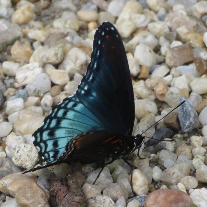
It looked like a lot of work had recently been done at the park. Norma commented how the restroom looked new. For a place with such few trails, the parking lot was pretty big. I wondered if they will be adding more trails. I'm sure I will be back in the winter to see what this place looks like when it is less rain-foresty. Once I got home, I looked on a map and noticed that this park is just upstream of the reservoir. I'm not much into reservoir paddling but launching at the reservoir and seeing how far upstream I could paddle on the river might be of interest to me if and when I get a shorter boat. |
|
On August 9-12, 2019, Norma, Daphne, and I did some hiking in southeastern Virginia and northeastern North Carolina along the Blue Ridge Mountains during our trip to Galax, Virginia.
|
|
On September 17-24, 2019, Norma and I did some hiking in California.
|
|
On May 5, 2018, Norma, Daphne and I saw a very unusual rock on the Red Trail in Wincopin. Back then, I called it a cairn but it was really a balanced rock.
Rock balancing or stone balancing (stone or rock stacking) is an art, discipline, or hobby in which rocks are naturally balanced on top of one another in various positions without the use of adhesives, wires, supports, rings or any other contraptions which would help maintain the construction's balance. - from Rock balancing On September 15, 2019, we saw several more balanced rocks just off the Green Trail in Wincopin where it meets the Little Patuxent River at its northernmost point, 39.144162, -76.834080. This is just south of the stone wall. Today, Daphne and I returned. As far as I could tell, all the balanced rocks were still standing. I took pictures with my crappy phone camera, not my much better real camera. I counted nine formations. Whoever put them there put a lot of time and effort into getting them just right. 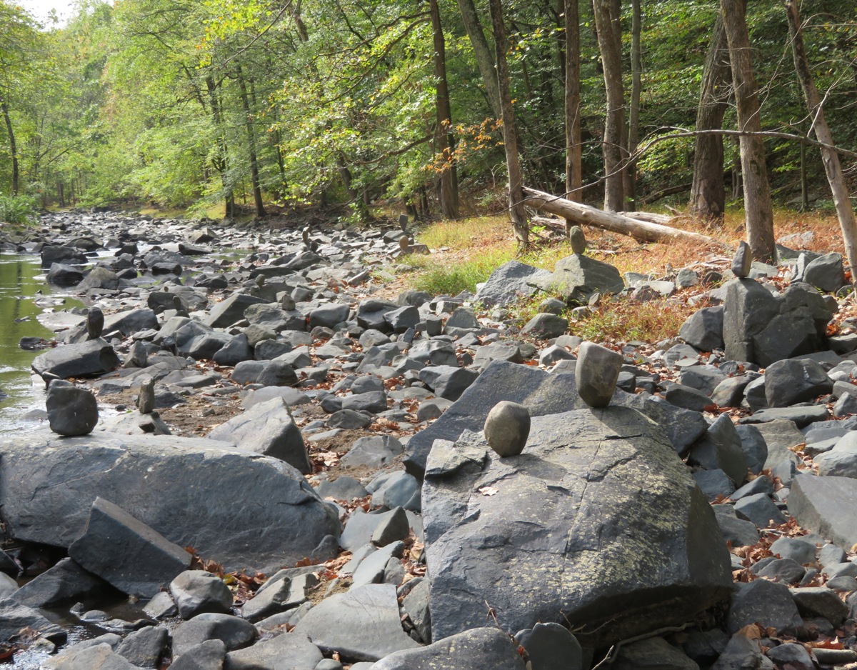
We actually got to the rocks from the River Trail which is on the east side of the Little Patuxent River. 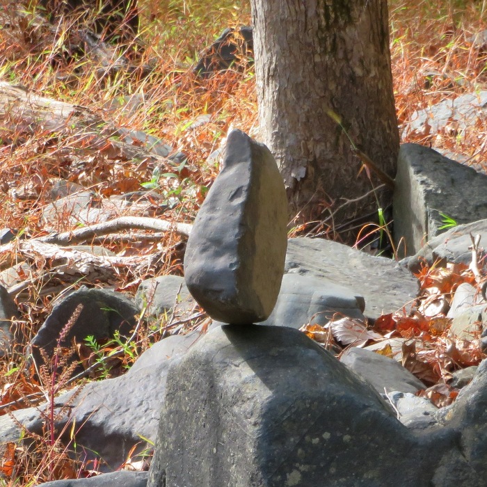
The water was low and very clear that day. If you were careful, you could rock hop across the Little Patuxent River to Wincopin without getting your feet wet. But a smallish dog like Daphne could not. 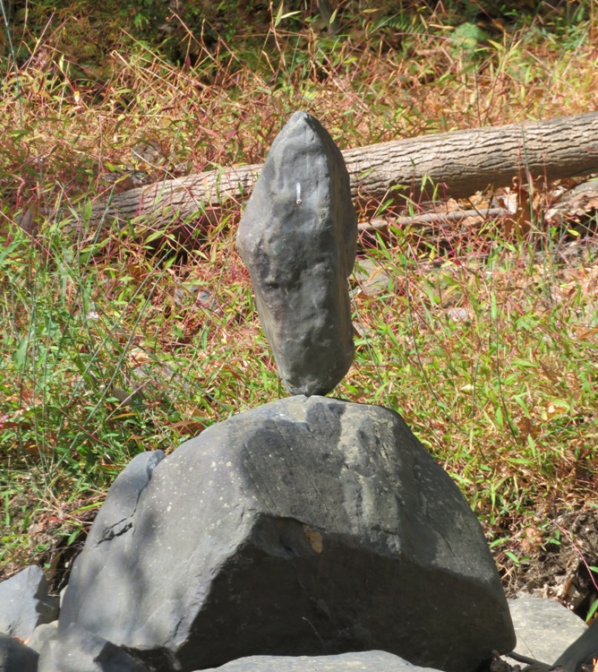
This one looked like a gentle breeze would topple it over. 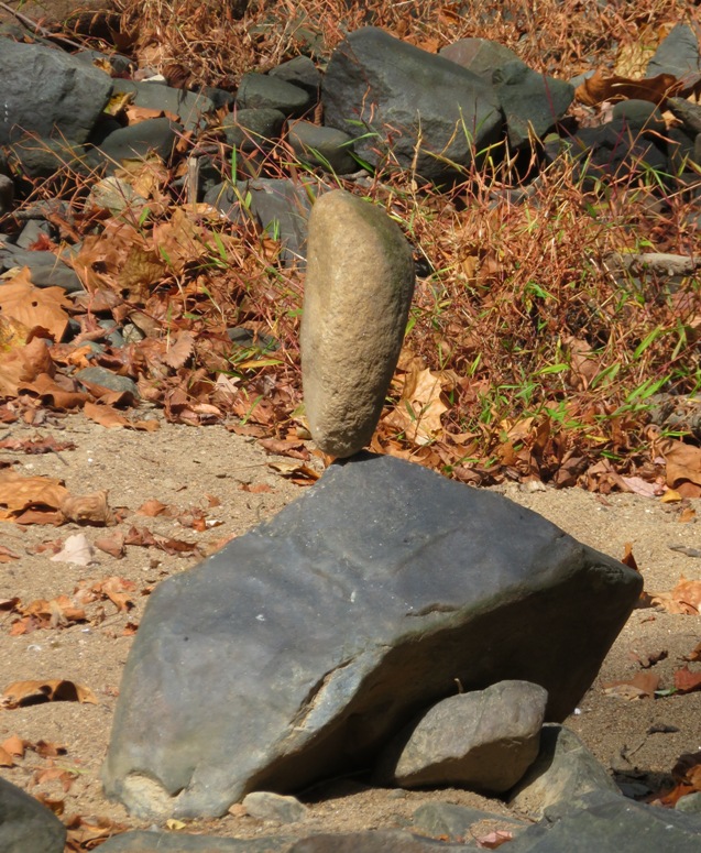
Rocks like these are typical along the Little Patuxent River. Such stones were used to build Savage Mill and Carroll Baldwin Hall. 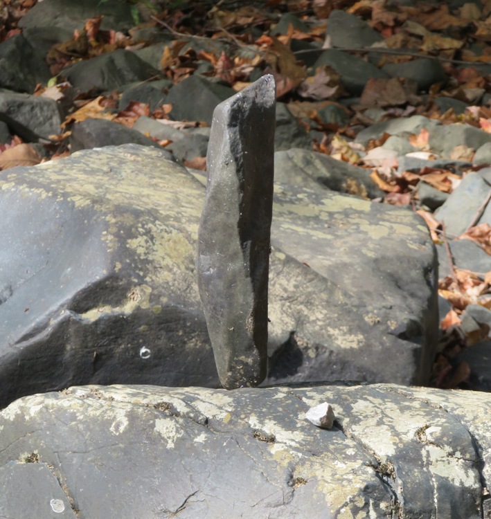
While wind hasn't taken them down, I have to wonder if they will still be standing after a heavy rain when the waters rise. 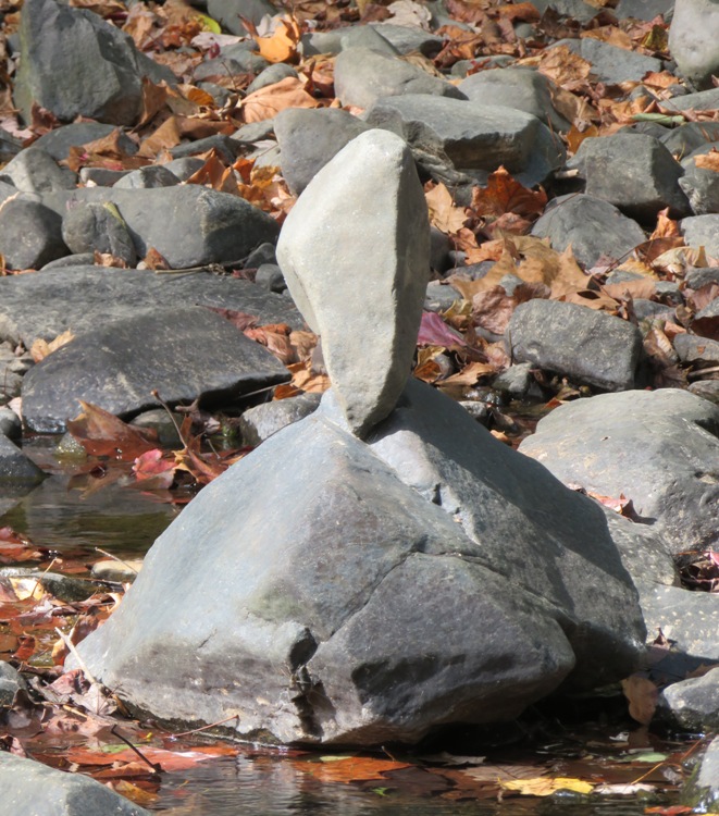
Does anyone have an idea who the artist is that is doing this? If you do, please tell him or her that we are very impressed. 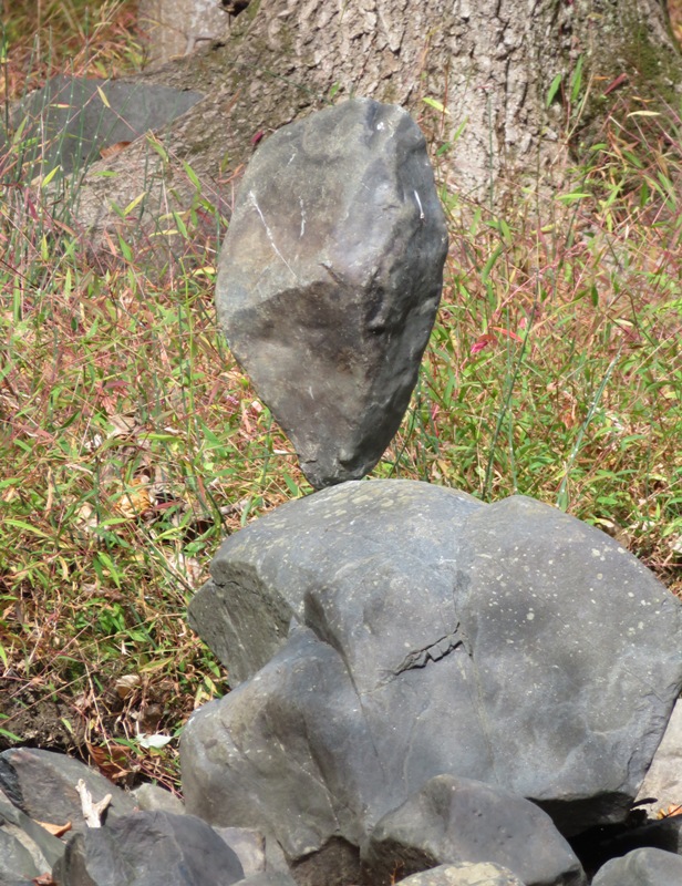
|
|
Norma, Daphne, and I went for a hike at Patuxent Ponds Park in southern Odenton, Maryland.
This area doesn't have real trails in a hiking sense; it is more like a network of roads for work and recreational vehicles. There are no road/trail signs so it is easy to get lost. But it is a great place to let your dog run off leash. We only saw one other person (also with a dog) during the whole time we were there. We saw some club moss producing spores. 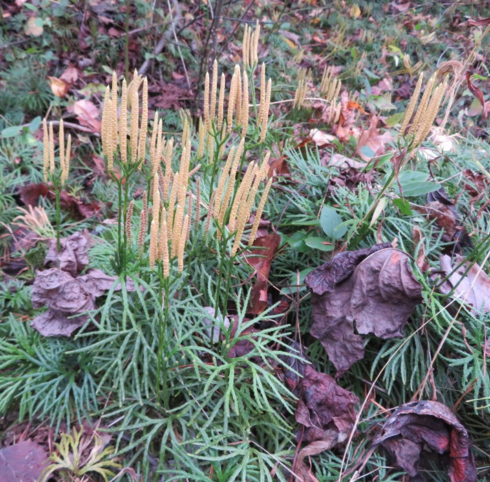
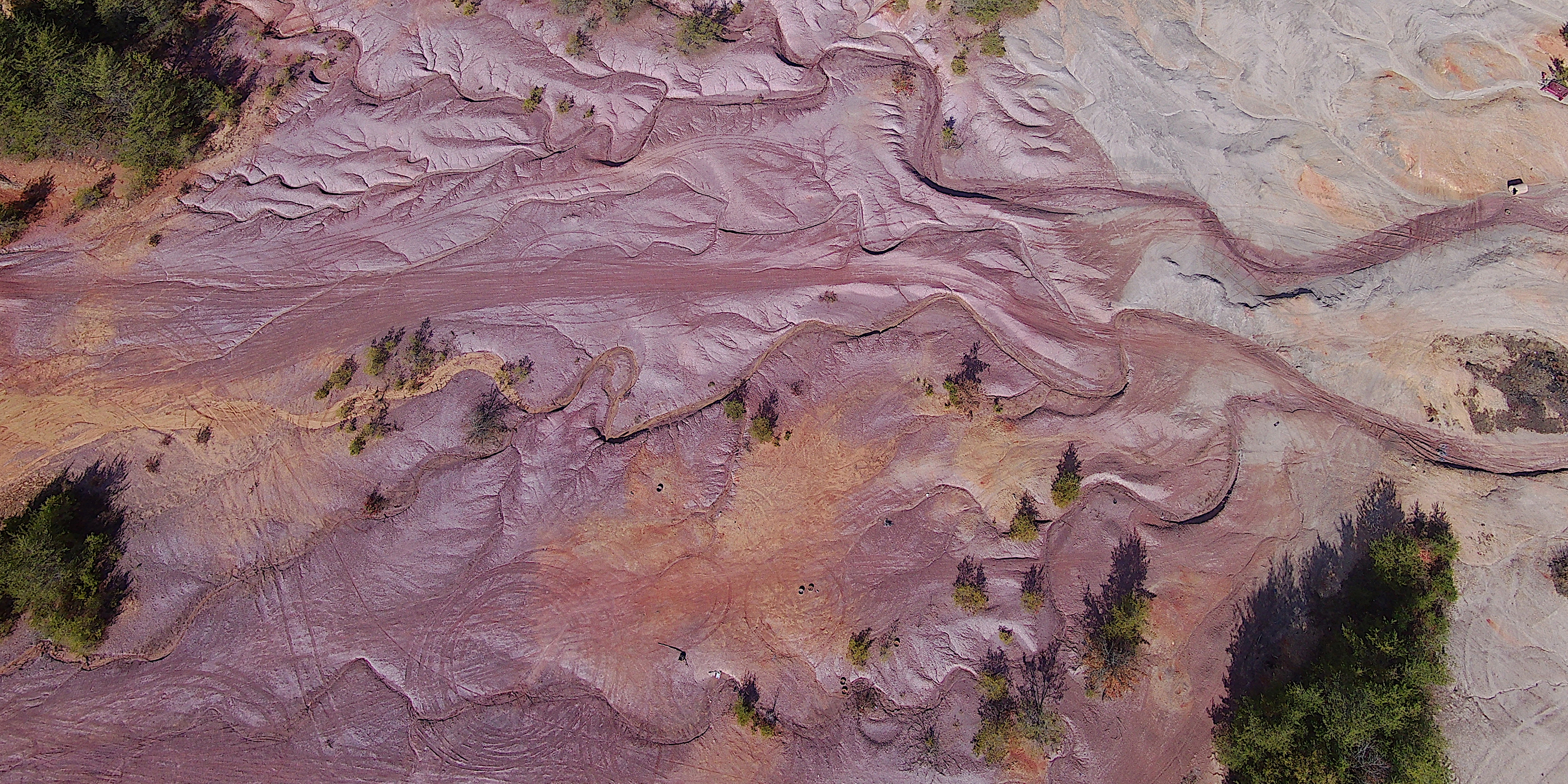
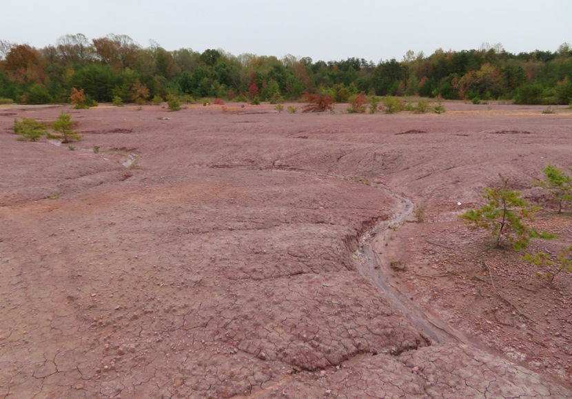
After walking northwest for at least a mile, we ended up at the Patuxent Sand Esker, which is as close as you'll get to hiking on Mars. We've never seen anything like this place in Maryland. What is an esker? An esker is an attractive landform formed through fluvioglacial deposition. It is a winding ridge of low-lying stratified sand or gravel dominating the terrain and providing the vintage point and dry routes. An esker occurs in a glaciated area or a formerly glaciated region, especially in Europe and North America. - from World Atlas - Mountain And Glacial Landforms: What Is An Esker? The name of this place seems to imply that there was once a glacier here. But glaciers never made it as far south as Maryland. So what did we see there? For starters, we saw several places where the ground seemed to wear away around small rocks. This reminded me of Sugarloaf Mountain in Frederick County, Maryland which is a monadnock. But here at the Patuxent Sand Esker, we saw lots of micro-monadnocks. Monadnock is an originally Native American term for an isolated hill or a lone mountain that stands above the surrounding area, typically by surviving erosion. - from Wikipedia - Monadnocks 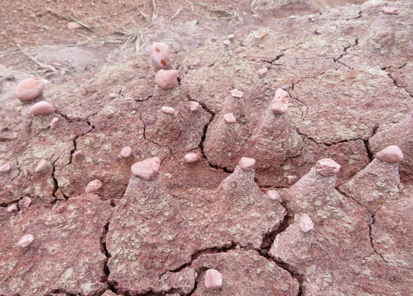
This is what Norma and Daphne would look like if they were on Mars. 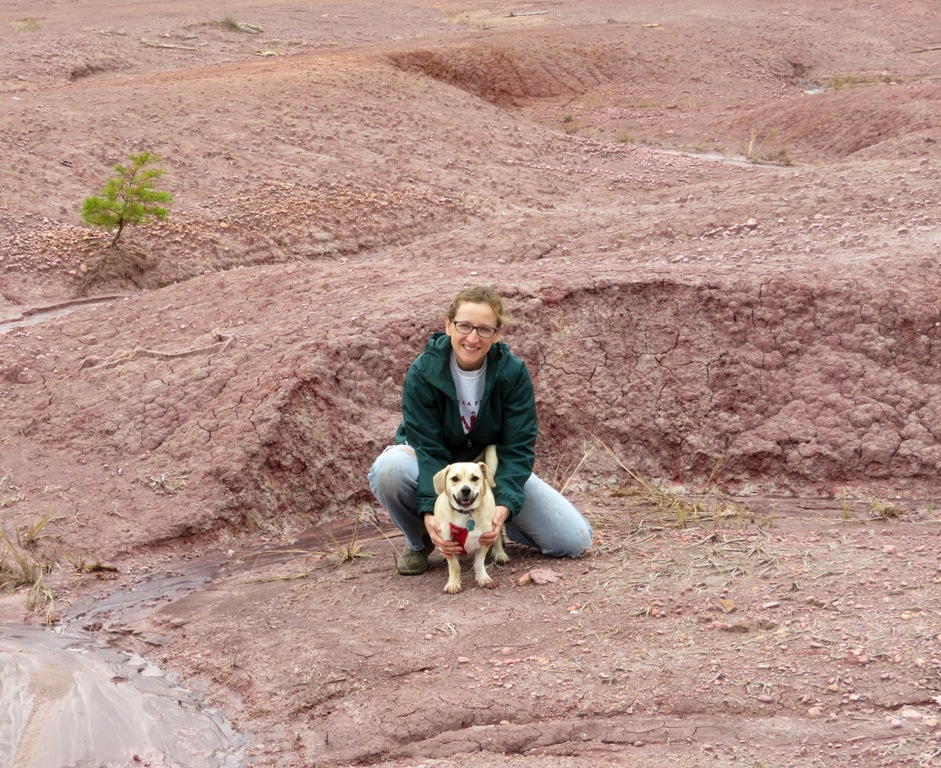
Much of the ground in the esker appeared cracked like a dry desert lake, while almost all the roads near the esker were sandy. 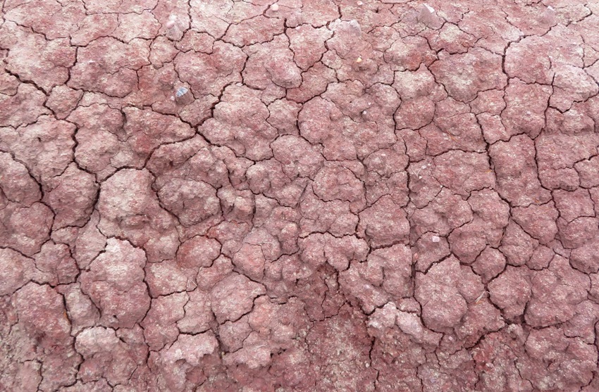
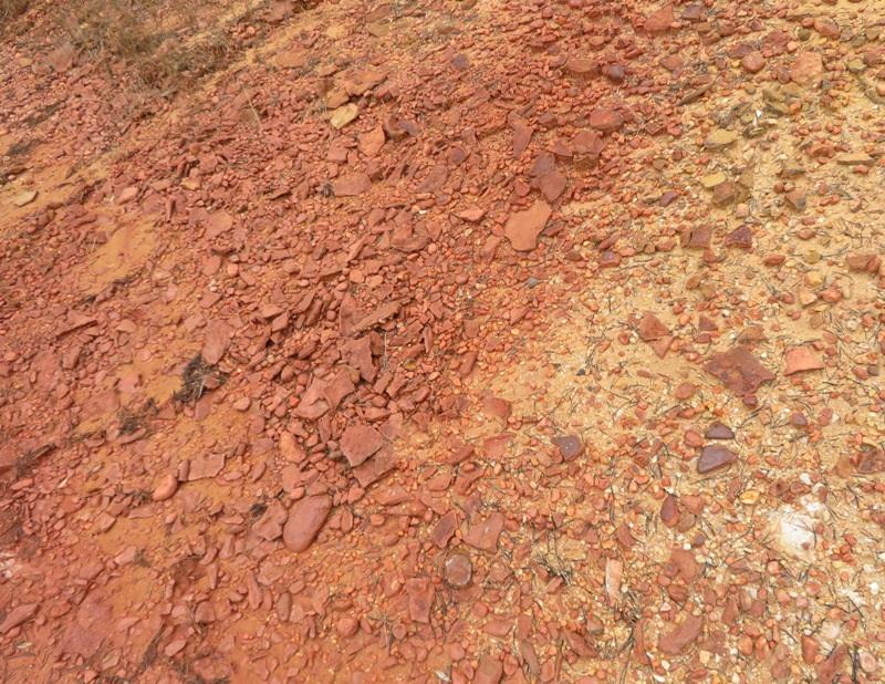
No color enhancements on these pictures. The ground really is this red here. Closer to the parking lot and away from the esker, a beaver was doing some work very recently. Notice how green the leaves are on this tree. 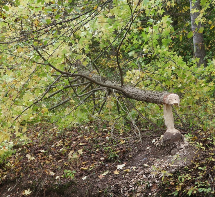
Here's Daphne and me at Patuxent Pond near the parking lot. 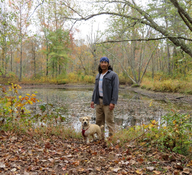
|
|
I flew my drone at the Patuxent Sand Esker. Recall that Norma, Daphne, and I stumbled across it on October 26, 2019.
This time, Daphne and I (Norma was not with us) entered via what Google Maps lists as the trailhead, which is only about a quarter mile from the esker at 39.046947, -76.732978. There isn't a real parking lot. I just pulled over on the side of the road, making sure to not block traffic or the gate. 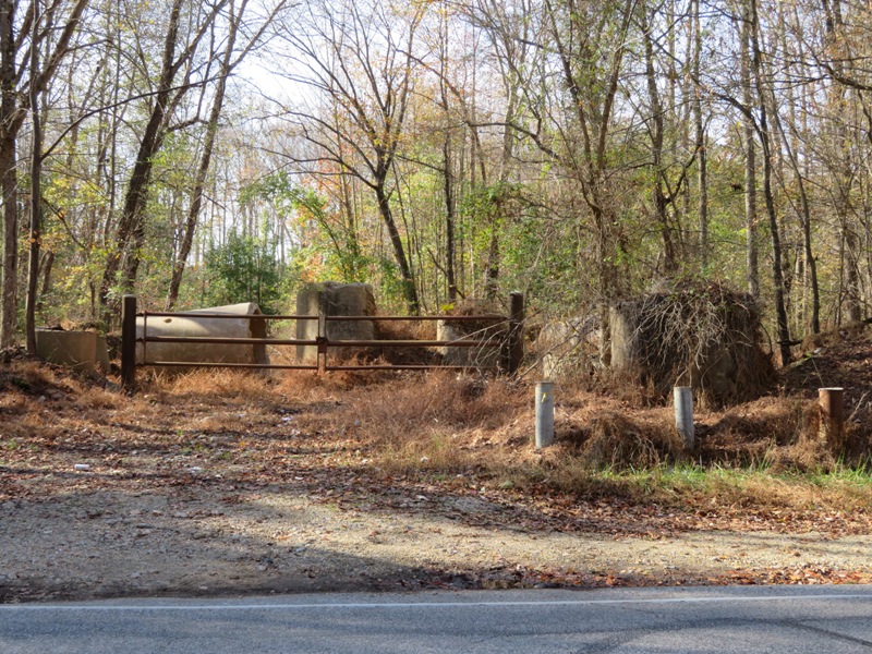
At the trailhead, I found a sign posted indicating that this area may become the Chesapeake Terrace Rubble Landfill. So if you want to see this area, don't wait too long! For more information about this project, see Greater Crofton Council - Two water use permits for the Chesapeake Terrace Rubble Landfill. Here are my drone photos. In all of them, there is no color enhancement. Below, I'm in the bottom left part of the photo. It is just before noon but the sun is low in the sky so even though I appear just as a dot, my shadow is obvious. 
The wetter areas appear more red, giving it a very Mars-like appearance. 
Also see the photo at the bottom of this page. |
|
Norma, Daphne, and I did a Veterans Day hike in the west side of the Hereford Area of Gunpowder Falls State Park. We started at the Masemore Road trailhead and then walked west on the Gunpowder South Trail to Prettyboy Reservoir.
I was testing out my new Garmin GPSMAP 64st with my external plug-in antenna. I thought I got it for a good price until I saw that Bass Pro Shop was selling it for $170 on their Black Friday Sale. So far, I like this GPS, which got great reviews, but I agree with what the critics say...it is pretty bulky. I also preferred the bigger display from my GPSMAP 76 series which Garmin quit making. But the 64st seems fast, accurate, and user-friendly. If you've used the 76 series before, then using the 64st will seem intuitive. Here's a view looking upstream on Gunpowder Falls from the 1898 wrought iron bridge at Masemore Road. 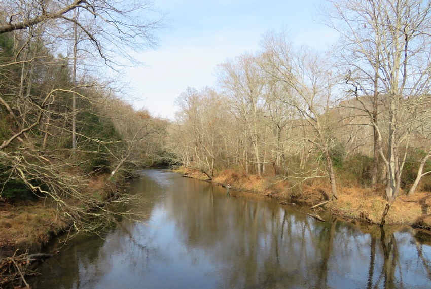
I found these unusual rocks which had lots of curved indentations. 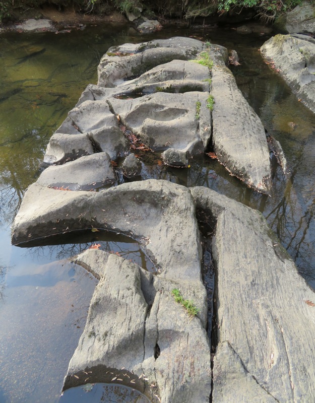
We spotted these spinal vertebrae, which I think are from a very large deer. 
Just downstream from the Falls Road Bridge (shown below) on the south side is a small beach where one can launch a kayak. According to my map, The upper river between the first public access point at Falls Road to the take-out at York Road (route 45) is described...as comprised of "easy riffles and fast flat water." 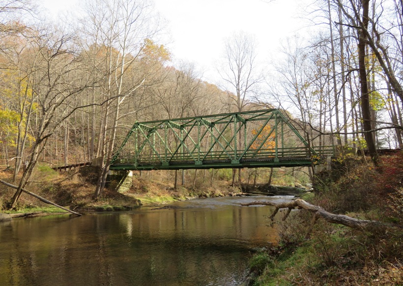
On the right side of the pic below is the launch area. I'm adding this three mile (one way) paddling route to my "to do" list for next spring. 
Here is a fisherman and great blue heron just downstream from Prettyboy Dam. We law lots of fishermen and no other hikers. 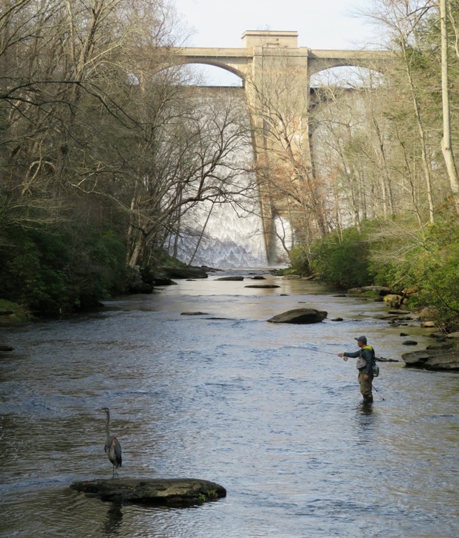
This is Daphne and me. The great blue heron is still there, standing on the rock on the left. 
Here is Norma and Daphne near the dam. The Prettyboy Reservoir has a capacity of 20 billion gallons. Its watershed is 80 square miles. 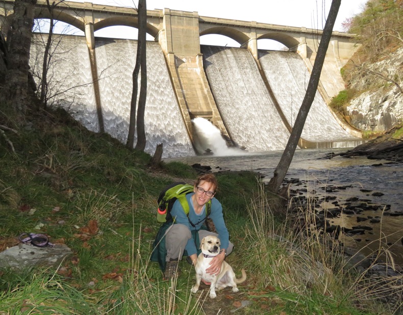
On the return trip, we walked on the Highland Trail, which was much easier. We got in 5.6 miles. I found a good place to pull over and fly my drone to get a shot of the dam and reservoir, 39.618800, -76.708390. I looked around but saw no signs indicating that I could not fly a drone here. Maybe I'll return after it snows or during the spring to fly. Morning shots should work well. We stopped in at Mission BBQ and bought dinner. I got a free sandwich because it is Veterans Day and I am a veteran. I never expect anything on Veterans Day so anything where businesses thank me for my service is greatly appreciated. |
|
Norma, Daphne, and I explored the Oxbow Natural Area. This Nature Conservancy property, located in the Russett Community of Laurel, Anne Arundel County, Maryland, is just a ten minute drive from Savage.
What makes this place special is that it comprises over 300 acres of land surrounding a 70-acre lake in the floodplain of the Little Patuxent River. Oxbow Lake is considered to be the largest naturally occurring body of freshwater in Maryland; other large lakes are manmade, the result of damming creeks or rivers. - from "MD Birding Guide - Maryland/D.C. Birding Guide - Oxbow Natural Area" (a broken link as of 2020) How was this body of freshwater created? Well, let's just say that if it wasn't for beaver activity, there would be no Oxbow. The key feature of this preserve is the Little Patuxent Oxbow, an impoundment of the Little Patuxent River that was created over hundreds of years by beaver activity. - from The Nature Conservancy - Oxbow Nature Preserve 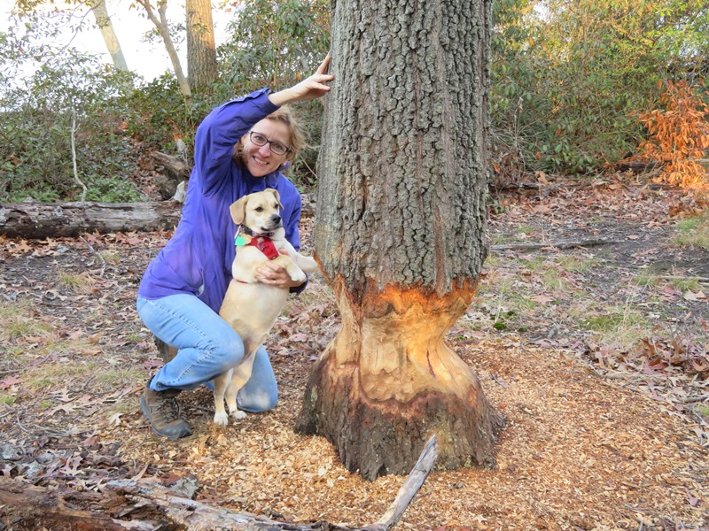
Lots of birds make Oxbow Natural Area their winter home. Over 205 species have been reported on eBird from Oxbow Lake. - from Maryland/D.C. Birding Guide - Oxbow Natural Area 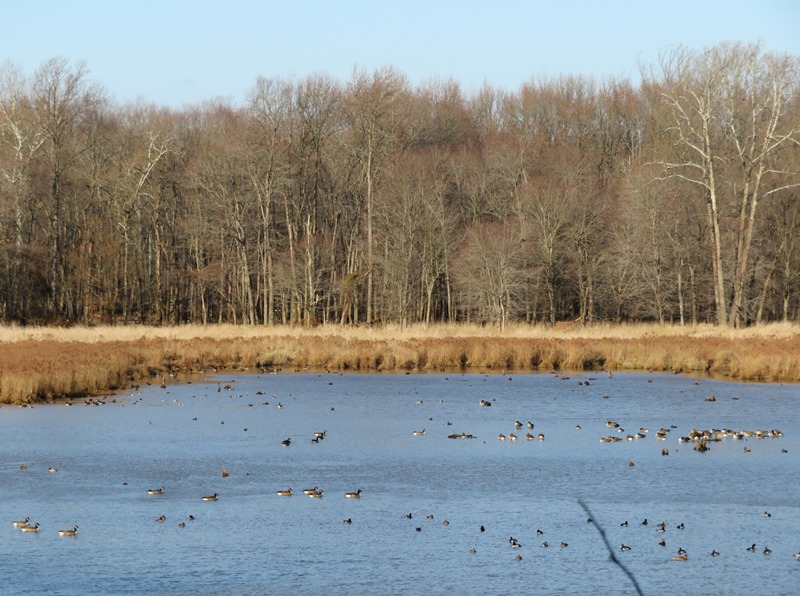
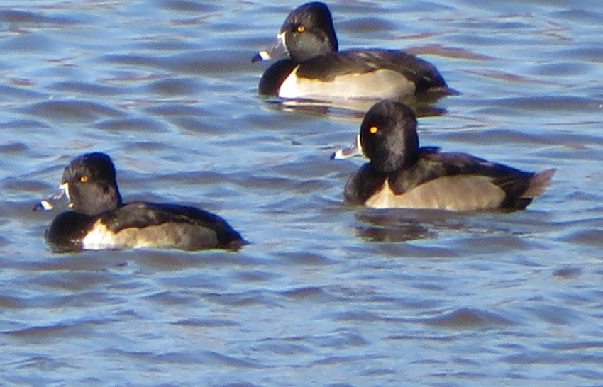
We saw several ring-necked ducks and a few tundra swans...this is our native swan. Mute swans are the other common swan in this area but are invasive. For more information about tundra swans, see Chesapeake Bay Program - Tundra Swan The three of us did a little bushwhacking, exploring, and then ended up in Bacontown...I love that name. It is a community founded in 1860 by freed slaves. For more information, see The Baltimore Sun - Uniting to Protect Bacontown. This is a great place for a sunny, short day, winter hike. You can't go far unless you venture off the trails. So take your time and savor the moment! |
|
I'm adding the following to my hiking bucket list:
...this superlative small town frequently ranks on lists of America's prettiest, coolest, most romantic and most adventurous places. |