Hiking 2020

This page describes my hiking adventures in 2020. It was an unusual year due to the Covid-19 pandemic. Folks were socially distancing themselves indoors while getting outdoors more than usual. With so many people not going into their workplace, many had the luxury of doing more hikes.

The above photo shows Daphne and me at Patapsco Valley State Park on January 1, 2020.

Quarry Trail: January 1Open accordion icon
On Jan. 1, 2020, the Maryland Park Service will offer 40 guided hikes on 33 state lands and parks, as part of a nationwide event sponsored by America's State Parks.
- from Maryland Department of Natural Resources - First Day Hikes Offer a Fresh Start to 2020

In my opinion, this is a terrible day to go on a hike because there are so many other people out. But if you can pick one of the less traveled trails, then it can still be enjoyable.

Norma, Daphne, and I started our Patapsco Valley State Park hike just north of Woodstock, on the northwest side of the Patapsco River. The trailhead is just 28 minutes from Savage. From there, we hiked upstream on the White Trail and then north on the Quarry Trail.
Map of our route

At first, we ran into a lot of folks, some in big groups. But we used that time to explore an unnamed stream while we let them pass. After the first mile, we saw very few people.

The Quarry Trail follows this stream near lots of historic ruins. Below, large stones create a 5-6 foot drop.
Water falling over large carved stones

We found several brick, cinder block, and stone ruins. This structure led to an underground area where there were several pipes.
Norma and Daphne in front of door to brick structure

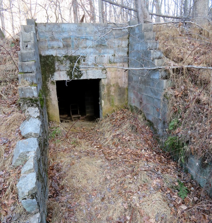
As far as I could tell, the building below is an underground doomsday shelter. It is fairly spacious. Inside, I found a rusted out, old bed.
Entrance to underground cinder block structure

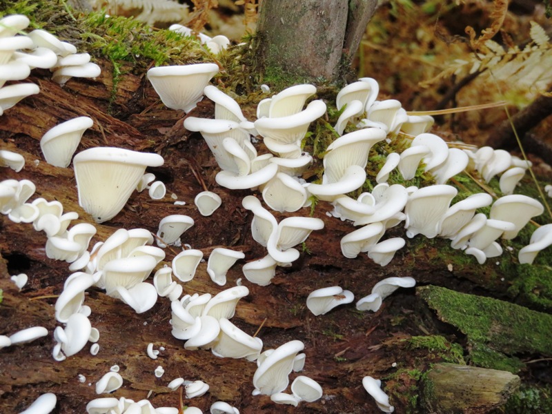
We found a decaying, damp log providing ideal conditions for growing mushrooms.
White mushrooms on decaying log

After a little over a mile and a half, we reached our destination...a flooded quarry. What was mined? Well, the closest town is called Granite. In some places, the rock walls around this flooded quarry rose about 30 feet! I'm quite certain it is very deep. Maybe I'll return with my drone to get an overhead view.
Norma and Daphne at flooded quarry

We made this hike into a loop by returning along a different route. Below is Daphne and me on the stone bridge between Church Trail and Joe's Trail. We saw the foundations from a few buildings on these trails.
Daphne and I on stone bridge

It was an easy and scenic hike covering 4.75 miles. We spoke to one fellow that said there is a trail that connects the quarry to a church. I assume he meant St. Alphonsus Rodriguez Catholic Church at 10800 Old Court Road, Woodstock, MD 21163. So I'm adding that to my "to do" exploration list.
Close accordion icon

Gorman Stream Valley Loop Trail: January 5-12Open accordion icon
I don't know the official name for the trail that runs on both the north and south sides of the Middle Patuxent River in Kings Contrivance in Columbia, Maryland, but I call it the Gorman Stream Valley Loop Trail. It is comprised mainly of the Gorman Stream Valley Trail and the Middle Patuxent River Trail. Gorman Park is another name I've seen associated with the area. These trails reside near the Middle Patuxent River in Howard County, Maryland.

On December 25, 2012, Norma and I explored this loop, but over the last few years, I haven't been able to find the trails that complete the section on the south side just west of Murray Hill Road.

Murray Hill Trailhead - South: January 5Open accordion icon
Daphne and I did an exploratory hike starting at Murray Hill Trailhead - South. We walked west but couldn't find where the trail picks up west of the power lines. But I did find a few things.
1 / 5
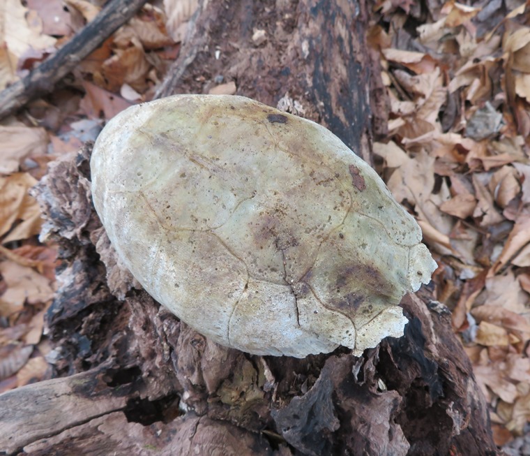
Sun-bleached old turtle shell
Turtle shell.
2 / 5
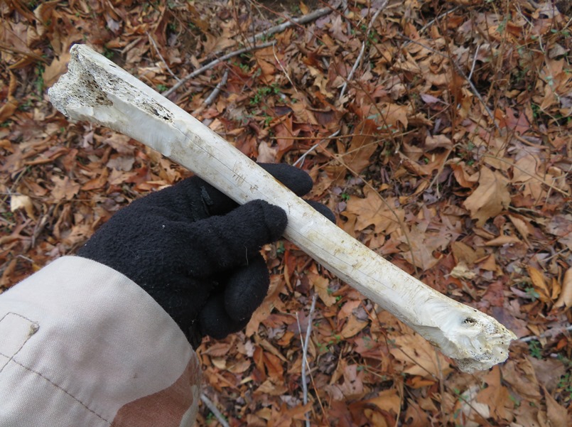
Old bone, possibly from a deer
Deer bone?
3 / 5
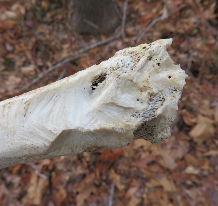
Gnaw marks on the bone
Gnaw marks.
4 / 5
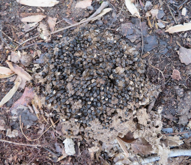
Piece of empty hive comb on the ground
Fallen hive.
5 / 5
Possibly dead hive brood on the ground
Brood?
Close accordion icon

Kindler Road: January 11Open accordion icon
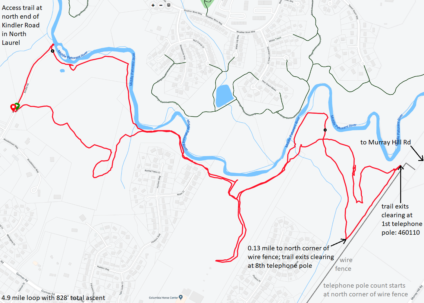
Daphne and I returned and explored the trail from the other direction. We picked up the trail at the north end of Kindler Road. The last fifth of a mile on Kindler Road is paved but closed to vehicles. There is no development but there were fire hydrants. Why would there be fire hydrants for woodlands? My guess is there was a plan to build homes here and that fell through.

Looking north at the Middle Patuxent River, we could see the stone ruins of a bridge that connected Kindler Road with Eden Brook Drive. We walked east, and when the trail split, we tried to stay near the river. Not surprisingly, it was a little muddy.

We found a fairly well defined south trail which exits the woods at the power lines. This is the view looking east from the trail toward the clearing under the power lines.
Daphne near south trail where it exits the woods

For this south trail, if you come from Murray Hill Road (the other direction), when you reach the north corner of the wire fence, walk southwest along the outer fence line for eight telephone poles and then look for the trail entrance on the west side. My GPS says this location is 39.155700, -76.862000.

We also found a less defined but much more convenient north trail which exits the woods at the power lines near this rock.
Big stone landmark

Regarding the north trail, if you come from Murray Hill Road, when you reach the north corner of the wire fence, walk southwest along the outer fence line to the first telephone pole and then look for the trail entrance on the west side. The telephone pole has a small metal sign that reads "460110." My GPS says this location is 39.158600, -76.859417. It is not obvious and if you can't find it, then keep walking and pick up the south trail.

What makes the north trail more convenient than the south trail? The path along the wire fence is not really made for walking. It can be a little thorny and isn't flat. In the summertime, it is likely full of ticks. So I suggest sticking with the north trail and using the south trail as a backup.

Daphne and I walked back on the north trail. It wasn't easy to follow. I headed south, crossed a stream, and then headed north and uphill for awhile, eventually veering west before coming back to a section of the trail that I had walked on the way out.

I mentioned that for this route, I tried to stay along the water, at least for the first part. But on the return, I tried to stay away from the water so I could see what other trails were out there. I found one section of the trail that headed south for quite a distance. It ended up at the north side of a horse farm. Turning around, I saw blue "no tresspassing" marks that were painted on the trees. But they were painted on the south side, so I didn't notice them until I turned around.

The last part of my trip took me on dry land back to Kindler Road but about a fifth of a mile south of the river. In other words, I returned right back to my car which I parked near the barricade. Here's my 4.9 mile route.
Map of our route
Close accordion icon

Eden Brook Drive: January 12Open accordion icon
Daphne and I resumed our reconnaissance from the previous day. This time we started on the north side of the Middle Patuxent River. I parked as far south as I could on Eden Brook Drive. There was a gate that kept me from driving to the end. So we walked around the gate to the river where I saw the Kindler Road trailhead on the other side of the river along with the remains of the bridge stone foundation.
Bridge stone foundation

In a clearing on the right (northwest), we picked up the trail heading west to Old Columbia Pike bridge. It was a nice hike but near the bridge, things weren't very clear. There was the overgrown area near the river and also a big mowed grassy area that looked like private property. But I saw no signs telling us to keep off the latter so I guess you can walk there.

I saw several trees showing signs of recent beaver activity.

We crossed the bridge and then picked up the trail at Old Columbia Road Trailhead, heading southeast (downstream). We stayed along the river.

Here's a view looking downstream on the Middle Patuxent River. This is a great place to kayak in the spring.
Looking downstream on the Middle Patuxent River

It was a great day to be out. The temperature got into the mid or high 60s. I considered going paddleboarding but chose this hike instead.
Daphne and me on the trail

Eventually, we came to the north end of Kindler Road, where we had started yesterday. On a much warmer day, I would have considered swimming back to where I started, which was just a stone's throw across the river.

Rather than return back on the same trail, we did some exploring, seeing if there was a different route. In short, there was not. There were uninteresting sections cut out to maintain underground pipelines and cables but these were not trails and they only connected to roads that didn't take me where I wanted to go. So it is best just to remain on the main trail if you are west of Kindler Road or west of Eden Brook Drive.

Back where Eden Brook Drive meets the river, Daphne and I continued walking east (downstream) on the trail. Eventually, we came to playground KC16, 39.162162, -76.872329. From there, we headed right (downhill) on one of the Columbia Association paved trails which is shown on Google Maps as Kings Contrivance Loop. If you stay along the river, it will take you east, all the way to Murray Hill Road. I knew that, so we didn't bother exploring further east.

But Daphne and I did do some exploring in Columbia on the paved paths and some of the sidewalks. We didn't find anything noteworthy. Today's exploratory hike was 5.6 miles. If we were to walk the entire Gorman Stream Valley Loop Trail, I estimate it would be 6.5 miles.
Map of our route

The trails that follow along the river are not shown on many maps. I believe they are primarily for fishermen, of which, I saw many.
Close accordion icon

Bacon Ridge - North end: March 21Open accordion icon
Norma, Daphne, Sara C. and I hiked 8.1 miles in the northern part of the Bacon Ridge Natural Area, starting from the Bacon Ridge Road - North Trailhead. There are lots of well drained dirt trails that meander through this wooded section of Crownsville, Anne Arundel County, Maryland. Unfortunately, we saw no trail signs or overlooks. It is easy to get disoriented, especially when the sun isn't out.

Now that the Novel Coronavirus (Covid-19) is a problem, various institutions have closed and people are working from home. But folks can still get outside as long as they avoid groups and keep their distance from each other. The size of groups to avoid keeps changing as the problem worsens. The way I figure, getting some exercise outside to keep your immune system strong might be the next best thing to washing your hands regularly.
1 / 3
Red moss sticking out of greenery
Moss sporangia.
2 / 3
Norma, Daphne, and Sara C. at wooden footbridge over Bacon Ridge Branch
Bacon Ridge Branch.
3 / 3
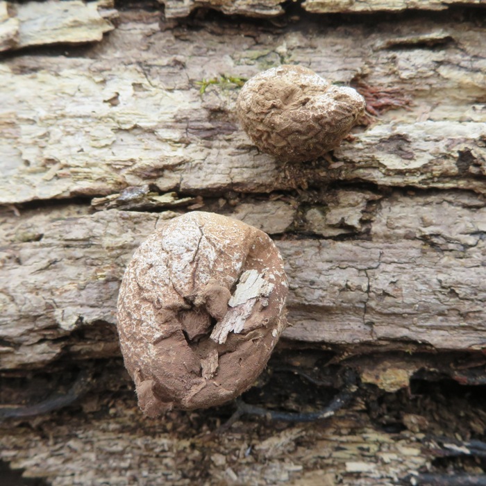
Puffball mushrooms (Lycoperdon pyriforme) that have seen better days
Puffball mushrooms.

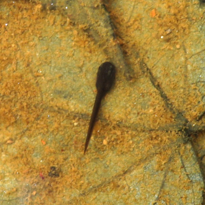
Near the Bacon Ridge Branch, we saw several amphibian eggs in a vernal pool along with a few small polliwogs.
Polliwog

The four of us stopped for lunch at a fallen log, where we saw several flowers from a quaking aspen tree.
Quaking aspen tree flowers in my hand

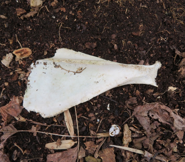
I found a deer scapula and a snail. I rarely find snails on land in Maryland.
Deer scapula and snail

We were trying to do the Bacon Ridge Trail: Phase 3 route but never made it to the southern part. Maybe we'll try it again some other time.
Close accordion icon

Piney Orchard Nature Preserve: March 29Open accordion icon
Norma, Daphne, and I went for a 2.9 mile walk at the Piney Orchard Nature Preserve. This place is full of lots of beautiful wetlands.

There were quite a few people out getting some exercise while practicing social distancing in wake of the Covid-19 outbreak.

Here is some of the stuff we saw.
1 / 3
Skunk cabbage.
2 / 3
3 / 3
The shed skin of an assassin bug
Assassin bug exuvia.

Norma and I found a colorful assortment of hair-cap moss and reindeer lichen.
Purple, green, and white mixture of vegetation/fungi

Daphne also found a few things.
1 / 2
Old turtle shell
Old turtle shell.
2 / 2
Daphne investigating a fox hole
Fox hole.

We saw beaver lodges at Duck Cove Pond, a remnant of past mining operations. Unfortunately, we did not see the residents.
Two beaver lodges and two Canada geese

Here's Norma and Daphne on Wood Duck Way. No wood ducks spotted.
Close accordion icon

Gorman Stream Valley Loop Trail: April 4Open accordion icon
Norma, Daphne, and I hiked the Gorman Stream Valley Loop Trail, walking counter-clockwise.

We started at Eden Brook Drive. Near where the road ends at the Middle Patuxent River, someone painted lots of hearts on a log and several trees. I'm not much for graffiti in a natural area but if it must be done, it could have been a lot worse.
Hearts spray painted on fallen log

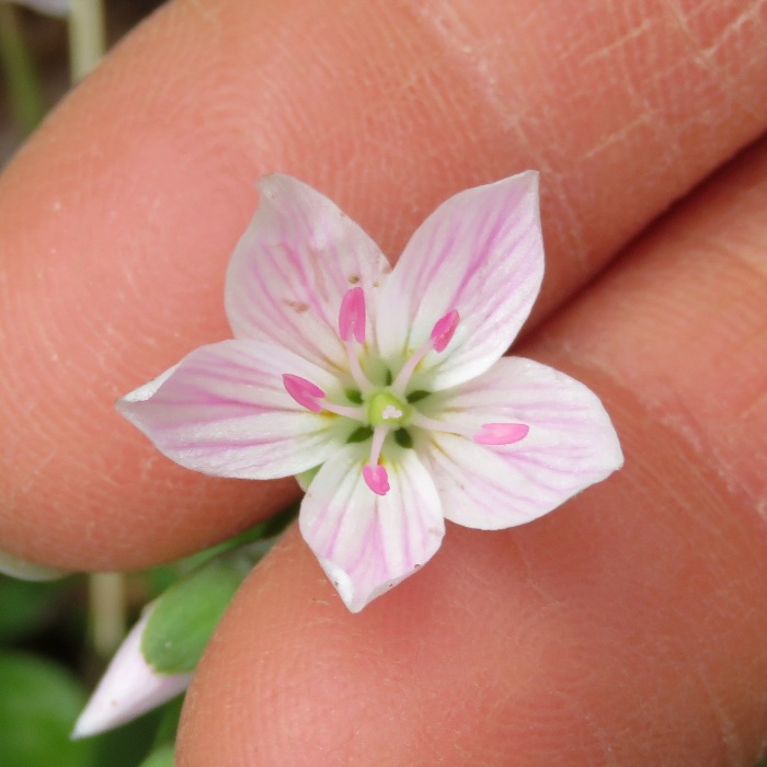
We saw lots of spring wildflowers in bloom.
1 / 3
Trout lily
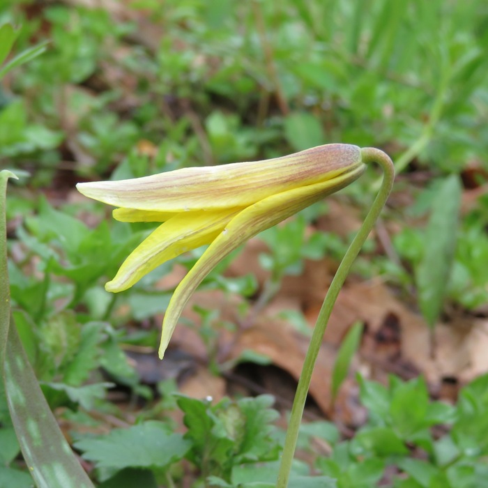
Trout lily.
2 / 3
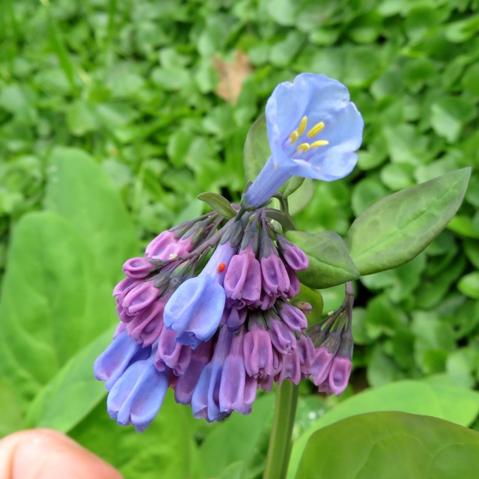
Virginia bluebells
Virginia bluebells.
3 / 3
Spring beauty
Spring beauty.

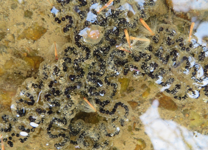
Some standing water right next to the river held thousands of American toad eggs.
After [American toad] mating takes place, the females lay their eggs in the water, in long spiral tubes of jelly. They lay 4,000 to 8,000 eggs in two rows. When each row of eggs is stretched it generally measures between between six and twenty meters long (20 to 66 feet). Each individual egg is 1.5 mm in diameter.
- from "BioKIDS - American Toad" (broken link as of 2026)
1 / 2
American toad eggs
American toad eggs.
2 / 2
A closer view of American toad eggs
Close-up.

In another pond, I saw spotted salamander eggs but I couldn't get a good picture.

I found a 2.5-inch long coccoon from a silk moth.
Silk moth coccoon

There were several wet areas full of skunk cabbage. But that's nothing special because at this time of year, I can also see them while standing on my back deck.
Skunk cabbage

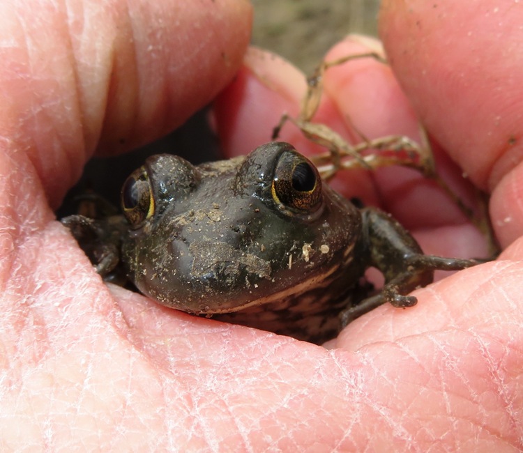
At one of the ponds, I saw an American bullfrog. At first, I wasn't too sure what this was until I saw its underside.
1 / 3
Face of American bullfrog in my hand
American bullfrog.
2 / 3
Top view of American bullfrog
Top view.
3 / 3
Underside of American bullfrog
Underside.

The Middle Patuxent River is a great place to kayak. One can paddle downstream and take out in Savage, just a short distance from my house.
Scenic view of the Middle Patuxent River

The entire hike was about 6.7 miles. If you try this on your own, I highly suggest you read my scouting notes from January 5-12, 2020 and go clockwise. It will be easier to find landmarks than if you go the other direction. Also, when in doubt, stay close to the river.
Map of our route

The Howard County Greenfest was scheduled for this day. It was canceled due to the Covid-19 outbreak. But getting outside for a nice spring hike was the next best thing...maybe even better!
Close accordion icon

Bacon Ridge - South End: April 18Open accordion icon
Norma, Daphne, and I did a hike in the southern part of the Bacon Ridge Natural Area, starting from the Hawkins Road - South Trailhead.

On the way there, we passed the spooky Crownsville Hospital Center, aka Hospital for the Negro Insane. I'd like to explore the place sometime.

My plan was to walk the 5.5 mile Bacon Ridge Trail, but I don't think we ever made it to the northern side beyond the creek. Like our March 21, 2020 hike on the northern section off Bacon Ridge Road, I found the trails very circuitous, meandering, and difficult to navigate. I know my sense of direction isn't the best but even with a handheld GPS, it was very difficult to stay on track.

It was cold, windy, and overcast when we were out, so we saw very few people...much less than if we had walked in our own neighborhood. With the coronavirus thing, such isolation was good. I know some people are preaching to "stay at home" and avoid unnecessary travel but I think exercise with social isolation isn't a bad thing as long as you don't drive too far...just my opinion.

There was a porta-john that I used. After entering, I thought about having touched the handle to get in. How many (possibly coronavirus infected) people had touched that handle prior to me? Fortunately, there was a hand sanitizer dispenser but when I pressed the lever to get some sanitizer, it was empty. So now I touched two things that lots of other people had surely touched. Not a good start.

On the middle trail (there are three trailheads that meet at the parking lot), someone put out several Easter bunnies and fake eggs. I saw about five trees where such things were laid out.
Ceramic bunny and fake eggs at tree

Norma, Daphne, and I found some old junk. I think at least one of these things is a refrigerator. I never like seeing trash while I'm hiking but at least this was more interesting than cans and bottles.
Norma and Daphne in front of big trash

We found a tree with lots of exposed roots, shown below. I think this was on the Box Turtle Trail. But we saw no box turtles. With nighttime temperatures down to the low 30s, I'm guessing they might still be hibernating. That seems to be the case in Savage. Norma and I have been digging up bamboo and we found a couple of box turtles underground that were looking very sleepy.
Me holding Daphne with exposed tree roots below

Norma found some autumn olive flowers. They are very small...only about 0.5-0.7 inch in diameter. But they are very fragrant. I felt like I was walking past a perfume store when we passed them. Unfortunately, they are invasive. I was told they are edible.
Whitish autumn olive flowers, each with four petals

We found an old car graveyard containing five vehicles. At least two are Mercuries. I'm guessing these cars are from the 1960s. Trees grew around one of them so tightly that either the car or the trees would need to be cut for it to be removed.
1 / 3
Daphne and I on an old Mercury car
Mercury.
2 / 3
Old car with bullet holes
Bullet holes.
3 / 3
Five old car wrecks
Five wrecks.

There were several ferns, many still curled up.
Our ferns unfurled to every breeze, from dawn to setting sun...Semper Fern
Fiddlehead

Norma and I walked 3.8 miles. I'm guessing Daphne did at least 4.3. But we still had some energy left so we decided to do another hike in the area. See Severn Run Natural Environmental Area.
Close accordion icon

Severn Run Natural Environmental Area: April 18Open accordion icon
After completing a hike at Bacon Ridge - South End, Norma, Daphne, and I hiked the Severn Run Natural Environmental Area. We did the Severn Run via Indian Landing route from the Indian Landing Road trailhead to the Brown Property trailhead and back.

We saw some dogwood trees in bloom.
Flower on dogwood tree

This is a lovely place to explore and the trails are very nice, even after a rain. There are some good views of the uppermost sections of the Severn River, which is probably the least accessible major river in the area...at least from a kayaking point of view.

Here is a view near the headwaters of the Severn River. The only place I found that could make for an easy launch was very shallow and over a half mile away from the closest trailhead.
Shallow, narrow section of the Severn River

We found what appeared to be the cinder block ruins of an old home.
Norma and Daphne on cinder block foundation and stairs

Seeing the river made me want to get out on the water, but so far this spring it has been cold, windy, or very overcast. So my motivation has not been great.
Close accordion icon

Hell House: April 25Open accordion icon
On this fine day, Norma, Daphne, and I did a short hike and some exploration at the Hell House.

We arrived at the Ilchester Road (east) trailhead at 1030. The main parking area was almost full. By the time we finished our walk, people were parking along the side of the road and multiple people were waiting for us to leave so they could take our spot. With the Coronavirus lockdown in effect, people are really wanting to get out to enjoy some fresh air and get some exercise. I've never seen the area so busy. But despite the crowd, folks seemed to be obeying the social distancing rule of not getting closer than six feet. We pretty much just saw families and couples. No large groups.

The last time we were here was February 25, 2012 and we didn't get a chance to explore things thoroughly. That was my plan for today...to see every square inch that we missed before. We started up the stone steps. That was undoubtedly the most difficult part of the hike.
Norma and Daphne on stone steps

At the top, we saw remnants of the entrance to Saint Mary's College, built in 1868.
St Mary's was once a five-story brick college building, replete with a portico and cupola. There also was a chapel here. Maryland State Historical Trust records noted that St. Mary's College and Chapel were one of the most impressive architectural complexes in Howard County.
- from "MidAtlantic Day Trips - A Visit to Hell House in Howard County, MD" (broken link as of 2026)
Stone structure at top of stairs with lots of graffiti

Looking around, we found a couple of manholes where some of the concrete below had fallen away. A tree was growing out of one of them.
Tree growing out of manhole

I was looking out into the distance, trying to find ruins. Norma, on the other hand, was looking down, searching for mushrooms. We had recently joined the Maryland Mushrooms and Mycology Facebook group. Based on what we've been reading, this has been an unusually good year for finding morel mushrooms, a delicacy. This is largely due to the cool, wet spring we've had. I also suspect that with the Coronovirus lockdown, a lot of people have more time on their hands to look for morels.

Norma found four morel mushrooms near 39.249750, -76.765967. I didn't find any morels. My eyes are much better trained for finding shark teeth.
1 / 2

Two morel mushrooms in hands
First two.
2 / 2
Large mushroom in hand
5.6" x 3.9" head.

I've never cared much for the taste of mushrooms although it is really the texture that I find unappealing. Too slimy and rubbery for me. But as a general rule, if Norma prepares it, I will eat it. That night, we ate them. It wasn't bad. After reading about morels, I started to develop a greater appreciation for them.
...morels will generally contain significant amounts of Iron, Copper, Manganese, Phosphorus, Zinc, Vitamin D, Folate, Niacin, Riboflavin and a decent dose of Potassium, Magnesium, Calcium, Selenium, Thiamine, Vitamins E and B6.
- from Untamed Feast - Everything You Ever Wanted to Know about Morel Mushrooms

But for me, the big thing is protein. According to Nutrition Value - Mushrooms, raw, morel, there are 3.1 grams of protein per 31 calories of raw morel. That's more protein per calories than a raw egg! But is it a complete protein? Yes!
Mushroom-based protein is a suitable option for those who suffer from allergies or who are unable to consume whey, soy, or wheat-based proteins. Because it delivers on amino acids and has high amounts of the coveted BCAAs, it may also be a great option for athletic or highly active patients because of their role in building muscle and burning fat.
- from Designs for Health - The Surprising Protein Composition of Mushrooms

After telling my parents about Norma's find, they sent us an article from their local paper, which I also found online: Stalking the elusive morel mushroom.

We found some other mushrooms too, including what someone at the "Maryland Mushrooms and Mycology" group thinks might be a helvella. Like the morel, helvellas are edible although I am not totally confident that this is a helvella. For safety's sake, I think we'll just stick with morels because they are easy to identify.
1 / 2
Likely a helvella mushroom
Likely helvella.
2 / 2
Likely four helvella mushrooms
Four of them.

We saw lots of jack-in-the-pulpit plants. These are also called Indian turnip. The roots are edible but require far too much time and effort for the average person. We'll just stick with morel mushrooms for now. If the shutdown ends up going into apocalypse mode, then I'll reconsider eating jack-in-the-pulpits.
1 / 2
Side view of jack-in-the-pulpit plant
Side view.
2 / 2
Top leaf lifted to expose spadix
Here's Jack (spadix).

Because of the locality of Saint Mary's College, there was a lot of brick and stone. This big brick wall (shown below) supports the road that leads up the hill. It looks like Chuck Norris gave it a roundhouse kick. Nearby, I found what Norma thinks was an elaborately decorated but broken concrete bird bath.
Damaged brick wall

Norma and I saw a very old brush cutter and lots of stone walls.

I found a stone structure with lots of graffiti. It seems like just about everything old had been vandalized.
1 / 2
Vandalized stone structure with Daphne looking away
Daphne & structure.
2 / 2
Different view of same structure
Another view.

At the westernmost portion of our hike, the trails came to an end so we stopped for a snack at some concrete steps which led to nothing. But there were plenty of concrete foundation blocks indicating that some large structure once resided there.

Nearby were some corrogated metal structures that resembled school bus shelters. I'm thinking that at least one was an outhouse because I found a toilet seat in it.

On our return, we spotted what a blogger thought might be used for storing water. Not sure if that makes sense since it was at ground level but another person agreed. Norma was thinking it might be a grain silo. I thought it looked like something for storing oil but I can't imagine a small college would need that much oil so water is probably the correct answer.
1 / 2
Big metal container with graffiti
Big container.
2 / 2
Daphne and I on other side of container
Daphne and I.

There was a ladder that was missing several rungs that one could use to climb to the top of the container. Someone had propped a log against the container to reach the ladder.
Log propped up against container by ladder that leads to the top

Near the base, we found a small hole which Norma was able to squeeze through.
Norma squeezing through hole in side of container with Daphne waiting

Daphne and I followed. Inside, the place smelled like spray paint. I'm guessing the vandals that got in here killed off a few brain cells with all the unventilated fumes. Here's what we saw:
1 / 2
Norma holding Daphne with graffiti-covered wall inside container in background
Norma & Daphne.
2 / 2
Opposite side inside the container, also covered in graffiti
Opposite wall.

Inside the container was a ladder that was rusty but solid, and not missing any rungs. I climbed it and exited out a hole in the top. High up, I had a good view of the surrounding area and was able to select our next destination.
1 / 2
Hole at the top of the ladder
Hole at top.
2 / 2
View from top of container
View from top.

We entered our next area through a narrow, overgrown, chain-link opening to a big, open area with lots of low, concrete walls and floors. The MidAtlantic Day Trip blogger thinks this was an outdoor swimming pool. I concur.
1 / 2
Graffiti-covered opening in chain link fence
Chain-link opening.
2 / 2
Graffiti-covered walls at swimming pool
Pool area walls.

Norma, Daphne, and I walked on an old road to my goal, the altar/dome/gazebo/cupola. I'm calling it an altar. This is, without a doubt, the most impressive structure still remaining on this property. But before I describe it, I need to summarize the history of the place, along with its sinister past.
St. Mary's College was built in 1868 to train young men on their way to taking up the cloth. Unfortunately for the college (but fortunately for urban explorers) the schools student body slowly evaporated until there were just not enough to keep things going and the facility was abandoned in 1972. The empty buildings slowly decayed as curious explorers, urban legend hunters, and hormonal teenagers took charge of the property. The haunting ruins soon became the subject of countless local legends involving every sort of supernatural clap-trap from satanic cults to restless souls, eventually earning the buildings the colloquial name, "Hell House."
- from Atlas Obscura - St. Mary's College

So what were some of these local legends?
Whilst it was the dwindling number of students that resulted in the closure of the college, by the late 1980s, rumors about the 'real' reason for the closing down of the college began to spread. One of these, for instance, is that an insane priest had slaughtered several female students. This rumor may have spread due to some confusion with the Patapsco Female Institute. Another rumor is that there was a priest who raped nuns in the college, and was eventually found out. The ending of this story varies from one version to another. One, for instance, claims that when the priest was caught, he managed to escape, whilst the nuns became possessed by demonic forces and murdered everyone in the college. In another version, the nuns were found hanged, with a pentagram drawn in blood on the floor below, and the priest dead from a self-inflicted gunshot wound. It may be noted that St. Mary's College was a seminary for men, and not a nunnery. Nevertheless, such tales, as well as many others, were circulating, and resulted in St. Mary's College being nicknamed 'Hell House College'.
- from Ancient Origins - The legend of The Hell House College of St Mary's

While there are still other remnants of the college littering the grounds including foundations and concrete staircases, the most stunning relic on the site is the Christian altar that still stands beneath a crumbling, colonnaded pavilion. The large metal cross sitting beneath the faux-classical dome seems like some ancient artifact from some bygone time.
- from Atlas Obscura - St. Mary's College

There are a couple of things that leave me with questions about this place. According to the above reference,
Update August 2017: The cross is gone and the gazebo is still standing.
Update February 2020: The gazebo, altar, and nearby stones have all been mysteriously painted with symbols and other drawings, all black and white.

What happened to the cross? Was it stolen? And what's with the black and white paintings? It appears to be mostly dragons and some form of cryptic writing. Someone obviously put a LOT of time and work into it. In a way, it is beautiful but it also looks satanic, in my opinion. I spent some time looking into the script origin of this writing but found nothing. I'm sure there are some smart people at the National Security Agency that can determine this and decipher what it says if they put their minds to it.
Stone column with dragon and mysterious script

Later, I was told
The script used on the stone structures is Iokharic, the Draconic alphabet from the Dungeons & Dragons (D&D) fantasy setting.

Below are some views at the altar. Looking down from this area, we saw a lot more paintings, dragons, and cryptic writings, which flanks our view of the trail. We could have spent a lot more time at the altar but it was a popular place so we figured it was best to leave so other folks could enjoy it while practicing social distancing.
1 / 3
Altar and columns covered in dragons and mysterious writing
Altar & columns.
2 / 3
Altar showing arched roof
Backed-out view.
3 / 3
Looking downhill at trail flanked by painted stone structures
Looking downhill.

Bushwhacking our way to one of the lower paths, we ended up at what one blogger at "Ghost Soldiers - Hell House" (broken link as of 2026) calls a "grotto." Here, we ate lunch.
Stone grotto

Continuing down, we walked to the Bonnie Branch Road (west) trailhead. I cut across the road where I had an excellent view of a waterfall created by a stone wall at 39.249724, -76.767378. As far as I can tell, the creek that flows over the wall does not have a name.
Waterfall created by large stone wall

The day was mostly overcast and cool, but there were a few moments where the sun came out. With the previous and following day expected to be rainly, it was good to get out. We walked 3.8 miles.
Map of our route

Winter is a better time to visit, after the foliage has died back. Less people too.

Close accordion icon

Parris N. Glendening Nature Preserve: May 2Open accordion icon
Norma, Daphne and I went for a hike at the Parris N. Glendening Nature Preserve. Daphne and I were last there on May 22, 2019. Back then, we walked the trails of the outer loop. So today, I decided we should do the inner trails.

One reason I picked this location is because we recently had a good bit of rain. I figured this area wouldn't be too muddy. Also, I've never seen many people here so I was hopeful that it wouldn't be too crowded. With the Coronavirus lockdown, a LOT of people have been out hiking...more than I'd ever seen. We recently did a walk around Lake Elkhorn in Columbia and that place was packed.

My goal was to hike, let Daphne run off leash, and see wildlife. Norma wanted to find morel mushrooms. We are new to morel foraging and neither of us really know what makes for a good morel environment so at this point, it is mostly just hit and miss.

We entered through the Plummer Entrance. They opened the gate around 0850.

Some beautiful columbine flowers were in bloom.
Red and yellow columbine flower

We found a painted rock that Norma figures was left over from an Easter egg hunt.
Rock painted to resemble chick

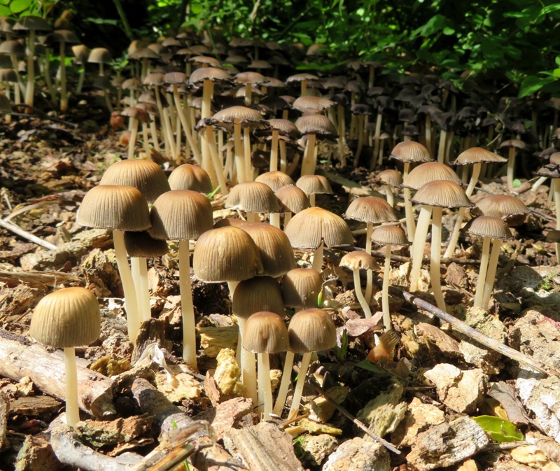
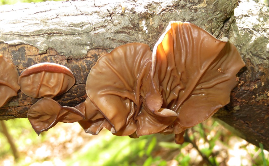
There were no morels to be seen but there were other mushrooms, none of which we picked. We saw coprinellus mushrooms and wood ear mushrooms.
1 / 2
Coprinellus mushrooms
Coprinellus mushrooms.
2 / 2
Wood ear mushrooms
Wood ear mushrooms.

Usually, I have a better eye for finding wildlife than Norma but I think she has gotten better. She found a garter snake getting ready to shed its skin. Its grey eyes are indicative of this.
Garter snake on branch

Most of the trails were sandy and well-drained. But the southern parts were less sandy and sometimes muddy.

We checked out the Wrighton Entrance. The parking lot there was full. There were far more people at the Preserve than I'd ever seen before.

I found an eastern painted turtle. It was the fastest turtle I'd ever seen. The carapace was about 4.5 inches long.
Me holding a very small eastern painted turtle

Back near the Plummer House, we saw a huge hummingbird bush. Norma recently received a cutting from Stacy and we hope ours will look like this one someday.
Daphne and I in front of hummingbird bush

We drove home and then I went paddleboarding. See my May 2, 2020 blog.
Close accordion icon

Soldiers Delight: May 9Open accordion icon
Norma, Daphne and I went for a hike at the Soldiers Delight Natural Environment Area. We had both been there before but neither of us remembered when. I'm thinking I was there around 2005.

It was unusually cold for May. During the time we were there, the high temperature was about 45 degrees and the wind was 20+ mph. That night in Savage, it was supposed to get down to 31 degrees.

But the cold, windy weather meant that the place was not too busy. We arrived around 1100 to a mostly empty parking lot at the visitor center.

The three of us walked west on the white-blazed Serpentine Trail. We passed Red Dog Lodge and then walked south to the Stargazing Field.

Much of the area on the Serpentine Trail was covered with what looked like dead grass. Not a lot of trees. Definitely not a pretty place in my opinion. It reminded me of the Sacramento area in summertime.
This Serpentine Grassland and Oak Savanna Ecosystem was part of "The Great Maryland Barrens" according to renowned Historian, William Bose Marye (1886-1979). "Great" because they covered over 100,000 acres in the Maryland piedmont, stretching from the Potomac River near Washington D.C. into Pennsylvania. "Barren" because they were "bare," not of trees, but of "timber." Tree species were present, but they were "gnarled and stunted oaks which dotted the landscape."
- from information sign
Daphne on the Serpentine Trail

The oak savanna community is one of the rarest natural communities in Maryland.
Community volunteers, Maryland Department of Natural Resources, U.S. Fish and Wildlife Service, and Soldiers Delight Conservation, Inc., are working steadfastly to restore and protect this rare and endangered ecosystem for generations to come. Their efforts are part of an ambitious goal to recover 1,000 acres of the original Great Maryland Barrens.

- from information sign

We walked the outer portions of all the trails. I think the only parts we didn't hit were a couple of sections in the red-blazed Choate Mine Trail and orange-blazed Red Run Trail.

We passed a pool filled with polliwogs and then stopped for lunch shortly after at the Pit Mine.
Polliwogs

On the Red Run Trail, the scenery changed from barren to lush...looking more like Maryland. I suspect this was largely due to the fact that Red Run Stream passed by.
Red Run Stream

It seemed most of the trails on the east side of Deer Park Road were muddy. We did have a lot of rain over the last few days but the amount of water on the trails seemed excessive. Norma carried Daphne over some of the more squishy parts.
Norma and Daphne on a very wet section of the trail

On the Choate Mine Trail, we passed the Choate Mine, where chrome was once mined. Unfortunately, the mine was underwater.
The deposit was first worked before 1839. The ore consisted of chromite disseminated in serpentinite. The last ore was removed in 1918.
- from MindAt - Choate Mine, Owings Mills, Baltimore Co., Maryland, USA
The entrance to the Choate Mine

Chrome was first discovered in the United States in Baltimore County circa 1808. Isaac Tyson, Jr. operated chromite mines at Soldiers Delight and in other serpentine barrens and from 1828 to 1850 his mines produced almost all the world's chronium (sic). The unique beauty of this area is enhanced by rare plants and animals.
- from information sign associated with the Baltimore County Historical Society

In my opinion, this isn't one of the more scenic places to hike but it is fascinating from a geologic and historic point of view. I don't know what this is below but it looks interesting.
Interesting rock

We walked 6.3 miles.
Close accordion icon

Schooley Mill Park: May 12Open accordion icon
Norma, Daphne and I went for a short hike at Schooley Mill Park. This is about ten miles from our house. I stopped there briefly during a bike ride on May 11, 2020.

I wasn't expecting much and was delighted to find that there are a lot more wooded trails than I expected, especially on the west side. We started near the horse ring and then headed south. I didn't get any good photos but we did see a fox carrying a rabbit. It was probably taking it to its den to feed its kits.

One word of caution. If you have dogs, be advised that horses use these trails. We saw at least two. Daphne is good around horses. She just looks at them and doesn't bark.
Close accordion icon

North Point State Park - Black Marsh Trail: May 13Open accordion icon
It had been a relatively cold and windy spring. But today was different. It was warm with very light wind and sun...a great day for paddleboarding. So Daphne and I drove out to North Point State Park, intending to explore Black Marsh Natural Area.

We arrived to a six mph wind with eight mph gusts from the south. The wind speed wasn't bad but it was blowing across a lot of open water and kicking up some waves. The wind was expected to drop and then pick up slightly on our return trip if we were to venture out. So I decided to leave this adventure for another time.

Instead, we explored the area on land. I checked out the beach and the trails that led to it. Then we drove out to parking lot A near the entrance and picked up the Black Marsh Trail. Much of this trail was very muddy but I found that if I stuck with the path that led just outside the park at 39.220956, -76.429962, it was dry.

My goal was to get to the Observation Trail but it was too muddy at 39.221241, -76.424842 to get past without going through what appeared to be ankle deep muck. It had rained quite a bit recently. So we just spent some time there viewing the beauty of the wetlands before heading back.

I saw two beaver lodges, turtles, and a northern water snake with muted colors that looked bronze.
1 / 2
Northern water snake on log
Water snake.
2 / 2
Close-up of same snake
Close-up.

It was still fairly early so I decided to spend the rest of the day paddleboarding in Curtis Bay. See my May 13, 2020 blog.
Close accordion icon

North Point State Park - Black Marsh Trail Revisited: May 16Open accordion icon
After kayaking in the Black Marsh Natural Area with Norma and Daphne on May 16, 2020, we decided to check out the hiking trails at North Point State Park.

Upon landing, one of my Teva Tanza sandals broke. The stitching came undone on one of the straps so it was no longer connected to the sole. So for this walk, I wore Norma's old water shoes. They are too big for me and the sole is very thin. Not very comfortable but it would do.

We drove to parking lot A, which is near the entrance. Then we walked on Bay Shore Road to where the Black Marsh Trail connects to the road near the bend. Here, we picked up the trail and walked counterclockwise back to the car.

A lot of people use this route to get to the less secluded beaches. It is harder to get to so there are less people.

This place was once home to an amusement park.
Bay Shore Amusement Park was built on 30 acres in 1906. During its time, the park was a lively and attractive place offering a variety of recreations and relaxation along the Chesapeake Bay. Activities included a dance hall, bowling alley, restaurant, and pier. In addition to the trolley/streetcar from Baltimore, visitors could reach the park by steamboat from Baltimore to the park pier.
- from Wikipedia - North Point State Park

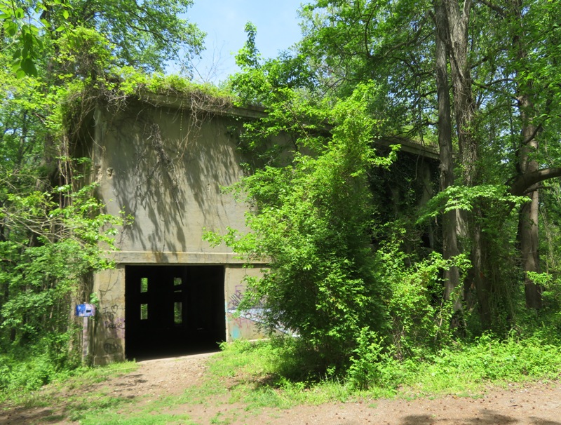
Some of the ruins from this amusement park, such as the power house, still stand near the Power House Trail.
...the old power house [is] an immense poured concrete building that seems strangely out of place in the middle of a wildlife preserve. Its furnaces once generated electric current for the streetcars that needed a boost at this far eastern extremity of the old United Railways and Electric Company's system. The generators also supplied voltage to the park's rides.
- from The Baltimore Sun - Fabled Bay Shore Park survives as wildlife preserve, hiking trails
Powerhouse with lots of greenery

This power plant...
...was built on the North Point peninsula, near Bay Shore Park. It contained eight generators, seven to provide DC current to power streetcars and one generator which provided AC current, primarily for Bay Shore Amusement Park.
- from flickr - Wendy Alexander - Abandoned Power Station
1 / 2
Columns inside power plant
Columns.
2 / 2
Daphne and graffiti-covered wall
Daphne.

According to The Baltimore Sun - Fabled Bay Shore Park survives as wildlife preserve, hiking trails,
When the Bethlehem Steel Company purchased the parkland (ZTC feared that the rival U.S. Steel was going to put a plant here), it left the concrete powerhouse standing. [Not sure what ZTC stands for.]
"It was secluded in a grove of trees and Bethlehem stored its secret government ship patterns in it. The feeling was that if Sparrows Point was ever bombed from the air, the ship patterns would be safe in another place."


Despite its age and neglect, the power plant is in remarkably good shape. But like many abandoned ruins, the power house has become a haven for graffiti.
1 / 2
Graffiti-covered walls
Graffiti.
2 / 2
Daphne standing in the doorway with more graffiti
Daphne in doorway.

Not surprisingly, the closer we got to wetlands, the more wildlife we saw. I guess that's one reason I am drawn to the water. I caught a snapshot of this red-winged blackbird in mid-shrill.
Red-winged blackbird in mid-shrill

We walked to the end of the Observation Trail and stood on the observation platform. But we couldn't see anything in the marsh because the grasses were so tall. But it was a nice walk nonetheless.

Recall that on May 13, 2020, I tried to explore the Black Marsh Trail but it was too muddy to get through. Well, three days later (today), the muddy areas were a little drier so we were able to pass. Along the way, we saw two large bullfrogs.
1 / 2
Bullfrog on log
On log.
2 / 2
Bullfrog in water
In water.

We also saw a great blue heron.
Great blue heron on stump

I'm guessing we walked about 2.5 miles.

Once we got home, I sewed my Teva back together using kevlar thread. Then I used Shoe Goo to glue the sole back together. I tried it out on May 23, 2020 and it worked as good as new!
Close accordion icon

Patuxent River - Annapolis Road to Deerings Branch: May 31Open accordion icon
Norma, Daphne, and I did a little exploring in southern Baltimore County, about 25 minutes from our house.

Usually, we walk on established trails but we also like to get out and check out the roads less traveled. In this case, I found an unmarked trail that runs parallel to the Patapsco River on the north side. I learned about it after studying Anne Arundel Water Trail Map 1 - Northwest Section and then looking at satellite photos.

We started at 39.226306, -76.641389 just off Annapolis Road (route 648) near Manoff Road.

Walking northeast, I determined that our trail was a dirt road used for sewer maintenance. During the first third of a mile, we trekked over several muddy spots. It last rained three days ago. There were vehicle and bicycle tire prints in the mud, but we only saw fishermen and that was just at the areas very close to a road. Otherwise, the place was secluded.

Norma saw a large bird fly into the trees. I noticed it was a barred owl. It was at least 100 yards away. That made our day!
1 / 2
Barred owl facing me in tree
Head on view.
2 / 2
Same owl looking at me over its shoulder
Over the shoulder.

There was lots of poison ivy along the side of the road. So I made sure to stay on it.

There was also alot of non-native hairy vetch in bloom. Also some non-native moth mullein.
1 / 2
Purple flower from hairy vetch
Hairy vetch.
2 / 2
White and pink flower from moth mullein
Moth mullein.

We walked under Baltimore-Washington Parkway (highway 295). Our trail was scenic and wooded. Power lines ran parallel to our trail but further inland. Not sure if one can legally hike there.

Eventually we came to Hammonds Ferry Road. I checked out Hammonds Ferry Road Launch which is mentioned in Anne Arundel Water Trail Map 1 - Northwest Section. One can indeed launch here but not easily. Putting in on the west side of the road would be best. But it is a fairly steep dropoff to the water. Easier to put in about 2.5 miles downstream at Southwest Area Park.

Just east of Hammonds Ferry Road (but west of highway 695) is Deerings Branch. It is not shown on many maps. I've paddled this area many times now but never noticed it. Considering it is pretty narrow, it also looks fairly deep. It empties into the Patapsco River at 39.230697, -76.665092. We saw a nice trail that ran along side it on the west side but couldn't figure out how to get there without swimming across or crossing highway 695.

We walked north on Hammonds Ferry Road and then west on Eskow Avenue to Deerings Branch, 39.234548, -76.664115. On the north side of Eskow Avenue, the branch was shallow. We saw what looked like the remnants of an old bridge.
1 / 2
Deerings Branch under Eskow Avenue
Under Eskow Avenue.
2 / 2
Concrete foundation from what looked like was once an old bridge
Bridge remains.

Walking back the way we came, we continued past where we picked up the trail, crossed under the train tracks, and made it to 39.224757, -76.639376. We'll explore east of there another time.

On the west side of the train tracks, we picked up another part of the trail which took us to the east end of Manoff Road at 39.226537, -76.638959.

I'm guessing we hiked about 3.5 miles.
Close accordion icon

Billy Goat Trail - Section A: June 28Open accordion icon
Norma organized a hike with her friend Malar, Malar's kids (Thanusha, Nidhiksha, and Dursha), and Nidhiksha's friend, Rashida. We planned to meet at Great Falls Tavern.

We passed Anglers Inn on the drive out. The parking lot looked full and some folks were parking illegally on the side of the road. I guess they figured that if lots of other people did it, they wouldn't get a ticket. Maybe they were right.

We arrived at our destination around 0740. The lot wasn't full but it was quickly getting there. Anglers Inn is much more popular because it is free. In contrast, we had to pay $20 to park at Great Falls Tavern, even though the visitor center was closed. At least we had a real restroom...not a porta-john.

This is a walk we typically reserve for when we have guests. It is a fun place to explore because it has lots of great scenery but it is near an urban metropolis and on almost any weekend or holiday when the weather isn't bad, you can expect a lot of people. With the Coronavirus pandemic, the crowds were much larger. If you're trying to socially distance yourself, then this is not the place to go.

Daphne could not join us because dogs are not allowed on the Billy Goat Trail. It probably would not have been good to bring her, regardless. It was pretty hot and with all the people, she would have been on a leash the whole time.

The seven of us walked to the Observation Deck for Washington Aqueduct. The water looked high.

On the Chesapeake and Ohio (C&O) Towpath, we saw a black snake and passed some of the locks which looked refurbished with new wood and hardware. Very nicely done.
Refurbished canal lock

Next, we walked on Olmsted Island Trail to Olmsted Island.

A little later, we picked up the 1.7 mile Section A of the Billy Goat Trail on Bear Island.

We saw several lizards, including an eastern fence lizard and a broadhead skink. There were also several tadpoles in various stages of development. Some had legs. One was a frog with a tail. We also saw a few frogs, small fish, large carp, and turtles.

There were lots of healthy-looking paw paw trees but only one or two bearing fruit. Not sure why but it seems like the paw paw trees in more urban areas are less likely to bear fruit. And I don't think it is because people pick the fruit. These would not be ripe for a few more months.

We walked a total of 5.7 miles.
Map of our route

Upon arriving home, I took Daphne for a nice walk along the Little Patuxent River. It was a much more socially distanced walk than the Billy Goat Trail.
Close accordion icon

Browns Bridge to Tucker Lane: July 18Open accordion icon
Norma, Daphne, and I did an early morning hike starting at Brown's Bridge, commencing around 0700. I learned about it at AllTrails - Browns Bridge - Rocky Gorge Reservoir.

Normally, one would need a permit to hike here but for the remainder of the season, permit fees are waived, according to WSSC Water - Watershed Regulations.

The trail is very wooded so you'll be fine if you don't wear sunscreen. But definitely wear long pants. You're o.k. if you stick to the main trail, but if you venture off on any of the side trails, foliage (and maybe ticks) will definitely rub up against your legs.

We walked to the Patuxent River where I saw about six kayakers pass by in about 15 minutes. We were paddling here on June 20, 2020. It is much more beautiful on the water than it is on land.

It was very humid. I'm guessing the shade and humidity are great for fungii, which we saw a lot of, including crown-tipped coral fungii, which, according to Forager Chef - Crown-tipped Coral Mushrooms is a delicacy.
Crown-tipped coral fungii

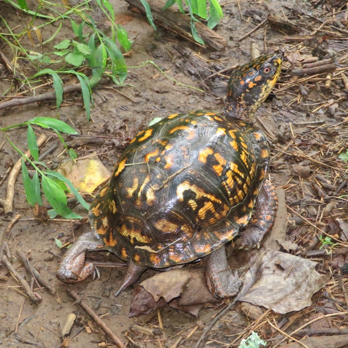
Norma found a box turtle.
Top view of a box turtle

We found a lot of wine berries. This is an invasive plant from Asia. They were growing all over the place, but especially on the main trail. Norma and I picked a lot. Some were overripe and were a little squishy. Those I simply ate on the trail.
Four ripe wineberries

Since this was an out-and-back trip, we took the side trails when we could to make things more interesting. These trails don't get as much use. A few times, I collided with spider webs. Fortunately, I missed this one.
Big spider web with spider in the middle

Norma found the unripened fruit of a Jack-in-the-Pulpit plant.
Unripened green fruit of a Jack-in-the-Pulpit plant

We (mostly Norma) picked almost a half gallon of wine berries.
Wineberries in colander

This is a great place for social distancing. We only saw three other people on the trail and got in 3.45 miles. Here's our route.
Map of our route

After we got home, I ate, washed up, took a power nap, and then went paddleboarding.
Close accordion icon

Middle Patuxent: July 24Open accordion icon
This isn't really about hiking but it is about a special place (39.160188, -76.853191) just off a trail that I love to hike...the Gorman Stream Valley Loop Trail.

On July 24, 2020, Norma, our niece, Daphne, and I drove to the Murray Hill Trailhead - South. From there, we walked a short distance to the Middle Patuxent River. There was a beach area near Murray Hill Road where we hung out. Our niece played in the water while I looked for interesting wildlife. I don't know if one is legally allowed to play in the water (they can be uptight about this in Savage) so we tried to stay out of view of the bridge in case police driving over it saw us.

It was a great day to cool off. We were in a heat spell and our air conditioner quit working. Being in the water was most refreshing.

I saw a five-inch long crayfish that I tried to catch but failed.

Several years ago, I did a "splash hike" with the Howard County Sierra Club starting just downstream from here. One of the amateur naturalists in our group pointed out silk nets in the water created by net-spinning caddisfly larvae to catch food, which for them is algae, small invertebrates, and detritus (dead particulate organic material). I saw such nets and pointed them out to Norma and our niece.
Caddisfly larva net

Caddisflies are useful as bioindicators (of good water quality), since they are sensitive to water pollution, and are large enough to be assessed conveniently in the field.
- from Wikipedia - Caddisfly

Not only does their presence indicate clean water but they also benefit the ecosystem by reducing the amount of silt in streams and rivers, thereby making the water cleaner.
- from Youtube - Science Education Feature: Caddisflies

I was pretty sure that if I looked hard enough, I would find at least one dragonfly exuvia. I did.
An exuvia (plural exuviae) is the cast-off outer skin of an arthropod after a moult.
- from Amateur Entomologists' Society - Exuvia
1 / 3
Top view of dragonfly exuvia
Top.
2 / 3
Side view of dragonfly exuvia
Side.
3 / 3
Head-on view of dragonfly exuvia
Head-on.

I also saw this ebony jewelwing damselfly. Is it just me or does its sleek body and metallic green and black colors make you think of a luxury sports car?
Ebony jewelwing damselfly

I spotted several fishing spiders. The largest had a leg spread of about four inches.
Dolomedes [fishing spiders] do not build webs to capture prey. They roam freely and consume a variety of animals in and on water and on land. They can run across the surface of a pool or stream and actually dive and remain submerged for several minutes while they hunt and capture small fish and tadpoles using sharp claws and powerful fangs.
- from "Bug of the Week - Big Spiders are a Little Scary: Fishing Spiders and Wolf Spiders" (broken link as of 2026)
1 / 2
Fishing spider on log
Fishing spider.
2 / 2
Head-on view of fishing spider
Head-on.

Shortly before departing, I used my lightning fast ninja cat-like reflexes to catch an American bullfrog tadpole. Or maybe I just sneaked up on it using my Tai Chi slowness. Regardless, I got it. After showing Norma and our niece, I released it.
1 / 2
Top view of American bullfrog tadpole
Top.
2 / 2
Side view of American bullfrog tadpole
Side.

After a couple of hours, we left, packing out a couple of bottles that we found along with a large, broken plastic Y-wing Star Wars toy buried in the sand.
Close accordion icon

Wincopin: August 6Open accordion icon
Daphne and I went for a midday hike at Wincopin. We had some time and there weren't many people out so we decided to explore some of the side trails that are unmarked and don't appear on the map.

One unnamed trail branched off from the Green Trail and took us to the Little Patuxent River just north of the quarry. Along the way, we saw a defiant-looking box turtle.
Box turtle looking alert

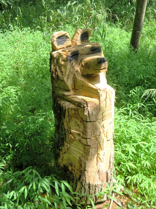
There was another unnamed trail that turned south, west, or southwest from either the Green or Blue Trails and led to the Middle Patuxent River. I seem to remember it being near a very small wooden foot bridge. Anyhoo, we followed it and it led us to a chainsaw carved bear. On it were the words "Hi Ann." Ann must be a very special person.
1 / 2
Chainsaw carved bear
Bear.
2 / 2
Front view of chainsaw carved bear
Front.

I was hoping to find a luna moth. I haven't seen one of them for a long time. But finding a chainsaw carved bear is even better!

On August 11, 2020, my neighbor told me who made the bear. It is the same person who had been doing the really impressive rock balancing. He lives here in Savage and someday I hope to meet him. I heard that Ann is a woman he hikes with.
Close accordion icon

Susquehanna State Park: August 8Open accordion icon
Norma, Daphne, and I did a six mile hike in Susquehanna State Park, starting at Rock Run Grist Mill. I think of this area as the Garrett County of the east because it is so undeveloped, hilly, and has lots of farms.

We walked down to the water and looked across the Susquehanna River at Wood Island. The river seemed pretty low considering we had so much rain.

The three of us walked up to the Archer House and then caught the Land of Promise Trail which took us south. Veering off it, we found ourselves at the Steppingstone Museum. At the northeast end of this property, we found a path that took us to the Susquehanna Ridge Trail. We followed this east and saw several dozen of earthworms wriggling on the surface. I later concluded that these are probably invasive jumping worms. Norma, Daphne, and I then picked up the Land of Promise Trail heading west. This took us to a road leading back to the Steppingstone Museum. Making this into a figure eight route, we again picked up the Susquehanna Ridge Trail where we first caught it, but this time hiked west until we were back at Rock Run Grist Mill.

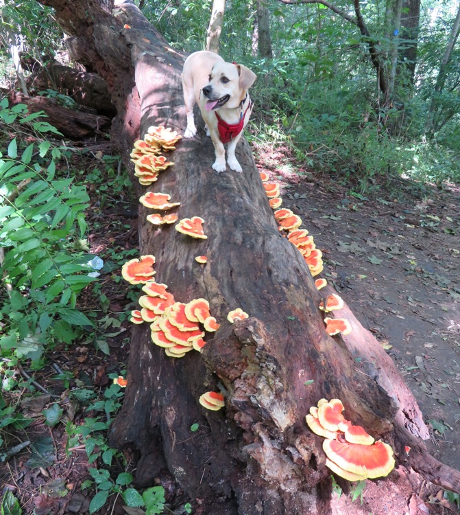
After a short break, we walked to Rock Run Road and picked up another part of the Susquehanna Ridge Trail. Trekking north, we crossed Rock Run. Here, I had an embarrassing fall in the creek while hopping from one rock to another. We were looking for wildlife and instead found Laetiporus sulphureus, aka chicken-of-the-woods, which supposedly tastes like chicken. Norma picked a whole bunch for us to eat. She ended up battering and frying it for dinner on August 18. It wasn't bad. I think most of the flavor was in the batter. It was chicken-like in color and firmness. I would eat it again though I much prefer real chicken.
1 / 2
Daphne standing on a log covered with chicken of the woods
Daphne.
2 / 2
Close-up of chicken of the woods
Close-up.

We caught Trail Spur #6 which led us downhill, east, and to Stafford Road and Deer Creek. We walked along the road for awhile and then picked up the old train track just east of the road, following that back to the mill.

We ate a lunch that Norma packed and then started our second adventure for the day...paddling from Havre de Grace to Swan Creek.
Close accordion icon

Supplee: August 30Open accordion icon
Hurricane Laura didn't really hit Maryland but it did bring some rain. When it left, it sucked up the humidity, leaving us with sun and mild weather. So that morning, Norma, Daphne, and I did a little exploring.

We did a short hike, commencing at Supplee which sits on the southeast side of Rocky Gorge (T. Howard Duckett) Reservoir. From there, we headed west along the shoreline.

It rained a good bit over the last few weeks so there was a lot of interesting fungi. My app says this one is likely a jellied false coral fungus or a white coral fungus. They look very similar. But while the latter is edible, the former causes severe abdominal pain. I wasn't willing to use this criterion to determine which it was.
Some type of coral fungus

Here's Mutinus elegans, aka elegant stinkhorn or devil's dipstick. It is a mushroom. I saw two of them. Supposedly they smell bad but we didn't notice any scent. According to MushroomExpert.com - Mutinus elegans, M. caninus, & M. ravenelii,
Unlike other mushrooms, the stinkhorn distributes its spores by applying an odorous, spore-thick slime to its tip, which flies and other insects are attracted to. The flies then carry the spores to other places.
Mutinus elegans, a red and green horn-shaped mushroom

These are likely waxcap mushrooms.
Possibly waxcap mushrooms...two orange specimens

This could be a thelephora.
Thelephora mushroom

We didn't see much wildlife. But we did spot a box turtle. This has been a great year for finding them.
Box turtle

Norma spotted a Hylodesmum nudiflorum, aka naked-flowered tick trefoil. It is not the most interesting flower but the leaves have a sine wave-like pattern that makes it easy to identify.
Pink flower with wavy leaves

At an underground gas line, we headed away from the water (south) and then caught a wide trail or narrow dirt road that led us back to the start. This section was the border between reservoir property and private property. Here is our route.
Map of our route

We walked a total of 3.3 miles and saw maybe three or five other people. I would like to explore more of the trails on the south side of this reservoir but access points are few. Studying satellite images, I have some areas I plan to scout and if they are good places to pick up the trail, you can be assured I will blog about them.

It was a lovely day and we wanted to spend more time outside. So we rested up and then went paddling later in the day.
Close accordion icon

Garrett County: September 5-7Open accordion icon
On September 5-7, 2020, Norma, Daphne, and I did several short hikes in Garrett County, Maryland along with one area just across the border into West Virginia.
Close accordion icon

Snavely Ford: September 20Open accordion icon
Norma, Daphne, and I spent some time in Shepherdstown, West Virginia. Then we met with Daphne's biological father, Finn, and her sister, Mia, near lock 38 just off the Chesapeake and Ohio (C&O) Towpath National Historical Park in Sharpsburg, Maryland. She had met both before but this was the first time that all three were together. In attendance were Finn's adopted parents, Brian and Julie, along with Mia's adopted parents, Richard and Esther. In the below snapshot, from left to right are Finn, Daphne, and Mia. Mia looks more like her biological mother, who is at least part beagle. Finn is part corgi and part husky.
Three dogs on the grass

After the family reunion, the three of us drove to Antietam National Battlefield where we walked on the Snavely Ford Trail to Antietam Creek. We did a 2.8 mile section of the Snavely Ford Antietam National Battlefield Trail.

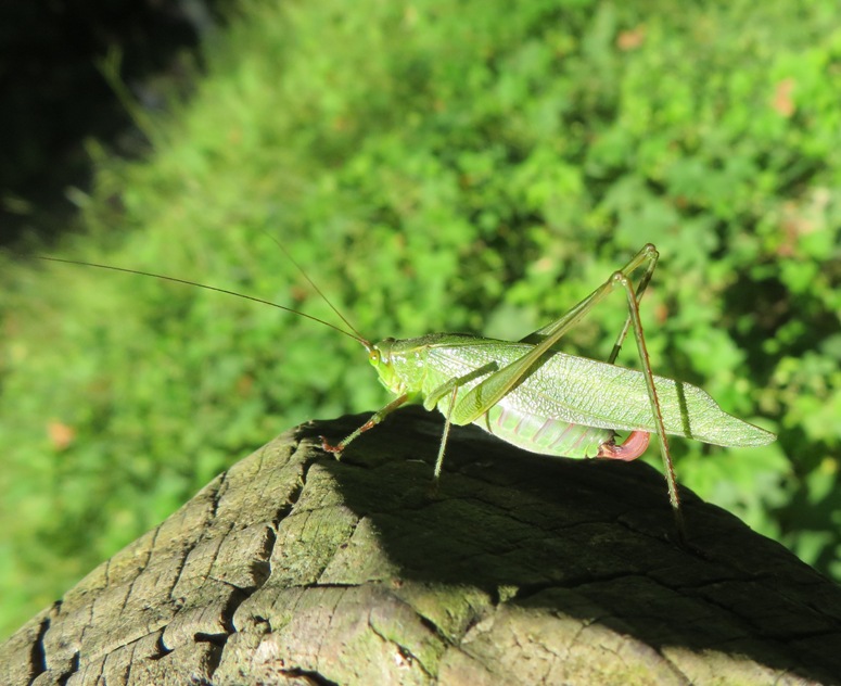
We saw some kind of female katydid.
Katydid on log

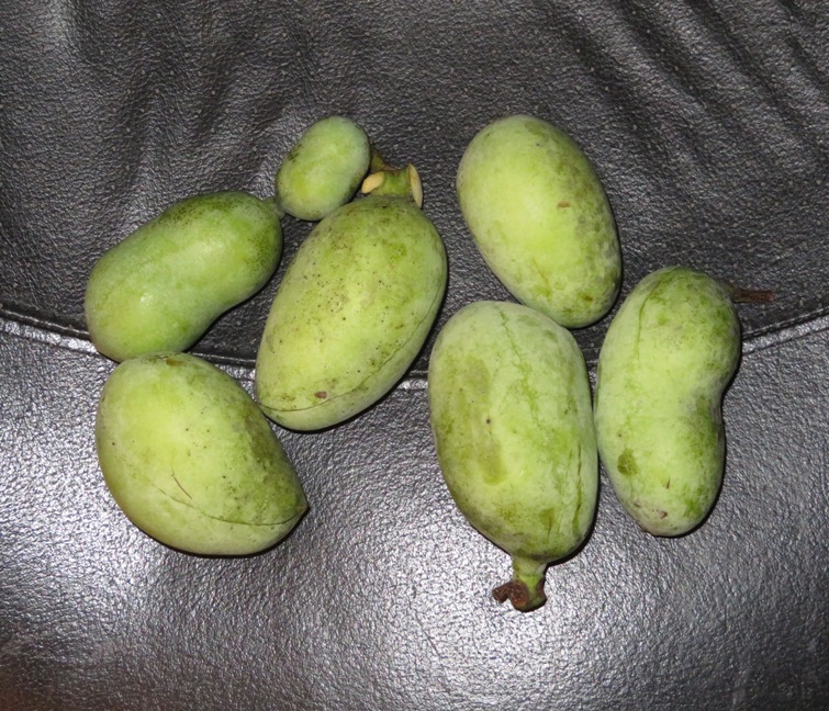
There were lots of paw paw trees along the Antietam and a few of them had fruit.
Seven paw paws

On the drive home, we saw a hot air balloon somewhere around Frederick.
Hot air balloon

Here is our route. There are a lot of trails at Antietam. I've lived in Maryland for 25 years, and this is the first time I ever hiked on any. Guess I'll be back.
Map of our route

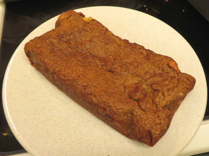
We let the paw paws sit around for a few days. One of them that was already ripe ended up getting too ripe so I fed it to the chickens who loved it. But except for one that was small, the other ripened to perfection. I peeled and de-seeded them, then gave the mushy meat to Norma. She found a recipe for paw paw quick bread. Paw paws are very similar in consistency to banana so I think one can simply substitute paw paws for bananas in any similar recipe. The result was delicious!
Paw paw bread
Close accordion icon

Pine Grove Furnace State Park: October 3Open accordion icon
Norma, Daphne, and I went for a hike and did a little exploring in Pine Grove Furnace State Park, Pennsylvania.

Pole SteepleOpen accordion icon
We walked 4.8 miles on the Pole Steeple Loop.

From the parking lot we had a great view of Laurel Lake to the north where I could see a lot of rental canoes on the north side. Clearly, this is a popular tourist destination. Before stepping off, a bald eagle flew from a tree near my car. Seemed like a good omen.

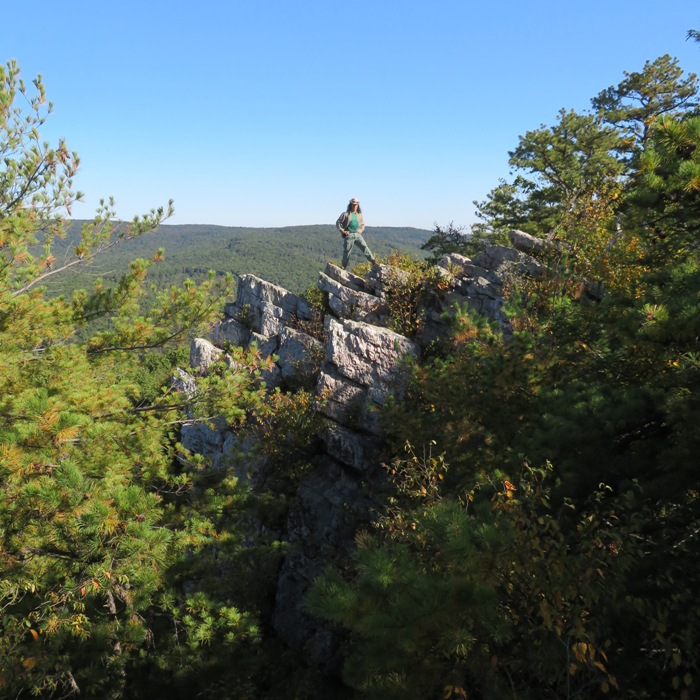
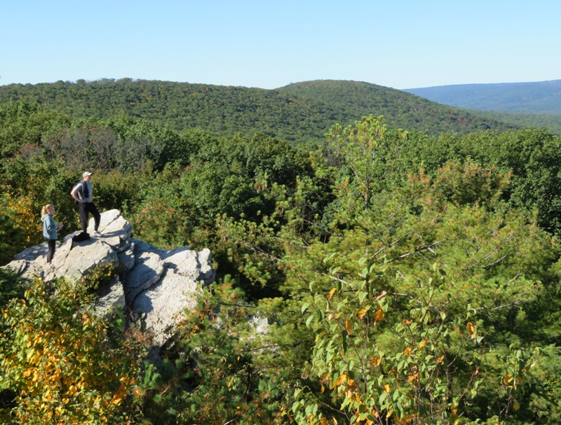
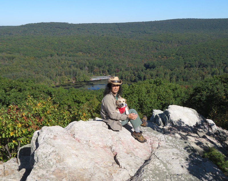
Heading clockwise on the loop, we walked up the steep, rocky, blue-blazed Pole Steeple Trail which was lined with ferns and small sassafras trees. I was glad to be wearing my thick-soled high top boots. It was a little cold but the climb quickly warmed us up. As we approached the 1,303 foot Pole Steeple Vista, we did some rock scrambling. It was challenging for Daphne but she made it to the top without our help.

I know this vista/peak must get a lot of visitors so we were glad to be there when it was still early. The view was nice though it was still early in the season so the leaves hadn't changed color. Maybe they will in another couple of weeks.
1 / 3
Me standing on some high rocks
On top of the world!
2 / 3
Another couple, also on some high rocks
Another couple.
3 / 3
Daphne and I with Laurel Lake behind
Daphne and I.

Continuing our hike on the south side of the vista wasn't so easy. We somehow managed to lose the trail and I used my AllTrails phone app to get us back. Technology is convenient but it makes me lazy and not having to think.

Heading downhill on Pole Steeple Trail and then west on the white-blazed Appalachian Trail, we saw lots of mountain laurel, some club moss, and a few other things.

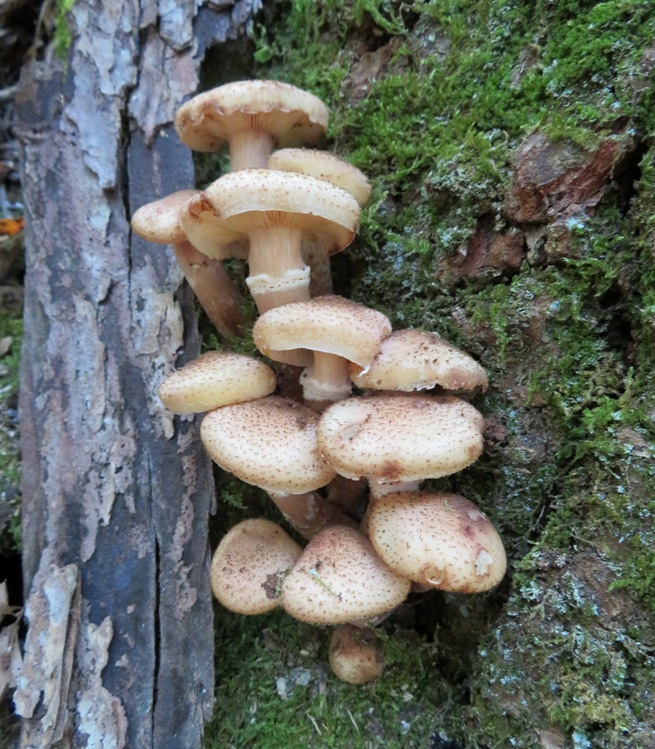
These mushrooms made me think of snickerdoodles.
Whitish mushrooms growing on side of tree

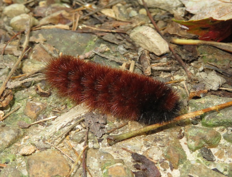
I saw a woolly bear. It is the larva of the Isabella tiger moth (Pyrrharctia isabella). This one is predicting a mild winter. For more information, see NOAA - Woolly Bear Caterpillar - Winter Predictor Or Not?.
Mostly red woolly bear caterpillar

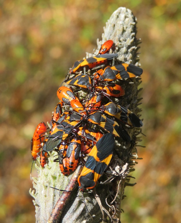
We were hoping to find monarch caterpillars on these milkweed plants but instead we saw milkweed bugs. They protect themselves by consuming milkweed sap, which is toxic to most predators.
Milkweed bugs on milkweed

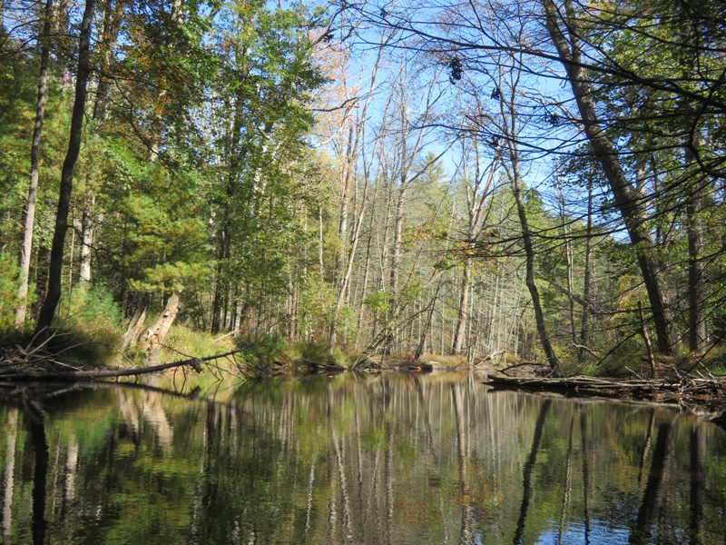
Next, we headed northwest on the yellow-blazed Mountain Creek Trail, which parallels the scenic Mountain Creek.
Bucolic Mountain Creek

We found what I believe is Angel's Wing Mushroom (Pleurocybella porrigens). According to Chemical and Engineering News - The Angel's Wing Mystery, it is deadly poisonous and may cause acute encephalopathy, a type of degenerative neurological condition characterized by lesions in the brain.
White Angel's Wing mushrooms on log

I found some rhododendron and witch hazel plants growing along the creek.

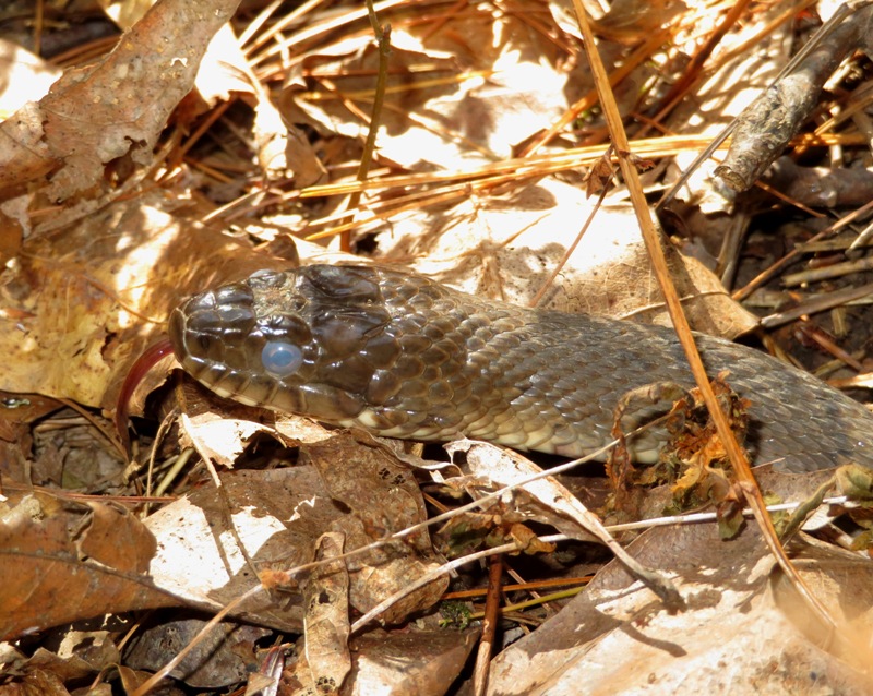
Our big find of the day was spotted by Norma...a northern water snake. Its pale eyes means it is getting ready to shed. I managed to capture the tongue in this picture.
Close-up of the head of a northern water snake flicking its tongue

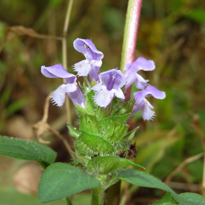
The final part of our hike was on the Old Railroad Bed Road where we found a spring and a self-heal flower. According to Lady Bird Johnson Wildflower Center - Prunella vulgaris, its common name derives from wide use as a herbal remedy for throat ailments.
Small purple flowers

Completing our walk, we drove to our next stop, the Appalachian Trail Museum.
Close accordion icon

Appalachian Trail MuseumOpen accordion icon
Norma, Daphne, and I stopped at the Pine Grove Furnace State Park visitor center, but it was closed. There, I read a letter from Sandra "Sandi" Marra, President and CEO of the Appalachian Trail Conservancy (ATC) which read:
Please stay away from the Appalachian Trail. Whether your hike is for a couple of hours or a couple of days, staying away from the Trail minimizes the spread or contraction of COVID-19.
I was quite surprised to see this, considering so many people were spending time outdoors since medical experts told us that we were so vulnerable indoors. There was no date on this letter.

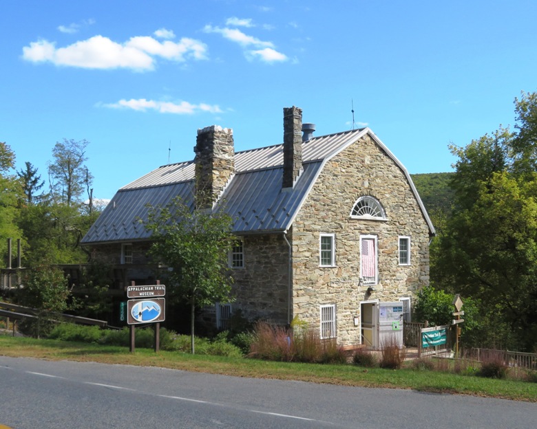
Next, Norma and I visited the Appalachian Trail Museum. We left Daphne in the car for this one. It is located at 1120 Pine Grove Road, Gardners, Pennsylvania 17324. Displays are set up to describe its passage through each state that it touches. I can claim to have hiked the entire section through West Virginia...yes, all four miles of it. This place has everything you'd want to know about the trail, its history, evolution, and features. The museum is definitely worth a visit but expect to do a lot of reading.
Appalachian Trail Museum building

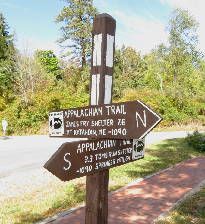
Why was the museum built at this location? Because this is the midpoint of the Appalachian Trail. It is about 1,090 miles to either endpoint.
Wooden sign with pointers to either end of the Appalachian Trail

We visited the general store, ironmaster's mansion, and stone furnace. Then we headed off for our second hike of the day...the Koppenhaver Trail.
Close accordion icon

KoppenhaverOpen accordion icon
Norma, Daphne, and I walked 2.2 miles on the Koppenhaver Trail which lies in Pine Grove Furnace State Park.

We started at the Fuller Lake day use area where one can pick up both the Koppenhaver and Cumberland County hiker/biker trails.

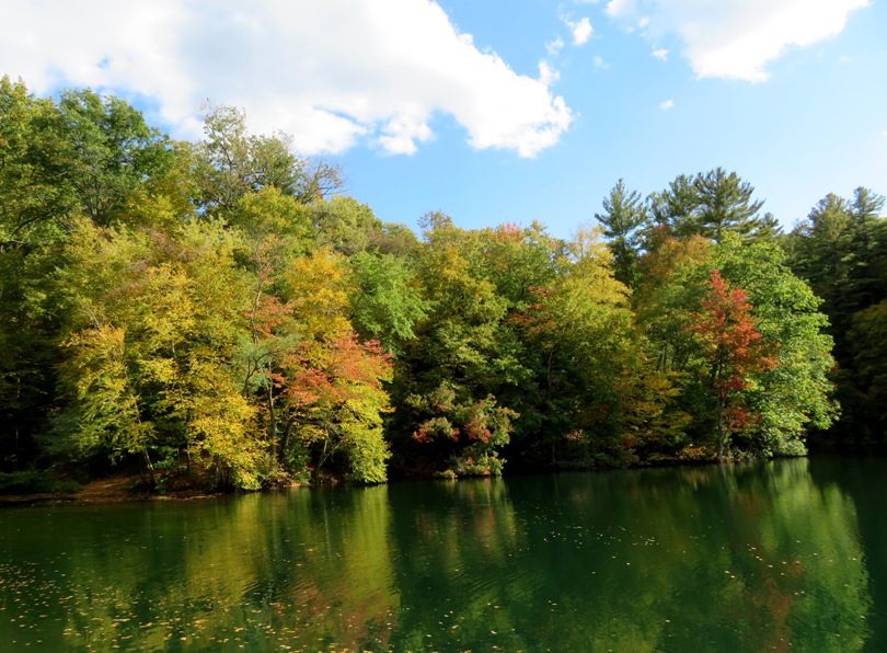
The three of us crossed over Mountain Creek and checked out Fuller Beach where folks can lay out in the sand or swim in the lake. Here, the trees were just starting to change color.
View across from Fuller Beach

The Appalachian Trail crossed through near the beach but if it wasn't for the white blazes, I never would have known because this section is paved. It really doesn't fit in with the rest of the trail. I think it is just a connector section.

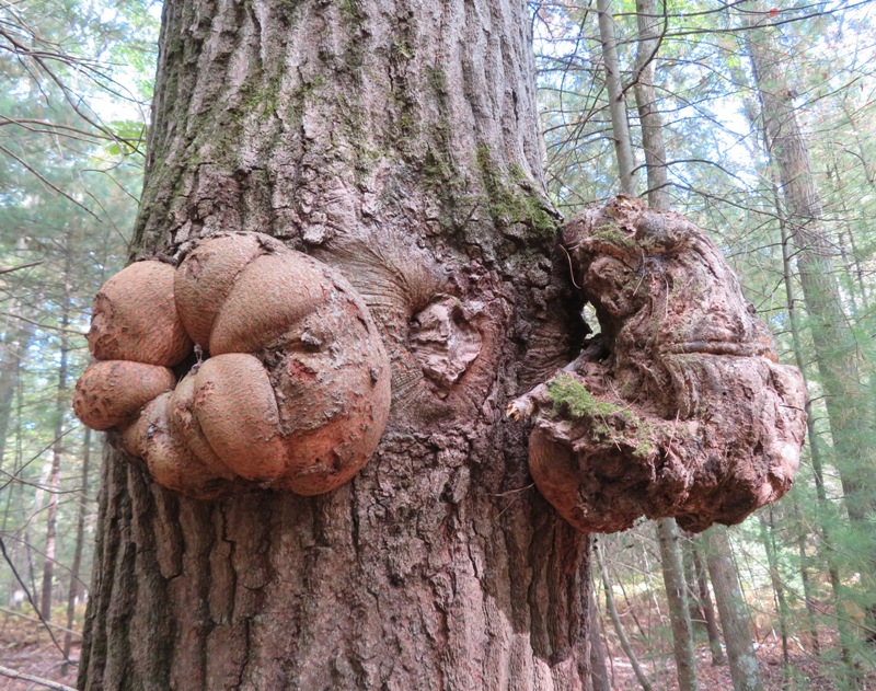
We saw some joe pye weed, eastern hemlock, invasive Japanese barberry, and mullein. We also found this tree with an unusual growth. What does that thing on the left side remind you of?
Growths on tree

There were several old concrete structures along Mountain Creek. According to the Friends of Pine Grove Furnace News, Spring 2020 newsletter:
They are remnants of an amusement park and summer camp - an unexpected legacy of 19th century ironmaking at Pine Grove Furnace.
The South Mountain Mining & Iron Company needed to increase income from the South Mountain Railroad that connected Carlisle with Pine Grove Furnace. One way to do that was to increase ridership, but what would induce people to take a train into the mountains? An amusement park! In 1878 the iron company built an attraction on 30 acres of land next to Mountain Creek. Our modern Koppenhaver Trail loops right through the site.


There weren't many flowers but I did see some chicory.
Blue chicory flower

Here is our route.

After our walk, we stopped for ice cream and then visited a couple of farm produce stands. It turned out one was owned and run by a relative of someone Norma knows.
Close accordion icon

Ricketts Glen: October 10-12Open accordion icon
On October 10-12, 2020, Norma, Daphne, and I did a lot of hiking in the Ricketts Glen part of Pennsylvania.
Close accordion icon

Kendall Ridge: November 22Open accordion icon
Norma, Daphne, and I went for a hike in Columbia, Maryland on the Kendall Ridge Loop trail. This is a paved path maintained by the Columbia Assocation.

We saw a red-shouldered hawk near the trailhead.
Red-shouldered hawk

Here is our route.
Map of our route
Close accordion icon

Rocky Gorge - Brogden to Kruhm: November 29Open accordion icon
Norma, Daphne, and I took advantage of the nice, sunny weather to do some hiking on the Bridle Trail in Rocky Gorge (T. Howard Duckett) Reservoir. When places like Wincopin are overflowing with visitors, the trails at the reservoir are almost vacant. We only saw two other hikers.

Unlike previous winters, these trails will remain open throughout the winter. The following was posted to WSSC Water - Watershed Recreation User Program on November 25, 2020:
Providing families with outdoor recreation options to help alleviate stress caused by Covid-19, and foster improved physical and mental health, WSSC Water today announced it will keep all watershed recreation areas open for the winter season. Typically, the watershed recreation areas close on December 1 and reopen on March 15. All eight recreational areas will remain open throughout the winter, weather permitting.

The reservoir doesn't have any designated scenic overlooks but there are some places that are indeed very scenic. In my opinion, winter hikes are very nice because then you can walk along the high areas and see the water down below through the trees.

There are a few places along the trail that lead to large rocks which overlook the water and provide a panoramic view of the area.
Norma and Daphne on large rock by the water

Notice the red, green, and blue paint on this boulder. There is a lot more graffiti on the other side, which I saw while paddleboarding on June 3, 2020.
Daphne and I on painted boulder

Some of the trails pass by private property. One house had some very ornate, medieval-looking structures built into stone.
Gargoyles, stone, and iron

Here is our route. Three days prior, we did a hike at this same reservoir but slightly west. There are lots of great trails but unfortunately, not enough places to access them. We made it to Kruhm Road but there is no public connection between the trail and the road. So exploring east of here will be challenging.
Map of our route
Close accordion icon

Huntington Trail - Sooty Mold: December 13Open accordion icon
Daphne, and I went on a short hike on what I call the Huntington Trail. It is southwest of Vollmerhausen Road between Murray Hill Road and highway 95, across from Huntington Park.

This trail is very well maintained and it seems like there are constant improvements. This time, someone chainsawed a large fallen tree into a bench. Maybe it was the same guy that made the chainsaw bear carving in Wincopin.

We walked on the white-blazed trail and then under highway 95 into Wincopin. We've hardly hiked on Wincopin since the pandemic started because there are so many people there on a nice day. But the Huntington Trail is never crowded. The only concern is that if it has rained in the last few days, the trail near the Middle Patuxent River will be muddy.

I saw a carving that someone made on this tree along the white trail. I had to investigate.
'LOOK' and an arrow carved on a tree

Upon investigation, I found this behind a rotting stump. The box underneath contains a geocaching prize. I think I'll submit a geocaching prize sometime in 2021. Not yet sure what or where this prize will be.
Dog statue on container with geocaching prize inside

One of the foot bridges on the white trail was decorated for Christmas. They even included lights and a battery pack.
Daphne on decorated bridge

I found this tree. One side was blackened. At first, I thought it had been struck by lightning.
Small tree blackened on one side

Many of the branches on this tree were also blackened and covered by what looked like thick soot.
Blurry pic of black stuff on branch

I found a broken branch with this thick, black soot and took it home. Here is a close-up of the thick black soot. It did not have a burnt smell and the soot was not flaky. Upon further investigation, I learned that this was not caused by lightning but rather is caused by woolly beech aphids. The black stuff is sooty mold which grows on the excrement of the insects.
Close-up of sooty mold

For more information about sooty mold, see
  • How Orchids Rebloom - What is this black sooty stuff on the leaves of my plant?
  • Wisconsin DNR Forestry News - Ants, aphids and sooty mold on white pine
  • Close accordion icon

    Triadelphia Reservoir - Green Bridge: December 19Open accordion icon
    Norma, Daphne, and I did a short out-and-back hike on the Montgomery County side of Triadelphia Reservoir, starting from Green Bridge and heading northwest. We saw a red fox.

    This is a great place to hike if you want to get away from people. With the Covid-19 pandemic, popular trails are heavily used and you are likely to run into other people. But on this hike, we saw nobody except at the parking lot.

    Here is what we saw.
    1 / 5
    Norma and Daphne on a snow and ice-covered trail
    Norma & Daphne.
    2 / 5
    Daphne with the Triadelphia Reservoir behind
    Daphne & reservoir.
    3 / 5
    Inlet
    Inlet.
    4 / 5
    Footprints in the snow
    Footprints.
    5 / 5
    More footprints in the snow
    More footprints.
    Close accordion icon

    Triadelphia Reservoir - Triadelphia: December 27Open accordion icon
    Norma, Daphne, Teresa, Bob, Ken, and I did a 6.5 mile out-and-back hike on the multi-purpose trail on the Montgomery County (southwest) side of the Triadelphia Reservoir. We commenced at the northwest trailhead at Triadelphia Lake Road and then hiked southeast.

    We passed the Maryland Chapter of the American Chestnut Foundation seed orchard.

    There were lot of birds out on this sunny day including a possible kestrel.

    In the snapshot below, Daphne shows off her new Christmas sweater. But the temperature got up to the high 30s so she didn't really need it. Still, she wore it. Her short legs meant the bottom of the sweater got wet. It might be best to wear when it is much colder and there is little chance of encountering liquid water. Since then, I have started to look into things she can wear that are both insulated and waterproof or water-resistant.
    Daphne wearing red sweater

    High up in a tree, I spotted some very unmushroom-shaped mushrooms.
    Three triangular-shaped mushrooms

    Here's Bob and Daphne near the end of the trail, which is really a maintenance road. As such, it isn't made to take one to scenic areas. Since it is rather wide, I think it would make a great place for cross country skiing.
    Daphne and Bob walking on wide dirt road through the woods

    We took a group shot at the end of the hike. Left to right standing are Norma, Ken C., Teresa, and Bob. Daphne and I are in front.
    Group photo with most of us wearing Covid masks

    The main reason I organized this hike was so I could finish exploring this trail. There is very little written about it and I never knew how long it was. But now I know. It is 4.8 miles, one way, give or take a little. I created a map by merging information from this hike and the one I did on December 19, 2020. I suggest opening this image in a new window so you can view it full-size.
  • On the 19th, we started at Green Bridge and hiked northwest to the western green star.
  • On the 27th, we started at Triadelphia Lake Road and then hiked southeast to the eastern green star.
  • Map of the area with my notes

    Normally, I don't think one would find many people on this trail, but on this day, we saw about a dozen. That may not be much compared to a more popular trail but for this, it seemed like a lot.
    Close accordion icon

    Bucket ListOpen accordion icon
    These trips are on my "to do" list for 2021. It is a work in progress.
  • Black Moshannon State Park rests high in the mountains of the Allegheny Forest in Pennsylvania. It is known for its bogs, carnivorous plants, and wild orchids, the latter of which can bloom anytime from late April through July though supposedly June is the ideal time to see them. There are also cranberries which ripen mid-September through early November. Centred Outdoors offers free, guided hikes. For more information, see Centre Daily - Cranberry bog, wildlife and more: Take a guided tour of Black Moshannon State Park.
    Close accordion icon
  • Daphne and me in front of a graffiti-covered metal structure
    Daphne and I in the Hell House area, April 25, 2020