|
This page describes my kayaking and standup paddleboarding adventures in 2020. |

|
This page describes my kayaking and standup paddleboarding adventures in 2020. |
|
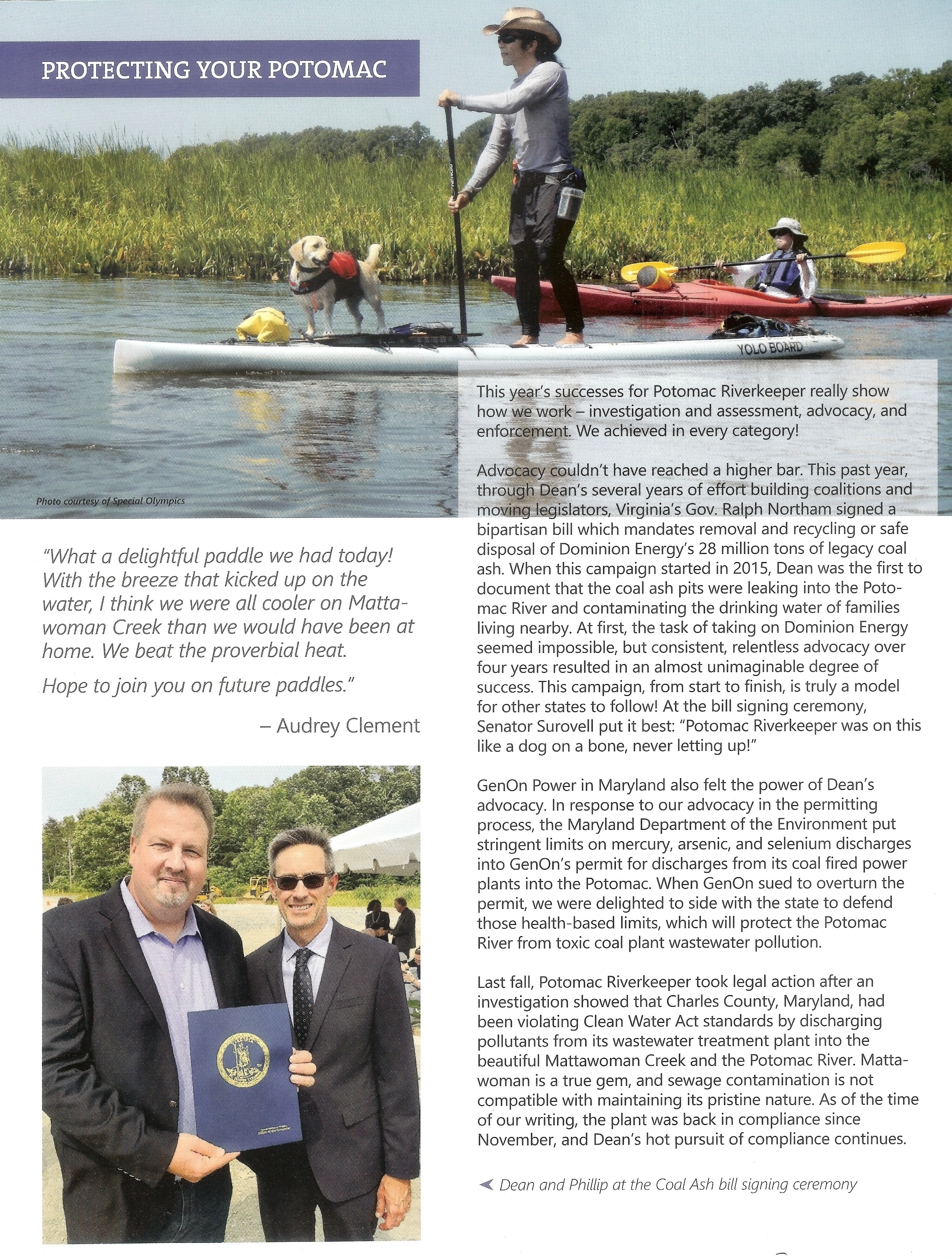
I received the "Potomac Riverkeeper Network 2019 Annual Report" magazine. I was surprised to open it up and find a photo of Daphne and me in it. Lately, it seems Daphne and I have been getting our photo in magazines a lot but I know that Daphne is the one that the photographers like. I just happen to be her chauffeur.
 |
|
Every spring, I look forward to getting out on the water and seeing frogs, great blue heron rookeries, beavers, muskrats, etc. But this year was different because of the Coronavirus shutdown and the weather.
Fortunately, kayaking and paddleboarding were not off limits. In fact, Since kayaking and paddle boarding are both human-powered forms of exercise, akin to bicycling, they are permitted under the executive order. Guidance on social distancing and the prohibition on social gatherings must be strictly followed. - from "Maryland Department of Natural Resources - Frequently Asked Questions about Governor Hogan's Stay at Home Order" (broken link as of 2025) But I was more hesitant to get out on the water, especially if it involved driving far. It just didn't seem right for me to drive a long distance for "exercise" when so many people were of the mindset to "stay at home." Also, the weather in the spring of 2020 wasn't the best. Maryland springs are typically windy but in 2020, it seemed windier than normal. It also seemed a little colder. So what did I do to take up my time? I dug up bamboo from my backyard. Reading this post-pandemic, it might seem silly, but at the time, there were a lot of mixed feelings as to what was the right thing to do. I tried to let my conscious and the leaders I trust guide my actions. Looking back, I have no regrets. |
|
I think it is safe to say that today was arguably the nicest day of the year so far. The high temperature was in the 70s, it was sunny, and the wind was ~nine mph. After a hike at the Parris N. Glendening Nature Preserve (see May 2, 2020 hiking blog), I decided to go paddleboarding with Daphne. But while driving to my destination at Spriggs Farm Park, I felt guilty because the government is sending us mixed messages regarding what we are supposed to do and not do:
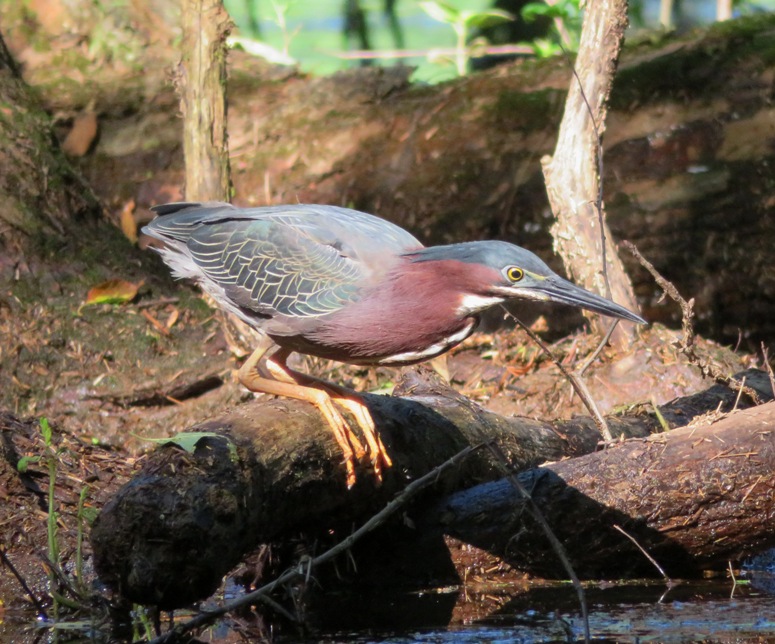
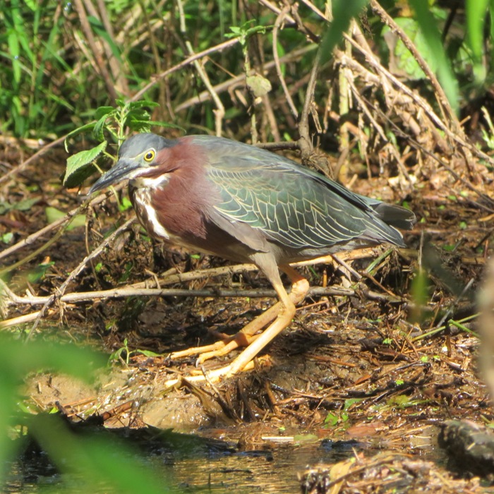
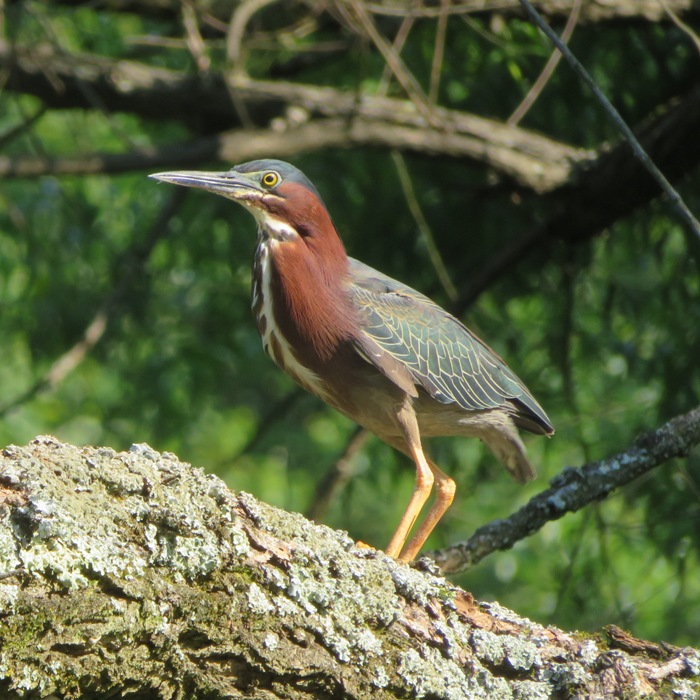
The problem is that the first two contradict our governor's message which permit kayaking and paddleboarding (see my Coronavirus and bamboo blog). I like our governor, Larry Hogan, but I am very annoyed at how the Coronavirus slogans are worded. Lots of powerboats and a sailboat were out on the water, creating some pretty big wakes. Some may have been fishing but I seriously doubt that was the case for all of them. Recreational boating is prohibited until the governor lifts the executive order or until the State of Emergency has ended. Recreational fishing is prohibited. Limited fishing is allowed only if you are seeking food for you or your family... - from "Maryland Department of Natural Resources - Frequently Asked Questions about Governor Hogan's Stay at Home Order" (broken link as of 2025) But most people seemed to be practicing social distancing. I saw single families and sometimes small groups of just two couples that were keeping apart and/or wearing face masks. Lots of kayakers and paddleboarders were out on the water. I paddled my SUP downstream (east), exploring tributaries that connect to the south side of the Magothy River between the launch site and the Little Magothy River. Not surprisingly, all the interesting stuff, like this green heron, was seen in the less populated upstream sections of the tributaries. 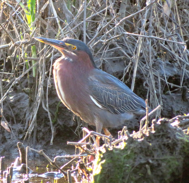
I saw a muscovy duck. Unlike wood ducks, muscovies always seem to let me get pretty close to them. 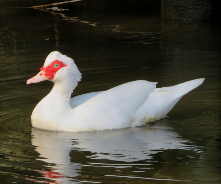
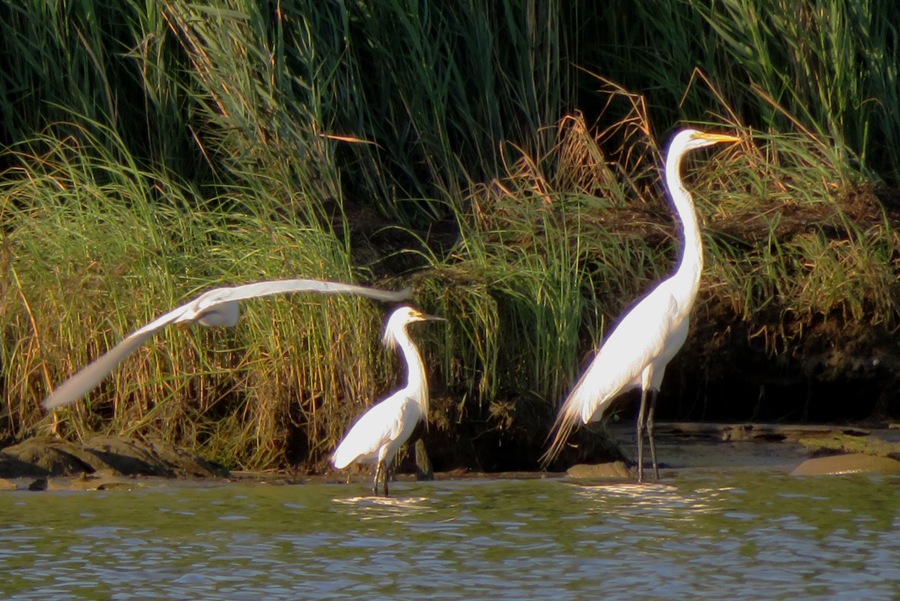
A great blue heron posed for me. I am still trying to get a non-blurry photo of them with their wings outstretched. 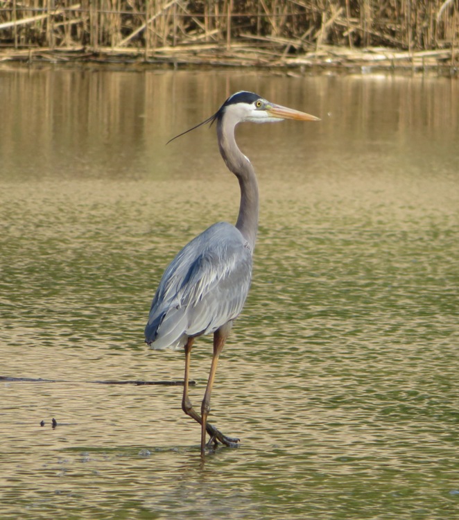
I was stopped at a beaver dam. I did not see any beavers. I'm guessing the cut lumber was placed there by someone so they could easily ford the dam. 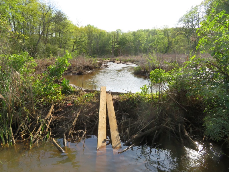
Here's one of about three or four muskrats I saw that day. The top of this one looks particularly dry. 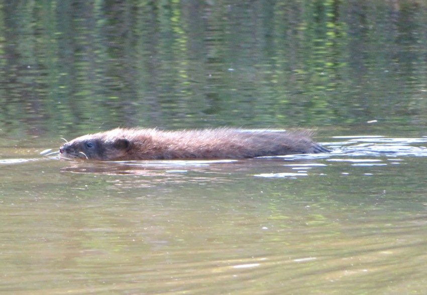
I was fortunate to get a shot of this one out of the water, on a log. It needs a manicure. 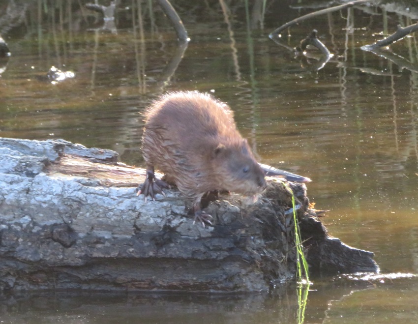
It was good getting out and seeing some wildlife, even if it was in a fairly densely populated area. I paddled just under nine miles. Lately, it seems like everything on Facebook and the news is about the Coronavirus. Much of it is being policitized, which I find distasteful. I think it is good to keep updated on things but it is not good for something like this to totally encompass our lives. So I decided to take social distancing one step further...I am now practicing "social media distancing." I am still posting photos to specialty group Facebook pages such as "MD Birding" but I am now ignoring almost all other Facebook posts and am not posting to my personal page. I wonder if anyone will notice. I might go back to normal once the Coronavirus is no longer the central media focus. I've also quit watching the news. I watch the stock market and I've also started following Good News Network but I am no longer reading mainstream internet news. Sometimes, ignorance is bliss. |
|
Daphne and I got an early start, launching at Southwest Area Park. It was very overcast and cool with some off-and-on light rain. That kept a lot of folks indoors which was good for the more hearty types like Daphne and me. Unfortunately, that also meant wildlife was less active.
The first thing I noticed was that the place smelled like a perfume factory. It was because of all the fragrant honeysuckle flowers in bloom. 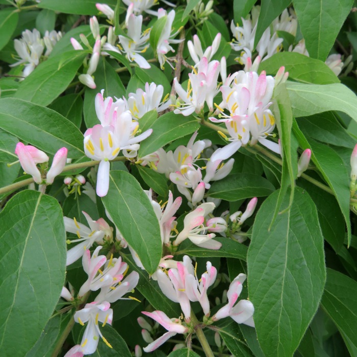
I paddled into some narrow waterways on the west side of the Patapsco River, just north of highway 895. There, we saw several snowflake flowers. 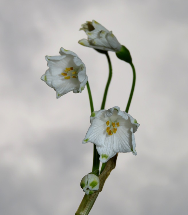
We took one narrow section to an isolated area under highway 895. It was neat seeing all the road supports positioned one after the other. It was like looking into two mirrors facing each other. 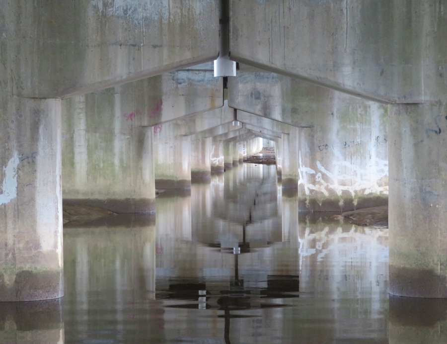
I paddled upstream to the railroad bridge just east of Baltimore Annapolis Boulevard (route 648). Then we started heading back, exploring the various ponds on the southeast side of the river. We saw quite a few fishermen (no fisherwomen). Back near the launch site, I decided to try something I had never done before. There is a pond just west of the launch site on the west side of the foot bridge at 39.235120, -76.624491. I had never paddled there. But today I would give it a try. The challenge is getting under the foot bridge. I reckon I had about 18 inches between the bottom of the bridge and the water. 
I lay down on my SUP and started pulling the beams at the bottom of the bridge to make my way under it. I had to turn my head sideways to fit. But I couldn't get all the way through. The problem was that Daphne would not lie down. I tried to get her to do so but she was stubborn. So I picked her up and put her on the shore. Then I got myself under the bridge to the other side. Next, I called Daphne over and put her back on the SUP. If you want to get under the bridge, you'll need a SUP. With a kayak, you'll need to portage. You need the water to be low enough to fit under but if it is too low, it will make it hard to paddle in the pond, which is shallow. Is there a place one could launch to get on the pond? There is a place where the road is right next to the pond but one would have to do a commando launch near some drain pipes, at 39.236071, -76.626683. 
Launching at 39.234755, -76.623029 could also work but I expect it will be pretty muddy and overgrown. The pond wasn't very interesting. But I did see an eastern painted turtle and a cormorant. The latter let me get close enough so I could see its feather patterns. We managed to get in 6.3 miles before the big rain hit. |
|
Norma and I had been pulling weeds in the garden plot adjacent to hers at her community garden. The woman who rents this plot is a medical doctor and has been working very long shifts due to the Coronavirus pandemic. So we figured we could help out by assisting the heroes who are keeping us safe.
After pulling weeds at this doctor's plot, Daphne and I went to Beachwood Park and spent the rest of the afternoon SUPping. It was pretty windy but this area is very sheltered so it wasn't bad. There were quite a few power boats out on the water for a Thursday along with a few kayaks and one other SUP. I expect to see a lot more power boats in the coming days because as of 0700 this morning, the ban on recreational boating was lifted by our governor. Apparently, the Coronavirus threat is diminishing. Effective Thursday, May 7, at 7 a.m., recreational boating activities, including motorized and non-motorized vessels and personal watercraft, are permitted... - from "Update Regarding Maryland's Stay at Home Order and Opportunities for Outdoor Recreation" (broken link as of 2025) Our governor errs on the side of safety so if he is lightening up restrictions, then I figure things are really getting better. Only time will tell if he is right. I was looking for the Mandarin duck I saw on May 26, 2017. Some people on the "MD Birding" Facebook page saw it last year. But I didn't see it today. However, I did see plenty of birds. I'm guessing Daphne and I were out for about 2.75 hours. I'm not sure because I still haven't bought a new watch since my six year old $16.24 watch died on March 12, 2020. But I looked into getting a new one that night. It will almost certainly be a $15.99 Armitron Sport 45/7012 digital watch. Without a watch, I go by the sun. Sure, I can use my cell phone but that involves taking it out of the dry bag and turning it on. I don't need to know the time that bad. We pulled ashore around sunset after paddling about ten miles. |
|
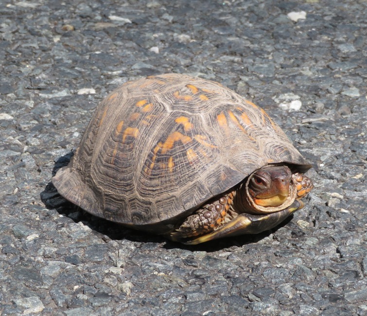
Daphne and I explored North Point State Park on foot. See my May 13, 2020 hiking blog. After that, I drove to Solleys Cove. On the way there, I saw a box turtle in the middle of the road. I stopped to move it off, to the side where it was facing.
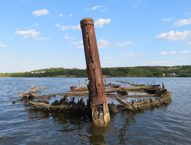
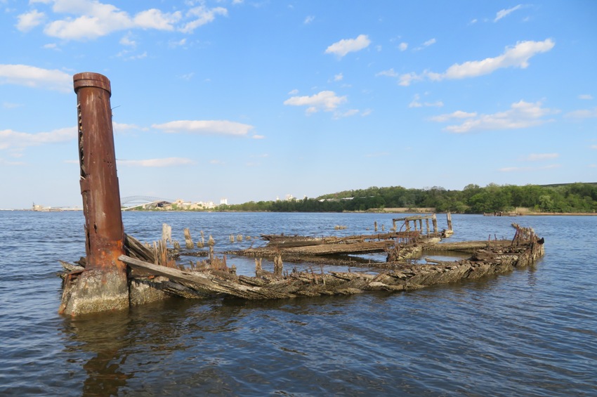
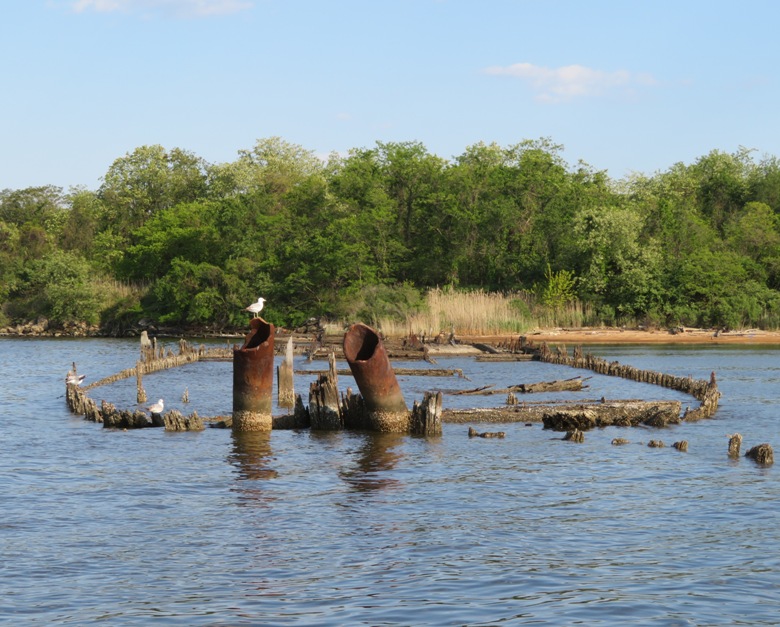
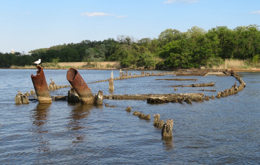
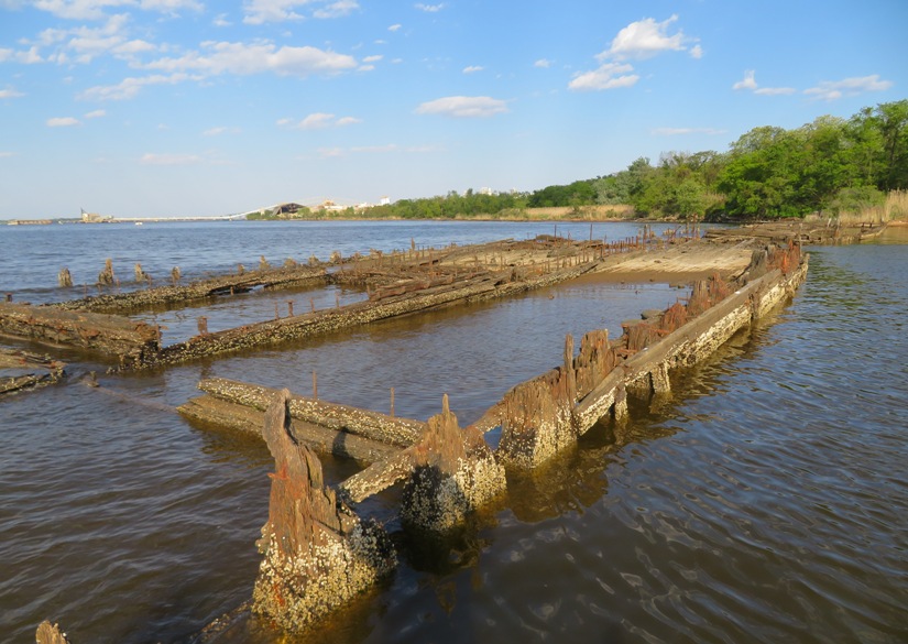
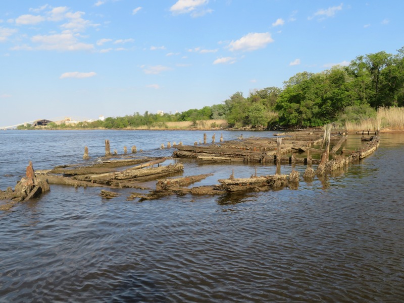
I launched my SUP and paddled downstream to Curtis Bay. In an unnamed body of water at 39.191095, -76.569037, I saw a muskrat, red-winged blackbird, and a green heron. I had to wade through some mud to get a picture of the latter while Daphne patiently awaited my return on the SUP. Using terminology I created on July 4, 2012, I paddled to the Walnut Point Wrecks at 39.208260, -76.575476 to get a good view of the concrete boat. Here's an overhead view of this boat I took on April 18, 2019 via drone. 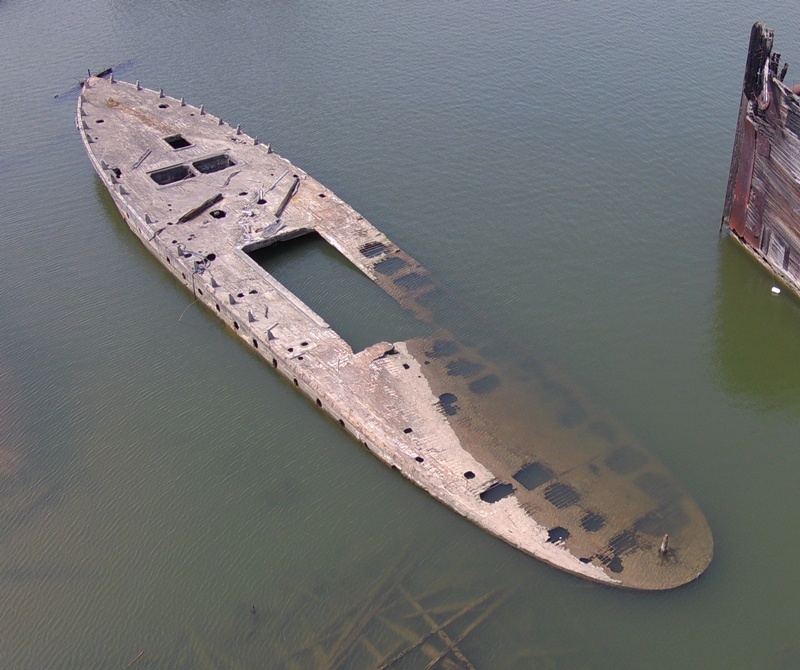
These are some other pics of this concrete boat: Exploring some of the wooden wrecks at Walnut Point, I saw a black-crowned night heron. I don't often see these birds. Next, I paddled to the Sledds Point Wrecks at 39.215333, -76.566306. I visited near low tide which is ideal for maximizing your viewing pleasure. 1 / 6

Front view.
2 / 6
Front port view.
3 / 6
Two pipes.
4 / 6
Perched gull.
5 / 6
Barnacles.
6 / 6
Backed-out view.
Lots of metal bars stick out of the wood on these wrecks. It is best not to get too close if you're on a SUP lest you fall and impale yourself. Just east of the Sledds Point Wrecks, I explored the boats slightly west of Leading Point at 39.215917, -76.559222. They are pretty close to the Sledds Point Wrecks so I'm just going to consider them part of the same group. I had never seen these before. 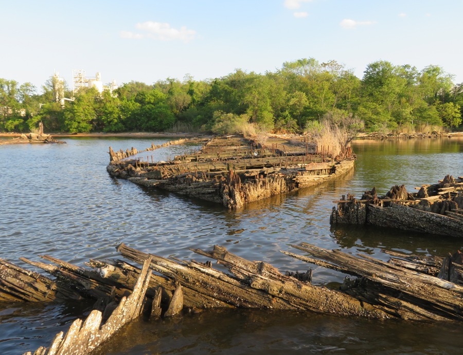
Sometimes these looked like a collapsed pier. Only after seeing the distinct curves of a boat did I know what it really was. 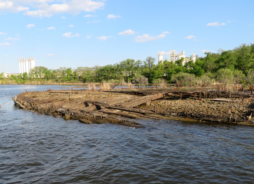
This was a special find. It is the only shipwreck I've encountered that still has its propeller. I'm thinking that all the rest were salvaged because it is a such a large chunk of metal that is worth money. I don't know why this was left behind. 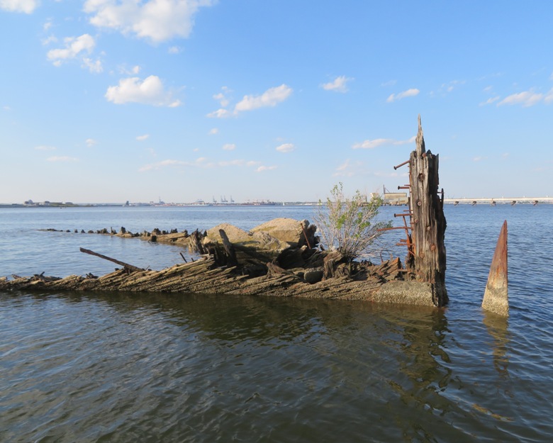
Only the top third of the propeller was sticking above the water (3.5-4 feet) so I reckon the whole thing was 10-12 feet long. 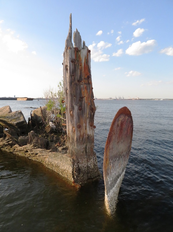
On the way back, I saw another boat. It wasn't old, but it was still a wreck. What did I see just behind the steering panel? A pussycat! For a brief moment, I thought about trying to take him home but something told me he would not have wanted to share a paddleboard with me and Daphne. Daphne and I saw a bald eagle. I landed back at Solleys Cove at sunset. 
The tide was lower than when I launched but not significantly so. If there was anything unusual in the shallow areas when I left, I think I would have noticed it then. But upon returning, I saw 29 dead eels, mostly on the shore. What could have caused this? Early the following morning, I reported it to the Maryland Department of Environment Fish Kill Investigation Program. I never heard back as to what killed them. But with some insight from Greg W., I now have a theory. I saw some PVC pipe sticking out of the water. Maybe it was there to hold an eel trap in place. Perhaps the fisherman set his trap and wasn't able to check it in a reasonable amount of time because he was somehow affected by the Coronavirus (working long hours, sick, etc.). Or maybe he just forgot. So the eels ran out of food and starved. When he finally did return (while I was out SUPping), he opened his cage and found a bunch of dead eels, which he then dumped on the shore or in shallow water. That would explain why I didn't see any other dead stuff and why the dead eels were in such a specific location. I am hoping this is the reason and that their death isn't the result of some toxic environmental condition or malicious act. |
|
Following up on my exploratory May 13, 2020 hike, Norma, Daphne and I launched from North Point State Park so we could explore the Black Marsh Natural Area. This trip was on my 2019 bucket list.
Since one must paddle through a very exposed part of the Chesapeake Bay to get there, timing is very important. It would have been best to visit the marsh at high tide but instead, I chose to visit when the wind was low and not coming from the east or south so the water would be calmer. It was a pretty good distance from parking lot B to the beach so we employed my kayak cart. Wheeling the boat on a dirt trail with exposed roots made me appreciate my inflatable tires. Some carts have plastic tires which made you feel every obstacle. On the water, we passed by the three concrete barges used to transport munitions in World War I. They reside near the end of the pier ruins at 39.213167, -76.416806. Next, we pulled over to explore one of the beaches where we found lots of bricks, sea glass, and old metal objects, possibly back from when Bethlehem Steel bought the place in 1947 or maybe from when the area was part of Bay Shore Amusement Park from 1906 through 1947. 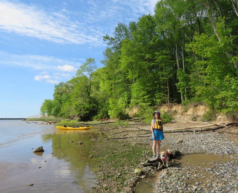
We entered the marsh. It was sheltered, quiet, and pristine. Most of the waterways we kayaked in Black Marsh Natural Area looked like the below pic. There isn't a whole lot of elbow room so I suggest bringing a single blade paddle. I've never seen anyone else paddling out here. 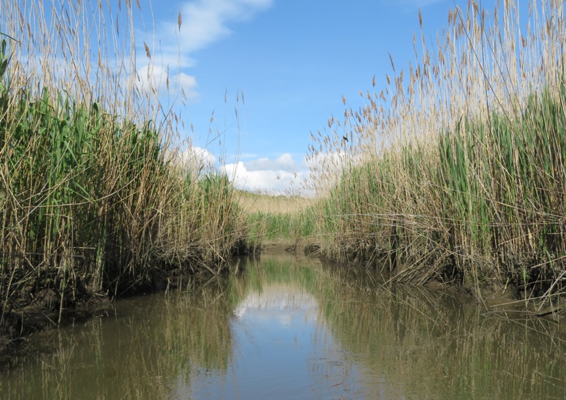
There is a ridiculous amount of wildlife in the marsh, but you have to paddle very slowly and quietly if you want to see it. Stealth is the key. The marsh splits between two waterways. We kayaked into the northern section. Here, I saw least sandpipers. Notice the yellowish legs. If these were Sanderlings, they would have black legs. Someone from the MD Birding Facebook group told me this. I tend to generically call them all sandpipers. 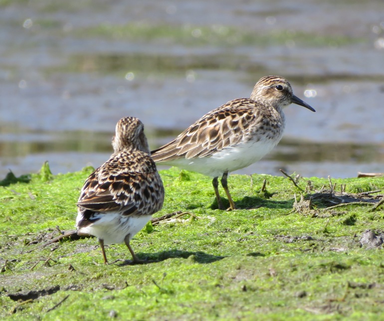
I saw a snake and several muskrats. These were all very close encounters. I quickly learned that I need to have my camera case open at all times in the marsh because speed is crucial if I want to snap a picture. Next, we explored the southwest section. I had not been to this part before. I saw a least bittern. I had never seen one of these. They are very elusive. I had to stand up on the kayak to get this shot. 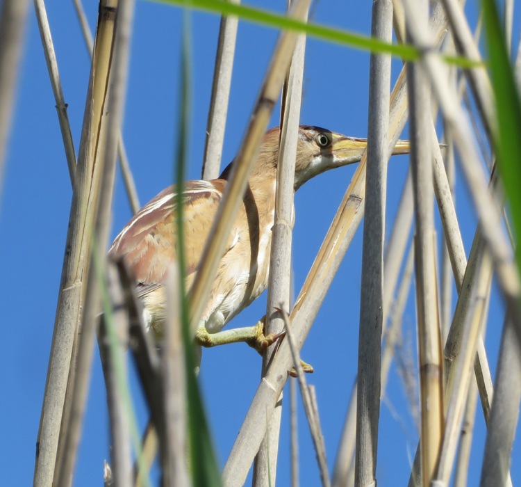
A little later, Norma, Daphne, and I saw this northern water snake. We saw at least three that day. 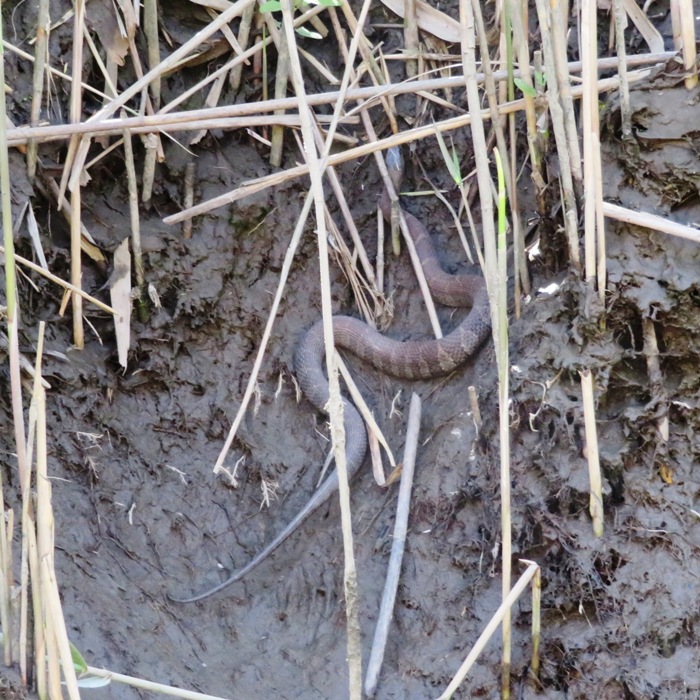
Here is one of the many muskrats we spotted. There were so many, I lost count. 
I don't often take pictures of turtles while kayaking because there are so many but snapping turtles are a less common sight. We saw two or three of them. 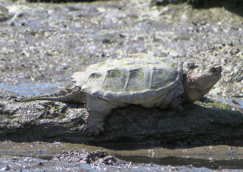
This is as far as we got upstream in the southwestern section of the marsh. It got too narrow and shallow to continue further. 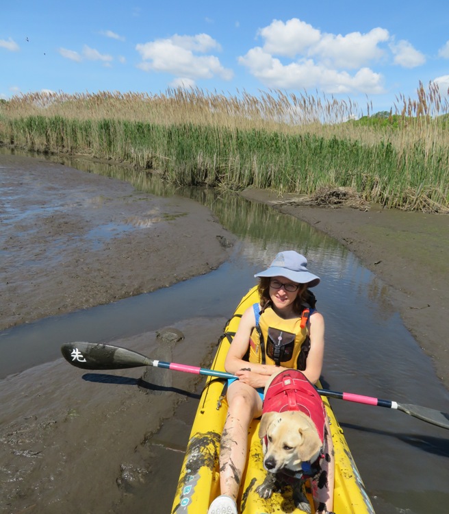
At our turnaround point, Daphne tried to go ashore. She just sank into the soft mud, unable to move. We had to rescue her. What a mess! She got rinsed off in the Chesapeake Bay after we left the marsh and then got a good, thorough bath once we got home. We saw lots of red-winged blackbirds and thousands of small fish. 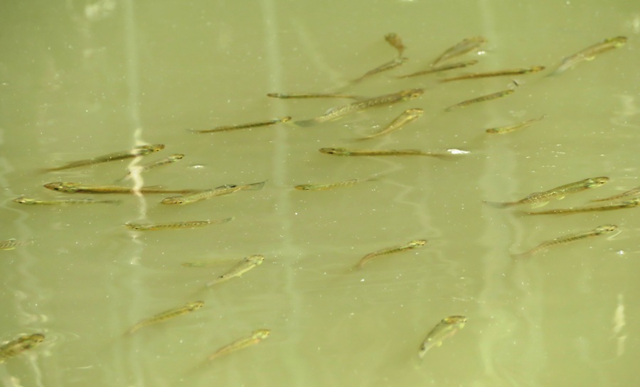
It was a short (in terms of distance) and scenic trip, just over five miles. We were out for over three hours. This is our route. 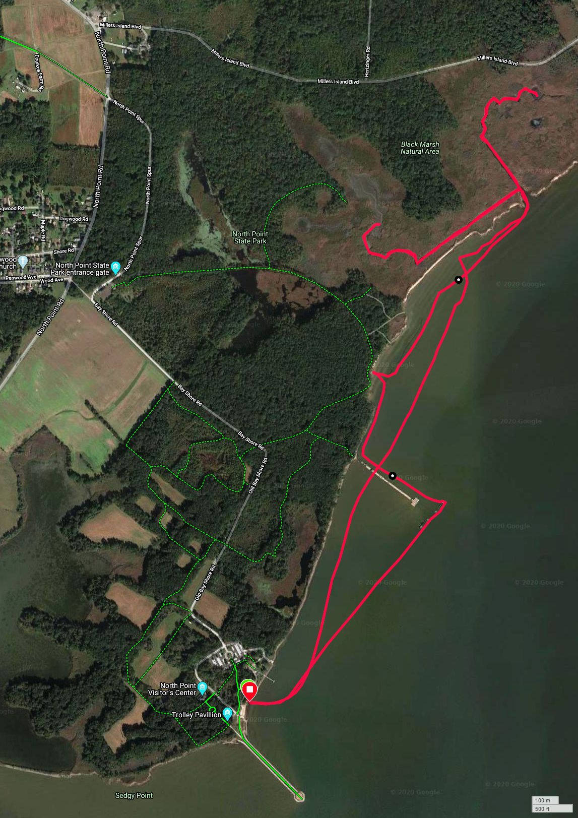
Here's the Black Marsh Natural Area. 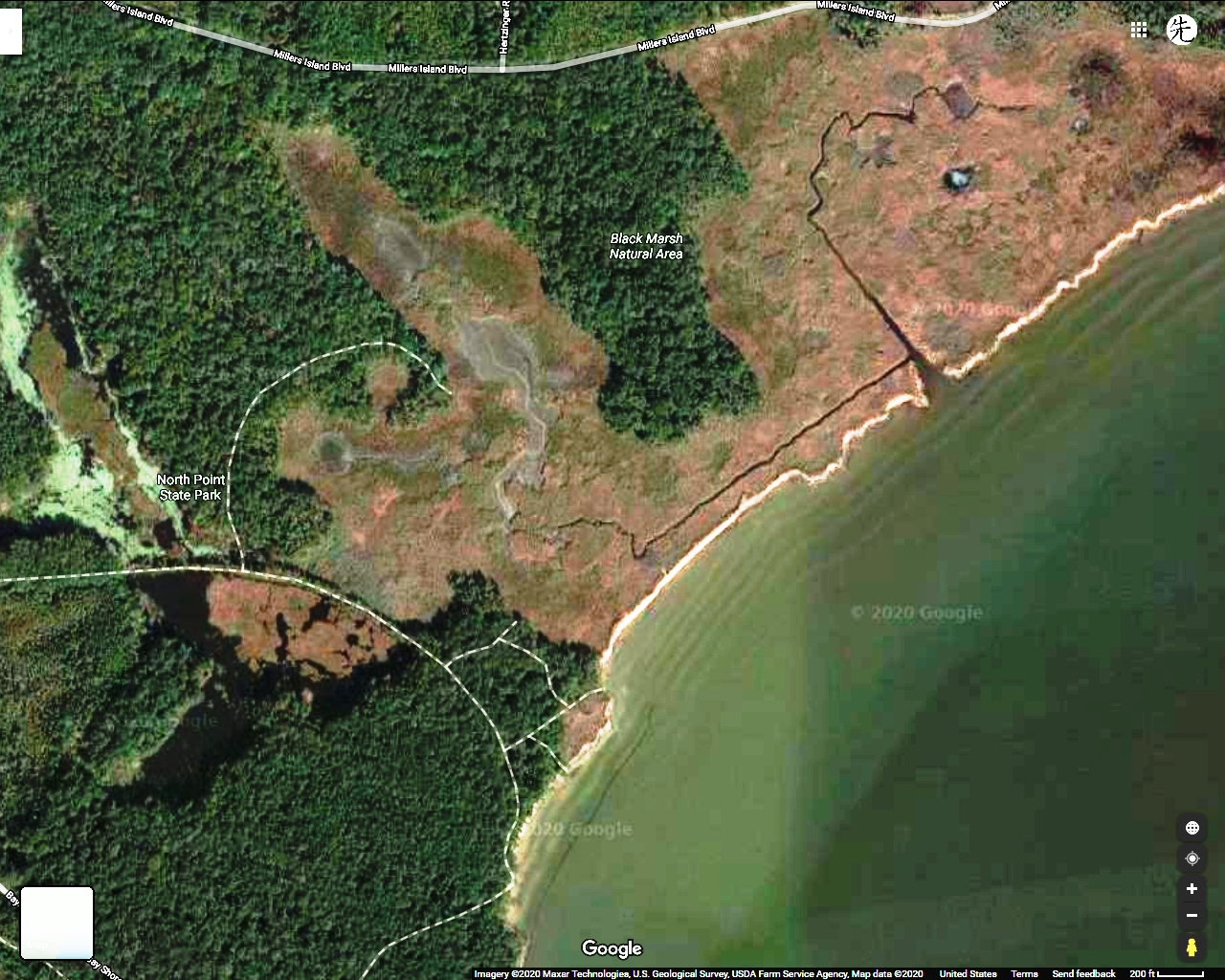
In the above, notice the long dotted line that enters the marsh. This is the Observation Trail. We hiked to this point after kayaking. It took us to an observation platform but we couldn't see anything in the marsh because the grass is too high. Seeing things from the water is definitely best. I would like to return during a supermoon high tide and see how far I could get upstream on the southwest side of the marsh. The time we were out is shown in a red box below. 
The best boat for this trip is something short without a rudder or that has a retractable rudder/skeg. A SUP will give you a nice view from above but the fin will limit how far upstream you can go. Next, we explored the Black Marsh Trail. See my May 16, 2020 hiking blog. |
|
On Memorial Day weekend, Norma and Daphne went to go visit Norma's mom. I stayed behind. Of course there's nothing I'd rather do than spend time on the water on the holiday weekend. So on that Saturday, Sara and Mike B. joined me for kayaking on the Monocacy River. This was their first time paddling on it.
The plan was to paddle 11.7 miles from Millers Bridge (aka Rocky Ridge) on route 77 to Devilbiss Bridge. The river had been low but we recently had some rain. It wasn't a lot but it was enough. For kayaking at that location, it is suggested that the minimum water flow read 350 cubic feet per second and gauge height 2.1 feet. The gauge height should also be below five feet. I watched U.S. Geological Survey Real-Time Water Data (Jug Bridge) like a hawk. Once the rain stops, the water level keeps rising for some time. During the time we were out on the water, we had the following river conditions: Despite the recent rain, the water was very clear. But I would have preferred more. We never had to portage but we did scrape bottom a few times. Fortunately, we both had plastic boats which could handle some abuse. For the first couple of hours, I don't think we saw anyone else on the water. It was secluded and peaceful. Mike identified lots of birds, both by appearance and their call. He never ceases to amaze me with this skill. We saw at least two bald eagles. There were at least two because we saw them at the same time. After that, it might have been the same two that we saw over several locations. 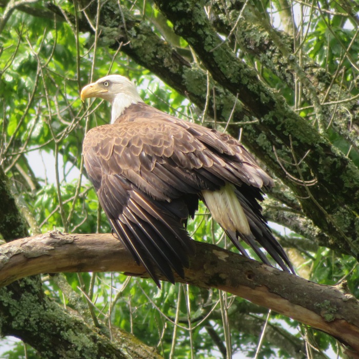
Here's Sara and Mike in her Mad River Canoe Adventure 14. 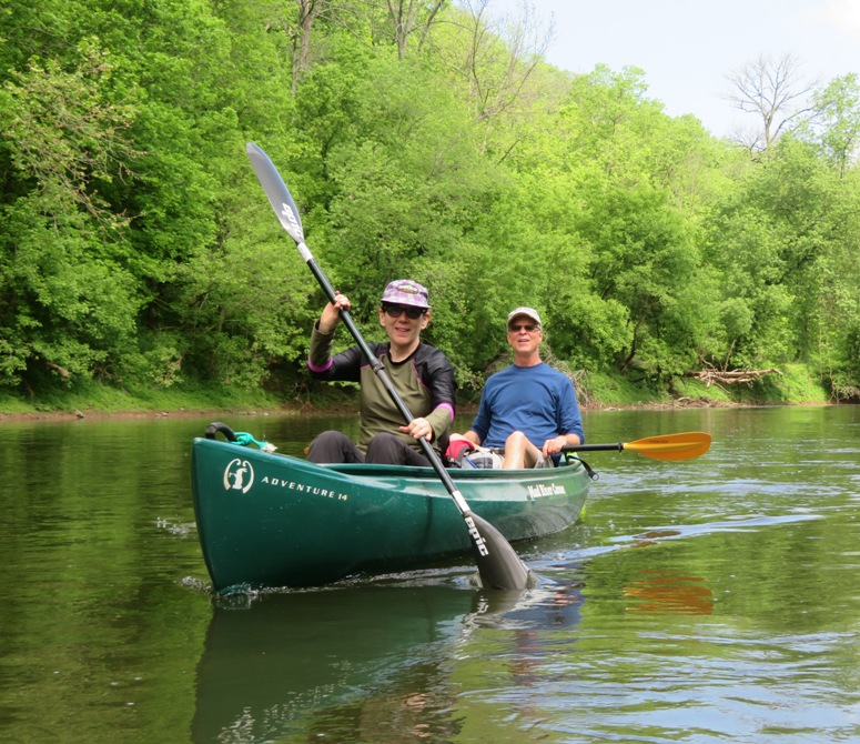
Sara spotted a barred owl. It is rare for me to see an owl but if I do, it is almost always a barred owl. The last time I saw an owl, it was while kayaking with Sara. I guess she has a good eye for owls. This one flew into a tree near me and I had a clean shot at it but my camera started giving me warning messages about my battery. Then once I cleared those messages, the bird flew across the river. It was about 150 yards away but I still managed to snap this picture. 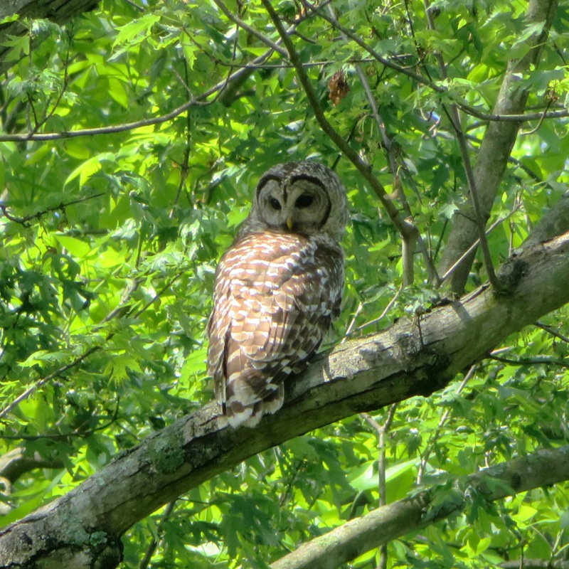
I saw a northern water snake perched on a rock. I don't think it killed this fish. 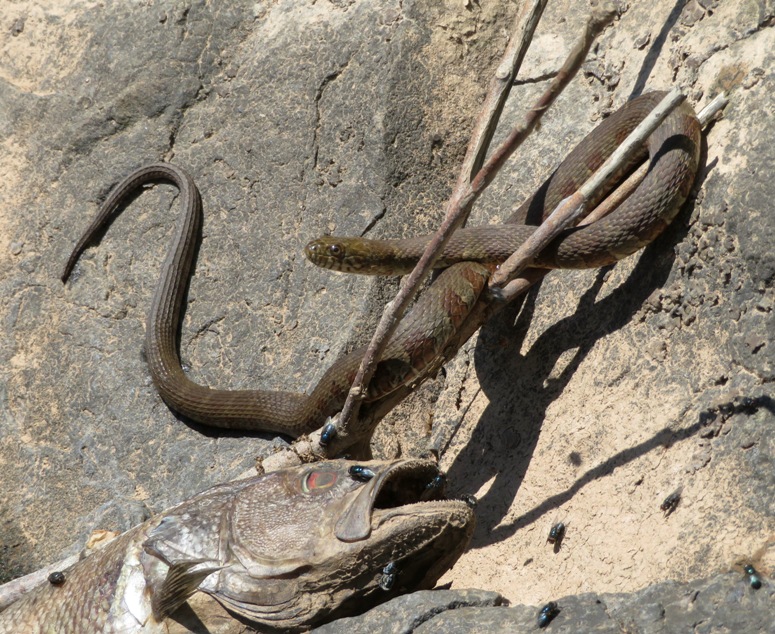
This snake was pretty cooperative with my camera and I managed to get a tongue flicker. That's the money shot! 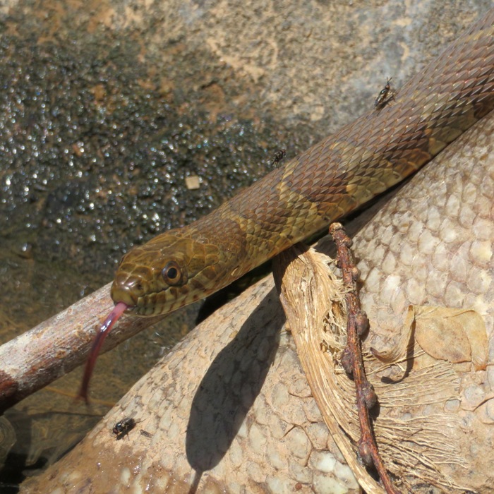
About 3.25 miles downstream from the start, we came to Legore Bridge. ...a five-arch, stone structure build in 1900. - from Monocacy Scenic Water Trail 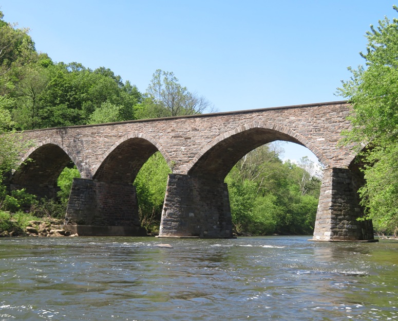
Around the halfway point, we pulled ashore and ate lunch. We also skipped rocks. Mike is the best. He skipped rocks about 95% of the way across the river. I skipped a few and the next day, my shoulder was sore. About 6.25 miles from the start, we passed Creagerstown Park, which was busy with activity. From here on out, we saw quite a few people. I don't think I'd ever seen so many people on the Monocacy before. Because of the Coronavirus, folks have been really making an effort to get outdoors since indoor socializing in big groups is forbidden. We paddled near a shooting range so we heard the sound of gunfire for quite awhile. Near the end of our trip, I saw northern water snake number two. I viewed it swimming and then followed it to a log. 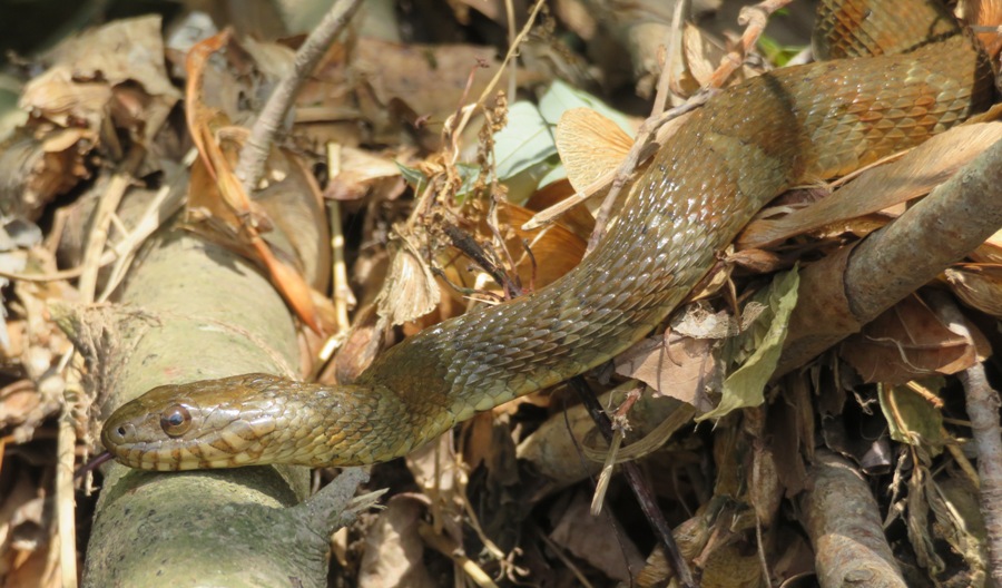
It was curious about my kayak. 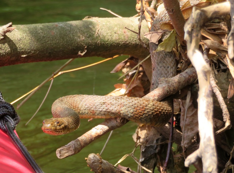
I ended up kayaking 12.4 miles, due to paddling upstream a couple of times. That night Sara, Mike, Sara's son Matt, and I sat outside and played Wingspan, a board game. Some of the cards we played were of birds we saw that day. Sara and Matt kicked my butt. They're really good. I considered getting out on the Middle Patuxent River the next day but the river was too low. |
|
On Memorial Day, I set out for some long distance kayaking.
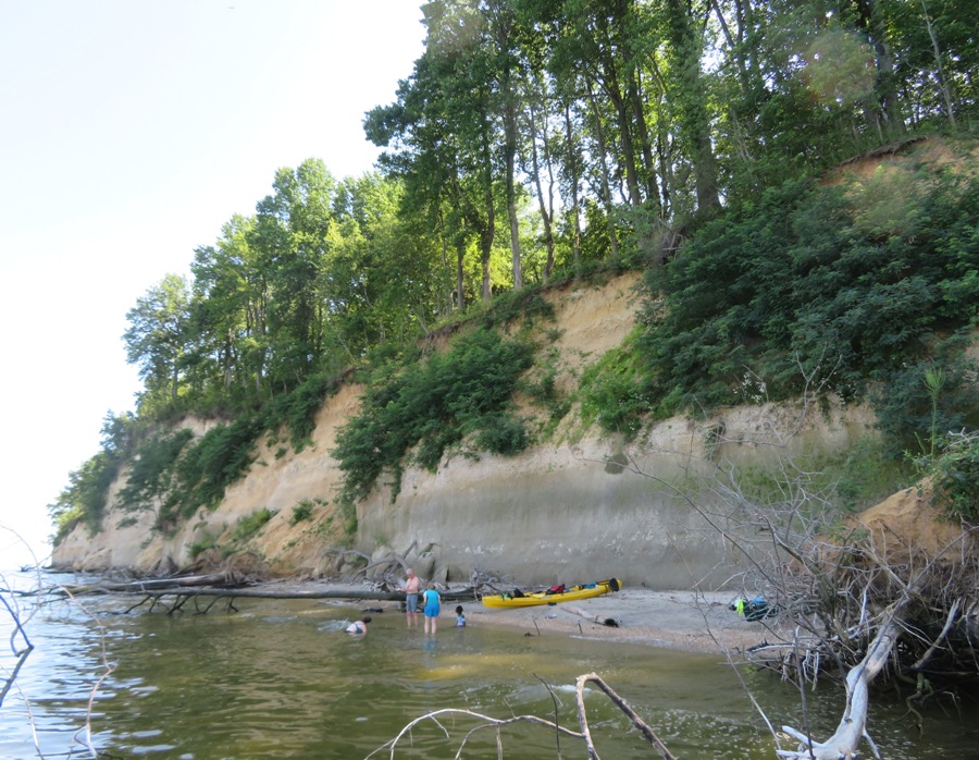
I launched my surf ski kayak at Breezy Point Marina in Calvert County and then paddled south in the Chesapeake Bay to the jetty at Calvert Beach-Long Beach (a private beach). I know nothing about Calvert Beach-Long Beach and there isn't much information on-line. I believe it is a community beach and therefore not open to outsiders. But if it is, it could be a great place to launch. Just south of it is Flag Ponds Park which is difficult to launch at because the beach is so far away from the parking lot. I saw a bald eagle and two rays. I pulled ashore a few times and looked for fossils. I didn't find many. My guess is that with many people not working because of the Coronavirus, a lot of folks have time on their hands so there are significantly fewer shark teeth (and morel mushrooms) to be found. But I did find one very small and remote beach just north of Parkers Creek at 38.546639, -76.517167. This is not an easy place to get to. It is at least five miles from the closest public launch site. At this beach, I found a Cadillac shark tooth. It is big, in excellent condition, and has lots of detail. This tooth is 1.313 inches wide and 1.125 inches long. The serrations on the edge led me to believe it is from a snaggletooth shark. I posted a picture of it to the Fossils of Calvert Cliffs Maryland FB group and various people think it is a small megalodon tooth. Nobody agreed with my guess that it was from a snaggletooth shark. So I'm going with the megalodon diagnosis. 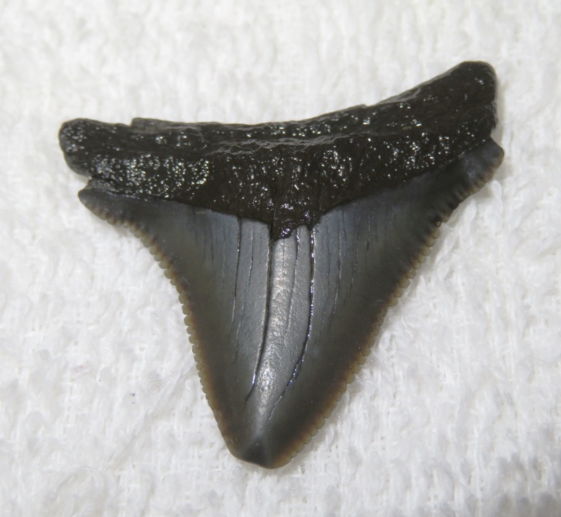
Norma and I have been watching a lot of King of the Hill. The store that is often referenced in the show is Mega Lo Mart which sounds very similar to Megalodon. When I hear of one, I think of the other. How old is this megalodon tooth? According to my booklet "Fossils of Calvert Cliffs" The sands, silts, and clays that form Calvert Cliffs accumulated during the middle of the Miocene Epoch, 5-24 million years ago. This time period lines up pretty good with when megalodon lived, 3.6-23 million years ago. I found various other fossils. The top three things are obviously pieces of a ray dental palate. I believe the bottom three are (from left to right) from a tiger shark, megalodon (same as in previous photo), and tiger shark. 
The following is from Florida Museum - Fossil Shark Teeth How do shark teeth become fossilized? The process of fossilization is a slow one that usually takes thousands of years. In the case of shark's teeth, they are preserved through a process known as permineralization. Which occurs as water seeps down through the sediments and over the teeth. This water carries different minerals in it that are deposited into open pore spaces in the teeth. How can you tell if a shark tooth is a fossil or recent? Modern shark teeth, both the crown and the root, are typically white in color. Fossil teeth are permineralized and are usually darker colored. There was a 2-3 mph wind from the east. I got in a total of 23.3 miles. |
|
Daphne and I were thinking about exploring Fishing Creek in Chesapeake Beach but decided not to because there was limited access to certain recreational areas in that town due to the Coronavirus.
So instead, we set out to visit Hall Creek in Calvert County. We drove to Hall Creek Natural Resources Management Area (NRMA) in Dunkirk. Then we had to cart the SUP a third of a mile to get to the launch site on the Patuxent River. 
Here's Daphne eager to get out on the water. 
I checked the weather report from NOAA, Windy, and Wunderground. The former called for winds ~eight mph while the others were calling for lighter winds. NOAA was more accurate. The breeze pushed me downstream on the Patuxent. Along the way, I saw this osprey. 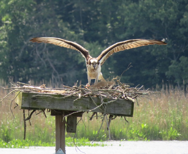
We started making our way up Hall Creek. High tide was around 1100 and it was about 1000 so I had a little help. If you're into social distancing, this is the place to go. For about three hours, I saw nobody. But that's not to say that there are no signs of civilization. There are some piers but they are pretty spread out. This is a nice place to paddle but it is very open. The creek is frequently as wide as the Monocacy River but without as much tree cover so if you're out in the middle of the day, be sure to wear sunscreen. I had some encounters with biting flies. I also had to pull off a tick that I picked up in the NRMA. Seems like I always get a tick at Hall Creek NRMA. It would have been better if I could have gotten out earlier or later. There wasn't a whole lot of wildlife activity in the middle of the day. I don't believe the NRMA ever closes and the parking lot doesn't fill up so launching anytime is possible. Upstream on Hall Creek, I saw a lot of healthy-looking spatterdock producing lots of flowers. After about 3.5 miles of paddling upstream, it got too narrow to continue. Sure, I could have gone a little further but turning around would have been difficult. Twice I scared off a doe that was hiding near the creek. At least one of them was protecting a fawn. The doe was gone but I could hear its fawn bleating. I found a cooperative red-winged blackbird willing to pose for me. 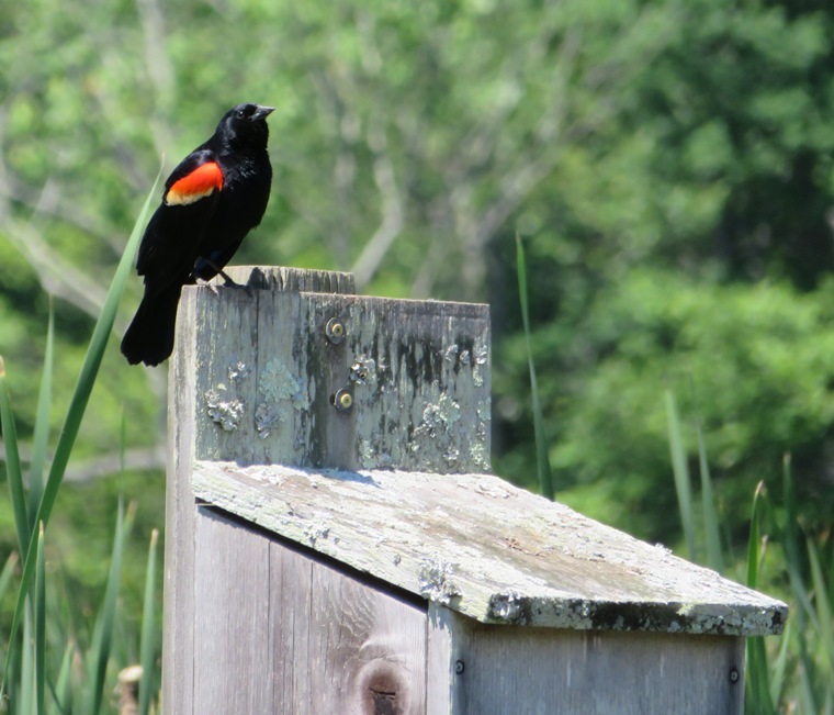
I put my camera on a duck blind, set the timer, and took this selfie. 
I saw no muskrats or snakes. But I did find a piece of snakeskin floating in the water. 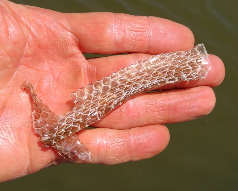
Daphne and I explored some really narrow waterways. 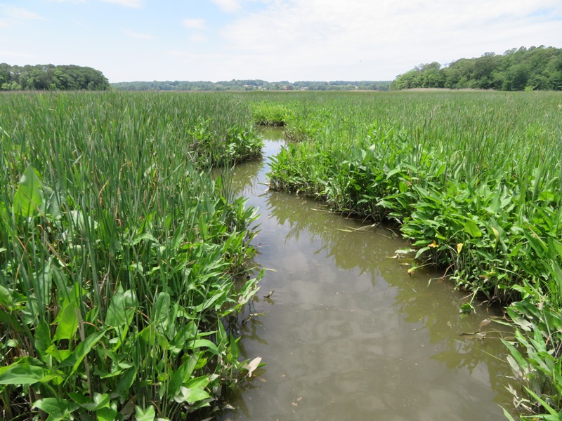
I saw a few bald eagles. 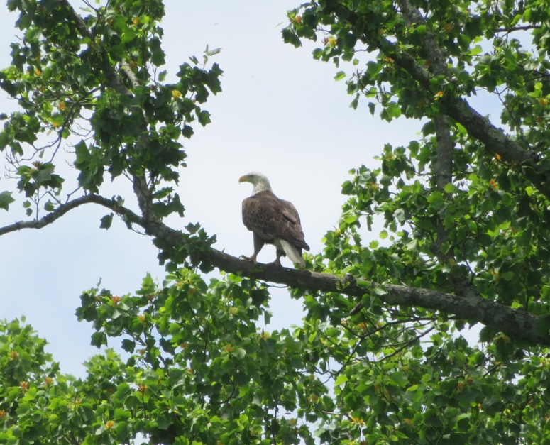
I also saw a small bird harass an eagle in flight and then land on it briefly. This was not the first time I've seen that happen. Got in 10.75 miles of paddling. |
|
As far as temperature goes, we've been very lucky this year. We had a warm winter and a cool spring. But today, the forecast for my town was a high of 94 degrees and somewhat humid. This motivated Daphne and I get out on the water early to avoid the hottest part of the day.
We launched my SUP at 0645 from Brown's Bridge - Montgomery County Launch at the T. Howard Duckett Watershed (Rocky Gorge). Why here? According to WSSC - Watershed Recreation User Program, for both the T. Howard Duckett and Triadelphia Reservoirs Watershed use permits are not required through June 30, 2020. Downstream is the reservoir while upstream is the Patuxent River which flows through it. Even though the water was quite low, we made it 1.3 miles upstream from the launch site before we were stopped by riffles. I could have easily portaged over it but decided to leave that for another time. The place was very scenic. 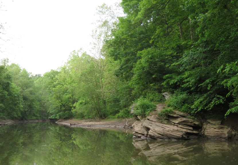
I explored an unnamed tributary at 39.149018, -76.967975 where I found a huge snapping turtle with a 16-inch long carapace. 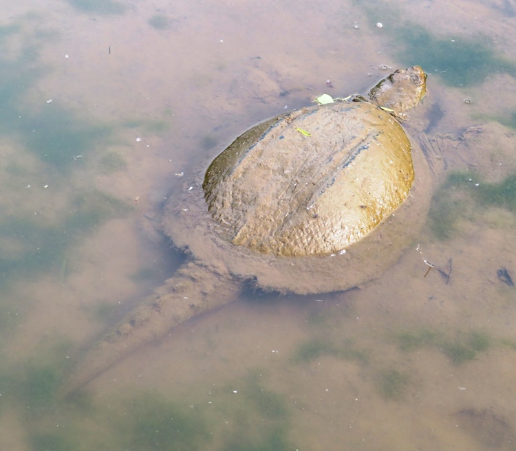
I wasn't able to get very far upstream because things got too narrow. 
Next, I paddled downstream for a few miles. I quickly remembered why I don't much care for reservoirs. Things were too pristine and unnatural, as if it is managed by a homeowners association (HOA). I found it somewhat boring. But I did see some wildlife, including eastern painted turtles, a box turtle, and several great blue herons. I saw no snakes or eagles. One animal I saw that I'm not used to seeing while paddling is polliwogs. They were here, in the shallow, warm areas near the shore because the water, for the most part, was stagnant and fresh. In the places I normally paddle, there is flow and more salinity. 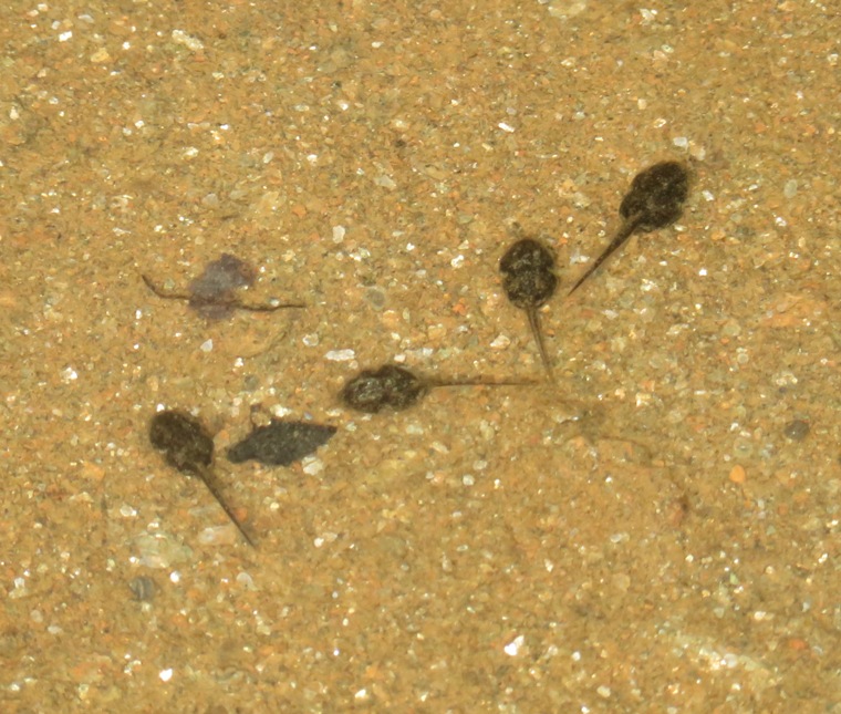
But not everything was pristine. In one spot, I saw a lot of graffiti and litter. Very sad. 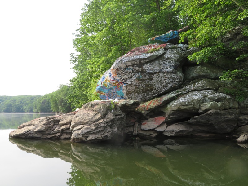
We spotted quite a few deer including this young buck and doe. 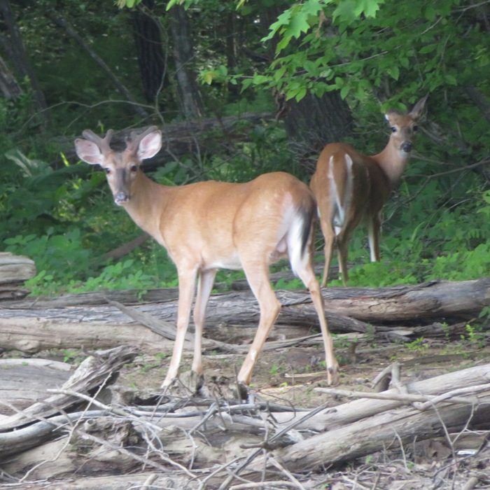
Here is the launch site and Browns Bridge. 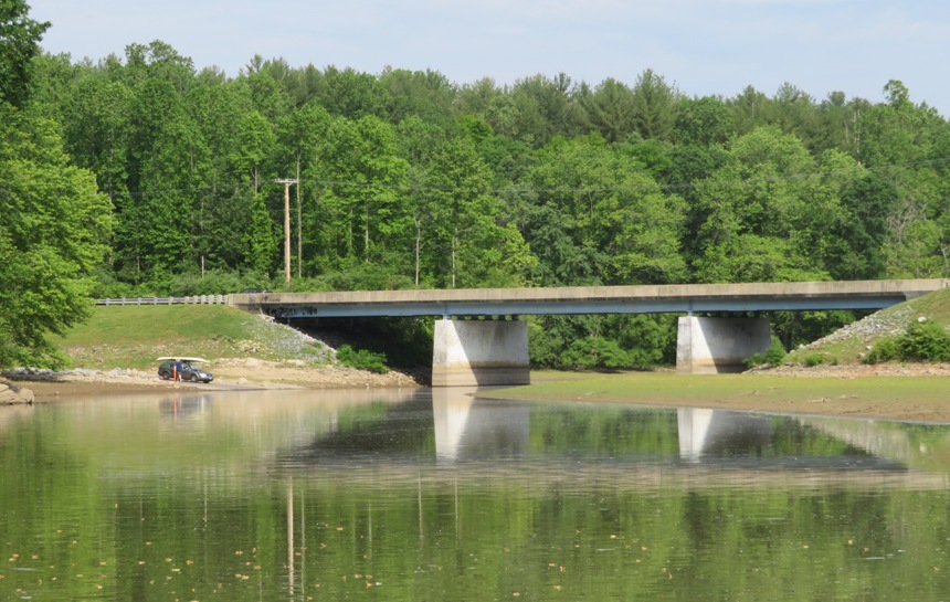
Lots of tiger swallowtails were out. I don't know if these were feeding or mating but there were a lot in a muddy area near the boat ramp. 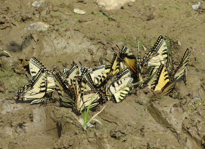
We were off the water around 0930 after paddling 7.5 miles. I figured it would be nice to start further upstream on the Patuxent and paddle down to Brown's Bridge. So I did some scouting. Along the way, I found a fine specimen of a tulip poplar flower. 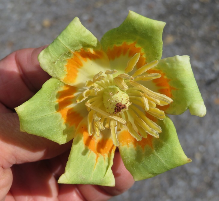
I found a place to launch on Mink Hollow Road. I know there will be some portaging from this site but since I already know one can get 1.3 miles from Browns Bridge going upstream without portaging, the possible portaging section will only cover about 1.7 miles. I expect to return here and paddle upstream as far as I can without too much portaging before heading downstream. Could I launch further upstream? Perhaps. There is a place about 2.5 miles upstream called Haviland Mill Park at 6941 Haviland Mill Road, Clarksville, Howard County, Maryland 21029 but I could find nothing about it. Satellite photos show parking about 150 feet north of the river. |
|
I had been waiting three months for the right moment to paddle the Middle Patuxent River from Carroll Mill to Simpsonville. Many things needed to line up for this to occur. I needed a full day...one where I would not need to work. I wanted good weather and another person to join me so I could have a car shuttle. And most importantly, I needed rain. According to American Whitewater - Middle Patuxent - Carroll Mill Road to Savage Mill,
this trip should be done when flow range is 4.5 to 6 feet. But this does not occur normally and when it does, the window of opportunity is small.
On this day, I decided to give it a shot. Norma was available so we could put her car at the takeout and use mine to launch. Was there enough water? Well, over the last 36 hours, it rained over 2.4 inches. But that wasn't enough. According to USGS 01594000 Little Patuxent River at Savage, MD, we had 4.17 feet when we launched at 1000. By the time we finished at 1630, we had 3.87 feet. But if that much rain wasn't enough, what was? Looking at the gauge from January 1, 2020 to now, things fluctuate sharply. And the gauge over the last three days showed how the rain raised the water level quickly, only to also fall over a fairly short period of time. So conditions weren't ideal, but they were much better than most days. Norma, Daphne, and I carried my Ocean Kayak Cabo to the water, trying to avoid the lush poison ivy which lined the river. It was a beautiful day...mostly sunny, warm, and despite the recent rain, the water was clear. When I scouted this area a few months ago, I had a good view of the river from the bridges. But without actually getting out on the water, my guess as to paddleability was vague at best. This section of the Middle Patuxent has excellent scenery but it is not easy to explore via kayak. I'm guessing we did two dozen portages, including one over a log jam about four feet above the waterline. But most were over rocky riffles too shallow to paddle over. It felt like for every eight minutes of kayaking, we were portaging for three. Some might question my choice of boat but despite some drawbacks, it is very rugged and can handle hitting a lot of rocks, which we did. Also, being a sit-on-top, it is easy to get into and out of, which we did very frequently when we walked the boat through shallow areas. I think I would have given up if it wasn't for Norma's positive attitude and the fantastic views. 
Our first wildlife encounter was two red fox kits. Next, I saw a northern water snake, about three feet long. 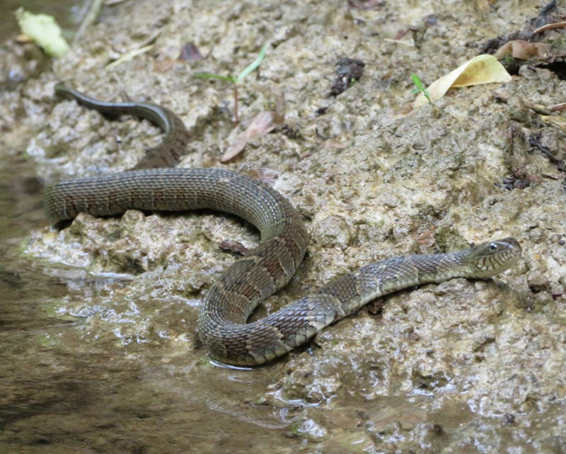
This year, Norma took a more serious interest in mushrooms. So she was pleased to find several. Here's pheasant back mushrooms. 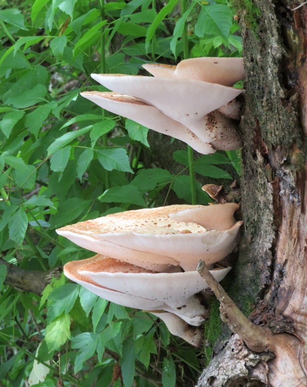
These are wood ear mushrooms. 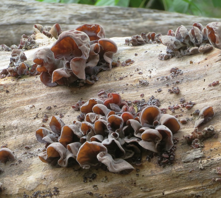
We saw a few deer, including a doe with its fawn. 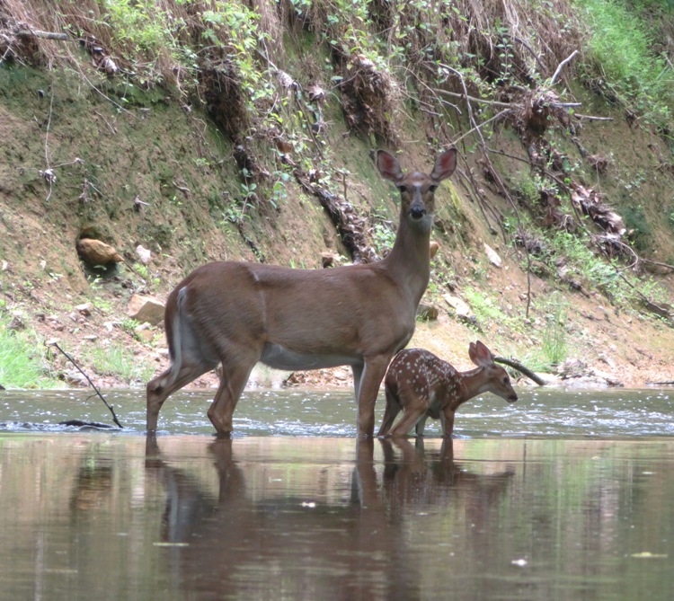
A little later, I spotted a barred owl. 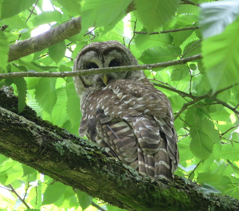
The three of us didn't see any other people for the first five hours...not until we got well within the Middle Patuxent Environmental Area. That is also where we encountered several log jams. 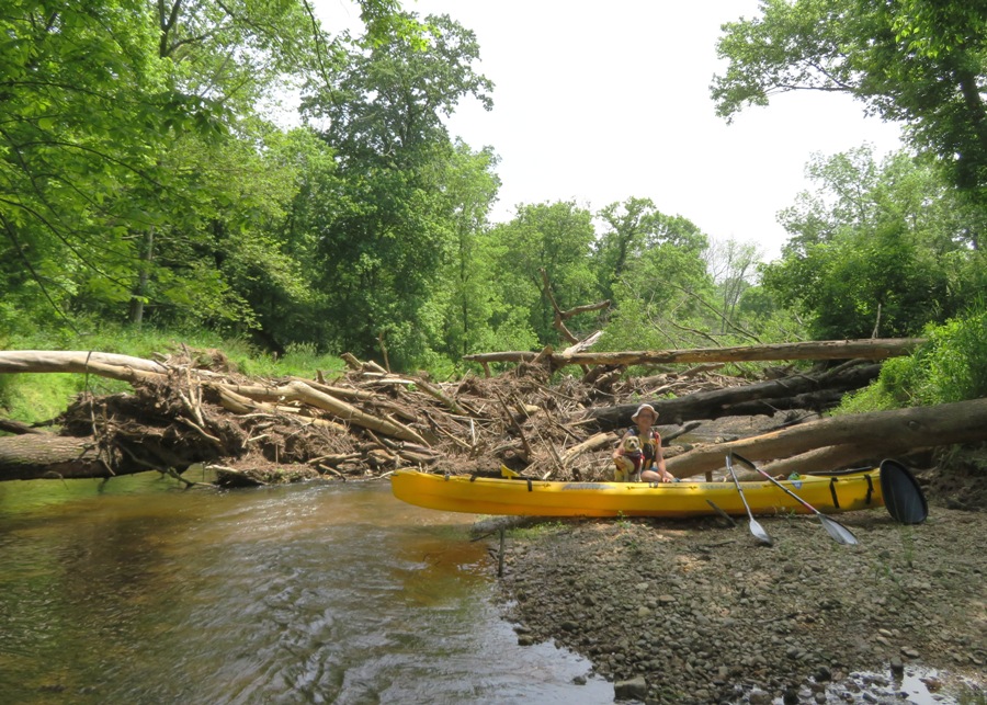
Big rocks were also a problem. With such little water, it was easy to hit rocks or get stuck between them. Towards the end of our trip, near the Robinson Nature Center was the worst for this. We finished around 1630 after being out for about 6.5 hours and only covering a little over eight miles. It would have been faster to simply walk through the water. Would it have made much difference if we had the 4.5 to six feet of water that was suggested? I have no doubt it would have helped. But I'm thinking we still would have had numerous portages. Not sure I will ever do this trip again. I found it very frustrating. But at least I can say I did it. And with the exception of about a half mile whitewater section in Savage, I can say that over time, I've paddled from Carroll Mill Road on the Middle Patuxent River to Piney Orchard Parkway on the Little Patuxent River. I don't reckon many people have done that though I suppose Greg, Chip, and Ed Gertler have. |
|
It was supposed to get up to 90 degrees. So I figured I'd get out on the water early with Daphne on my SUP. We launched at Green Bridge (shown below) and paddled in the Triadelphia Reservoir.
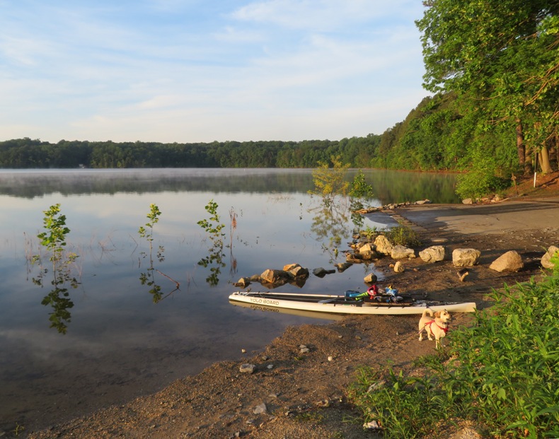
Just downstream lies Brighton Dam. Boaters are cautioned to keep away for fear of certain death. I've been paddling now for over 20 years but I don't know if I've ever been in this reservoir, despite the fact that it is so close to home. I guess it is because I don't like reservoirs. But this month, one can paddle here for free so I figured it was my time to check it out. We were on the water by 0630. There was a low fog over the water which made the place seem magical. I didn't think I'd see many people but there were more out than I expected. About half were fishermen. 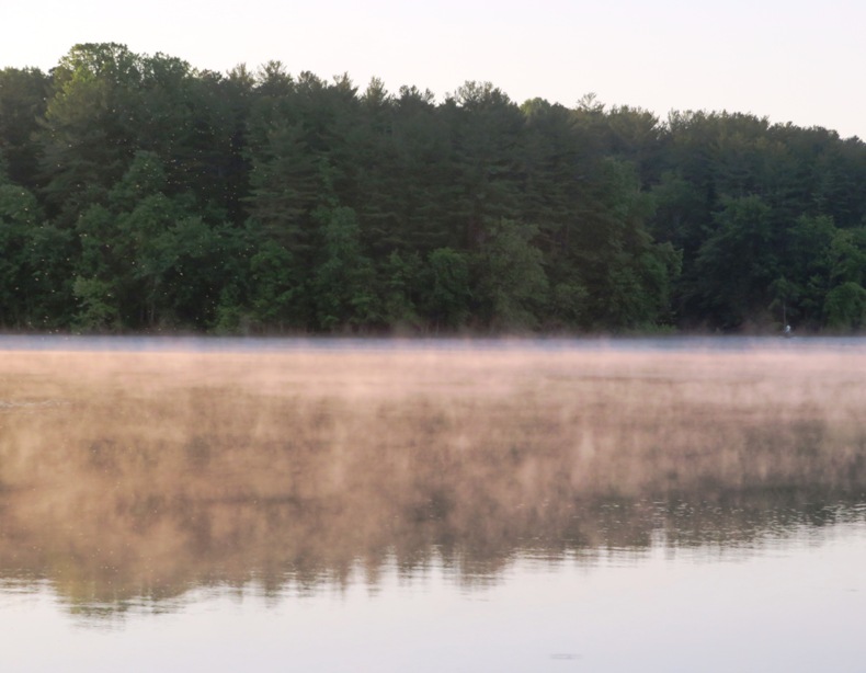
Daphne and I headed northwest. Since I wasn't interested in hugging the shoreline yet, I relied on my compass to keep me heading in the right direction. After 3.15 miles, I saw the Triadelphia Lake Recreation Area which has a nice ramp and fishing pier. Next time, I'll plan to launch here so I can be closer to the more scenic spots in the northern side. 
What areas are scenic? We left the reservoir and paddled up the Patuxent River. Unfortunately, we didn't get far...just 0.3 miles from where the river becomes the reservoir, though that isn't clearly defined. Next time, I'll bring a kayak and portage past the boulders that stopped us. 
Had we gone another 0.2 miles upstream, we would have gotten to Roxbury Mills Road (route 97). Upstream of that is Howard Chapel Road, where I waded on July 7, 2019. The area around the Patuxent which resides upstream of the reservoir is Patuxent River State Park. The other scenic spot (even better) is Cattail Creek or East Branch, depending on what map you're looking at. 
I was able to paddle 0.8 mile up from the reservoir on this creek. Boulders stopped me from going further without portage. This creek is also worth returning to with a kayak and exploring past the boulders. 
Last year, the reservoir was closed for recreation due to construction. Much of it was drained. It was interesting looking at satellite photos and seeing how dry things were. During that time, trees started to grow. But once construction was complete, the reservoir was once again filled. So now there are many small trees underwater. The bigger ones have their tops protruding above the surface. I don't imagine they will live long. 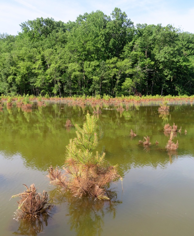
We were done by 0900, having paddled 9.8 miles. Check out our route and notes below. 
It was good to get out early and beat the heat. |
|
It was the first day of summer. So how did Norma, Daphne, and I celebrate? We went kayaking, of course.
We did a car shuttle, leaving Norma's car at Brown's Bridge - Montgomery County. Then we drove to Mink Hollow Road. The three of us were on the Patuxent River by 0830. It rained about a half inch 12 hours prior to launching and the water was noticeably higher than when I scouted it on June 3, 2020. But the downstream current at the launch was still a gentle one to two mph and I would have liked even more water. I don't believe there are river gauge stations in this area so I can't tell you the flow. I'm thinking that this info is not available because this place is between two dams, so things like gauge height and discharge are at least as much dependent on the dams as rainfall. Our first find was a damselfly. It had recently emerged from its nymph stage and was perched near the empty shell from which it came. Not quite ready to fly, it graciously posed while I took its picture. 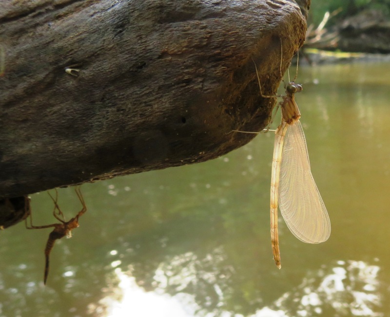
Paddling upstream, we soon encountered a large downfall but I was able to remove one large branch to create an opening where we could paddle under it. Here, I saw a fishing spider with a 4.5 inch spread. 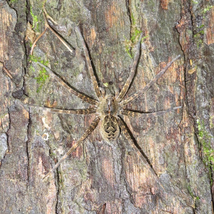
The rest of our portages were simply through shallow sections. No other big downfalls except the one where we turned around. It was good to be out early. It wasn't too hot but it was humid and hazy. Maybe not the best conditions for picture taking but with such narrow water lined by tall trees, I expect there would have been lots of harsh shadows had it been sunny. 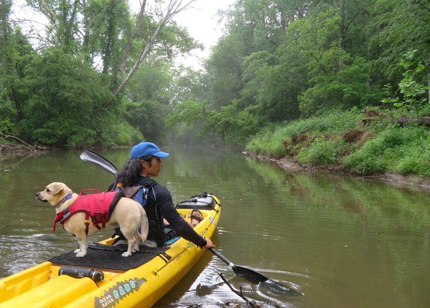
Things were pretty quiet until we heard the distinct squawking of a heron rookery. I stayed with the boat while Norma and Daphne went ashore to investigate. We believe it was near 39.174693, -77.001726. I went to the other side of the river and tried to look for it from higher ground but could not see anything. But all the noise made it sound close. Norma and Daphne bushwhacked their way to see the rookery but were stopped by numerous breyers. She made a video to capture the sounds of the birds. Watching the videos from home, I saw a small fuzzy silhouette of a parent bird feeding its offspring. Neither the sound nor the image had web-worthy quality for posting. Norma found something interesting that I had never seen before...an eastern eyed click beetle (aka eyed elater). The "false eyes" depicted on the pronotum [plate-like structure that covers all or part of the thorax] are a defensive adaption designed to confuse or frighten potential predators. Like all click beetles, A. oculatus [this insect] is also capable of suddenly catapulting itself out of danger by releasing the energy stored by a click mechanism, which consists of a stout spine on the prosternum and a matching groove in the mesosternum. - from Wikipedia - Alaus oculatus 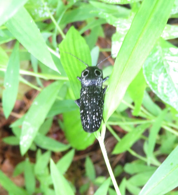
After 1.35 miles, we came to a good turnaround point at a large downfall. We could have carried the boat over but decided that if we wanted to beat the pending thunderstorm, it was best to do otherwise. Looking upstream, I didn't see other downfalls but there were plenty of shallow areas. Had we ventured another 650 feet, I think we would have gotten to where the Patuxent River merges with Hawlings River. Maybe I'll return and scout Haviland Mill Road and see if I can launch somewhere near where it passes over the Patuxent River, 39.178663, -76.999925 or where it passes over Hawlings River, 39.175914, -77.007671. We started making our way downstream. The place was beautiful with all its lush greenery, ferns, hemlocks, deciduous trees, and large boulders. 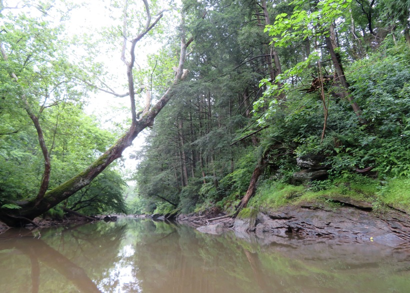
A little upstream of Mink Hollow Road, we saw a four inch long dragonfly. Again, I don't know what kind it was. What had me perplexed was the fact that it was resting with its wings tucked back like a damselfly, rather than outstretched like a dragonfly. I'd never seen this before. I noticed it was perched on the remains of a large insect. Later, I learned that, like the damselfly, it too was a new adult, having recently emerged from its nymph stage. Norma noticed that its wings were still wet. 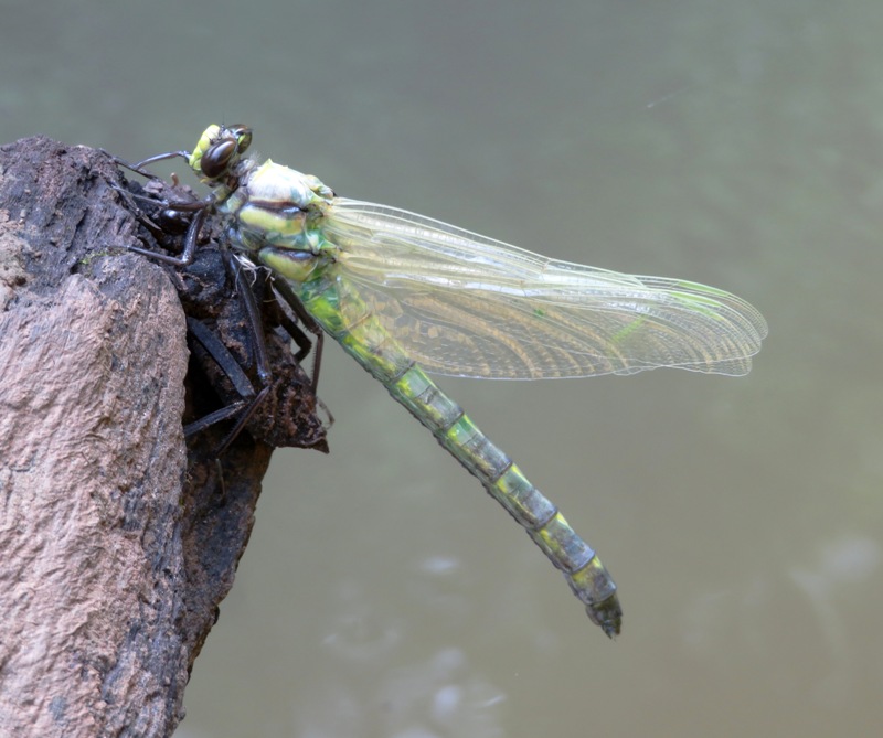
Continuing downstream past Mink Hollow Road, we only had some shallow portages but no downfalls. 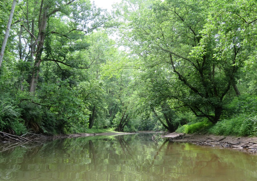
We paddled under Clarksville Pike (route 108). I think that might have been where we first starting seeing others. Prior to that, for about the first 2.5 hours, we saw nobody. The sun came out briefly and then the river started to widen as it eventually became the T. Howard Duckett Watershed (aka Rocky Gorge Reservoir). A bald eagle perched above us flew away as we appoached. Had it not flown, we never would have known it was there. Eventually, we were paddling over some of the same area I SUPed on June 3, 2020 though I couldn't tell because the higher water made things look much different. We could hear thunder in the distance. Then it started to rain. But we were only caught in the heavy rain for the last five minutes. We finished our trip around noon, having paddled six miles. 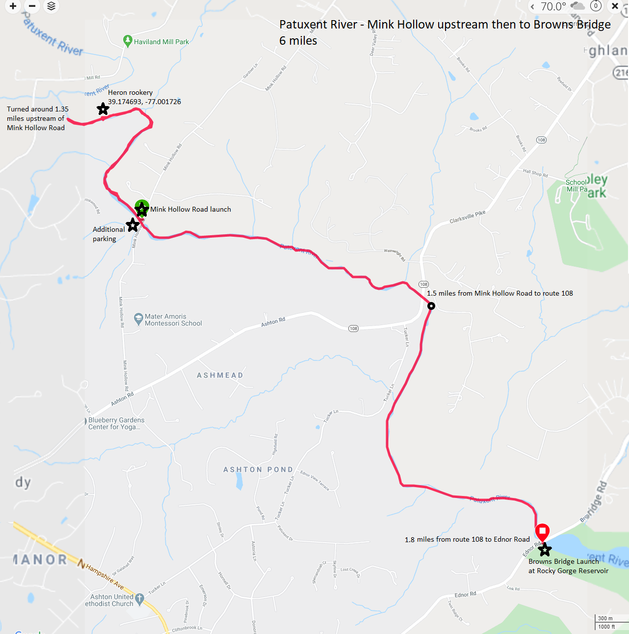
This was a great trip. Much better than our June 6, 2020 paddle on the upper part of the Middle Patuxent. Today's was a good length with lots of great scenery and just enough portages to ensure we had solitude. |
|
With the days being so long, I have to wake up pretty early if I want to get out when the sun is really low. But since I haven't been going into work due to the Coronavirus, I've been able to get plenty of sleep.
I was up at 0440. I launched my surf ski at 0600 from Supplee. There were already plenty of other people out on the water. I think all were fishermen (no women). I paddled through a thick fog which reminded me of kayaking at the Apostle Islands on August 9, 2017. 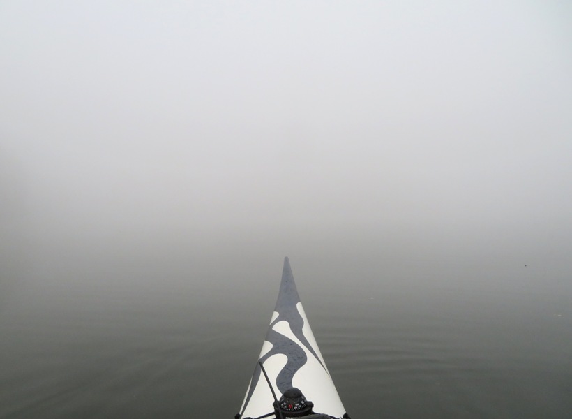
My first goal was to simply paddle to Browns Bridge over the most direct route. That is easier said than done. The little coves in the T. Howard Duckett Watershed (aka Rocky Gorge Reservoir) are sometimes not so little and with the fog, it would have been easy to venture off the main path into one of them. But surprisingly, I stayed on course and reached my destination in an hour and 20 minutes, covering 7.3 miles and averaging 5.47 mph. On my way back, I took a more circuitous route, exploring some of the coves. I saw a bald eagle, a young buck, and several great blue herons. I also saw some interesting rocks. I generally don't much care for reservoirs because I find them uninteresting. But not today. Paddling my way through the thick fog, I saw a naked fellow on a rowing shell wearing only a headband. He looked to be in his mid to late 60s, fit, confident, and a good rower. Needless to say, I was shocked and appalled that he wasn't wearing a personal flotation device (PFD). 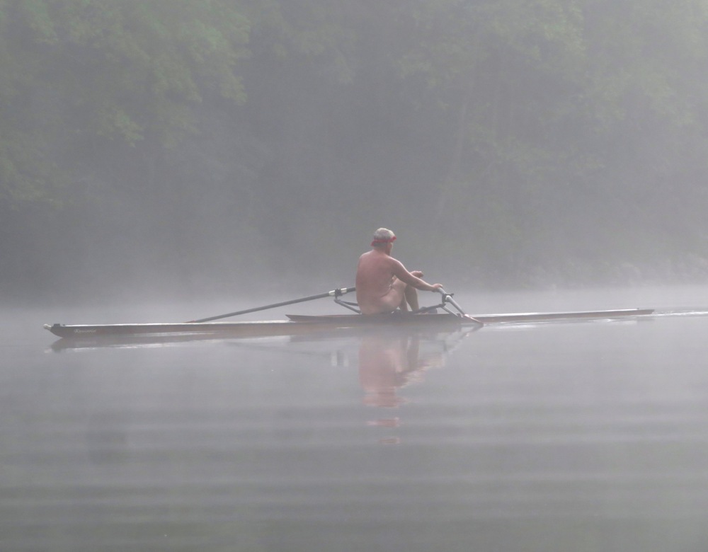
I tried to paddle as far south as I could but was stopped by marked buoys about 0.4 mile north of the dam that warn boaters to stay away. I was done by 0920, having paddled 17.4 miles. My overall average pace was 5.1 mph while my moving average pace was 5.5 mph. A few days ago, WSSC - Watershed Recreation User Program mentioned Watershed use permits are not required through June 30, 2020. But it has recently changed. Now it says Watershed use permits are not required through the remainder of the 2020 recreation season. So I guess I'll be getting to know the reservoirs well this year. |
|
Norma, Daphne, and I went kayaking on the Corsica River Water Trail, launching from Centreville Public Landing. This trip was on my 2019 bucket list.
On September 5, 2019, we paddled section one and part of section two of the water trail. I vowed to return and complete this trip. So we got up at 0530, left the house at 0650, and drove out to Anglers to purchase a Queen Anne's County boat launch pass. The place was packed. Fishermen tend to be early morning people and that was certainly the case today. I marveled at how the customers at the store were so racially (but not gender) diverse. An annual pass cost $35, the same as it did seven years ago. Now if only I could find auto/homeowners insurance that would remain that consistent in price. We got across the Chesapeake Bay Bridge quickly. There has been construction taking place but they have also done away with the toll to help make up for delays. The three of us arrived at the Chestertown Farmers Market. Normally, it is in the historic district at Fountain Park but due to the Coronavirus, they moved it to the East Coast Storage Company parking area at 848 High Street. This location allows vendors to spread out so people could practice social distancing. 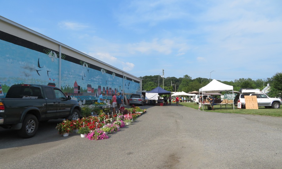
Chestertown had delayed the opening of the farmers market and today was the first day. I drove the three of us to Centreville where we walked on Millstream Trail starting at the north end. We explored some of the side trails that connect it to Centreville Elementary School. Along the way, we found a box turtle that appeared to be laying eggs. Slightly further away, we found the remains of what I believe were turtle egg shells. 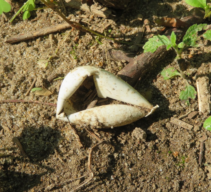
We launched and were on the Corsica River by 1040. High tide was 1227. We'd had a good bit of rain recently so the water was pretty high. Of course that's good for getting further upstream and exploring the shallow areas. First, we explored scenic Earle Creek. This isn't part of the water trail but it looked interesting. We managed to get 0.4 mile upstream on that. There were several paw paw trees, some bearing fruit. 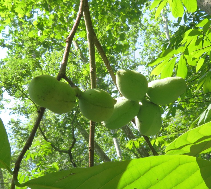
Next, we kayaked downstream on the Corsica, crossed to the other side, and then paddled upstream on Alder Creek as far as we could...about a mile. We had to duck really low to get under a bridge. This was section three of the water trail route. Near 39.071944, -76.082750, we saw a great blue heron rookery containing at least nine nests. All were empty due to the juveniles maturing and flying away. In contrast, just a week prior, on June 20, 2020, we found an active rookery. Clearly, this is the time when great blue herons mature and are ready to venture out on their own. 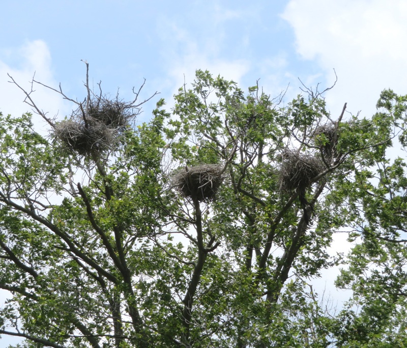
Not far away, on the Corsica River, we saw several osprey nests with large, juvenile osprey still being cared for by their parents. How much longer before these parents suffer from empty nest syndrome? August is emptying-the-nest month for ospreys. - from "Chesapeake Seasons - 'Teenage' Ospreys Spread Their Wings" (broken link as of 2025) 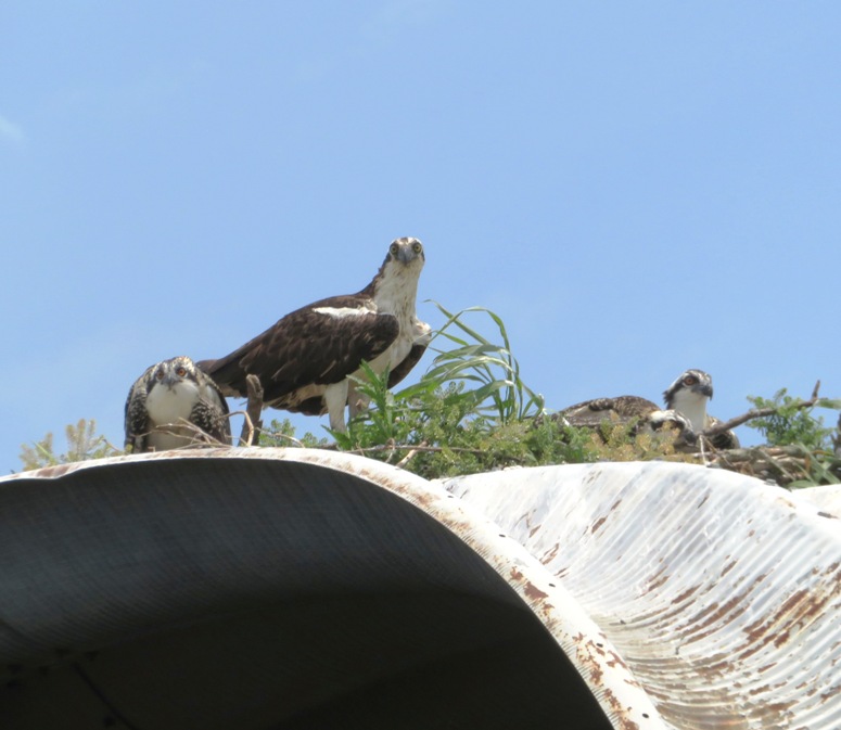
The most uninteresting part of our trip was from the mouth of Alder Creek to Centreville Wharf. During this time, the wind was generally not over 10 mph but sometimes it gusted to 21 mph. Under the wharf, I found three dragonfly nymph shells (exuvia). A nymph - when referring to animals, and particularly insects - means the immature form of an insect which undergoes gradual metamorphosis before reaching its adult stage. A nymph's overall form already resembles that of the adult, except for a lack of wings (in winged species). - from "WildCreaturesHongKong - Nymphs, Naiads and Larvae" (broken link as of 2020) 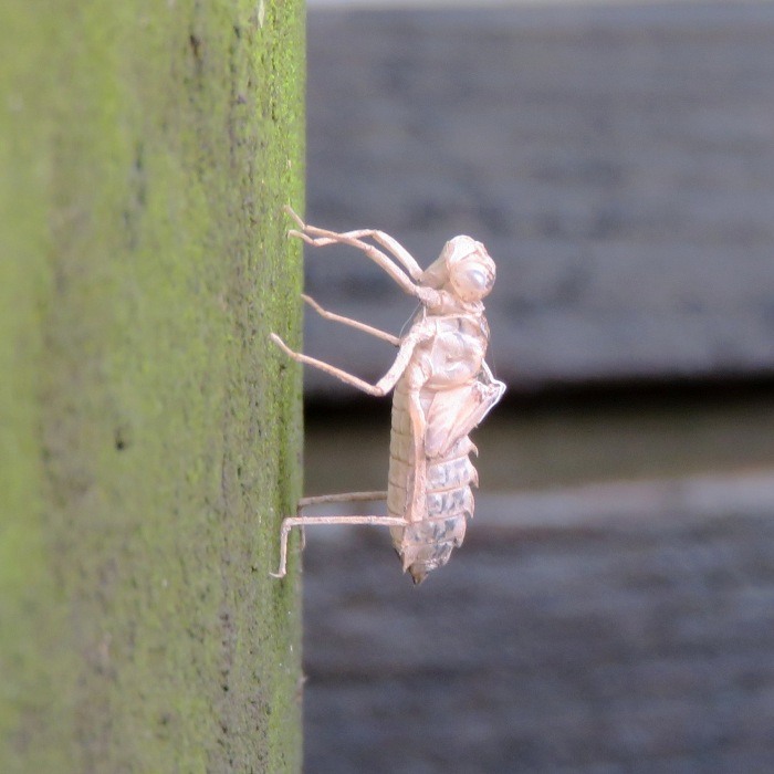
Exuviae are the cast of exoskeletons left behind after dragonflies emerge. Because they are solid, they retain the exact shape of the full grown nymph, a kind of death mask for that previous stage of life. There is a hole in each exuvia located behind the head and between the wing pads where the adult dragonfly made its escape, literally crawling out of itself. - from iNaturalist - Exuviae We paddled up Yellow Branch Stream and Three Bridges Branch, getting 1.3 miles upstream of Watson Road Bridge. There was a good bit of pickerelweed and lizard's tail lining the shore. At the most upstream section, I saw an exuvia which Wayne D. identified as being from the family Gomphidae (aka clubtail). 
Norma and I did some moderately challenging portages in the sense that we did them while balancing on a log. 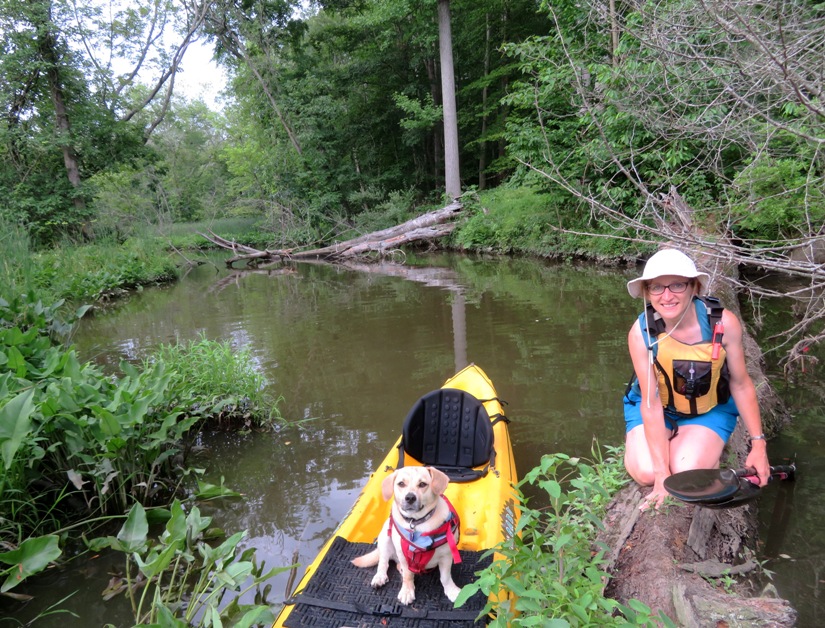
Daphne didn't much like portaging over trees or having to navigate around limbs though I think she preferred the latter. 
We saw several bald eagles and of course several ospreys, great blue herons, and a few red-winged blackbirds but we only saw one green heron. 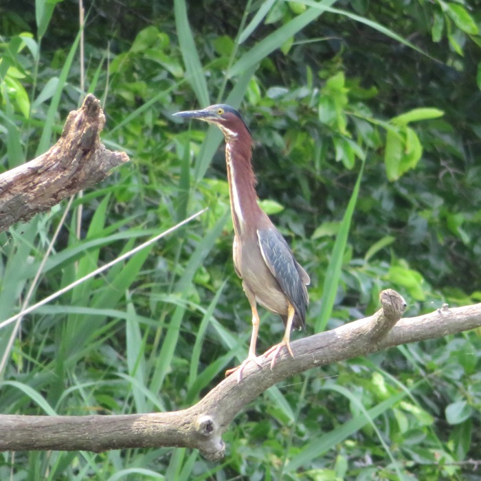
No muskrats, beavers, or snakes were seen. We caught a little rain but not much while on the water. The high temperature was 92 degrees Fahrenheit. We did at least some portages on each of the three creeks. I got to work on my flying straddle kayak mount. After being out on the water for about 4.5 hours, we paddled 9.9 miles. 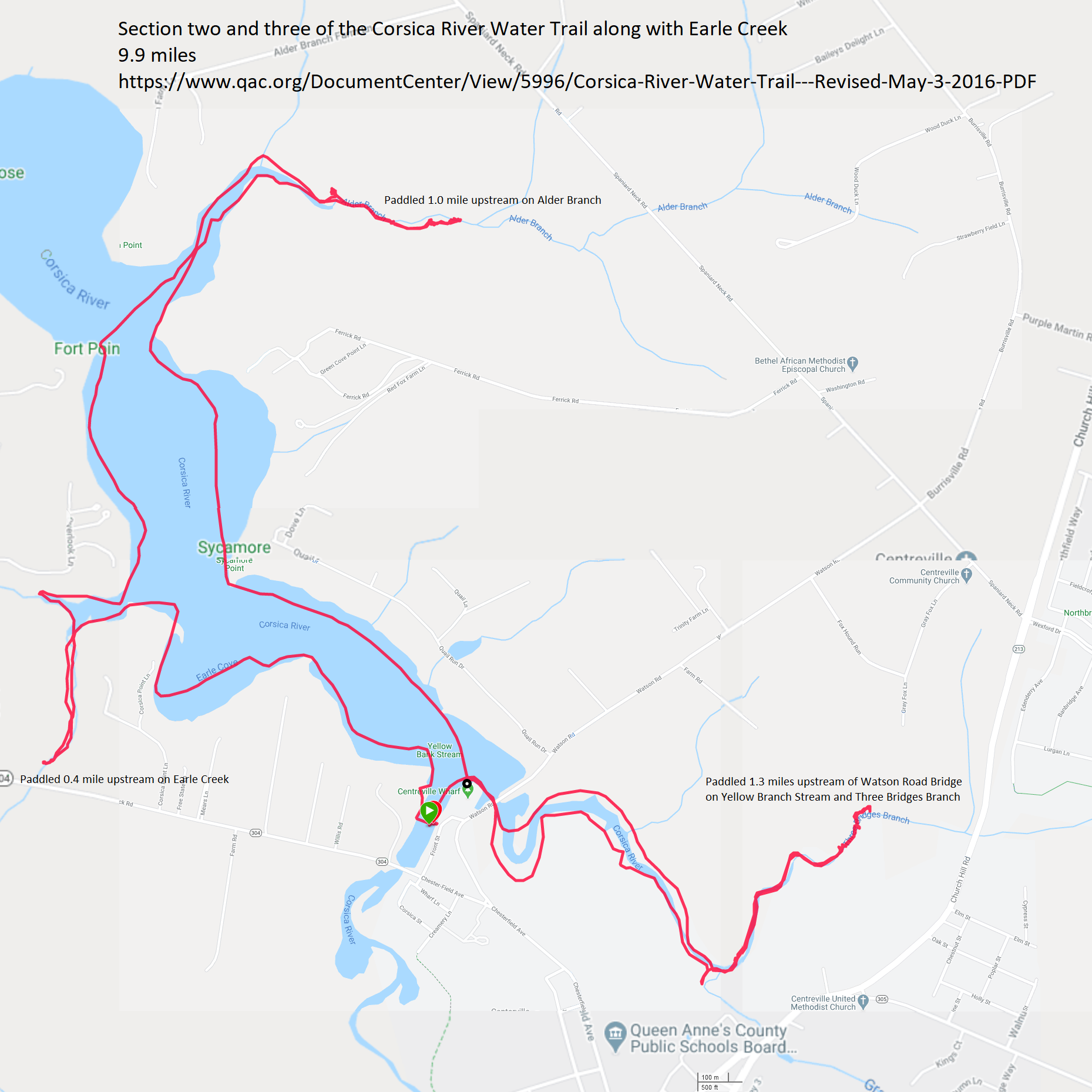
According to the info about the water trail, sections two and three were only 5.5 miles but we also did Earle Creek and Earle Cove though I didn't think those would have added that much more distance. Just a short walk from the launch area was Doc's Riverside Grill. We ate a really good dinner there. They let us bring Daphne to join us in their outdoor seating area. They had live music too. There was heavy rain on the drive home in Annapolis but none of it hit Savage. |
|
Daphne and I were out paddleboarding on the T. Howard Ducket (Rocky Gorge) Reservoir shortly after sunrise. We launched from Scotts Cove. It is amazingly close to home yet I've never put in there. We hugged the shore, exploring all the nooks and crannies in the reservoir. Seeing what I saw (and didn't see) confirmed my belief that reservoirs are not that interesting.
Near highway 29, along the shore, I found a Rolling Thunder flag. Rolling Thunder is a non-profit organization that addresses POW/MIA issues. 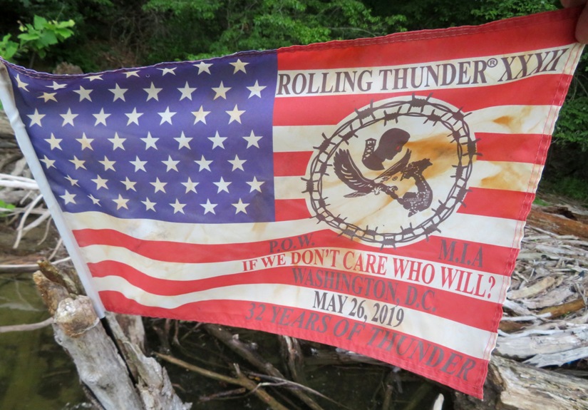
I saw a tiny frog that was less than a half inch long. 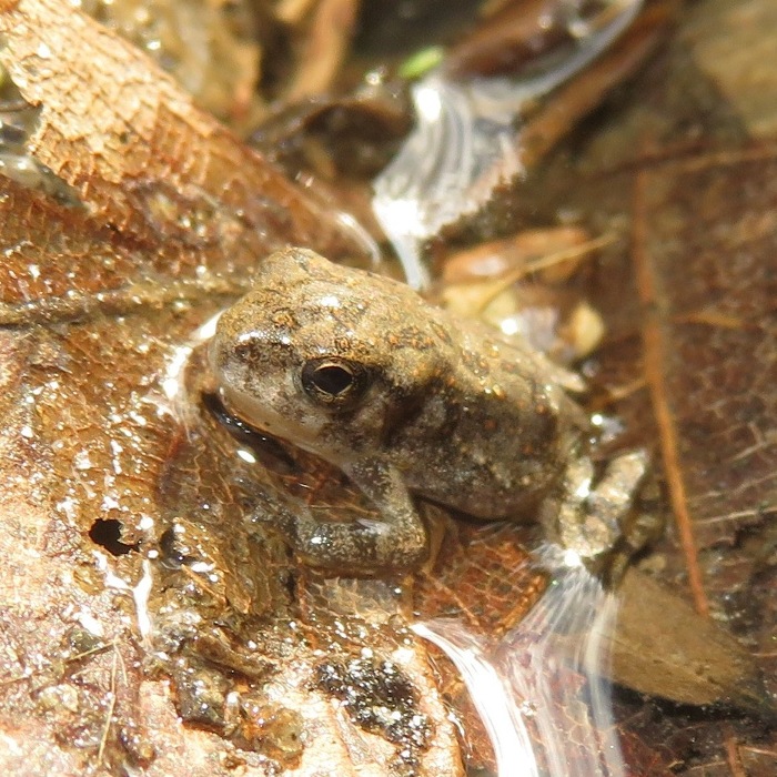
Near the frog, I spotted this damselfly which I'm thinking might have recently transitioned into adulthood. It was very sluggish and not wanting to fly. Notice the water droplet on its back. 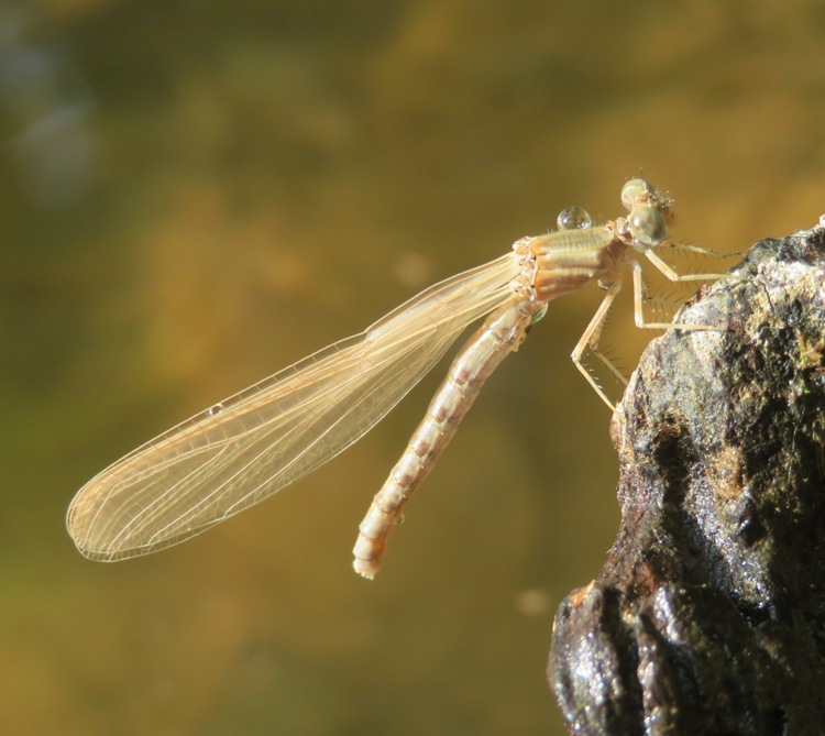
On June 23, 2020, I posted Watershed use permits are not required through the remainder of the 2020 recreation season. This is still true. But what I found out today is that SUPs are not permitted in the reservoir. Surfboards, windsurfers, paddleboards, sailboards, rafts, houseboats, mattresses, unseaworthy watercraft, or any craft which facilitates frequent body contact with water in the reservoir, or any craft sold as a "toy" rather than a "boat" are not permitted on Washington Suburban Sanitary Commission (WSSC) Water reservoirs. - from WSSC - Watershed Recreation User Program I saw a guy on a surf ski and started talking to him. Turns out we've paddled together before. He told me the above info and mentioned that the police have stopped giving out warnings and are just ticketing people now. That might explain why I never saw any other paddleboarders on the water. Such a shame. But I actually feel like I've done as much SUP exploring as I want on the reservoir so for me, it is no big loss. But I do know others that are new to SUPping who could have really benefited from paddling on the reservoir. I got in 10.5 miles in 3 hours (0600-0900). 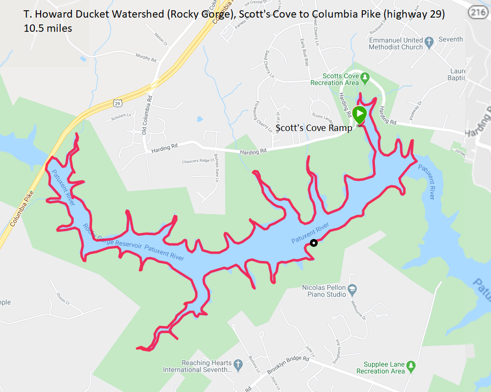
|
|
Norma, Daphne, and I launched from Triadelphia Lake Recreation Area. Recall that I scouted this area via SUP on June 9, 2020. But today, I planned for us to do some portaging so we could get further upstream on Cattail Creek (or East Branch, depending on what map you're looking at) and the Patuxent River.
It was supposed to get up to 95 degrees so we definitely wanted to be on the water early. We awoke at 0430 and launched at 0640 when the air temperature was around 70 degrees. About 48 hours prior, it rained 0.38 inch, but the water didn't look particularly high or low when we were out. Ideally, we should have been on the water much sooner after a heavy rain. The water in the Triadelphia Reservoir was lukewarm. As we paddled north towards Cattail Creek, Daphne was at ease. I can always tell when she's relaxed on the water because she sits or lies down. 
We paddled upstream of where I stopped the last time I was there. There were a few portages over shallow areas but no log crossings. The place was lush with deciduous greenery, and the water was significantly cooler than the reservoir. 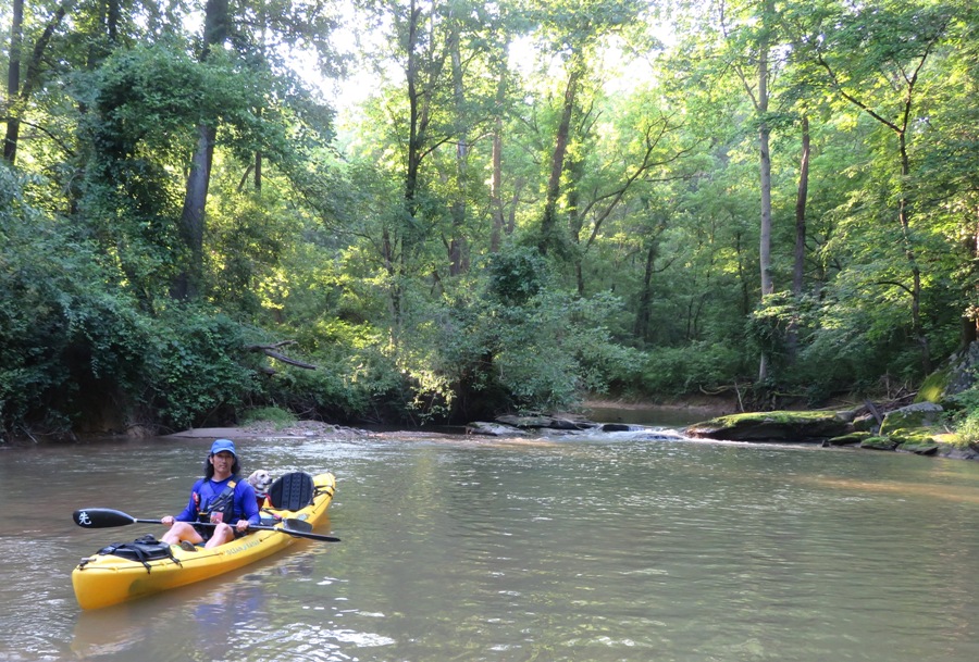
The three of us made it up 1.5 miles to 39.251856, -77.047142. We could have gone further but we would have spent more time portaging than paddling. Leaving the boat on the shore, we walked about another tenth of a mile upstream until we saw a road that crossed the river. There was a sign that pointed west for route 97 and east for Triadelphia Road. On the west side was a Washington Suburban Sanitary Commission (WSSC) marker that named the road TRHC0044. Norma spotted a one inch-long crayfish. Later that morning, we saw a three inch-long crayfish. On a decaying log, we saw some fungii called Calocera cornea, also known as club-like tuning fork. 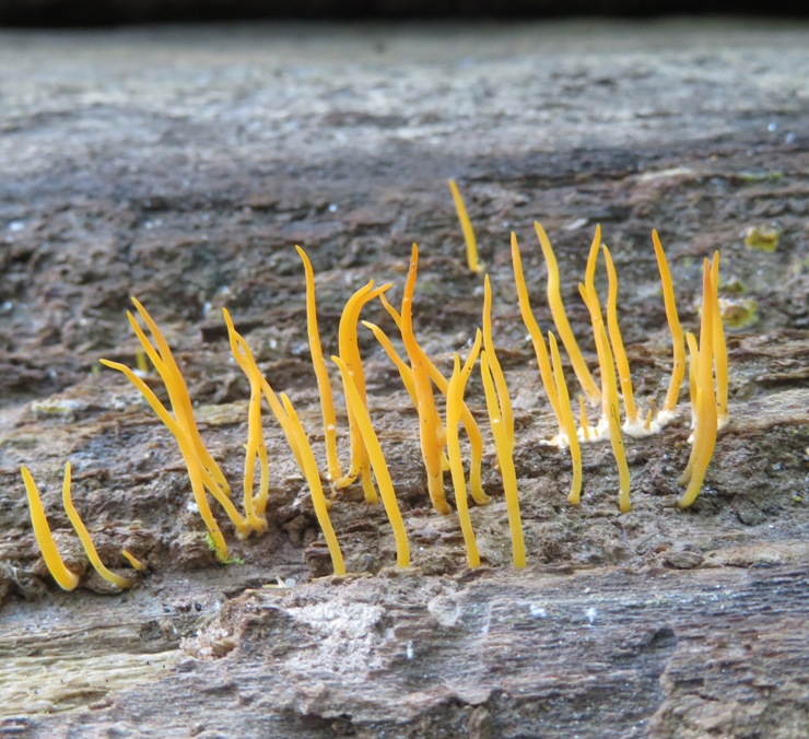
Not far away, I found what I thought was another fungii but it turns out it is instead something produced by insects. It is frass from ambrosia beetles. So what is frass? The frass of wood-boring beetles is made up of fragments torn off but not consumed, and fragments that have passed through the insects gut! It resembles a fine, powdery dust and is usually found below the area of the infected wood. - from "deBugged - Woodworm - 'frass'-inating..." (broken link as of 2025) 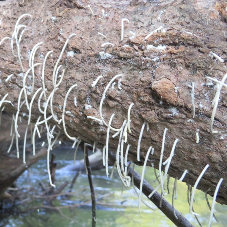
I climbed up on a log to take this picture of Norma and Daphne looking pretty. 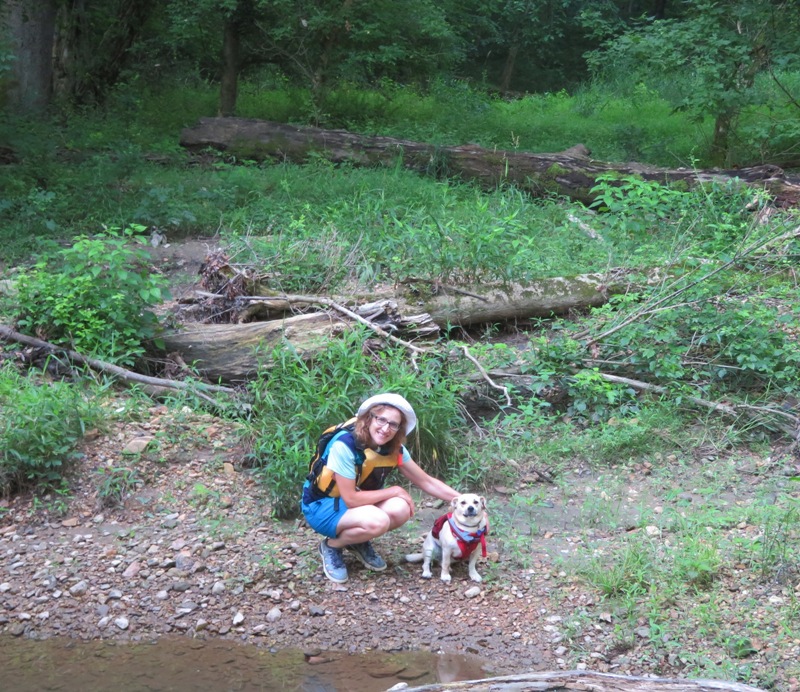
While I was up there, I saw this Araneus cingulatus, commonly known as Red-spotted Orb-weaver. It was about 0.75 inch long. Never seen one of these before. 
Looking around the area, Norma found a really tiny American toad, about 0.6 inch long. 
Paddling back downstream, we had lots of great scenery to appreciate. 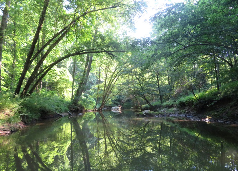
Closer to the mouth of Cattail Creek, we saw a green heron that posed for us in perfect morning sun. They have many colors but you need bright light to really appreciate them. 1 / 5
Ready to jump.
2 / 5
Looking for breakfast.
3 / 5
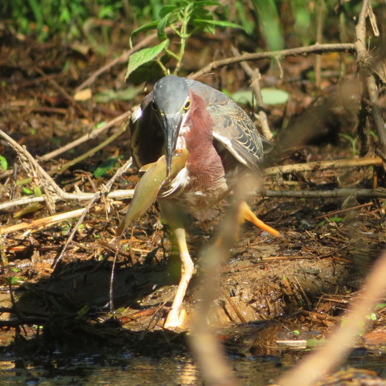
Got it!
4 / 5

What a catch!
5 / 5
Beautiful colors.
We paddled back into the reservoir and then up the Patuxent River. Here, we found a big, shady rock that had "lunch spot" written all over it...no, not literally. Like Cattail Creek, we could have used more water. There were some portages, including this one over a small dam at route 97. But spots like this made for a fun downstream trip. 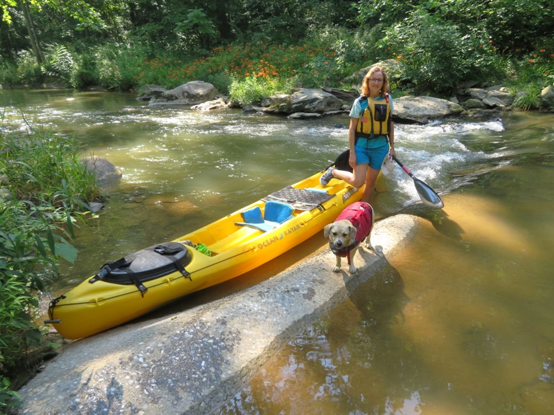
Norma looked around on shore while Daphne and I squeezed under a log and continued for a stone's throw to a bamboo grove about 0.7 mile upstream from the reservoir at 39.239840, -77.058197. That was as far as I got. For both tributaries, we could have kept going upstream but the ratio of portage to paddle was getting too high to make it worthwhile. If you only have time for one, do Cattail Creek. Both are nice but Cattail is better. Back in the reservoir, we kayaked by something that I initially thought was a submerged tree stump with something growing on it. It was a couple feet under the surface. When I poked it with my paddle, there was no resistance. It felt like a plastic bag filled with water. As it rose to the surface, I quickly realized it was a freshwater bryozoan. More specifically, I believe it was Pectinatella magnifica. It was at least as big as a basketball. 
I watched a Cool Outdoor Stuff: Let Us Now Praise Famous Bryozoans video about freshwater bryozoa where I learned There are fossil impressions found on the Chester River created 30 million years ago. [Not bryozoan-specific information but I thought it was interesting because I love Chestertown.] Bryozoans go back 500 million years. There are ~5,000 species of bryozoans but only about 50 species that live in fresh water. They filter the water for algae and bacteria. Investigating further, I found out Individuals in bryozoan (ectoproct) colonies are called zooids, since they are not fully independent animals. [Each zooid is] about 0.5 millimetres long. Freshwater bryozoans are preyed on by snails, insects, and fish. In freshwater, bryozoans are among the most important filter feeders, along with sponges and mussels. - from Wikipedia - Bryozoa The last time I found a bryozoan was September 30, 2019 on the Sassafras River. But that was brackish water whereas I was now at fresh water. So I am pretty sure they are different types of bryozoa. We were off the water by 1105, as the temperature approached 90 degrees. The three of us completed 5.8 miles. Here's our route. 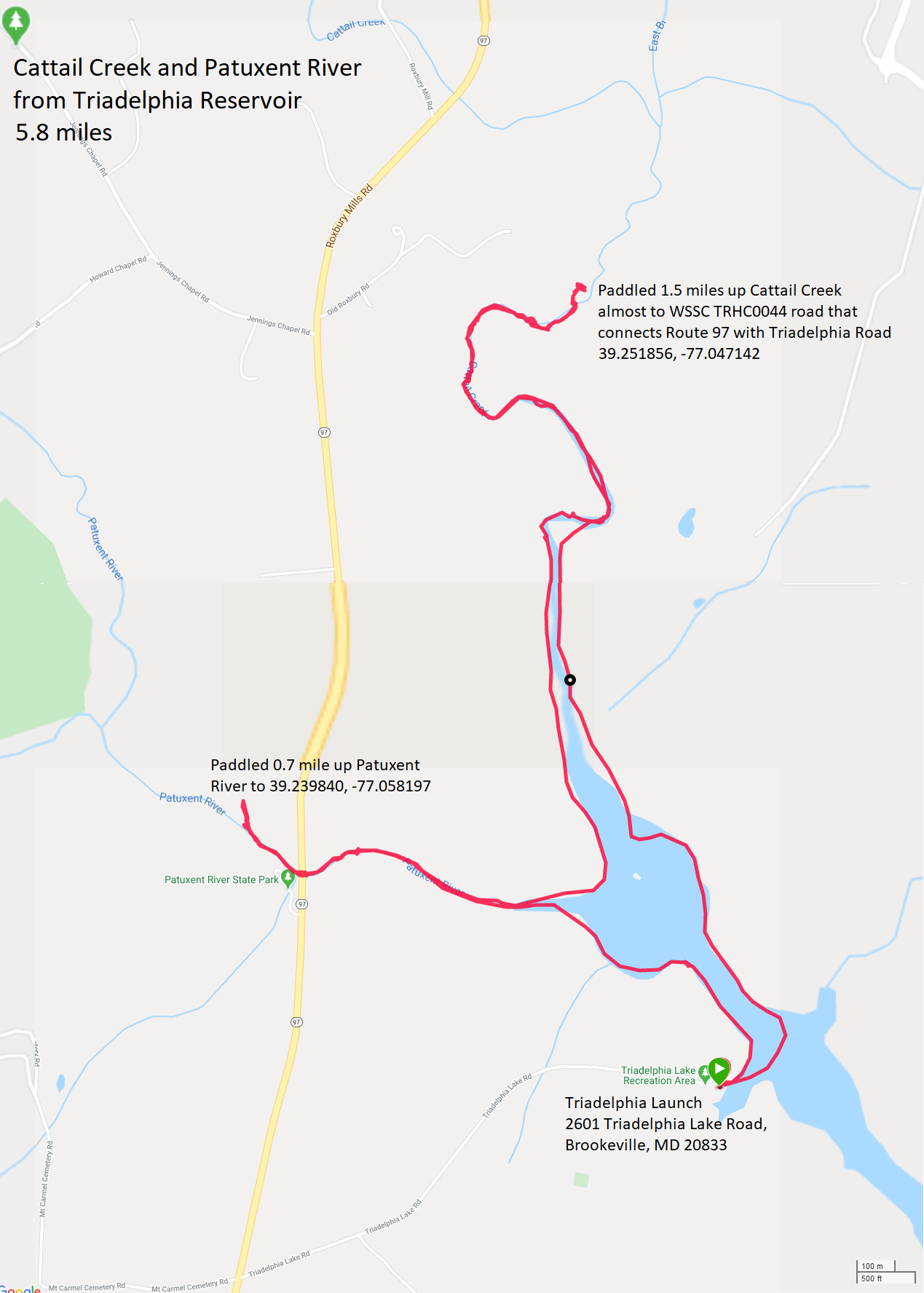
Because of the Coronavirus, I have been staying closer to home. Free use of the reservoir this season has made that easier. As a result, I've also done more freshwater paddling this year than almost any other. I've been out on the water earlier. The latter is also a result of the Coronavirus. Many people have been getting outdoors more, possibly because normal activities like shopping, going to restaurants, bars, beaches, etc. has been so limited. For me, I'm spending as much time on the water as I have in previous years. But I prefer solitude. The best way to obtain that is to get out really early to avoid the crowds. It has been a few months since the pandemic started in Maryland. Some states have not fared so well, partially because their leaders have been more lax about safeguards. But our governor has been better than most and the number of our infected residents has been going down. So things are starting to open up and folks are traveling more. Norma and I are more cautious than many and still prefer to socially distance ourselves by declining gatherings and staying away from crowds. But at this point, we are starting to drive further for day trips. So our fresh water paddling might be on the downhill for the rest of the year. |
|
Daphne and I launched my SUP at 0700 from Homeport Farm Park. I picked this location because four days ago, the riverkeeper for the South River reported seeing a large pod (20+) of dolphins at the mouth.
We paddled south on Church Creek and then out into the South River, where we headed downstream. I kept an eye out for dolphins but didn't see any, though we never made it to the mouth. Along the way, I spotted what was likely a Forster's Tern. I don't know one tern from another so I consulted experts on this. In the future, I should reference BirdQuiz.net - Tern identification: Common and Forster's Terns. I paddled up Harness Creek, along Quiet Waters Park, passing the pier at the kayak rental area where I first paddled in Maryland back in 1998. Private small boats can also launch here but it is a third of a mile carry from lot I. At least it is a paved path so carting should be easy. It was a little after high tide on the day of the Buck Moon. The water looked very high. One pier was partially submerged. I saw a few green herons but the lighting wasn't right to get good pictures. Too cloudy. I need bright light to truly capture their outer beauty. With my Canon SX720 HS this light would have been better for egrets. We explored Loden Pond before heading back. According to Anne Arundel County Water Trail Map 9 - Lower South River to Eastport, one can park at lot M at Quiet Waters Park and then walk 100 yards to launch on the north side of this pond at any tide. I was told there is no sign or trail to this launch. I saw and said hi to Marilyn F. who was out kayaking with a friend. There were a lot of comb jellies and sea nettles in the water. The latter tended to have a bell up to seven inches in diameter. I followed around a few to take their picture. Jellies, it turns out, have been around for some 600 million years, and they are very good at adapting. - from "Chesapeake Bay Foundation - Sea Nettles" (broken link as of 2025) I also made a video of how they look when they swim. Click on the image below to play it. Note that I slowed the video down to half-speed. 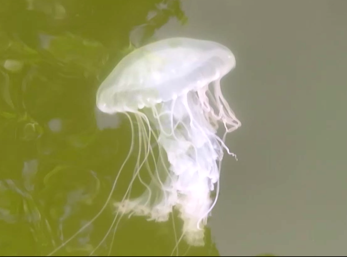
Daphne and I pulled ashore just after 1000, having paddled 10.8 miles. By that time, it was getting pretty hot. I was glad to have gotten on the water early. Folks from the WatersEdge Meetup Group were launching as we pulled in. We managed to squeeze in between two groups. I stopped in at the Anne Arundel County Farmers' Market which is only 1.6 miles from Homeport Farm Park. They don't allow dogs so I pulled in under a tree, rolled down the windows partly, and made a quick trip to buy mini-cranberry orange muffins and peaches. Unfortunately, I've never seen them sell dog treats. |
|
Daphne has a sister whose name is Mia. Norma and I have been in contact with her owners, Esther and Richard. Recently, the two of them purchased an inflatable iRocker Sport 11'x31" SUPs. I said I would be happy to join them on their maiden voyage. They accepted my offer.
They wanted to paddle someplace local so we decided on the Patapsco River at Daniels Area. They arrived first and I was just a few minutes behind. A police car was in front of me with another behind. All the regular parking was taken and several vehicles were parked on the shoulder near the church. The cars weren't impeding movement but they were parked where there were "no parking" signs. So the police started writing tickets. I don't remember the signs the last time I was there but maybe they were. It is a shame that such a popular area has such limited parking. Needless to say, we didn't stick around. Esther and Richard suggested we go to Lake Elkhorn. I agreed but was very skeptical because I know just how popular that place is, and I was certain there would be no parking anywhere near the launch area. I was wrong. We ended up getting the second and third best parking spaces, just a short distance from the wooden boat ramp. 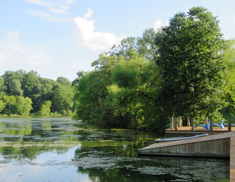
Esther and Richard unpacked their gear. Their SUPs were brand new, still in the box. While they were pumping them up, I got ready to launch. As soon as I put my SUP in the water, Daphne jumped on. But she soon realized that I wasn't ready to go quite yet so she hopped off. In doing so, she pushed the SUP out away from the ramp. I lept in the water to retrieve it. The water was almost chest-deep. I saw and said hi to Tina (neighbor Jeff's wife) who had biked to the lake. Daphne and I paddled in the immediate area while Esther and Richard got ready. In much of the lake, thick aquatic vegetation hindered paddling. I expect much of this vegetation is only there in the summer. We saw some floating wetland areas. I put my camera on a covered bench area over the water, set it on the timer function, and took a selfie. 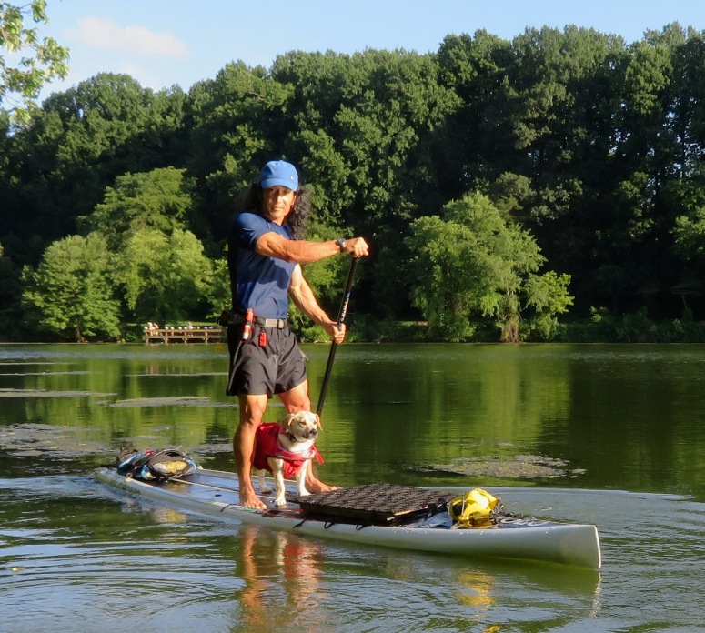
Soon, we were all on the water. We saw a couple green herons, a barn swallow nest under the pedestrian bridge, and a few great blue herons. 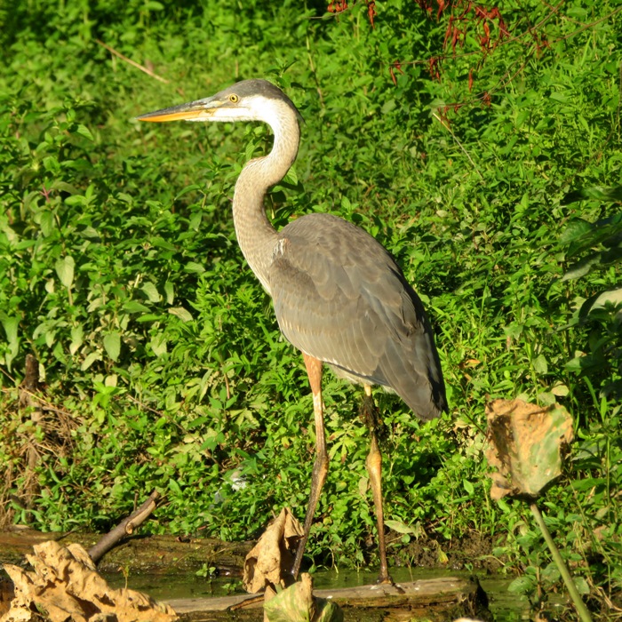
Some spatterdock was blooming. What I really wanted to see was a bryozoan colony but I had no such luck. Here's Esther and Richard, having fun on the water. 
Lake Elkhorn is only 10 minutes from Savage. I've walked, jogged, and skied there, but this was the first time I paddled there. It really isn't big enough to hold my interest and like the reservoirs, I find it too sterile. I expecially hate having so many people there. The thick aquatic vegetation didn't help. But this was Esther and Richard's day and I was glad to be with them on what I hope will be a positive life-changing event, just as purchasing a SUP has been for me. |
|
I wanted to get a lot of outdoors time because the next day I would be returning to the office. So I got up at 0430, grabbed Daphne, and then drove out to Chesapeake Beach where I paid five dollars to launch my SUP from Marina West, Lynwood T. Kellam Memorial Recreation Park.
I was on the water by 0640, paddling upstream on Fishing Creek. I don't enjoy waking up early but I love being active before the summer heat kicks in. It was supposed to get up to 90 degrees. I also enjoy being out when nobody else is. After I launched, it took about three hours before I saw anyone else...solitude! I last paddled on this creek on May 14, 2017 but my time was limited then. My goal today was to see just how far I could paddle upstream and explore its tributaries. Along the way, I saw a snake swimming and then a bald eagle that actually cooperated with my camera. High tide was around 0946. I figured this area could get shallow so having help from the tide was important. But even with such help, getting around via SUP was difficult. Not only was the creek shallow in the more upstream sections but there were also submerged obstructions. Maybe some were old stumps. I had one hard fall onto the SUP from some obstacle I never saw. After that, I took things slower and paddled with more vigilance. The early morning sunlight was gentle so I worked on building up my vitamin D, which is naturally low. 
I made it 3.15 miles upstream from the launch. This portion of the creek was extremely scenic. It was a maze of wetland beauty. I inched my way along so I could savor the moment. I didn't post any pictures of this area because they don't do it justice. I saw some beard lichen. Beard lichen, any member of the genus Usnea, a yellow or greenish fruticose (bushy, branched) lichen with long stems and disk-shaped holdfasts, which resembles a tangled mass of threads. It occurs in both the Arctic and the tropics, where it is eaten by wild animals or collected as fodder. In the past it was used as a remedy for whooping cough, catarrh, epilepsy, and dropsy. It has been used also as an astringent, a tonic, and a diuretic. - from Britannica - Beard lichen 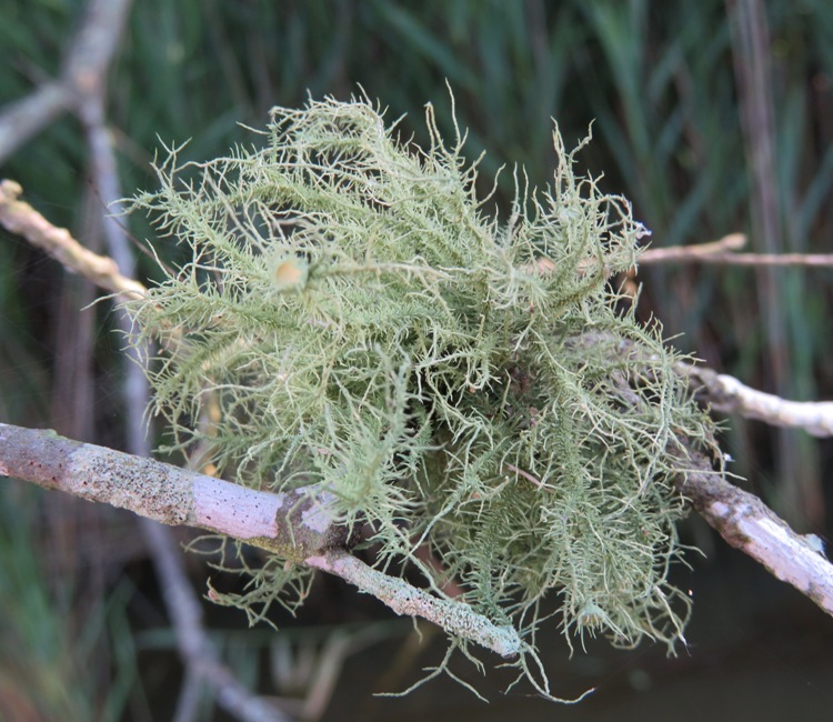
Beard lichen... ...can sometimes be used as a bioindicator, because it tends to only grow in those regions where the air is clean, and of high quality. The usnic acid in Usnea is effective against gram positive bacteria such as Streptococcus and Staphylococcus, making Usnea a valuable addition to herbal formulas for sore throats and skin infections. It is also effective against a bacterium that commonly causes pneumonia. - from Wikipedia - Usnea Daphne and I saw dozens of autumn meadowhawk dragonflies. 
By 1000, the sun was starting to burn brightly as it rose higher. There wasn't much shade on Fishing Creek but we managed to find some in one of its small tributaries where we pulled over for a snack. I let Daphne walk and sniff around on shore. 
I saw hundreds of sea nettles, starting about 1.7 miles upstream from the launch at high tide. After awhile, they all started looking the same. But on the longest (0.6 mile) tributary near 38.688237, -76.544255, I saw one which was unique. It had a small crab hitching a ride. Never in my 21 years of paddling had I seen this before. ...blue crabs (Callinectes sapidus) are often observed atop of exumbrellae [outer surface of the umbrella] of Chrysaora quinquecirrha [Atlantic sea nettle], but they have never been reported to feed on medusae [e.g. mature sea nettles]. - from Blue Crab Predation on Jellyfish I posted pictures of the crab and jellyfish on the Maryland Nature Lovers page. It took about two hours to get 200 "likes" and after two days, I had well over 500 likes. Without a doubt, these are the most popular pictures I've ever put online. The hitchhiker crab wasn't the only crab I saw. I typically see lots of blue crabs in the lower section of Fishing Creek. Paddling towards Lake Moffat, a pair of green herons startled Daphne when they flew out of their hiding spot, just a few feet in front of us. They eventually came to rest on a couple of piles marking the entrance to the lake. 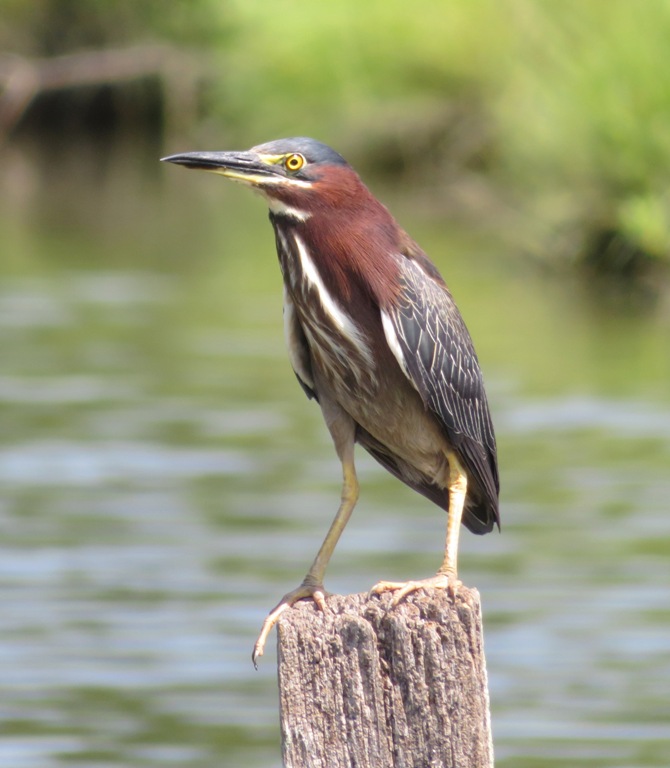
I was done by 1150. It was a long day but a very interesting one. Here's my route. 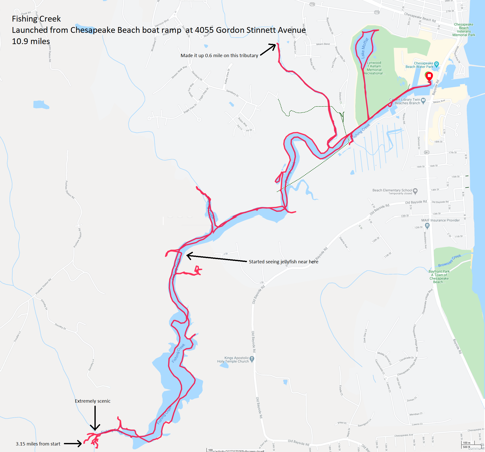
I don't recommend doing this trip via SUP. Even at high tide, the water was too shallow and there were too many underwater obstructions. That's why it took so long. I'm glad I paddled as far upstream as I did but I don't expect I'll do it again. Too much of the middle portion wasn't so interesting. |
|
You may remember that in 2019, I spent several days working towards completing the Patuxent Challenge. Here are the blogs I wrote:
I wrote an article about my experience which I submitted to the Chesapeake Conservancy on October 16, 2019. Then on March 25, 2020, during the Coronavirus pandemic, I was laid off this freelance writing job due to budget cutbacks. But I was paid for everything that I submitted, even if it wasn't published...so they had some articles of mine sitting in their queue. Then on July 14, 2020, my twelfth article was published: The Patuxent Challenge - Challenge Accepted!. I am still hoping I can get re-hired so I can continue to write professionally. I did end up getting rehired a few months later. In the meantime, this article made its rounds, appearing on various websites, including Maryland Planning Blog - Another Way to Get your (Walktober) Walks On. |
|
Lately, once a year, I paddle out to Sharps Island Lighthouse to look for rays. It is a long drive and for the sake of both safety and photography, I need ideal conditions that don't occur very often to make this trip work. Today I had those conditions.
I monitored weather conditions from a variety of sources though I felt Windy.com was the best because it allowed me to select the location of the lighthouse rather than naming a town. Based on Windy.com's report, I had an excellent window of opportunity from 1600 to 1800. It provides hourly reports so I figured I might be able to stretch it from 1530 to 1830. During this time, the wind was forecast to be a mere three knots (3.45 mph). It also hadn't rained for a few days. This means water clarity would be good because much of the sediment would have settled...another desirable condition for photographing rays. I was up early so Norma, Daphne, and I could go for a hike but after washing up, eating lunch, and taking a power nap, I was ready for more. So I left the house around 1230 and headed towards the eastern shore. I knew it would be a long drive but it ended up being extremely long (about two hours and 45 minutes) because of slow traffic before the Chesapeake Bay Bridge. That was not unusual considering it is a hot summer day and folks want to get to the beach. I was surprised that one of the westbound lanes on the bridge wasn't opened up to alleviate the eastbound congestion but once I got to Kent Island, I saw that the westbound traffic was heavy too. Not sure why that would be. I finally arrived at Bar Neck Landing on Tilghman Island. I love being on the island. It is the kind of place where I would be very proud of my roots had I grown up there. It is like a step back in time to a real waterman community...not one made just to attract tourists. I launched my SUP. I left Daphne at home. I felt this trip was not suitable for her. Too hot, too much sun, and in the unlikely chance that she fell off, she could get attacked by a ray. So could I but it is better for me to die than both of us to die. The latter would be devastating for Norma. The temperature got up to 89 with a heat index of 94. But it was a good bit hotter in Savage. I just paced myself, making sure not to overexert. I had water, tea, Gatorade, and salty snacks. I also had my VHF radio so I could make an emergency distress call if needed. Of course I had my cell phone too. In the past, this trip was always a little intimidating because the lighthouse is three miles from shore. But I've done it enough times now that it is no big deal. The long drive is the toughest part. Unfortunately, I only saw two rays and neither was near the surface. In the past, I've seen as many as 100+. But my previous trips had been in June or September. I figured that with the water so warm, the rays were probably in deeper water and near the bottom. I was disappointed to see so few rays but I figured that is research. At least now I know when is NOT a good time to see them. Maybe I'll return in September. I didn't see many other fish either, though I did see a lot of splashing just on the other side of the lighthouse. I never found out what that was all about. I saw maybe four needlefish. Sea nettle jellyfish were abundant. I scanned the horizon, looking for things sticking up out of the water: ray wing tips or dorsal fins, either from dolphin or sharks. Nada. I took lots of photos of the lighthouse. It looks the same as it did on my previous trips...or had it changed? Sharp's Island Lighthouse near the mouth of the Choptank River was struck by flowing ice during the winter of 1977, causing it to lean at a 15 degree angle to the south. The lighthouse sits in ten feet of water which at one time was a 600 acre island, now the island is completely gone. - from Jay Fleming Photography - Sharps Island Reflections I wondered if the lighthouse was learning more than it did in 1977. It would not be surprising if the lean increased. Consider the Leaning Tower of Pisa. The Leaning Tower of Pisa...is the campanile, or freestanding bell tower, of the cathedral of the Italian city of Pisa, known worldwide for its nearly four-degree lean, the result of an unstable foundation. The tower began to lean during construction in the 12th century, due to soft ground which could not properly support the structure's weight, and it worsened through the completion of construction in the 14th century. By 1990 the tilt had reached 5.5 degrees. The structure was stabilized by remedial work between 1993 and 2001, which reduced the tilt to 3.97 degrees. - from Wikipedia - Leaning Tower of Pisa Depending on where I stand when I take a picture of the lighthouse, the angle between it and the water could be less than the actual lean but not more. That's why I took so many pictures. When I got home, I selected the snapshot with the greatest lean and then measured the angle with my protractor (yes, I still have one). Based on my visual observation, I believe that the lighthouse tilt has not changed. 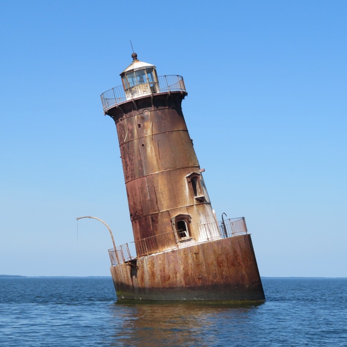
I paddled to a shallow area where there were lots of piles and a couple of fishing boats. The only interesting thing I saw were lots of osprey. The wind was not a problem for my SUP but at first it made the water non-flat, which is not good for taking pictures of rays. But there were plenty of times when it was flat. So what I'm saying is that a three knot wind is o.k. but not ideal. I paddled back to the area where I launched, Blackwalnut Cove. Then I paddled along the edge of the cove. High tide was around 1450 and it was now about 1700. The edges along much of the cove are very shallow. I paddled slowly, still looking for rays, skates, horseshoe crabs,...anything! I did see some blue crab. In the aquatic grasses, I searched for sea horses. I have never seen a sea horse in the wild but I know that they live in the Chesapeake Bay. Encountering one would be the find of a lifetime! There were quite a few terns out including what was likely a Forster's. This little guy was about the size of a robin. 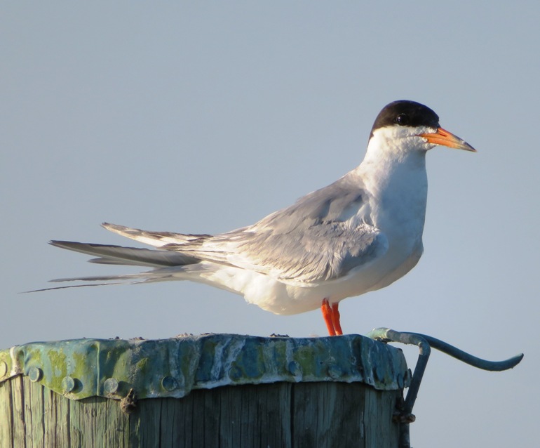
In the more northern sections of the cove, I saw a lot of egrets, both snowy and great. 1 / 6
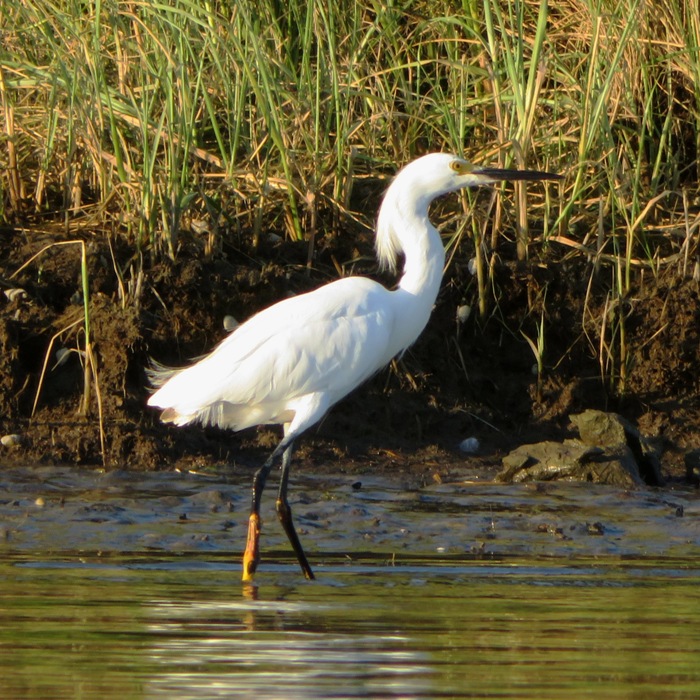
Snowy egret.
2 / 6
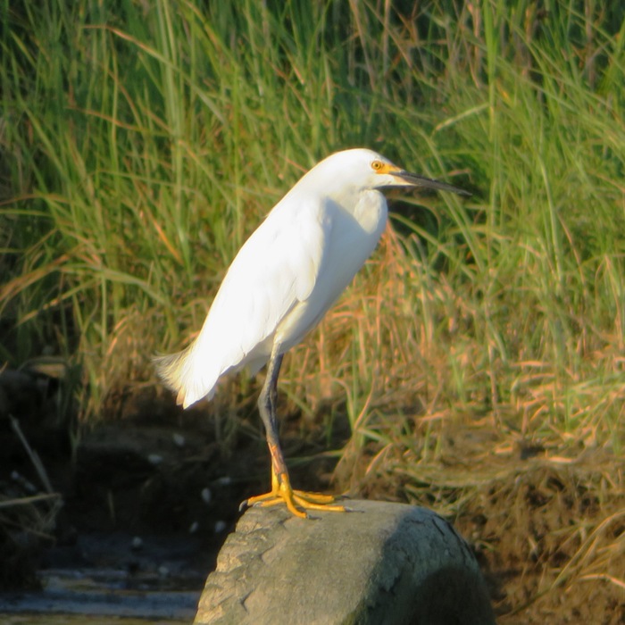
Yellow feet.
3 / 6
Snowy and great.
4 / 6
Great egret.
5 / 6
Great on pine.
6 / 6
From snowy.
I was out on the water for over four hours. The low sun was casting some beautiful light and I was not eager to get off the water or face heavy traffic on the way home. I figured that the longer I was on the water, the lighter traffic would be. I got in 11.8 miles. 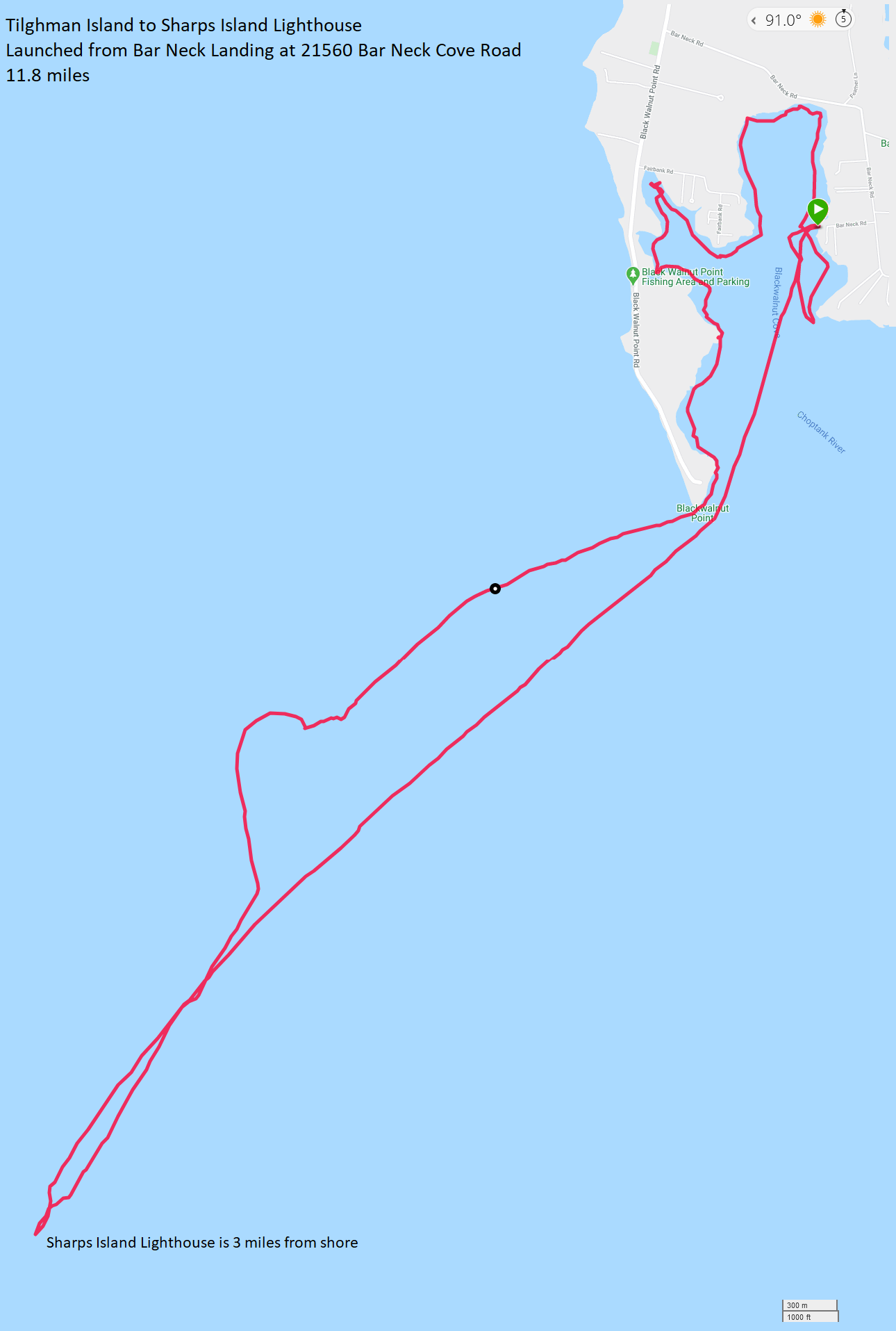
On the way back, I stopped in Claiborne to watch the sunset but was a little too late. Not the best place anyway. There was some land blocking the view. The drive home wasn't bad at all. I got home around 2200. |
|
I did a 3.75 mile paddleboarding trip on the northern section of the Magothy River, primarily exploring the area upstream of Magothy River Bridge. I launched from Beachwood Park.
Something was moving around on the water. As I approached, I realized it was a dragonfly. I pulled it out and let it dry off on my SUP. Then it flew away. Dragonflies eat mosquitoes so in this case, the enemy of my enemy is my friend. 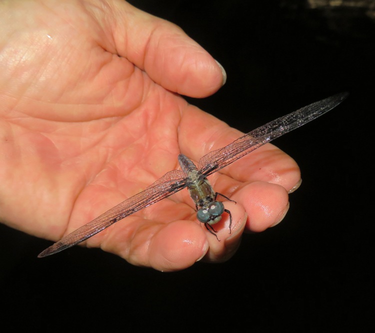
I saw a couple of bald eagles. Unfortunately, they saw me first and flew away so I only saw them in the air. Near Catherine Avenue, I came across about 50-100 depressions under the water created by fish. They use their fins to fan away the sand and then deposit their eggs. I also found a few fish that I assumed were parents standing guard over their eggs. They swam away as my SUP neared. In the picture below, I don't think those things that look like pebbles are eggs. I think they are just pebbles. 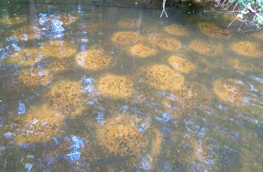
You can walk down to the water on the west side of Catherine Road to 39.115167, -76.550083 if you want to see them. It's pretty cool. I found a tall bald cypress tree. 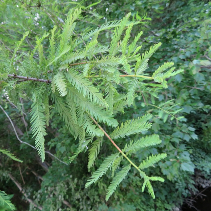
I have yet to really explore Beachwood Park on foot. That is on my "to do" list. I know there are lots of ruins there but I don't think any are all that impressive. They are mostly just cinder block foundations. Still, I enjoy looking at stuff like that and trying to figure out what the place used to look like. In the following snapshot is an structure which was decorated by Girl Scouts. 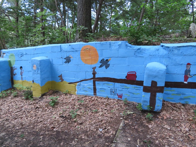
Sorry I don't have a map to post showing my route. I tried to download my GPS information but it wouldn't connect to Garmin. It turns out Garmin was just recently hit with a ransomware attack so their server has been shut down. ZDNet - Garmin services and production go down after ransomware attack. I was only out on the water for about an hour and 40 minutes. It was getting dark and there was a storm approaching. It rained on the drive home. This was our second storm over two days. Something tells me it might be time to go look for shark teeth. |
|
Norma, Daphne, Sara, Mike B., Norma's niece, and I launched from Breezy Point Marina and paddled to my favorite place to find shark teeth.
I think a lot of people have more time on their hands due to the Coronavirus pandemic. They don't want to travel far but they want to get outdoors and do something interesting. What better way to spend your time than looking for shark teeth? There is a lot of activity on the Fossils of Calvert Cliffs Maryland Facebook page which supports my claim. But this means that there are a lot of folks wanting to know about the place that I took Norma, Daphne, Sara, and Mike because it is so rich in shark teeth. The more that know about it, the less shark teeth there will be for my friends and me. So I am no longer telling people where I go. But if you are a friend of mine and have done LOTS of paddling (to include open water trips), then I might invite you to join me if you're willing to take a once a year invitation on short notice. Since there could be unobstructed wind for over 15+ miles, I don't consider this a beginner trip. Norma and I told her niece about this trip: how long the drive would be, how long it would take to paddle, and how long we would be on the beach. She was sold. So then we had to figure how to get the three of us there. I knew a tandem canoe would be better for carrying a small child than a tandem kayak so I swapped boats with Sara. That worked just fine though I definitely felt less stable with the higher center of gravity as compared to my kayak. 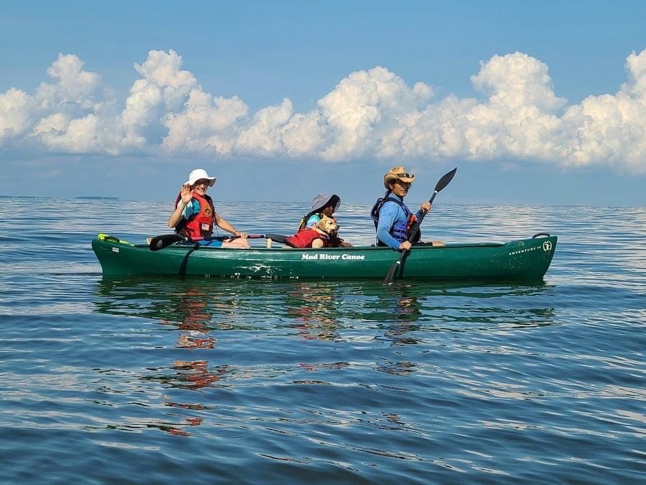
Over about two hours and 14 minutes of hunting, we all found lots of teeth and other interesting things. I thought Norma's niece might be bored after awhile but Norma kept her engaged. With some help from her aunt, she found 30 shark teeth! She also played in the water and got a couple of sea nettle stings. 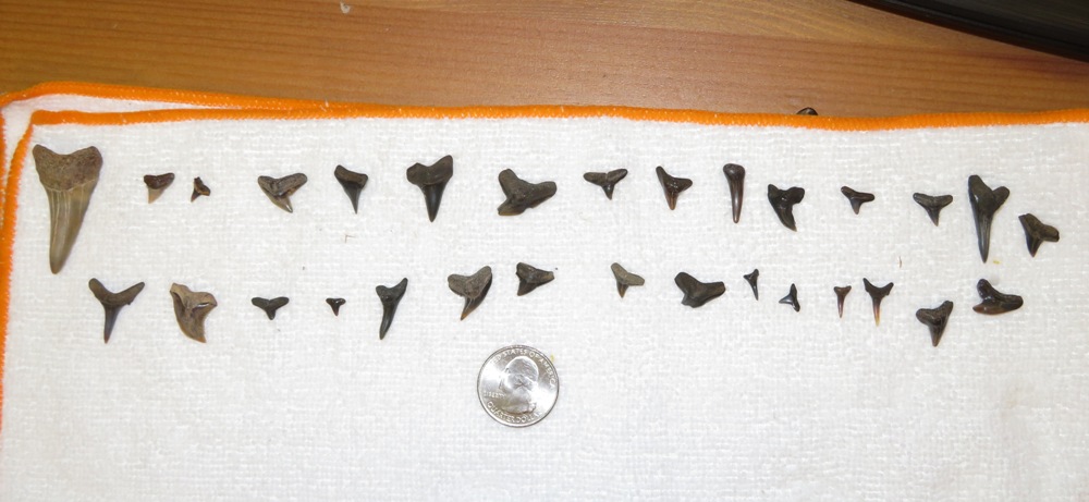
I found a piece of coral, a chunk of unidentified non-ferrous metal, 13 pieces of ray dental palate, and (drum roll please)...142 shark teeth! It was my second best day for shark tooth hunting. 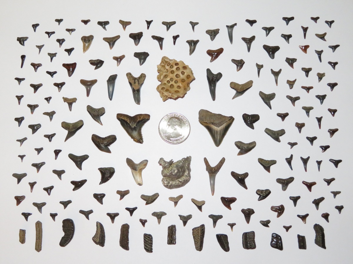
Below are my favorite finds. The big broken one to the right of the quarter was found as soon as I stepped off the boat. It is a small megalodon tooth. The other big one on the left side of the quarter with the serrations was found once I pulled the boat further inland so it wouldn't get taken away by the rising tide. That tooth was under the boat. It is from a snaggletooth shark. 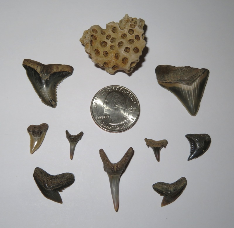
The snapsnot below shows the biggest teeth found by Harlem/Norma and me. They found the middle tooth which is 1.5625 inches long. It was the biggest shark tooth found that day. 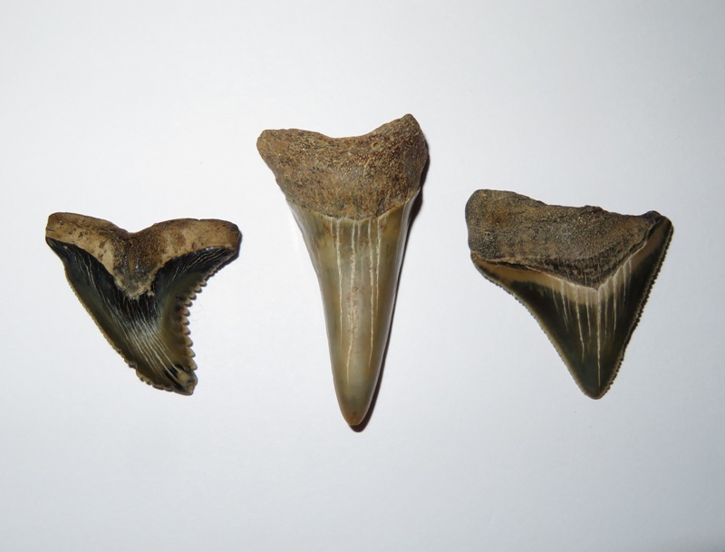
Norma found 28 shark teeth, an impression fossil, a piece of coral, some petrified wood, some turritella shells, and various other shells. 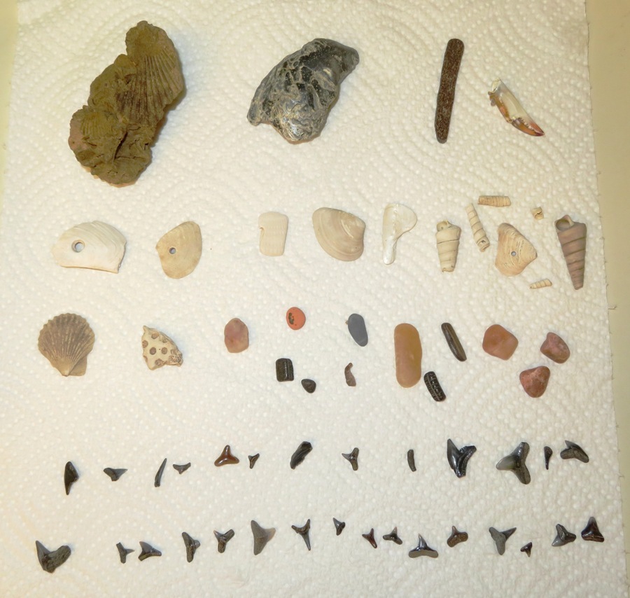
Of the shells that Norma found, three had holes in them. I believe these were made by moon snails. According to Fossils and Other Living Things - Just Making a Living in the Miocene ~ Defense of the Moon Snail, The species of the family Naticidae [moon snails] are carnivorous animals that prey upon other mollusks. They seek out another shell and, using a peculiar tooth ribbon that is common to almost all snails, drill a small round hole through it and suck out the juices of the animal inside. These holes, usually about one-eighth inch in diameter, are often seen in the shells of bivalves and gastropods in the Maryland Miocene [23.03 to 5.333 million years ago] fauna and are mute reminders of the unpleasant death suffered by the animal that formed the shell. 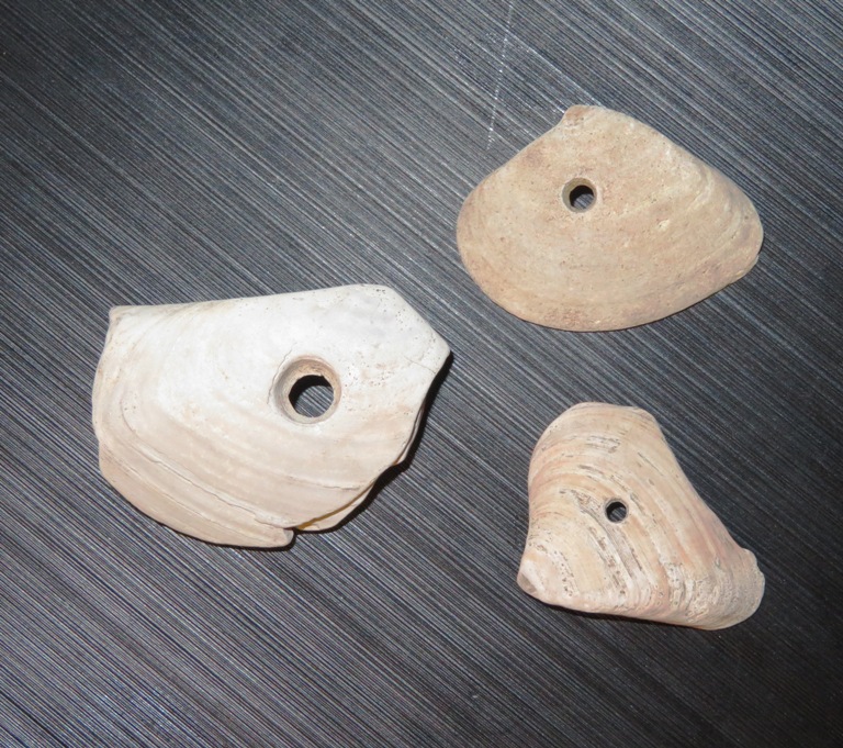
Moon snails still exist but I don't believe they live in the Chesapeake Bay anymore. But you can find them in Puget Sound, Washington. I found an Etsy Ad where someone was selling moon snail fossils found in Calvert County...three for five dollars. You better believe I'll be looking for moon snail fossils on my next visit. In my opinion, Sara found the most interesting shark tooth...a fine specimen from a cow shark. It was a great day to get out on the water and beat the heat. The only bad thing is that Sara baked lemon bars and before I could try one, Daphne found them and finished them off. |
|
In 1998, I rented a kayak from the outfitter at Quiet Waters Park. I instantly fell in love with kayaking, purchased an Ocean Kayak Scupper Pro, and have been an avid paddler ever since.
On July 26, 2020, Norma and I took her niece, Daphne, and some of Norma's friends on a excursion at Quiet Waters Park. The place brought back fond memories. We started with a short walk where we saw a five-lined skink. 
A little after 1000, we arrived at the outfitter. There aren't many kayak outfitters open due to the Coronavirus pandemic so we were fortunate to find this place. They had booming business. Everyone else in our group chose tandem kayaks while Daphne and I rented a 14' long BIC SUP. It wasn't quite as nice as my Yolo Prowler but it was surprisingly good for a rental. My original plan was to launch my Yolo at Loden Pond and meet the rest of the group at the pier but that turned out to be more difficult that I expected. Here are shots from our time on Harness Creek: 1 / 5
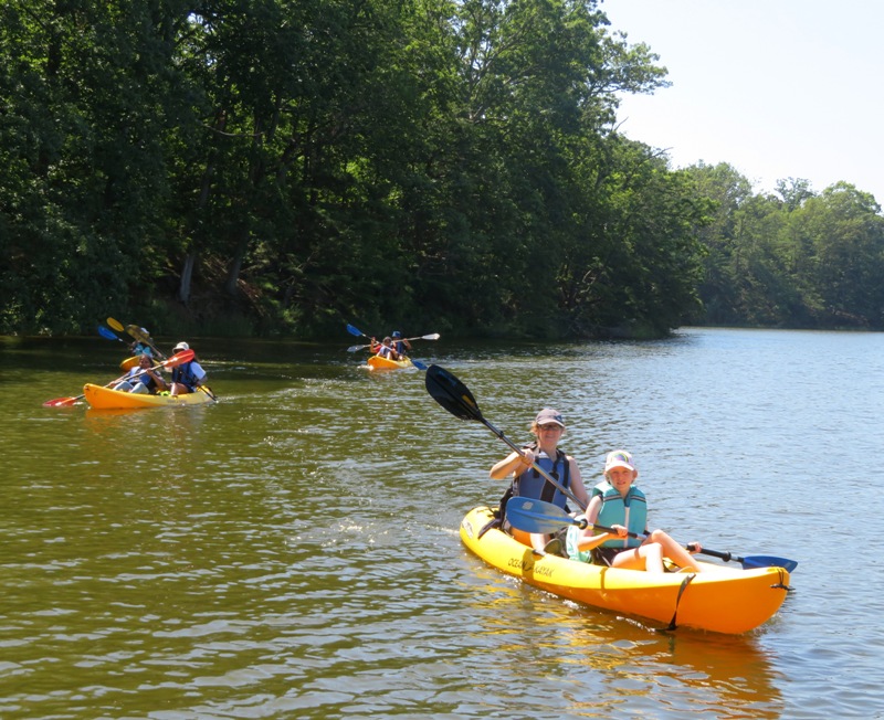
Allison and daughter.
2 / 5
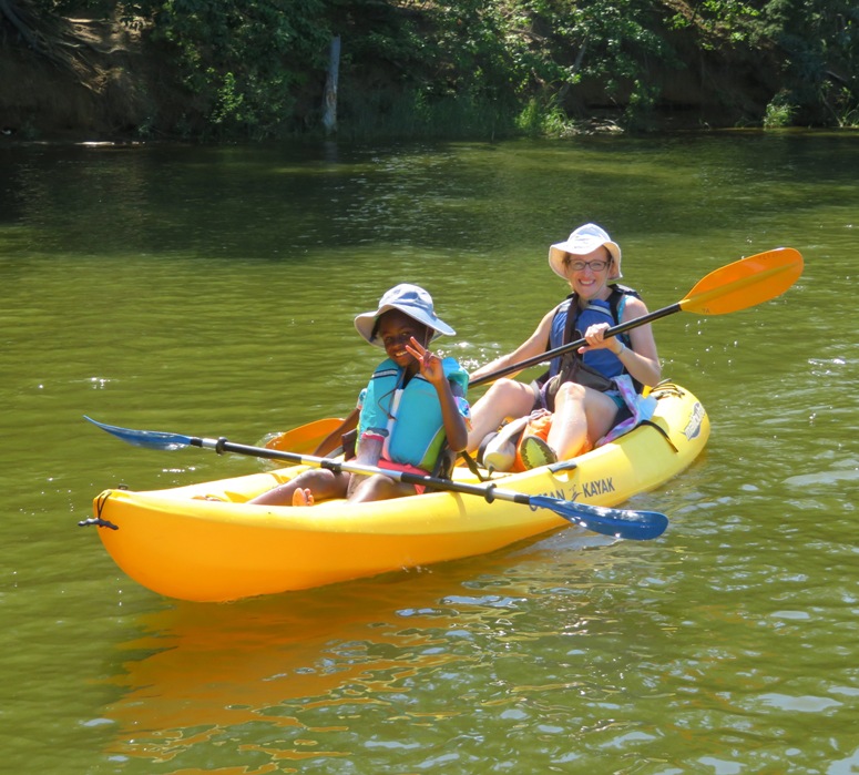
Norma and niece.
3 / 5
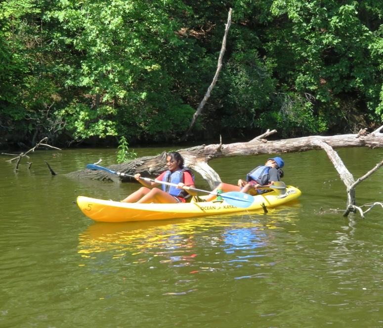
Kayak limbo.
4 / 5
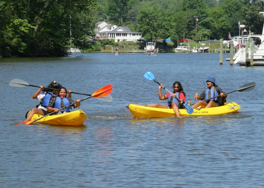
Splash fight.
5 / 5
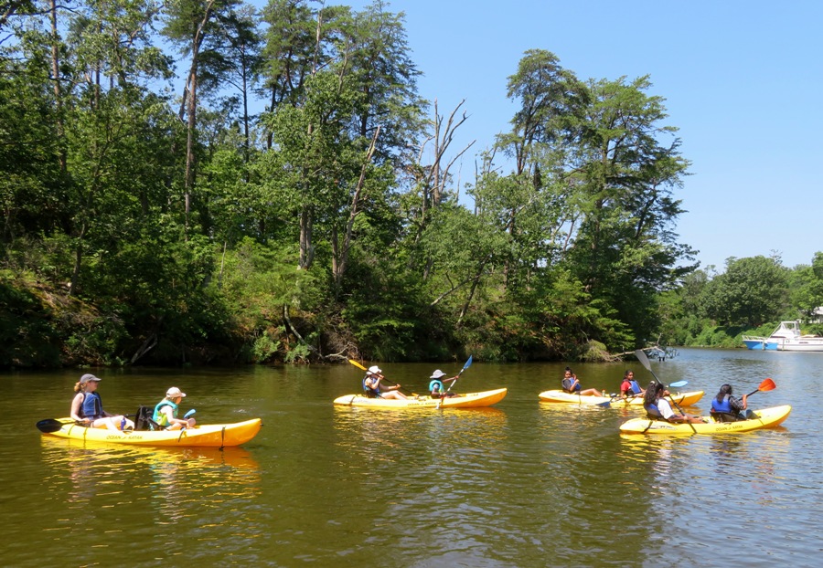
The fleet.
Allison's daughter swam in the creek where she met with the business end of a sea nettle (got stung). I don't think we paddled more than two miles. We met for a picnic lunch at the pavillion. At one of the benches, Viviana found a dead orb weaver spider. I think everyone had a good time and enjoyed getting out to enjoy some outdoor socializing. |
|
Late July to early August is a good time to see American lotus flowers in bloom. In my opinion, the best place to see them in Maryland is Turner's Creek, a tributary of the Sassafras River. But 12 hours before planning my trip on August 1, 2020, the Sassafras Riverkeeper reported
Please continue to avoid or limit water contact as much as possible until this [algal] bloom subsides. In particular, Turner's Creek was hit pretty hard with the bloom. So I decided to leave this trip for another time. Instead, I set a three prong goal: Norma was out of town so I didn't sleep well, which tends to be the rule rather than the exception when she is gone. That meant Daphne and I got a late start. But traffic wasn't bad and we arrived at Mason Springs Conservancy a little after high tide. What I found far exceeded my expectations. 
Mine was the only car at the parking lot. The place was primitive and with few amenities but it was outstanding in terms of scenery. The fresh water was cool and clean. We were on the water by about 0830. I paddled my SUP upstream through a forest canopy. 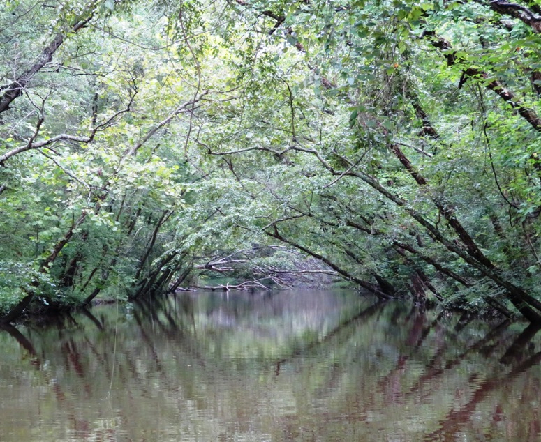
The water was shallow, despite it having rained recently. Daphne and I were able to get about a sixth of a mile upstream without portage. The current was moderate...a little challenging for a SUP but not bad. I would like to return with a kayak in the spring when the water is higher and do portaging to get much further upstream. Heading downstream, we passed under Hawthorne Road (route 225) where we saw a colony of barn swallows. 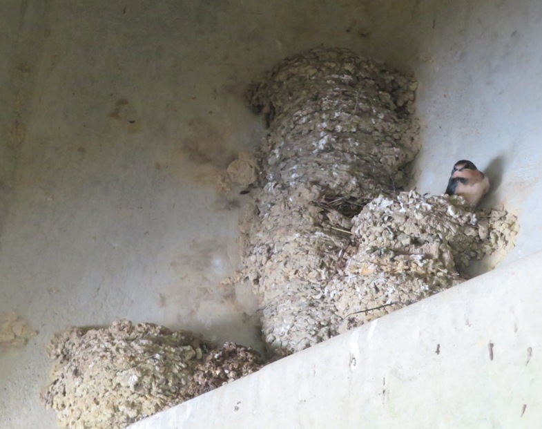
Paw paw trees are plentiful in this area but as is typically the case, only a few were bearing fruit. 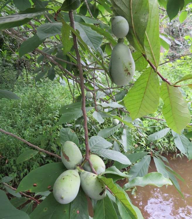
Rotting logs were home to various fungii, including Panus neostrigosus and Pleurotus pulmonarius, the latter being a "true" oyster mushroom. Heading downstream, the creek opened up but remained scenic. I saw a LOT of fishermen and found out from one of them that there was a fishing tournament taking place. 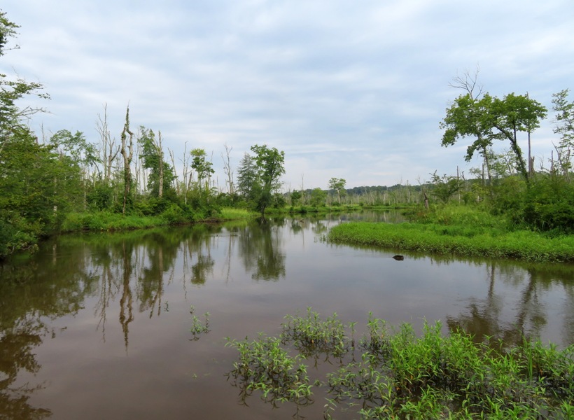
I paddled past pickerelweed, both in bloom and past prime. There were also several swamp hibiscus flowers. Norma and I have a few of these growing in our back yard. They are quite plentiful on the Mattawoman. I saw several bicyclists riding on the Indian Head Rail Trail. It was fairly hot and I bet a lot of them were jealous of me being on a SUP...at least that's what I prefer to think. Eventually, we came to the point where we turned around on a trip which I documented in Paddling Mattawoman Creek "Where one goes pleasantly". I have fond memories of that day. A little west of Nelson Point, Daphne and I made our way up a long, unnamed tributary of the Mattawoman that I've been wanting to explore for some time. At the mouth of this tributary is the most upstream location of lotus flowers on the Mattawoman (that I know of). 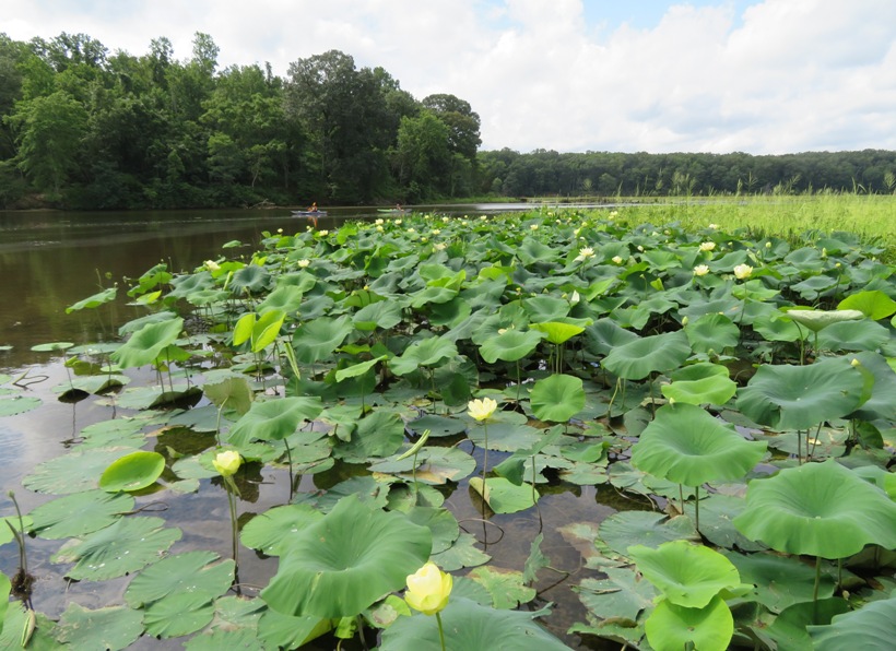
According to AquaPlant - American Lotus, the leaves may be up to 2.75 feet in diameter. 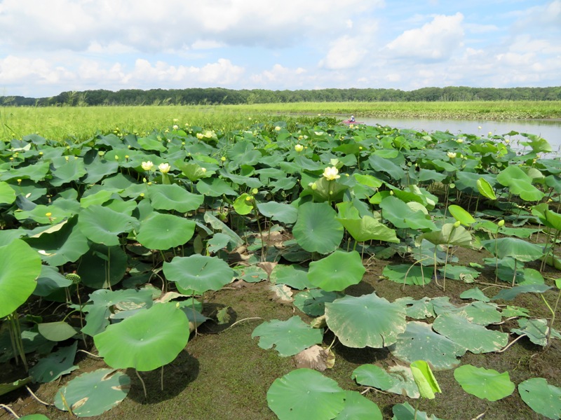
This picture was selected to be the cover photo for the "Maryland Native Plant Society Discussion Group" Facebook group...at least for awhile. 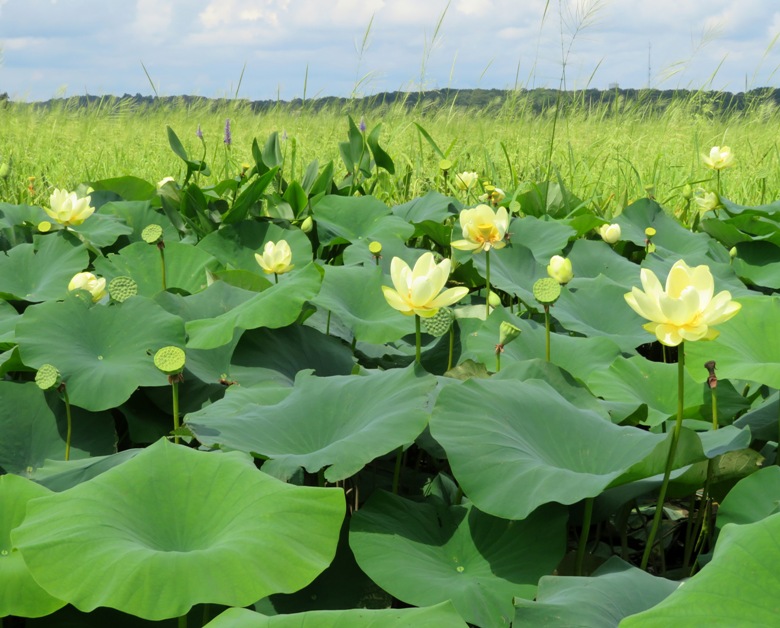
Here's a young one not yet ready to blossom. 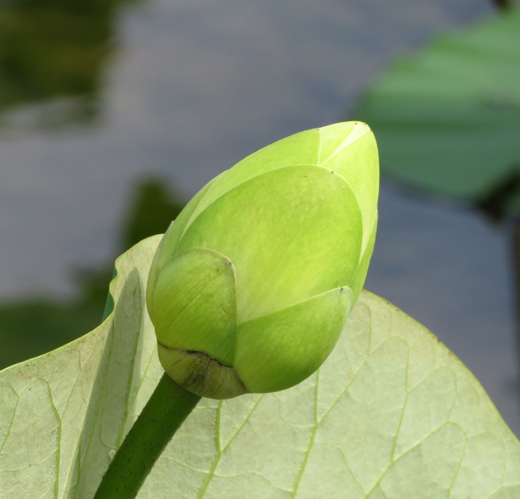
Eventually, the flower becomes a shower head seed pod. I think this one looks sad, as if it longs for the days when it was once a beautiful flower. According to Wikipedia - Nelumbo lutea, the seed [each about 0.4 inch in diameter] is edible and known as "alligator corn". 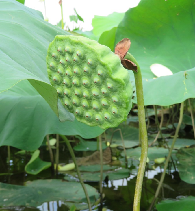
I'm always looking for the "perfect" American lotus flower in the wild. This one is as good as I could find. 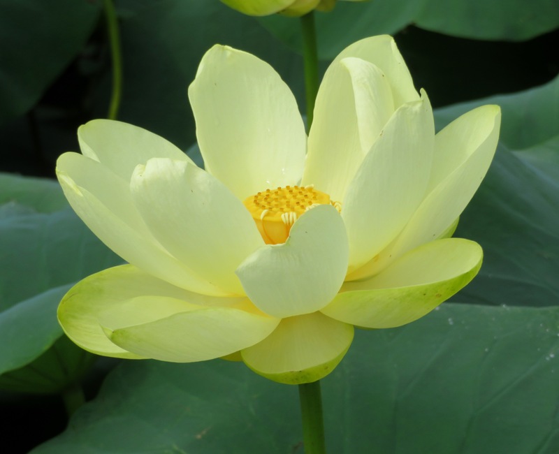
According to AquaPlant - American Lotus, flowers get up to ten inches wide. 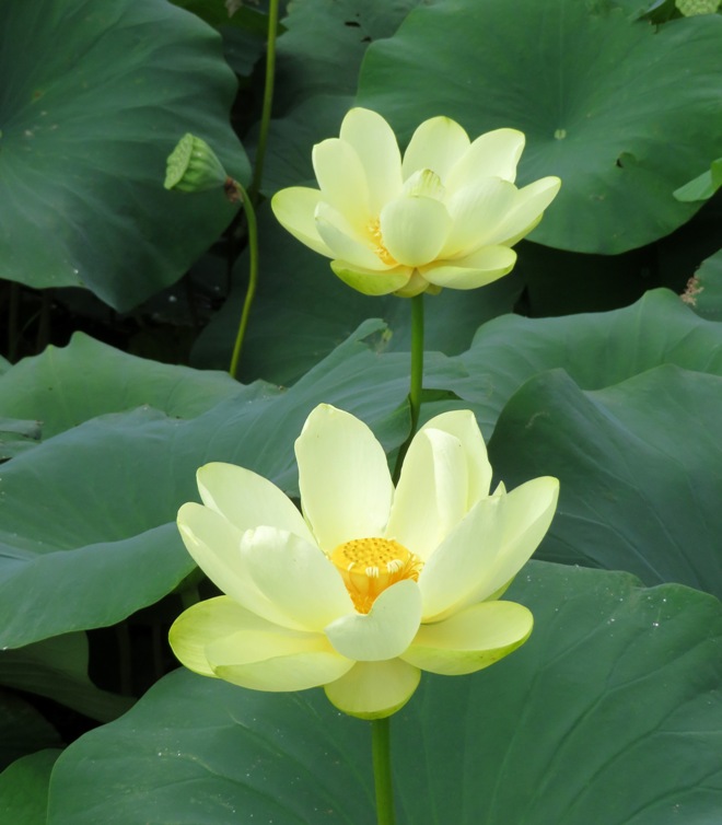
Here, a pollinator makes a visit to help prepare for the next generation. 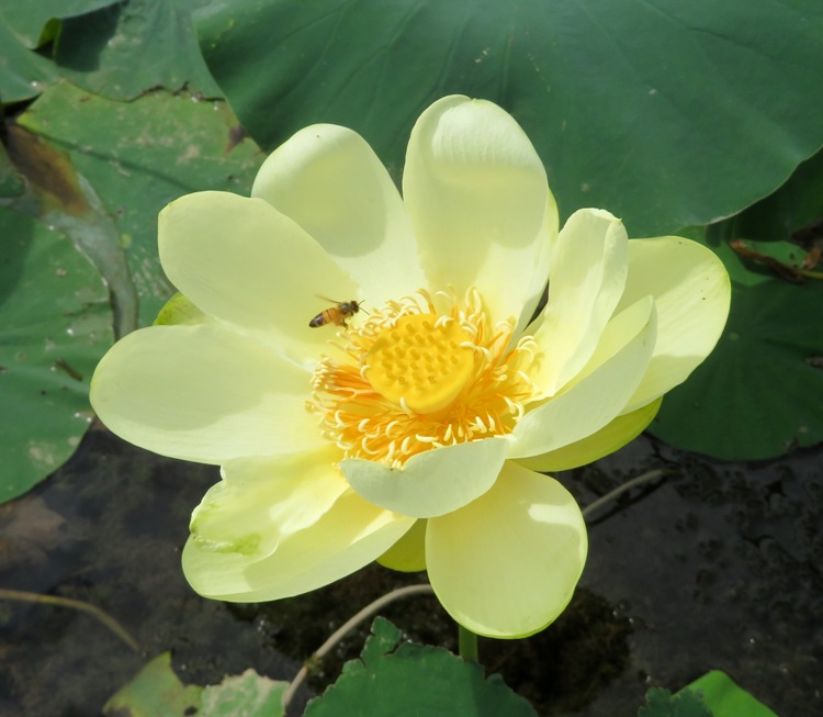
Continuing up the unnamed tributary, I eventually stopped seeing lotus flowers but I did see plenty of spatterdock and wild rice. 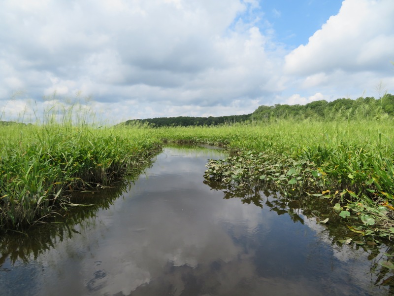
Summer is not a good time to explore the narrow sections because the thick aquatic vegetation makes paddling difficult. Not only is this place known for having American lotus flowers, but it is also home to three barges and a smaller boat which lie in ruins. Naturally, the best time to see them is at low tide, which for me was still a couple of hours away. Regardless, I got some great views. 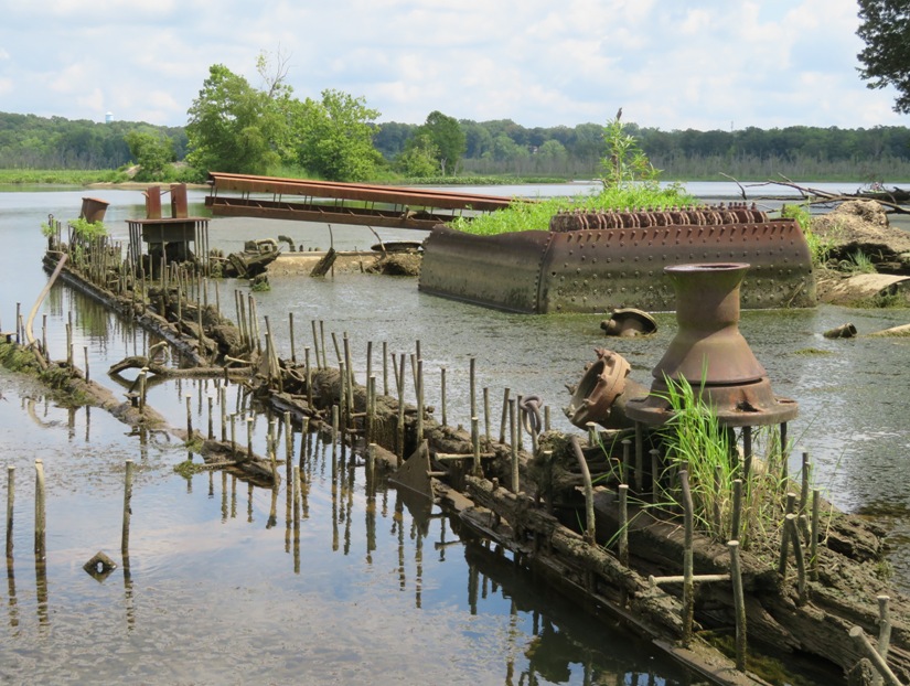
The wooden hulls and steel rods are somewhat reminiscent of the ships at Mallows Bay but I don't believe they are related. 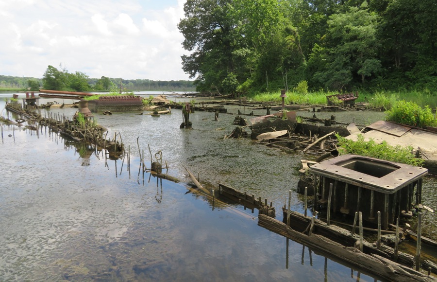
I saw lots of metal. If this were Mallows Bay, I think a lot of it would have been salvaged long ago for scrap. 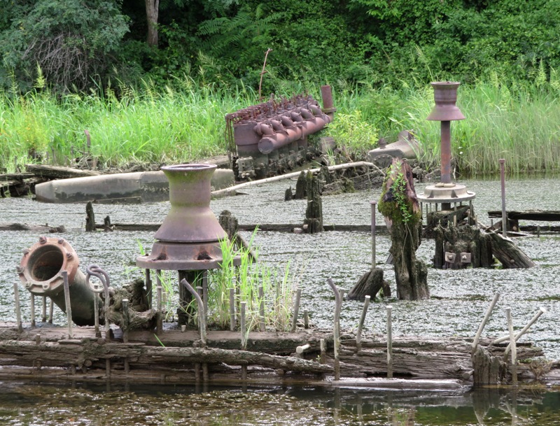
That's a really big engine. It is from the smaller boat, not one of the barges. 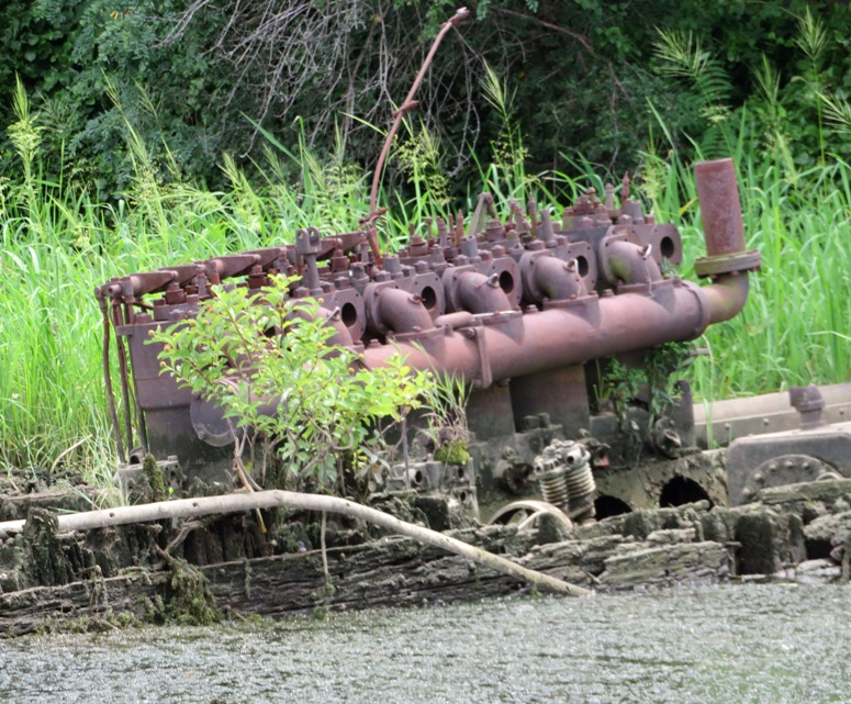
This smaller boat looks much newer than the barges. Based on it size, I'm wondering it it was a tug boat. 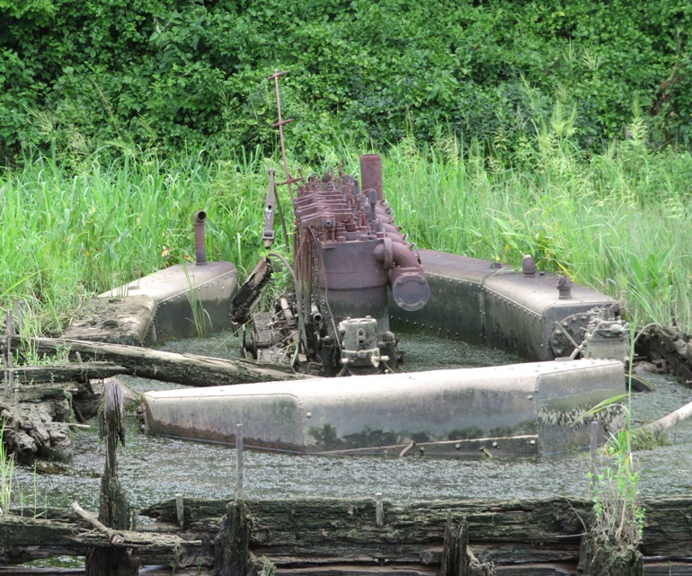
Looking northeast, you can see Nelson Point in the background. 
Here are some of my favorite shots of the barges. 1 / 6
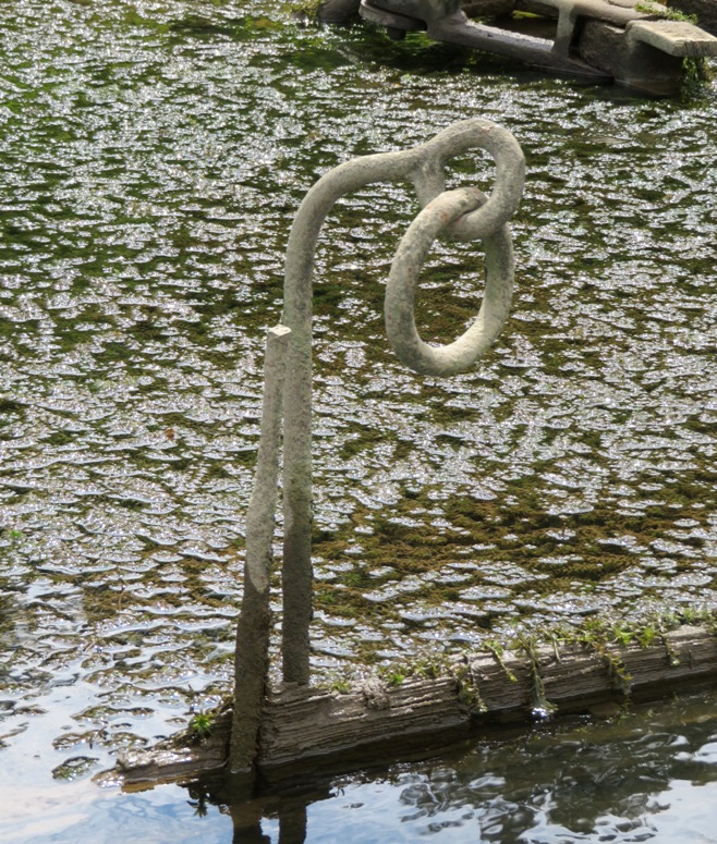
Interesting hardware.
2 / 6
Capstans?
3 / 6
Boxy barge.
4 / 6
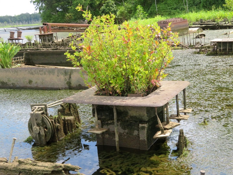
Nice planter.
5 / 6
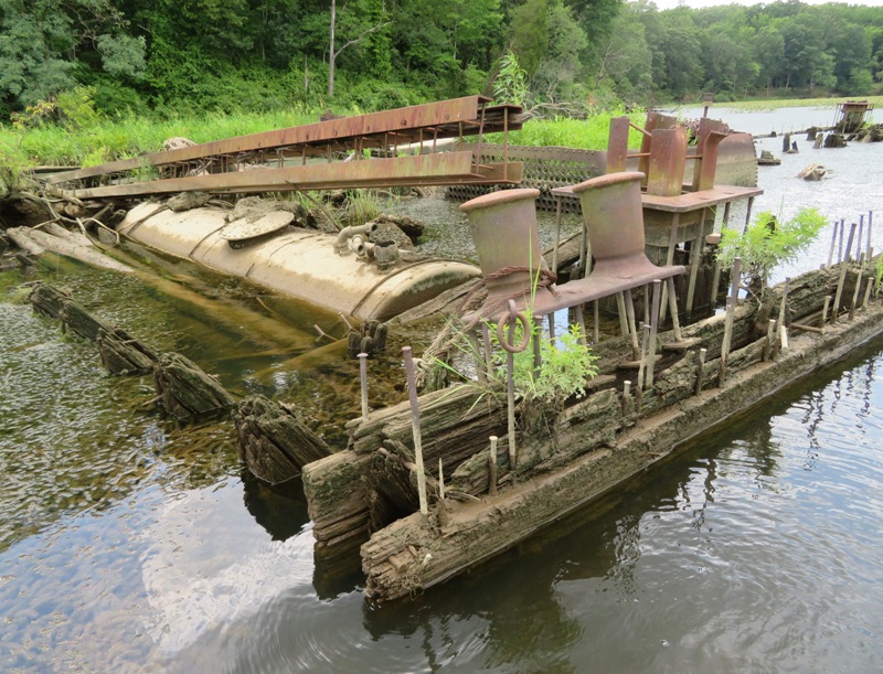
Fuel tank and bollard.
6 / 6
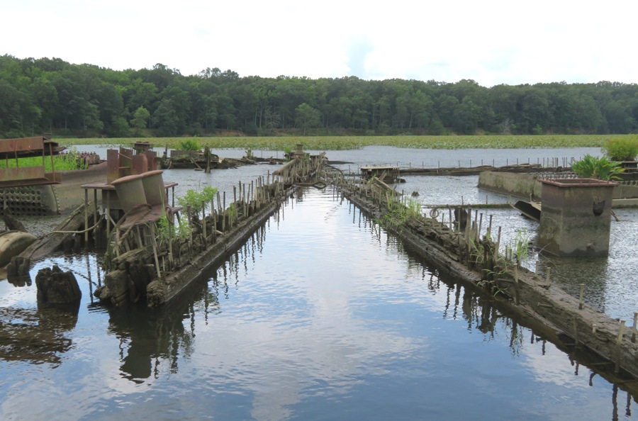
Between barges.
These wrecks are located at coordinates 38.586750, -77.143111. 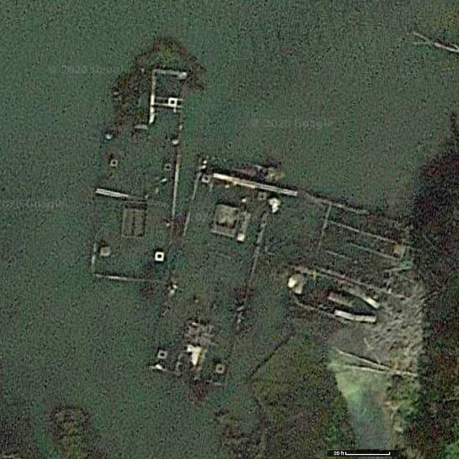
One person on Facebook said that it was once a dredging operation. More specifically, Greg W. said There used to be a sand and gravel operation there. In fact, a couple of those islands are the old spoil piles. Along the shore are the remains of conveyor belts, which used to run onto a fixed barge, to which other barges would dock for loading. I pulled ashore on the south side of the creek to give Daphne a break. I'm sure she works her stabilizer muscles standing on the SUP. She enjoys being able to run around and sniff wherever I pull over. Looking around, I found a large mystery snail shell. 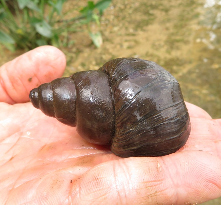
I also spotted what I believe to be an old man of the woods, which is an edible mushroom. 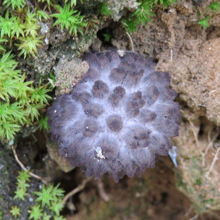
There wasn't a whole lot of wildlife to be seen. But I did find a golden-winged skimmer dragonfly. We paddled upstream against the ebb tide. Closer to the launch area, we had to do one minor portage because the water level had dropped. Of course the water was also lower where I launched which made for a a slightly more steep dropoff to the water. 
While carrying my SUP back to the car, I spotted these Japanese beetles honing their submission grappling skills. I ended up paddling 8.7 miles. 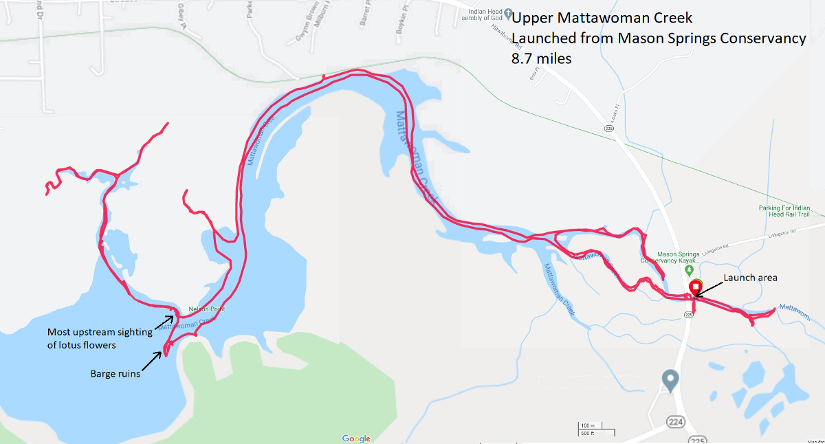
I explored everything that I wanted to explore which was not overgrown with aquatic vegetation. I'll be back in another season to explore the rest. Having accomplished my first goal, I then set out to find the trailhead for the Swamp Lane Trail. I could not. I went to the neighborhood where it supposedly starts but if it exists, it is not marked and it resides between two private residences. After failing at my second goal, I drove to the location where I had seen the lotus flowers from the Indian Head Rail Trail. I drove around and looked on foot for a place where I could get better photos of the flowers than I got on Independence Day. I determined that if there is a better location, it is on private property. So I failed at that too. Despite my failures, I was not disappointed because my one success was a huge one. So it was still a good day. |
|
Tropical storm Isaias had passed through, dumping 2.35 inches of rain in Savage on August 4, 2020...a far cry from the 3-5 inches that the National Oceanic and Atmospheric Administration (NOAA) forecast. Still, it was a lot, and for me, that meant an opportunity to get further up small creeks than I would normally be able to.
The next day, Daphne and I launched my SUP from Patuxent Wetlands Park at 0615. The rain in Savage had stopped in the late morning on the fourth. Not sure about Upper Marlboro, which is where we put in. But much of the water here at the park would have passed through Savage. The river was as high as I'd ever seen and it was still about 50 minutes until high tide. I noticed that only the top three inches of the #46 Patuxent Water Trail sign was visible. The rest was underwater. I saw three muskrats. I wondered if they were busy doing house repairs after all the rain. 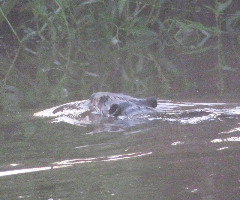
It was barely past sunrise so there wasn't much light. Couple that with the fog, and visibility was not great. But it was magical, in an eerie sort of way. Here's a view from Galloway Creek. 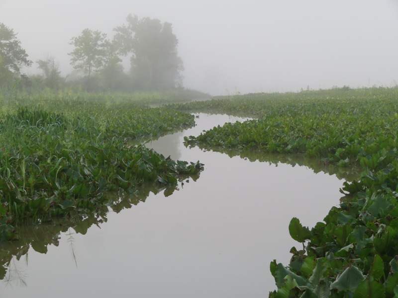
As I paddled through the shallow areas, small fish jumped about. One leapt up and landed on my SUP. Daphne sniffed it as it wriggled about, eventually making its way back into the water. I made my way up Old Galloway Creek as the sun started to break through the fog. I explored some really narrow sections that were blocked by spider webs. But with all the fog, the webs held onto fine water droplets which made them very visible. So I wasn't taken by surprise with a face-full of web. Paddling back downstream on Old Galloway Creek, I glanced west and saw something I had only seen before on August 9, 2017. It was a fog bow. A fog bow, sometimes called a white rainbow, is a similar phenomenon to a rainbow; however, as its name suggests, it appears as a bow in fog rather than rain. - from Wikipedia - Fog Bow I passed Pig Point, the place where Savage's own Commodore Joshua Barney burned his flag ship, the USS Scorpion, to prevent it from falling into enemy hands during the War of 1812. He did this after being overwhelmed by superior forces but succeeded in delaying the British advance on Washington, D.C. About 200 years later, attempts were made to find wreckage of the Scorpion but due to a lack of funding, excavation did not take place. The structures in the background shown below reside at Pig Point. For more information, see National Park Service - Archeology: Discovering Hidden 1812 History and Search for the USS Scorpion. 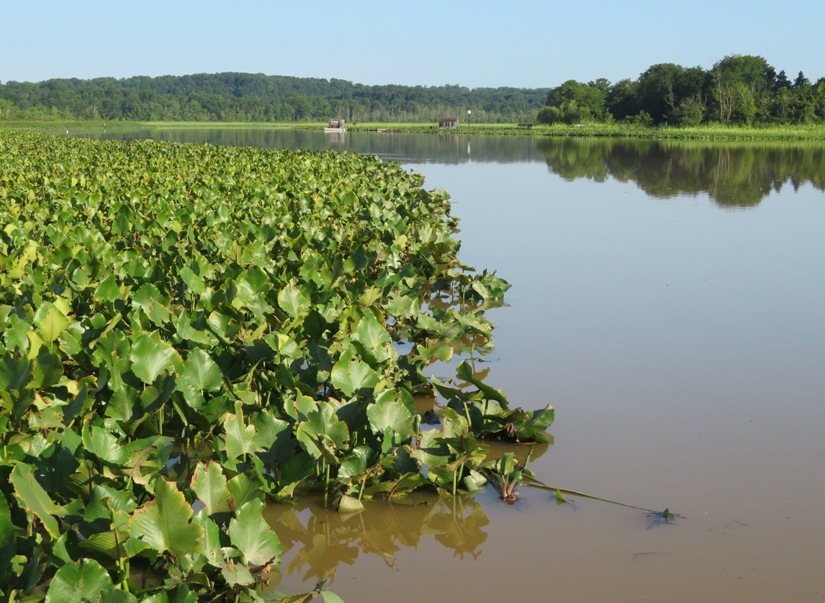
I was later informed of the following by Greg W., a very reliable source: That is what the history books say, but his barge was actually found on the river bottom about a mile north of the MD-4 bridge by an archeological group in part sponsored by the state highway administration several years ago. I turned around at Jug Bay Wetlands Sanctuary - Proper. The downstream current from the heavy rain along with the ebb tide was moving at about 1-1.5 mph. Not much resistance but I definitely had to work a little harder on the way back. I paddled through a maze of spatterdock that had seen better days and along the way, I spotted a beaver lodge. 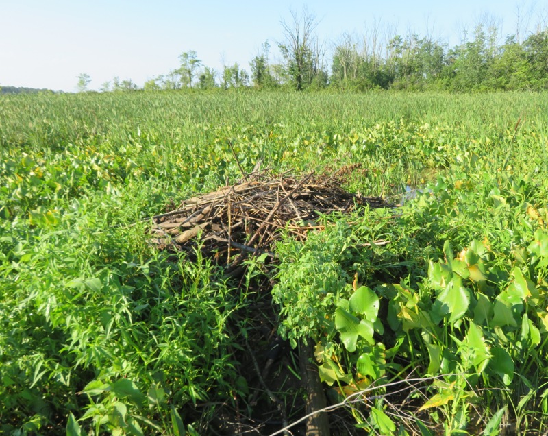
Three kayakers floated downstream. They seemed curious about Daphne. I finished my trip after paddling 7.6 miles. The water at the launch site went down about 3-4 inches since I started. Traffic heading home on highway 95 was a bitch. 
|
|
Earlier in the morning, I did some paddleboarding. The water was quite high because of all the rain we received from Tropical storm Isaias. But now it was about 30 hours later. Would the water still be high? That's what I was counting on.
Norma, Daphne, and I launched from Southwest Area Park around 1720...about 60-90 minutes after low tide. I figured all the rain would have more than made up for the tide and produced high water that would have allowed us to paddle far up the tributaries of the Patapsco River. I was wrong. The water was extremely low. We still did as best we could to explore the narrow sections. I'd seen all this plenty of times before but some of it was new to Norma. 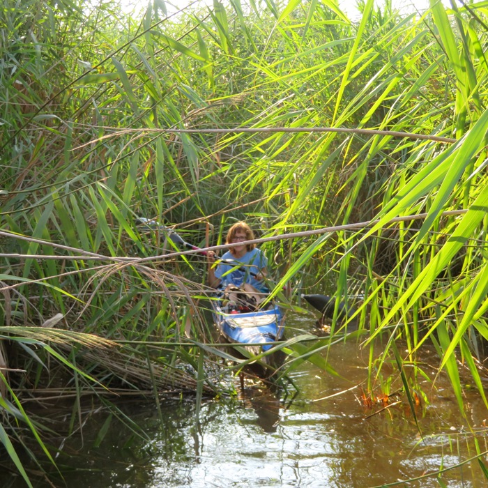
This was Daphne's second time out on the water today. I think she was still having a good time. 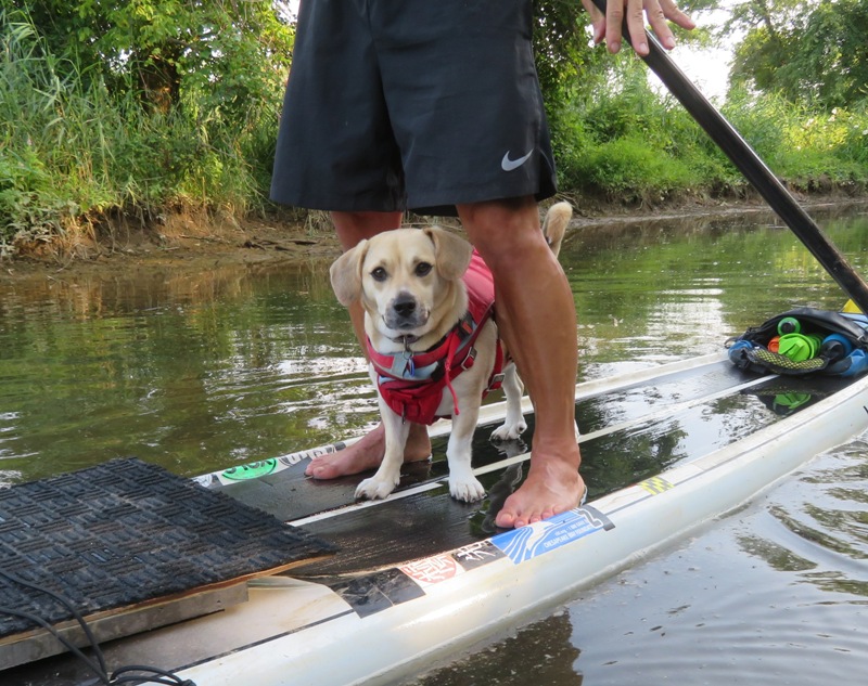
We saw lots of swamp hibiscus flowers blooming. Some were a much darker pink than the others. As it got later in the day, a few started closing up. Norma enjoyed taking pictures of me and Daphne. I picked up some trash from the river. One was a bottle which a female Eastern Amberwing dragonfly decided to use as a perch. It was the tamest dragonfly I'd ever seen. I put it back on my SUP and it stayed there until I landed. Then I had to pick it up and put it someplace else so I could load the SUP onto my car. We only paddled 2.7 miles. There are often warnings about getting out on the water after a big rain. A lot of impurities get washed into the water. People with open sores or a compromised immune system are frequently advised to stay out of the water. I don't think it was a problem on the Patuxent River that morning but here in Baltimore, the water definitely smelled bad. The three of us walked on the trail that leads from the launch area to the model air flying field. Then we walked back on Klunk Drive and the main road. There wasn't much traffic and it was getting near sunset so it was a nice little hike. On the way back to the car, Norma spotted a mullein plant. She grabbed a few seeds so she could grow some on our property. Common mullein is native to the Mediterranean countries and Eurasia. It has played a major role as a medicinal herb throughout these regions for thousands of years. Once it arrived on the North American continent, the Native American people quickly learned to use common mullein's many healing properties. - from LiveScience - Common Mullein: Stunning Photos of the 'Flannel Leaf' Plant Once we got home, I rinsed off the boats and our gear. Of course Daphne got a good washing too. |
|
After spending the morning hiking in Susquehanna State Park in Harford County with Norma and Daphne, I drove us all to Havre de Grace where we launched at Millard E. Tydings Memorial Park around noon.
High tide was around 1347 and I wanted to be out during that time. I figured that would help minimize drag on the boats from the thick aquatic vegetation which grows in the low salinity waters of the Chesapeake Bay in the summer. But that meant we would be paddling against the tide in both directions. It was a long, mostly uninteresting paddle to our destination. Norma was not enjoying it. But I knew the reward would make it all worth while. Along the way, we saw someone parasailing. At first, we couldn't see the rope that towed them so we just figured it was a very skilled parachutist. I wondered if it was my co-worker Adam S. 
We also saw bald eagles. Not just a few. It seemed like they were all over the place. I'd never seen so many. Maybe these were the same ones that hang out at the Conowingo Dam during the winter. 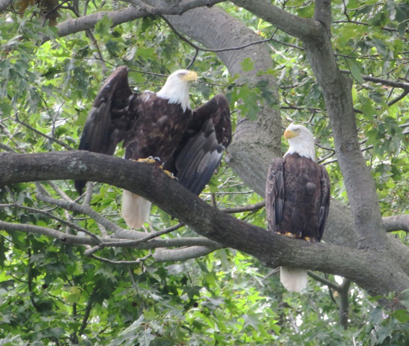
The three of us neared Swan Creek Point and then paddled across the mouth of Swan Creek to Plum Point (sometimes spelled Plumb Point). Just south of Plum Point in the creek were lotus flowers. The first grove we saw didn't have many flowers, 39.484254, -76.114404. I think we would have seen a lot if we were there a week prior. Norma found a narrow opening at 39.484594, -76.113939 which led to a beautiful cove. It doesn't have a name so I'm calling it Plum Point Cove. Norma found a shady area and took a short nap in her boat. She felt much better after that. In Plum Point Cove, I saw something swimming near Norma's kayak so I paddled over to investigate. It was an eastern cicada killer, which I pulled from the water. The following information is from Orkin - Eastern Cicada Killer Wasp: The prettiest flowers and scenery were in Plum Point Cove. 1 / 11
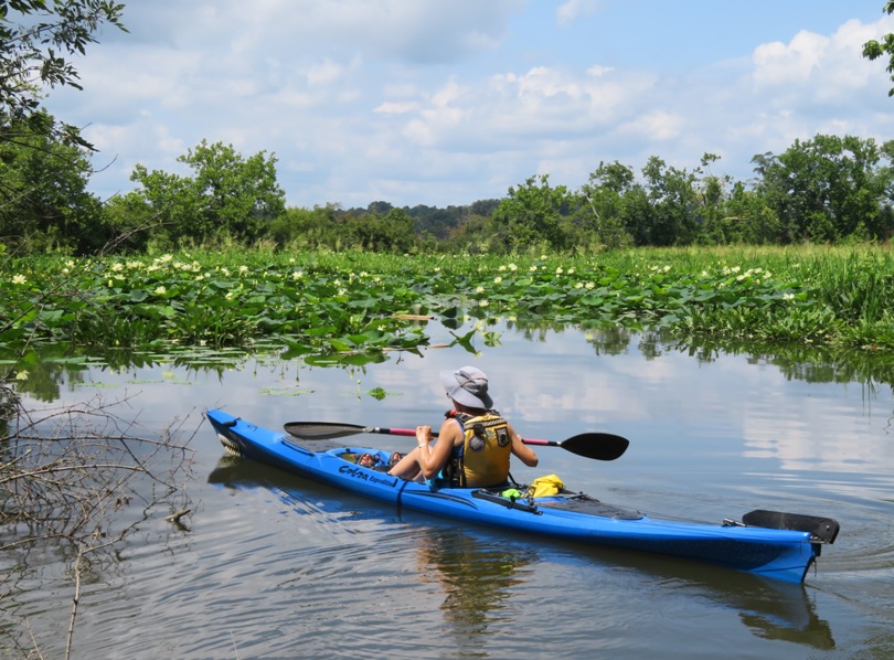
Norma in the cove.
2 / 11
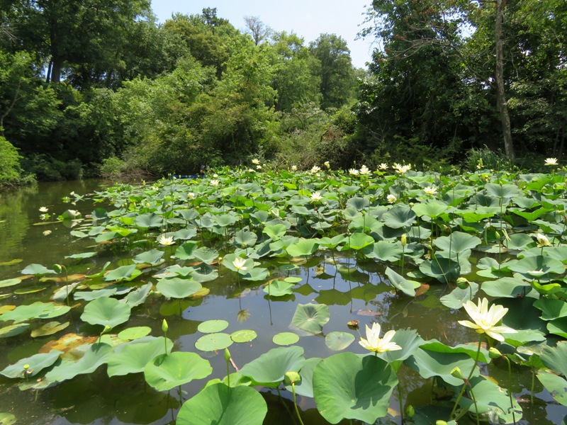
Entrance on the left.
3 / 11
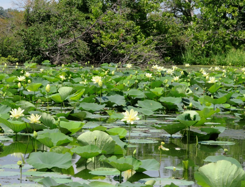
Lotus flowers.
4 / 11
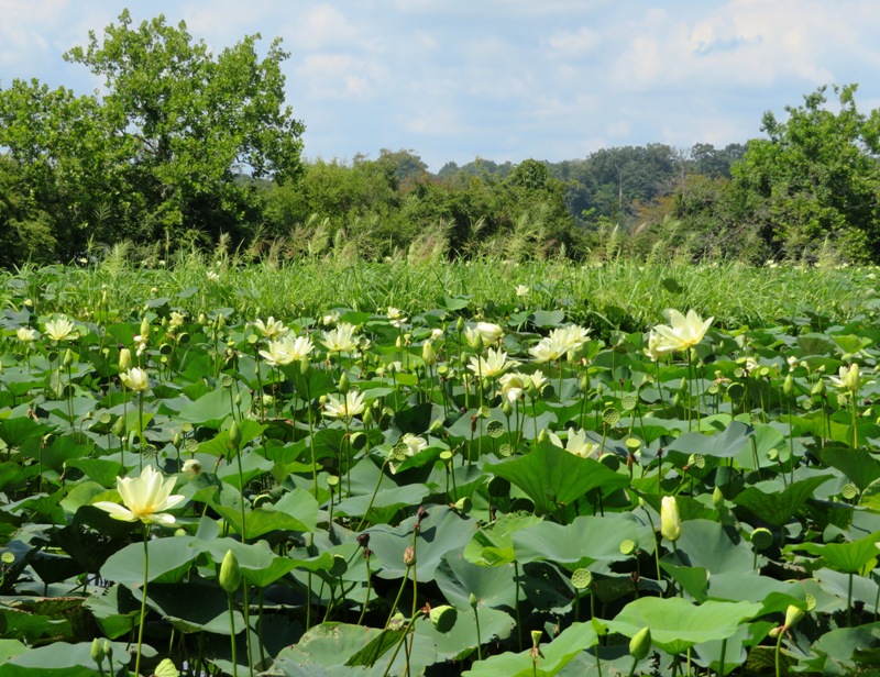
Trees define cove's edge.
5 / 11
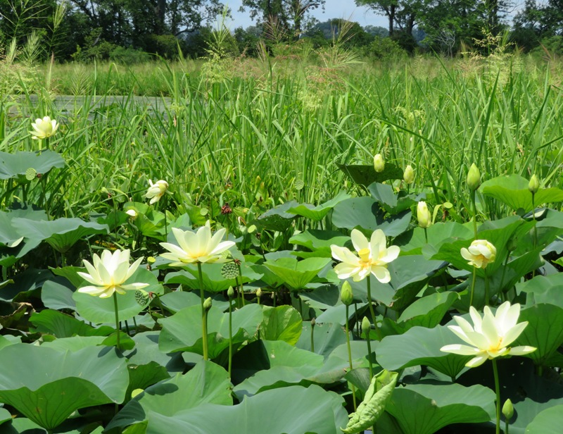
Wild rice in back.
6 / 11
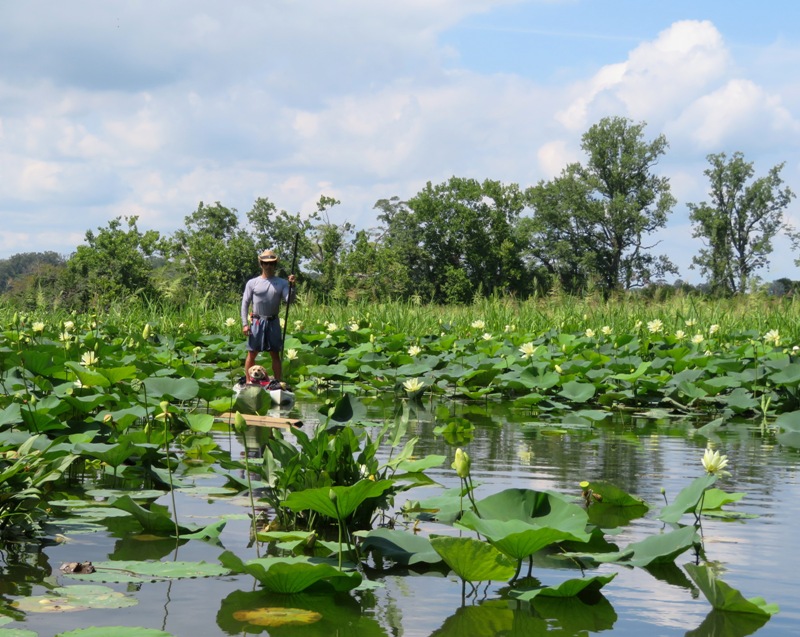
Daphne and I.
7 / 11
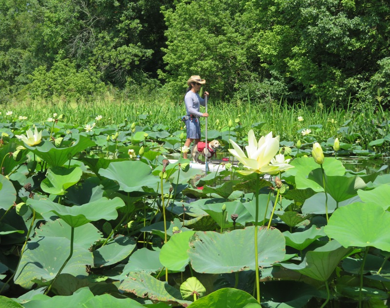
Paddling amongst lotuses.
8 / 11
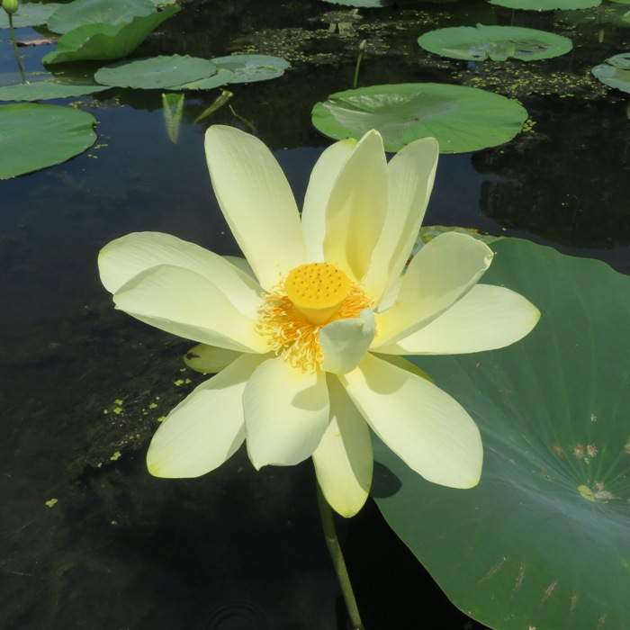
Almost glowing.
9 / 11
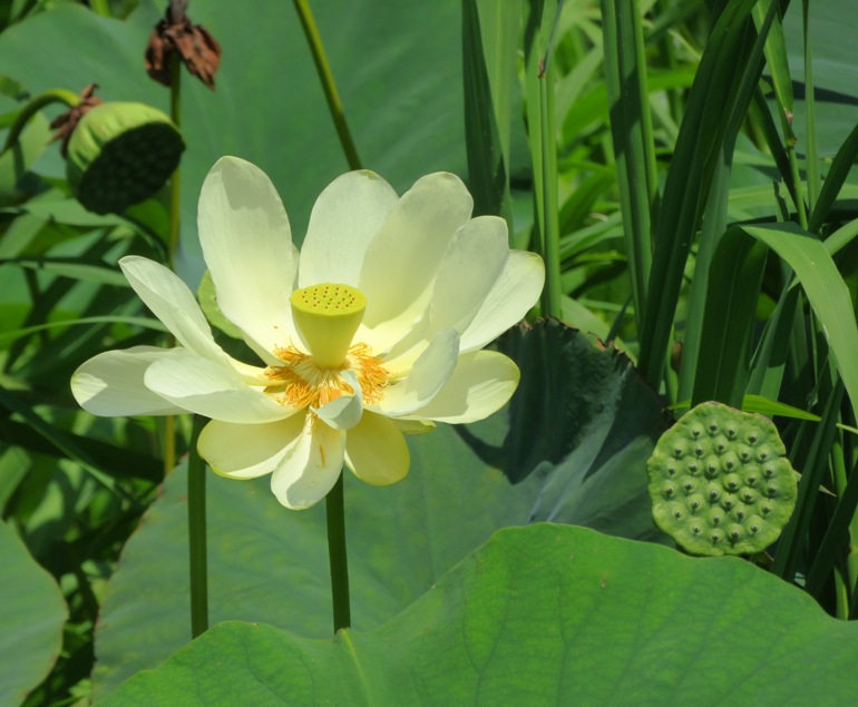
Yellow cone.
10 / 11
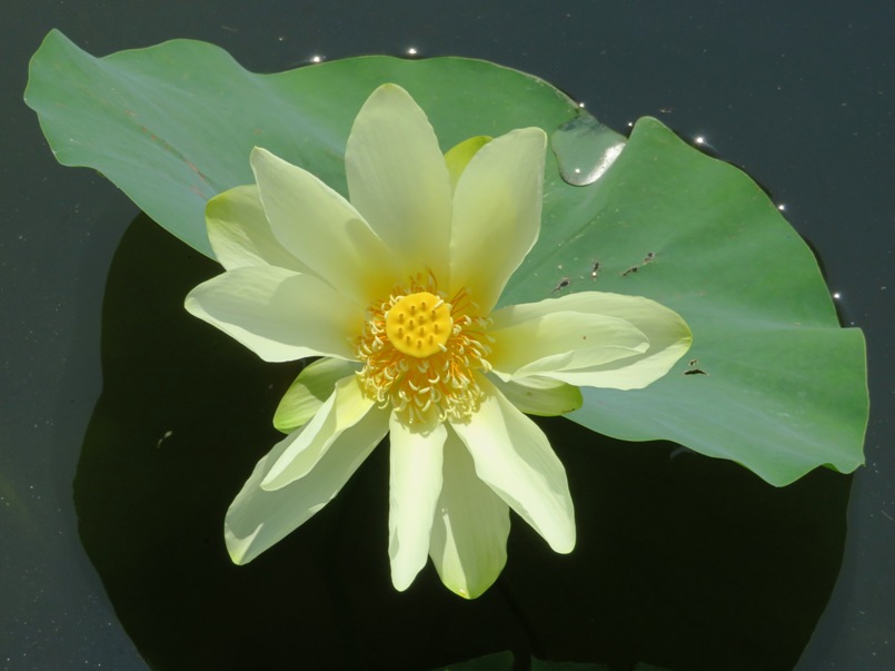
Looking down.
11 / 11
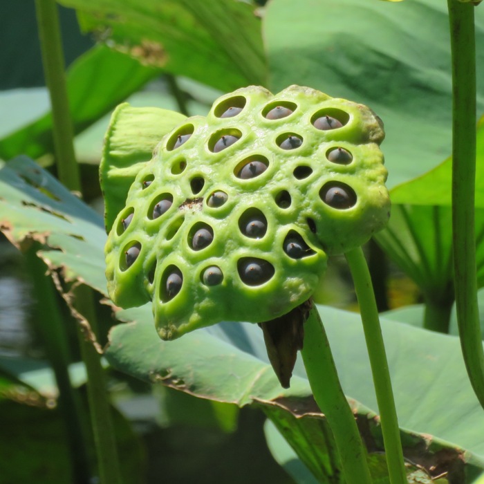
Lotus seeds.
We found a third lotus grove at 39.480082, -76.117639. There were a good number of flowers here but I bet there were more a few days ago. Norma found a garter snake. She called me over and it was nice enough to wait and pose so I could get a look. 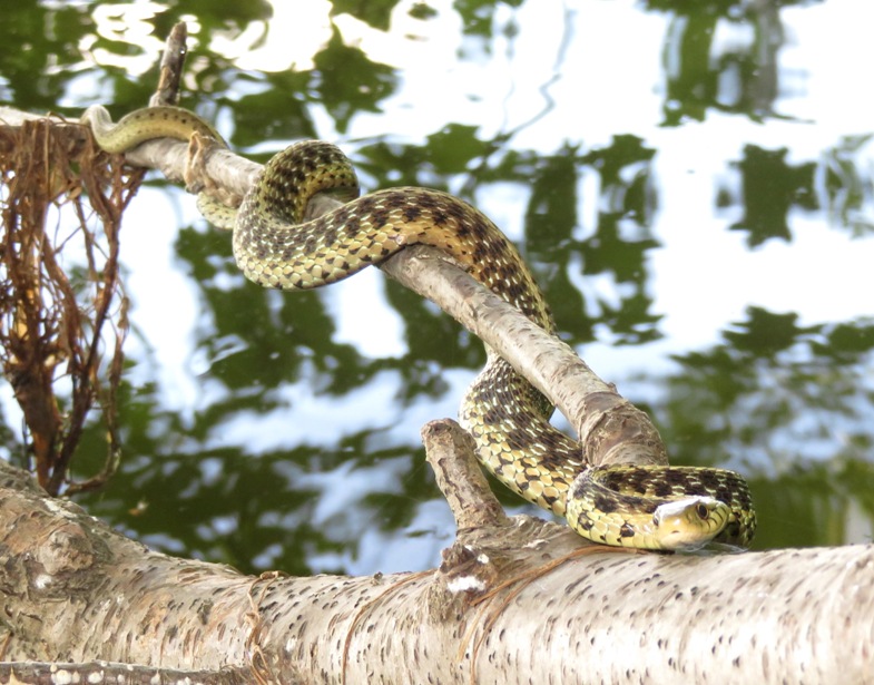
We paddled south on Swan Creek as far as we could. The water was noticably cooler and the aquatic vegetation was thick in some areas. It wasn't a peaceful place due to all the industrial sounds coming from Aberdeen Proving Ground. 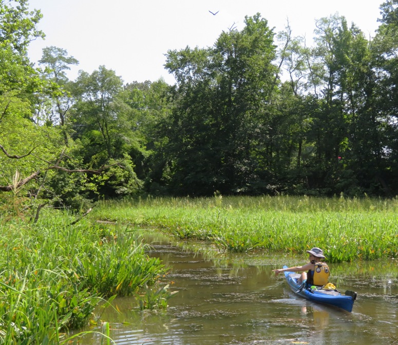
On the return trip, we saw a lot more eagles. Most were not cooperative with my camera but I found an outlier. 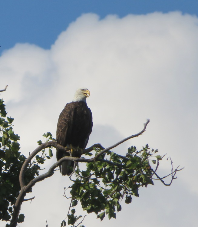
In Swan Creek, I found some lotus seeds floating on the water. One was in inch long. 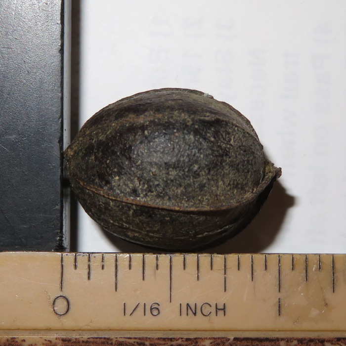
We paddled 10.7 miles. Here is our route. 
After leaving Harford County, we drove to Village Square Cafe to experience the Orange Book Music Series in Baltimore. Mike B. and Thom H. were performing on keyboards and guitar, respectively. I expect to return to Swan Creek in the spring or autumn (when the aquatic vegetation isn't so thick) to see how far I can get up the north side. Will probably use the surf ski for that. Next summer, I also think I'll return to see the lotus flowers. After we got home, I looked at satellite photos to see if there were groves that we missed. Indeed we did. |
|
On the evening of August 17, 2020 and the morning of the following day, the forecast called for coastal flood warnings. It wasn't supposed to rain but it had rained recently. Maybe that along with the high tide was cause for concern. But I saw this as an opportunity. Low water is great to see shipwrecks while high water is good for paddling to areas that are normally too shallow to explore.
On August 18, Daphne and I launched from Homeport Farm Park around sunrise (~0635). We paddled south on Church Creek to the South River. Then we headed west (upstream). Daphne went ashore at one of the bridge supports for the South River Bridge while I took a picture of the shadow cast by the early morning sun. I looked so tall...I felt like I was 5'8"! 
We paddled south (upstream) on Beards Creek. I was really curious about one part of the creek that I saw in a satellite photo at 38.934299, -76.590226. It appears discontiguous from the main part but surely it is not. I figured that with the high water, maybe I could access the section that seemed to be separate. I explored the southernmost part of the creek, looking for an opening. Eventually I found one. There were various logs blocking the opening but I got through after doing a couple portages. Not sure if I would have needed to portage with a canoe...the fin on the SUP is always the problem in shallow areas. A retractable fin would work much better in places like this. After this first portage, I paddled upstream (south) for about 0.3 mile. It was absolutely heavenly so I'm calling it the Heavenly Stretch. There were lots of narrow, deep sections lined with lush greenery. I wish it could have kept going but eventually it got pretty narrow so I decided to head back. I did have to do more portages, including one at an almost submerged beaver dam. 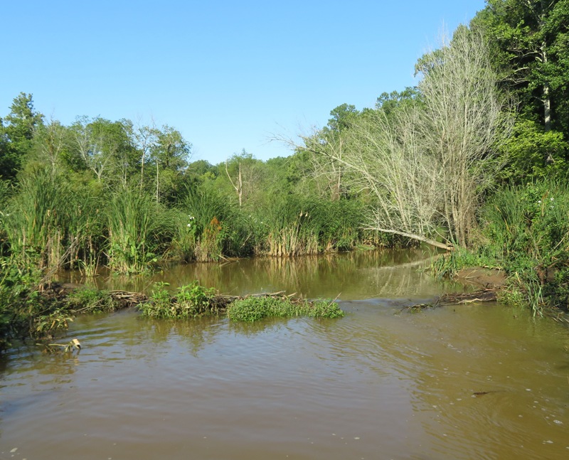
The dam was in disrepair and I don't expect it to be around much longer because off to one side I found a dead beaver. I'm guessing it was the engineer clinging onto its final project until its last breath. I saw several dozen swamp hibiscus flowers in bloom. Here's one with a handsome meadow katydid. 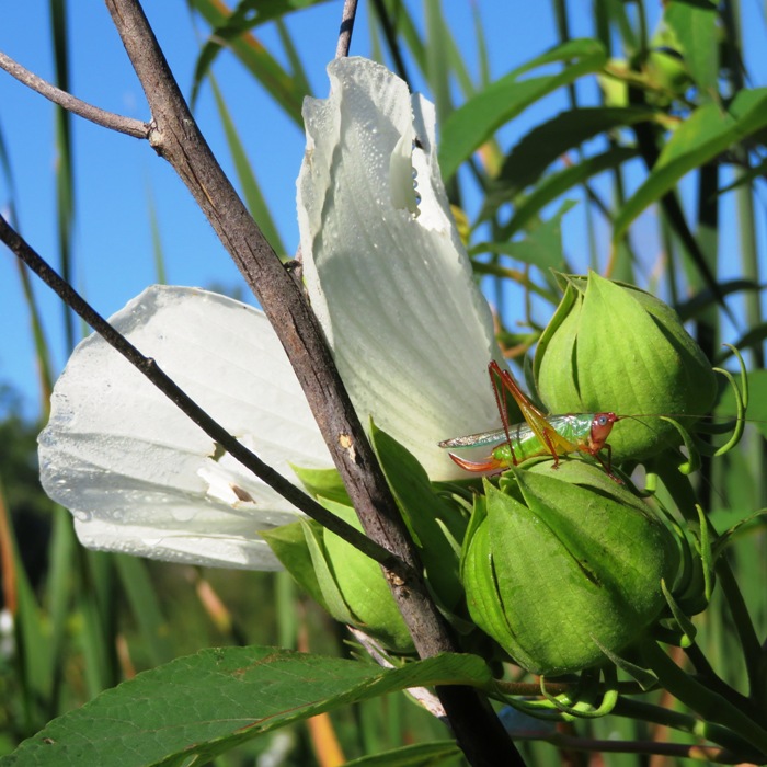
Here's the same picture but zoomed in on katy. 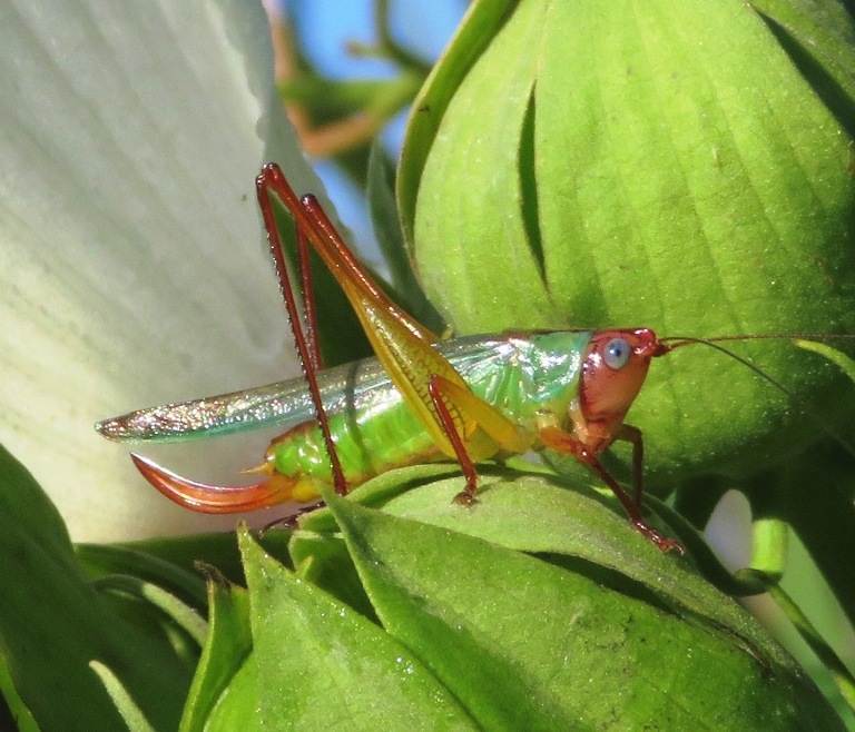
One final view of Heavenly Stretch. 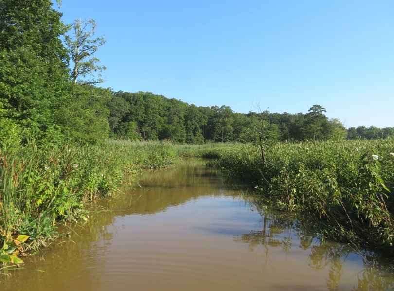
Next, I explored Scotts Cove, paddling upstream on that as far as I could. I did one portage there. 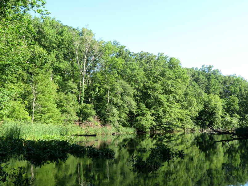
Saying farewell to Beards Creek, Daphne and I headed downstream, back to where we started. On Church Creek, I noticed that about half the piles had a crab on them. I tried to grab one large one and it had the audacity to try and pinch me before it dove towards deeper water. 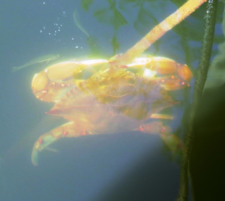
I got in 11.8 miles. 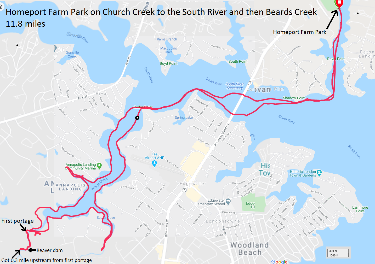
During our time out, I saw two other paddleboarders and one kayaker who was fishing. Today was the nicest day we've had in awhile. The sun was brilliant, the humidity was low, visibility was superb, and our July and early August heat wave broke, so the high temperature was only 84. I made it a point to spend as much time outside as I could. Once I got home, I mowed the lawn and then Norma and I took Daphne for a walk at Huntington. I've been giving a lot of thought to the retractable SUP fin idea. I thought about making one but then looked it up on-line and found that it has already been invented, Frogfish Pivoting Spring-Loaded Stand Up Paddle Board Replacement Fin for Rivers, Shallow Water and Surf. So I ordered it. I'll let you know what I think after I've had a chance to try it out. |
|
Norma, her nephew, Daphne, Sara, and I planned to launch from Breezy Point Marina to go look for shark teeth.
As we pulled into the marina, I saw a nest at the top of a crane. At first I thought I found a black vulture nest but I think they were just resting at an old osprey nest. Later, I read the following: Black Vultures nest in dark recesses usually under some type of cover. They do not build a nest, instead, they lay their eggs in rocky crevices, caves, tree cavities, hollow logs, and on the floors of abandoned buildings. - from Hawk Mountain - Black Vulture 
Just before launching, Norma's nephew fell on the slippery, algae-covered boat ramp and cut his hand. Norma got him cleaned up and then took him and Daphne to Chesapeake City while Sara and I paddled south to look for fossils. It was good he did not join us for kayaking because Vibrio vulnificus bacteria levels were very high, according to National Centers for Coastal Ocean Science (NCCOS) - Vibrio Predictive Models. This is nothing to mess with. Vibrio vulnificus, can cause life-threatening wound infections. Many people with Vibrio vulnificus infection require intensive care or limb amputations, and about one in five people with this infection die, sometimes within a day or two of becoming ill. Some Vibrio vulnificus infections lead to necrotizing fasciitis, a severe infection in which the flesh around an open wound dies. Some media reports call this kind of infection "flesh-eating bacteria," even though necrotizing fasciitis can be caused by more than one type of bacteria. - from "Centers for Disease Control and Prevention (CDC) - Vibrio vulnificus & Wounds" (a broken link as of 2025) Sara and I paddled south in the Bay near low tide. We pulled into one beach and started looking for fossils. There were a few others out searching too. I'm guessing they must be locals since there is no public beach access there. Over about 2.5 hours, we moved the boats twice so we could stay close to them as we looked. We didn't find nearly as much as we did on July 25, 2020 but conditions were not the best either. We hadn't had any big storms recently to expose a lot of new fossils. The return trip was a little rougher. The wind was ~seven mph from the southeast. That isn't a particularly strong wind but southeast is very unexposed so some waves were kicked up. Definitely not a beginner trip. I saw a few bald eagles and a ray. As we neared the launch site, I unknowingly pulled up a jellyfish with my paddle. It landed on my arm but fortunately I was wearing long sleeves so I didn't get stung. There really weren't many jellyfish out as compared to our July 25 trip. Also, the Bay was significantly cooler. Here's everything I found: an unusual rock, eight fragments of ray dental palate, a shell with a hole made by a moon snail, and 46 shark teeth. 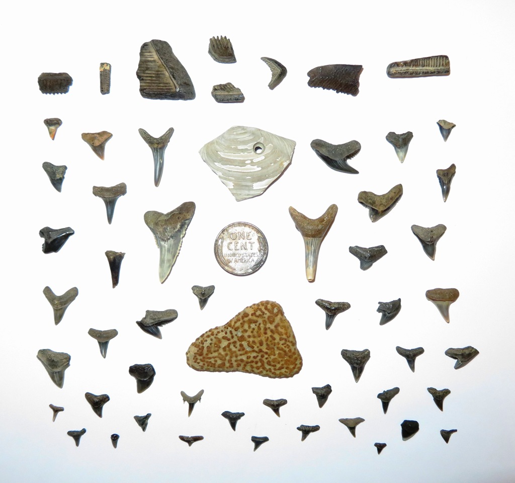
These are my favorite finds: fragment of an eagle ray palate (top left), tiger shark tooth (bottom left), snaggletooth shark tooth (middle), and sand shark tooth (right). 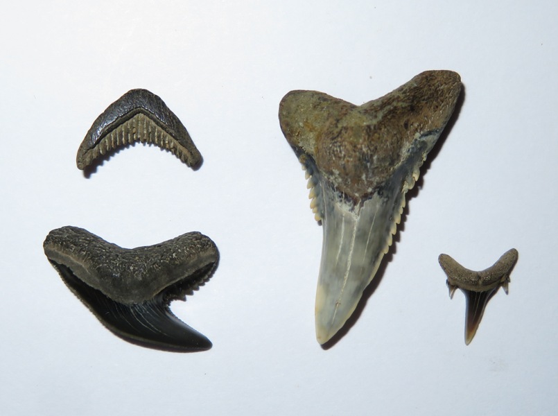
Sara found a turritella shell, cetacean (whale, dolphin, or porpoise) rib, fragments of Ecphora (MD's state fossil shell), and a stone crab claw. |
|
Norma, Daphne, and I had already completed a short hike in the morning, but with the weather so nice (and not expected to be so for awhile), we really wanted to spend as much time outside as possible. So this was our second outing of the day.
I decided we would do a trip similar to the one I described in High Tide and Exotic Blooms. So we launched around 1450 at Bladensburg Waterfront Park and then paddled south (downstream) on the Anacostia River. Low tide was at 1359 and high tide wasn't expected until 1909. The fluctuation between the two was 2.44 feet. But that area is particularly sensitive to tidal changes so I had to remain flexible with my planning. My intention was for us to go up Dueling Creek, but around 1520, it was so narrow and shallow that I didn't even recognize it. So we kept going downstream until we came to the pier at the National Arboretum. There were quite a few people in the grassy area along the shore just outside of the fence so we decided to skip landing and instead paddle back upstream. We turned into the waterway adjacent to Kenilworth Aquatic Gardens. Even at 1610, the water was too shallow to get very far. A lot of mud along the shoreline was exposed. Then I saw one mound of mud move. It was a huge snapping turtle. Had it remained stationary, we never would have recognized what it was. 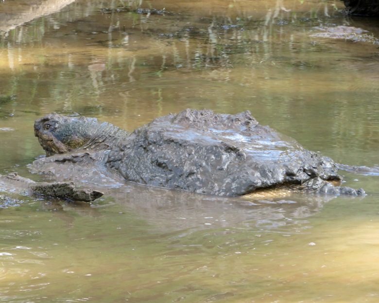
There were lots of egrets out. After seeing pictures of little blue herons, I have to wonder if some of the birds I've been calling egrets were really juvenile little blue herons. Snowy Egrets are often mistaken for juvenile Little Blue Herons, but they have an all black bill and black legs compared with the grayish bill and greenish-yellow legs of Little Blues (note that juvenile Snowy Egrets have yellowish legs). - from All About Birds - Similar Species for Little Blue Heron Norma, Daphne, and I paddled about as far as we could in the shallow Kenilworth area (shown below), and then continued upstream on the Anacostia. 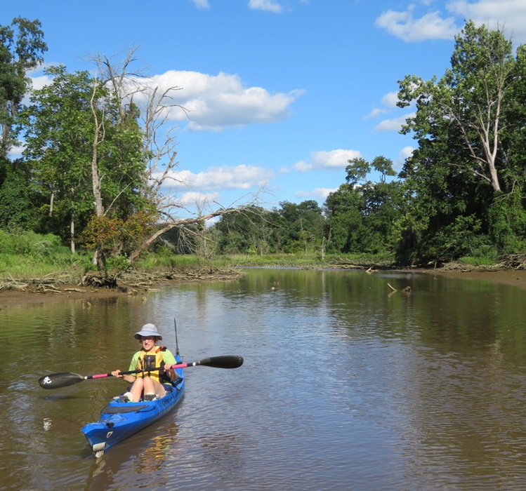
A small fish jumped on my SUP. Sometimes they flop around until they hit my leg or foot. Other times, Daphne lets me know they are there. But Norma saw this one and rescued it. 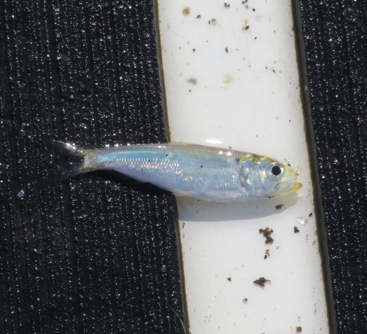
We made our way up Beaverdam Creek pretty far. 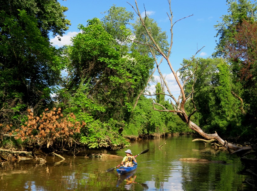
The creek looked peaceful until the Metro zipped by just 100 feet away. Norma picked a lot of trash out of the water that day. I did too but not as much as her. I was getting pretty good at pulling things out of the water with my paddle to avoid having to bend down. At one point, we made a game out of it, racing each other to pick up a piece we both spotted. By 1715, the water was high enough to paddle up Dueling Creek and into the Dueling Creek Natural Area. Do you know how Dueling Creek got its name? If you don't, read High Tide and Exotic Blooms. 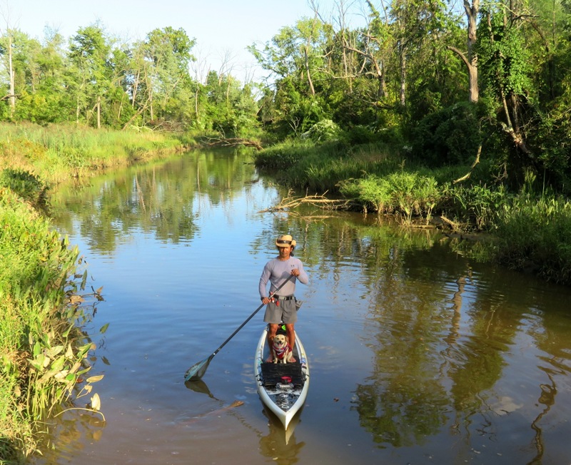
We landed at the pier on the north side of Dueling Creek at Colmar Manor Community Park. I tied up the boats and we went ashore for a snack and to look around. We found some really nice wooded trails where we did a one mile circuit hike on the east side. We were off the water for about 40 minutes. When I went to untie the boats, I noticed that the aft side of Norma's Cobra Expedition was caught under a pier support. The rising tide trapped it there and was actually starting to bend the boat. Fortunately, we saved it before there was any permanent damage. Lesson learned...respect the tide! One of the main reasons I wanted to visit this area was to check out this park. There are more trails than I expected and they are very nice. We will definitely return and explore things further. The best birding is at the north end of the park, where a grassland and scrub-shrub area lies near the prominent footbridge over the Anacostia; along the riverbank east of the ballfields, where a foot-trail heads south toward the Dueling Grounds; and in the Dueling Grounds area itself, where a restored wetland is encircled by trees, and where a short pier provides access to Dueling Creek. - from Birder's Guide to Maryland & DC - Bladensburg Waterfront Park, Colmar Manor Community Park & Anacostia River Trail Next, we paddled to Bladensburg Wetlands. This is a great little tributary of the Anacostia that meanders around, forming somewhat of a maze. As I paddled past, numerous ducks flew out of their hiding spots. The sun was getting low and the lighting was magical. We finished our trip around 1900, having paddled 6.8 miles. Once I got home, I went on AllTrails and found a map of the main trails at Colmar which I annotated with additional landmarks. 
I think there are lot of side trails not shown in the above map. The route we paddled is depicted below. 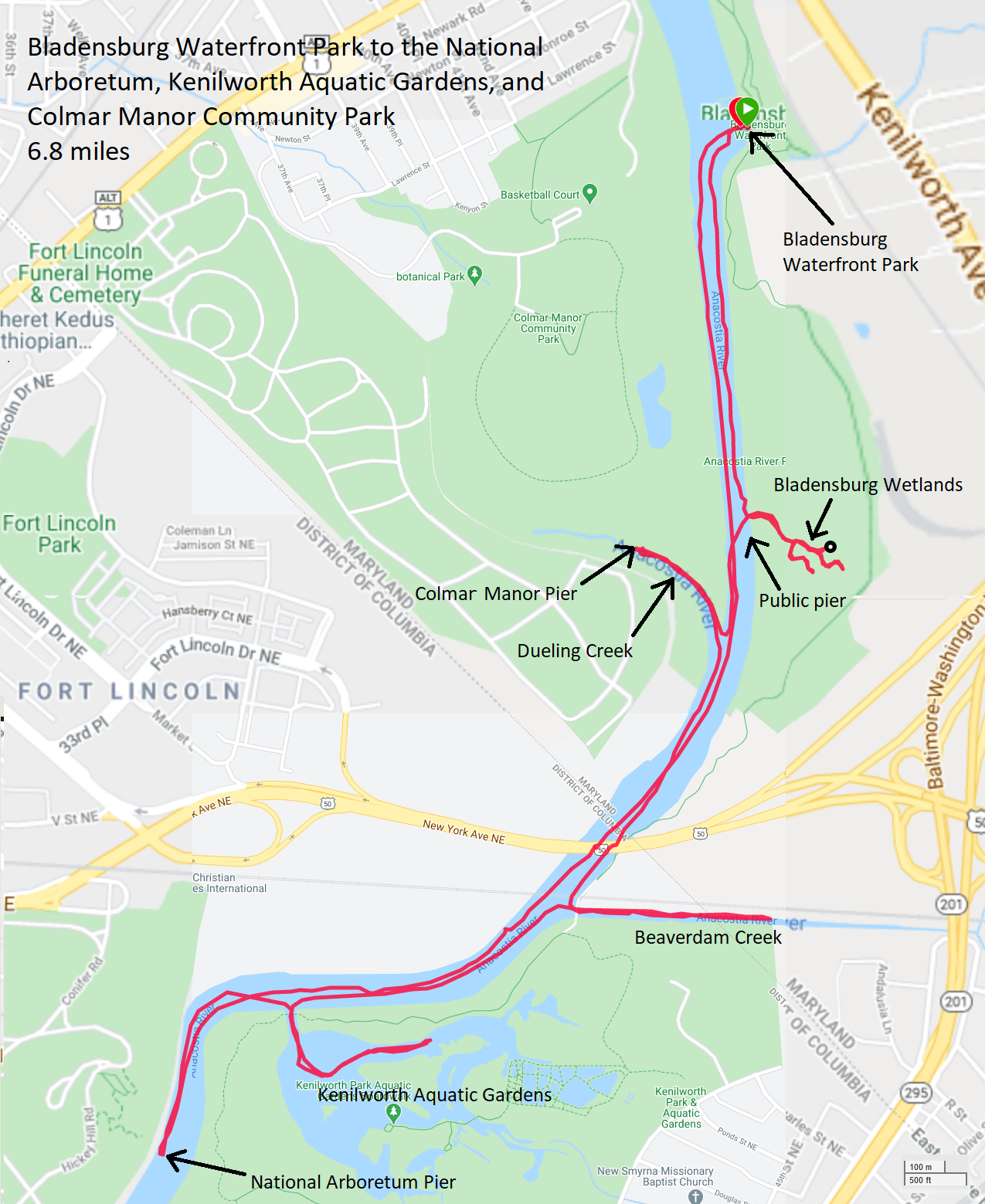
On the way home, we stopped to pick up dinner at a pupuseria food truck in Laurel. |
|
Daphne and I woke up early. We headed out to Browns Landing where we launched on Cox Creek. The last time I was there was May 13, 2014. Browns Landing has really improved since then.
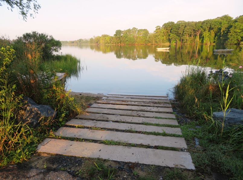
I paddled across the creek to the undeveloped, wooded area. There, we saw a few bald eagles, a green heron, a few ospreys, some great blue herons, and several snowy egrets. 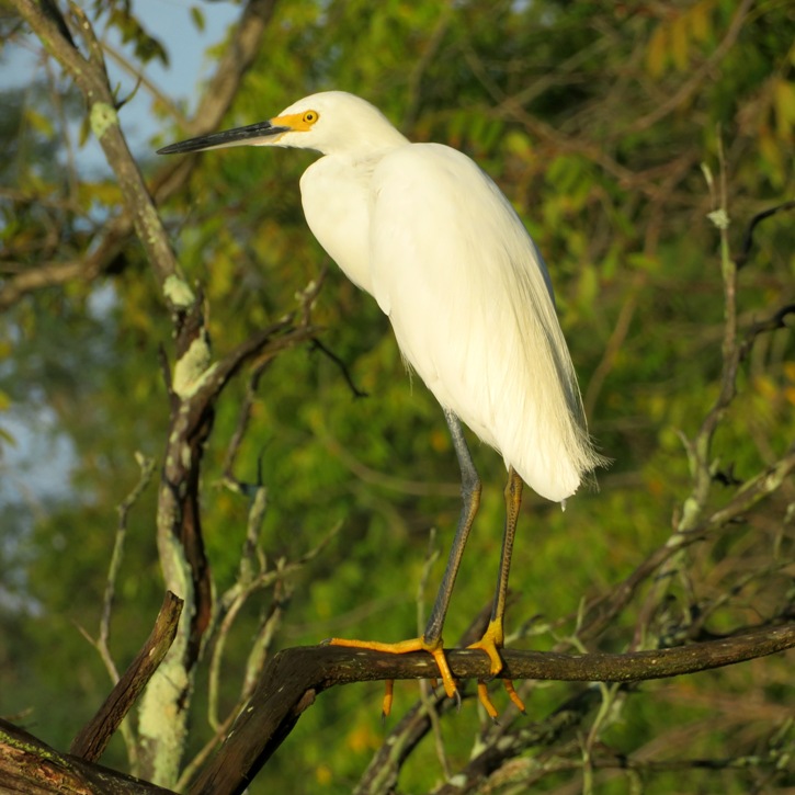
My goal was to get as far upstream on the creek as I could. My notes from my last trip there mention I got pretty far but I figured I'd map it all out with my GPS this time. It was a little after high tide and it had rained the day prior so I figured it was a good time to do this. Also, I really wanted to get my money's worth out of my one year Queen Anne's County launch permit. I paddled under Blue Star Memorial Highway (highway 50). Along the south side of it near the water, there were a lot of salt marsh mallow flowers in bloom. Next, we went under Main Street (route 18) where we saw a few swallow nests. After that was the scenic Cross Island Trail bridge. Around here, things got very shallow. Fortunately, I was using my new Frogfish fin which allowed me to paddle through many places where I would have otherwise had to portage. After the shallow spots, things got narrower, deeper, and more scenic. I saw a couple of writing spiders (Argiope aurantia). According to Curbstone Valley Farm - The Writing Spider, it is also known as the Yellow and Black Garden Spider, Golden Orb Weaver, Yellow Argiope, Corn Spider, Scribbler Spider, Golden Garden Spider, and Black and Yellow Argiope. In the below picture, the red circle on its abdomen is the spinneret, which is the organ used to produce web. 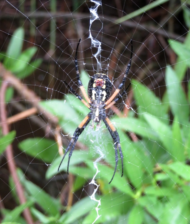
Eventually, the creek passed between people's back yards which made me feel like I was spying on them but I suppose they are probably used to paddlers coming through. In one back yard, there were about 18 black vultures, all standing on the ground with their wings outstretched. It was quite a sight. Unfortunately, they took to the air when they saw me. I kept paddling and paddling and I was thinking that I might I come out into the Chester River or the Chesapeake Bay which would have proved that Kent Island is really comprised of at least two islands. But after studying Google Maps, I don't think that is the case. I came to a decrepit bridge at what I think was Ackerman Road. I had to get parallel with the SUP to make it past this one. If you're not low enough, there is a lot of rusty metal that will cut you. 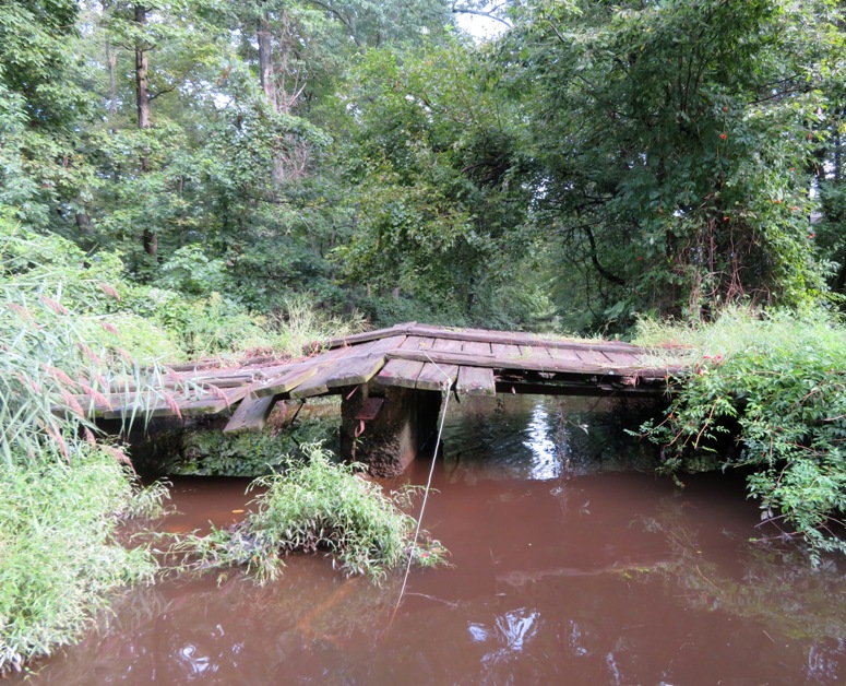
I didn't make it much further. I was stopped by dense low branches. I could have portaged around it but that would have meant trespassing. Note to self: bring loppers on my next visit. I made it 2.2 miles upstream of highway 50. On the way back, I stopped to take a picture of one of the salt marsh mallow flowers. 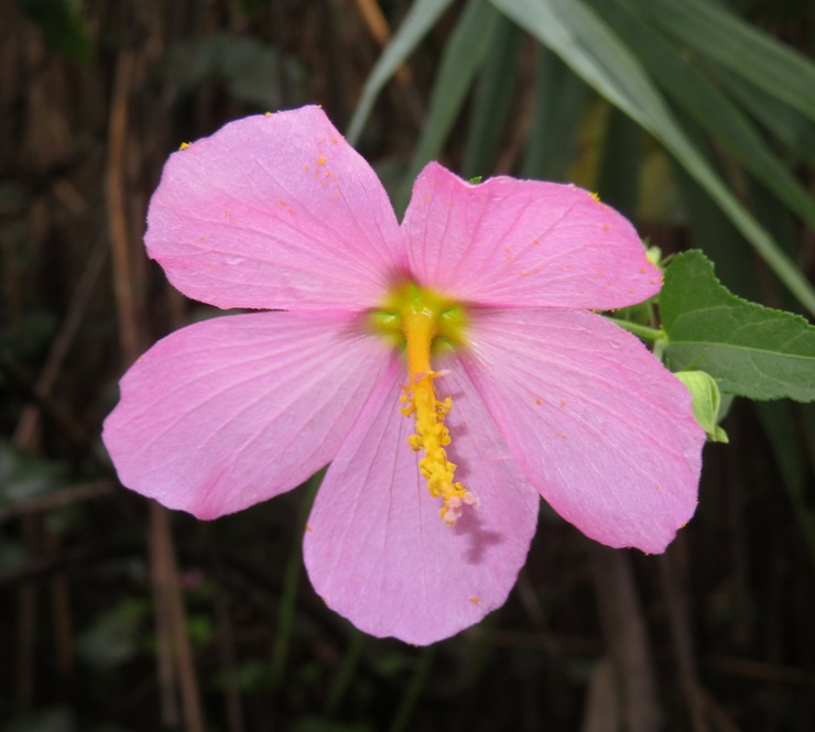
Looking back, I admired the pristine and peaceful view. 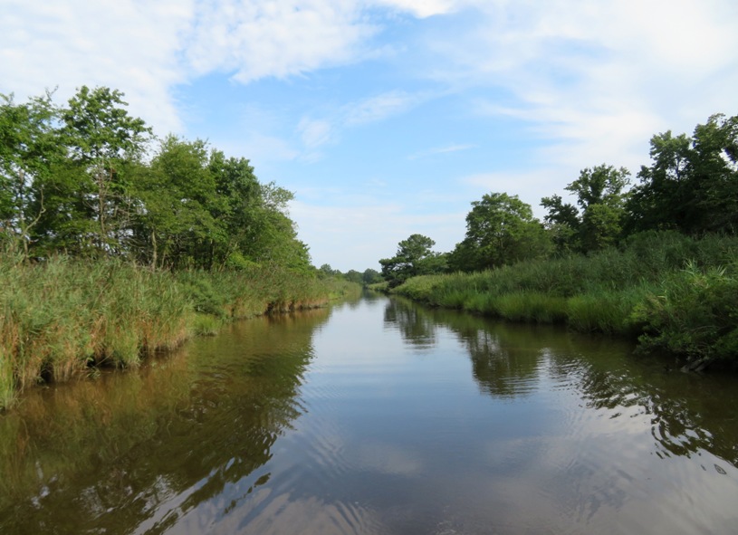
I ended up paddling a total of 7.8 miles. 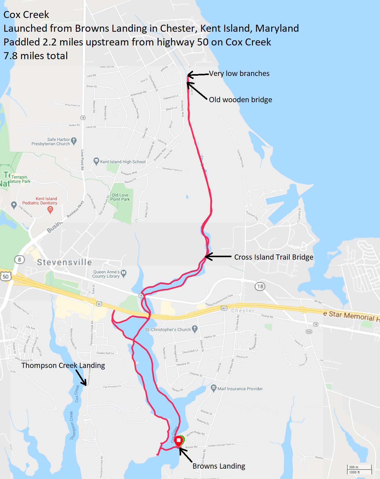
|
|
On August 18, 2020, I ordered the Frogfish Pivoting Spring-Loaded Stand Up Paddle Board Replacement Fin for $99 plus tax. It arrived four days later.
My SUP was originally made for racing. At 14 feet long, 27 inches wide, and only 29 pounds, it is pretty fast. But the newer SUPs are much more streamlined so I think my Yolo Prowler is now more of a touring SUP. It is great for covering fairly long distances. But I also use it to explore narrow creeks. Fourteen feet is long for a SUP but short for a sea kayak so its relatively short length is an advantage, compared to lots of other watercraft. I also find that SUPs are much easier to maneuver than kayaks so getting around tight turns and obstacles is less of an issue. However, the biggest drawback with paddling a SUP in creeks is the fin. The original one that came with the SUP protruded 9.5 inches below the board. I later replaced it with a SUP ATX fin which protrudes seven inches. The advantage of the shorter fin is that it is less likely to catch on obstacles. But still, at seven inches, it makes the SUP inferior to a canoe or kayak of similar length with a flip-up rudder, retractable skeg, or no rudder/skeg when paddling in shallow water. But the Frogfish fin is helping change that. It is basically a flip-up fin. Extended, it sticks out below the board 11.5 inches. 
But if the Frogfish fin hits an obstacle, it can fold back to render a mere 3.5 inch profile. This means I can paddle my SUP in much shallower water without having to portage. 
I tried out the Frogfish fin on August 30, 2020 on the Anacostia River and its tributaries. Exploring the shallow areas, the fin did quite well, folding up as I went over mud and logs that would have been an obstacle for my SUP ATX fin. But the Frogfish fin also kept me in control in the deeper areas, providing good tracking. The one thing that some people might not like is that when I went fast, the drag from the water moved the fin back and then forward, very slightly. I'm sure that affected speed. I couldn't hear the movement but I could feel it. If you only go paddleboarding in places where there is very little chance that your fin will bottom out, then the Frogfish fin is not for you. But if you like to explore the scenic, shallow creeks where depth is sometimes an issue, then consider purchasing the Frogfish fin. I'm writing this addendum on March 29, 2021. I still really like the Frogfish fin but I don't love it quite as much. It is still great when it comes to paddling the shallow areas but otherwise, it slows me down. Looking behind me when the SUP is moving, it is obvious it creates some turbulence. I don't know if it changes my maximum speed very much but it definitely keeps me from gliding and instead I slow down more quickly once I stop paddling. I can still keep up with the sea kayaks but it takes more effort. It is still a great design but maybe it can be improved to be more streamlined. |
|
I am an introvert, and big social events sometimes stress me out, especially when children are present. So after hosting such an outdoor event at our house on September 13, I needed to get out on the water to detox.
Daphne and I launched from Jackson Creek Public Landing at 1700. The sun was low in the sky and making things glow. First, we paddled east to the waterfront mobile home park. I know people tend to look down on mobile homes but this is such a great location with awesome views that I think a lot of paddlers would love to live here. The creek to the east of the mobile homes is Winchester Creek. Daphne and I explored that in its entirety. There, I met and I spoke to an elderly woman kayaker by the name of Fran who lives nearby. Just east of Winchester Creek is a small pond that is shallow and undeveloped. It is pristine and natural. Here, a green heron let me get so close that at times it was shaded in my shadow. Unfortunately, the lighting was not optimal. I think it would have if I had been there an hour prior. I saw a few American persimmon trees with lots of fruit. 
The thick aquatic vegetation kept getting caught on my Frogfish fin. I stopped a few times to clear it off but I also found that paddling backwards sometimes cleared the debris. I let Daphne explore a sandy beach along the creek. As the sun set, the water all the way out to Eastern Neck Island was as smooth as glass. Out on the water, the bugs weren't so bad but as I paddled closer to shore, a swarm of mosquitos attacked us. I rushed to get to the car to apply bug spray but probably lost a pint of blood to those vampires while doing so. Still, it was a good trip. |
|
Norma, Daphne and I launched from Cabin Creek Landing for a short (~six mile) trip.
The last time I was here was nine years ago. Back then, this put-in was crap. But it is now much better. There is a big pier with plenty of parking. The launch area is a narrow spot on the north side between the grasses. It is muddy at low tide but not terrible. 
The mosquitoes were bad, but I was prepared. The three of us hugged the shoreline as we paddled east. There are lots of bay grasses near the shore and pine trees further inland. In some spots, there are sandy beaches where I found lots of razor clam shells. We explored Cabin Creek thoroughly, checking out every nook and cranny. 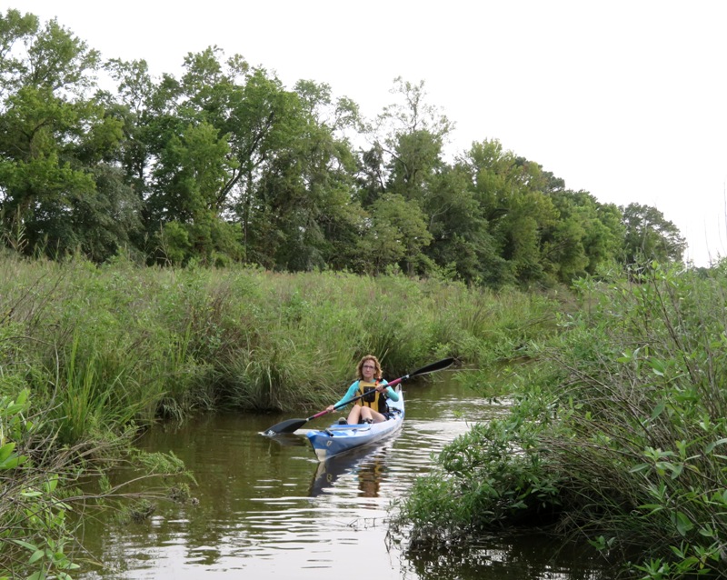
The area is quite pristine. 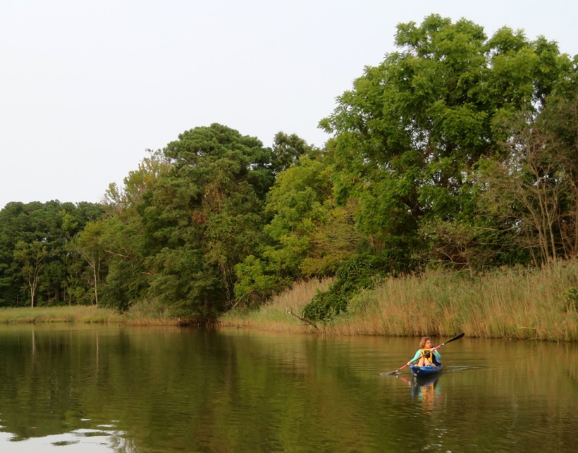
There were lots of bald eagles. I saw more sea nettle jellyfish than I'd seen in several years. Lots of little ones. Not many bigger ones. 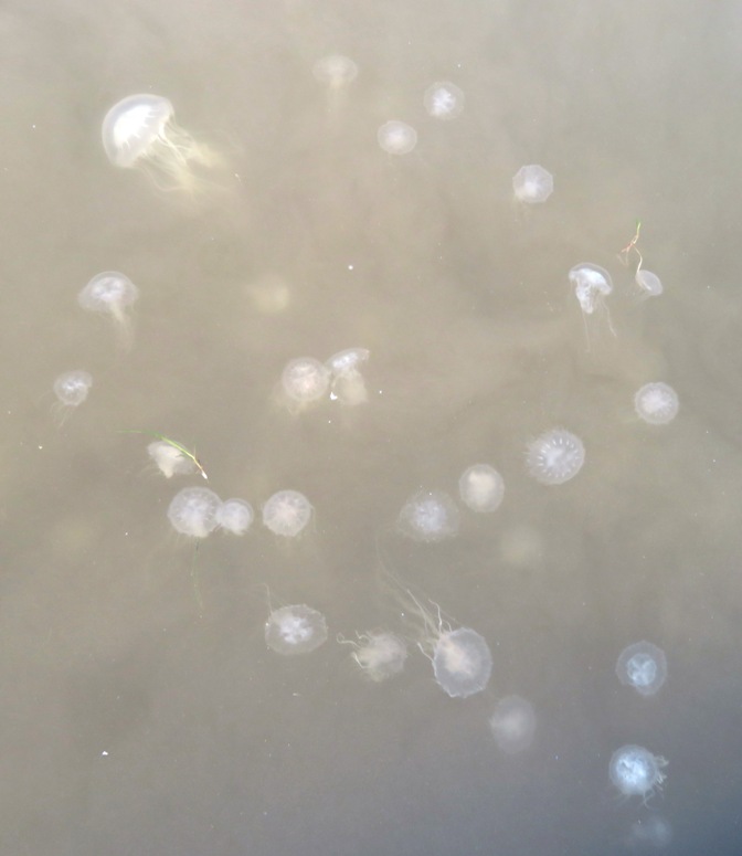
Norma saw what was probably a northern water snake but I missed it. Continuing south past Brian Point, we paddled into Hoghole Creek. High tide had passed almost two hours ago and we found ourselves making our way against a very strong outgoing tide that was channeled into a low grade "reversing falls." We paddled along the shore of Hoghole Creek as best we could. It was very shallow but my Frogfish fin allowed me to get into places that normally only a kayak or canoe could access. The main problem was when it came time to turn around. The Frogfish fin only folds back, not forward. So its long vertical length is a definite hinderance when it comes to backing up or traversing sideways. To turn around, I had to get into the water where I sunk about two feet into the mud. Then I had to lift the back end of my SUP so I could turn it around. How could I have prevented this? By making sure to turn around in places which are wide enough so that I never have to paddle backwards or sideways. Or, I could turn around in places that are at least as deep as the fin is long and are also as wide as the SUP is long. With my fixed fin, it wouldn't have been as much of an issue to turn around because its profile is 4.5 inches shorter. Also, a fixed fin is much stronger so I am more comfortable putting pressure on it to back up or turn sideways. I still think the Frogfish fin is very good but it is not the best fin in all situations. We eventually came to a yellow iron bridge at Talisman Circle Road (aka Talisman Farm). Here, we saw Talisman Plantation. We found a few American persimmon trees bearing fruit. The forecast called for clear skies but instead it was hazy. Smoke from the wildfires raging up and down the West Coast has now made it all the way across the country to the East Coast thanks to the jet stream. The fires are sending so much smoke into the upper levels of the atmosphere (about 20,000 feet into the jet stream), that it's riding the westerly winds across the country. Here in the East, we are getting a thin layer of haze that's creating a dim diffused effect and limiting the sun. The result, we are not getting help of sunshine to warm us up. We will stay seasonably cool with highs in the low 70s. The haze is high enough that it should not drastically deteriorate our air quality. Expect this haze to hang around for a day or two, until we see a shift in the pattern. Also, look for the potential for interesting sunsets as light filters through the smoke on the horizon. - from CBS Baltimore - Wildfire Smoke From West Coast Reaches Eastern Seaboard, Creating Hazy Skies Sunset that day was 1913. A few minutes before then, I expect the sun to shine less intensely and be obscured by humidity, smog, haze, etc. I also expect the natural yellow of the sun to look reddish. But today, the sun had these characteristics much earlier in the day. At 1818, it almost looked like we could see the corona around the sun. Seems so fitting in the age of Coronavirus. 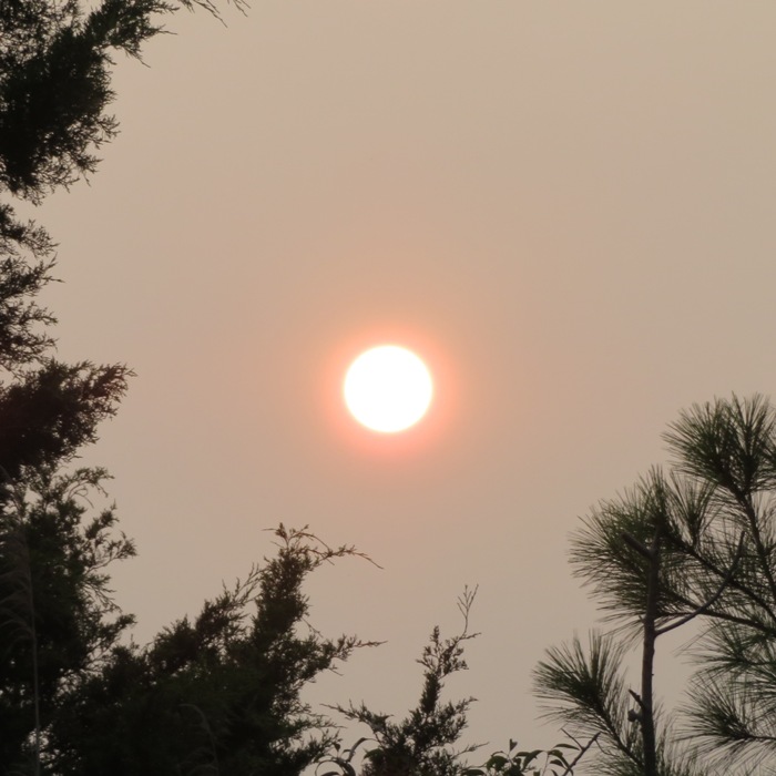
At 1827, the sun was looking dim. 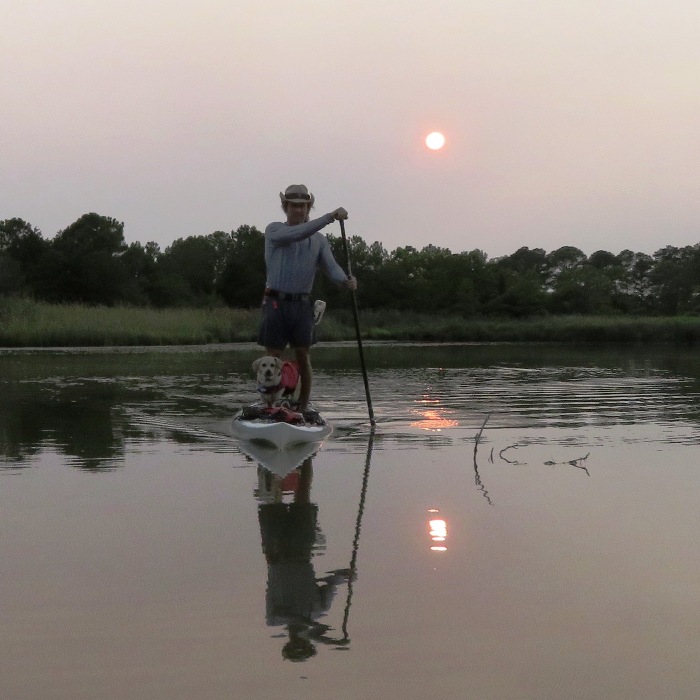
At 1839, the water could not have been calmer. 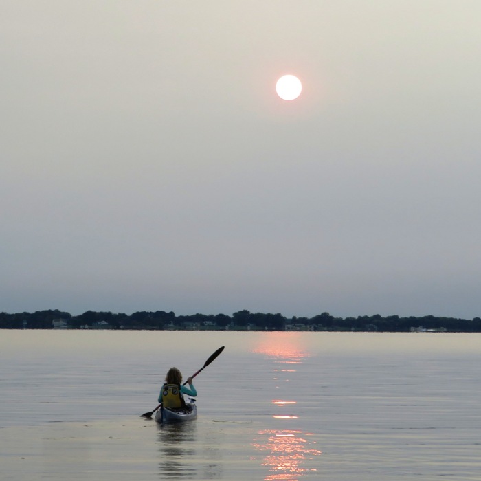
At 1843, the sun was looking more like Mars. A few minutes later, it was not bright enough for its rays to pass through the smoke. It was as if it set far above the horizon. 
At 1853, the sky had a dull and eerie glow. You can't even see it here behind Daphne and me. 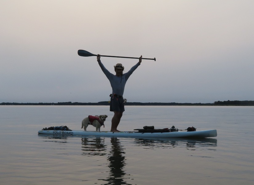
It was getting pretty cold...not just the air but also the water. I don't ever remember the Chesapeake Bay being this cold in mid-September. Once we got to deeper water, Norma and I raced each other back to the launch area to warm up. She is amazingly fast for someone who doesn't consider herself a serious kayaker. Over a short distance, we are about the same speed. But after about 300 feet, I pull ahead because my endurance is better. Keep in mind that I was also carrying Daphne. |
|
Norma, Daphne and I launched from Patuxent Wetlands Park around 1600. We paddled upstream on the Patuxent River and then explored Back Channel.
We saw several thousand marsh beggartick (Bidens Laevis) flowers. Aquatic vegetation was thick and it made paddling difficult in the shallow areas. Norma found a cluster of wild grapes. I thought they tasted sour. Also, there was a lot more seed than edible fruit. 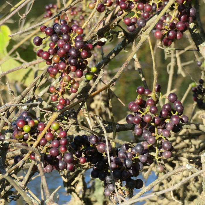
We did one portage on a tributary (38.822039, -76.703880) where, in years past, we had paddled up quite a ways. But today, it was shallow and we had to turn around after only about a tenth of a mile. It seemed like the marsh beggartick flowers were almost everywhere. If they weren't lining the water, then it was spatterdock. Lots of red-winged blackbirds were out. 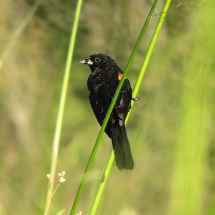
We got in a mere 4.4 miles. I would have liked to have paddled more but we explored what I set out to explore and it was getting dark. As we loaded the kayak and SUP, a fellow pulled ashore. He didn't look like your typical kayaker. He wore a helmet and old school flotation vest, used a single blade paddle, and had an interesting looking boat. I commented that the cockpit on his boat looked very small. He replied that it is a C1 boat, used for slalom courses. He had just finished paddling about 19 miles, starting from Conway Road on the Little Patuxent River. I knew then that this guy was hardcore. We spoke for a while and then I asked his name. He replied "Ed Gertler." I said, "You're Ed Gertler?!" I told him that I had his books and how much I've made use of them to put together some great trips. There's no doubt that I use his "Maryland and Delaware Canoe Trails" more than any other book that I own. Ed seemed quite flattered to meet perhaps his biggest fan. It is an understatement to say that Ed is a role model for me. He truly embodies the spirit of adventure and exploration. 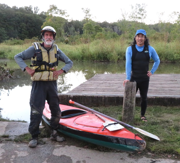
A C1 boat is a canoe and his is a "decked" canoe. So what is the difference between a decked canoe and a kayak? I read on a forum page that If you sit less than four inches off the bottom and paddle with a double blade it's a kayak. If you sit four inches or higher or kneel and paddle with a single blade then it's a canoe. The deck has no say in the matter. Further, if you paddle a canoe with a double blade or a kayak with a single then you are a kook. Here is our route. 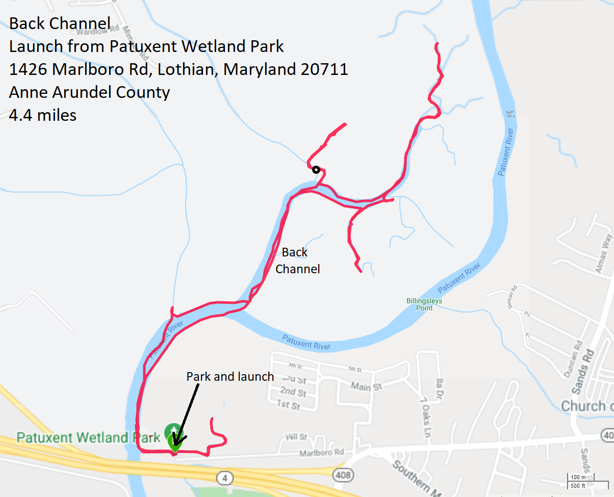
|
|
Daphne and I launched from Galesville. This is an area I always enjoy visiting. It is a nice, small town that I would consider living in. When I paddle here, I often feel at peace. I think the place has good "vibes." Maybe it is because, according to Galesville History, this town is home to
...the birth of Quakerism in Maryland. We paddled on the West River out to Parish Creek. The two of us landed at a muddy launch site I found at Shady Side Park. 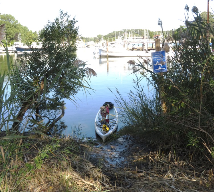
The above is not a great place to launch but I did find good place nearby at Discovery Village, shown below. This place is a real gem and will allow me to bridge the gap between Galesville and Franklin Point State Park. 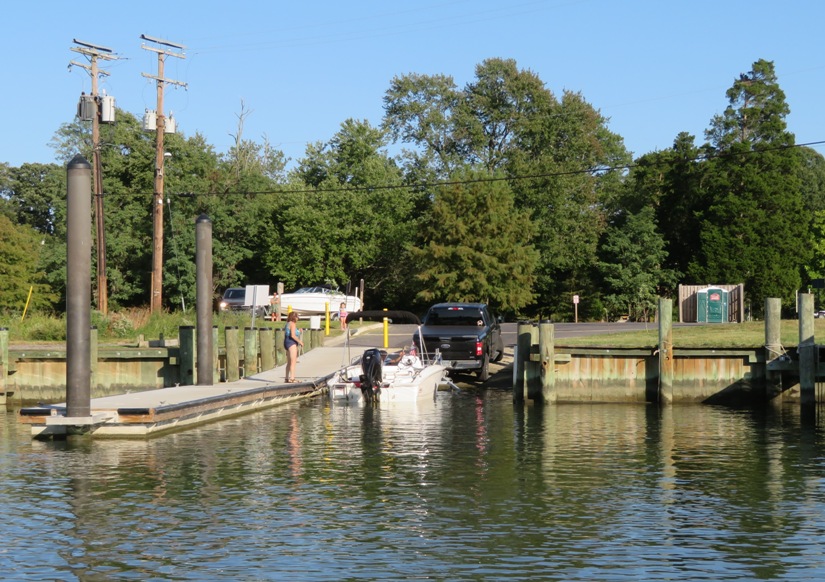
Next to Discovery Village was the Chesapeake Bay Foundation's (CBF) Maryland Oyster Restoration Center. Here's Daphne and me posing in front of the Patricia Campbell, the CBF's oyster restoration vessel. 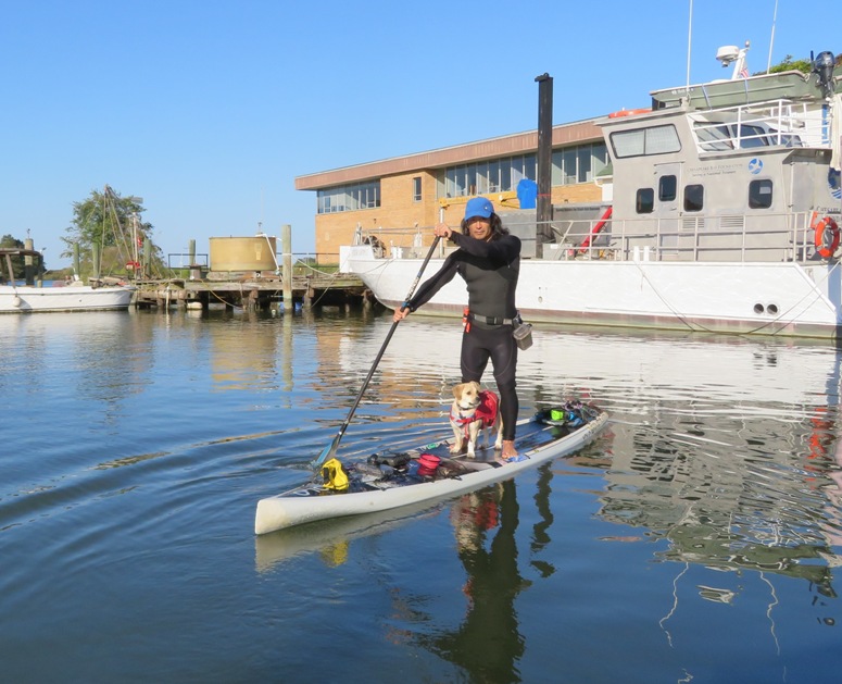
We paddled out to Hopkins Cove and then landed at the Shady Cove Natural Area Idlewilde Restoration Project. 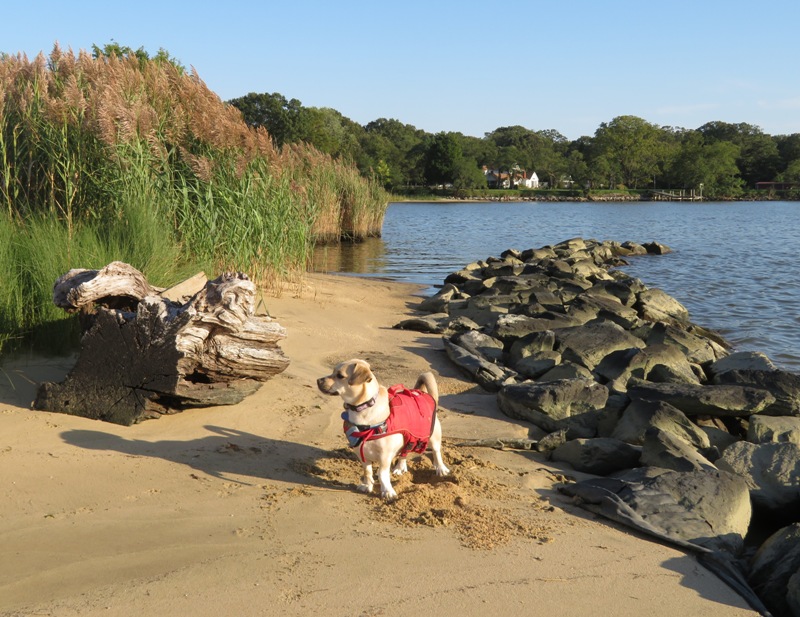
In the water, I found what I initially thought was the tiny lower half of a turtle shell (plaston). But after posting this snapshot on Facebook, Mike B. told me it was the apron of a female sook crab. I replied My one chance to use the word "plaston" in a sentence and I used it incorrectly. 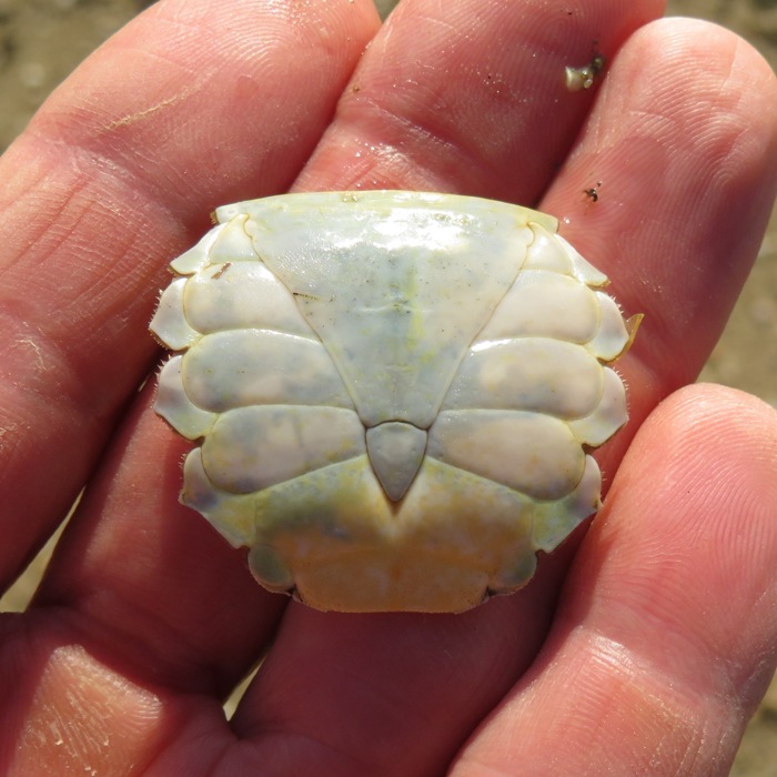
I turned around before we got to Jack Creek. On the way back, I saw a bald eagle. 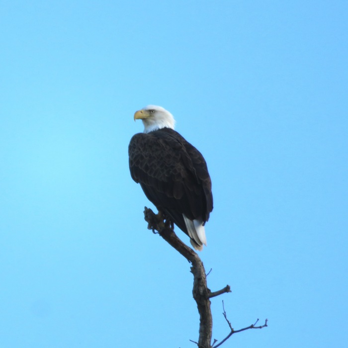
It was a bright, sunny day and I was hoping to get a nice sunset photo but as the sun got low in the sky, it was obscured by clouds. We got in 10.5 miles. 
I look forward to launching from Discovery Village and exploring the unnamed creek near Horseshoe Point at 38.834535, -76.493294. |
|
Norma, Daphne and I drove to Discovery Village for an afternoon of paddling. We found a little break in the grasses where one can launch a small boat. This is where we put in.
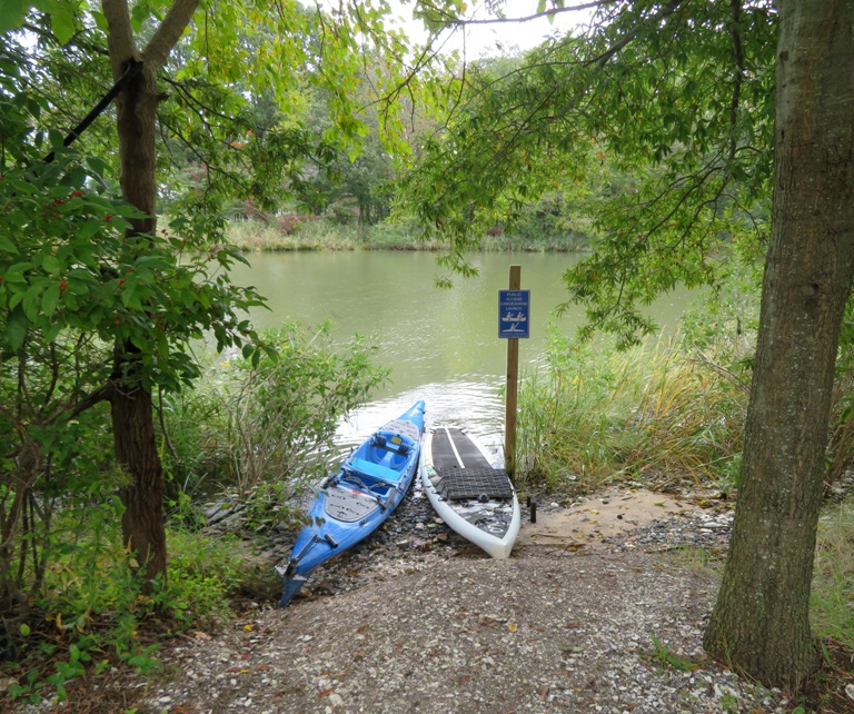
From there, we paddled northeast to the Shady Cove Natural Area Idlewilde Restoration Project and let Daphne run around. Continuing northeast, we rounded Curtis Point and entered the Chesapeake Bay. Rolling waves made Norma a little seasick so once we entered Jack Creek, I took her to Jack Creek Park where she could rest while Daphne and I explored the rest of the creek. Here's the beach we landed at. I found a short path that led from a bench at this beach to a parking lot. The place is still under construction but certainly usable in its present form. 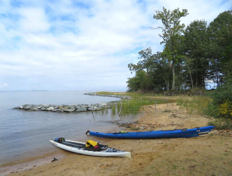
A lot of flowers were in bloom, especially beggartick (Bidens) flowers. I explored some of the trails at the park while Norma took a nap, with Daphne standing guard. 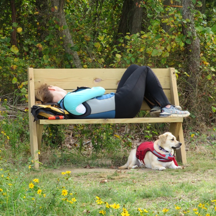
I didn't want to get too deep in the woods since mosquitos were out so I cut my walk short. After awhile, she was feeling better so we continued our journey. Continuing south in the Chesapeake Bay, we approached a place near Horseshoe Point where there is an unnamed creek that empties into a man-made inlet at 38.834718, -76.493240. For lack of a better term, I'm calling this Horseshoe Point Creek. We arrived just before high tide, which was around 1439. Forster's terns greeted us. 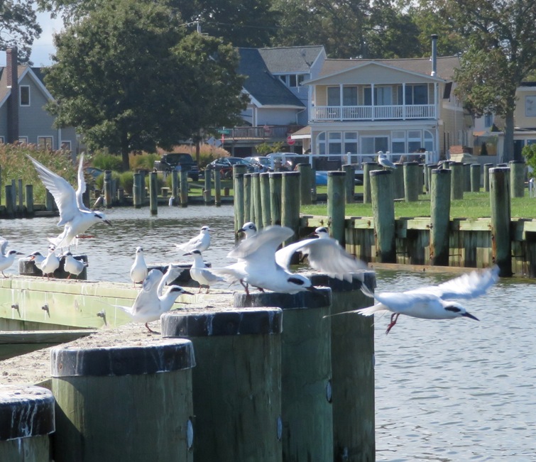
After paddling under a footbridge, we made our way up the creek, exploring for over two miles! I've often said that if a creek doesn't have a name, then it probably isn't worth paddling but this is an exception. There were three branches of the creek and all ended at shallow ponds (I call them "terminus ponds"), so turning around wasn't an issue. Just make sure to explore it at high tide. 1 / 6
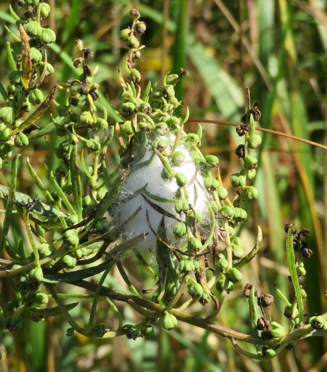
Egg case.
2 / 6
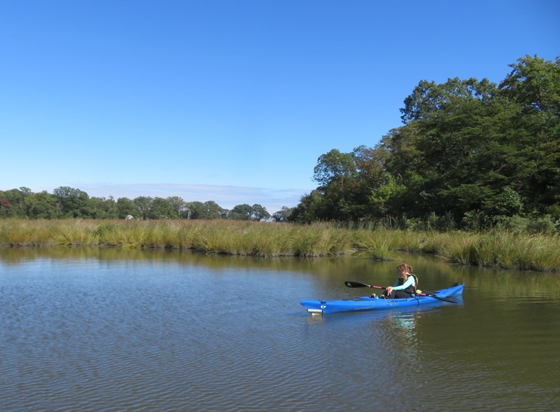
Terminus pond.
3 / 6
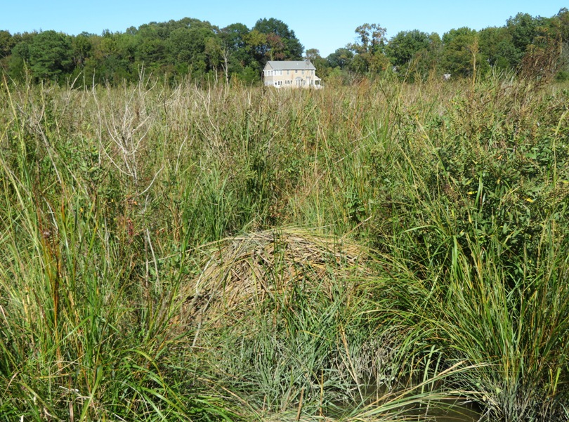
Muskrat mound.
4 / 6
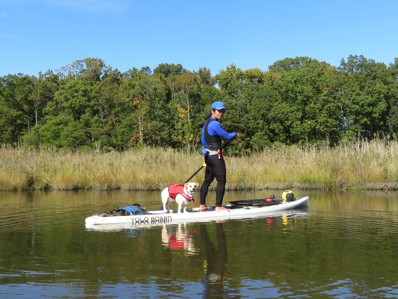
Another terminus pond.
5 / 6
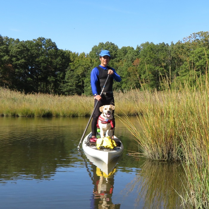
Daphne and I.
6 / 6
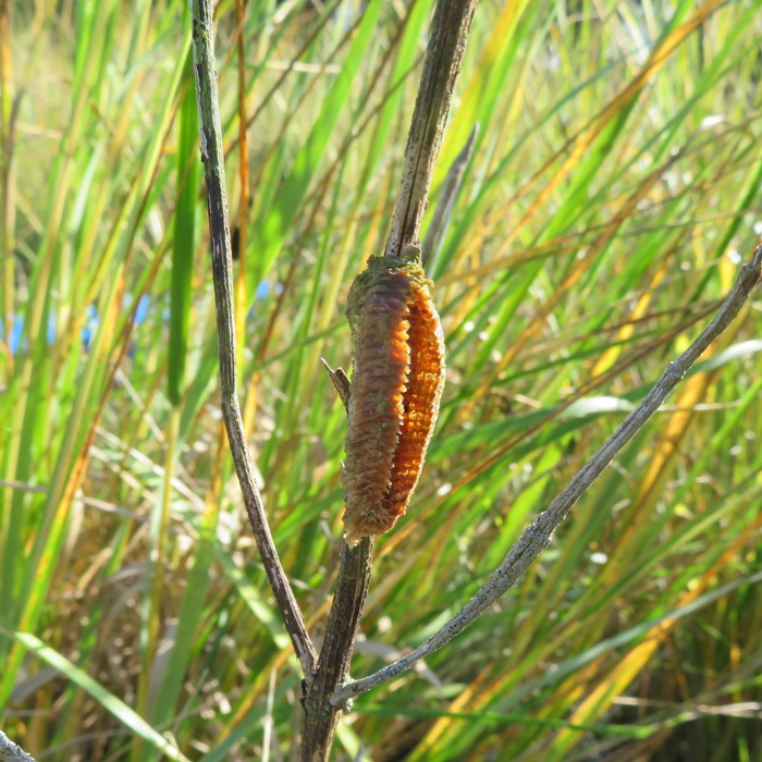
Hatched mantis egg sack.
Horseshoe Point Creek is narrow and mostly deep, except at the ponds. It is lined with a variety of bay grasses that transitioned from tall grasses to ones of a shorter variety as we paddled upstream. 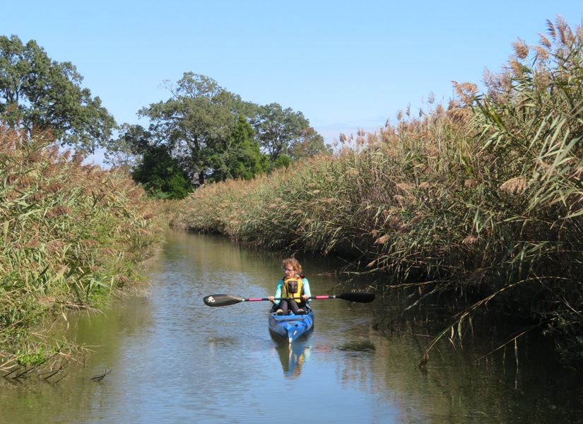
One particularly interesting thing we saw numerous times was spittlebug foam. It's the larva of a kind of insect whose adult form is known as a froghopper. Froghoppers belong to the True Bug Family, the Hemiptera, so spittlebugs and froghoppers are real bugs, along with cicadas, aphids, planthoppers, leafhoppers, and shield bugs. So, why does that little egg-shaped larva spew spit around itself? You can see that the bubbly stuff effectively hides the larva from predators, though in Mississippi I've seen Orchard Orioles and Red-bellied Woodpeckers probe spittlebug spittle on pine trees, apparently looking for and capturing the larvae, to eat. Experts, though, often emphasize other advantages to living inside a gob of spit. The foam effectively insulates the larva from surrounding temperature and humidity extremes. - from Backyard Nature - Spittlebugs 
Back at the man-made inlet, we saw a snowy egret along with more Forster's terns. Out on the Bay, the return trip was smoother. 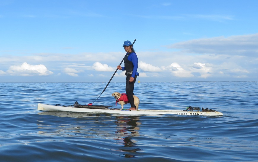
Eventually, the gentle waves, open water, and bright sun started getting to Norma, who wasn't having fun. I think the problem was mostly that she wasn't wearing her hat. I gave her mine when we started paddling west. Here's our route. We paddled 7.8 miles. 
I was sad that Norma didn't enjoy this trip as much as me, though she did think Jack Creek Park and Horseshoe Point Creek were nice. I, however, had a great time. I was very pleased to have explored Horseshoe Point Creek. It is one of those secrets that keeps exploring fun. |
|
After work, I launched from Green Haven Wharf. I got in 11.3 miles on Stoney Creek, Nabbs Creek, and Black Cove.
I saw a few great blue herons. I don't have many good pictures of them in flight. That is something I need to work on. I used to think my camera wasn't good at that but I think it is more of a user problem. 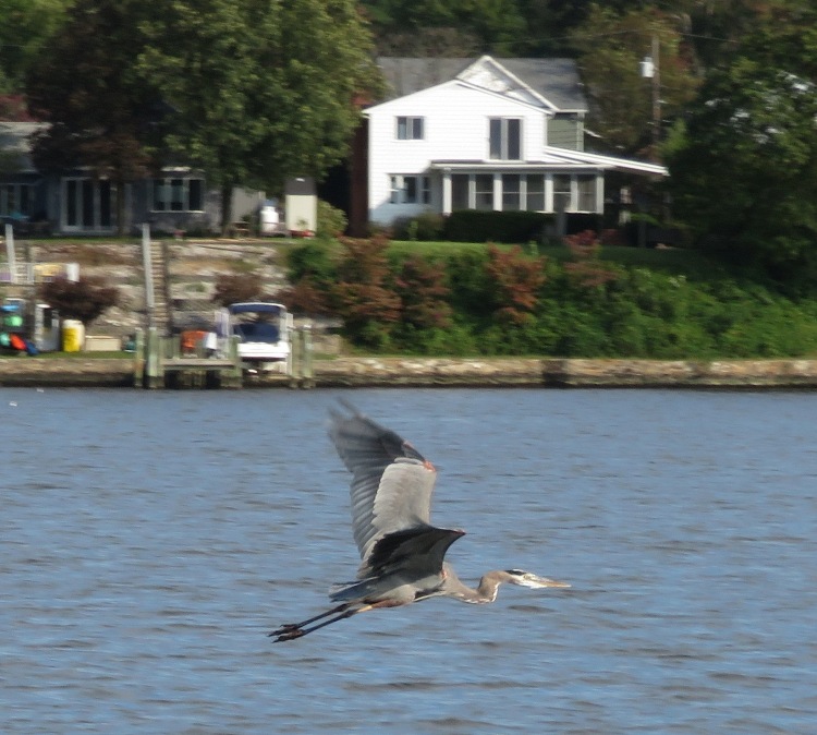
On Nabbs Creek, I saw several half-sunken boats at a place I call Nabbs Creek Ship Graveyard. Actually, the place is called Hand Brothers Marina, Inc. And yes, I know these are not technically ships. Also, they probably have no historic value. 1 / 5
Needs work.
2 / 5
Becoming submarines.
3 / 5
Lowrider.
4 / 5
A fixer-upper.
5 / 5
Open port.
On Stoney Creek, I saw seven black-crowned night herons which is the most I'd ever seen in one day. Unfortunately, by the time I started seeing them, the clouds rolled in and it was too dark to get a good picture. For the first time, I saw a boat with a Biden flag. If a power boat has a political flag, it is almost always pro-Trump. I rounded Black Rocks at the mouth of Stoney Creek before heading back. It ended up raining during the last hour of my trip. It was good Daphne wasn't along...she would have gotten cold. Here is my route. 
|
|
Daphne and I launched from Bryantown Public Landing. This was the first time I launched from here. It is a good location but it isn't very kayak/SUP friendly. We had to climb down about three feet to launch from a muddy shore.
My goal was to explore the tributaries and get as far upstream as possible on the Wye River. But I spent too much time with the tributaries and ran out of daylight. But that's o.k. It was a lovely time to be out on the water. There were lots of jellyfish out, including several washed up on the shore. 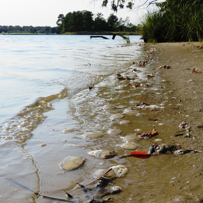
We also saw two bald eagles and a muskrat. A big wasp nest hung from a tree, just a couple feet above the water. 
I met someone from Kula SUP who was staying at an AirBnB just off the northwesternmost creek that I explored. We spoke about local paddleboarding. Daphne and I did a thorough exploration of the creeks on the west side of the river, putting in a total of 12.2 miles. It was high tide when we returned so the area where we launched was underwater. But the water rose enough so it was easy to land at the pier. Here is our route. 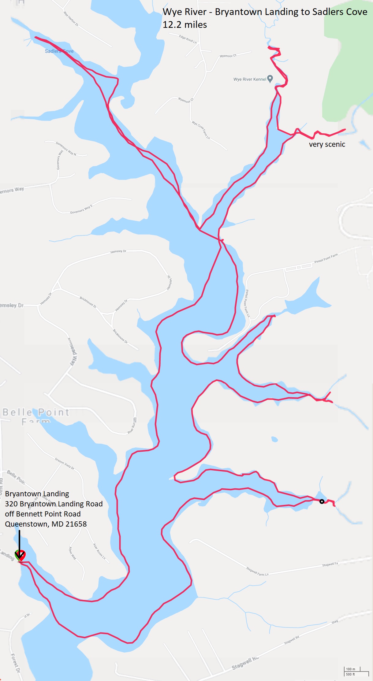
|
|
On October 4, 2020, Daphne and I explored the Wye River. I wanted to get as far upstream as possible but I ran out of daylight. So today, I returned to finish what I started.
We launched from Bryantown Public Landing. This was at least the sixth time I put in from a Queen Anne's County site. These locations require a permit. I had an annual permit, which I don't purchase very often. But since I had it, I wanted to get my money's worth. I feel I had. Daphne did not enjoy the first part of our trip. There was a lot of gunfire coming from Pintail Point Sporting Clay School which had her spooked. She put her front legs on me, positioning herself vertically. This meant she wanted me to hold her. Then she tried to get as far forward on the SUP as she could, and ended up falling in the water. It is extremely rare for her to fall in. She was cold. I took off her PFD and shook as much water off her as I could. Eventually, she warmed up and we got far enough away so the sound didn't bother her. I saw a three bald eagles, including this very cooperative one. 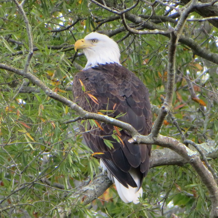
Paddling upstream is not as easy to navigate as one might expect. Sometimes the tributaries that flow into the Wye are as wide as the Wye itself. So having a GPS is helpful. As expected, things got more scenic as it got narrow. Some parts were shallow so it was good we were there near high tide. Eventually, we paddled under Highway 50, aka Ocean Gateway. Head west on 50 and you'll end up in Sacramento. I found some stalagtites growing from the concrete. 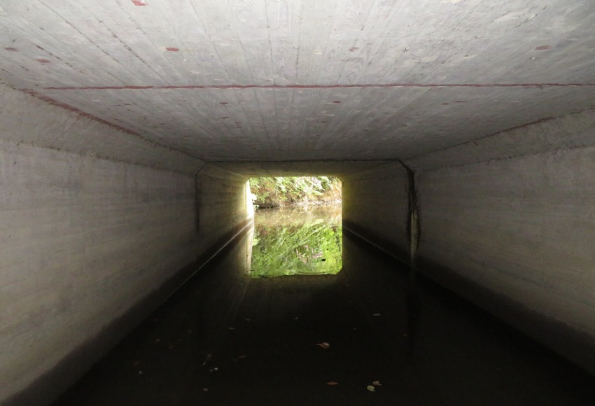
We made it a quarter of a mile upstream of the highway. We discovered this little peninsula just north of Highway 50 where we stopped for a snack. 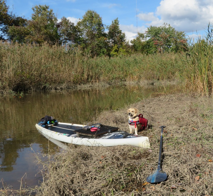
I spotted an interesting gall. Most of the holes on it looked nearly perfect. 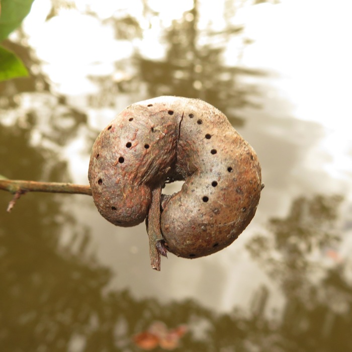
Here's Daphne and me on the move. Oftentimes, when I take such a selfie, she wants to walk to the back of the SUP. I pull my feet together to close off the tunnel so she can't. 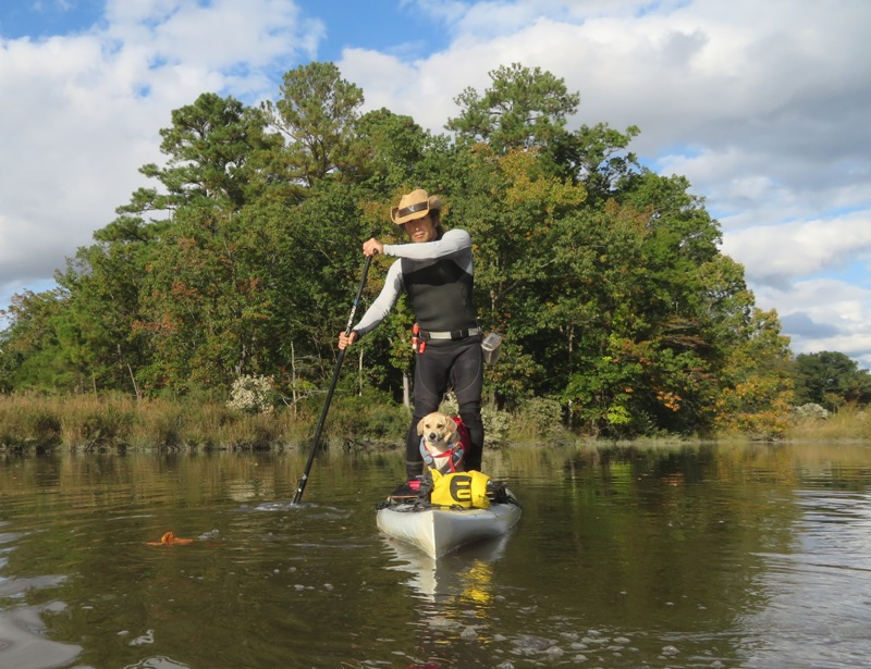
I saw this great blue heron as the sun got low in the sky. 
There were no ospreys to be seen. They've already headed south for the winter. On the return trip, which was late in the afternoon, all was quiet. We got in 13 miles and accomplished the mission. Here is our route. 
Kayak/SUP season for me is coming to a close. That makes me sad but I am pleased to once again say that I got in as much paddling as I wanted. I don't know many serious non-retired kayakers or paddleboarders that can honestly say that. |
|
Typically, when I visit the Curtis Bay shipwrecks, I approach them from downstream. But that usually means I don't see the most upstream wrecks, especially the ones east of Sledds Point. Today, I decided to launch from Fort Armistead so I could start upstream.
Joining me were Sara and Daphne. We paddled northwest to Curtis Bay, timing our visit with the low tide. To learn about the history of these wrecks, read Paddling the Curtis Creek Ship Graveyard. It started out with some eight mph wind from the south that made things a little choppy. But I knew once we got past Hawkins Point Shoal, we would be protected. Then, the wind would die down a little later, making things calm. The sky was overcast but set to clear up later, so we did more paddling at the beginning and more photography later. But we did pull ashore at Thoms Cove to do some exploring and let Daphne run around. This was my first time exploring Thoms Cove. Nothing worth seeing there in the water. It was more interesting walking on the beach. 
I saw three persimmon trees on the southwest side of Leading Point. The bulk of the wrecks east of Sledds Point are near 39.216058, -76.558920, where Sara is kayaking below. I think if this place as "Little Mallows Bay" because they look so similar. 
Sara recently purchased a new camera. Unlike my compact point-and-shoot, hers is a more bulky "real" camera that takes much better shots. In the below photo which she took, I am standing on the spindle-thing (not sure what it is called) that holds the ship's propeller in place. So I reckon this propeller is at least 12 feet in diameter. I don't ever recall seeing any propellers at Mallows Bay. I suspect the metal would have been salvaged. 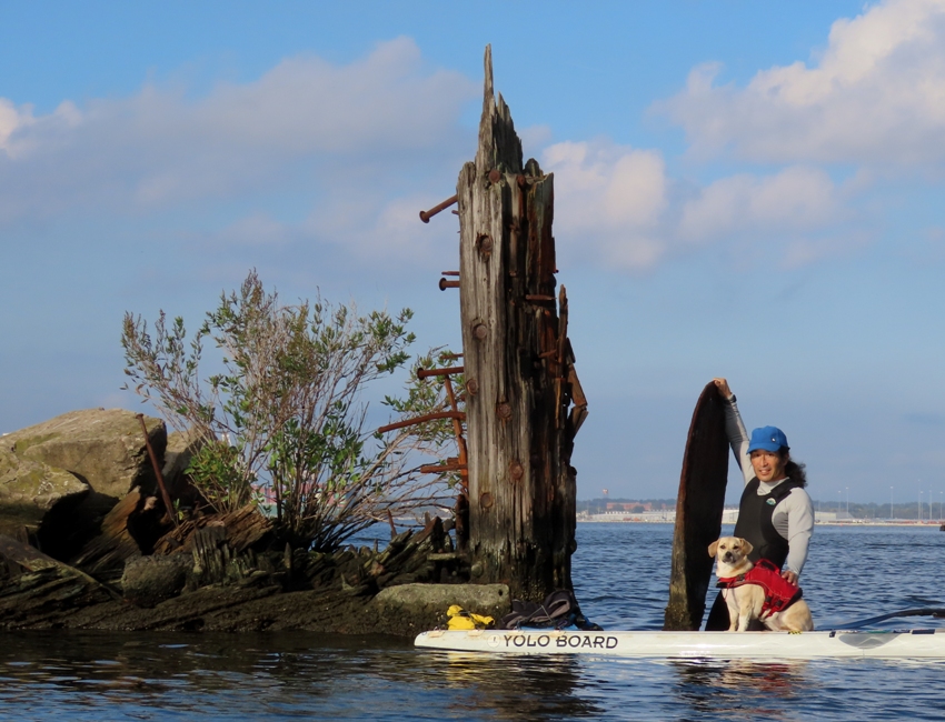
Next, we paddled out to 39.215859, -76.567031. Slightly closer to shore we took more pics. Here's Sara with a clear outline of the ship. Also notice the two pipes sticking up vertically. Not sure what they are. Perhaps smokestacks? 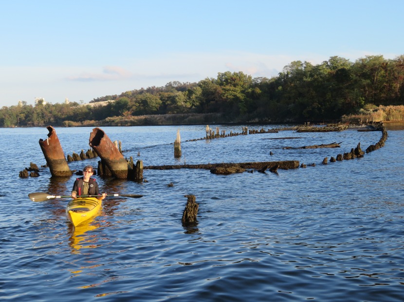
Sara's camera did a great job capturing this shot of Daphne and me with a wreck and the Francis Scott Key Bridge behind. I developed a special appreciation for this photo on March 26, 2024 when the bridge fell. 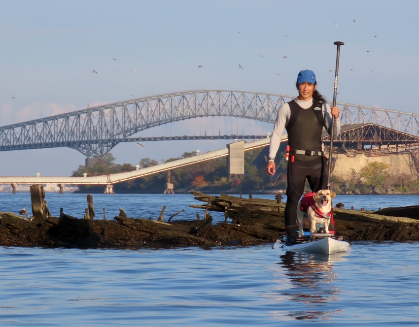
A lot of ship hardware remains in place on some of these wrecks. 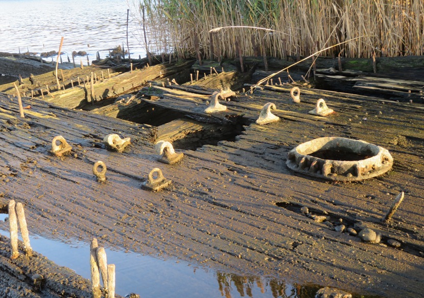
I caught a large comb jelly (sea walnut) with Daphne's water bowl. It is not easy to get a good picture of these things. A clear container would have been better. 
It was my first time seeing this wreck at 39.211778, -76.538667 in some unnamed cove. 
On it, there are two propellors. One is sticking out of the water quite a bit. Only the top of the other is visible. I'm guessing they are from the same boat but they don't seem to be in the right position for that. I would like to see a picture of what these boats used to look like in their prime. I imagine they resembled the ones shown at U.S. Department of Transportation Maritime Administration - The Ships of Mallows Bay but unfortunately, the low quality shots on that site do not show the aft portion of these boats out of the water. Here's Sara and me with the shipwreck in the previous photo and the Key Bridge behind. Here's a solo shot of Francis. 
The three of us ended up getting in 7.75 miles. This is our route. 
There are few things I like more than exploring shipwrecks. But I wouldn't recommend it for beginners or anyone with an inflatable craft. Paddleboarders need to be particularly skilled. There are a lot of sharp, rusty objects both above and below the water. They could wreak havoc to a boat or a person. So make sure you are one with your boat before venturing out to see shipwrecks like these. |
|
To say I'm a loner and an introvert is an understatement. But once in a blue moon, I get out and paddle with an organized group. Norma, Daphne and I did so with the WatersEdge Kayak Club. This was largely because Norma was feeling stressed about not socializing enough during the pandemic.
There are a few people in this meetup group that I know. On this trip, I knew Suzanne. Then there was the leader, Dr. Greg P. who I had never met face-to-face but we knew about each other through reputation. It was good to finally meet him. Some others in the group knew about me via my website. Google pulls it up quite a bit when folks are looking for launch sites. There were 16 people on our trip plus Daphne. At first, Greg was a little skeptical about Norma paddling a sit-on-top but I assured him that the Cobra Expedition has dimensions like a sea kayak and is quite fast. He knew about my paddling skills but others were a little uncertain about me being on a SUP. Norma and I were the only ones without sea kayaks. Soon, everyone's doubts would be put to rest. We launched from Flying Point Park at 0950. Mask protocol was in place to help minimize exposure to Coronavirus. Nearby, a great blue heron posed for me. 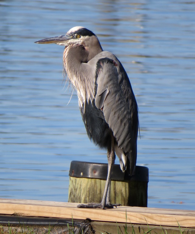
The air temperature was 63 degrees and it was extremely sunny. After introductions, we started paddling. In the trip description, Greg mentioned We'll paddle 8-12 miles, exploring this creek system and the water trail. so I was a little surprised that we started by paddling downstream...away from the designated water trail. I figured he was having us start in that direction while the wind was calmest (one mph) and would soon have us head back upstream to the trail, riding the flood tide which would peak around 1332. That was not the case. We made our way to the mouth of Otter Creek and then into Bush River where we paddled against the tide. We passed Willoughby Beach Launching Ramp. 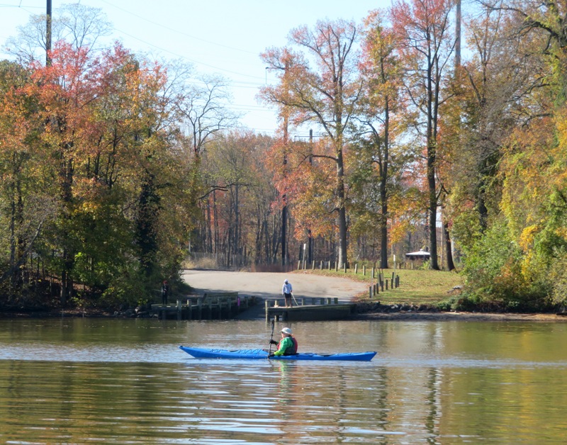
Next, we paddled under the train bridge. 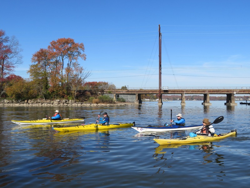
The autumn colors were fantastic, for this area. Norma hasn't done much group paddling. When we go out, I tend to tailor trips to accommodate her. But I felt she could handle this trip, though she might find it challenging. She did fine and followed my cardinal rules for group kayaking: 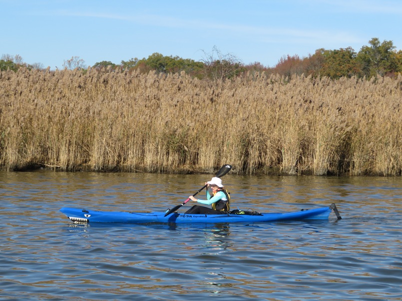
We saw a few bald eagles and a kingfisher. After a long stretch of nearly continuous paddling, we pulled into and explored Kings Creek. There, I saw the only non-bird wildlife, a turtle. 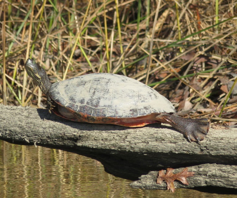
I suppose since folks knew Kings Creek was an up and back, the group started to spread out, with some people taking a break, though we still hadn't actually pulled ashore anywhere yet. Norma took a picture of Daphne and me. 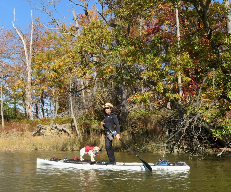
I spoke to several people in our group: Gail, Paul, Ray, Sophie, and Serge. Serge is an ultra-marathoner and his fitness really shows once he gets moving in a kayak, though it is really a combination of that and good technique. 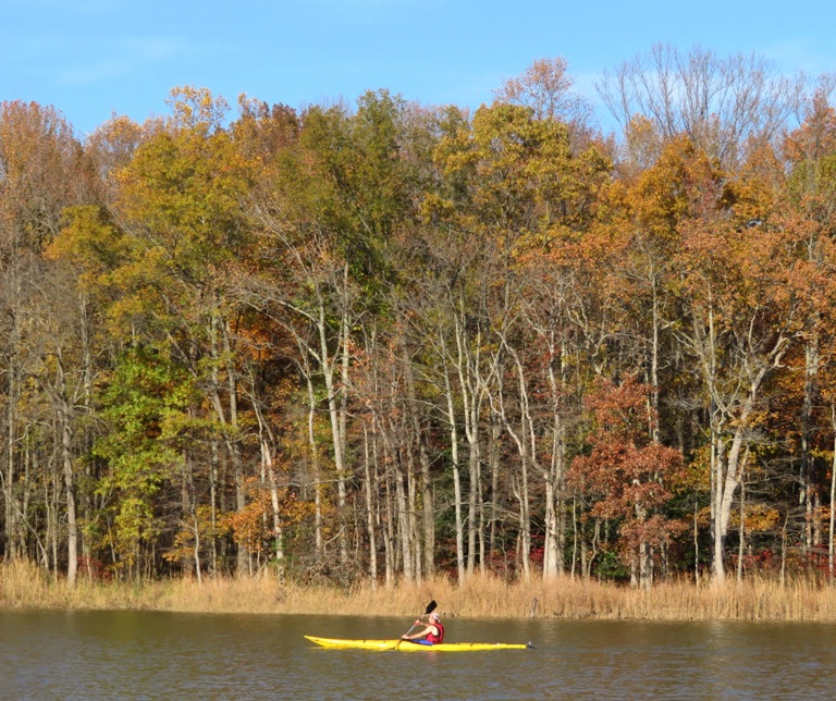
Heading back upstream on the Bush River, we pulled into Lauderick Creek. There were some nice beaches where it would have been good to stop for lunch except for the fact that everywhere we were paddling was part of Aberdeen Proving Ground and there were signs warning of unexploded munitions. But eventually we came to a safe area where we could pull ashore, Skipper's Point Campground. There was a boat ramp, porta-john, and picnic tables here. Not sure if it was open to the public but nobody complained. We saw only about two other people there who weren't part of our group. I think we were all glad to be finally off the water for awhile. I know Daphne was. After resting up, we were back on the water. The air temperature warmed up to 68 degrees. 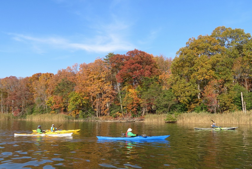
Greg, about four other men, and myself, explored a shallow tributary of Lauderick Creek. Others started heading back on their own. Norma was part of that group. By now, the tide had changed and we found ourselves working against the tide once again. But at least we had a little wind behind us...~five mph. We saw a novel contraption, Row on Air. A big, fit, military-looking fellow was on what appeared to be an inflatable SUP with a rowing apparatus attached. But what made this really unique is that the oars were hinged in a way that he could row and see where he was going...not where he had been. Despite the fact that he was on what looked like an inflatable SUP, he was moving really fast...at least surf ski pace. Those of us in Greg's group who had explored the muddy creek followed far behind, out of eyesight of the main group. By the time we finally caught up, folks were landing. It was a good trip but a little too much for Daphne. She stood up the whole time and by the end, she was shaking. When Norma and I paddle slowly in narrow creeks to see wildlife, Daphne will sit or lie down or at least take it easy but this was more open waterish so she never felt quite that relaxed. We paddled 14.5 miles. Norma probably did a little under 14, but still that was quite a bit, especially since the trip description said it would be 8-12 miles. She was sore but she kept up just fine and never complained. I know she prefers the small water trips that I put together, but we still enjoyed today's trip. Here is our route. 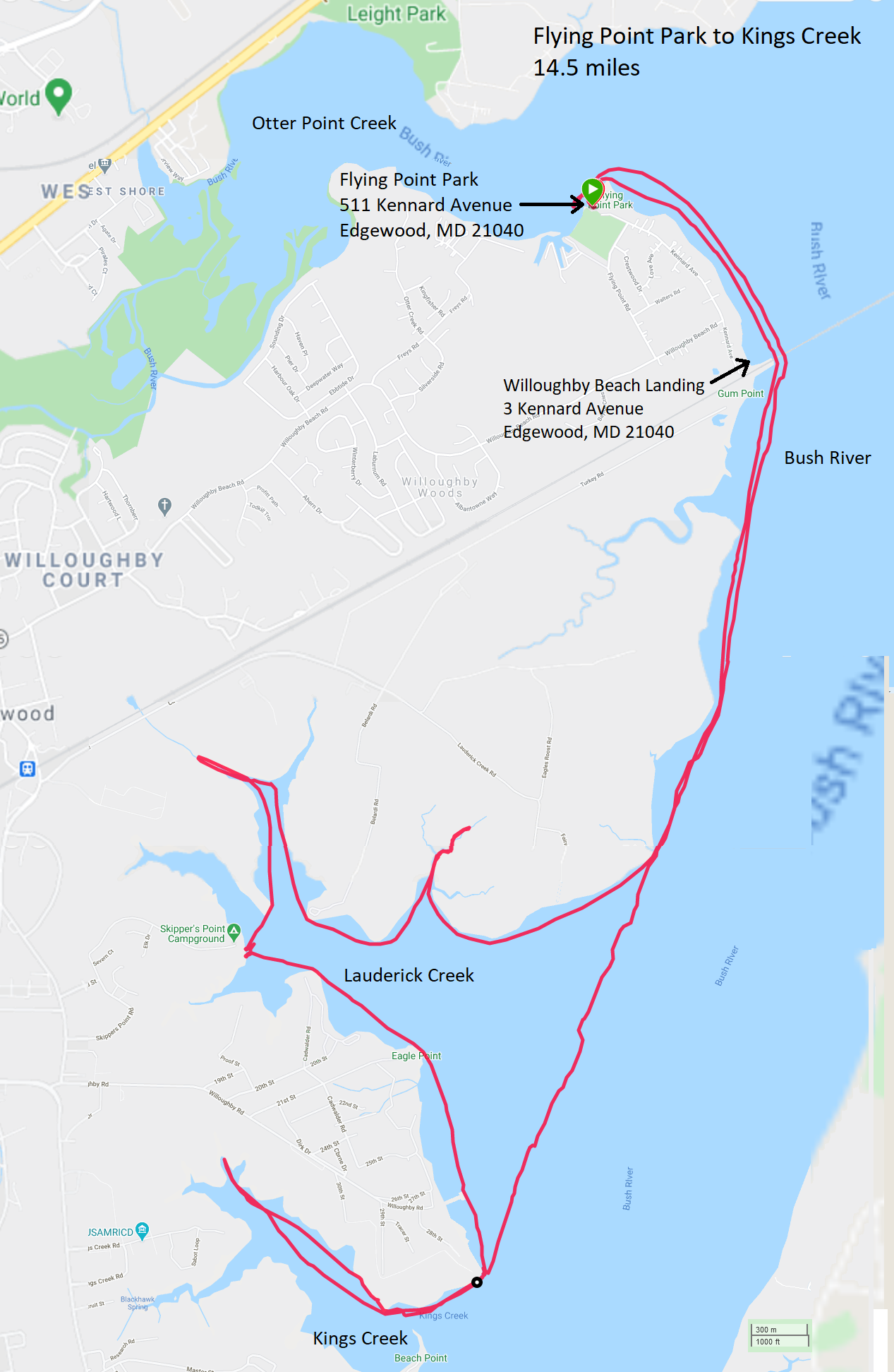
Afterward, a few of us met up for some outdoor dining at Bush Mill Tavern in Abingdon. It is near a busy road with lots of traffic noise. We all changed into dry clothes but I was definitely underdressed in terms of warmth. I wasn't expecting us to be out on the water for so long so by the time we started eating, it was getting dark and cold. It was good to get out and paddle with others. I'm sure I'll return to Flying Point Park next year and head the other direction. It will be interesting to see what that water trail holds for us small water explorers. For me, paddling season typically ends at the end of October. I decided to stretch it out a few more days to take advantage of the nice weather. This was the last trip of the season for me. |
|
These trips made my "to do" list.
The E.A. Vaughn Wildlife Management Area is located in southeastern Worcester County and features over 3,500 acres of habitat for plants and animals that are native to the Delmarva Peninsula. The E.A. Vaughn Kayak and Canoe Trail was developed in 2005 through a partnership between Delmarva Low Impact Tourism Experiences (DLITE), Maryland DNR, The Coastal Bays Program, and Worcester County. Three paddling routes which range in length from 3 to 6 miles can be accessed from either Taylor Landing or George Island Landing. - from Beach and Beyond - EA Vaughn Kayak & Canoe Trail (a broken link as of 2020) For more information, see Maryland DNR - E.A. Vaughn WMA and Kayaking Delmarva - E. A. Vaughn Wildlife Area. |

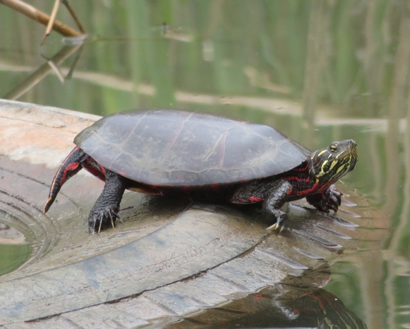
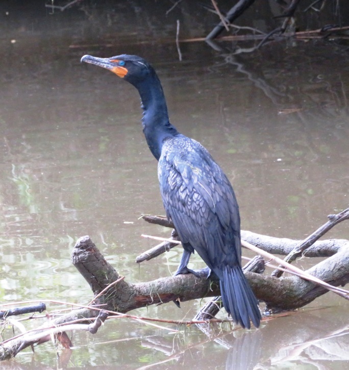
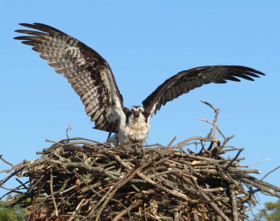
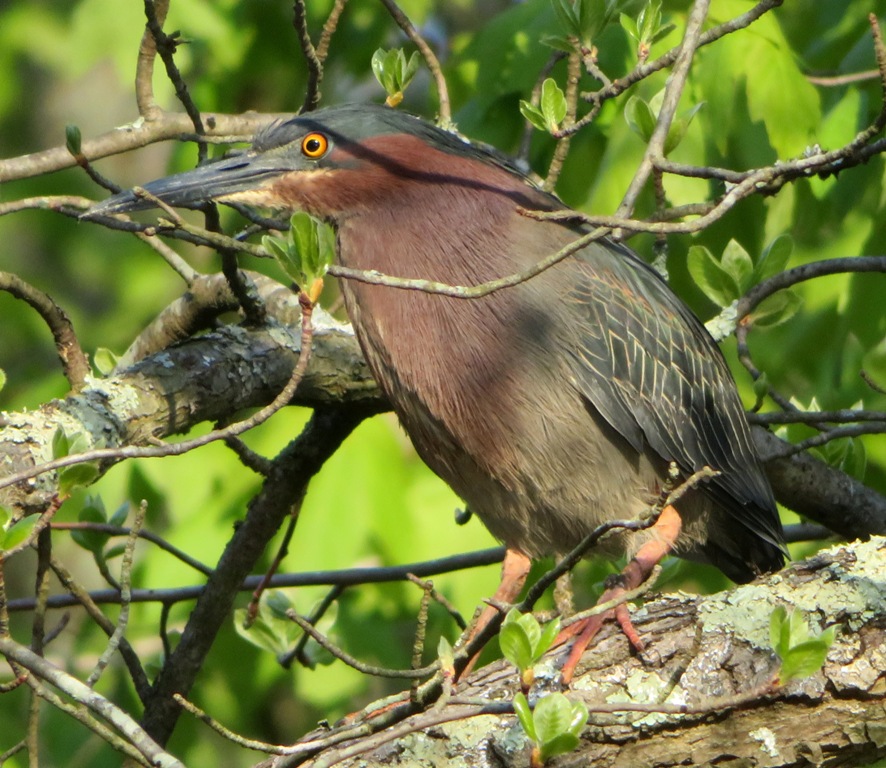
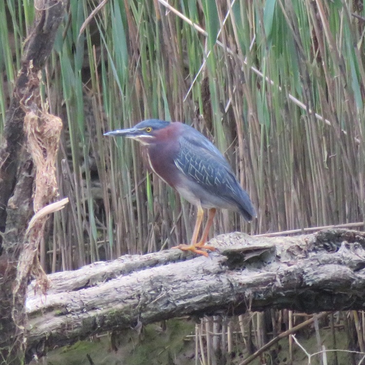
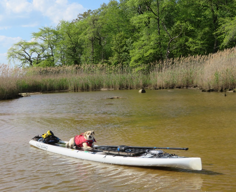
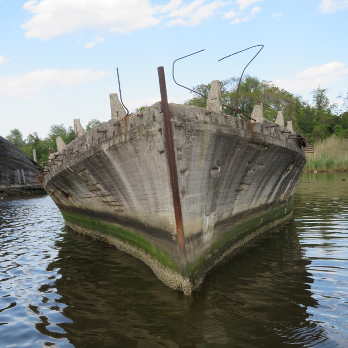
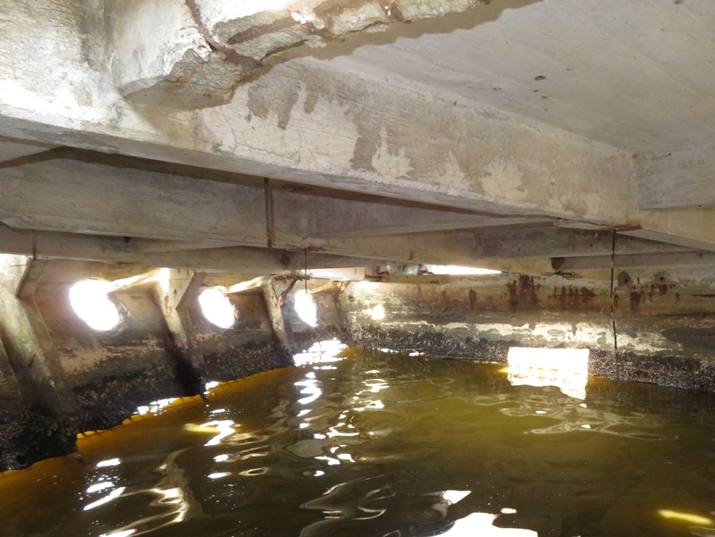
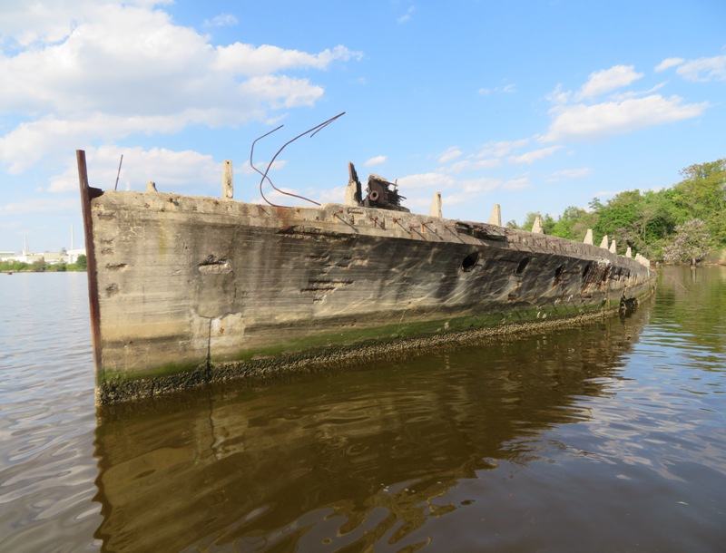
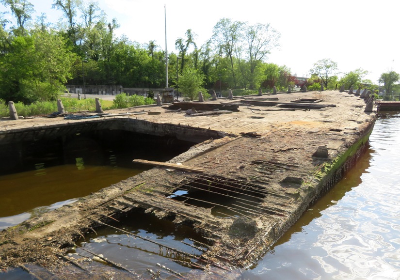
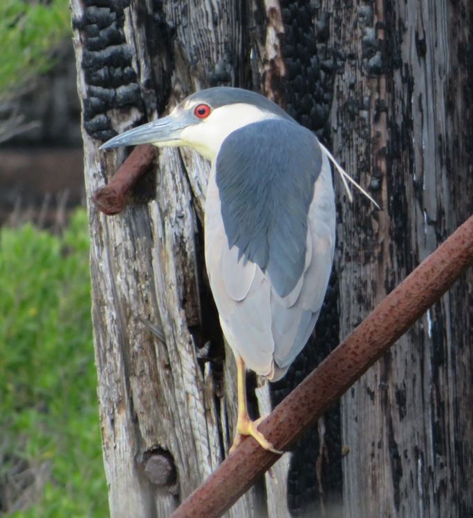
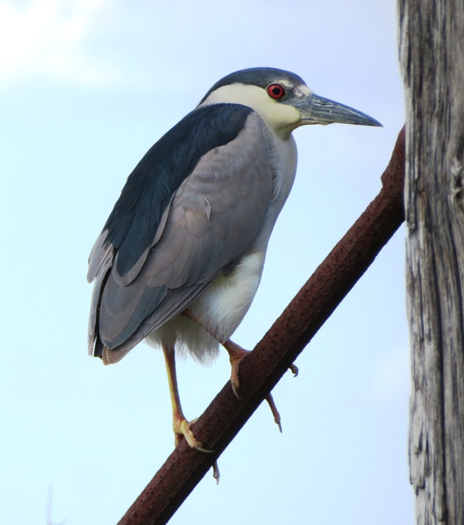
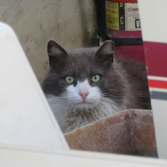
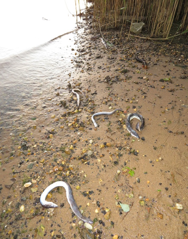
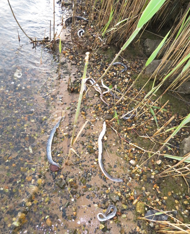
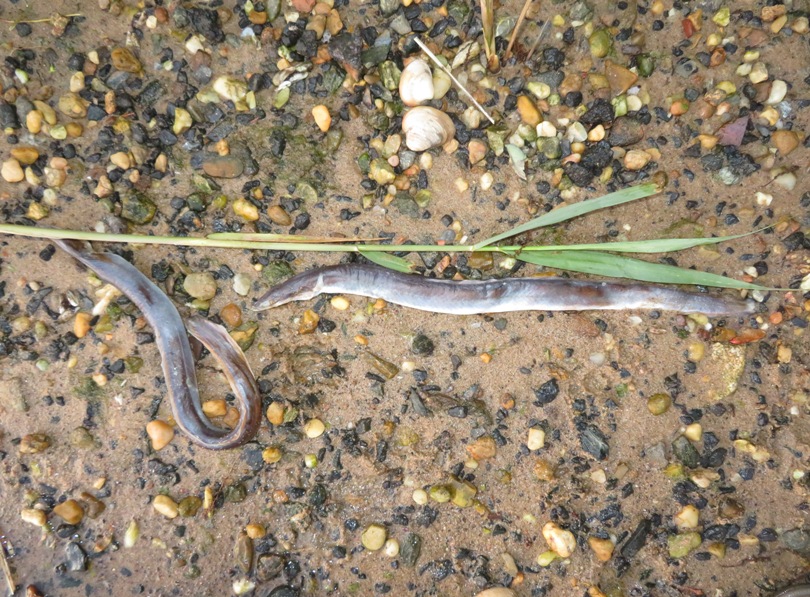
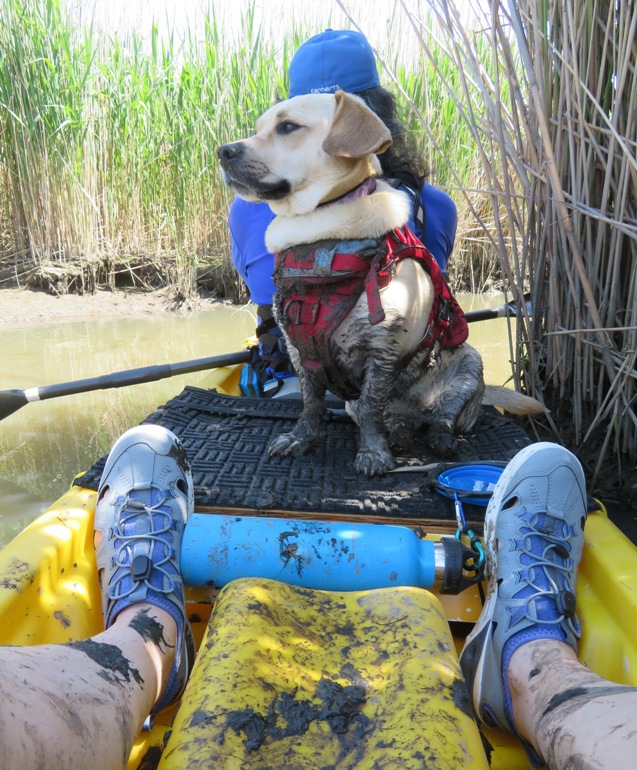
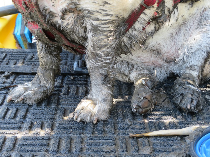
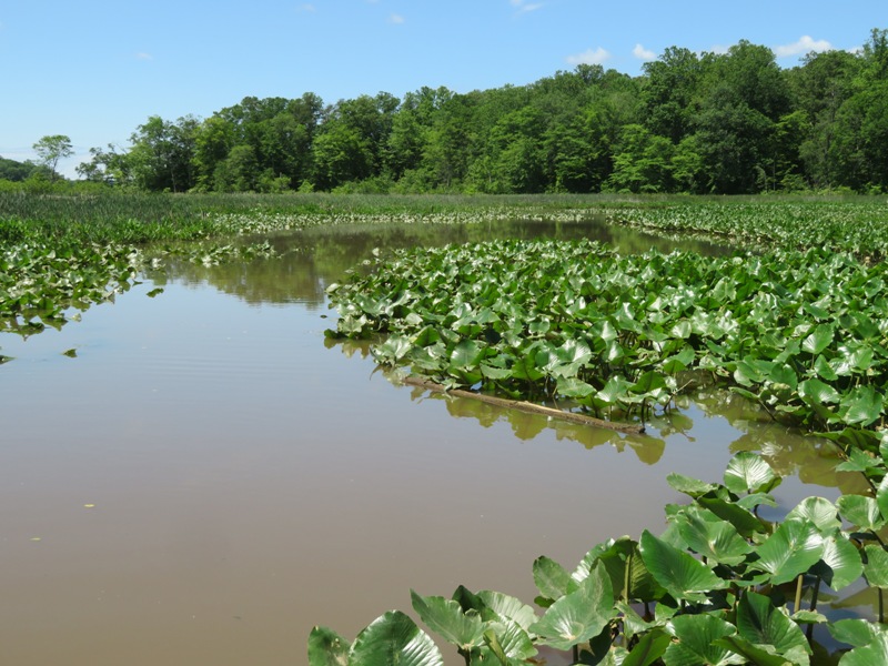
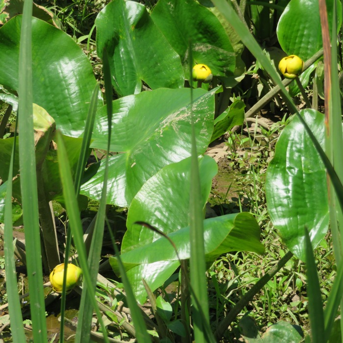
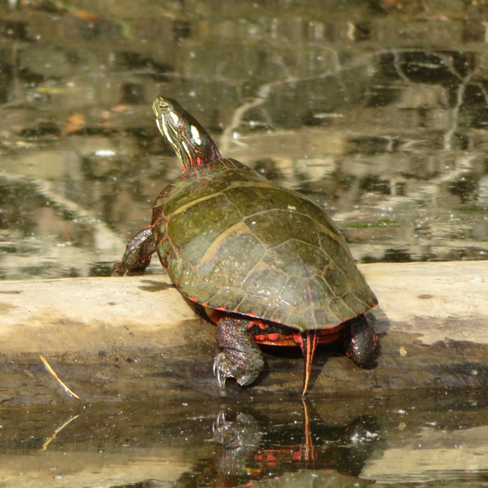
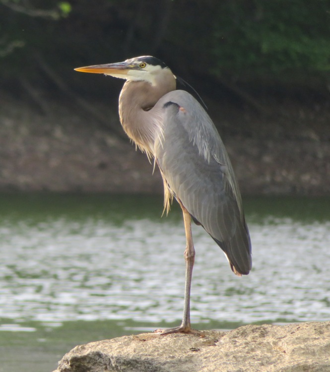
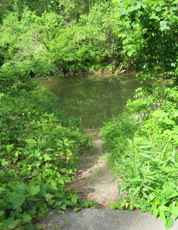
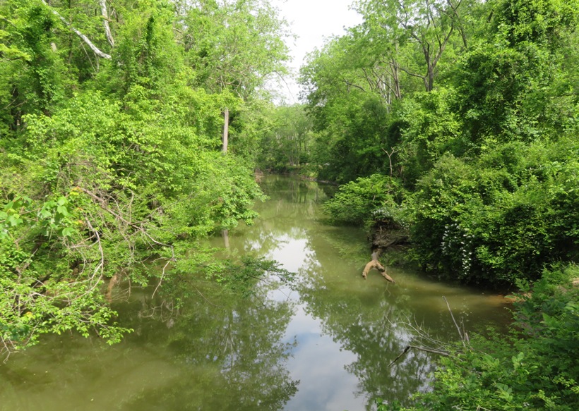
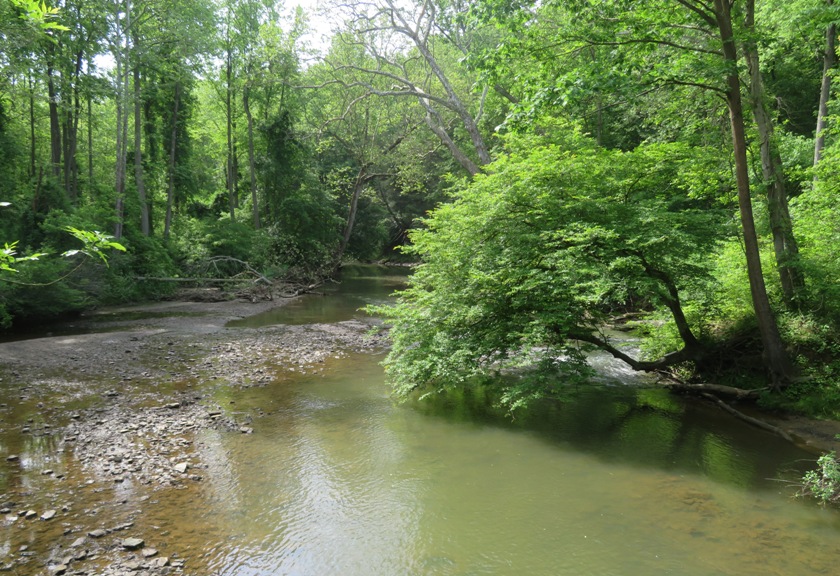
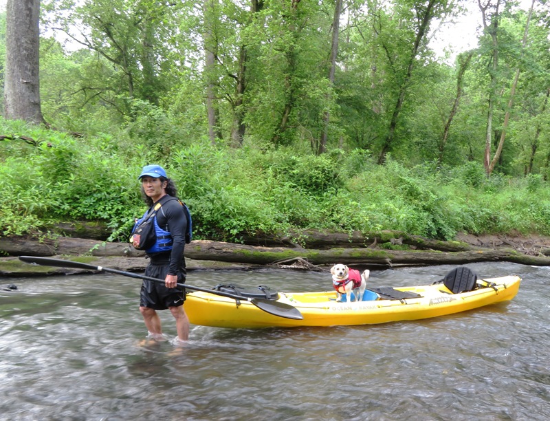

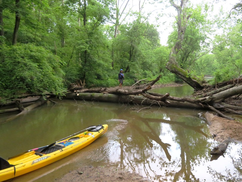
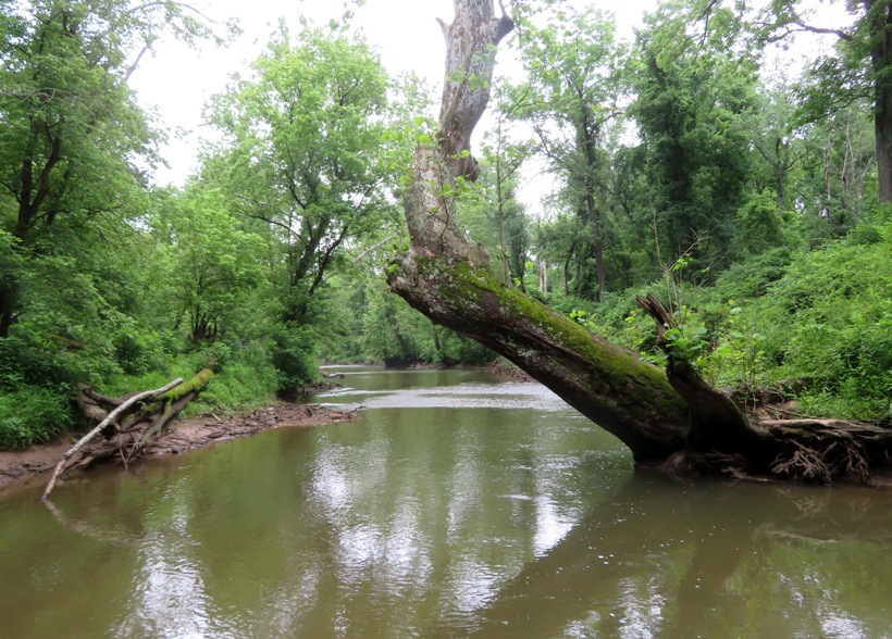
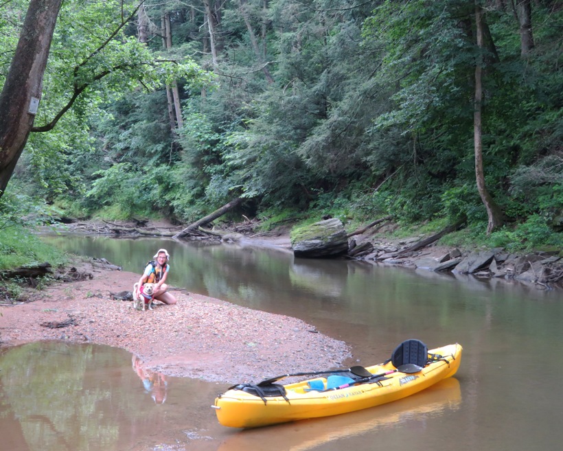
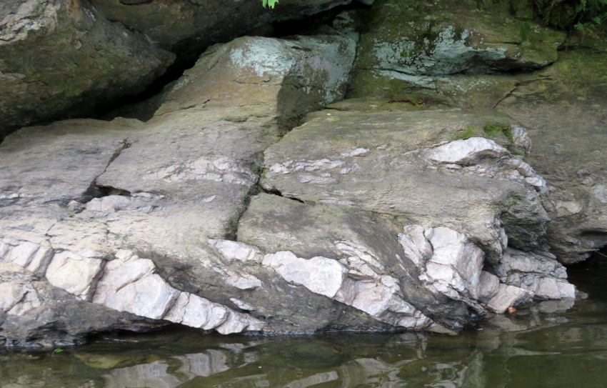
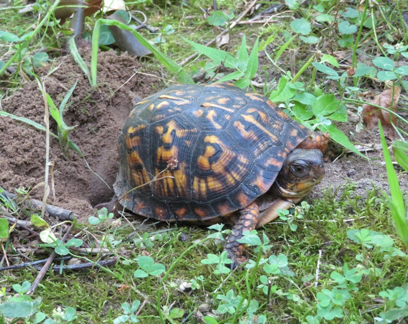
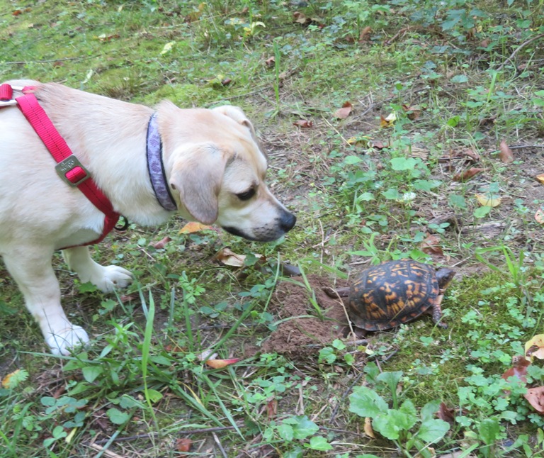
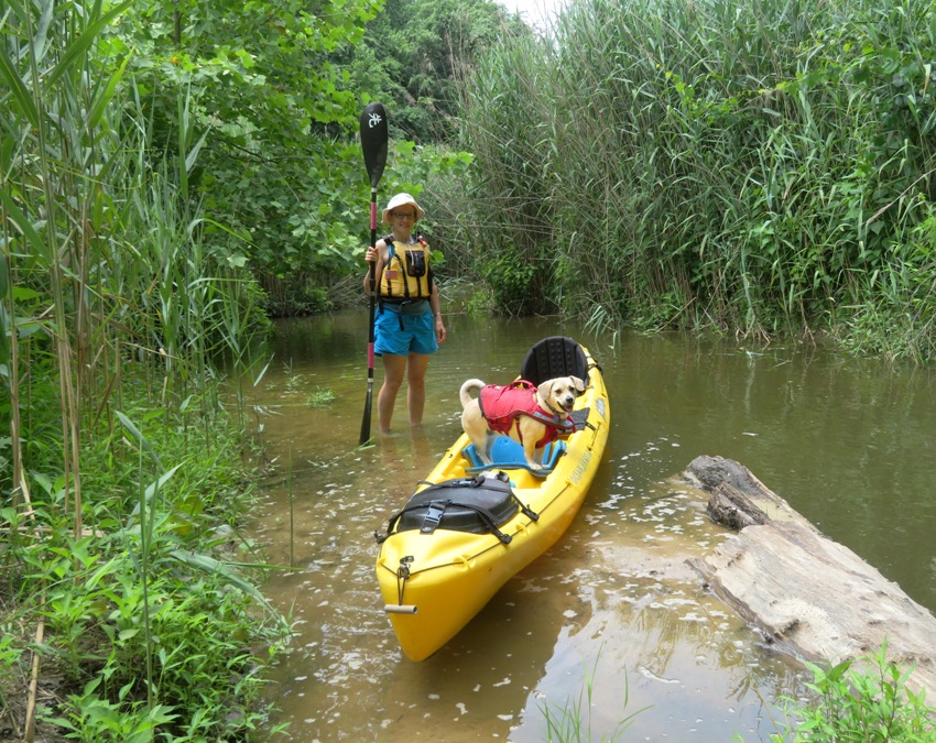
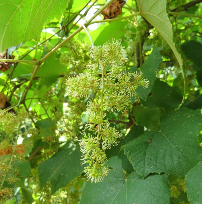
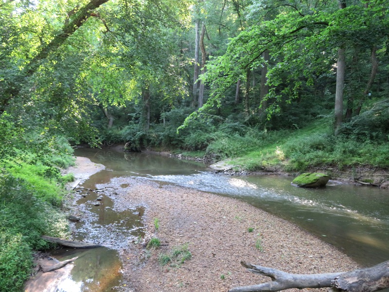
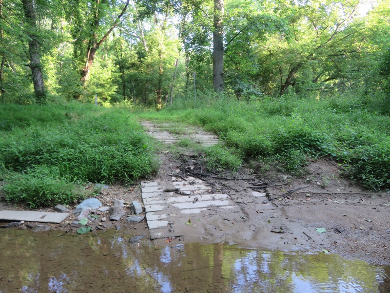
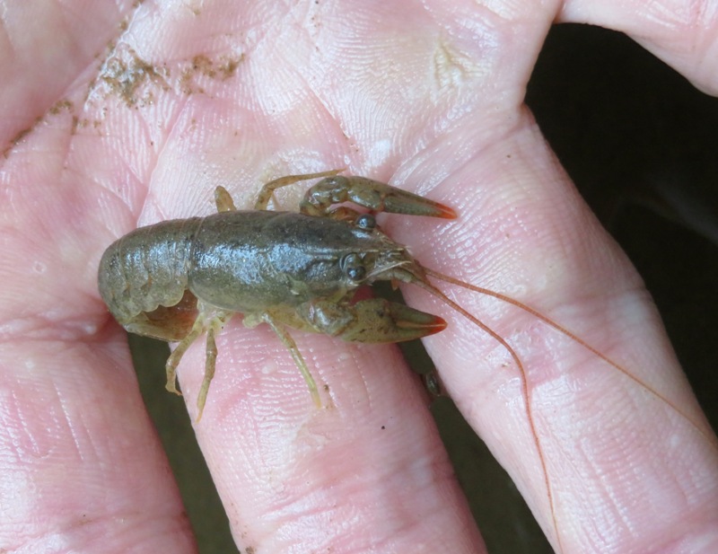
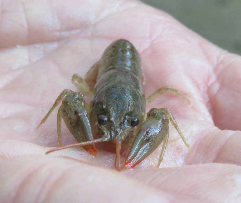
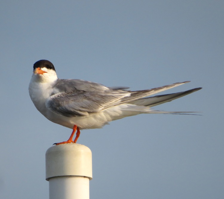

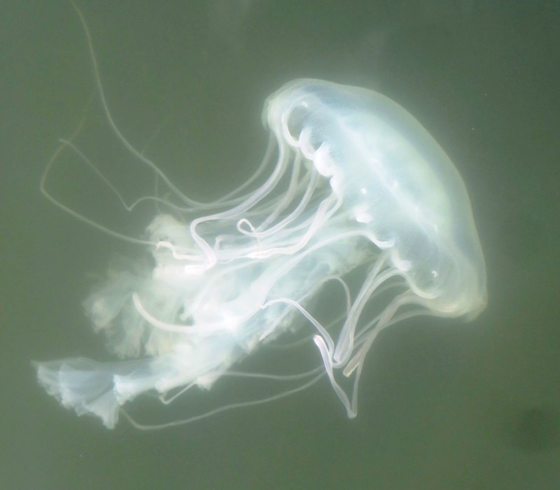
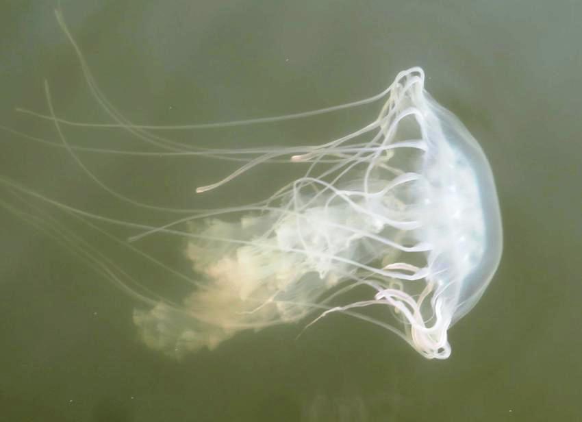

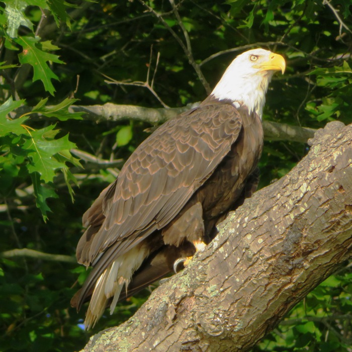
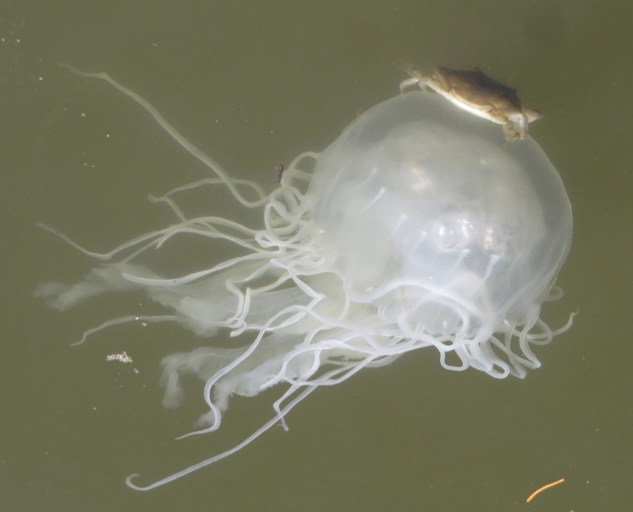
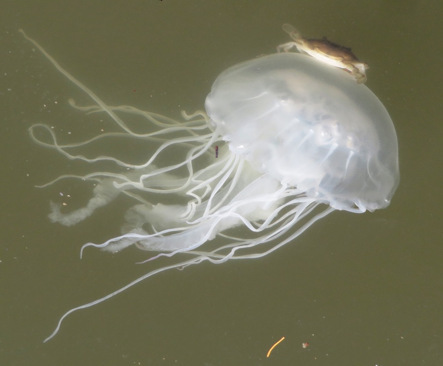
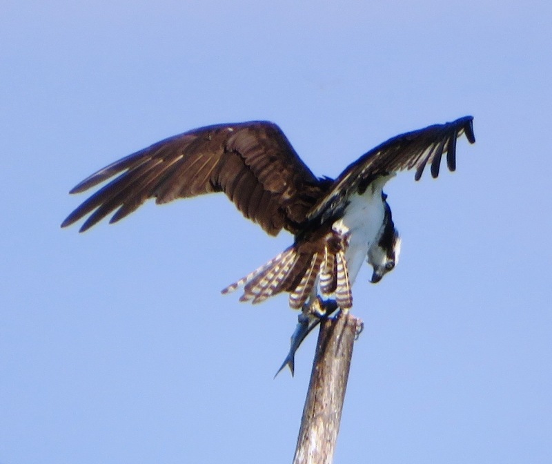
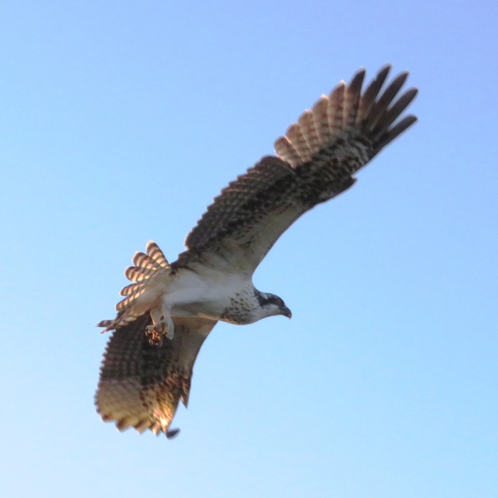
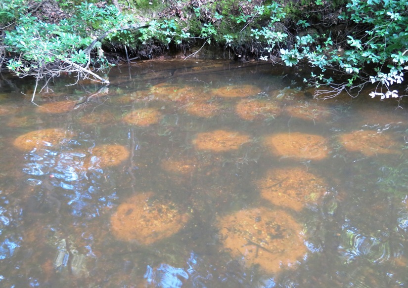
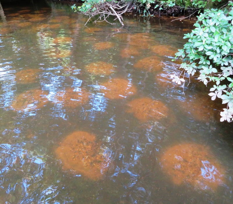
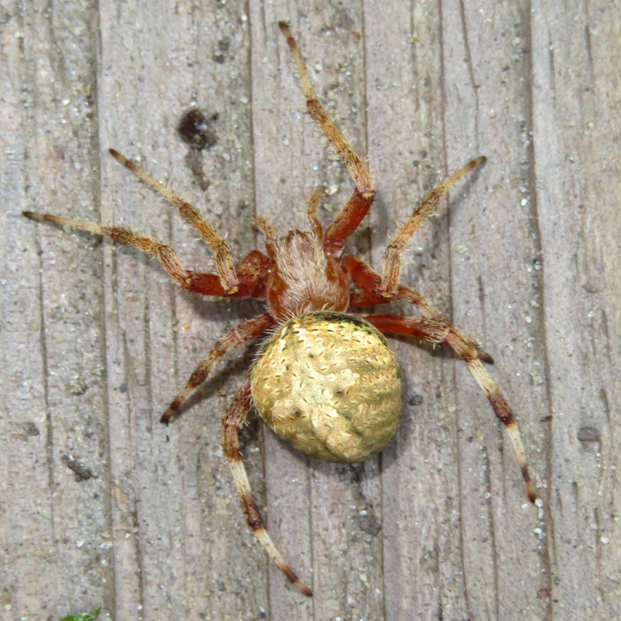

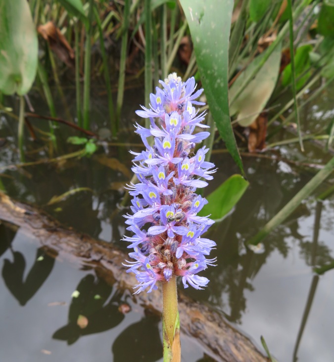
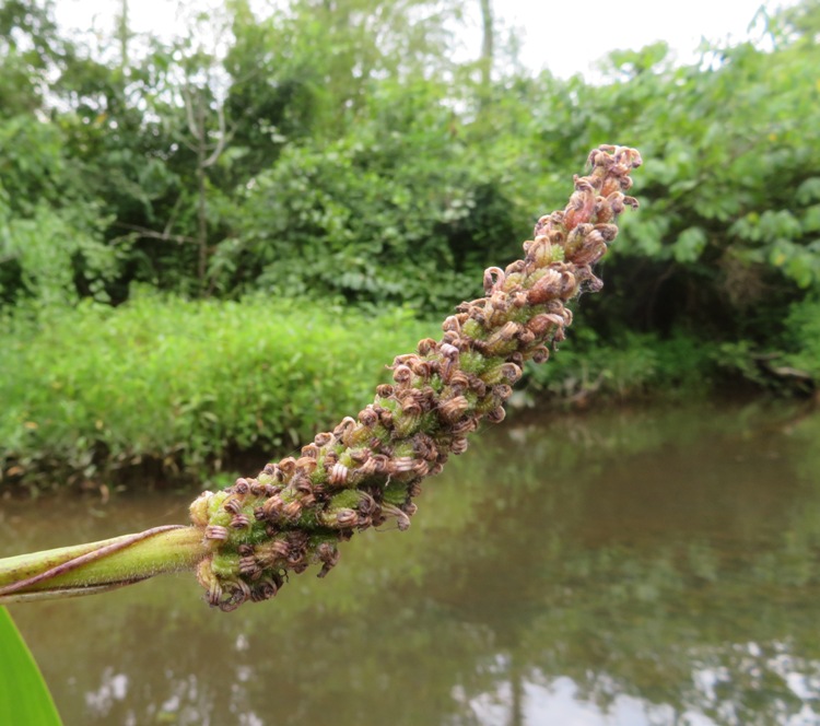
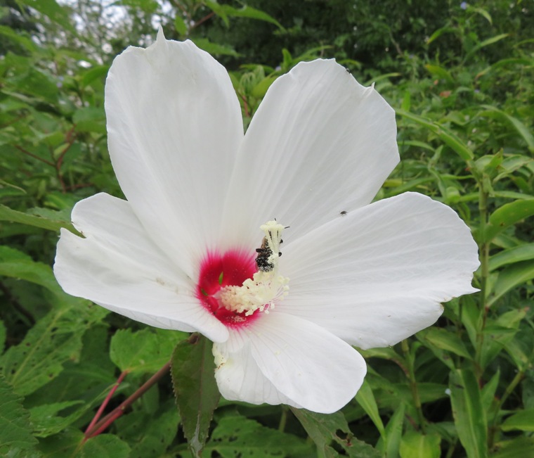
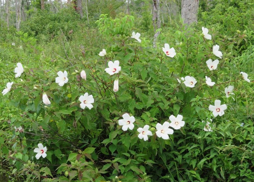
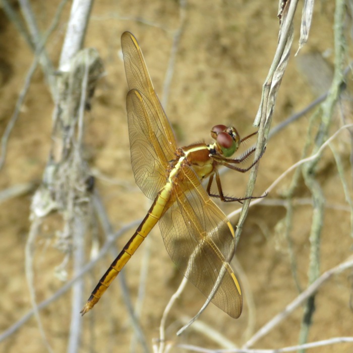
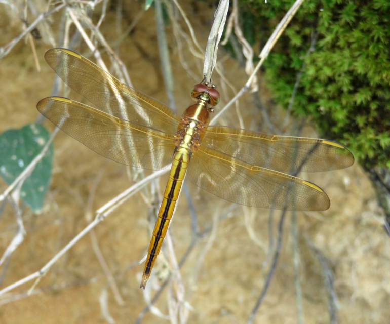
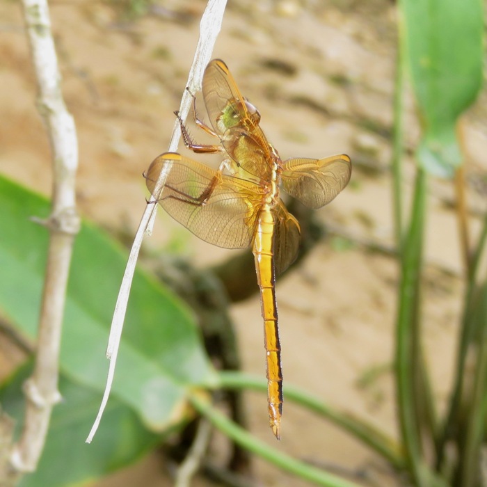

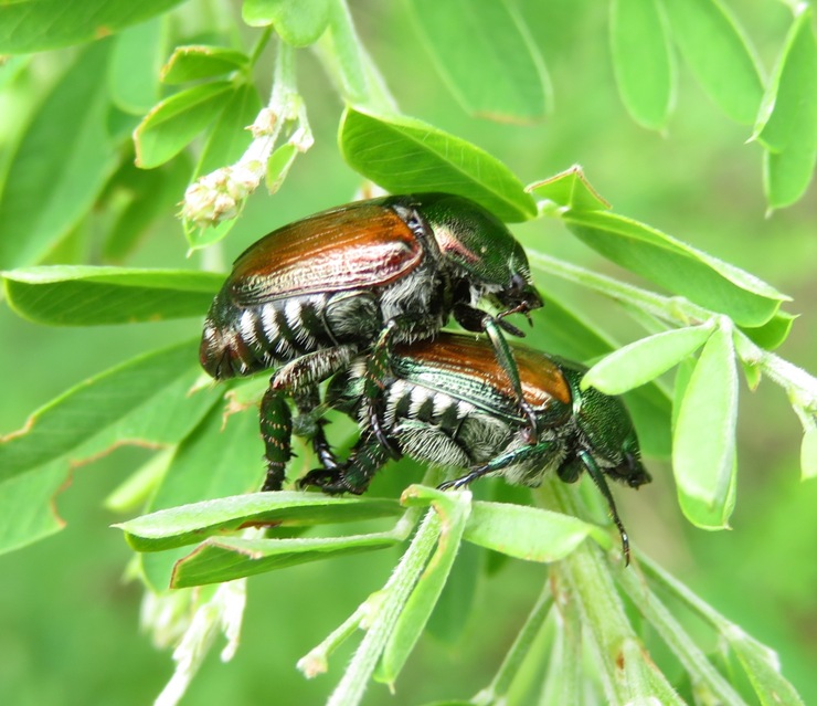
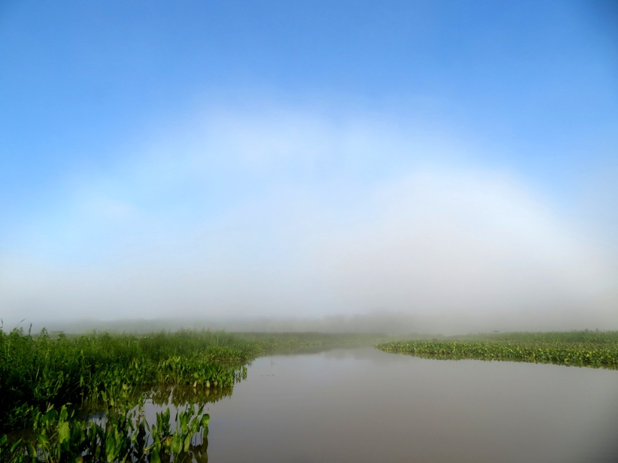
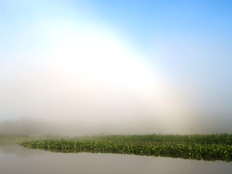
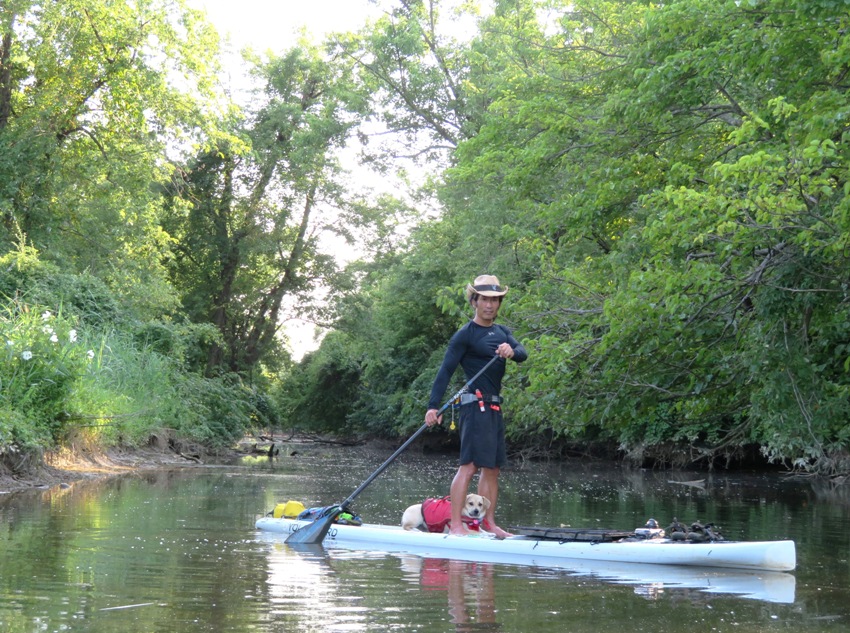
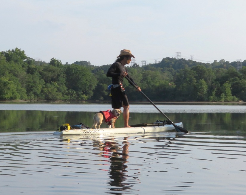
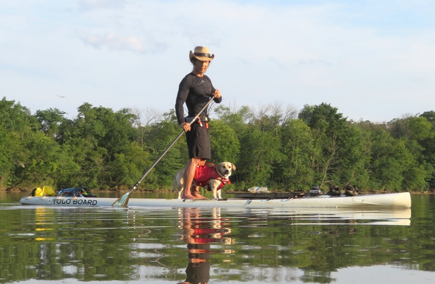
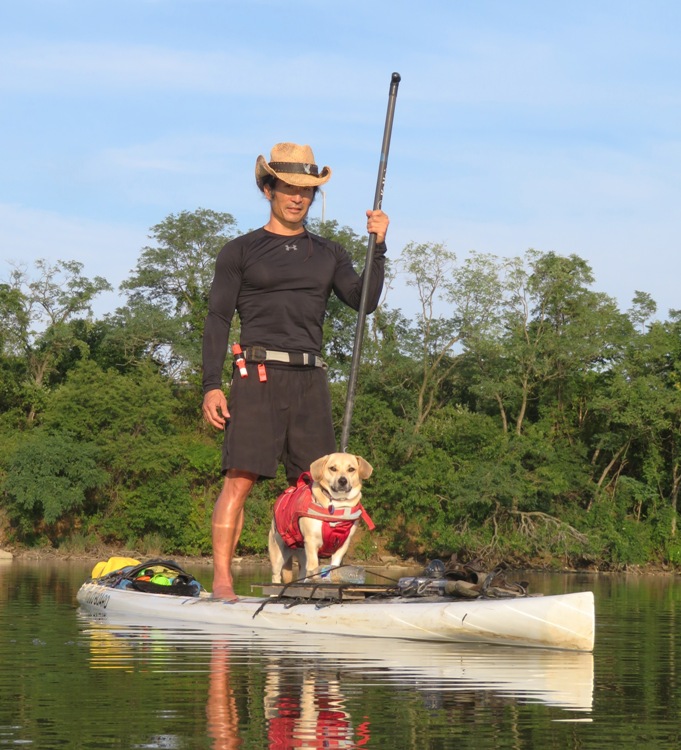
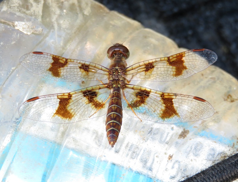

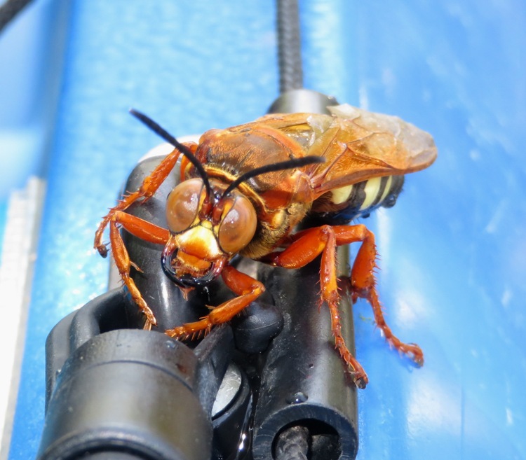
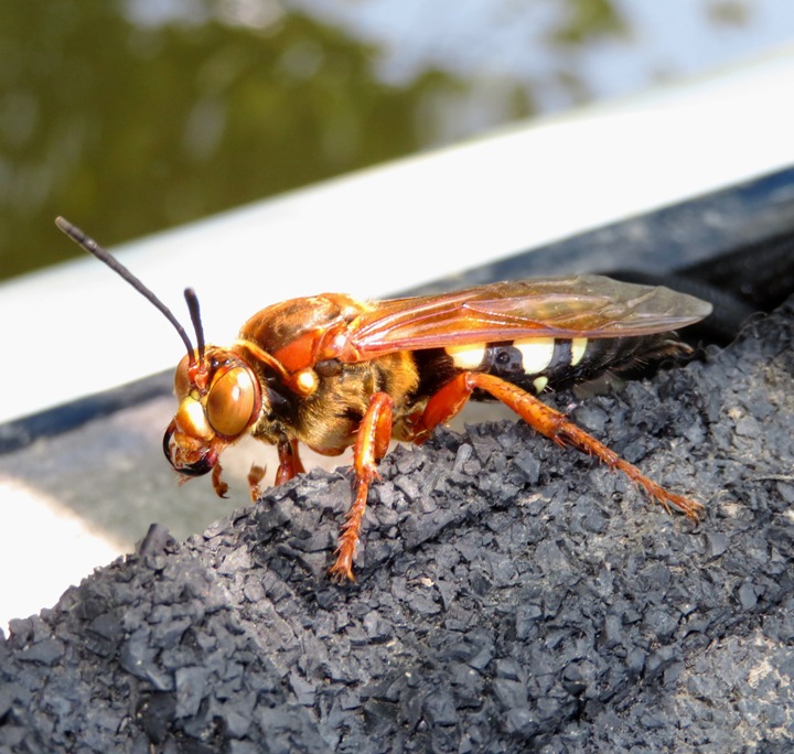
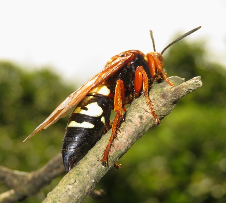

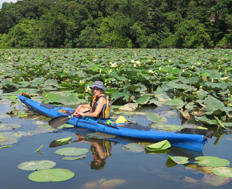
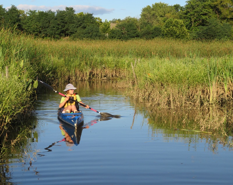
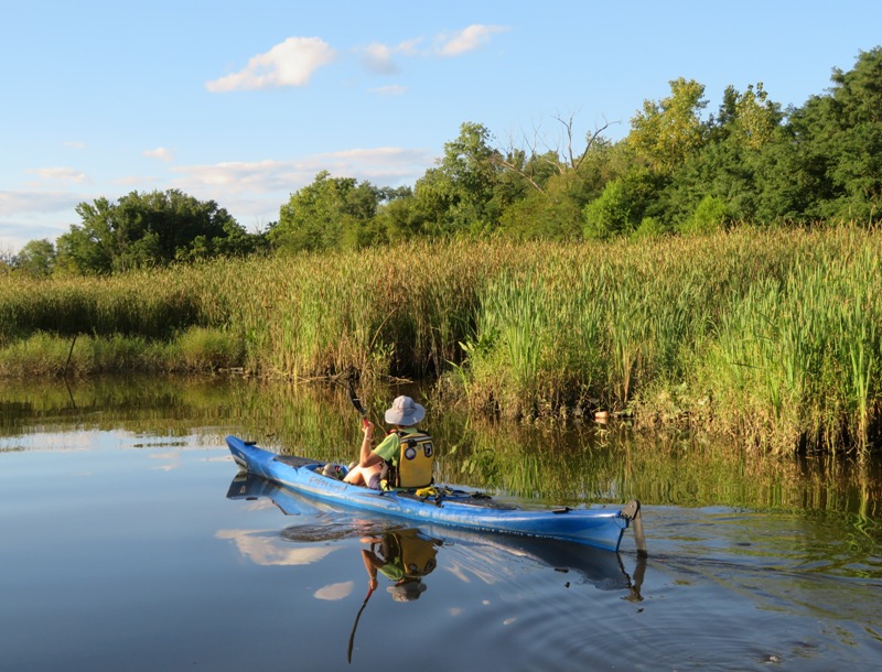
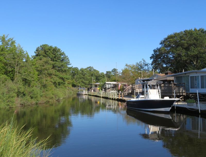
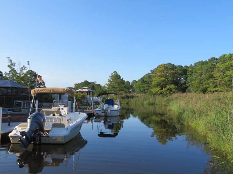
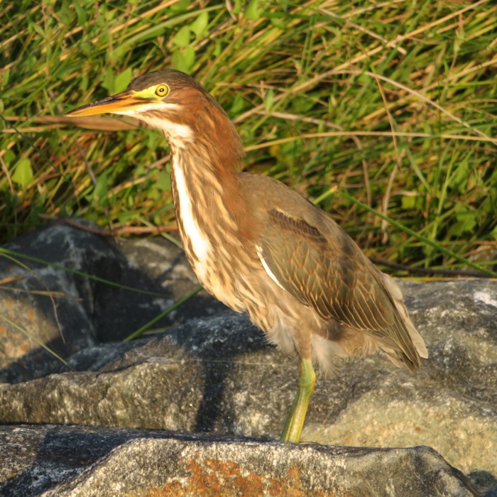
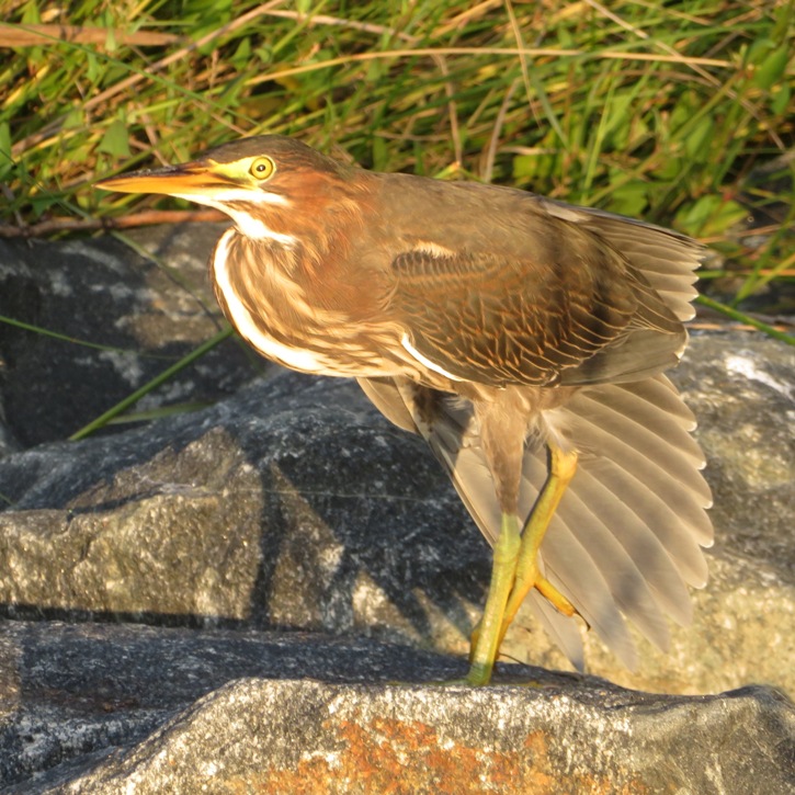
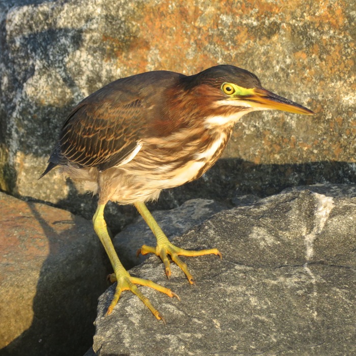
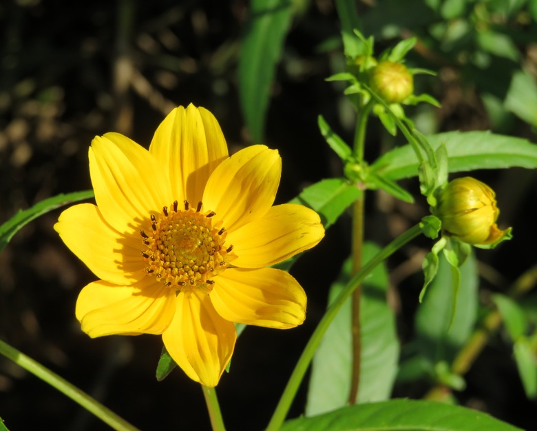
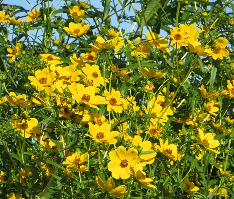
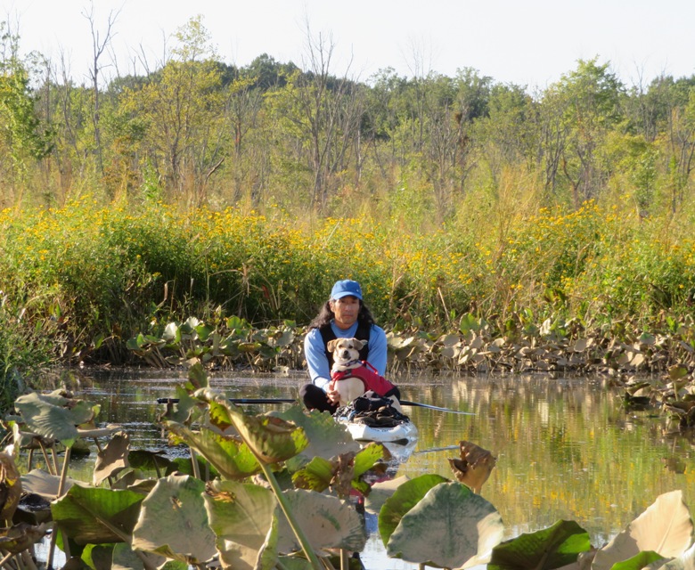
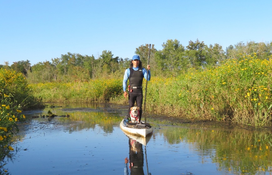
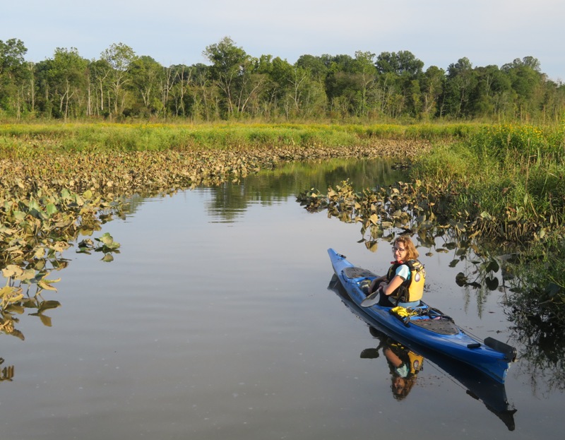
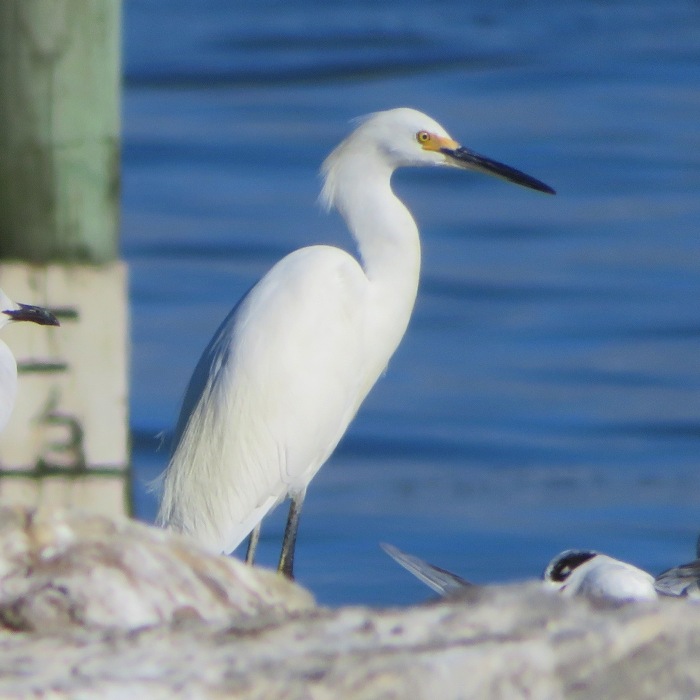
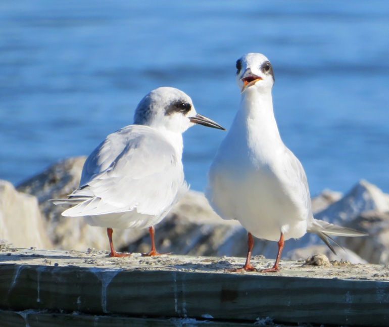
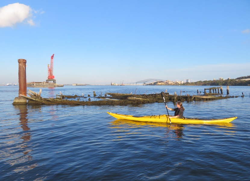
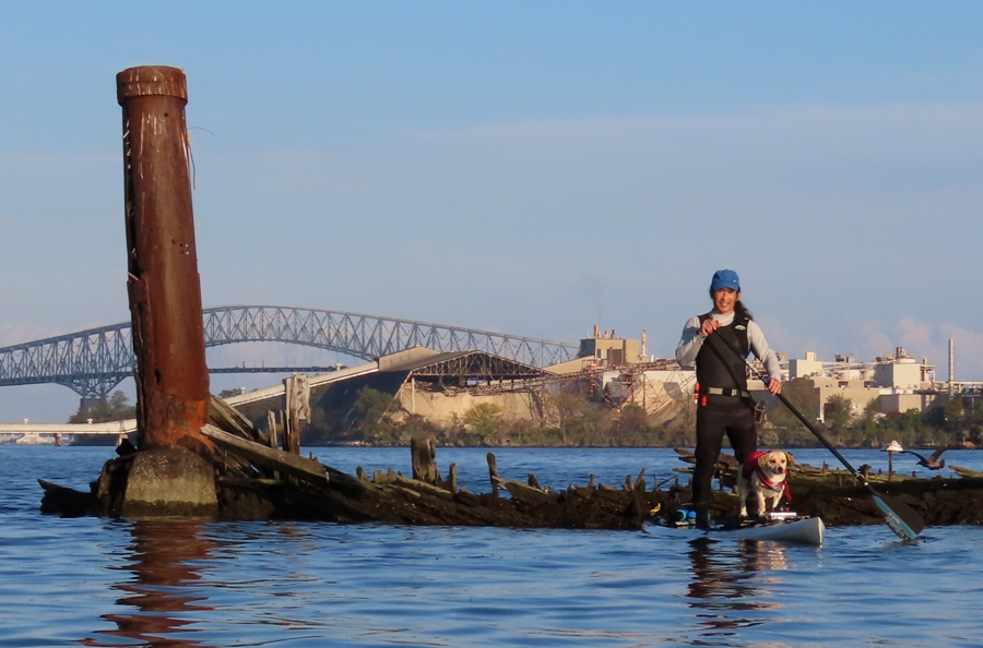
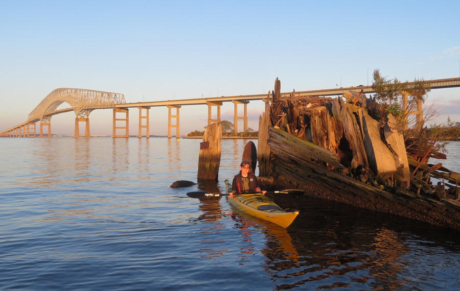
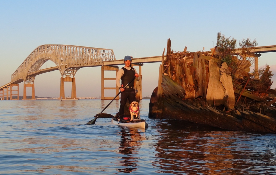
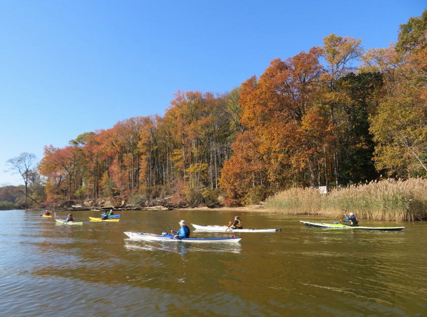
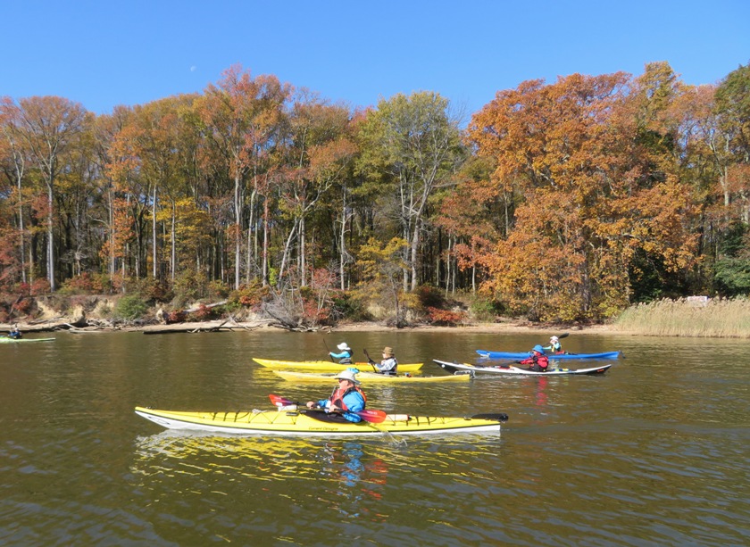
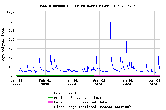