|
This page describes my kayaking and standup paddleboarding adventures in 2019. |

|
This page describes my kayaking and standup paddleboarding adventures in 2019. |
|
I celebrated the Spring Equinox by going kayaking at Mallows Bay. This area is known for its shipwrecks which lie in the Potomac River near Nanjemoy, Maryland.
[There are] hundreds of ships whose remains still rest in the relatively shallow waters of Mallows Bay, on the Maryland shore of the river about 30 miles south of Washington, DC. Most are historic wooden steamships created for service in World War I, but many others lie among them - including schooners, workboats, barges, and what may be a longboat from the Revolutionary War. It has been called the largest collection of wrecks in the Western Hemisphere. More than 100 of the vessels are wooden steamships, part of a fleet built to cross the Atlantic during World War I. It was a pivotal point in U.S. maritime history. Until then, the United States was not focused on shipbuilding, but the war created an urgent need. "The idea was to build 1,000 ships in 18 months and we put one million men to work," Shomette said. "We had to create schools, build shipyards, expand the timber industry and prepare the railroad." The result was the start of the U.S. Merchant Marine and the rise of the United States as an important shipbuilding nation. But this early effort was a huge undertaking, and the war was over before most of the ships were built. There wasn't much use for them, because coal-burning ships with wooden hulls were quickly becoming obsolete. Most of the ships wallowed in the James River until the government sold them to the Western Marine and Salvage Company, which planned to strip the ships of their metal components. The company moved the ships to the Potomac River at Widewater, VA. In 1925, they were dragged across the river to Mallows Bay. - from "Bay Journal - Ghost fleet may go from wrecks to recreation" (broken link as of 2025) My first stop was at the Accomac. The [Accomac is the] only steel-hulled vessel in the Mallows Bay-Widewater area. She serviced the ferry route between Cape Charles and Norfolk, Virginia until she suffered a fire and was permanently taken out of commission. About 1973, the ship was hauled to the southern perimeter of Mallows Bay and abandoned. - from "Chesapeake Conservancy - Map of Mallows Bay" (broken link as of 2025) Many of the wrecks were filled with mud. Some have trees growing out of them. Maybe the one below will in a few more years. 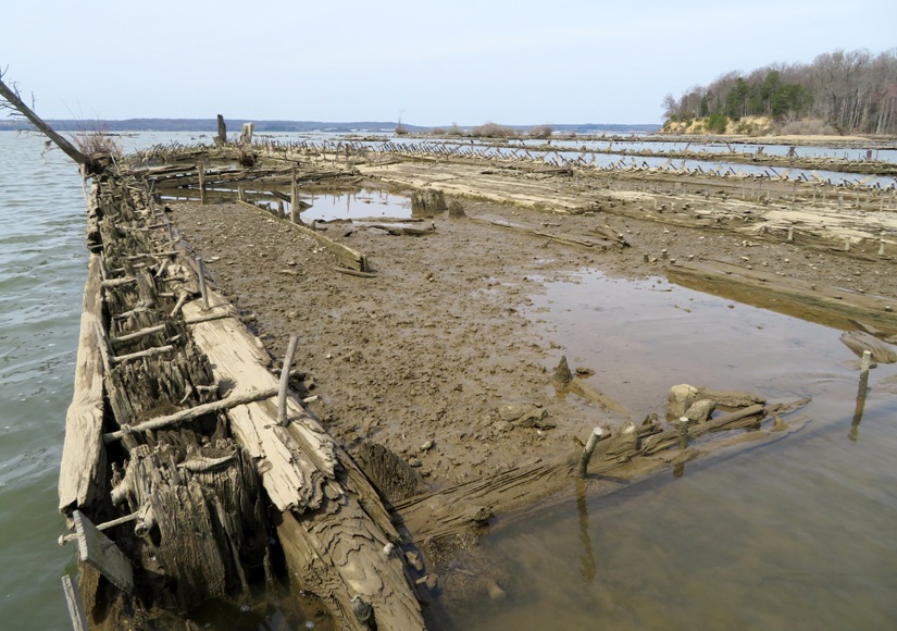
Here an osprey stands perched amongst the shipwrecks. 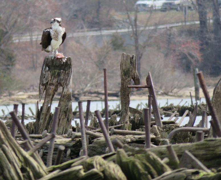
Perhaps the most photographed ship in Mallows Bay is the Benzonia because it sticks so far above the waterline. [The Benzonia] launched into the Columbia River in Washington in 1919 and named after a town in Michigan. For a short period Benzonia was engaged in the war effort, but was sold to Western Marine and Salvage Company in 1922. In 2003, she was moved by Hurricane Isabel and in 2013, a mysterious fire took hold in her stern section. - from "Chesapeake Conservancy - Map of Mallows Bay" I landed at a northern section of Mallows Bay called Grady's Spit. What's in that big box on top of my boat? A drone. 
I first kayaked at Mallows Bay on September 23, 2007. Back then, there was no park or launch site. I took a photo of the shipwrecks that later appeared on the Spring 2010 cover of the Maryland Department of Natural Resources magazine when they announced that they would be building a boat ramp. Paddling at Mallows Bay is not new for me. But seeing it from above via drone is. Why today? Wednesday will mark the third - and final - supermoon of 2019 when the moon is a few thousand miles closer to Earth than usual. When the moon is significantly closer to the Earth than average, it's called a supermoon. Wednesday evening, our moon will "only" be 224,173 miles from Earth, which is about 14,000 miles closer than average. - from USA Today - Supermoon, first day of spring are an astronomical doubleheader coming Wednesday Flying at low tide during the supermoon means the tide will be exceptionally low. This means I'll be able to more easily see the tops of the shipwrecks which sometimes reside below the surface. Actually, March 21 will yield a lower tide but rain is expected. High winds are expected for March 22. But March 20 is almost as good so I went with that. I think General Eisenhower faced similar difficult choices when he picked D-Day. Looking down from above, I noticed that the shape of the boats remains amazingly consistent. "Cookie cutter" is an appropriate term to describe their similarity. 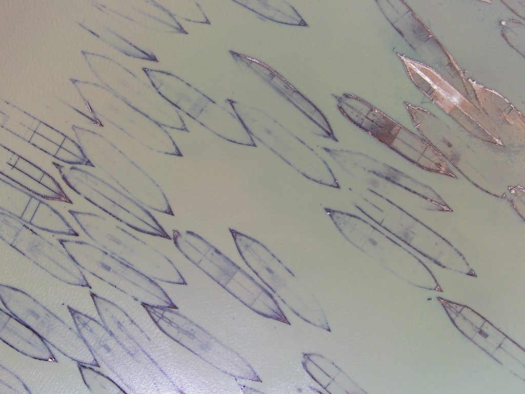
In the picture below, on the lower right is Grady's Spit. The blue sliver on it is my kayak. The two dots below it are me and my drone carrying case. I am the gray dot. 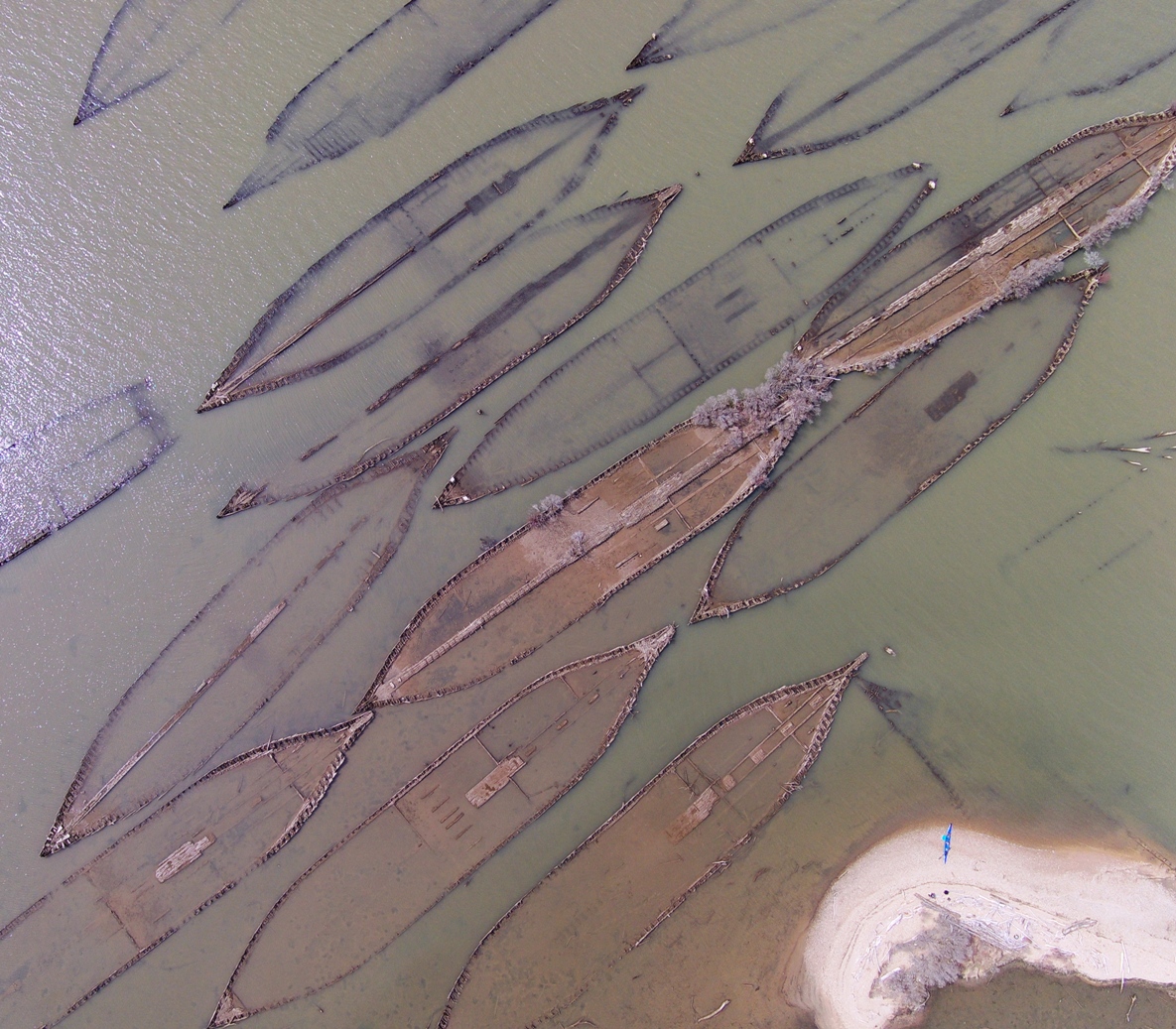
For this pic, Grady's Spit is the sandy peninsula at the top. 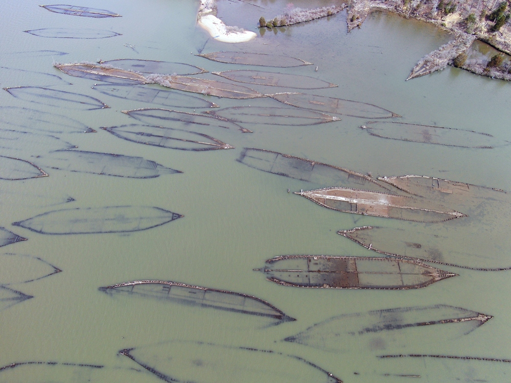
Getting views like this is the reason I bought a drone. 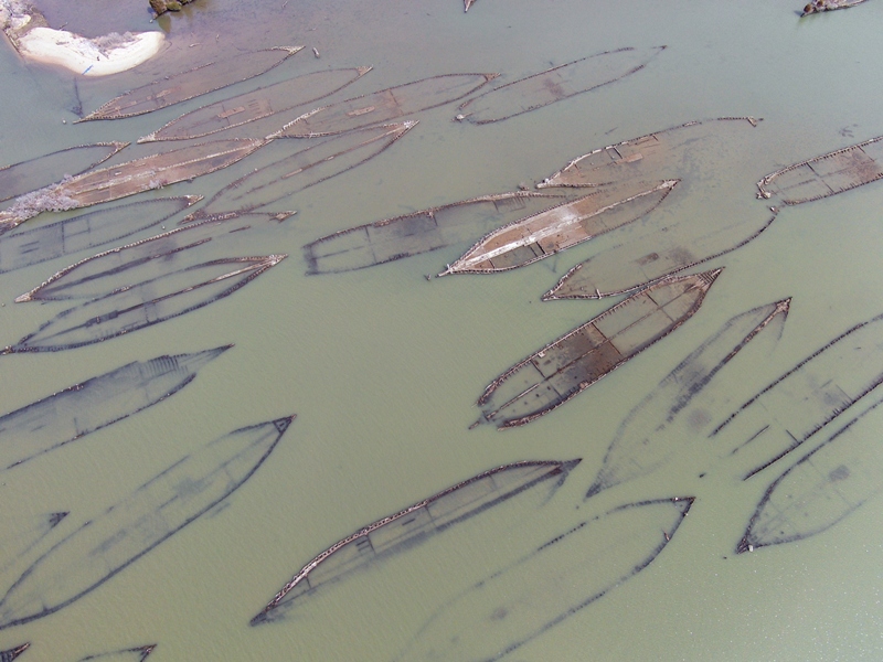
Notice the trees growing out of some of the shipwrecks in this snapshot. 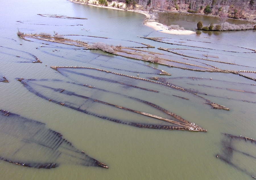
I believe the boats at the top in the below photo are the Three Sisters Wrecks. The Three Sisters is a group of three wrecks: Dertona, the "Heron Wreck", and the Moosabee. Dertona was briefly in the coasting trade. The "Heron Wreck" is named for the frequent sightings of Great Blue Herons on and about the site. The Moosabee carried timber logs to Europe from 1919 until 1922. - from "Chesapeake Conservancy - Map of Mallows Bay" 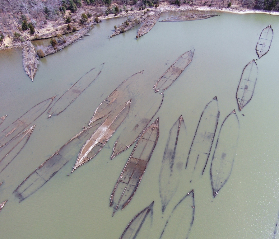
Here's a couple lower altitude views of the Three Sisters Wrecks and nearby wrecks. It is a rare opportunity to get drone photos at Mallows Bay during such an exceptionally low tide (-0.16 feet). Having good visibility and low wind (for flying) makes it even more special. 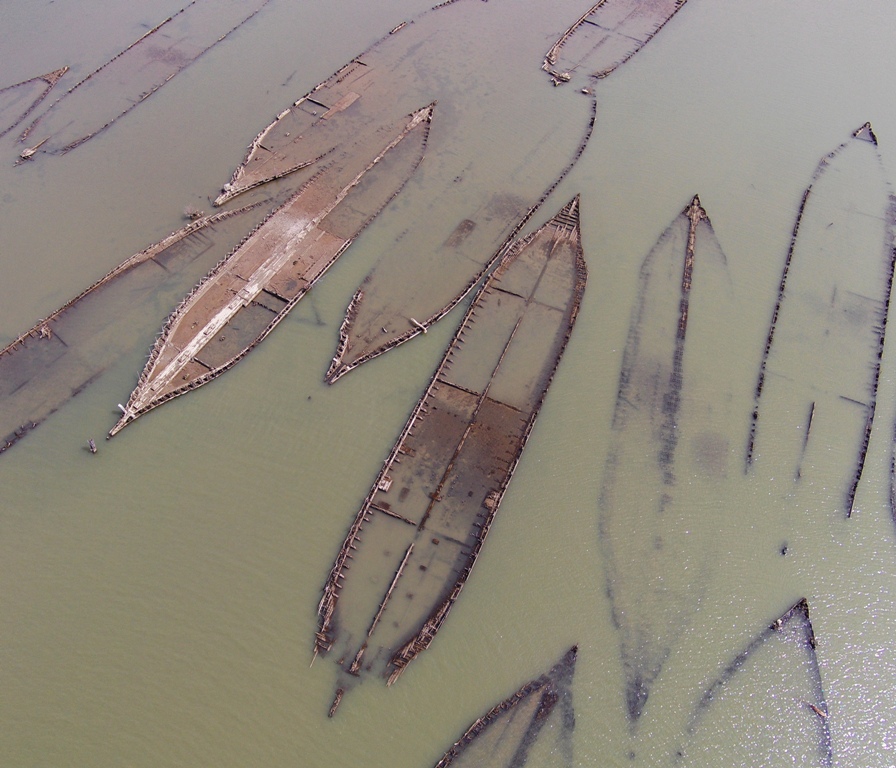
This is a satellite view from Google Maps. I can't fly my drone high enough (at least not legally) to get such a view. 
If anyone wants to learn about these ships in depth, read Ghost Fleet of Mallows Bay and Other Tales of the Lost Chesapeake by Donald G Shomette.  |
|
Maryland Day [March 25] commemorates the formal founding of the colony of Maryland, when the newly-arrived colonists erected a cross on St. Clement's Island, offered prayers (perhaps by saying Mass), and took "possession of this Countrey [sic] for our Saviour and for our soveraigne [sic] Lord the King of England." According to one of the three versions of Father Andrew White's account of the voyage of the Ark and the Dove, this event took place on 25 March 1633/34 at the colonists' first landfall in Maryland. Marylanders began observing Maryland Day in 1903, when the State Board of Education designated it as a day to be devoted to the study of Maryland history. In 1916, the General Assembly authorized the celebration of Maryland Day as a legal state holiday.
- from "Maryland Day Celebration in Annapolis and Anne Arundel County" I celebrated Maryland Day Eve (March 24) by kayaking to and flying my drone near one of Maryland's most distinctive landmarks, Fort McHenry. I did not launch my drone on Fort McHenry property due to drone flight restrictions at national parks. Fort McHenry is primarily known for the Battle of Baltimore during the War of 1812, when American troops stopped a British invasion. The battle inspired Francis Scott Key to pen what would become the national anthem, "The Star Spangled Banner." - from "Baltmore.org - Fort McHenry" (broken link as of 2025) The following are my drone photos. In this pic, I like the way the fort is captured overhead with the industrial section of Baltimore near the skyline. 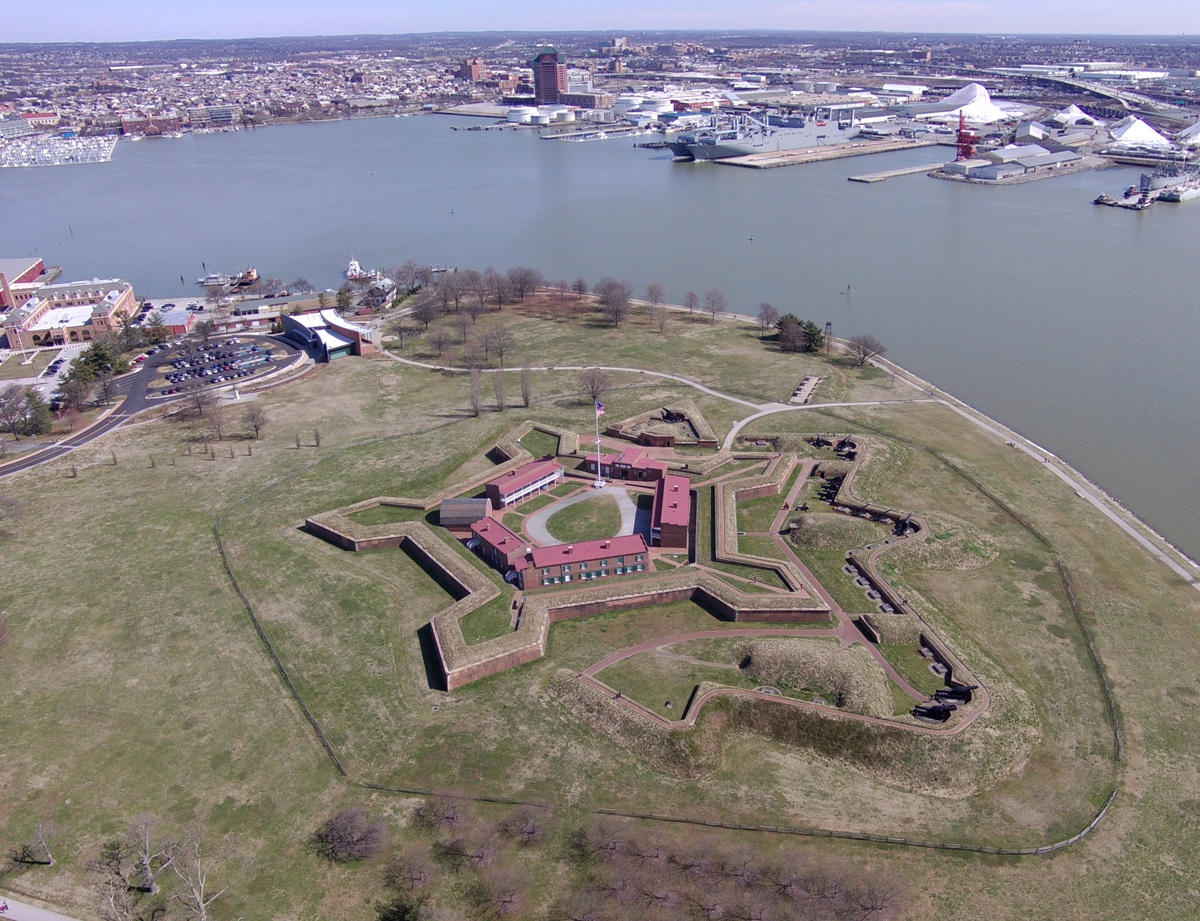
Here's a view looking northwest towards Tide Point. In the upper left, one can see buildings that line the Inner Harbor. Further out from the lower right is where Fort McHenry lies. 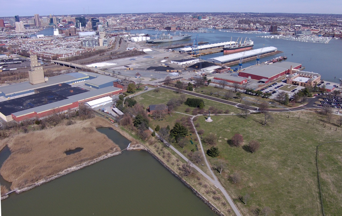
Here's a low altitude view of Fort McHenry, looking east toward Lazaretto Point. 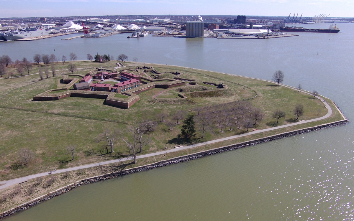
Fort McHenry was constructed between 1799 and 1802. It was in the shape of a five-pointed star, which was a popular design during the period. Each point of the star was visible from the point on either side and every area of land surrounding the fort could be covered with as few as five men. - from National Park Service - Fort McHenry - The Star Fort 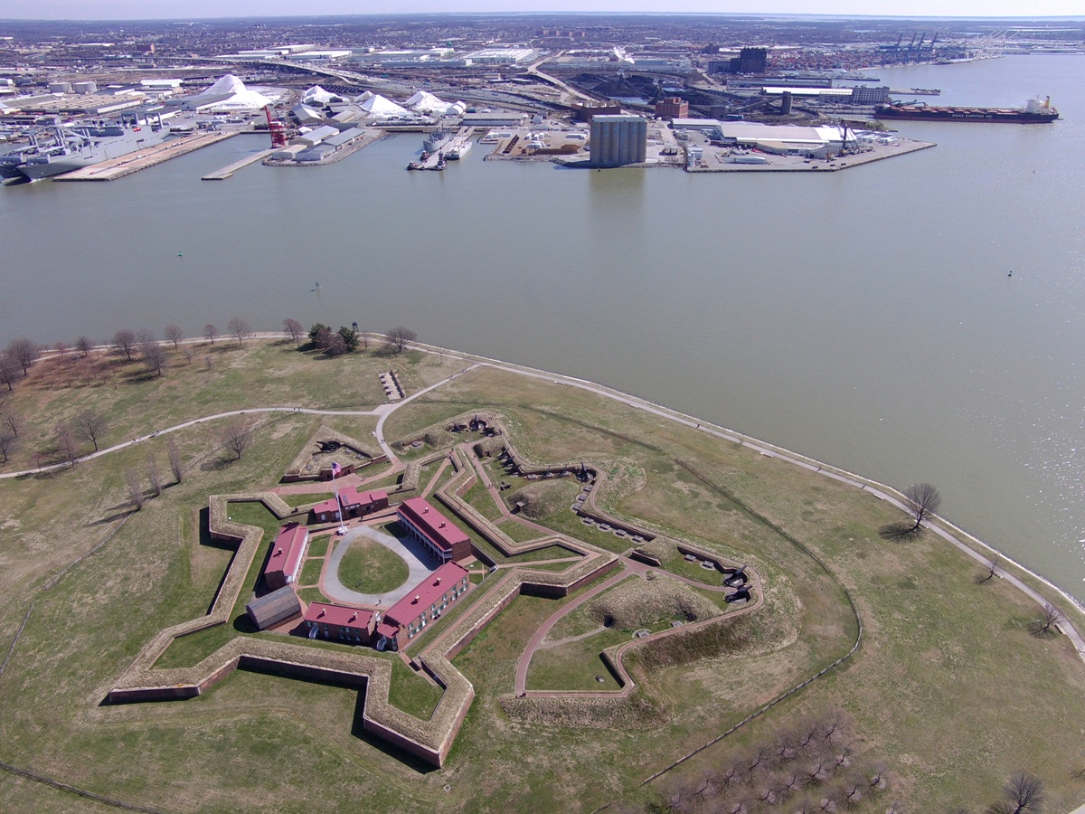
A former co-worker suggested I have a "Where's Saki" drone photo so here it is. On the upper right, you can see the Baltimore Inner Harbor. Fort McHenry would be off to the lower right if this photo were extended. Both my kayak and I are in this photo but not together. Can you find me? 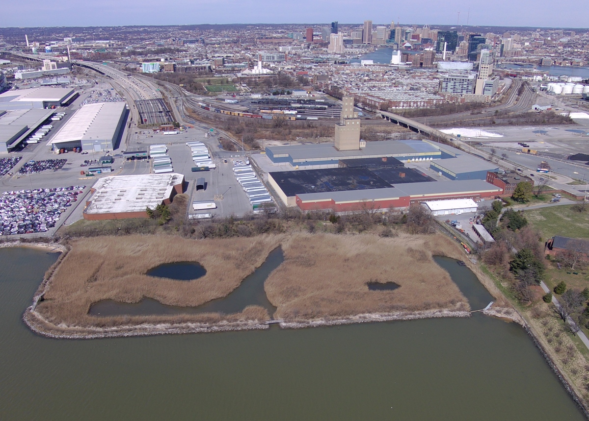
Here's the answer. I landed at a small beach but couldn't see Fort McHenry from there. So I walked down a path which was lined by small trees which also kept me from seeing the fort. It wasn't until I was on the foot bridge that I could see above the trees. So that's where I stood to direct my drone. 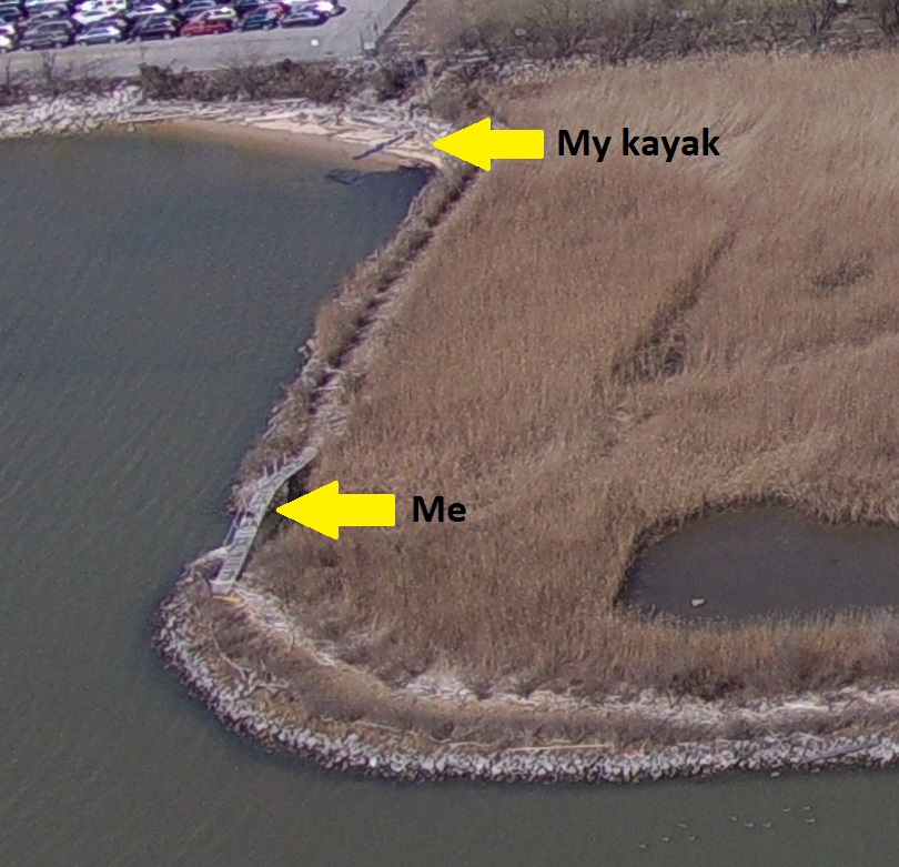
Maps of the fort can be found at John's Military History - Fort McHenry. |
|
On the same day I shot drone photos of Fort McHenry, I also paddled out to 39.265038, -76.623911 to get drone photos of the swing bridge on the Middle Branch of the Patapsco River.
When trains pass over water, something must often be put in place to allow ships to pass. In this area, I don't recall ever seeing a drawbridge to support trains. Instead, swing bridges seem to be the norm. Why is that? I was later told the following by Greg W.: Swing bridges are seen more often for train crossings due to a number of factors in our area. The swing bridges can give clearance for bigger ships, which can pass in two directions simultaneously (draw bridges usually have ships on one side going then the other). Also, trains do not handle steep grades well, and most draw bridges are designed to let a certain amount of river traffic pass under them without needing to open, meaning the train has to go uphill to get over the bridge. Another reason is that if the track is used less frequently than the waterway, a swing bridge can be kept in the open position more safely than a drawbridge. Generally, drawbridges are stronger because they can use a girder construction rather than a truss construction. The following are my drone photos. This is a low altitude view of the swing bridge looking west. I don't know if it is still in use. The elevated road on the left is highway 295. 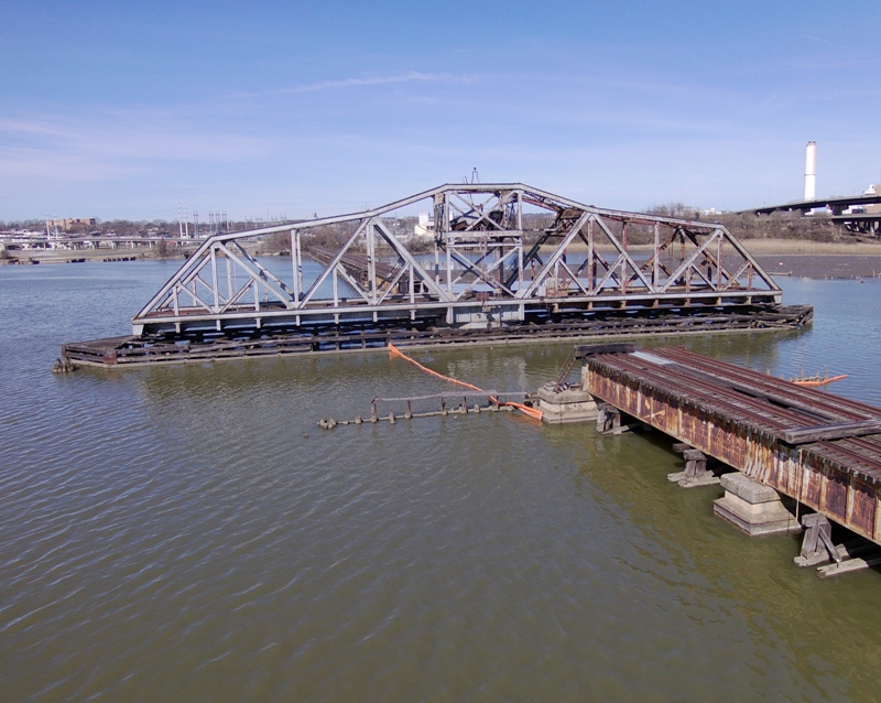
Here's a higher altitude view of the swing bridge. This area is very polluted. Do you see that small white island on the right? I was going to land there to fly my drone until I discovered that it is just a collection of floating plastic bottles and other trash. 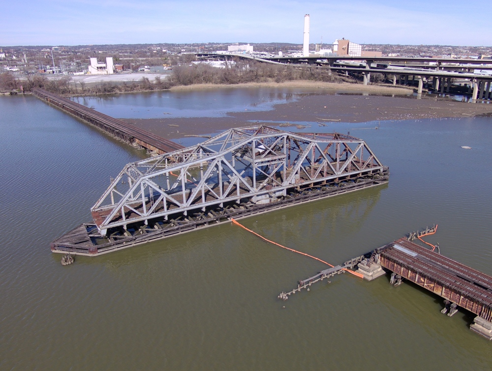
This is starting to look a little more like the satellite view. 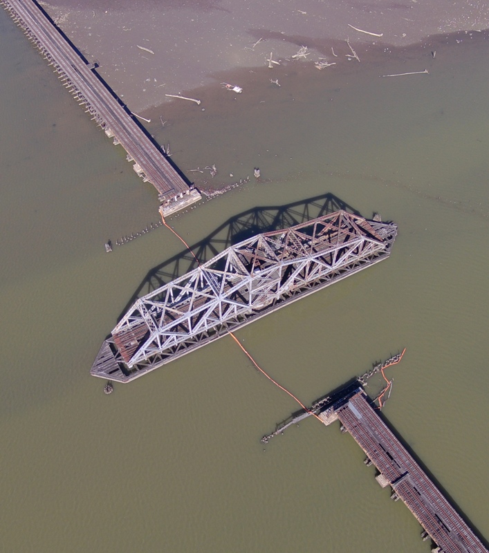
Here's a shot looking north. In the back is the Baltimore Inner Harbor. Just left of center is the M&T Bank Stadium, where the Baltimore Ravens play. The elevated road is highway 95. The one that leads into Baltimore is highway 395. 
This is looking east. On the right is the Under Armour building. If you were to zoom in a lot, you'd see Fort McHenry in the distance. On the left is the Inner Harbor. Can you find me or my kayak? 
Here's a zoom of the previous photo to show where I parked my boat. I'm just to the left of it. 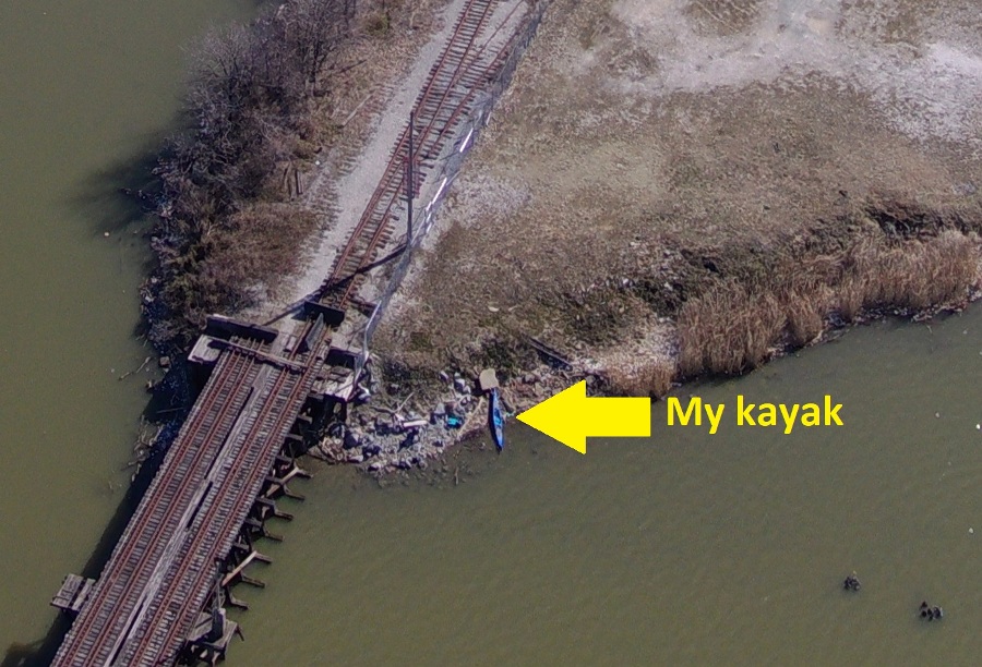
It was good to get out and get some snapshots of the city from a point of view most will never have. |
|
I drove out to the eastern shore of Maryland to do some kayaking. On the way there, I stopped in my favorite small town, Chestertown...no, not Savage. I went to their Farmers' and Artisans' Market where I bought oatmeal raisin cookies for me and "Doggie Crack" for Daphne, Rufus, Cassi, and Bailey.
The town was really hopping. Lots of people and dogs were at the market. At Wilmer Park, it looked like there was a big rowing race taking place. But things were quiet at the Town Dock so I pulled out my drone and took some pictures of the town. The sun was not as bright and the humidity was high so the photos are not as crisp as they could be. Here's a shot looking northwest on High Street. The white steeple in the upper part of this shot is the First United Methodist Church. In front of that is Fountain Park, where the farmers' and artisans' market is located. The big house in the lower right corner is Widehall. [Widehall] is a large, 2 1/2-story, mid-Georgian, brick dwelling house built in 1769 by Thomas Smyth. It later was the home of Robert Wright, Governor of Maryland between 1806 and 1809; and of Ezekiel F. Chambers, State and United States Senator and Judge of the Court of Appeals. - from Wikipedia - Widehall 
In this pic, Widehall is in the lower left. One of the many things I love about Chestertown are the well preserved historic buildings. In Maryland, only Annapolis has more Colonial-era buildings, but Chestertown also has the alchemy of an untrammeled riverscape and a welcoming, small-town vibe. - from Soundings - Time Travel 
Here's a view looking southwest. The long gray building on the left is Chestertown Station, a historic railway station built in 1902-03 for the Pennsylvania Railroad. In the lower right is the Custom House. Built in 1746, the Custom House was the residence of Thomas Ringgold, a leader of the local Sons of Liberty who was also - in cruel contrast - one of the most active slave traders in the entire Chesapeake region. The building, overlooking the tidal waters of the Chester River, also served as a warehouse and store, and British redcoats were quartered here during the French and Indian War. - from "Washington College - Home to the Starr Center, the historic Custom House embodies the complexity of American history" (a broken link as of 2020) 
I drove north to the Sassafras River and launched my boat at Foxhole Landing. I saw two great blue heron rookeries, a bald eagle, several turtles, and a few other critters. Spring is definitely here! I paddled to Hen Island. I reckon it has about 30 great blue heron nests. There are also a lot of geese...but no hens. I found that if you approach the island slowly and remain quiet, the herons will go about their business as if you aren't there. In the pic below, I'm guessing one of these birds is male and the other female. I can't distinguish between great blue heron genders. Can you? 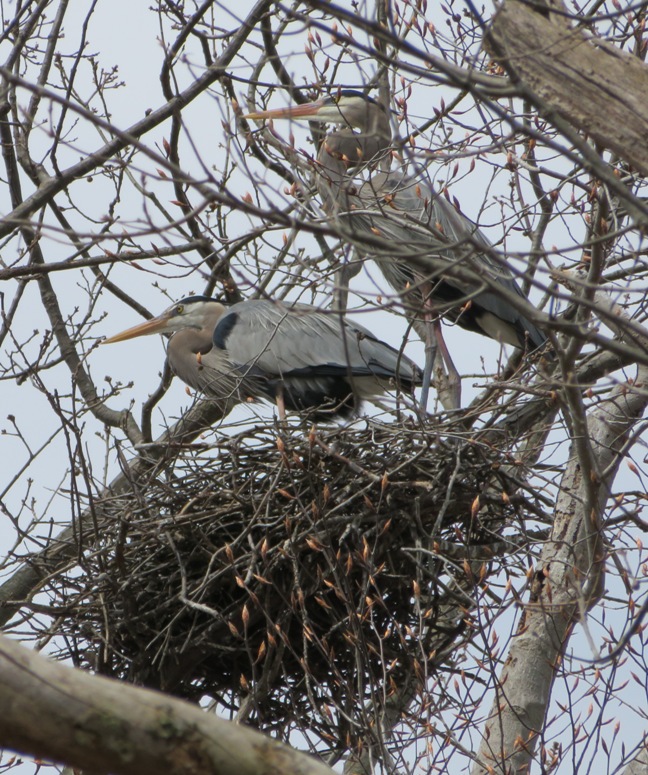
It looked like some were building their nests while some were sitting on eggs but I really have no idea if there were eggs. I suppose I could fly my drone above them to see but that would be unethical, in my opinion. After spending maybe an hour near Hen Island (I never went ashore), I explored the area east of Hen Island to 39.381688, -75.822698. There were many great blues out. I noticed one that had some stuff on its beak and it looked like it needed a napkin. When birds wipe their beak, it is called "feaking." My chickens do that because they have good table manners. I pulled ashore at Jacobs Creek and took a selfie. If you're wondering where my personal flotation device (PFD) is, I'm using it to prop up my camera. 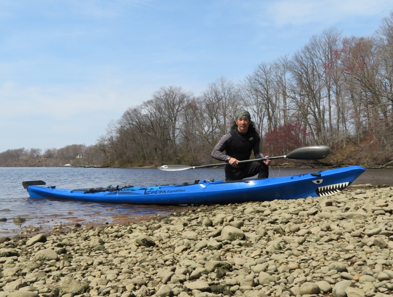
I found a second rookery at 39.377194, -75.832167. I was out near low tide which kept me from getting any closer. Better to look for rookeries at high tide. 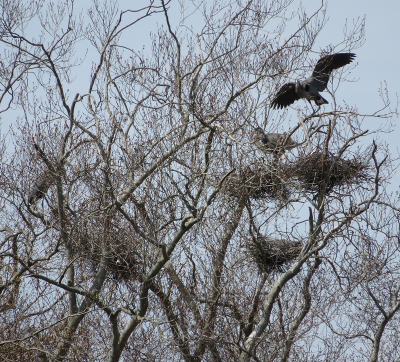
It wasn't a particularly sunny day and as the day wore on, the clouds rolled in and the wind picked up. Still, today would be much nicer than tomorrow. There were several turtles out. I saw a few eastern painted ones. 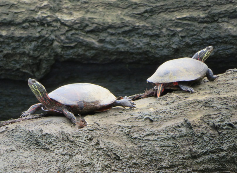
I also spotted a couple dozen greater yellowlegs sandpipers. About ten turkey vultures circled the area. This one perched long enough for me to get a shot. 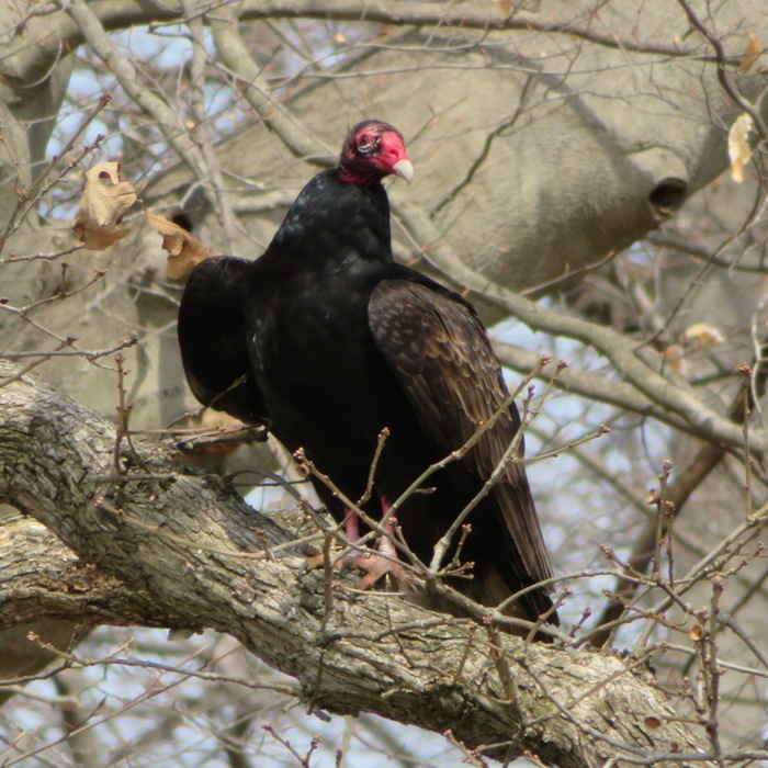
It was a long but peaceful drive home. Driving on the eastern shore is soooooo much nicer than driving in the northern Virginia and Washington D.C. area. |
|
Sara and I launched from Rileys Mill near Chestertown and paddled the upper section of Morgan Creek. We were the only ones on the water. It was a very peaceful day with great opportunity to see a plethora of wildlife.
Our goal was to visit a great blue heron rookery. But we saw so much more to include a barred owl (Sara saw, I did not), several bald eagles, an eagle nest, and an osprey that dove into the water just 90 feet in front of us and then flew away carrying a fish in its talons. Here's a muskrat which swam past my SUP and then hid under some brush. 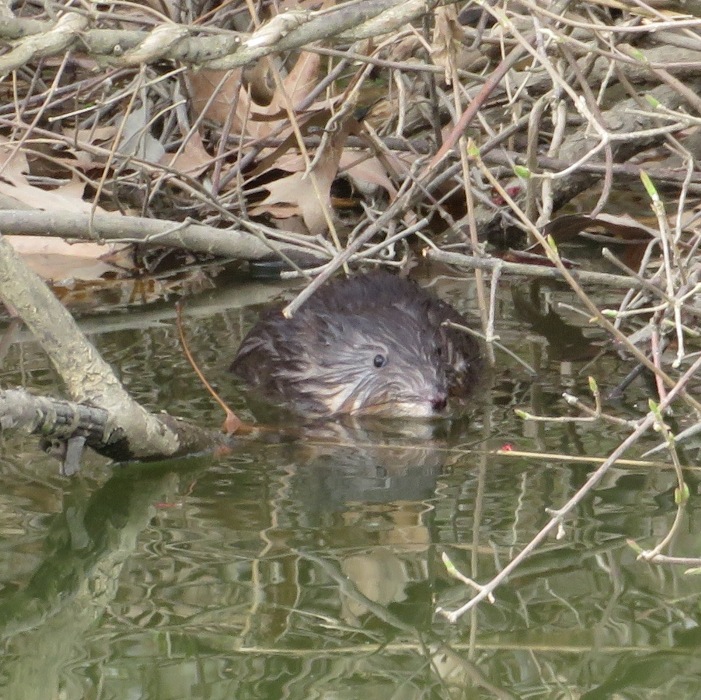
This red-winged blackbird made a boisterous call as I paddled past. Glossy-black males have scarlet-and-yellow shoulder patches they can puff up or hide depending on how confident they feel. - from All About Birds - Red-winged Blackbird 
Eventually, we came to the rookery. I reckon there were about three dozen nests in it on the east side of the creek, about a mile upstream from Rileys Mill. 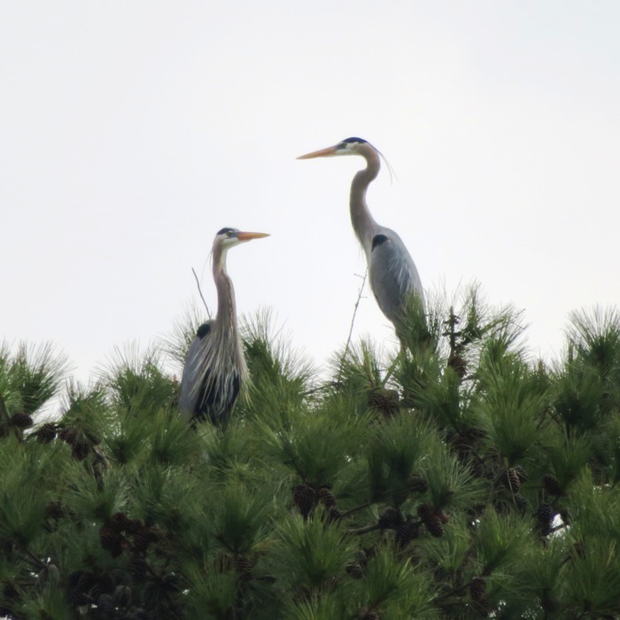
Some nests were in a pine tree while most were in deciduous trees. It is important to get out in early spring to see the nests before they are hidden by leaves in the deciduous trees. 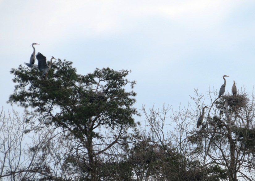
The best place to photograph these fine birds is from the middle or west side of the creek. 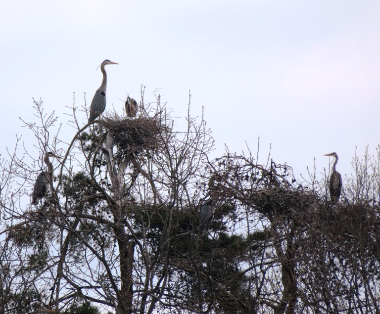
Landing around high tide (which I recommend) at 39.267269, -76.028216, we ventured onto land to observe the great blue herons from below. If you remain quiet and still, they will ignore you. It is for this reason that we left our dogs at home. Notice the bird in flight in the lower right corner. 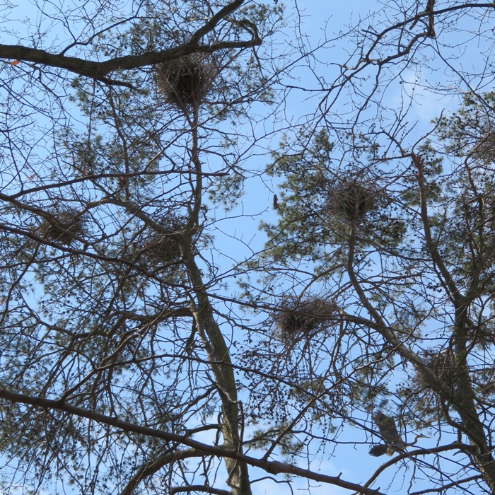
Here's some non-rookery pics. Sara and I saw a very thick northern water snake about three feet long. I saw it swim and then go underwater. I tried to back up my SUP to get a photo. As I backed up, my fin (skeg) caught a submerged log. I fell backwards onto the SUP with enough force to lift the nose of my board into the air. I was soaked but I did NOT fall off. What I was most proud of is that the whole time, I held the strap of my camera in my teeth. Even though I lost my balance and fell flat on my back with water splashing around, I never dropped my camera and it remained totally dry. Not so for me. It is because of things like this that I carry extra warm paddling clothes. The picture I got wasn't even very good. 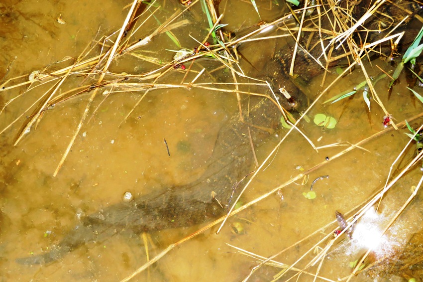
My SUP fall reminded me of when I pulled a dead branch from my mother-in-law's tree. I pulled really hard and I wasn't ready when it fell. I fell backwards, landed on my butt, and then did two backward rolls downhill before I finally came to a stop. I was embarrassed and a little sore but it was well worth it to see my mother-in-law get a good laugh out of the whole thing. After paddling, we stopped in Chestertown for superfast lunch service at Play It Again Sam in Chestertown. They have outdoor seating in both the front and the back. Seating in the back is accessible from both the restaurant and a back parking lot. We encountered light traffic both on the way there and on the way back. It was a great day though not as sunny as the day prior. But I think we were out during the brightest part of the day. Later that afternoon, it got more cloudy. |
|
Norma, Daphne, and I kayaked on the Middle Patuxent River from Old Columbia Road to Savage Park. The water was high due to rain from the previous night.
This was Daphne's first kayak trip of the year and she was happy to be out with us. 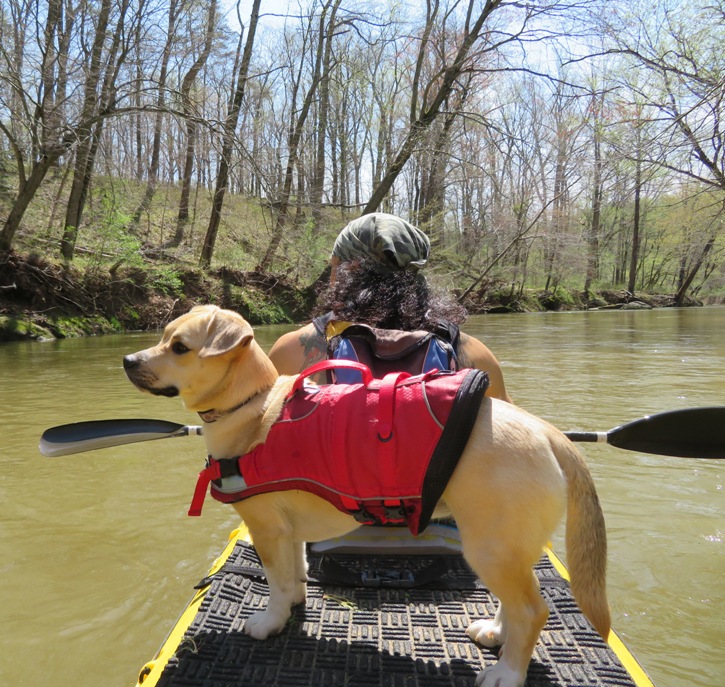
Somewhere between Old Columbia Road and Murray Hill Road (closer to the former), we saw the remains of a stone bridge foundation. It was around 39.163833, -76.877444. 
I posted this picture to the Friends of the Guilford Industrial Historic District Facebook group and received the following feedback: It is closer to Atholton and possibly the Judge I. Thomas Jones property where quarrying was also done around 1900. Definitely granite - you can see the drill marks. You can walk down Kindler Road, and then continue down the remnants of the old road that used to connect to Columbia on the other side. I've colloquially heard it was washed out by a past hurricane. They want to put a bridge in there. However, about 2-3 times an average year (The last 12 months have seen more) the river crests and floods over that section of the old road. I think that they are unwilling to put in a bridge where the risk of it getting removed by another flood event is as high as it is. The bridge remnants are easy to see and you can walk the (not well maintained) trail following the river either left towards Old Columbia Rd or right towards the sharp curve of Gorman prior to Murray Hill. The scenery was beautiful. Even though we were never far from civilization, we often felt like we were away from it all. We saw two snapping turtles. This one had a carapace about 14 inches long. 
Pulled ashore, we saw small pieces of muscovite and possibly chromite. 
There were two major log jams that required portage. Here I am checking things out to decide how to get us past it. It is because of this and strainers (we capsized once) that I don't recommend this route for beginners. 
Erosion has exposed lots of tree roots. 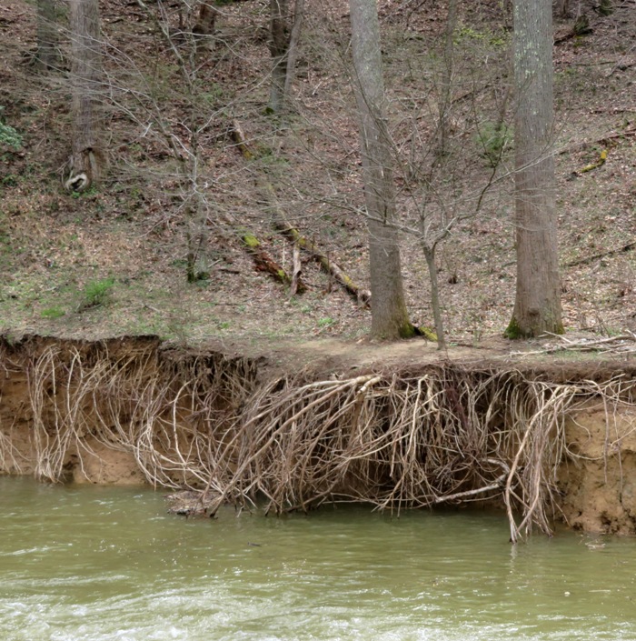
We saw a kingfisher. 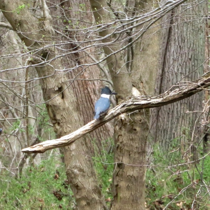
In the latter part of our trip, Norma sat in the front seat of our tandem...something she rarely does. 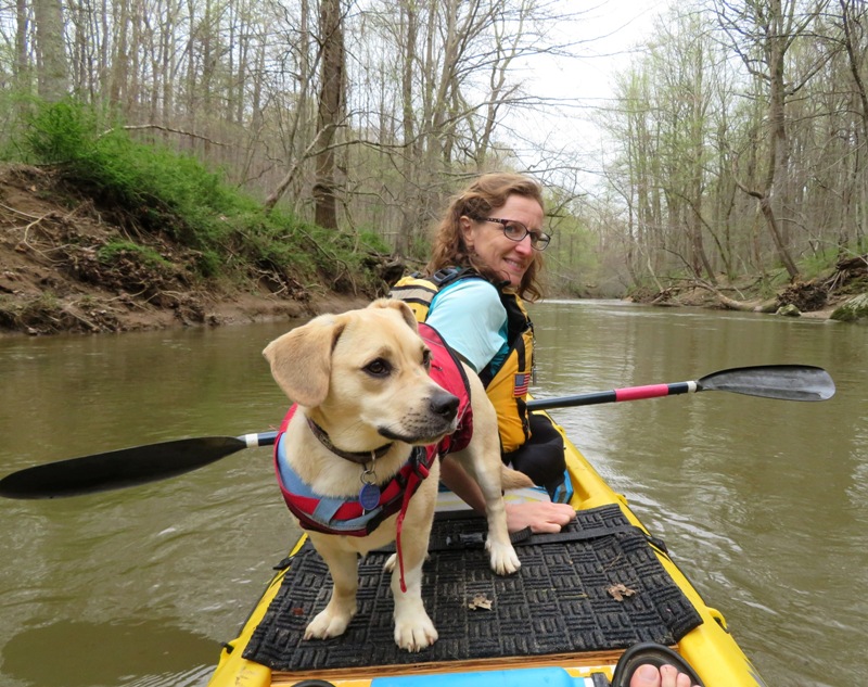
In Wincopin Park, I spotted a four to five-foot long black snake. It used its scales to grip onto the bark of the tree so it could rest vertically. Here I am at the takeout, near the ruins of the Savage Mill dam. 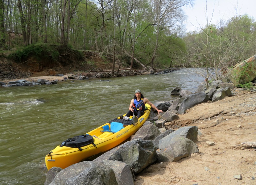
|
|
I launched my kayak from Solleys Cove and paddled downstream to Curtis Bay.
Baltimore Shipwrecks - Curtis Bay
Bald Eagles on Curtis Creek
Baltimore Shipwrecks - Curtis Creek
|
|
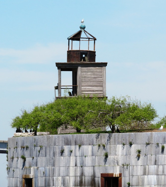
Before I purchased my drone in December 2018, I decided that my ultimate goal would be to photograph Fort Carroll. This piece of Baltimore history is privately owned and off limits to the public. I landed there on February 20, 2017 but didn't stay for long...just long enough to get a few snapshots.
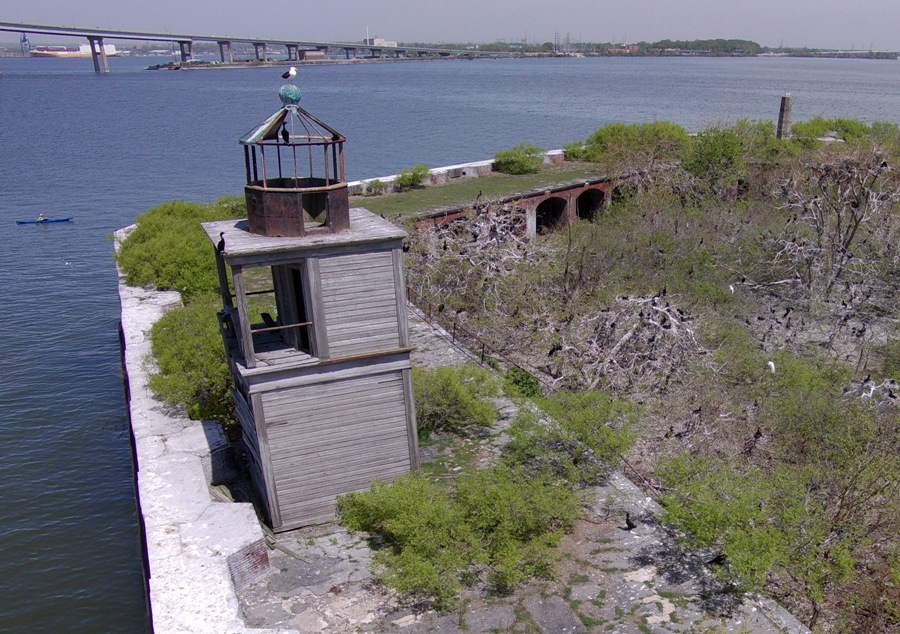
I wanted to see the fort again but in a way that very few had...from above. Doing so would not be easy because it is about 0.8 mile from land. So I decided I would get there by stand up paddleboard (SUP). I felt the SUP offered more flexibility in handling the drone by myself because I could stand up, kneel, or sit. I could also easily access whatever equipment I was carrying while on the SUP. Skies were fairly clear and the wind was somewhat light on this day so I decided to paddle out to the fort and fly my drone. At no time did I enter the fort. Norma accompanied me on her kayak. I didn't want to rely on her for help with the drone because I wanted to see if I could do it all myself. But just in case I ran into problems, I might need an extra hand. Otherwise, her main job would be to document my adventure via camera. We launched from Fort Armistead in the late morning. Visibility was good but not excellent. Even though the wind wasn't very strong, there were definitely waves being kicked up. That part of the Patapsco River is relatively narrow (that's why they built a bridge). It is also very deep (to accommodate shipping) and very shallow (that's why the fort is there). This means any currents are channeled and it also means any waves will increase in size when they get near the fort. Paddling my SUP, especially with a big box containing a drone, was not easy in these waters. Fort Carroll was built on a 3.4-acre artificial island built on Soller's Point Flats. It is located here. What do I know about the history of this place? Baltimore's Third System defense, Fort Carroll was named in 1850 to honor Charles Carroll, a signer of the Declaration of Independence. It is located on a man-made island in the Patapsco River adjacent to the Francis Scott Key Bridge. The construction [which commenced in 1848] was once supervised by Robert E. Lee. The fort was abandoned after WWI. The Coast Guard used the fort during World War II. A lighthouse was added in 1854 and rebuilt in 1898. The lighthouse and the fort were abandoned after World War II. The fort was originally known as Fort at Soller's Point during its construction. - from Fort Tours - Fort Carroll My two main objectives were to get well lit pictures of both the lighthouse and the fort. I had morning sun in the southeast but there was also a breeze from that same direction. I planned to do two drone launches. The first would be from the northwest side. This meant I could use the fort as a windbreak and see the drone when I photographed the lighthouse on the west side. I would then do a second launch from the landing dock on the north side. I would get off my SUP for this and sit on the stairs of the dock ruins. This would enable me to view the drone when I photographed the sunny side of the fort. I needed line of sight to the drone in order to get a visual reading on the monitor. Breaking up my time into two launches also meant I could swap an old battery with a new one, thus extending my flight time. Norma and I crossed to the northwest side of the Francis Scott Key Bridge. We made our way northeast then cut southeast to the fort. Here is what the place looks like from a kayak/SUP. 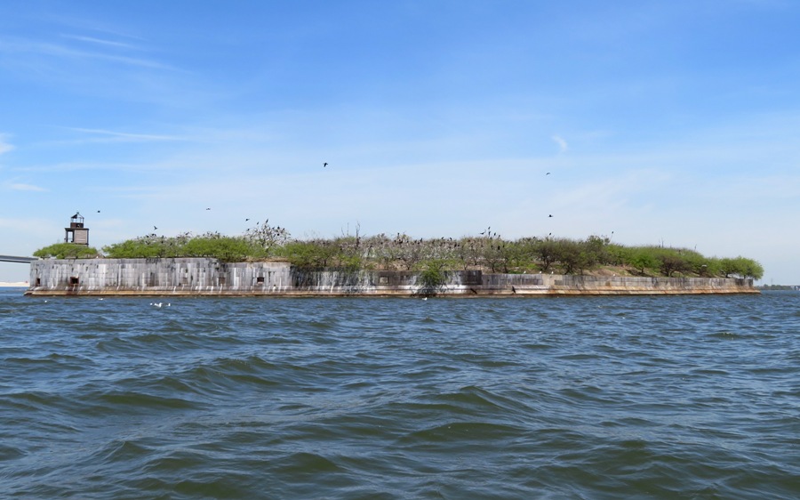
I approached the northwest side which was sheltered from the wind. Then I prepared my drone. It didn't take long before it was airborne. As I typically do, I did a quick ascent and got a straight down shot of the entire fort. Notice our SUP and kayak at the bottom of the pic. 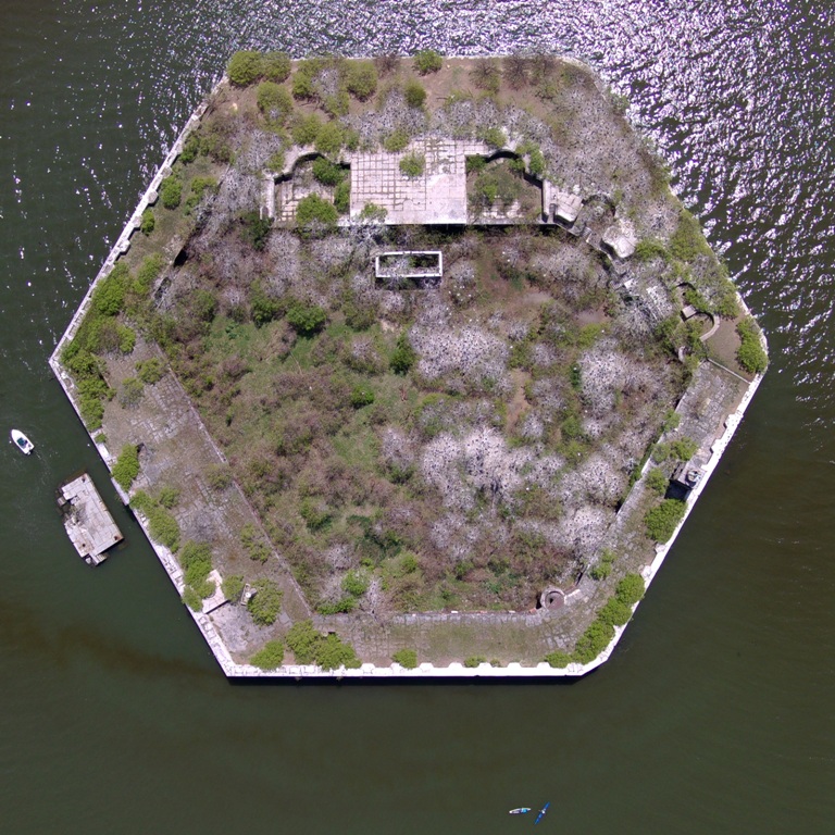
While my drone was up there, I directed the view northwest towards the Francis Scott Key Bridge. 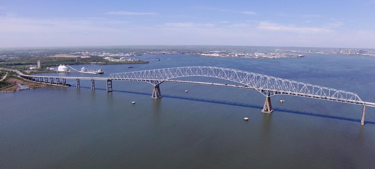
Next, I lowered the drone to get another view of the fort. 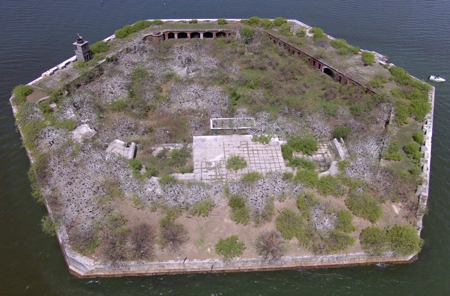
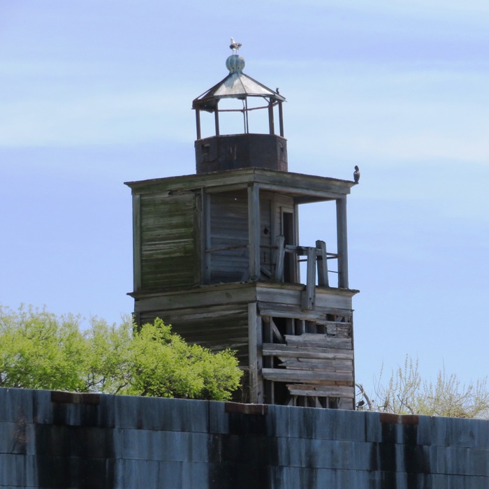
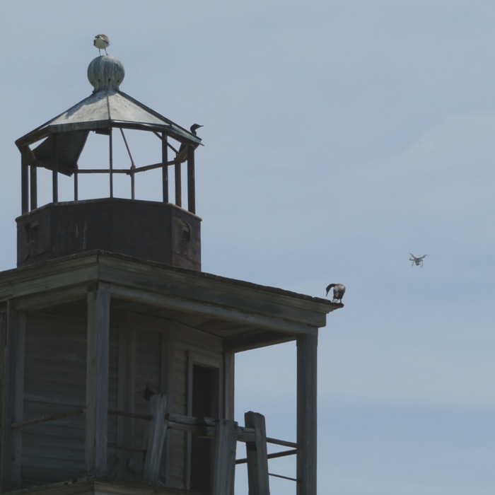
I then directed my drone to the lighthouse. In 1854 a lighthouse was built on the ramparts of the fort to warn vessels away from the construction site and to mark the turn from the Brewerton Channel to the Fort McHenry Channel leading in and out of Baltimore Harbor. In 1898 a new lighthouse was built, the one still seen today, and it was automated in 1920 and then discontinued sometime between 1931 and 1945. - from ByteNet - Fort Carroll 1 / 5

Fort Carroll Lighthouse.
2 / 5
Different view.
3 / 5
Lighthouse and drone.
4 / 5
Drone view of lighthouse.
5 / 5
High view.
Norma captured me concentrating deeply about the task at hand. 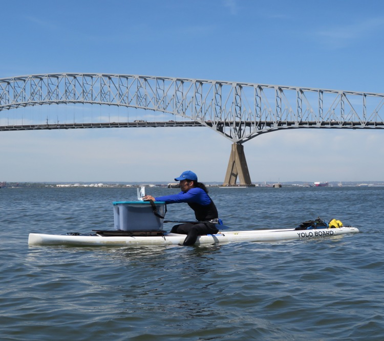
Many water birds make Fort Carroll their home. This pic of a great blue heron was taken via kayak. 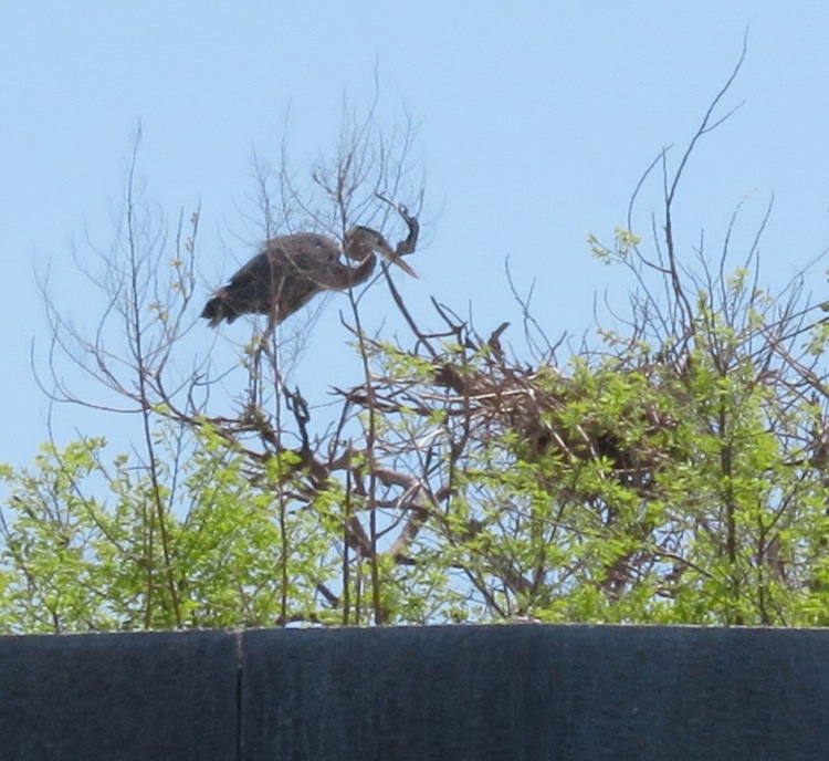
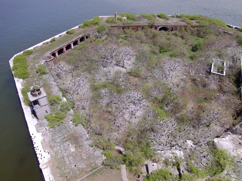
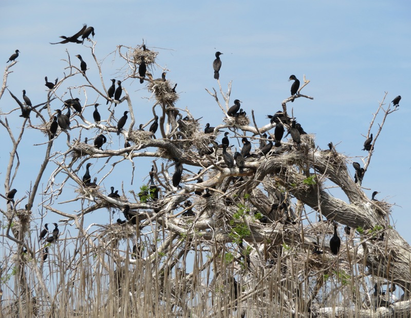
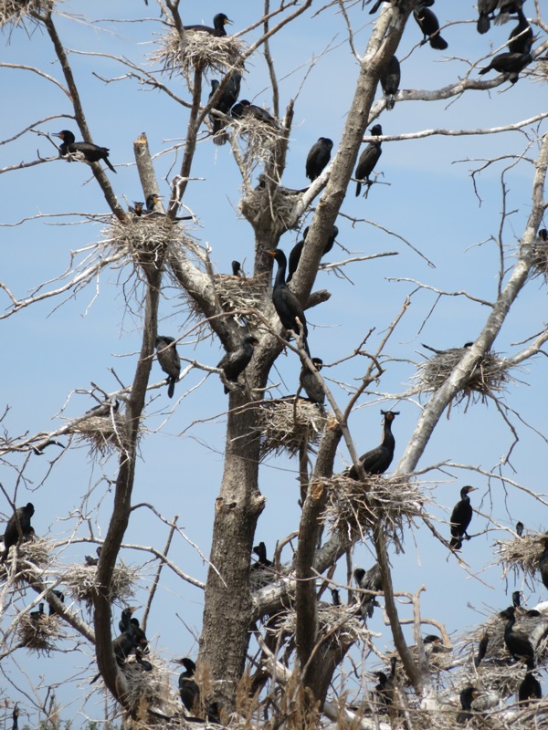
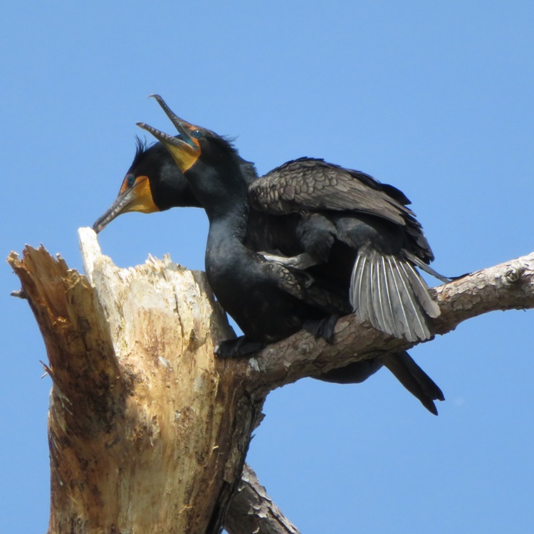
Hundreds of cormorants live at the fort. In the summer, the foliage at the fort is very thick so visibility is poor. In the winter, vegetation is sparse but there is little wildlife. This time of year is good because there are plenty of birds building and sitting on nests which can easily be seen. They did not seem to be the least bit affected by the presence of my drone which I kept a good distance away. Living amongst the cormorants are several egrets. This is only the second time I've ever seen an egret rookery. From afar, all the little black things are cormorants while the little white things are egrets. Now take a look at the below image. If you were to enter the middle of the fort via the landing dock entrance, you would pass through the wide entrance with the curved archway on the left. Now look at the right side. My question is, "What is that big rectancular thing?" It is about 43 feet long and 17 feet wide, based on Google satellite information. The sides appear to be made of brick or stone. I can't tell how high it is...maybe five feet tall? One person thought it might possibly be for ammunition storage. In old snapshots, it looks like flag poles are mounted on it. 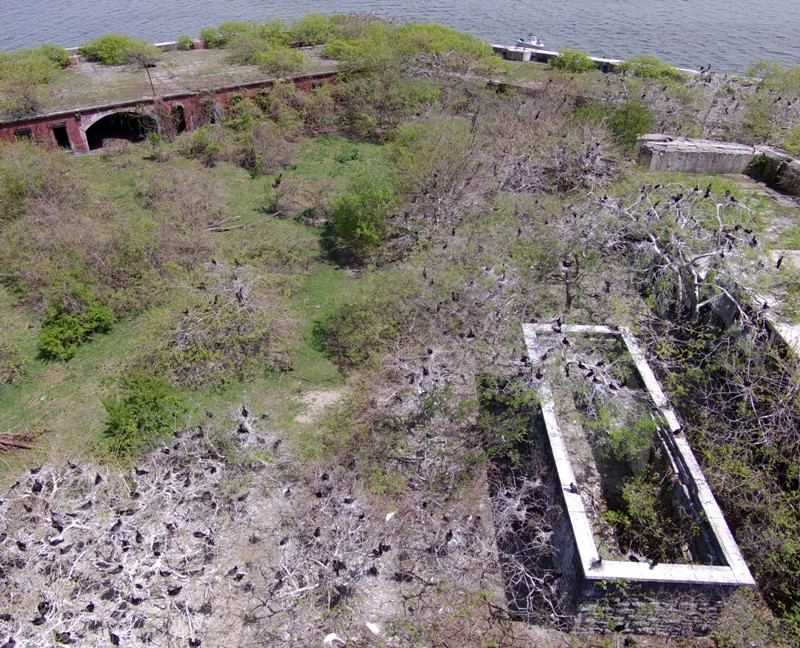
Here's another view of it from higher up. Some of the artillery emplacements are in front of it, facing downstream, which is where an attack would likely originate. 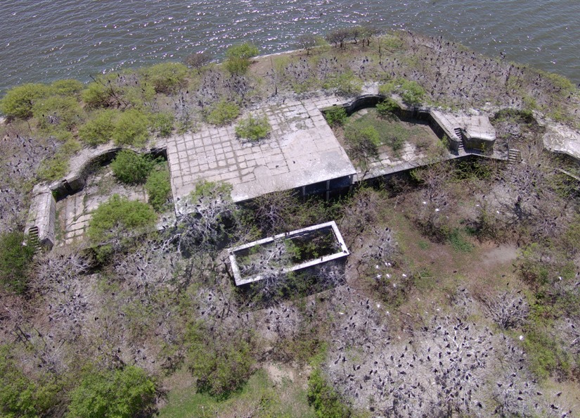
Big guns are the bread and butter of a fort. Such cannons are no longer here but you can clearly see where they once stood. For the latter, Sparrows Point is in the background. Fort Carroll has many stairs laid out to help its soldiers get to their battle stations quickly. Here's a close up of where a couple of the artillery pieces once lay. 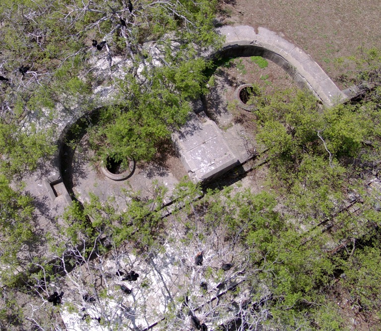
Peach trees (and maybe other fruit trees) once grew at the fort...perhaps they still do. I can't tell if anything in the photo below are or were peach trees. Grass was growing on the parade ground and the fruit trees were here, but nothing like this. Now the trees have taken over the place and in time their roots will tear the place apart. - from The Baltimore Sun - Amateur historian dreams of restoring Fort Carroll 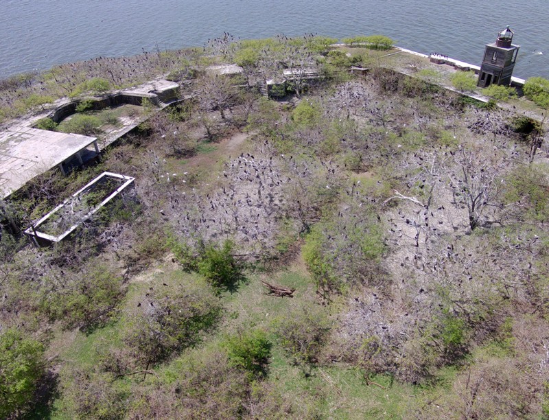
I mentioned that there are many staircases which lead to the gun positions, but in the pic below there is an enclosed spiral staircase. Just outside of the fort is Norma in her kayak. 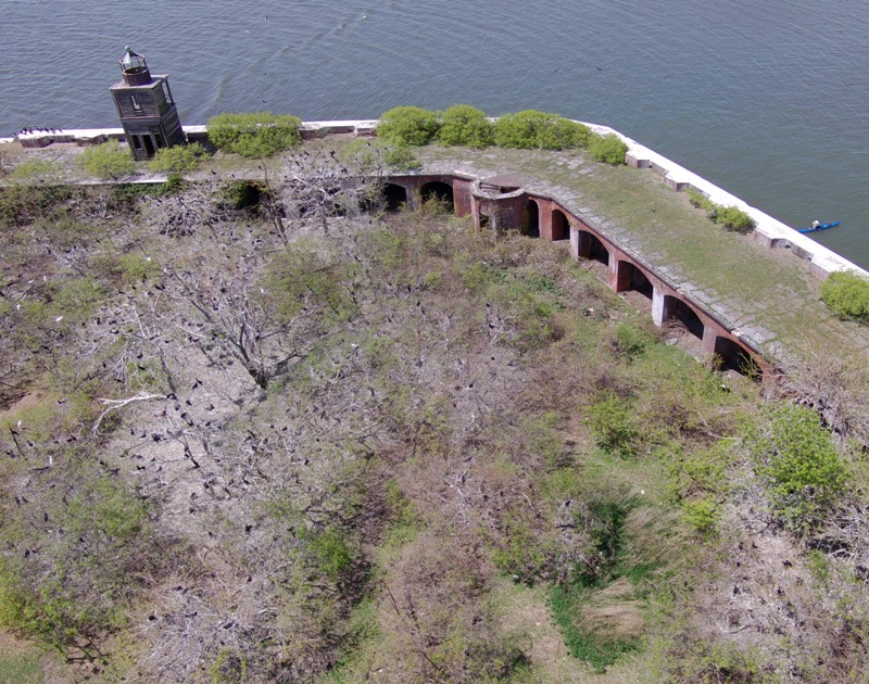
After about 12 minutes of flight time, I brought my drone back. 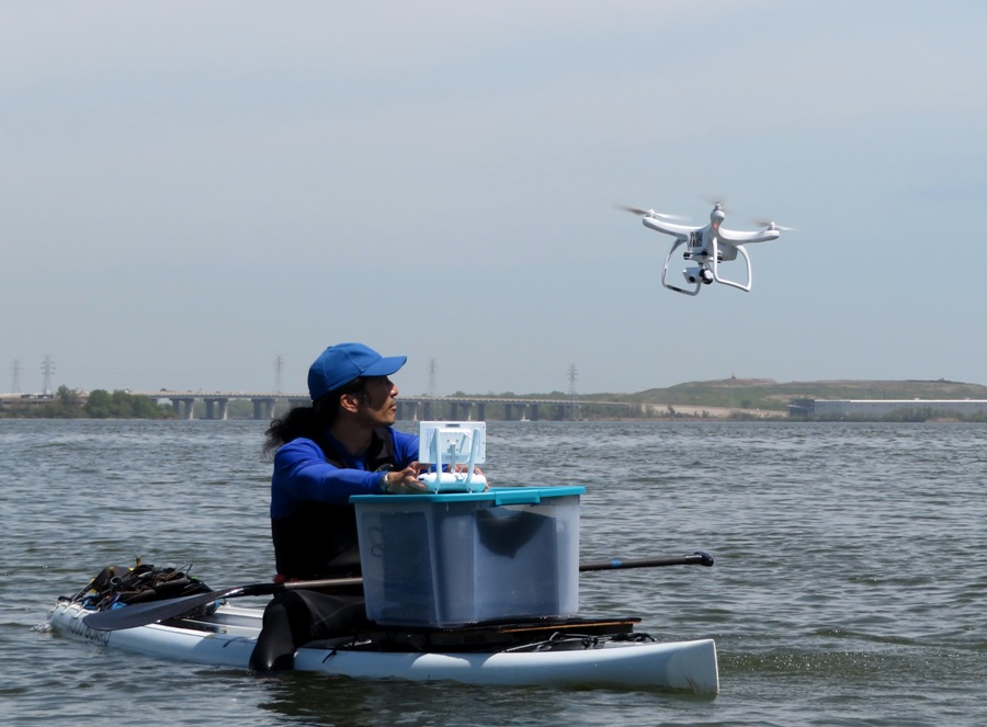
From early on, I thought about how I would land the drone when I am on the water. Landing on a narrow platform such as a SUP would leave very little room for error. So I practiced what I called a paddleboard landing. This involves me getting it to the right height near me, paddling to it, and then grabbing it out of the air. I then lower it to the SUP as I use the controller to turn it off. If instead it tries to fight me by gaining altitude, I simply put down the controller and turn off the battery. The challenge is that I would need two hands to turn off the battery, a third to hold the controller, and maybe a fourth and fifth hand to paddle into position. I reduced this challenge somewhat by adding a nylon strap so I could wear the controller around my neck. But simply putting it on the plastic carrying box was sufficient. 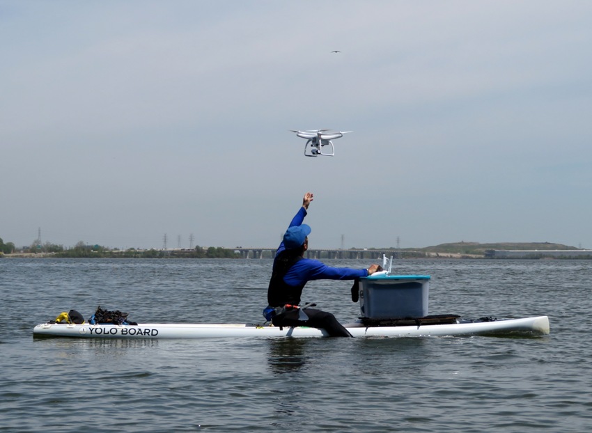
I spent two years of my Marine Corps enlistment stationed on an aircraft carrier. What makes a boat an aircraft carrier? One criteria is that aircraft must launch from and land on the boat. I don't know what the other requirements are but I think my SUP has this one covered. I paddled over to the landing dock. Here I could maintain line of sight with the drone as it flew to the southeast side of the fort. 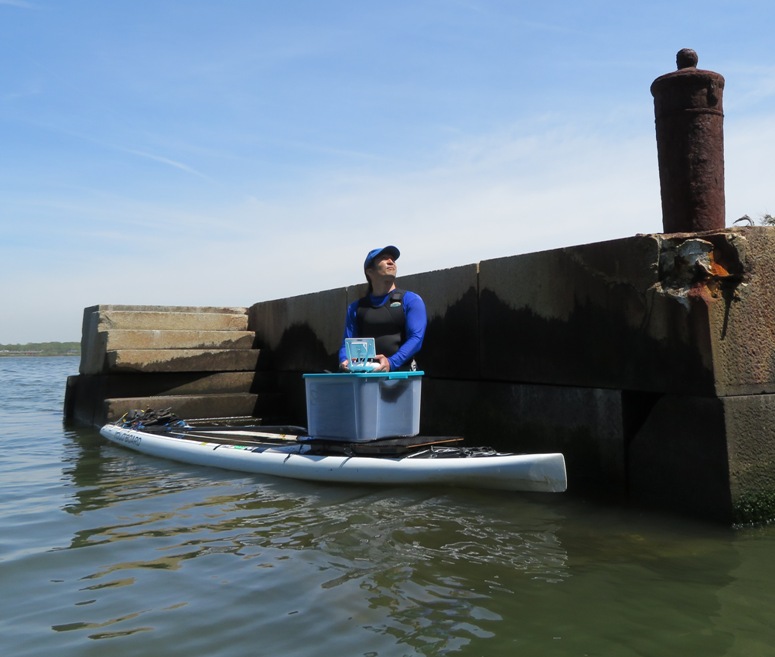
This is my favorite shot. My drone is looking west as the sun illuminates the fort with the Key Bridge behind it. 
Here's another view of the fort and the bridge. On the other side of the Key Bridge is the heart of Baltimore, which Fort Carroll was built to protect. 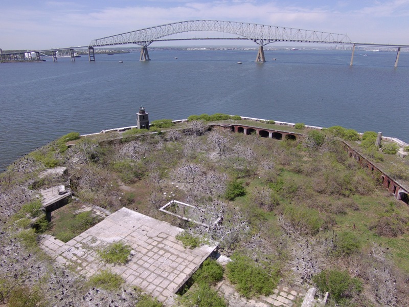
Britain's invasion of the Chesapeake in the War of 1812 had shown that forts like Baltimore's Fort McHenry were too close to the cities they were meant to defend. A new plan for fort construction, called the "Permanent System" (also known as the Third System) intended to defend America's most important seaports and prevent another invasion from the sea. - from ByteNet - Fort Carroll So what happened to the fort? Did it ever save Baltimore from another attack? Was it ever used in battle? The answer to both questions is no. Plans were proposed over the years to see the fort as the base for a giant statue, just as the Statue of Liberty had been erected on the remains of Fort Wood in New York harbor. Other plans included using the fort as an island prison like Alcatraz or as a museum. The Army and Coast Guard both used the interior of the fort as firing ranges briefly, but in 1958 the entire fort was sold to Benjamin N. Eisenberg for just over ten thousand dollars. Eisenberg hoped to turn the Fort into a casino, but the plan fell apart when he discovered that the fort was just outside the boundaries of gambling-tolerant Anne Arundel County. Eisenberg still spent a great deal patching up the Fort's neglected walls, planting peach trees and keeping the interior landscaped. In 1964 real estate developer Robert L. Jackson leased the fort and used his private passenger hydrofoil, the Baltimore Clipper, to ferry guests for picnics in the unique surroundings offered by the fort. Soon this plan was abandoned, too. Rumors persisted of development plans through the years, but in the meantime trees, vines, and weeds engulfed the fort's interior and the effects of wind, rain, and time eroded the brickwork and concrete. Thousands of birds nest there, and the Forts walls are covered with guano and bones. In October 2000 developer Bill Struever signed a new lease form [sic] the Eisenberg family, declaring his intention to "preserve this terrific piece of history," and "protect the site from neglect and decay." Nothing came of this man's ambition, either. - from ByteNet - Fort Carroll Here's a view looking south with the Herbert A. Wagner Generating Station in Curtis Bay in the distant background. 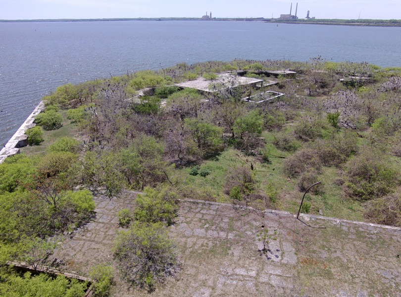
I asked to see if anyone knew what the cylindrical thing is in the shot below. I believe it is at least eight feet tall and made of stone. The top is not hollow. Someone on Facebook replied along with a link to the Darkroom photo stating It is the base for the lookout tower. The rest is long gone. 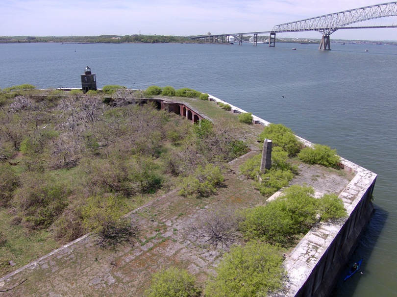
I brought my drone back and then we returned to Fort Armistead. 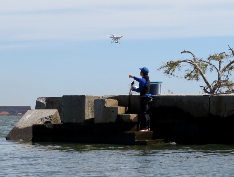
Everything went well but there was one concern. While at the landing dock, a big boat passed by that created waves. As the waves reached me, they grew to be pretty big due to the shallow water. The waves bounced off the fort walls and crashed into oncoming waves. This went on for awhile. Fortunately, all my drone equipment was on the stable landing dock. I held onto my SUP as the waves tried to upset it. While this was going on, I let the drone hover. It took a few minutes for the water to calm down. This was time that was draining the drone battery. Fortunately it was not an issue. But if I return, I will need to ensure that I can deal with the waves while I control the drone. Had I been on the SUP, I would have headed out to deeper water to help minimize the wakes. After this, I crossed one of my most important personal goals off my bucket list. |
|
I kayaked on the Middle Patuxent River between the Robinson Nature Center and Old Columbia Road. Recall that on April 13, 2019, I kayaked the lower section of this river starting at Old Columbia Road. Until today, I had never explored upstream of this location. I picked this route because it was very windy so open water kayaking would not be fun.
I launched my boat from Simpsonville and then paddled upstream. The ruins of the Simpsonville Mill lie under the Cedar Lane bridge. The history of this mill dates back to the mid-1700s. I launched right by it at a sandy area. 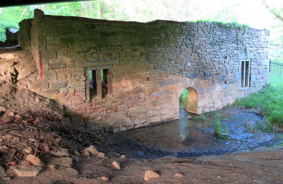
It had rained recently so I expected there would be plenty of water. My goal was to get two miles upstream. Gertler says that is where a significant unnamed creek merges with the Middle Patuxent River. Upstream of that, the flow is too little to make it worth kayaking. My take out was only two miles downstream from Simpsonville. At best, this would be a six mile trip. Paddling upstream, I saw a couple of stone structures which I assume were somehow related to the mill. The area was very wooded, scenic, and natural. Occasionally, I saw a hiker on one of the Robinson Nature Trail paths. I took out several times to look around. Near a smelly sewage area on the west side, I found a stone wall and a couple of ponds next to it. There were lots of American toads and pollywogs in them. I only made it up about a half mile from the launch site. Above that, it was too rocky and I would have needed to do a significant amount of portaging. My six mile trip would now only be three miles. I intended to savor this as much as possible. Making my way downstream, I pulled out at the mill race. 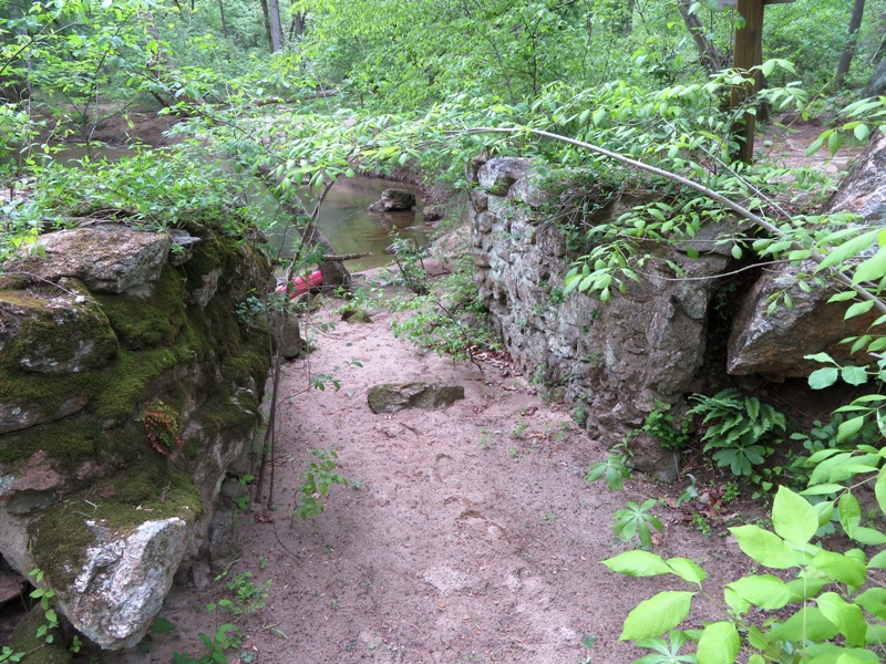
Here, I saw honeysuckle azelea flowers. 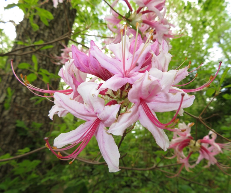
Near route 32, there was a two foot drop. I pulled ashore on the northeast side to scout things before continuing. I'm glad I did because had I taken the left side, I would have hit a rock just below the drop which would have surely caused me to capsize. Staying to the right was much better. I saw a blue jay collecting nesting material. 
I also spotted a fishing spider. 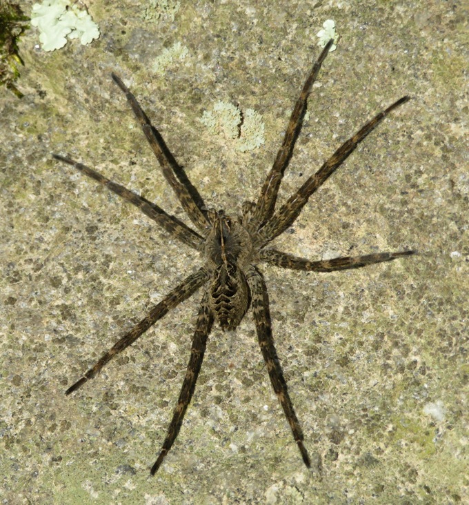
I can't emphasize enough just how scenic the Middle Patuxent River is. 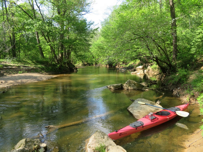
I don't remember how many portages I did but there were a few, mostly upstream from Simpsonville. I don't think it is worthwhile to paddle upstream from there. I pulled ashore near 39.175142, -76.892658 at a gravel road junction. I never saw any people or vehicles on this road. I investigated it from car afterwards and found that it connects to a recreational park owned by the Applied Physics Laboratory at 39.173702, -76.895685. There were no signs telling folks to stay out. I checked with a neighbor who works there. He asked his security people about the area and it turns out it is not restricted. So I plan to return with Daphne. It looks like a good place to let her run off leash. |
|
Norma, Daphne, and I kayaked to the Poplar Island area in Talbot County, Maryland to do a little bird watching. We found two rookeries, egrets, ospreys, a bufflehead duck, a sandpiper, a couple of Canada goose nests with eggs, and a duckling that appeared to be separated from its parents. This place is out in the Chesapeake Bay, a little over a mile from the mainland. We paddled a total of 7.6 miles.
Since its reconstruction with dredged material began in 1998, Poplar Island had grown to 1,140 acres by 2005. Plans call for the addition of another 575 acres. Only "clean" material, dredged from approach channels, is being used on Poplar Island. The Poplar Island restoration project will not use material dredged from close to Baltimore, which may be contaminated with heavy metals. The island is the home of approximately 175 different species of birds, including terns and osprey. More than 1,000 diamondback terrapins have been reported hatching annually on the island in recent years. Chesapeake Bay biologists consider Poplar Island's restoration to be a huge success for the diamondback terrapins, a brackish water turtle - and Maryland's "official state reptile." Terrapins started laying eggs on the island almost as soon as construction workers started building the sand berms and beaches, and the island now hosts the nation's largest terrapin research and propagation project. Terrapins here enjoy a nearly 99 percent survival rate (compared with 10 percent or less elsewhere) because there are no fox or raccoon, their major predators. - from Wikipedia - Poplar Island Here's another interesting fact about Poplar Island: In 1847, Charles Carroll launched an enterprising business on an island in the Upper Chesapeake Bay: the Great Poplar Island Black Cat Farm. Carroll had heard that there was a market in China for black cat fur, so he offered 25 cents apiece for female black cats. He shipped the cats to Poplar Island, paid a local waterman to deliver fish daily, and let the kitties have the run of the place. All was well until winter arrived. The bay froze, the fish couldn't be delivered, and the hungry cats made off across the ice to the mainland, thus bringing an end to Carroll's feline farm. - from Johns Hopkins Magazine - Treasured Islands We launched my tandem kayak from Lowes Wharf. In this area, we saw a bufflehead duck. 
The wind was strongest at the start of our trip. Waves rocked our boat and made Daphne feel uneasy. But after about a half hour, the water was calm so she could relax. We pulled ashore and walked around on the unnamed island at 38.769255, -76.372335. Here, we saw Canada geese nests. The pic below shows a nest with a very recent hatchling. Yes, it is alive. We tried not to disturb anything but the nests are right out in the open and the geese sitting on the nests don't let you know they are there until you are almost right on them. They leave and return after we are gone. 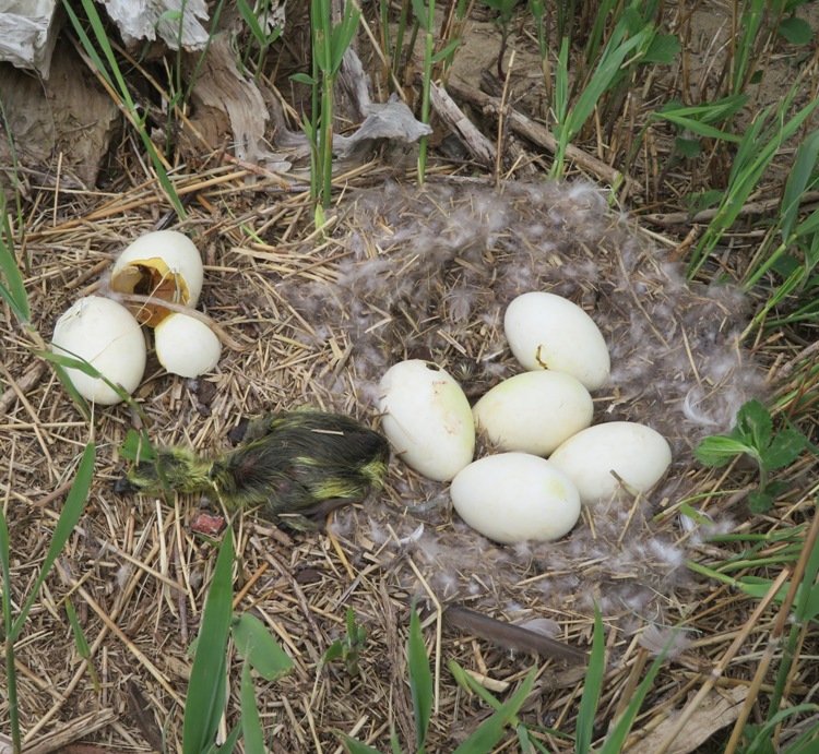
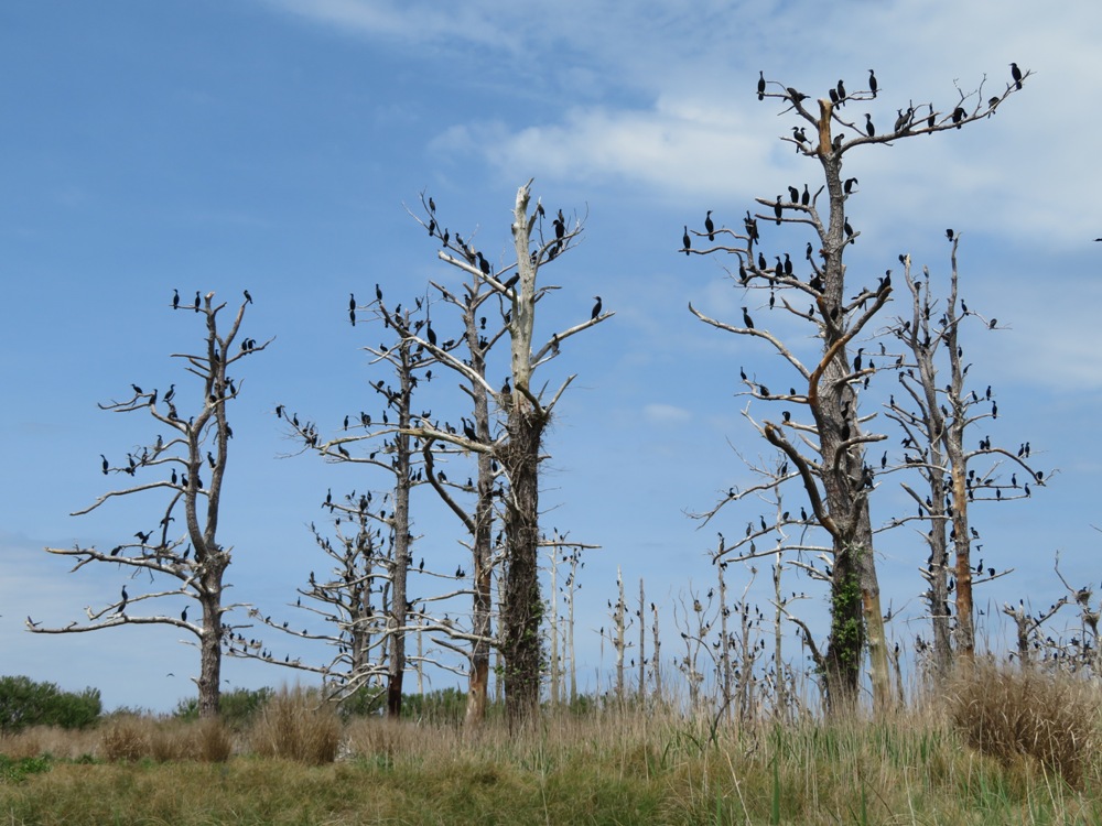
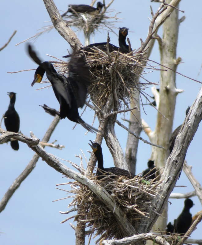
Our next stop was Jefferson Island. This lies just east of Poplar Island and is home to a very large double-crested cormorant rookery. It is located at 38.766306, -76.371639. I took a multitude of pictures of the cormorant rookery. 1 / 7
On dead trees.
2 / 7
Nests on fallen tree.
3 / 7
Lots of nests.
4 / 7
Coming in for a landing.
5 / 7

More nests.
6 / 7
Sitting in nests.
7 / 7
Mating or courtship?
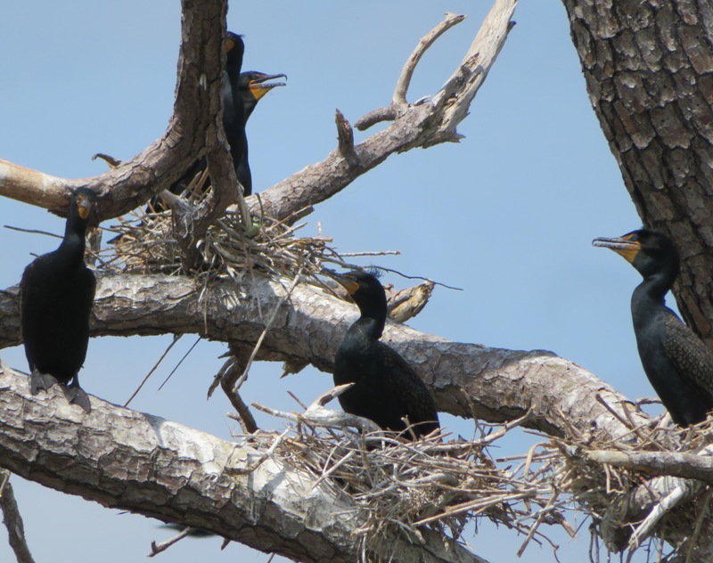
It was a mostly cloudy day but occasionally, the sun did come out. I was very fortunate that it came out when we were at the rookery. These two have blue-green eyes. The mouth of the bird on the right matches its eyes. 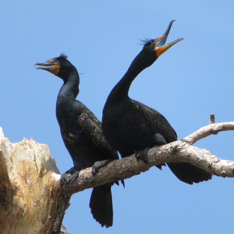
This trip was the first time I've ever heard cormorants. Their call reminded me of the Predator alien. I wondered if their sounds are only heard during mating season. In the pic below, the bird on the left has very clearly defined tufts on the side of its head. This means it is ready to breed. 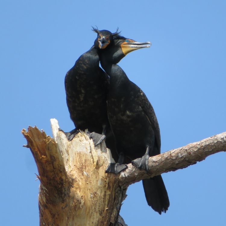
More tufts. Kinda reminds me of Dilbert's pointy haired boss. 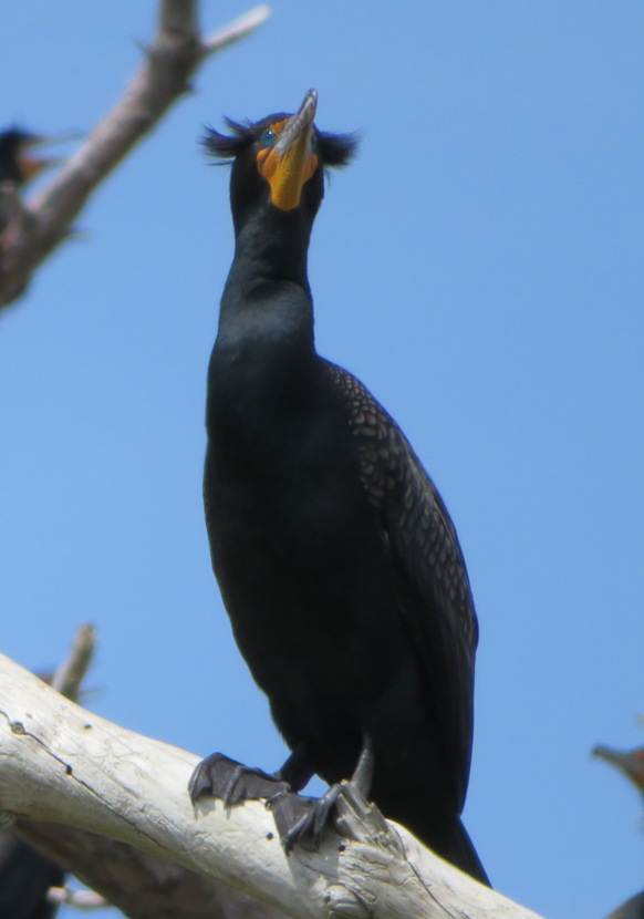
Something tells me the cormorant in the below snapshot is going to get shit on when this great blue heron takes flight. 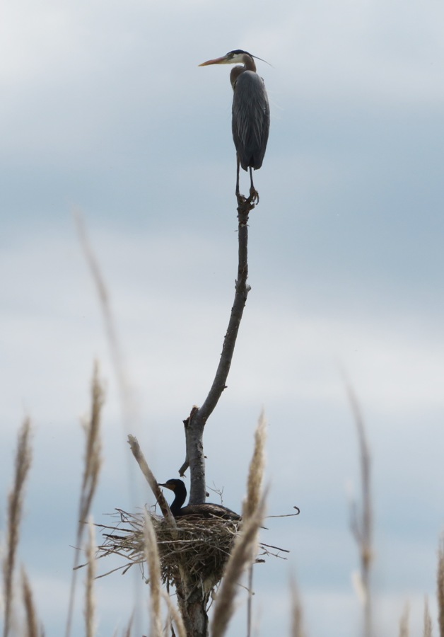
The following scene shows cormorants in various stages of flight. Unlike mallard ducks, cormorants need a lot of space in front of them to get airborne. 
I found a cormorant recipe at "Funny Jokes - Cormorant Recipe" (broken link as of 2025): Finally roast in a very hot oven for three hours. The result is unbelievable. Throw it away. Not even a starving vulture would eat it. According to Wikipedia - Poplar Island: The island is the home of approximately 175 different species of birds, including terns and osprey. I assume this includes the islands around Poplar (like Jefferson). Norma, Daphne, and I headed to Coaches Island where we spotted a great blue heron rookery at 38.752083, -76.365917. The best place to see this is from the eastern side of the island. 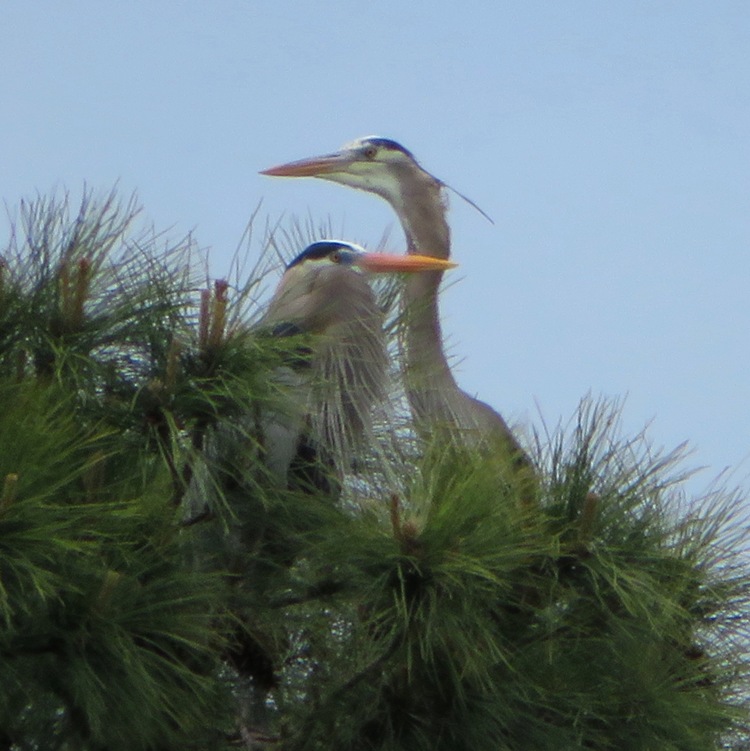
These great blue heron nests are in evergreen trees so they are very difficult to see. 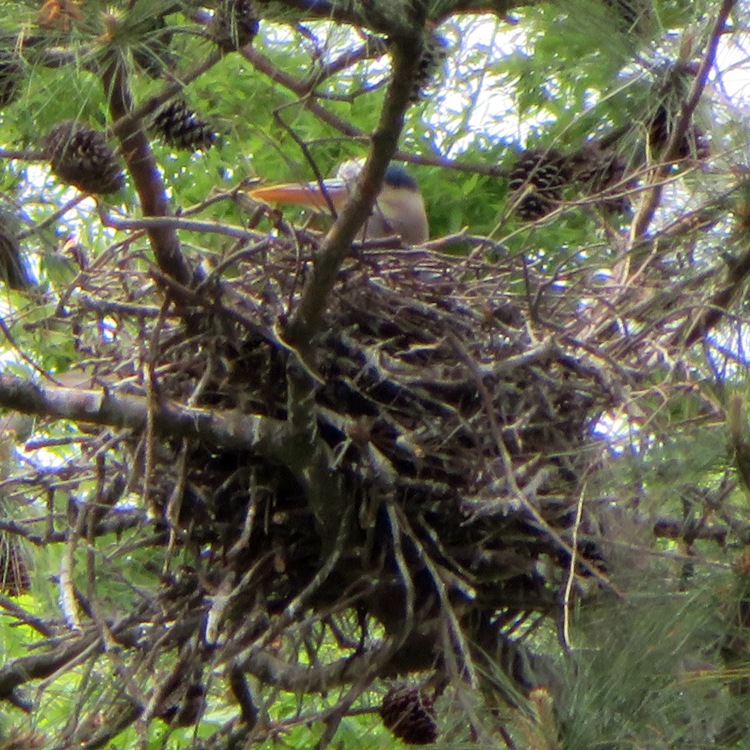
I couldn't see them but I'm pretty sure I heard the faint sounds of baby great blue herons. Hatching around now is about right, according to All About Birds - Bird Cams FAQ. 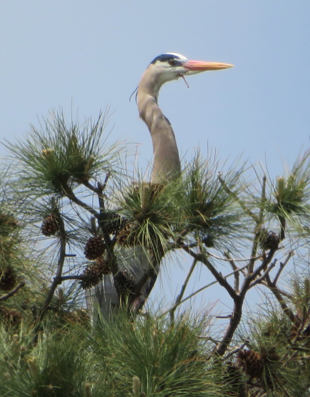
After paddling, we ate a very nice lunch at Crepes by the Bay in Saint Micahels. |
|
On Star Wars day, I took Daphne paddleboarding on the South River in Edgewater, just south of Annapolis, Maryland.
First, we stopped in at the Anne Arundel County Farmers' Market. I picked up some bread, cookies, and a breakfast sandwich but I was disappointed that dogs are not allowed. Daphne had to wait in the car. Next, Daphne and I paddled 12.6 miles between Homeport Farm Park and Quiet Waters Park. We explored Church Creek, Aberdeen Creek, and Harness Creek. These creeks all flow into the South River. I saw a muskrat and lots of carp activity in the shallower sections of the creeks. I'm guessing they are mating...not the muskrat with the carp but the carp with other carp. I saw lots of ospreys but no eagles. Daphne and I stopped at Quiet Waters Park. I pulled ashore at the boat rental pier. Then I took Daphne for about a two mile walk on the trails. I saw her sniffing around. Then she was startled. I checked things out and discovered that she had found a box turtle. 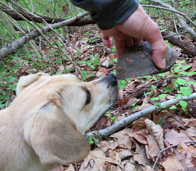
The park trails are very nice but they also get a lot of use so it isn't a good place to let your dog run off leash though maybe during the week it isn't a problem. This place has a dog beach and a dog park. I took Daphne to the dog park but she wasn't feeling very social. At Quiet Waters, I found a male broadhead skink resting on a log. This is the first time I've ever seen this kind of lizard. 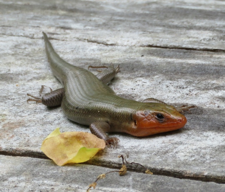
Back on the water, I saw a great egret. They look so much like great blue herons, I think if you just bleached out a heron, you'd end up with an egret. 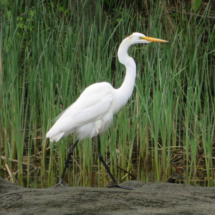
This bird ruffled his feathers in a manner that reminded me of a pee shiver (piss quiver). I found a good explanation for this at "Hank Christensen Photography - Snowy Egret Feather Shake": He shook his body vigorously to fluff all of his feathers, so that they could resettle into a natural insulating layer. This type of shake will rearrange the micro-structure of a bird's outer feathers, keeping water from penetrating the inner feathers. 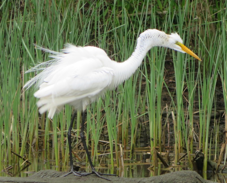
I saw several green herons. This is one of my favorite birds. This one was fairly cooperative at posing for my camera. 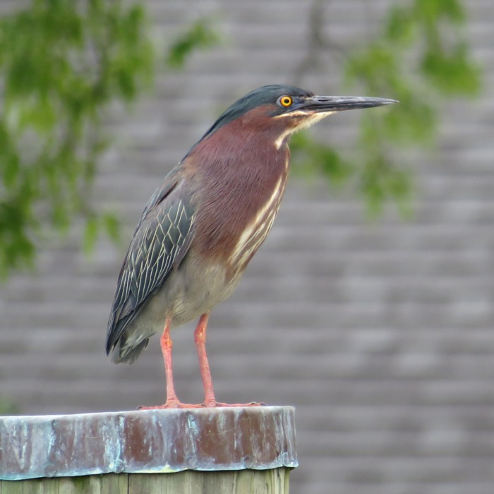
Ralph H. and Greg W. informed me about a great blue heron rookery on Aberdeen Creek. I found it at 38.944528, -76.519667. Even in early spring, this rookery would be difficult to see because it is built in pine trees. In addition to the great blue heron rookery, I was also looking for a long-tailed duck that Ralph and Greg saw on May 2. I could not find it. I considered taking a drone shot of the big brick building at Historic Londontown but that would have required me to cross the South River. Daphne wasn't enjoying the boat wakes so I figured I'd save that for another time when she wasn't with me. Instead, I practiced setting up, launching, and landing the drone from my SUP. Daphne doesn't much like my drone. Notice that she is standing behind me. 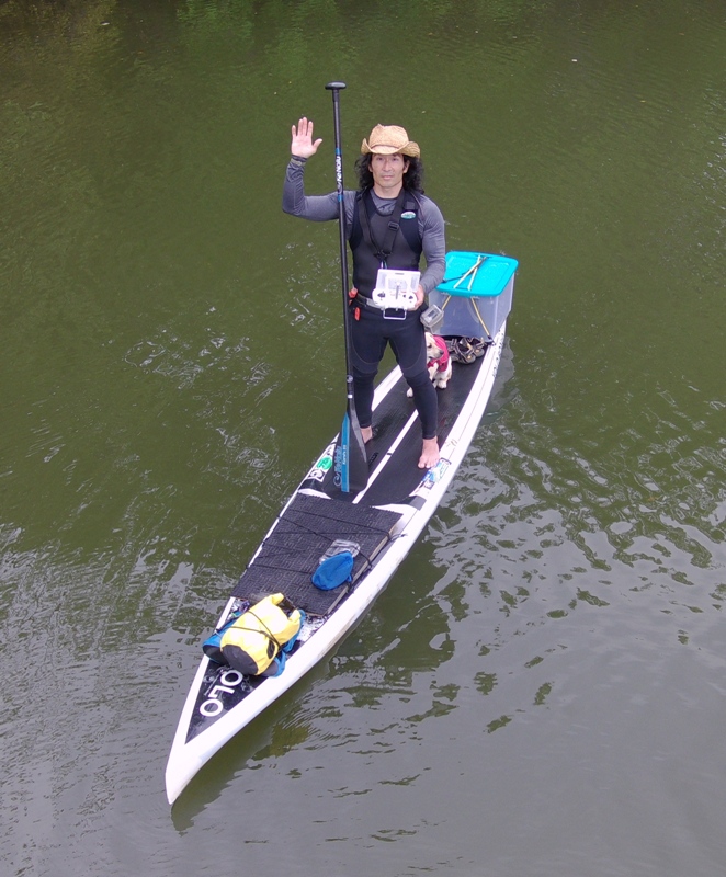
The next day, Daphne stayed in bed until almost noon. I think this trip did her in. She was standing almost the entire time she was on the SUP. I offered her fresh water to drink but she always turned me down. From now on, I'll reserve the shorter trips for her (up to ten miles) and try to keep things flat water. She shakes when we start hitting waves. I notice she yawns a lot too. According to "Pedigree - What Your Dog's Yawn Really Means" (broken link as of 2025): A yawn may indicate anticipation or stress. |
|
On this day, I kayaked in Cecil County, Maryland, paddling from Perryville to Charlestown. I explored Mill Creek, Furnace Bay, and Northeast River. Then I paddled up into the Susquehanna River.
Here's some information about the area, taken from Cecil County Life - Saluting a rich history: The first known inhabitants of the Perry Point peninsula were the Susquehannock Indians, who left stone arrow and spear points on the land as they hunted and fished there for untold centuries. In a display case are a few arrowheads, two of which were singled out by a recent visitor as possibly being about 2,000 years old, Vincenti said, so the occupation of Perry Point apparently goes back into prehistory. In about 1680, Lord Baltimore granted some 32,000 acres of land, including what was then called Susquehanna Point, to his cousin, George Talbot. Talbot discovered that John Bateman was already living on the Point, having acquired the land in 1658 by a patent from Lord Baltimore. In 1710, Captain Richard Perry acquired the land, but the Perry Point name predated him, and is mentioned in the land grant to John Bateman, earlier than 1658. Lots of people were out fishing. This prevented me from paddling the most scenic route because I had to make sure I stayed away from people's fishing lines. I saw plenty of eagles. Too many to count. I found an 18" long feather. I found this unnamed island on Principio Creek at 39.562472, -76.036306. If nobody has any objections, I'm naming it Isle of Saki. 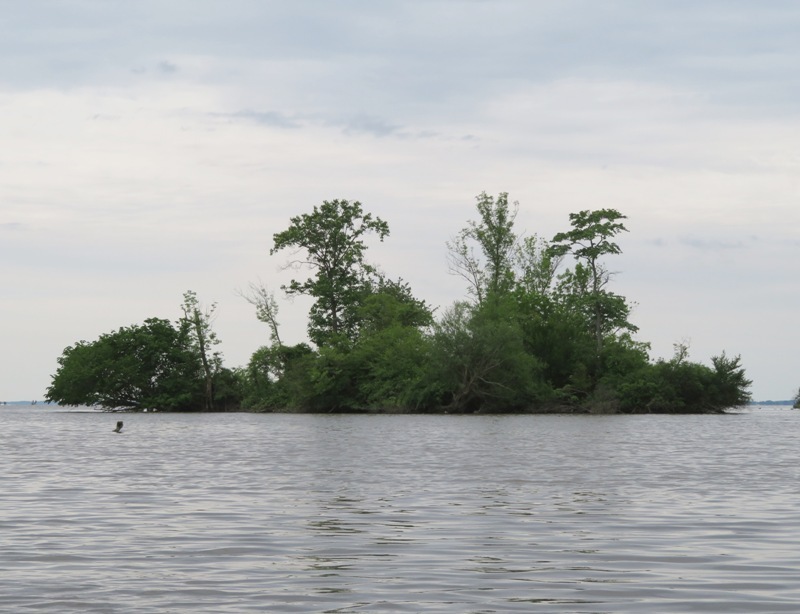
Nearby, I kayaked between two very unusual and unnatural-looking peninsulas. I looked for clues but could not figure out why they were there. They are at 39.565083, -76.032667. I turned around after taking a short break at Charlestown. According to an information sign, this is Charlestown Wharf. Stone wharf and warehouse were built here by decree of general assembly in 1744. During [the] Revolutionary War, this was a major supply depot for American armies. 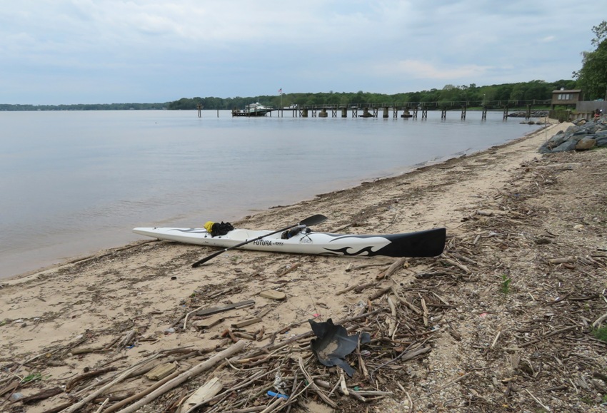
I found this unusual structure (shown below) on Carpenter Point at the mouth of the Northeast River at 39.541306, -76.002833. I thought it might be the remains of an old lighthouse. It is certainly in a good location for one. But I could find nothing to indicate this. There is a beach right next to it but it seems like overkill to be a place for lifeguards to sit. 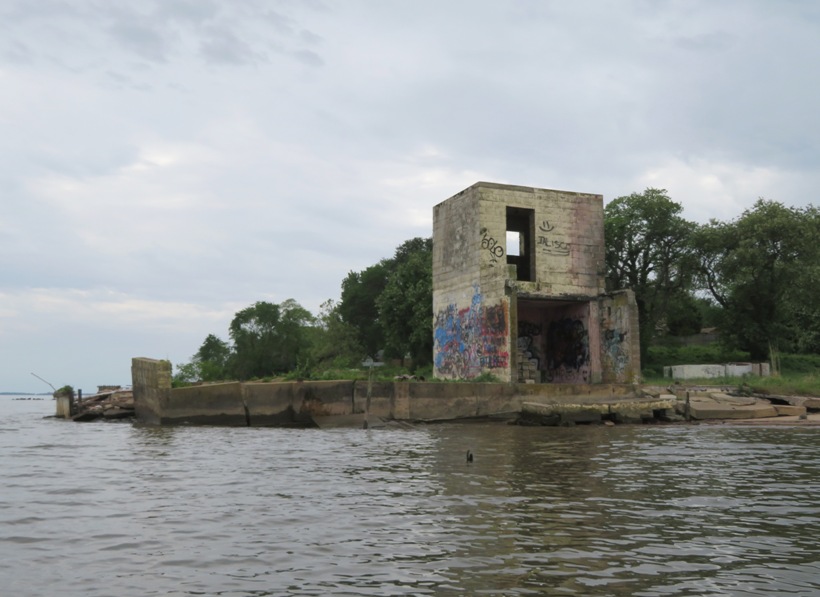
The sun had been out earlier in the day prior to my launch. I used that time to take drone photos of Havre de Grace. But I knew it would be dark and overcast while I was on the water. So I didn't take many photos or pay much attention to nature. For me, this was more of a training paddle. I was working on form and endurance. The wind was calm and later in the day there was a light rain. I kayaked to the Perry Point Gristmill. Constructed in 1721, the gristmill continually operated serving the community of Perry Point until the end of the Civil War, when it was abandoned. Today, the 280-acre Perry Point site serves as a medical rehabilitation facility for Veterans. - from Preservation Maryland - The Gristmill at Perry Point Maryland VA Medical Center 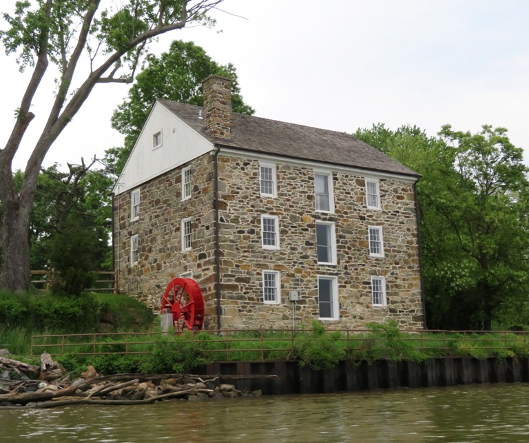
I paddled 20.6 miles. This was my first real training paddle of the year. My back and abs were sore. That's what you want to be sore. It is an indicator that you are using good technique. |
|
After work, I did a little kayaking on Marley Creek, launching from Solleys Cove.
One or two miles into my trip, a couple of kids called me over and showed me a box turtle they found. It was on a landscaped grassy area in back of their apartment complex and they were concerned for its safety. The shell was just slightly damaged as if it might have gotten caught under a lawn mower. I told them I would take it across the creek to an undeveloped, wooded area and let it go there. Box turtles are not aquatic. My favorite kayak is my S1-A surf ski. It is unstable but very fast. I only take it out when the water is fairly calm. If I am expecting rougher water, I'll use another boat. My surf ski is only 16 and a half inches wide so it is an understatement to say that it isn't spacious. I don't use this boat to carry Daphne or my drone. The footwell isn't even wide enough for me to wear sandals. There isn't much room for transporting stuff but I managed to find room for this turtle. 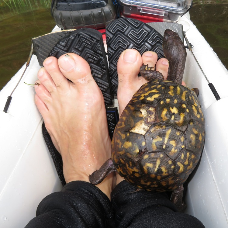
I released the turtle on the east side of the creek on a level area under some trees. Later, I saw a couple of eagles though it might have been the same one that I saw two different times. I paddled 11.7 miles. After finishing, I came home and started planning my big trip to see the horseshoe crabs come ashore in Delaware to spawn. I did this trip on May 18, 2019. |
|
After work, Sara, Mike B., Norma, Daphne, and I went paddling on the Kings Creek Water Trail launching from Kingston Landing. It started out fairly windy where we put in on the Choptank River but once we entered the sheltered Kings Creek, the water became calm.
Sara and Mike tried out Sara's brand new Adventure 14 Mad River Canoe. I thought it looked extremely comfortable. Daphne seemed to like it too. In the pic below, we are a short distance from Kingston Landing, where we launched. Kingston was one of three designated "Port Towns" established by the Maryland Assembly in 1683 as tobacco trading ports and warehouses on the Choptank River. Steamboat wharves and warehouses also operated here before the town died out in the 19th century. - from "Choptank and Tuckahoe Rivers Water Trails Map Guide" (broken link as of 2025) 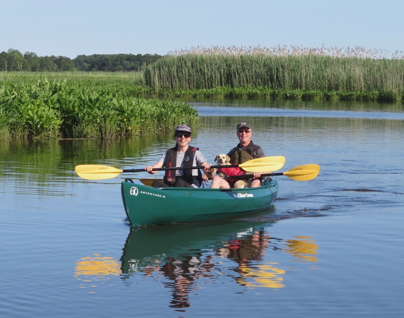
At the mouth of Kings Creek, the salinity of the water is higher so the vegetation is more grassy. But further upstream, the water is fresher so the landscape is more wooded. There were several spatterdock flowers in bloom. 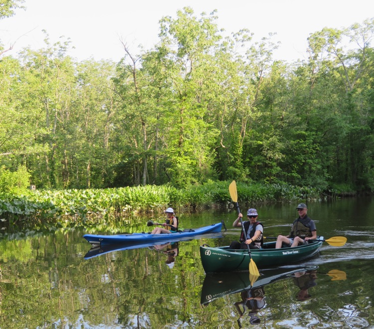
Near mile three, one can pull over on the downstream north side of the Kingston Road bridge for a break. One could also launch from here. There is enough room on the west side of the road to park at least two cars about 60 feet north of the creek. 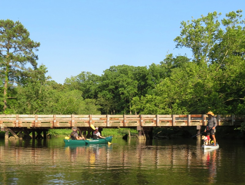
Under Kingston Road bridge live several barn swallows. These birds use mud to build their nests. Notice the baby remaining motionless in the nest. 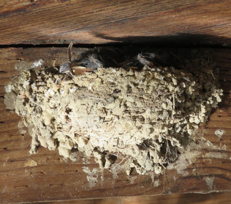
Along the shore, we saw a few very fragrant sweetbay magnolia flowers. 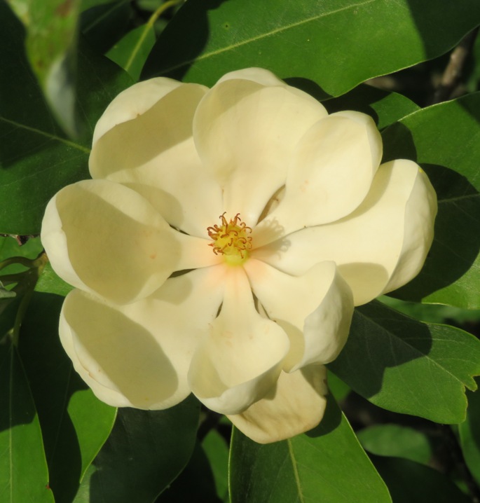
I saw a turtle or two but overall, we didn't see much wildlife. However, near mile four, Norma spotted a river otter. Unfortunately, the rest of us were too busy talking to notice and we never got a picture of it. I think all our chatter scared away the critters. 
Daphne and I passed a clump of arrow arum plants. 
Daphne is quite competent on the SUP. She's part corgi and that gives her very short legs which means a low center of gravity. I've got short legs too. She must get it from me. 
In the shot below, we are near the Choptank wetlands. This 650 acre tract of land is owned by the Nature Conservancy and is considered one of the largest remaining tracts of undistrubed brackish marsh in the United States. Historians believe that these marshlands are pristine, meaning that despite their closeness to Kingston Landing, they are untouched by man. - from "Kings Creek Water Trail" by the Midshore Riverkeeper Conservancy 
Mike, Sara, Daphne, and I paddled downstream on Kings Creek as the sun sets while Norma took our picture. 
This place looks so natural. I wonder if the scenery has changed much since prior to European settlement. The Choptank Indians inhabited this region. They are a sub-tribe of the Algonquin Nation closely related to their neighbors the Nanticokes. The Choptank Indians were generally considered a peaceful tribe who traded regularly with the English settlers who came to the area. In 1699, the League of Peace between the Choptank Indians and the province created a 14,000 acre reserve area. Eventually, the Choptank Tribe fizzled out as members moved to Pennsylvania and joined the Nanticokes or died from diseases brought by the settlers. - from "Kings Creek Water Trail" by the Midshore Riverkeeper Conservancy We eventually made our way to the mouth of Kings Creek, where it meets the Choptank River. The Choptank's deepest waters are found at the river's confluences with the Tuckahoe (40 feet) and Kings Creek (50 feet). These are two of the many interesting tributaries along the Upper Middle Choptank. Locals call the smaller of these channels "guts," an odd-sounding name for streams so often lined with beautiful swaying grasses and awash in vibrant wildflowers. - from "Choptank and Tuckahoe Rivers Water Trails Map Guide" (broken link as of 2025) There are many fine creeks that flow into the Choptank that are paddleable, at least for some distance. The Tuckahoe is the most well known. But I'd recommend any that have a name. Those without are often too shallow, narrow, or too short to make exploring worthwhile. We were out of the water just after 2000. The four of us put in eight miles, making it slightly upstream of where Kings Creek and Beaverdam Branch merge. Afterwards, we stopped for dinner at Chipotle (8911 Ocean Gateway, Easton, Maryland 21601), which Mike suggested. They have a dog-friendly outdoor dining area on the west side. This was a great find for me. Kings Creek is one of my favorite places to paddle. Norma and I have been there several times now but this was a first for Sara, Mike, and Daphne. I was glad to be able to share it with them. |
|
What is a dream job? In my opinion, it is when you can get paid to do something that you truly love. I now have such a job.
On May 15, 2019, Greg W. forwarded me an e-mail he received from the Director of Communications of the Chesapeake Conservancy. She was looking for someone who could write about paddling ideas and experiences in the Chesapeake watershed. I reached out to her and pointed her to my website to give her an idea of my adventures and style of writing. After several e-mail exchanges between us and another woman from the Conservancy, they decided to let me write an article for them. I submitted my first piece, Paddling the Curtis Creek Ship Graveyard, which was approved and posted on June 6, 2019. For this trip, I launched from Solleys Cove. The woman in the top photo of this article is my good friend Sara. Sara took the photo of me in the second photo. I am now a "freelance paddling adventure journalist." After an idea I propose is given a green light, I will do a kayak or stand up paddleboard (SUP) trip, write about it, submit it for approval, and then (if they like it) get paid. This program is sponsored by the Chesapeake Conservancy and National Park Service. My goal is to write two articles per month. These articles must cover one particular area on a list of a few hundred places. There are no deadlines. During the late autumn and winter, I can write about my hiking adventures but my focus will be on paddling. I will be reimbursed for mileage and fees. On May 17, 2019, I opened a fortune cookie. My fortune read, "You are soon going to change your present line of work." I don't plan on quitting my regular job but certainly a change in my work has taken place...a change for the good. What's next? Maybe this winter I will work on getting a commercial drone pilot license so I can submit drone photos with my articles. A few months later, I did get my commercial drone pilot license. I worked at this job for a few years. But eventually, the Chesapeake Conservancy lost funding from the National Park Service and had to take down their "Find Your Chesapeake" site which had been hosting my (and everyone else's) articles. I saved mine to Published Articles - Find Your Chesapeake. I don't know if a job like this will ever come along again but I'm glad it did. |
|
On June 15-17, 2019, I went kayaking at Kiptopeke and then Norma, Daphne, and I paddled at Chincoteague after spending the weekend with some of her family.
|
|
I paddled out to Sharps Island Lighthouse launching from Bar Neck Landing on Tilghman Island. The lighthouse is located three miles south by southwest from the southern tip of Tilghman Island, out in the Chesapeake Bay. The name of the lighthouse implies it is located on an island but this is not the case...only water. Because of this, I only venture out to this location under ideal conditions, such as today's 2-6 mph wind and sunny skies.
Heading out, I crossed the Chesapeake Bay Bridge early and then got one of only two parking spaces at Bar Neck Landing. I did not want to show up later and risk not having a place to park. I had my SUP loaded up for some serious business. I brought my drone, lots of food, plenty of liquids, a VHF radio, sunscreen, boom box, etc. Next time I should put the SUP in the water before loading the big stuff. I couldn't lift it. 
The wind was not strong but it wasn't yet calm enough for a three mile open water crossing on SUP. So I paddled north on the west side of Tilghman Island so I could catch the north wind to the lighthouse when it was time to make my move. Eventually, the whitecaps subsided and a slight tailwind gave me a push to my destination. 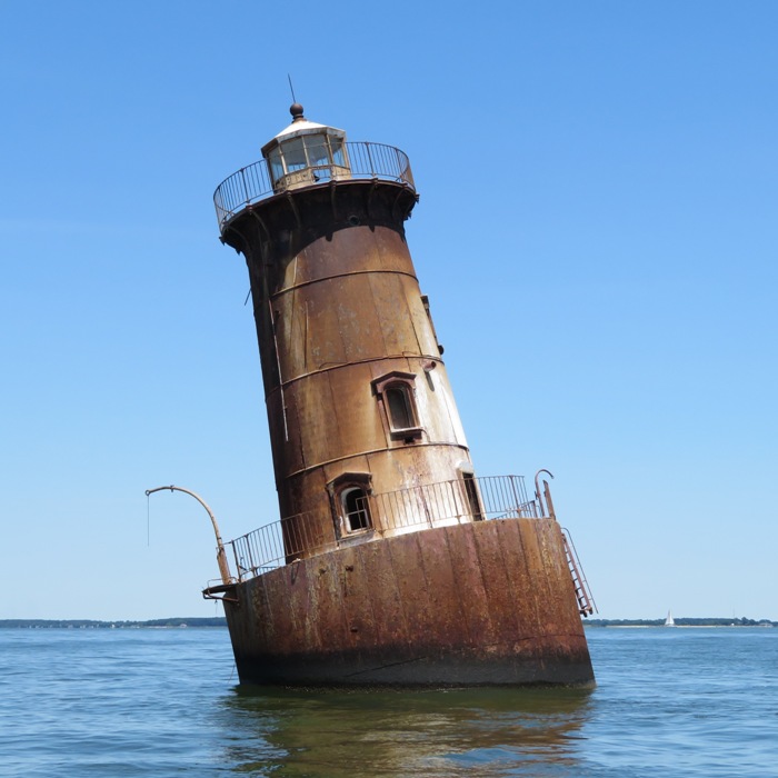
Sharps Island Lighthouse is actually the ...third lighthouse with that name to serve the Eastern Chesapeake Bay area near the entrance to the Choptank River. The first lighthouse was actually situated on Sharps Island... - from Lighthouse Friends - Sharps Island Lighthouse Sharps Island lies directly at the mouth of the Choptank River. It is named after Peter Sharpe, a Quaker "Chirurgion" who owned the island before 1675. The island then consisted of over 700 acres. Exposed to wave action on all sides, the island had eroded to about 100 acres by 1914 and eroded completely away by the early 1940s. - from "Choptank River Heritage - Sharps Island" (broken link as of 2025) I took this shot with my hand-held camera. From this angle, it doesn't look like the lighthouse is leaning. But it most certainly is. Leaning by about 15 degrees since it was ice-damaged in 1977, the structure is picturesque, but in poor condition. - from Wikipedia - Sharps Island Light 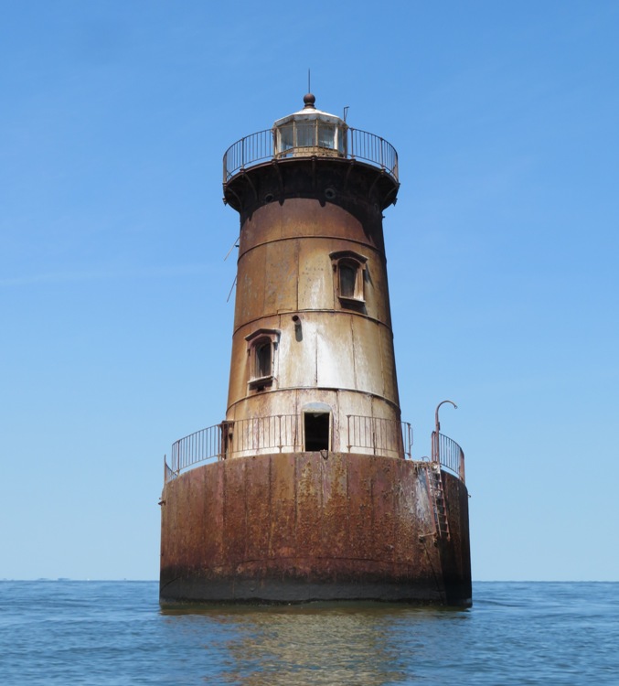
I've paddled out to Sharps Island Lighthouse several times now and have plenty of photos of it. But today, I took my drone to get a different view. 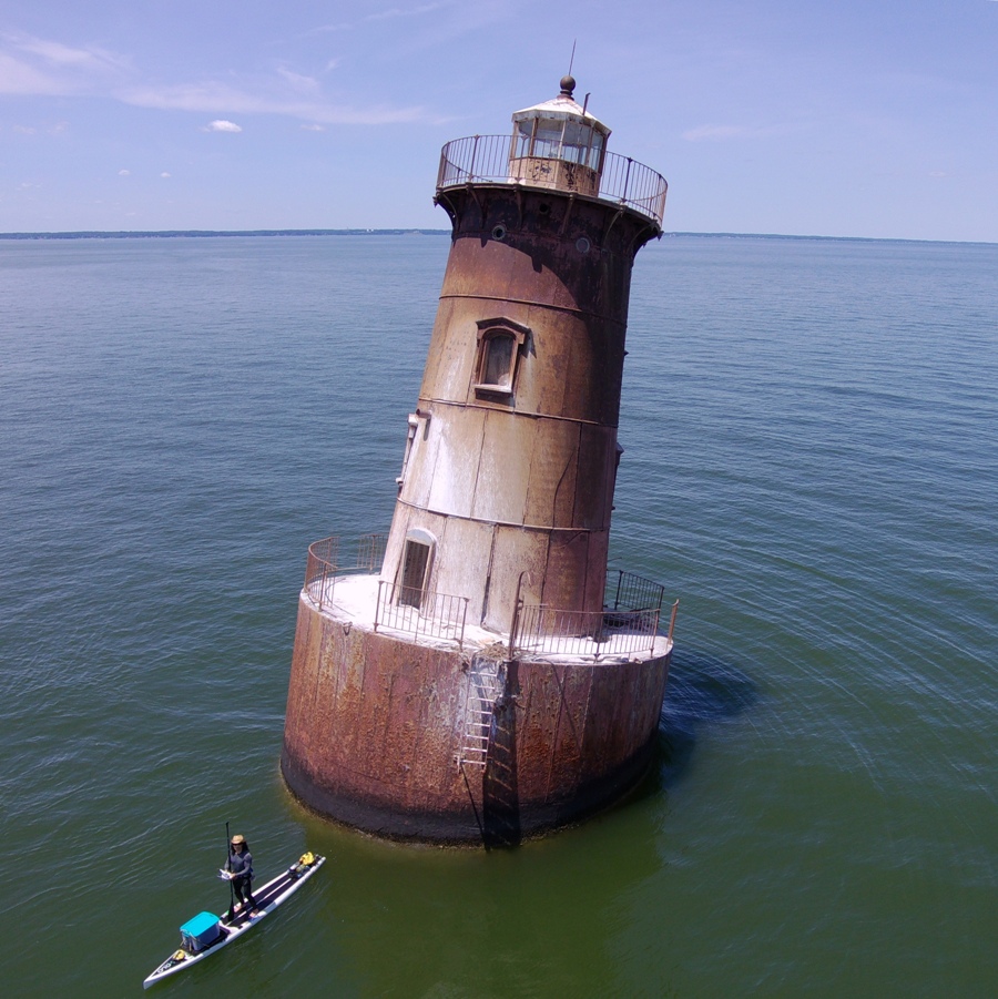
The Sharps Island lighthouse is a cast iron caisson filled with concrete with a brick lined cast iron tower built on top. The tower is 37 feet tall which sets the light 54 feet above the mean water level. This structure was constructed in 1881-2 and first lit on February 1, 1882. - from Chesapeake Chapter U.S. Lighthouse Society - Sharps Island Lighthouse Here's another picture I took with my drone. It wasn't until I saw this image at home that I realized that the light is hanging freely so that it is always perpendicular to the ground. Thus, even though the lighthouse is skewed 15 degrees, the light is not. ...the structure is, to date, fundamentally sound. The inclination, however, was severe enough to require the removal of the Fresnel lens, which was replaced with a 250 millimeter plastic beacon. This new apparatus was placed on a leveling plate fastened to the lens pedestal, where it gives off a flashing white signal with a red sector used to mark dangerous shoals. - from Lighthouse Friends - Sharps Island Lighthouse 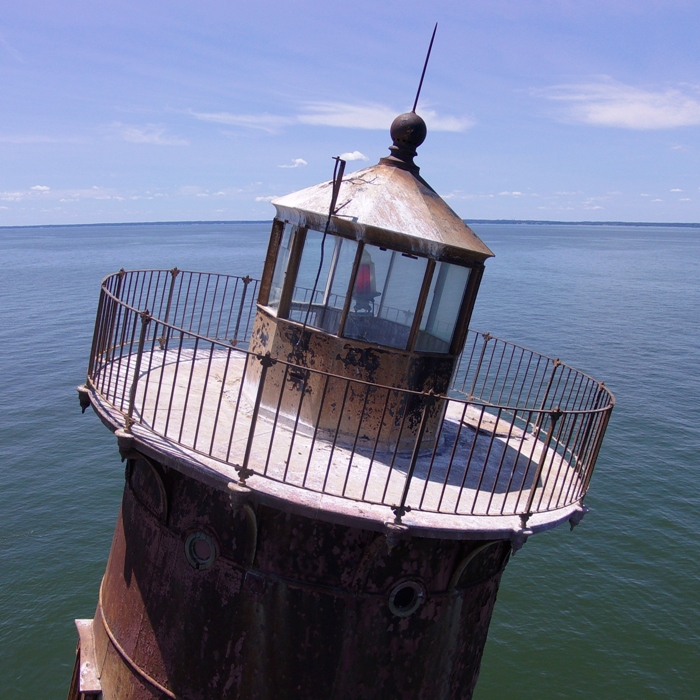
So what became of this lighthouse? As of 2006, the lighthouse was a candidate for sale under the National Historic Lighthouse Preservation Act. It was deactivated in January 2010. - from Wikipedia - Sharps Island Light While viewing the lighthouse was great, my main goal was to see and photograph cownose rays. On September 16, 2017, I saw 60+ rays near the island or the lighthouse. Then on June 30, 2018, I saw 101 rays. But on this trip I only saw 40-50. Most were in Blackwalnut Cove at the south end of the island. What made this trip different than the others is the amount of splashing taking place. At various times, it seemed every few seconds a ray was making as much noise as a bowling ball being dropped into the water! Why all the commotion? - from Chesapeake Bay Program - Cownose Rays - from Florida Museum - Rhinoptera bonasus - from Georgia Aquarium - Cownose Ray I don't recommend paddleboarding around rays unless you have very good balance. Though not aggressive, these rays can be dangerous. - from The Infinite Spider - Can a Cownose Ray Hurt Me? - from Chesapeake Bay Program - Cownose Ray For the purpose of photography, I look for rays swimming at or near the surface. If they are just below the surface, I usually won't know until they are close. But I can see fins sticking out of the water from further away. Then I can paddle to them and get a closer look. A female will swim with the edges of her pectoral fins sticking out of the water, with male cownose rays following her trying to grasp the fins to mate. - from Wikipedia - Cownose Ray Back when I lived on a boat, I sometimes saw flying fish. They were airborne for quite awhile but they didn't really fly...they glided. But watching cownose rays swim, I would say they look like they are flying through the water. Click on the image below to start a video. 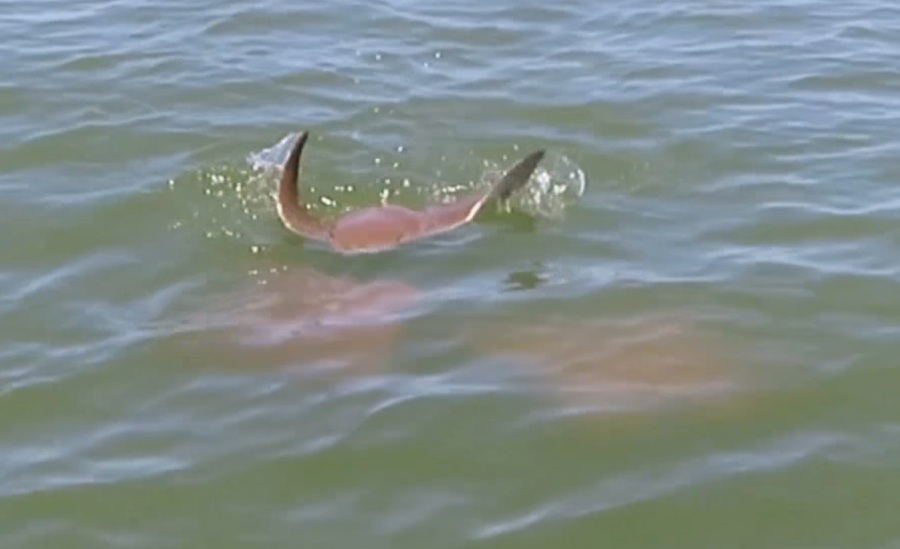
In Mexico, I saw mobula rays propel themselves out of the water as they flapped their pectoral fins on January 4, 2013. In a sense, maybe those rays really were flying. Also in Blackwalnut Cove, I spotted an osprey family. If you look on the right side of this image, you'll see a juvenile laying low. They do this because unlike their parents, which can fly away, the young are vulnerable and therefore must avoid being seen. 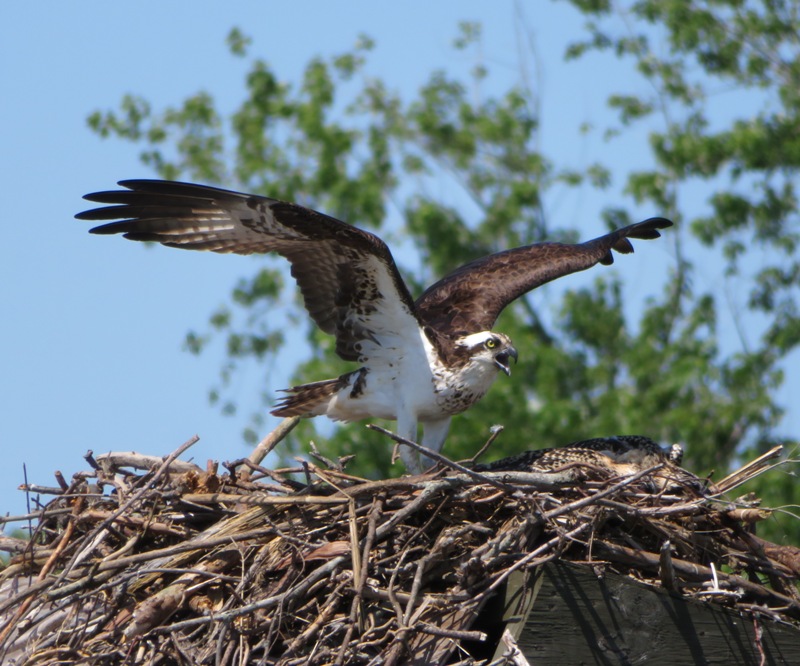
I got in 13.2 miles. |
|
I launched my SUP at Rocky Point Park then paddled to North Point State Park and back. Both parks reside in Baltimore County. On this 12.1 mile Chesapeake Bay trip, I
Rocky Point Park to North Point State Park
Craighill Channel Lower Rear Lighthouse
Concrete Ships
Black Marsh
|
|
I spent much of the day paddling at or near Jug Bay Wetlands Sanctuary.
Upper Glebe Marsh
Evening Mysteries of the Marsh
|
|
I launched my SUP early in the morning at Franklin Point State Park in Anne Arundel County, Maryland. I explored Deep Creek (not the one in Garrett County) and Deep Cove Creek. These areas can get pretty shallow and difficult to navigate but I was on the water at high tide and all the rain from previous days ensured the water level was higher than normal. Ralph told me
Deep Creek was [deep], I am told, until a hurricane filled it in, sometime in the 1970s. I saw three muskrats. Here's one that was in Deep Cove. After seeing me, he decided to do a 180. Some of the narrow, grassy sections reminded me of the Patuxent River. This is a great place to visit if you want to get out in nature. I never saw another person the whole time I was out. There are some houses but not many. 
I saw several great blue herons such at this. I also saw three bald eagles, egrets, osprey, red-winged blackbirds, and a green heron. 
Here I am paddling the west end of Deep Cove Creek. I put my camera on a wood duck box to get this shot. 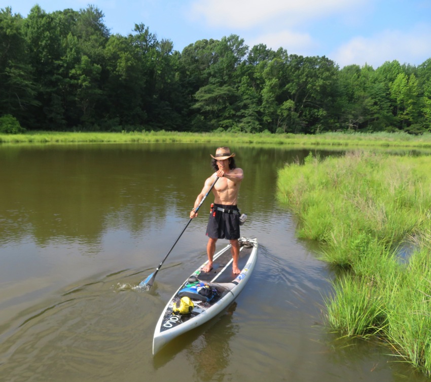
I paddled out into the Chesapeake Bay as the wind kicked up some waves. I tried surfing but the waves were too close together for my 14-foot long SUP. As I tried to surf, the stern was lifted up which then forced my bow underwater into the wave in front of me, thereby slowing my momentum. Where the park meets the Chesapeake Bay, I saw this Surf Scoter. 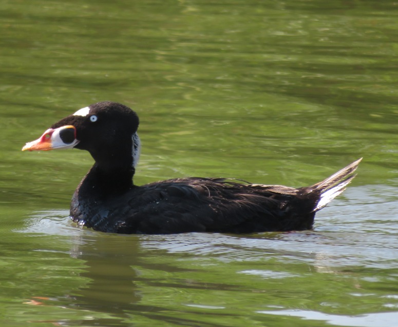
Having paddled 6.7 miles, I stopped in at the Anne Arundel County Farmers' Market to purchase locally grown/made goods. The place was packed. I was there rather late and the merchants were running out of stuff. I came home, mowed the yard, and then went to a pool party at my neighbor Jason's house. I was pretty exhausted that night. I think the heat and humidity while mowing did me in. I kept cramping up in the pool. So I devoured a Pizza Hut meat lover's pan pizza once I got home. Man food! |
|
One thing I have learned the hard way is "when in doubt, have a backup plan." When Norma and I launched from Breezy Point Marina on July 4, 2017, we arrived at 0545 and didn't end up launching until 0720 because there were so many people trying to get to the beach. There is only one road to the beach and the marina so despite the fact that we were probably one of maybe 70 people trying to get to the marina, we all had to wait in the same line of traffic. I had no backup plan.
Fortunately, today that was not the case. We left Savage at 0530. Yes, there were a few cars lined up to get to the beach when we arrived at 0640 but not many. Even better yet, there was someone near the entrance that saw our boats and then gave us head of the line privileges to get to the marina. So we launched around 0715. Our goal was to find shark teeth. I like to make a game out of this. So before we started, I set three contest categories: Sara, Mike B., Daphne, and I paddled north in the Chesapeake Bay to Roosevelt Cliffs. This is my favorite place to look for shark teeth. According to "Fossils of Calvert Cliffs" and USGS - Chesapeake Group; Calvert Formation, this area is the principal mollusk-bearing stratum of the Calvert Formation, both in number of species an individuals. Fossils date from the Miocene epoch (5.333 to 23.03 million years ago). Here's Sara and Mike at the cliffs. They are using my now 20 year old Ocean Kayak Cabo tandem sit-on-top. I've really gotten my money's worth out of it. 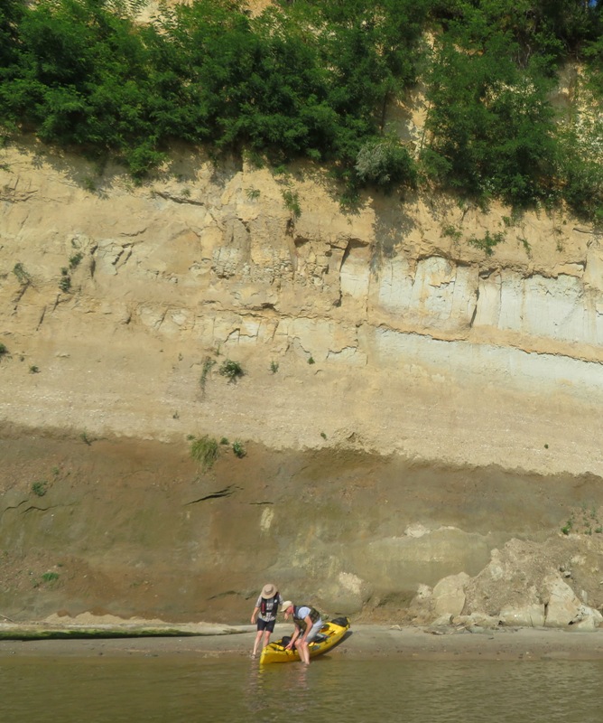
The wind was 5-7 mph from the northwest. This meant a nice, smooth ride for Daphne on my SUP as well as for Sara and Mike. 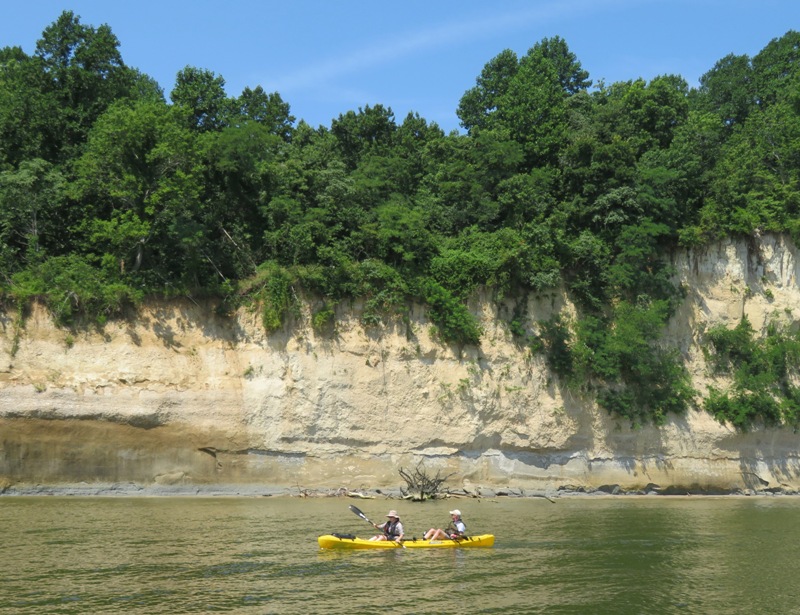
Out on the water, I saw several schools of fish and five rays. We brought a couple sifters I made out of scrap wood and leftover hardware cloth used to make the chicken coop. While sifting, Sara caught a small fish and Mike found a horseshoe crab, about two inches long and semi-transparent. Daphne had a good day. She got to run around off leash, sniff things, swim (not by choice), rest in the shade, and do lots of digging. I don't know if she was looking for anything in particular. 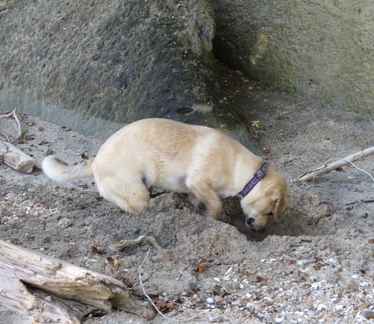
I don't necessarily find big teeth at Roosevelt Cliffs but I always find a lot. This day was no exception. I found the following: 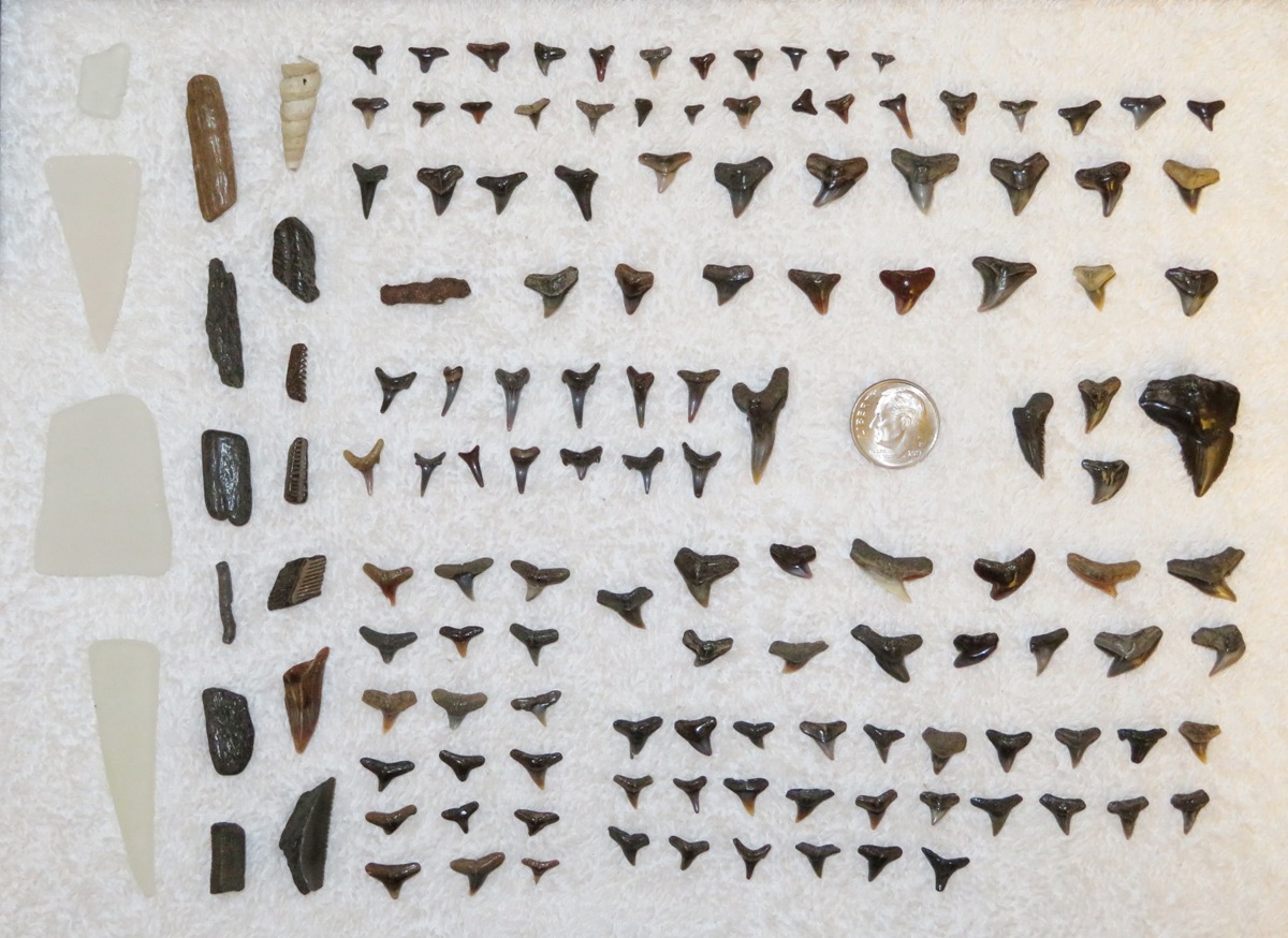
Sara found 56 teeth. Mike found less. 122 for me may sound like a lot but the last time I was there I found 140. My record at that location is 157. Today was a good but not a great day. The low tide was 0.52 feet which is just moderately low. A lower waterline would have exposed more fossils. My most interesting find was this 15/16th of an inch long piece which was black and very smooth along the sides. Mr. D.J. Robare thinks it is a broken piece of a megalodon tooth. Based on photos I've seen that resemble my find, I believe he is correct. I believe Sara found both the biggest shark tooth. It is from a snaggletooth shark. This tooth was in excellent condition with very well defined serrated edges. Though not a shark tooth, I think this piece is worth honorable mention. After looking through "Fossils of Calvert Cliffs," I believe it is a stone crab claw. It is 7/8th of an inch long and, unlike a shark tooth, it is hollow. 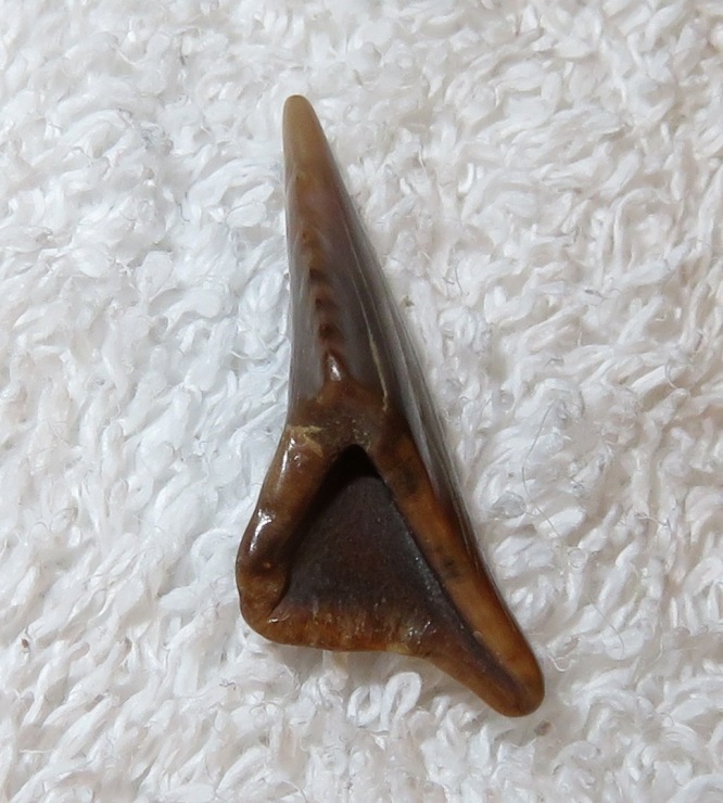
We paddled 6.25 miles. So what was my backup plan? It was to paddle in Rockhold Creek, launching from Tri-State Marine or Chesapeake Paddle Sports. No, fossils would not be involved on these trips but I felt they would be close by and fairly interesting. But I'm happy my primary plan worked. I think Sara and Mike were glad too. |
|
"Challenge accepted" was the catchphrase commonly used by Barney Stinson (one of my favorite television personalities) of How I Met Your Mother. Keeping that in mind, I decided to undertake the Patuxent Challenge.
This challenge requires one to complete certain physical activities within a given calendar year. Despite the name of the activity, none are challenging. The challenge is just getting out and doing them. But as evidence that you were at least there, you need to take a selfie snapshot by the Patuxent Challenge sign at the different locations. I had actually completed two of these challenges earlier this year. Site 16: I installed this sign in my town on May 31, 2019. It was formally unveiled the next day at Savage Fest during a visit from County Executive Dr. Calvin Ball and District 3 County Councilperson Christiana Rigby. Did I actually do the required activity there? Yes, not that day...but certainly that year, many times. Every year I walk countless miles through my town and along the Little and Middle Patuxent Rivers. So yes, I qualify. 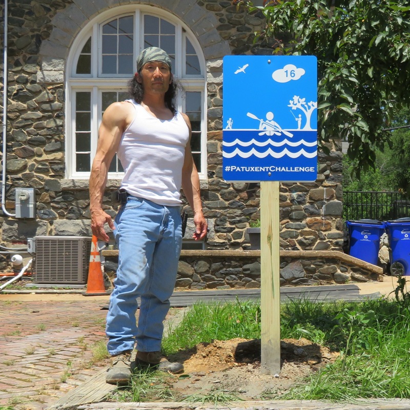
Site 4: July 7, 2019 hike at Patuxent River State Park. 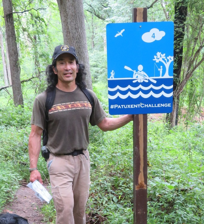
So what did I do on this day? Daphne and I walked about five miles and paddled 10.35 miles to get six (I originally thought seven) selfies taken at various Patuxent Challenge signs along the Patuxent River. In the process of doing so, we also found two launch sites I had never been to: Lower Marlboro Wharf/Pier and Patuxent Riverkeeper. Site 6: Daphne and I got an early start, arriving at our first destination, Governor Bridge Natural Area, around 0745. During our short hike, we were greeted by a garter snake. Getting the sign picture was difficult because the land drops off very sharply into the river and what little land there is is muddy. I later realized that I photographed the wrong sign. What I captured is a Patuxent Water Trail sign, not a Patuxent Challenge sign. I guess I'll have to return to do it right. Sites 15 and 10: I paddled from Lower Marlboro Wharf to Kings Landing Park via the Patuxent River. I got a kayaker to take a snapshot of us at Kings Landing in front of what I originally thought was a Patuxent Challenge sign. But it is not. It is just one of the Patuxent Water Trail signs. I made the same mistake as at the Governor Bridge Natural Area...but at least this time I realised my error then whereas at Governor Bridge, I didn't comprehend my mistake until a week after. On the way back from Kings Landing, I explored Tyverne Creek, getting 0.92 mile upstream. This is Daphne at our turnaround point. 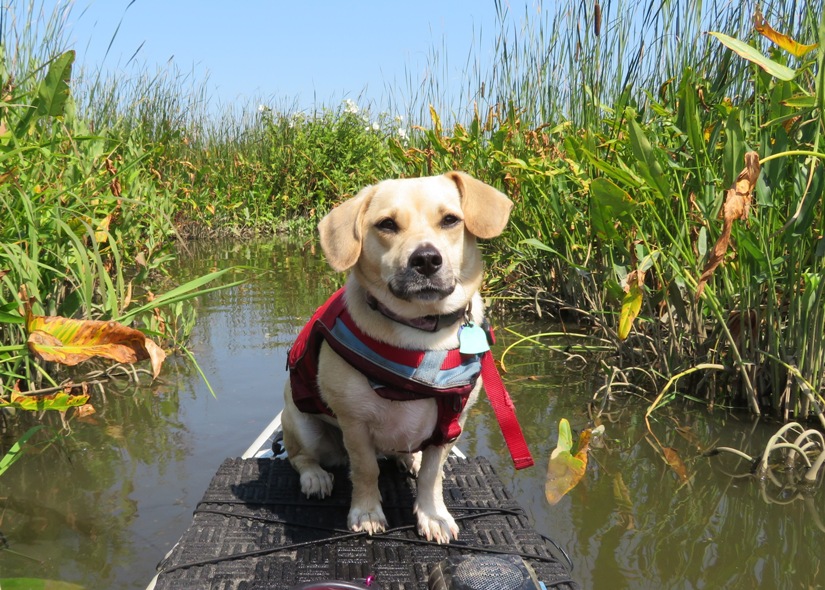
I haven't seen many monarch butterflies this year. This is one I saw on Tyverne Creek. Like Michael Jackson, it is lacking pigment. 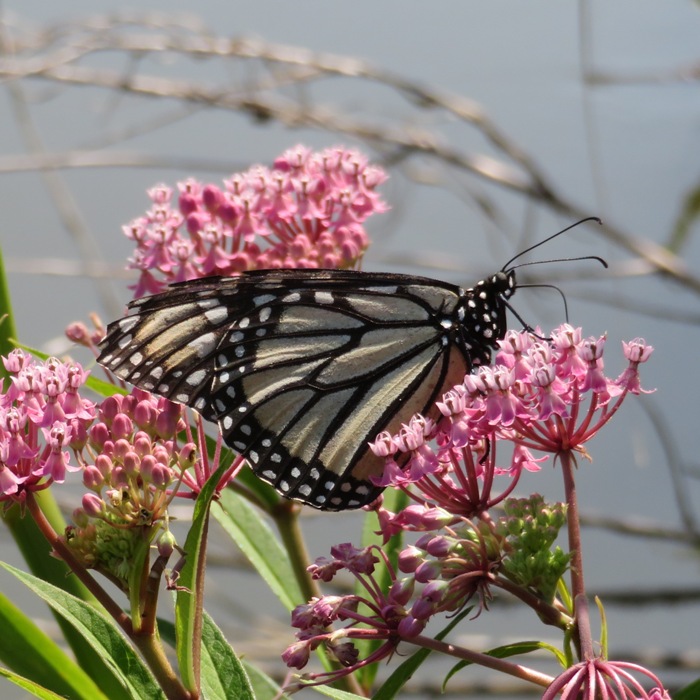
While the monarchs seem to be hiding, there is certainly no shortage of tiger swallowtails. I must have seen over 100 that day with many on Tyverne Creek. 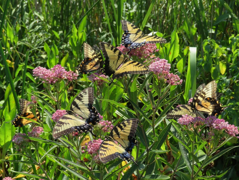
Site 11: Daphne and I hiked 2.8 miles on the Blue Trail loop at Maxwell Hall Park. She found something interesting to roll in. The place is popular with equestrians. Needless to say, she got a bath once we got home. 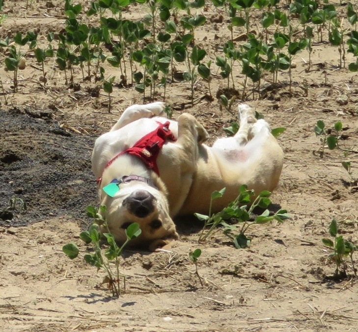
Here we are at the sign. 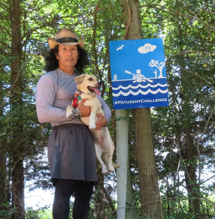
We made a brief detour to visit the Patuxent Riverkeeper where one can launch a boat. 
Site 9: At Patuxent River Park, I was supposed to paddle. But I did this on June 29, 2019 so instead, I chose to explore on foot. I wanted to take Daphne with me on Black Walnut Creek Nature Study Area but dogs are not allowed so we stayed closer to the visitor center. I walked slowly and let her sniff everything. Here we are at the Jackson's Landing sign. 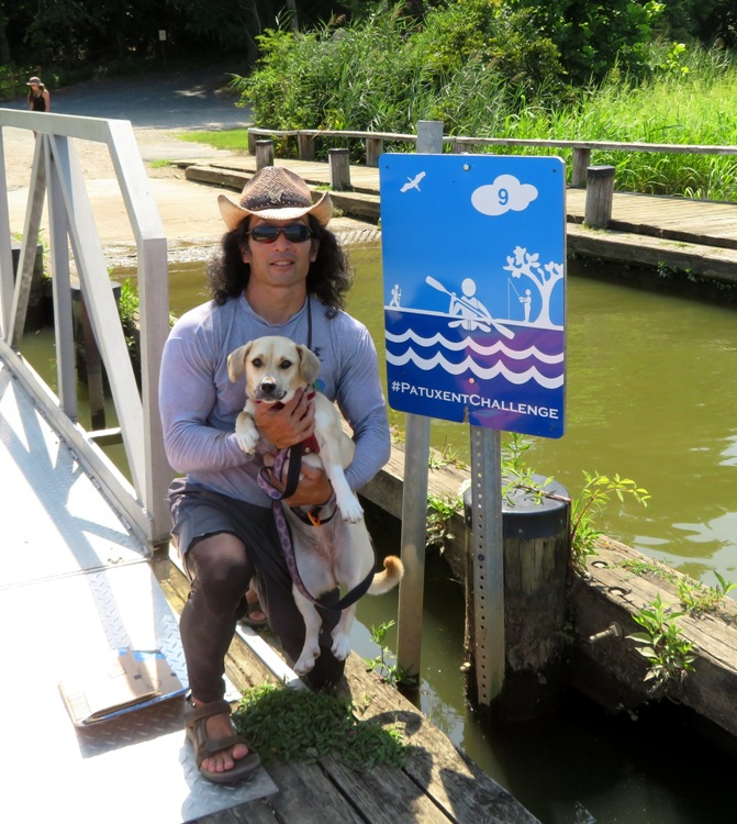
In the Patuxent Rural Life Museum, this black vulture was giving us the old stink eye. 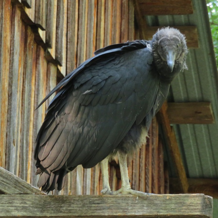
At 38.773278, -76.710111, I found a small grove of paw paw trees with lots of fruit. 
I was looking for monarch butterflies, chrysalises, or caterpillars in and amongst the milkweed but all I saw were these large milkweed bugs. 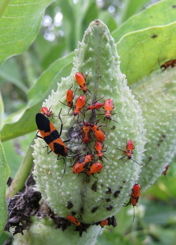
Sites 7 and 8: I paddled from Patuxent Wetlands Park to the Glendening Nature Preserve via the Patuxent River and Galloway Creek. 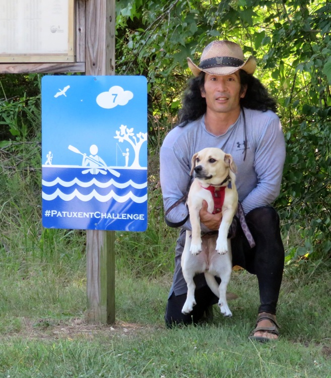
Below, Daphne is on the Chris Swarth Boardwalk which leads to the Cliff Trail at Glendening Nature Preserve. 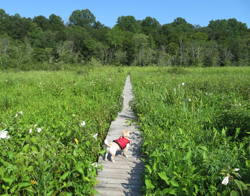
And here's a crappy photo of the both of us at the Glendening sign. 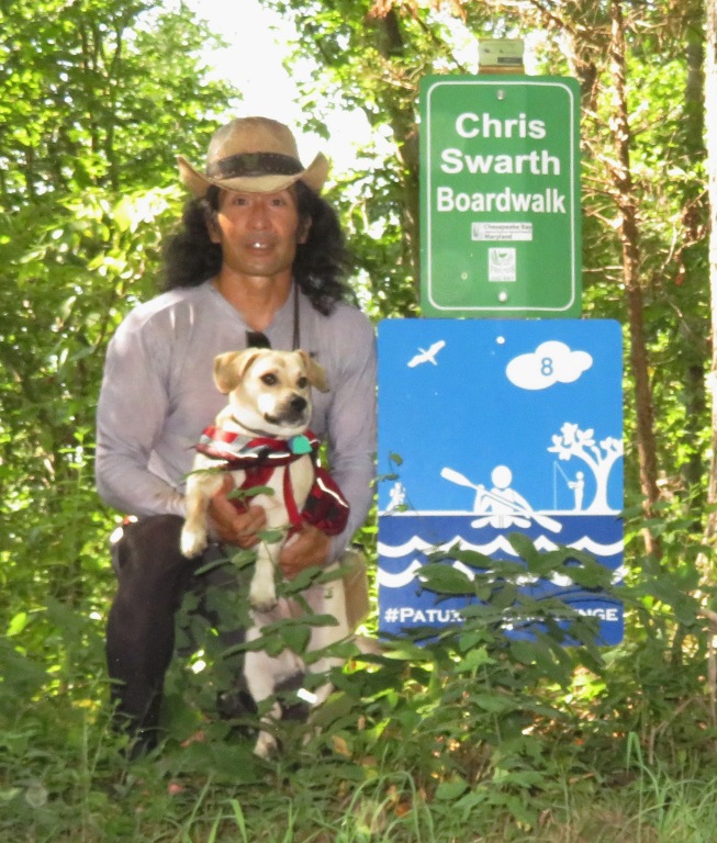
By the time we got home, we had spent over 12 hours out working on the Patuxent Challenge. I still need to do some of the ones closest to home and the ones furthest away. But I'm pretty sure I'll get them all before the year ends. |
|
Norma, Daphne, Chester, and I did a Pocomoke River area trip on the eastern shore of Maryland with Allison, Mark, Viviana and their new puppy, April.
|
|
On this day, I went kayaking in the Baltimore Inner Harbor. Paddling just north of the Lazaretto Point Lighthouse, I could see the cannons of Fort McHenry. It looked like at least one had been shot because I saw smoke coming out of it. The weird thing is that instead of pointing towards where the British would have attacked during the War of 1812, it was pointed towards Baltimore! The pic below shows a zoomed-in view.
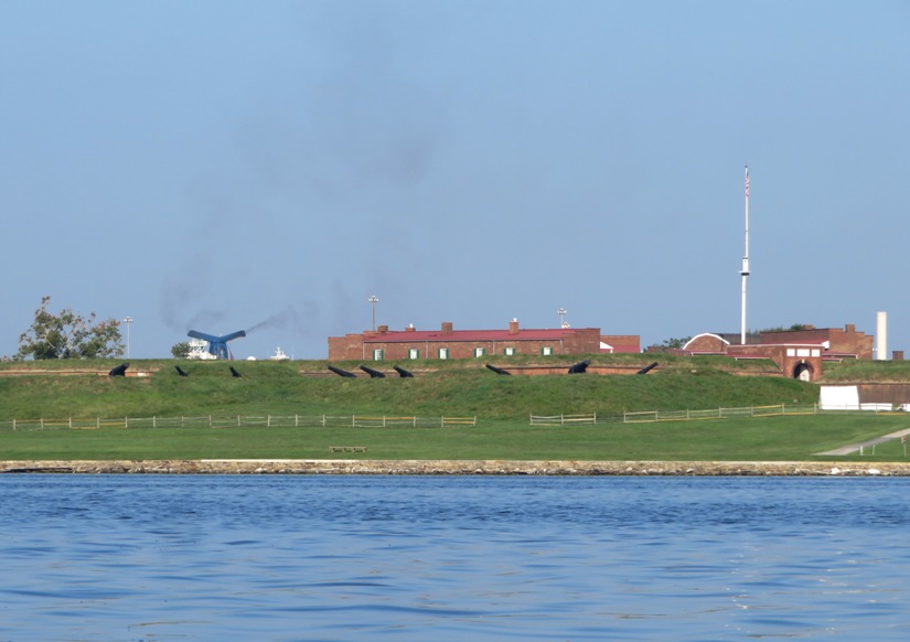
But upon zooming-in even more, I learned that was I thought was smoke coming from a cannon was instead exhaust coming from a luxury cruise ship on the other side of Fort McHenry. 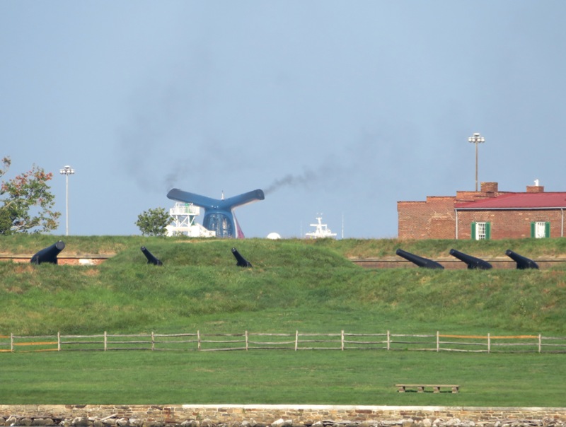
I hadn't paddled in the Inner Harbor since last year. I noticed a few interesting things which I posted as questions on Facebook. Question one: Anyone know what these black squiggly lines are for? When I paddled up close to them, it looked like they had some thickness so I'm guessing they were stuck on. 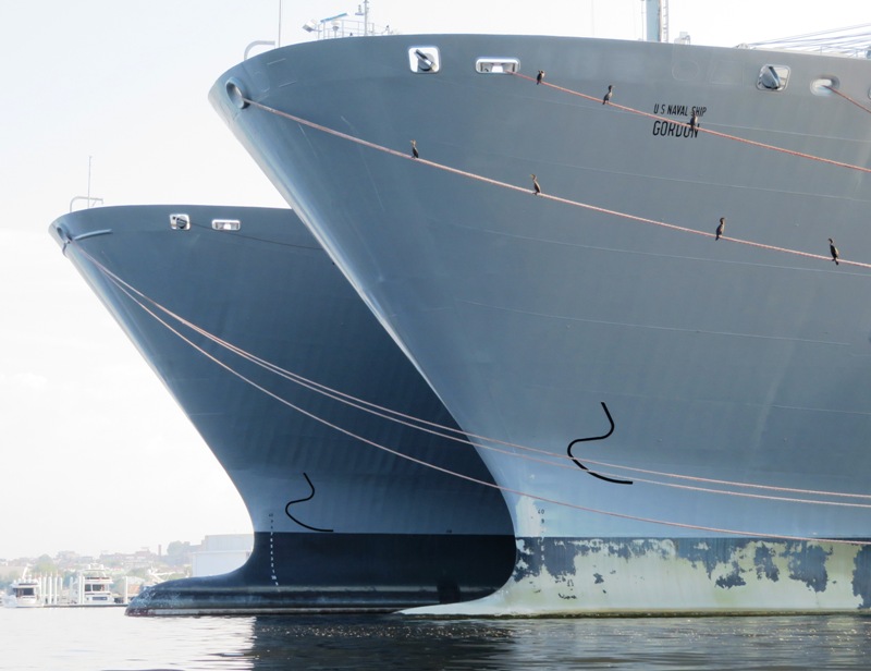
Answer one from Ray P.:Where a vessel's bulbous bow extends forward beyond her stem head, a symbol of a bulbous bow shall be marked above the vessel's summer load line draught mark in addition to a + symbol followed by a number indicating the total length in meters by which the bulbous bow projects beyond the stem. Question two: I guess this is the closest thing to a waterfall that I'll see anywhere near the Northwest Harbor. Seems like an awful lot of water to come from a bilge pump but then again, it is a pretty big ship. There was also water coming out the other side. Anyone know the story? 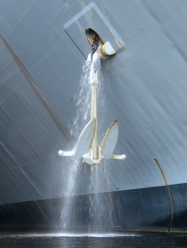
Answer two from Ralph: Might be that the anchor wash down [that] sucks water from the chain locker to keep it relatively clean and that they wash it on a regular basis. Question three: These are the Harborview Pier Homes, located at 39.278750, -76.604806. Many sell for around a million dollars. They've been there a few years now. Every time I paddle by, I never see any boats tied up to their pier. This is one of their two piers. Both are completely empty. I would think that at least some people willing to spend so much for waterfront property with so much pier access would have a boat. I was out pretty early so I can't imagine all the boats would have been gone. Has anyone ever seen boats at this pier? It's a shame if it isn't being used. 
No answers for question three. Question four: Does this boat make me look fat? 
Answer four from Rey: Yes, start working on your personality. I saw about eight or ten kayaks launching from right in front of the Maryland Science Center. I was told it was a tour group led by the city. A few years ago, whenever I landed there, the police would chase me away. I got in 12 miles doing a few bursts of speed, keeping up with runners for short distances. |
|
Hollywood, California, Saint Leonard, and Bowie. These are the Maryland towns I visited today as I continued in my pursuit in completing the Patuxent Challenge. Recall that my last big effort for this was July 27, 2019. The goal is to do a particular activity, find the Patuxent Challenge signs, and take a selfie with the sign as proof that you were there.
Back on August 4, Norma, Daphne, and I walked through the scenic wetlands and historic dam ruins on the 1.5-mile paved trail at Riverfront Park in Laurel, Maryland. Not sure why I'm mentioning that in this blog but I am. 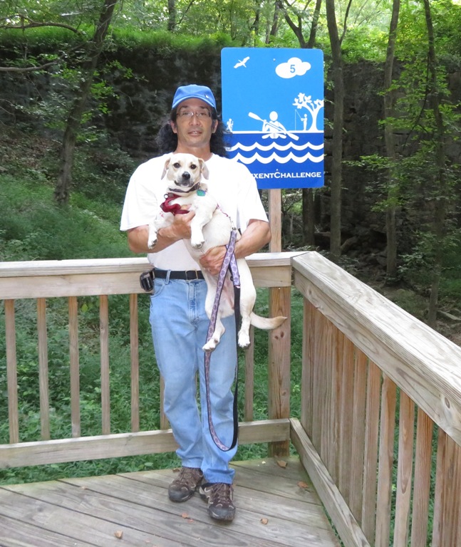
Today I spent about ten hours looking for Challenge signs. The rest of this blog is about those ten hours. First, I visited Jefferson Patterson Park and Museum in Saint Leonard, Calvert County and walked on the Village Trail and Riverside Trail. The Challenge sign was along the former. 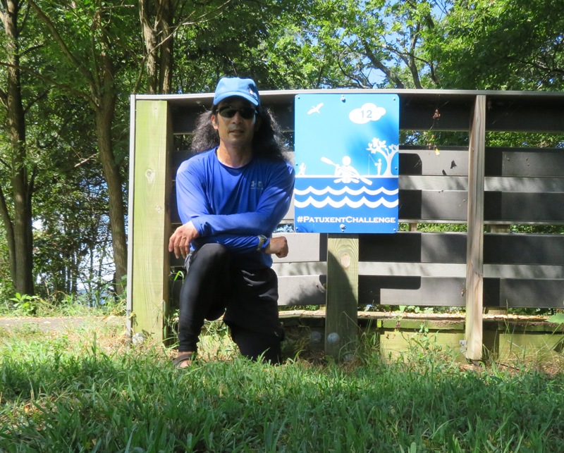
Then I checked out the kayak launch site. 
Next, I launched my surf ski from Clarke's Landing and then paddled to Myrtle Point Park in California, Saint Mary's County. 
I landed at the beach just southwest of Thomas Point and walked on the Wet Sox Trail to the picnic area, where I found the Challenge sign. I didn't have to paddle far but there was a lot of boat traffic kicking up waves so it wasn't easy. 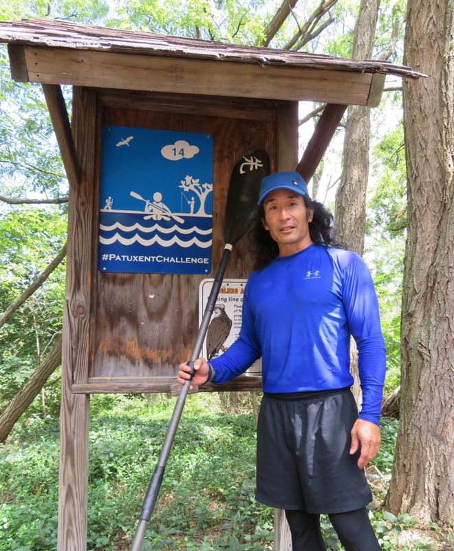
In the launch site parking lot at Greenwell State Park, I saw this red-spotted purple butterfly. 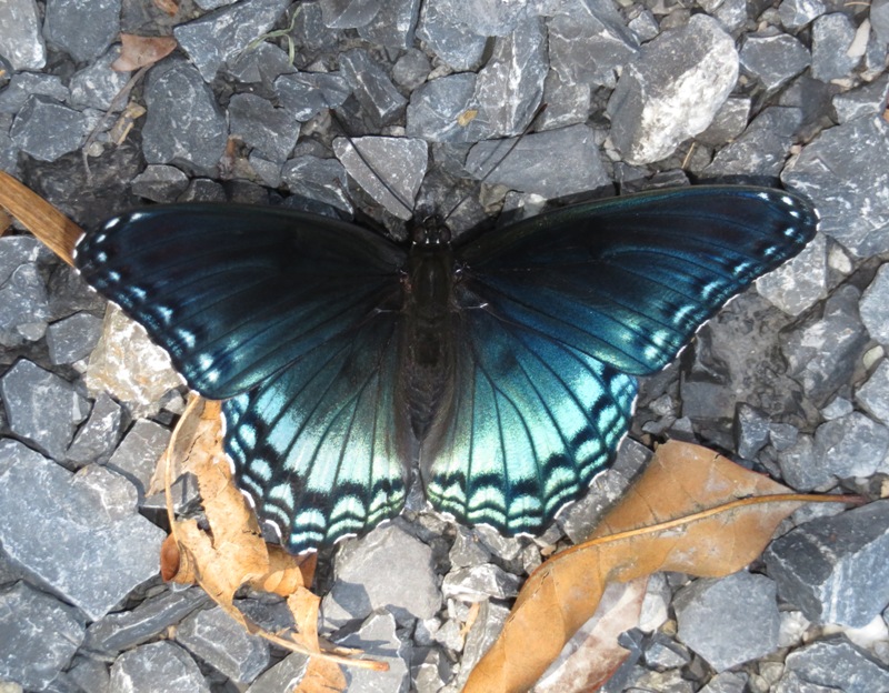
I launched my surf ski from the park's pier (shown below) and then started paddling to Historic Sotterley Plantation in Hollywood, Saint Mary's County. 
Much of the time when I'm exploring the great outdoors, I'm either looking up for paw paws or down for shark teeth. On this day, I found both. I was not expecting to find shark teeth. When I was kayaking to Historic Sotterley Plantation, I overshot my mark, landing north of Sotterley Creek at Sotterley Point. I pulled ashore and noticed that the broken shells and rocks looked very similar to parts of Calvert County where I've found numerous fossils. I observed the cliff and noticed a layer of embedded shells which is a very good sign for fossil hunters. I looked around for about 30-40 minutes and found six shark teeth along with a couple pieces of ray dental palate. Not sure what happened to the latter but I'm thinking Chester (our cat) took them when they were on my desk. 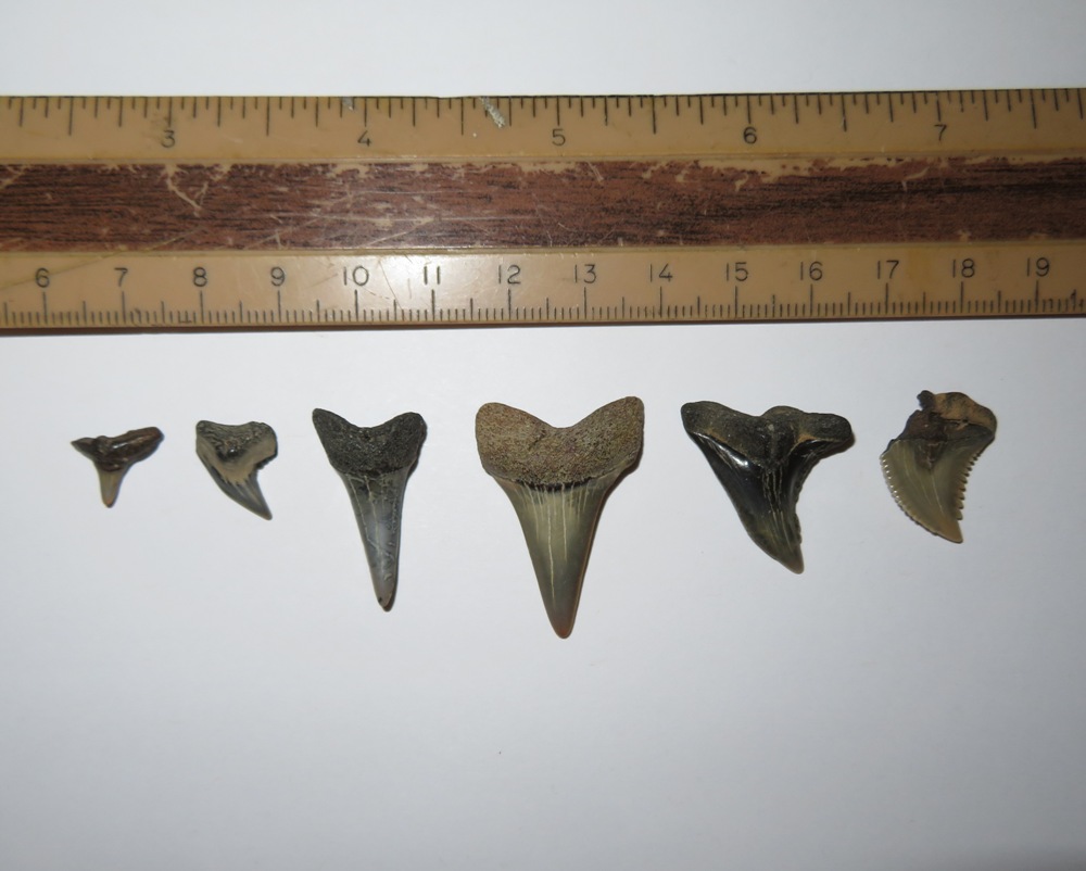
Here I am posing with my surf ski at the Historic Sotterley Plantation boat landing. 
This plantation has 300 years of history and over 20 historic buildings including a 1703 Plantation House and an 1830's Slave Cabin. There are also almost six miles of trails, of which, I hiked none because the wife of the manager gave me a ride in a golf cart to and from the visitor center where the Patuxent Challenge sign was posted. 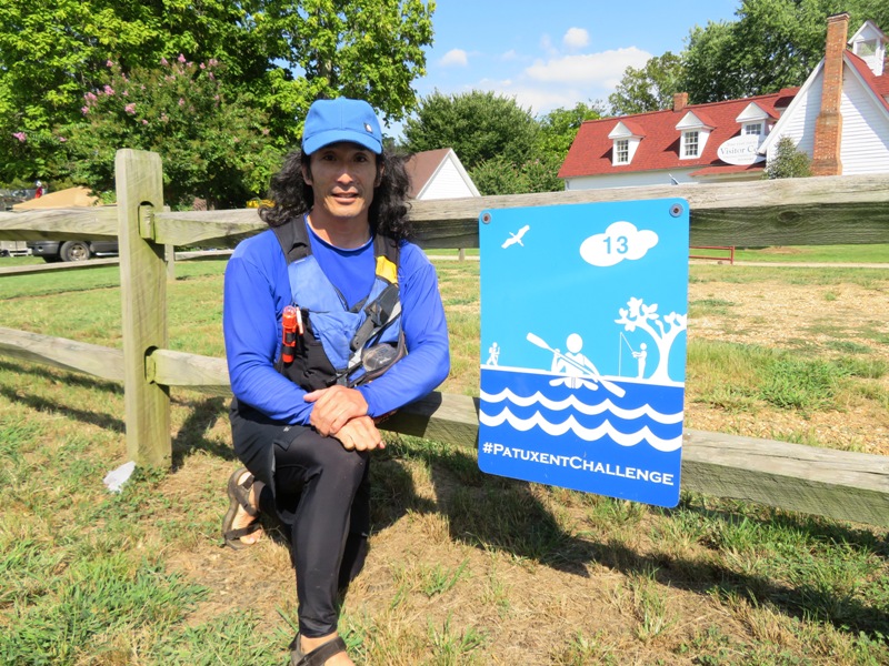
I spoke to the woman with the golf cart and despite living at Sotterley for ten years, she's never heard of anyone looking for shark teeth around there. So this is my secret gem...at least it was a secret until I announced it to everyone via the internet. Here is where I found the teeth: 38.383472, -76.537889 and 38.379750, -76.535083. For my final trip of the day, I walked about two miles in Governor Bridge Natural Area in Bowie, Prince George's County. Here is one of the ponds beside the Green Trail. 
I was last here on July 27, 2019 and took a picture of what I thought was a Patuxent Challenge sign. But it turned out to be a Patuxent Water Trail sign. So I returned on August 24 to find the correct sign. I failed. It is supposed to be on the Red Trail, which I hiked most of. But the Red Trail is poorly maintained and eventually fades away as it gets close to where Green Branch enters the Patuxent River. Yes, I did inform someone about this via e-mail, specifically DLMDP-Webmaster_MDP@maryland.gov and PatuxentChallenge@gmail.com. I received confirmation of this on November 6, 2019 from Jason Dubrow, Resource Conservation & Management Manager, Maryland Department of Planning. I will return and walk/swim to my objective via the Patuxent River since I know it follows the river. For those of you that have never heard of Hollywood, Maryland, it is shown in one of my favorite movies, "Tenacious D in The Pick of Destiny." Here is the video clip. This is superfantastic music from Jack Black, Meatloaf, and the late Ronnie James Dio. I saw Dio in concert in 2007. |
|
They say the "third time's a charm." For me, this statement held true.
The origin of the phrase "third time's a charm" is probably ancient, as things that come in sets of three have often been associated with good luck due to their similarity with the Holy Trinity of Christianity. - from Ginger - Third Time's a Charm You may recall that I've been trying to locate the Patuxent Challenge sign at Governor Bridge Natural Area. July 27, 2019 was my first attempt. I erroneously located the Patuxent Water Trail sign which is a whole different animal. But I didn't realize my mistake until I got home. So I returned on August 24, 2019. The sign was described as being on the Red Trail. I hiked as much of it as I could but found that the southwest end of the trail was overgrown and parts had eroded away. Running out of daylight, I vowed to return to complete my mission. I did that today. Prepared to go "full amphibious," I walked in the Green Branch, sinking up to my knees in mud at times. I followed this creek to the Patuxent River and waded in that until I found a break in the treeline where I picked up the overgrown trail. I was wearing splash plants to protect myself from poison ivy. Eventually, I found the sign somewhere around 38.942833, -76.692222. Mission accomplished. 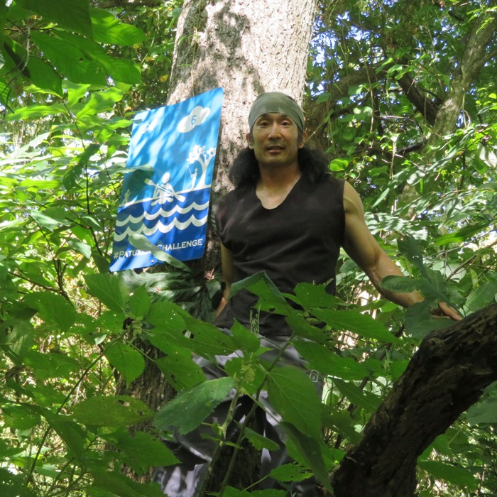
After a bit of a drive, I stopped in at the Robinson Nature Center. I parked at Simpsonville and checked out the pre-colonial Simpsonville Mill ruins. Then I walked on the Mill Ruins Trail and strolled through Annie's Garden. Next, I walked up the Sycamore Stroll Trail towards the nature center until I found the Patuxent Challenge sign. Easy find. 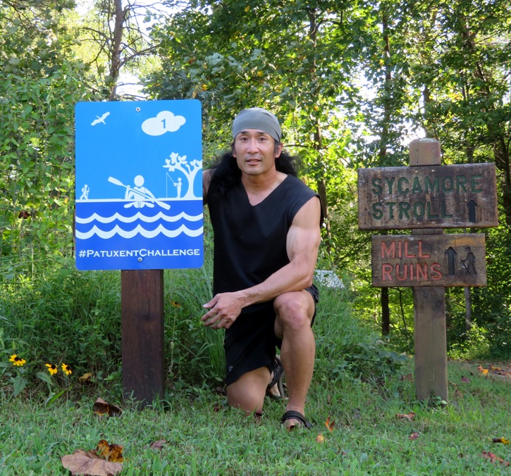
|
|
I took the day off from work to go kayaking and look for fossils. Recall that on August 24, 2019, I paddled from Greenwell State Park to Historic Sotterley Plantation as part of the Patuxent Challenge. I found a few shark teeth at Sotterley Point but didn't have enough time to do a thorough search of the area.
On this trip, I did a detailed search for fossils between the launch site at Greenwell State Park and Saint Thomas Creek, both in Saint Mary's County. I decided that Sotterley Point was the only area worth exploring for fossils. The air was cool and the water was warm. It felt like autumn was right around the corner and I was wanting to spend as much time on the water as possible. The Chesapeake Bay was clean and full of crabs, fish, sea nettles, and comb jellies. Below is one of several hundred comb jellies that I saw. They do not sting. I waded through the water, brushing up against them and never noticed. I caught this one in a plastic bowl so I could get a picture. They are also known as sea walnuts. According to Virginia Institute of Marine Science - Sea Walnut They can produce light when agitated, and can often be seen flashing brightly in boat wakes at night. 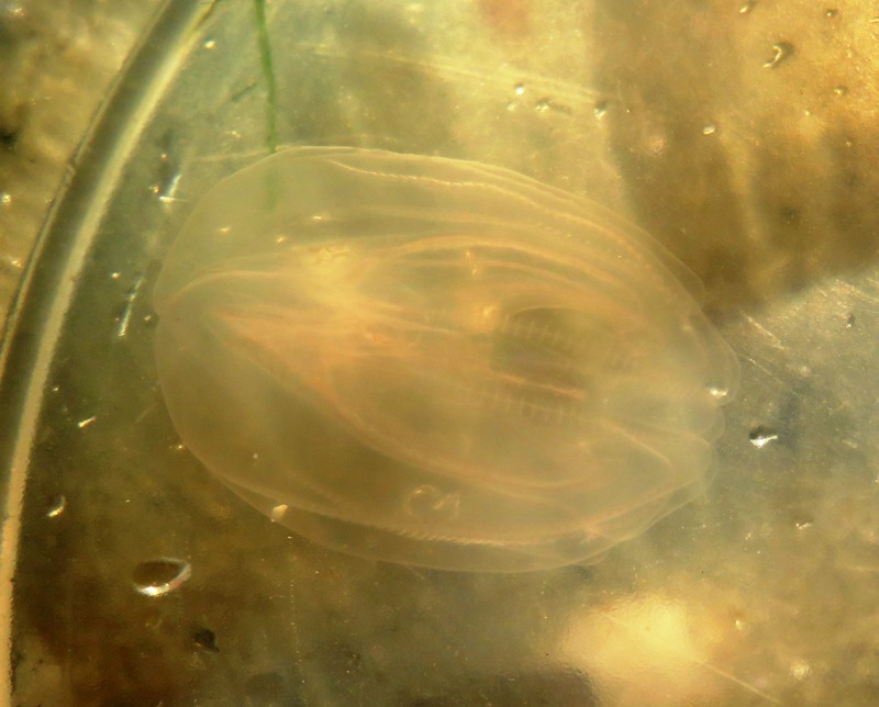
I rarely paddle at night but I might start doing so if it means seeing such bioluminescence. When disturbed at night, the color bands of the sea walnut glow soft green. Comb jellies break apart when taken out of the water. If you find a comb jelly and would like to view its true shape, gently scoop it out of the water with a clear container and view it... - from Chesapeake Bay Program - Comb Jellies Here's a comb jelly washed up on the shore at Sotterley Point. 
On the north side of the point, I saw dozens of comb jellies that ran aground. 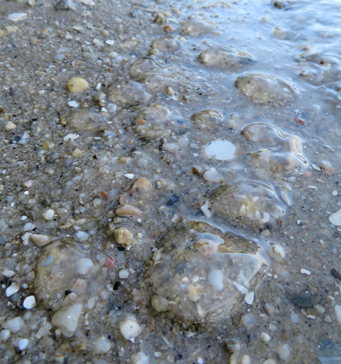
I also saw several bald eagles. I did find numerous fossils, but considering how long it took and what I found, this location is not as promising as my favorite spots in Calvert County. 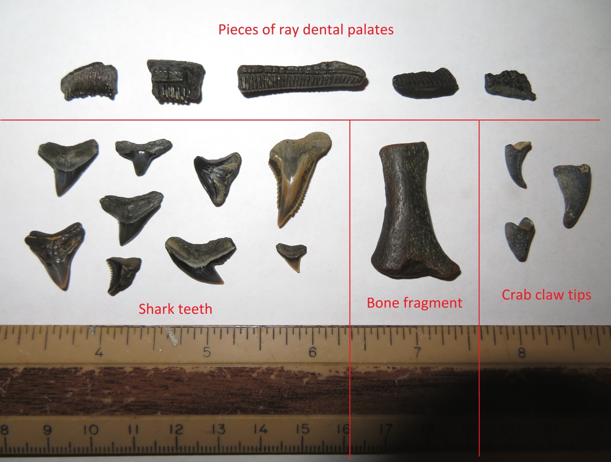
It is interesting how certain parts of the cliff held embedded shells at very distinct layers...much like some of the cliffs along the Chesapeake Bay in Calvert County. I think this is a good indicator that there are shark teeth nearby. 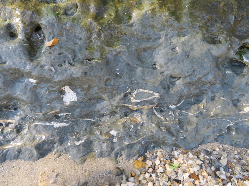
Ever since my last trip, all I've been thinking about is finding the coveted large megalodon tooth...the holy grail for shark tooth hunters. I've never found one but I did find a piece of a small one in Calvert County. Sadly, I did not discover any on this day. After looking for fossils, I continued exploring the area. It is just moderately scenic. What I found most notable was an unusual sign. The top sign reads "WARNING Bats may be rabid. Land at own risk" while the bottom one says "Private Property. No trespassing." I supposed it is intended to keep people out but bat lovers like me might be tempted to look for the bats. I guess it is better than saying "Trespassers will be shot." 
I paddled about seven miles on my surf ski. |
|
On July 27, 2019, I declared "Challenge accepted!" to the Patuxent Challenge. But today, I declared "Challenge completed!"
I found the challenge sign at the Brighton Dam Visitor Center in Montgomery County where Brighton Dam meets the Triadelphia Reservoir. 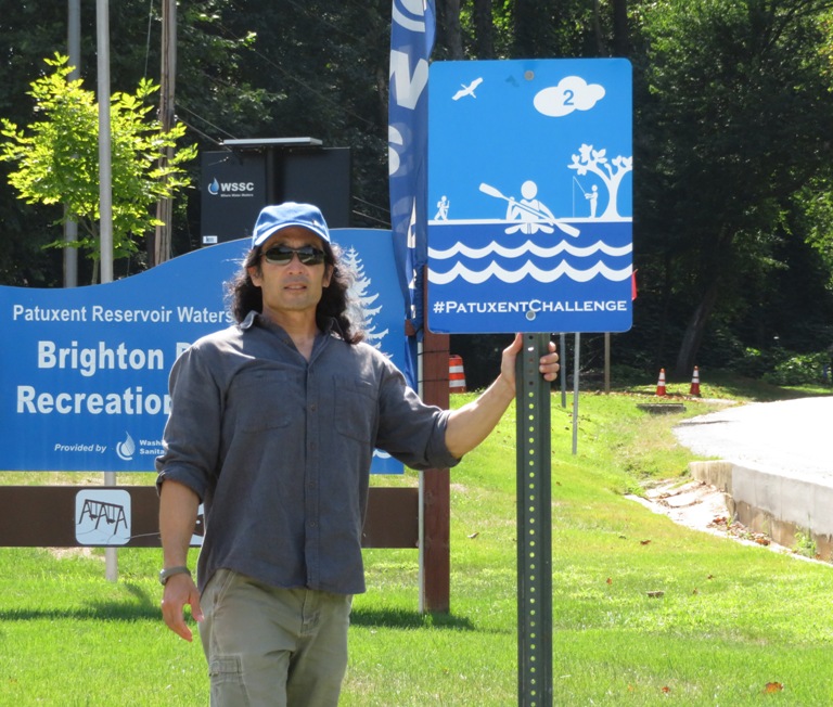
I stopped in at the Visitor Center to talk to someone about launch sites and pick up a map. The trails and Azelea Garden at Triadelphia are closed for construction until 2020. I'll have to come check it out then. Then I found the last of the 16 Patuxent Challenge signs at Scott's Cove Recreation Area in Howard County. This is by a scenic area on the T. Howard Duckett Reservoir. I've never liked paddling on reservoirs because I find them too sterile and artificial for my taste. It also costs $6 per day or $70 per year to launch or even hike here. But I expect I'll take advantage of this area once I turn 64 because then the fee is waived. On August 31, 2019, I submitted the photos for all 16 sites. Daphne was with me for seven of them but she doesn't qualify for a prize because they only give out one per address. I received confirmation of their receipt on September 4, 2019. |
|
On this day, I kayaked on the upper part of the Murderkill River in Kent County, Delaware. Almost all of my trips are on the Chesapeake Bay watershed. But the Murderkill is on the Delaware Bay watershed. One difference between the two is that the Chesapeake Bay watershed tends to have a tidal fluctuation of up to two feet. But where the Murderkill flows into the Delaware Bay, the tidal fluctuation is closer to seven feet! That means if you time things right, you won't have to work very hard and if you time things wrong, you might have a very bad day.
On this day, high tide at the mouth was 1130. I launched my surf ski 7.5 miles upstream from the mouth at Frederica Road (route 12) in Frederica so I figured high tide would be a little later. How much later? Well, about seven miles upstream on the Delaware Bay, high tide occurred at 1149. So I figured high tide at Frederica would be just a wee bit after. But even after I finished at 1400, the tide was still going up. So I ended up paddling upstream with help from the tide and paddling against the tide on the way back. I got in about 15 miles. What's the story behind the name "Murderkill"? According to Delaware Backstory: The Murderkill River doesn't have a grisly past: Mother is "moeder" in Dutch, and river is "kill." Taking pictures from the surf ski isn't easy but I managed to get in a few along with some from land. I pulled ashore at the Canterbury Road (route 15) launch and portaged around the Coursey Pond dam. Then I launched at the Coursey Pond launch. This lovely pond is bordered by Killens Pond State Park on the north. I saw several people fishing and one other kayaker. Lots of spatterdock were in bloom. 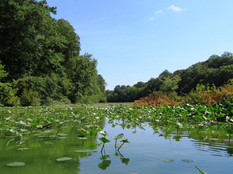
I see so many turtles when I'm on the water that I usually don't bother photographing them unless they are unusual, very large, or very small. This eastern painted turtle at Coursey Pond fits the latter criteria. Its carapace is about three inches long. I also saw a few bald eagles. 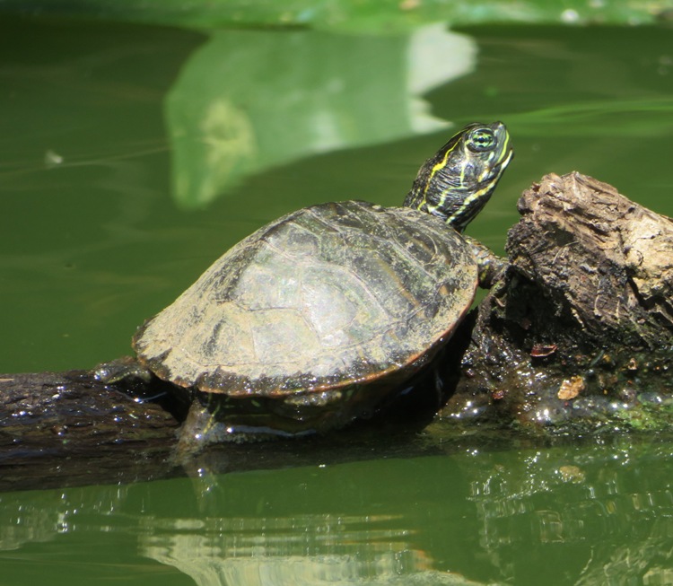
Back on the Murderkill River, I found this wasp or hornet nest about five feet above the water. 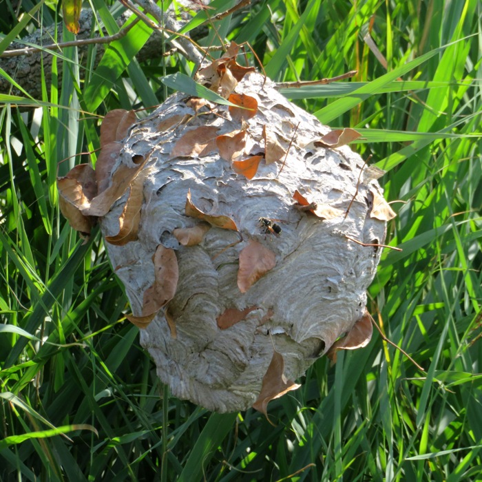
I paddled under a few bridges. One was road 389. Going upstream, none of the bridges were an issue. Coming back downstream, I was expecting to ride the ebb tide but instead, the tide was still rising. It had risen so much that I could not paddle under road 389. I was going to try to swim under it, pulling my boat behind. But instead, I found that if I leaned forward and bent my head forward, I could fit under the bridge. I pushed forward against the bottom of the bridge to get across. Then I noticed a black snake between the bottom of the bridge and the foundation. I scooched my way over to get a closer look. You can't see it but its head is on the left side. It was pretty thick so I'm guessing it was about five feet long. 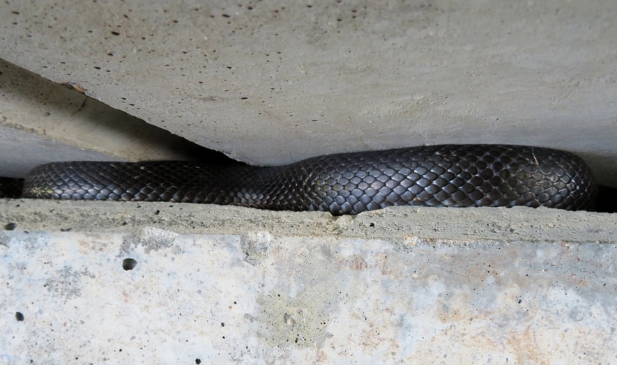
This is where I launched and landed. It is on the northwest side of Frederica Road (route 12) on Spring Creek. I launched in mud but the tide rose quite a bit while I was out so that when I landed, all the mud was underwater. 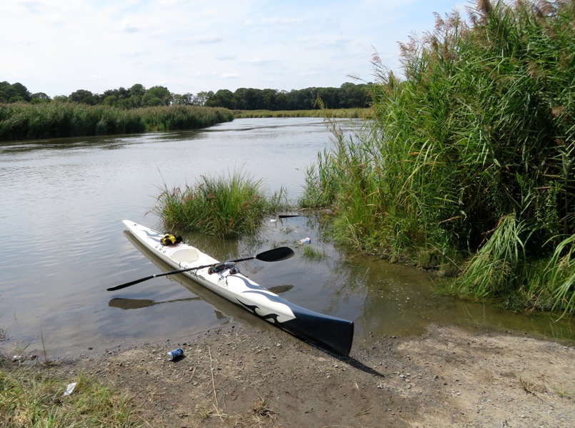
This six mile section of the Murderkill River between Frederica and Coursey Pond is very scenic and natural. It starts out being bordered by bay grasses. Then, as I paddled upstream, I started to see a few trees. For some reason, the ones nearest the water were dead. After a few miles, the trees were in better shape and it was nothing but trees. The increase in trees is due to changes in the salinity of the water. I only saw one other boat while paddling on the Murderkill. So if you want to get out and enjoy some quiet time deep in nature, this is the place to go. My suggestion for the tide? Bring a fast boat so if you do have to fight it, you won't have to work as hard as if your brought a slow boat. |
|
Norma, Daphne, Beate, Gerhard, and I paddled in the Dyke Marsh Wildlife Preserve. Beate and Gerhard are Norma's friends from Germany that stayed with us September 1-6.
I read about this place in another blog. It appeared interesting. The more I looked into it, the better it sounded. The satellite photos were particularly appealing. 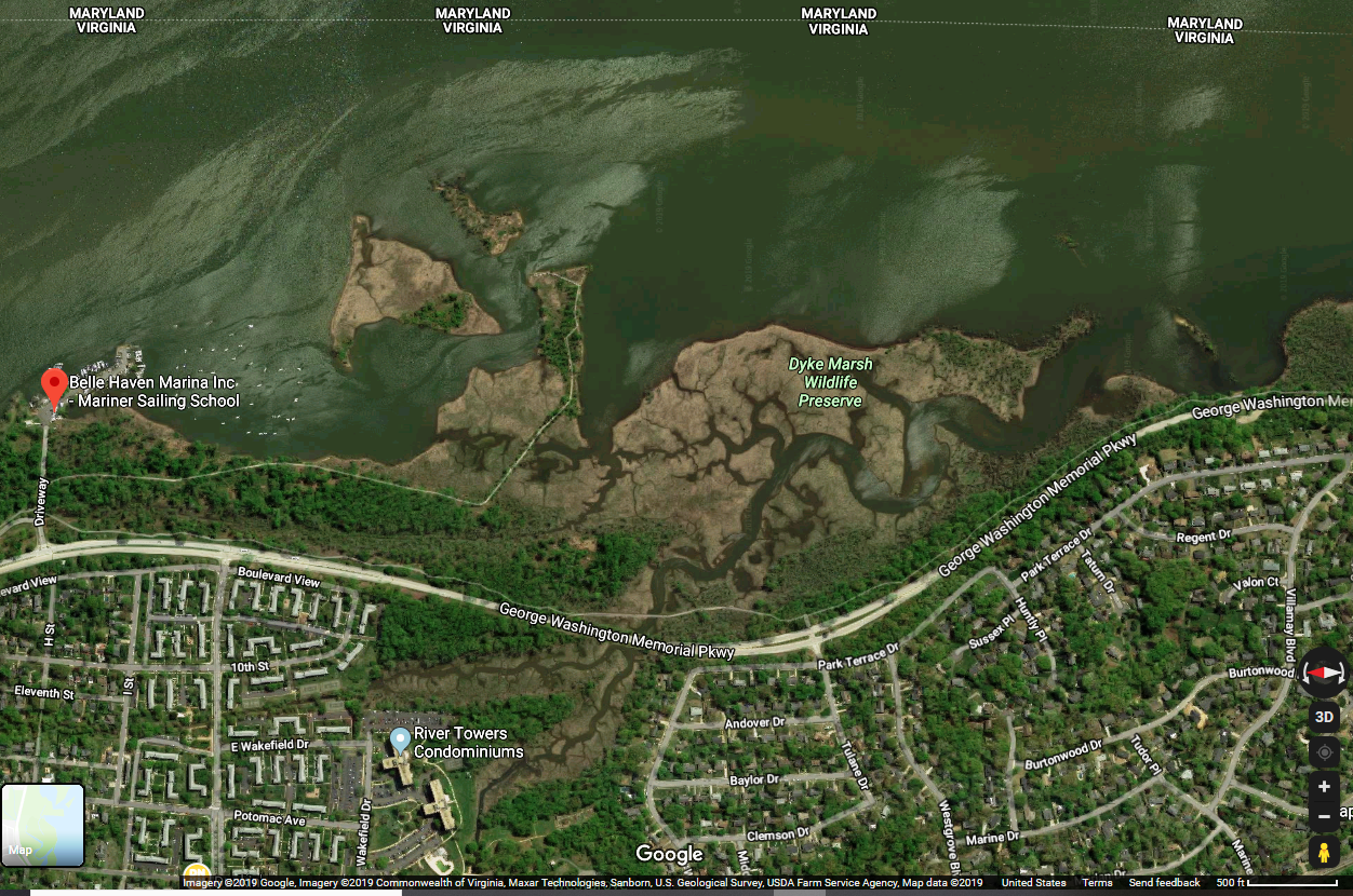
We launched from the boat ramp at Belle Haven Marina in Alexandria, Virginia. 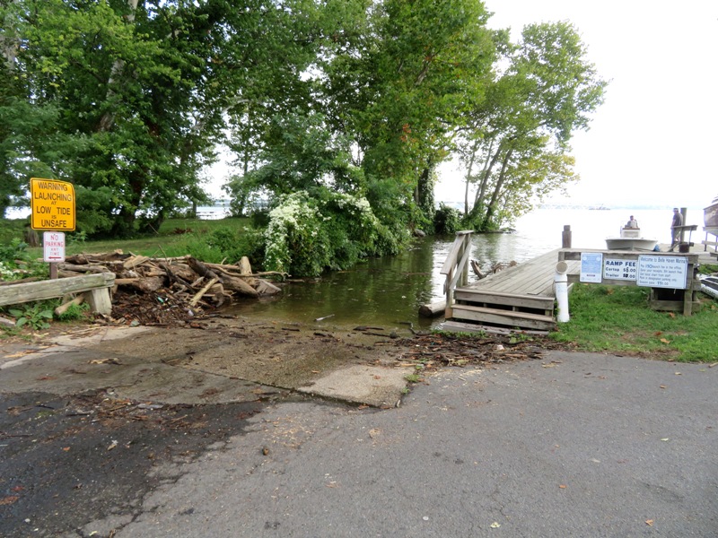
Belle Haven Marina is a real gem. It is strategically located to offer great boating opportunities to some very interesting places like Old Town Alexandria which lies about a mile north. Just prior to that is Hunting Creek and Cameron Run which I have yet to explore. My plan is to return and visit all of these when the Tall Ship Providence is in port so I can see that too. The five of us paddled south on the Potomac River to the marsh. It was fairly windy (I'm guessing 12 mph gusts) at times but I positioned us on the downwind side of the islands to make things a little calmer. Eventually the wind subsided. There were lots of people enjoying Labor Day by getting out on the water, biking on the Mount Vernon Trail, or walking on the Dyke Marsh Trail. At the east end of Dyke Marsh Trail is a fishing pier. Here, we found a group of men that caught two American eels. 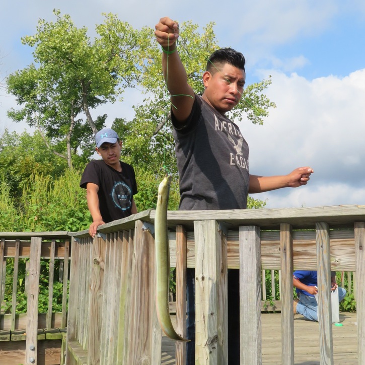
It didn't take long before we were at the mouth of the marsh. The mix of sun and clouds provided some dramatic views. 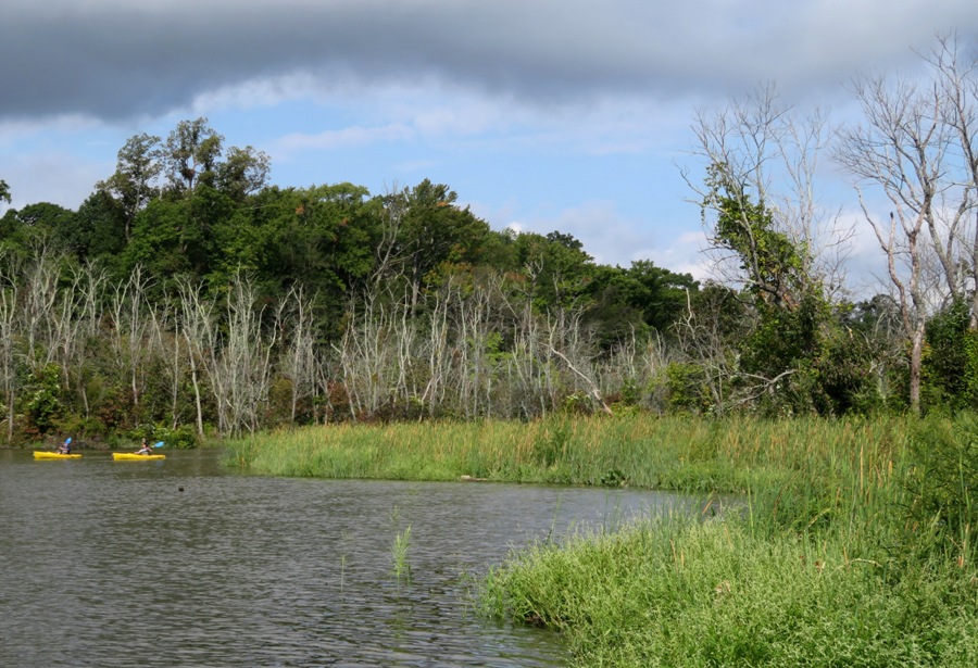
Norma paddled my Cobra Expedition sit-on-top kayak while Beate and Gerhard were on my Ocean Kayak Cabo tandem sit-on-top kayak. The marsh is comprised of a main waterway, called Hog Island Gut, which has several tributaries that branch off it, making it a great place to explore. Managed by the National Park Service as a part of the George Washington Memorial Parkway, Dyke Marsh provides a habitat or home for a diverse array of plants and animals and offers an ideal setting for a variety of recreational activities. The trail, which leads visitors into the marsh, known as the "Haul Road," is a favorite of area birdwatchers, hikers, photographers, and nature lovers. In addition, the waters in and around the marsh are popular fishing areas. People who explore the marsh by canoe may be rewarded with up-close encounters with the resident wildlife. - from "Find Your Chesapeake - Dyke Marsh Wildlife Preserve" (a broken link as of 2024) 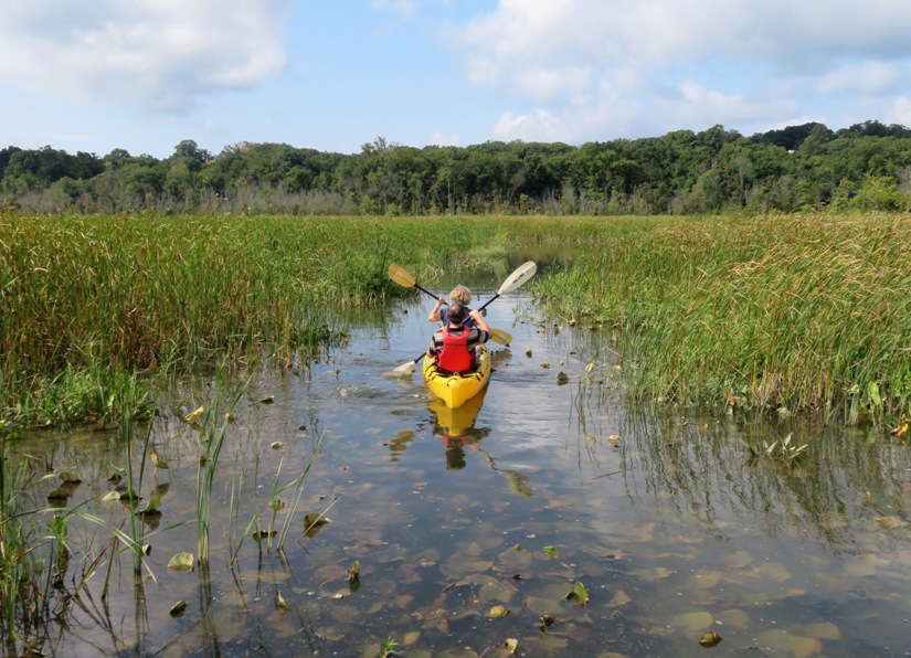
The further upstream we paddled, the more lush and wooded things became. At times it felt like we were deep in nature yet the George Washington Memorial Parkway was sometimes just 300 feet away. The Mount Vernon Trail was even closer. As people and dogs ran by on the trail, Daphne was on high alert. 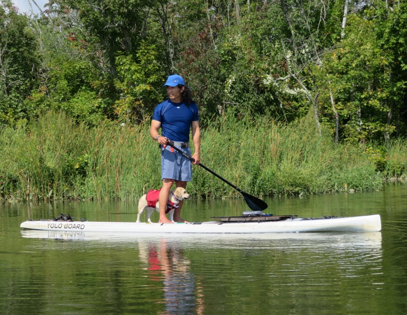
We turned around at the Mount Vernon Trail. It was near high tide. Could we have gotten under the trail at low tide? Perhaps. But right behind that was the George Washington Memorial Parkway, which would have stopped us so we didn't venture further. We started making our way downstream. During that time, I started to think about the history of the area. According to National Park Service - Dyke Marsh Wildlife Preserve: Located along the west bank of the Potomac River approximately 95 miles from the Chesapeake Bay, Dyke Marsh Wildlife Preserve consists of approximately 485 acres of tidal marsh, floodplain, and swamp forest. Dyke Marsh, which is believed to have formed 500 years ago, is one of the largest remaining freshwater tidal wetlands in the Washington Metropolitan area. Dyke Marsh was indeed "diked" at one time. In the early 1800s, earthen walls were built around the perimeter of the marsh in order to create more "fast land" or land not flooded by high tides. These areas were used to graze livestock or grow crops. U.S. Geological Survey (USGS) estimates that the southern marsh has existed for approximately 2,200 years, and the northern marsh has existed for 500 years. - from U.S. Army Corps of Engineeers - Dyke Marsh Wildlife Preserve Restoration We saw lots of wild rice growing in patches along the shore. According to Friends of Dyke Marsh: In late summer and early fall, Dyke Marsh's wild rice (Zizania aquatica) is a shimmering panorama of green in the breeze. It is a native, annual, emergent, light green grass with flower clusters on broom-like branches. Wild rice thrives in soft, muddy areas and can grow to eight to ten feet tall. Additionally, we spottted a couple of wild persimmon trees. The fruit from these trees is about the size of a racquetball. Norma says they won't be ready to eat until after the first frost. 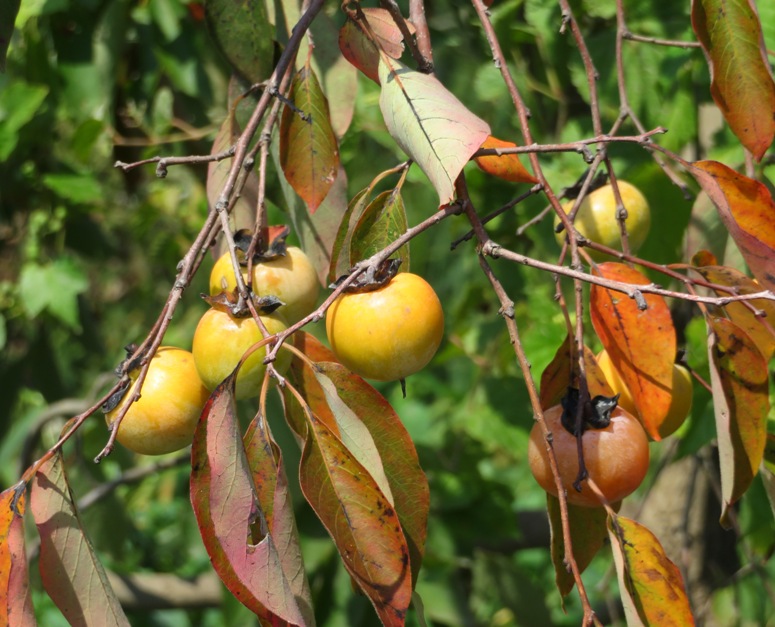
What other flora resides in the marsh? To date, more than 360 species of plants have been recorded in Dyke Marsh. The dominant species of the marsh itself is the narrow-leafed cattail, which typically develops its characteristic flower spike by June. Other species associated with the tidal marsh include: arrowhead (a.k.a. duck potato), a plant whose starchy tubers are favored by waterfowl; arrow arum, a distinctive plant with large triangular leaf blades; pickerelweed; sweetflag; spatter-pond lily; and northern wild rice, the grains of which are enjoyed by red-winged blackbirds, waterfowl, and people. - from National Park Service - Dyke Marsh Wildlife Preserve But while so many of the plants in the marsh appear healthy, The marsh has many dead trees, presumably killed by the invasive emerald ash borer. - from Friends of Dyke Marsh - Marsh Life 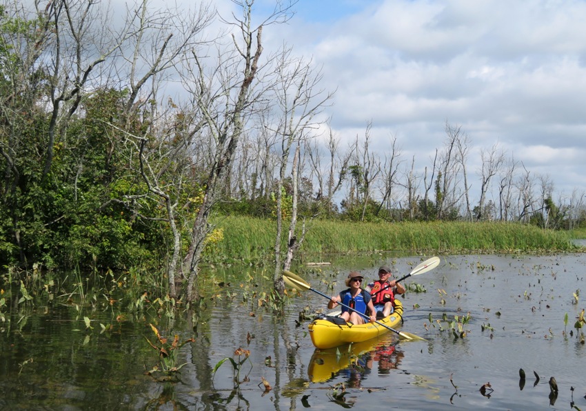
We saw a few turtles, and unfortunately, trash in some places, especially on the Potomac. But litter was very localized with some areas having a good bit while others, like those below, had none. On the Potomac River, we saw some construction in progress. It is expected to conclude in 2020. According to U.S. Army Corps of Engineeers - Dyke Marsh Wildlife Preserve Restoration: The Baltimore District and the National Park Service (NPS), George Washington Memorial Parkway, are working on a project to protect and restore freshwater tidal marsh within the Dyke Marsh Wildlife Preserve. With the available project funding, work includes an approximately 1,800-foot breakwater and construction of a stone sill to prevent erosion. While looking for snakes (I found none), I came across Mother Nature's floral arrangement. 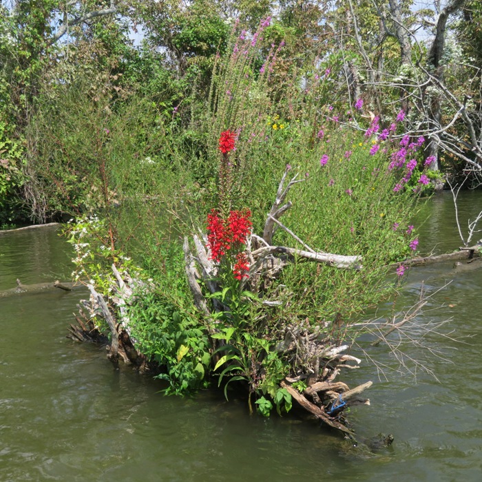
After almost six miles on the water, we ended up landing at a different place than where we launched. At the south end of the marina is where they rent kayaks. They have a nice soft launch there which is better suited for small boats than the ramp. I didn't see it when we arrived. 
After loading the boats and changing clothes, we drove to Old Town Alexandria and ate lunch at IL Porto Ristorante. It was a good Labor Day weekend for me. Over the last four days, I was on the water three of them, each in a different state: Maryland, Delaware, and Virginia. On the day I wasn't on the water, I was in Pennsylvania at Norma's family reunion on her mother's side. |
|
The Corsica River Water Trails have been on my bucket list since last year. Today I finally started exploring them.
After purchasing a couple of Queen Anne's County boat launch passes, Norma, Daphne, Beate, Gerhard, and I launched from the Centreville Public Landing. Beate and Gerhard are Norma's friends from Germany that stayed with us September 1-6. We paddled south on Mill Stream Branch. The day was overcast with temperatures in the mid-70s. It was very comfortable but without the sun, I never really felt like I was completely awake. It was a terrible day for taking most pictures though it would have been great for photographing egrets. Here's Norma, Beate, and Gerhard kayaking upstream on the scenic and peaceful Mill Stream Branch. 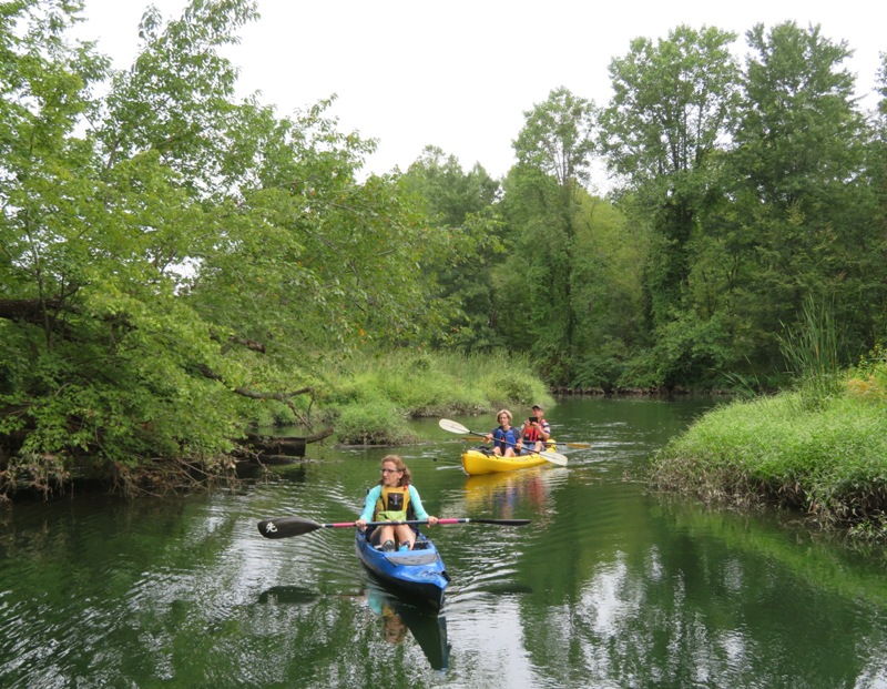
You can't see it but to the right is Millstream Trail, where Norma, Daphne, and I walked on July 4, 2018 with Sara and Samantha. 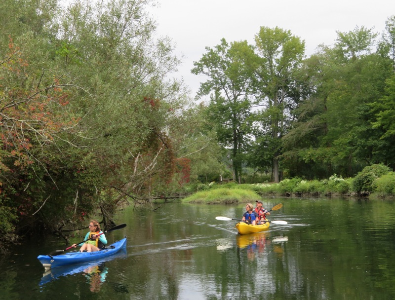
Shortly after I took this picture, we paddled under the Centreville Road (route 213) bridge which was undergoing construction. Then we started seeing paw paw trees with fruit. I picked four of them. 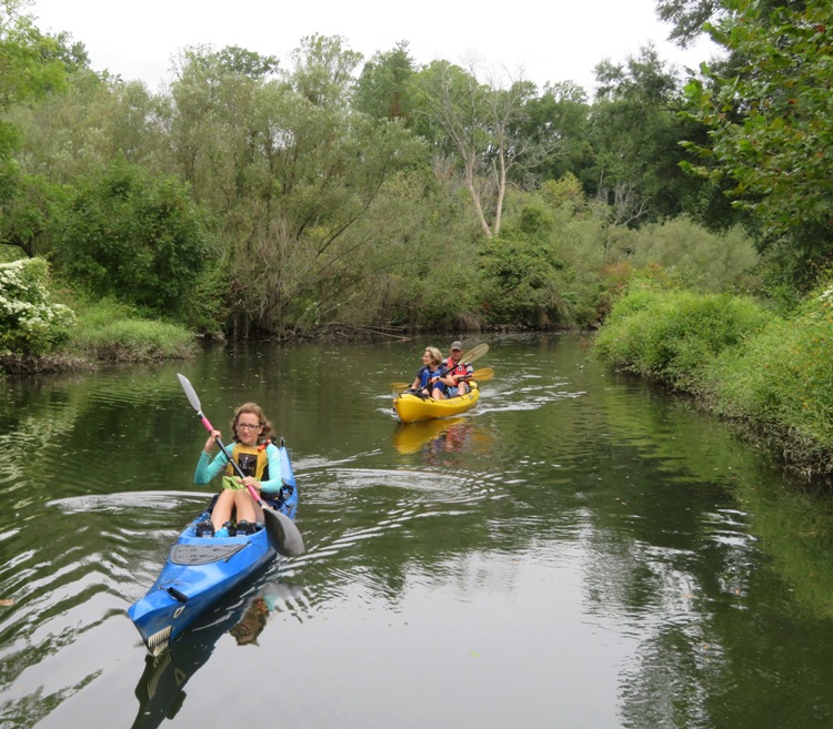
We saw this two foot long carp. I generally find them in muddy water but upstream of the Centreville Road (route 213) bridge, the water was pretty clear so it seemed out of place. 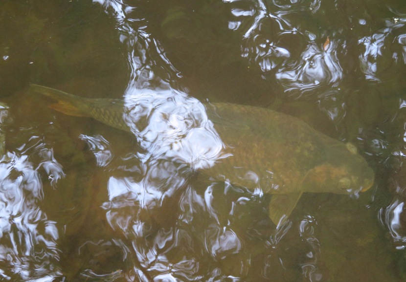
We managed to get about a half mile upstream of the bridge. Here we are heading back downstream on Mill Stream Branch. 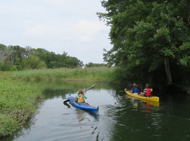
Back at the launch site, Daphne found this cicada, which I rescued before she ate it. After a snack, we continued paddling, this time making our way up Yellow Branch Stream. This part was not as interesting but at least we saw a few bald eagles. Slightly past Gravel Run, we encountered this fallen tree which we paddled through. But just beyond that was another which we would have had to portage. I didn't think all of us were willing to get soaking wet to continue past, so instead, we turned around. I expect I will return another day to see how far I can make it up this stream. We put in a total of about 5.8 miles. The water trail is comprised of three sections. We finished the first and did most of the second. The third is Alder Branch which I will do another time. Upon driving away from the launch area, two bald eagles flew in front of my car. After paddling, we ate at 98 Cannon Riverfront Grille in Chestertown. From their deck, I spotted this boat called "Sara V." Of course I let Sara know about it. She jokingly claimed it was her boat. 
|
|
On September 3, 2019, I sent out an invite for folks to join me for a guided canoe trip on Parkers Creek. Unfortunately, I had no takers. Additionally, Daphne could not join me because dogs were not allowed.
This event was part of the American Chestnut Land Trust's 2019 Guided Canoe Program. I arrived early, giving myself plenty of time so I could explore the area. I stopped in at Parkers Creek Preserve and picked up a hiking trail map. I'd hiked on the northern American Chestnut Land Trust trails once before on November 13, 2011 but I had never been to this section of trails. Fifteen of us (including three guides and two children) met at Warrior's Rest Nature Preserve. This place is managed by the American Chestnut Land Trust and not open for public use. Already, I felt like my $15 event fee was being put to good use because I was seeing something that others could not. Next to the driveway at Warrior's Rest, I found what I believe to be a rat skull. It was about 2.5 inches long. 
Ten boats (including my SUP) launched from a beach on the Chesapeake Bay at 38.535306, -76.517583. 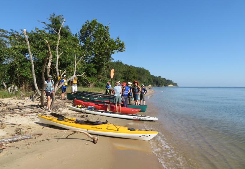
Looking to the north and south, I saw cliffs where I probably stopped to look for shark's teeth back on August 10, 2014. That was also when I last paddled on Parkers Creek. Fish jumped out of the water as we paddled by. Looking down from the SUP, I saw hundreds of them, all about 2-3 inches long. Many were jumping further away too. Greg Montgomery, our lead guide, told us that those were likely disturbed because of a predator. I was reminded of the times when small fish have leaped onto the deck of my SUP. We paddled about an eighth of a mile north to Parkers Creek. The flood tide and the surge from tropical storm Dorian gave us a strong push at the mouth of the creek. 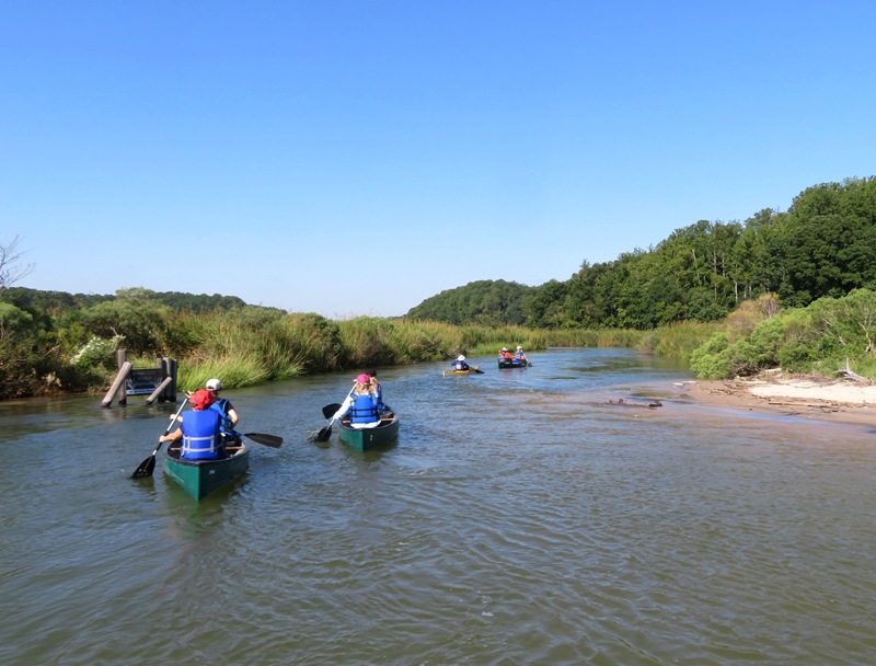
The lower part of this creek was lined with various bay grasses since the salinity of the water is similar to that of the Chesapeake Bay. 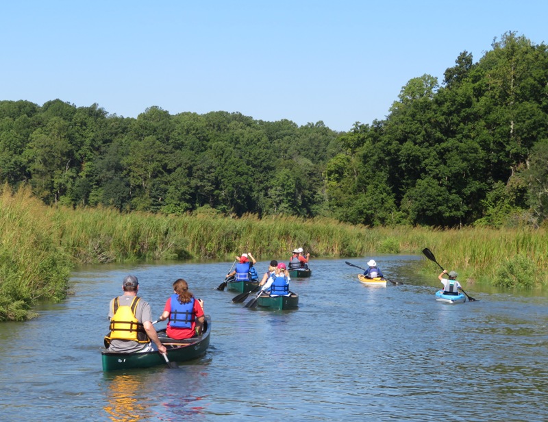
As we paddled upstream, Greg pointed out an island at 38.533972, -76.524194 with several trees. He called it a "seed bank" because if there is a fire, there would be seeds from various native plants that would survive and help repopulate the vegetation. 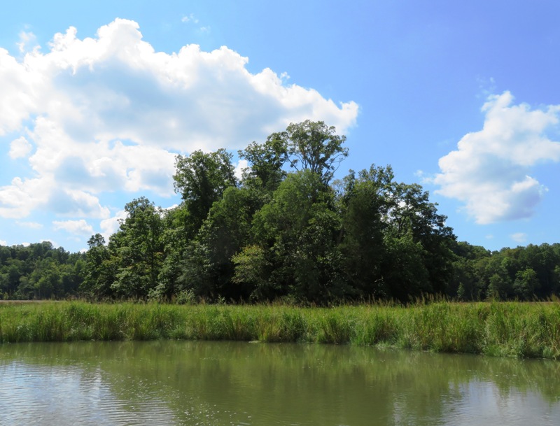
We saw several bald eagles, ospreys, a great egret, and great blue herons. 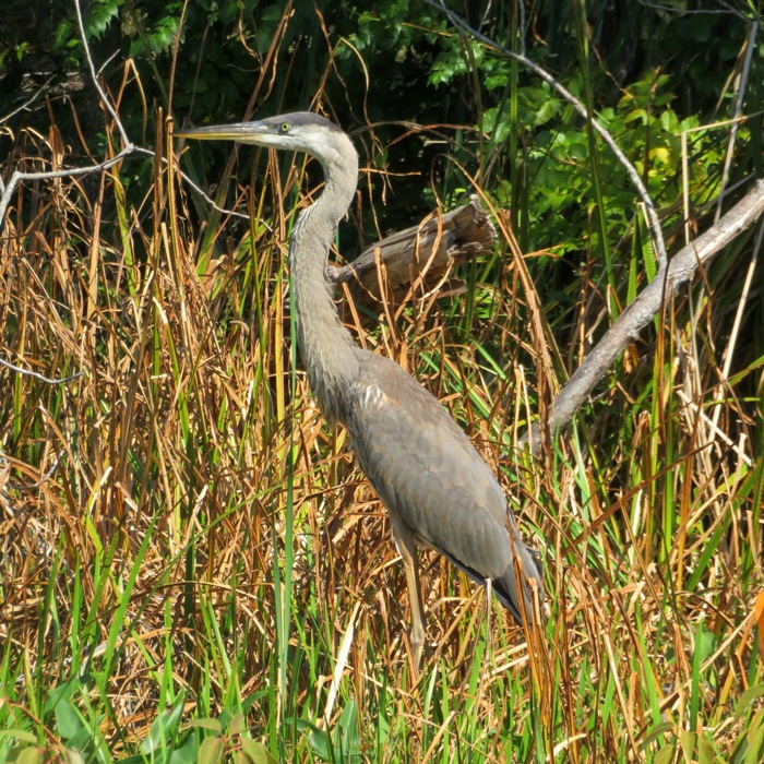
As we made our way upstream, the salinity of the water went down. Greg pointed out that we were now seeing fewer non-native, invasive phragmites plants as cattails became more abundant. Further upstream we started to see more woodlands. I asked Greg why there were so many dead trees but he didn't know. I thought maybe it was the same thing that killed many of the trees that we saw on September 2, 2019 at Dyke Marsh Wildlife Preserve. There were some striking similarities between the two locations. The marsh has many dead trees, presumably killed by the invasive emerald ash borer. - from Friends of Dyke Marsh - Marsh Life 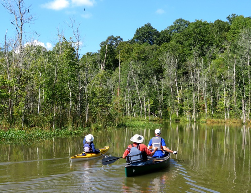
I saw two turtles (like the one below), a muskrat, and a snake swimming in the water. Other folks saw crabs. 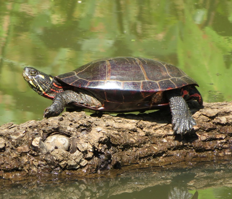
We turned around at 38.532694, -76.543556 just before the creek got too narrow for a canoe to turn around. In the pic below is one of our guides, Laura Berg, who is bringing up the rear. Our middle guide was Jan Hurst. 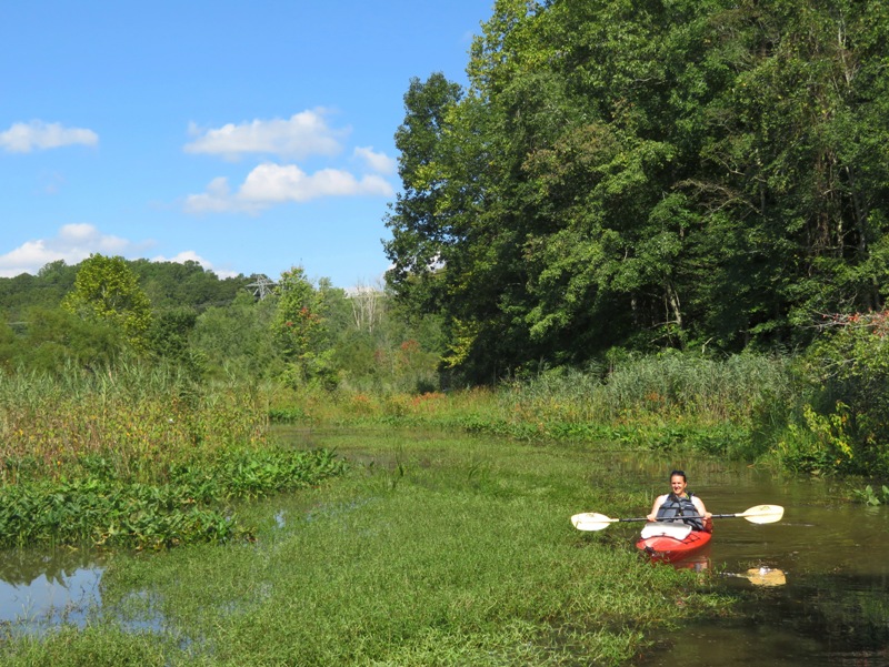
Various hiking trails meander through the American Chestnut Land Trust. A wooden raft connects Parkers Creek Road Trail with the North-South Trail so that hikers can get across Parkers Creek. 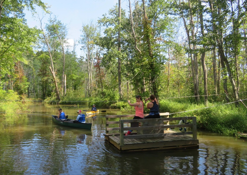
On this sunny day, the wind was light and the temperature stayed in the 70s. Can't get much better than this. 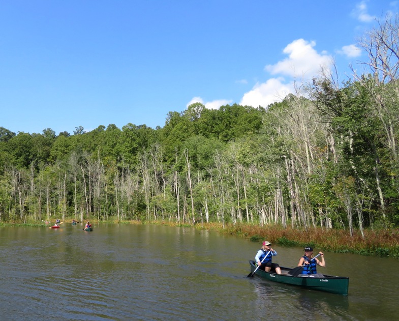
High tide was supposed to be around 1020 but like my September 1, 2019 trip on the upper Murderkill River, the tide kept rising even after I expected it to fall. In this case, I attributed it to Dorian. It was a great day for taking pictures. 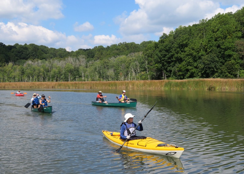
We got in about five miles in 2.25 hours. |
|
Of the last ten days, I spent six on the water. Today was the most recent. I was thinking about being a landlubber but I thought twice because I didn't want to pass up a great opportunity.
My section of the country got off easy in that we didn't experience heavy wind or rain from hurricane or tropical storm Dorian. But we did get strong tidal surges. On September 7, 2019, the following was reported: Coastal flood watches and advisories remain in effect through Saturday afternoon for Anne Arundel and Baltimore counties in Maryland, where the weather service said up to one foot of floodwater on low-lying streets is possible during high tides. - from WTOP - Strong waves, rip currents in Md. as Dorian parallels East Coast For me, this meant I could paddle further upstream than I would normally be able to. So I loaded up my SUP and headed out to Solley's Cove. Then I paddled to Furnace Creek and explored the northern and western sections. I'd paddled this section many times before but on this day, I saw it in a totally different light. One of the tributaries on the north side of Furnace Creek is Back Creek. This is the only place I'd ever seen or photographed a little blue heron. I remember that day well because I had to walk through a lot of mud to get close enough to take the picture. But had conditions been like today, I would have easily been able to paddle to my destination and possibly another quarter mile upstream. I made it up to around 39.193944, -76.593083. 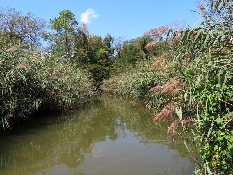
Also on Back Creek, I easily circumnavigated the island shown below which is located at 39.192333, -76.591222. Under normal conditions, I would have never been able to reach this island without portaging. I was there around 1240. High tide was around 1520. 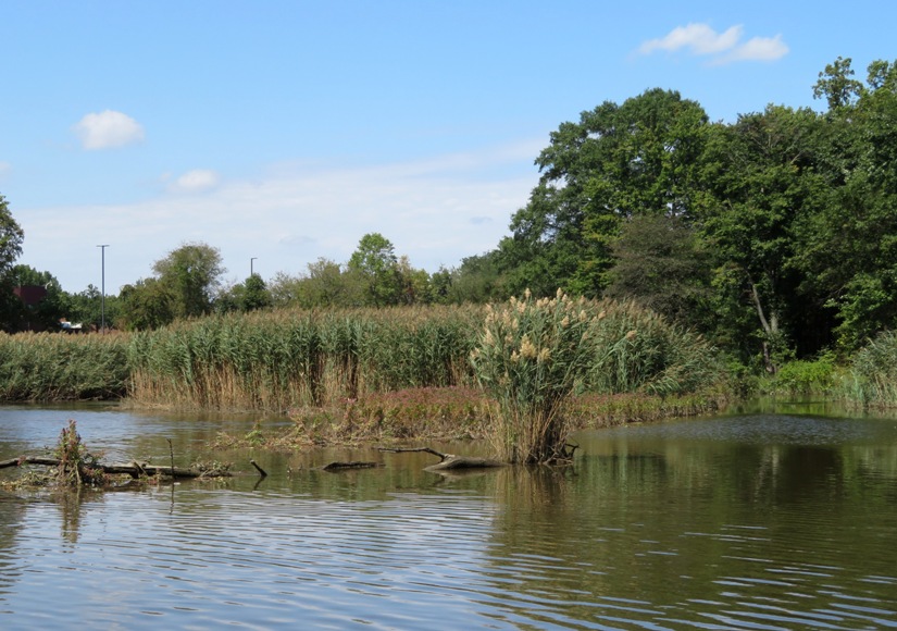
Since we hadn't had much rain, the water was pretty clear. I saw several turtles and hundreds of fish...more than I'd ever seen before in this area. There were lots of divots in the bottom of Back Creek which I assume fish might have made when building their nests. 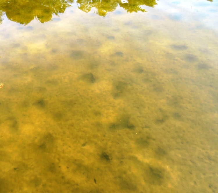
Out on Furnace Creek, I saw several places where the water was very pale in color near the shore. Since so much of the dirt and sand along the shore was also pale, I'm guessing the high water saturated parts of the shore that would not normally be saturated, thereby causing it to erode. 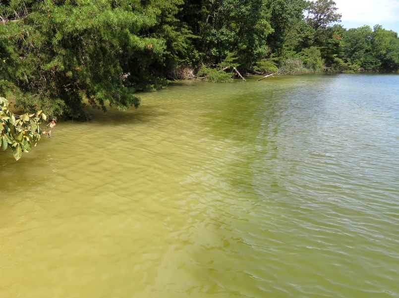
Paddling west on Furnace Creek, I saw some very scenic areas that I never knew existed. One doesn't typically associate such natural beauty with Glen Burnie. 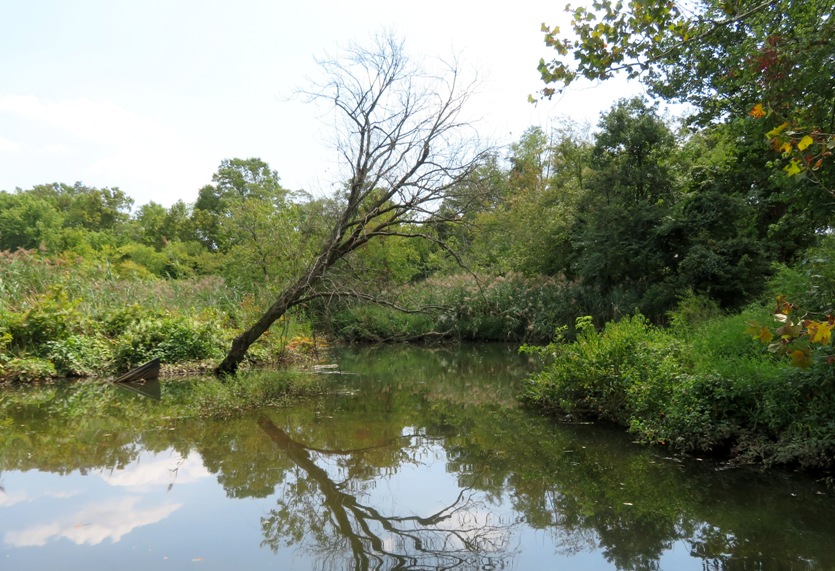
I managed to paddle west of Governor Ritchie Highway (route 2), reaching 39.183000, -76.613222 before turning around. I tried to sneak up on a cormorant that was asleep on a pile but my camera case made a popping sound when I opened it, which woke up my intended target. I got to hear some live music as I paddled past Ram's Head Dockside. It was a short and unexpectedly scenic trip. |
|
Norma and I did some kayaking in California at Drakes Estero.
|
|
I went kayaking on the Potomac River. I explored four islands, three creeks, two states, and covered 16 miles.
I launched from the 838-acre Algonkian Regional Park in Virginia. According to an information sign, it was reportedly used as a site for stills during Prohibition and originally built as a corporate retreat. Next to the boat ramp, I found some osage oranges. An outfitter was taking a group of about ten people out on the water. It hadn't rained much in awhile so the water was low. But based on Ed Gertler's description of this area, it is canoeable all year. But canoeable is not the same as paddleboardable, the latter requiring more water due to the large, unretractable fin. So rather than chance it with a SUP, I brought a plastic kayak. Paddling upstream from the launch site, I came to the privately owned Tenfoot Island. I saw plenty of paw paw trees on the island but no fruit. I think they were at peak ripeness a couple weeks ago. There were also several swamp hibiscus flowers in bloom. I found a pond on the upstream end with hundreds of snails, each about a third to a half inch long. I stopped briefly at Tenfoot Island. Behind my kayak in the photo below is Van Deventer Island which is owned by the Maryland Department of Natural Resources. 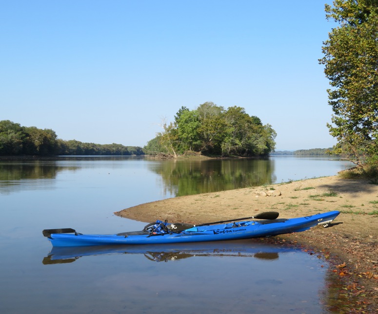
The Potomac River was shallow and clear. I could see five feet down. There were millions of small clam shells and a few large ones. It wouldn't take many of these to make a fine meal. 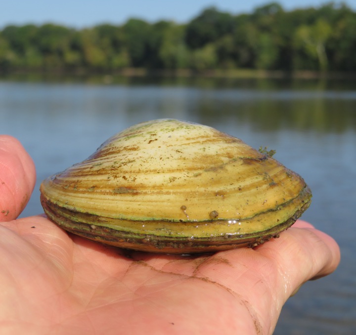
At Van Deventer Island, I saw lots of wild turkeys. After paddling almost a mile along the privately owned Selden island, I kayaked upstream on Broad Run for about a third of a mile. Any further and I would have had to portage. 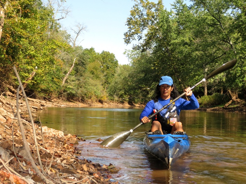
I went ashore to explore a bit. On the east side of this creek are trails that are part of the Potomac Heritage National Scenic Trail. This eastern painted turtle just south of Selden island let me get unusually close. 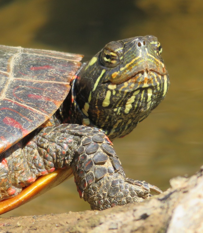
I was not able to paddle west of Broad Run south of Selden Island. Too shallow. I paddled between Selden and Van Deventer Islands. There were lots of big fish on the south side around here. At least some were not carp. Next I crossed the Potomac River to the Maryland side and then I landed at and explored Sycamore Landing which borders the McKee-Beshers Wildlife Management Area. Nearby, I saw this great blue heron take flight. 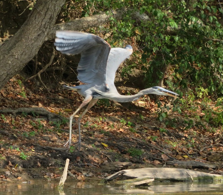
There were quite a few great egrets out. This one is stalking its next meal. 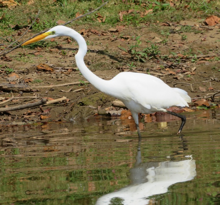
Paddling east, I landed at Sharpshin Island. I saw several snails crawling along the muddy river bottom. According to "LandScope America" (broken link as of 2025), The Potomac Conservancy acquired Sharpshin Island via charitable donation in 1996. 
I pulled ashore near the Chesapeake and Ohio (C&O) Canal and saw these things in a stagnant pond. Each is about two inches long. I reached out to various people to inquire what they are. Renowned author and entomology professor Dr. Michael J. Raupp said they are some kind of fly larvae. Just behind the pond, two bicyclists passed by on the towpath. 
I paddled upstream on Seneca Creek for about a half mile. Then I pulled ashore near the mouth at Seneca Landing Park. In the pic below is Seneca Creek Aqueduct. It is one of eleven aqueducts built from Georgetown to Cumberland to carry water over water. The aqueducts, literally 'water bridges,' carried the canal over large streams and rivers flowing into the Potomac River. - from park sign 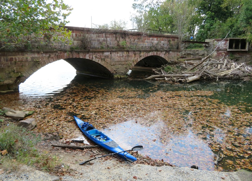
I paddled right up to Lock 23 at Violettes Lock. Locks like this on the C&O Canal were build to raise and lower boats so they could navigate along the canal. 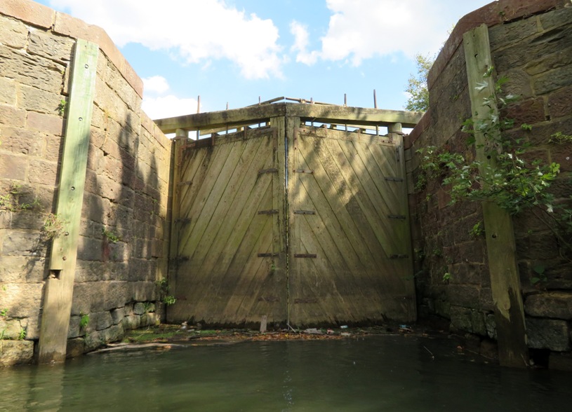
Then I ventured ashore at Violettes Lock to see what Lock 23 looked like on the other side. From here, I saw people kayaking in the C&O Canal, where barges were once towed by mules in the 1800s. There is a nice place to launch in the canal just a short distance from the Violettes Lock parking lot. Of course this is also a good place for bicyclists to access the towpath. Back on the water, I saw a snake swimming to shore. I paddled back into the Potomac and starting making my way back to Virginia. I pulled over at one of the many big rocks in the river. Recall that I mentioned that I saw no paw paw fruit. But clearly, some animal did. These are paw paw seeds. I found quite a bit more mixed in with lots of poop. 
I paddled by Dam 2. Below is a view looking downstream from it. The dam was built to supply water for the canal from the Seneca area to Dam No. 1 at Little Falls. Only rubble is left today, but the Potomac still backs up, forming the Seneca Lake. - from River Explorer - Dam Number Two 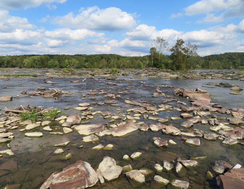
In the following snapshot, one can clearly see where the rubble from Dam 2 starts. Upstream (left) is Seneca Slackwater, aka Seneca Lake. 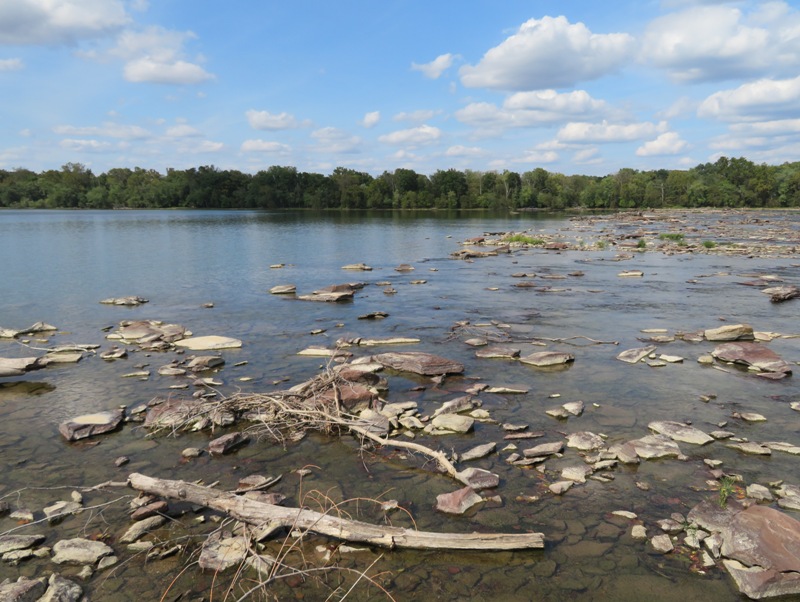
The last creek I explored was Sugarland Run on the Virginia side. This is a very scenic place that I plan to return to and explore more thoroughly when there is more water. I made it upstream about two thirds of a mile. 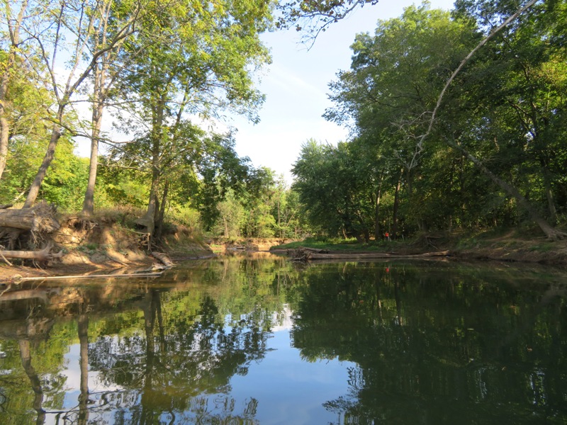
I was out for about 6.75 hours. It was a full day of exploration. There was a lot of cool stuff to see which always makes for a nice day. |
|
You may recall that between July 27, 2019 and August 30, 2019, I participated in the Patuxent Challenge.
This challenge requires one to complete certain physical activities within a given calendar year. Despite the name of the event, none are challenging. The challenge is just getting out and doing them. But as evidence that you were at least there, you need to take a selfie snapshot near one of several Patuxent Challenge signs. Prizes of different levels are awarded to participants who complete 5, 10, or 15 activities within the calendar year. I completed all 16. On October 7, 2019, I received my prize. It was a box full of swag from some of the cities and counties through which the Patuxent River passes through. I was very pleased with it. Here's what was in the box: I am estimating this is all worth about $54. Just the complimentary canoe or kayak rental from Patuxent River Park is worth $26. Everything except the crab had something on it to indicate it is associated with Maryland. I also received a handwritten card of congratulations from the Patuxent Challenge Committee. 
|
|
Norma, Daphne, and I launched from Violettes Lock in Montgomery County, Maryland. We paddled across the Potomac River to the Virginia side and then upstream on Sugarland Run for about a mile until we were stopped by shallow riffles. Then we paddled back across the Potomac and kayaked up Seneca Creek for about 0.8 mile until we were again stopped by shallow riffles. We put in a total of about 7.6 miles.
In addition to seeing crayfish, I saw what appeared to be a freshwater sponge where we launched. 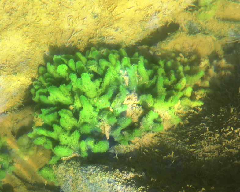
I read that freshwater sponges have been found in this area. I reached out to the National Capital Region Network Inventory and Monitoring Network to confirm. A couple days later, I was told by a biological science technician (vegetation) of the National Park Service that this is indeed a freshwater sponge. According to In Defense of Plants - Freshwater Sponges, Though it is not readily apparent, sponges are animals. They aren't a single animal either. What functions as a single unit is actually a collection of individual organisms working in unison. The entire body of the sponge consists of these microscopic individuals connected by living tissue and held rigid by tiny rods made out of silica. They are an indicator of clean, clear water. If you see sponges then you know it must be a healthy ecosystem. The three of us pulled ashore in the Potomac River at the rubble of Dam Two to do a little exploring. 
The last time I was here, I noticed how there is no evidence of man made structures to indicate that anyone ever constructed a dam. There are lots of rocks but they don't appear to be cut and there are no metal or concrete structures. If I didn't know otherwise, I might think the sudden change in scenery from open water to rocky rubble is entirely natural. But looking from above with my drone, things take on a much different appearance. Looking north, one can clearly see the sudden demarcation between open water and rubble. At the bottom left is my kayak. I'm standing to the right of it, waving. 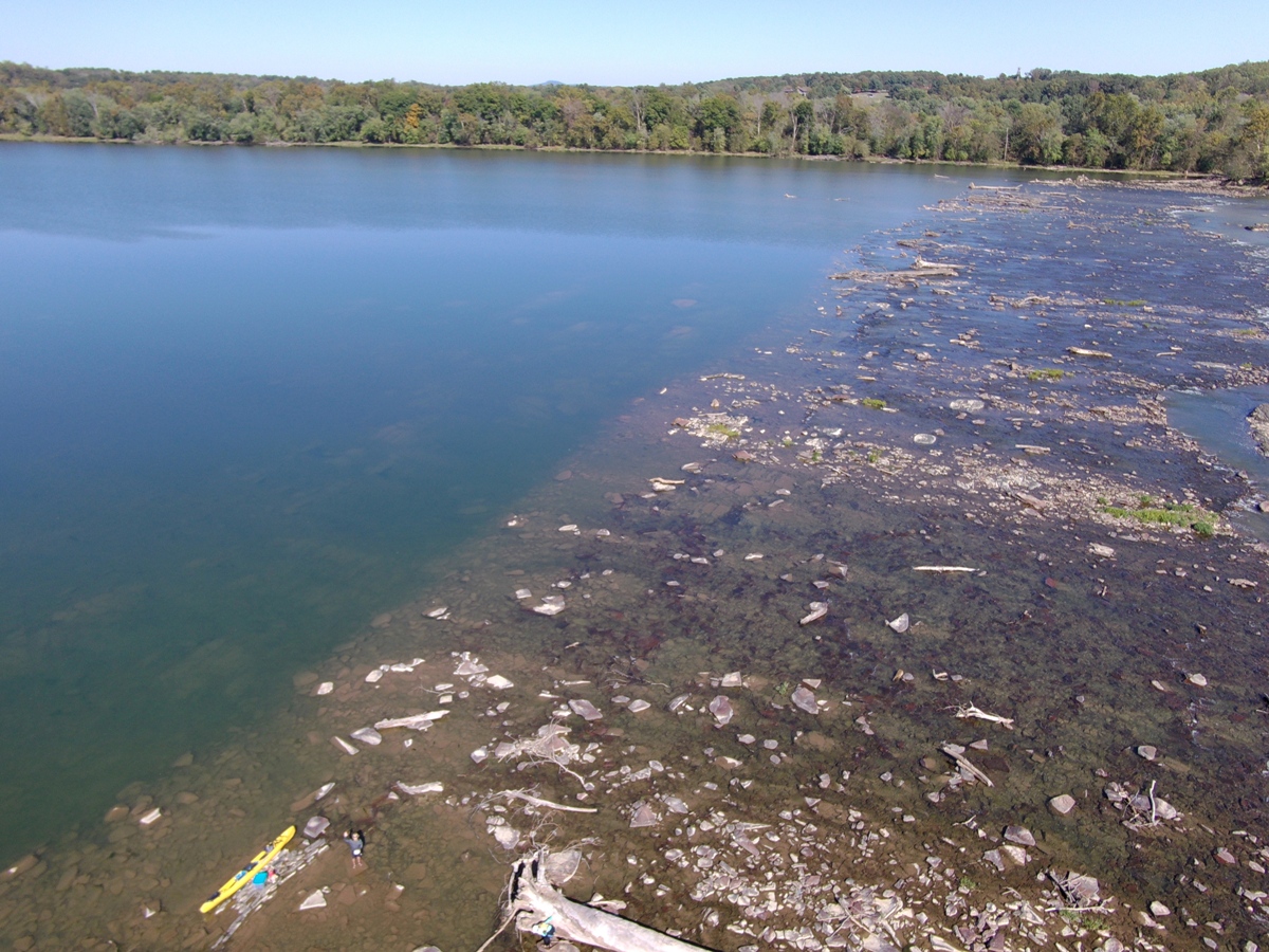
Here's a higher altitude view. Again, my boat is near the bottom. 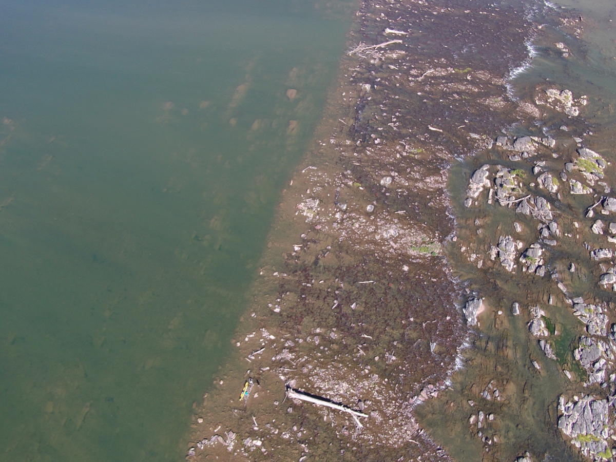
Looking downstream of Dam Two, the rocky rubble extends for quite a distance. 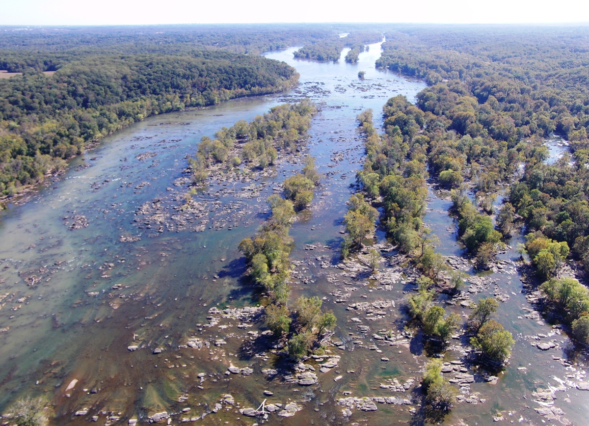
Looking southwest from Dam Two is the Trump National Golf Course. This made the news in 2018 and 2019. According to WUSA9 - Canoe club claims wins over Trump golf club, river dispute, In 2018, the Coast Guard shut down a busy, two mile stretch of the Potomac River near Trump National Golf Course. The river, which is used for recreational purposes by paddling groups, summer camps, disabled veterans' organizations and more, was completely closed off. With the help of a Democracy Forward, a nonprofit legal organization, the Canoe Cruisers Association brought a lawsuit against the Department of Homeland Security (DHS) in 2018. As of March 21, 2019, the Coast Guard created a new, interim rule which reduces the size of the security zone around the golf club. 
With both of us curious about Dam Two, Norma found "Maryland Historical Trust Worksheet - Violet's [sic] Lock House" (a broken link as of 2025) which states After exploring the Dam Two area, we kayaked on the scenic Sugarland Run where there was no shortage of fish. The three of us took a catnap on the beach. Just west of the mouth of Seneca Creek, I saw a great blue heron eating a frog. It put on quite a show as it kept dipping its meal into the water. I'm guessing it was trying to reposition it so it could be swallowed. I used much of this information along with what I learned on September 29 to write Still Waters Run Deep at Seneca Slackwater. |
|
I took the day off from work to spend some time on the eastern shore.
First, I flew my drone in Saint Michaels and got some good shots of the Chesapeake Bay Maritime Museum. I launched it from Muskrat Park. Next, Daphne and I launched my SUP out of Dogwood Harbor on Tilghman Island, Maryland. Dogwood Harbor claims to be the "home of the last working fleet of Skipjacks in North America and Chesapeake Bay commercial watercraft." It is one of the few harbors where workboats outnumber pleasure craft. The water was pretty clear. I saw lots of fish and a few crabs. I paddled under the Knapps Narrows (aka Tilghman Island) Drawbridge which separates Tilghman Island from the mainland. 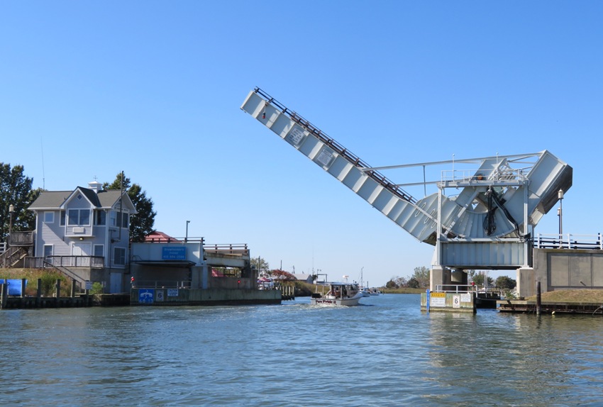
Daphne and I explored the waterways around Anne Arundel Island. 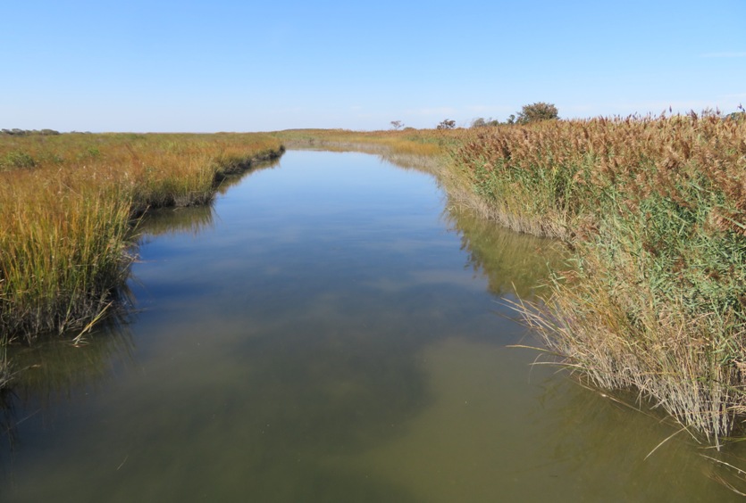
There, we saw two river otters swim and then run across a spit of land before jumping back into the water. Located at 38.7223146, -76.3357384, they dove under once they saw me. 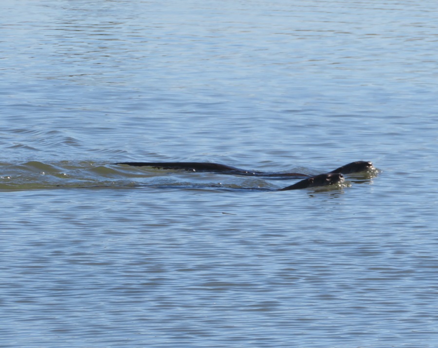
On the Chesapeake Bay side of Anne Arundel Island, I found several snail shells. 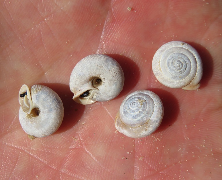
I also found this four-inch wide horseshoe crab. It was a semi-transparent molt. 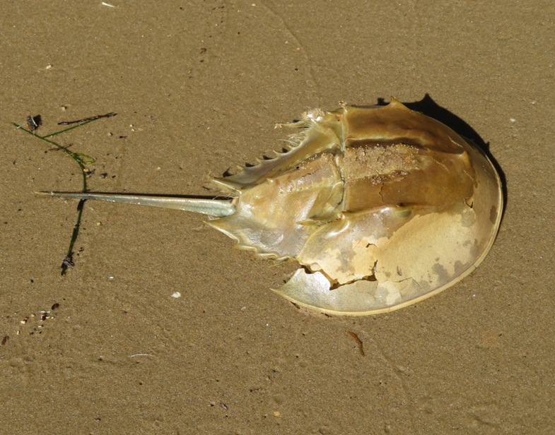
Daphne and I explored Back Creek. We had to turn around because it got too narrow, not because it got shallow. But we made it about to 38.7406974, -76.3309882. 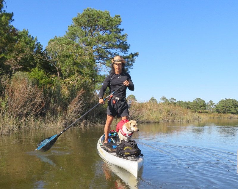
Downstream on Back Creek, I saw a bald eagle take flight. I followed it and took more pictures. Back at Dogwood Harbor, I saw an oyster dredging tool. At this place, I found that the busiest time to launch is morning or midday during the week because these are working watermen boats, not pleasure craft. At least half of them had a Trump flag affixed to their boat. I got in a slow seven miles. I'm going to a funeral on October 19, but if I wasn't, I'd make time to attend Tilghman Island Day. This will be a great opportunity to experience Maryland eastern shore waterman culture. Now that it is autumn, I am finding I am not as interested in being on the water. I still enjoy it but not as much as I do in the spring or summer. Perhaps it is because there isn't as much wildlife and it is getting colder. I brought my wetsuit but didn't wear it. But on my next trip, I definitely will. |
|
On November 1-3, 2019, Chestertown (my favorite town) had their annual Downrigging Weekend (aka Tall Ships Festival). I always love seeing these boats.
This year was a little different than previous ones because they had bluegrass music and a new marina. But it was pretty much the same ships. I wish they could get the Dove, a reproduction 17th-century English trading ship. The original was one of two ships which made up the first expedition from England to Maryland. Norma, Daphne, and I drove out on Friday afternoon, November 1. We explored the Still Pond Cemetery and then checked into our AirBnB room at a venerable Civil War house, that Union soldiers burned over argument between an owner and a Union recruiter before the beginning of the Civil War. - from AirBnB description by Nancy, the owner Next, the three of us did a hike at the Sassafras Natural Resources Management Area. This is a great place to let your dog run off leash, assuming it isn't hunting season. We walked on the Tochwogh Trail, named after a Native American tribe that lived along the Sassafras River. Finally, we ate at Barbara's on the Bay in Betterton after walking at Betterton Beach. Norma loved the restaurant. The next morning (November 2), we drove out to Chestertown to see the ships. I launched my SUP from Truslow/Hodson Boat House with my drone while Norma and Daphne explored on land. 
I saw two kayakers I knew: Patricia N. and Carlos. The rightmost ship below is the Schooner Sultana, a reproduction of its 1768 namesake used by the British Royal Navy to enforce the notorious tea taxes in the years preceding the American Revolution. Built in Chestertown and launched in 2001, the new Sultana's mission is to educate students of all ages about the history and ecology of the Chesapeake Bay. 
Again on the right is the Sultana. It is dwarfed by the much larger Kalmar Nyckel...more about that later. 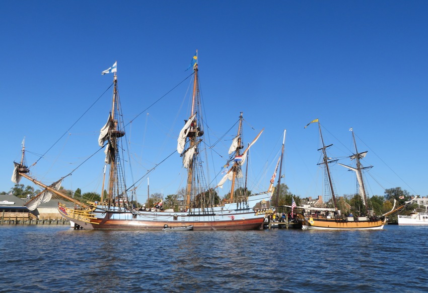
Here's all the ships as seen from my SUP. Kinda boring, right? 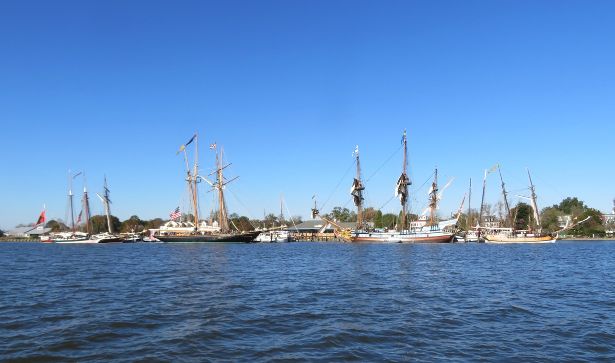
But here's almost the same view as the previous shot but taken high up from my drone! This shot was taken about an hour after sunrise. I like the way the sun makes things glow but keeps the water looking black. 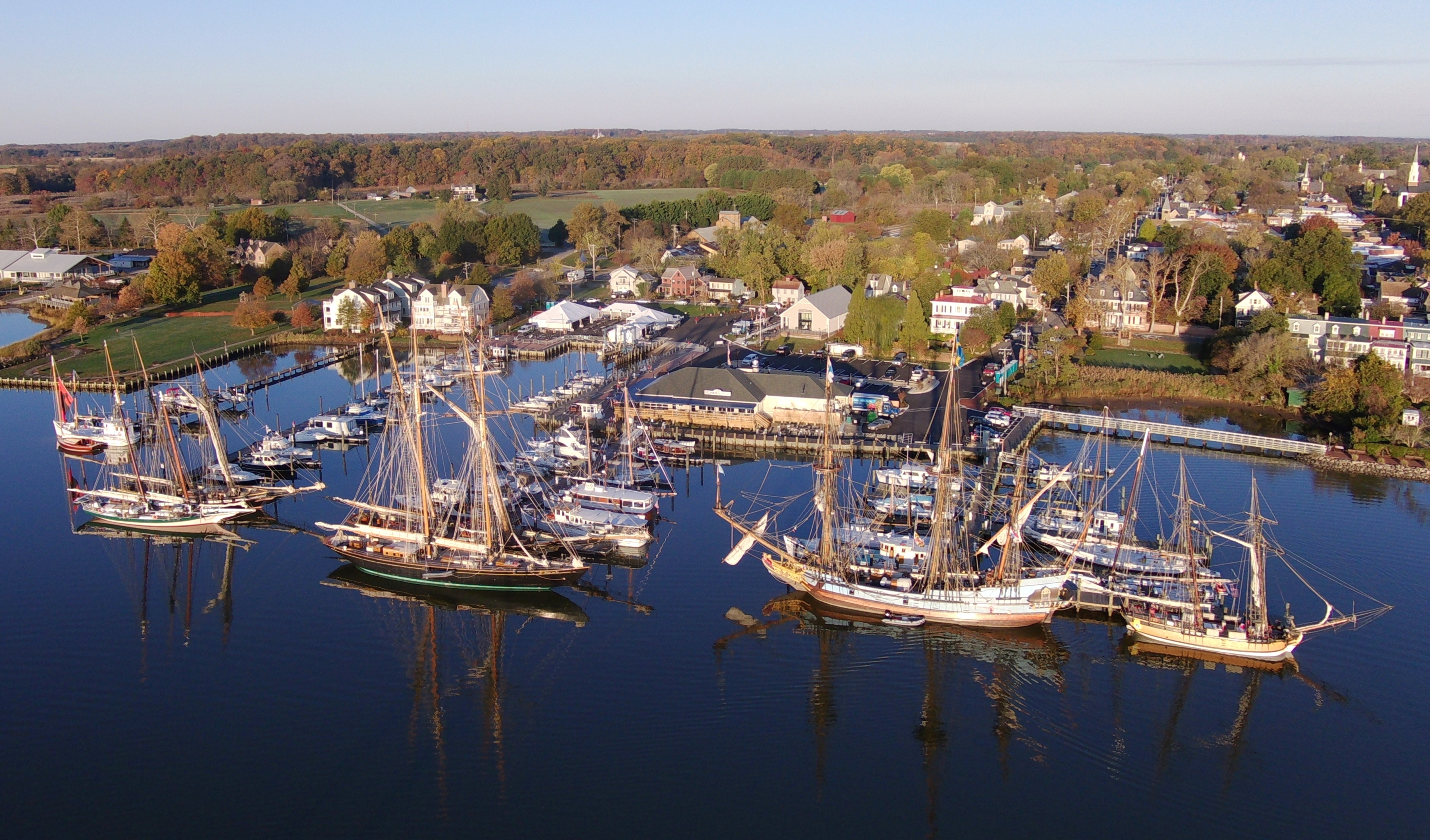
In the pic below, the outboard ship is the Virginia, a reproduction of the last all sail vessel built for the Virginia Pilot Association. The original ship sailed for the pilots from 1917-1926. The inboard ship (closer to the pier) is the Pride of Baltimore II, a reconstruction of an early 19th-century Baltimore Clipper. 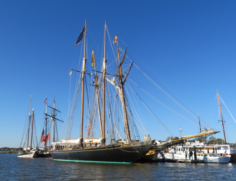
This ship is the Kalmar Nyckel, a re-creation of the first colonial Swedish settlement ship to arrive in America. 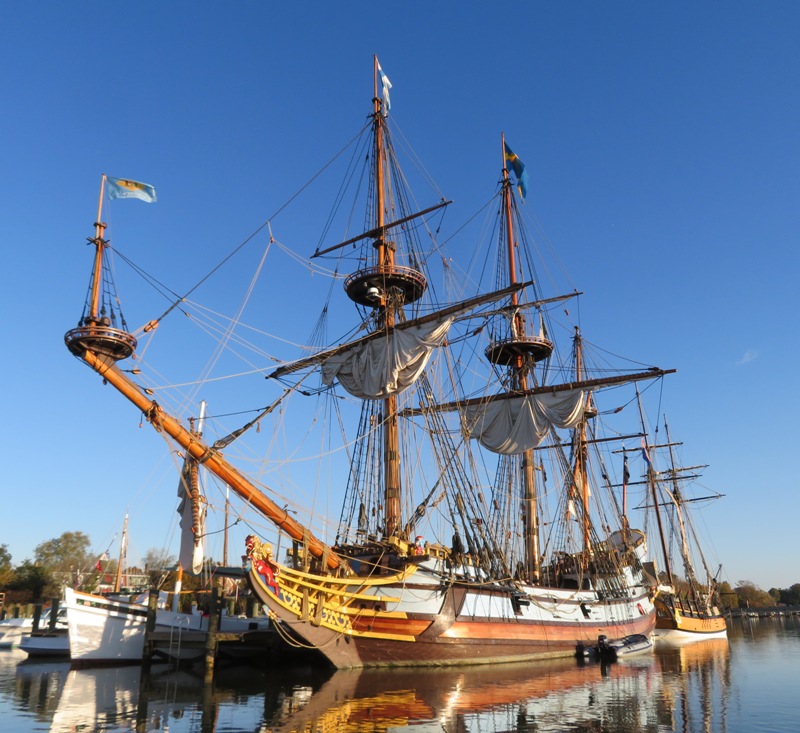
Launched in the Fall of 1997, this ornately carved 17th century reproduction ship sails seasonally, visiting ports from the Mid-Atlantic through New England while carrying out her mission of goodwill and providing educational opportunities for school children. It is based out of Wilmington, Delaware. Here's an aft view. The original ship was constructed around 1625 and was probably nowhere near as decorative. Someone told me that he thinks two of the faces shown here look like President Trump and Vice President Pence. I can see that. 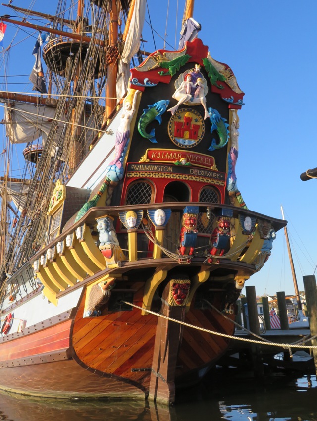
This is the bow which shows a two-tailed lion figurehead, one tail symbolizing the old ship and one symbolizing the new ship. 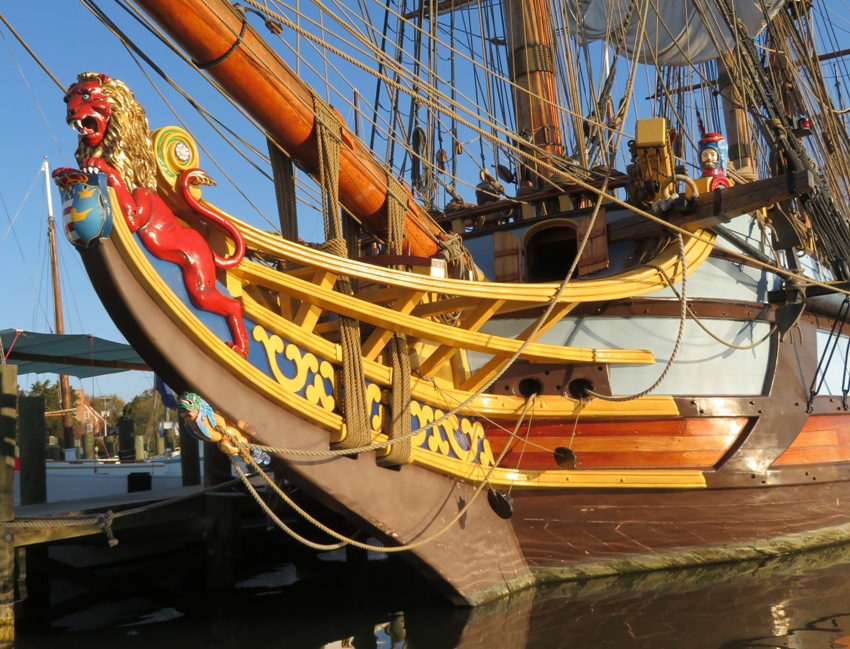
In the below snapshot on the left is the Lady Maryland, a full-scale reproduction of a traditional 19th century Chesapeake Bay cargo schooner called a pungy. It is the Living Classrooms Schooner and flagship. On the right is the Lynx, a square topsail schooner designed and built to interpret the general configuration and operation of a privateer schooner from the War of 1812. 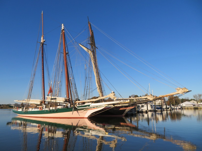
Here's a drone's view of historic Chestertown. Appearing in the front on the left are the Kalmar Nyckel and the Schooner Sultana. Further back on the right is the River Packet, a 65-foot classic yacht, which offers charter cruises on the scenic Chester River. This 1920-style tour boat is based in historic Chestertown. 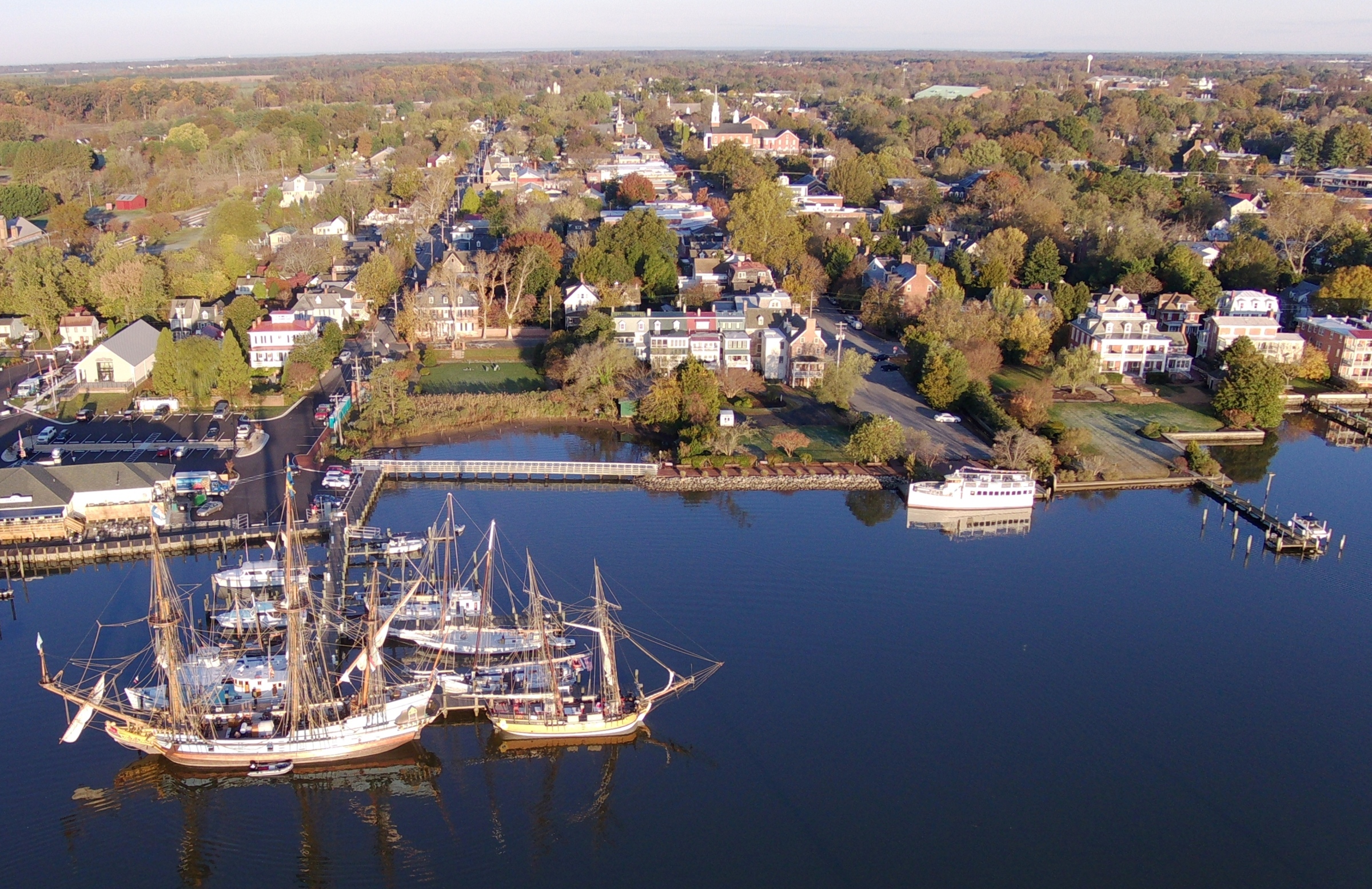
Shown below is the Muriel Eileen, 65-foot buy boat built in 1926. On the right is the Silent Maid, a reproduction of a racing catboat designed by Francis Sweisguth and built by Morton Johnson of Bay Head, New Jersey in 1924. 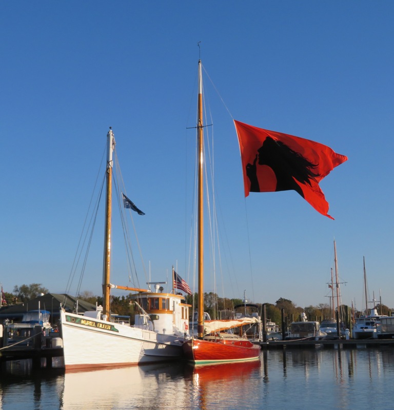
Here's one final view of the boats, looking northeast on the Chester River. We named our cat "Chester" after Chestertown and the Chester River. The cat mascot on the Kalmar Nyckel is also named Chester. 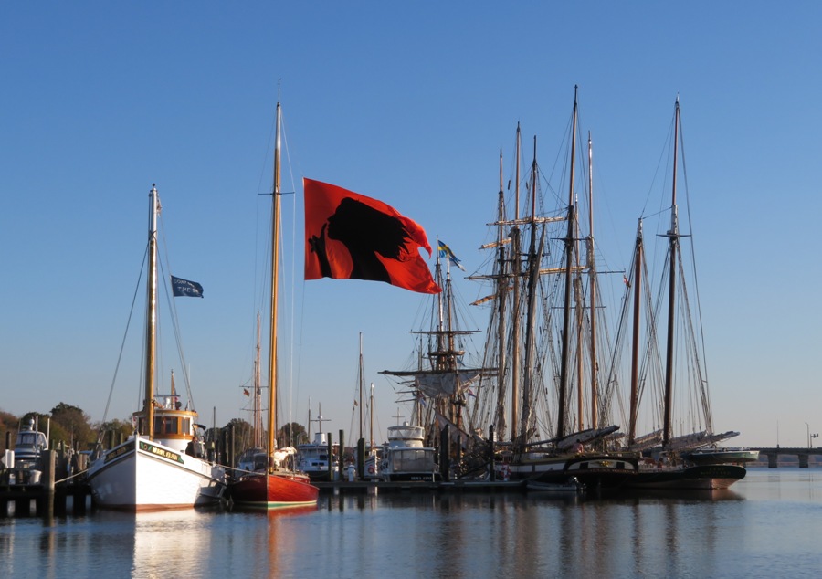
You'll notice I only posted two drone photos. I actually took a lot of photos on Saturday. I launched a little upstream because the wind was blowing downstream. I got a lot of pictures. Around 12 minutes into flight, I was about to call my drone back but instead it went into homing mode because the battery got low. It has done this in the past but usually after more like 14 minutes. I've never had a problem with the homing mode. But what was different today is that I was on the water. I assumed it would return to the transmitter but instead, it returned to the location from where it launched which is not where I was. Recall that I mentioned the wind was blowing downstream. I saw it take off upstream and it was moving too fast for me to catch up. I saw it touch down and then sink. It is somewhere at the bottom of the Chester River. Needless to say, I felt helpless and sad. After looking at the ships, the three of us watched the Chestertown Halloween parade, shopped at the farmers' market, and ate at Play It Again Sam. Then we walked around in the area east of Philosophers Terrace and thought about what it would be like to retire there. It is certainly quiet and the homes are nice. Then we drove back to the western shore so we could volunteer at the Laurel soup kitchen, Elizabeth House. We didn't get a chance to hear any of the bluegrass bands in Chestertown. Maybe next year. On Sunday, I returned with drone two. This is the same as the first but doesn't work as good. Why do I have two? It is a long story but basically, one didn't work so good after I crashed it and the company gave me a new one (I told them it was my fault) but before that, I purchased a second one. I flew one of them in the vicinity of high voltage power lines but stayed a good distance away...it was safe for the power lines but not my drone which was affected by the electromagnetic radiation. So when drone two hovers, it ends up making circles that get bigger and bigger until I fly it in a straight line so it can then reset its tracking. Tests indicate it starts circling after about two minutes. I was out on the water early on Sunday on my SUP with drone two. I got into position. There was no wind so I didn't have to worry much about drift. My plan was to fly it straight up and take photos. Then, after 45 seconds, I would return it. Everything went fine but after about 30 seconds, it went into homing mode. I don't understand why but I later read that if the signal is interrupted, it will do that. I wonder if someone was jamming me. Anyway, it returned to where it was launched. I had drifted slightly and paddled back to grab the drone. I missed it on the first pass but got it on the second, just as it hit the water. The camera got wet but that was it. I got home, took it apart, and let it dry out. I only got four photos, two of which were shown above. So will I get another drone? Well, drone two still works but not well. The battery is only good for so many runs and it might be getting near the end for that. Maybe that's why it went into homing mode so fast but I find that hard to believe. I am currently limited in my choice of drone because I have an old Windows phone that is no longer supported so I need a monitor that doesn't rely on a phone. If I upgrade phones, I will rethink about getting a new drone. But for now, I've photographed most everything I've wanted to from an unmanned aerial vehicle (UAV). I've certainly gotten my money's worth out of them, even they only lasted about 11 months. |
|
These trips are on my "to do" list for 2020. It is a work in progress.
|
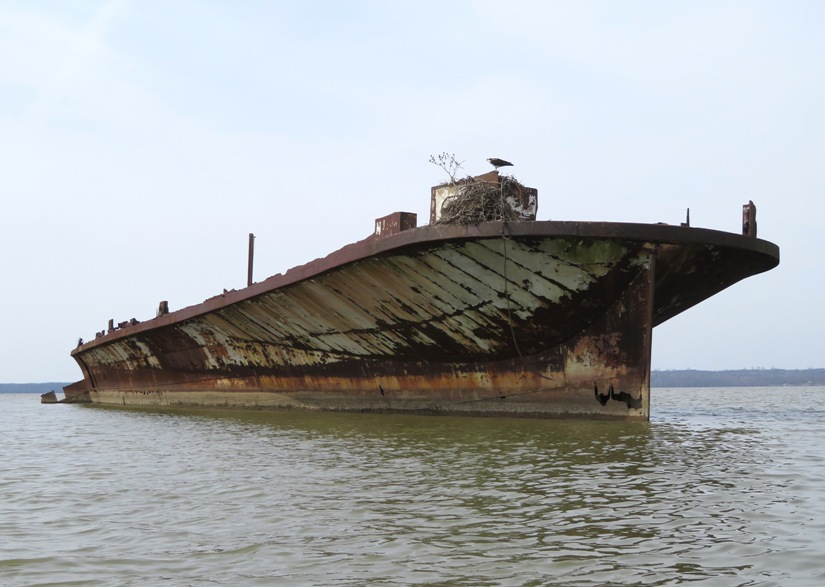
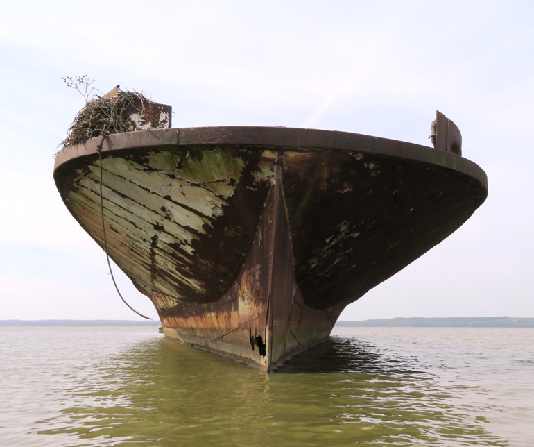
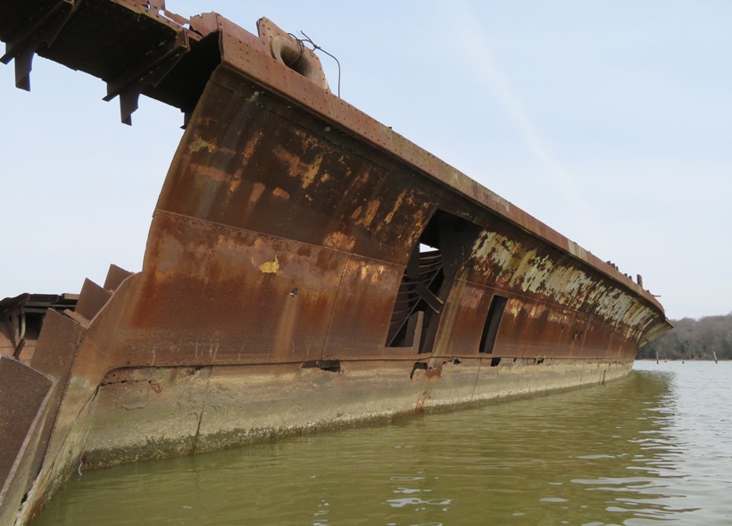
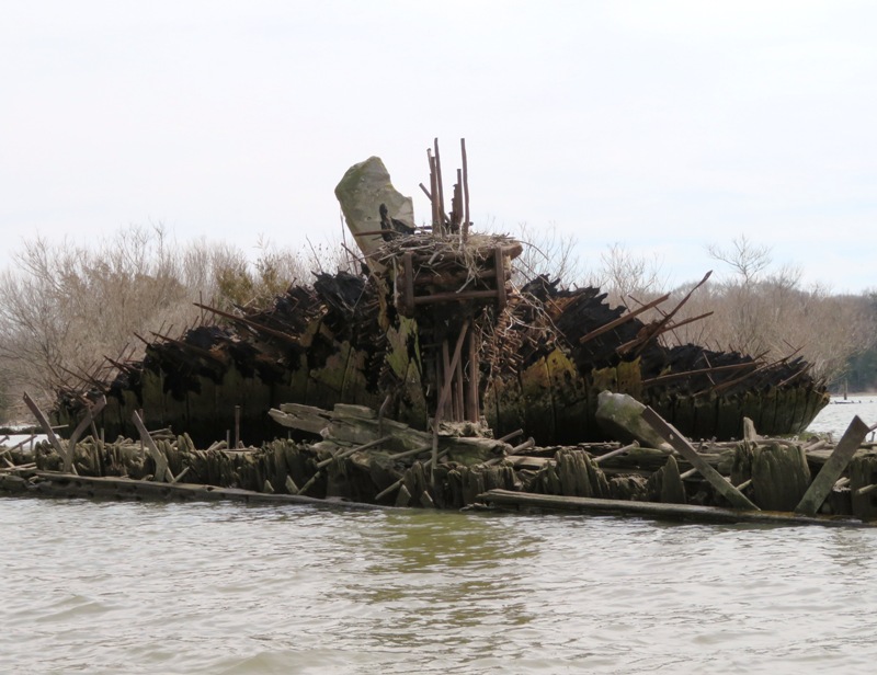

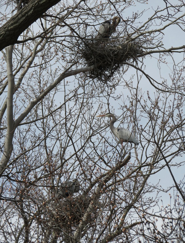
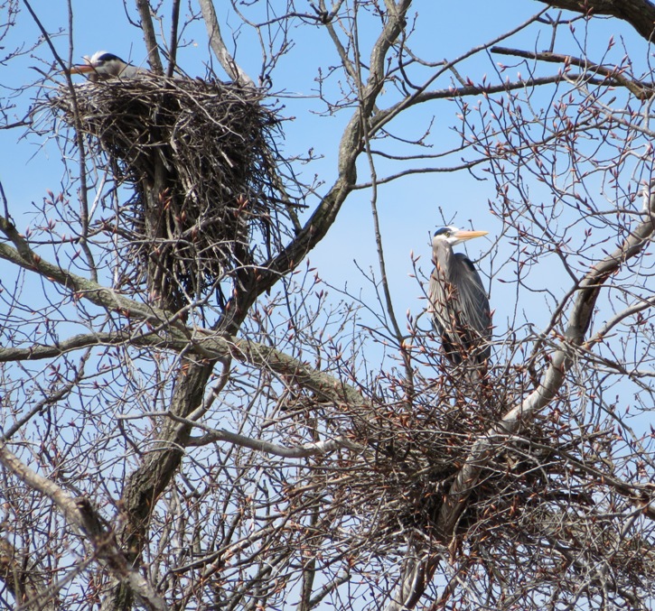
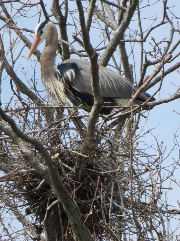
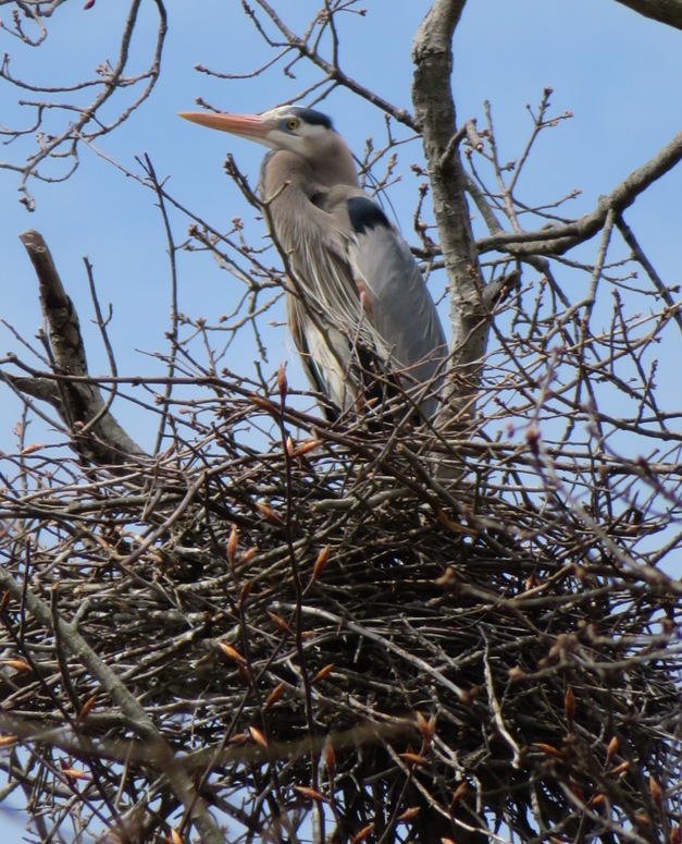
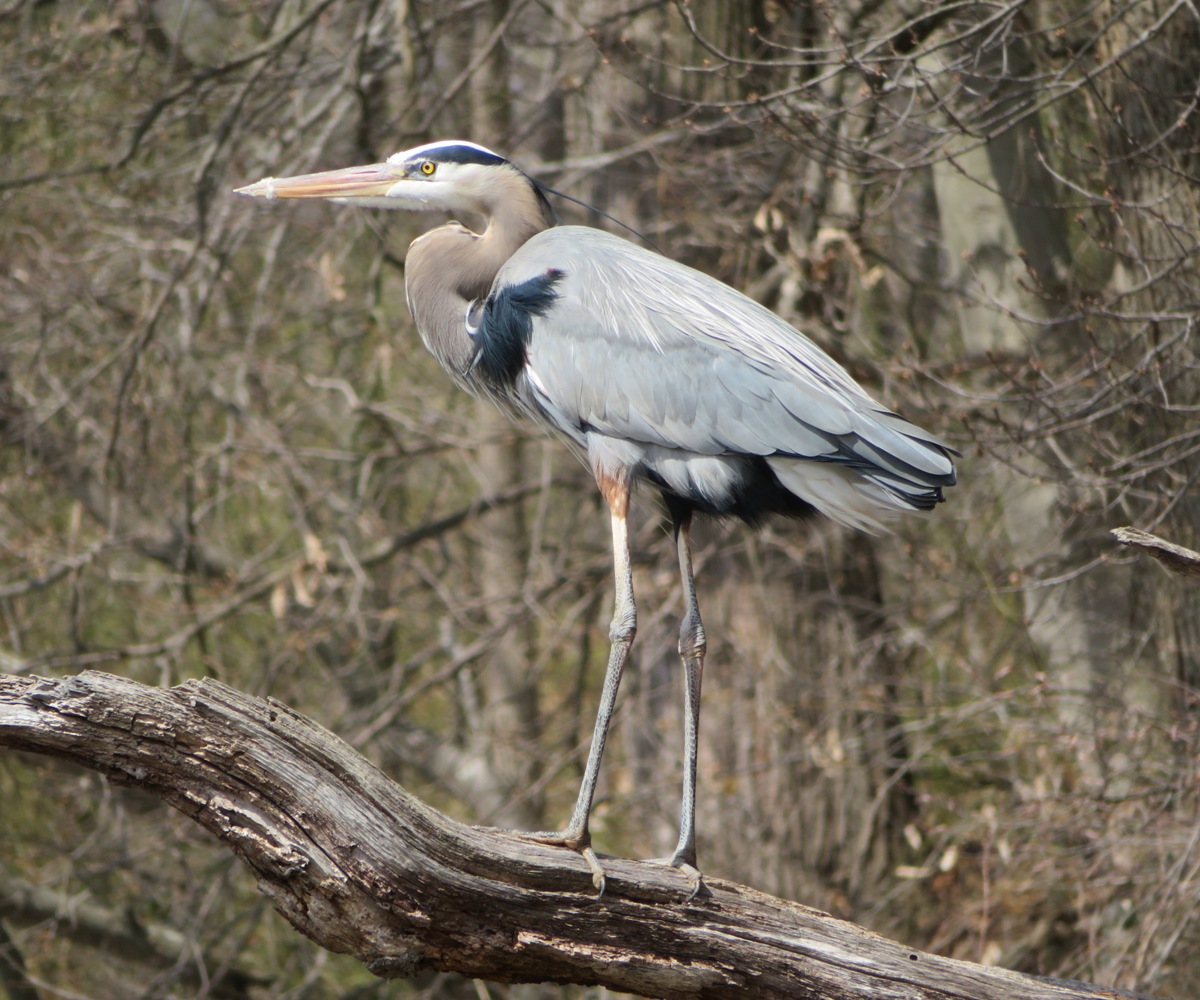
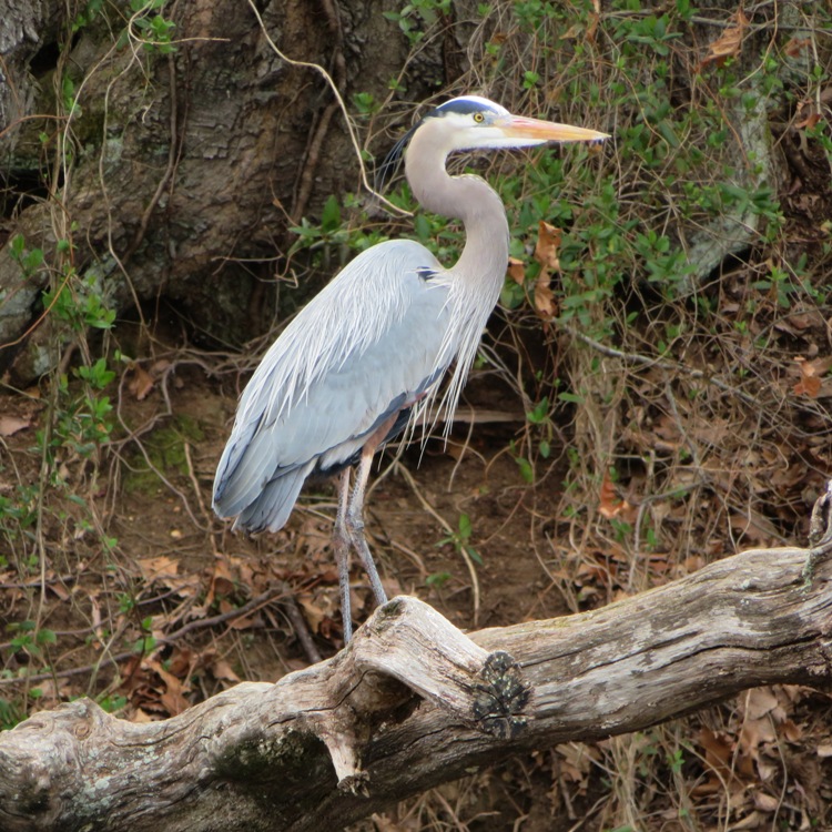
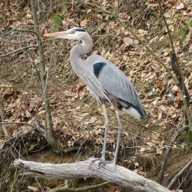
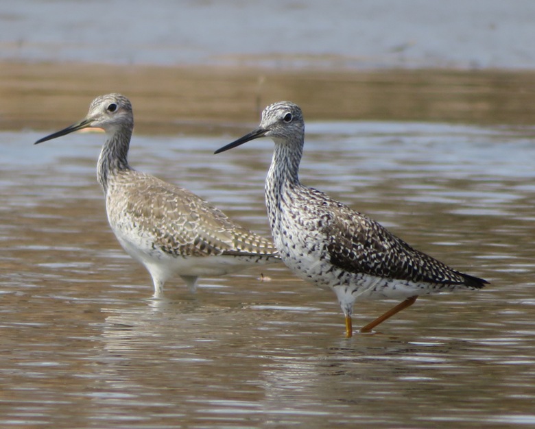
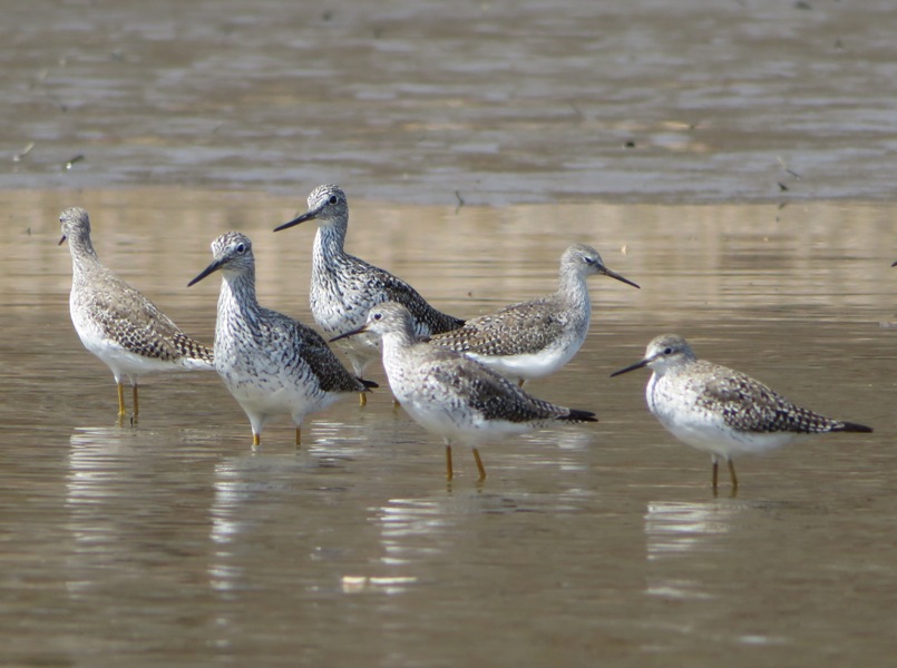
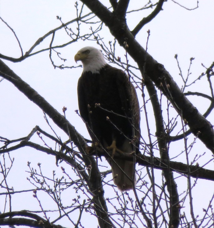
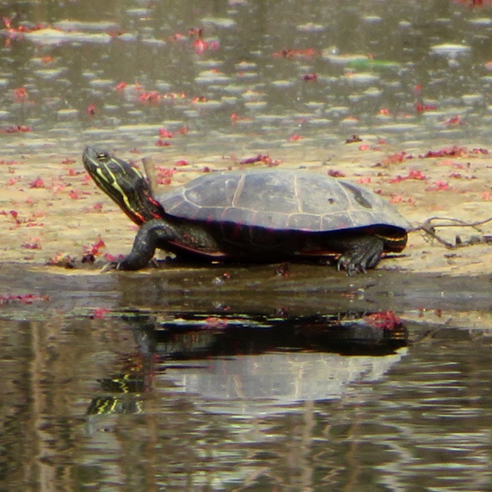
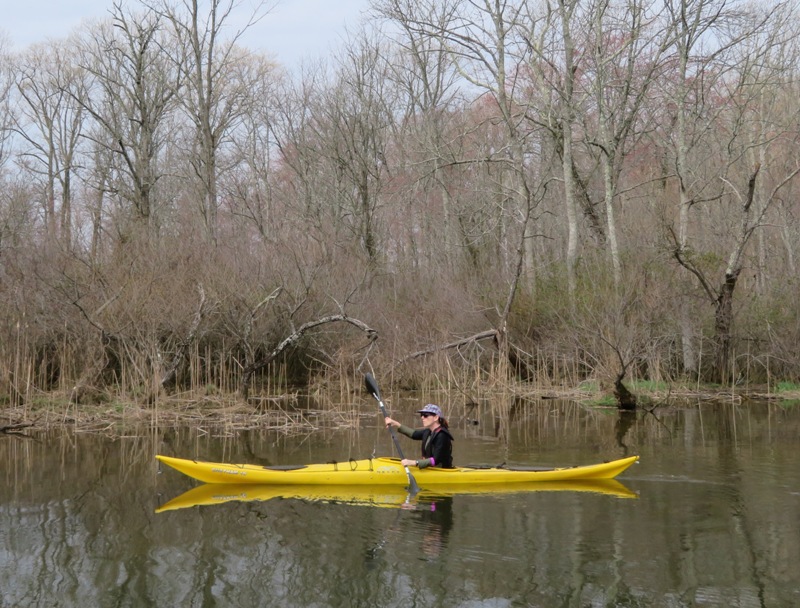
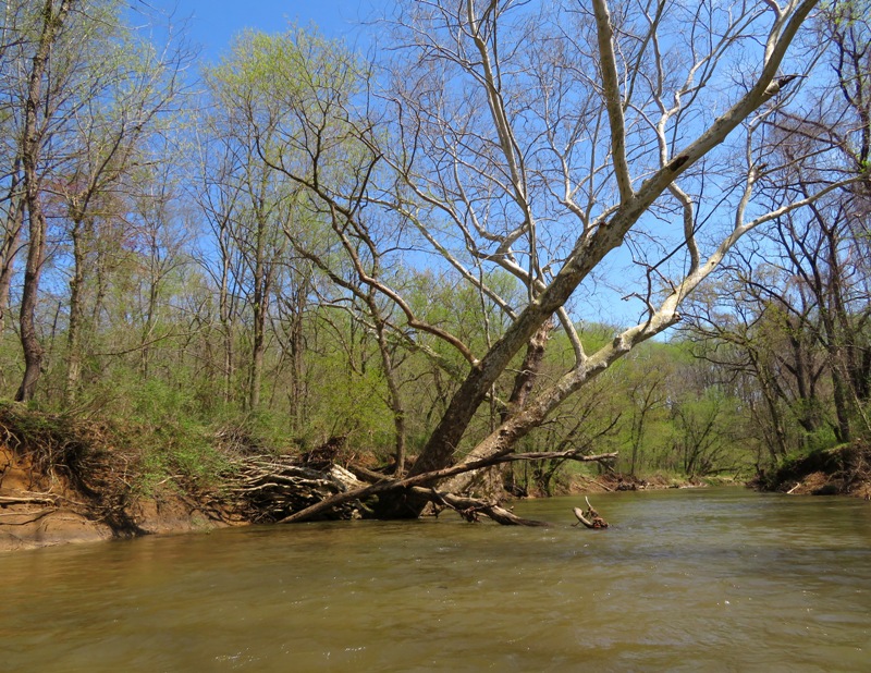
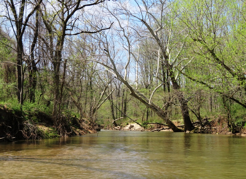
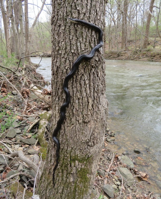
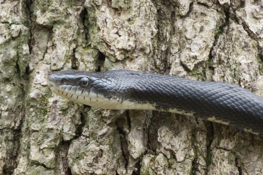
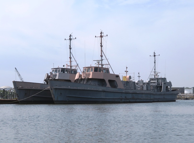
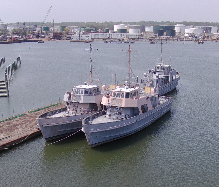
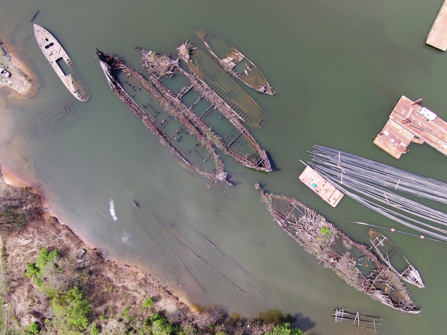
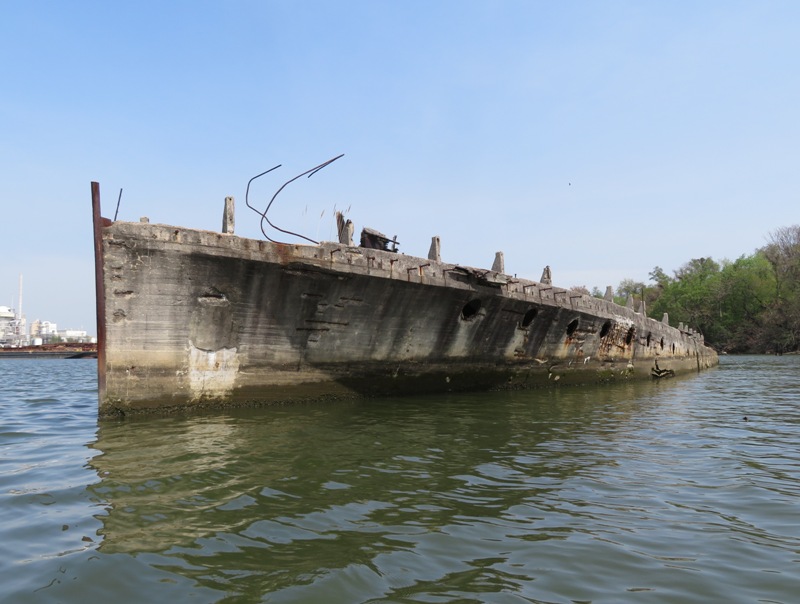
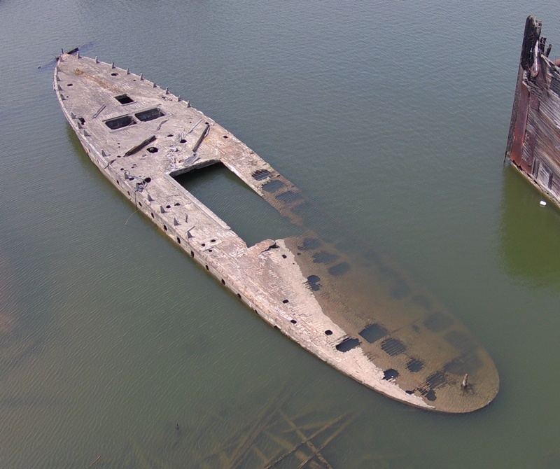
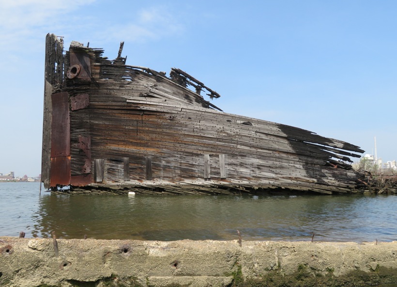
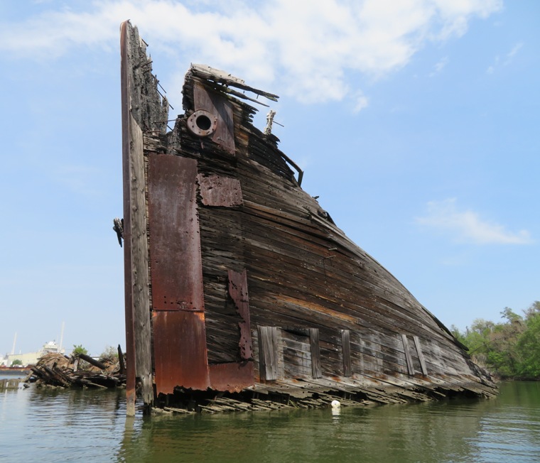
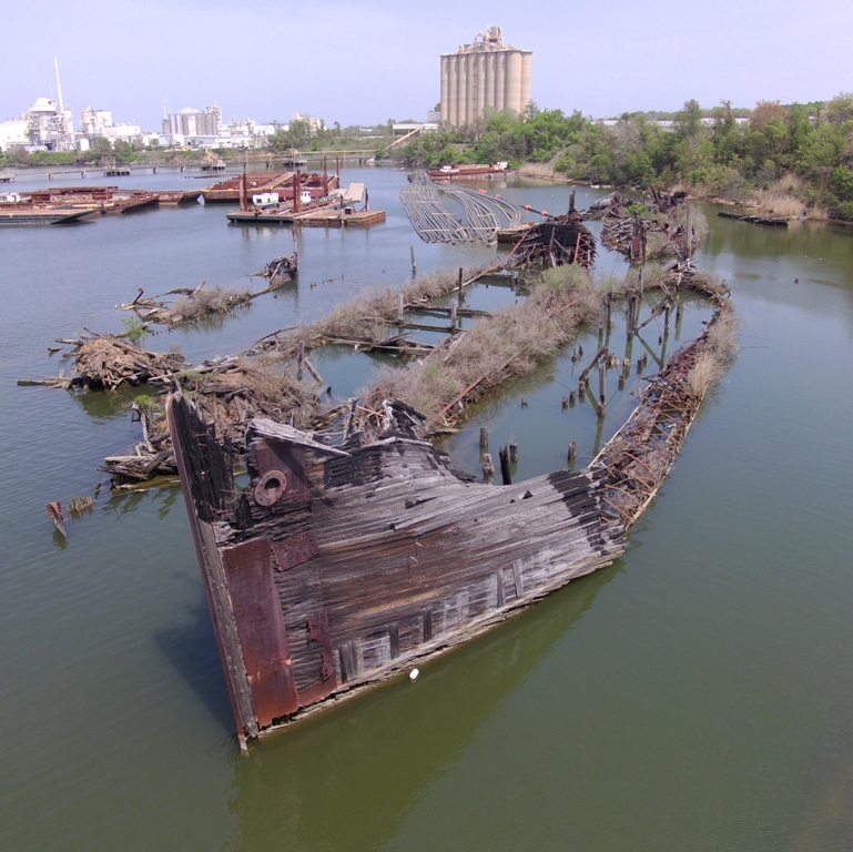
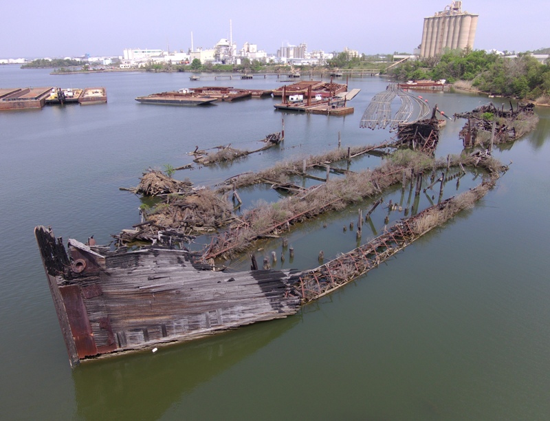
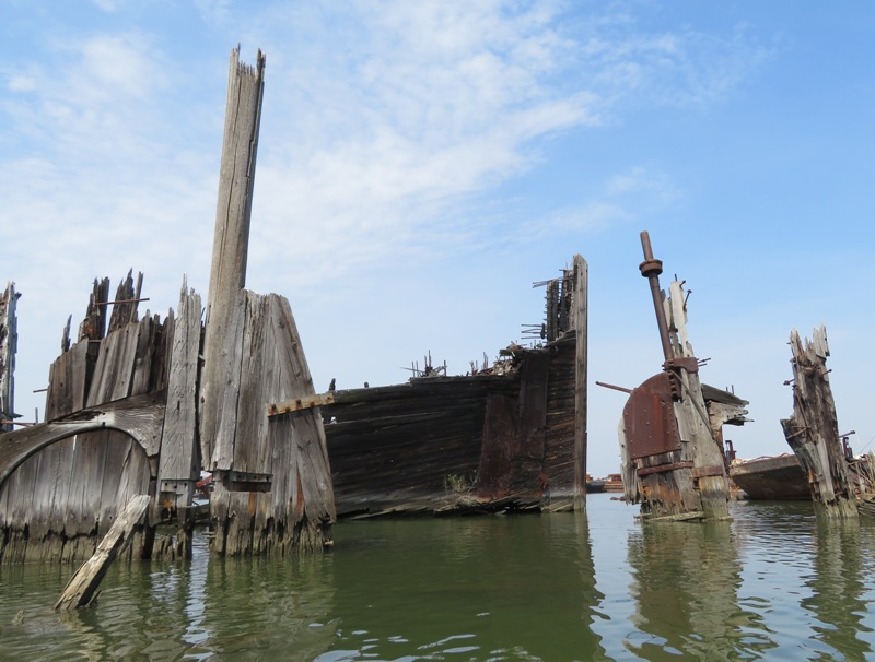
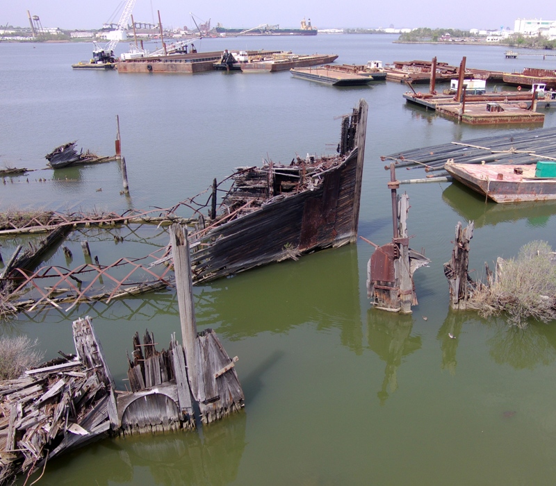
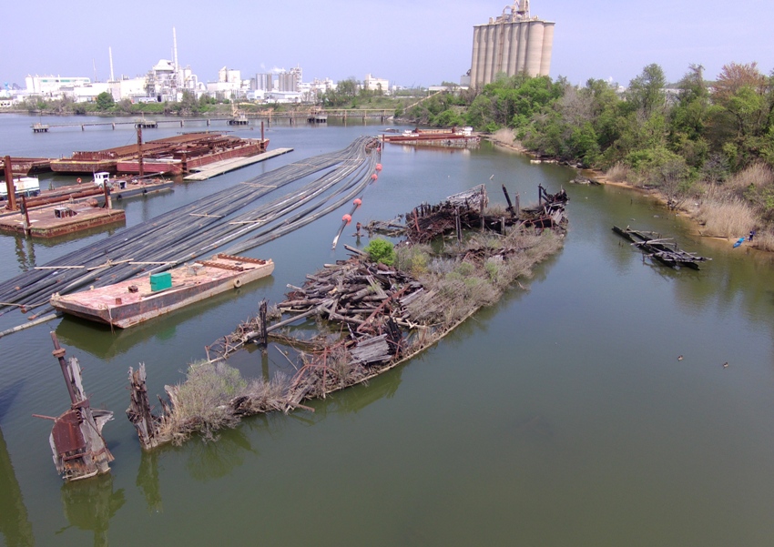
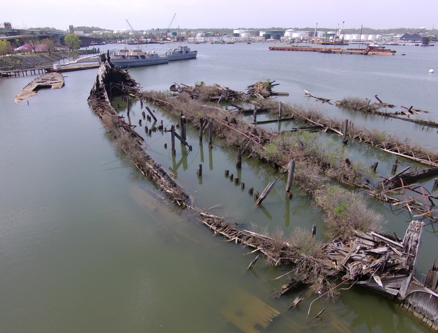
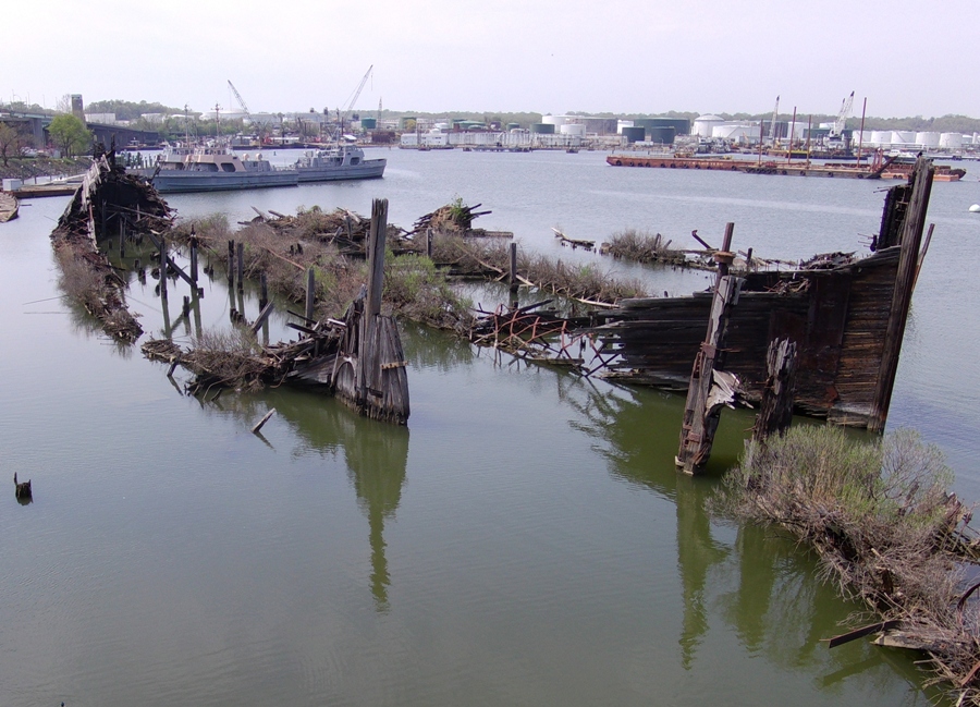

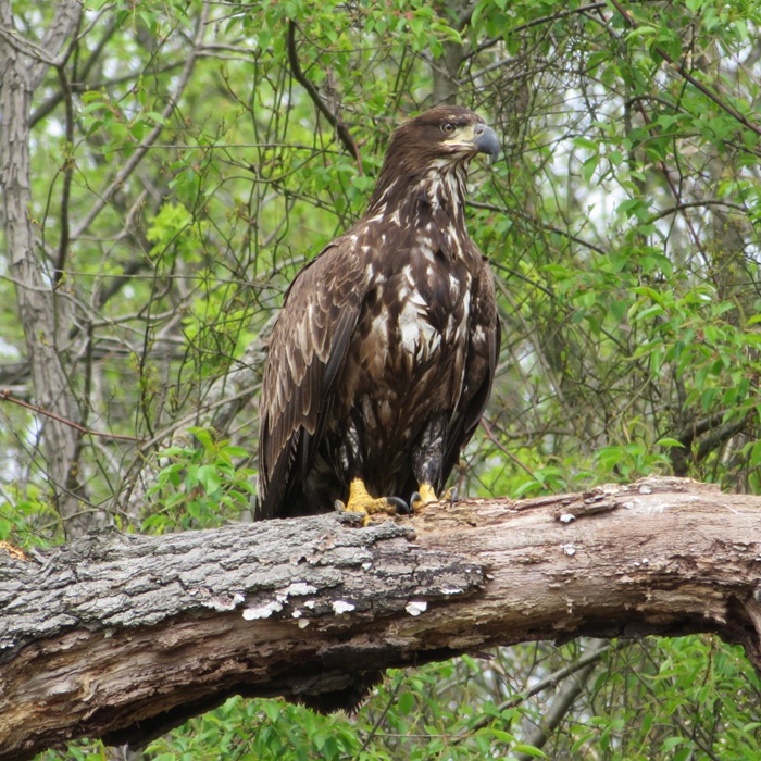
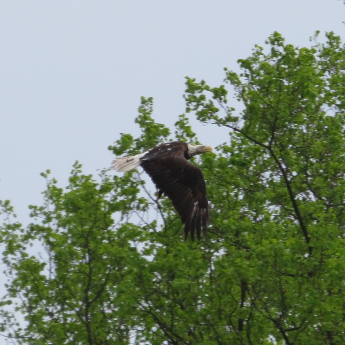
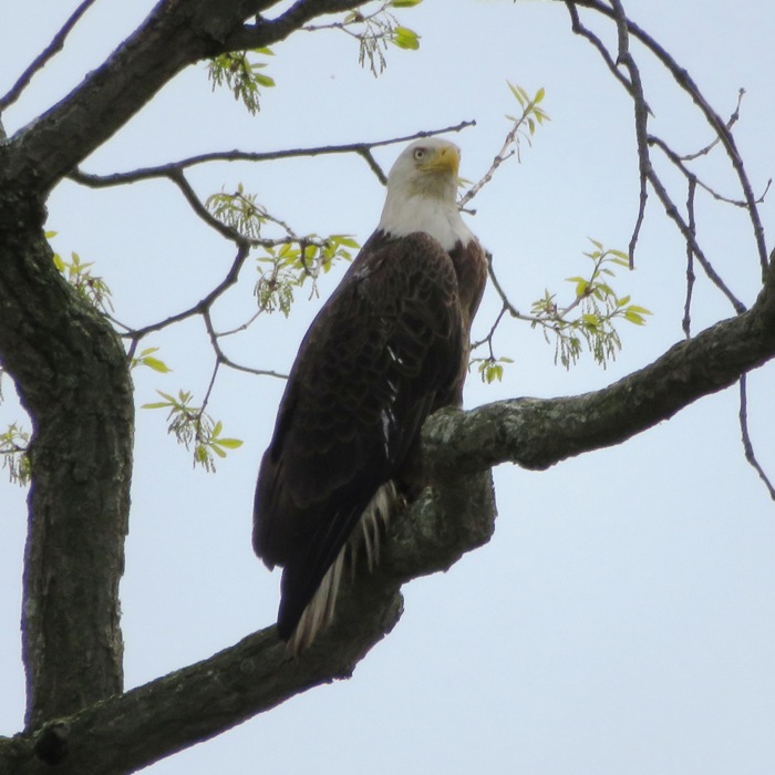
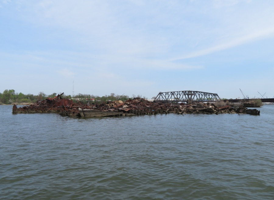
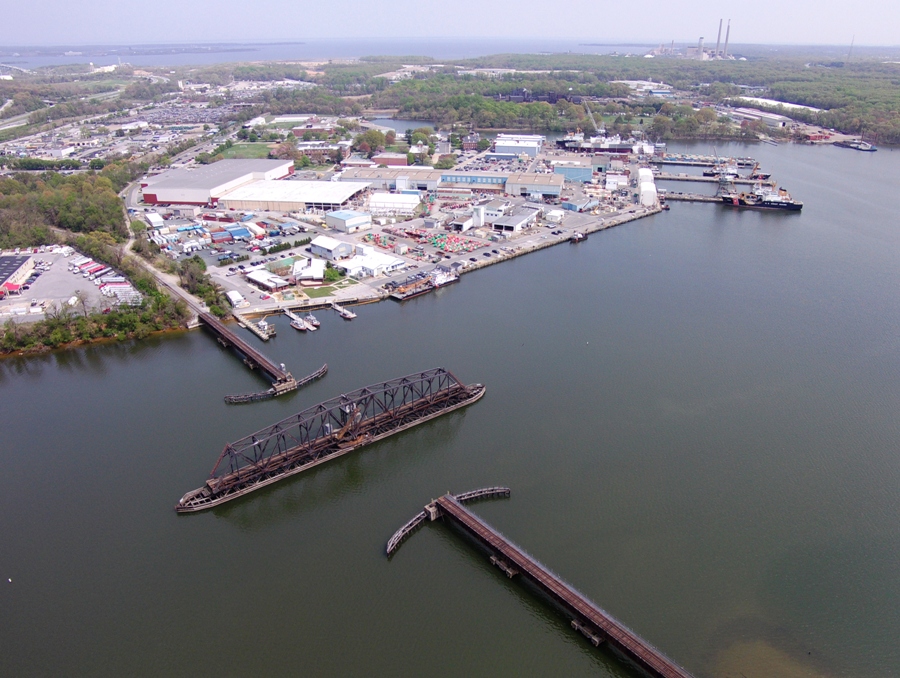
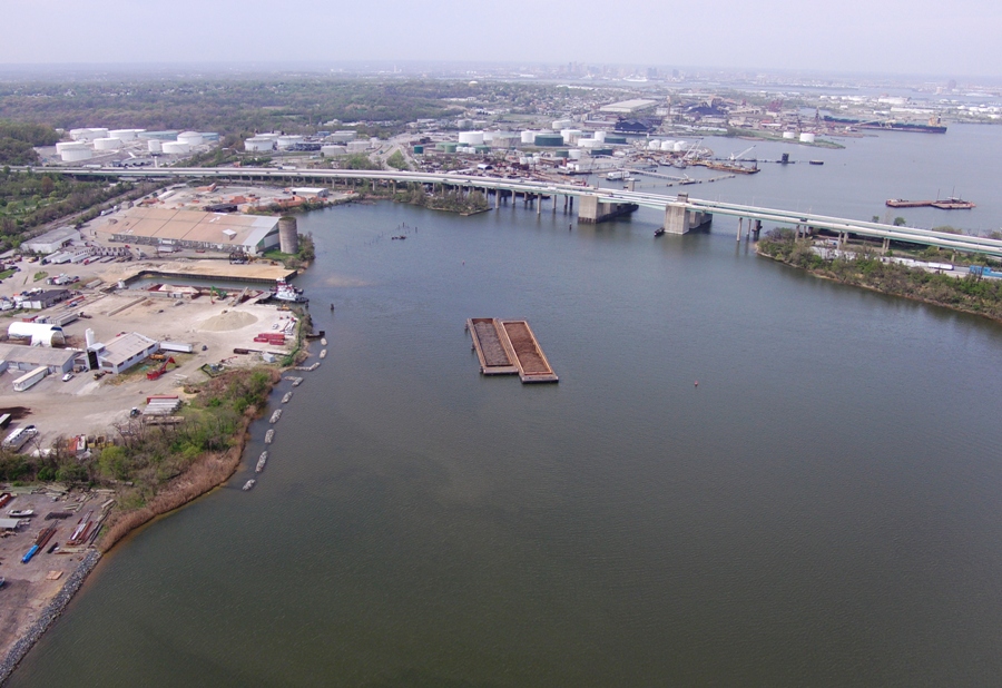
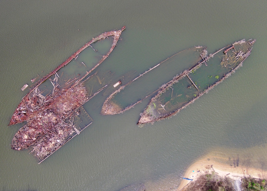
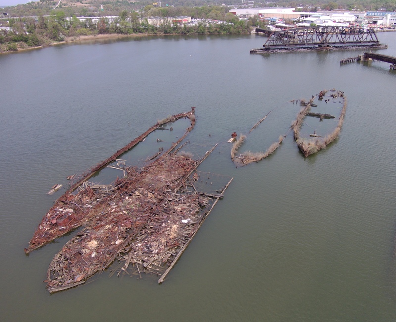
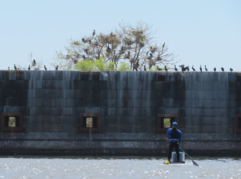
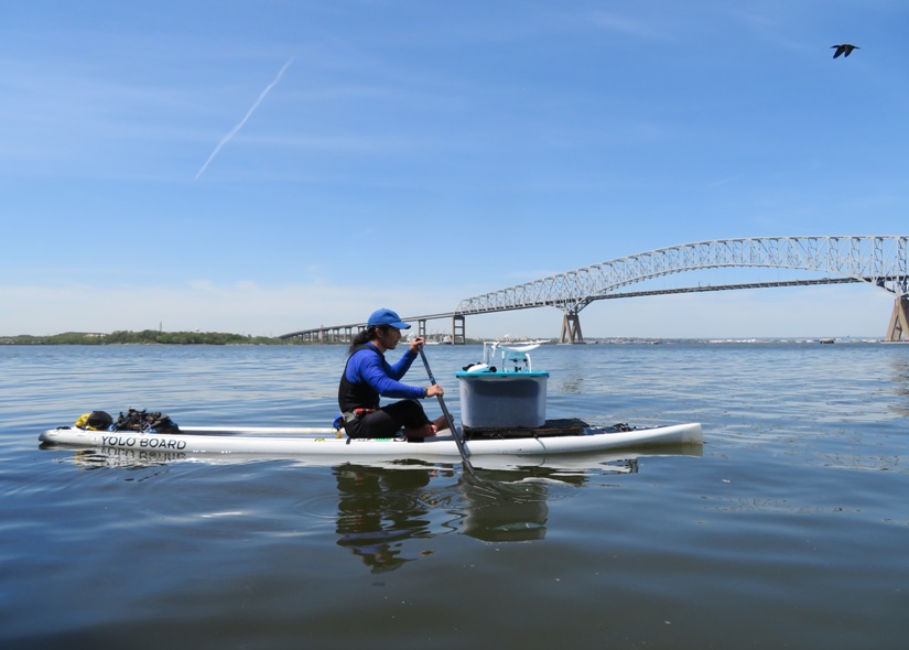
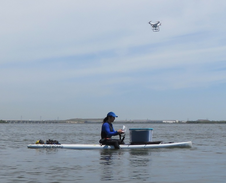
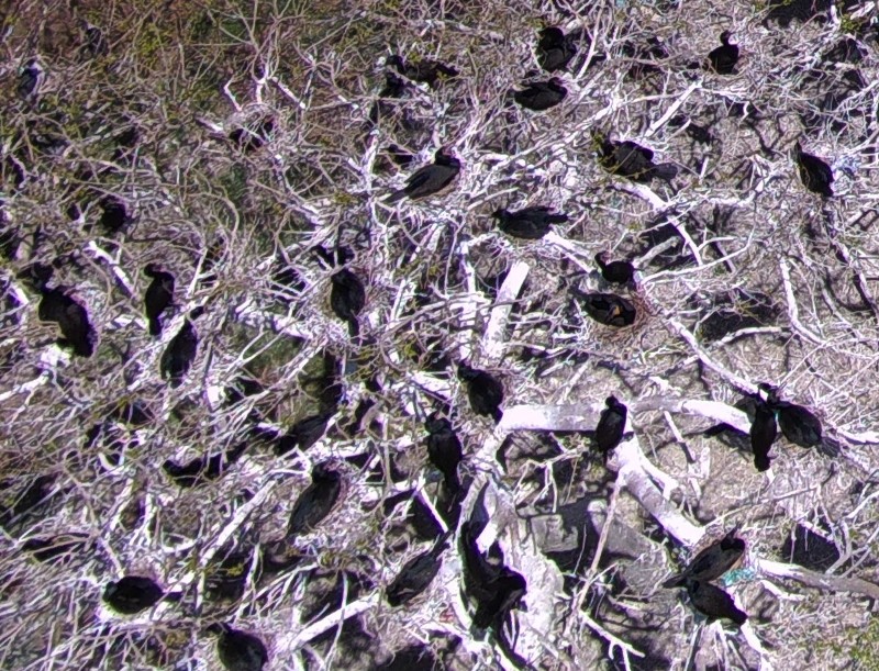
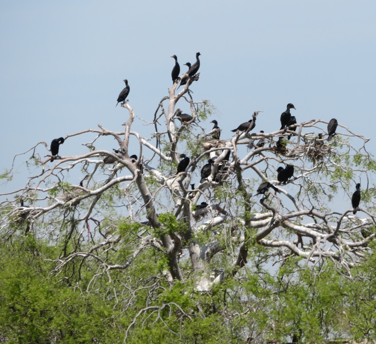
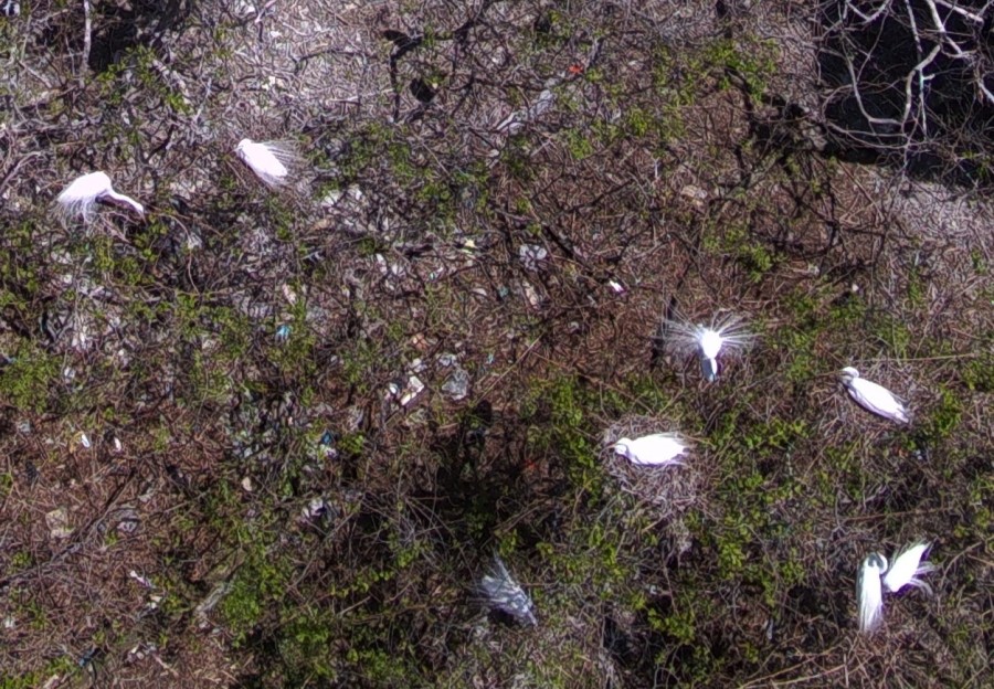
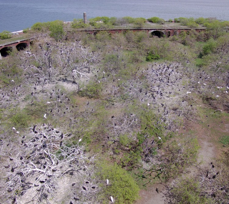
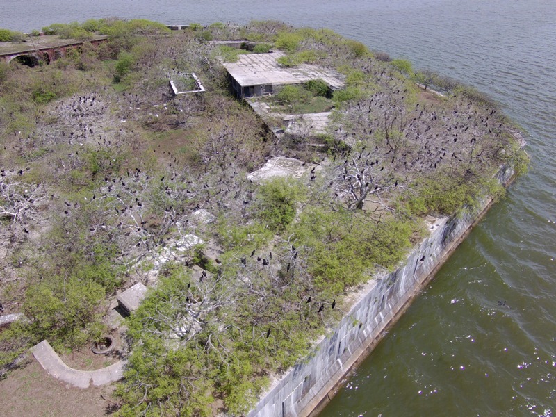
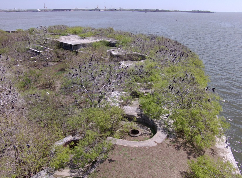
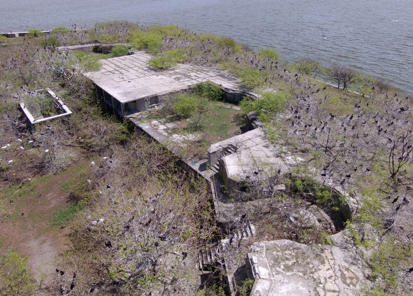
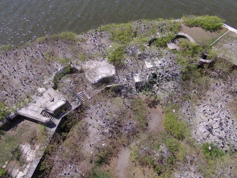
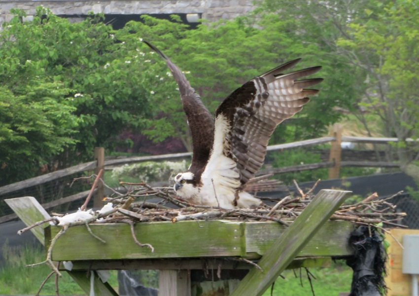
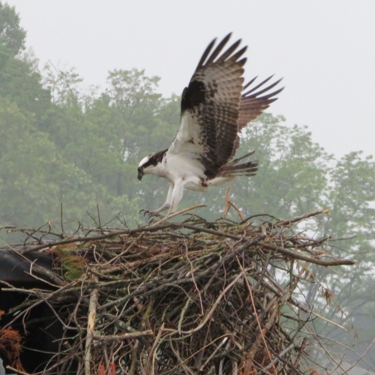
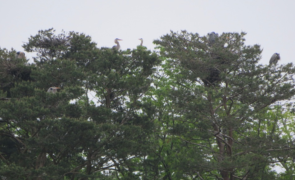
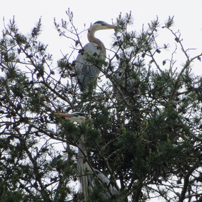
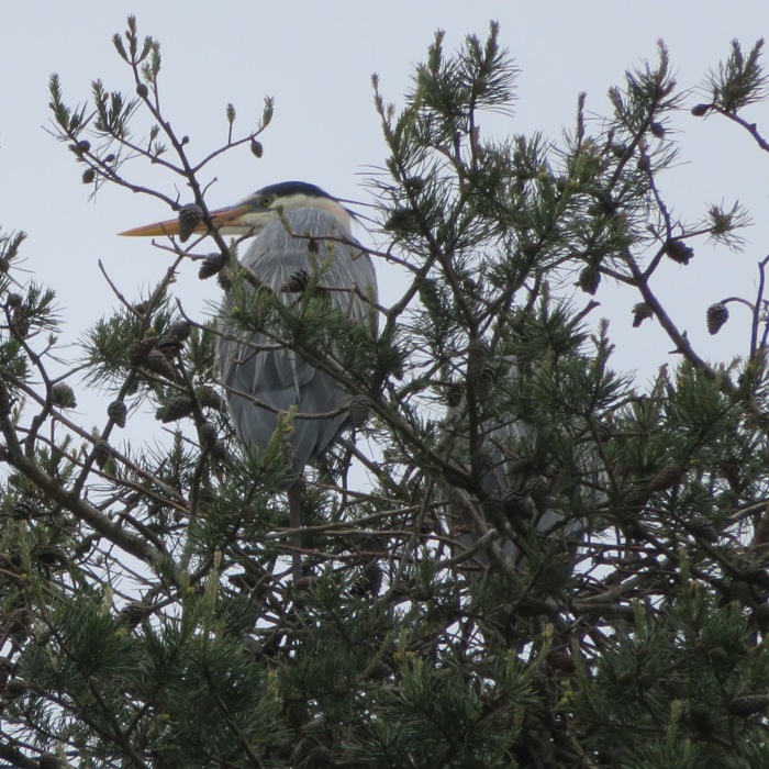
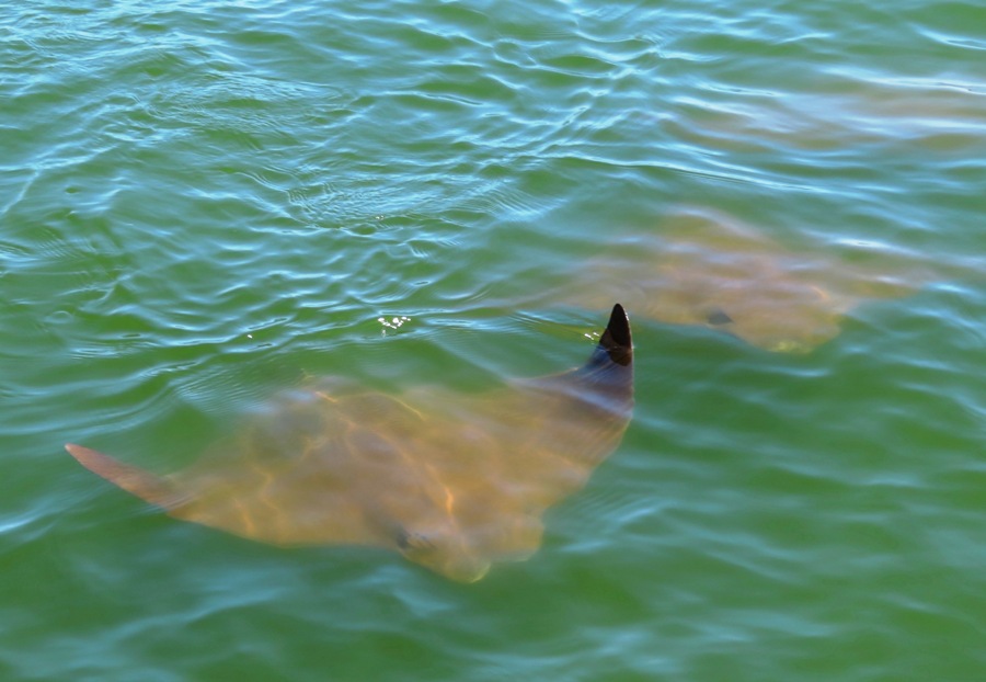
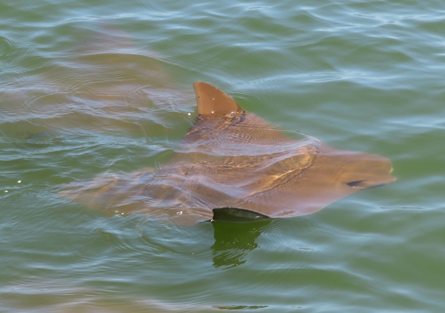

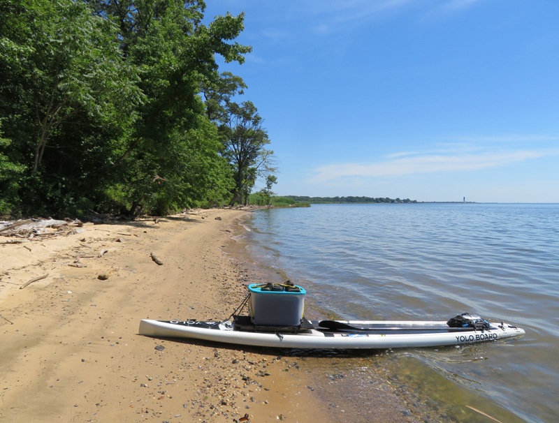
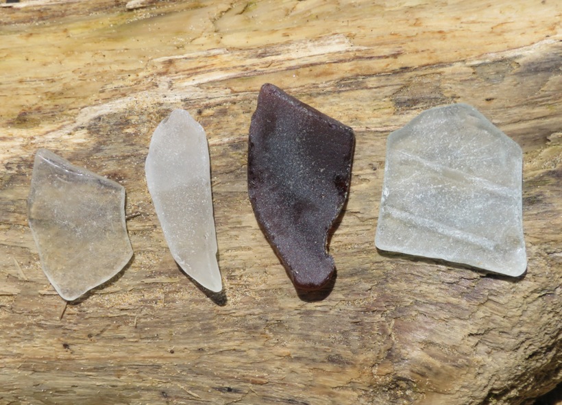
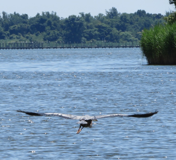
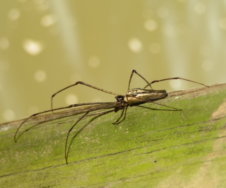
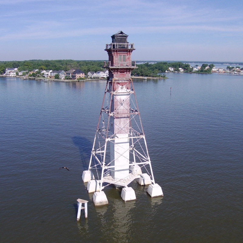

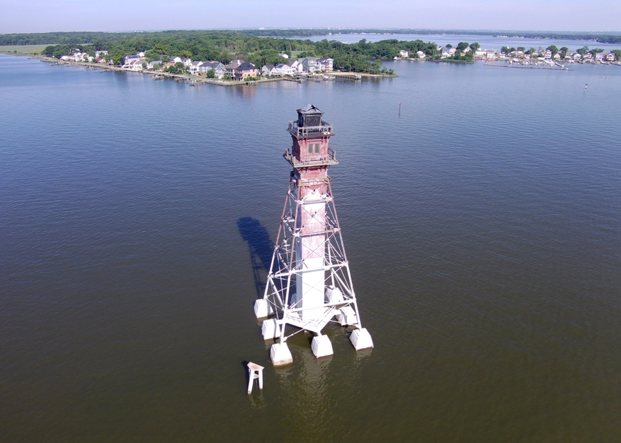
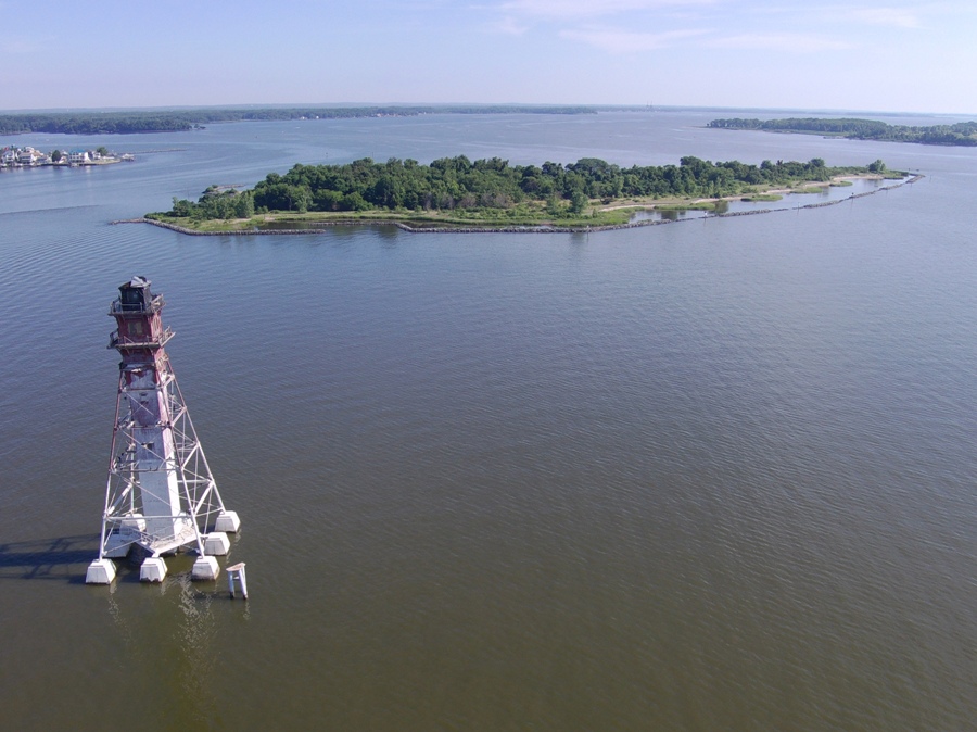
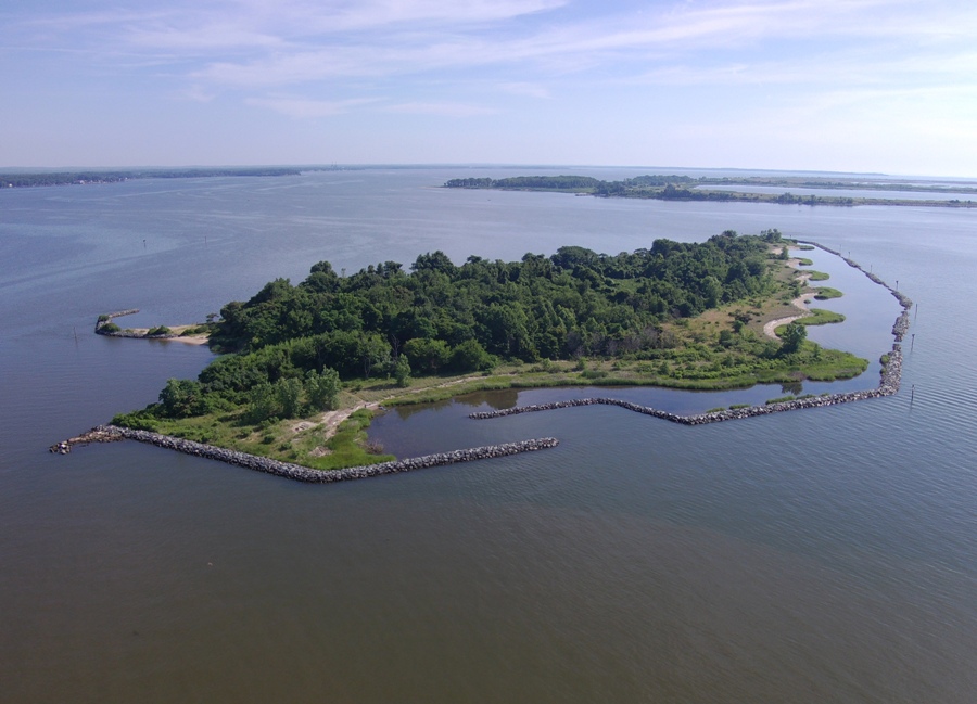
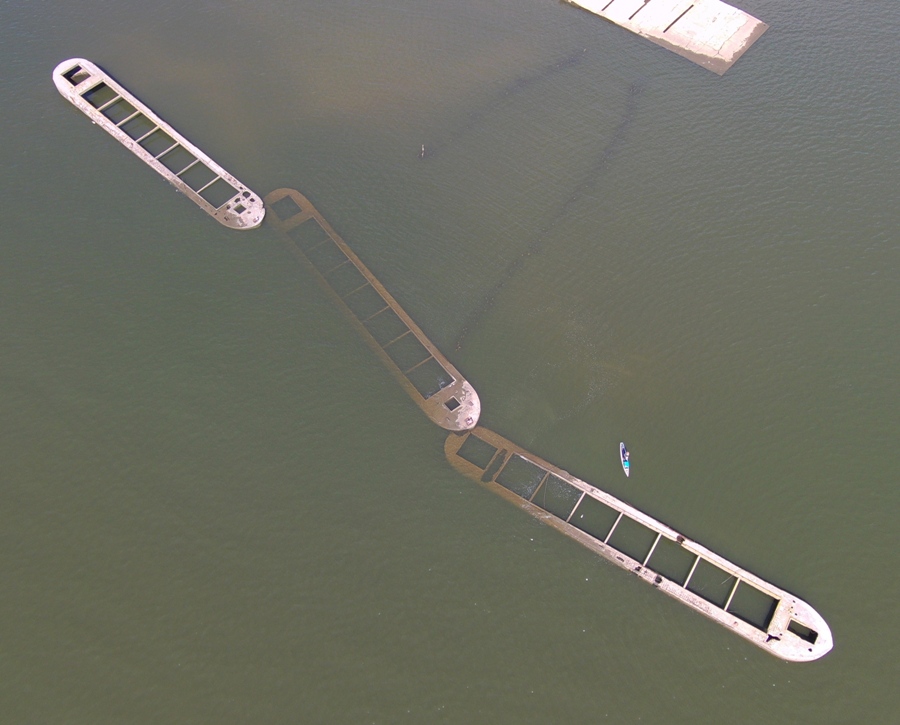
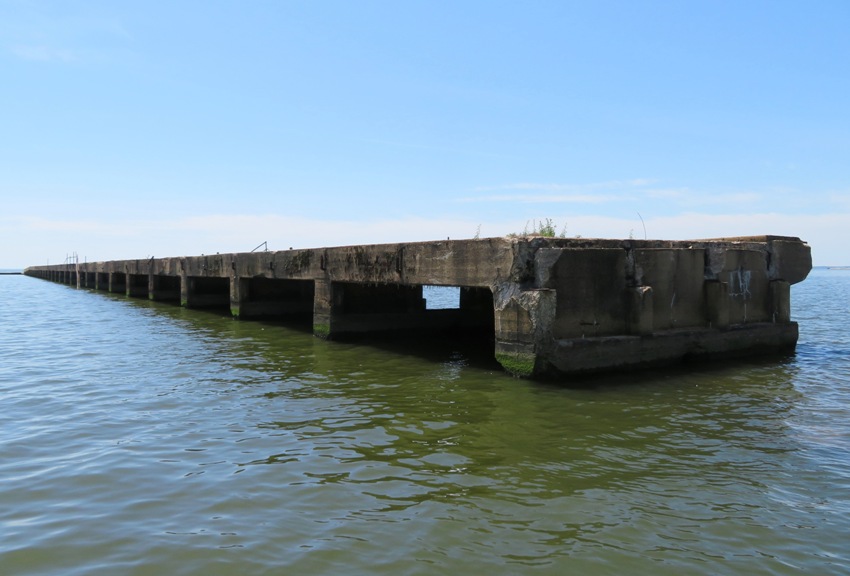
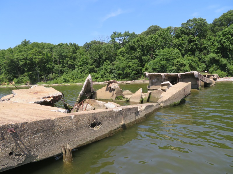
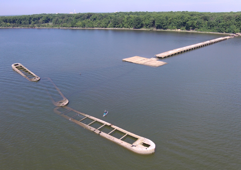
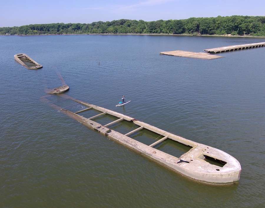
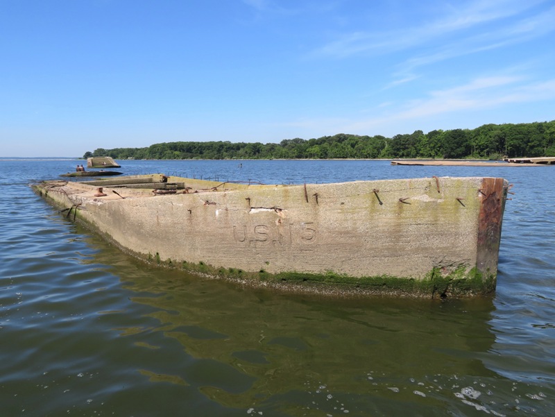
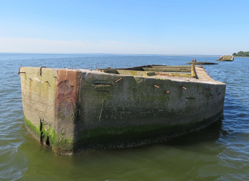
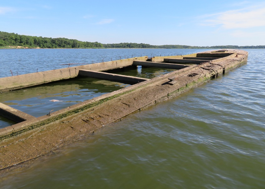
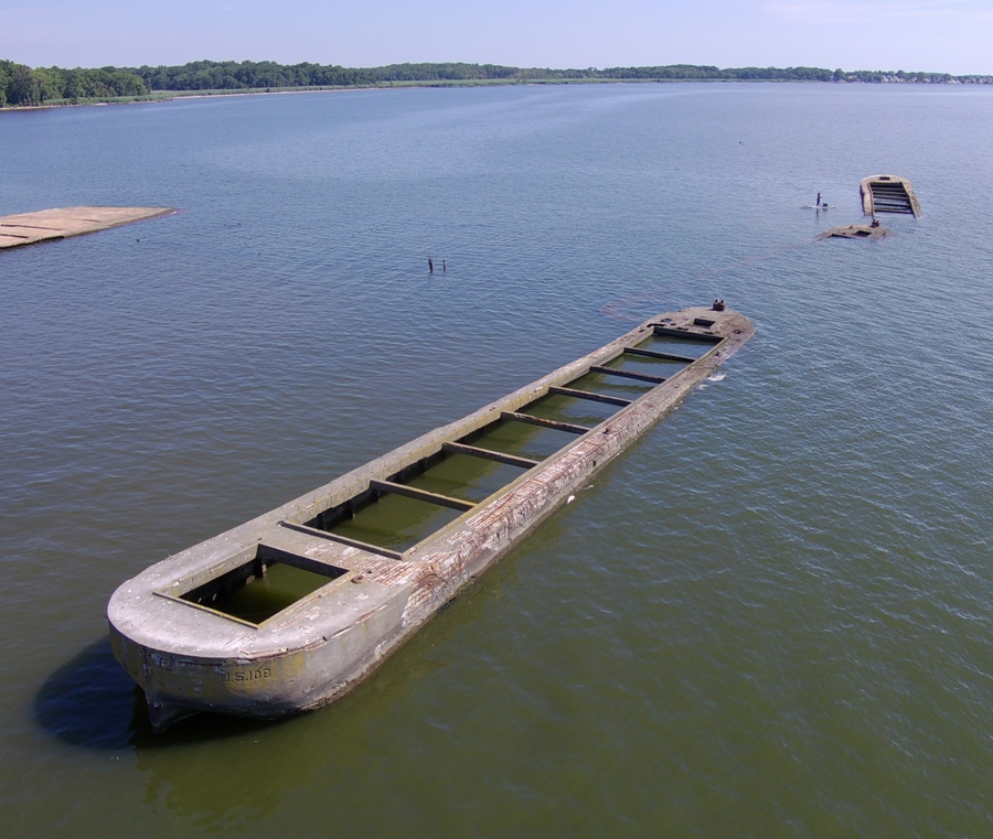
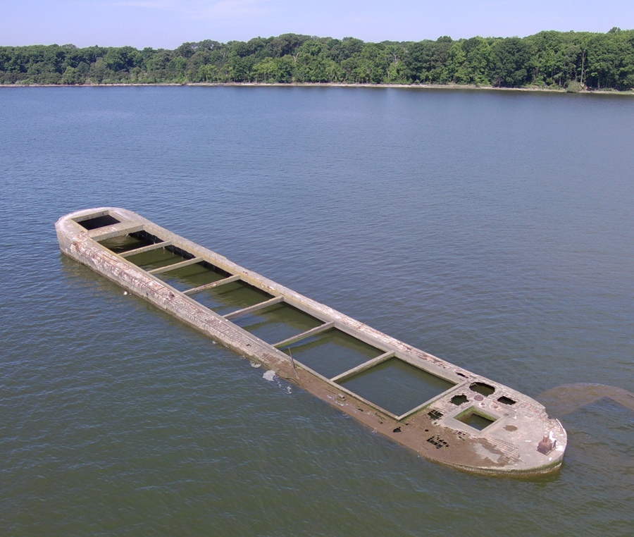
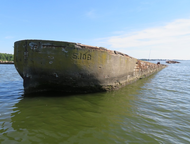
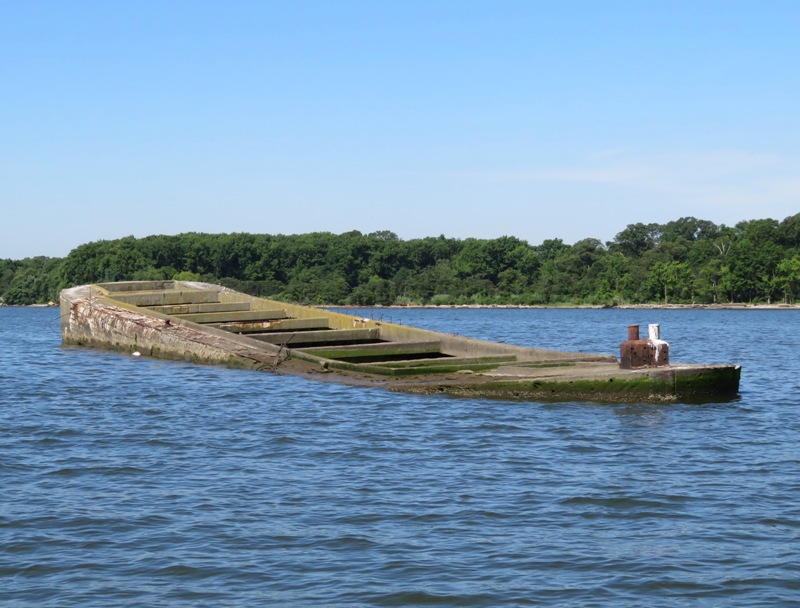
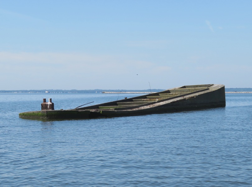
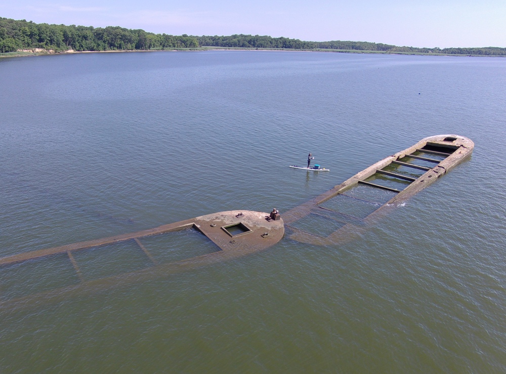
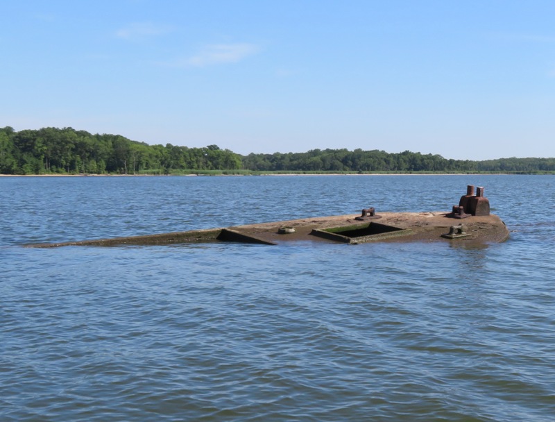
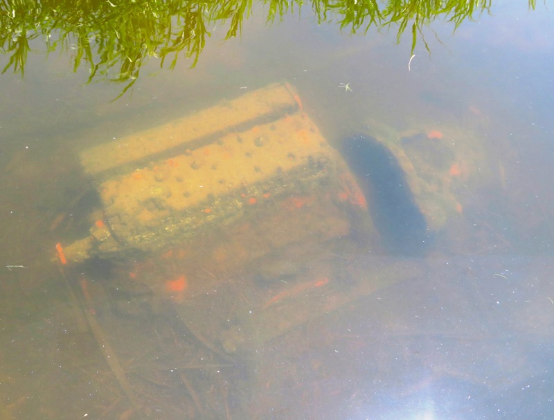
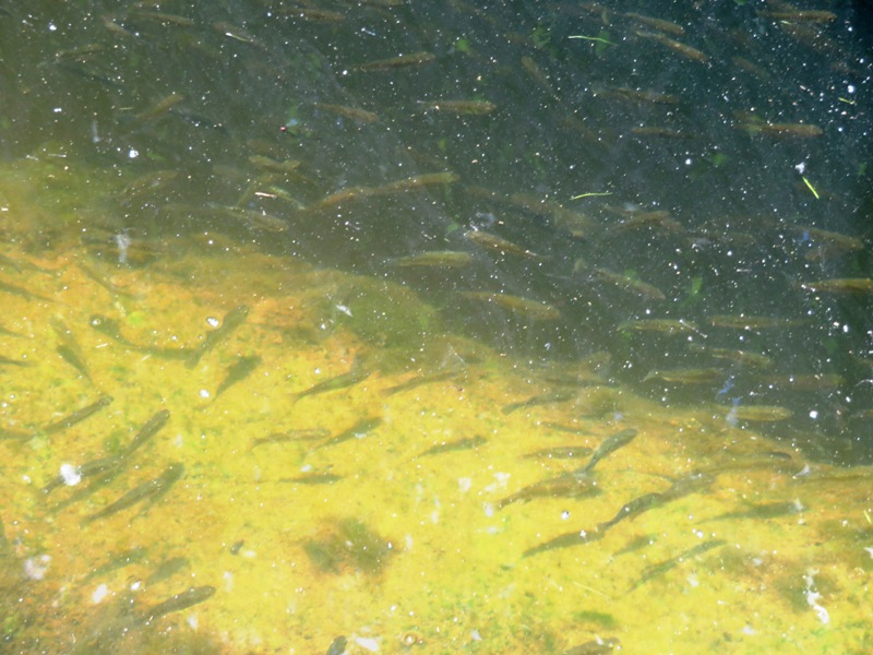
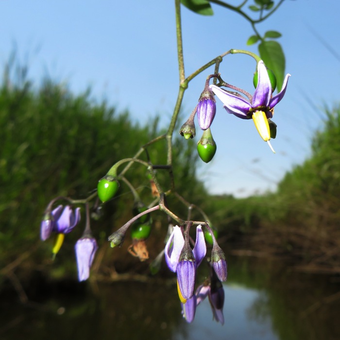
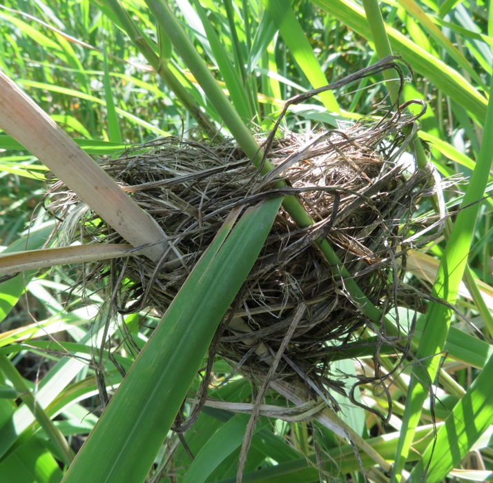
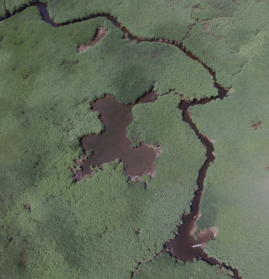
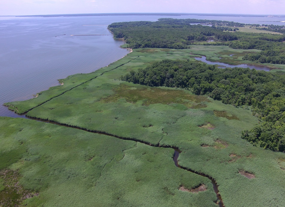
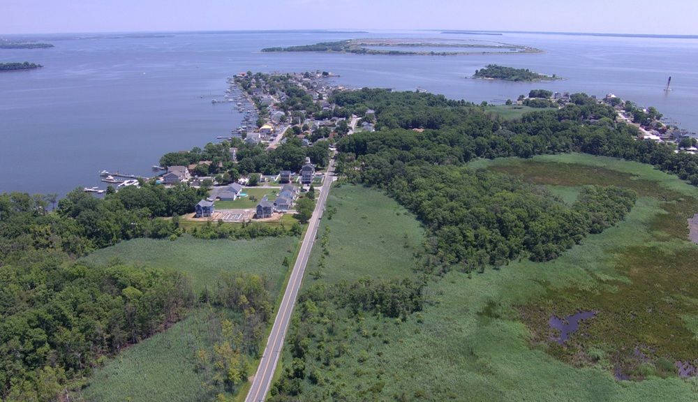
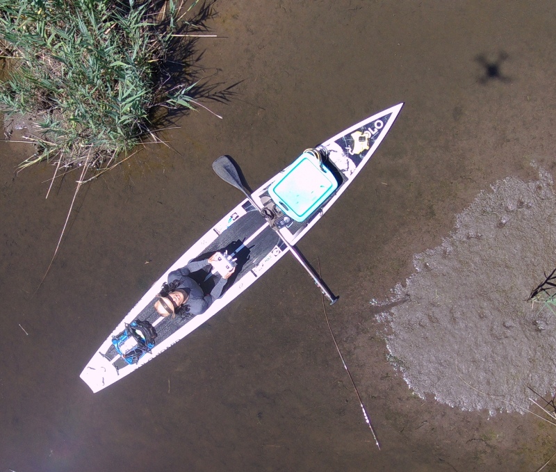
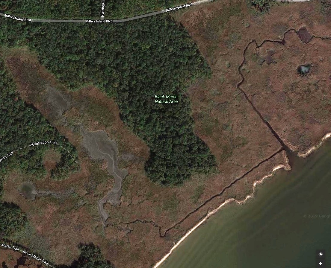
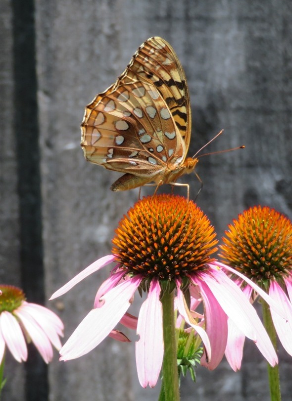


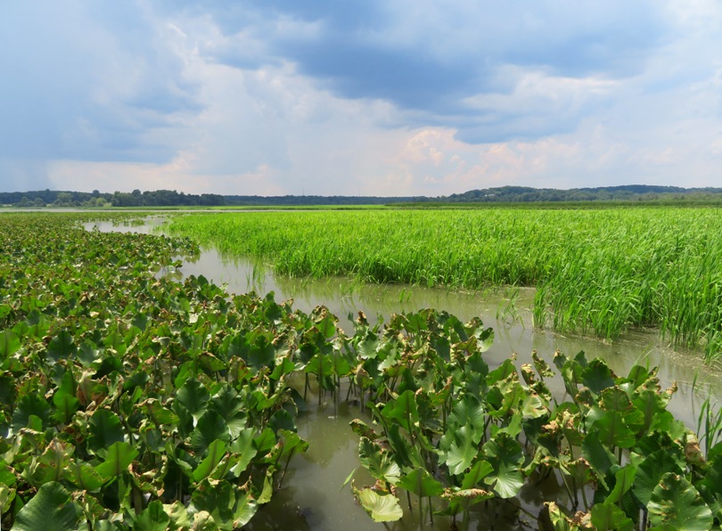
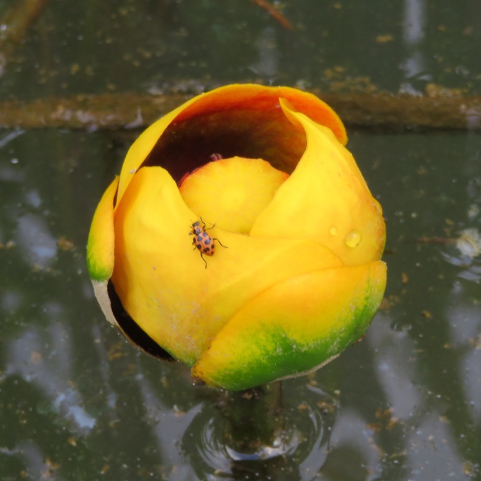
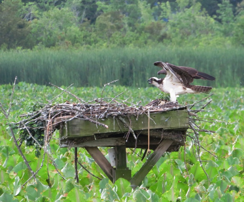
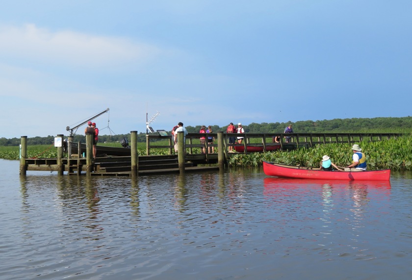
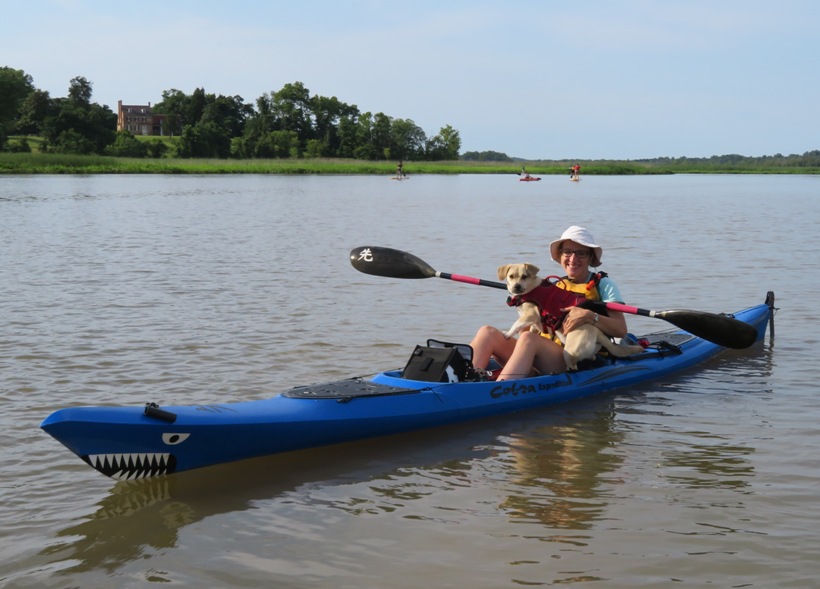
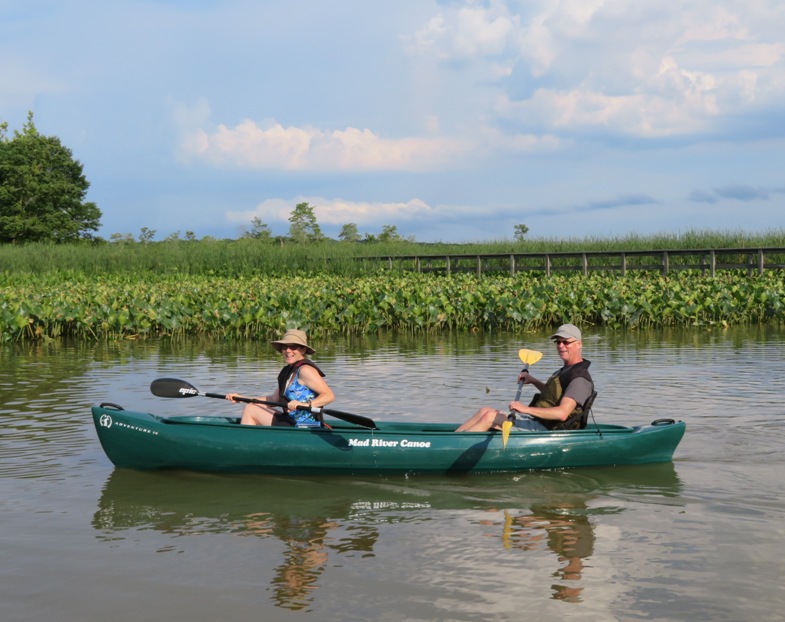
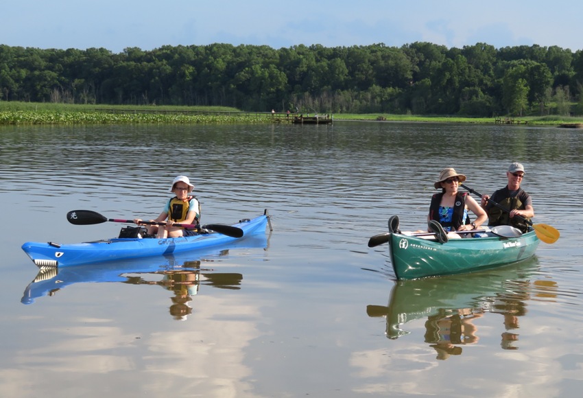
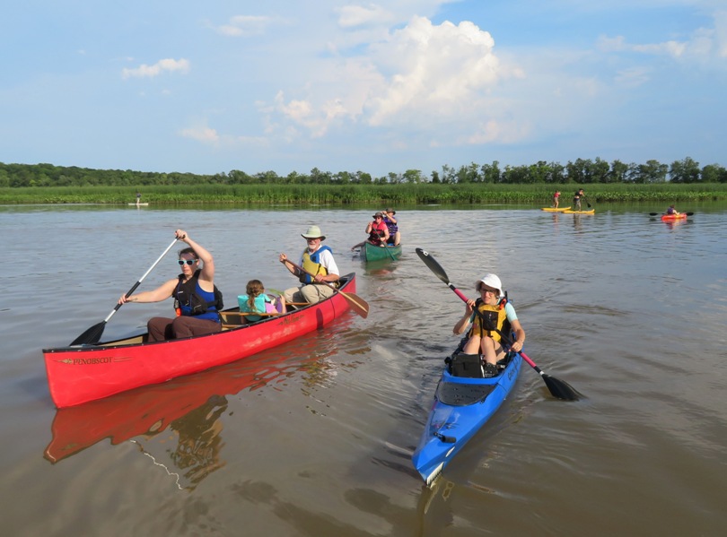
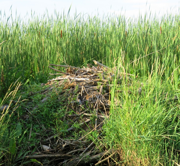
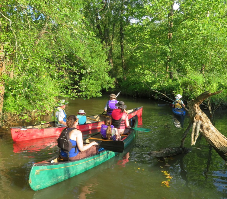
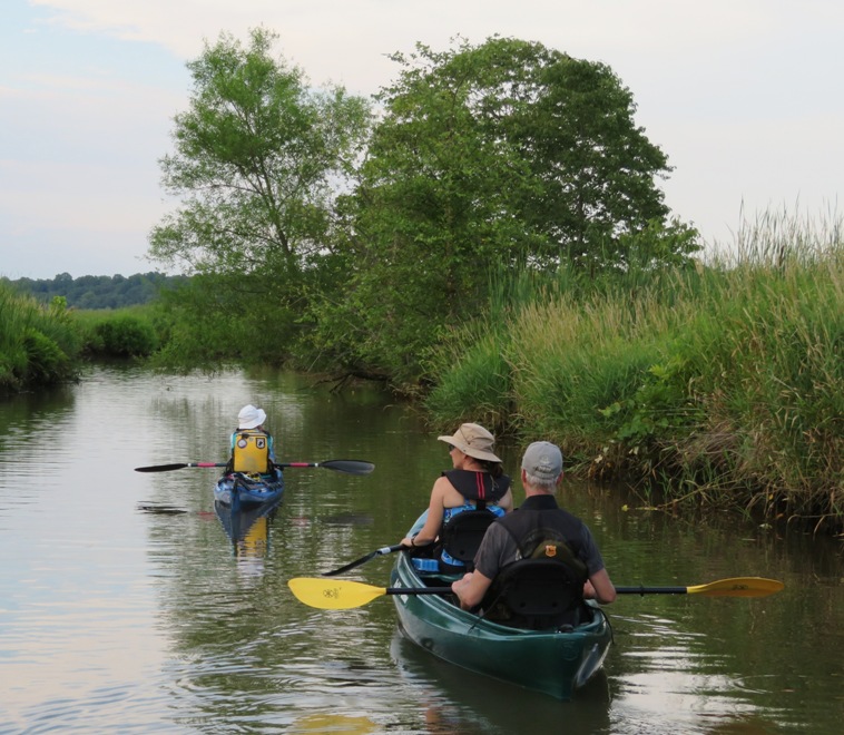
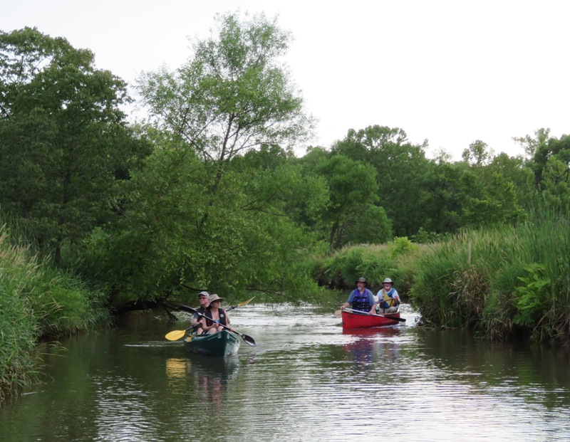
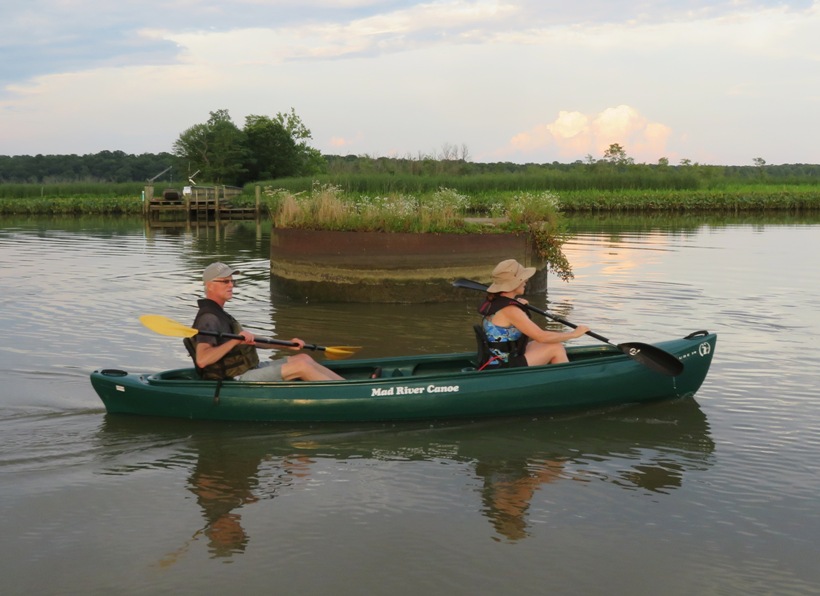

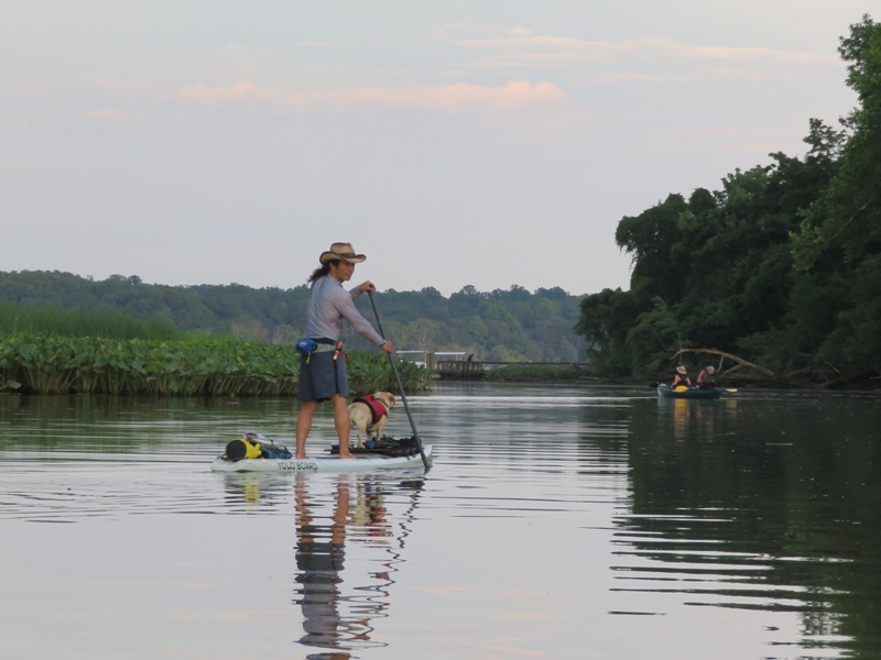
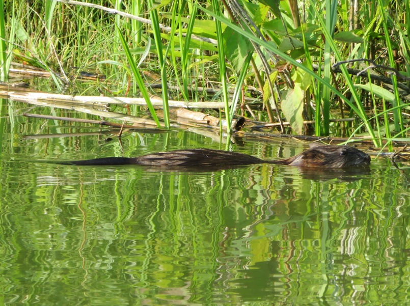
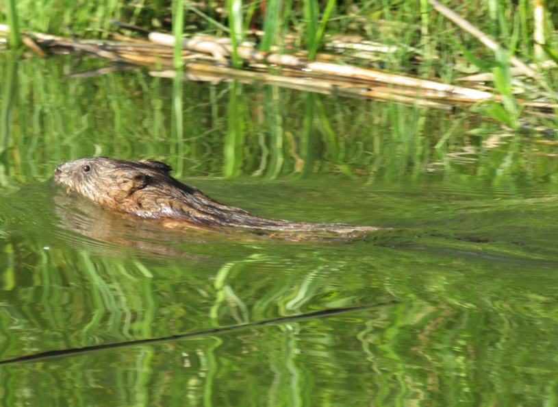
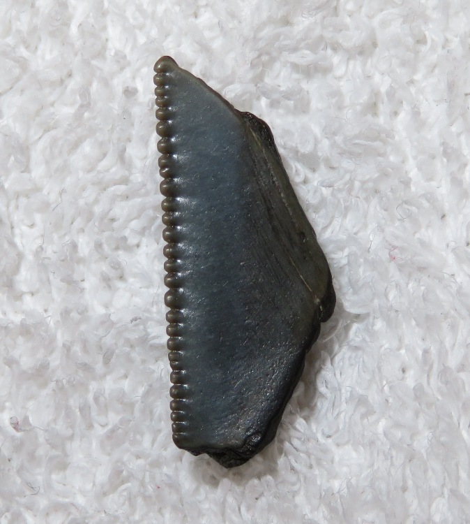

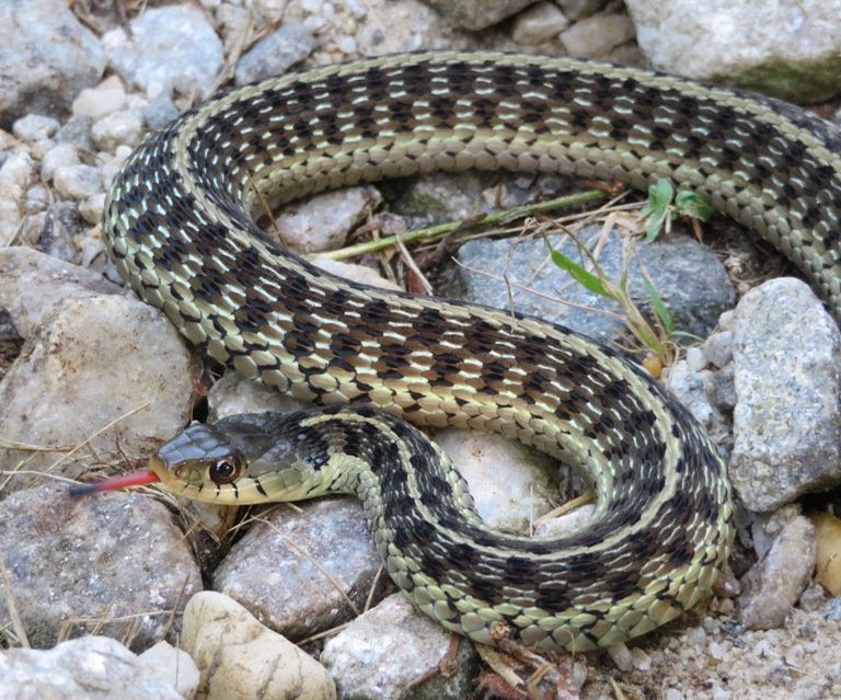
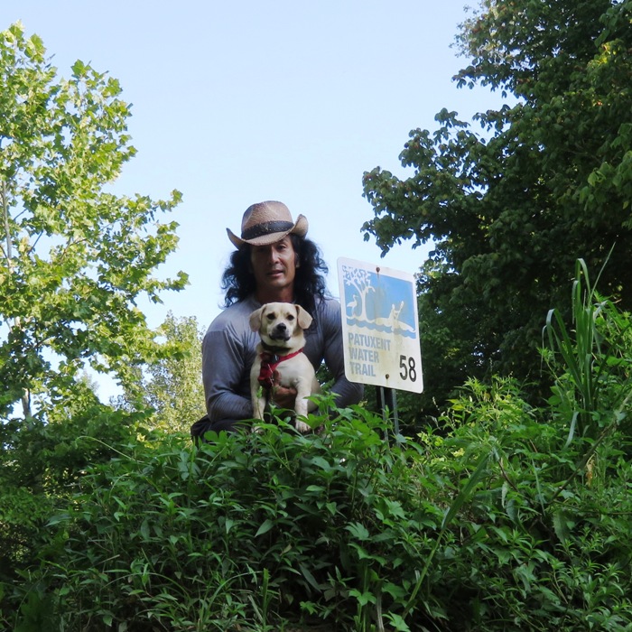
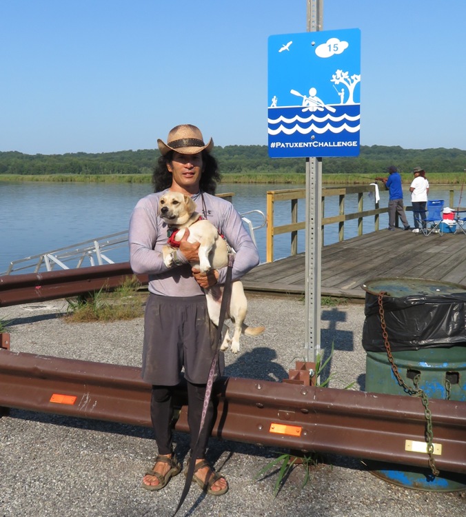
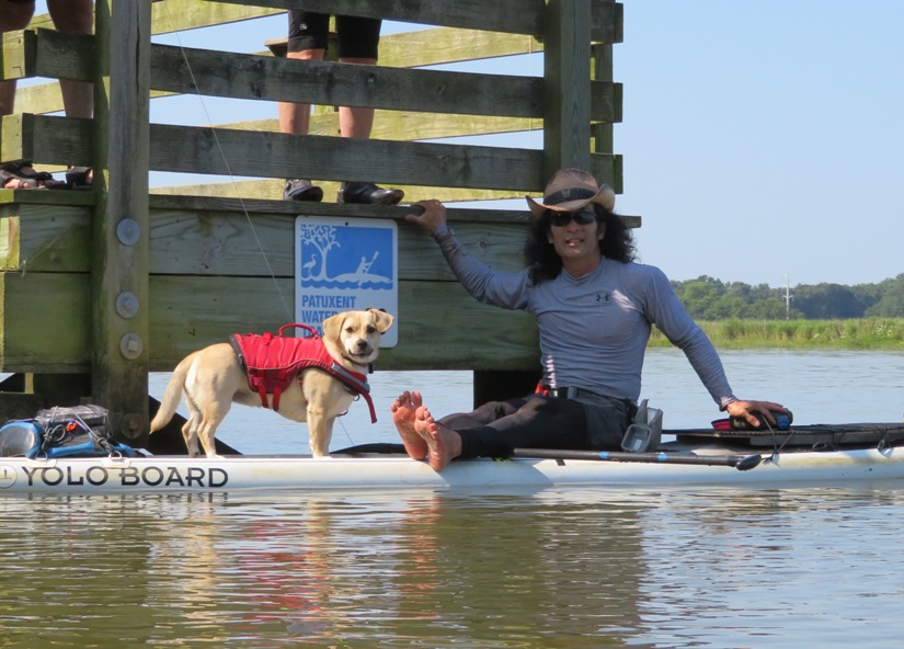
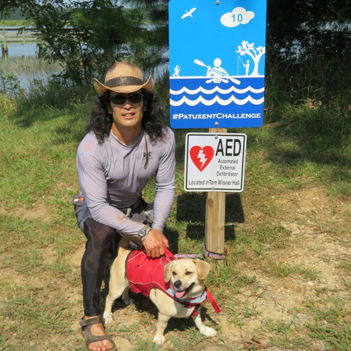
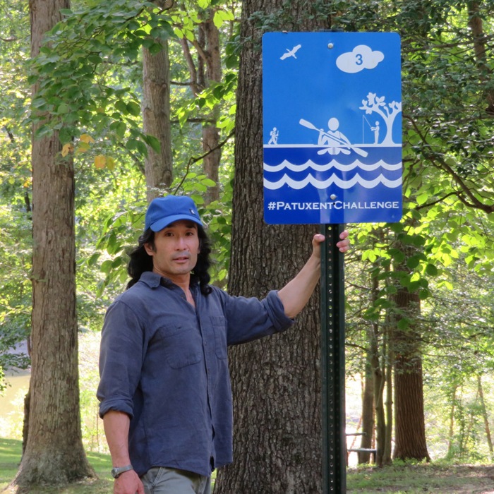
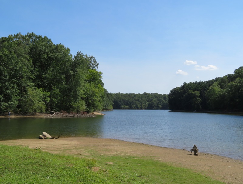
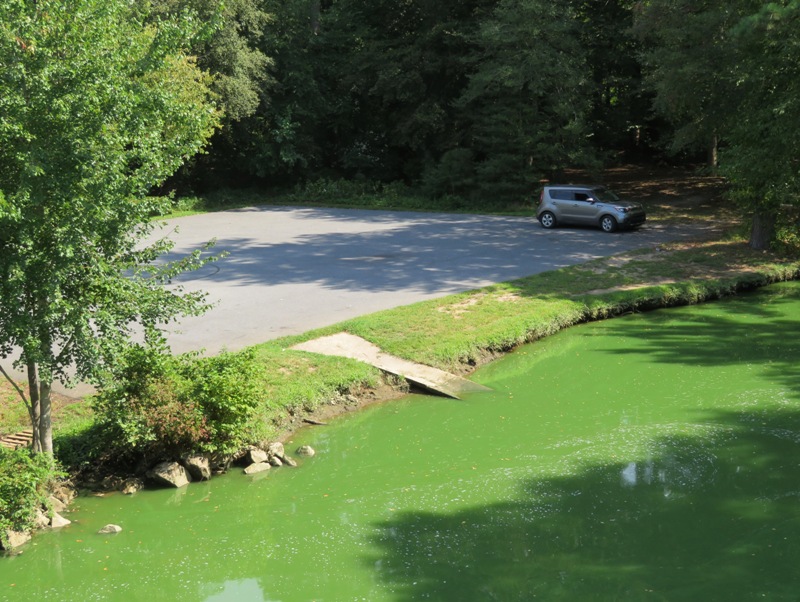
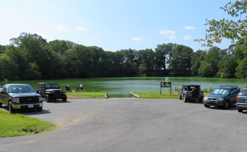
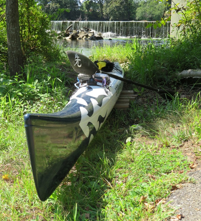
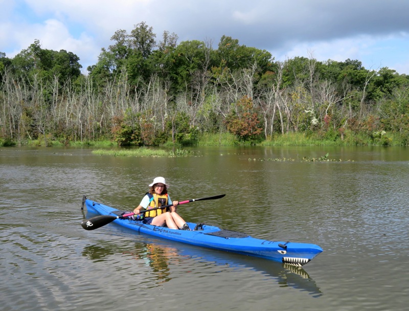
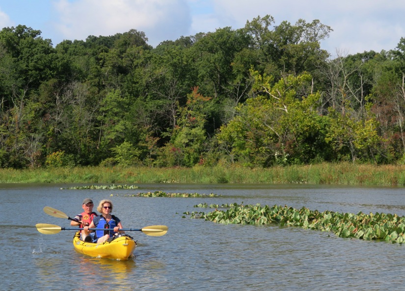
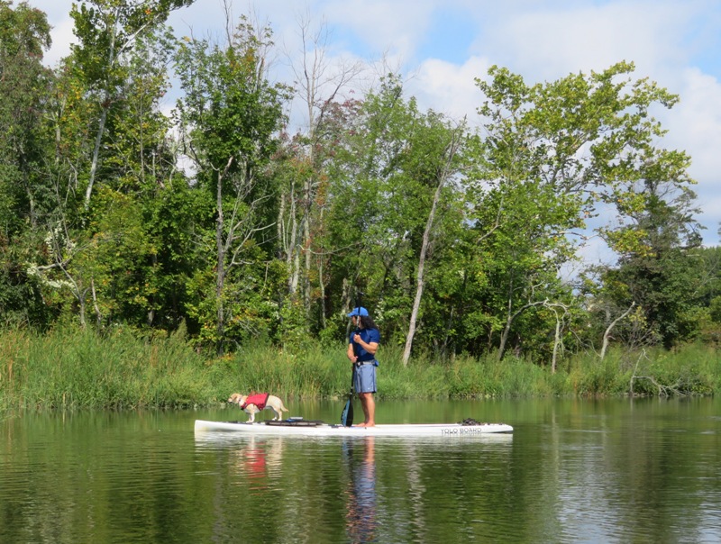
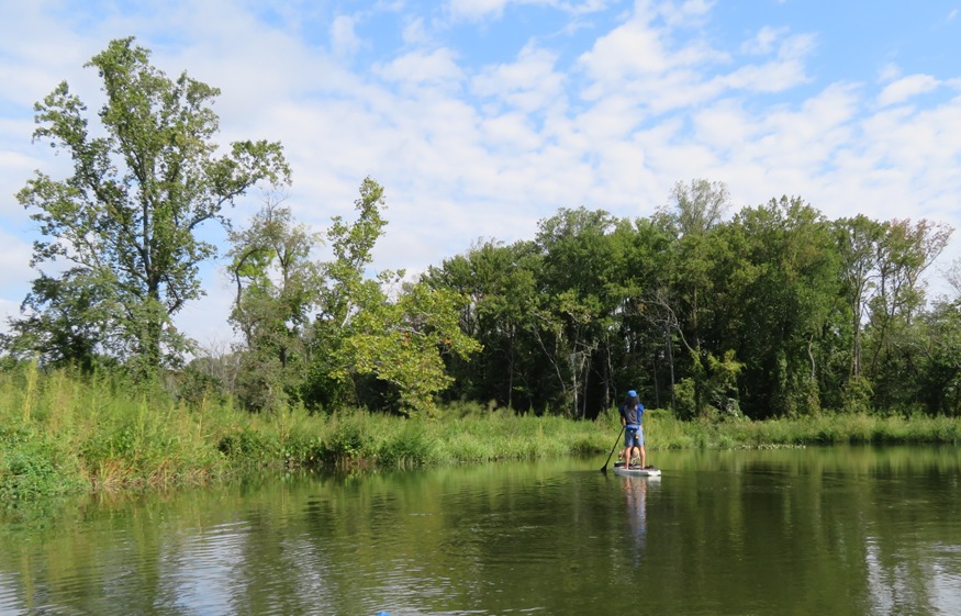
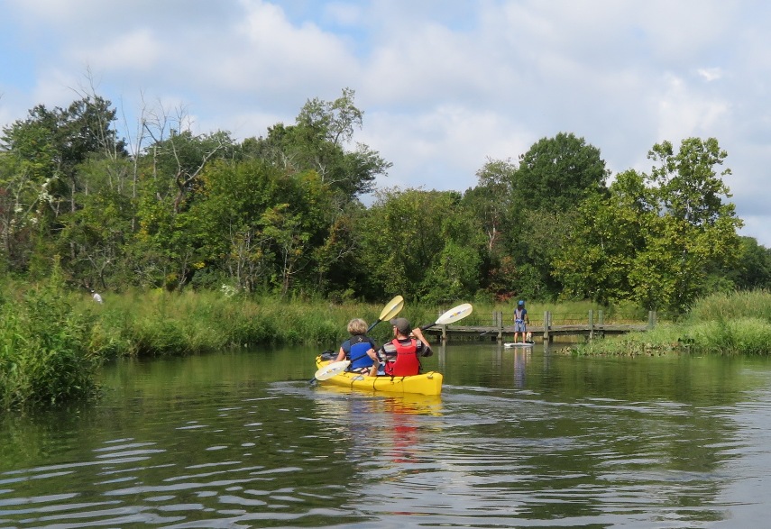
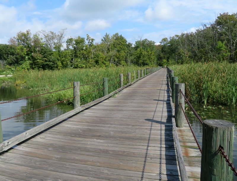
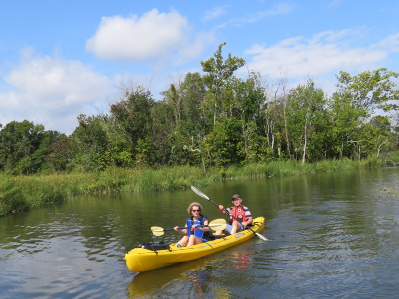
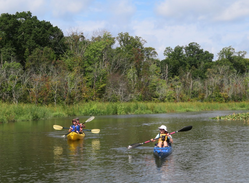
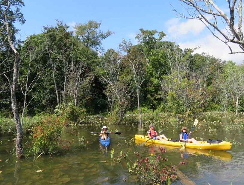
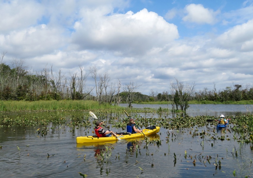

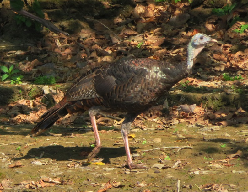
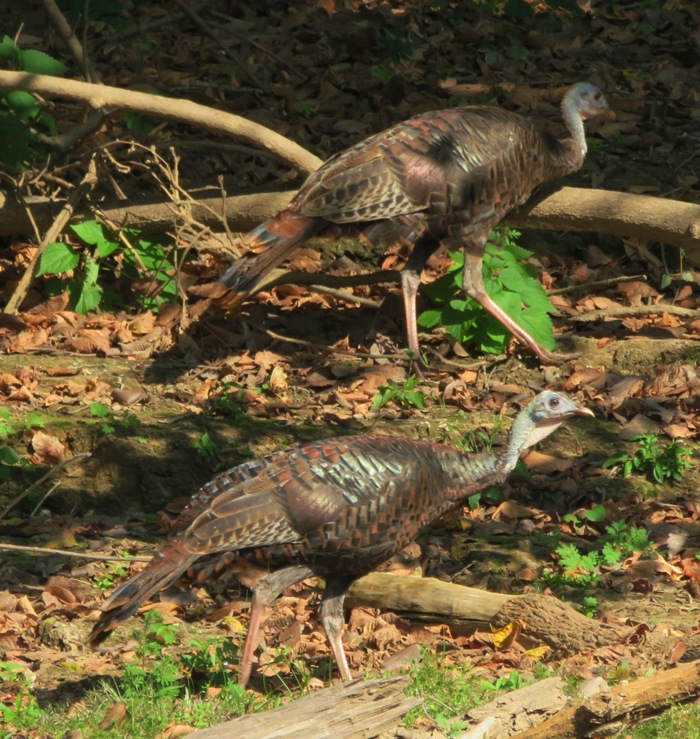
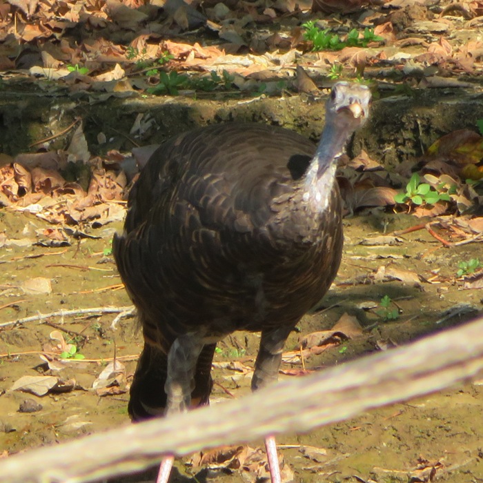
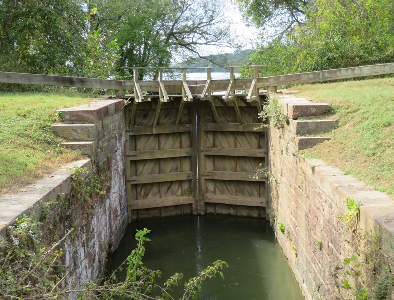
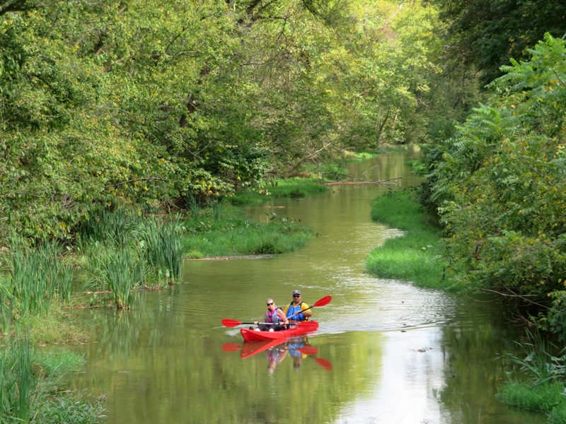
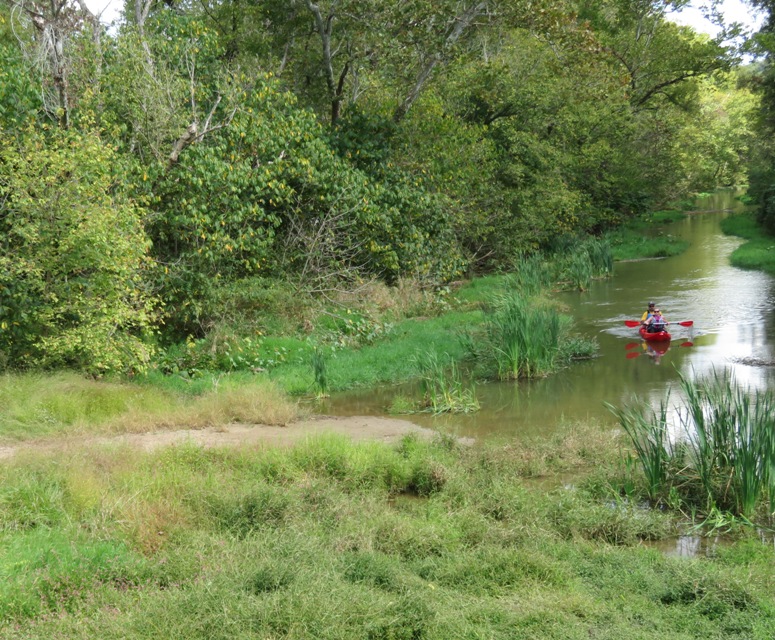
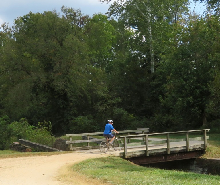
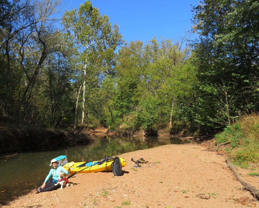
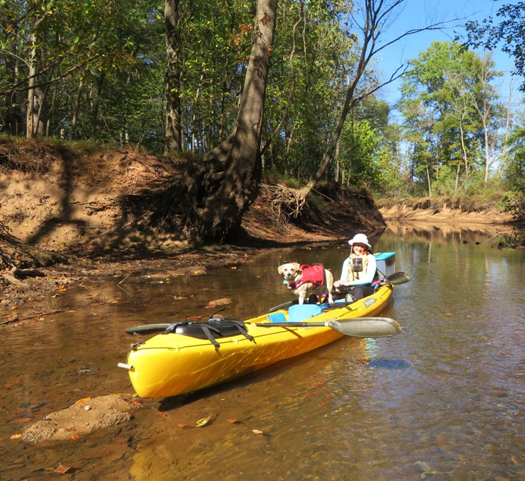
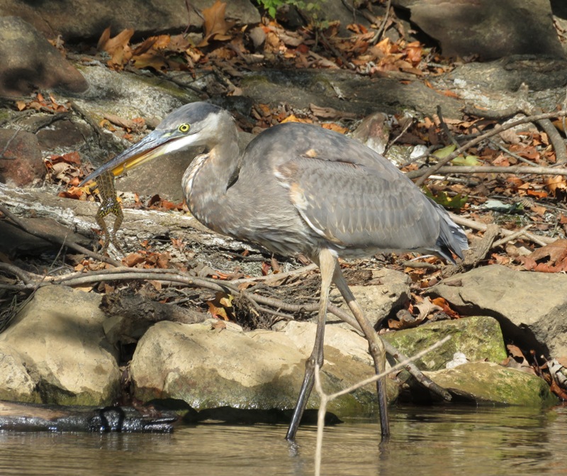
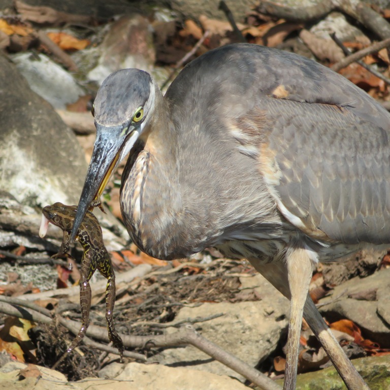
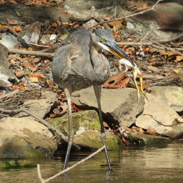
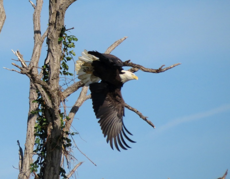
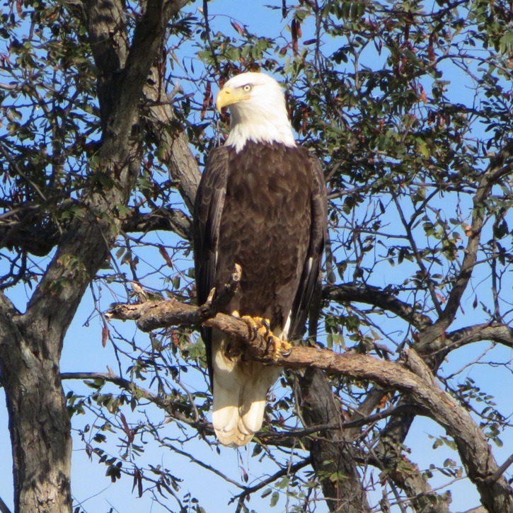
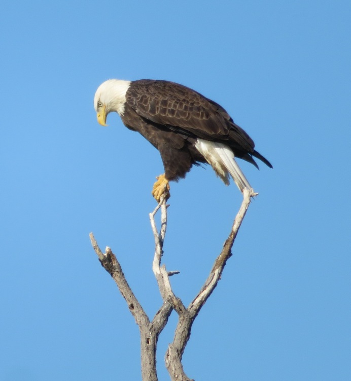
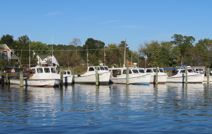
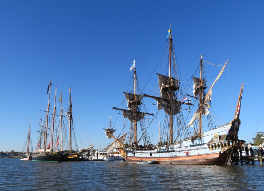
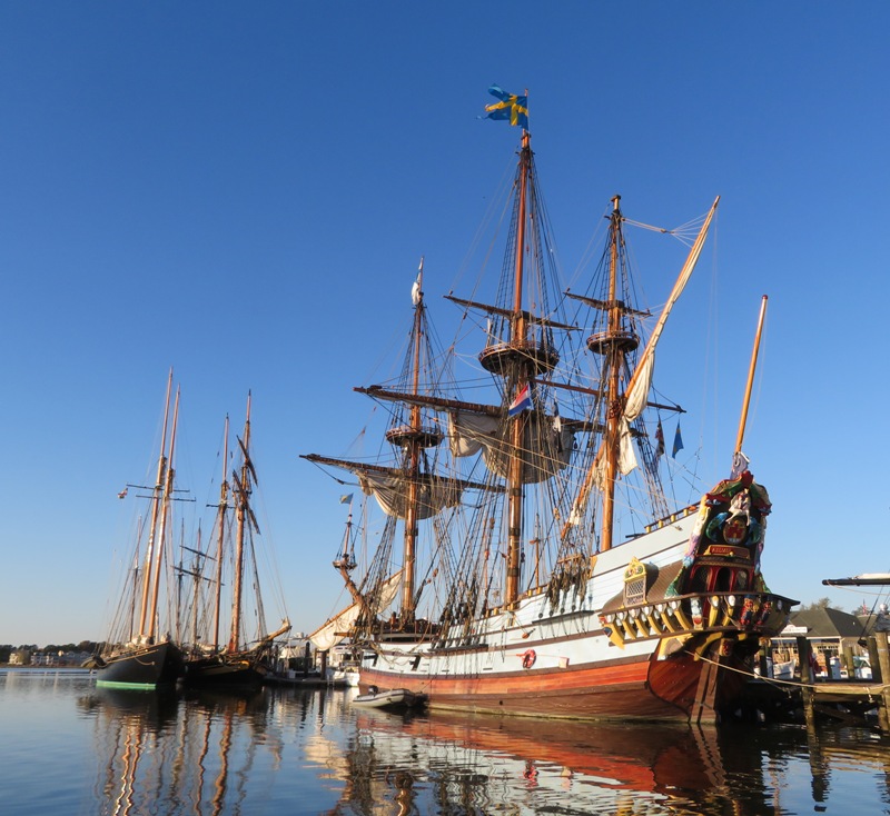
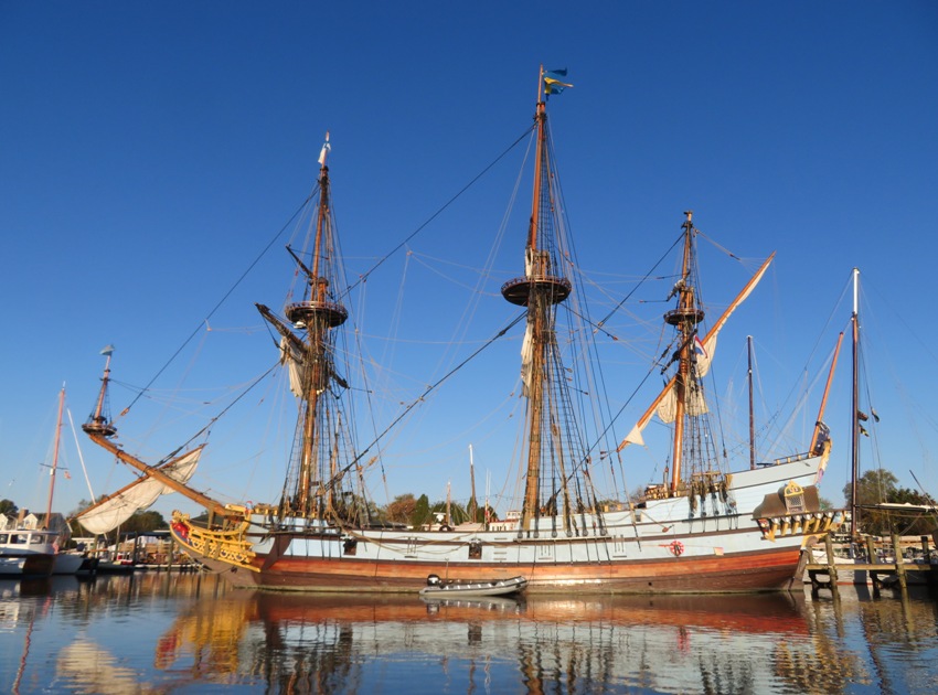
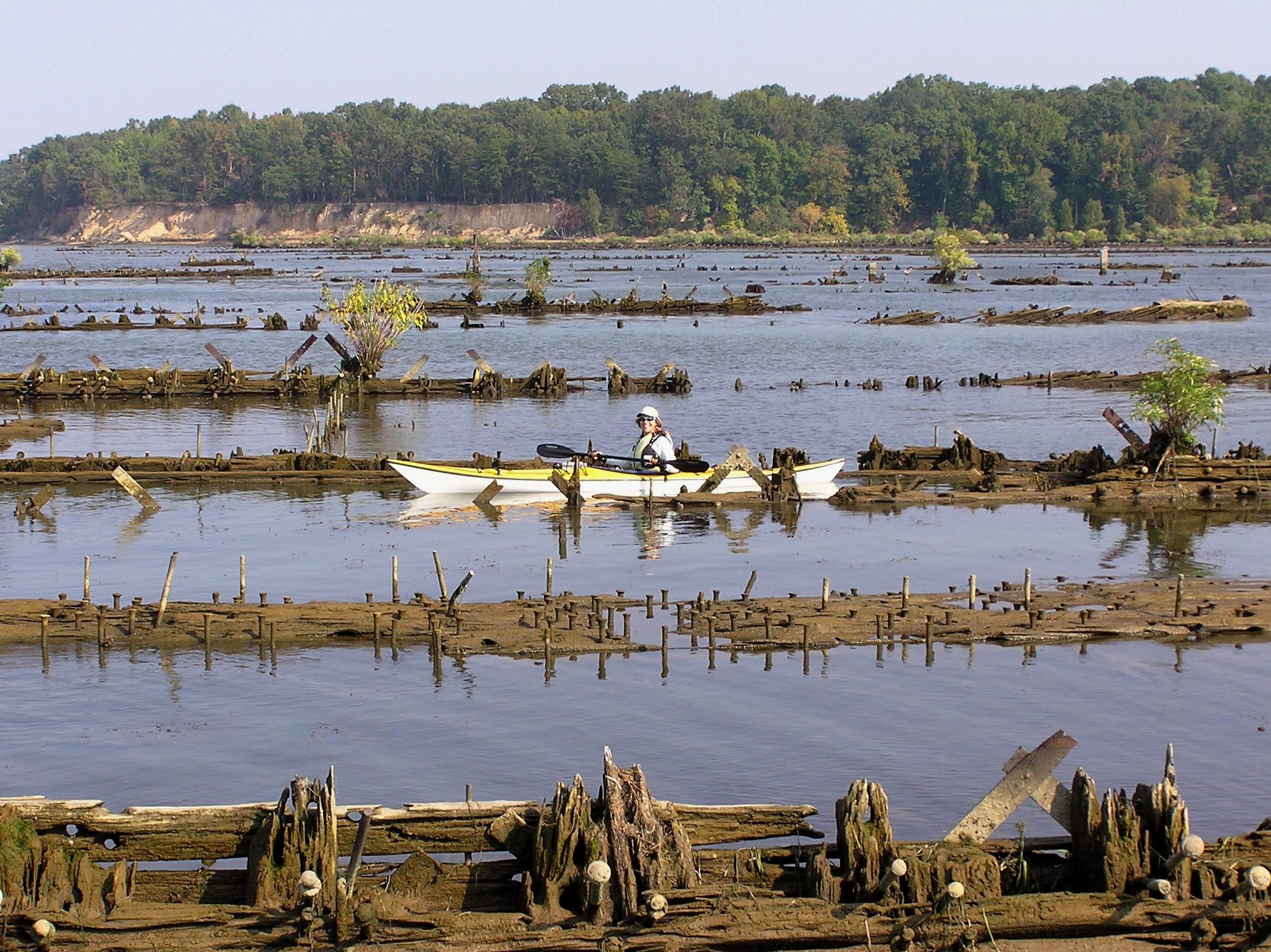
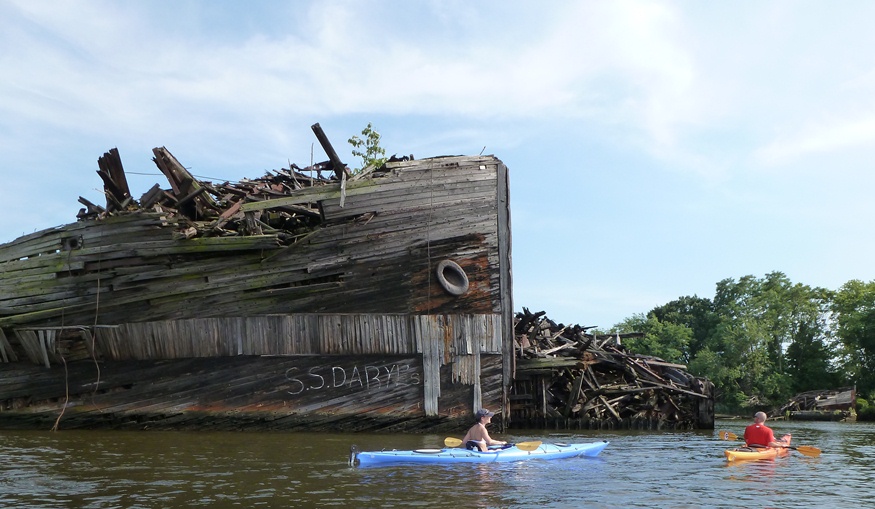
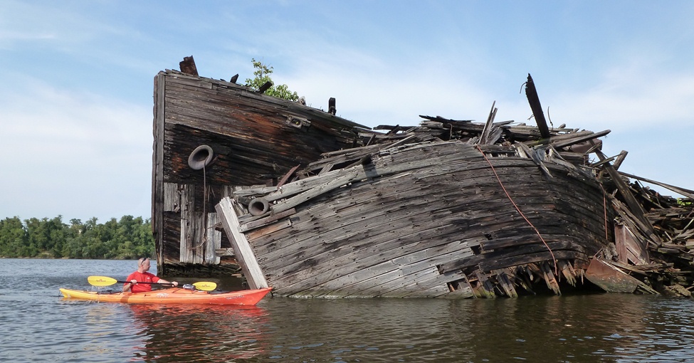