|
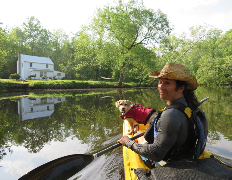
This page describes my kayaking and standup paddleboarding adventures in 2018. |

|
This page describes my kayaking and standup paddleboarding adventures in 2018. |
|
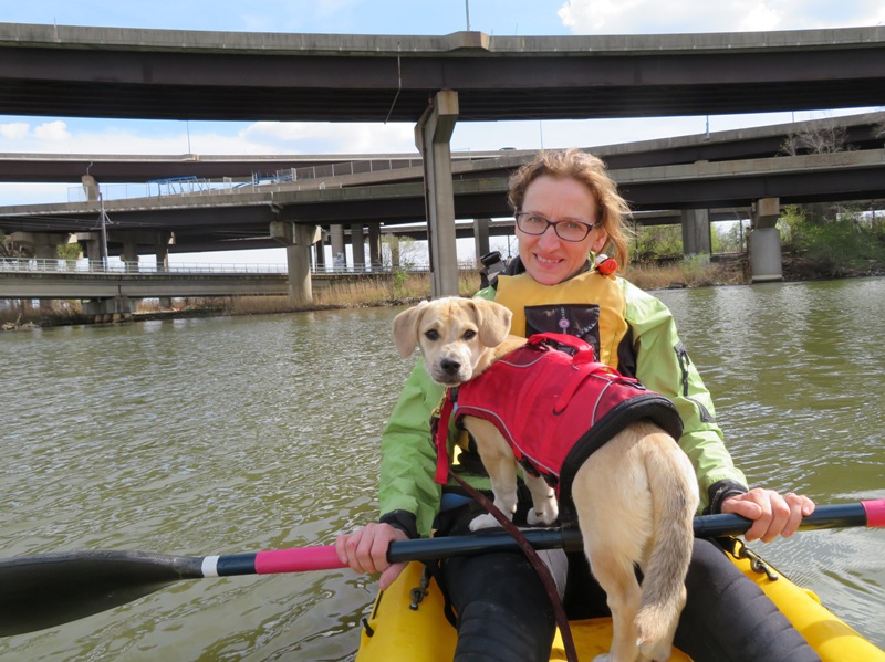
On January 15-16, 2018, Norma and I kayaked and paddleboarded on the San Joaquin River near Antioch, California. Cousin Steve joined us on the first day.
 |
|
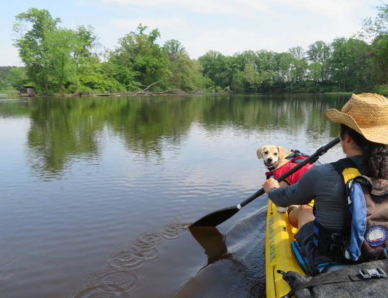
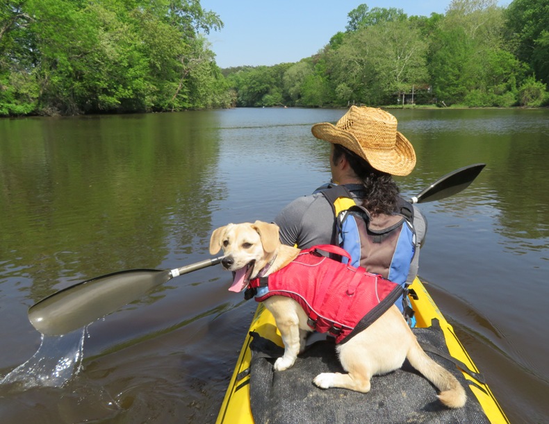
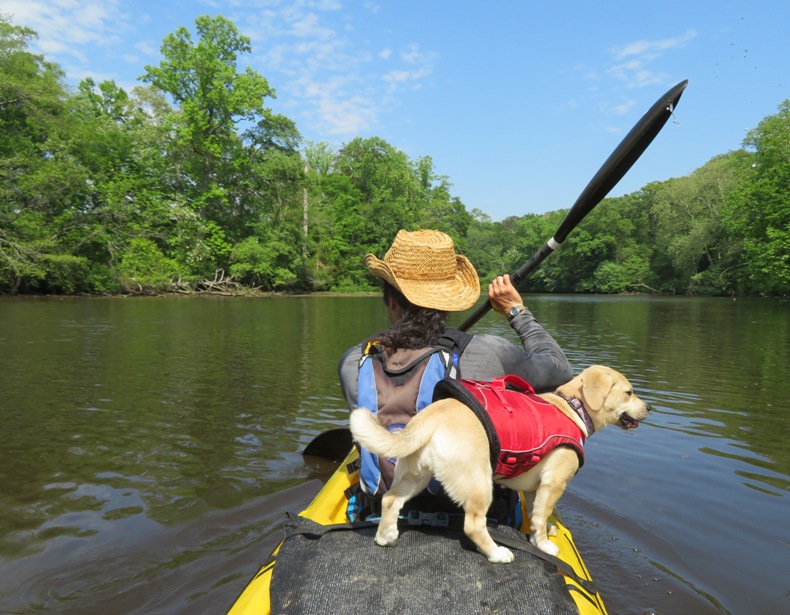
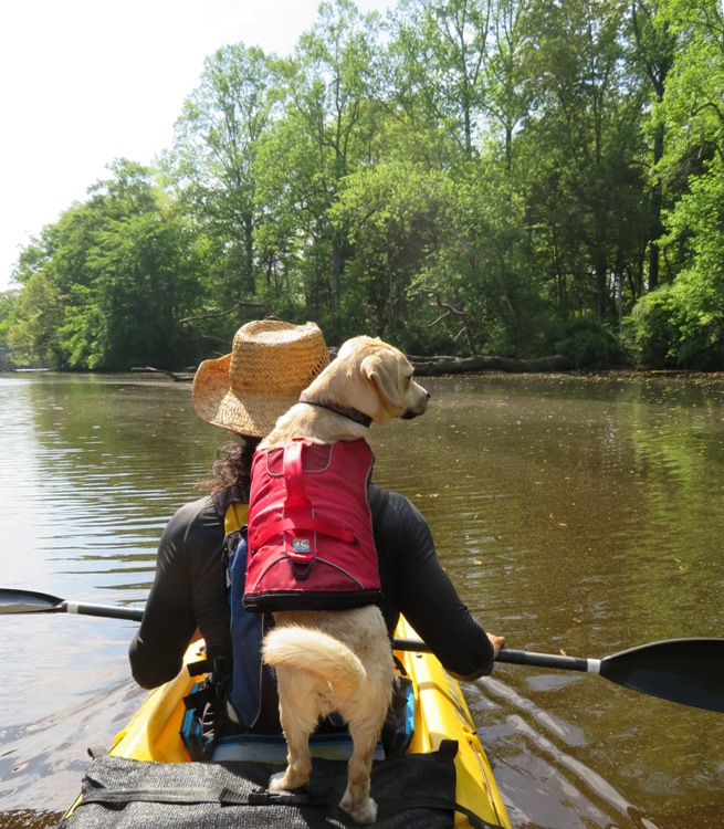
When to start kayaking/paddleboarding in Maryland after winter is largely dependent on the weather. One year, I was out on an exceptionally nice day in late February. But in 2018, that day was today. It actually got up to 70 degrees on the previous day but it was very overcast and rainy. In contrast, March 31 only got up to about 58 degrees but it was extremely sunny. It was one of those days where my solar panels earn their keep.
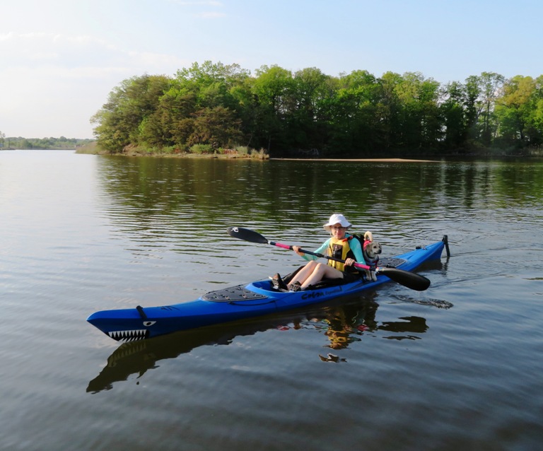
I drove out to Mason Neck State Park with my SUP. My Waze GPS software took me driving through downtown Washington D.C., which I usually try to avoid. I was remembered why I try to avoid it. Too urban for me. I'll take the Maryland eastern shore any day. I arrived just after 0930. I checked out the pond next to the cartop boat launch area. No turtles. It was still early in the day and very cool. Before 1000, I stood at the trailhead sign for the Bay View Trail for the ranger-led Freshwater Architects walk. Learn about their [beaver] lodges/dams and in the process, ways in which they are a lot like us. It was advertised on-line and in a handout as starting at 1000. But a posted pamphlet at the trailhead said it would start at 1100. I saw a couple of older people and what looked like a teenage girl walk by. The girl looked like she was wearing an official jacket but I couldn't tell. Nobody else met at the trailhead for this event so I walked the trail by myself. In the marshy area on the south side of the Bay View Trail loop, I heard many frogs/toads. On the boardwalk, I saw the same girl I saw earlier. She was older than what I originally thought. Thinking young adults are kids is a sign that you are old. It turns out she was the park ranger that was supposed to lead the Freshwater Architects walk. I was surprised that she just walked by without acknowledging me earlier. I asked various questions about beavers and she pointed out the beaver lodge and dam. Next, I launched my SUP. I spoke to a guy in a fishing canoe on the beach. He said he caught snakehead fish in the area. According to him, it eats like a cross between salmon and chicken. Sounds tasty. It is funny how when I first heard about this invasive fish, back in 2002, there were all kinds of predictions about how it would "take over." Rumors were It can walk on land! It can breathe air! It will eat everything in sight! - from "Capital Gazette - 10 years after Crofton snakehead discovery, concerns linger" (broken link as of 2018) It is true that its presence has spread and it is here to stay. But otherwise, it doesn't seem to be nearly as bad as what some experts predicted. Native fish still thrive. The snakehead is traditionally considered to have medicinal value. In 2000, a man in Crofton, Maryland ordered two snakeheads from a fish market in New York to make soup for his ailing sister. However, the woman recovered, so he put the live fish in his aquarium. When they grew too large for the aquarium, he let them go in a nearby pond. The snakeheads thrived and reproduced. - from Mental Floss - Messing with Mother Nature: Snakeheads On the beach at the launch site, I saw the empty shells of numerous mystery snails. Like the snakehead fish, this is also an invasive species from Asia. They can get up to three inches long! 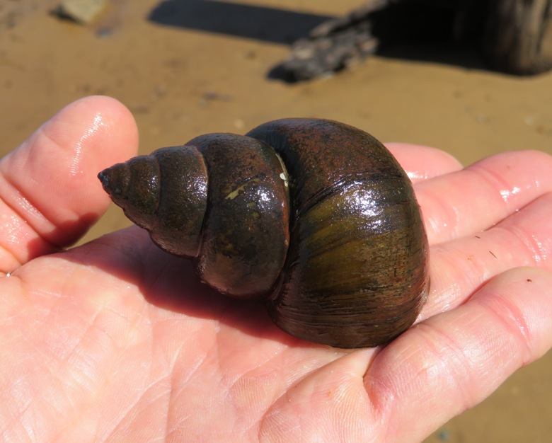
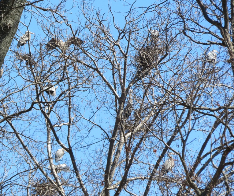
I've never seen a snakehead fish in the wild but I saw thousands of mystery snails that day at 38.622746, -77.205056 in the Elizabeth Hartwell Mason Neck National Wildlife Refuge. I paddled out into Belmont Bay heading southeast. The wind was low. I was wearing my farmer john wetsuit, neoprene shirt, and the neoprene booties that Jim C. gave me. The temperature was around 52 but I was very comfortable. I rounded Sandy Point. Near this area, I saw the area that a ranger later told me would be a paddle-in campsite. Shortly after reaching Occoquan Bay, my shoreline changed from state park lands to wildlife refuge. Seveal osprey were out, building their nests. In the below pics, one is flying back, bringing nesting material. The other has some plastic trash attached to it. Not sure how well it could fly. I reported this to the refuge. It was around noon. High tide was about 0830. I could have used the extra water. It was quite shallow and hard to paddle near the shore. At 38.623344, -77.203748 is a large unnamed pond on refuge grounds, about two miles from the launch site. One isn't supposed to go ashore here but I did, briefly. In years past, I was able to see a great blue heron rookery in the trees around this pond. But this year, I could not. My years of paddling has taught me that rookeries are not fixed in location and often shift over time. At this unnamed pond, I saw signs of spring (see below). I also saw about four dead turtles. I'm guessing our cold winter did them in. Or perhaps the warm winter days brought them out of hibernation, only to be hit by another cold spell. 
The pond was black, like the Pocomoke River. But unlike the Pocomoke, this pond is host to American lotus flowers. I'll need to return in the summer to see these majestic flowers but it was obvious they were here, since I saw the woody remnants of their seed pods. 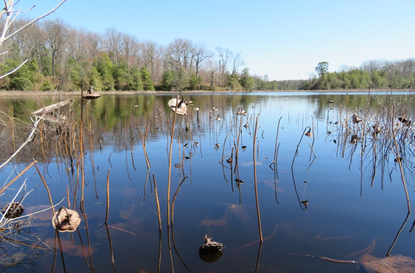
Back on my SUP, I paddled south. Between the pond and High Point, I spotted the rookery. Just north of High Point in the Occoquan is where it looked densest. But even here, I did not see all that many nests. I suspect most are further inland, like the ones in this satellite photo shown below, near 38.620734, -77.201269. 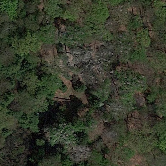
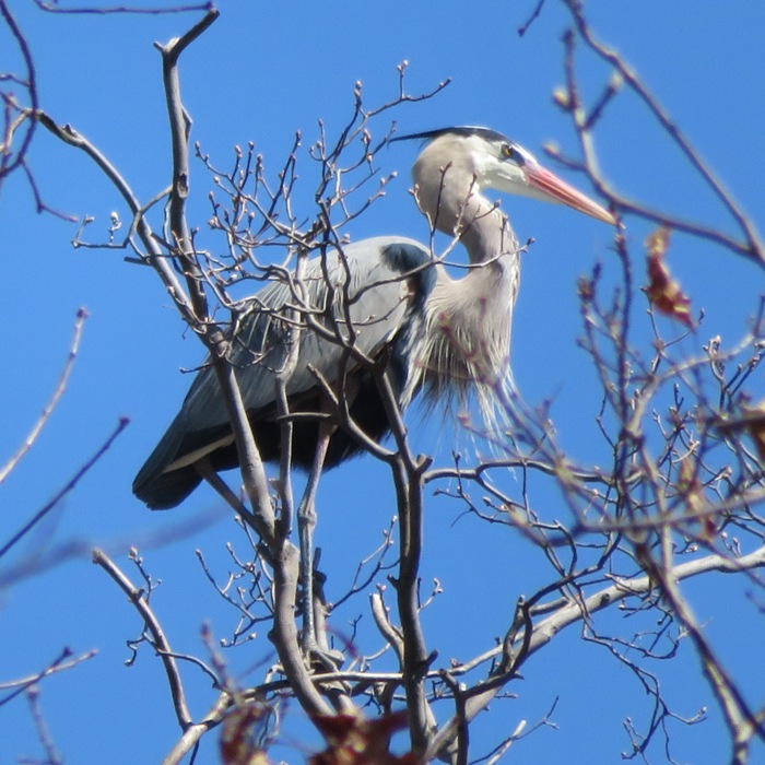
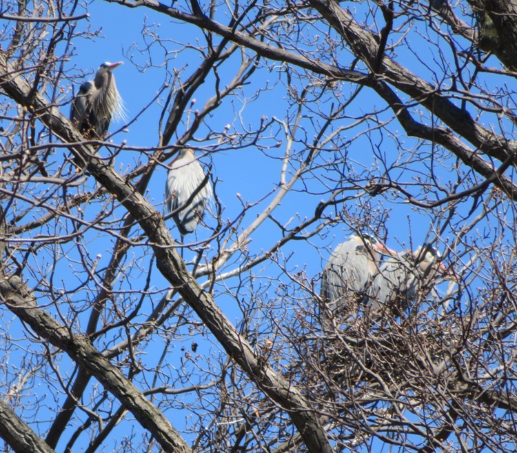
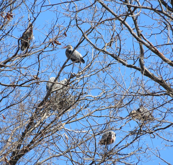
Mason Neck Wildlife Refuge has an impressive reputation for its heron rookery. with more than 1,400 nests, the great blue heron rookery here is one of the largest in the region. - from "National Wildlife Refuge System - Great Blue Heron" (broken link as of 2020) I much prefer the rookeries on the Sassafras River. Ospreys and eagles are solitary. But great blue herons are communal. Seeing them is great but seeing a whole rookery is a special treat! These majestic birds stand four feet tall and have 72-inch wingspans. Despite their large size, I wasn't able to paddle close enough to them so they were difficult to see. Fortunately, my camera has a lot of zoom. But it is often hard to hold it steady while standing on a SUP. So for many of these photos, I disembarked and stood thigh-deep in the water. I was glad to be wearing neoprene. 1 / 8

Singleton.
2 / 8
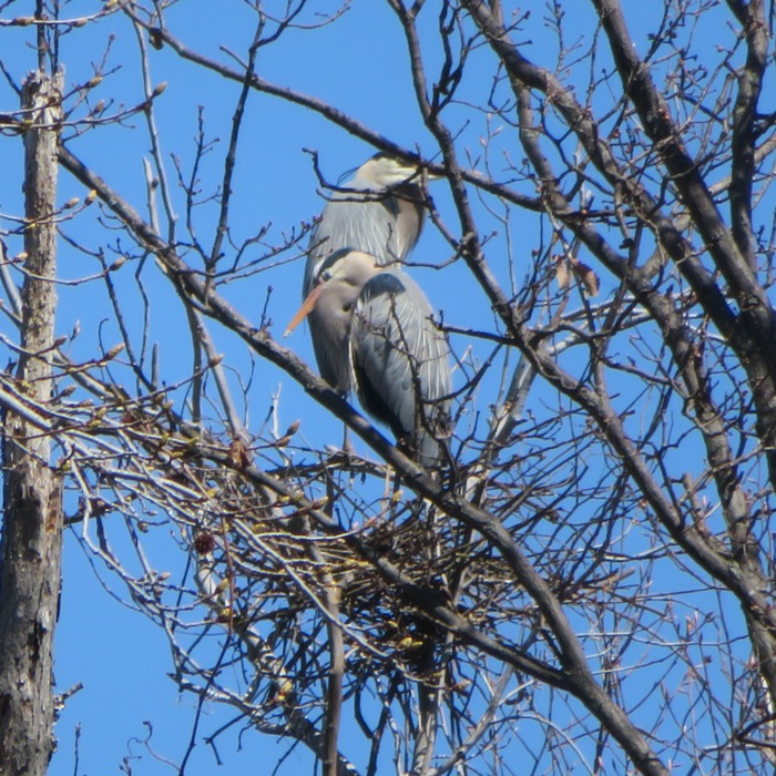
Pair.
3 / 8
Quad.
4 / 8
Six?
5 / 8

A mating courtship dance?
6 / 8
Lots of birds.
7 / 8

Nests need work.
8 / 8

Heron on the rocks.
The best time to see great blue heron rookeries is in early spring, before leaves cover the trees. I find it interesting that 'I' is the only difference between heron and heroin. Just a random thought. There were also bald eagles out. I saw two nests. One was embedded in the rookery. Not sure who was there first and what they think of each other. That can't be good for either's real estate values. I paddled 6.4 miles. I was surprised how many power boats were on the water so early in the year. It wasn't a lot but more than I expected. I definitely made it out before leaves obstructed my view so that was good. But if I had to do it again, I might have chosen afternoon sun from the west and higher tide. I checked out the pond near the cartop boat launch. It was devoid of turtles earlier but now there were probably a dozen out enjoying the high sun. Unlike many turtles, these are used to seeing people and don't mind getting their picture taken. Near the playground, I checked out the park's Furs and Skulls event. View, touch, and learn about some of the furs and skulls of mammals that call Mason Neck home! They had squirrel, opossum, skunk, groundhog, raccoon, fox, beaver, coyote, and white-tailed deer. 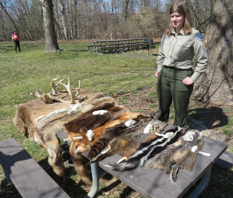
After changing into dry clothes, I checked out a couple of ponds off the side of the road that takes one into the park. I was looking for amphibian eggs. I found none. I started heading home around 1520. It took two hours and ten minutes to get home! It was a great day to be out but apparently, that's what everyone else thought too. Traffic was hideous. I was reminded again why I try to avoid the Washington D.C. beltway area. A six car accident on highway 295 brought things to a slow jog. I could have avoided that if I'd listen to Waze. The damaged cars were moved to the side of the road and passing drivers were rubbernecking. The forecast is calling for a chance of snow in two days. Winter just doesn't want to give up! |
|
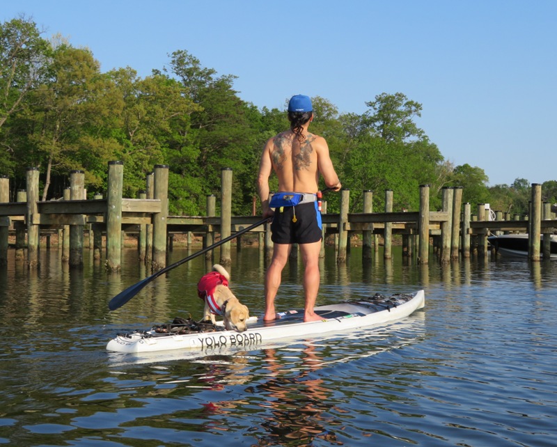
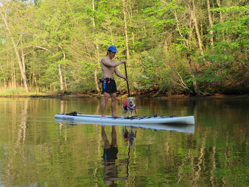
Norma and I took Daphne out on the water for the first time. We launched at Southwest Area Park in Baltimore County. This put us on the (Little) Patapsco River. It was quite windy (25 mph gusts) but also a warm 84 degrees. It was hard to believe we had a little snow earlier this week. Looks like spring is finally here!
Daphne was very excited about being on the water. It was much different from anything else she's experienced. 
I tried out the kayak dog cushion I made for her. I think it would work if she would lie down but she never did. 
After kayaking, I gave her a taste of the paddleboard. She generally stood behind me. 
Daphne enjoyed staying close to Norma on the kayak. But sometimes she was so close, it made it hard for Norma to paddle. Sara had the same probem with Cassi on the first time out. 
The front hatch of the Cobra Expedition is very flat and Daphne used it as a platform for standing. Norma did her best to keep the boat from rocking. 
Daphne fell in the water three times. Her Kurgo Surf N Turf Dog Life Jacket PFD has a handle so it is easy to pull her out of the water. Here, Norma is demonstrating her kayak dog rescue skills. 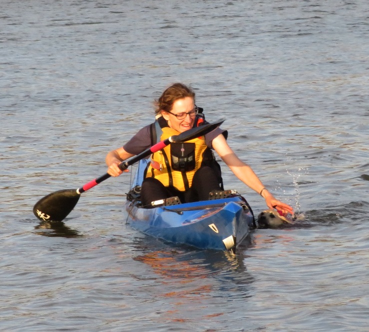
Daphne is quite the sight...like a ship bow figurehead. 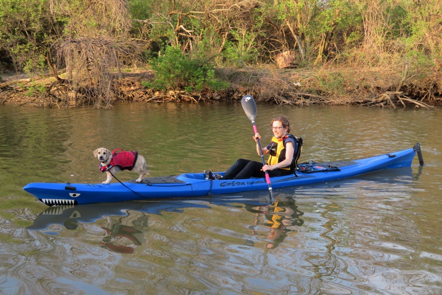
I think Norma and I just need to be disciplined and make sure we get Daphne out on the water regularly. She was scared today but I expect that if she sees that Norma and I love being on the water, then she will too. |
|
After spending much of the morning taking care of chickens and taking Daphne for a bike ride, I decided to relax and spend the afternoon kayaking. I would loved to have taken the SUP but they were calling for 20 mph gusts. So instead, I was on my Prijon Catalina which I improved recently with a custom seat cushion that I made.
The drive down to the Clyde Watson Boating Area (Magruders Ferry/McGruders Landing) was far from relaxing. It seems like traffic lately has been unusually heavy on the weekends. Maybe folks are trying to get out and enjoy the good weather just like me. I can't blame them. My navigation software told me to take the D.C. beltway but I totally hate that so instead I took Route 3 south. I launched on the Patuxent River (Pax) at 1430. I started kind of late because high tide was at 1556. But I should have commenced earlier because the area closes at 1800. Later in the year, it will be open later. I paddled north (upstream) about a mile and then explored Full Mill Branch in the Full Mill Branch Natural Resources Management Area on the west side of the river. I saw a wood duck. The ones in Maryland never want to pose for pictures. I spent quite a bit of time exploring the creek and made it up pretty far. There were other parts I could have explored but I wanted to have time for other creeks. Besides, it was all starting to look the same with so much dry grass and no trees. 
I kayaked back into the Pax, crossing over to the east side. Then I started making my way downstream. Now I was fighting the wind and very thankful I was not on the SUP. The temperature was in the mid-80s but I was quite comfortable in the wetsuit. One might think I would overheat but with all the wind, I was getting splashed by the cold water. I explored Tyverne Creek where I spotted a couple in a fishing boat. Those two were the only people I saw except for two power boats in the distance. The fishermen hadn't caught anything. This creek meandered for what seemed like forever. I spent a long time there and didn't see it all. Certainly the high tide made it more navigable but I also wonder if the strong south wind today and over the last few days pushed more water into the Chesapeake Bay and its tributaries. It must have since I know a strong north wind will lower the water level. Tyverne was almost all grassy, like Full Mill Branch. I saw several muskrat mounds (shown below) and two muskrats. Beavers wouldn't likely be in this part since there were no trees. 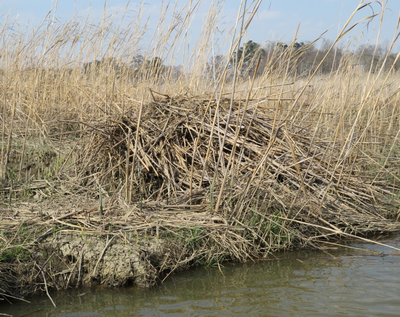
I saw four snakes throughout the day. One was swimming on top of the water and one was under the water. I got a good look at the latter and determined it was a northern water snake. The third snake startled me when I pulled ashore and it slithered away quickly. I saw the fourth from a distance as it went into the water. I pulled ashore on the Tyverne. 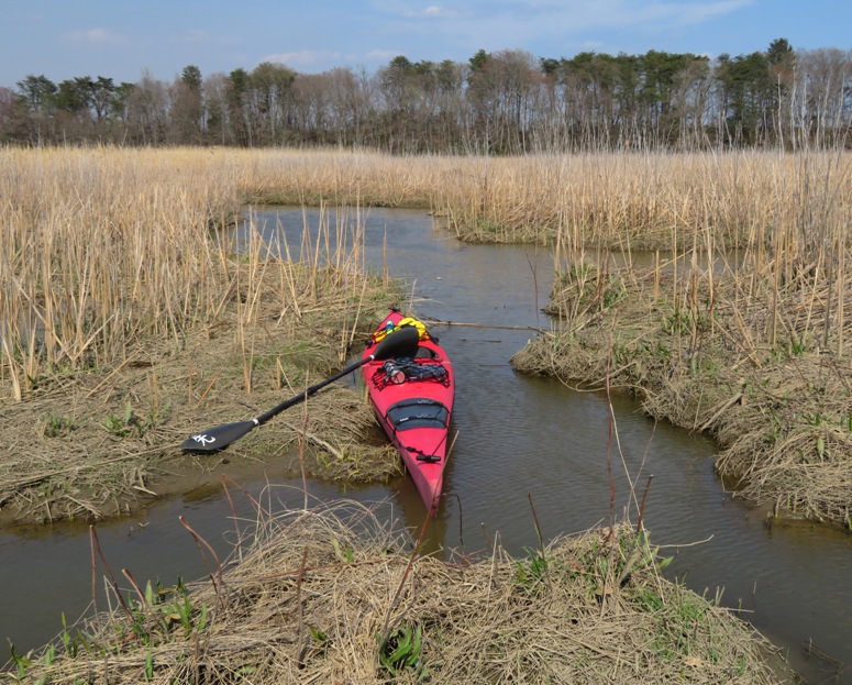
There had been a lot of recent raccoon activity. 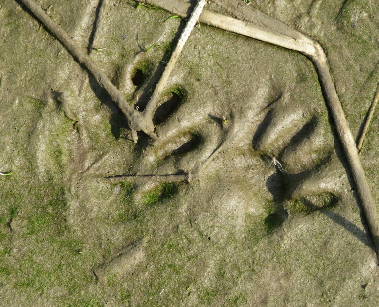
My original plan was to also explore Chew Creek and Cocktown Creek in Kings Landing Natural Resource Management Area and Kings Landing Park but I was running out of time so instead I crossed back to the west side and checked out Black Swamp Creek in the Patuxent River Natural Resource Management Area. There was a really bad smell in that area. I guess it was a rotting carcass. I remember a heron rookery there about 15 years ago on the north side. But recent satellite photos did not show any and I did not see them. I only made it up about a half mile on this creek before I had to turn around. At that point, grasslands were transitioning to woodlands which I find more interesting and easier on my eyes. 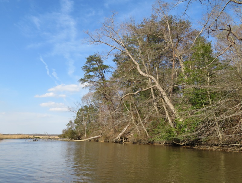
I very much look forward to returning and finishing my exploration of this area. It might take two trips. There were more turtles out than I could count. But they were very shy and not willing to pose for pictures. Many were large. I did not see any snappers. 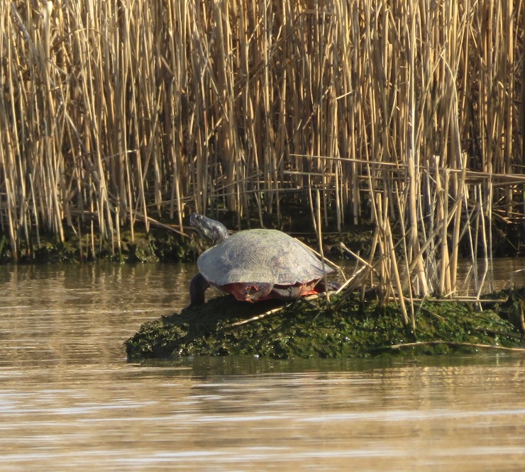
Towards the end of my trip, I spent some time taking pictures of a couple of osprey at a duck blind on the Pax near the mouth of Black Swamp Creek. I don't think they started their nest yet. Maybe they're still working on the courtship. I was out 3.25 hours but only covered 9.5 miles, largely due to the strong wind and the circuitous exploration. I left the area just after 1800. There were still plenty of people there after I was gone so they must not be too strict about closing on time. But I wouldn't want to take the chance of being locked in. When I got home, I viewed more satellite photos and noticed that near the mouth of Black Swamp Creek, one can see various dots. I believe these are muskrat mounds. 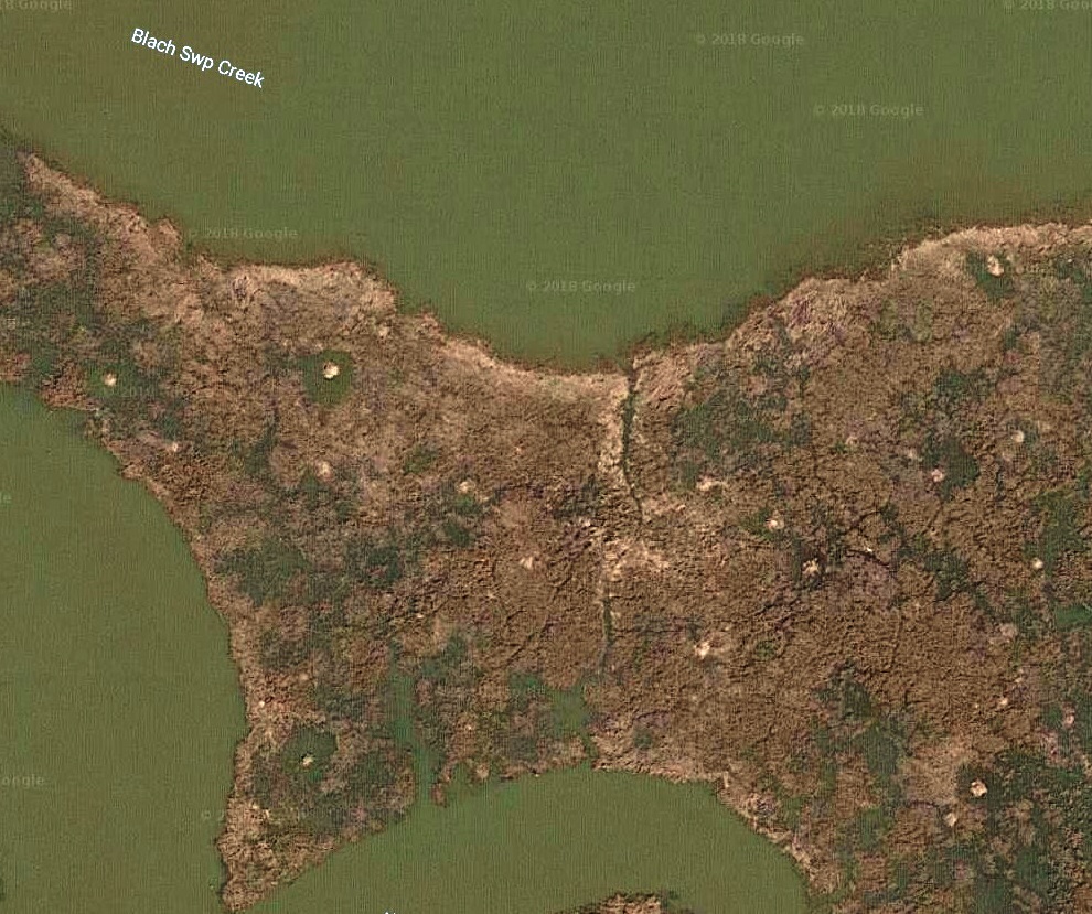
The seat cushion is a definite improvement. After three hours on the water, I was doing o.k. but not great. But I could have easily been out for another hour without much discomfort. Sitting is not my strength. One of my favorite places in the whole world is the Patuxent River. It is full of nature and it seems every creek with a name is paddleable if you hit the tide right. The Pax offers a lifetime of exploration...something I truly enjoy. The drive home wasn't so bad. |
|
Sara, Cassi (her dog), and I did a one way trip from Woodstock to Daniels on the Patapsco River.
We were hoping to see toads mating or laying eggs but we saw none. It was probably too cold. Or maybe they already did their business on some of the warm days earlier in the month. We kayaked 1.2 miles to Davis Branch. Just downstream of there on the Baltimore County side, I tried to find the vernal pool from April 5, 2017 where I found so many toad eggs. But I could not locate it. Perhaps there wasn't enough rain. When I saw it before, I was paddling upstream so maybe I just didn't recognize where to pull over. Sara has paddled with me plenty of times before but this was her first trip in her new Old Town Vapor 10 kayak. The extra long cockpit makes it more dog friendly than a lot of other boats. She did a lot of research on good dog kayaks before purchasing it. We pulled over a few times to explore and let Cassi stretch her long legs. Looking around, we found an amphipod. It was about an inch long. I don't know the common name. Sara found a rock with lots of amphipods. Not sure if this was a real rock. Perhaps it was something left over from the old train railway. Sara also found some muscovite. 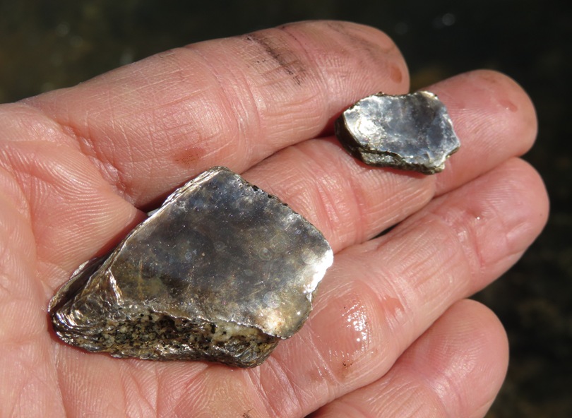
I spotted a three-foot long northern water snake. 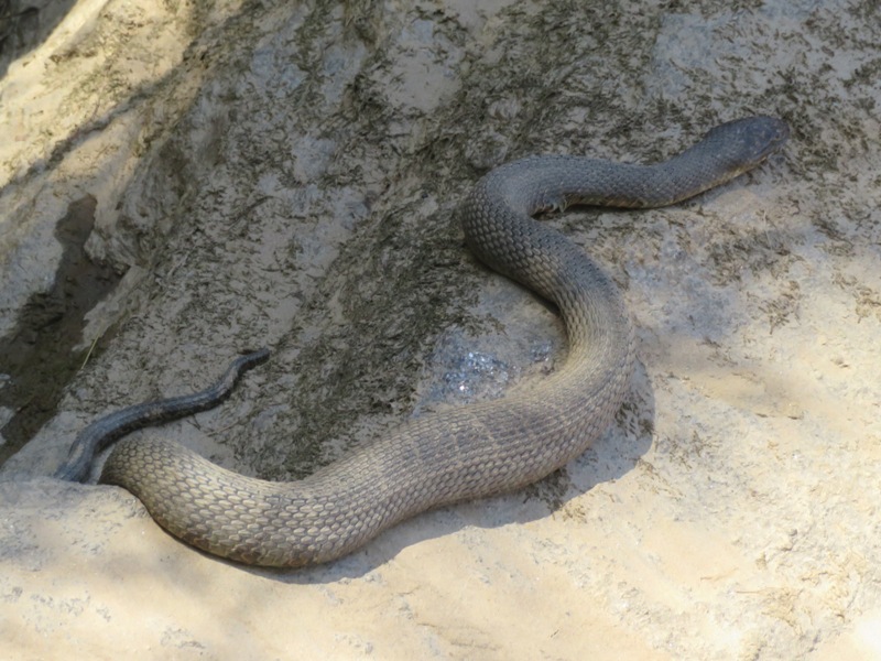
Cassi was good for most of the trip. We were out for over 2.5 hours and most of the time, Cassi sat patiently. She never barked. Closer to the end, she was wanting to get off the boat. By that time, the sun was getting low so she might have been cold. I most certainly was. 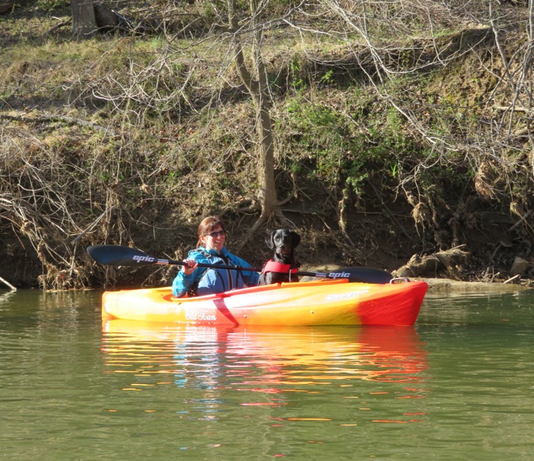
We only saw one turtle, an eastern painted. 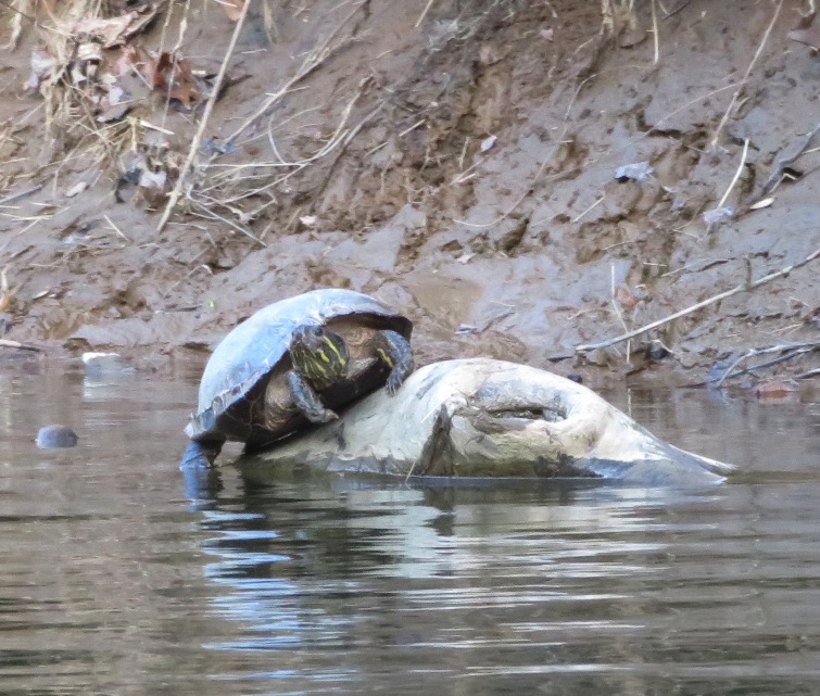
Sara and I kayaked 5.25 miles. After kayaking, we pulled into Mount Hebron High School to check out a drainage pond. It looked like a great place for frogs and toads. We heard a lot of spring peepers but they shut up as we got close. We never actually saw them. But we did see this solitary sandpiper. 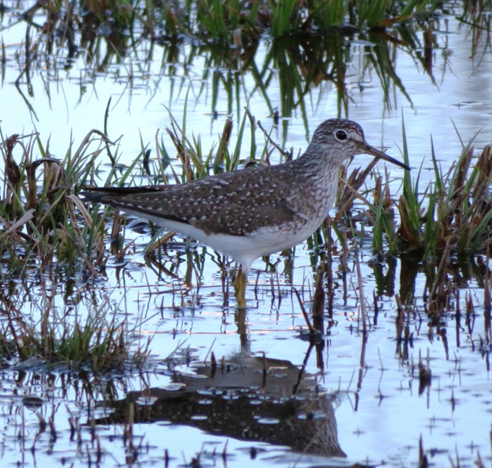
|
|
I took the SUP out and explored Lloyd Creek, on the south side of the Sassafras River. I launched from Betterton, taking advantage of the high tide.
On this sunny, spring day, wildlife was abundant. I saw three foxes, three muskrats, a beaver, ~12 turtles (including a snapper), ~12 deer, terns, a small heron rookery, an eagle nest, and too many eagles to count. The wind was fairly calm, which is not so common during the spring in Maryland. So it was a good day to be on the SUP. I paddled along the shoreline, hitting every creek I could find. The main reason I chose to paddle in this area was so I could see a heron rookery at an unnamed island. A few years ago, I saw a small rookery here. It was late in the season so the foliage on the trees hid the nests. I figured that if I was out in April, I'd see a lot more. I could see the nests on satellite photos which were taken I don't know when. But sadly, I found no nests today. A lot can change from one year to the next. Rookeries move around. Still, the Sassafras River is the best place I've found for finding rookeries. Here's a small great blue heron heron rookery on the east side of Royal Swain Road. There were only about eight nests. I was not expecting to find this here. 
I saw plenty of other birds such as this osprey near the launch site. The sun was low. It was that time of day when everything illuminated looks beautiful. 
Lots of Canada geese were out. At an unnamed island, I spotted one goose in the water which kept making noise and wouldn't shut up. It wasn't until I saw another on a nest fly away that I realized why it was being so loud...it was protecting its eggs. I quickly got a photo and then left. Here are some of the bald eagles I spotted. I shot several pics of a Forsters tern. There were two terns and both were quite cooperative at posing for my camera. 
Many turtles were out including eastern painted and snapping. Of the latter, one was waiting for me to fall off my SUP so it could bite off my toe. It went under water and I waited for it to come up and get air. I was thinking, "It can't hold its breath forever." I managed to get a not-so-great shot once it surfaced. I saw a beaver...not something I see often. From a distance, I wasn't sure what it was but only a quarter mile away was a beaver lodge. That's when I was pretty sure it was a beaver. Lots of people mistake muskrats for beavers. The latter are much bigger but unless you have the two next to each other, that isn't always the easiest way to distinguish them. But if you can spot the tail, that is a clear giveaway. Beavers have wide, flat tails while muskrats have rat-like tails. Oh, how I miss muskrat Fridays. This was when my co-worker, Bishop, would draw muskrat cartoons every Friday. He stopped this a few years ago. 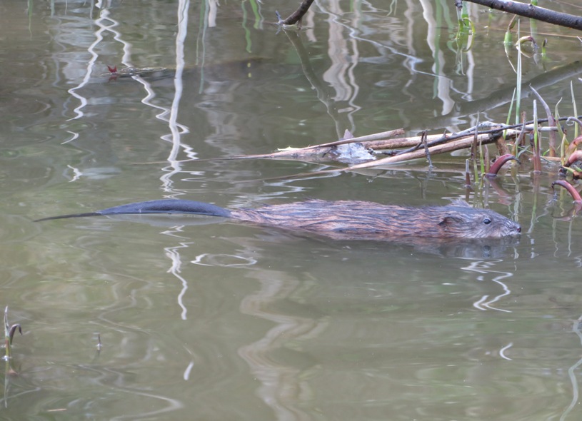
I got in a very slow 13.8 miles. The drive home was great. No traffic and great views. How I love the eastern shore! As I drove west across the Chesapeake Bay Bridge, the sun had just set and the clouds were red. I was feeling very calm and zen-like. |
|
I took Daphne out for a short bike trip and then later a kayak trip with Norma. This was only her second adventure on the water. This time, we took the Cabo (a tandem) and launched from Broening Park.
Daphne did much better than her previous trip on April 13, 2018. She did not fall in and she seemed much more relaxed. We explored Middle Branch in Baltimore City, paddling under highways 95 and 395. We saw a lot of trash, a boat wreck, a couple of turtles, a century plus old CSX railroad swing bridge, and a small homeless encampment or two. The amount of litter in this area is staggering. But since tourists don't go here, the city doesn't have much invested in this part of the city. There just isn't financial incentive to keep it clean. 1 / 4

Railroad bridge & boat wreck.
2 / 4
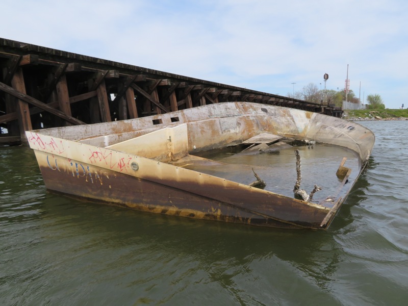
Non-historic wreck.
3 / 4
Highways.
4 / 4
Swinging bridge.
Daphne was getting cold toward the end so Norma held her while I paddled. The tandem is good for that. We were out for 90 minutes and got in 3.75 miles. Later, Lisa told me about a kayak rescue that took place the previous day. See PropTalk - Maryland State Police Helicopter Rescues Stranded Boaters from Patapsco River. It was near where we paddled. |
|
There was nothing particularly special about this day. It was very warm and sunny, and I had a little time after work to get out on the water. Rush hour traffic sucked but that is the norm in this area. I launched at Beachwood Park and explored the little fingers which flow into the Magothy River along with the west side of the river. It was my first trip out on the surf ski this year. I felt pretty comfortable on it...no worse than usual.
I took a lot of pictures but only one was deemed by me to be web-worthy...a cormorant standing on one leg. 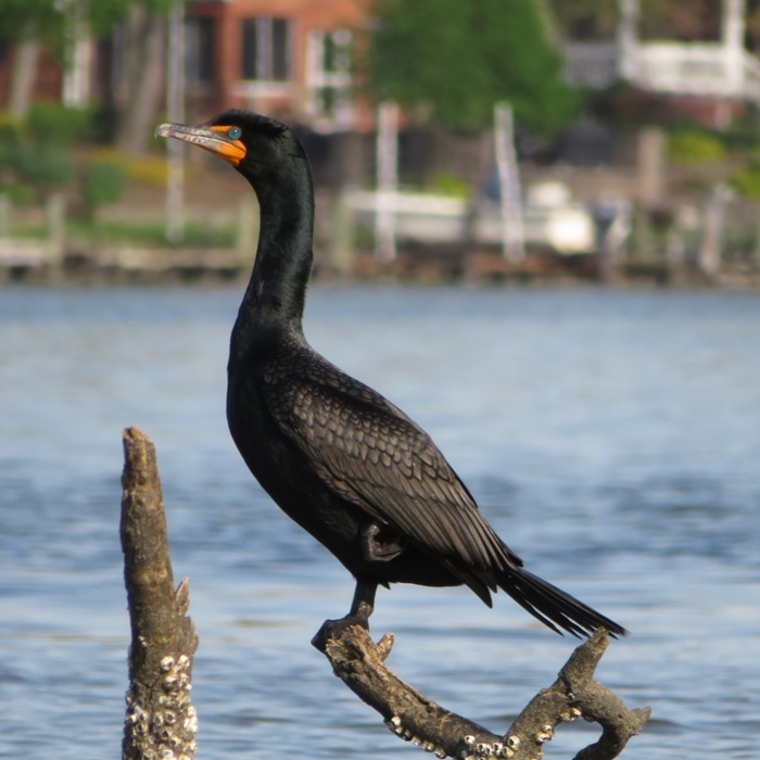
|
|
On Cinco de Mayo, I launched my SUP at Stemmers Run. This put me at the mouth of Elk River where it flows into the Chesapeake Bay on the eastern shore. I was on the water around 0830.
It wasn't a great weekend to be out. Neither Saturday nor Sunday would be sunny. But at least the wind was calm and there was less chance of rain on Saturday morning. I paddled my SUP heading south and explored Pond Creek. This is not a place you want to be on a SUP at low tide but I found myself there just after. It was often very shallow and muddy. There were numerous fallen logs that my fin got stuck on. It was undeveloped but much of that land was privately owned so I couldn't go ashore. I saw several eagles. 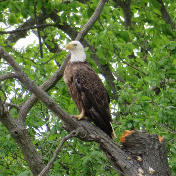
Next, I did an open water crossing to Turkey Point where I saw the Turkey Point Lighthouse on the Elk Neck State Park peninsula. The Turkey Point Lighthouse was once used to project light 13 miles down the Chesapeake Bay to direct ships safely away from the shorelines. Now it stands as a reminder of the history of the area. Built in 1833, Turkey Point Lighthouse sits on a 100-foot high bluff that overlooks the union of the Elk River and the Chesapeake Bay. At 129 feet above the water, Turkey Point Lighthouse is the third tallest light on the Bay after the lighthouses at Cape Charles (191 feet) and Cape Henry (164 feet) at the mouth of the Chesapeake Bay in Virginia. - from "Maryland DNR - Elk Neck State Park: Turkey Point Lighthouse" (broken link as of December 2018) Turkey Point Lighthouse isn't really "tall"; it resides on a bluff so it is "high." 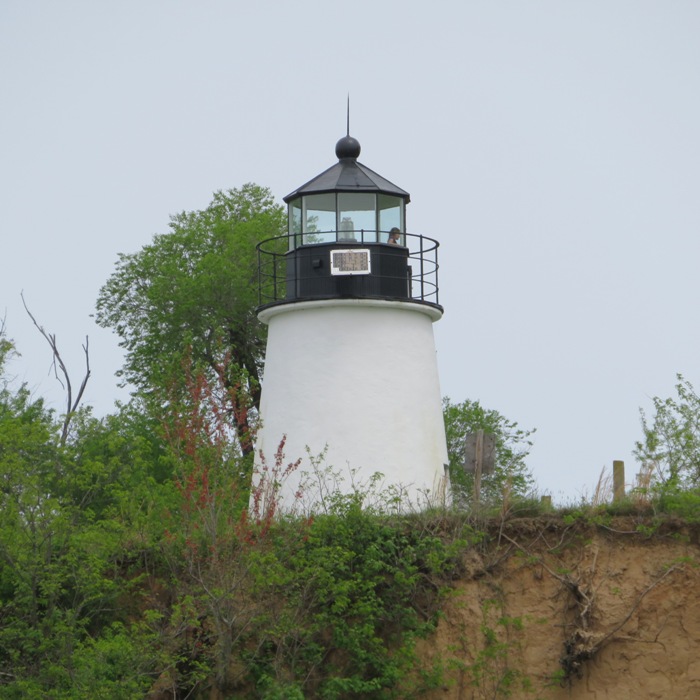
I made my way upstream on the Elk River. I didn't get much sleep the previous night, partly because Norma and I had a delightful evening at the "Creative Alliance - Fiery Fiddles" performance. I also never really felt like I woke up because it was so overcast. So I pulled over at Elk Neck State Park for a power nap. I rested for about 20 minutes but never fell asleep. Ants were biting me. 
I did not see any reptiles. But I did see a few birds. I crossed back over Elk River from Stony Point to Arnold Point and then paddled southwest (downstream). I saw several turkey vultures including these eating a large fish. 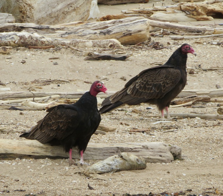
I paddled past the Pearce Creek overflow outlet. I didn't go into Cabin John Creek. Maybe next time I will get there by launching from Rogues Harbor. Along the east side of the lower part of Elk River, I saw lots of vacation homes and RVs. I'm not against either, but I felt the layout was visually unappealing. It looked like the developer just crammed in as many as he could on tiny spaces. Many were falling apart. Some were boarded up. I finished, having paddled about 16.5 miles. This wasn't a particularly interesting trip. Maybe I was just feeling tired and disappointed that the sun didn't come out. There just wasn't much to see of interest. The one place I would have loved to explore was Pearce Creek. Looking from Stemmers Run Road, it looked pristine. But except for the overflow outlet and the marina (neither of which go in very far), there is no way to access the creek from Elk River. I expect one could launch from 39.435326, -75.977779 but it is a managed hunting area (MHA) and the website for it says Due to security and safety concerns related to the Army Corps of Engineers construction project, Stemmer's Run MHA will be CLOSED to ALL VISITORS until further notice. - from Maryland DNR - Stemmers Run MHA (a broken link as of 2020) From the bridge over Pearce Creek, I took these pictures: The wind was unusually calm. It would have been a great day to have done some big open water stuff...though I could have used more sleep before embarking on such an endeavor. |
|
Norma, Daphne, and I paddled on Marley Creek, launching from Solleys Cove. We were out for two hours, exploring Solleys Cove and Tanyard Creek. These are areas that I typically don't spend a lot of time.
Having Daphne with us makes me go exceptionally slow. One can say that she makes me stop and smell the roses. This was her third time on the water. Each time, she makes huge progress. That's not surprising since at this time of the year, the days and the water keep getting warmer, so being on the boats is becoming more comforatble. We're still trying to figure out the best position for Daphne where she is stable and also doesn't get in the way of Norma's paddle. 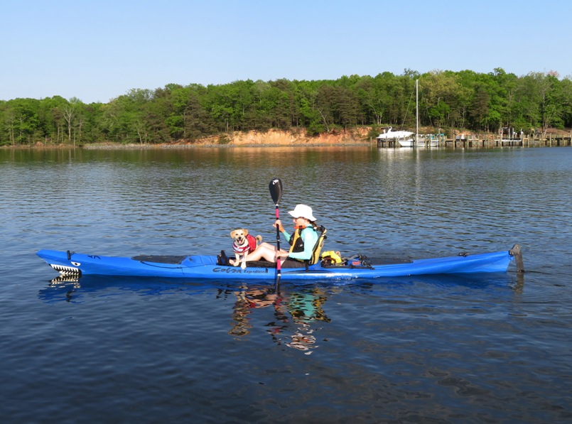
Daphne's rear legs fell off the SUP but she managed to pull herself back on. That was the closest she came to falling off. 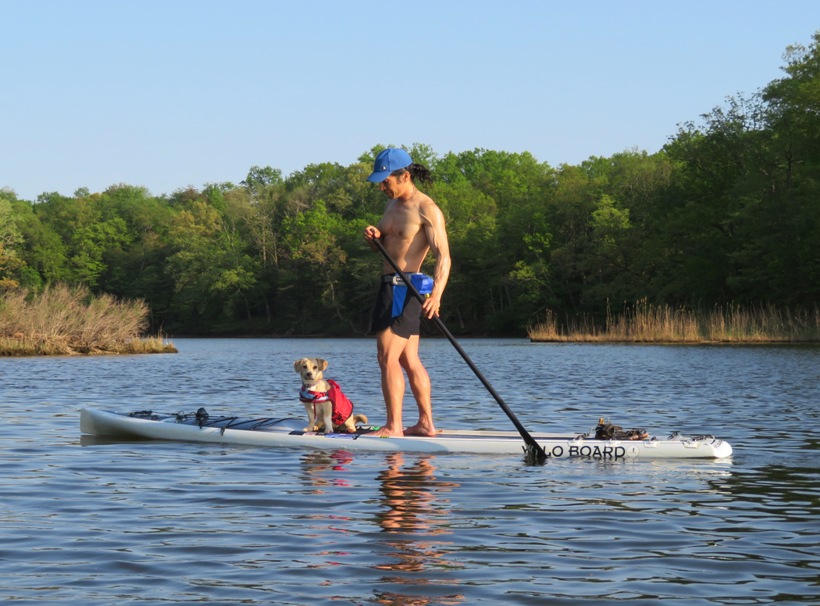
We let Daphne go ashore three times. I think breaking up the trip like this made it more enjoyable for her. 
At the mouth of Tanyard Creek, there were some young men with loud dirt bikes. Daphne didn't like the noise so she tried to climb up on Norma. 
Here's some more pics. 1 / 5

Entering Tanyard Creek.
2 / 5
Norma and Daphne.
3 / 5
Daphne on SUP.
4 / 5
Interesting lighting.
5 / 5
Heading home.
|
|
The weather has been unusually nice...sunny, warm, and dry. I don't need the wetsuit or the bug spray...just the sunscreen. Conditions like this don't last long in Maryland so I gotta enjoy it while I can.
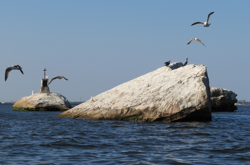
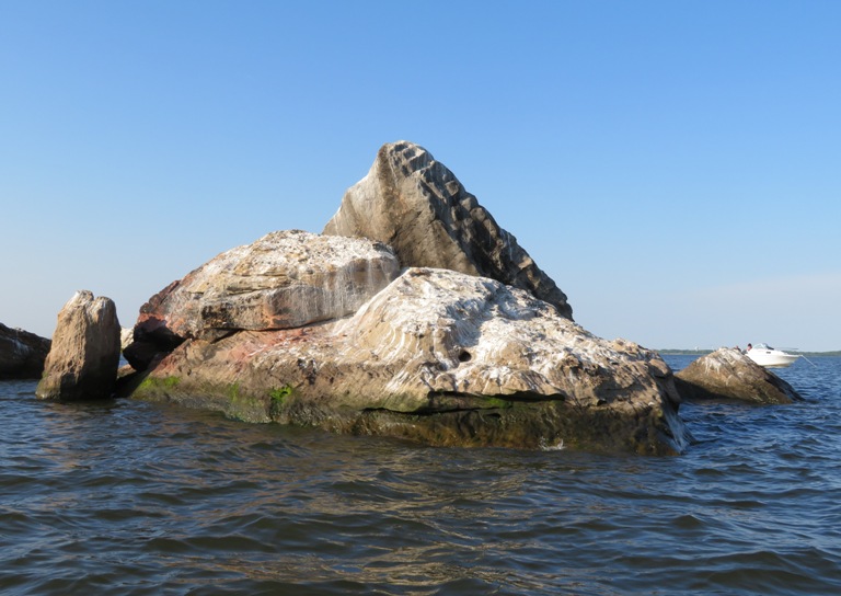
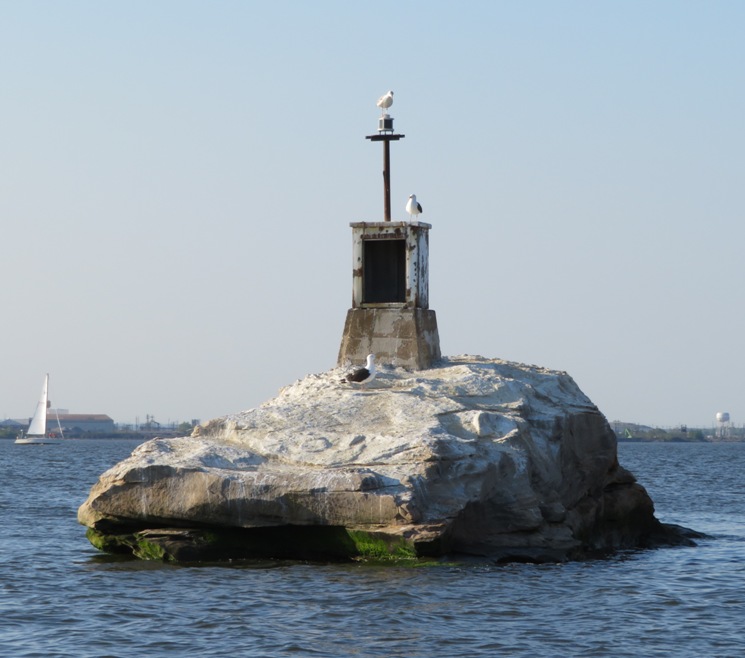
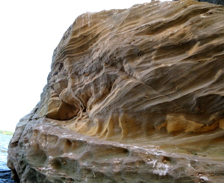
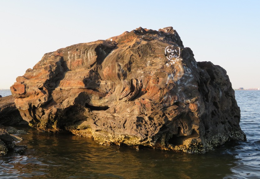
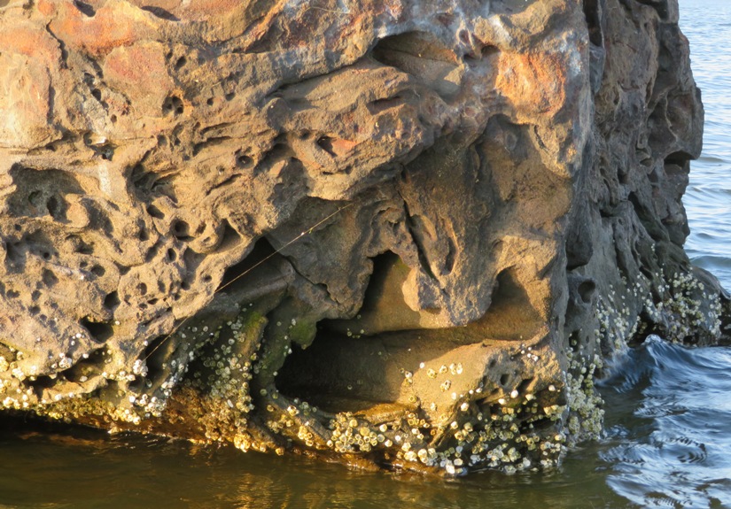
After work, I launched my SUP from Green Haven Wharf and paddled on Stoney Creek and then into the (big) Patapsco River. There was a light wind and small waves. My goal was to get close-up views of White Rocks and Black Rocks. Both are geologic anomalies for Anne Arundel County, Maryland. Most of the Chesapeake Bay and its tributaries are either muddy or sandy. Places with big rocks are not the norm. Why is White Rocks white? ...some experts believe the white pinnacles were formed from an accumulation of oyster shells fossilized in sedimentary rock over thousands of years...the White Rocks Islands, as they are sometimes called, consist of tough, erosion-resistant, white sandstone of the Late Cretaceous period, which accounts for their color. That means this pile of boulders has been around since the dinosaurs were here. - from "Pasadena Voice - The Puzzle of White Rocks Island" (broken link as of December 2018) White Rocks is comprised of several rocks about 0.6 mile from Fort Smallwood Park, the closest land mass. 1 / 6
Many birds.
2 / 6
White from bird droppings.
3 / 6
Not sure what this is.
4 / 6
Not looking like Maryland.
5 / 6
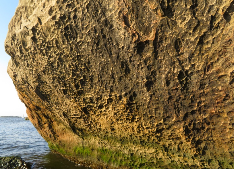
Cratered.
6 / 6
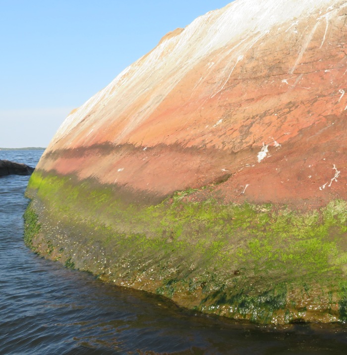
Color transition.
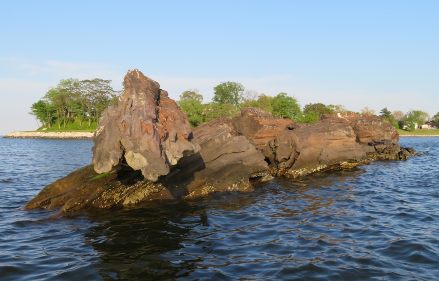
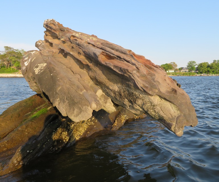
On my return trip, I stopped at Black Rocks, which, as the name implies, looks nothing like White Rocks. It is located at the mouth of Stony Creek, where it flows into the Patapsco River Pictures of Black Rocks: 1 / 5
Balanced rock.
2 / 5
Close-up.
3 / 5
Graffiti.
4 / 5
Nooks and crannies.
5 / 5

Key Bridge behind.
I spoke to a woman on the pier with a dog who said that she also has a SUP. Her dog is much taller than Daphne and doesn't like the SUP. I'm guessing Daphne's short legs and low center of gravity make her more comfortable on it. The woman said she hasn't been out on the SUP yet this year. What a shame to be passing up such beautiful weather! I got in just over 9.3 miles. I came home and watered the lawn seeds I had planted a week prior. |
|
I took Norma and Daphne out to Chestertown. This is a place I've talked about retiring to. I don't think Norma would want to live there but she is certainly realizing what a great town it is.
Our first stop was Tractor Supply's Spring Market Day. There wasn't a whole lot of activity but we struck up some conversations with folks who live in the area and love it. I met the fellow who has been dressing up as Santa Claus for the last 20+ years. Next, we went to the Chestertown Dog Park which is big and new. Daphne met and played with a few other dogs. Norma and I got to speak to more people who told us how much they like Chestertown. Seems like people come here to spend the rest of their lives. Our third stop was the Chestertown Farmers' and Artisans' Market at Fountain Park. There weren't a lot of dogs at the dog park...probably because most were here. There were two vendors selling dog treats. We spoke with one for awhile and bought from both. Next, the three of us ate lunch at Play It Again Sam in the downtown area. We've become huge fans of restaurants with outdoor seating that are dog friendly. Daphne attracted lots of positive attention from passers by. Norma, Daphne, and I walked to the waterfront area and then took a short nap at Wilmer Park under a tree. It was pretty hot in the sun but comfortable in the shade. We saw several greater white fronted geese. 
Strolling through town, we saw signs announcing various local cultural events. For such a small town, there is a lot going on. We returned to the car and then drove east to Shadding Reach on the upper part of the Chester River. We paddled upstream on my tandem kayak. This was my third time out on the water this week. The weather had been usually good and it was quickly coming to an end. Unlike California, we can't plan for the weather to be good weeks in advance. So when it is good, I try to take advantage of it. This was also Daphne's fourth time out on the water. We've been alternating with the single kayak with SUP and the tandem kayak. Today it was the latter. I've never paddled on this part of the Chester River. I think it is a place I knew would be scenic and I wanted to save it for a time I'd be with Norma. It was indeed lovely and I highly recommend kayaking out here though I would advise avoiding low tide. We paddled up Unicorn Branch until we were stopped at a downed tree. Norma put Daphne in the water which forced her to swim for a very short distance. Her PFD worked fine though it didn't keep her as high out of the water as I would have expected. Still, Daphne seemed to have no problem swimming. The place was lush, green, and peaceful. We never saw a powerboat on the water. Only about four other kayaks. 1 / 6
Shadding Reach.
2 / 6
Daphne standing.
3 / 6
Yawning.
4 / 6
Facing starboard.
5 / 6
Getting a better view.
6 / 6
Great views.
Despite how natural the place was, we saw no snakes. But we did see other wildlife. We saw about four muscovy ducks. I've never seen these before. They aren't supposed to be this far north. I posted a photo to the MD Birding Facebook page. Someone confirmed our theory that they are likely feral escapees from someone's private collection. 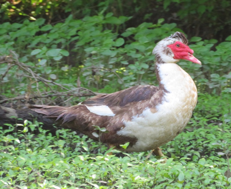
We saw several herons and thought there might be a rookery nearby. But the trees were too full of leaves to see anything and we also didn't hear the sounds of young herons. 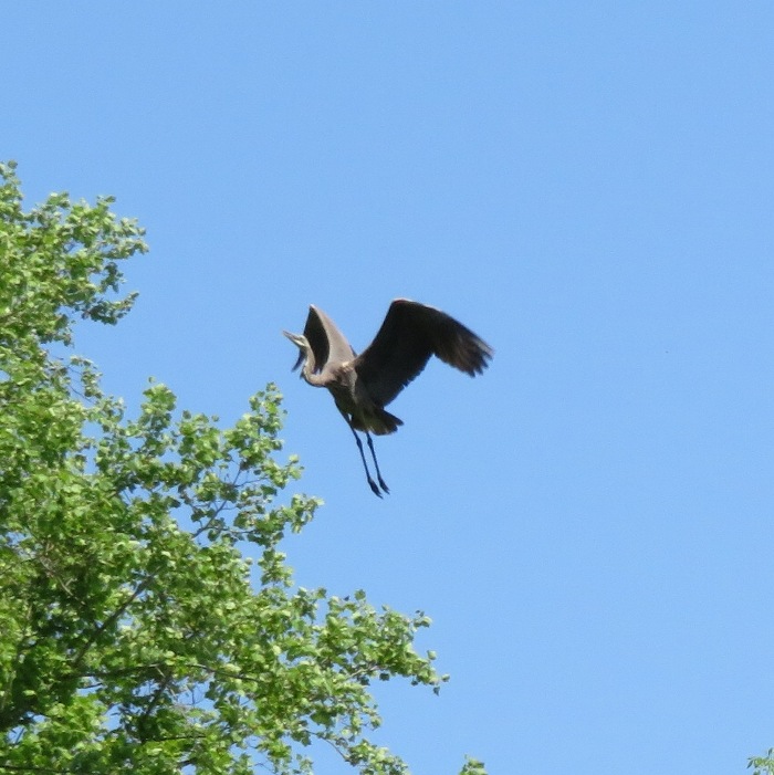
We saw two small muskrats playing. This one looks more like a drowned rat. 
At one creek on the north side, we saw some beautiful waterfront property. Seems like a great place to open a bed and breakfast or maybe a yoga retreat if you could control the biting insects. 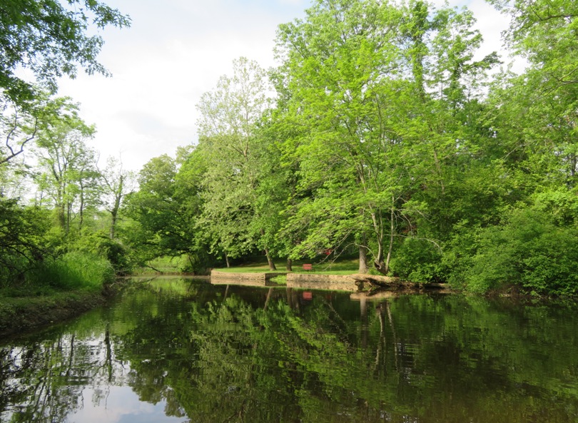
We stopped at a small island where Daphne dug in the sand and played with an old beer can. 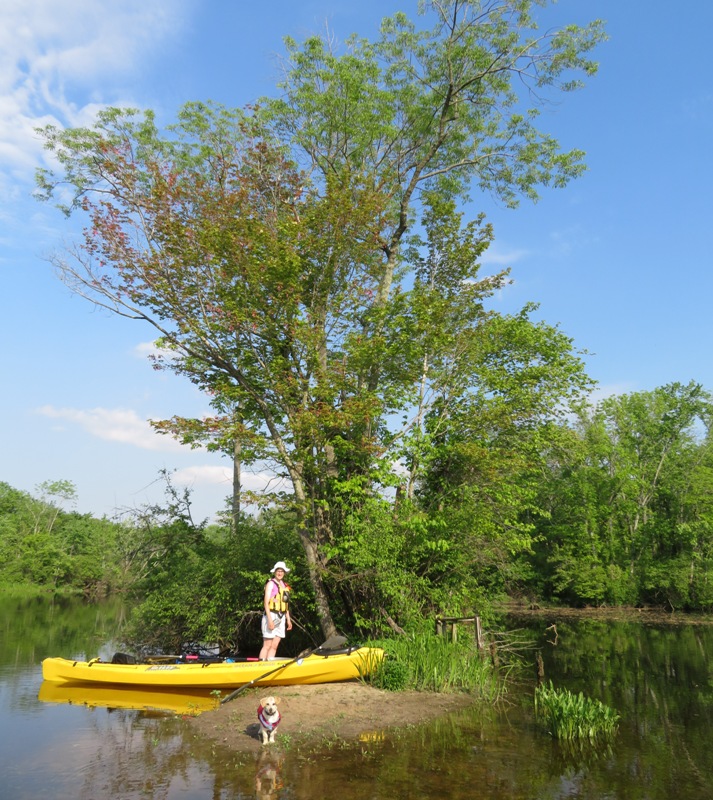
After three hours and ten minutes, we were done. This was by far, Daphne's longest trip and she did just great. We paddled 7.2 miles. Back at the launch site, we saw two guys fishing. As we put the boat away, one fellow caught a 20-inch long channel catfish. 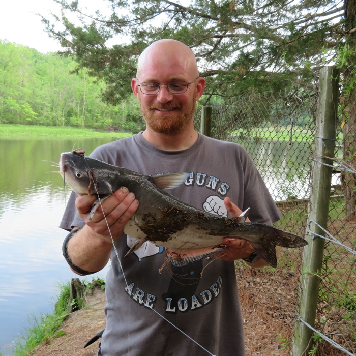
I drove us to the nearby town of Millington. There, we ate at Two Tree. The three of us started sitting outside until a really big storm rolled in. Then we put Daphne in the car and finished our meal inside. The service was incredibly slow though we didn't mind too much because we didn't want to drive in the downpour. Heading home, the rain was sometimes light and sometimes heavy. As we got to Kent Island, traffic slowed considerably. We saw a lighted sign that said the Bay Bridge was closed so I pulled over at the next exit. It turns out high winds tipped a tractor trailer. We waited a few hours until the bridge opened up again. It wasn't all bad. I met a fellow SUP/surf ski guy and we spoke for a long time. I think his name was Ron. Norma, Daphne, and I made it home after midnight. I was plum tuckered. But it was a great day. |
|
Norma, Daphne, and I launched my tandem kayak from Breezy Point Marina and paddled north in the Chesapeake Bay to look for fossils. We've had a LOT of rain over the last week and a half which means cliffs have eroded and put new fossils on the beach.
This was Daphne's first time in big, open water. She fell out once but we quickly fished her out. The water wasn't all that rough but it wasn't flat either. We landed at Roosevelt Cliffs which is about 2.5 miles south of Chespeake Beach and 1.5 miles morth of the launch site. According to "Fossils of Calvert Cliffs" and USGS - Chesapeake Group; Calvert Formation, this area is the principal mollusk-bearing stratum of the Calvert Formation, both in number of species and individuals. Fossils date from the Miocene epoch (5.333 to 23.03 million years ago). In my opinion, Roosevelt Cliffs is the best place to look if you want a LOT of shark teeth. You may not find the biggest, but you'll find the most. I don't know where to look for the biggest. I'm still on the quest for the holy grail...a Carcharocles Megalodon tooth. Below are the favorite shark teeth I found. The serrations on the top tooth lead me to believe it is from a snaggletooth shark. The two on the left below it are from a sand shark because of the nubs on both sides of the main tooth. The two on the right with the "multi-teeth" are from a cow shark. 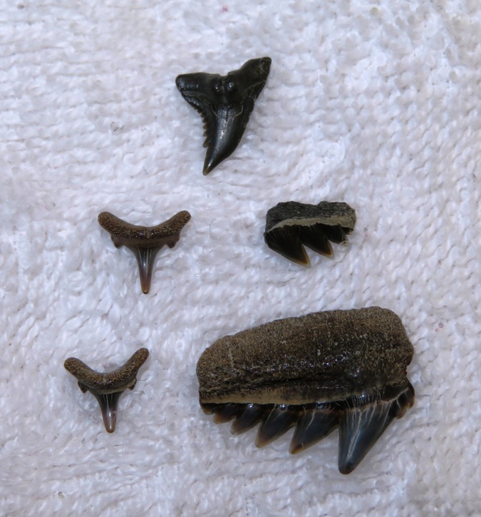
In 2.5 hours, I found 140 shark teeth and 17 fragments of ray dental palates, shown below. But this is not the most I found in one day. On May 14, 2017, in this same area, I found 157 shark teeth and 10 fragments of ray dental palates. That day, I only spent about 90 minutes of searching. 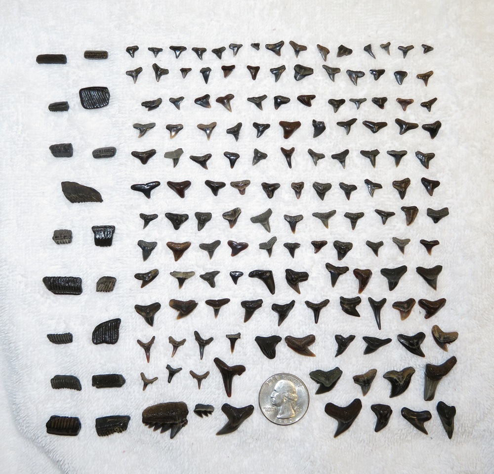
There were a lot of biting black flies. Next time I need to remember to bring bug spray. At least there weren't mosquitos. The water was cool but not cold. I went in for a dip several times. This was Norma's favorite find, an "impression fossil." What is an impression fossil? These fossils contain prints, or impressions, of plants or animals from long ago. The plant or animal lands in mud, silt, or sand and makes an impression. Over time, it disappears, but the impression remains. The mud, silt, or sand hardens into rock, and an impression fossil remains. Homeschool Science Corner - Three Types of Fossils 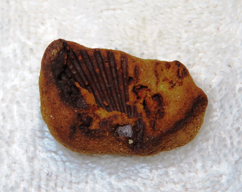
Norma found various shells, rocks, 46 shark teeth, four fragments of ray dental palate, and some Astrhelia palmate coral. 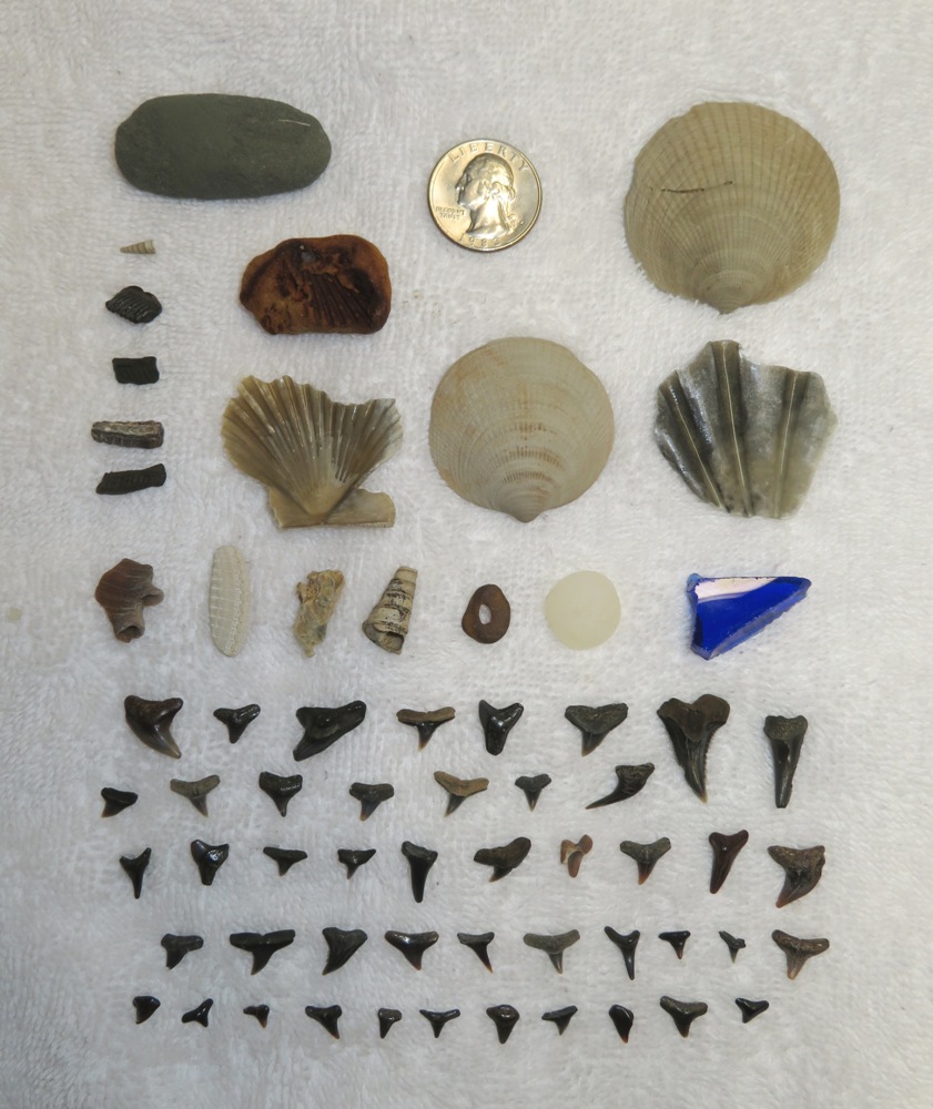
Daphne just likes to dig in the sand. She is just one more contributor to erosion in Maryland. |
|
Sara and I launched from Carrs Wharf. We each brought our dogs. Both were easily transported in Cassi's crate which barely fits in my Subaru Impreza.
We paddled to Flat Island. Daphne was fine with me on the SUP but Cassi was not happy. She jumped out of Sara's kayak and swam to Daphne. Both Sara and I were amazed at how fast Cassi can swim. I pulled Cassi onto the SUP with me. She was much happier with Daphne than Sara. There was a ten mph headwind but it wasn't much further to the island so I figured I'd complete this leg of the trip with both dogs. That was tough because Cassi kept moving around. She's not a small dog so she makes the SUP unstable. She fell off at least once and I had to stop and pull her back on which was easy. She often stood between my legs. That kept her along the centerline of the SUP to make things more stable. To keep my balance, I bent my legs. I was having flashbacks to my old Kenpo Karate days where my sensei would have us stand in a deep square horse stance for what seemed like eternity. Today, all that training was paying off. But I could only bend my knees so far with Cassi under me. 
Eventually we made it to the island and took a short break. Then it was onto Sheephead Cove where we were sheltered from the wind. Some wildlife was out. Sara and I saw a snake swimming. A small fish jumped on my SUP. We also saw an eagle. We headed east to the Smithsonian Environmental Research Center (SERC) and eventually to Muddy Creek but we didn't go up it. We stopped for a break at Railroad Run which connects to Hog Island. Then we started heading back. This time, Sara had both dogs. I got some pics of Sara with the dogs. The four of us pulled over at Big Island which is owned by SERC. I asked Sara if she could get Cassi back into her kayak by herself. Her Old Town Vapor 10 kayak has a pretty high cockpit so we weren't so sure. But she gave it a try and was successful. We paddled up Whitemarsh Creek a little. Sara and I completed 5.8 miles. Back at the launch site, some black vultures waited for us. 
Later that night, Sara checked Cassi's feet and found they are webbed. |
|
I put in a short day at work and then went exploring. There were some places to investigate that have been on my list for about a year so I figured it was finally time to get around to checking them out.
The first was Hancock's Resolution. This is a nice historic area that connects to the north side of Bodkin Creek. Bodkin Creek has always been rather elusive. I only knew of one launch site and it was not public. So I never spent much time out there. I won't describe the launch sites too much here because I describe them in my link above. I think I found the west and definitely the east takeouts. The latter, marked by a bamboo grove, is where you should land if you want to go look around at Hancock's Resolution. Next, I drove to Downs Memorial Park. It is near Hancock's Resolution as the crow flies but it took longer to drive there than I expected. I was aware of the launch site on the Chesapeake Bay side but I had never seen the new one on Bodkin Creek until today. This launch site, called Locust Cove is very nice. I launched my SUP from here. 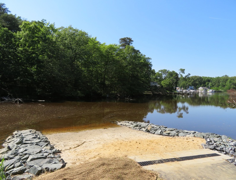
I paddled out until I could see Hancock's Resolution. As I looked behind me, I saw a fellow on a SUP. He was going pretty fast and he appeared to be following me. I stopped and let him catch up. His name is Craig (or Greg?). He remembered me from the one and only SUP race I did on August 2, 2014. He was also familiar with my website. I said I was heading out into the Bay and said he could join me, which he did. I was wanting to investigate what all was between Bodkin Creek and Fort Smallwood Park. I've paddled between the two before but never really explored things thoroughly. At Atlantic Marina Resort, Craig decided to return. I continued to the Fort. I reached my destination and then headed back. Except for the harbor at Atlantic Marina Resort, I wasn't seeing anything except shoreline. Nothing to explore. But once I got home, I noticed I overlooked a few things. In particular, I think I could have seen more interesting things had I checked out Boyd Pond at 39.143276, -76.452467 and Hines Pond at 39.154870, -76.471033. Their entrances are easy to miss. Maybe next time. Back in the Bodkin, I saw an eagle and a great blue heron. The latter was eating a big catfish at Ashlar Pond, a tributary of Bodkin Creek. You'd think with all that extra weight, the bird wouldn't be able to fly but it did, only a minute or so after devouring its meal. The sun was low as I returned to the launch site. 
I completed 10.75 miles. |
|
Today would be my fourth time on the water in one week. All that rain we had the previous week was making me feel a little cooped up so I was more than eager to get out again and again.
This was the first day of Memorial Day weekend. I can't remember the last time I had the whole weekend to myself. In previous years, I spent time with Norma and her family (not that I'm complaining). Being wifeless and dogless for the weekend meant I had time to do a long trip...one where I would not want to bring either Norma or Daphne. I spent the previous day resting up, staying on land, and building things so that Norma and I could carry Daphne on the boats more easily, giving her stable footing. I went to bed early and then got up at 0410 to beat the traffic and the rain. I wasn't sure if I wanted to paddle my surf ski or SUP so I brought both. Where I was going, there was a slight chance of rain and thunder at noon with a 5-9 mph southwest wind. High tide would be at 0938. I was doing a bucket list trip...one I had read about last year that sounded interesting. It was a totally unfamiliar area. You can read about it in my Fort Delaware State Park Notes. It involved starting in Delaware and paddling to New Jersey, visiting three forts along the way. I would do an island circumnavigation. There would be some big open water crossing though nothing too far. One would be across a busy shipping channel. My main concern was the tide. In the Chesapeake Bay, a two foot tidal difference is pretty common. But where I would be, it would be six feet! Compared to Maine, this is small, but it was still something to consider. At 0700, I launched my SUP at the Delaware City Boat Launch. Why the SUP? Looking at the debris moving slowly on the water, I figured dealing with the tide wouldn't be too difficult and the wind was pretty calm. It was supposed to get calmer later in the morning. The SUP is slower but I can take better photos because I am standing and it is more maneuverable than the surf ski. I knew there would be rip rap around at least one of the forts so standing would give me a better view over them. I made my way out the northeast end of Delaware City Branch Channel. Then I paddled north (upstream) on the Delaware River in Delaware. I passed by Delaware City and then a big ship that seemed to glow in the morning sun. I had some flexibility in my schedule since the main route wasn't too far. So I was in no rush and wanting to see anything interesting. I had some help from the tide on the first leg of my trip but it wasn't noticeable. I only went as far north as Cedar Creek at Reybold Cove. Looking in the mouth, it didn't appear very scenic. No trees...just grasses. I crossed the west side of the Delaware River and paddled to the north end of Pea Patch Island. How did this one-mile long island get its name? The island emerged as a mud bank in the river in the 18th century. According to folklore, the island received its name after a ship full of peas ran aground on it, spilling its contents and leading to a growth of the plant on the island. - from "Wikipedia - Pea Patch Island" (broken link as of 2025) The island is not a place to stop and explore. There are signs that read "Pea Patch Island Nature Preserve, closed no entry." So I just stayed on my SUP, doing a clockwise circumnavigation. Paddling south, I saw a lot of great blue herons. I figured a rookery was somewhere on the island but with the trees thick with leaves, I would not be able to see it. But hear it, I could. The young had hatched and were hungry. Turn up your speakers and listen to the video I recorded by clicking on the image below. 
While I couldn't very well see the nests, I did have a good view of some of the birds in the morning sun. 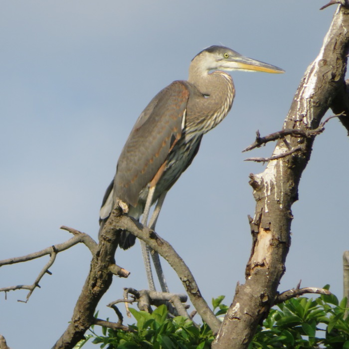
After I got home, I noticed all the grey dots in the trees in a satellite photo of the area at 39.595582, -75.574440. These are the nests. 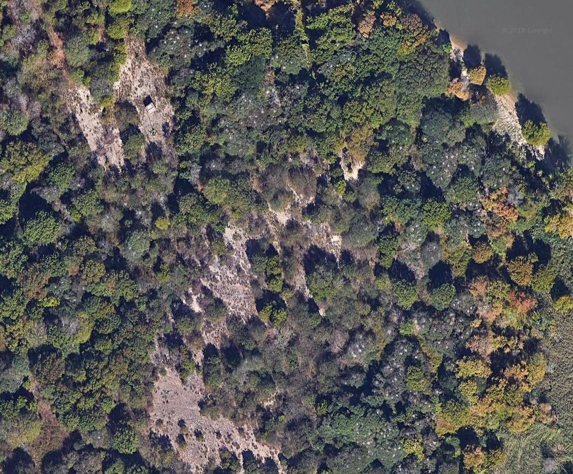
I read ...the island provides a significant wetlands stop for migratory birds. It is the location of the largest colony of herons in the U.S. north of Florida. - from "Wikipedia - Pea Patch Island" (broken link as of 2025) On the southern half of the island, I could see Fort Delaware. I had actually been there once before for a tour with my parents on May 24, 2009. Fort Delaware, the Union fortress dating back to 1859, once housed Confederate prisoners of war. It was originally built to protect the ports of Wilmington and Philadelphia. - from Delaware State Parks - Fort Delaware State Park 
As I approached the south end of the island, the effects of the flood tide were felt and my pace slowed to a crawl. Had I stayed further away from the island, it wouldn't have been so bad but I wanted a good view of the fort. I found a break in the rip rap and did a quick landing...just long enough to go ashore (an amphibious landing) and snap a picture. I was no longer in the nature preserve. 
I saw the first of three bald eagles. 
Making my way north on the west side of the island, I saw this large metal cylinder. It was about ten feet long. Anyone know what it could be? 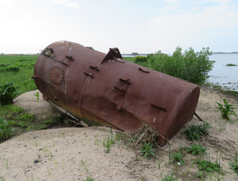
Satellite photos show several waterways that flow into the island on the west side. But I didn't find any to be significant enough to warrant exploration. Back at the northern part of the island, I proceeded to cross over to New Jersey. But I had to wait for a large cargo ship to pass. The area between the island and New Jersey is a busy shipping channel. I passed Finns Point where a military fortification was built (but never finished) in 1872. I saw nothing interesting there. My next stop was Fort Mott. Fort Mott was part of a coastal defense system designed for the Delaware River in the late 1800s. The fortifications seen today at Fort Mott were erected in 1896 in anticipation of the Spanish-American War. - from Fort Mott State Park I saw no signs that said I couldn't land so I did, at a very small beach just north of the pier where the ferry lands. I then explored on land. I came across earthenworks built to house magazines which store munitions. 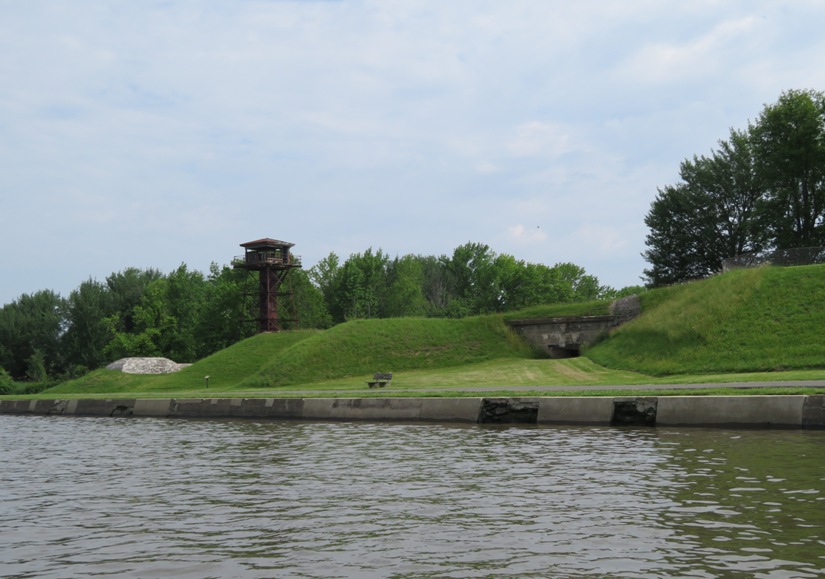
This is Battery Control Station Number Two. This 55-foot tall steel tower was built in 1902. It was used to help direct fire for the 12-inch guns. 
Battery Gregg was comprised of two five-inch rapid fire guns, mounted in 1906. 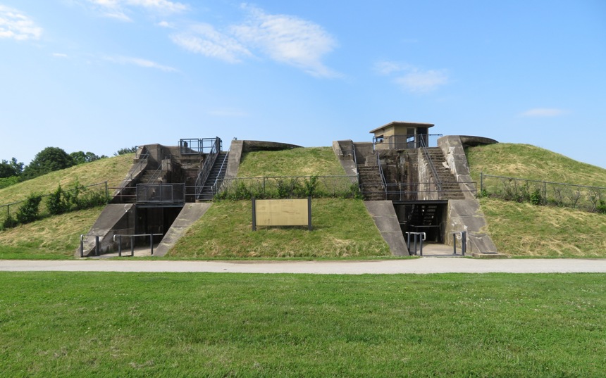
After checking the weather, I realized I had some time before things turned bad so I paddled south to explore the Supawna Meadows National Wildlife Refuge. I figured it must be good since "SUP" is the first half of "Supawna." I explored the creek just upstream of Mill Creek. It was not interesting. I paddled east for at least a mile and a half and explored some of its tributaries. It was almost entirely grasslands. Very little vegetative diversity and no shade. It didn't take long before it all looked the same. 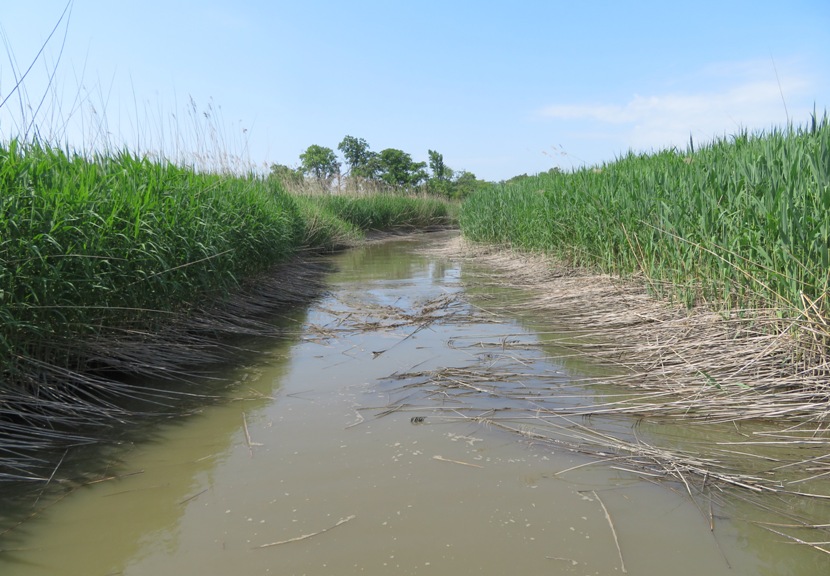
I did, however, see a couple of yellow iris plants in bloom. I was told they are invasive but also good for pollinating insects and water quality improvements. 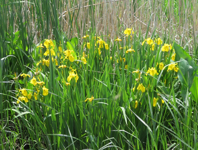
This area reminded me a little of the Chesapeake Bay area much further south than Annapolis. I think the salinity of the water is higher so the vegetation is more suited for grasses. I didn't see much in terms of wildlife which seemed unusual considering this is a refuge. I wondered if there might be a lot of pollution from New York and New Jersey. When I got home, I did a web search and learned The Delaware River, running along the western border of New Jersey and providing drinking water to millions in the Garden State, is the fifth most-polluted river in the country, according to a report released Wednesday [article is from April 2012] by Environment New Jersey, a nonprofit environmental activist group. Most of the 6.7 million pounds of toxic chemicals estimated to have been released into the Delaware in 2010 are due to the DuPont Chambers Works in Salem County, which is legally permitted to emit 5.3 million pounds of effluent into the watershed, says the report, which relies on federal Environmental Protection Agency data. - from Delaware River is 5th most polluted river in U.S., environmental group says Despite not seeing much wildlife I did managed to see several dozen fiddler crabs. The large claw means this one is a male. He's also a southpaw, like me! 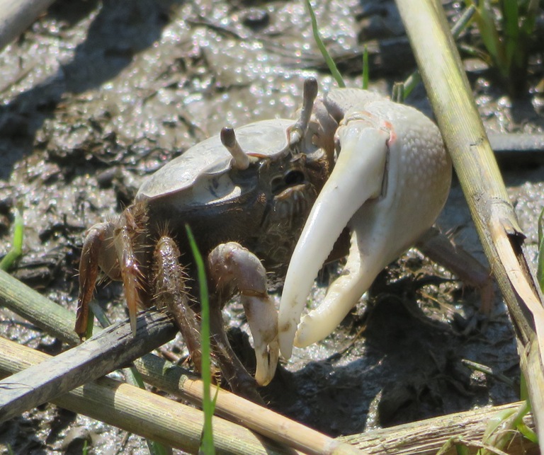
Back in the Delaware River, I continued downstream. I saw various concrete structures. I don't know what they were. Some were square and some were cylinder-shaped. Maybe they were once the support for something. 
I made it to the mouth of Mill Creek. Looking in, it looked like a wider version of the creek I had just explored. So I decided not to venture up. I paddled back to Pea Patch Island and then to a small peninsula at the end of Wilmington Avenue. Then I paddled upstream back to Delaware City. I tied up my SUP at a public floating dock on the west side of the Delaware City Branch Channel and then set out on foot into the city. I stopped at an ice cream shop and had a scoop of delicious black cherry ice cream on a waffle cone. 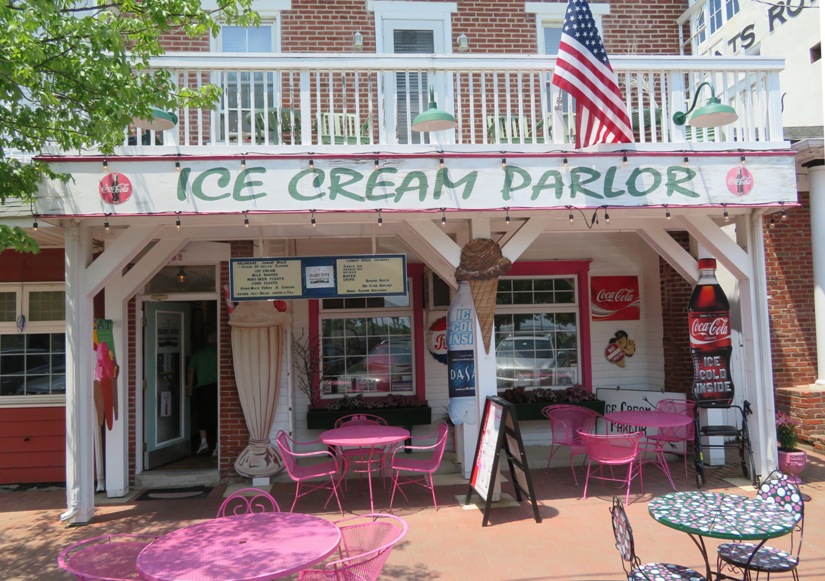
I spoke to someone at the Fort Delaware State Park information area. I asked about Fort Dupont. He pointed out some raised earth structures on the other side of the Channel that was used as part of the defense for the fort. He mentioned other things I could look for as I paddled down the Channel but I never saw them. But I paddled right by the place. I paddled to the south end of the Channel where it flowed into the 14-mile long Chesapeake And Delaware Canal. I was told kayakers were not allowed here but I saw no signs to indicate this. I did see folks on jet skis. From what little I saw, the Canal did not look interesting. I went ashore to take a look at the Michael N. Castle Trail. This is a place I'd like to bike with Norma and Daphne in the autumn. Maybe also do a side trip to Lums Pond State Park. The northeastern terminus is next to Kathy's Crab House at 107 5th Street in Delaware City. The Michael Castle Trail & Ben Cardin Recreational Trail are paved pathways that create a 14.2-mile long trail that follows the north bank of the Chesapeake & Delaware Canal in Northern Delaware. The trails connect Chesapeake City in Maryland to Delaware City along the Delaware River. The Ben Cardin Recreational Trail is 1.8-miles long and is the Maryland portion of this trail system. The Michael Castle Trail is the 12.4-mile long section of the canal trail located in the State of Delaware. The east end of the Michael Castle Trail meets up with the trails in Delaware City that continue for another 0.6-miles along the canal and reach to Fort Delaware State Park on the Delaware River. - from "Walk Ride USA - Michael Castle Trail & Ben Cardin Recreational Trail, C&D Canal, Delaware" 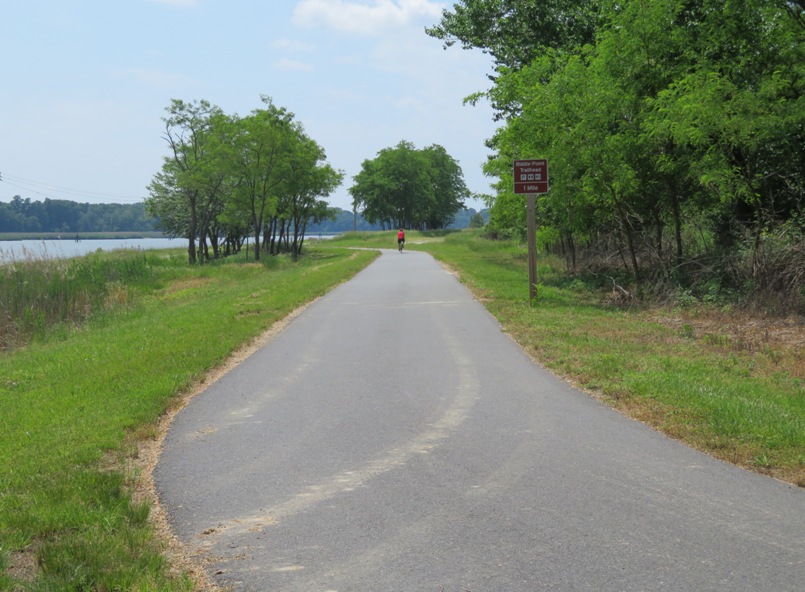
After 7.5 hours, I paddled 21 miles and got in more exploring than I could shake a stick at...if that makes sense. I should have taken the surf ski. There were a lot of boring places that I would have liked to have crossed more quickly. On the drive home, I encountered a torrential downpour. Traffic was bad (but not terrible) and there was an awful accident. I think I would have been safer on the water. |
|
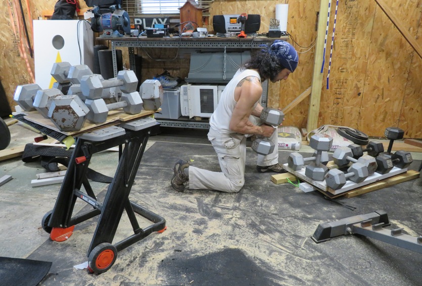
Am I playing dumbbell Jenga? No, actually I'm building something for Daphne. Having lived on a boat for two years, I realize the importance of having good footing. So I am making dog standing platforms that will go on two of my kayaks and SUP. Each will have rubber matting with traction. I'm using contact cement to glue the matting to the platforms. The dumbbells provide pressure to ensure the glue holds firm. This will ensure she is comfortable and secure when she joins us for our aquatic outings.
|
|
Yesterday Ellicott City flooded...again. The last flood was July 30, 2016.
The National Weather Service received a gauge report of 8.4 inches in Ellicott City. The 2016 Ellicott City cloudburst was deemed a "thousand-year rain event" in terms of the probability of recurrence. That an event of this magnitude unfolded in the same spot, two years later, is what it is, and statistics be damned. - from Washington Post - The second 1,000-year rainstorm in two years engulfed Ellicott City. Here's how it happened. Some people said all the development in Howard County means there is significantly less land that the rainfall can permeate. So instead, the water rushes downhill, eroding the landscape and filling the Patapsco River to flood level. I don't know if either flood would have been prevented if development had not taken place. But it is ironic that at this time of flooding, many of the residents of Savage were against a proposed development in a wooded historic section of our town along the Little Patuxent River. Perhaps our politicians should consider the destruction of the Ellicott City floods before allowing our woods to be cut down for development. Just my opinion. I took my surf ski out on May 28, 2018. I was going to launch at Broening Park but there was too much trash and debris. 
Instead, I launched from Southwest Area Park. I estimate the flow averaged 3-4 mph. Water looked about 16" higher than normal. I flipped my boat when I hit some large debris floating downstream that was just below the surface. It forced the bow of my surf ski out of the water, causing me to lose my balance. I paddled 5.4 miles upstream and then back down for a total of 10.8 miles. I made it just past highway 195. I saw Joe, a fellow who remembered me from a trash cleanup. He said he follows my blog. He made it up to route 1 and could have kept going. I didn't remember him. My max speed going downstream was 9.8 mph though I wasn't trying to max out. The next day, I was told that people should stay out of the Patapsco River due to sewage overflow. |
|
I last paddled at White Rocks on May 9, 2018. I showed Norma photos from this trip and she expressed interest in seeing it. So I decided to return with her and Daphne.
We launched from the boat ramp shown below at Fort Smallwood Park. From here, we could see the rocks, about 0.6 mile away. 
First, we paddled south to White Pond. It is really more of a cove. Daphne was standing on the new dog platform I made for her which has grippy rubber traction. I made three, all different. Two for kayaks and one for my SUP. 
Next we continued south to Yates Pond which really is a pond. We had to do a minor portage to get there. The water was black. Here, I saw more dragonflies than I'd ever seen along with some birdlife. I plan to return when the hibiscus flowers bloom. This is a good area to paddle with a dog since there are plenty of places to go ashore. Daphne loves to dig in the sand. I don't think she's looking for anything in particular. She just likes the way it feels on her toes. 
The three of us paddled into Rock Creek and explored Tar Cove. Kayaking north, we headed over to White Rocks. The water was still high from all the heavy rain that flooded historic Ellicott City (on May 27, 2018). For the first time ever, I landed at the rocks! Daphne was feeling a little insecure on the return trip because of the wave action. They weren't big waves but certainly enough to make her unbalanced. White Rocks is out in the open and even with a light wind, there will often be waves. After loading up the boat, we walked around the park until dusk. |
|
On June 8-10, 2018, Norma, Daphne, and I camped at New Germany State Park with her family.
Norma planned this trip a few months ago. She went out of her way to accommodate her friends so they would join us. But the weather forecast called for a chance of rain so her friends bailed. We were both very disappointed. We spend much of our time gathered at the campsite of Joyce and Jimmy. They were there with their two kids. Present just for Friday was Norma's sister, Laah, and her two children. Daphne slept with us in our Marmot Limelight 3P tent. Our site was in the dog-friendly Hemlock Loop. This was our first time using this tent on a camping trip and it was also Daphne's first time camping. 
Usually, when I go to Garrett County, I don't bother with bug spray. But here, I got several bites. We saw two snakes hiding in the rocks along with one swimming in the lake. On June 9, after a short hike with the kids, I paddled my SUP in New Germany Lake, launching on the beach section between the dam and the swim area. The lake is scenic and small. Daphne joined me on the SUP and stood on the new rubber mat platform I made for her so she would have more room in front of me. But often she preferred to stand on the hard, smooth section in front of the platform. Norma and Jimmy rented kayaks. Jimmy got a tandem, hoping one of his daughters would join him but they preferred to play at the beach with several other children. Near the shallow northeast side of the lake where Poplar Lick Run flows into it, I saw several Eastern Newts. 
Joyce paddled for awhile. In the pic below, she approaches the boat ramp near the overflow lot by site 39. The most unusual feature of the pond were the craters dug by fish to lay their eggs. The lake held a plethora of fish. I was told bluegills and sunfish do this. 
Jimmy tried my SUP and paddled to other end of pond. He did fine. Despite predictions of rain, it didn't rain at all on Friday or Saturday. On Sunday, it didn't start raining until our tent was packed. But it did rain prety hard on the drive home. |
|
On June 12, 2018 and June 13, 2018, I took Cousin Steve kayaking in Baltimore and Tuckahoe Creek, respectively.
|
|
Norma and I were both exhausted after very busy weeks. But today was a day of near perfect weather that we didn't want to let slip through our fingers. So I planned an easy day.
The two of us took Daphne and walked the short wooded trails in Kings Landing Park in Calvert County for about an hour. Next, we launched from the west side of the park near the pier. 
This put us on the Patuxent River. After paddling upstream for about two-thirds of a mile, we were on Cocktown Creek. We paddled this up as far as we could go. Here, we saw no people, boats, or buildings. Just lots of nature. Unlike some creeks where you have to paddle upstream for awhile before it becomes very scenic, this one was beautiful from the start. It is bordered by the park to the south and the Patuxent River Natural Resource Management Area to the north. A few days ago, I cut some plywood to fit Norma's kayak and then glued on a rubber mat to make a standing platform for Daphne. Despite this, she chose to stand on the smooth plastic near the bow of the boat. 
We had about seven muskrat encounters. I don't think I've ever seen so many in such a small area. 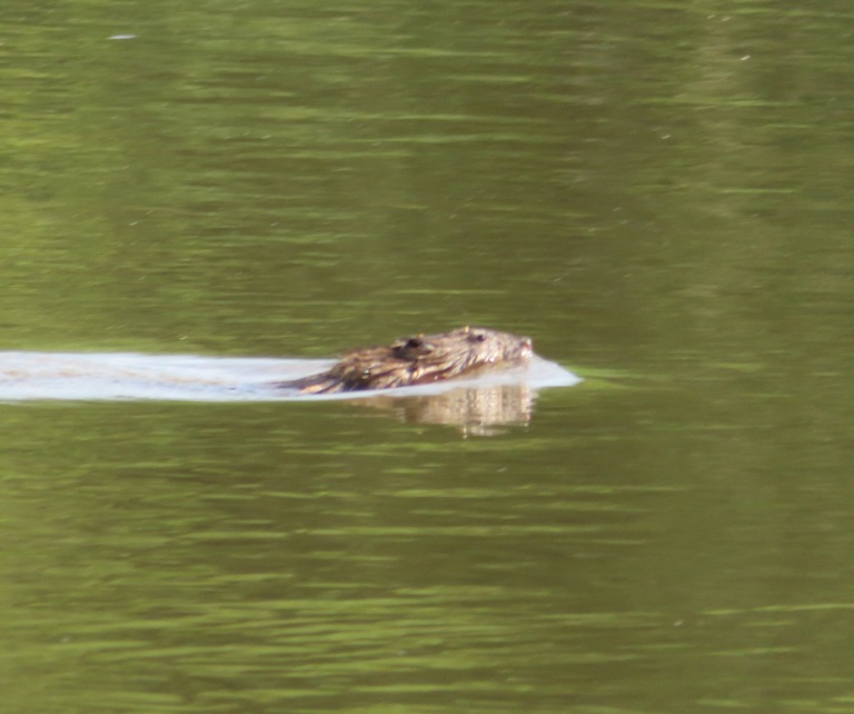
At several places along the creek, we heard lot of frogs making noise. Turn up your speakers and then click on the image below to play a recording. 
Daphne fell into the water when she tried to go from SUP to kayak as the two watercraft separated. There are only two places to go ashore in this area. One is the boardwalk which leads to the park. The other is just north of the mouth at 38.630472, -76.680073. Unfortunately, we didn't find this until too late. Daphne peed on my SUP. But I'm surprised it took this long for her to do that. We paddled 4.6 miles. I think this is an excellent beginner trip because of the easy launch, protected waters, and great scenery. I was feeling like I was catching a cold so I slept on the way back while Norma drove. |
|
I launched my surf ski at Green Haven Wharf. The first day of summer was June 21 and the water was getting warm. But near the shore, it was cold because fresh spring water flowed from the beach at low tide.
From Stony Creek, I paddled out into the Chesapeake Bay and then turned northwest. Things can get a little hairy there because it is a very exposed area where waves rebound off a wall. I paddled towards an industrial area and then into Cox Creek which I explored fully. I've only been to Cox Creek once before. Near 39.175480, -76.528934, I saw a lot of black-crowned night herons. I pulled over for a break on Cox Creek. Here's some bird footprints on the beach with my surf ski in the background. 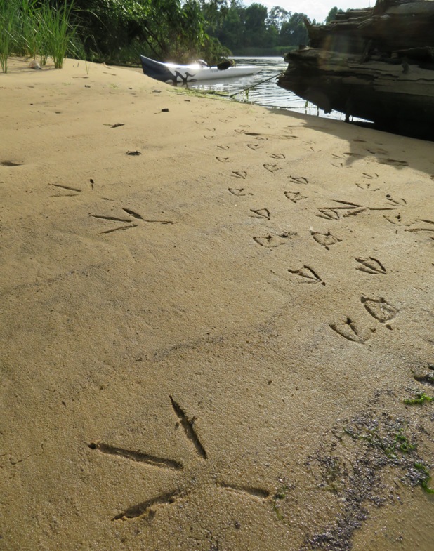
On the return trip, I got mooned by some ducks in Stony Creek. How embarrassing! 
I saw a couple of black-crowned night herons near the mouth of Stony Creek. 
I don't see black-crowned night herons very often. If I do see one, that is one more than I usually see in a day. But today I had about eight encounters. 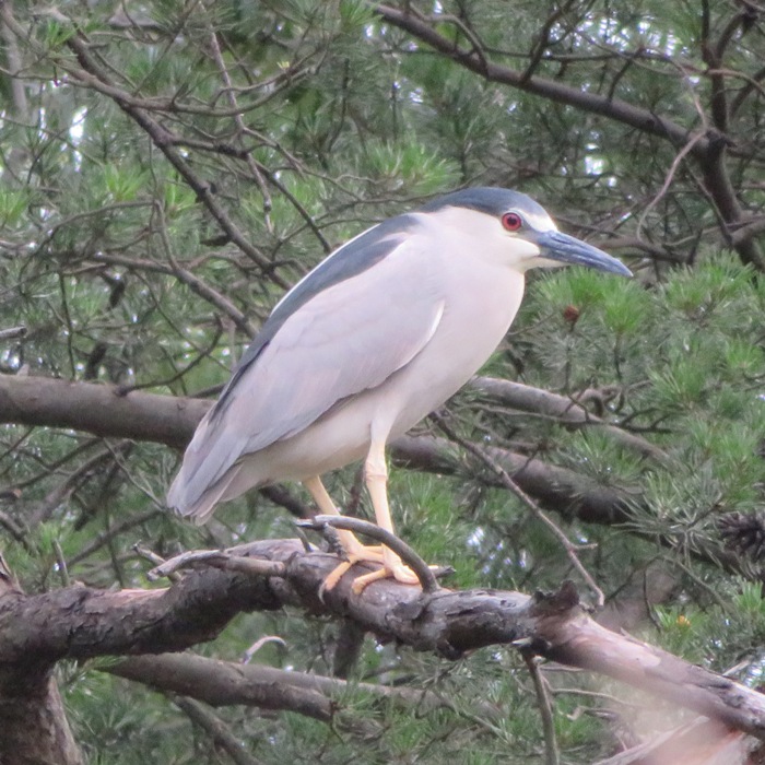
The wind was pushing me back. I caught a few boat wakes and managed to hit some pretty high speeds. I saw a LOT of people out enjoying the warm summer day. It wasn't too hot. It wasn't all that sunny either but the kids hadn't been out from school very long either so they were really happy being outside. I had a good day seeing the black-crowned night herons. I decided to look at more wildlife...but this time in my backyard. I made this video of a firefly on my finger. Click on the image to play it. 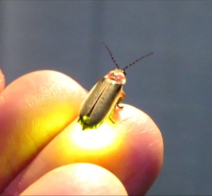
|
|
I've gotten really good at picking the right time and place to look for shark teeth and rays. I am still refining the latter but every year I get better. Here is what I look for.
Today was a great day to see rays. It wasn't perfect but it was pretty close. In the mid-morning and early afternoon, the wind would be around two mph at Tilghman Island. Such calm wind doesn't happen very often out here where the Chesapeake Bay is about 11 miles wide. I left the house at 0650 and got caught in a traffic jam just before the Chesapeake Bay Bridge. I think if one can plan to be at the bridge by 0650, things should be fine during the summer. I was last here on September 15, 2017. Back then, I saw at least 60 rays. Today, I saw more and they were much larger. Mating takes place in June or July each summer. After mating, male cownose rays leave the Bay while females stay until October. - from Chesapeake Bay Program - Cownose Ray That trip in 2017 was a 15-miler. I launched from Dogwood Harbor back then. Recently, I purchased the Tilghman Island and the Bay Hundred Water Trails map which told me about two launch sites that would put me almost four miles closer to my destination. I first checked out Black Walnut Cove. This is a terrible place to launch. It was clearly designed to be only a fishing pier without any thought being given to launching a kayak. 
Next, I checked out Bar Neck Landing which is where I ended up launching. It is a tiny speck of land where the county found room to put a floating dock and two parking spaces (barely). So plan to arrive early if you want to get a spot. Also have a backup plan if you don't. 
I spoke to two bicyclists from upstate New York staying at St. Michaels. Their names are Clair and Tom (I think). I'm not very good with people but I am pretty confident on the water and I think this confidence carries over socially in the right environment. I launched at 0940. The two mph wind was supposed to start at 1000 so I was in no rush. The high temperature was supposed to be around 90. I saw about a dozen rays near Blackwater Point, the southern tip of Tilghman Island. Here is it three to five-feet deep. I paddled out to Sharps Island Lighthouse. It roughly marks the spot that was once known as Sharps Island. Farms, forests and orchards covered the former island whose landmass once measured more than 900 acres. The last remnant of the island washed away in the 1950s and now only the lighthouse remains. The lighthouse was constructed in 1882 to warn travelers of the hazardous shoals at the mouth of the Choptank [River]. Moving ice knocked it askew when the Chesapeake Bay began to thaw after freezing solid in the winter of 1977. The light leans about 15 degrees. - from Tilghman Island and the Bay Hundred Water Trails map I saw plenty of rays along the way but I didn't bother to photograph them unless they were in a school or swimming near the surface. Most were singletons or couples that dived down when they got near me. If I did find a school, it wasn't larger than five. Last year, I saw some as large as twelve. The rays last year were smaller so when they were in a school, I could get more in a single photo. The reason for the size difference is because today there are males (which tend to be larger) whereas last year in September, the males had already left the Bay. I could get more rays in a photo if I were taller but I can't do anything about that. High tide was 0559. Low tide 1322. I saw a few very small rays (14" wingspan) but many were big, ~three feet across. The former were likely born in mid-June. Lots of needlefish were swimming about. I saw no jellyfish. I approached the lighthouse. From Tilghman Island, it is far away but easy to spot because it is the only crooked thing sticking out of the water. 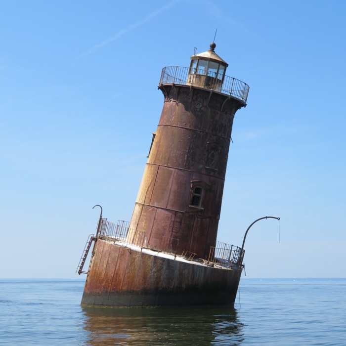
This ray swims by flapping its fins like a bird. As it swims, the tips of the fins break the surface and can look like shark fins. Many "shark" sightings in the Bay are actually cownose rays. - from Chesapeake Bay Program - Cownose Ray 
The cownose ray's kite-shaped body has a wingspan of up to three feet and can weigh as much as 50 pounds. 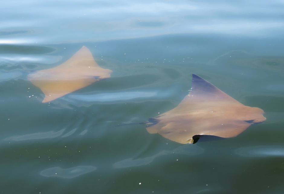
Cownose rays are opportunistic feeders, eating whatever is available. In the Chesapeake Bay, they eat mostly softshell clams, macoma clams and razor clams, but they will eat oysters and hard clams when available. 
The cownose ray is sometimes called a "doublehead" because of the indentation around its snout. - from Chesapeake Bay Program - Cownose Ray 
The tips of their kite-shaped bodies slice the surface like shark fins. But they are not sharks - they are members of the same ancient family of fish with cartilage skeletons and sandpapery skin. 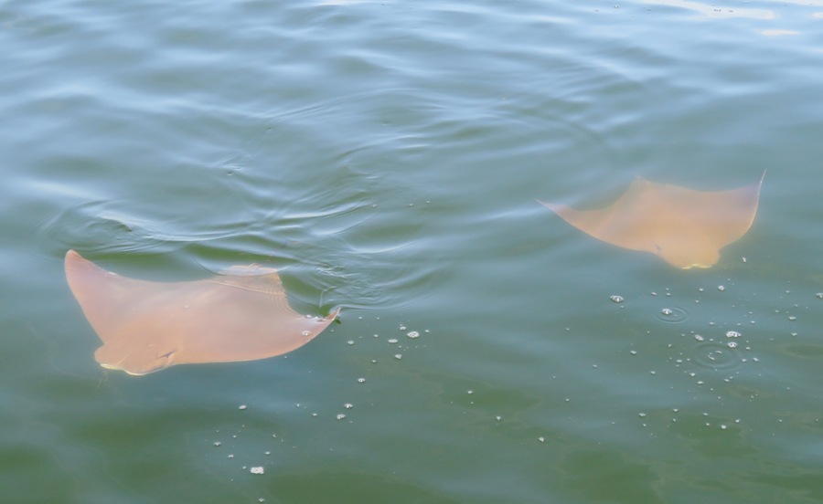
The [cownose ray] name comes from their almost bovine snouts, beneath which are slit-like mouths that vacuum up clams, crabs, oysters, and other hors d'oeuvres on the Bay's bottom. 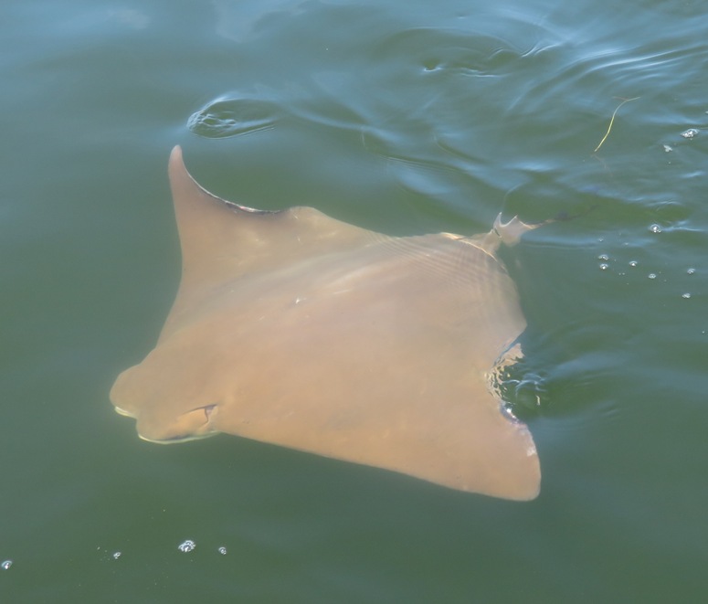
...they reproduce slowly. Rays take six to eight years to mature, and females give birth to only one pup each year. - from "Chesapeake Bay Foundation - Cownose Ray, Misunderstood" (broken link as of 2025) 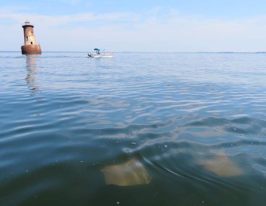
I approached some boaters and asked them to take my photo in front of the lighthouse. They, along with Clair and Tom, told me about big pods of dolphin in the area which had been seen in the early morning. I think a lot of animals (rays, included) are not as active in the middle of the day. I'm very confident on my SUP in fairly calm water and light wind. If I wasn't, I wouldn't be out there three miles from shore surrounded by these potentially dangerous (but non-aggressive) animals. You don't want to fall in and startle a cownose ray because they ...have venomous spines at the base of their tails. Captain John Smith learned about the cownose ray's spine the hard way. During his 1608 voyage he was stung so severely that his crew thought he was going to die. - from Chesapeake Bay Program - Cownose Ray Also, don't forget that a ray is what killed Steve Irwin, the Crocodile Hunter. According to the incident's only witness, "All of a sudden [the stingray] propped on its front and started stabbing wildly with its tail. Hundreds of strikes in a few seconds." - from Wikipedia - Steve Irwin, Death I spent a lot of time near the lighthouse where the water depth is roughly 9-10 feet and gets as shallow as three feet about a half mile east by northeast. While in the vicinity, I ate snacks in the shade of the lighthouse and looked at the light, which I'm guessing no longer works. The fourth-order Fresnel lens was replaced with a 9.8-inch (250 mm) lens in 1977. - from Wikipedia - Sharps Island Light 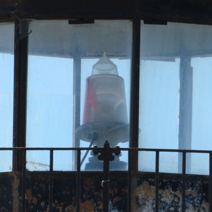
The whole time, I saw no other kayaks or SUPs. Most of the time, it was just me and the rays. 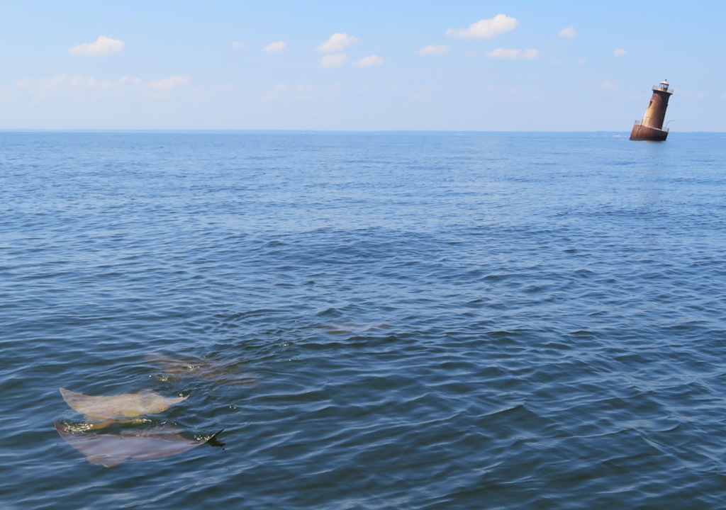
On the return trip, I did not see as many rays...probably because it was midday. I spent some time exploring the shallow Black Walnut Cove. I could often see the bottom clearly. I was hoping to find lots of critters but only found two terrapins, an eagle, and a couple of rays, one of which appeared to be sleeping. I finished at 1340, having paddled 10.6 miles. I saw 101 rays over four hours. I assume all were cownose rays though some could have been other types or possibly skates. On the drive home, I pulled over at a park and ride for a 15 minute nap. It was light traffic going home. By 1400, traffic heading east (the other direction) was backed up ~3.5 miles before the Bay Bridge. That's the price I pay for sleeping in. Looking at photos at home, I thought it was interesting how nature sometimes mimics itself. On the left is a ray while on the right is a luna moth provided by Pics4Learning. 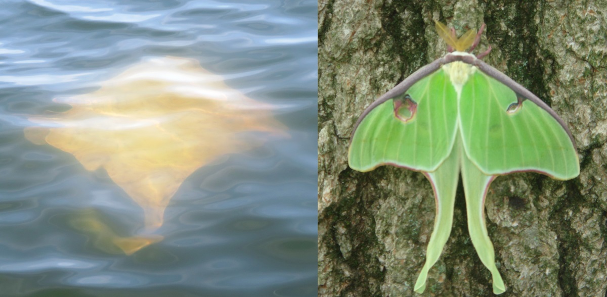
I might return in the fall to look for rays. What might I do next year? Maybe I'll invest in a drone with a camera so I can get better overhead views. Wouldn't that be something? |
|
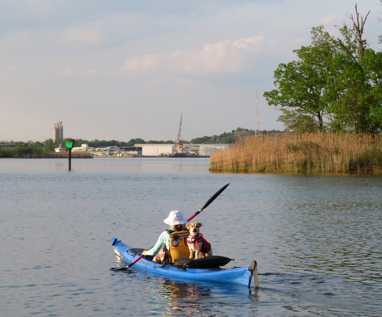
On Independence Day, I got together with Sara, her daughter Samantha (Sam), their dog Cassi, Norma, and Daphne for some fun on the eastern shore of Maryland.
I expected a lot of traffic that morning so we left early, around 0600, and crossed the Chesapeake Bay Bridge without any problems. Our first stop was Centreville where we took the dogs for a nice walk in Millstream Park. The very scenic trail runs along the uppermost section of the Corsica River. This wasn't just a chance for me to stretch my legs before kayaking. I was also there to scout things out for a return visit on the Corsica River Water Trails. I took note of the park's launch site. 
The trail had some great views of the river. 
My only complaint was that it was too short...the trail, not the river. It led us into town where we saw the Centreville Public Landing. This is near the confluence of the Corsica River and Yellow Bank Stream. 
We walked around town a bit and passed by Doc's Riverside Grille which has outdoor seating and therefore might be dog-friendly. But they were closed for the holiday. We returned to the cars, having walked only about 2-2.5 miles. Next, we drove to Millington and unloaded the boats at Millington Waterfront Park. The view of the Chester River here is pretty awesome. 
Then we drove to Shadding Reach where we left one car and then returned to Millington. There are a few places you can launch a boat at Millington Waterfront Park. The best is mediocre. We launched from a narrow, somewhat steep path that leads to the water. 
This trip was a follow-up of the one that Norma and I did on May 13, 2018. Back then, we started from Shadding Reach and paddled upstream, never making it to Millington. Today we started by paddling upstream as far as we could on the Chester River. It was extremely scenic. It was also a good place to spend a hot summer day. The river was narrow and tree-lined, providing us with shade if we wanted it. Had we been on land, we would have been hot, but here on the Chester, we were comfortable. Those of us that wanted to cool off even more went for a swim. At first, this was just Cassi who enjoyed swimming from boat to boat. We spent at least a half hour exploring upstream from the park. Making our way downstream, Sam paddled in the front of my tandem kayak with Norma behind. There were a few obstacles like this fallen tree. We think there was some poison ivy on it. I didn't suffer any effects but Norma says she did. 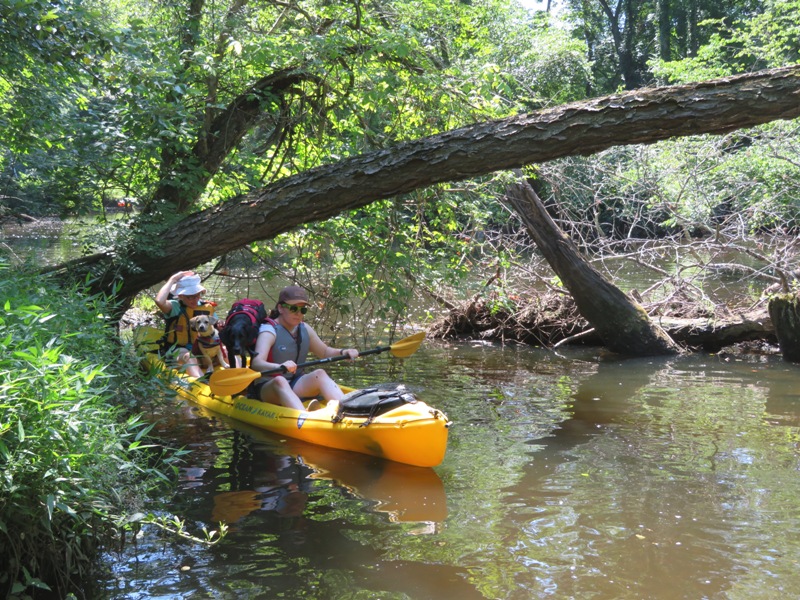
The shortest distance between the two launch sites is only three miles. But we paddled upstream for about 0.4 mile to make it a little longer. I also removed some downed trees so we could paddle a much longer route south of an unnamed island at 39.257151, -75.845804. This was totally worth it! We paddled under some old railroad bridges. 
At various times, we each had one or both dogs. Cassi is quite comfortable in the water while Daphne is not. Sometimes they would both stand on the SUP. Then Cassi would jump off with so much force that I would fall onto the SUP and Daphne would fall into the water. But I could retrieve Daphne pretty quickly. 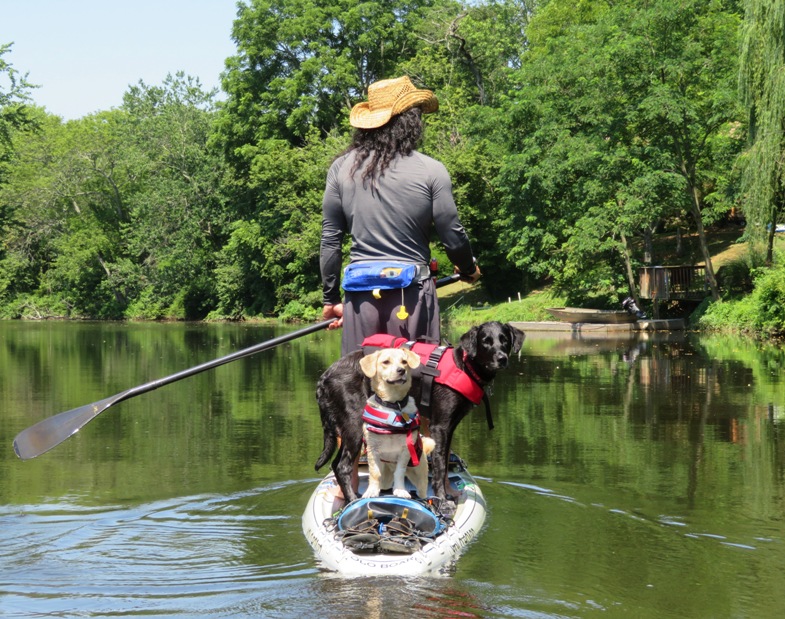
Sara's Old Town Vapor 10 kayak is good for hauling dogs. There was some wind which would have slowed me down in open water but with all the trees, I hardly felt it on the SUP. 
Which boat do the dogs prefer? I don't know. The walls of Sara's boat probably makes Daphne feel more secure but the SUP gives them the most space to move around. If you like lush greenery, this is a great place to paddle. The main drawback is there aren't many places one can land. I think the dogs would have preferred to have spent a little more time on dry land. I was planning to stop at one of the islands I landed at on my last visit but this area is tidal. High tide was around 1330 and the beaches at these islands were now submerged. 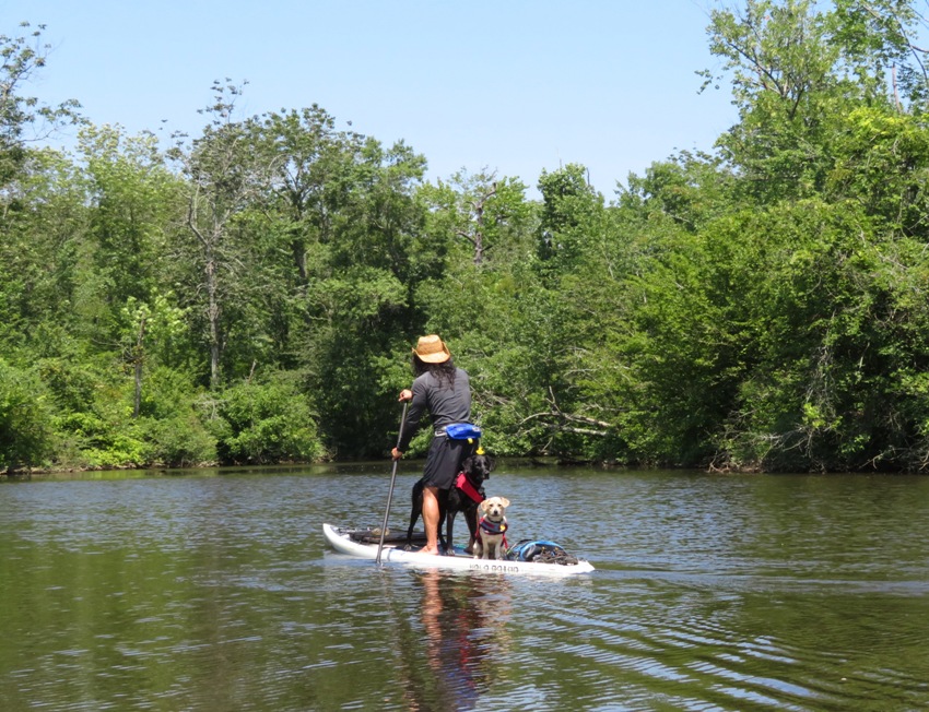
I went for a bit of a swim. The water felt good at first but after exerting myself, I found the water to be too warm to cool me off. Cassi and Daphne play pretty rough on land. When they were both in the water, Cassi was wanting to interact with her. But Daphne is not a good swimmer so when Cassi was trying to play with her, she ended up pushing Daphne underwater. We got Daphne out but not before she swallowed some water. If she was uncomfortable in the water before, she's probably even less comfortable now. I think we saw four other kayaks during the whole time were were out (about three hours). This is a nice place to be if you want to get away from it all. We didn't see much in terms of wildlife though we did see the muscovy ducks that Norma and I saw last time. I think we were too loud and scared off any wildlife before we got close. We paddled a little over six miles. Sara and Norma retrieved the car we left in Millington while Sam and I starting getting the gear ready for loading. After loading, we drove to Chestertown for a late lunch/early dinner at Fishwhistle. We all had a really good meal. We sat out on their mesh-shaded deck with our dogs. It was pretty warm but we had a nice breeze from the Chester River to keep us comfortable. Sara, Sam, and Cassi headed home while Norma, Daphne, and I walked over to Wilmer Park for a siesta. They were getting things ready for a fireworks celebration. After our nap, we strolled around town and spoke to people that were curious about Daphne. Chestertown is full of very friendly people. Unfortunately, most everything was closed. We might have stayed for the fireworks if it were later but instead we decided to head home after a quick stop for ice cream. |
|
Norma, Daphne, and I did various hikes and two kayak trips during our road trip to Sussex County, Delaware.
|
|
Norma had been wanting to go see the flowers at Kenilworth Aquatic Gardens so I put together a last minute trip after checking the tide. Kenilworth is NOT a place you want to be near low tide.
Today the two of us and Daphne launched from Bladensburg Waterfront Park. We hadn't been there for awhile. 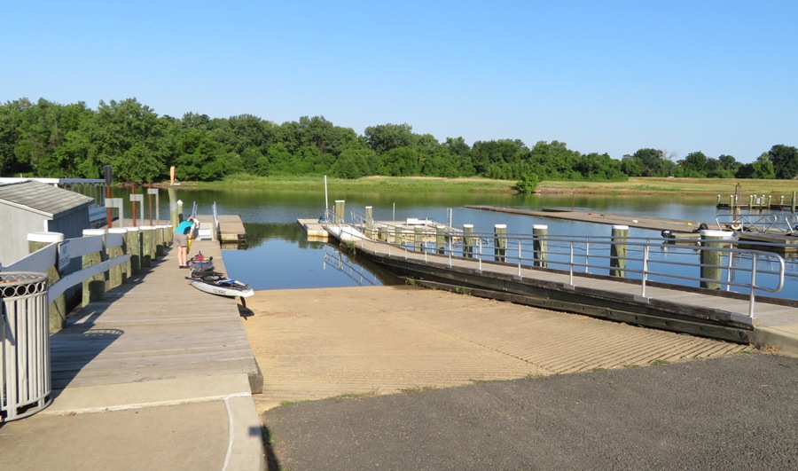
This place is much nicer ever since the Anacostia Riverwalk Trail connected to it. Now it gets a lot more use and I feel that the government has put more effort into making the place look nicer and keeping the Anacostia River clean, though it still has a ways to go. Some parts of the trail are still under construction but based on satellite images, I think you can ride from Colmar Manor Community Park, Colmar Manor, MD 20722 to Diamond Teague Park, 100 Potomac Ave SE, Washington, DC 20003 Surely we will confirm this in the future...probably later this year. The three of us paddled downstream on the river. There was a decent amount of wildlife which is always a good sign. 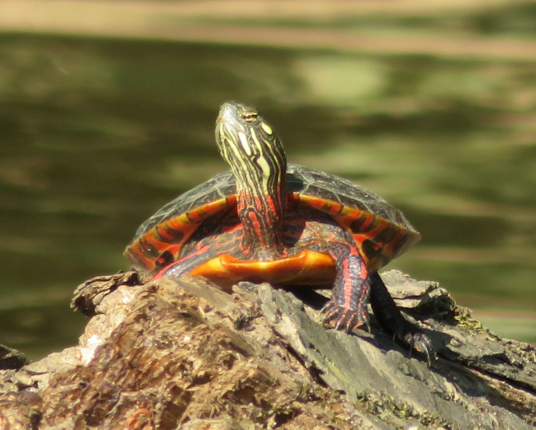
We passed some side tributaries which I promised to explore at a later date when I have more time. Paddling into the Gardens, we explored the open waterways around it. A grasshopper-like bug landed on Norma's arm. This fellow had a body less than an inch long but each antenna is at least four inches long! 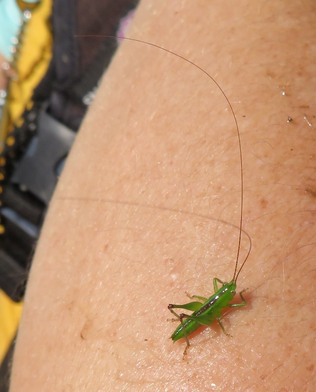
The three of us landed near a bench just off one of the trails in the Gardens. The place really isn't designed for landing a small boat but the staff don't seem to mind. I immediately found a hornworm. 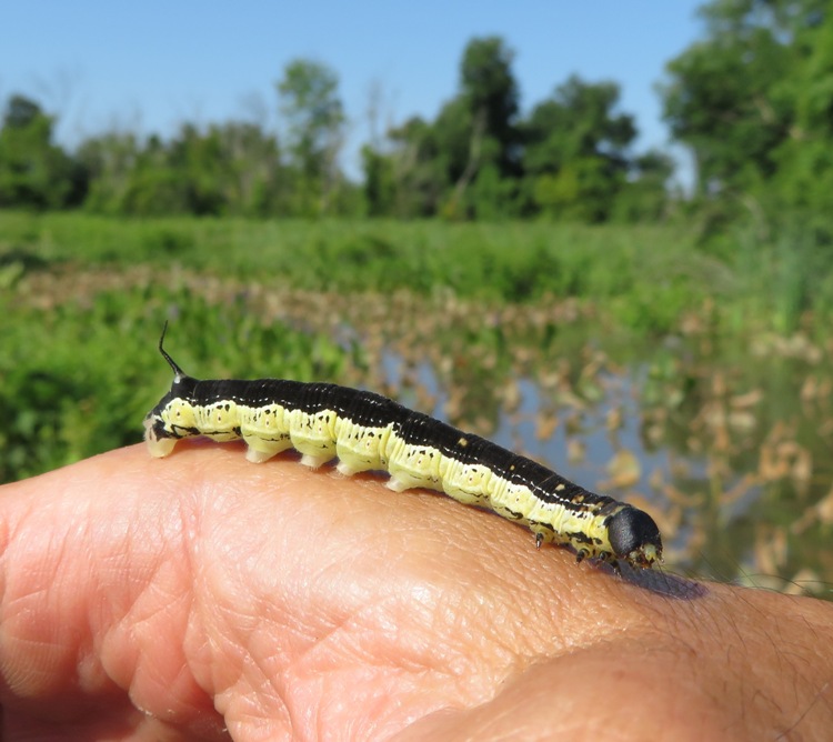
I spotted a male monarch butterfly at Kenilworth. How do I know its gender? It opened its wings and I saw the dots. 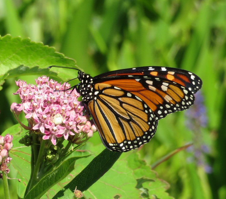
There were a lot of dragonflies including this Halloween pennant. This place is a haven for bugs. 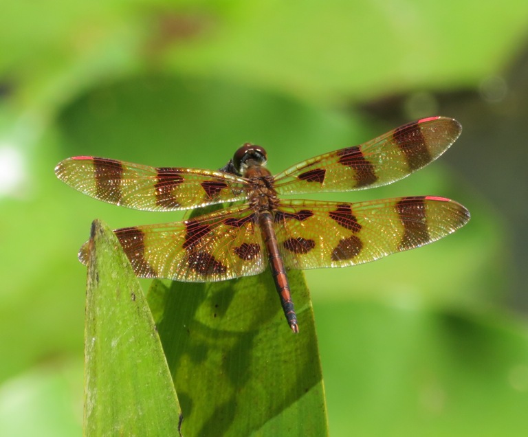
I love seeing all the insects, but what we came here for were the flowers. Here's an American lotus flower. I prefer to see these in the wild rather than in the park. The Sassafras River is a great place to see them via kayak/SUP. 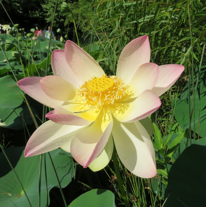
This is a pink lotus. It is not something I see in the wild in Maryland though I suppose if you dumped enough food coloring into the water, you could get the same effect. 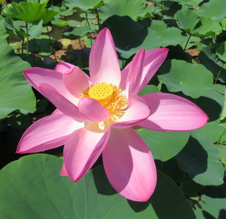
This swamp hibiscus looks just like the ones growing in our back yard. 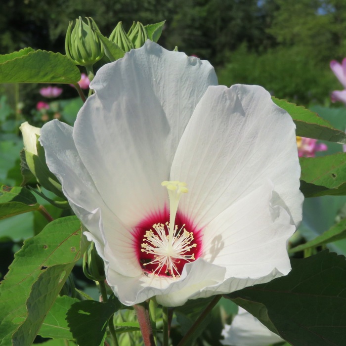
There was a corgi meetup group. Daphne is a quarter corgi. Her long body and short legs are definitely corgi but her face is not. I find corgis to be very expressive. 
Kids are always drawn to Daphne. Sometimes she can be shy but never aggressive. Today she was friendly. 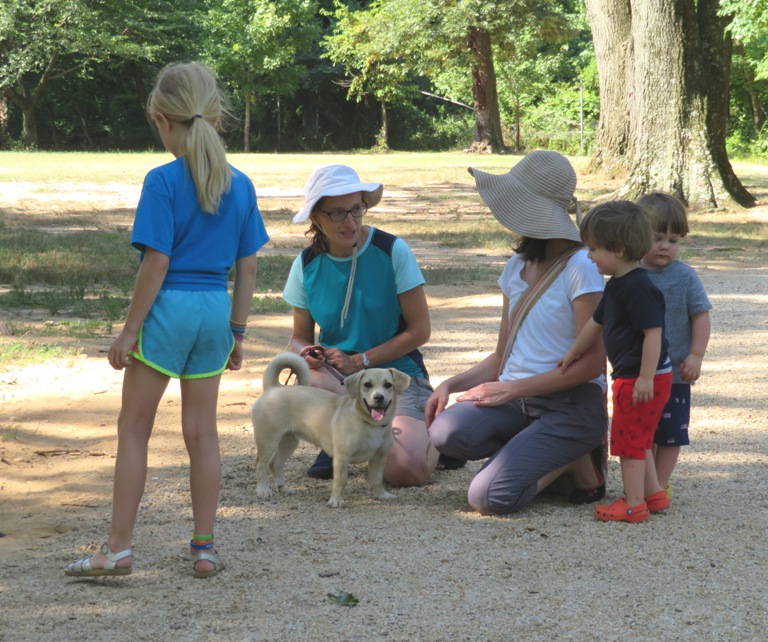
We started making our way back to the boat, stopping one last time for a final picture with the flowers. 
I unlocked the boats from where we parked them and then we were off, heading back upstream on the Anacostia. 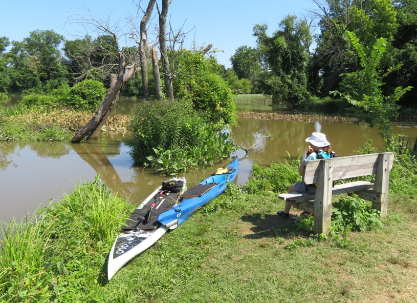
Here's Norma and Daphne on my Cobra Expedition. 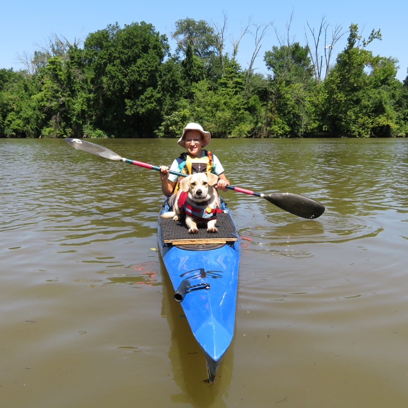
Near the launch area, we saw a cormorant fighting with a large catfish, which unfortunately, I was not able to get a good photo of them. At home, I found a praying mantis waiting for us, resting on our doorknob. 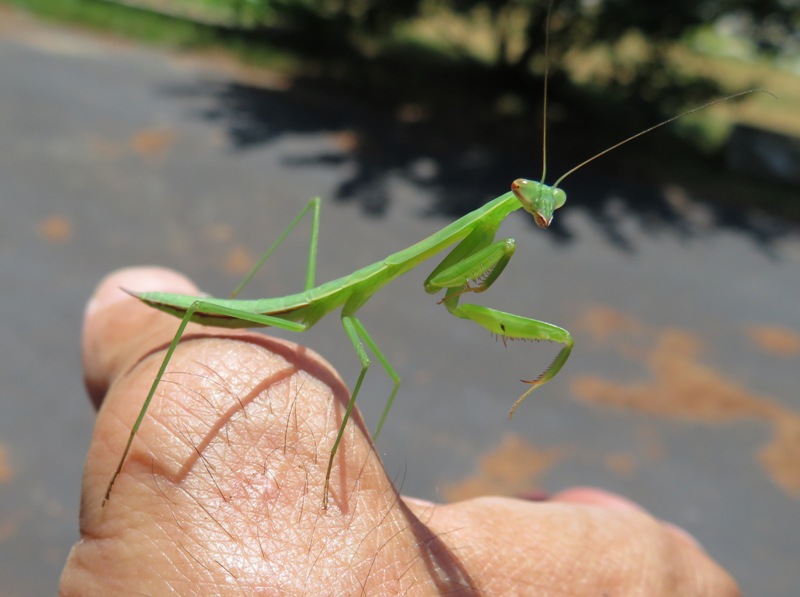
|
|
We had some heavy rain on July 17. Rain like that can sometimes erode cliffs, sending lodged fossils down to ground or water level. Such fossils might not have seen the light of day for several million years. That prompted me to leave work early today so I could hunt for shark teeth, shells, interesting rocks, etc.
I launched my SUP at Flag Ponds Park near low tide. Putting in is never a fast or simple process. The last time I was here, a ranger told me I could drive down to the handicapped parking area to unload my boat. I did that again today. After unloading, I then parked in the main lot and then walked to my boat. It was still then a pretty good distance from the handicapped lot to the water so I carried my SUP via kayak cart. That worked fine until I was on sand. Then it was easiest to just carry it. If I rush, I can do this all in a half hour. Next, I paddled in the Chesapeake Bay. I headed towards Calvert Cliffs State Park, stopping at numerous cliffs along the way. Fossils in this area are from the Cenozoic era, Tertiary period, and Miocene epoch. This means they are 5-24 million years old. - from "Fossils of Calvert Cliffs" I passed by the nuclear power plant. They have a pipe which extends out from the shore underwater and sends a lot of water into the Bay, creating white caps from all the turbulence. You can paddle further out to avoid them but it is easier to stay a little closer to shore but still far enough out to not cause anyone at the power plant to feel threatened. The water isn't released for a pretty good distance out. I assume it is for cooling the reactor. There was a north wind up to eight mph which then turned east. That may not sound like much but it was unobstructed and I was out in the bay so it kicked up more waves than I would have liked. The vertical walls near the reactor did not help. They caused the waves to bounce back, though I was far enough out so it wasn't all that noticeable. It was not enough to make me unstable but defintely enough to slow me down. I saw four fawns. They were extremely small and from a distance, I initially thought they were dogs. 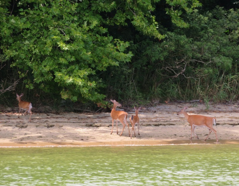
I landed at about five spots. Things look much different than further north in the county near Plum Point. There, and even further north, there are a lot more shark teeth but fewer impression fossils. In this area, there are thousands of scallops. Many are loose on the beach and some are embedded in the cliffs and rocks. This area has many fossil-bearing Miocene sediments from the Choptank Formation which is rich in shells. - from Maryland Geological Survey - Calvert Cliffs I found a partially sunken sailboat along with a couple large decrepit structures which I could not identify. 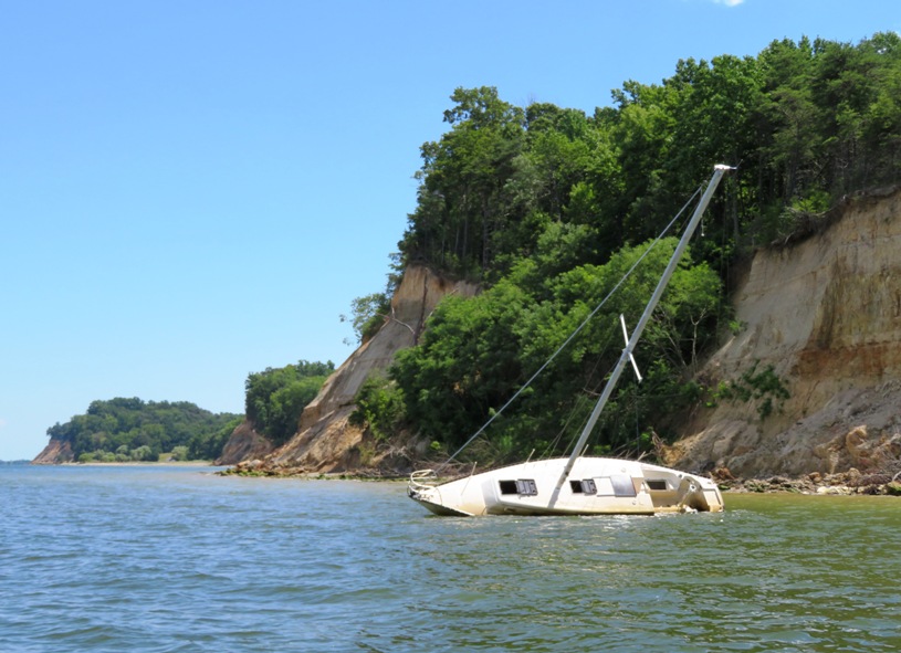
In addition to fossils, I saw plenty of life. I saw several bald eagles, fish, and dragonflies, like this eastern pondhawk. Eastern pondhawk females and immature males are bright green. As the males age, they gradually turn a powdery blue from their abdomen to their thorax. - from Maryland DNR - Common Dragonflies in Maryland 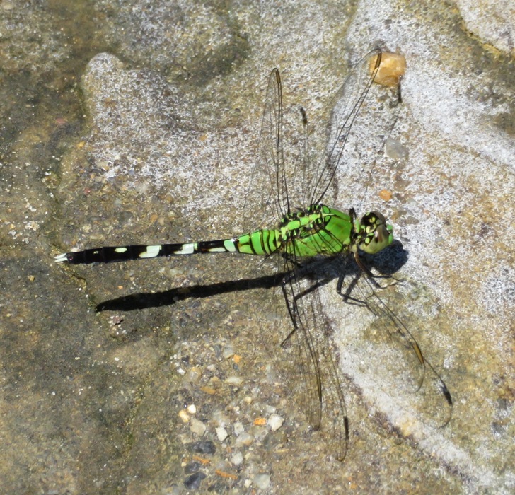
I found some objects which I could not identify. This one was quite heavy and about three quarters of an inch thick. Perhaps it is a piece of fulgurite? No, someone on Facebook identified it as bog iron...not as interesting. 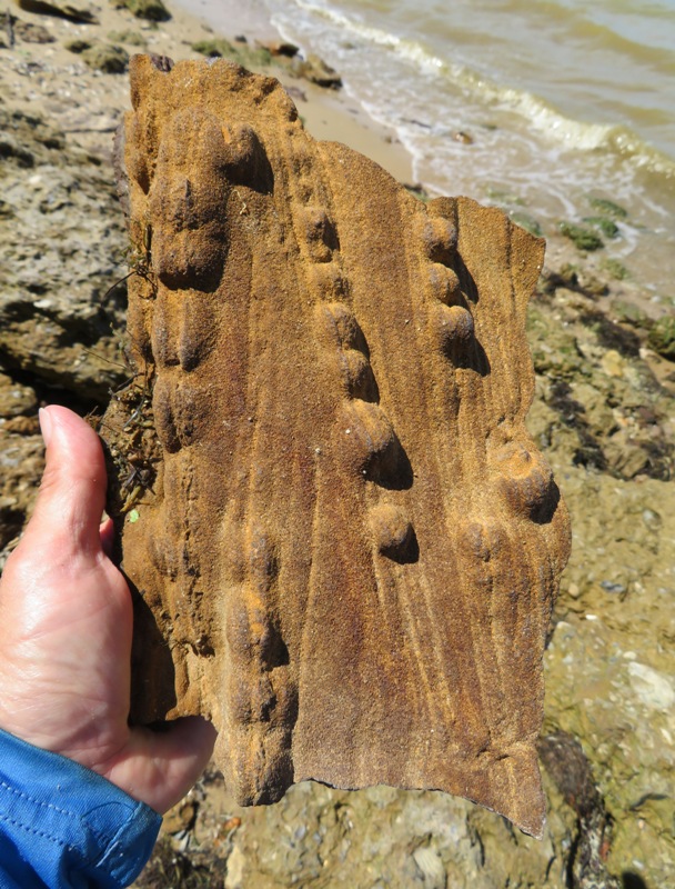
I turned around just before Rocky Point and then paddled back to where I started. As I walked back to my car, I noticed that there are a lot of paw paw trees in the area. Many have fruit. I'll probably return in September to pick them. 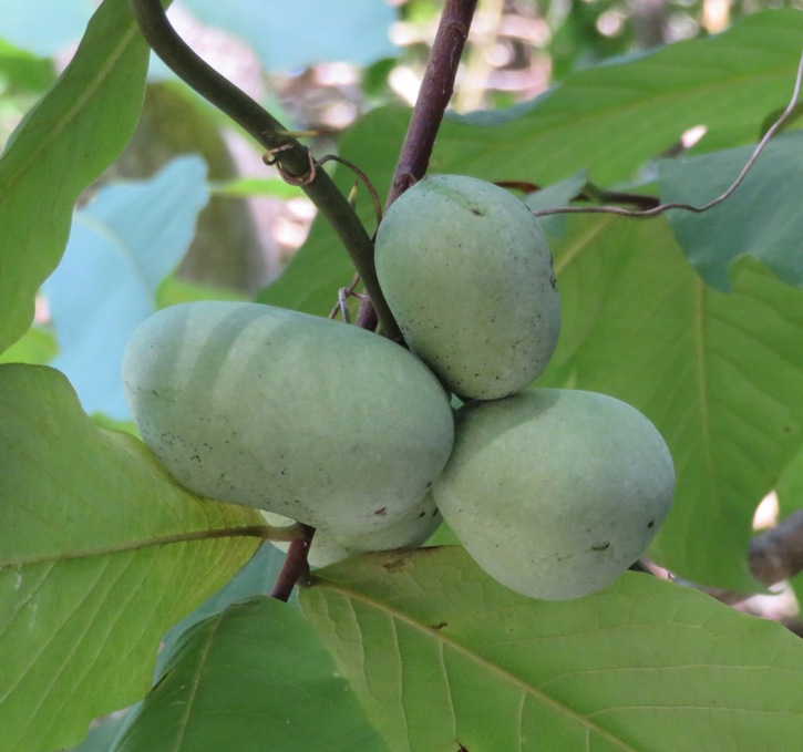
I returned with lots of scallops, a few barnacles, three shark teeth, a piece of petrified wood, a stone crab claw, two pieces of ray dental palate, and lots of impression fossils. The largest scallop is almost six inches wide! If you want to find shark teeth, this is a terrible place to go. But if you want impression fossils, then it is great. But there isn't much diversity. You'll pretty much just find impressions of scallops along with actual scallops. I paddled about 6.6 miles. I would have liked to have stayed out longer but the park closes at 1800. But I had some time so I did another short trip. See Back Channel. |
|
After my Flag Ponds SUP trip, I made a quick stop on the way back at Patuxent Wetlands Park. It was late in the afternoon and a good time to see critters.
First, I paddled up the small, unnamed creek at the launch site. It is here that Norma and I spotted a river otter last year. But I didn't see one today. Also, I couldn't paddle nearly as far upstream as then. There was considerably more aquatic vegetation today. Around here it sometimes gets like that in the latter half of summer. The nice thing is it clears up the water, but it also makes it hard to paddle. The vegetation only stays at a certain depth so if you're in deeper water, it won't affect you. 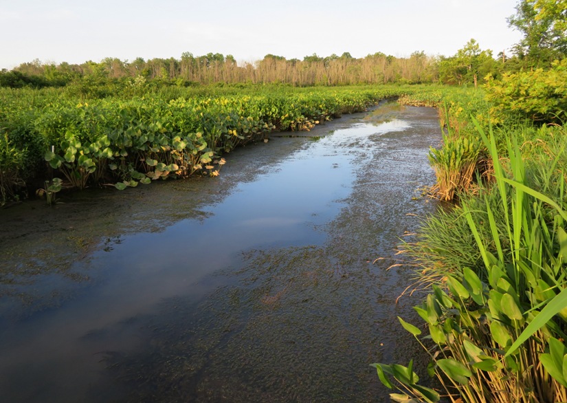
One strange thing I noticed is that water was flowing out of this unnamed creek. Low tide had passed about two hours ago so I expected water to be flowing up it. If we had a very recent heavy rain, it would not be surprising but it hadn't rained for a couple of days and the water did not seem high. But maybe the rain from Tuesday was still on its way out. I paddled upstream on the Patuxent River and then up Back Channel. I saw lots of turtles in the water but not many on the shore. There were hundreds of small fish jumping as I paddled in the shallow areas just beyond where the aquatic vegetation ended at the surface. Check out the video I made by clicking on the image below. 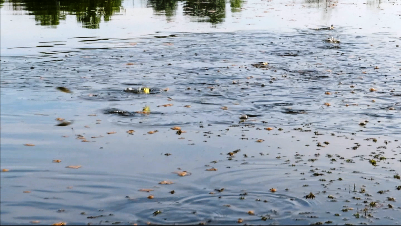
Three fish jumped up on my SUP. Since SUPs have a low deck, it is easy for fish to land on them when they go airborne. I don't know what kind they were. Lisa thinks maybe they were mummichog which jump like skipping stones. 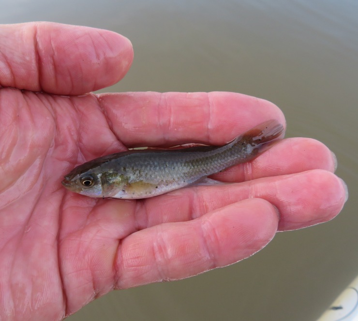
I returned to the launch site where I saw a beaver, which in my opinion, is the next best thing to seeing an otter. 
Now that it was late, I had an easy drive home with light traffic. That was my goal. Had I driven straight home after Flag Ponds, things would have likely been much different. |
|
On July 21, Norma and I had plans to paddle one of the Corsica River Water Trails, stop at some farmers markets, go to the Kent County Fair, and then end the day by attending a concert featuring the Kentucky Headhunters and Confederate Railroad. This all fell through with a forecast of 2-3 inches of rain. All for the best. The concert got canceled.
Lisa reached out to me and invited us to go kayaking the next morning. There would be a break in the rain for a few hours and she wanted to take advantage of it. Norma would be busy but Daphne and I were available so we said yes. So the next day, Daphne and I met Lisa and Madeline T. at Homeport Farm Park. Daphne wasn't wanting to get very close to the two women. She seems to be less trusting of people now that she is getting older. Daphne growled at them. Lisa said, "Daphne would make a good guard dog but of all my friends, you're the one who needs the least protection." Their two kayaks and my SUP took us out Church Creek where we then crossed the South River. Daphne landed at Historic London Town for a pee break but wasn't wanting to leave so I had to do a quick landing to retrieve her. I saw a red fox there. It was sunny. Hard to believe it rained so hard just a few hours ago. Next, we paddled up Almshouse Creek where we saw a lot of green herons, pictured below. We also saw a bald eagle, a kingfisher, and four ospreys occupying one nest! Back in the 1980s, I had an album by the English street punk band called "Charged GBH." GBH stood for "grievous bodily harm." Today, I use GBH to mean "great blue heron." I saw this one on Almshouse Creek. 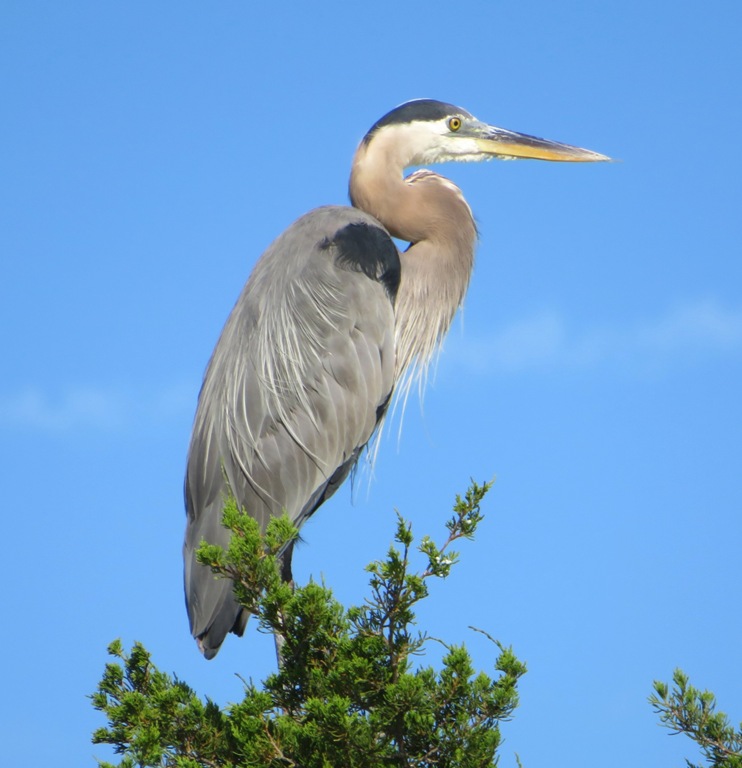
We paddled back across the South River to Crab Creek. Here's Lisa. 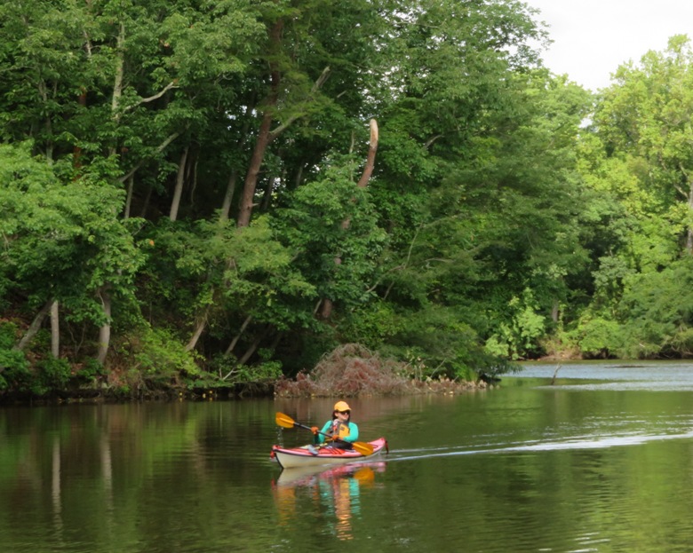
We saw a huge inflatable "My Little Pony." Daphne was looking very relaxed...sometimes even lying down which she rarely does. It started to sprinkle very lightly. If I didn't see tiny droplets hitting the water, I wouldn't have known it was raining. We heard some thunder off in the distance but we weren't far from the launch site and could rush back if needed. At the launch area, Madeline said she saw a snake. It swam into the water. I then came over and saw this one. I called her over and she said she saw a different one that was much larger. So there were two. This one was about 18-inches long. Later, I was told that how a snake appears in the water can often determine if it poisonous or non-poisonous. Behavior can also indicate poisonous or non-poisonous. Water snakes, for example, come in both varieties, but only poisonous snakes will swim with their entire bodies visible on the water. This is because venomous snakes swim with their lungs inflated, whereas a harmless water snake will swim with its body submerged. - from Snake Removal Nationwide Service - How To Tell if a Snake is Venomous 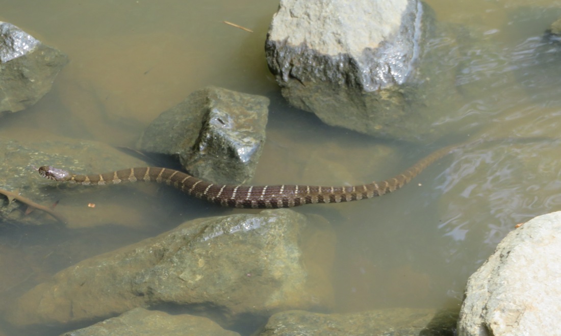
It turns out the snake I saw was swimming with only its head above the water. I believe it was a northern water snake which is non-poisonous. We finished after about three hours, having paddled 7.6 miles. I'm really glad I got out on the water when I did. Looking at the forecast for the next several days, it may be awhile before I see the sun again. |
|
Norma, Daphne, Sara, Cassi, Madeline, and I launched from Mattingly Avenue Park and paddled on Mattawoman Creek. The Chesapeake Bay Foundation says this creek
boasts one of the largest fields of American Lotuses along the western side of the Chesapeake Bay. We were on the water by 0700 heading upstream. The sun was pretty low and many of the flowers weren't open yet. We would catch them on the way back. 
Cassi jumped out of Sara's boat and swam around. Sara has gotten pretty good at pulling Cassi back in. She tried for a bit to carry both Cassi and Daphne with the hope that Cassi would be more willing to stay put. I think Daphne was more of a distraction to Sara than Cassi. On the SUP, Daphne became rather territorial. I've never seen that side of her. She didn't like Cassi swimming over and trying to get on the SUP. The upstream section of Mattawoman Creek is very scenic and natural. I saw two beavers and four lodges. We also saw several swamp hibiscus flowers. 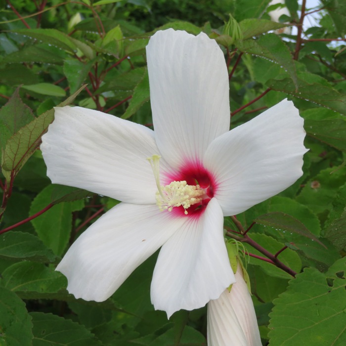
This area is largely undeveloped. The "Water Trails in Charles County, MD" map calls it... One of the most productive tributaries of the Potomac, Mattawoman Creek, which has a high diversity of fish, and healthy stands of aquatic vegetation... Sara found it best to keep Cassi from jumping out of the boat by creating distance between her and the rest of us. She decided to stay behind and explore some of the smaller creeks that were lush with lotus flowers. Norma, Madeline, Daphne, and I continued upstream. 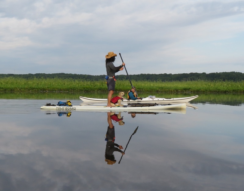
I found one good place to pull over. It is at 38.589697, -77.140615, near Nelson Point. We saw a lot of wild rice and folks out fishing. 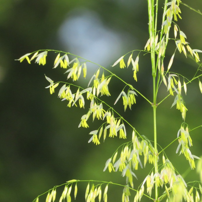
The upper sections of the creek were narrow and shaded. High tide was around 0936 which worked out good for us to get as far upstream as possible without having to portage. I checked up on Sara and we swapped dogs briefly. Here I am with Cassi. Then I raced back to join the rest of the group. 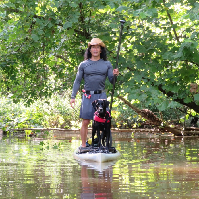
There were quite a few dead trees. Not sure why. 
The weather was good. Partly sunny with a high around 82 though we were off the water long before it got anywhere that warm. We'd been having a lot of rain recently so it has been hard to get out in nice weather. So today was very much appreciated. On the second part of our trip, we saw what we came to see...the lotus flowers. They weren't as large as I expected. I think they will be bigger in a week or two. 1 / 7
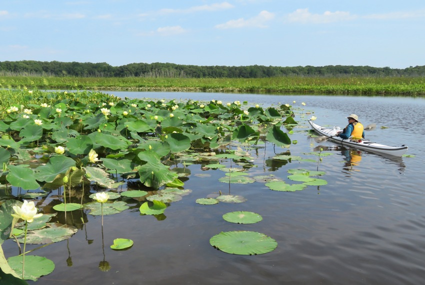
~26 pound kevlar Lincoln.
2 / 7
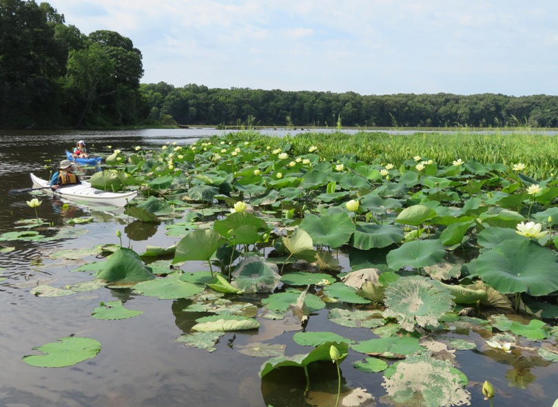
Norma and Madeline.
3 / 7
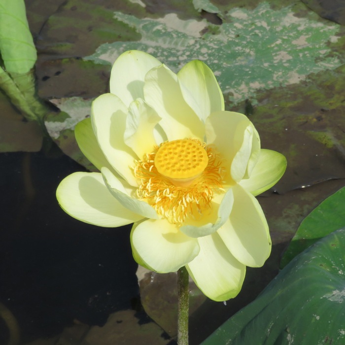
Lotus flower in bloom.
4 / 7
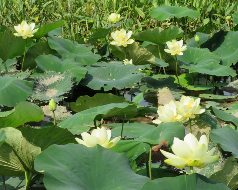
Several lotus flowers.
5 / 7
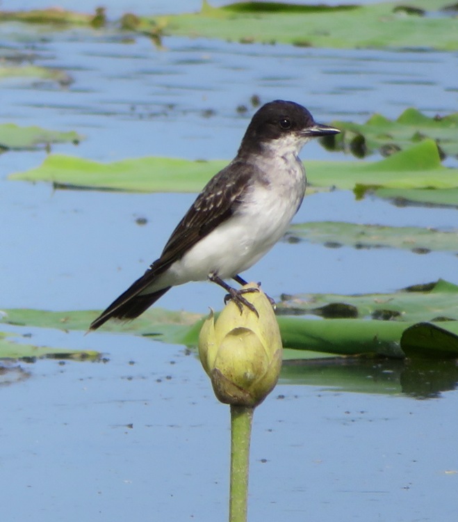
Eastern Kingbird.
6 / 7
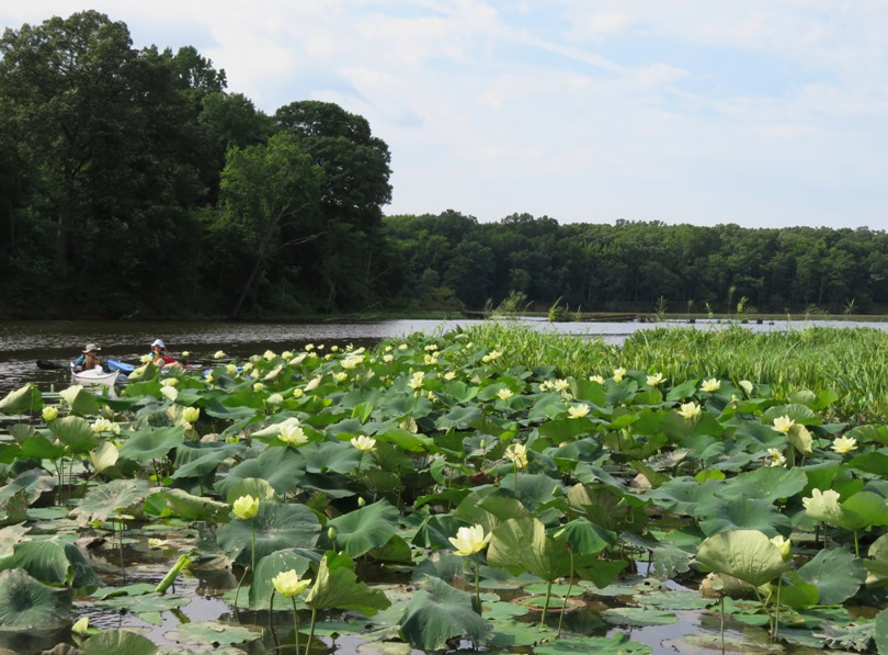
Dots of yellow, field of green.
7 / 7
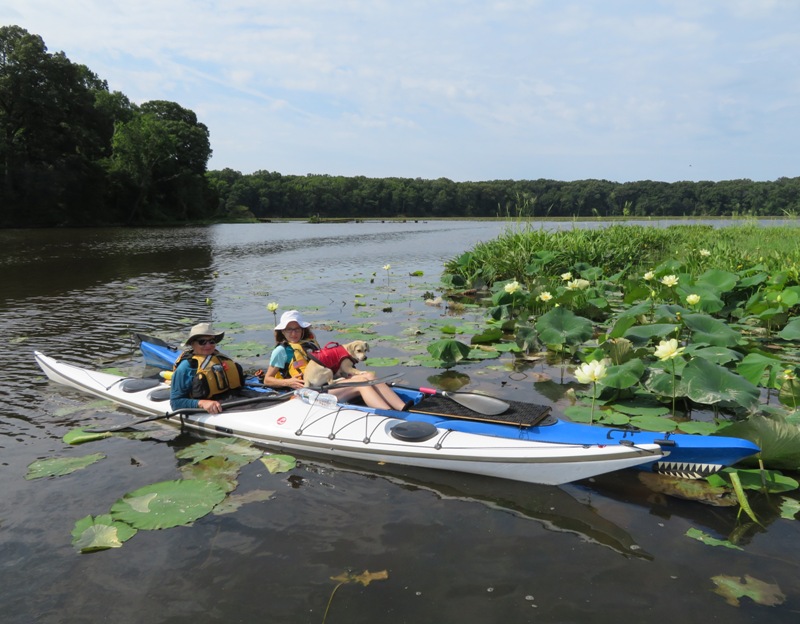
Madeline, Norma, and Daphne.
Norma's kayaking skills have gotten much better. I've been having her not use the rudder. Her forward stroke propels her at a pretty good pace. We were off the water at 1030, just as a big REI group was getting ready to launch. I think being on the water so early was a good thing. I got in 8.7 miles though I think that was at least a mile more than the rest since I raced back to check on Sara once the distance between us got pretty big. In my opinion, the lotus flowers are much prettier at Turner's Creek, a tributary off the Sassafras River. But from my house, that is about 25 minutes further, one way. I also think the non-lotus sections of the Mattawoman is nicer than the non-lotus sections of the Sassafras near Turner's Creek. If you're thinking about kayaking in this area check out the following links: |
|
I got up at 0500 and launched my surf ski from Shadding Reach at 0705. I was planning to get in at least 20 miles that day. Now that we have Daphne, I haven't been spending much time on the surf ski or doing long trips. Today, I planned to do both.
The weather was hot and humid with about a 50% chance of rain. By getting out early, I decreased that chance and took advantage of the 0831 low tide which would help me get downstream a little faster. I paddled downstream on the Chester River. I saw numerous eagles. A little upstream of Crumpton Road (route 290), I encountered a great deal of aquatic vegetation which made paddling difficult. I found that using my typical wing paddle stroke wasted too much energy. I was better off pushing the blade in the water far past my hip so that it would be pointed to the rear when I took it out of the water. That kept vegetation from getting caught in the blade. Such thick aquatic vegetation is something that typically occurs in shallow water with low salinity in the late summer. Being out near low tide only made things worse. There were various creeks that I would have loved to explore but I was better off sticking to the deeper water closer to the middle of the river. It took awhile but eventually I made my way to Chestertown. I paddled to Wilmer Park where I saw several older women landing a 6-8 person rowing shell. I also saw a group of about a dozen kayakers launching. I believe they were special needs people with their caretakers or guides. I hung out there for awhile then started making my way back upstream. Going downstream, I had headwind. Now the wind was to my back but that meant I had no breeze to cool off. Taking an occasional dip in the water helped but with the humidity so high, the water didn't refresh me as much as I would have liked. During the second half of my downstream journey, the tide had shifted. Now it was flood tide and with me paddling upstream, it was now giving me a little push. By the time I reached Shadding Reach, I had completed 25 miles. I still had some strength left so I continued. I made a wrong turn and went up Unicorn Branch. I got back on the main part of the river and continued until I made it to Millington, turning around just after the Sassafras Street Bridge (route 313). I paddled back downstream (now against the tide and wind) until I was back at Shadding Reach. It took 6.75 hours. I completed just over 32 miles by 1350. I was quite pleased with my performance so I deemed this trip my annual "Saki Challenge." This is a physical accomplishment that I find personally challenging. I've been doing a unique Saki Challenge every year since at least 2008. I started doing this after I read how Jack LaLanne would challenge himself with various feats (typically involving swimming). I was pretty sore but I never cramped up. My back muscles were the part that was most sore which is good. Having limits to push against is how you find out what you can do. - Sylvie Guillem |
|
It was a dark and misty morning.
Daphne and I launched from Truxton Park in Annapolis to see the Norwegian Viking ship, Draken Harald Hårfagre (Draken). I had heard about this just the day prior via Facebook. It stopped at the Spa Creek City Dock on its "Expedition America: East Coast Tour 2018." The Draken is world's largest operating Viking ship. For more information, see This ship crossed the Atlantic in 2016, reliving the Viking discovery of the New World more than 1,000 years ago. Draken Harald Hårfagre has a traditional dragon's head and tail and is richly ornamented with patterns found in excavations. The dragon's head protects the ship and her crew along the voyage, and is not mounted until departure from homeport. - from Draken Harald Hårfagre - About I spoke to some of the crew, which numbers 35. I was told the Draken will leave Annapolis on Tuesday. Then it sails to Saint Michaels. There were plenty of tourists out so finding someone to take my picture was not a problem. 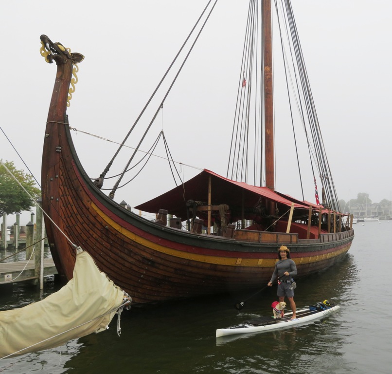
At a hundred and fourteen feet of crafted oak, twenty-seven feet on the beam, displacing eighty tons, and with a thirty-two hundred square foot sail, this magnificent ship is indeed worthy of a king. - from Draken Harald Hårfagre - About 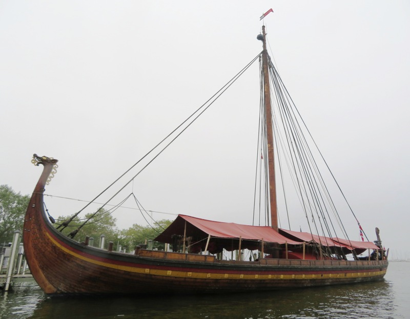
On the way back, I pulled over at Murray Hill Park and let Daphne walk around. We saw some awfully big geese there. We met more people there with dogs than folks without. 
It was a lazy trip. I got in less than six miles. I wasn't particularly motivated to get in any real distance. Also, there was a ten mph wind and Daphne wasn't enjoying the chop in the Severn River. The afternoon cleared up, which is exact opposite of what the experts predicted the day prior. Upon pulling ashore, I found that my paddle had suffered damages, not as a result of anything in particular today, but rather from six years of SUPping. 
|
|
Norma, Daphne, and I got out on the water. It was a dreary, dark day. But compared to how the weather had been recently, it was nice because it wasn't raining.
We launched from Solleys Cove and then paddled up Curtis Creek and Arundel Cove to the Coast Guard Yard. There, we saw several ships including the 140-foot long Katmai Bay, an ice breaking tug. 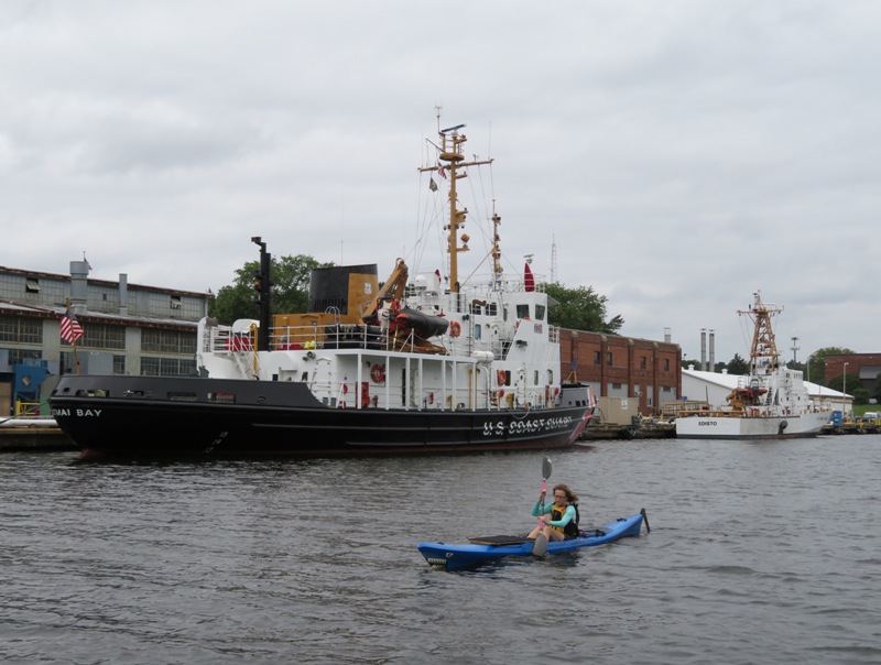
But we were really there to see the 295-foot long U.S. Coast Guard Cutter (USCGC) Eagle. The tall ship Eagle is a three-masted sailing barque with 21,350 square feet of sail, homeported at the Coast Guard Academy, New London, Connecticut. It is the only active (operational) commissioned sailing vessel in the U.S. maritime services. Seventh in a line of cutters to bear its name, the CGC Eagle was built in 1936 by Blohm and Voss in Hamburg, Germany, as a training vessel for German naval cadets. It was taken as a war prize in 1946, commissioned into Coast Guard service as the Eagle, and sailed from Bremerhaven, Germany, to New London, Connecticut. The Eagle serves as a seagoing classroom for approximately 175 cadets and instructors from the academy. On the Eagle, cadets apply the navigation, engineering, and other skills they develop in classes at the academy. - from The Cutters, Boats, and Aircraft of the U.S. Coast Guard The Eagle is the only active-duty sailing vessel in America's military, and one of only two commissioned sailing vessels, along with the USS Constitution. - from Tall Ship Eagle Since 1946, every single new [Coast Guard] cadet undergoing officer training has begun his or her career by learning to sail on her - the old way. - from BBC News - Why is the US still using a Nazi tall ship? Here's some photos: 1 / 7
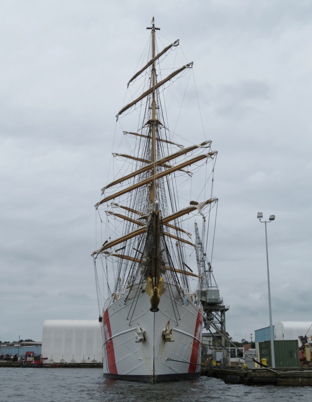
Front view.
2 / 7
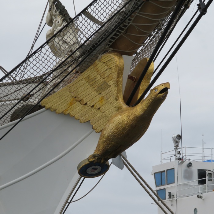
Figurehead.
3 / 7

The ship and I.
4 / 7
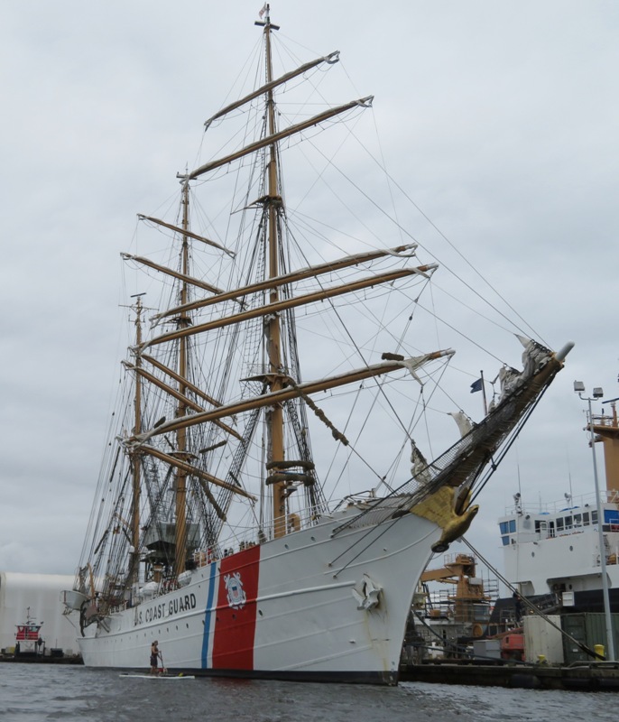
Front starboard view.
5 / 7
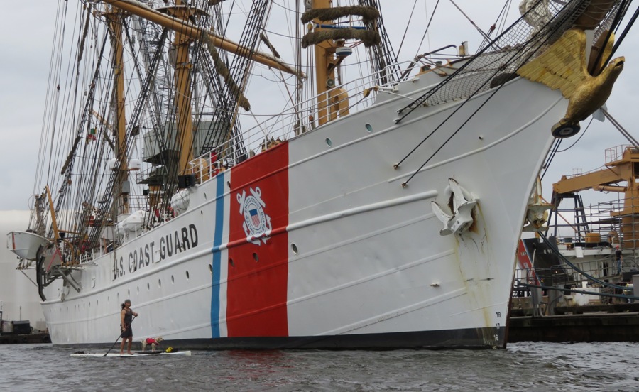
Daphne and I.
6 / 7
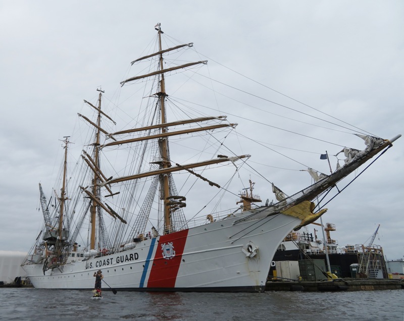
Paddling downstream.
7 / 7
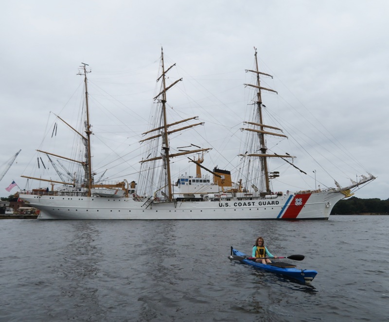
Norma.
We would see the Eagle again on October 4, 2018 during the Second Baltimore Fleet Week. We also paddled up Furnace Creek and explored a small tributary where we found a persimmon tree bearing lots of fruit. Eventually, we made our way to Rams Head Dockside which has a beach and pier. We were going to get a quick bite to eat but they only allow service dogs, which Daphne is not. We weren't out for long but it was long enough to wash away some of the rainy weather blues. 
|
|
I spent the day exploring Saint Mary's County with Daphne.
Point Lookout
Saint Mary's City
Piney Point Lighthouse
|
|
Daphne and I launched my SUP from Selby's Landing in Patuxent River Park. We paddled downstream on the Patuxent River and then up Mataponi Creek.
I called the park earlier to ask when they close their gates. I was told 1900. But when I arrived, the sign said the gate closed at 1830. So that only gave me two hours on the water. It took that long just to drive there and back. The weather was perfect. Sunny and warm. Not many days like this during the summer. I managed to get pretty far up the creek. The water was very high from all the rain we got over the last couple weeks. But it was also flowing very fast. This trip would have been ideal in a short kayak. A long one would have gotten me upstream further but a short one would have been better for the narrow parts. I found this female monarch butterfly. One wing was damaged. It wanted to stay on my SUP or my finger. So I let it hang around me for awhile and then put it on a plant along the side of a trail. 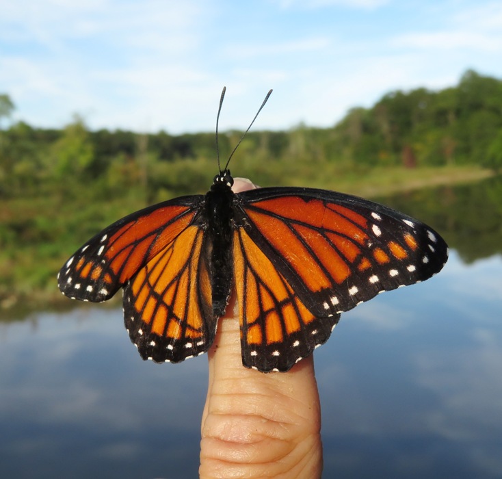
Daphne will often like to chase butterflies but only because they are moving. This one remained fairly still so she didn't get all that excited. 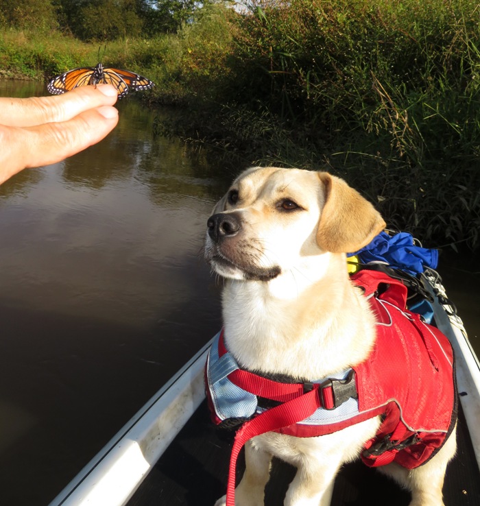
I was reminded of a song. See the dog and butterfly Up in the air he likes to fly Dog and butterfly Below she had to try She roll back down to the warm soft ground, laughing She don't know why, she don't know why Dog and butterfly When Nancy Wilson of Heart wrote Dog and Butterfly, she claimed the meaning of the song was that When you're an earthbound creature we're always jumping and reaching for things we can never really catch, but you try anyway. - from "God Beauty Perfection Love - Dog and Butterfly" (broken link as of 2025) Daphne didn't mind sharing the SUP with the butterfly which perched itself on my boom box. 
I paddled under the 1,000 foot long wooden bridge that connects Patuxent River Park and Merkle Wildlife Sanctuary. This bridge is part of the four-mile long Critical Area Driving Tour (CADT). 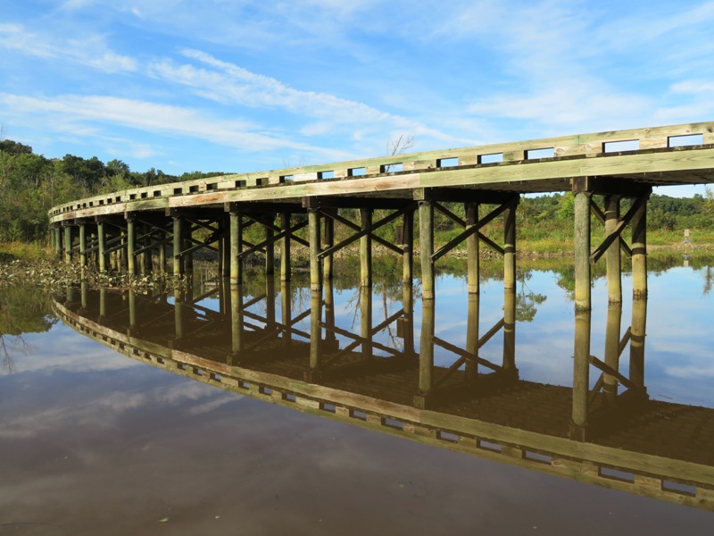
Daphne and I went ashore and climbed the observation tower where we got a better view of the bridge and Mataponi Creek. I have many fond memories of this place. 
The spatterdock plants were starting to die back. But there were a few flowers left. 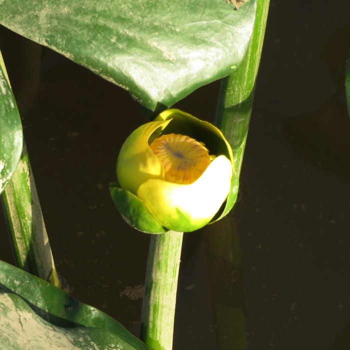
Lastly, we paddled to Jug Bay before returning. The area around Jug Bay is one of my favorite places in the whole world! |
|
Norma, Daphne, and I drove out to Anacostia Park. Most of the park was closed due to a race so we had to wait 45 minutes. It was pretty cool and overcast but by the time we launched, things were starting to clear up.
We paddled on the Anacostia River, up the west side of Kingman Island through Kingman Lake. We saw several great egrets and cormorants. There were also a lot of turtles sunning themselves on logs. They ranged from having a 1.5-inch long carapace to 14 inches. One of the reasons I chose this trip is because I wanted to see if there was a suitable place to land where we could access the nearby trails. It turns out the answer is yes. Here is where to land if you want to go ashore, 38.894083, -76.965417. On the north side, there is a small pier. 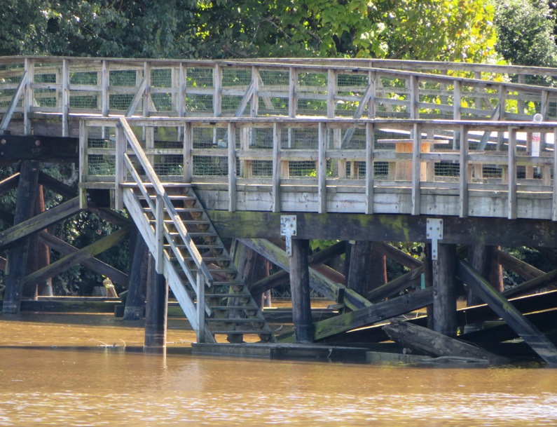
Instead, we chose to land at the southside dock which has a lower pier. There were a lot of canoes there which I assumed are owned by the park. But you can see in the picture that we parked in a way that would not interfere with them. 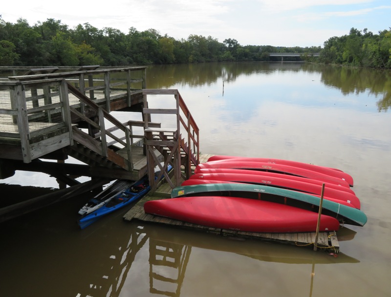
A boardwalk connects the docks to both Kingman and Heritage Island. In this picture, Daphne is eyeing the dog above. 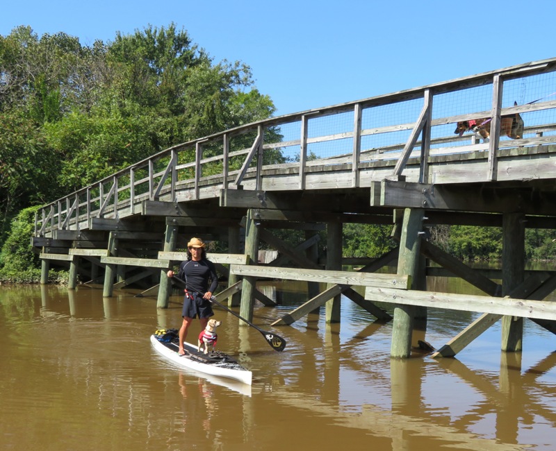
The three of us went ashore and explored Heritage Island. This island is poorly maintained with serious drainage issues. 
We tried to do a short loop hike and walked through plenty of puddles. Once they got up past my mid-shin and I couldn't see around the corner to determine where dry land was, we turned around. Sometimes it felt like we were in a wilderness jungle but the noise from planes, emergency vehicles, motorcycles, etc. quickly reminded me that we were very close to the urban jungle. In contrast, the main part of Kingman Island is crushed gravel, suitable for biking with a hybrid. At the south end, there are unmaintained dirt trails which we explored. We saw quite a few people out walking their dogs. There were also aster flowers with buckeye butterflies gathering nectar. 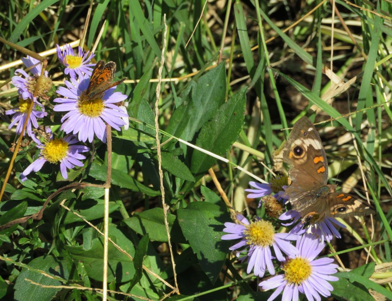
After a snack, we boarded our boats and paddled north, traversing Kingman Lake and then reaching the Anacostia River again. Daphne and I pulled over at a log by the bridge that connects the north end of Kingman Island with the mainland. 
Lisa, Madeline, and I tried to get west of Kingman Island earlier this summer but failed because the water was too low. But with a combination of the high tide and all the rain we've had, getting through the lake was no problem today. There were various small, unnamed islands at the north side of Kingman Lake. They were scenic and natural. Definitely worth visiting if the water is deep enough. The Anacostia River and the surrounding waterways are very polluted. But thanks to Norma, there is a little less trash. 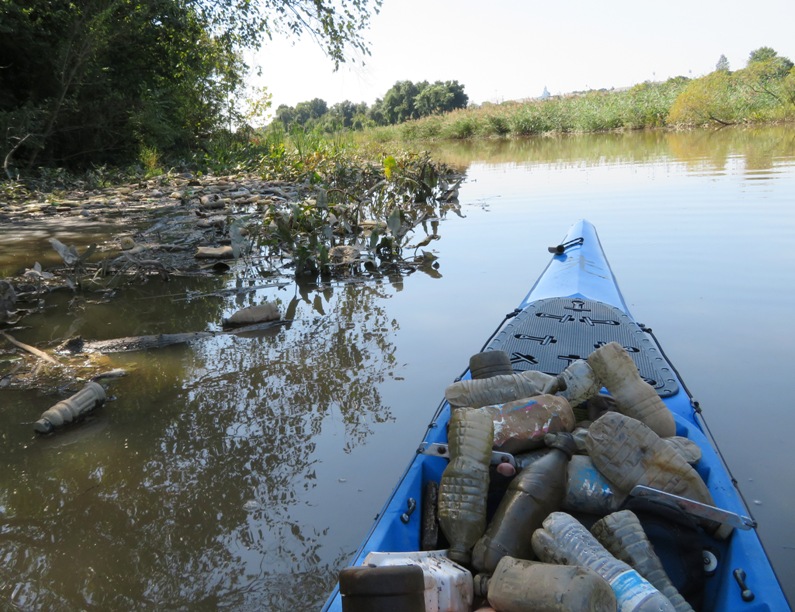
The drive home was terrible. I quickly remembered why I avoid coming here. It was not easy to get back on highway 295 heading north. Drivers were rude and much of the peace and tranquility from being on the water quickly came undone. One would think that a Sunday afternoon drive wouldn't be quite so hectic but that is not the case in Washington D.C. I saw a bumpersticker that read What's the difference between assholes and rednecks? Answer: The Chesapeake Bay As much as I love living near the Chesapeake Bay, there is some truth to this statement. On days like today, I prefer the rednecks. |
|
I missed seeing the Argentine tall ship ARA Libertad in Baltimore due to poor weather and a personal unwillingness to venture out in such conditions.
I most certainly did not want to let this happen during the Second Baltimore Fleet Week. The First Baltimore Fleet Week took place on October 14, 2016. I was out on the water for that and enjoyed it greatly. I hoped it would be an annual event but there was no such animal in 2017. So when I heard it was going to take place in 2018, I pencilled it in on my calendar a few months out. The challenging thing was deciding when to go. In 2016, parking was an issue so I figured that if I went in the morning during the week, that wouldn't be a problem. The weather was another consideration. I figured that a good viewing time would be October 4 from 1000 to 1200 with wind 3-8 mph from the south or southwest. It was foggy and overcast until around 0900, then it burned off. Visibility wasn't ideal but it ended up being good enough. Friday was forecast to be better but once Friday morning actually arrived, the forecast changed significantly and it ended up being a much worse day in terms of visibility. So I'm glad I got out on the 4th. Norma, Daphne, and I arrived at Canton Waterfront Park at 0730. Only the women's side of the restroom at the park was open. But there weren't many folks out so I had Norma stand guard at the entrance while I did my business. Daphne found a bone which she brought into the car. It was covered in ants and they decided that the passenger seat was a good place to occupy. We launched around 0800. Since I wasn't expecting the fog to burn off anytime soon, we paddled along the north side of the Northwest Harbor, heading west at a casual pace. We saw Mister Trash Wheel and paddled under some high end luxury condos that appeared to be built on an old pier. The first ship we saw was the U.S. Coast Guard Cutter (USCGC) Eagle. Norma and I actually saw it on September 21 where it is normally stationed, at Curtis Bay. 
Next, we saw Lady Maryland. The Lady Maryland is a replica of a Chesapeake Bay pungy schooner, a boat which sailed the Bay in the 1800's. Today, the Lady Maryland sails as part of the Living Classrooms Foundation's educational fleet, providing hands-on, multidisciplinary educational programs for students of all ages. 
Moving through the harbor, we spotted the Bay Hydro II, a National Oceanic and Atmospheric Administration (NOAA) research vessel. 
We passed the Sigsbee and the Kaiulani, two small sailing vessels. The former is a skipjack, which is a Chesapeake Bay sailing craft designed and built to dredge for oysters. The fog started to lift as the sun broke through. The next boat was a Navy ship called the City of Bismarck. T-EPF 9 is designed for the fast intra-theater transportation of troops, military vehicles and equipment. Capable of transporting 600 short tons 1,200 nautical miles at an average speed of 35 knots, the ship will provide U.S. forces with added mobility and flexibility. Right by the City of Bismarck was the United States Ship (USS) Tornado, a Cyclone class patrol (coastal) ship. This was the first ship we saw where the security was pretty tight. A small police boat made sure we didn't get too close while military personnel armed with M16s protected it from the shore. 
In the photo at the bottom of the page, you can see the Tornado in the background. By the National Aquarium, we spotted the Catlett, a survey vessel for the U.S. Army Corps of Engineers. 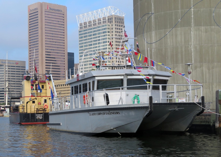
Just west of the Catlett was the Reynolds, a steel debris vessel, also for the U.S. Army Corps of Engineers. 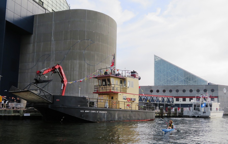
Not all the ships at Fleet Week were American. The Her Majesty's Canadian Ship (HMCS) Moncton is from Canada. Moncton was initially designed as a Mechanical Minesweeper but has since become a multi-role platform engaging in route survey and surface surveillance missions such as sovereignty patrols in the Arctic and drug-interdiction operations in the Caribbean. 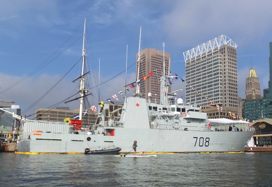
Between the USS Constellation and the Moncton was the Godspeed. Both the Constellation and Godspeed are historic re-creations. The next ship was the USS Milwaukee, a Freedom-class littoral combat ship. Up to now, I had been taking a lot of pictures of the ships. But now I was being photographed by the police boat that protects it. Not a big deal. Paddleboarders can be pretty dangerous. 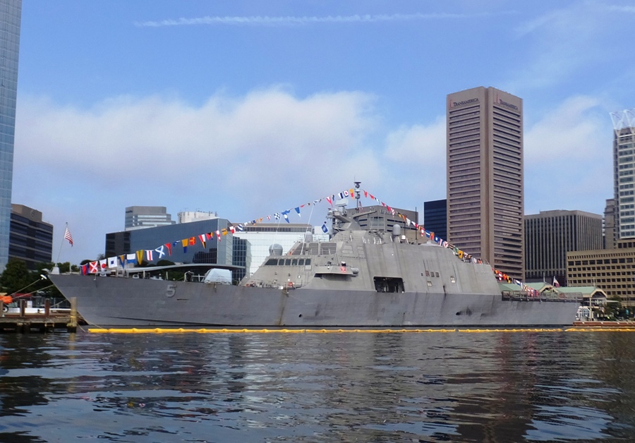
At the Baltimore Museum of Industry, we saw the Baltimore. Built in 1906, She is formerly the oldest operating steam tugboat in the United States, but at present does not hold an operating license issued by the US Coast Guard, so is unable to leave her dock at the Baltimore Museum of Industry. Not actually a featured ship, we saw the Nordic London, a bulk carrier from the United Kingdom. Earlier in the day, we heard something that sounded like thunder. It was noise made from something being dropped onto this ship (maybe coal?). 
Perhaps my favorite visiting ship was the Her Majesty's Ship (HMS) Monmouth. See the photo at the top of this page. This was the only ship with a helicopter on it. I guess someone told the Brits how bad Baltimore traffic can be. HMS Monmouth, known as the 'Black Duke' is the frigate with more battle honours than any other serving warship. Next, we paddled by the Antares and the Denebola. Shown below, the Antares is on the left while the Denebola is on the right. These behemoths are normally docked in Baltimore and were not featured in the Fleet Week brochure. 
A Baltimore City Fire Department boat passed by. Notice the Antares and Denebola behind. 
The last ship we saw was the USS Oak Hill, a Harpers Ferry-class dock landing ship. The USS Stout guided missile destroyer was supposed to be there but we didn't see it. I reviewed our photos and determined that if it was there, it wasn't where it was supposed to be. The three of us finished around 1120. I reckon we paddled about seven miles. It was 30 years ago that I arrived at my first permanent duty station, the USS John F. Kennedy. During my two year tour of duty on the "Big John" I was part of the Marine Detachment. We spent six months deployed to the Mediterranean Sea. I also had a chance to visit various ports on the east coast: Fort Lauderdale, Boston, New York, and Portland, Maine. I've enjoyed my share of Fleet Weeks. But today, I got to enjoy it as a civilian. The Big John was decommissioned August 1, 2007. It was the last conventionally-powered aircraft carrier built by the US Navy. They say nothing lasts forever. That was certainly true of the Big John and it was also true of the job I performed as part of the Marine Detachment, the oldest job in the USMC, dating back to its birth in 1775. Detachments of Marines have served aboard American naval vessels since the beginning of the Continental Marine Corps in 1775. That stretch of more than two centuries ended last May [1998] when officials at Marine Headquarters in Washington, D.C., opted to scuttle the detachments to free more Marines for Fleet Marine Force duty. - from "Leatherneck - The Corps' Salty Seadogs Have All but Come Ashore" |
|
Sail Baltimore reported that Republic of Korea (ROK) training vessels Chungmugong Yi Sun Sin and Dae Cheong would arrive at the Cruise Terminal, South Locust Point, Baltimore on October 16. They would then leave on the afternoon of October 19. So I launched my SUP from Broening Park to see them on that morning. It was quite windy with 17 mph gusts but I figured it would be worth the trip. It was not. They were not there and I never found out if they ever were.
So I made the best out of a bad situation and explored the surrounding area. I've paddled this area before countless times but I rarely explore the nooks and crannies. I took a picture of the flag at Fort McHenry. The 15-star, 15-stripe flag was authorized by the Flag Act of January 13, 1794, adding 2 stripes and 2 Stars. The regulation went into effect on May 1, 1795. This flag was the only U.S. Flag to have more than 13 stripes. It was immortalized by Francis Scott Key during the bombardment of Fort McHenry, Sept 13, 1814. - from The Star Spangled Banner, the 15 Star Flag 
Just south of Fort McHenry is a natural area which I've seen evolve over the last several years. I explored this shallow setting. For the last 15 years, the National Aquarium has worked with volunteers to restore Fort McHenry's wetland habitat for wildlife and remove nearly 600,000 pieces of debris from the park's shoreline. - from "Water Blog - Fort McHenry: Preserving a National and Natural Treasure" (a broken link as of 2020) Next, I paddled to the Hanover Street Bridge in Baltimore. It is also known as the Vietnam Veterans Memorial Bridge. It was opened in 1916. 
In the center of the bridge is a drawbridge span surrounded on four corners by classic style towers which lend it a distinctive appearance. Near the base of each tower is the entrance to a large space where one can see how the drawbridge is raised and lowered. I didn't climb into this space but I did reach in it with my camera to take pictures. 
It was a mediocre day. |
|
Norma, Daphne, and I did a little kayak scouting near Richmond, Virginia. We found places to launch on the Chickahominy, North Anna, and Pamunkey Rivers.
|
|
After being disappointed because the Korean ships were nowhere to be seen on October 19, 2018, I took my chances on October 31 after Sail Baltimore reported that a 431-foot Brazilian Navy training ship called NE Brasil would be at the west wall of the Inner Harbor in Baltimore. I launched my SUP at Canton Waterfront Park to see for myself. It was indeed there.
I took plenty of photos though I should have taken them in the morning instead of the afternoon. The lighting was not idea for a ship docked at the west wall. This ship was commissioned in 1984. It carries 442 midshipmen - officers in training from the Brazilian Naval and Merchant Marine Academies. 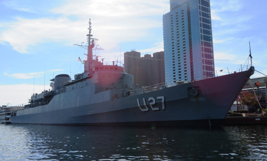
I like the tall sailing ships but I also like the modern war ships. But I really like seeing the big guns, which this ship did not have. 
The below pic shows me on my SUP in front of the NE Brasil (U27). Unlike the American military ships at Baltimore Fleet Week, the police didn't mind me getting close to this vessel. But there was a fellow in the crows nest of the ship keeping his eye on me along with a Baltimore police boat in the area. 
Here's the NE Brasil in front of buildings in the Baltimore Inner Harbor. 
After seeing the NE Brasil, I paddled just east of Tide Point to see some Baltimore ruins at 39.274778, -76.588889. 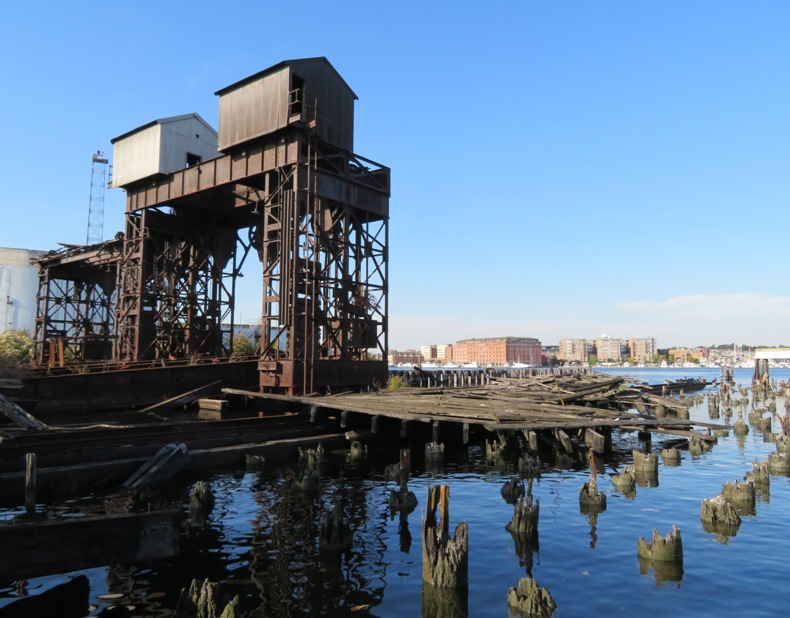
Just west of the SS Denebola cargo ship, which is always there, I noticed that the water was unusually clear. I'm not saying it was clean but I could easily see down past depths of eight feet! Maybe this occurs often. The harbor is quite deep so even if it is pretty clear, one wouldn't know it unless they were in a more shallow section. Paddling between concrete structures in the water near the Denebola, a military-looking fellow in civilian clothes told me I wasn't supposed to be there and I should leave. So I did. 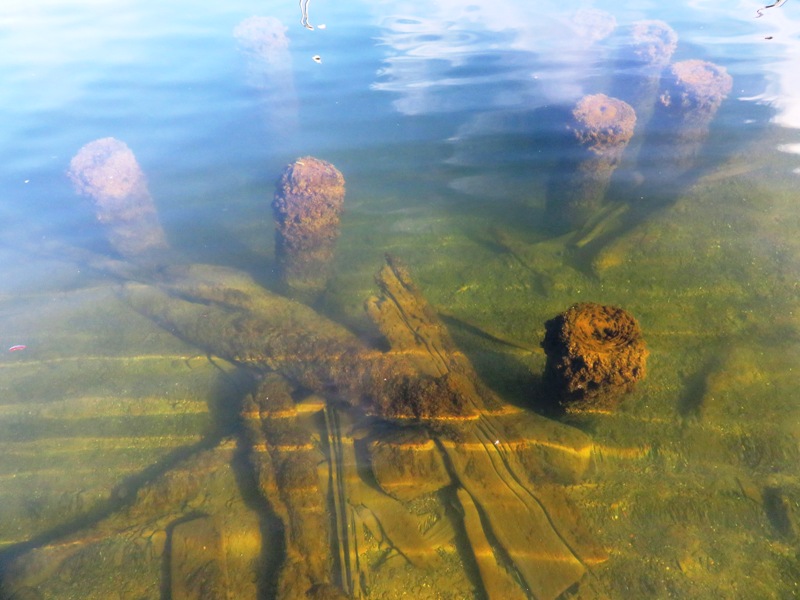
I also saw the Mildred Belle and the Lady Maryland, both of which I saw on October 28, 2018 at the 18th Annual Downrigging Weekend Tall Ship and Wooden Boat Festival in Chestertown. This was my last kayak/SUP trip of the year. |
|
After kayaking season ends, I start putting together my trips for the next year. I call this my "bucket list." Here is what I have so far.
Corsica River Water Trail This is a scenic trip based around Centreville. Part of it runs along the scenic Millstream Trail. Afterwards, maybe eat at Docs Riverside Grille. Satellite photos show umbrellas which implies outdoor seating and thus the place is likely dog-friendly. Also be sure to check out the farmers market at Centreville Plaza. Antelope Canyon Antelope Canyon is a slot canyon in Arizona. Split into two separate upper (southern) and lower (northern) canyon sections on the Navajo Tribal Park land, this is supposedly the most photographed slot canyon in the world! The Colorado River (flowing southwest in this section) is dammed by the Glen Canyon Dam to form Lake Powell. A little over four miles upsteam from the dam is Antelope Creek which flows into Antelope Canyon. About a mile upstream from the mouth of the creek is the Antelope Point Launch Ramp. This is about 2.4 miles south of the Utah/Arizona border as the crow flies. Can we visit this area on our own or do we need a guide? The canyon [Antelope] lies within the LeChee Chapter of the Navajo Nation. Exploring this natural wonder is encouraged, but guided tours are required. - from Visit Arizona - Antelope Canyon Hiking would be nice but seeing things from the water would probably give us the best and most memorable views. For me, I would much rather prefer SUP to kayak, especially since Antelope (along with Labyrinth and Lost Eden) canyon is designated wakeless at all times. One popular and highly rated outfitter that offers both SUP and kayak tours is Lake Powell Paddleboards and Kayaks. Looks like their SUPs are pretty good. They allow us to bring dogs but if we want to drive there, it will take 34 hours from Baltimore. Some outfitters offer multi-day tours. Not sure if that is best or to do multiple single day tours. The latter is harder to coordinate but could be good if the best features of the area are spread out. Perhaps the largest and most central feature in this area is Lake Powell. Lake Powell is remarkable. The incredible canyons and natural landscapes are unlike anywhere else on earth, thus landing Lake Powell on our SUP Wonders of the World list. You may have seen photos of the amazing red rock cliffs and beautiful, crystal clear, warm water but there is nothing like experiencing it in person. With an average depth of 300 feet, there is no shortage of water. Lake Powell is located in the Glen Canyon National Recreation Area on the Utah/Arizona border. There are over 94 major canyon sections to paddle at Lake Powell, with over 150 miles of lake to explore and constantly fluctuating water levels you will never have seen it all! - from 7 SUP Wonders of the World. It is listed as #1! The closest airport to Antelope Point Launch Ramp is the Page Municipal Airport (PGA) but this is very small and only has two airlines, neither of which I'd ever heard of. Not sure if one can rent cars here either. After that, the Phoenix Airport (PHX) is the next closest. A good round trip flight price for one adult should be around $225. It is a four hour and 20 minute drive from the launch ramp. Here are some interesting features in the area: Other links: Slovenia Paddleboarding photos look spectacular and 7 SUP Wonders of the World ranks it as #6. |
|
I remember the earthquake in Maryland back in 2011. Then there was the derecho in 2012 with 70 mph winds. What will 2018 be remembered for in this area? Rain.
By far, 2018 was Baltimore's wettest year on record. Just how wet was it? Precipitation at Baltimore-Washington International (BWI) Thurgood Marshall Airport surpassed the previous record, 62.66 inches in 2003, by November 15. And in the six weeks that followed, more than nine inches of rain fell - the same amount that falls in the final three months of an average year. For the year, precipitation at BWI, the region's point of record, totaled 71.82 inches. Baltimore's weather record book goes back to 1871. - from "The Baltimore Sun - 2018 was Baltimore's wettest year on record" (broken link as of 2025) Some folks tried to blame climate change (global warming) for all the rain. I admit that climate change is responsible for a lot of things but all too often, people who don't understand meteorology try to use it as a "catch-all" excuse for any bad weather. Real science seems less credible when it is not used properly. ...Washington, D.C., received 66.28 inches of rain last year, when 39.74 inches typically falls in the city in one year. So what was the cause of the unusually wet and record-setting year in the South and East? It was a combination of factors, according to AccuWeather Meteorologist Kyle Elliott. "An abnormally strong Bermuda high pressure system prevented cold fronts from diving southward out of Canada and into the eastern United States as is typically the case every couple of weeks from July through September," Elliott said. Strong high pressure systems like the one that was in place act like a roadblock in the atmosphere. "As a result, storm systems basically came to a standstill for days on end in the eastern half of the nation," Elliott said. This led to a firehose of tropical moisture being directed into the Ohio Valley and mid-Atlantic for much of the summer and early fall months. "In addition, three tropical systems (Florence, Gordon and Michael) impacted a large portion of the East," Elliott said. "Gordon and Florence slowed down significantly once they made landfall, which allowed these systems to dump extreme amounts of rain over several days," Elliott added. - from "Accuweather - Dozens of cities in eastern, southern US set new rainfall records in 2018" (a broken link as of 2020) All the rain was not good for kayaking or paddleboarding. Normally, this would have made for a terrible year but 2018 was a little different in that it was the first year we had Daphne. Having her along made the whole kayaking and paddleboarding experience seem new and fresh. She brought light to the darkness and brightened up our lives. |
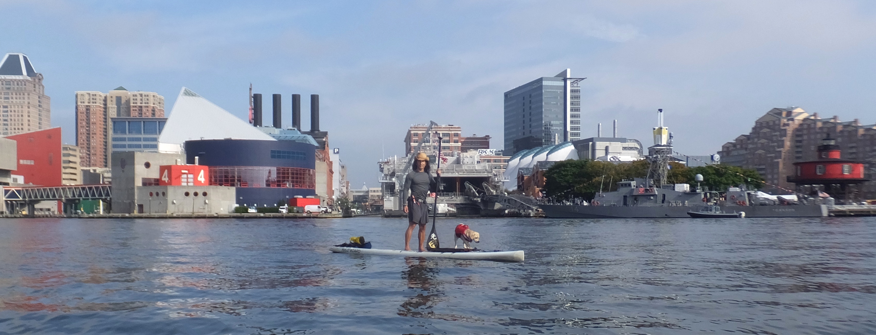
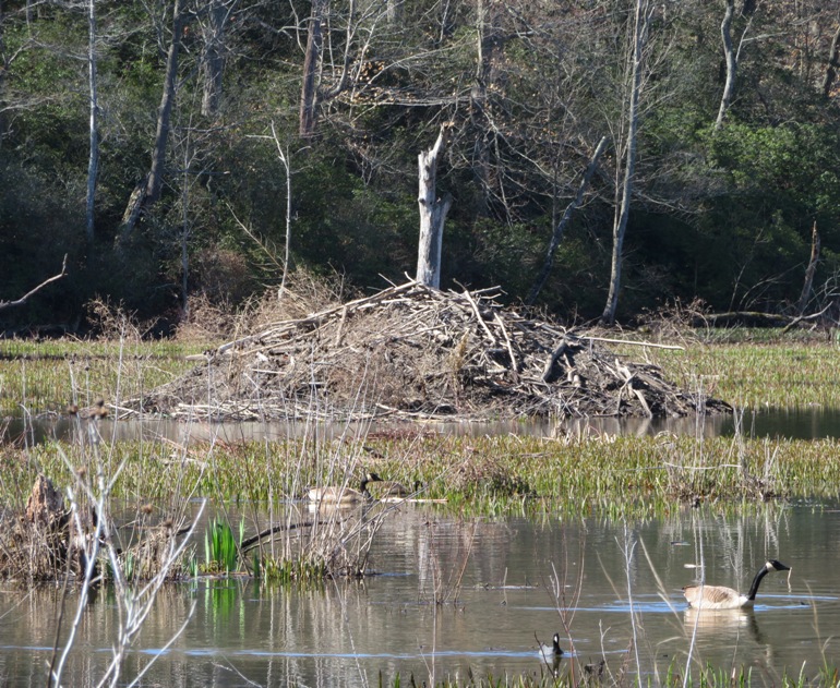
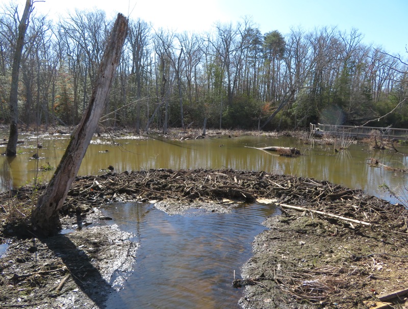
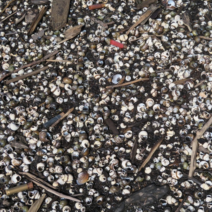
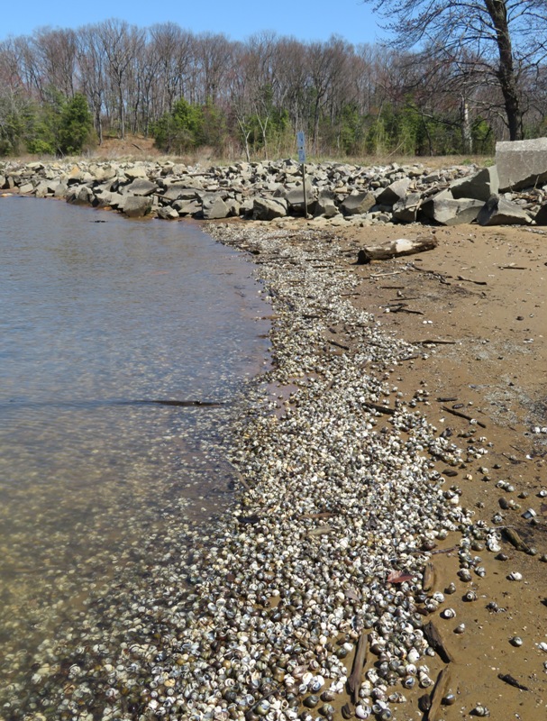
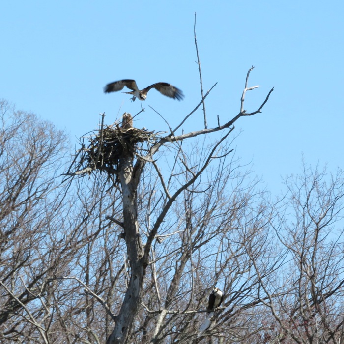
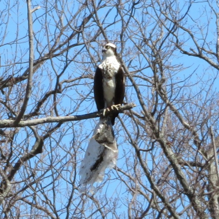
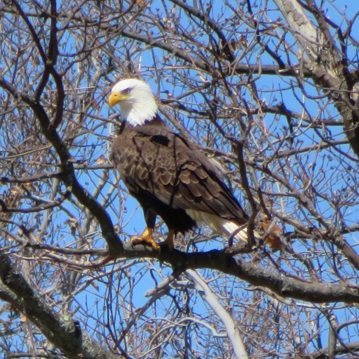
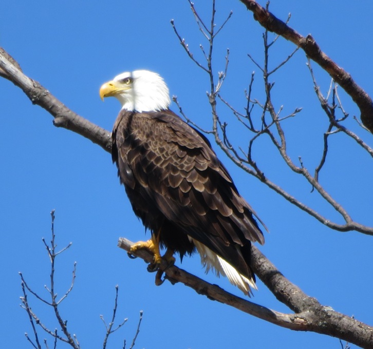
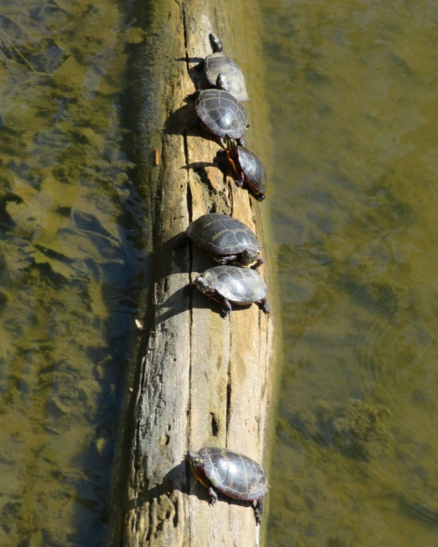
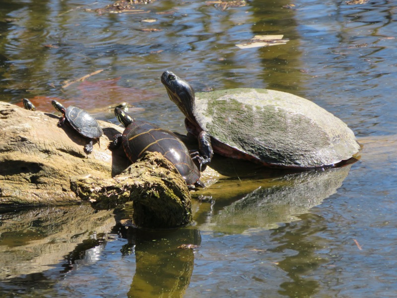
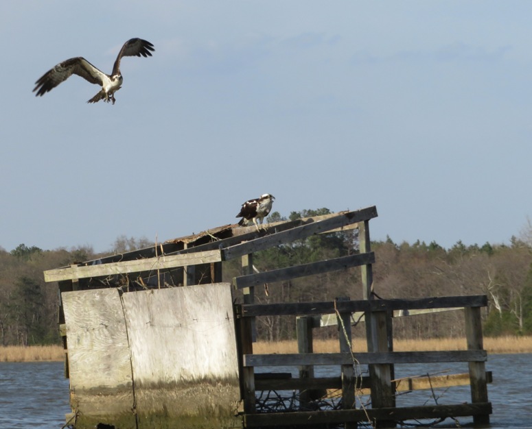
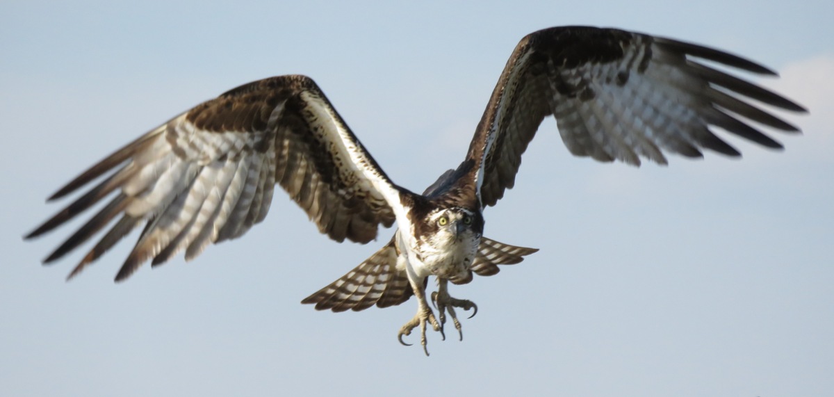
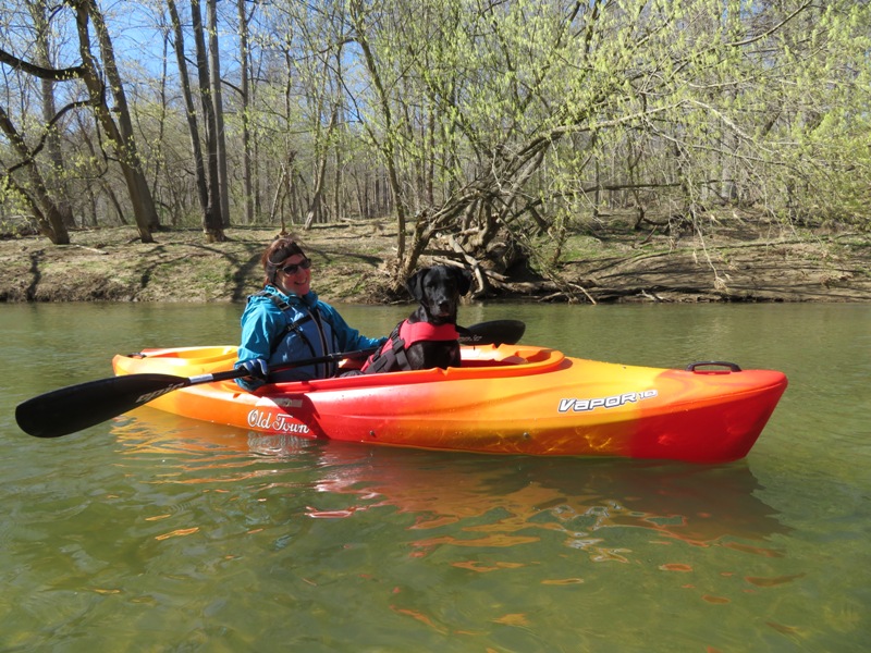
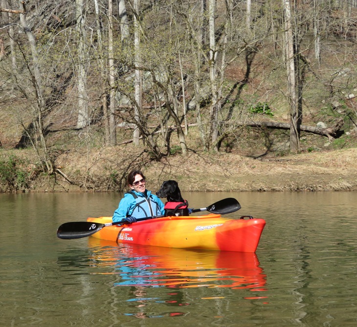


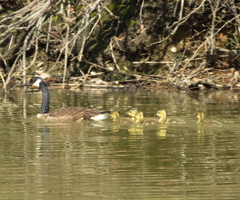
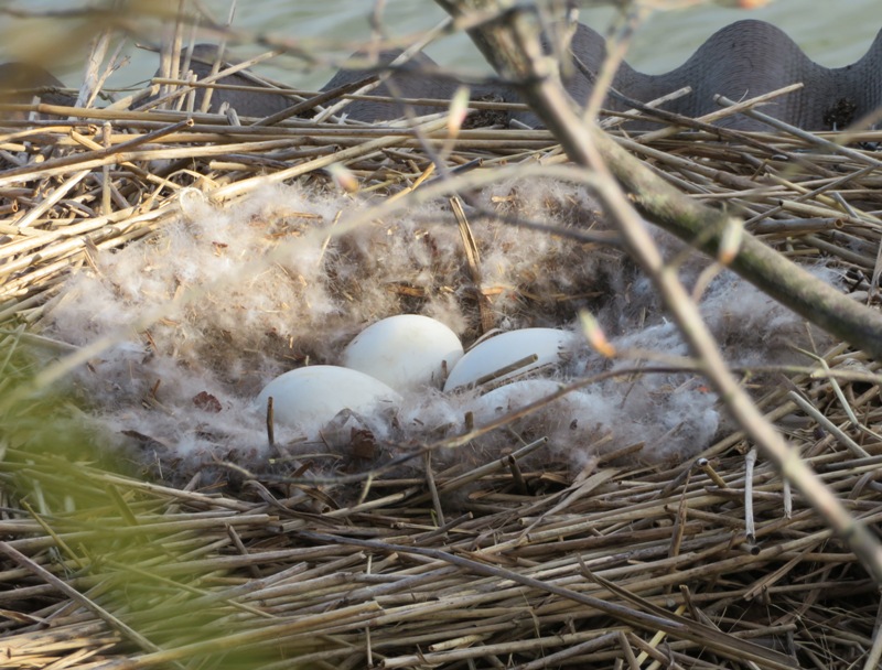
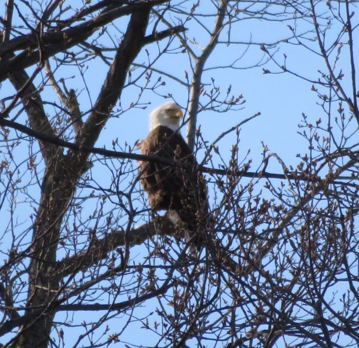


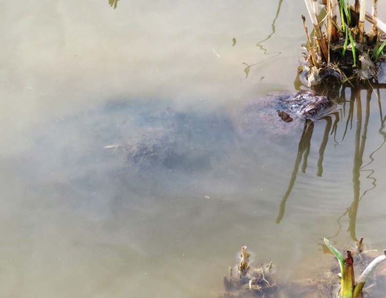
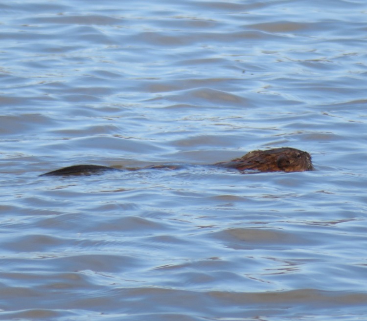
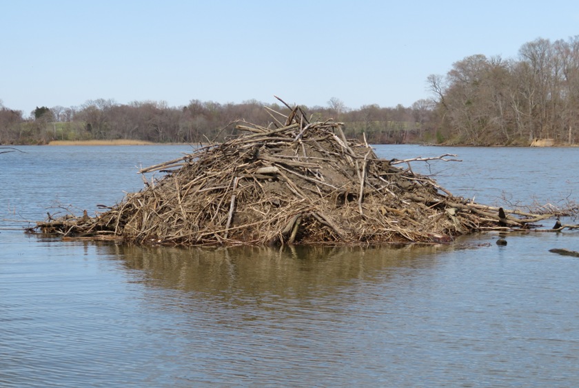
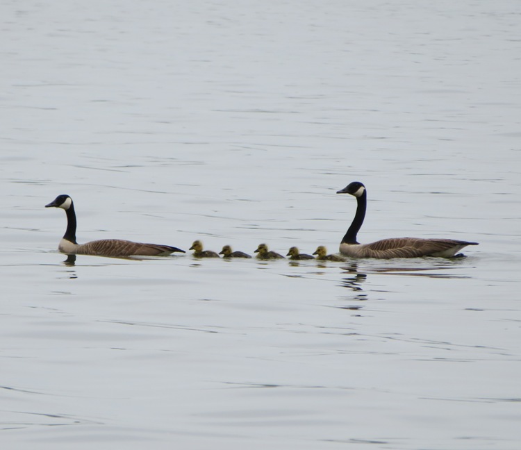
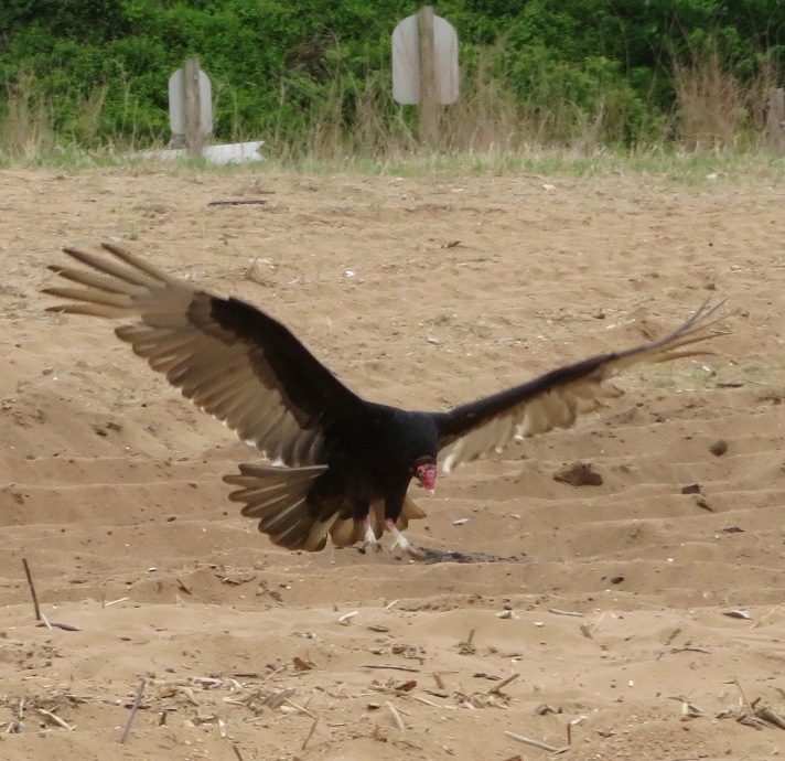
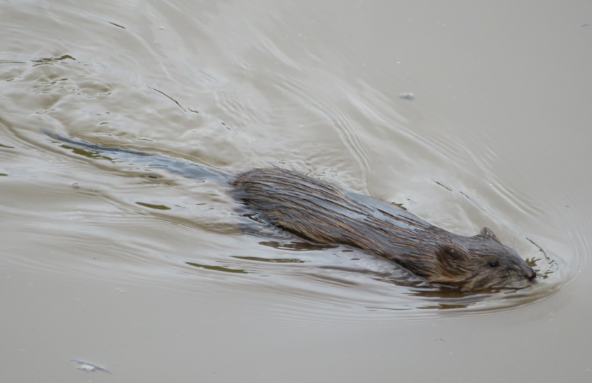
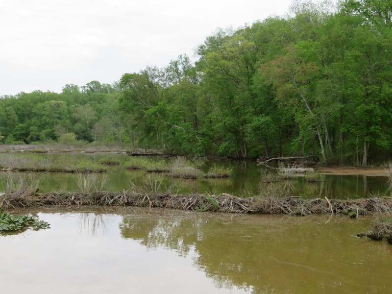
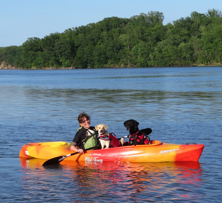
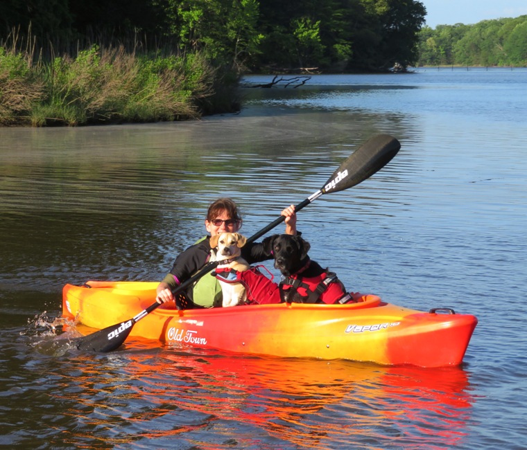
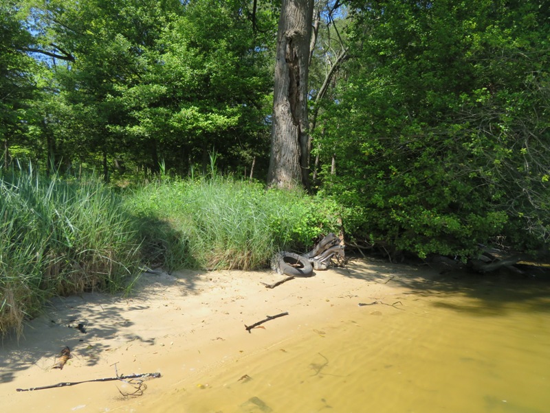
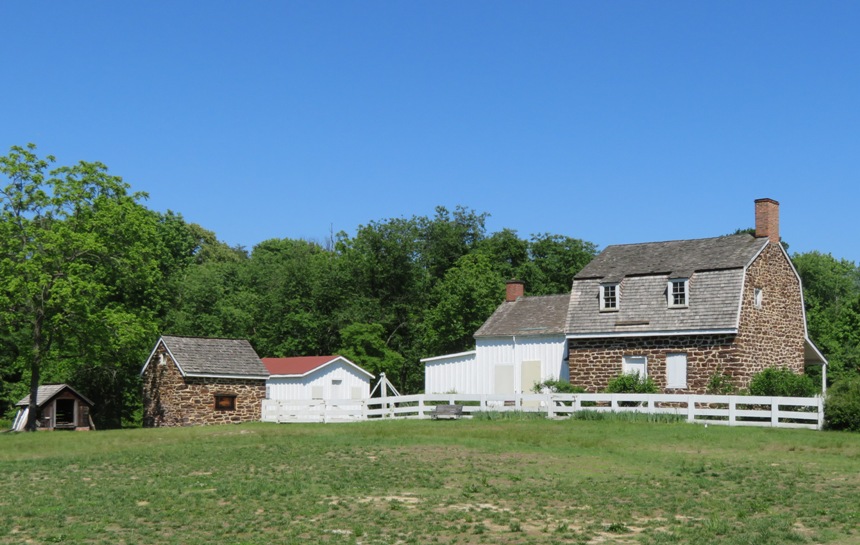
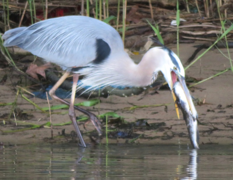
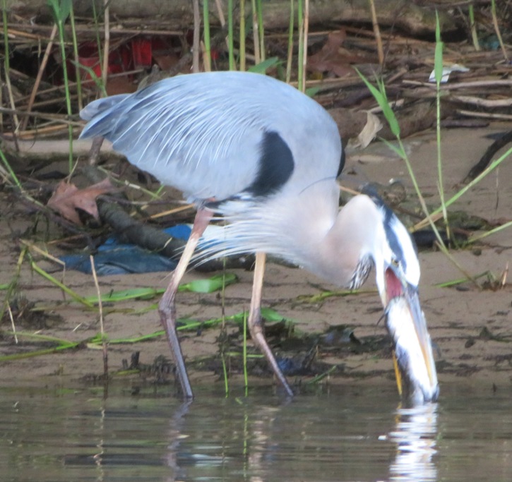

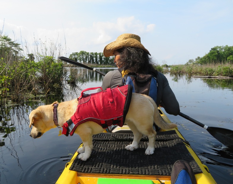


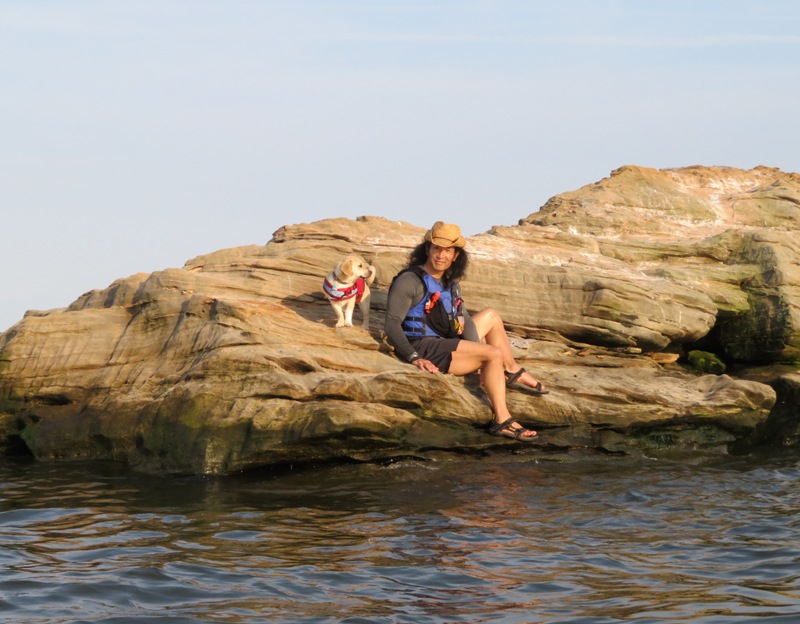
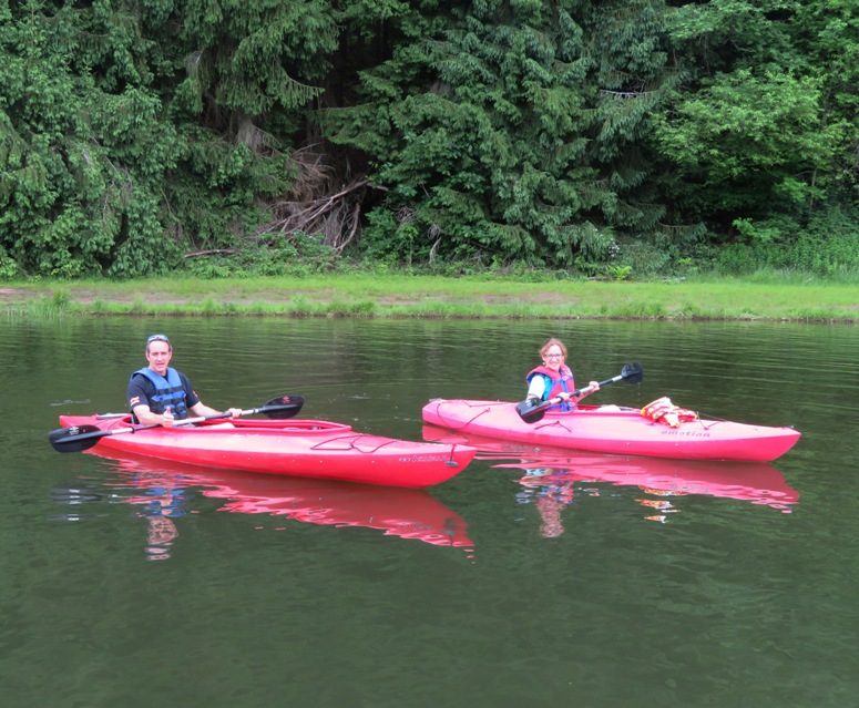
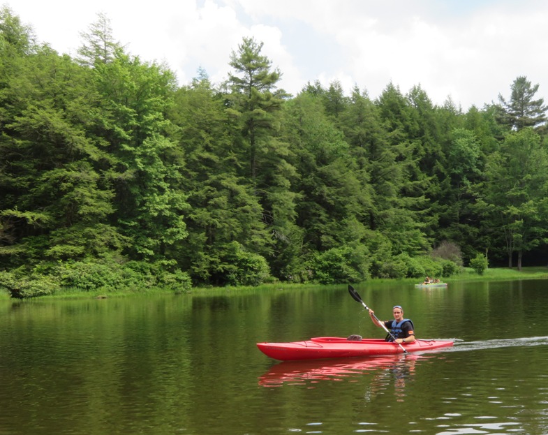

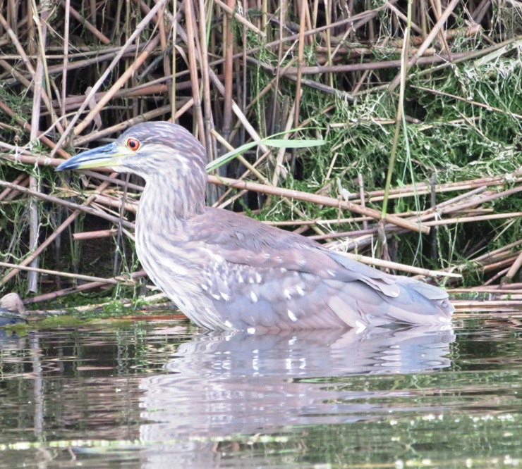

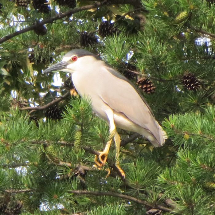


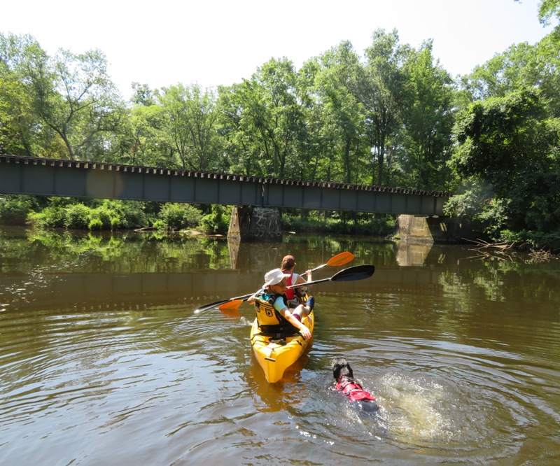
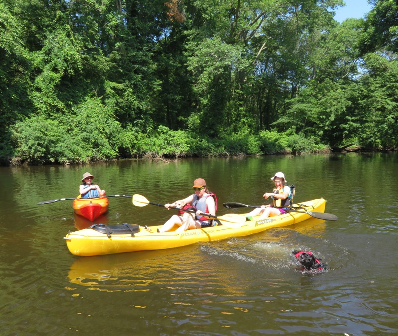
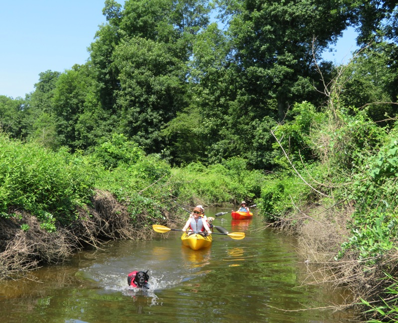
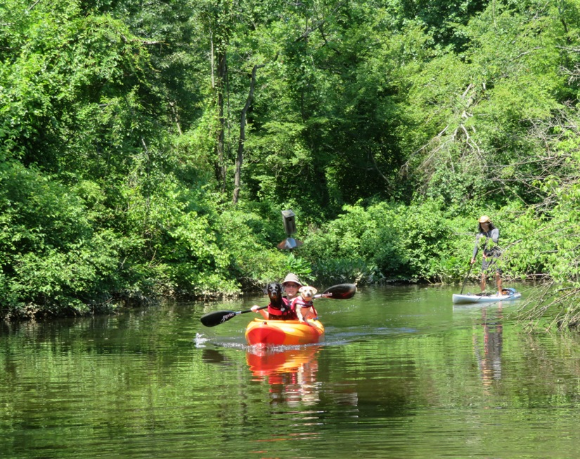

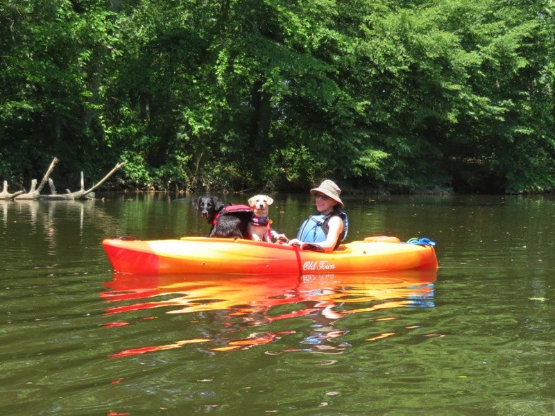

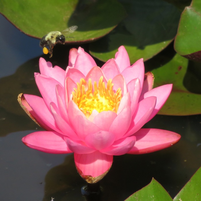
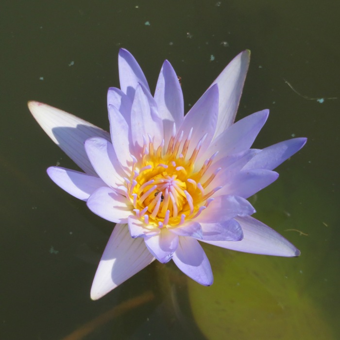

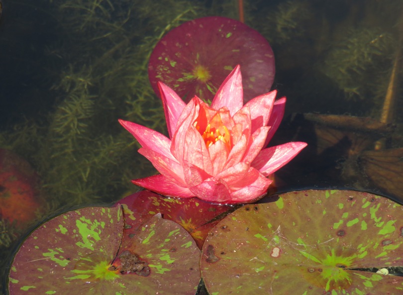

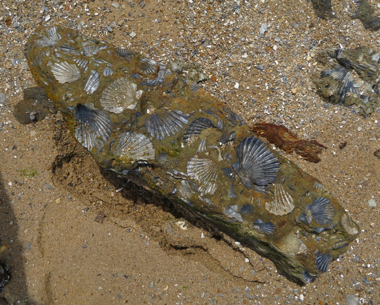

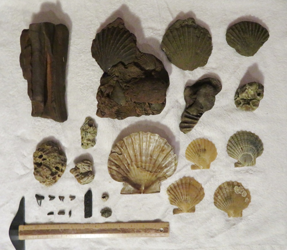
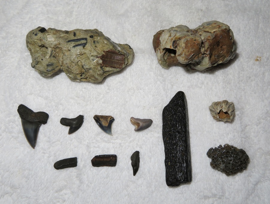
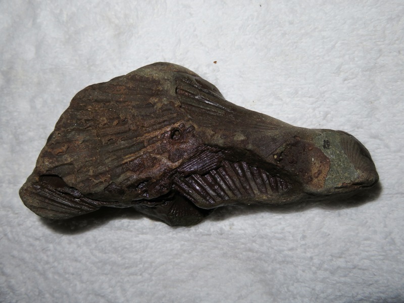
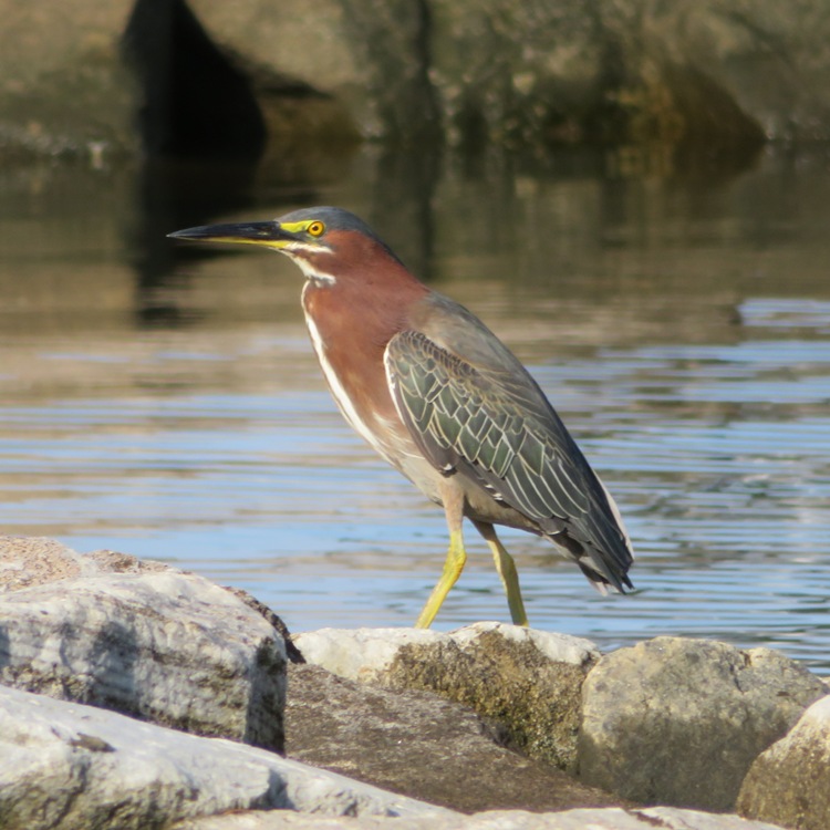
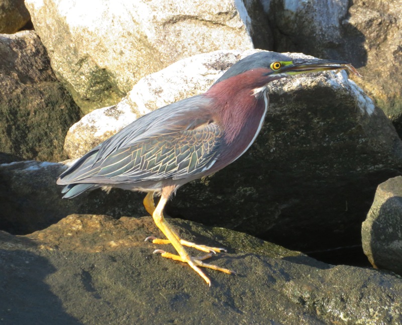
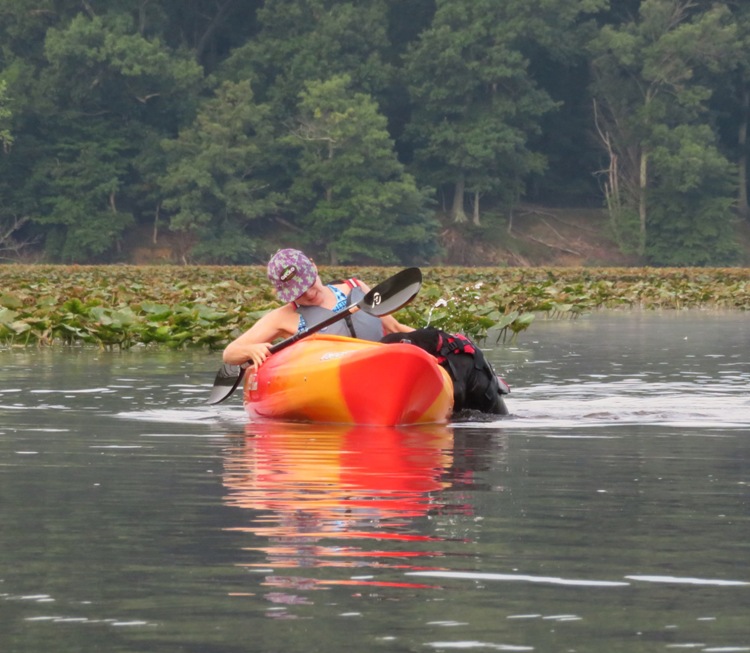
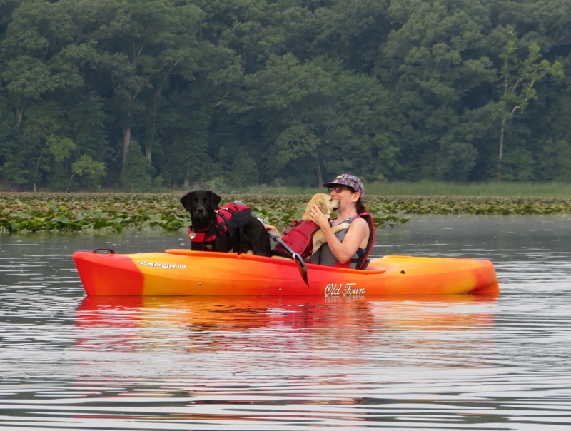


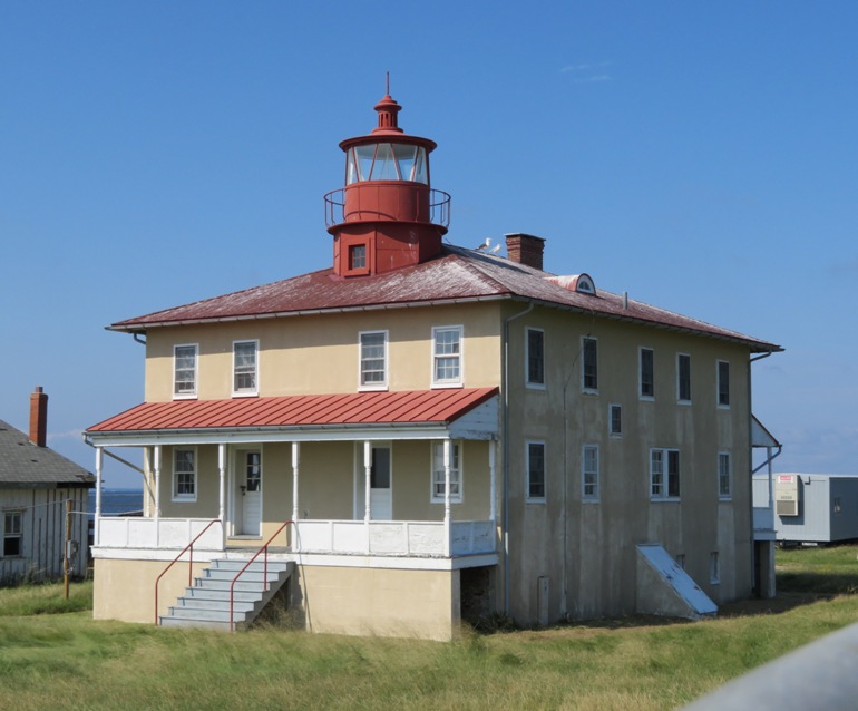
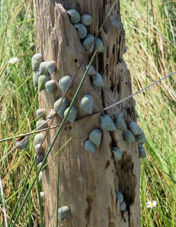

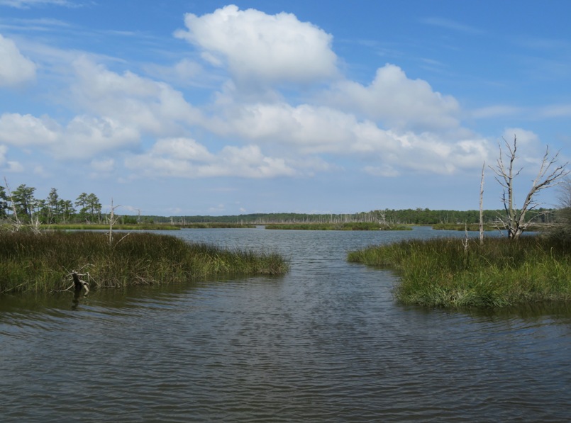

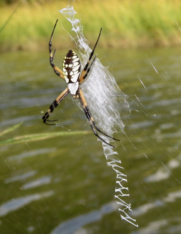
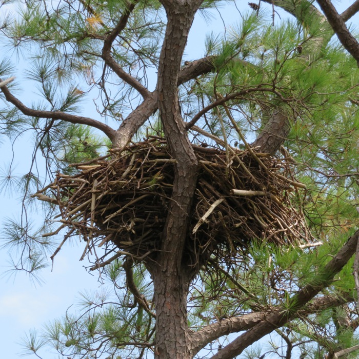
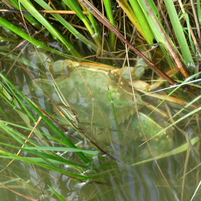

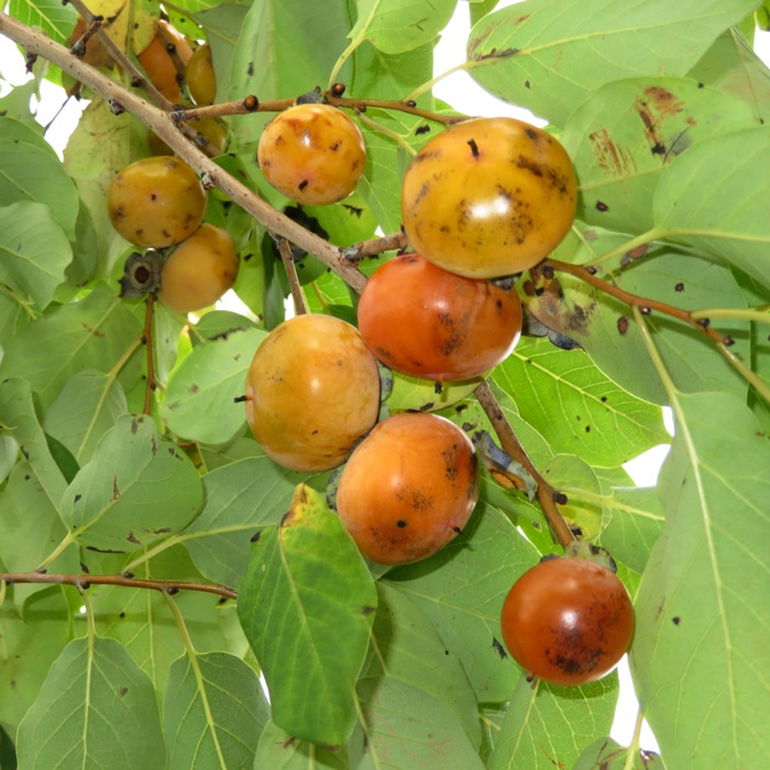
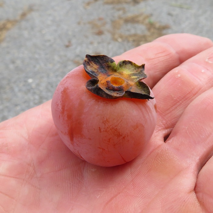


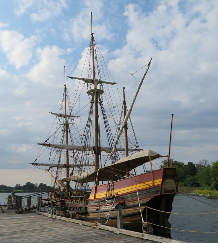
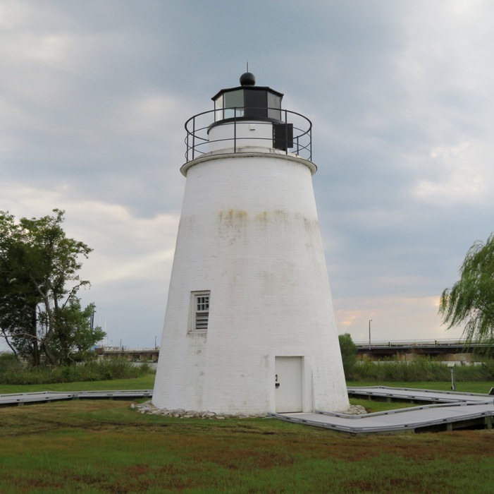
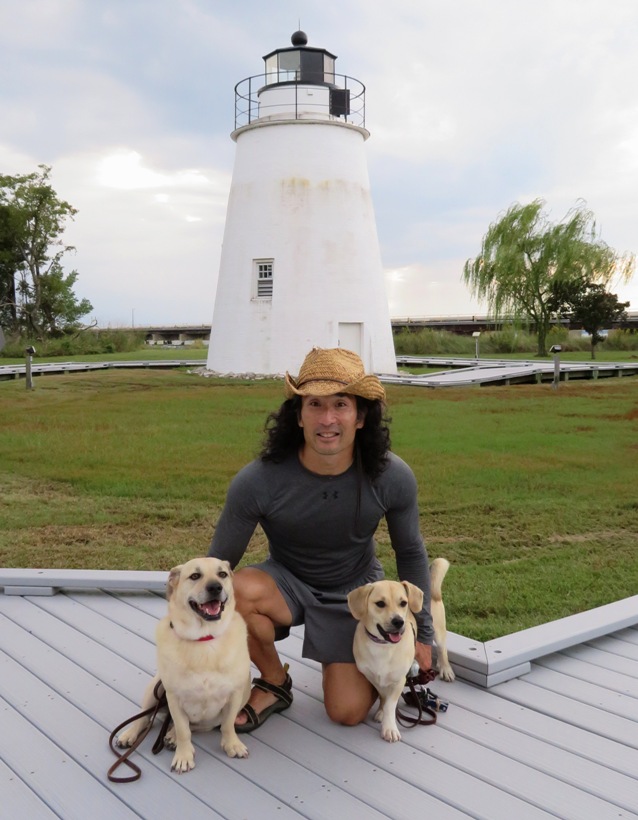

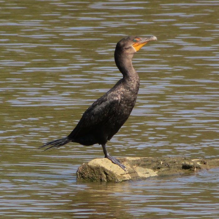


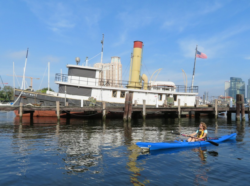