|
This page describes my kayaking and standup paddleboarding adventures in 2016. |

|
This page describes my kayaking and standup paddleboarding adventures in 2016. |
|
After visiting Rocks State Park - Kilgore Falls on February 7, 2016, I took a short drive on some narrow, dirt roads to Eden Mill. Here, I found a nice visitor center with live snakes and turtles. They also sold honey made from their bees. The place has about three miles of trails. But the most important find was the launch sites.
This is a very scenic part of Deer Creek in Harford County. I have only paddled on this creek once, back on October 28, 2007. It is a beautiful, natural area but the water can get low in the summer, making kayaking difficult. It is also a place where paddling upstream isn't practical so you'll need a shuttle so you can paddle one way if you want to cover any real distance. Walking from a pretty big parking lot, I passed an old barn. Can you see the apiary on the right? The barn housed various old farm equipment. 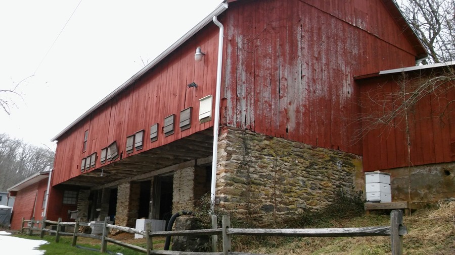
Next to the Eden Mill visitor center was a dam over Deer Creek. The original Stansbury Dam was built in the 1790s and stood at six feet in height; the dam was rebuilt several times up to 18 feet. The original dam was used to power the water wheel for the mill that the Stansbury Family ran. The mill processed corn and wheat, among other grains, and was an important part of the farming community. - from Eden Mill Nature Center Trail Guide 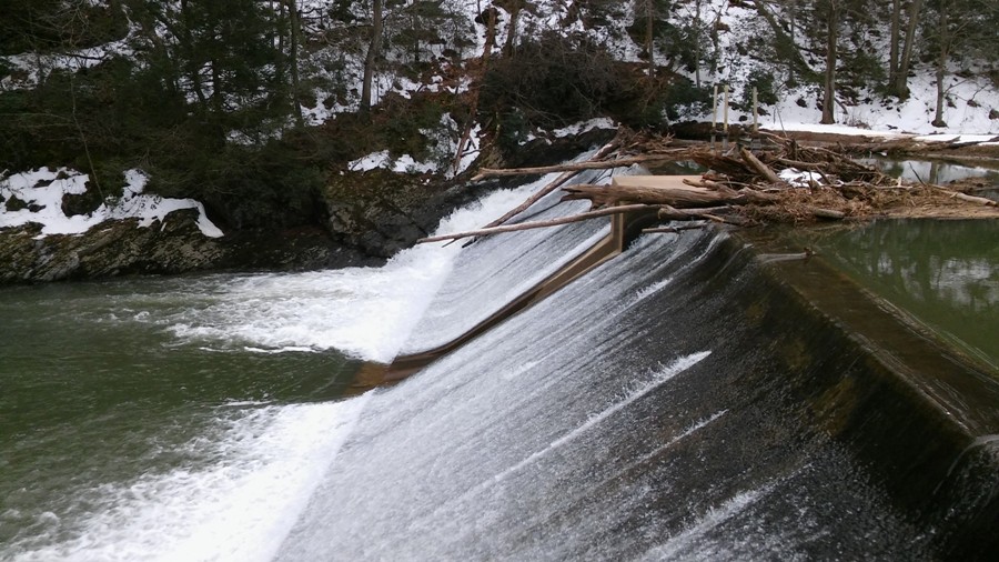
Just upstream of the dam and slightly west of the visitor center is a launch area. You'll want to drop your boat and gear off and then park in the main lot on the east side of the visitor center near the pavilion. There is no launch fee. 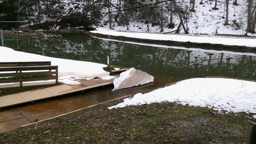
Here, the water is deep and calm. 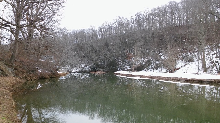
I walked on a snow-covered boardwalk on the north side of Deer Creek heading upstream. Then I strolled along a narrow tributary called Big Branch. 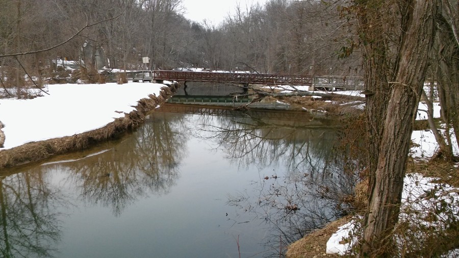
I was told that one can't get too far on this via kayak though I would like to see just how far I could get. Here's a view taken from the bridge in the previous photo, looking upstream. 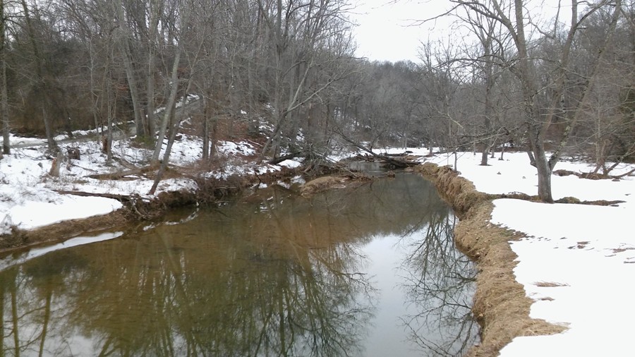
There was a lot of recent beaver activity in this area. 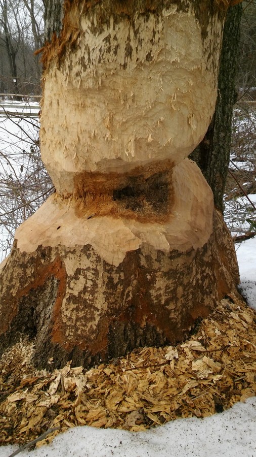
Near the pavillion, east and downhill of the visitor center, one can launch downstream of the dam. Here, the water is shallow and runs fast. There isn't a formal launch area. You just have to carry your boat about 50 yards from the lot to the water. If you really don't want to have to carry your boat, then you can launch further downstream on the south side of Red Bridge Road just east of Fawn Grove Road. I saw a small place just off the dirt road where a very limited number of cars might fit. See 39.675350, -76.445856.  |
|
This was a trip that I planned which turned into more of a short hike after scouting showed it to be less than ideal. Check out my February 28, 2016 hiking blog.
|
|
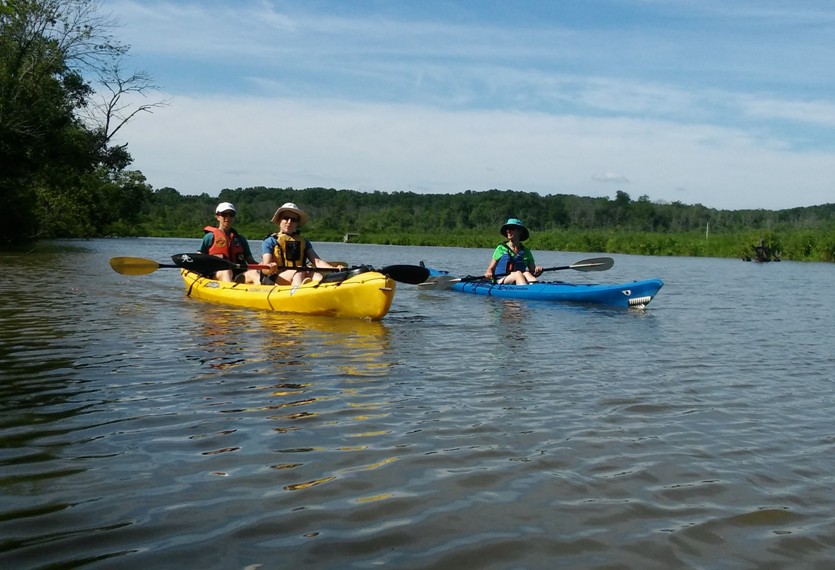
In early March, we got a couple of inches of snow. Then, very quickly, things warmed up a lot. During the week of March 5-12, we had a good bit of sun and two days with a high temperature of at least 80 degree. I took advantage of this to get a lot of work done in the backyard, building planters. See north view of planters and south view of planters. After a few days of getting the wood nice and dry, I stained it on March 9. Satisfied with my progress, I worked a half day on March 10 and then went kayaking. I asked a couple of friends to join me but they had other things to do.
It was a little too windy for the SUP so I took my surf ski. On May 30, 2013, I explored Scotchman Creek and Little Bohemia Creek, launching from Bohemia River Minipark which put me on the Bohemia River. Today, I launched from the same place but explored Great Bohemia River. With a small kayak rudder instead of a big SUP fin, I figured I would make it pretty far upstream...maybe even to Delaware. At the launch area, a couple of guys were fishing. They were catching a lot of perch. Just during the few minutes it took for me to get my boat ready and don my wetsuit, one fellow caught two fish. I was on the water around 1230. High tide was ~1040 and low tide was ~1703. I did not want to be stuck far upstream at low tide. A surf ski isn't the ideal boat for exploring small creeks, especially one with a non-retractable rudder like mine. But when my destination is six miles from the launch site and I have limited time, it is a luxury to travel quickly. Last year I did not paddle my surf ski at all...instead preferring my SUP. I still prefer the surf ski if the weather and paddling conditions are ideal. Today, the conditions favored a kayak rather than a SUP. One thing I like about the SUP is it is easier to listen to music. But now I can hear my tunes just as easily on the surf ski. Over the winter, I took a plastic cat litter box lid, cut it up, glued stuff together, attached things to my kayak, threw on some bungee cord, and voila...I now have a GPS and boom box holder! 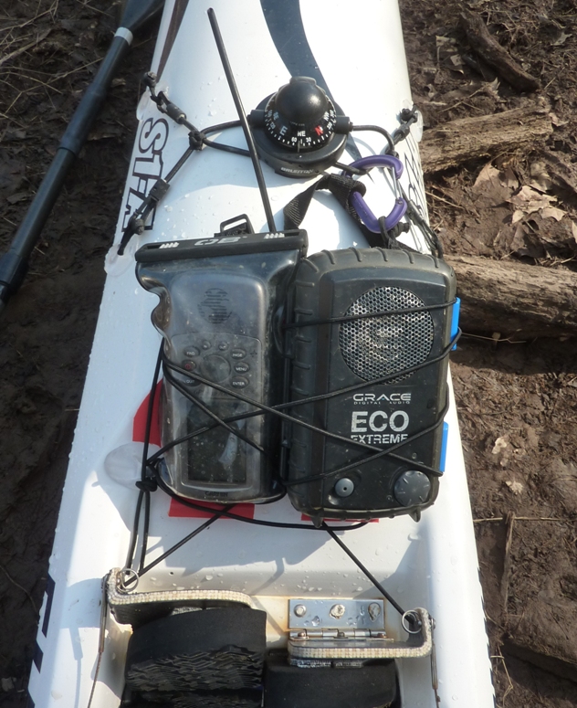
After paddling for 12 minutes, I saw my first eagle. I spotted several more throughout the day. Most were juveniles. I also came across three eagle nests. The air was warm and breezy while the water was cold. I was glad to be wearing a wetsuit. I brought an extra neoprene shirt in case I got cold but I did not need it. Despite the water temperature, there were many turtles out. I saw too many to count. Unfortunately, none would pose for a photo. Two big fish (each about 16 inches long) jumped clean out of the water in front of me. I couldn't tell what they were. Once I got pretty far upstream, I spotted a beaver lodge. 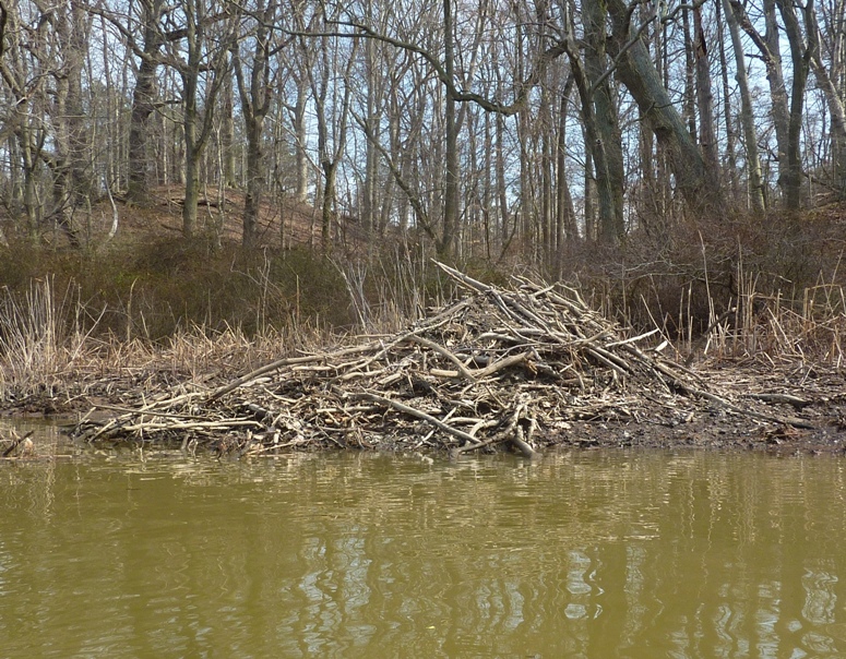
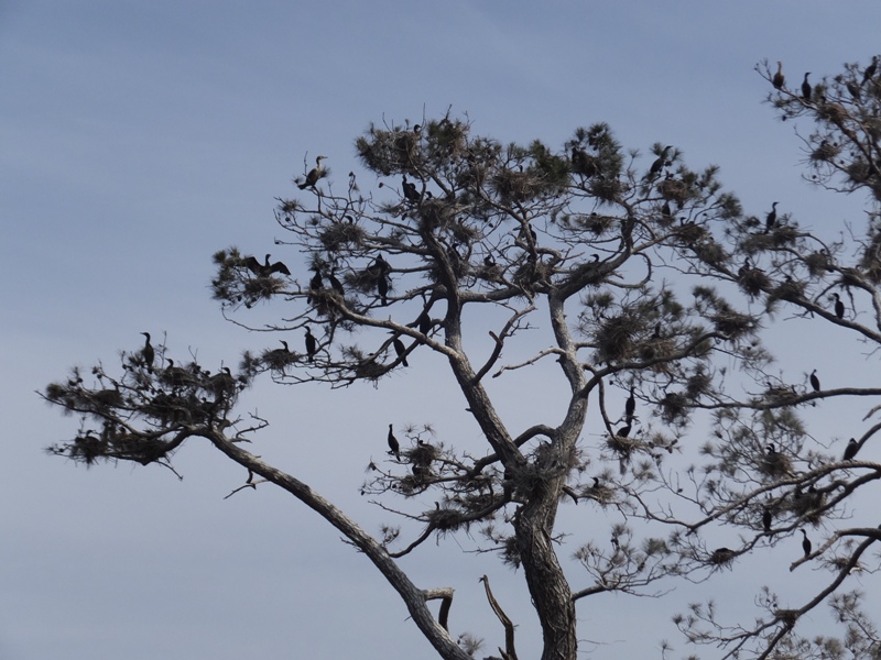
About five miles east of the launch site, I spotted a small heron rookery. It is good to see them before mid-spring while there aren't many leaves on the trees to obstruct their view. Herons begin returning to a colony to breed in February and March. Nest building begins in March or April. The nesting season [is] February 15 to July 31. Nests are 25-40 inches in diameter and 12 or more inches thick. - from "Washington Department of Fish and Wildlife - Herons" (now a broken link) 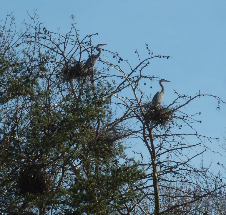
I only saw about ten nests but I expect many are still under construction since they probably aren't ready to start laying. When will the eggs be laid? In 2012, the female at this nest laid her eggs on March 28, March 30, April 1, April 3, and April 6. In 2013, the eggs were laid on April 14, April 16, April 18, April 20 and April 23. Great blue herons usually lay an egg every two or three days until the clutch is complete. - from "The Cornell Lab of Ornithology - Cornell Herons" (now a broken link) I paddled up Sandy Branch as far as I could which wasn't far. On a very narrow section of Great Bohemia Creek near Bohemia Mills, I saw a yellow perch. It was alive and on the shore. It had something flesh colored sticking out its right side. Above that was something that looked like eggs. I passed around the photo and asked folks what they thought it might be. I was told there is a good chance the flesh colored thing is Lymphocystis Disease. Lymphocystis Disease is a chronic and benign infection caused by an iridovirus that results in uniquely hypertrophied cells, typically on the skin and fins of more advanced orders of fishes. The virus is spread by physical contact between fish. Factors such as high population density and external trauma enhance transmission. The virus has an affinity for connective tissues and consequently manifests its tumors many times in fins, gills, or skin. Incubation times and lesion durations vary with species, however, cold water species can carry visible tumors for several months up to a year; while warm water species may have the lesions for only a few weeks. The disease has been found in many species of fishes including: herrings, smelts, temperate basses, sunfishes, perch, flounder, sole, and many others. Regarding the stuff that looked like eggs, one person thought it was some kind of gill parasite eggs while another thought eggs from the fish were coming out of its wound. My photo was sent to a biologist at the Smithsonian Environmental Research Center (SERC) who replied Those are fish eggs with some internal organs poking out. This fish was injured somehow. I didn't make it to Delaware but I think I got within a quarter of a mile. 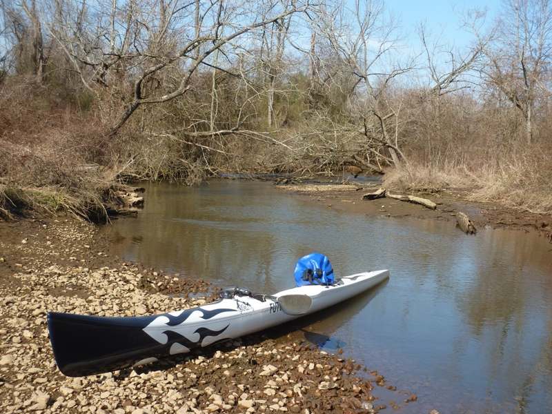
From near my turnaround point, I was able to see the Telegraph Road Bridge. Why didn't I continue further? There were many obstructions, it was shallow, and too narrow to venture on. I saw another mystery item near the yellow perch. It was a wooden pole about 20 feet long and five inches in diameter. At one end was a metal fitting. I took a photo and passed it around too. I got more guesses for this. 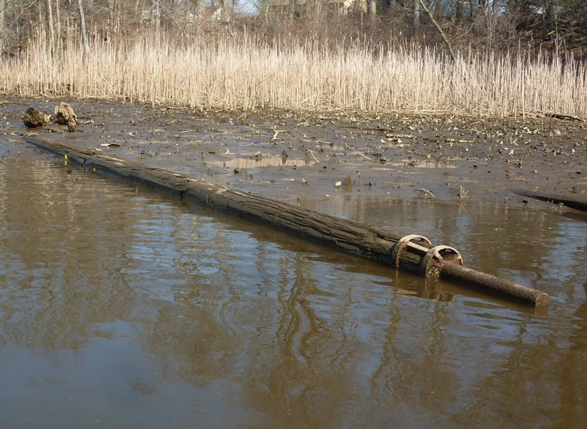
Here are the answers people gave. Later, I wondered if this pole might have had something to do with Bohemia Mills. I was not able to find out anything about the mill other than there was also a dam. I searched and found no photos, dates, or even a description of what kind of mill it was. Having explored the most upstream sections of the creek, I started making my way back downstream. The tide had gone out. The difference between high and low tide was 2.7 feet. This isn't much (in Maine it could be 20 feet!) but considering this creek isn't very deep to start with, the drop was significant. Several areas in the middle of the creek that were underwater on my way upstream were now exposed. I spent a good deal of time zig zagging, looking for the deepest areas. A few times, I got stuck and had to walk through knee deep mud to get back to deep water...and by "deep" I mean water where I could sit in the kayak and float without my rudder dragging on the bottom (about 16 inches). Walking through the mud reminded me of my May 20, 2007 trip to Kenilworth Aquatic Gardens. I was hoping to explore some of the tributaries on the north side of the creek but the entrance to them was too shallow. What started out as a sunny day ended up being cloudy. Just east of the Bohemia River Bridge on the north side, I saw a sign that read "LOOSE CATTLE, BEWARE, TWO VICIOUS BULLS." This was enough incentive for me to keep my distance. If it was just one vicious bull, I wouldn't have cared but I don't think I can take on two. 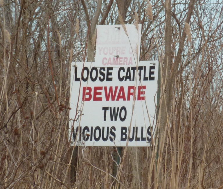
I finished at 1610, having paddled 12.4 miles. It was still early and I didn't want to fight the traffic near Baltimore so I spent some time exploring the Elkton area. I checked out Marina Park which could give me access to Big Elk Creek. It looked very shallow. Here's a view taken from the park. 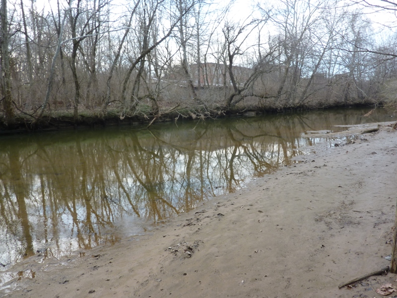
This is a shot looking north (upstream) from the Bridge Street (Route 213) bridge. 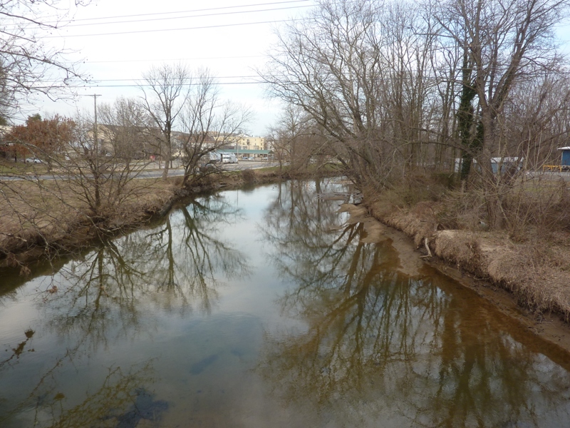
Hoping to find deeper water downstream, I drove to Historic Elk Landing which borders Little Elk Creek near the confluence of Little Elk Creek and Big Elk Creek. This was shallow too but maybe not as much. Here's a view looking south (downstream) on Little Elk Creek. 
I had never spent any time in Elkton. What I saw didn't look particularly impressive but I later learned they have some interesting history. When northern states began to pass more restrictive marriage laws in the early 20th century, Maryland did not. As a result, a number of Maryland towns near borders with other states became known as places to get married quickly and without many restrictions. Elkton, being the northeasternmost county seat in Maryland (and thus closer to Philadelphia, New York, and New England), was particularly popular. It was a notorious Gretna Green for years; in its heyday, in the 1920s and 1930s, it was "the elopement capital of the East Coast" and thousands of marriages were performed there each year. - from Wikipedia - Elkton, Maryland Gretna Green is a village in the south of Scotland famous for runaway weddings. - from Wikipedia - Gretna Green Apparently, I stuck around the area just long enough. I started heading home around dusk and didn't hit any significant traffic. |
|
I left work early and then drove out to Skipton Creek with my Prijon Catalina.
I was last there on June 17, 2015. I got what I think are some pretty awesome photos on that day. Back then, I found a heron rookery on Mill Creek at Google Maps coordinates 38.896800, -76.080263. But since it was late in the season, I suspect some of the young herons might have left the nest since the ones I saw looked almost as big as the adults. Additionally, the trees in which they lived were full of leaves so I couldn't get a good look. I was on my stand up paddleboard (SUP) so I couldn't access the shallow areas. I planned to return one day and check things out with a kayak early in the rookery viewing season. That day was today. As I unloaded my boat, I noticed a sign that said "NO SMOKING." A little later, a couple showed up and stood out on the pier, smoking cigarettes. I was on the water by 1520. Low tide at Claiborne on the Eastern Bay was 1139 and high tide would be at 1735. I figured the tidal effects would probably hit my area about a half hour later. I wanted to take advantage of the flood tide to avoid having to walk through the mud like I did on March 10, 2016. It was sunny and supposedly about 66 degrees with a south by southwest wind of ten mph. I wore my wetsuit with the top pulled down. If I needed it, I could easily pull it over my shoulders for extra warmth. I also brought my long sleeve neoprene shirt though I did not expect to use it. Big fish were jumping. One was close enough to splash me. I paddled right along the shore. There was a narrow stream I kayaked up for a short distance. Thousands of small fish jumped as I passed by. As I made my way north on Mill Creek, I spotted several bald eagles. About half were immature. In one tree, I saw three mature eagles. I found no eagle nests. 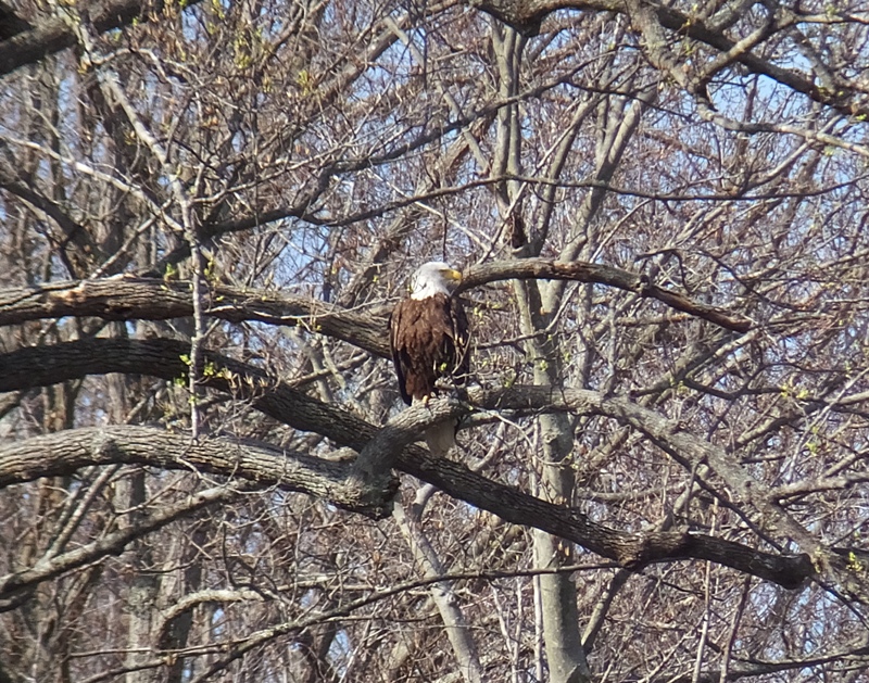
There were many turtles resting on sunny sections of logs. Most dove in as approached. One appeared to leap into the water, covering a horizontal distance of about a foot in a 14-inch drop. Mill Creek got narrow and I encountered some downfalls that required portaging. In a few cases, I was able to simply build up speed and go over debris. I brought two saws and some small loppers but didn't need them. Skunk cabbage flourished. 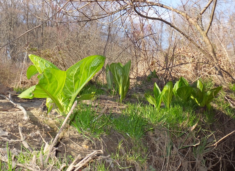
A rotting tree stump looked like it provided several meals for various wood-eating insects. 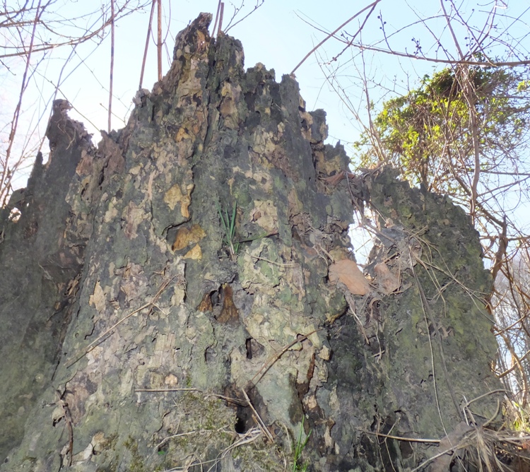
There was evidence of beaver activity but nothing recent. I saw no lodges or dams. I pulled ashore and turned around about 100 feet from Wye Mills Road (route 662). Behind my boat stood an 18'x12' root base and dislodged dirt from a fallen tree. 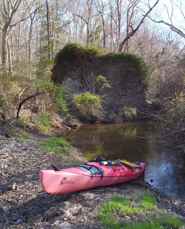
Spring equinox was just three days prior and it was definitely looking like winter was over. Trees were budding and various plants were starting to flower. 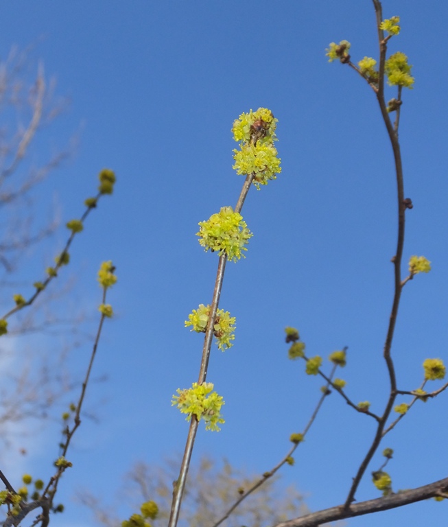
I found a source for the creek that appeared to be a spring. 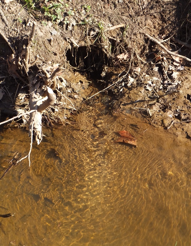
It was a good day to be on the water. I don't expect there are many people that ever got as far upstream as I did that day. 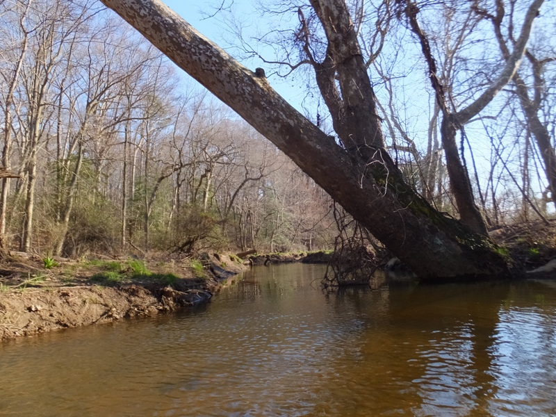
I saw a wood duck, kingfisher, and a red-winged blackbird. Kayaking downstream, I checked out the rookery I remembered from last year. I was hoping to get a good view but many of the trees in which the nests were built were evergreen. Other nests were just too hidden to get a good view. I reckon there were about ten nests. 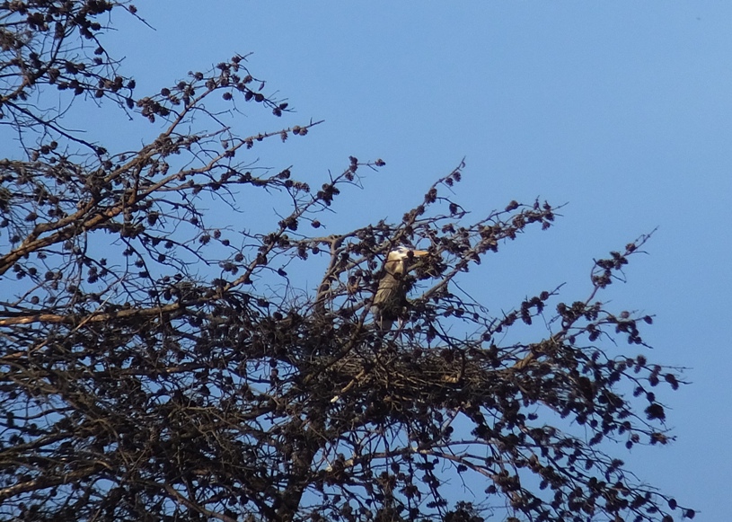
Back on Skipton Creek, I pulled over and took a quick Cheez-It break. It was that time of the day when the low sun was making things glow. 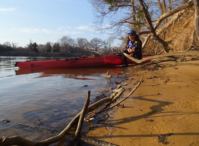
The temperature was dropping so I put my wetsuit on all the way over my shoulders. I paddled past where I launched. I took out my camera to take a photo of a great blue heron standing in shallow water. But just before I clicked the button, it started to take off in flight. 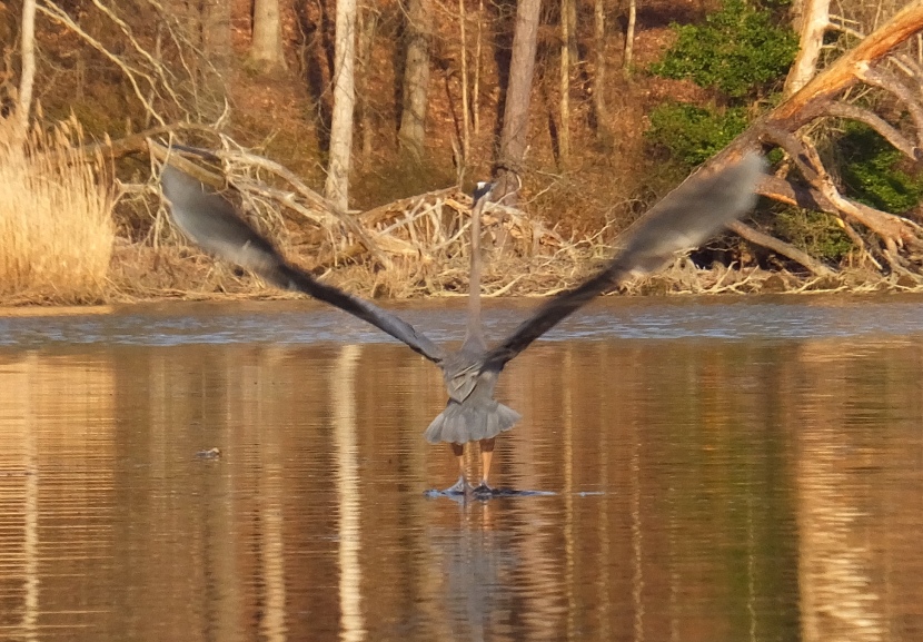
At Google Maps coordinates 38.886216, -76.066749, I found another rookery. This one also had about ten nests. But these were positioned much better for taking photos. Near a boat dealer called Marine Mart, the creek split. I turned left and kayaked east under Highway 50. This is the same Highway 50 that goes all the way to Sacramento! On a telephone pole, I saw an osprey nest. 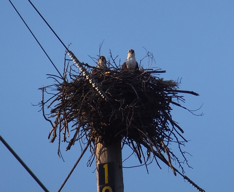
I only got about a tenth of a mile east of Highway 50 before I got out, turned the boat around, and then headed back. I was going to take the other route at the Marine Mart split. This would have taken me south and then under a different part of Highway 50. But it seemed too shallow. Not sure how I did it with the SUP last year. Maybe things have eroded since then. As it started to get dark, I saw a tree with several birds. I couldn't tell what they were but they were pretty big. Eagles and ospreys aren't social and they did not appear to be herons. I'm thinking they were vultures. Funny how I've never seen a vulture nest. An osprey watched me from a tree. It let me get unusually close. 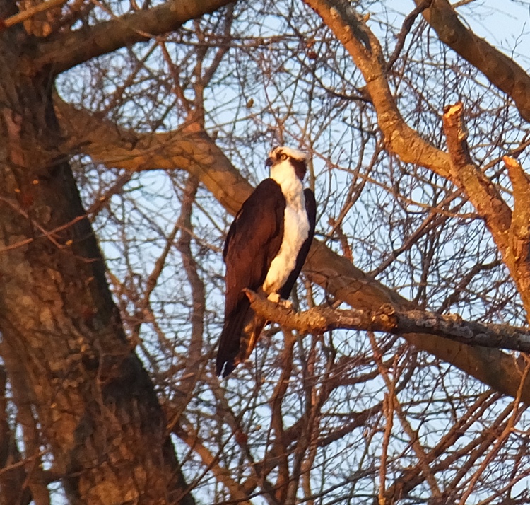
I made it back to Skipton Landing at 1900. 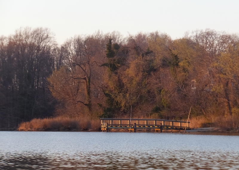
The "NO SMOKING" sign I saw just before I launched was now vandalized. Someone took a black marker and crossed out "NO" and also drew a swastika on the sign. I wondered if it was the couple from earlier but they looked a little too old to be doing something so childish. The ironic thing is the vandal's swastika was drawn backwards, like the Buddhist symbol. |
|
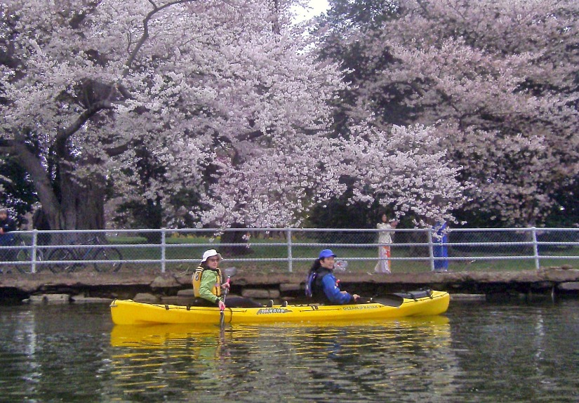
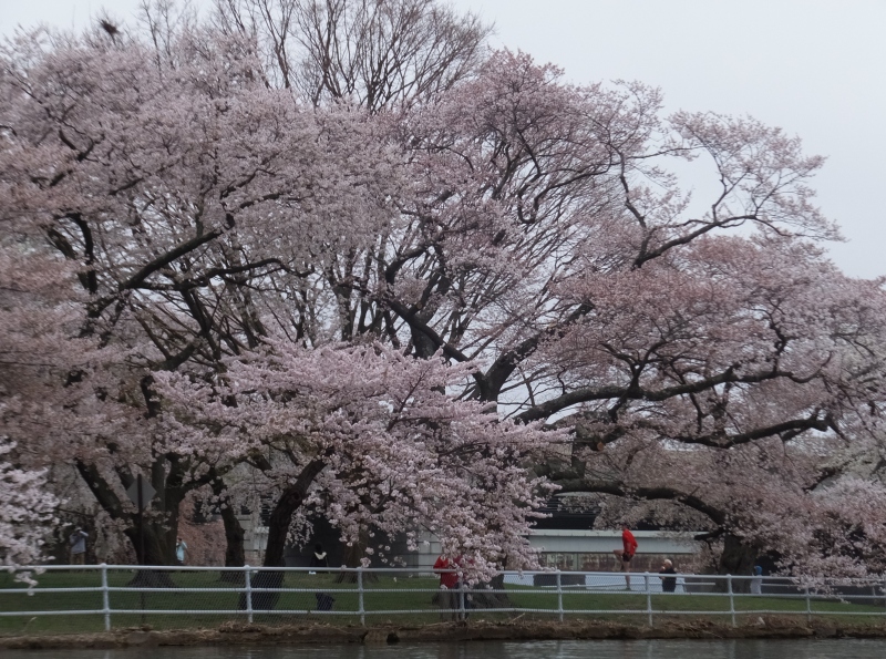
My chickens provide me with all the eggs I need so instead of looking for goodies hidden by the Easter Bunny, Norma and I went kayaking with Ralph. Today was cold, dark, and gloomy
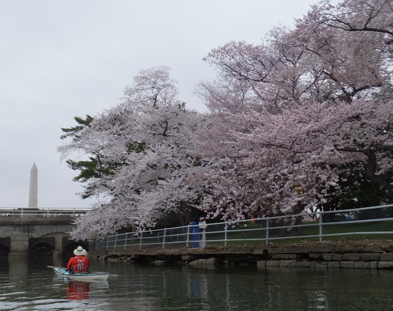
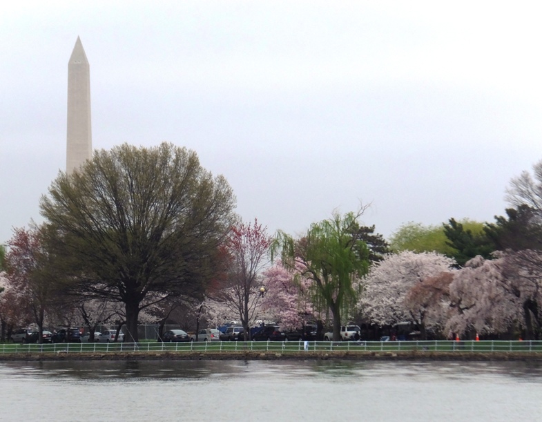
but kayaking in Washington D.C. to see the cherry trees in bloom brightened our day.
Ralph picked us up at 0645 and we were on the water at 0800, launching from Columbia Island Marina. He was in his Current Designs kevlar kayak while Norma and I paddled my Ocean Kayak Cabo tandem. Directly across from our boat ramp was the Pentagon, which doesn't look so special if you see it at ground level. 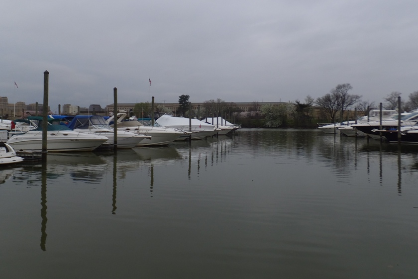
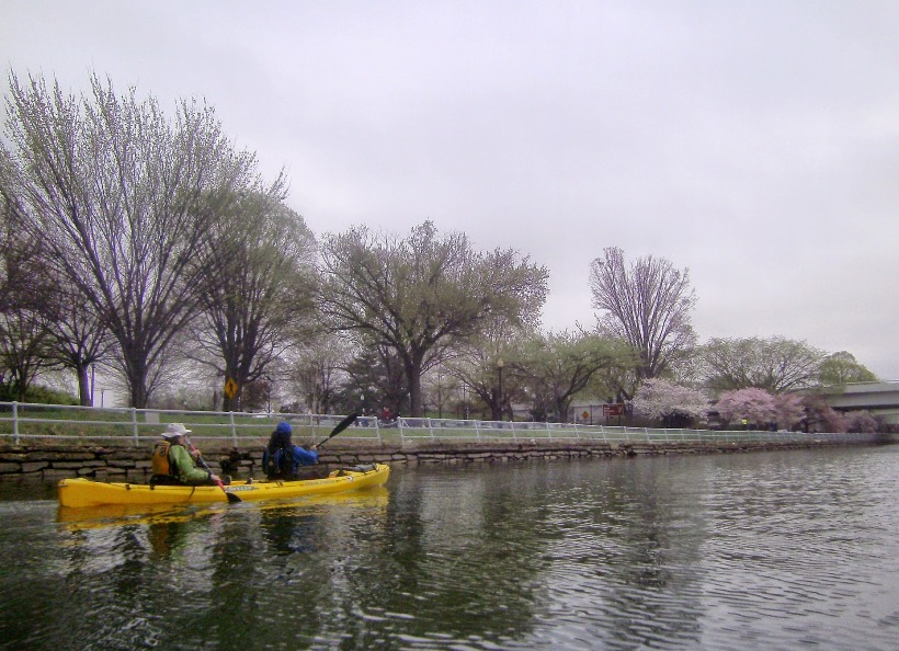
We crossed the Potomac River, leaving Virginia for Washington D.C. In my opinion, one of the best views of the cherry trees is between the 14th Street Bridge and the Tidal Basin. We could not access the latter because it is gated off. They do allow people to rent paddle boats in the Tidal Basin but kayaks cannot enter. It has been suggested that the gate prevents the paddle boats from entering the Potomac River where they would be like turtles on a highway. 1 / 4

Washington Monument.
2 / 4
14th Street Bridge.
3 / 4
Norma and I.
4 / 4
Heading downstream.
The temperature was around 49 degrees. The sun did not come out all day. But at least the wind was calm (as the pic below depicts) and it didn't rain while we were on the water. Ralph wore his dry suit while Norma and I wore farmer john wet suits, neoprene shirts, splash jackets, and neoprene footwear. Even then, after three hours, we were a little cold. But that probably wouldn't have been the case if we were in cockpit boats. 
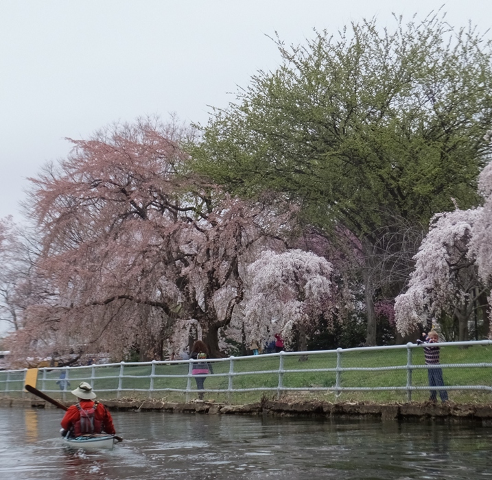
The three of us kayaked downstream, following East Potomac Park to Hains Point. This put us at the mouth of the Anacostia River. We then crossed over to the northeast side where we saw the National War College at Fort Lesley J. McNair. Next, we paddled up the Washington Channel until we could see the other gated entrance to the Tidal Basin. Then we headed back. 1 / 6
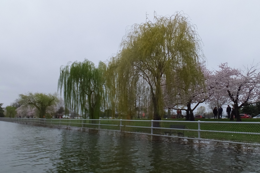
Willow trees.
2 / 6
Washington Monument.
3 / 6
Child watching us.
4 / 6
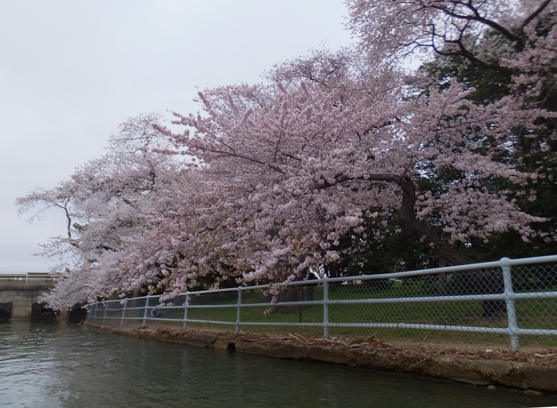
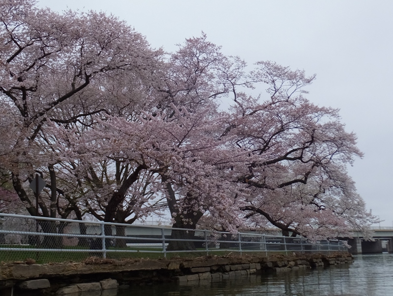
Cherry trees.
5 / 6
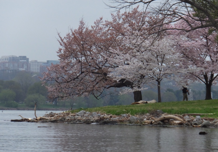
Near Ohio Drive Bridge.
6 / 6
Runner stretching.
We paddled a little over ten miles that day. The previous day was sunny and much warmer. I heard there were over a hundred people out on the water that day in kayaks to see the cherry blossoms. But today, we only saw a few outrigger canoeists in training and two other kayaks on the water. A few SUPs were returning when we landed but I didn't see them when we were on the water. There were a lot of folks out to see the cherry blossoms but not many that day could say they saw them from the water. |
|
Weather in late March and early April wasn't all that great. But over the last few days, we've had dry weather and lots of sun. So it only made sense for me to get out on the water today.
I'm usually not a social paddler but every once in awhile I like to see folks from the Chesapeake Paddlers Assocation (CPA). There are a lot of really good people in that club. Tall Tom H. and Tim D. led a trip that Marshall W. started awhile back called the Eastern Neck Paddle. This is a circumnavigation of Eastern Neck Island. I last did this trip back on July 22, 2006. I drove across the Bay Bridge to get to the eastern shore. Just before I got to the other side, a big clear plastic bag (bigger than a trash bag), floated amongst the lanes. I call such things an "air jellyfish." As cars zipped by, the movement of the air jellyfish became unpredictable. I ended up running over it. I looked in my rear view mirror and didn't see it for awhile. After several seconds, it dislodged from the underside of my car. I pulled over to check out the damage but didn't notice anything. So I continued my drive to the island. At the island, someone told me that something was dragging under my car. I noticed that a few protective plastic parts of my car had gotten ripped and come loose. I pushed the part that was dragging back into place and then continued driving to the Bogles Wharf launch site. The Chester River Steamboat Company built the original Bogles Wharf around 1887, just upriver from here. The wharf extended 1,000 feet into the deeper waters of the Chester River to allow loading and unloading from deep draft ships. Although Bogles Wharf received some passenger traffic, it was primarily a shipping point for Eastern Neck Island produce destined for Baltimore. By 1910, steamboat transport became obsolete, and therefore so did the original Bogles Wharf. The wharf in front of you extends into the sheltered water of Durdin Creek. It has been used by watermen and recreational boaters for over a century. Although this wharf is not in the same location as the original Bogles Wharf, it has taken the same name. - from sign at boat ramp Some heavy traffic near Washington D.C. on Highway 50 slowed a lot of folks down so we didn't get on the water until around 1045. There is a nice boat ramp but instead, we launched on the sandy beach. 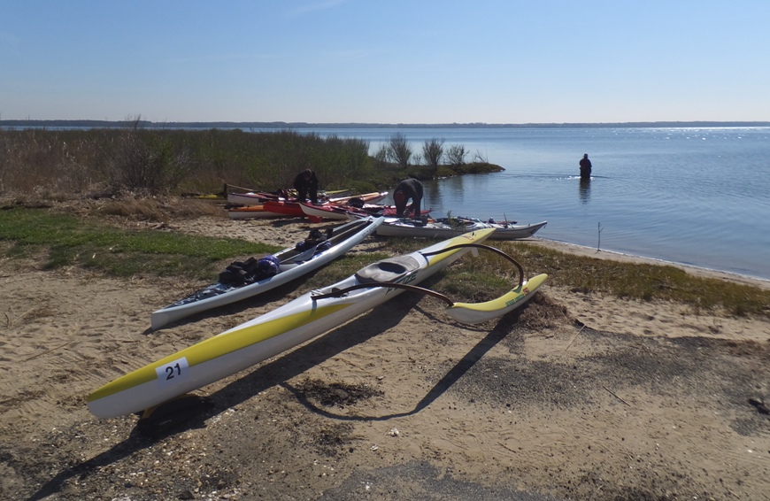
There were 14 of us: 12 kayaks (including Suzanne), a 21' long outrigger canoe (OC-1), and me on my stand up paddleboard (SUP). The outrigger canoe was paddled by Annette. She is very fast and I was not able to keep up with her on my SUP when we raced up Hall Creek. She and I traded boats a couple of times. She likes paddling my SUP and I really enjoyed her OC-1. It is like a surf ski with training wheels in that it cuts through the water effortlessly but is much more stable. I also found it to be more comfortable than a kayak. Sitting with my hips higher than my feet seemed more like sitting in a regular chair. 
Tall Tom (shown below) led us for the first half of the trip while Tim led for the second half. 
We saw numerous bald eagles but had no close encounters...they were all pretty far away but close enough for us to see their white head and tail. I spotted about eight jellyfish. I also saw a dark shadow of a large fish (about three feet long) swim under a kayak. I don't know what it was. I took a lot of photos of folks on their boats but the bright sun with most everyone wearing hats usually meant their faces were in shadows. The water looked unusually clear. From the SUP, I could see lots of stuff on the bottom. I was looking for horseshoe crabs or cownose rays but saw neither. About halfway through, we pulled ashore for a lunch break. 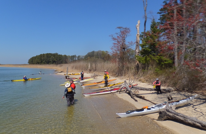
I found an old tree with some very interesting patterns. Had it been in better shape, I bet it would have sold for a lot as furniture wood. 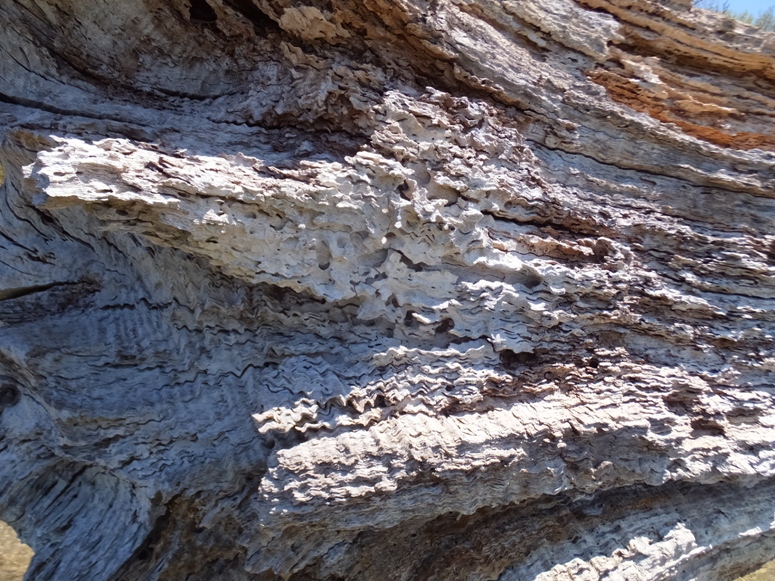
Rested up, we were back on the water again. 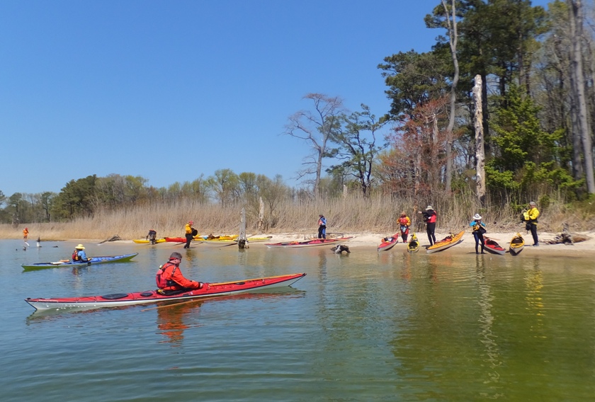
I was expecting fairly calm winds that would increase to eight mph in the afternoon but I don't think it ever got that fast. In fact, the water was roughest at the start as we paddled south on the eastern side of the island. The group continued onward, eventually paddling under the Eastern Neck Road bridge. Annette and I did one more boat swap. We mastered the art of swapping boats without getting in the water. She paddled my SUP the rest of the way in as I sliced through the water on her OC-1. 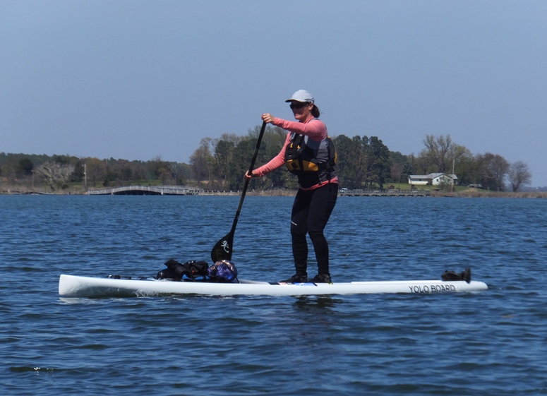
Near Calfpasture Cove, Tubby Cove, and Eastern Neck Narrows, we were (sort of) hoping to see the invasive mute swans that live there. It would have been nice to see them but at the same time, they are bad for the environment so in that regard, we didn't want to see them. But I did see them on March 15, 2008. Tundra swans are the native species but at this time of year, they live elsewhere. I was told that the mute swans eat too much vegetation. The mute swan eats bay grasses such as eelgrass and widgeon grass, pulling out whole plant, including their roots and rhizomes. Adults eat more than eight pounds of bay grasses every day. They feed by submerging their head and neck underwater, sometimes "tipping up" their tail in the process. During the winter, they will also eat wheat and other grains from farm fields. - from Chesapeake Bay Program - Mute Swan We completed 12 miles at about 1545. I was invited to join the group for an early dinner but I had things to get done at home so I declined. I need to make plans to take Norma kayaking tomorrow. I thanked our trip leaders and said farewell to the group. I then looked at the damage underneathe my car. I cut off one dangling piece of plastic. Then I made a hole in another part and used zip ties to secure it to another part of my car where there were once rivets (yes, I just happened to have zip ties for such an occasion). At home, I saw that the ripped piece that I had pushed back into place had come loose again. So I cut that off too. Not sure what it is all for but this can't be good. Still, I had a very enjoyable day! |
|
After spending April 16, 2016 out paddleboarding on big open water, I decided to spend the day with Norma on a trip more to her liking...something deep in nature.
We drove out to Kingston Landing to kayak on the Kings Creek Water Trail. This water trail was officially designated last summer but we actually paddled the area on July 2, 2006, shortly after we started dating. By 1400, we were on the water, kayaking downstream on the Choptank River. After about a quarter of a mile, we turned right onto Kings Creek. Norma was on the Cobra Expedition while I was on my Prijon Catalina. 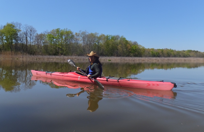
Invasive phragmites lined the brackish waters but eventually, they gave way to woodlands. Norma and I kayaked into a small tributary that was full of all kinds of nature sounds. We sat for a few minutes and just listened. Then we heard a distinctive bird call. After making a recording, I sent it to a biologist with the Maryland Department of Natural Resources who identified it as a least bittern. Pay attention to the three or four whoot sounds that occur after about two seconds. On the left, we passed the Nature Conservancy's Kings Creek Preserve. I expect we will return some time to explore the trails there but today was not the day for that. There were a lot of turtles out. I reckon we saw 50+ throughout the day. Norma spotted a snapping turtle in the water. I saw a 2.5-3-foot-long northern water snake. I followed it as it swam across the creek and then settled in the bay grasses. 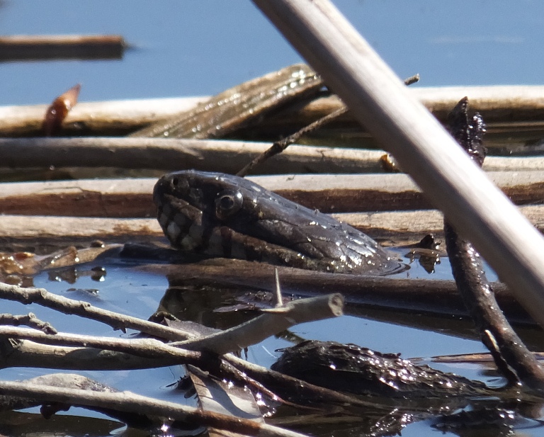
There were a few remnants of old beaver lodges but I did see one that looked more recent. 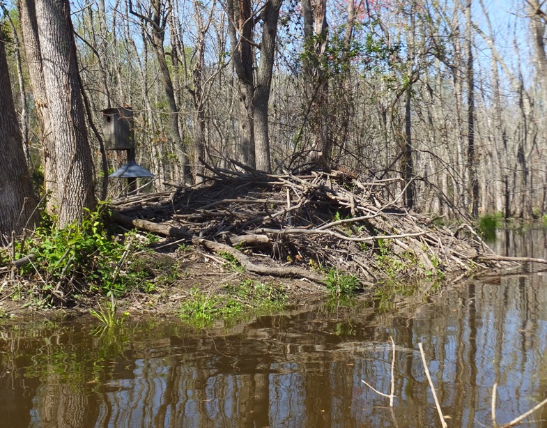
It was a very scenic day with warm weather, bright sun, and very little wind. Eventually, we came to the Kingston Road Bridge. It would have been easy to take out for a break on the west side but we were fine so we just kept paddling. 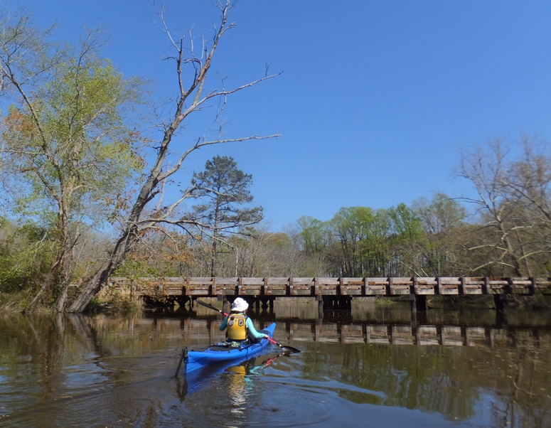
Plants were loving the nice spring weather. There were some downed trees but nothing that required sawing (yes, I was prepared for that) or portaging. I guess that's one advantage of paddling on a water trail...there is someone designated to help keep things clear. Eventually, we came to the Kings Creek and Beaverdam Branch confluence. Back in 2006, we explored the latter but today we wanted to see how far we could get up Kings Creek. Skunk cabbage was flourishing in the most upstream freshwater sections of the creek. About 1.4 miles upstream on the confluence we pulled over for a lunch break. 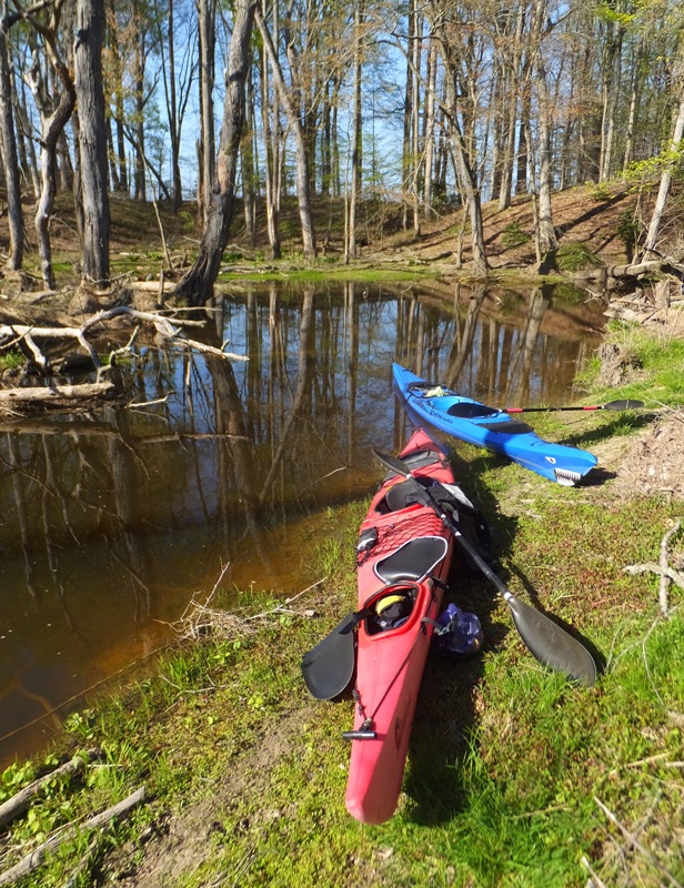
This is as far as I wanted to go. Any further would have meant portaging since just a stone's throw upstream was a beaver dam. The dam diverted water into the woods which killed many of the trees. I saw recent beaver activity in the area. 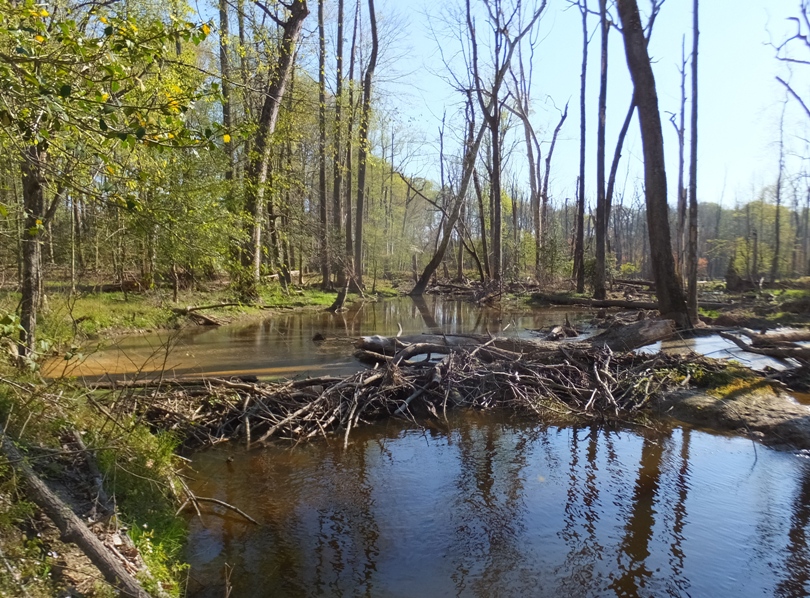
We explored on foot and found a large skeleton, about deer size. 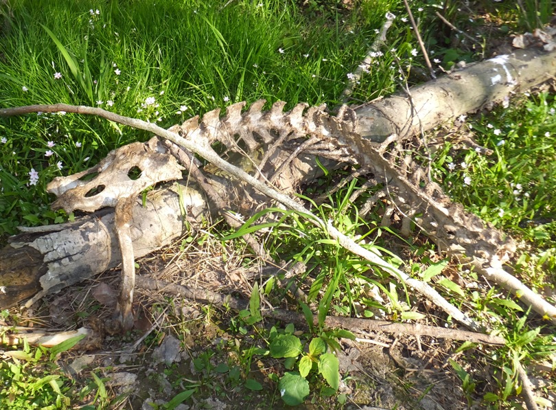
I also found the molt shed skin of a dragonfly larva. 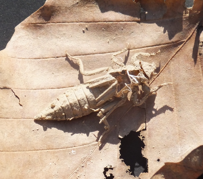
One fallen log had a lot of fungi and moss growing on it. It's interesting to think that the death of one thing provides life to a lot of others. 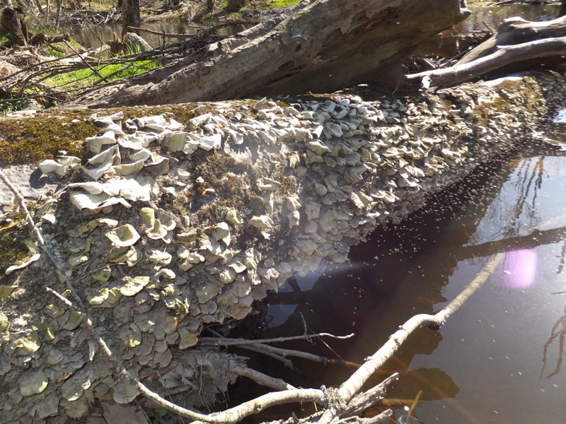
The landscape reminded us of parts of Florida. 
Refueled and rested, Norma was bright-eyed, bushy-tailed, and ready to rock. 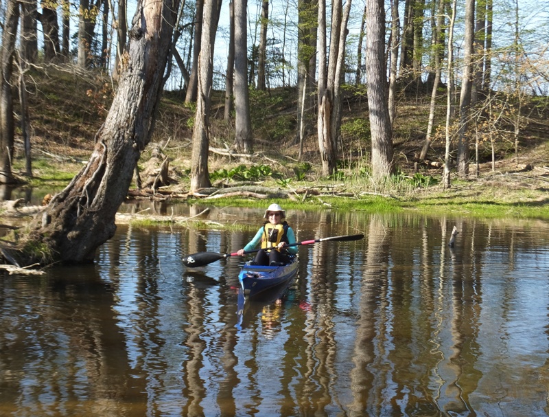
I timed it so we got a tidal push upstream. We got to the uppermost section of the creek at flood tide so we were able to get a little help from the ebb tide on the return. Norma was really enjoying taking photos that day. We saw a few herons, ospreys, and bald eagles. As the sun got low in the sky, the landscape took on a magical glow. See cover photo. Norma and I were off the water around 1800, having paddled 11.7 miles. This was a VERY scenic trip...one that I would easily put in my top ten (maybe top five) places to paddle in Maryland. We spoke to a fisherman who showed us the perch and catfish that he caught. Driving back, we stopped at Easton Diner for a fabuous dinner. My phone didn't show this location when I did a GPS search. It is on the east side of Highway 50 just south of Denny's. I highly recommend it. It was an awesome day and a fantastic weekend! |
|
I've often wondered if one could have too much of a good thing. I think the answer to this is yes. I used to be a huge fan of Led Zeppelin and Metallica. But I listened to too much of both and got burnt out on them. I still like them...but I don't enjoy them nearly as much as if I had just listened to them casually. I think the same is true of kayaking and paddleboarding. I wouldn't want to do either for a living because I think for me, that would make them less enjoyable. Of course that's all up to the indivdual. I'm only speaking for myself.
Today was my third continuous day of being on the water. I spend a lot of time on the water but three days in a row is pretty unusual, even for me. I was wondering if I wouldn't find it as satisfying today. But I just couldn't say no to the great weather. It was sunny and in the 80s. Passing up a day like this to be on the water seemed sinful...almost like turning down a gift from God. I worked a short day and was on the water by 1640, launching at Solleys Cove. I did a lot of driving over the last two days so today I picked someplace close to home to paddle. There was a nine mph northeast wind so I let the wind push me and my SUP upstream on the west side of Marley Creek. A cormorant let me get very close and take its photo. 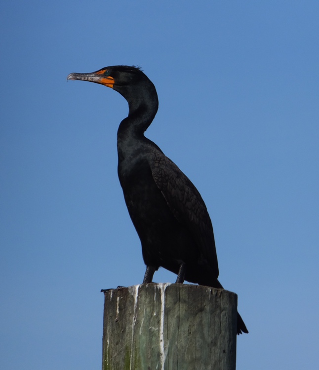
I have a co-worker who fantasizes about owning his own island. Someone in Glen Burnie made that dream a reality by buying Brewers Island and putting a house on it. 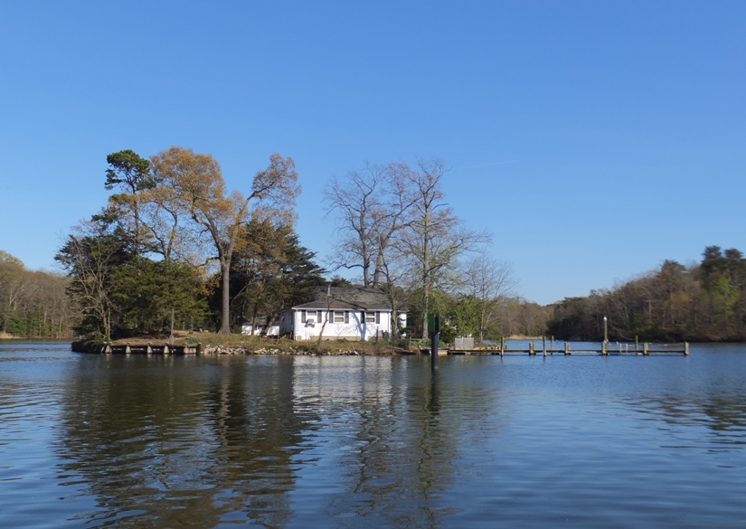
After paddling under the Arundel Expressway (Route 10) bridge, I found myself in Harundale. I paddled up a short tributary for a short distance. Along the way, I spotted a rabbit. 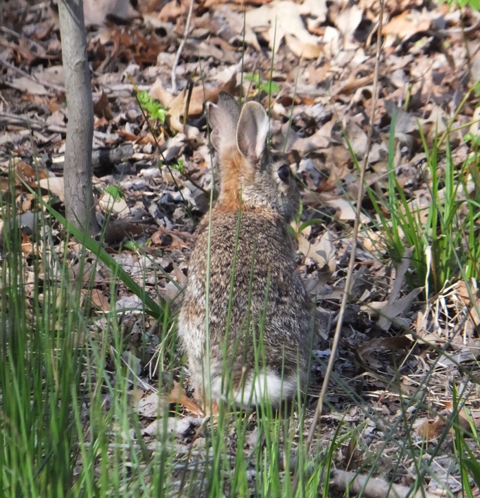
I had to do a few portages to get into the narrow, green, peaceful section but it was well worth it. 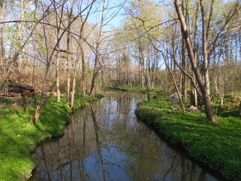
Back on the main part of the creek, I saw a lot of skunk cabbage. 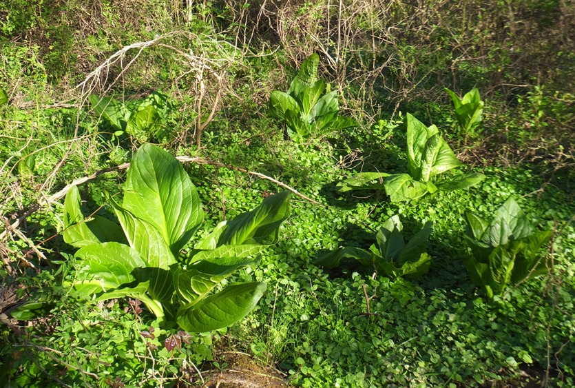
In the narrow upstream sections of Marley Creek, I typically see muskrats, and today was no exception. I spotted three! I chased after one to get a photo but it led me into shallow water where the fin of my SUP dug into the mud and I came to a screeching halt. But I managed to get the back of its head as it swam away, laughing at me. 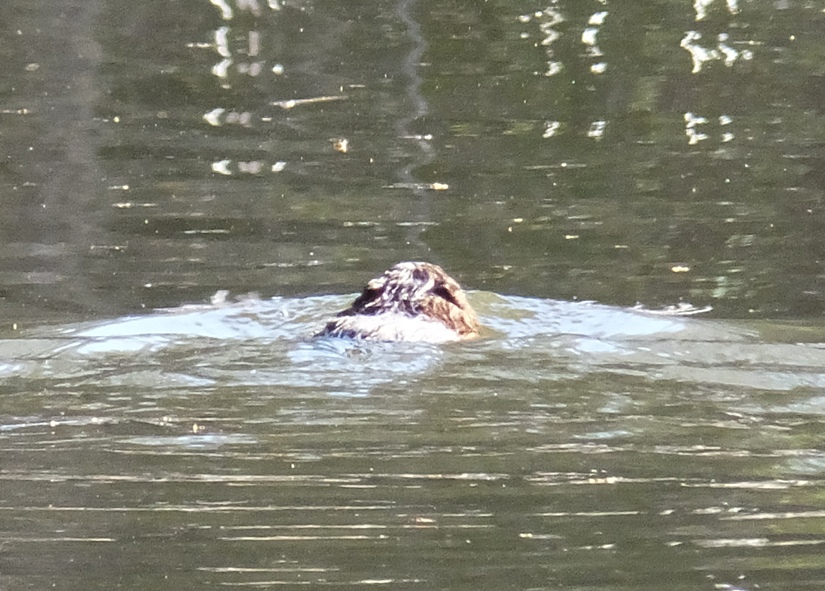
I saw two eagles along with several ospreys, herons, and ducks. I also saw about five turtles. Unlike yesterday, where Norma and I were the only boats on the water for about five hours, today I passed three kayaks and another SUP. I'm guessing the fellow on the SUP was a beginner. The water was very flat and he was paddling on his knees. But hey, we all gotta start somewhere, right? I paddled north of where I launched and then made my way to Curtis Creek. There was a tall ship at the Coast Guard Yard that I wanted to see up close. It is a boat I've seen before called the Eagle. The USCGC Eagle (WIX-327) (formerly the Horst Wessel) is a 295-foot (90 m) barque used as a training cutter for future officers of the United States Coast Guard. She is the only active commissioned sailing vessel, and one of only two commissioned sailing vessels, along with the USS Constitution, in American military service. She is the seventh Coast Guard cutter to bear the name in a line dating back to 1792, including the Revenue Cutter Eagle, which famously fought the British man-of-war Dispatch during the War of 1812. Each summer, Eagle deploys with cadets from the United States Coast Guard Academy and candidates from the Officer Candidate School for periods ranging from a week to two months. - from Wikipedia - USCGC Eagle (WIX-327) I took numerous photos of this ship. Here are my favorites. I finished SUPping, having completed an easy 9.3 miles. To follow up on what I mentioned earlier, by the third day, I was still very happy to be on the water, especially given the fantastic weather. I like Diet Pepsi and the first can of the day is always enjoyable. If I have a second (which is becoming less common), I don't enjoy it as much and those rare occassions that I have a third, it tastes rather crappy. But being on the water and drinking Diet Pepsi are two totally different activities with very little in common. |
|
My first rule for kayaking is to never spend more time in the car than on the water. I broke that rule today. My plan was to be out until almost sunset, which was 1954. That is when I see a lot of wildlife, especially racoons. But when I arrived at Selby's Landing, the sign said that the area closes at 1830. Why anyone would close a launch site so early doesn't make sense to me. I called the park to confirm. They do indeed close and lock the gate at 1830. If I was locked in, I'd have to call the park police to have them let me out. I figured that gave me about two hours and 15 minutes to be on the water.
I quickly launched and then headed south to Mattaponi Creek. I've paddled this area more times than I can remember though not so much recently. Shortly after Norma and I first met, we spend a significant amount of time in this area. I needed some time away from it. But now I was ready to explore it again. It was a little overcast with a temperature in the low 80s and an eight mph wind from the south. What I love about this area is the amount of wildlife in such a short distance from the launch site. Normally, to see that much wildlife, I have to paddle pretty far upstream on a small creek. But the Mattaponi is a short creek whose mouth is very near the launch area. I saw three muskrat mounds. They look like small beaver lodges but they are made of grasses instead of wood. Sometimes muskrats will inhabit unused beaver lodges too. 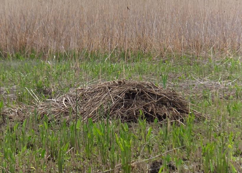
I spotted five beaver lodges. Unfortunately, I saw no beavers. They are quite elusive. I think I need to be out in the early morning or around dusk to see them. 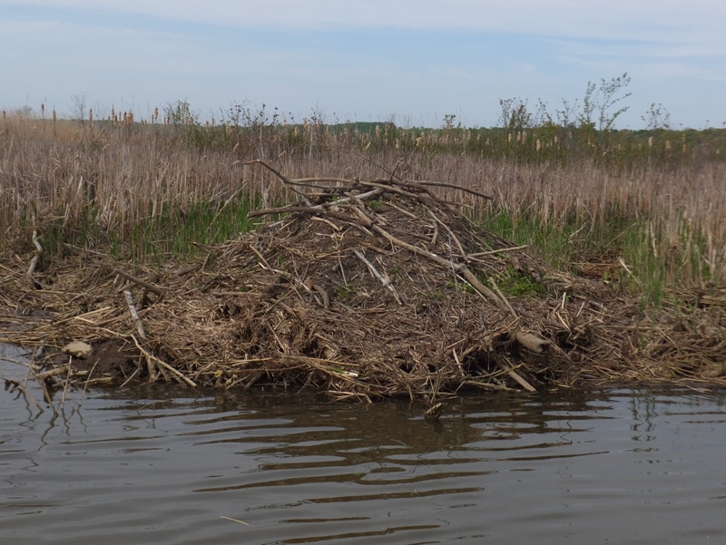
I passed two beaver dams. One looked like it might be very new. The area looked different than the last time I paddled here and I suspect the beaver dams might have something to do with it. They are quite amazing engineers capable of drastically changing a landscape. 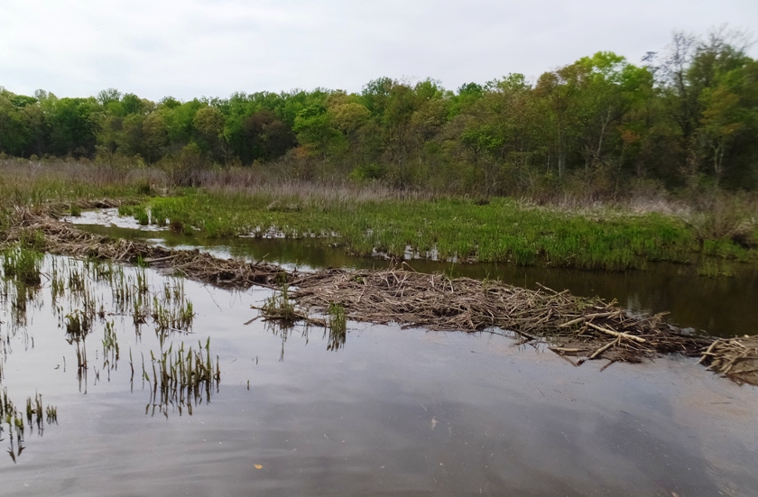
What I really wanted to see were snakes but I had no such luck. There were several turtles out but they were camera shy. Then there was one that got caught in a hollow, mostly submerged tree stump. It splashed around trying to get out as I approached. Then it went silent. Clearly it was stuck. I picked it up, took some photos, then released it. Many flowering trees and bushes were in bloom including dogwood. 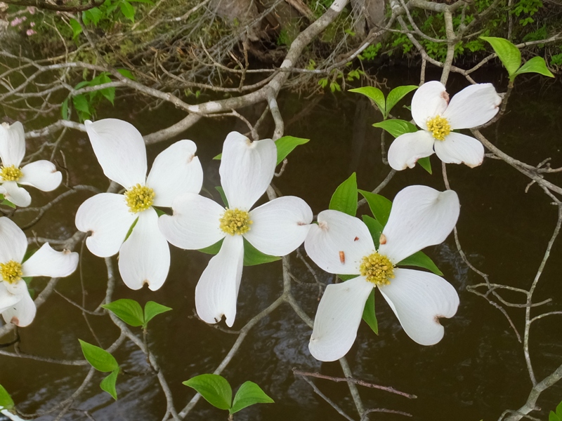
I saw one bald eagle and the usual ospreys and herons. Here's an osprey wearing an anklet. 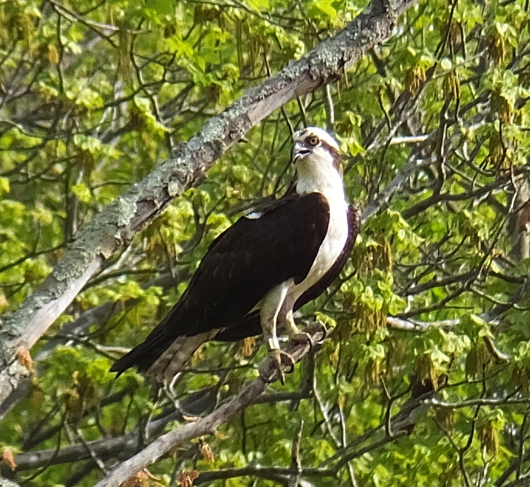
There were several red-winged blackbirds out. 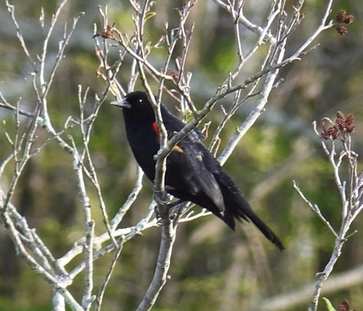
I came across two muskrats. 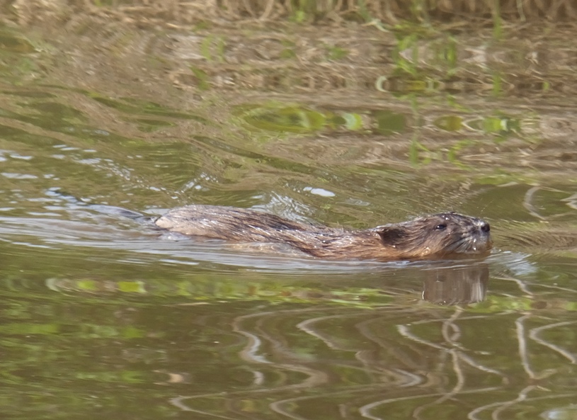
I found a crayfish mound which is not so impressive because I can find these in my back yard. 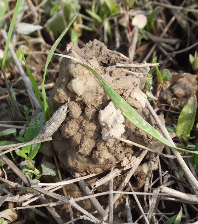
The most upstream sections of the creek were arguably the most scenic. I paddled under the wooden bridge that connects Patuxent River Park with Merkle Wildlife Sanctuary. 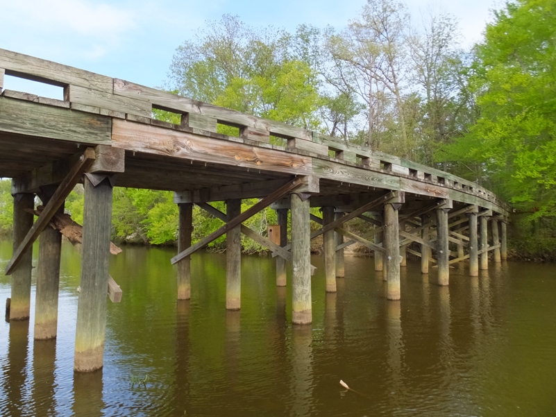
I saw White Oak Landing on the Merkle (south) side of the river. 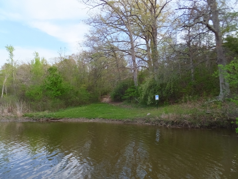
I made it off the water with about 15 minutes to spare. I got in a slow but scenic 5.15 miles. I really needed to clear my head that day and two hours on the water was not enough to do it. |
|
After work, I drove out to Lowes Wharf Marina in Sherwood to go paddleboarding. This is about as far as I am willing to drive for a day trip.
I was last there on June 15, 2014. Back then, I did not circumnavigate the islands because the wind was a little strong. Today I launched at 1540 with a wind of 4-5 mph that eventually became calm. It would have been a crime not to get some time on the SUP. After what I've heard is our coldest (and probably darkest) May on record, the high temperature for today was around 72. The first thing I noticed about the water was how clear it looked. I think it is the cleanest it has been since I started paddling back in 1999. Using my paddle and arm as a measuring stick, I determined that even at depths greater than seven feet, I could see the bottom quite well. What did I see? There were a couple hundred jellyfish out. Most were orange but some had red. I also spotted four pairs of mating horseshoe crabs. This is breeding season. I always saw a female with a male latched on. 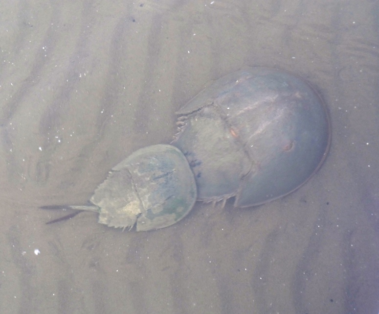
I was also fortunate enough to see three blue crabs and six rays. I spot the rays before they see me and when they do, they often sprint away. They can be quite fast. Shortly after launching, I spotted a bald eagle. There might have been more but my eyes were set on looking for things in the water. I saw a couple large schools of small fishes. I still couldn't get over how clear the water appeared. The bay looked quite healthy to me. The health of the Chesapeake Bay improved in 2015, according to the University of Maryland Center for Environmental Science. In terms of grades, the Chesapeake Bay 'C' grade is one of the highest since 1986. - from "Capital Gazette - Report card: Chesapeake Bay 'C' grade is one of the highest since 1986" (broken link as of 2025) The water was moderately cold. If you fell in without a wetsuit, you wouldn't be in trouble as long as you didn't stay in for long. I brought a neoprene top which I never put on but had in case I needed it. I paddled south and then cut across the bay to the southern tip of Poplar Island. I then started circumnavigating the three islands that comprise the area: Poplar, Coaches, and Jefferson. These islands are home to numerous birds including sandpipers. 
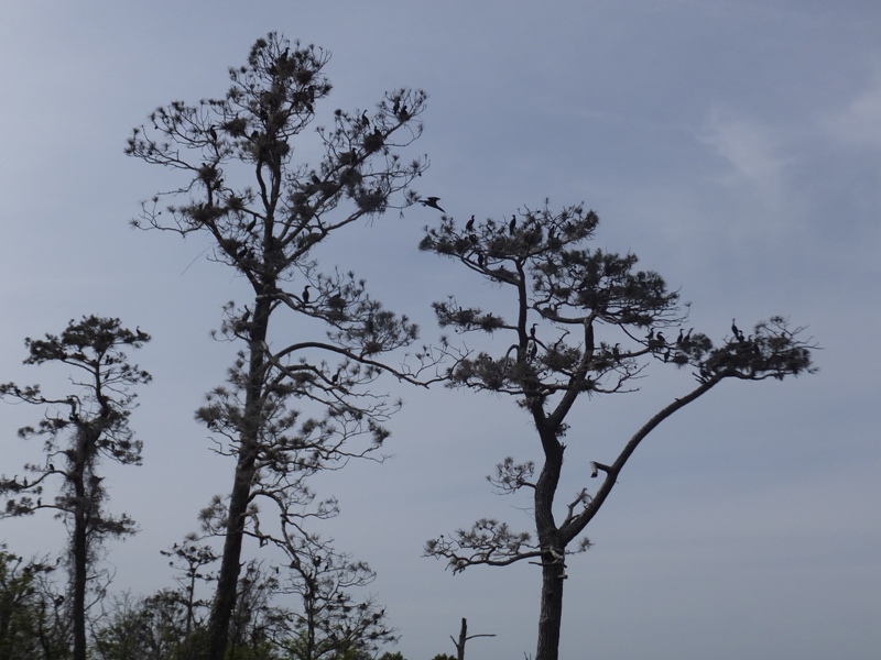
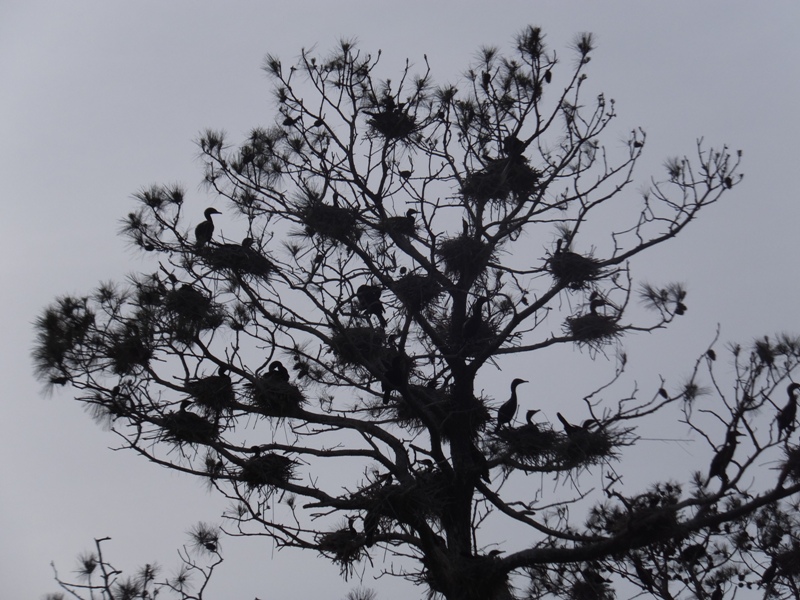
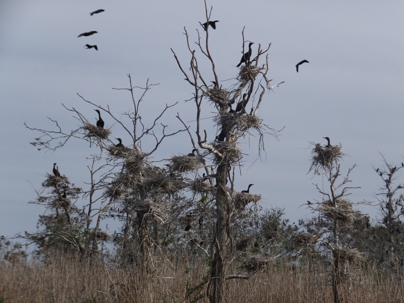
On the southern side of Coaches Island, there were an extremely large number of great blue herons, both on land and in the trees. Based on the way they were perched in the trees, I am almost certain there was a heron rookery there but the foliage was too thick to actually see the nests. Maybe I'll return in early spring to confirm this. I saw the largest cormorant rookery I've ever seen before. This was near what appeared to be an abandoned house on Jefferson Island. The place smelled like cormorant crap. 1 / 5
Northward view.
2 / 5
Nests in trees.
3 / 5
One tree.
4 / 5
Numerous birds.
5 / 5
Eastward view.
I set out on foot to explore Jefferson Island and found a killdeer nest on the ground. 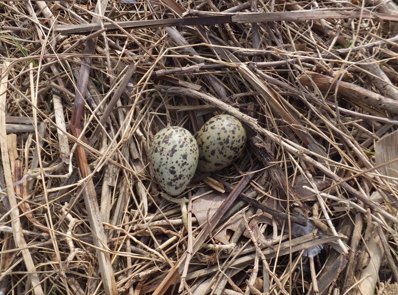
After being attacked by numerous mosquitos, I quickly left and sprinted out into deeper waters to get away from my predators. Poplar Island is special in that it is growing because much of it is man-made. Dredged material and rip-rap has been added to expand the island. The project is expected to be completed in 2027. For the most part, the man-made sections of the island are quite boring. So if you don't see the west side, you're not missing much although I must say that I saw numerous red-winged blackbirds there. On the south side of the island, I saw quite a bit of construction taking place. After reading "Diamondback Terrapin Nesting on the Poplar Island Environmental Restoration Project" (broken link as of 2025), I believe diamondback terrapins are laying eggs between Poplar Island and Coaches Island, maybe right now. I looked but saw no signs of this, though I really have no idea what to look for. Later in the summer, they should start hatching so maybe I'll make another trip there in the unlikely chance I'll see a newborn terrapin making its way to the water. When I was stationed at Camp Lejeune, I came across sea turtles hatching and making their way to the ocean. It was quite a sight...one that would definitely be worth seeing again. I saw a few fishermen but no kayakers or paddleboarders. I would have been shocked to see paddleboarders so far out in the bay. A fisherman asked me where I launched. I replied, "Sherwood." Then he asked, "Did you go around the whole island?" I said, "Yes." Then he yelled, "You're a maniac!" I completed my four hour, 13.85 mile trip as the sun set. |
|
On Memorial Day weekend, Norma and I kayaked on Morgan Creek, in the Chestertown area, where we also attended Chestertown Tea Party festivities.
|
|
My folks visited from the evening of June 2 to the morning of June 7. Savage Fest was June 4. Over six days around this time, we also caught seven groundhogs which I relocated about three miles from our house. I enjoyed all this, but with so much activity, I missed some time on the water. So I figured that for June 11, I'd do a long, scenic trip to make up for lost time.
I was up at 0400 and out of the house by 0420. Not surprisingly, I encountered very little traffic on my way to Wicomico County on the eastern shore. Around 0505, clouds started to illuminuate from the pre-dawn sun. Nature reminded me that we are quickly approaching the longest day of the year. I arrived at Cherry Beach Park and launched from the beach next to the ramp at 0645, just as a group of bird watchers approached the pier. My goal was to explore the lower part of Marshyhope Creek, below the El Dorado Road (route 14) bridge in Brookview. If there was public access anywhere on the creek below the bridge, I intended to find it. Not too many people paddle Marshyhope. I expect it is because there is a ~20 mile stretch between the launch site in Federalsburg and the next nearest site to the south. This southern launch site is Cherry Beach Park in Sharptown. Hence, my plan was to paddle southwest from Sharptown on the Nanticoke River to the mouth of Marshyhope Creek. Then I would paddle upstream on Marshyhope Creek to the bridge before returning. Today was a good but not a great day for paddling. The wind was expected to be 11-12 mph from the southwest in the afternoon. But I picked my route so that I would be largely shielded by the northwest/southeast orientation of Marshyhope Creek and then receive a push from the wind on my final trek on the Nanticoke. High tide at Sharptown would be at 1102. It would be a little later at the bridge on the Marshyhope. My plan was to use the flood tide to explore the tributaries that flow into these bodies of water and make my way downstream on the Marshyhope during the ebb tide. While I paddled this section of the Nanticoke and Marshyhope before back on September 20, 2008, I never explored the tributaries that flow into them. Today my motto was "leave no stone unturned." I intended to explore every creek that was at least as wide as the 14-foot long SUP that I paddled today. I would go until I had to portage or ran aground in shallow water. But I soon found out that the latter never happened. The creeks in this area keep their depth. I crossed the Nanticoke and began by exploring Mill Creek. Within 12 minutes of launching, I saw my first beaver. It was near its lodge, shown below. I was not fast enough to take a photo of it before it slapped its tail on the water and then dove under. Four minutes later, I spotted a muskrat. I eventually came to a tree downfall and made my way back downstream. This tributary, like all the others that day, was natural, scenic, and wooded. No bay grasses or marshland. I'm guessing the salinity of the water is pretty low which keeps the vegetation more to my liking. 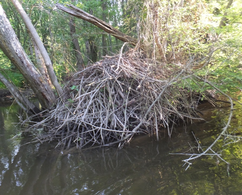
As I made my downstream approach to the beaver lodge that I passed a few minutes earlier, I paddled in stealth mode, hoping to see the beaver again. I did not, but what I did find was even better. Since I was moving very quietly, I was able to hear nature sounds quite clearly. I heard whimperish noises coming from the beaver lodge. It was the pups inside! I crept up close to the lodge and just listened. The sound was not very loud and after a short time, it stopped. I guess they knew I was close. I sat by for a few minutes, hoping the pups would start up again but they did not. I heard more than one. I explored other creeks off the northwest side of the Nanticoke including Molly Horn Branch. These tributaries are real hidden gems. I don't think many kayakers know about them. I did not see a single kayak, canoe, or SUP on the water all day. I think one reason why this area is so pristine is because so much of it is protected from development. Along the Nanticoke, most of the area to the north is a Boy Scout Reservation. On Marshyhope, there is a large wildlife management area and an area protected via various conservancies. After awhile, the tributaries became a blur but for the most part, any with a name are worth exploring. Throughout the day, I reckon I made my way up about seven of them. The area is a feast for the senses. There was a lot of beautiful natural landscape to see. I found sweetbay magnolias to smell. 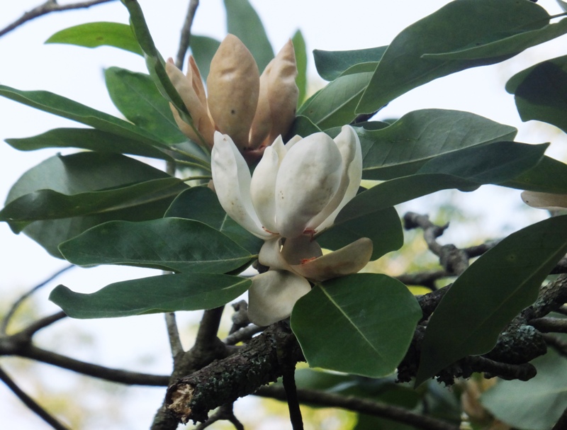
In one of the other creeks, I saw another muskrat. Can you see it below? 
There were numerous dragonflies buzzing about. My initial thought is that they are some type of meadowhawk but someone with considerably more knowledge than me about dragonflies said they are Needham's skimmer dragonflies. Eventually, I started making my way up Marshyhope Creek on the right (northeast) side. I saw buoys indicating that the University of Maryland (UMD) is performing research on sturgeons in the area. I've never seen a sturgeon in the wild. 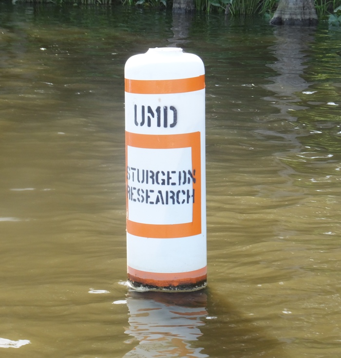
Knowing that sturgeon exist or can exist in a waterway is a good sign regarding the cleanliness of the water. ...there is a direct link between the fish [sturgeon] and the goals of the Chesapeake Clean Water Blueprint. "Because of their oxygen requirements, Atlantic sturgeon are the perfect poster fish for the Blueprint...The Blueprint is a federal-state plan designed to improve water quality across the watershed by reducing pollution across the watershed by reducing pollution from agriculture, runoff, air, and wastewater." - from Fall 2016 Save the Bay - The Magazine of the Chesapeake Bay Foundation "Atlantic Sturgeon - A Poster Fish for the Blueprint" There were more bald eagles flying about than I could count. 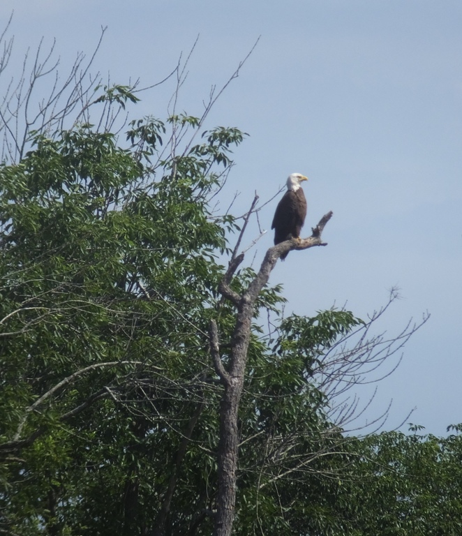
A few years ago, I remembered seeing a photo of a small bird riding on the back of a bald eagle in flight. I was told that the photo was suspected of being altered. Then on a kayaking trip to Mallows Bay on June 21, 2014, I saw a small bird land on the back of a bald eagle in flight. It only lasted a second or two. But then I started doubting myself because the others that saw this eagle didn't remember the small bird landing on the back of the eagle. Was my memory being clouded by the photo from earlier? But today, I saw it again. An eagle flew out of a tree above me. I glanced away and then when I looked back, I spotted something on its back as it flew. Could it be a small bird hitching a ride? My eyes were locked on it. A couple of seconds later, this small object flew away in a different direction. It was indeed a small bird on the back of the eagle! I couldn't tell what kind of bird it was but it was certainly smaller than a robin or blue jay. I feel blessed to have witnessed this now, not once but twice. On another tributary, I heard what I first thought was someone sawing wood. It was certainly some sound that was wood-related. Then it stopped and I saw nobody. But I did see a beaver lodge, shown below. When I got home, I confirmed that the sound I heard was a beaver chewing sound. Inside the lodge near the sound, I heard another beaver pup. I sat and listened for about five minutes but like before, once I got close, I heard little. There might have only been a single pup. I tried to get an audio recording but the sound was too quiet. 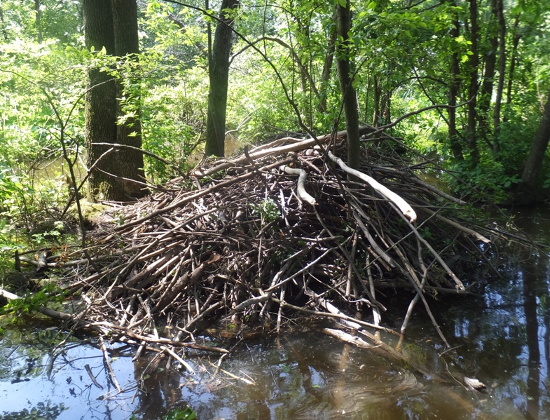
I explored Becky Taylor Creek, Bachelor Creek, and other waterways that drain into the northeast side of the Marshyhope. The former was most scenic and I was able to get upstream on it a good ways. Having gotten up so early, I was pretty tired so I pulled over into a shady spot and took a nap for about a half hour. That's one great thing about a SUP. Refreshed, I continued my adventure. On one of the creeks, I heard a beaver hit its tail on the water really hard. I've been told they do this as a warning to others. Then I saw it swimming about. Usually they don't stick around long enough to get photos but this one did. Eventually, I reached my destination. 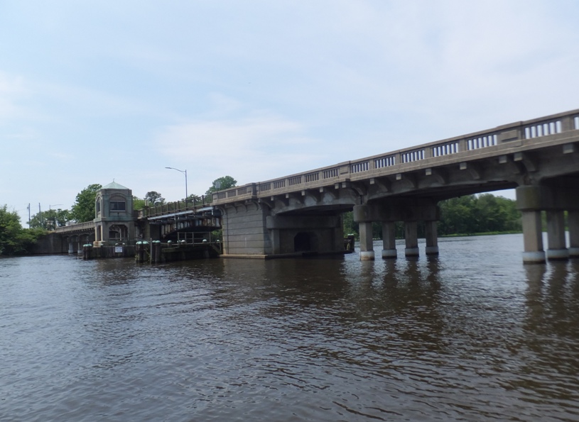
As I paddled by one of the supports for the bridge, I noticed that the area inside had a wooden platform where it appeared a beaver was attempting to build a lodge. At first I though it was just a collection of random sticks until I realized that they all had chew marks on the ends. 
Paddling downstream, I saw a four-foot long black rat snake. It was on the water, near some spatterdock. I tried to position my SUP to get a good photo and then it started swimming across Marshyhope. I followed it to the other side where it hid amongst the vegetation. It had taken me a great deal of time to reach the bridge and in doing so, I paddled 14.75 miles. If I explored the other side of the Nanticoke and Marshyhope in as much detail as I did in the first part, I could easily paddle 30+ miles and be out until very late. So instead, I decided to head back and leave the exploration of the other half for another day. I stopped to photograph a turtle. It was a lousy pic. But looking next to it, I saw a four foot long northern water snake. The snake was very cooperative and let me move all around it to take pictures while it stood motionless. Photographing a turtle and then getting a snake is like digging for silver and finding gold. I crossed the Nanticoke to Reconow Creek. Sticking with my game plan, I'll leave that for next time. I saw a tug boat pushing a platform full of what appeared to be sand. 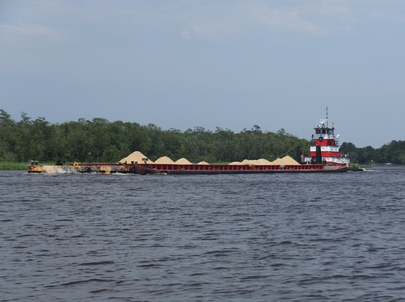
A little further upstream on the Nanticoke, I spotted a small shipwreck that reminded me of the sunken boats at Mallows Bay. It was made of heavy wood and had a lot of metal rods. Only the middle and forward starboard side were visible but the curved ribs of the hull left little doubt in my mind that it was a boat. I know other old boats had been found in the area but if this was indeed of the Mallows Bay era, then it would have been built around World War One. In contrast, one of the shipwrecks uncovered on the Nanticoke is significantly older. See The Baltimore Sun - Nanticoke River shipwreck could be linked to Revolutionary War skirmish. I looked for a satellite view of the wreck that I saw but could not find it. I landed eight hours and 45 minutes after I started, having paddled 24.17 miles. It was a good thing I launched early. My pace was incredibly slow but that's how it is navigating all those narrow creeks, especially when I try to paddle silently like a ninja. I'm glad I decided to leave the creeks on the southwest side of the Marshyhope and the southeast side of the Nanticoke for next time. I'm especially curious to see how far I can get on the Marshyhope tributary that starts at 38.526438, -75.761794. It looks like there is a canal that connects it to the Nanticoke after about a mile and a half. Back at my car, I realized I made the mistake of leaving my Diet Pepsi in the sun. The car got very hot and the can exploded, spewing soda in my car. I did this ten years ago on July 29, 2006. Hopefully I won't make this mistake for at least another ten years. 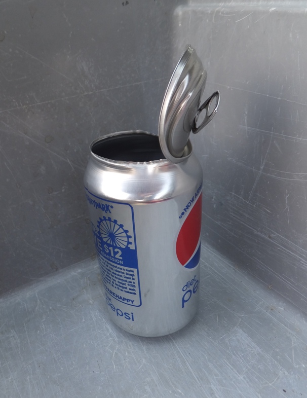
The drive home was easy. Traffic was not bad at all. My new Waze smart phone app directed me on a lot of peaceful back roads to Route 404. Somewhere on the north side of Route 404, I saw what I believe is the new Wye Mills Solar Farm facility. |
|
I didn't get much sleep, having been awoken suddenly when one of my chickens was attacked. I got another half hour of sleep after all the excitement before Norma and I got up at 0520 for a 0730 kayak launch at Franklin Point State Park in Anne Arundel County, Maryland. We got an early start to take advantage of the high tide since this area can get pretty shallow.
The last time I paddled here was on August 23, 2015. Back then, the park was brand spanking new. Now it was still new...just not spanking. I could see that various improvements had taken place such as wood chips and logs being laid out to mark paths. I paddled my Prijon Catalina while Norma was on the Cobra Expedition. We explored almost every nook and cranny on Deep Creek and Deep Cove Creek. Had we waited a few hours until the tide went out, we would not have been as successful. Norma and I kayaked up every tributary that was at least as wide as our boats. Below, Norma does a three point turn to make a 180 degree change of direction. 
We saw several redwing blackbirds. When they make their call, they often lift up their wings, displaying their colors if you're looking head on. We also saw several herons, ospreys, and eagles. 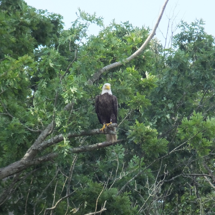
Most of the vegetation was grass but there were also plenty of woodlands. Some of the blooming vegetation we paddled by was orange hummingbird trumpet creeper. 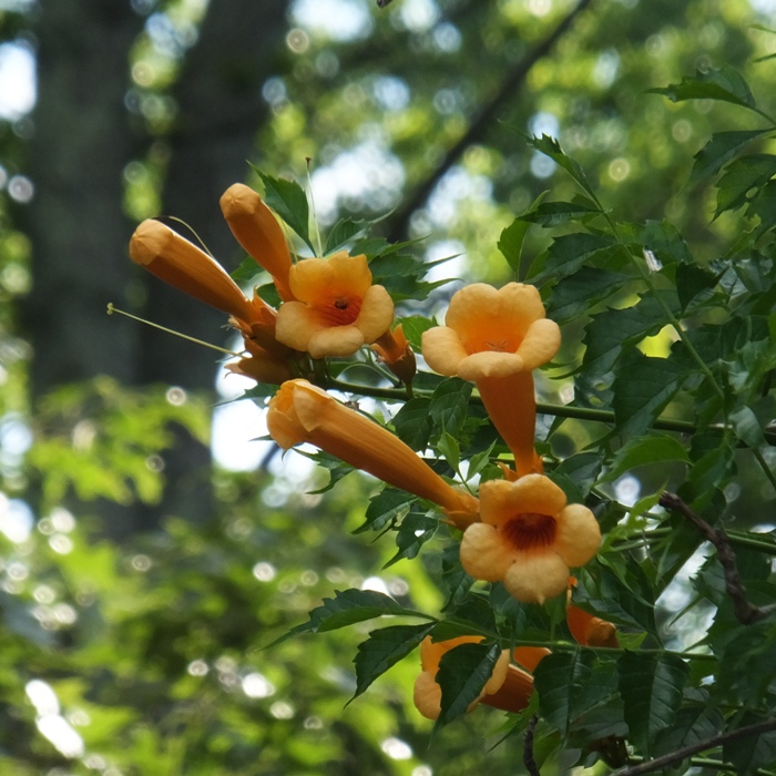
On the southeast side of Deep Cove Creek, Norma paddled under a low footbridge. 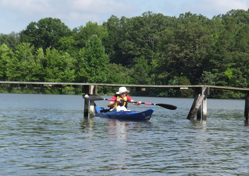
I spotted a three-foot long northern water snake swim past and then into the grasses. 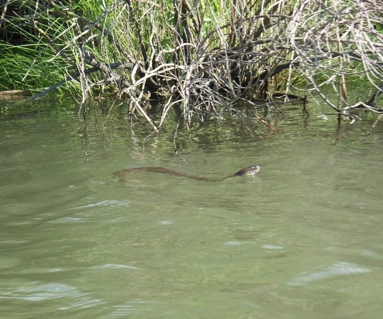
Near a beach on the Chesapeake Bay near the creek mouth, Norma practiced her wet exit using my cockpit boat. I walked her through the steps and she successfully demonstrated this skill twice. I tried doing some rolling in this same area for Norma to get on video but the water was too shallow. We saw what I believe to be a pair of long-tailed ducks though they're usually only in this area in the winter. At this same beach, Norma and I spotted what I think was a five-foot long black snake slither out of the water, then onto the sand and towards the Cobra kayak. It did not go in. We also found assassin bugs and a couple of mating horseshoe crabs. Near a creek marker at the mouth, a snowy egret patiently posed while I took its photo. 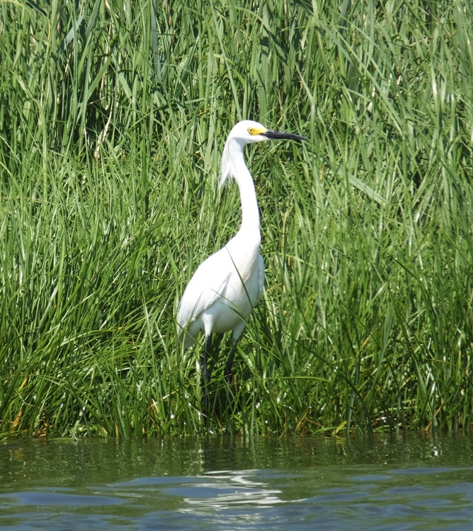
After six miles of paddling, we explored the hiking trails, having picked up a map in the parking lot. There were quite a few deer flies out. We walked along the main mowed roadway to the end and then came back via a trail on the west side that was flagged with ribbons. The map mentioned that this trail is marked for pending inspection by the Maryland Park Service. It looked unmaintained. We were not able to find the trail on the east side of the mowed roadway. Closer to the boat launch area, we walked by a building that was once used as a repair shop for a boat rental business. 
Before our short walk, I sprayed down with 30-40% DEET and Norma did not. She doesn't much care for bug spray. But she ended up attracting 20+ ticks while I only had three. So I guess DEET works. |
|
I launched my SUP at Breezy Point Marina between Chesapeake Beach and Plum Point on the Chesapeake Bay. I was on the water by 0730 heading south.
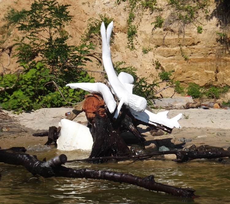
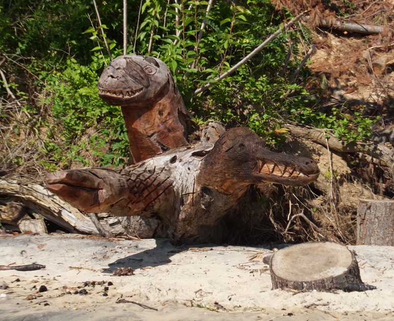
The last time I paddled this area was August 10, 2014. Back then, I stopped at various places and looked for fossils. I was pretty sucessful. Now, almost two years later, my shark teeth hunting skills have improved greatly, especially after our last shark tooth beach combing trip to Westmoreland State Park on June 18, 2016. I typically find pebbly beaches near a tall, eroding cliff to contain the most interesting things. My first stop was a 30-foot tall cliff where the bottom foot was largely comprised of shells and other old aquatic animal remnants. At another beach, I found the remains of horseshoe crabs. Some were large and others just two inches long from nose to end of tail. The latter were molts. Yes, they shed as they grow. Four miles south of where I launched, I turned around at Dares Beach. You can't miss this place because a very talented local has transformed many fallen trees into chainsaw carving sculptures and other works of art. 1 / 5
Mermaid & seals.
2 / 5
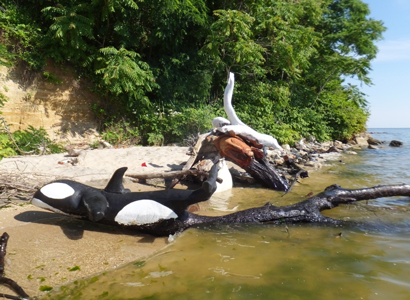
Killer whale.
3 / 5
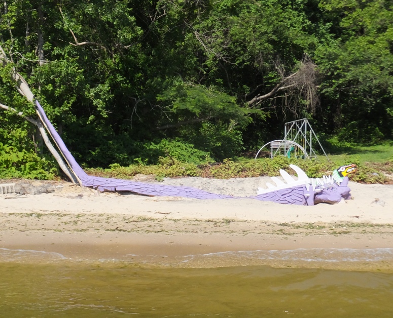
Pink dragon.
4 / 5
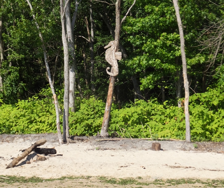
Seahorse.
5 / 5
Three heads.
At one area, I saw Long John Silver, Yogi Bear, a crab, and Jesus. 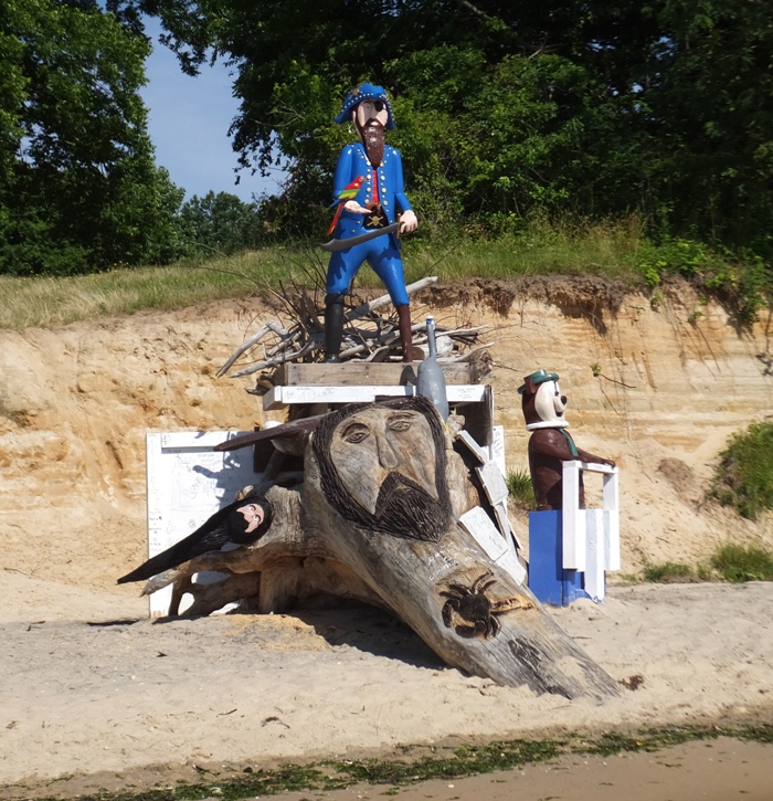
I spotted two rays and dozens of schools of fish, each containing hundreds of fish ranging from two to five inches long. From a distance, they look like dark patches or areas where there are concentrated riffles. As I paddled through these schools, I often saw much larger fish darting through, looking for a meal. I don't think I've ever seen so many fish in the Chesapeake Bay before. It is safe to say that I saw tens of thousands of fish that day. They say the Chesapeake Bay is getting cleaner and I definitely believe it. I saw a big blue crab, shown below. It was dead but I also found some that were alive, including a two-inch wide crab that I scooped up in my fossil sieve when looking for shark teeth. 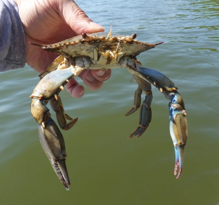
There were numerous bald eagles flying about over the cliffs but none were willing to pose for a picture. About a sixth of a mile from the shore, I saw a turtle floating on its back with its head sticking out of the water. It seemed like a very unusual position for a turtle. I looked closer and realized it was a box turtle. I find a few of these every year in my back yard so I thought it was strange that it was in the bay. Maybe it fell off a cliff into the water or was backed up to a cliff when the tide came in. Normally, when a turtle sees me, it dives under but this one seemed like it didn't know how to swim. I picked it up and paddled it to shore. Since there were a lot of cliffs, I had to paddle for awhile before I got to a suitable place of release. It kept trying to walk off my SUP so I turned it upside down. But like a wrestler, it did a neck bridge to upright itself. Hence, I had to keep flipping it over every minute or so until I pulled ashore. I put it where the woods meet the beach near a fresh water outlet on fairly flat land. Continuing my hunt for shark teeth, I found huge chunks of earth that had broken away from the cliffs which were packed with shells. 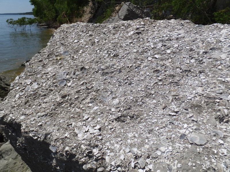
Sometimes I just looked on land and other times, I waded out into the water and scooped up small rocks from the bottom with a 12"x12" fossil sieve I made using chicken coop scraps. This is a handy tool when the tide is high. I added some accessories to my SUP to be able to carry it around easily. Occasionally, along with small rocks, sand, and shark teeth, my sieve would also catch a small crab. Near the marina, I paddled up Plum Point Creek until it got too shallow to continue. Along the way, I saw a green heron that was being uncooperative with my limited photography skills. 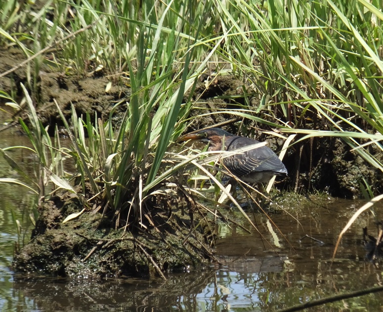
The area was very scenic and worth a return trip. By the time I finished, I paddled 9.75 miles, found 51 shark teeth, five pieces of ray dental palates, a fossilized bone (probably from a turtle), a piece of coral, a couple of nice shells, and something I couldn't identify. It might have been a broken pelvis from a small animal. 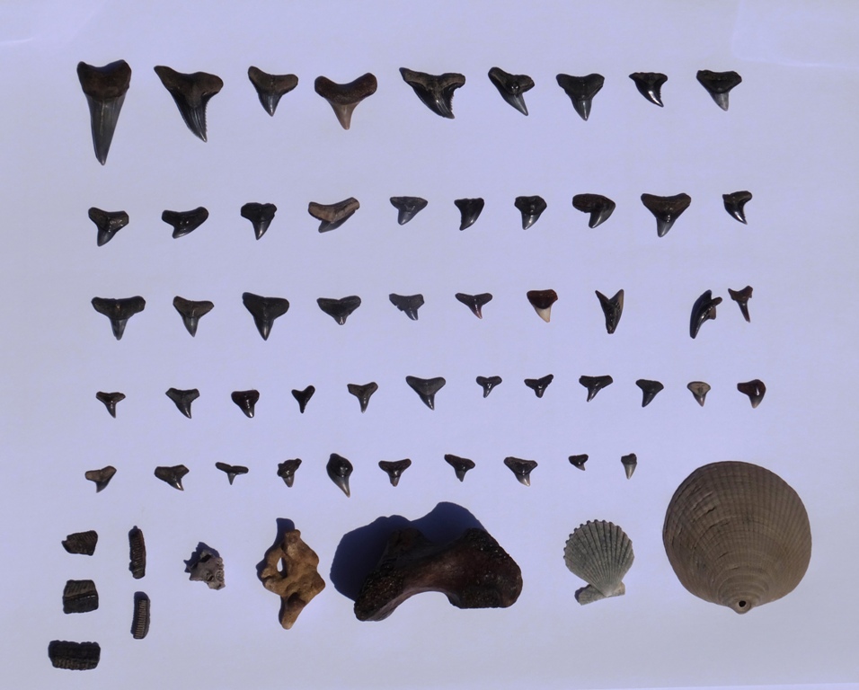
Back at the marina, I spoke to Dana, who works there. I showed her the shark's teeth I found. She said I could also paddle north and find teeth. I think she said Randle Cliff is a good place to look. My ADC map also shows Roosevelt Cliffs which might be another place to check. At Fossil Shark Teeth Identification Along the Chesapeake Bay - Maryland and Virginia - Calvert Cliffs, I see that people have found shark teeth at Randle Cliff so maybe I'll check it out. |
|
I got in my hours for the month early so I took today off from work and went kayaking. The morning and early afternoon was forecast to be sunny and the wind fairly calm until about 1400.
I decided to do two things a little differently. First, I generally avoid paddling in Baltimore or Washington D.C. unless I just want to be on the water for a short period of time. In that case, Baltimore is very close and convenient. But I prefer more natural areas and cleaner water which means I need to venture away from the big cities. Today, however, I figured I would do a much longer version of the Baltimore County lighthouse trip I did on June 18, 2006. That might have been the last time I paddled this section of the county. The other thing I decided to do differently was paddle my S1-A surf ski instead of my SUP. The SUP offers a better view, is more maneuverable, and most importantly, it is more comfortable. But today's trip would be a lot of not-so-interesting paddling over long distances to known points where there was something interesting to see (lighthouses). So I figured the speed of the surf ski would make the less interesting sections go much faster. Over the last two or two-and-a-half years, I've only used my surf ski once prior to today. I launched around 0820 at Rocky Point Park. Low tide was at 1048 so I got a little help from mother nature both on the way out and on the return. I kayaked across the mouth of Back River to Cuckold Point and then between the peninsula and Pleasure Island. Upon entering the Chesapeake Bay, I saw the Craighill Channel Lower (Range) Rear lighthouse, built in 1873. 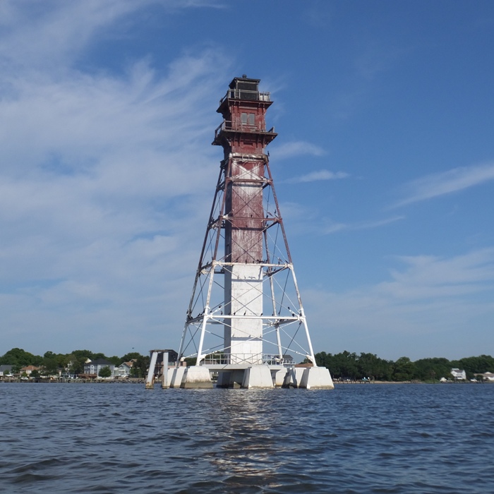
Next, I paddled about 2.5 miles due south to the Craighill Channel Lower (Range) Front lighthouse, also built in 1873. Notice the outhouse on the right side. I don't recommend going out to this lighthouse unless you are an experienced kayaker and the weather conditions are well within your comfort zone. Once you get there, you'll be about 1.8 miles from land and in an area that is extremely exposed. Even a moderate amount of wind can create somewhat rough conditions. 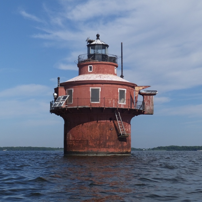
Kayaking west, I came to Craighill Channel Upper (Range) Front lighthouse, built in 1886. This was a less interesting looking lighthouse, in my opinion. 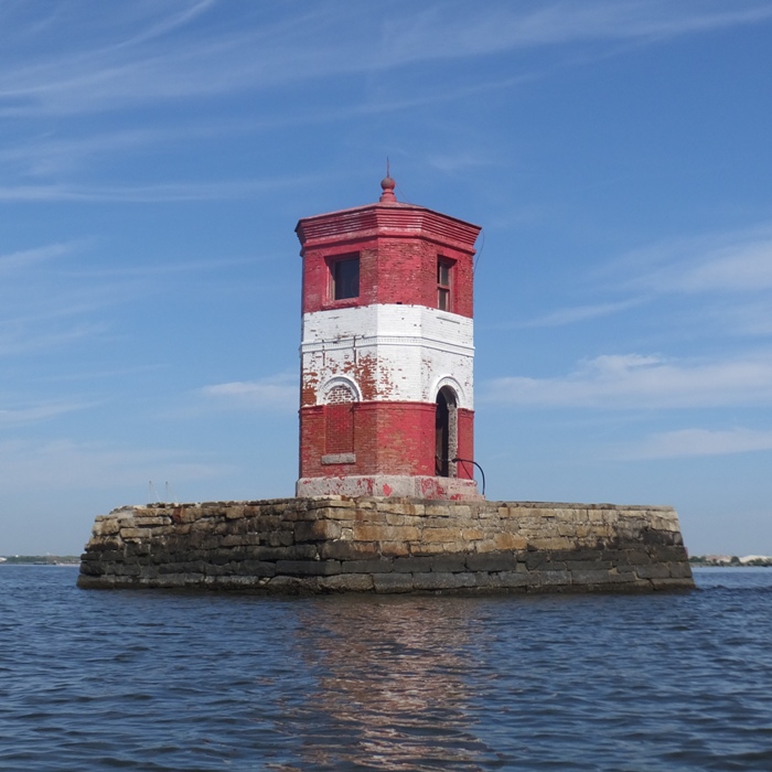
Seeing a glowing lamp from afar in the next lighthouse, I headed northwest to the west side of Old Road Bay. I passed a big industrial area near Sparrows Point. The Baltimore area seems to have a lot of stuff like this near the water. 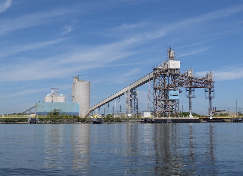
Kayaking north led me to the Craighill Channel Upper (Range) Rear lighthouse, built in 1886. 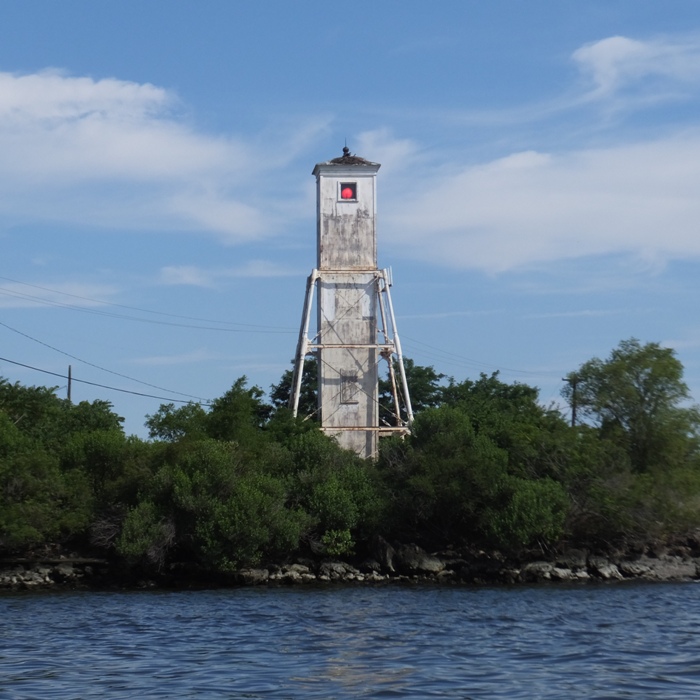
These four lighthouses comprise the Craighill Range lighthouses. I pulled over in Jones Creek to eat a sandwich and get a better view of the last lighthouse. I had paddled for nine miles over an hour and 35 minutes. I was making good time...far better than I could do on my SUP. If I simply returned on the shortest route possible, the trip would have been about 16.5 miles. I had the time so I figured I would explore the entire shoreline between the Craighill Channel Upper (Range) Rear lighthouse and the Craighill Channel Lower (Range) Rear lighthouse on my way back. I was not expecting this to be particularly interesting but like I said, the surf ski is great for covering such long distances quickly. I was easily able to maintain five miles per hour on calm water. Unfortunately, out in the bay, the wind picked up a little and the water was a little rougher than I preferred. It really wasn't all that bad. I just let myself get out of practice on the surf ski and then found myself feeling unstable. I fell out of my boat once in the Chesapeake Bay. But my gear was secured properly and I managed to get back on fairly quickly. While kayaking along the shore, I saw a few interesting things in Jones Creek and North Point Creek. Exploring the shallow areas was difficult because there was an abundance of aquatic vegetation. This was especially true in Shallow Creek. Eventually, I just skipped these sections. At North Point State Park in the Chesapeake Bay at Google Maps coordinates 39°12'46.9"N 76°24'59.9"W, I saw a concrete pier and sunken concrete barges that date back to World War One. I climbed aboard one and explored another. Here are two other concrete barges. Observe the Craighill Channel Lower (Range) Rear Lighthouse in the background. 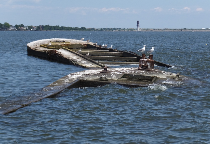
This is a Google Maps satellite view of the concrete barges. The end of the concrete pier is in the upper left corner of this image. 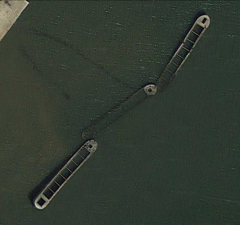
So what's the story with the concrete pier and sunken concrete barges? Ferry Grove Pier [the concrete pier] can be seen from the shoreline and is accessible from the Ferry Grove Trail in the Black Marsh Wildlands area. However, the pier is gated shut due to the fact that it is deteriorating and unsafe, it also is occasionally the site of nesting Least Terns, and on at least one occasion, has been a resting stop for Brown Pelicans. Also visble from the pier and from most of the waterfront in the park, are three submerged concrete barges from World War One that were sunk at the park in the early 1950's. This area is also used as a working duck blind during hunting season. It is available during hunting season on a lottery basis. - from North Point State Park - Ferry Grove Pier (a broken link as of 2020) Right here in Greater Dundalk is a beautiful expanse of natural wonder, complete with a forest, salt marsh, shoreline and the relics of the old Bay Shore Amusement Park, one of America's great, lost trolley parks. The park also has an old cement pier, now a protected nesting site for terns. Perpendicular to the pier, about 60 feet out from its end, lie three long, concrete barges sunk in a straight line to form, with the pier, a giant "T." In the late 1890s, while construction of Bay Shore was under way, the developers built a wooden pier to accommodate a ferry from Tolchester that would bring Eastern Shore visitors to the site. Bay Shore opened in 1906, but the pier was destroyed by a hurricane in the late 1910s. It was decided that the new pier, as Shakespeare would say, should be made of sterner stuff, so they built the current concrete dock. Bay Shore closed in 1947, a victim of changing habits and the rising use of the automobile, a development that destroyed the advantage of the old trolley parks. Prior to the death of Bay Shore (at least at that site), the land had been purchased by Bethlehem Steel. After the passing of the park, Beth Steel used the land as a private hunting preserve for its executives. In the early 1950s, Sparrows Point Country Club, another perk for Beth Steel execs, was under construction. To beautify the river view from the club, Beth Steel removed from Bear Creek three abandoned concrete barges that had been used to transport munitions in World War One. (Apparently, concrete barges ensured that, if a load of munitions went off and killed everyone nearby, you at least wouldn't lose the barge. Priorities were different back then.) The barges were raised, moved to the end of the old ferry pier and intentionally resunk to create a breakwater to protect the slowly crumbling structure. Later, the steel wizards at the plant created two custom-designed metal boxes that were installed at each end of the line of barges to serve as duck blinds so that execs skilled at making a killing in the steel market could try their hand at new kinds of carnage. In the mid-1980s, the plant manager scaled back executive privileges, and the blinds were abandoned. In 1987, the state purchased the property and it was organized into the park we see today. When the terns aren't nesting, permit holders can still use the old duck blinds..." So the barges lie there as active parts of the great recycling engine of history. They serve as reminders that, if you build something to last, as long as it's not a distillery warehouse, people will continue to find uses for it. - from Barge Spotting I pulled ashore at a beach at North Point State Park which didn't appear to be easily accessible on foot. I looked for fossils and found none. Nearby was what might have been the ruins of something. 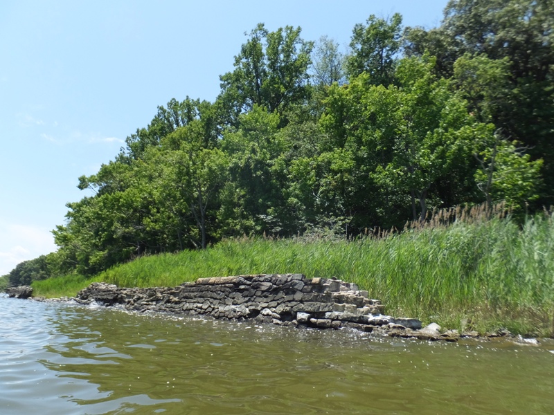
I found a couple of interesting rocks (or rock-like things) and some dragonflies. The wind picked up a little, making it difficult to stay upright until I got into more sheltered water. My sense of balance on the surf ski has REALLY gone downhill from lack of use. The Baltimore area is not a good place to paddle if you want to see interesting wildlife. Not many fish either, compared to other parts of the bay. But they do have a good number of birds. 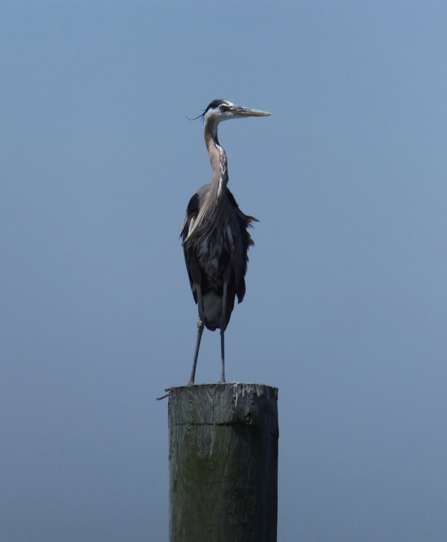
By the time I finished, I ended up paddling 26.2 miles in six hours. I try to stay fit but after paddling my surf ski so little over the last couple years, I found that I was really sore having completed this long trip. I guess I need to get on my surf ski a little more regularly. |
|
I got out on the surf ski after work. Launching from Green Haven Wharf in Pasadena, I kayaked on Stony Creek, Rock Creek, White Pond, and the (Big) Patapsco River, all in Anne Arundel County. I didn't get out on the water during the Independence Day weekend and I really needed my water time.
On one of the coves of Rock Creek, I saw what I first thought was a leucistic great blue heron but was later told that it is probably a great egret. When I initially spotted it, it was standing right next to a normal great blue heron and they were about the same size. Except for the color, it looked exactly like a great blue heron to me. 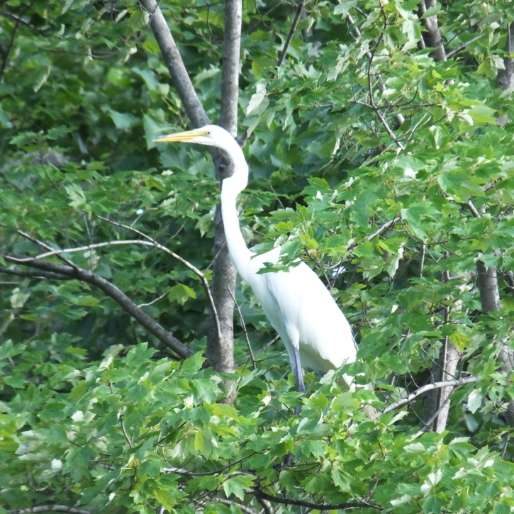
"Leucistic" means it has a partial loss of pigmentation, resulting in white, pale, or patchy coloration of the skin, hair, fur, or feathers but not the eyes. I put in 15 miles in just over three hours. I felt much more stable than the last time I was on the ski on June 30, 2016. |
|
I launched my SUP at New Bridge Landing on Tuckahoe Creek. I was on the water around 0830 to take advantage of the 1234 high tide at Hillsboro. This gave me a little push.
From the boat ramp, I saw a barn swallow. 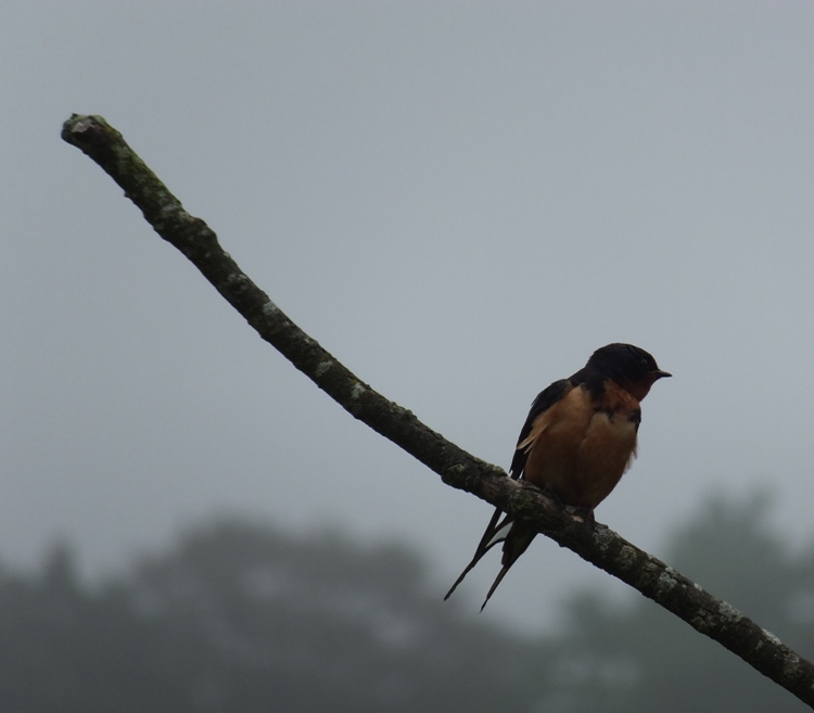
I saw my first bald eagle after three minutes on the water. I came across the second a minute later. I spotted several throughout the day. 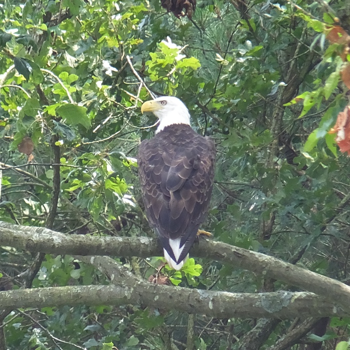
I paddled upstream 9.5 miles to Stoney Point Landing. There were a couple of police officers there. I am guessing they were Department of Natural Resources police. They were wearing body armor. It was hot and humid and I can't imagine they were comfortable. I wore body armor when I lived on a boat (1988-1990) and believe you me, it isn't something you want to wear in July in Maryland. I am guessing they wore it because of the recent shooting of police in Dallas. The two officers were very friendly and curious about my SUP. One mentioned that he had never seen anyone on a SUP on the Tuckahoe until now. The morning started out foggy and then much of the day was hazy from all the humidity. I paddled back downstream and explored all the small streams that flow into the Tuckahoe that my GPS indicated with a name. I've found that unnamed tributaries are not very paddleable because they are too shallow or too narrow. Some of the small streams I paddled got very narrow. That is often when they were the most scenic. Many appeared to be very clean. The fresh water that flowed out was very cold and full of fish. I dipped myself in to cool off. 
In the shallow areas, I saw some turtles. They were not as willing to pose for photos as the turtles further upstream, north of the dam. The ones I viewed in the water would bury themselves in the muddy bottom when I got too close. I saw about five beaver lodges but no beavers. 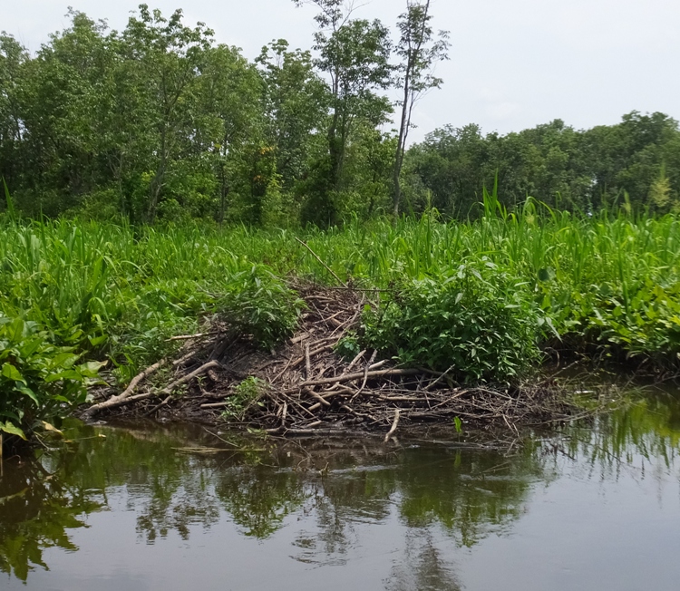
Marsh vegetation such as spatterdock, arrow arum, and pickerelweed grew abundantly and often created a well-defined path. I got in 25 miles in 7.5 hours. Of that, six miles of it were on small streams. While I spotted more eagles than I can remember and various other birds (especially ducks), there was not as much other wildlife as I normally see on similar creeks. The water was quite calm, despite the wind picking up a little in the afternoon. It wasn't a bad day to be on the water though I saw no other paddlers out, which was a little disappointing. I did this same stretch a few years ago on July 13, 2013 but back then I kayaked from Stoney Point Landing to New Bridge Landing and did not explore any tributaries. Back then, like today, I saw little interesting wildlife. After my May 17, 2014 excursion exploring north of where I turned around today, along with my May 14, 2010 trip exploring upstream of the lake, I think I can honestly say that I've seen all there is to see on the Tuckahoe. That is why it is one of my favorite places to paddle. |
|
Norma and I took her friends Susana and Yvette (shown below) out to Patuxent River Park. We launched kayaks at Jackson's Landing on the Patuxent River and paddled upstream to Western Branch.
Norma and Yvette were in my Ocean Kayak Cabo tandem while Susana was in the Cobra Expedition. I was in my Prijon Catalina. The wind was pretty strong but that didn't keep folks off the water. The park has a great kayak and canoe rental program and it looked like almost all their boats were on the water. Their 12-foot long recreational boats are good for exploring the narrow creeks. I think they might have at least one 14-foot long boat too. Also, several canoes. We saw several ospreys, osprey nests, a couple herons, and a few turtles. I spotted two snakes swimming in the water but I didn't get a good look at them. They were not small. Look closely at the pic below. 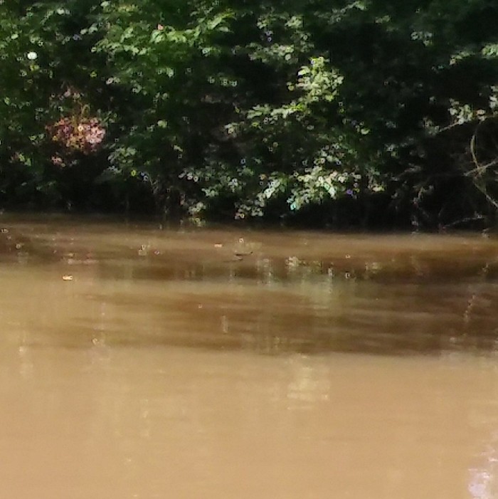
The upstream section of the Western Branch was largely wooded while the lower parts were lined with pickerelweed flowers. 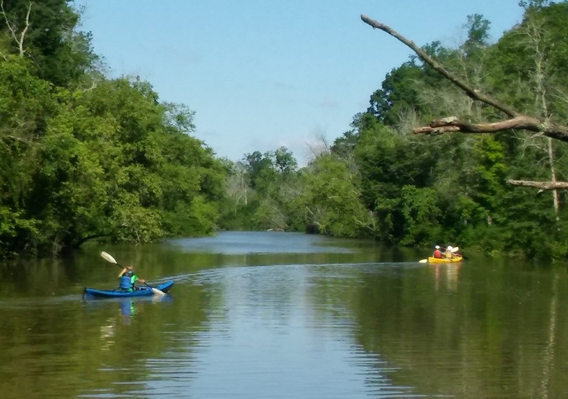
Just past the Washington Suburban Sanitary Commission (WSSC) Treatment Plant bridge, we turned around. Now the wind was mostly to our backs which made us happy campers. 
The four of us stopped at the Mount Calvert Historical and Archaeological Park for a break. A large beaver lodge lay across from Jug Bay Wetlands Sanctuary on the west side of the Patuxent River. We paddled almost five miles. At the park, we ate lunch and then proceeded to check out the Patuxent Rural Life Museum and Black Walnut Creek Nature Study Area. At the latter, we saw a six-inch long crayfish in the mud. 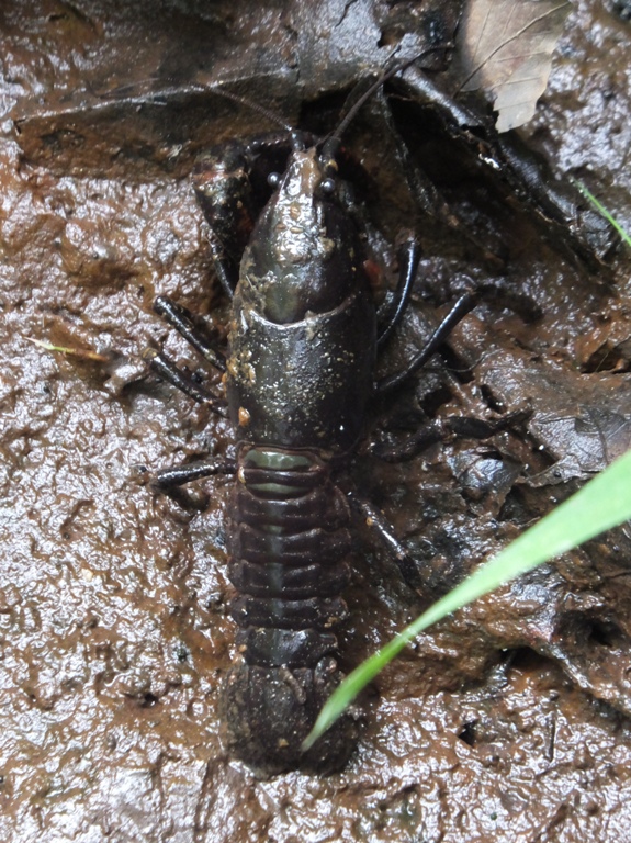
There were also several spatterdock flowers. 
We saw another beaver lodge and for a split second, I came across a mammal swimming near it that was either a beaver or a muskrat. The plan was to then visit the Billingsley House/Museum which overlooks the Western Branch but we decided to call it a day. |
|
After spending Saturday, July 16 mowing the lawn, doing bookeeping, cleaning the chicken coop, and doing some volunteer work, I decided to spend the next day doing one of the things I enjoy most...getting out on the water.
So today, I launched my surf ski at Rocky Point Park. I paddled into the Chesapeake Bay. As I did on June 30, 2016, I saw the Craighill Channel Lower (Range) Rear lighthouse near Pleasure Island. I landed briefly and confirmed that one can indeed camp at Pleasure Island. I paddled northeast along the Bay side of Pleasure Island. There were some beaches. I'm thinking that if you want a less crowded beach, this is the place to go. 
Next, I kayaked to Hart-Miller Island State Park and made my way northeast along the Bay side. It was not very interesting. It was almost all rip rap (shown below), much like the Bay side of Poplar Island which I saw on May 20, 2016. I paddled here once before on my Futura C4 surf ski, maybe around 2004. Back then it was pretty rough with lots of unobstructed wind from the Bay creating waves that bounced off the rip rap. Today it was much calmer. 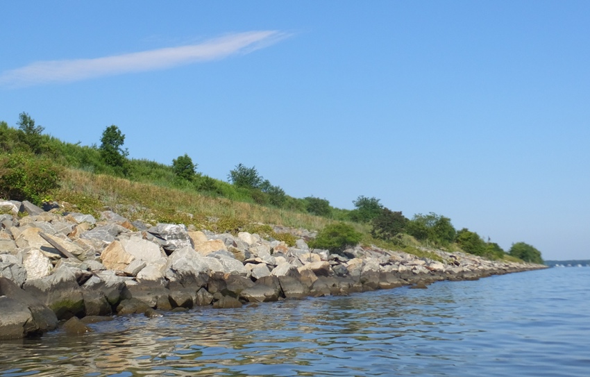
Hart-Miller Island is a 1,100 acre island located in Baltimore County, just off the mouth of Back River in the northern Chesapeake Bay. Originally part of a peninsula that extended from Edgemere, the two islands that make up Hart-Miller, were disappearing due to natural storm and wave action. Joseph Hart purchased Hart and Miller islands in 1821. By 1858, Hart Island consisted of 264 acres, and Miller Island 124 acres. The islands had many uses, including the Miller's Island Ducking Club and an amusement park on Pleasure Island. Both the club and amusement park were destroyed by storm damage erosion. By 1933, Hart Island had shrunk to 180 acres, and Miller island was down to 70 acres. The history of present-day Hart-Miller Island took shape in 1977 and 1978 when the Bethlehem Steel Corporation and C.J. Langenfelder and Son, Inc., conveyed deeds to the property, then known as the Hart-Miller-Pleasure Island Chain, to the Maryland Department of Natural Resources. In 1981 the state began the creation of what is now Hart-Miller Island by constructing a dike in the shape of an ellipse that included both islands. The dike was completed in 1984 and the resultant impoundment was filled with dredged material from the Baltimore Harbor, its approach channels, and channels in the upper Chesapeake Bay. - from sign at park On the north side of Hart-Miller Island, I pulled over at a small beach where there were a multitude of shells but not much variety. 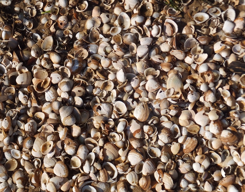
I saw a small dog running on the island. Perhaps it was a fox? I didn't get a good look. Continuing southwest along the non-Bay side, I landed at the ranger station and main beach at 39.252789, -76.371230. 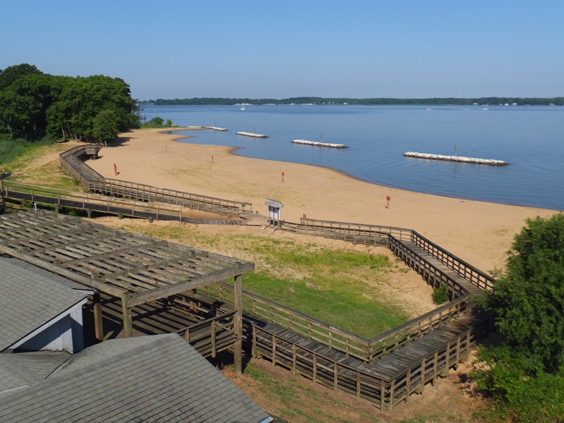
I don't believe this beach existed the last time I was here. I read about the Hart-Miller South Cell trails. Unfortunately, the road to it was closed off by a locked fence and there was nobody at the ranger station. I saw a few bald eagles (or perhaps the same one multiple times) and eventually, I found an eagle nest. 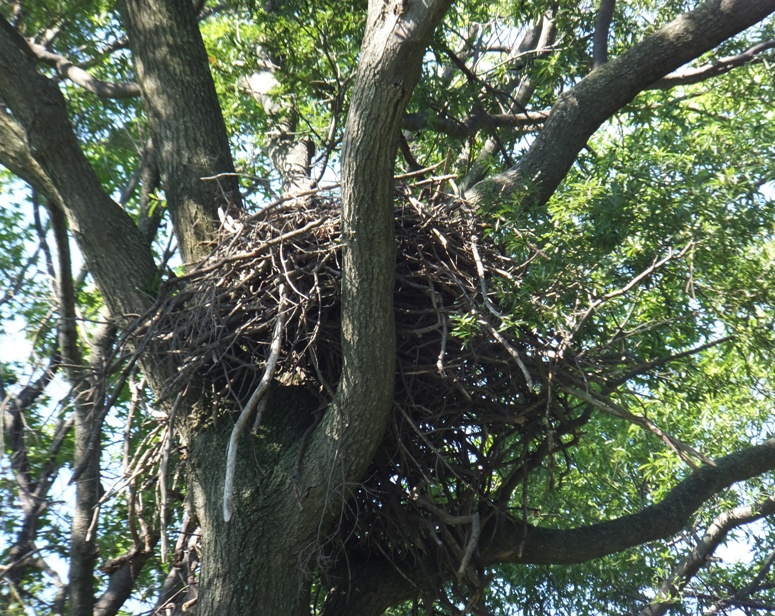
At another beach, I spotted a toad that blended in pretty well with the sand. 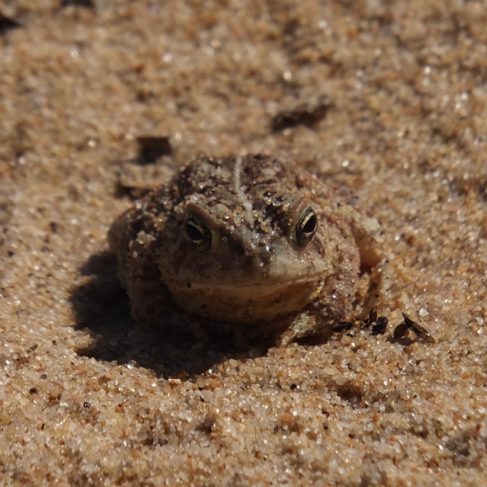
On the south side of the island, I saw a boat land with a lot of passengers. I was told they were part of a tour group but they looked rather official, like an international group from a teacher's conference. Just my guess...I'm probably totally wrong. A bus was waiting for them. I landed and figured I would walk to the trails from there but a park employee told me that I had to check in at the ranger station which I had already passed. The ranger would open the fence at 1100. I still had some time so I explored the rest of Pleasure Island and then made my way back to the ranger station at Hart-Miller Island. Now there were quite a few boats and a lot of people enjoying the water. I'm not totally certain why they are so strict about letting people onto the trails but perhaps the fear of unexploded munitions has something to do with it. In 2003 when the approach channels to the Baltimore Harbor were deepened and widened, the material dredged from the bottom of the Patapsco River yielded military ordnances and ammunition. Some of the recovered objects dated back to the Battle of Baltimore in 1812. The items were taken via barge to Hart-Miller Island by the U.S. Army Corps of Engineers where they were examined in a special safety area by historians and military explosives experts. Eight barges were needed to transport the more than 1,300 recovered ordnance items. The majority of them were found to be safe for handling, although the few that still contained gunpowder were safely detonated. - from sign at park There were three other men waiting for the ranger. I think they were employees of the park. I waited until 1140 and the ranger never showed up. During that time, I studied my lines for the wedding that I will be officiating in the autumn. I was not too happy about the ranger being tardy/absent. Once I got home, I sent an e-mail to the park service describing what happened. Here is the reply I got from Dean H. on July 21: Thank you for writing to voice your disappointment about Hart-Miller Island being closed Sunday. We sincerely apologize that your visit was dampened by the island's closure. Despite the fact that you were not able to explore the interior of the island, I hope that the rest of your voyage on the bay was enjoyable. Our advertised hours (Th-M, 11:00-4:00) are in fact the hours that the island is typically staffed. The only exceptions to these advertised hours include proactive closures for impending inclement weather or lack of staffing. Unfortunately as was the case on Sunday, two of our employees called out sick in the morning. For the safety of our staff, we require at least two employees on the boat all times, and unfortunately we just did not have enough staff to operate the island. As a result, we were forced to remain closed for the day. We understand that Hart-Miller Island is a destination park and we sincerely apologize for the inconvenience that you experienced. We will be open this weekend, barring any inclement weather, and we hope that you will return and visit us again. If you have any questions, please do not hesitate to call me at the park office, at (410) 592-2897. Towards the end of my trip, the wind picked up a little and the water was choppy though I expect most of that was due to boat traffic which was very heavy. I paddled to Balliston Point back on the mainland and explored Browns Creek a little. There was too much aquatic vegetation slowing me down so I didn't spend a lot of time there. Kayaking in deeper water is much more efficient at this time of year in this area. I rounded Rocky Point and then made my way up the creek that divides the park and Rocky Point Golf Course. I was able to get 0.6 mile upstream of the second bridge before I had to turn around. I saw a great blue heron that posed for me while I took its photo. 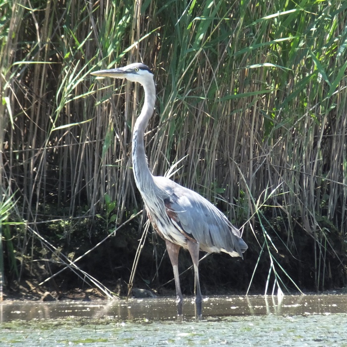
I kayaked 18 miles. |
|
After a very stressful day, I unwound by paddleboarding on the Wye East River. At 1845, I launched from Wye Landing and paddled upstream (north) as far as I could without portaging, exploring the tributaries along the way. I couldn't make it up very far on any of the tributaries even though I was out at high tide. Much of the landscape was wooded with few houses.
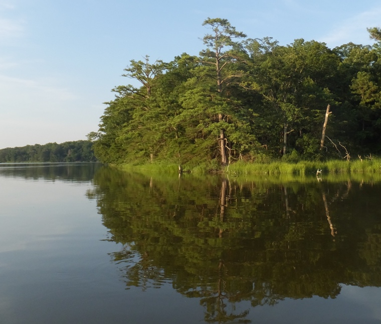
I turned around ~five miles upstream of where I started. The last 0.75 mile or so was especially scenic. I spotted about three bald eagles and six deer. I also saw a beaver (shown below) and three muskrats, though two of the muskrats might have been the same. 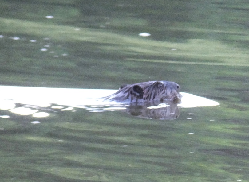
The sun set as I made my way back. It didn't take long before I was paddling in the dark. Normally, I don't particularly enjoy paddling in the dark because I like to see stuff. But once in awhile is o.k. It really makes me aware of sounds. I've often thought about launching at Old Wye Mills Road (route 662) where it crosses the Wye East River. I don't know if it would be deep or wide enough. I imagine it would be very slow with all the downfalls. So doing the route I did today but with a plastic kayak and a saw might be the way to go. I was off the water by 2130, having put in 10.6 miles. |
|
On July 25, 2016, I kayaked on the Wye River. No, not the one in Maryland which I paddled on July 21, 2016. I'm talking about the River Wye in Great Britain.
|
|
After work, I launched my surf ski from Ferry Point Marina on the south side of the Magothy River in Arnold. I paddled east out past Broadwater Beach, a small waterfront community.
I explored all the small creeks along the way. Some, like the one in shown below could easily be missed. Take a close look at the entrance. Big enough for a kayak or SUP but not much else. 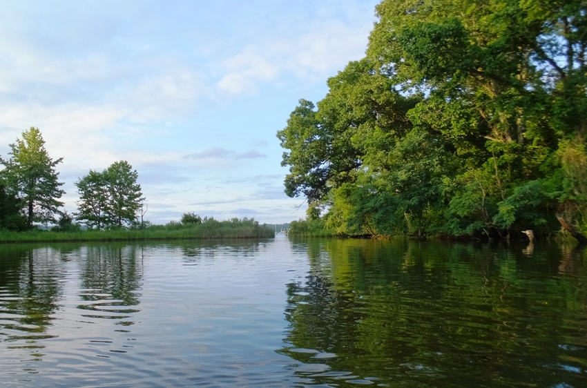
Take a gander at the below pic. A dolphin? A shark? No, just a ray. You'll notice there are two wingtips sticking out of the water...the left side is just sticking out more. I followed it around for awhile. 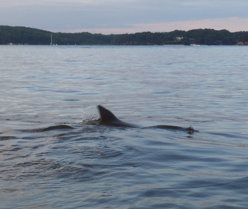
I was out until after sunset. |
|
Just two days ago, on August 5, 2016, I explored some of the south Magothy River in Arnold. Today I decided to check out some of the northern side in Pasadena. I launched my surf ski at Beachwood Park.
Unlike two days ago, I didn't do much exploring of small creeks. Instead, I went around Dobbins Island and Little Island in Sillery Bay. There wasn't much wind but there was quite a bit of boat traffic kicking up waves. I'm never confident taking photos from my surf ski when there are waves. On Little Island is a lighthouse that I am guessing is more decorative than functional. I looked online and didn't find a name for it. It is a beautiful property with a great view. Unfortunately, the person who owns it built the house without a permit. Read the full story at The Washington Post - One Man Is an Island. 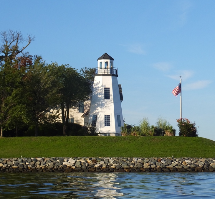
Kayaking back, I missed my turnoff. I seem to do that quite a bit. I need to remember to turn into the creek when I see the totem pole on the right and then cut across to the left. Except for the totem pole, there really isn't anything that stands out in my mind out there. I finished a little after sunset. |
|
On June 11, 2016, I paddled on the Nanticoke River and lower Marshyhope Creek, exploring the tributaries on the northwest side of the Nanticoke and the northeast side of the Marshyhope. Today, I did a similar route but explored the creeks on the southwest side of the Marshyhope. Like before, my motto was "leave no stone unturned."
I left the house at 0420. The weather for the day was not ideal. Winds were supposed to pick up to 14 mph from the southwest. That's too fast to paddle a SUP into for more than a short distance but my plan was to have this wind to my back on the return trip. I arrived at Cherry Beach Park and launched at 0710. The high temperature was supposed to be around 94. I was more concerned about being in the sun for a long time so I wore long sleeve and long pants Under Armour, a hat, and plenty of sunscreen for my face, hands, and feet. I viewed a writing spider. 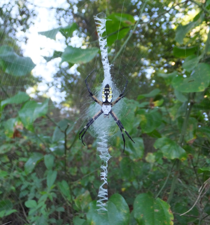
I saw a three-and-a-half-foot-long gar, a crab swimming on the surface of the water, about four eagles, and about eight turtles (none of which would pose for a photo). I paddled downstream on the Nanticoke, against a light wind. Low tide was 0811. A little after that, I made my way up Marshyhope Creek, having some push from the tide for most of my trip to the turnaround point at the El Dorado Road (route 14) bridge in Brookview. I made it there in about two hours. 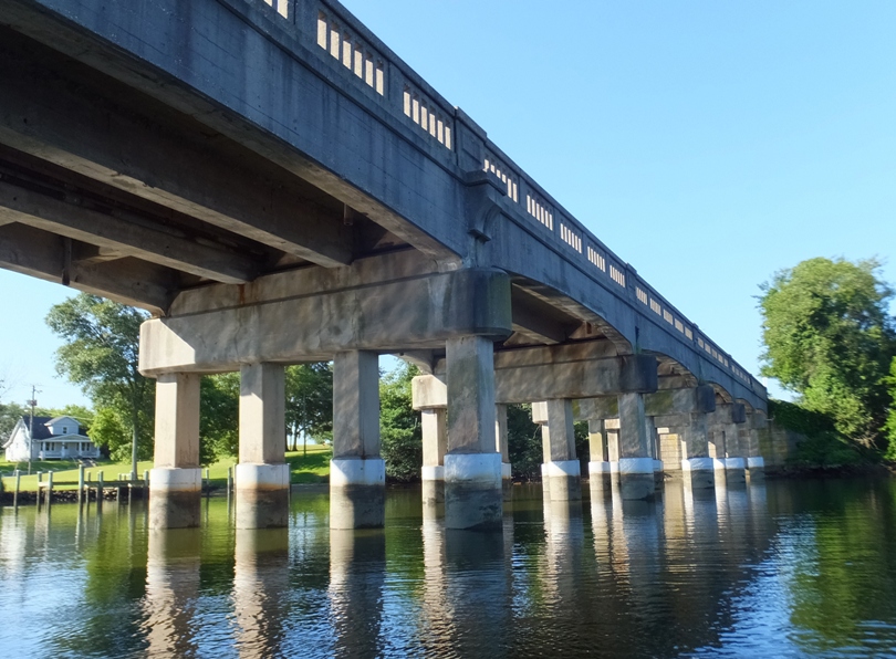
Now the interesting part began...creek exploring. Like the last time I was on Marshyhope Creek, I spotted a lot of beaver activity. That's why I call this place "Beaverland." I reckon I saw about ten lodges, one (possibly old) dam, and a lot of beaver chew. Where there's beaver activity, there are beavers though usually I don't see them. Sometimes I just hear them or see a big splash. But today I saw two beavers. One alive (see photo at the bottom of the page) and one was dead. I can't tell what caused its death. There was nothing to indicate it might have been a result of humans. Where I was, I expect humans would rarely go. 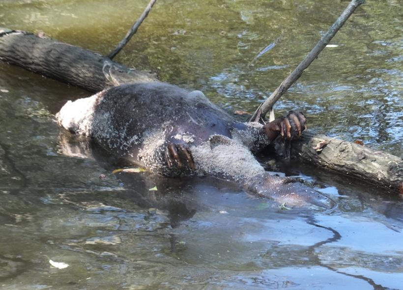
I spent a signficant amount of time on the small tributaries of the Marshyhope. I found them wooded, scenic, and peaceful. Never did I see another person on any of them. 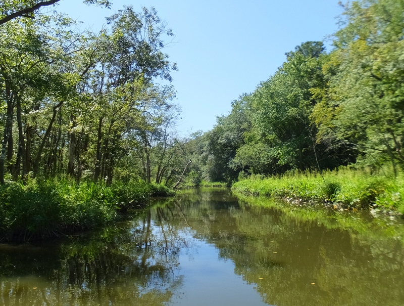
I don't think I had ever seen so many swamp hibiscus flowers in bloom as today. I sometimes get them confused with marsh mallows but I'm certain these were hibiscii today. 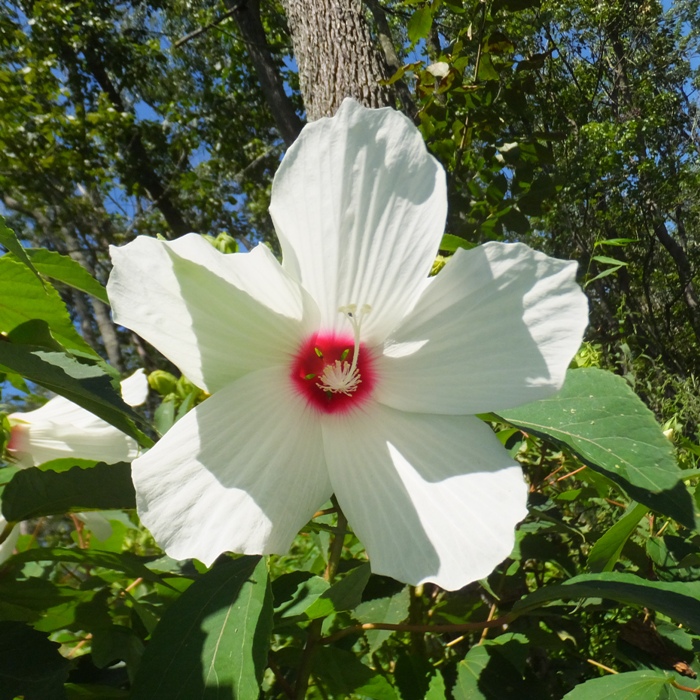
I saw another writing spider. 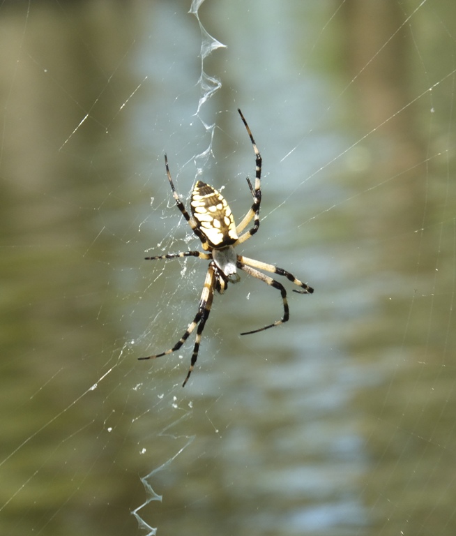
Unlike my last trip on the Marshyhope, the creeks that I explored today were wider. That being the case, I expected there to be more potential in getting further upstream. Hence, I did some portages. Portaging with a SUP is different than a kayak. If the obstructing fallen tree is low, I can often break off weak branches, get the SUP under other branches, and then step over. If the fallen tree is near the water line, I can sit far back on the SUP and get the nose out of the water (as if I'm doing a pivot turn). Then I paddle as close as possible to get the front of my SUP on the other side of the fallen tree. Next, I step onto the tree and move the rest of the SUP to the other side. I just have to make sure I don't put too much weight on the SUP when it is on the fallen tree; otherwise it will crack. Once on the other side, I position the SUP parallel to the fallen tree and remount. All this is very slow but it got me pretty far up creeks. Eventually, I came to Big Creek. This isn't named on my ADC maps. It is the creek on the south side of Marshyhope Creek, 0.4 mile northwest from where the Nanticoke River meets Marshyhope Creek at Fork Point. Big Creek is also just downstream of Walnut Landing. I studied satellite photos which showed a much different view than my maps. My maps showed this wide creek heading southwest and then just ending in the heart of Big Creek Marsh. But the satellite photos showed it connecting with a very straight waterway called the Canal which then led to the Nanticoke River. I wanted to see if indeed the two connected. 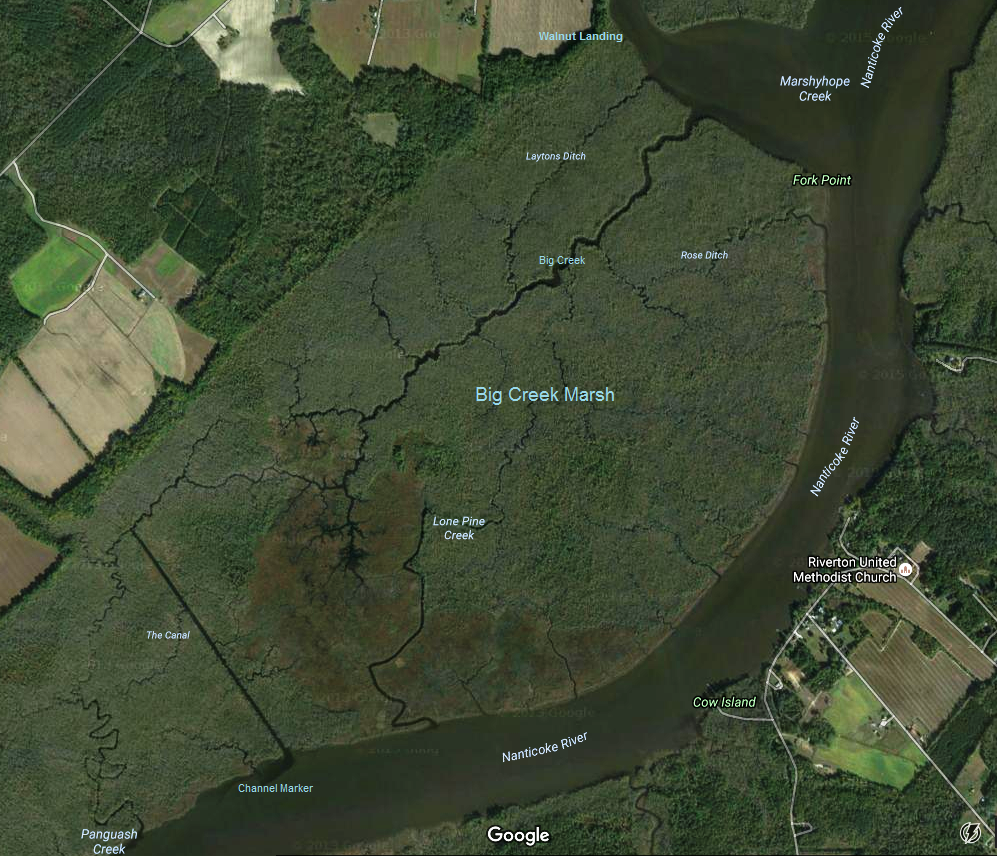
Unlike the other tributaries I explored today, Big Creek did not require any portages. The creek borders on Nature Conservancy land so it is extremely natural and scenic. There were a few offshoots but I tried to stick to the main part. Eventually I started heading south. I thought it might connect with Lone Pine Creek so I investigated that. It did not connect. Making my way back to the main part, I wasn't sure which way to go to get to the Canal, or even if that was possible. But then I noticed debris floating on the water. It was moving the opposite direction as downstream on Big Creek. High tide was around 1354 and it was now after high tide so I knew water was flowing out. If Big Creek didn't connect to another waterway, then the debris should have been moving the other direction. I was confident that if I just followed the debris, it would lead me to the Canal and indeed it did. The Canal is an unnaturally straight waterway, shown below. It is easily wide enough for power boats. I thought maybe it was built to haul goods to a port but after doing some web searching, I found nothing mentioned for the Canal. Looking at maps and satellite photos, it doesn't appear to lead to anything important either. Someone from one of the kayaker Facebook pages wrote We hypothesize it went to an old landing for shipping farm goods out - it appears an old lane went down to the end of the canal. 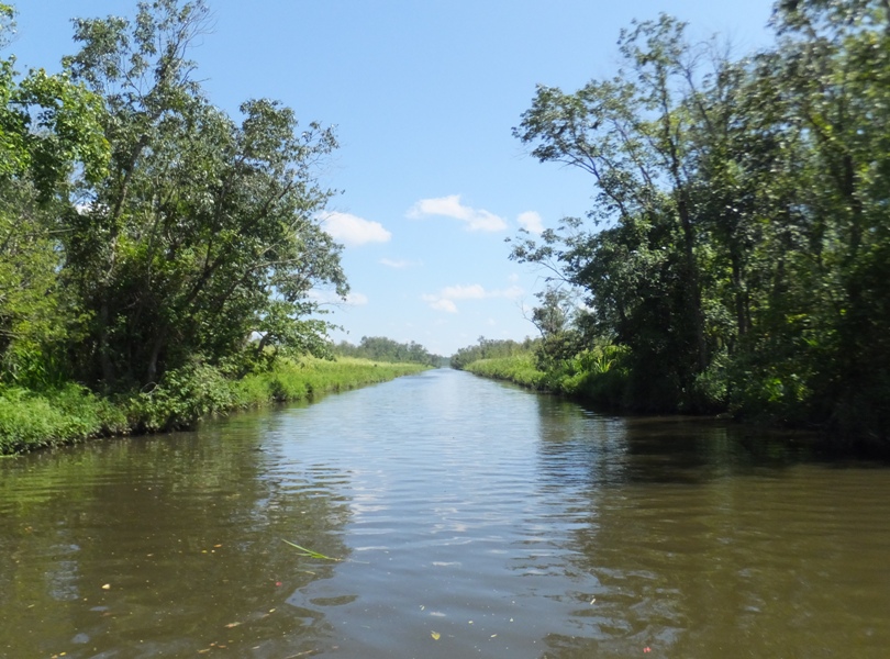
I paddled 3.2 miles on Big Creek, its tributaries, and the Canal. I could have easily paddled much more. There was quite a bit to explore. It looks like I could have skipped the Canal and gone straight to Panguash Creek which also connects to the Nanticoke. I'm thinking the shortest route between the Marshyhope and Nanticoke on Big Creek and the Canal would be about 2.4 miles. There really is a lot of scenic paddling out there. Unfortunately, it is 2.8 miles from the closest launch site, Cherry Beach Park, to Big Creek. If there was better access, I could see this place becoming a designated scenic water trail. On the Nanticoke, I was now in strong wind but fortunately, it was to my back, as I planned. There were lots of whitecaps. Getting across the river was difficult but fortunately, there was very little boat traffic so it wasn't so important to be at one side or the other. As long as I kept the nose of my SUP heading in the right direction, the wind would move me right along at a pretty good speed. I did a lot of surfing. My SUP is too long to really ride a wave properly and the waves weren't all that big but when I caught one, I could really tell because it felt like someone was giving me a strong push. That would last up to five seconds. My maximum speed was 6.4 mph. I was on the water for over nine hours. My feet were tired. I paddled 27.35 miles. Some folks on the beach asked about my trip. The woman in the group said that she wanted to try a SUP someday. I asked if she wanted to try it now. She said, "Yes." I made sure she knew how to swim, gave her my PFD, and helped her get on. She paddled away from the ramp and after about 90 seconds, fell in. I could tell she wasn't happy but it wasn't because she fell, it was because she lost her dental retainer. It sank to the bottom and she never found it. After my adventure, I did a little exploring. I stopped at a historic site called Handsell which is just north of the Nanticoke on the way to Vienna. 
Also around there, I checked out Chicone Creek. This is a narrow, scenic creek that looks like something that might be of interest to Norma. The closest launch site is Vienna, just a mile from the mouth of the creek. One should be able to paddle up it for at least 2.5 miles, making for an easy and scenic seven mile trip. I got a good view of it from both Indiantown Road and Chicone Road. I did not find anyplace to launch directly on Chicone Creek. I made it home shortly before dusk. It was a long day but one well spent. |
|
Since 2006, I have been doing what I call an annual "Saki Challenge." This is a physical accomplishment that I find personally challenging. Last year, I circumnavigated Kent Island via SUP on June 10, 2015. Like that day, most of my challenges have been water-based...kayak or SUP. But on August 23, 2016, I performed a water-based feat that does not involve paddling.
|
|
I launched my surf ski at Broening Park in Baltimore after work. I started out by kayaking east on what I call the "Big" Patapsco River. This is the section downstream of the Hanover Street bridge. If you look at it on a map, you'll know why I call it "Big."
Back on June 13, 2006, I paddled this area with Lisa A. There were several shipwrecks here back then but eventually, they were removed. I regret not spending more time exploring that area. Things have changed a lot over the last ten years. The state is doing some environmental protection work along the shore and some type of monitoring station has been set up. There is still some old "wreckage" present, though I hesitate to say it is from boats. Maybe I should call it "ruins" instead. I really don't know what it is. You can find them at Google Maps coordinates 39.248545, -76.597333. 1 / 9
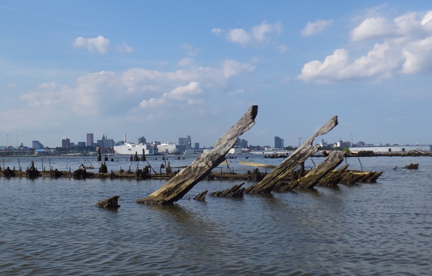
Ribs of hull?
2 / 9
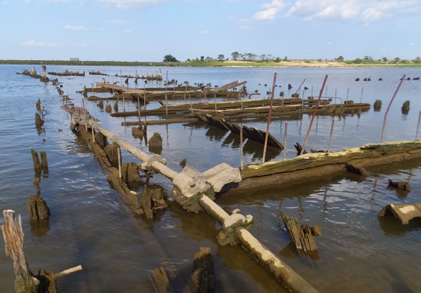
Wood and metal.
3 / 9
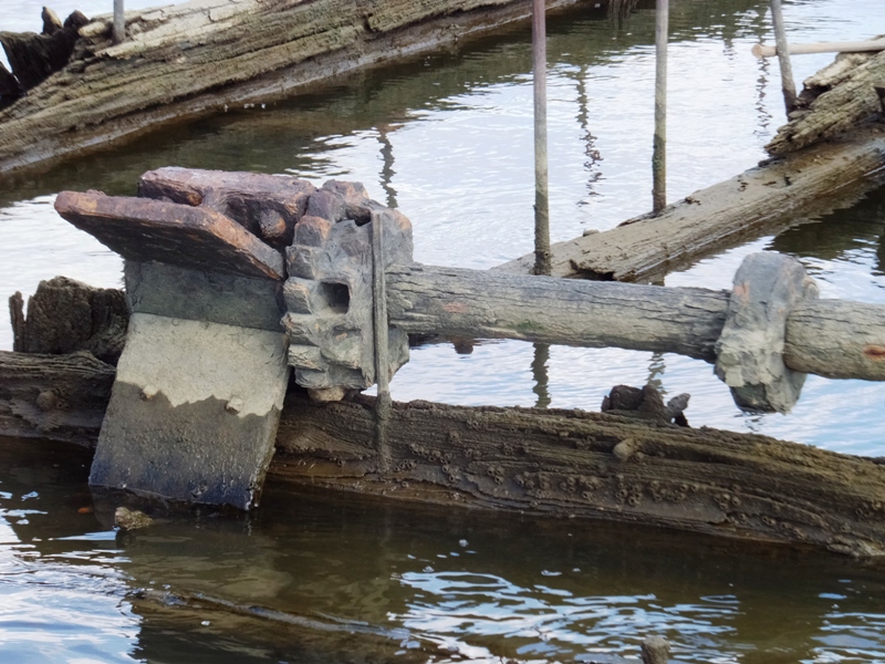
Gear.
4 / 9
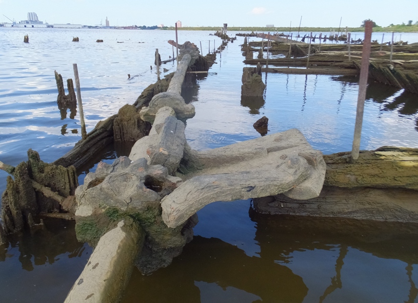
Another gear.
5 / 9
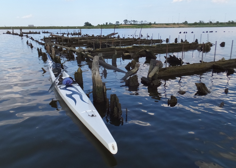
My surf ski.
6 / 9
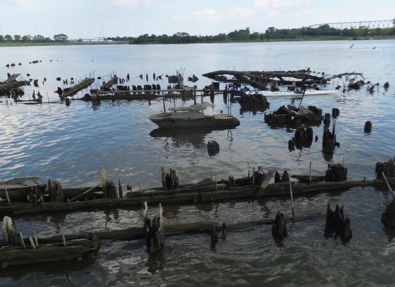
Higher view.
7 / 9
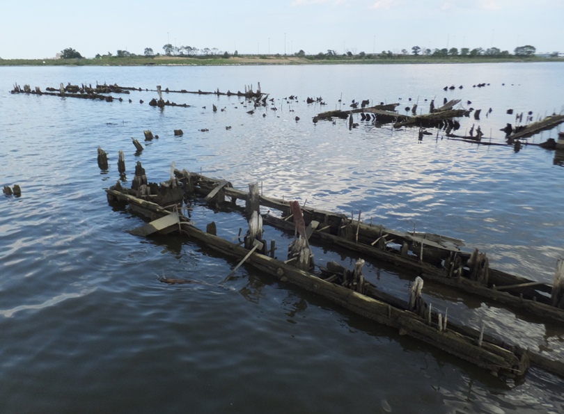
Looking northeast.
8 / 9
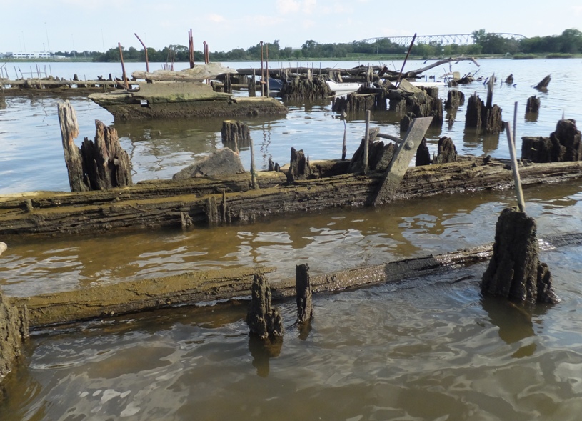
Rotting wood.
9 / 9
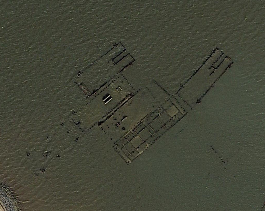
Satellite view.
On August 30, 2016, someone in the Chesapeake Paddlers Association (CPA) pointed me to JScholarship - Approaches to Baltimore Harbor Aerial Photos. The photo linked to this page I found most interesting was the 209.2Mb "MP_Sheet_No2.jpg" from 1948. The views shown below depict what this same area looked like back then. I still can't tell what they are but there are more of them. I saw an osage orange (aka hedge apple) tree with plenty of fruit. These things always make me think of Carmen because I remember her juggling them on October 12, 2015 during our Chesapeake and Ohio (C&O) Towpath bike ride. 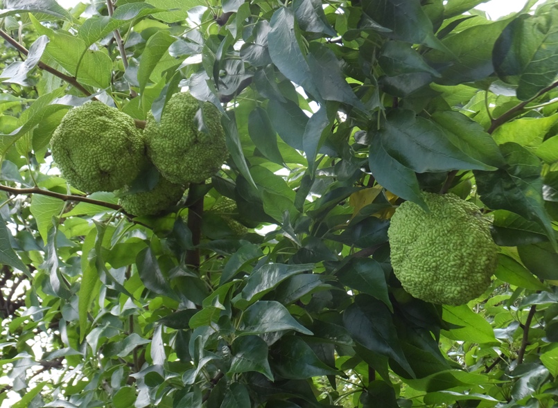
I also came across something that I believe is/was used to keep ships in place. 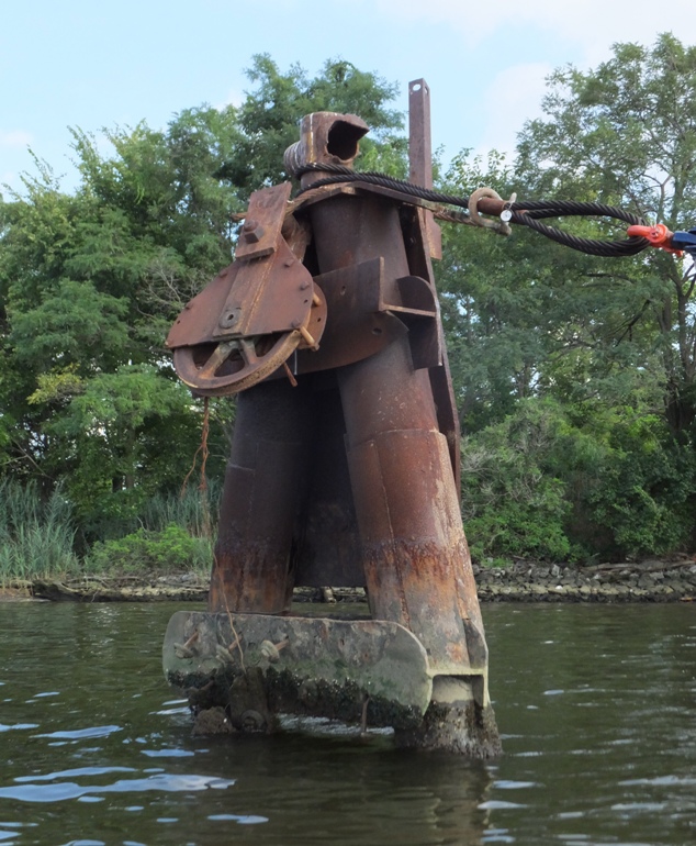
Next, I paddled up the "Little" Patapsco River. This is the part upstream of Hanover Street. Keep in mind that "Big" and "Little" Patapsco are Saki terms. Nobody else I know uses them...at least not yet. On July 30, 2016, Ellicott City fell victim to torrential rainfall which led to severe flash flooding. This took place upstream on the Little Patapsco River. A few days after, kayakers were told to stay away due to sewage leaking into the river. ...the storm caused the Patapsco River to rise 13 feet in nearly two hours... The storm caused at least $224 million in damages to public infrastructure, an estimate that includes costs of repairing a broken sewer line that dumped around 20 million gallons into the Patapsco River... ...the disaster is classified as a 1,000-year-event, which means it has a one-in-a-thousand chance of occurring per year... - according to "Officials Seek to Make Ellicott City Less Flood-Prone" in the August 25, 2016 Columbia Flier I was expecting to see a significant amount of debris and damage as I kayaked upstream. Much to my surprise, I did not. Things looked pretty much normal. However, there were sections where I could smell sewage. A great blue heron let me get unusually close so I could take its photo. 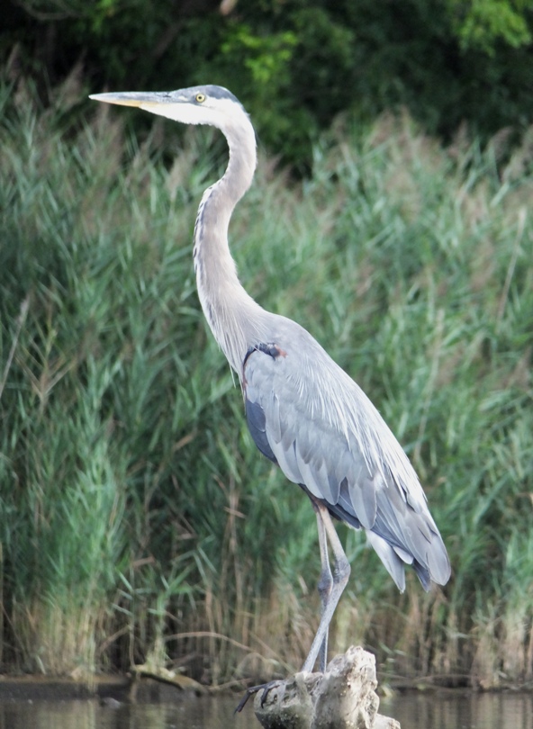
I saw a guy on a SUP. I am quite certain he launched from Southwest Area Park. I made it up to Highway 295 before turning back. Here is the view looking downstream from the 295 bridge. 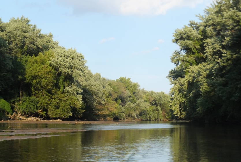
I saw three bald eagles, two great egrets, lots of big fish jumping, and about ten deer. Unfortunately, the wildlife that I encountered most was deer flies. I got bit up pretty bad. I guess that's the price you pay for being one with nature. I got in an easy 12.3 miles. |
|
When everyone else is on the land, sometimes the best place from which to see things is from the water...or so I thought. That was my theory for taking out my SUP to watch and cheer for folks running the Annapolis 10-Miler.
I ran this race back in 1998 with Rick. But today, I would show my support for Talia F., Mike, Ted S., Liz B., Jim C., Karen K., Dave T. The race started at 0700 and my goal was to launch from Truxton Park and be at the Rowe Boulevard Bridge on College Creek when it started. I would wait for the runners, cheer for them, and take their photos as they ran across. Then I would paddle a little downstream to Decatur Avenue and do more of the same. 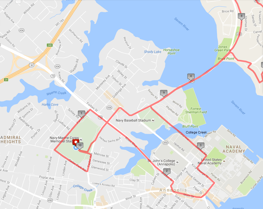
But due to poor planning on my part, I didn't make it out to College Creek in time. So instead, I quickly paddled out to Ego Alley to see some of them as they ran down Main Street and turn onto Randall Street. I tied my SUP up to a post to keep it from floating away and then walked ashore. You're not supposed to do that but the police in the area were more concerned about making sure the race was operating smoothly so they didn't care about my illegal parking. But then I saw a power boat approaching so I figured I ought to move in case I was taking up his space. 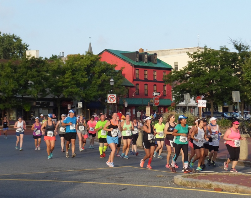
It wasn't terribly hot but it was very humid so it felt hotter than what it was. I hurried to Jonas Green Park at a race pace (~5.25 mph), parked my SUP on the beach, and then ran up the hill to the Naval Academy Bridge (route 450). This was near mile 8.5 of the race so runners were very spread out and I could pick out individual faces. But with all those hats and sunglasses, that wasn't always easy. Over about 45 minutes, I saw Ted S., Jordan B., Jim C. and Liz B., and finally Talia F. and her husband Mike. I missed Karen K. and Dave T. but they're really fast so I figure they crossed the bridge before I got there. The next day, I found out Karen took third place for women in her age group! I spent the rest of the morning paddling into and exploring the coves and creeks between the Naval Academy and the Severn River Bridge (Highway 50). I know that area all too well so it wasn't all that interesting. But I did see a few cool things. 1 / 5
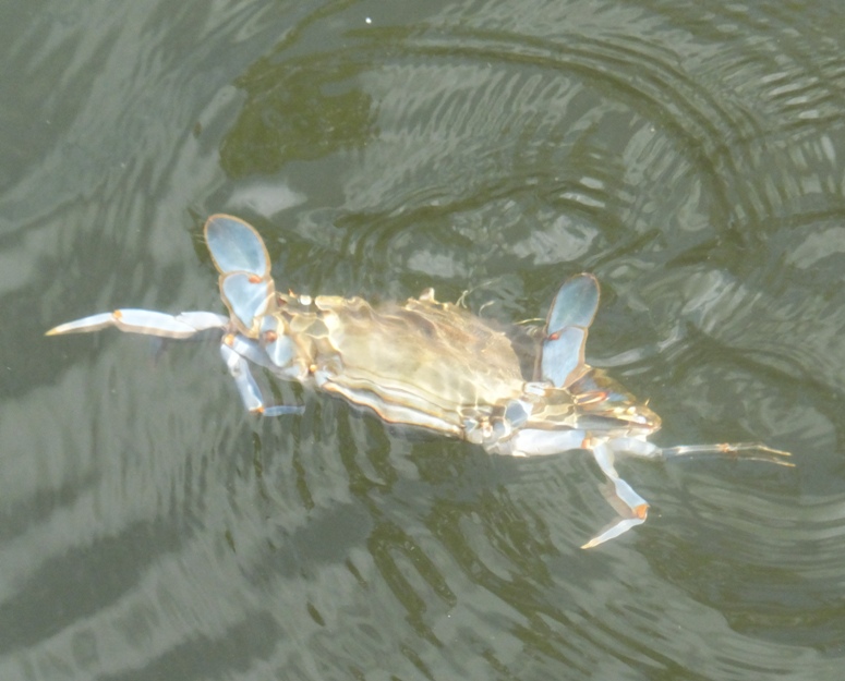
Crab on Weems Creek.
2 / 5
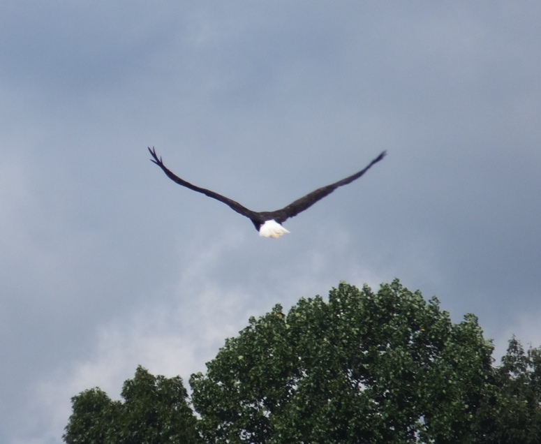
Bald eagle.
3 / 5
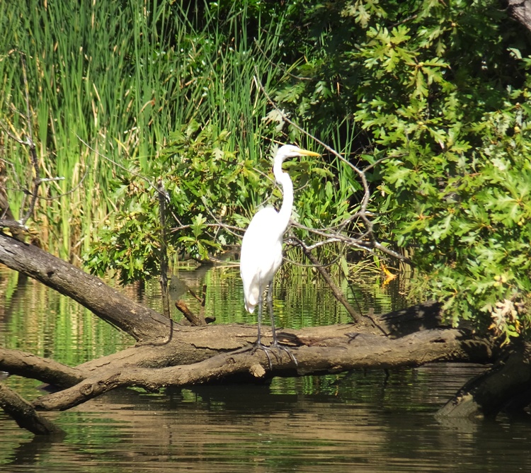
Great egret.
4 / 5
Tunnel under road.
5 / 5
Stalactites under bridge.
Back on Spa Creek (from where I launched), I saw more kayakers and paddleboarders in 45 minutes than I'd seen all year! There was also a lot of power boat traffic. I was concerned about the safety of the paddlers. I think many were on rental kayaks/SUPs and several looked fairly new to the sport. I commented to one SUPer that he was holding his paddle backwards. I ended up getting in 15.8 miles. I ran into the (new and improved) David M. from my kayak club. I hadn't seem him in years. He still looks as fit as ever. We spoke about his Stellar surf ski. He's tried several (including Epics) and has found this to be the most stable. I will definitely keep this brand in mind if I am looking for another high performance kayak. 
The next day, my triceps were sore from paddling so fast. |
|
On September 5, 2016, Norma, her intern, Janett, and I kayaked on the Rapidan River in Virginia. We also spent the Labor Day weekend in Fredericksburg, Virginia.
|
|
I launched my surf ski from Breezy Point Marina in Calvert County and then kayaked in the Chesapeake Bay heading north. Along the way, I pulled ashore at various places and looked for fossils.
It was a little windy and the water was slightly choppy but not too bad. At my first stop, I was sifting for fossils out in the water and pulled up a four inch long horseshoe crab. It moved pretty fast when I put it on the ground. I thought I was at a place that landlubbers could not easily access until I met a very friendly geologist who told me about the area. He gave me some fossils that he found, shown below. The one that isn't a shark tooth in this photo is part of a ray dental palate. It is the largest and most unusual piece from a ray that I've ever seen. The geologist said fossils in this area are typically between 12 and 20 million years old. He also said that the oldest cliffs in this area are Randle Cliffs. 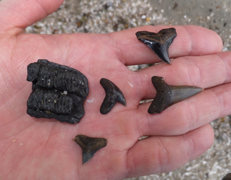
I heard that Randle Cliffs is a good place to look for shark teeth but I did not find that to be the case today. Of the places along my route, Randle Cliffs was the most accessible by foot so there were quite a few people in the area looking for fossils, likely snatching up the low hanging fruit. A long boardwalk made access from Chesapeake Beach easy. Instead, I found Roosevelt Cliffs to be the best hunting ground. But unless you have a boat, it might be difficult to get to. Like my time spent at Jurassic Coast, England looking for fossils on July 27, 2016, I saw several soft "rocks" which were really more clay-like. Many were embedded with shells and other aquatic life. Some just had very unusual shapes. 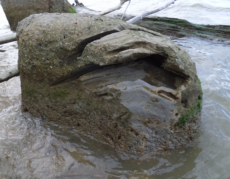
The cliffs had layers which were abundant with aquatic animal remains. This corresponded with time periods when such life was plentiful. 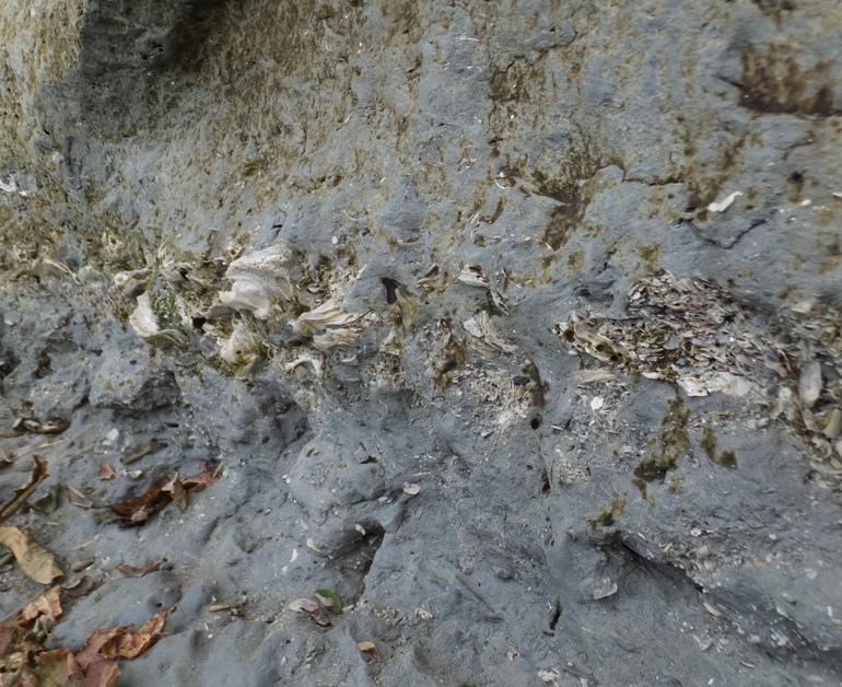
All the cliffs were quite steep and some were also very tall. 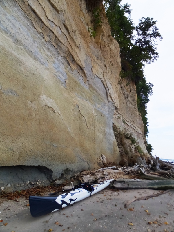
I walked by the biggest hornet I've ever seen. At first I thought it was the dreaded and deadly Asian Giant Hornet which my former co-worker, Crazy Jenn, told me about. But those aren't supposed to be in the United States. It looked to be two inches long from nose to ass. When I got home, I did some web searching and learned that what I saw was more likely a European Hornet. Wikipedia says Due to this coloration and abdomen pattern, V. crabro [European Hornet] is often mistaken for the Asian giant hornet. I only saw two other paddlers out and they were both fishing. I found 44 shark teeth and other fossils in about an hour and ten minutes. I would have looked for longer but it was getting pretty dark. I also paddled 11.3 miles. When I got home, I looked at everything I brought home. 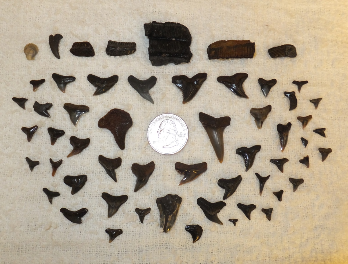
I was hoping to have enough time to explore Fishing Creek in Chesapeake Beach but I did not. Next time, I'll plan to launch at Rose Haven Memorial Park and then paddle south to this creek and see how far I can paddle up it. |
|
After work, I launched my SUP at Rose Haven Memorial Park in southern Anne Arundel County. A fisherman was getting ready to launch and we spoke for awhile. This trip was to complete the route I started on September 9, 2016 but from the other direction.
The weather was almost ideal with a very light breeze, temperatures in the high 70s, and low humidity. I looked briefly on the beach for shark teeth but didn't find any...I wasn't expecting to. But I did find an almost perfect specimen of a small dead horseshoe crab which I put in my car so I could take it to work for show and tell (fun fact Wednesday). I paddled out into the Chesapeake Bay and then south to North Beach in Calvert County. Continuing south, I made it to Chesapeake Beach. On a long stretch of rip rap, I saw a multitude of sea gulls. From here, I also had a nice view of North Beach. Next, I made my way up Fishing Creek. After getting past the marinas, it became very natural with lots of bay grasses and woods in the background. I noticed the The 1.4 mile long Chesapeake Beach Railway Trail which I promised myself I would return to explore. It is a very nice boardwalk that goes along and above the water and through the woods to offer a spectacular view of the wetlands. Between 1900 and 1935, the Chesapeake Beach Railway whisked vacationers from Washington, DC, to the grand hotels, beaches and boardwalk of the resort town of Chesapeake Beach, Maryland. Now tourists and residents alike can enjoy a different kind of luxury as they walk or pedal on the Chesapeake Beach Railway Trail, which occupies a portion of the abandoned railroad corridor. Unusual for a rail-trail, the Chesapeake Beach Railway Trail rests almost entirely on a wooden boardwalk just above serene Fishing Creek and the marshlands surrounding it. Bicyclists needn't worry, though - unlike some boardwalks, the trail is open for bicycling, and the width is adequate for such use. - from TrailLink - Chesapeake Beach Railway Trail I made my way north along a tributary of the creek. There were a lot of small fish swimming about. As my SUP sliced through the water, many darted out quickly to get away. Five swam a little too quickly and ended up stranded on the mud. I rescued them, putting them back in the water. Near the entrance to Lake Moffat I saw a couple of green herons. 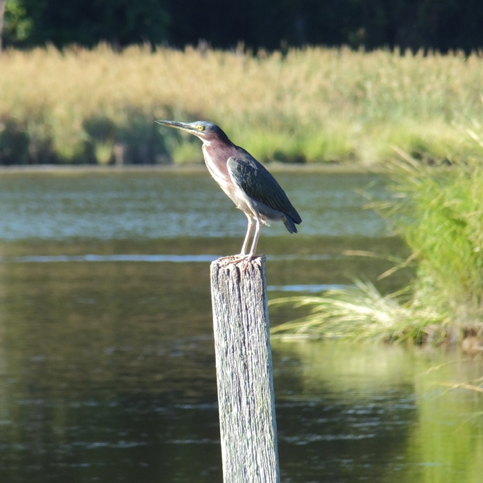
I was going to paddle around the perimeter of the lake but it was too shallow. It was about an hour before low tide so I expect if I return closer to high tide, I would be fine exploring the small lake. I found a tiger swallowtail butterfly spread eagle on the creek. It was stuck to the water. I pulled it out and let it dry off on my SUP. Then I put it on a bush. 
There was a great blue heron that was particularly cooperative and not camera shy, probably because it was more concerned about eating than my presence. At the mouth of this tributary, I could see the boardwalk in the distance. 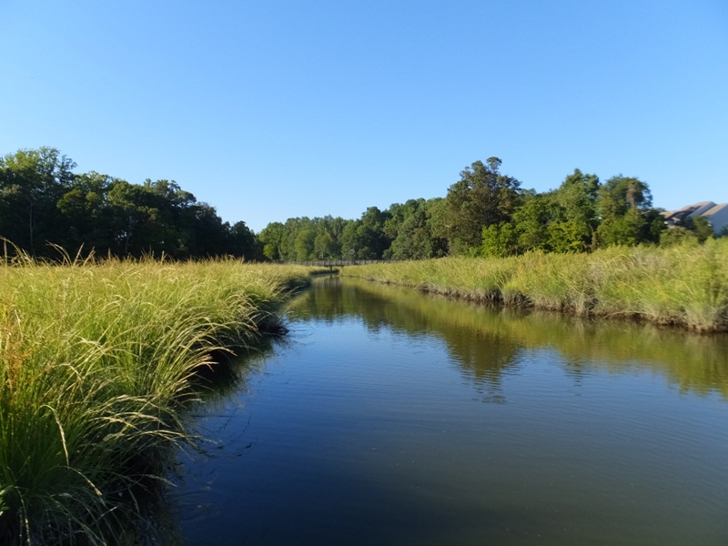
And here's where the boardwalk ends. 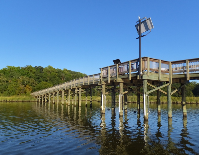
In Fishing Creek, I saw more blue crabs that day than I'd ever seen before in the wild. We are seeing a welcome new rise in crab numbers...In 2015, they started to increase...and this year [2016], they continued to climb, approaching scientists' preferred "target" level. The formula of science-based fishery management and improved habitat is working for crabs... - from Fall 2016 Save the Bay - The Magazine of the Chesapeake Bay Foundation "What are the Crabs Telling Us?" I followed at least a couple dozen egrets as they flew from one spot to another. 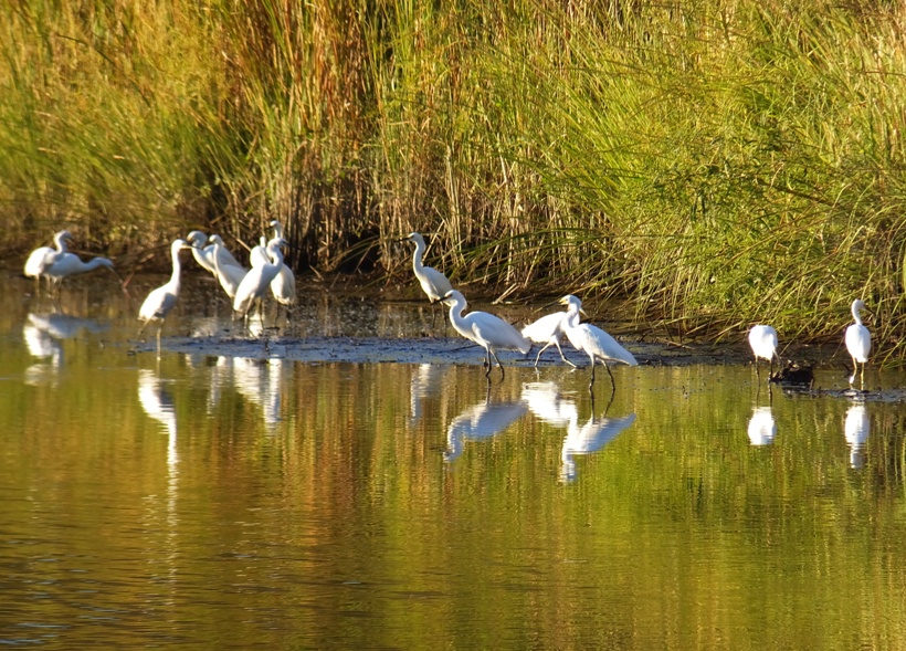
The creek was much larger and longer than I expected. I made it up 2.5 miles before turning around. I could have gone further but I was running out of daylight. Looking at satellite photos, I think I might have been able to paddle about another 0.6 mile at high tide. Making my way downstream, I saw a snake, likely a northern water snake. It was only about 2.5 feet long. Near the mouth of the creek, fishing boats glowed in the setting sun. 
I saw one bald eagle on the creek and hundreds of sea gulls out on the bay, most of which went into a feeding frenzy around dusk. Near the launch site, there were three fishermen in kayaks. They came in just as I did. One was the fellow I spoke to earlier. I got in 14 miles, finishing about 40 minutes after dusk. I studied the area on my computer. Looking at satellite photos, I have to wonder if I could paddle under Bay/Walnut Avenue near Hog Point at 38.713455, -76.529987 to access the body of water on the west side of the road and then get to Wetlands Overlook Park. The North Beach and Chesapeake Beach area is very nice. I plan to return here to do some exploring on land, hopefully with Norma and Carmen. Maybe we could check out Flag Ponds Park too. |
|
I launched my SUP at Horn Point Street End Park in Eastport and paddled southeast into the Chesapeake Bay.
After I rounded Tolly Point, I saw my destination in the distance, Thomas Point Shoal Lighthouse. The southernmost point of the peninsula on which Annapolis is situated is called Thomas Point, after Philip Thomas, one of its early owners who arrived in Maryland from Bristol, England in 1651. The need for a lighthouse at Thomas Point was recommended in an 1821 letter... The State of Maryland conveyed five acres of submerged land to the Federal Government on October 28, 1874, and Thomas Point Shoal Lighthouse was ready for its inaugural lighting on November 20, 1875, the same date the old Thomas Point Lighthouse was discontinued. - from Lighthouse Friends - Thomas Point Shoal From Tolly Point, the lighthouse was about three miles away, heading south. That's quite an open water crossing. Fortunately, the wind was pretty calm and while not completely flat, the bay certainly wasn't rough. As I made my way around the lighthouse, I saw a few fishermen and some people at the lighthouse. I assume they were workmen because they were measuring stuff. 
In the area, I spotted numerous crabs. The water looked clean. Next, I paddled about 1.25 miles west to Thomas Point. I wondered if one could easily launch a kayak or SUP from here. There was nothing obvious but I think I would need to scout it out more closely before I close the book on it. On the rip rap near Thomas Point, I saw a dead cownose ray. It looked pretty fresh. I looked closely at its teeth and noticed that in some places it had "jack-o-lantern" teeth. It reminded me of some of the pieces of ray dental palate that I obtained in Calvert County. I started making my way back to Eastport, hugging the shoreline. I explored Fishing Creek. In a tree along the shore, I saw a wild persimmon tree. 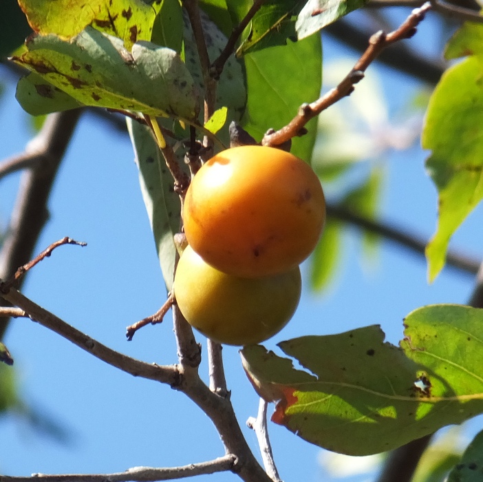
The main reason for me coming out to explore this area was to see Highland Beach. It has an interesting history. [Frederick] Douglass' son Charles happened upon this promise land on the Chesapeake Bay's Western Shore in 1893. He and his wife, Laura, had been turned away from a neighboring resort for being black. The pair headed south onto the adjoining Bay-front acreage where they met landowner Daniel Brashears, a free black farmer. Charles negotiated the purchase of about 40 acres, and Highland Beach was born. After Charles Douglass purchased the surrounding property, he made plans to develop a small summer colony for blacks looking to escape the summer heat in the cities of Baltimore and Washington, D.C. and the oppression of segregation. Highland Beach drew successful black visitors like Booker T. Washington. The State of Maryland and Anne Arundel County acquired Twin Oaks in 1995, then deeded it to the Town of Highland Beach as a memorial to Frederick Douglass. - from Fall 2016 Save the Bay - The Magazine of the Chespeake Bay Foundation (CBF) "A History of Promise - Highland Beach, Maryland" When Highland Beach was incorporated in 1922 it became the first African-American municipality in Maryland. - from History of Highland Beach The story in the CBF magazine inspired me to come out here. In this article, they included a small map of the area. Oyster Creek was depicted as forming part of the edge of this community. In the map, the inlet for this creek was not big. From a distance, one could easily paddle right by it without knowing it is there. 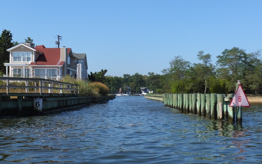
The creek was nice but nothing all that special. Back in the Chesapeake Bay, I paddled a little north until I saw a tiny opening to Blackwalnut Creek. Even if one were close to the shore, this inlet could easily be missed. 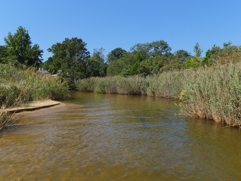
It is too shallow for a power boat. Some sections were even too shallow for my SUP. As I paddled in, I came across several more crabs. The inlet stayed narrow for quite awhile (below) and then it opened up. 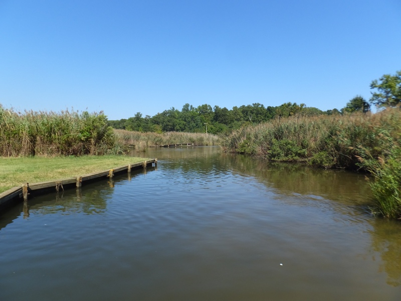
According to the CBF article, the Frederick Douglass Museum and Cultural Center was nearby, somewhere south of the inlet. I probably saw it from the water but didn't know it. I'll have to return on foot and find it. Blackwalnut Creek is a real gem. I suppose that because the inlet is so shallow and narrow, the area stays very natural since powerboat traffic can't get in. However, what you see is what you get. There is one narrow tributary that flows into it but you can't get very far up it. I passed a couple of CBF educators leading a group of kids in canoes. The water was perfectly flat and sheltered yet two of the boys managed to flip one of their wide canoes. 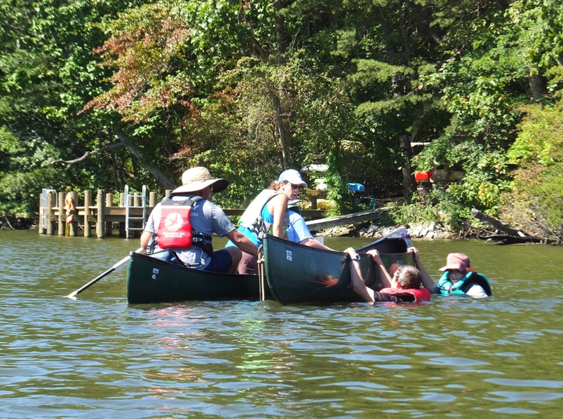
The leaders did a T-rescue to drain the canoe and then the kids got back in. 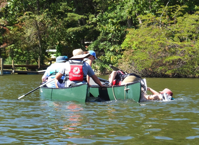
Then I took a picture of the whole group. 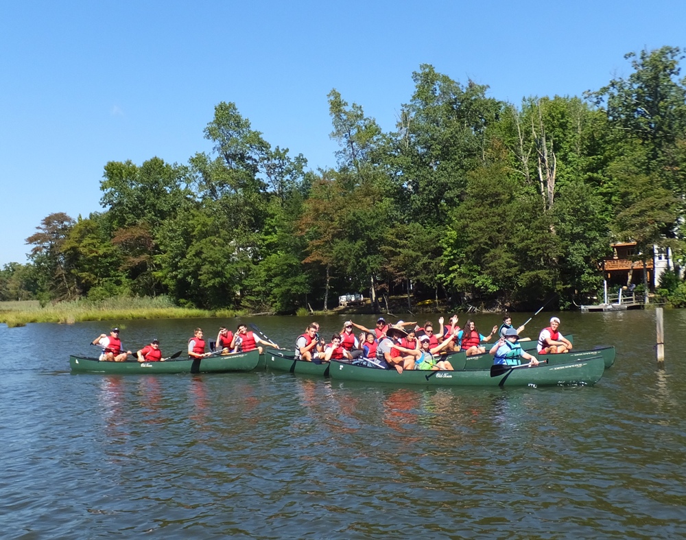
I saw something I had never seen before. It was a duck house. I don't know if it actually gets used as intended. 
I spotted two bald eagles. Near the east end of the creek, some kids doing some environmental project. 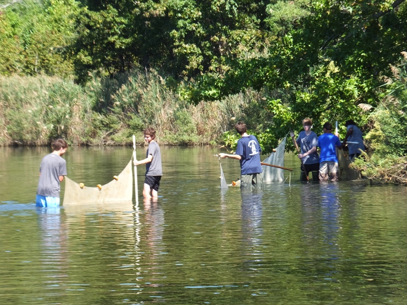
Back on the bay, there was a totem pole on the CBF beach along with the Philip Merrill Environmental Center which houses the CBF headquarters. The center, which opened in 2001, is one of the world's most energy-efficient buildings, incorporating natural elements into a fully functional workplace which has minimal impact on its Bay- and creek-front surroundings. The first building to receive the U.S. Green Building Council's Platinum rating for Leadership in Energy and Environmental Design (LEED), the center and its sophisticated systems have won international acclaim as a model for energy efficiency, high performance, and water conservation. - from "Chesapeake Bay Foundation - Philip Merrill Environmental Center" (broken link as of 2017) 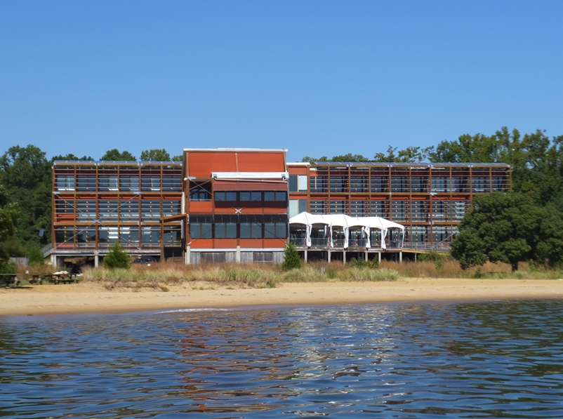
Could one launch a kayak at the Philip Merrill Environmental Center beach? Possibly. But their limited hours and other restrictions make it less than ideal. See CBF - Public Beach. On the CBF beach, I there was a rather cartoonish totem pole. 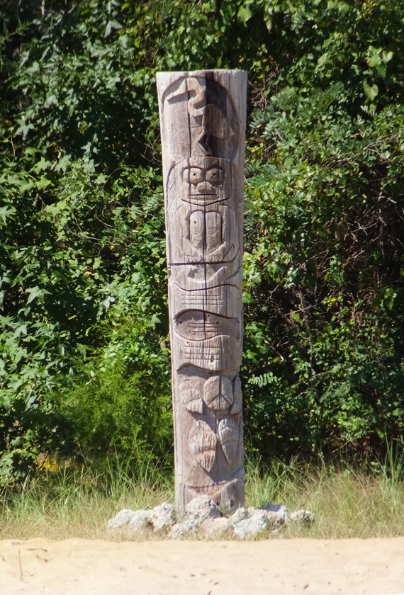
After I rounded Tolly Point, I made a straight shot back to the launch site. I paddled 19 miles in five hours and 20 minutes. I came home, got washed up, and then headed out to a wedding rehearsal where I will serve as the officiant. Yes, I am ordained. |
|
Yesterday, I officiated my first marriage as an ordained minister of the Universal Life Church. What better way to celebrate such an accomplishment than to go paddleboarding? So that's what I did the following day.
I launched my SUP from Turner Station Park in Dundalk around 1600. This put me on Peach Orchard Creek. The day was brilliantly sunny with few clouds, low humidity, and cool. I couldn't ask for a better photography day. I paddled across and to the east side of Bear Creek and then south of the Highway 695 Baltimore Beltway. Wildlife is always my favorite thing to photograph but if I don't have that, shipwrecks and ruins will suffice. I paddled out to Sparrows Point to find the latter. Steel was first made at Sparrow's Point in 1889, by the Pennsylvania Steel Company. By the mid-20th century, the Sparrow's Point plant was the world's largest steel mill, stretching four miles from end to end and employing tens of thousands of workers. Bethlehem Steel purchased the mill in 1916. The mill's steel ended up as girders in the Golden Gate Bridge and in cables for the George Washington Bridge, and was a vital part of war production during World War I and World War II. The Sparrow's Point Shipyard site was also a major center for shipbuilding and ship repair. Maryland Steel Company established the Sparrow's Point yard in 1889, and it delivered its first ship in 1891. Bethlehem Steel Corporation acquired the Sparrow's Point shipyard in 1917. During the mid-Twentieth Century, Bethlehem Steel Shipbuilding (BethShip)'s Sparrow's Point yard was one of the most active shipbuilders in the United States, delivering 116 ships in the 7-year period between 1939 and 1946. - from Wikipedia - Sparrows Point The place I really wanted to explore was Tin Mill Canal. On my map, it looks like it goes about a mile and a half east from the western side of Sparrows Point. If there is one thing Sparrows Point is known for, it is toxic waste and Tin Mill Canal is the epitome of all this. More than a century of steelmaking at Sparrows Point has left contaminants in Bear Creek that pose a slight health risk to humans... The worst contamination in Bear Creek was near the mill's Tin Mill Canal, which was used for decades to discharge water and wastewater into the creek. People who swim in the area face no extra risk, but people who eat a lot of fish and crabs caught there would have an increased cancer risk... The site was used as a steel mill for more than a century, mostly as a Bethlehem Steel facility. After a series of ownership changes, the mill closed for good in 2012. In 2014, the current owners bought the property and entered into environmental agreements with the state and federal governments, promising to spend at least $50 million on cleanups. - from "The Baltimore Sun - Sparrows Point contamination in creek poses some health risk" (broken link as of 2025) It didn't take long before I came to the mouth of the canal. Several pipes crossed the opening and I had to lie down on my SUP to get under them. I don't think a kayaker would have fit under. 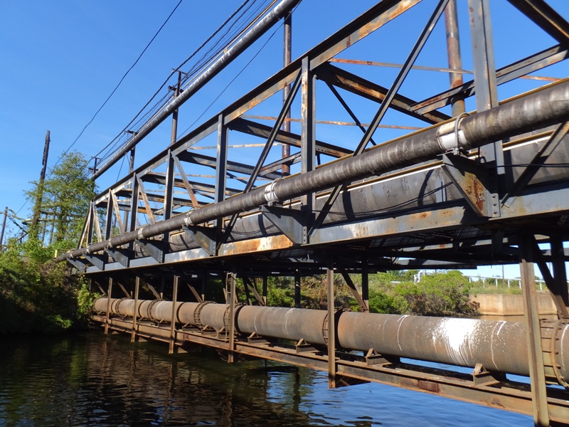
On the right side, I saw several more pipes. Perhaps they were pumping toxins out of the canal...or maybe they just contained water. I noticed one was broken and leaking all sorts of liquid into Bear Creek. 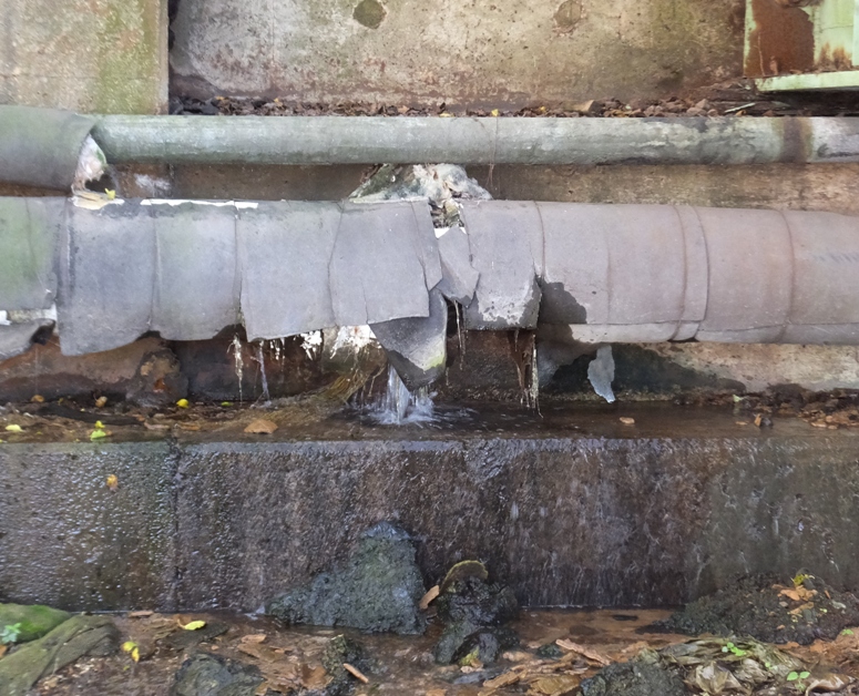
Eventually, I came to a steel and concrete wall that kept me from going any further. How far did I get up the canal? Let's just say I could have easily thrown a rock from the wall to the mouth. 
I paddled along the shoreline heading south and then came to a structure that reminded me of Lincoln Logs. 
Next, I saw the remains of an old pier and railroad line. I found a way to climb up one section and walk on the railroad track. I made my way past Lloyd Point and then under various concrete and wooden piers. Many were in disrepair. Some had big chunks of concrete hanging by rebar. 1 / 4
Old but still strong.
2 / 4
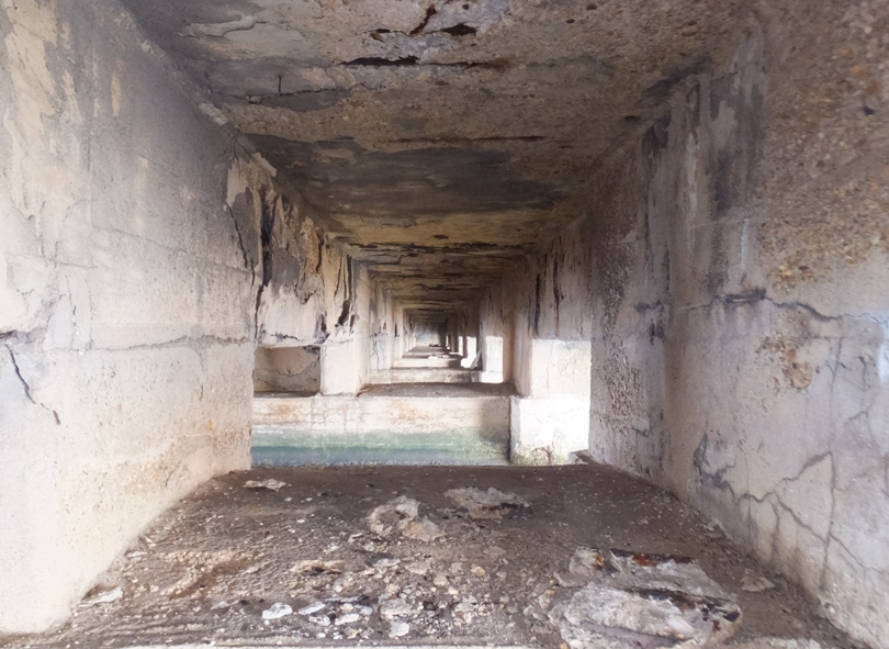
Under pier.
3 / 4
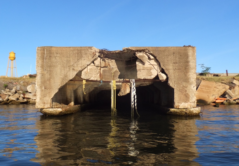
Short concrete pier.
4 / 4
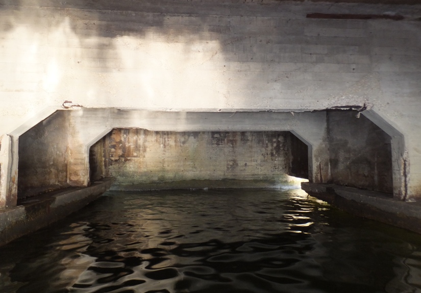
Under the short pier.
Between piers, things were set up for getting freight ships into port and loading/unloading them. 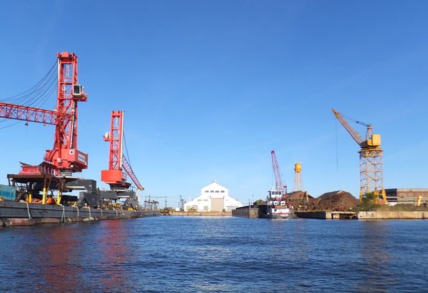
I did not find any shipwrecks. I gave myself some time to explore Tin Mill Creek. Since that didn't work out, I figured I'd paddle out into the Patapsco River and check out Fort Carroll. I hadn't been there in a few years. See my September 25, 2016 - Fort Carroll trip report. |
|
I spent the last hour and a half exploring much of the western side of Sparrows Point on my SUP. Now I was making my way west in the Patapsco River to Fort Carroll, which resides just downstream of the Francis Scott Key Memorial Bridge.
Fort Carroll's origins date to 1847, when the State of Maryland gave permission to the United States War Department to construct a fort in the shallow water of Soller's Point Flats to protect the city of Baltimore. Britain's invasion of the Chesapeake in the War of 1812 had shown that forts like Baltimore's Fort McHenry were too close to the cities they were meant to defend. A new plan for fort construction, called the "Permanent System" (also known as the Third System) intended to defend America's most important seaports and prevent another invasion from the sea. Under the supervision of a young engineer named Robert E. Lee, work crews began driving piles into the water and building the foundations for the giant fortress. Eventually Lee moved on to become superintendent of the United States Military Academy at West Point, while construction proceeded slowly, hampered by lack of funding and the difficulty of building such a heavy structure on soft sand. On October 8, 1850 the fort was officially named after Charles Carroll (1737-1832), a Maryland political leader and the last surviving signer of the Declaration of Independence. In 1853 a lighthouse was added atop the fort's parapets. In 1854 a lighthouse was built on the ramparts of the fort to warn vessels away from the construction site and to mark the turn form [sic] the Brewerton Channel to the Fort McHenry Channel leading in and out of Baltimore Harbor. The lighthouse keeper lived in a separate structure on the grounds of the Fort. In 1898 a new lighthouse was built, the one still seen today, and it was automated in 1920 and then discontinued sometime between 1931 and 1945. - from Bytenet - Fort Carroll The fort is one of those places that I find most people in the Baltimore area do not know about unless they are a kayaker. But for many of those that know about it, it is quite popular. Many have been there and written about it although I don't know of anyone besides me that has visited via SUP. Reading about the place, it is obvious that many have landed there and explored, despite the fact that it is private property. Getting onto Fort Carroll requires a little preparation. Supplies needed might include boots, pants, long shirt and a boat. Enter at your own risk. Birds might poke you. Also remember, it's privately owned. Despite the obstacles, it hasn't stopped curious explorers who have made their way to the hexagonal structure that lies underneath the Francis Scott Key Bridge. Ed Cwalina of Florida used to camp there. Eduardo Carillo saw birds eggs in the structures dilapidated lighthouse. The path to the fort is simple. Many park at the structures dock, walk up the lighthouse steps and look out at the overgrown brush that has taken over the long abandoned Fort Carroll. - from "Urban explorers seek out long-abanoned Fort Carroll" (a broken link as of 2017) Normally, I respect private property signs but the temptation in this case was just too great. Supposedly work is being done to secure funding so that others can visit. So think of this trip report as a way to help get the word out about preserving Fort Carroll...although I'm certainly not saying you should trespass. For nearly a half century the fort hasn't been utilized. With such a complicated location, the structure has been a challenge to investors who weren't sure what to do with the property. That challenge might change soon. National Park Officials placed Fort Carroll on the National Historic Trust List on Tuesday [April 22, 2015]. The designation allows for potential funding sources to open up what might preserve and attract history buffs back to it. - from "Urban explorers seek out long-abanoned Fort Carroll" (a broken link as of 2017) Before I describe my adventure, it makes sense to provide a satellite photo of the fort. In this image, north is up and the Key Bridge is to the northwest. On the north side of the fort is the Fort Carroll Landing Dock. Directly across from this is the entrance to the fort. I recommend bringing a plastic boat because it will surely be banged up against the giant stones that comprise the fort. Bring something to tie up your kayak/canoe/SUP so it doesn't float off and also make sure your paddle is secure if you leave it with your watercraft. Then, just climb up the low and not-so-steep wall using the ropes that were left behind and then you're there! 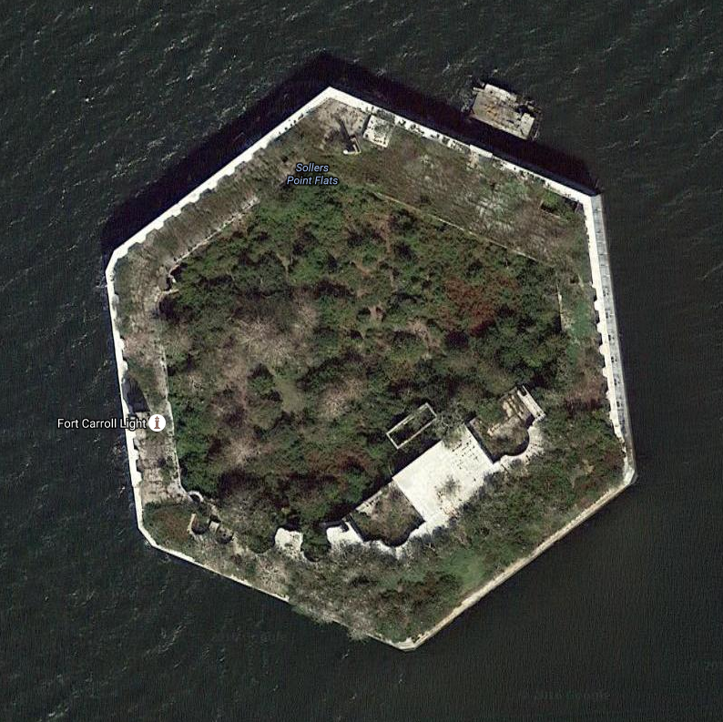
Here are my photos from inside the fort. 1 / 10
First view.
2 / 10
Stairs to roof.
3 / 10
Bones on stairs.
4 / 10
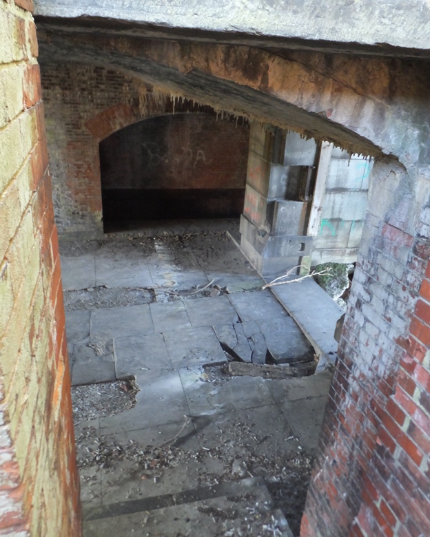
View from stairs.
5 / 10
Rooftop view of fort.
6 / 10
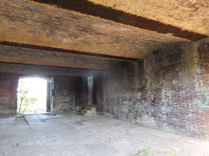
Looking back at entrance.
7 / 10
Not sure what this was.
8 / 10
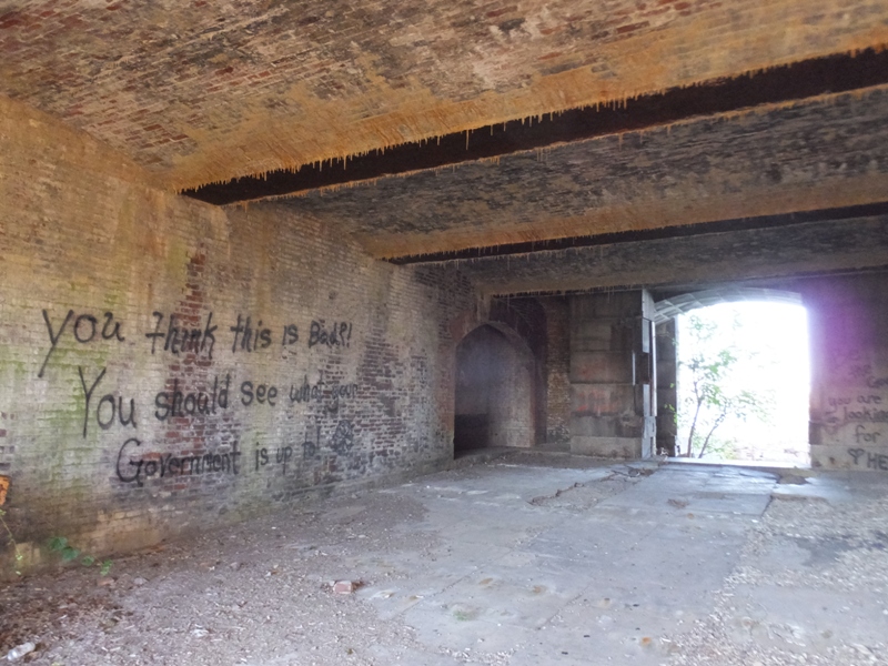
Anti-government graffiti.
9 / 10
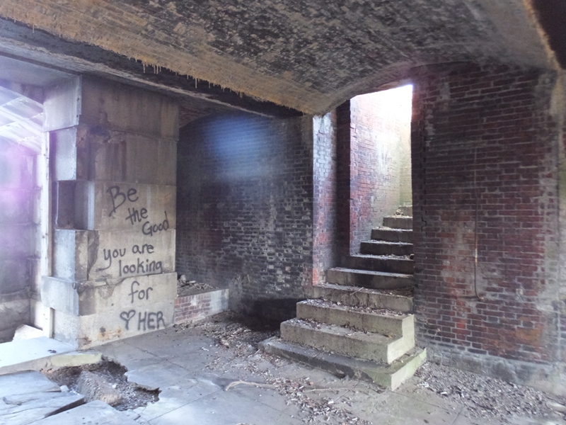
More graffiti.
10 / 10
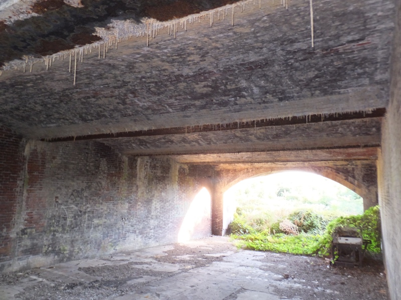
Stalactites.
Seeing the inside of Fort Carroll was exhilarating. This is one place where I really wish the walls could talk and tell me their story. Will I return? Likely. But not in the summer. The foliage was too thick to do much exploring. Winter would actually be the ideal time to come back. I got back on my SUP and circumnavigated the fort. 1 / 4
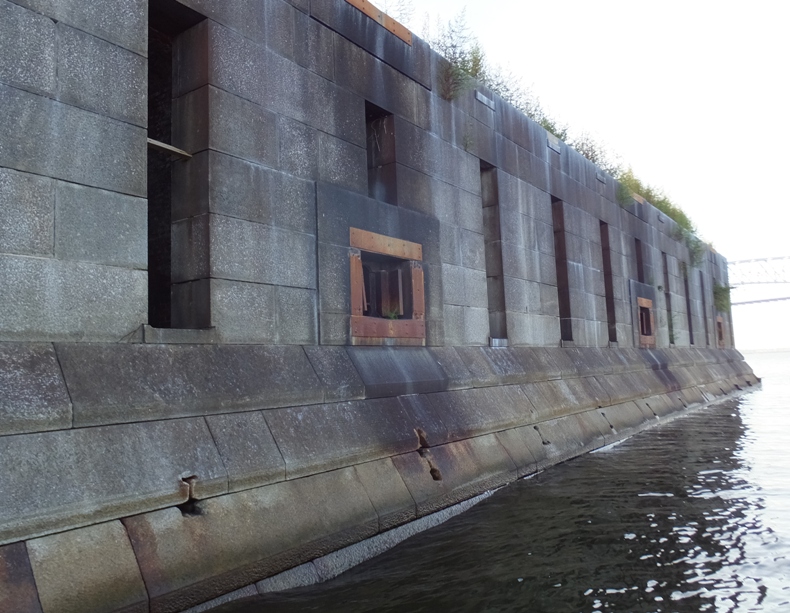
Northeast side, west view.
2 / 4
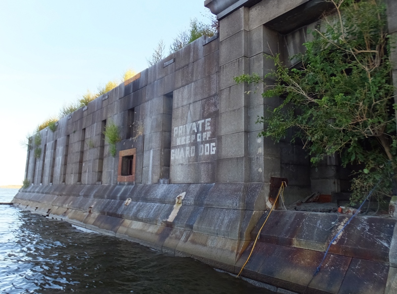
Northeast side, east view.
3 / 4
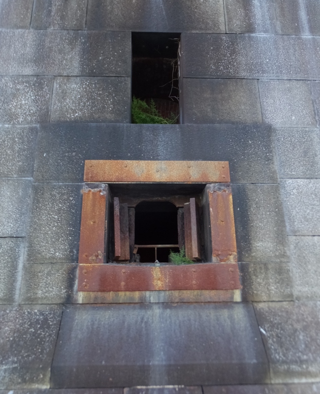
Steel shutters.
4 / 4
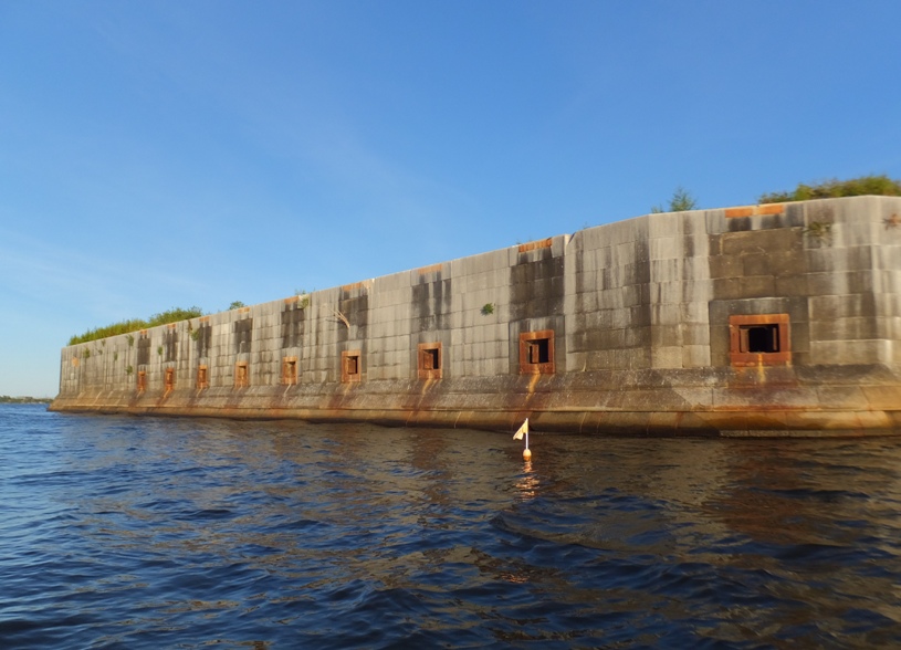
Northwest side.
On the west side, I could see the Fort Carroll Lighthouse. The fort was strategically obsolete almost before construction began, and the army finally abandoned the fort in 1921, one year after the light was automated. The federal government retained the property, however, and the coast guard used it for a pistol range and for temporary quarters for seamen whose ships were being fumigated. By this time the light had been discontinued. Various schemes for reuse ensued, and eventually in 1958 the property was sold to Benjamin Eisenberg, a Baltimore lawyer who intended to build a casino there. Jurisdictional issues nixed this, and the property has never been put to commercial use, though at one point a large number of peach trees were planted. In its neglect the fort has become a seabird refuge, by default. The light remains perched on the fortress walls, but in extreme disrepair. - from Wikipedia - Fort Carroll Light The sun was low and gave the lighthouse a special glow. I didn't see many birds at the fort but I certainly saw a lot of vegetation. A cruise ship passed under the Key Bridge. A little later, it passed by a freight ship. It seems most of the big ships passed on the west side of the fort though I don't know if this is typically the case. Anyway, it is something to consider when planning your route. Also, when I was out, there was little wind but there were quite a few waves created by all the boat traffic. The waves can get pretty big near the fort. I made my way back to Bear Creek and then Peach Orchard Creek, completing my 8.2 mile trip a little after dusk, at 1900. My how the days are getting short now that summer has ended. |
|
I'd been looking forward to the first Baltimore Fleet Week for a few months. I've participated in numerous fleet weeks before but had never been on the receiving end. In 1988-1990, I served on the USS John F. Kennedy (CV-67) aircraft carrier as a Marine. It was the largest non-nuclear carrier in the U.S. Navy. This ship was over 1,000 feet long and on deployment it held about 5,500 men (no women on combat ships back then). It has since been decommissioned. We were part of the Sixth Fleet and when we pulled into a port, people really noticed. In countries like Egypt, that many sailors and a small handful of Marines with some spending money were really good for their economy. Stateside, such a large ship was a big tourist attraction and civilians would line up for a chance to see what the "Big John" was like. But today I was the civilian wanting to see the ships.
The feature ship was the USS Zumwalt. This is the U.S. Navy's newest destroyer. It uses stealth technology and state-of-the-art electric propulsion to make it hard to detect. "They built this class to be very, very stealthy," Wertheim said. He sees the Navy using the ship in concert with the Marine Corps' new F-35B stealth jets: "It can get really close to provide that support." The Zumwalt is the largest destroyer the Navy has ever built - in an earlier era, it could have been classed as a heavy cruiser. The vessel displaces 15,600 tons, almost twice as much as an Arleigh Burke-class destroyer. But despite its size, nearly everything about the ship is designed to make it harder to spot on radar. Its smooth surfaces and unusual shape deflect radio waves at odd angles. The superstructure is made of a material more difficult to pick up than metal. Smaller boats that could one day be used by Navy SEALs are hidden away inside. And where on a traditional ship, crew on the bridge would be able to look out of windows or step outside to see the surroundings, the Zumwalt's officers will rely on a suite of cameras that project images onto television screens. The result, Kirk said, is that the ship looks on a radar screen just one-fiftieth of the size of an Arleigh Burke-class destroyer - one of which will also be in Baltimore for Fleet Week - despite actually being far larger. The ship is designed to be quiet, too, making it hard to listen out for. - from "Navy's new stealth destroyer Zumwalt to arrive in Baltimore on Friday for Fleet Week commissioning" (broken link as of 2025) The Zumwalt is scheduled to be commissioned on October 15, 2016. It would have been nice to go aboard this ship but ticket requests had closed on September 10. I figured I could at least see it up close from the outside but unfortunately, Coast Guard Fleet Week regulations state No vessel or person is allowed within 100 yards of a large U.S. naval vessel unless authorized by the Coast Guard, the senior naval officer present in command, or official patrol. I found out many of the ships would arrive Wednesday afternoon. That is not when I wanted to be out on the water since I didn't want to be near such a big ship that was moving while I was on a SUP or kayak. The perfect day in terms of weather ended up being Saturday but I figure that is when a lot of people would be on the water. Friday afternoon was also very good so I went with that. Fortunately, my job has flexible hours so sometimes I can do recreational things midday during the week. I obtained a map showing the location of the various boats. I figured I could see them all over seven miles or less. I invited several people to join me but they all declined. I guess their work hours aren't as flexible as mine or they just weren't interested. The plan was to launch at Canton Waterfront Park at 1400. I arrived around 1340 but I could not enter the park. Two policemen stood at the entrance which was blocked by orange road cones. They said the lot was full. Folks were there to get a good view of the air show featuring the Blue Angels F/A 18 Hornet fighter jets. So I drove around the corner and parked in a pay lot. Then I walked over and asked the policemen if I could walk in with my SUP and launch. They said yes. I returned a little later wearing a wetsuit and carrying my SUP and paddle on my head and carrying my gear in a dry bag backpack. The place was packed and the city even brought in some porta-johns. There was a sign at the boat ramp saying it was closed. There was another policeman nearby and I asked if I could launch my SUP and he also said yes. I was on the water by 1420. I paddled across Northwest Harbor to get a view of the USS Zumwalt at the North Locust Point Marine Terminal. There was a floating yellow barricade up around the entrance connecting the piers where the USS Zumwalt, USS Leyte Gulf, and USS Jason Dunham were docked. In front of that was a police boat. I was pretty far from the nearest ship but the police told me not to get any closer. So I paddled back across Northwest Harbor. I figured I'd see the Zumwalt again and in doing so, I would know just how close was close enough. I made my way towards the Inner Harbor staying along the north side. A lot of people were out watching the Blue Angels. I'm not much into planes but they certainly were impressive. 
The Thunderbirds is the Air Force equivalent to the Blue Angels though I think the latter is better. I've always been biased in favor of Navy pilots. It takes nerves of steel to take off and land on an aircraft carrier...something I'm guessing few Air Force pilots ever do. I saw a few people from the Canton Kayak Club launching their club kayaks near the Royal Canadian Navy Iroquois-class warship HMCS Athabaskan (DDG 282). 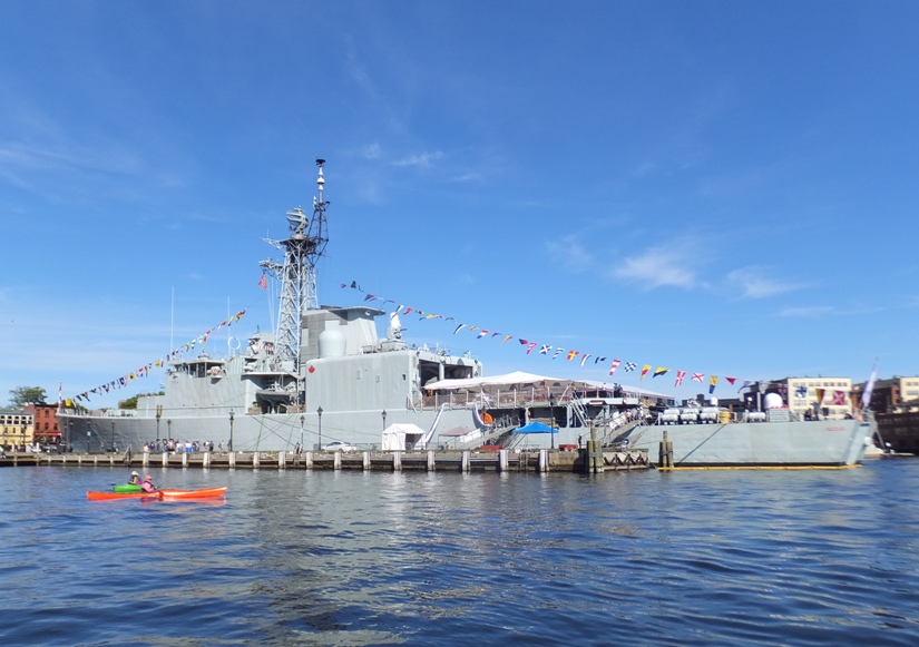
During the time I was out, I saw about eight kayaks. I was the only SUPer. There were very few powerboats out. I reckon that is because there were restricted areas near Fort McHenry where boats couldn't go during the air show. That means boats outside of the Inner and Northwest Harbor had to stay out until the air show was over. Near the Seven Foot Knoll Lighthouse, I saw a U.S. Navy Yard Patrol (YP) Craft. The YPs are used to teach familiarization with water craft, Basic Damage Control and underway instruction of Basic to Advanced Seamanship and Navigation. Yard Patrol craft provide realistic, at-sea training in navigation and seamanship for midshipmen... - from "Maryland Fleet Week & Air Show Baltimore Vessels" (a broken link as of 2025) 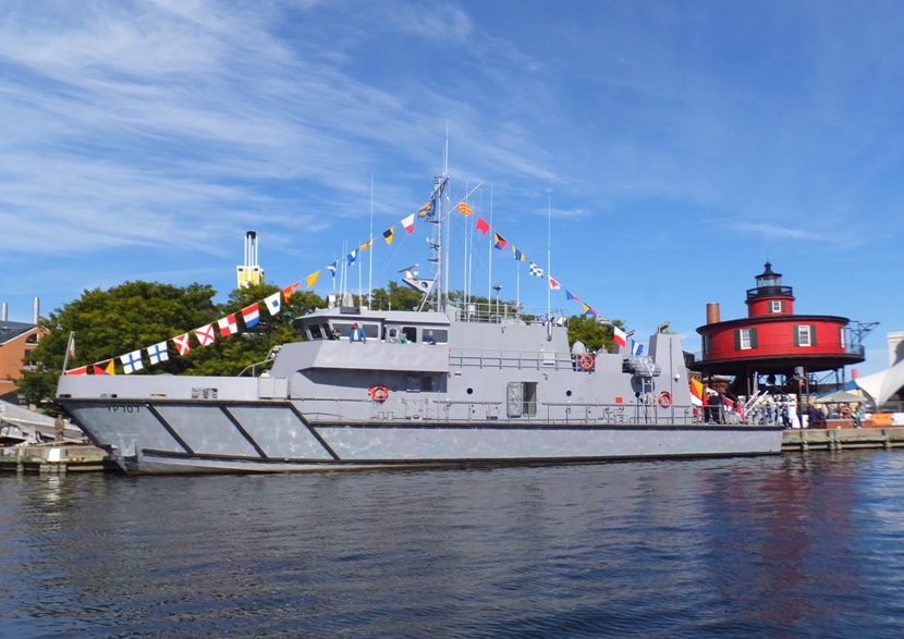
Next, I saw something that looked like a catamaran from the rear. It was the United States Navy Spearhead-class expeditionary fast transport ship USNS Carson City (T-EPF 7). 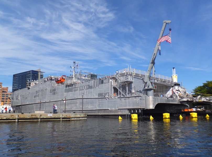
Near the Baltimore National Aquarium, I saw the National Oceanic and Atmospheric Administration Research Vessel Bay Hydro II. Serves as NOAA's "eyes" to see the Chesapeake Bay's bottom. The vessel is equipped with state-of-the-art hydrographic technology to calculate water depths, locate sunken debris and chart the shape of the sea floor. - from "Maryland Fleet Week & Air Show Baltimore Vessels" 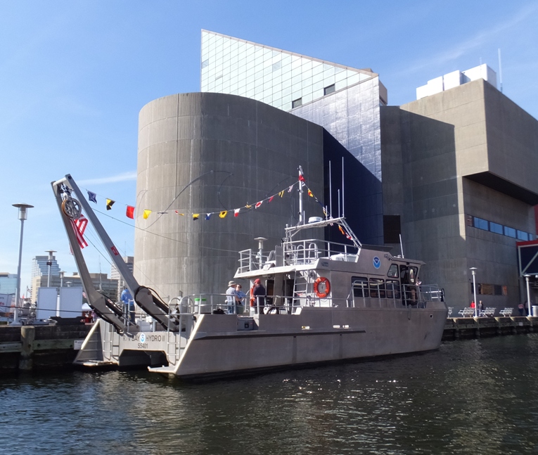
I saw a couple U.S. Army Corps of Engineers vessels. The first was the Debris Vessel Reynolds which ...regularly patrols the Patapsco River and its tributaries, covering 24 square miles, removing debris and obstructions to provide clear and safe channels for general navigation. - from "Maryland Fleet Week & Air Show Baltimore Vessels" 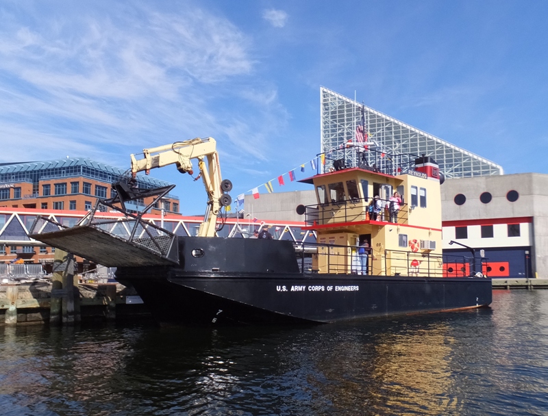
The second U.S. Army Corps of Engineers vessel was the Survey Vessel Linthicum. This ...is the Baltimore District's oldest working vessel, having been constructed in 1976. It operates out of Baltimore District's Fort McHenry Yard and is the largest survey vessel in the District's Hydrographic Survey Section. It regularly surveys navigation channels in and around the Chesapeake Bay, including shipping lanes in the Baltimore Harbor and its approach channels in the Bay as part of the Corps' mission to ensure safe navigation in the region's channels. - from "Maryland Fleet Week & Air Show Baltimore Vessels" 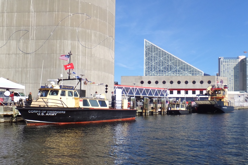
Not all the ships I saw were there just for Fleet Week. Some are regularly docked there. USS Torsk (SS-423): Someday I'd love to go aboard a modern submarine but until then, this will have to do. 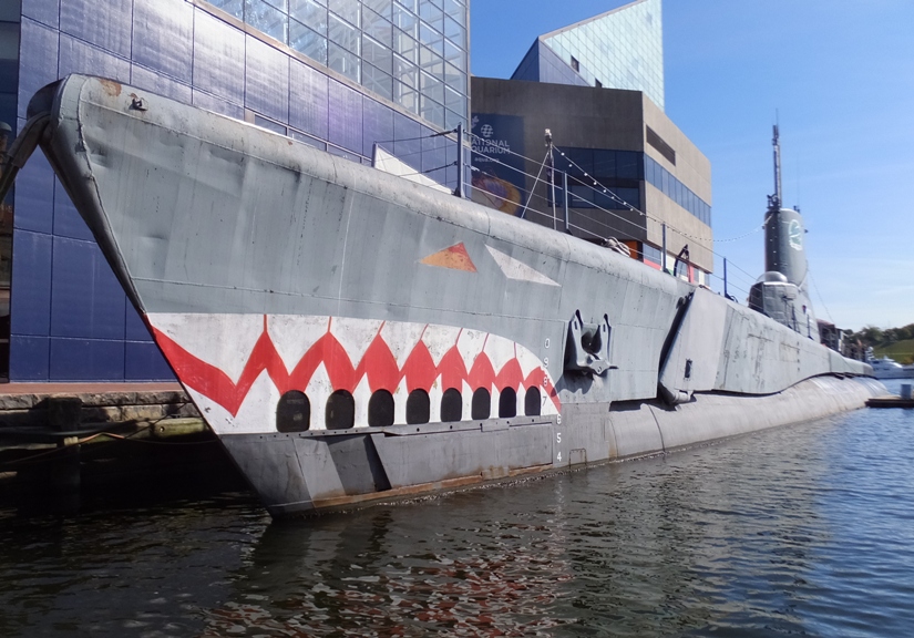
Here's the Chesapeake (LV-116) with its 5,000 pound mushroom anchor. 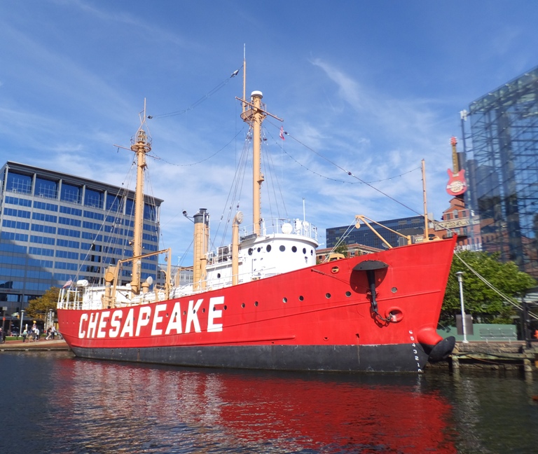
This is the famous USS Constellation. The last Civil War vessel afloat, the USS Constellation, was built in 1854 and is the last all-sail warship built by the US Navy. 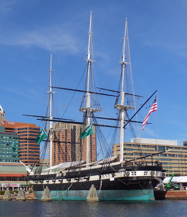
Now back to the visiting ships. Directly across from the Constellation, was the Royal Canadian Navy Kingston-class Maritime Coastal Defence Vessel HMCS Shawinigan (MM 704). 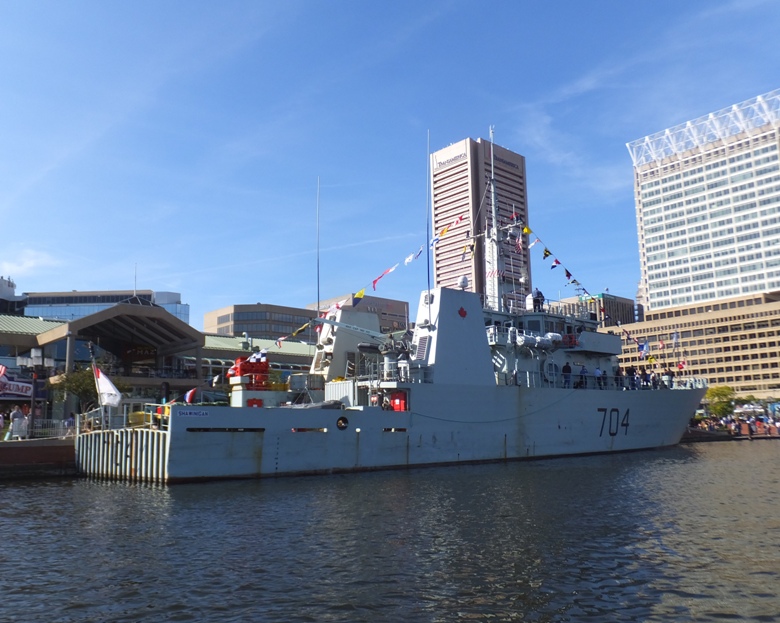
The next boats were the U.S Army Reserve Tugboats USAV Cat Lai (ST-915) and USAV Fort Moultrie (ST-912). 
On the south side of the Inner Harbor, there were no ships for Fleet Week. Back in Northwest Harbor, I saw a few ships that would have been there even if Fleet Week wasn't occurring. Azure Bulker cargo ship from Panama. Underway was the Pride of Baltimore II... A reproduction of the 1812-era Baltimore Clippers that helped America defeat the British in the War of 1812. 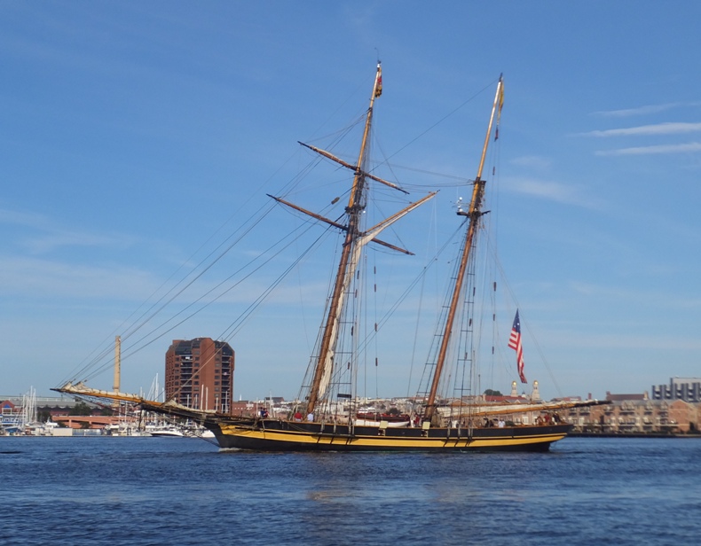
I was really hoping to see a lot of Fleet Week ships as big as the SS Antares (T-AKR 294) (on left) and SS Denebola (T-AKR 289) (on right). I don't think I've ever seen these ships move from their docks. 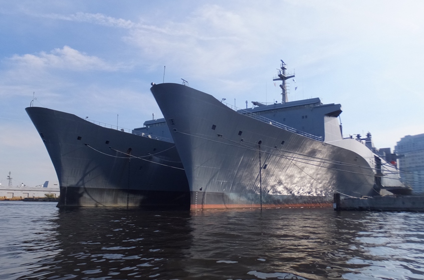
Saving the best for last were two big visiting ships which I saw as I completed my counterclockwise loop, arriving back at the North Locust Point Marine Terminal. At Pier 3, I viewed the United States Navy Ticonderoga-class guided-missile cruiser USS Leyte Gulf (CG 55). 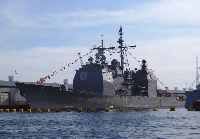
Next to it at Pier 4 was the USS Zumwalt (DDG 1000). It was 1650 and the sun was getting a little low so it was hard to get a good photo of this ship. Or maybe the advanced stealth technology that it uses was keeping me from getting a good photo. 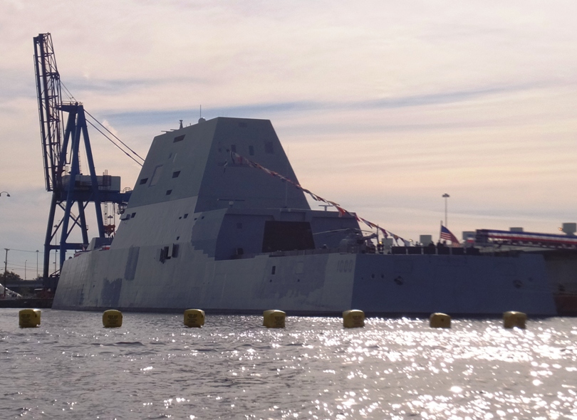
I paddled 6.5 miles in about 2.5 hours. It was a great day to be out on the water. Fleet Week was good but I was expecting more and bigger ships. But hey, this is just the first one. |
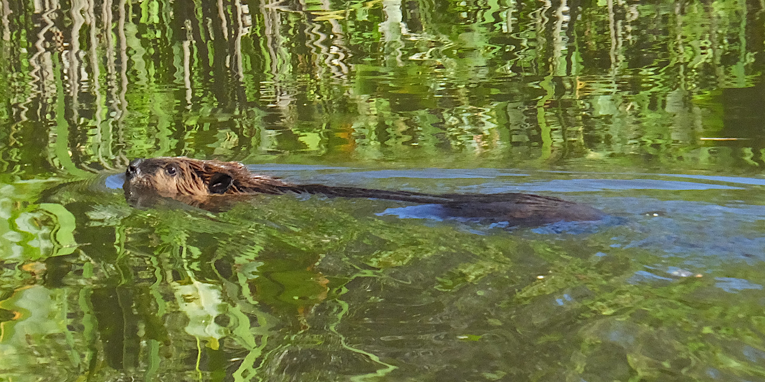
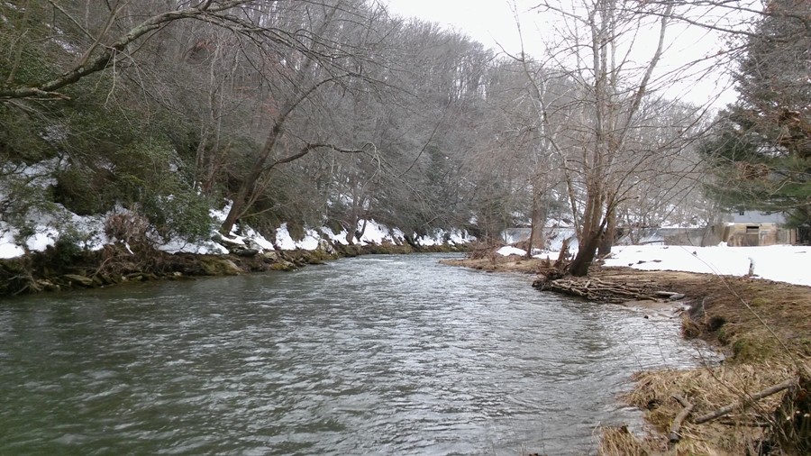
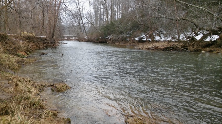
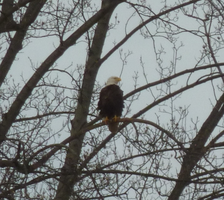
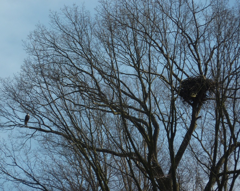
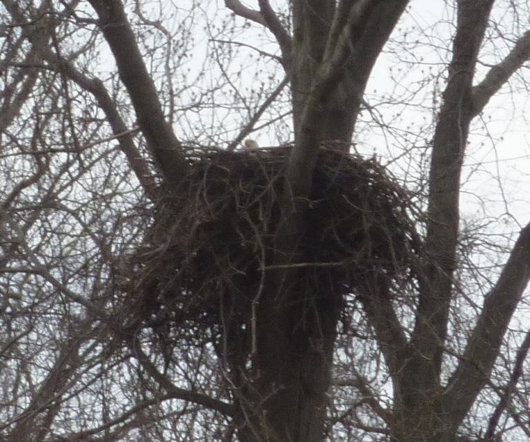
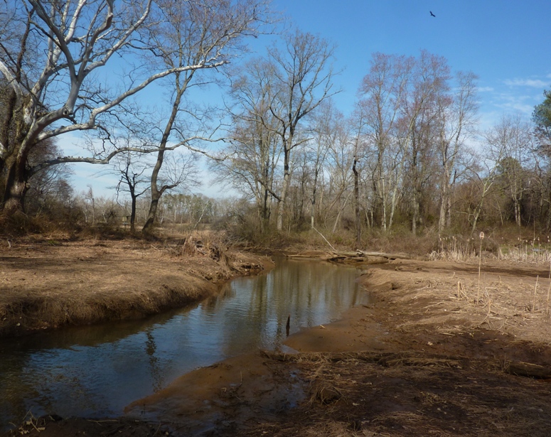
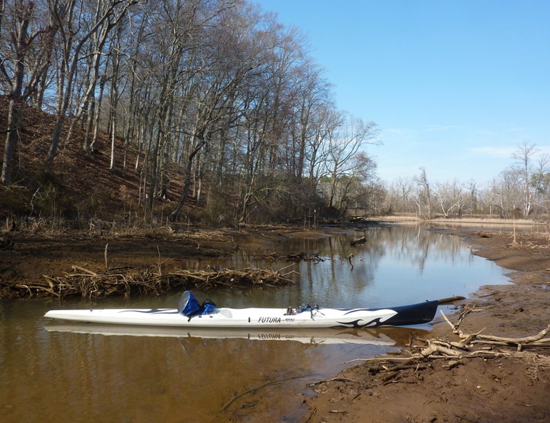
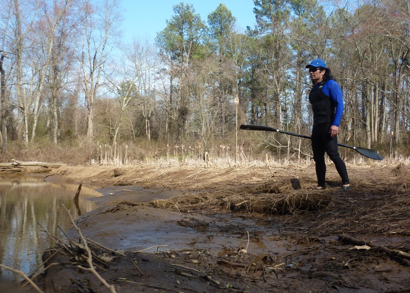
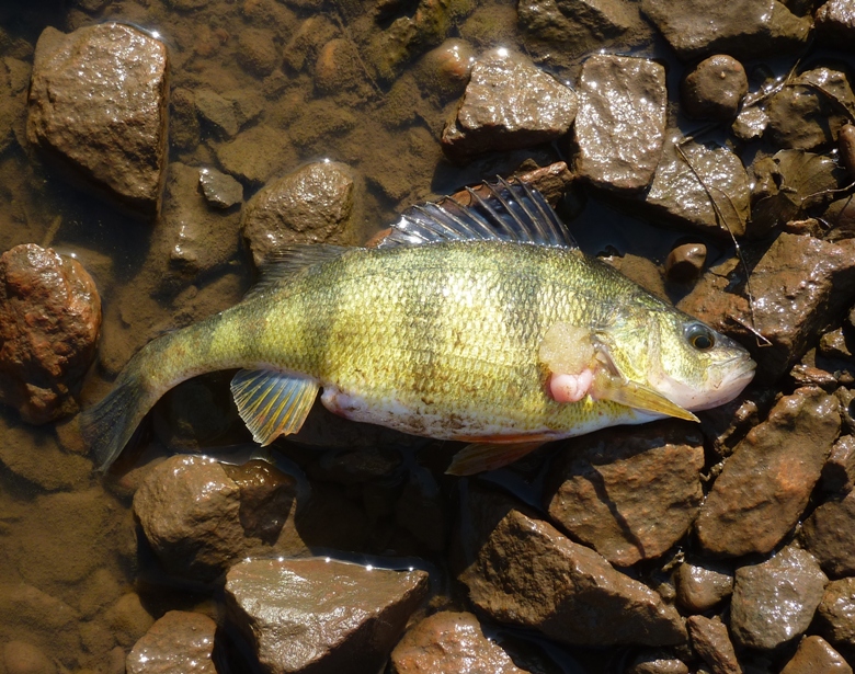
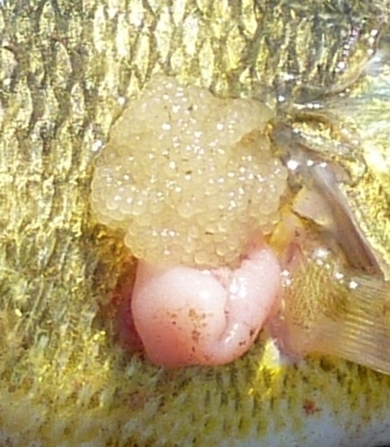
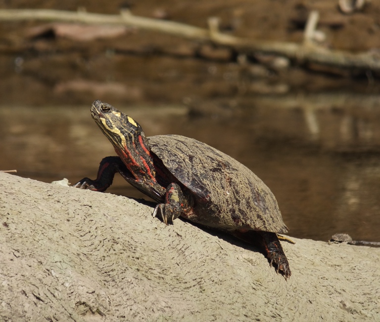
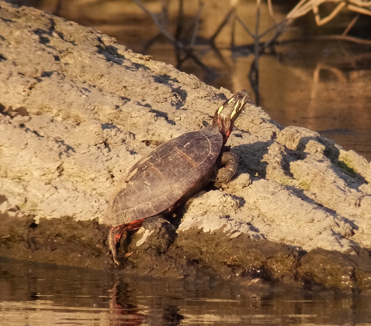
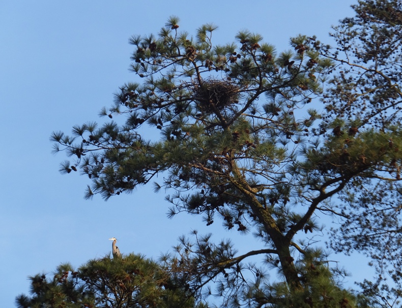
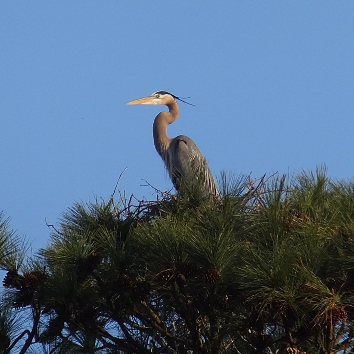
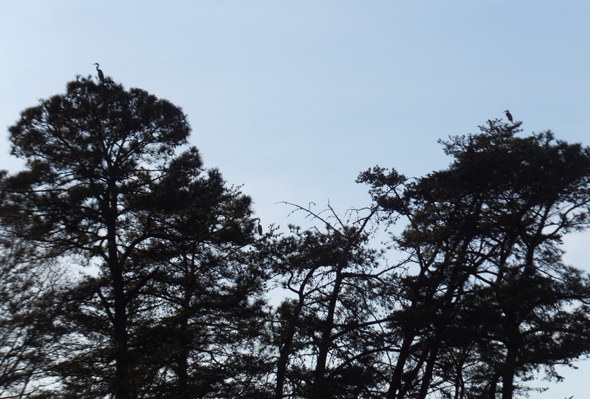
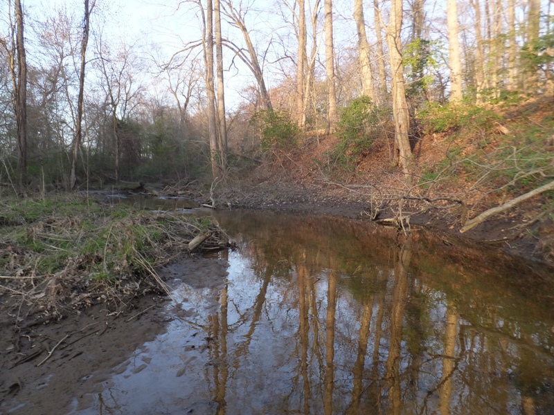
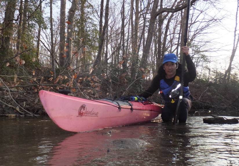
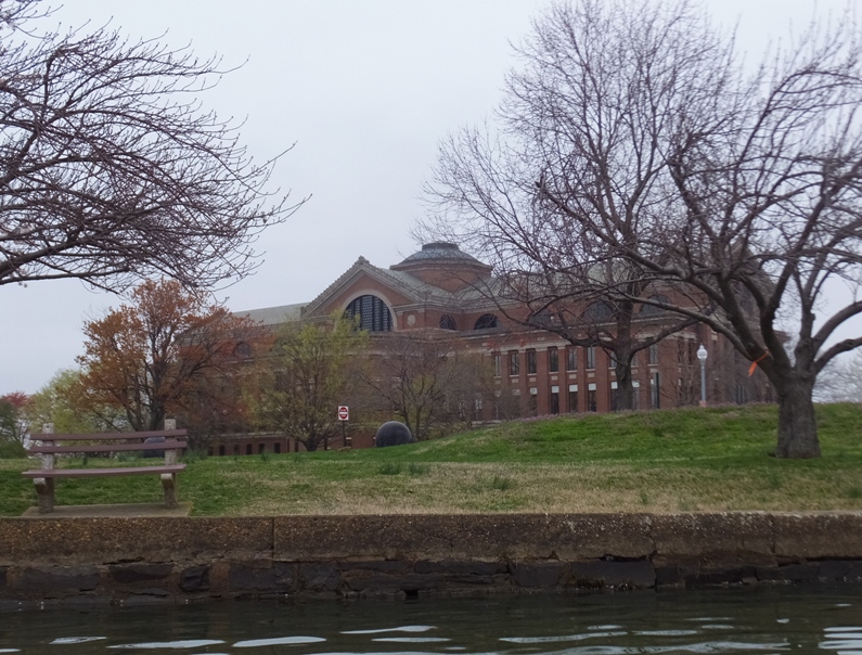
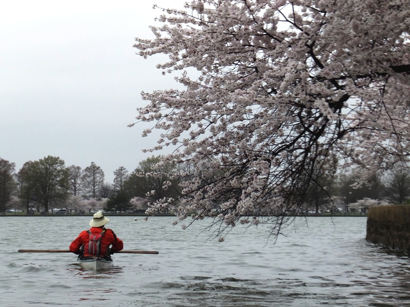
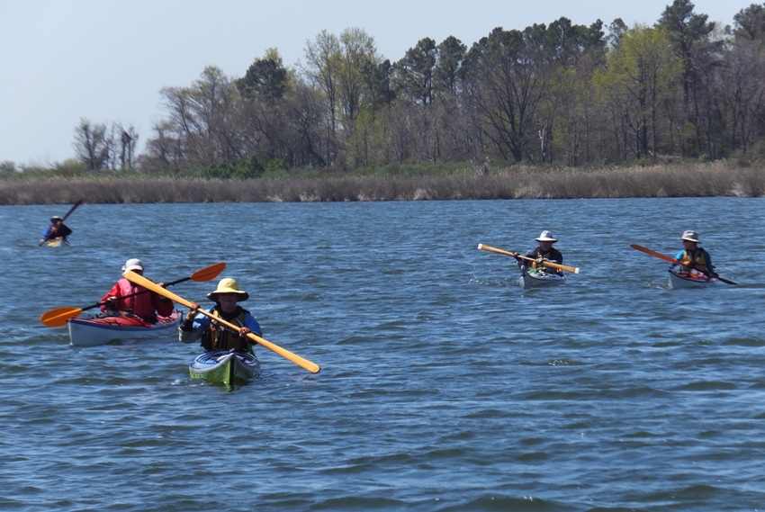
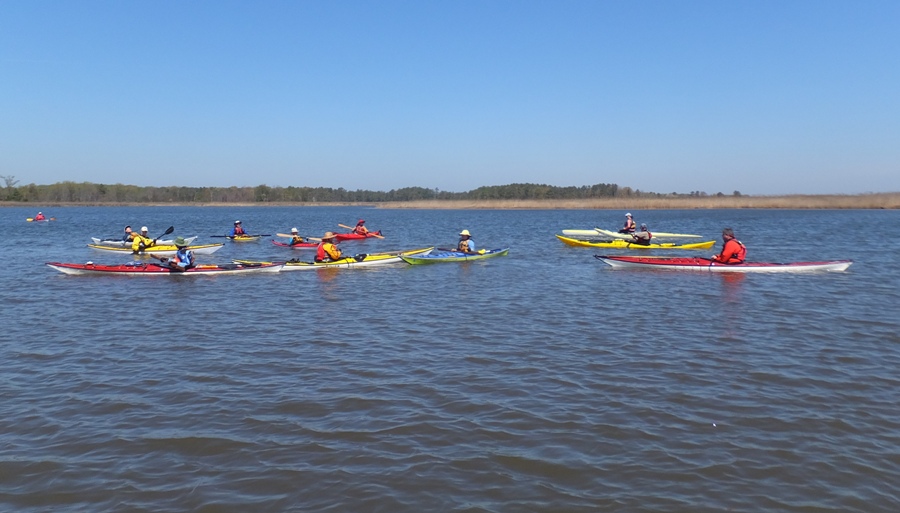
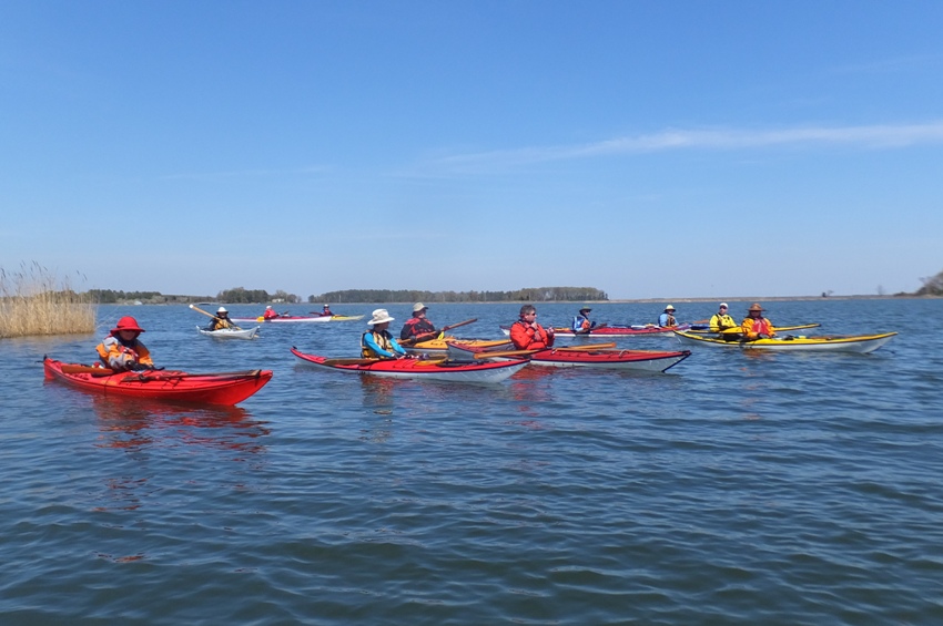
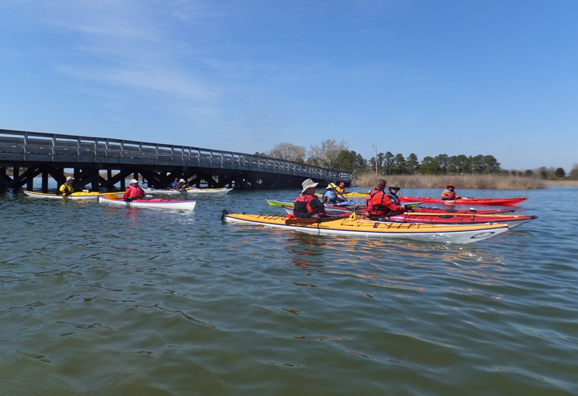
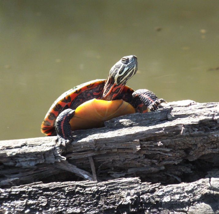
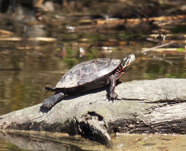
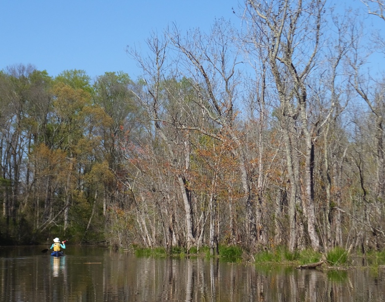
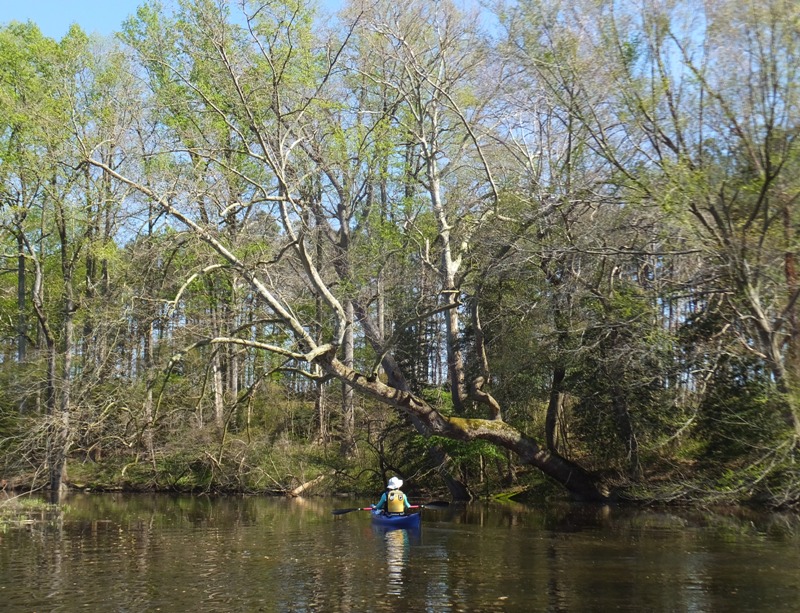
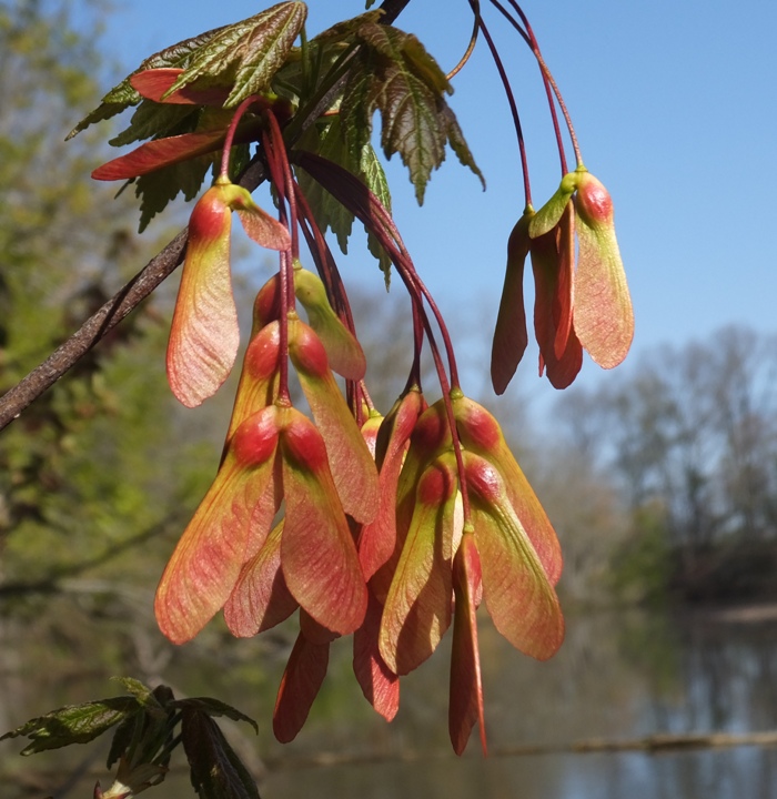
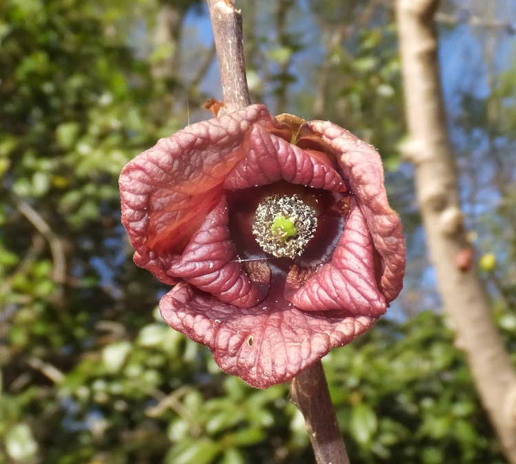
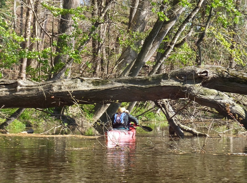
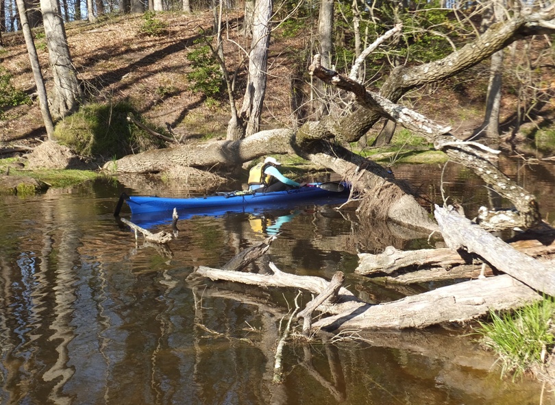
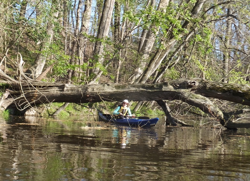
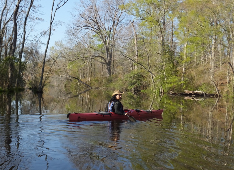
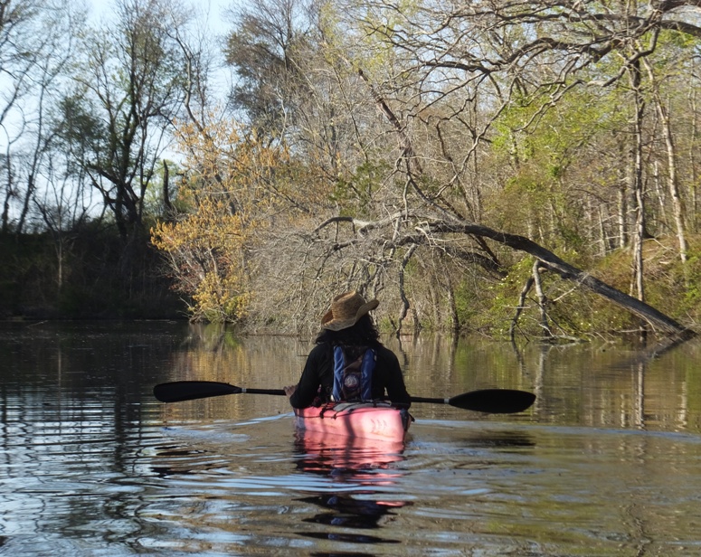
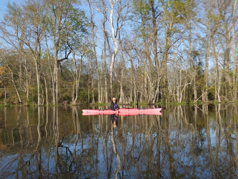
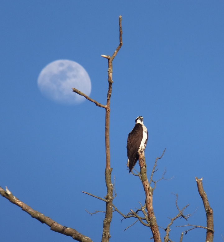
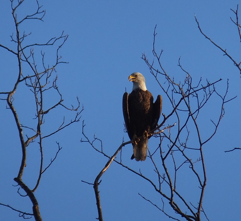
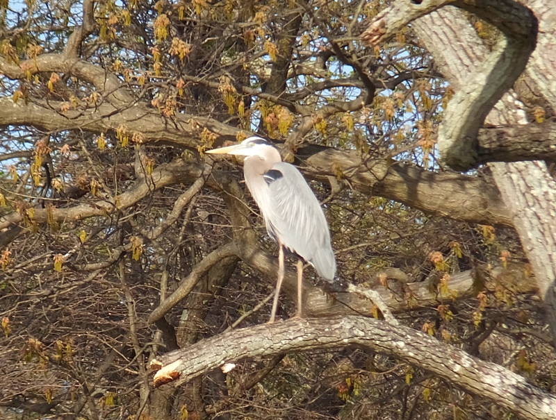
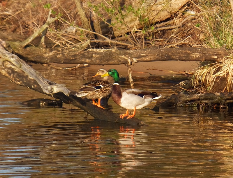
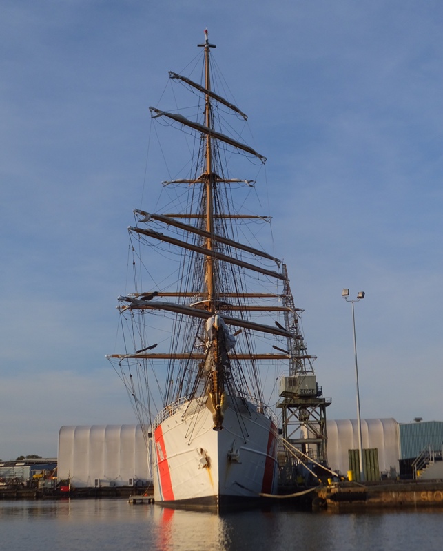
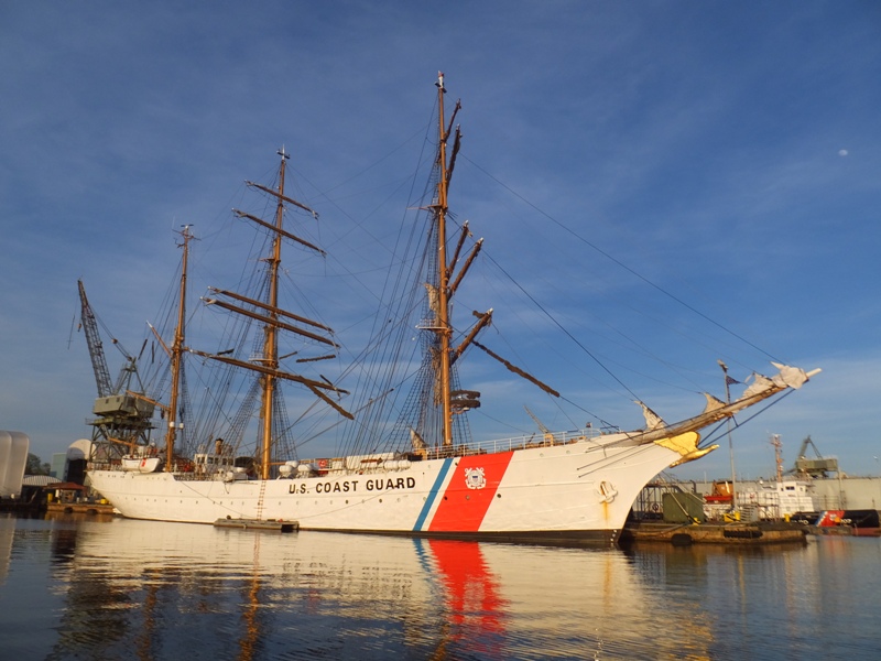
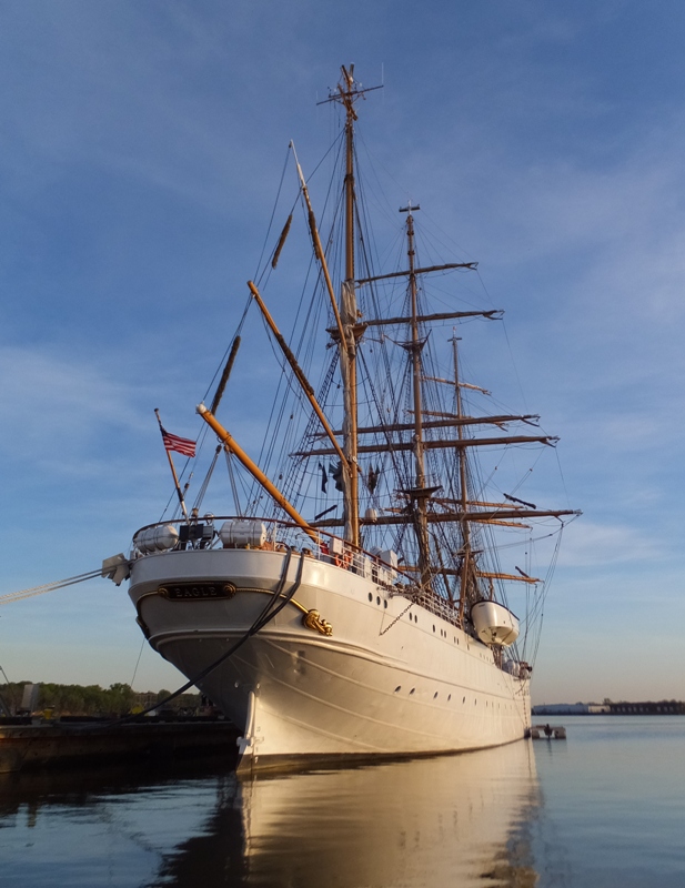
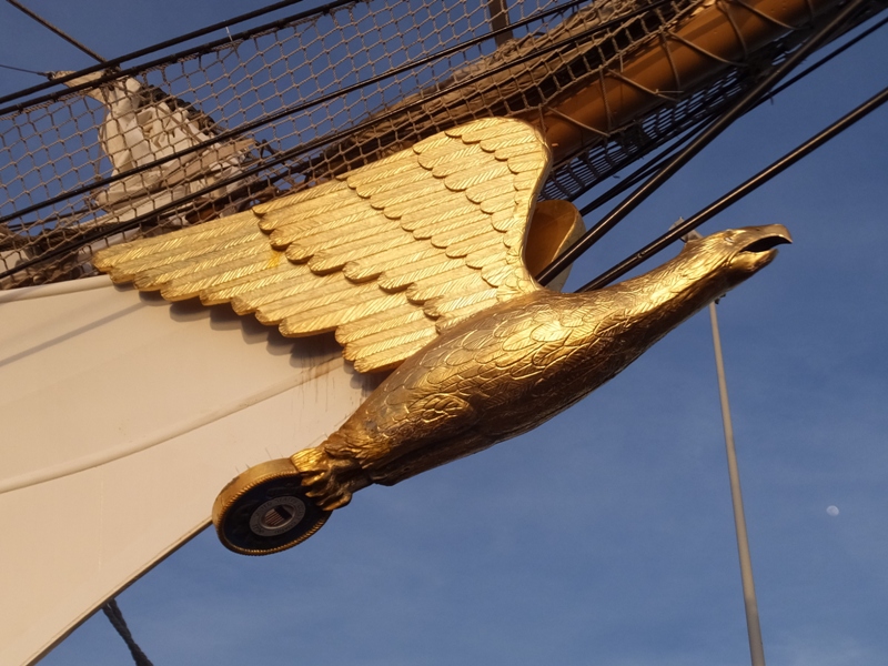
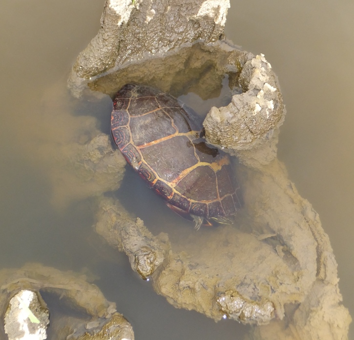
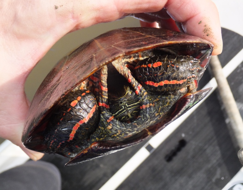
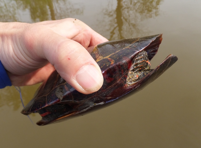
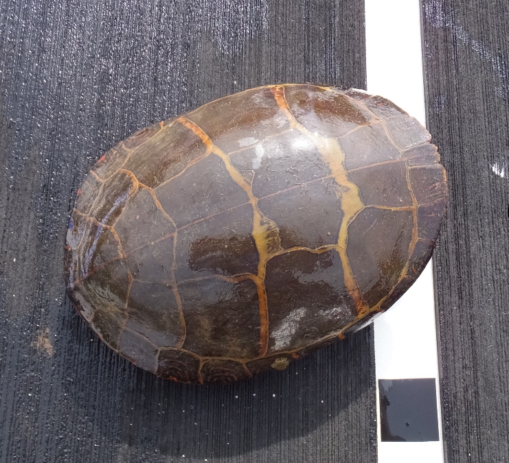
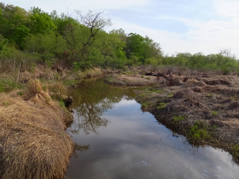
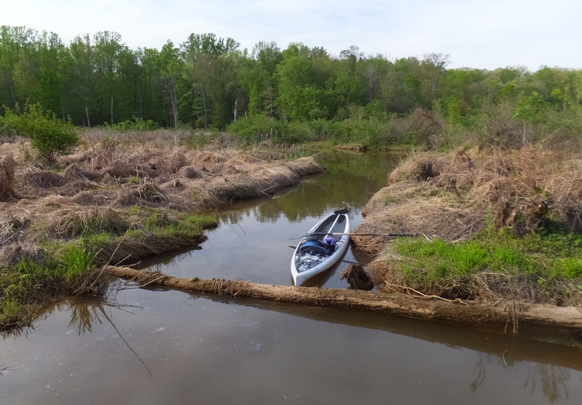
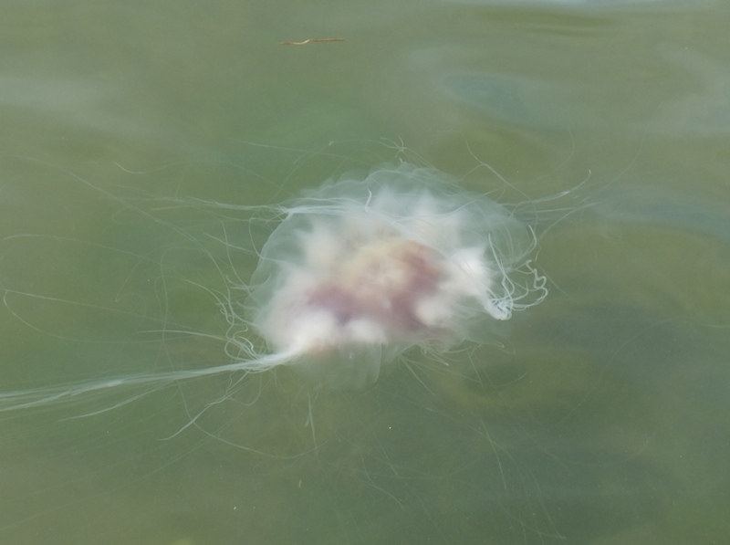
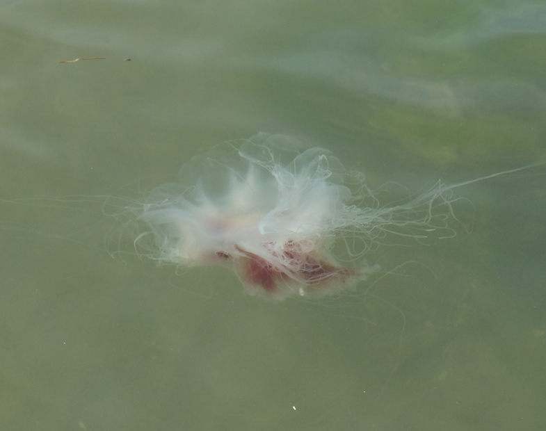
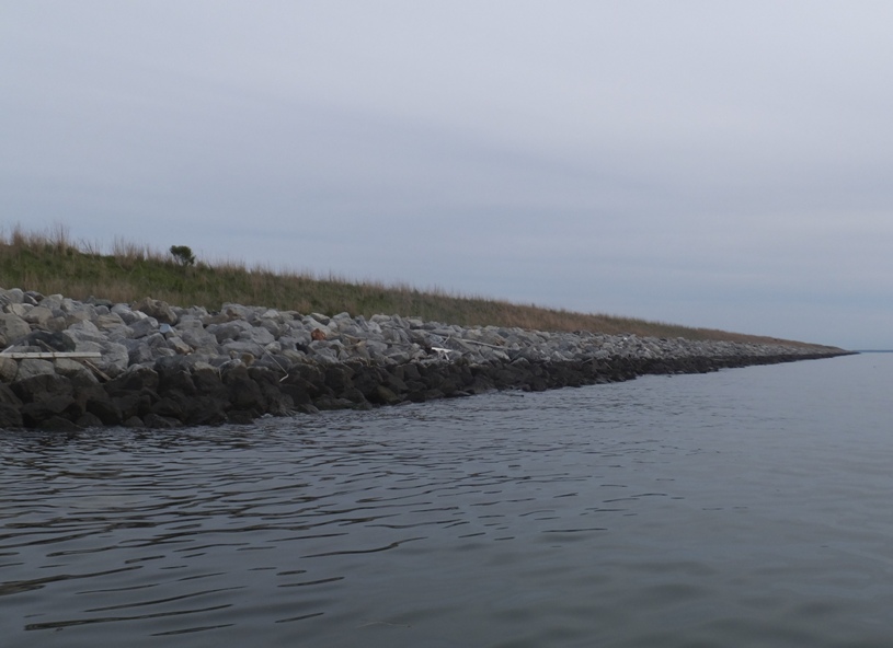
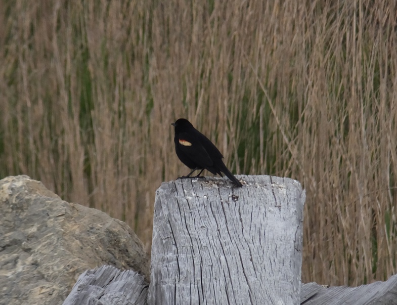
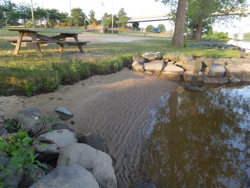
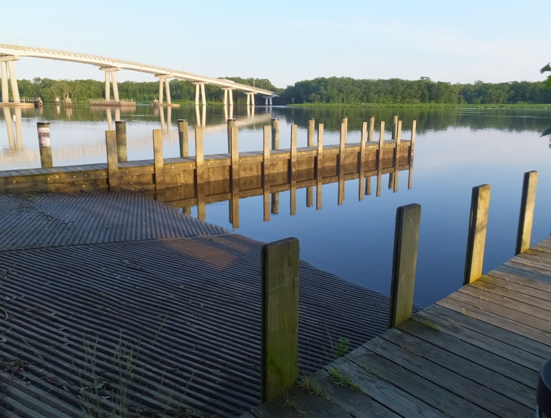
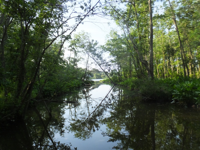
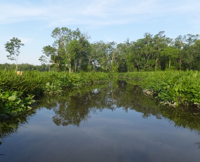
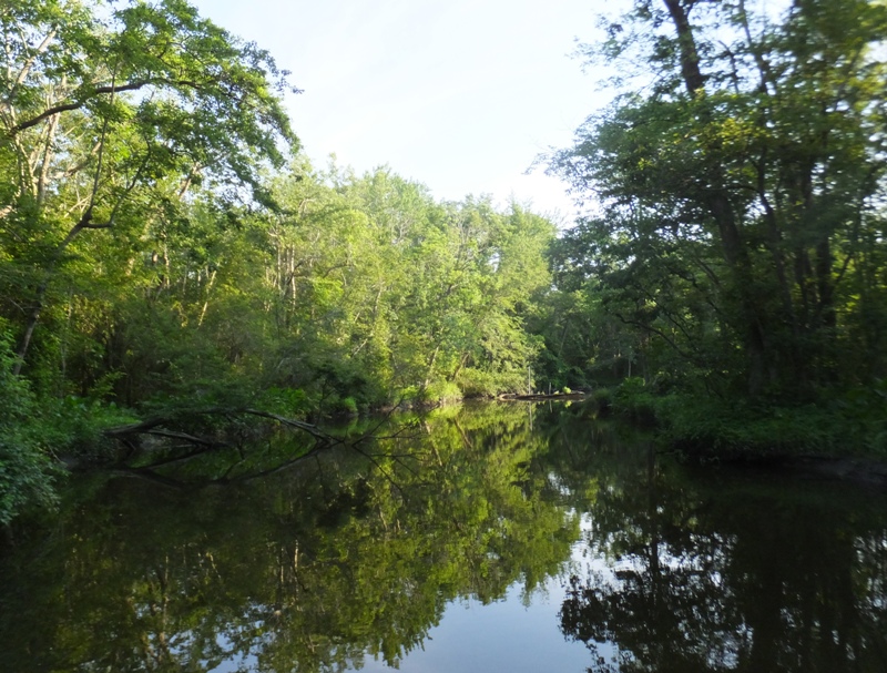
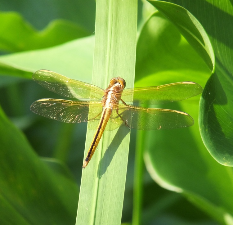
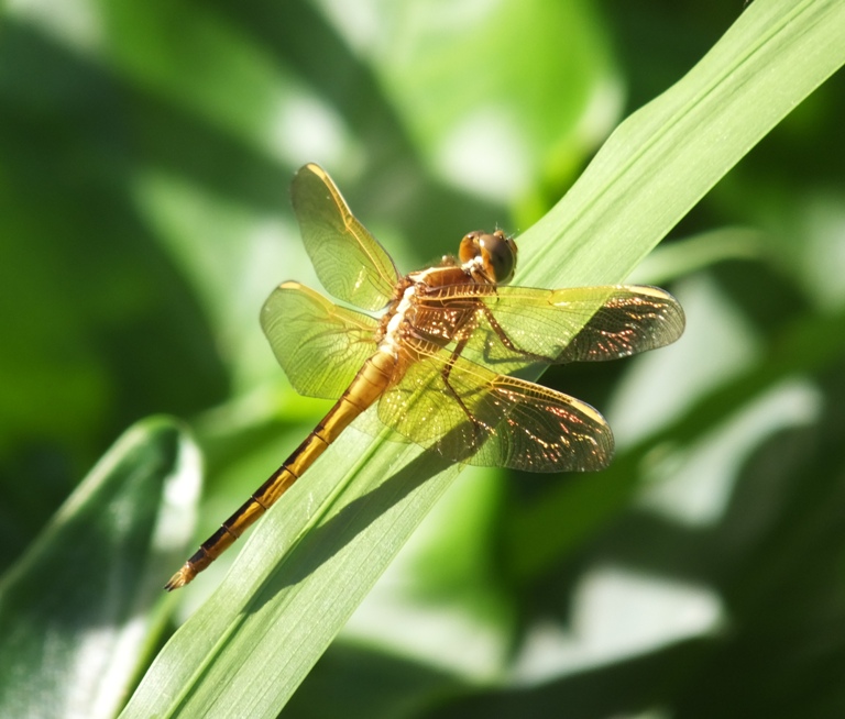
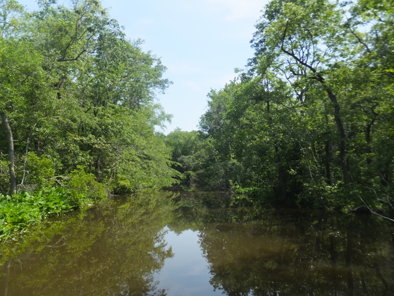
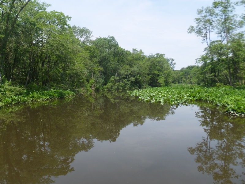
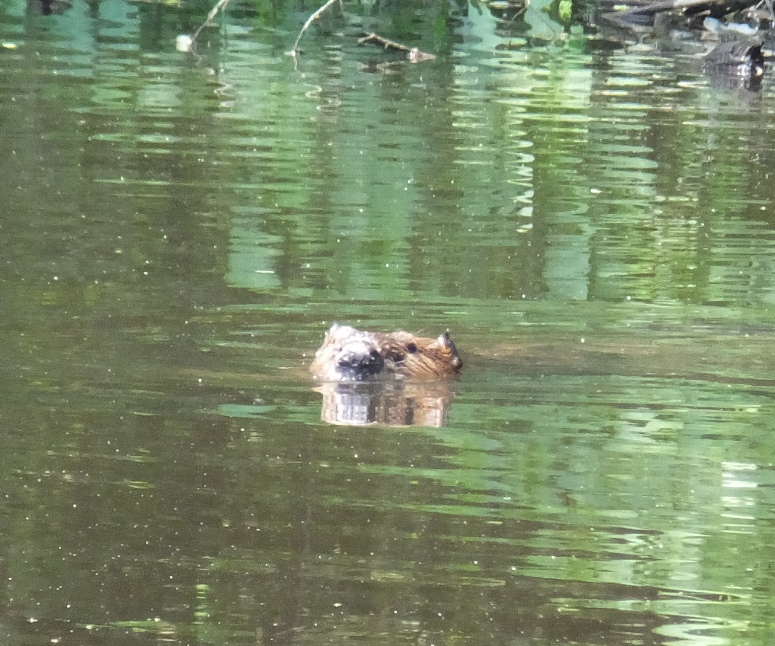
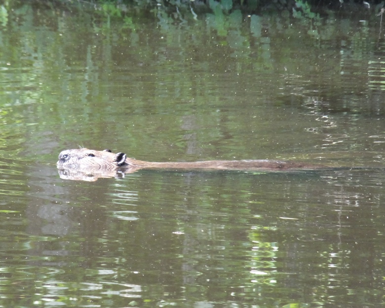
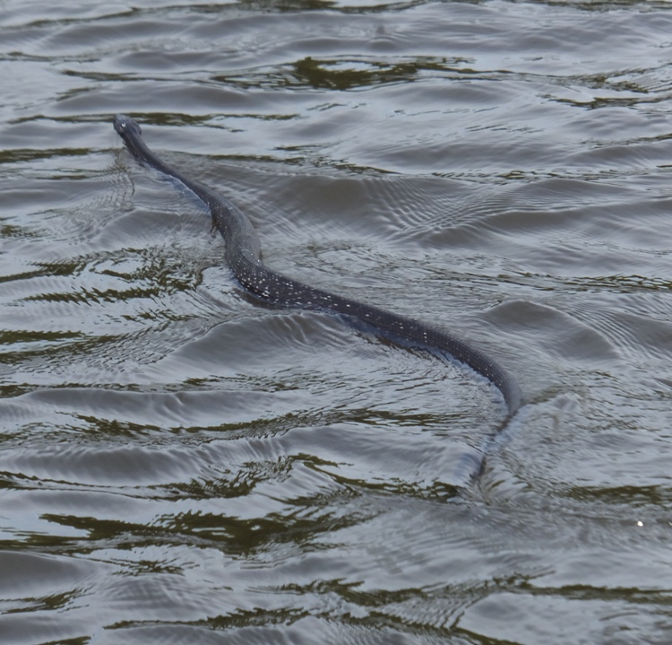
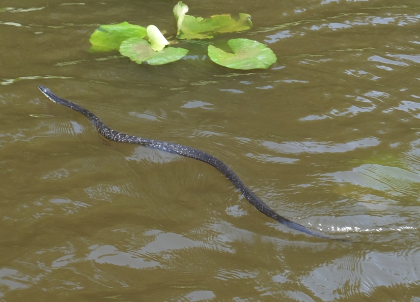
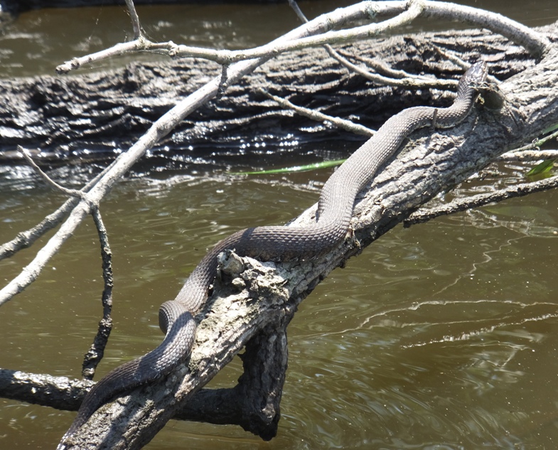
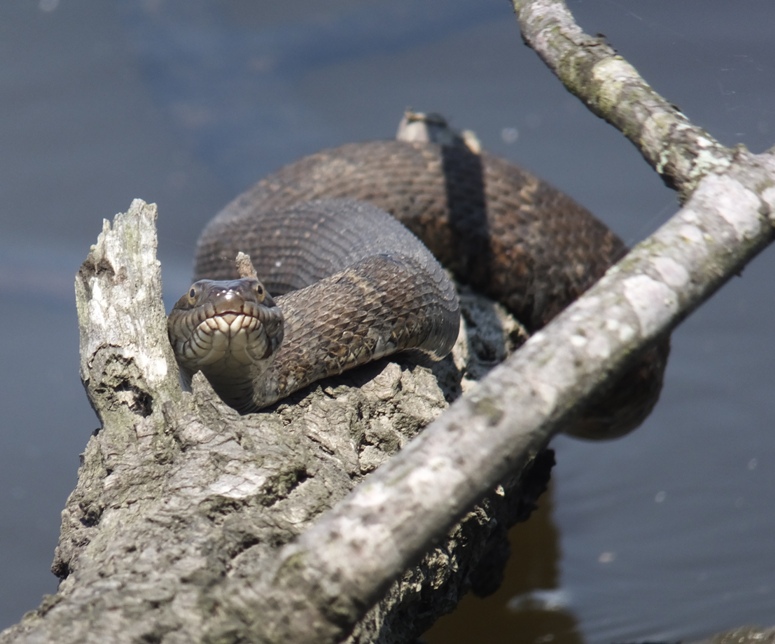
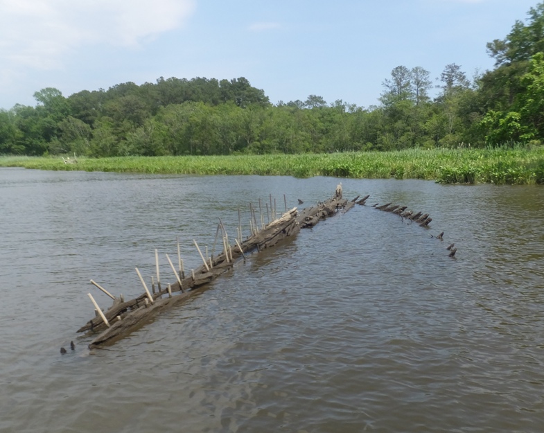
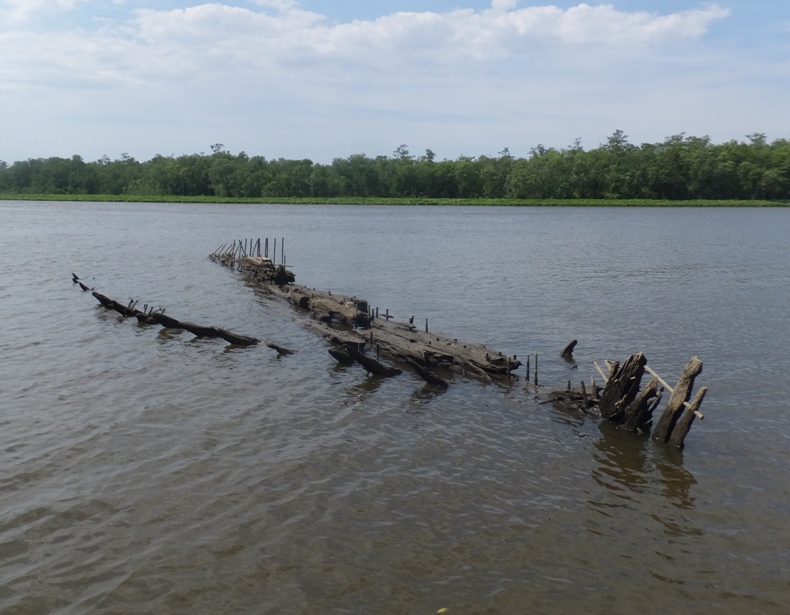
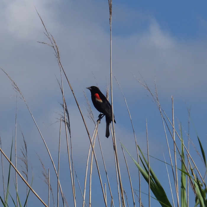
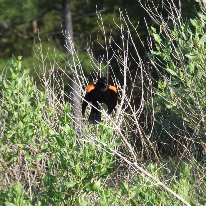
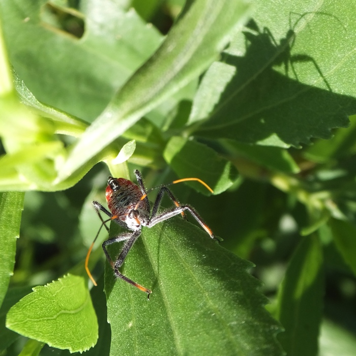
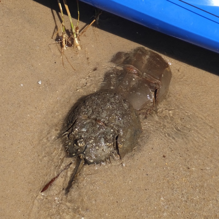
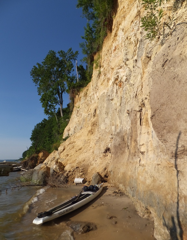
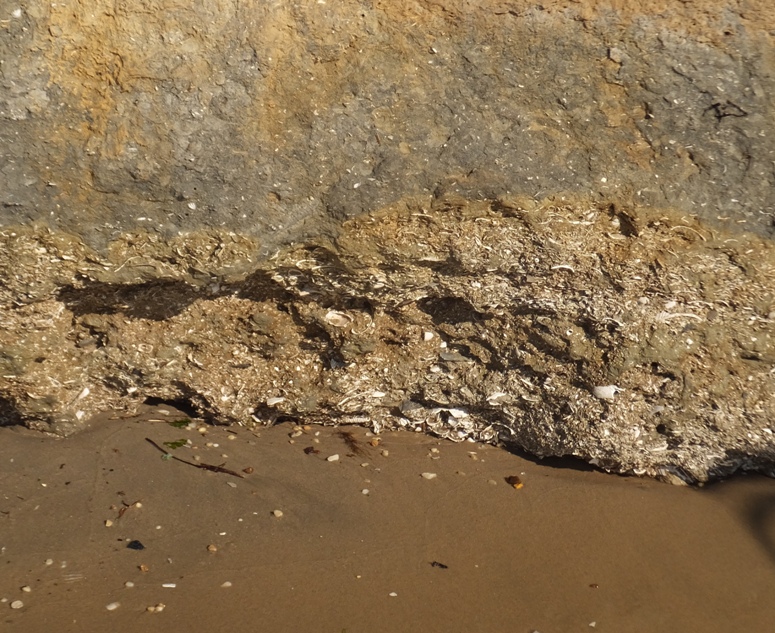
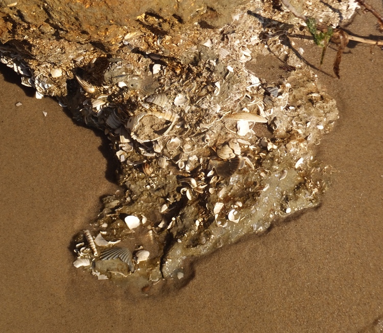
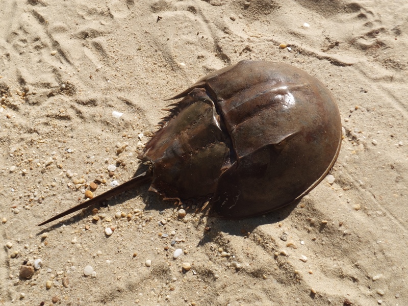
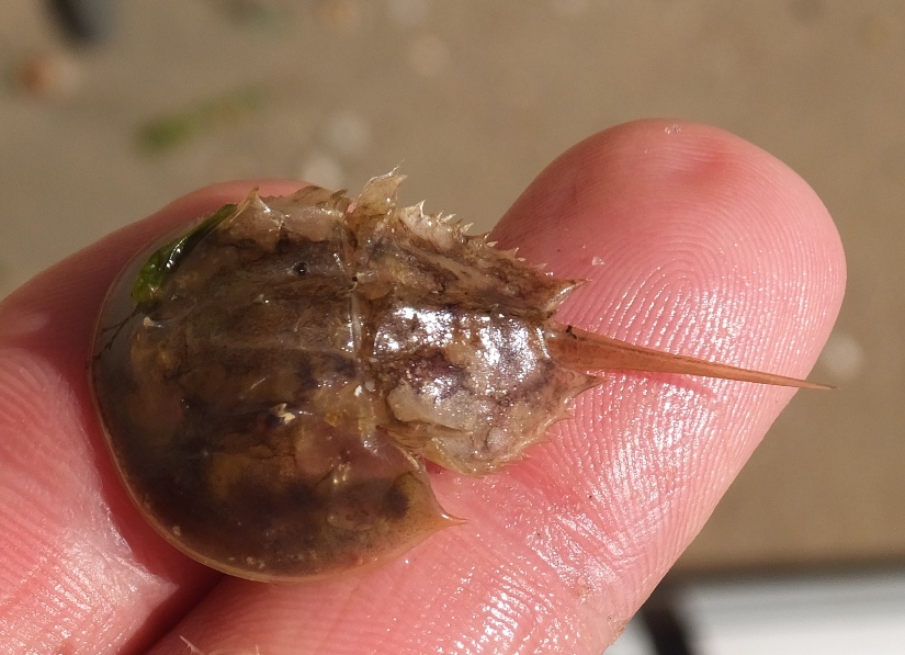
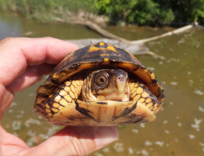
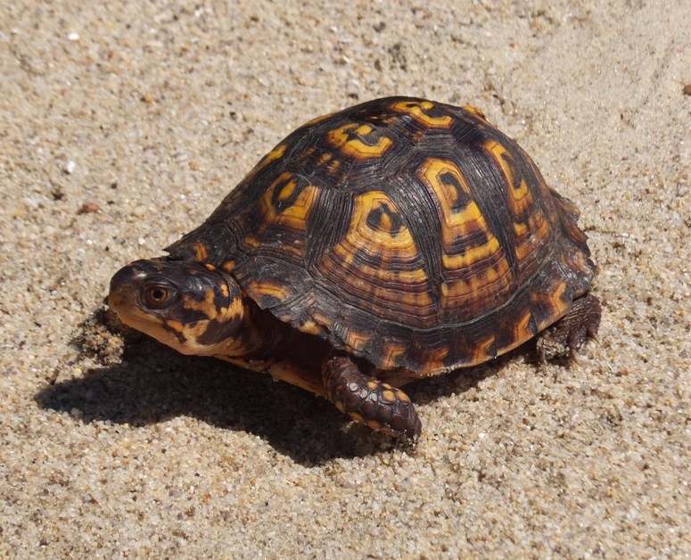
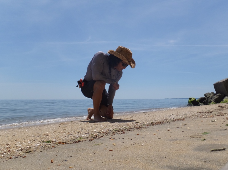
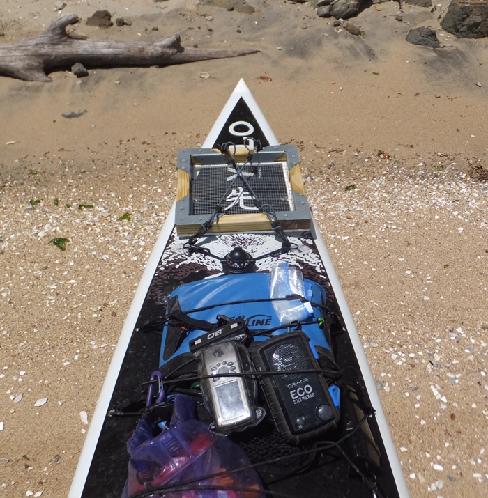
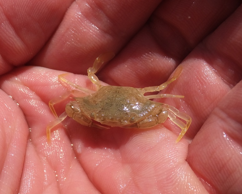
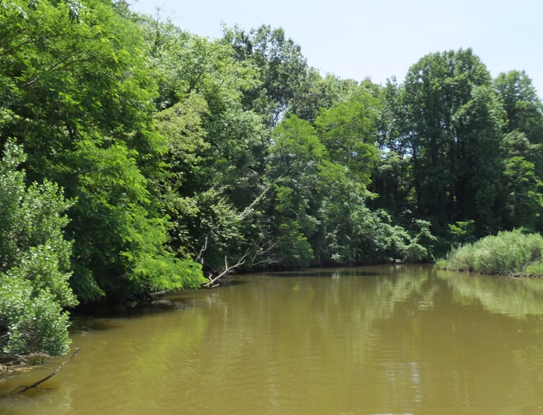
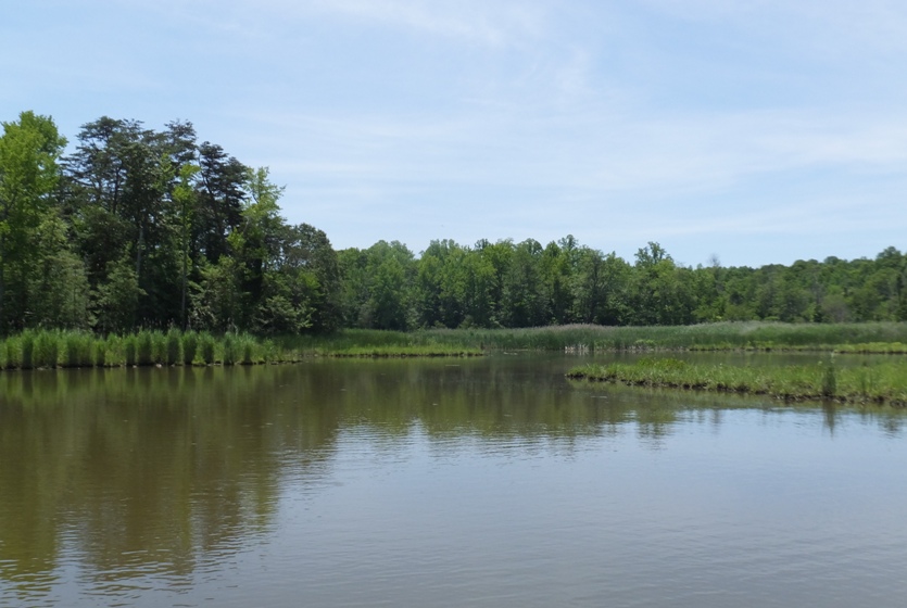
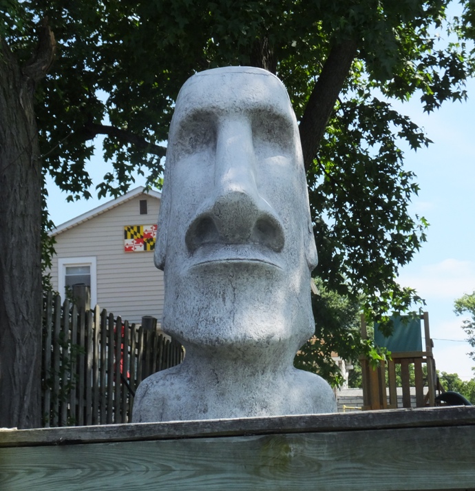
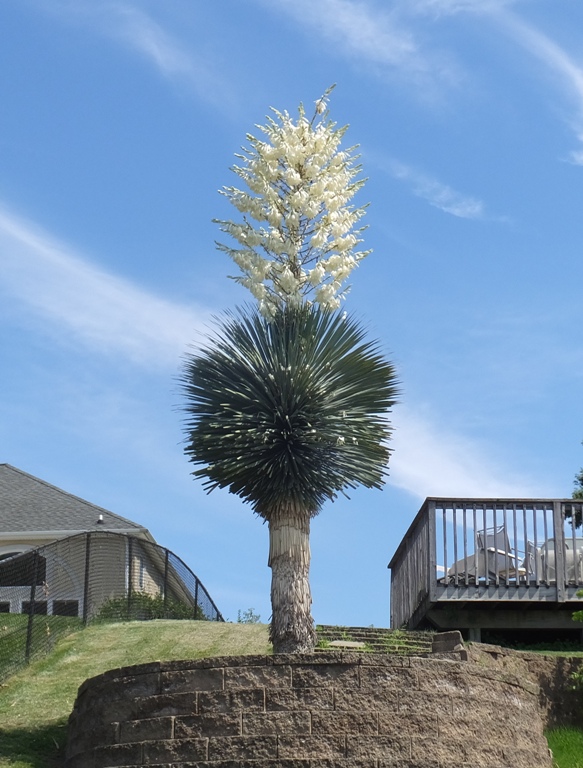
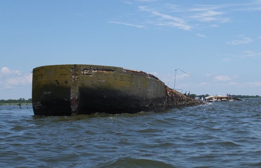
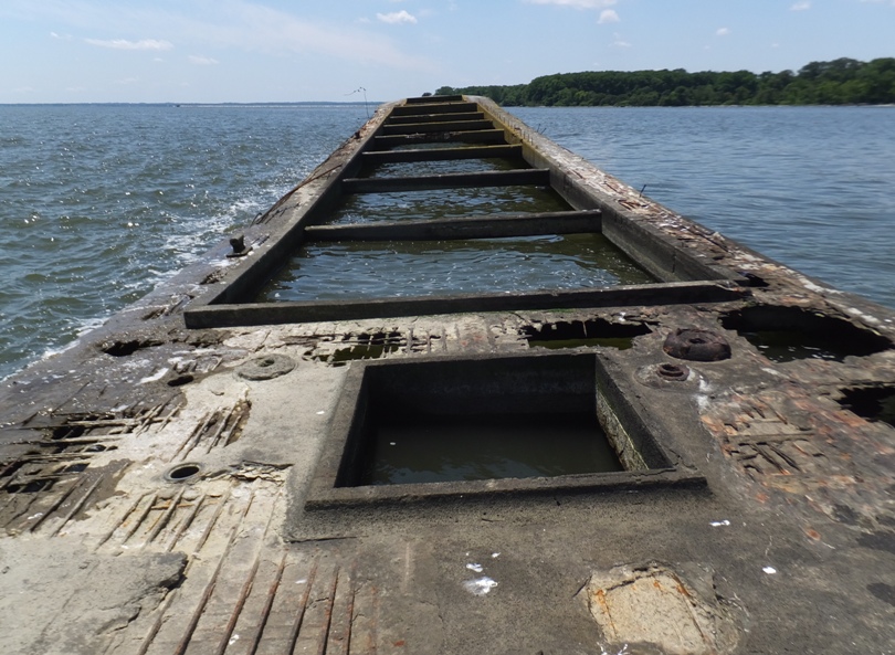
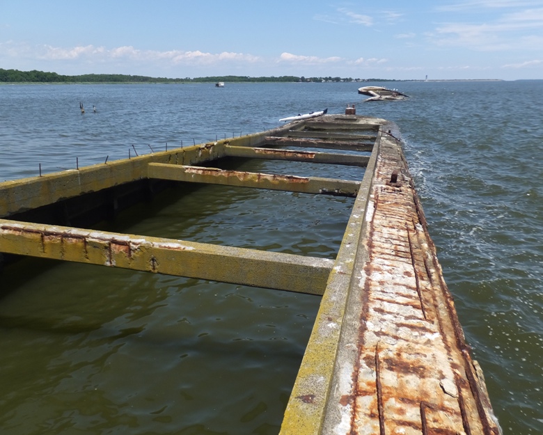
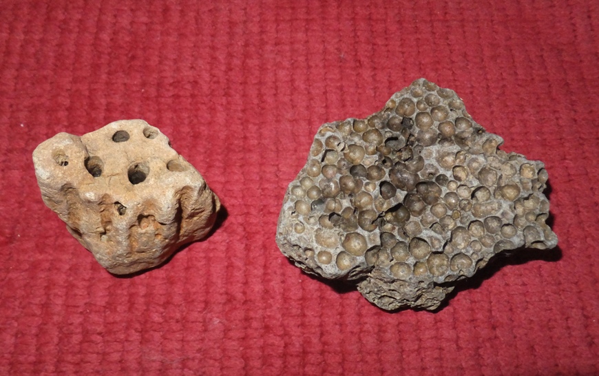
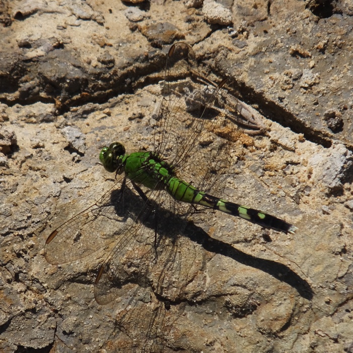
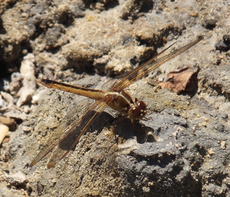
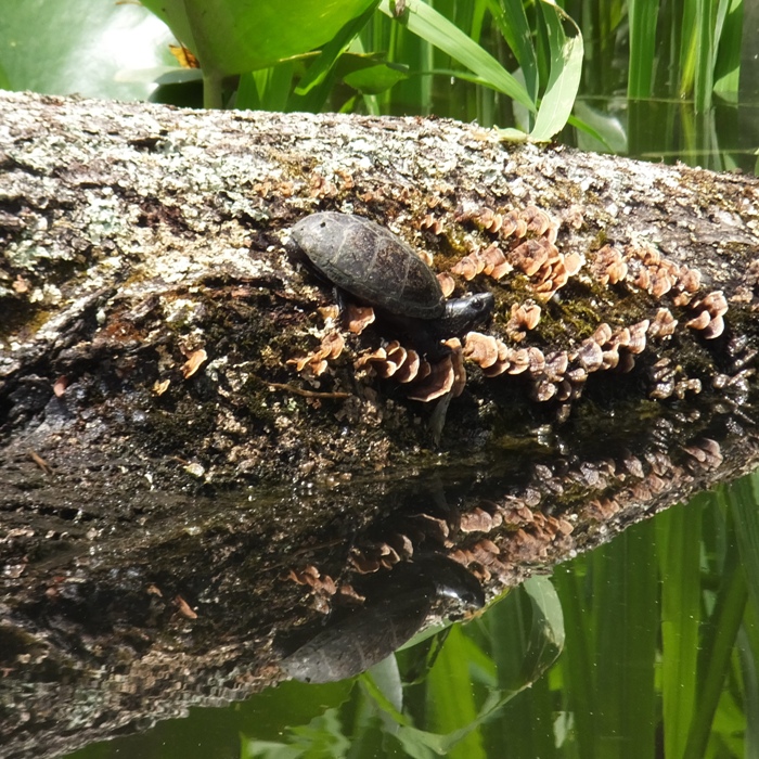
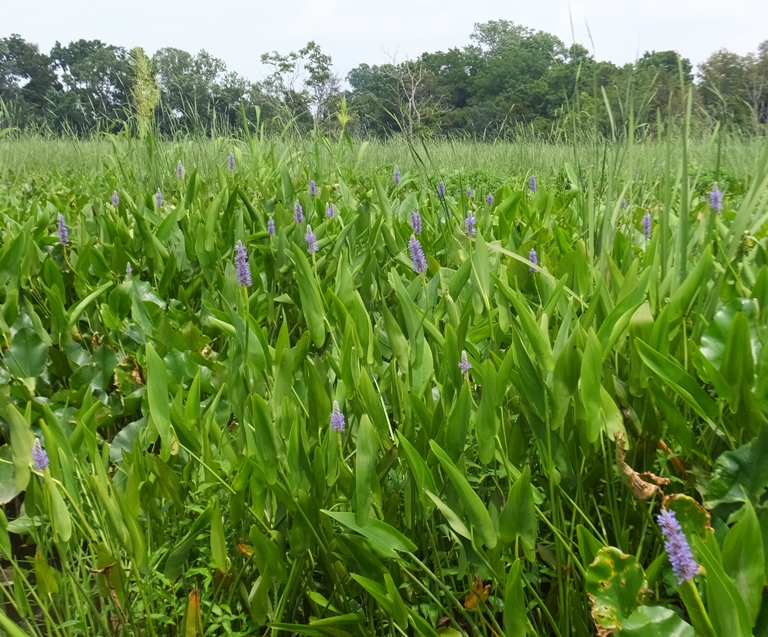
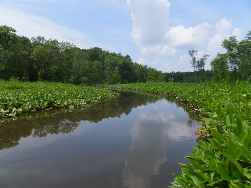
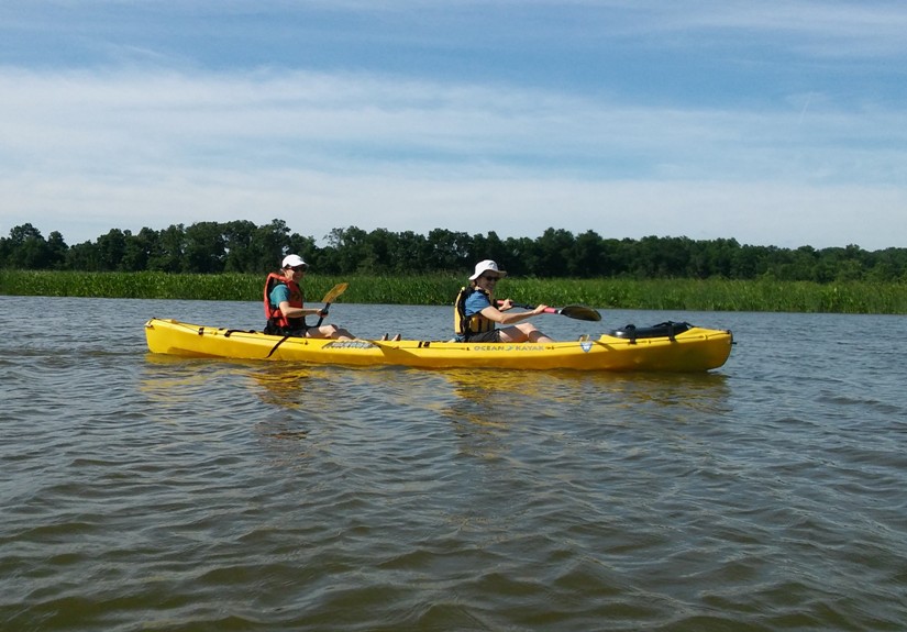
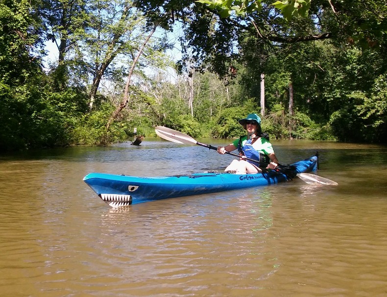
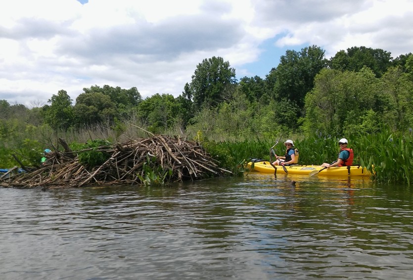
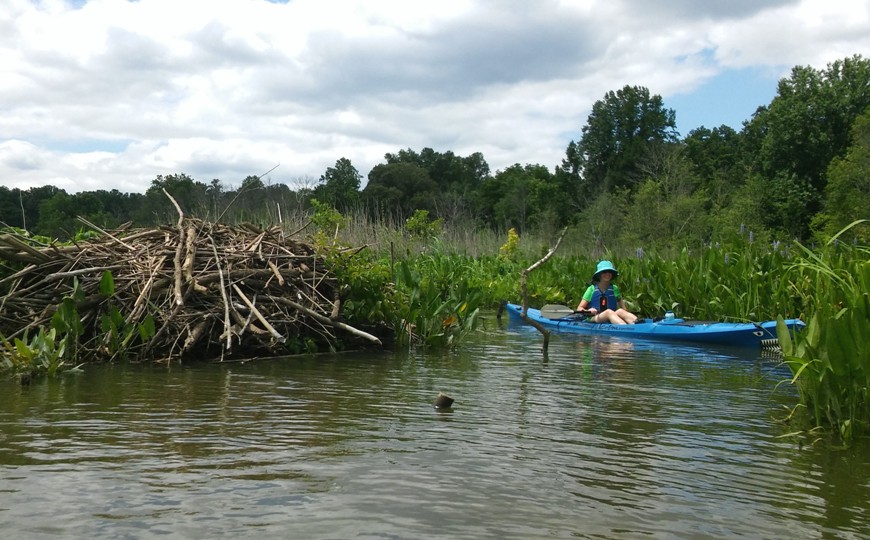
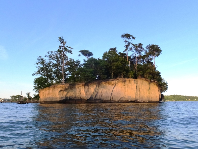
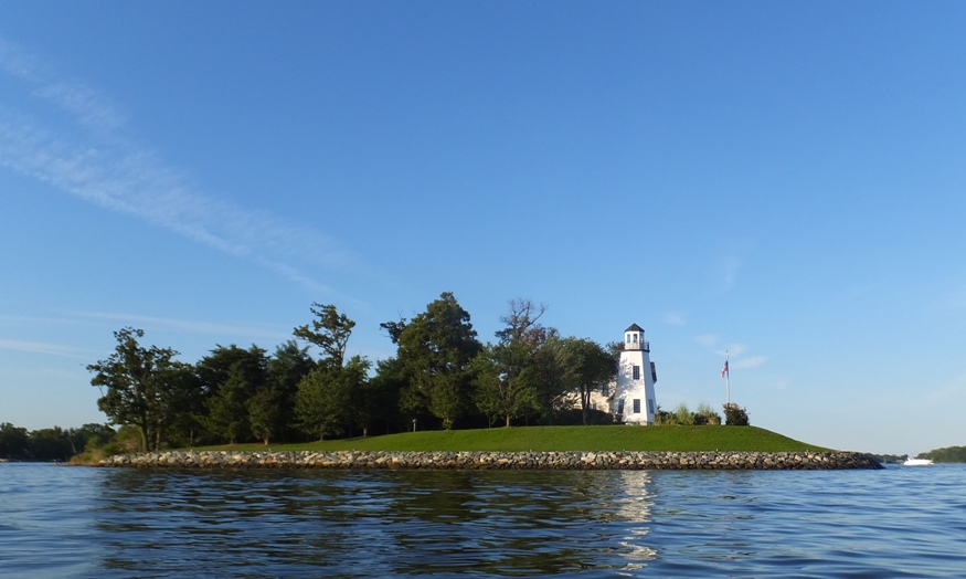
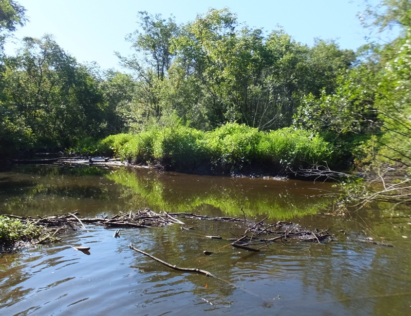
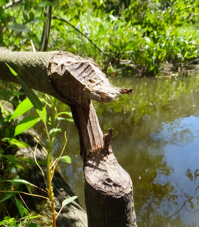
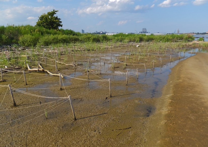
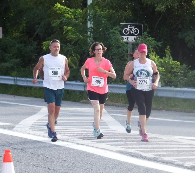
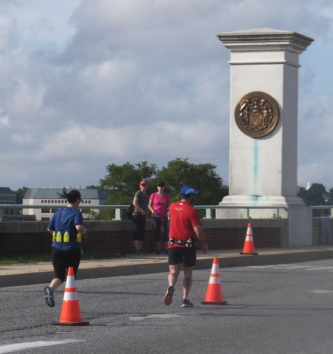
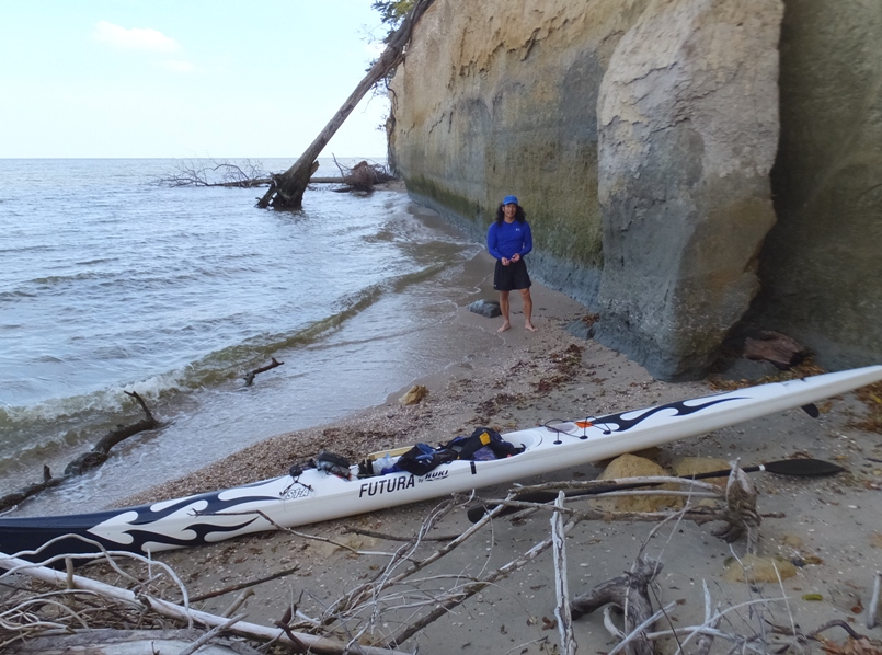
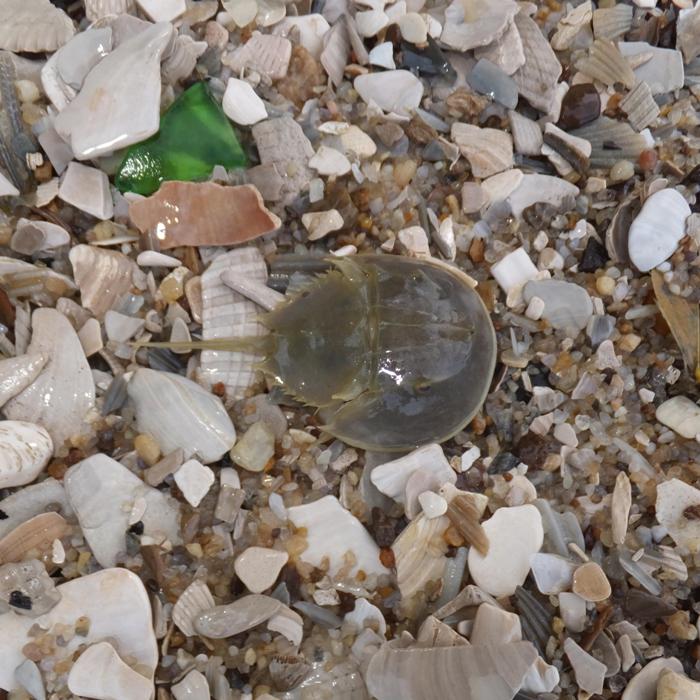
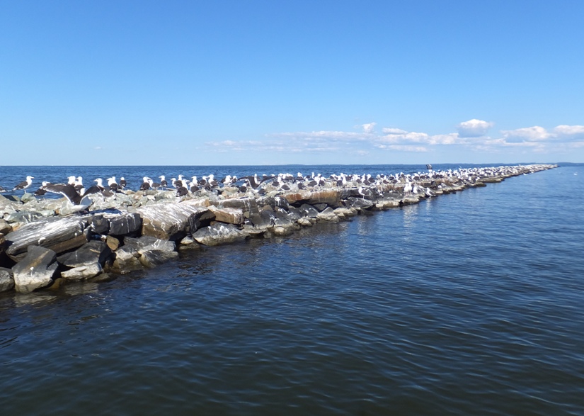
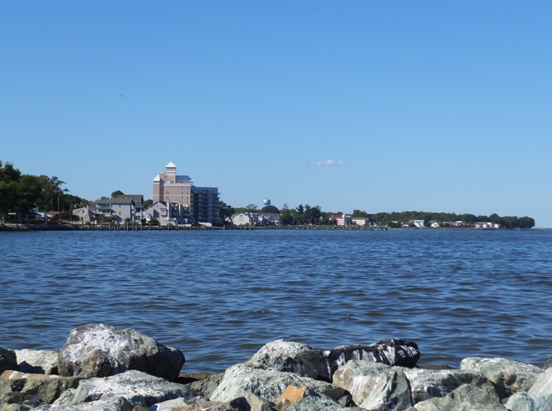
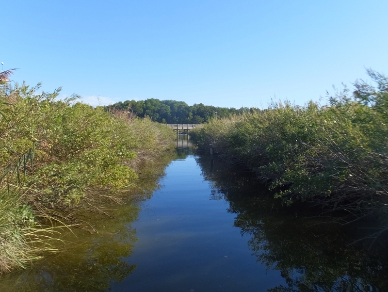
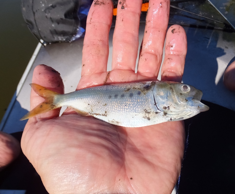
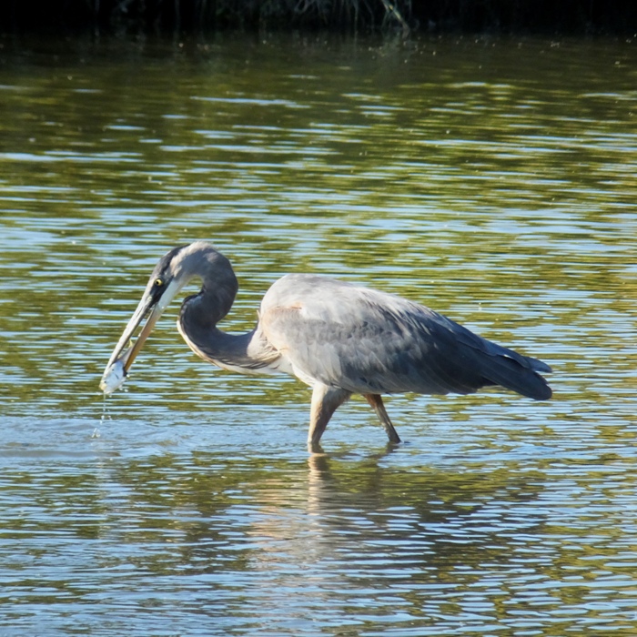
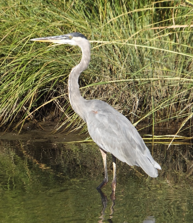
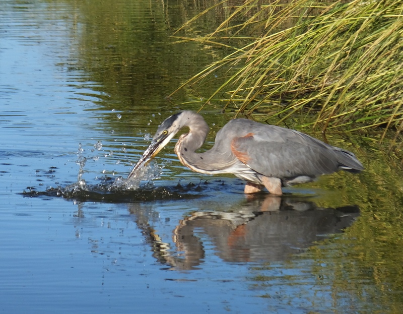
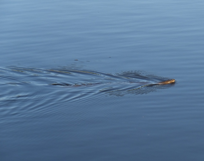
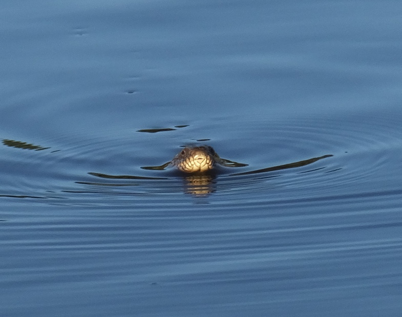
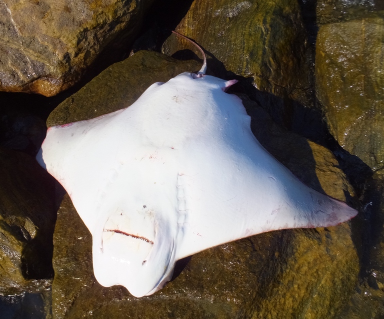
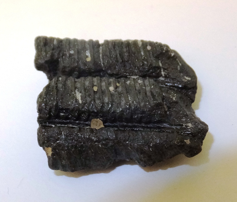
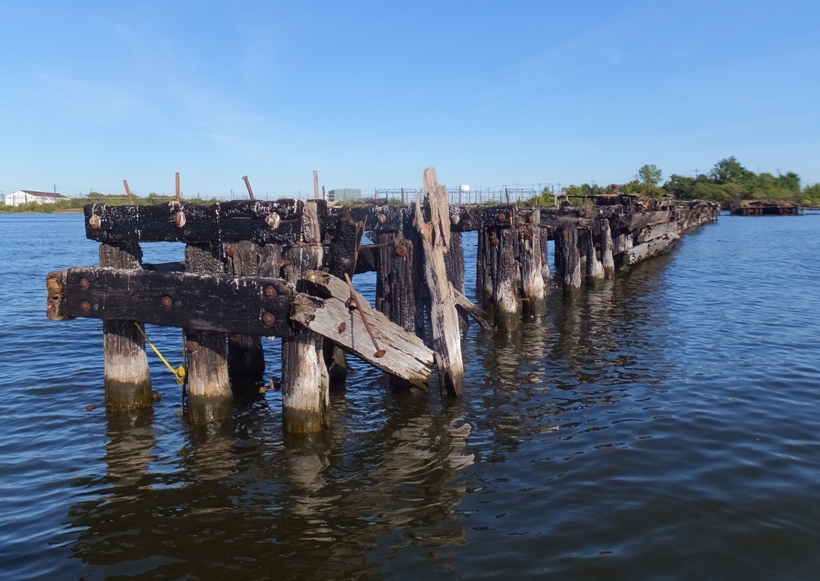
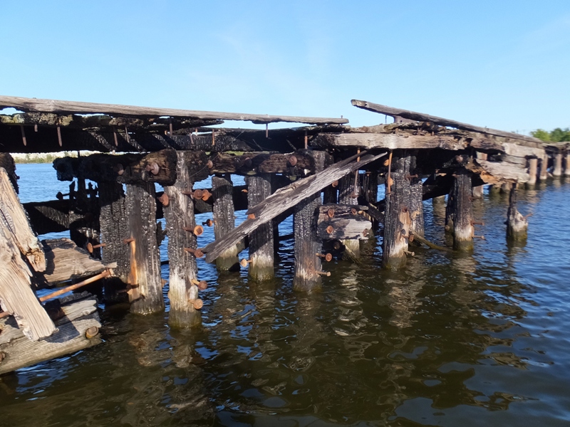
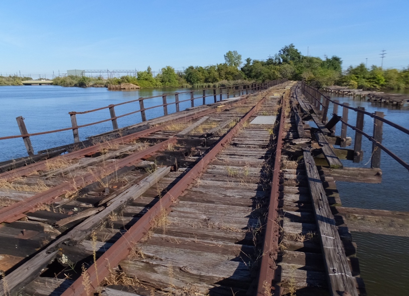
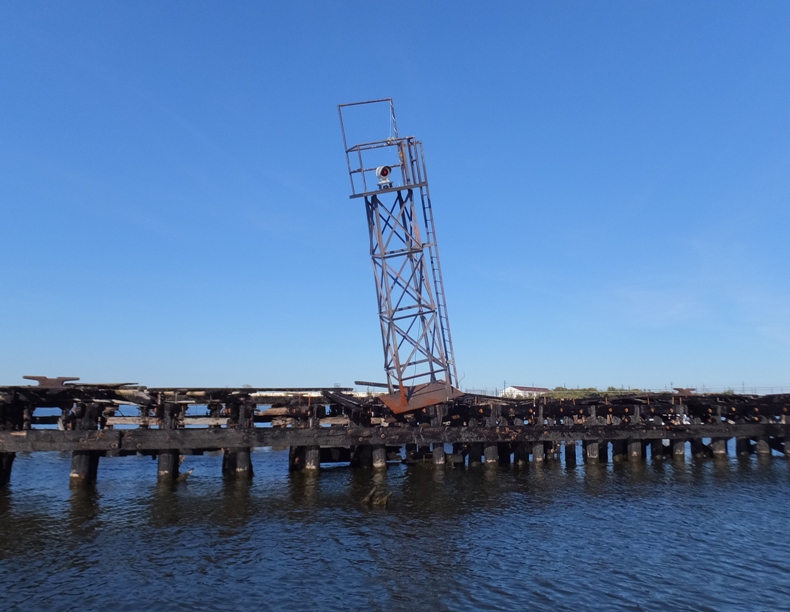
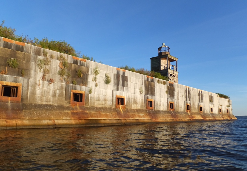
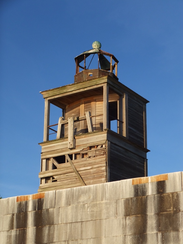
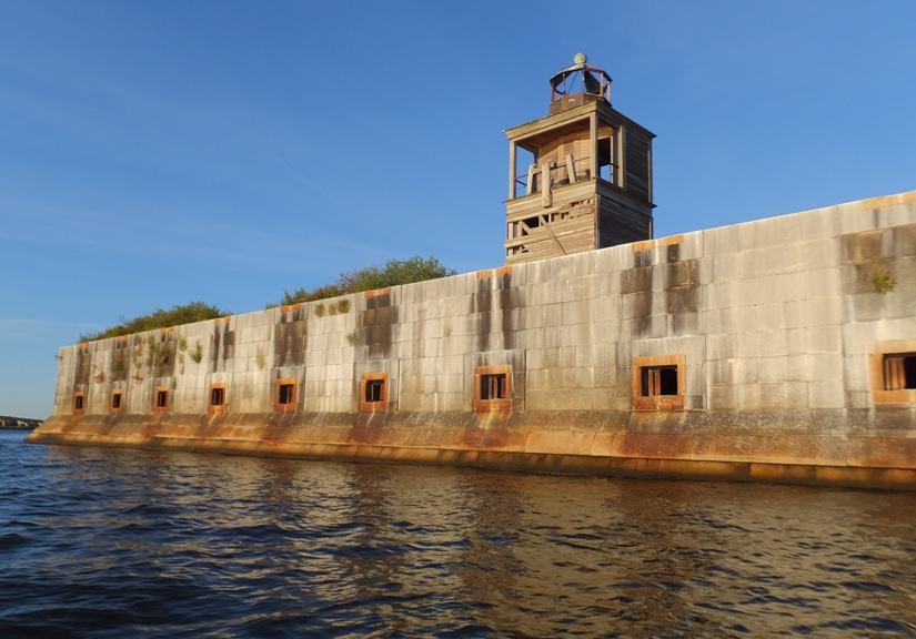
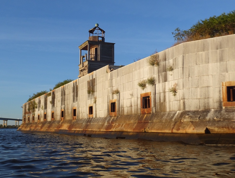
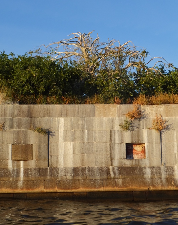
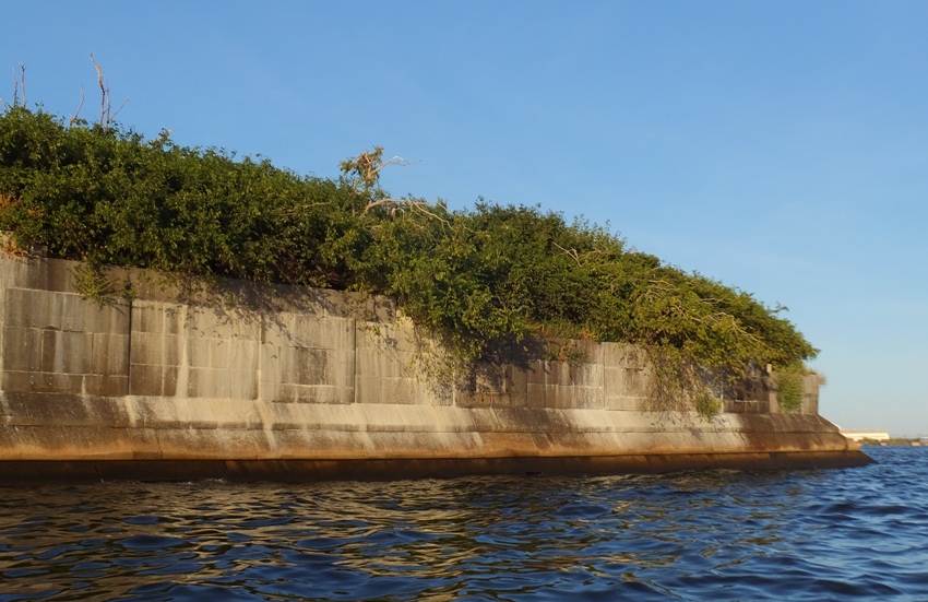
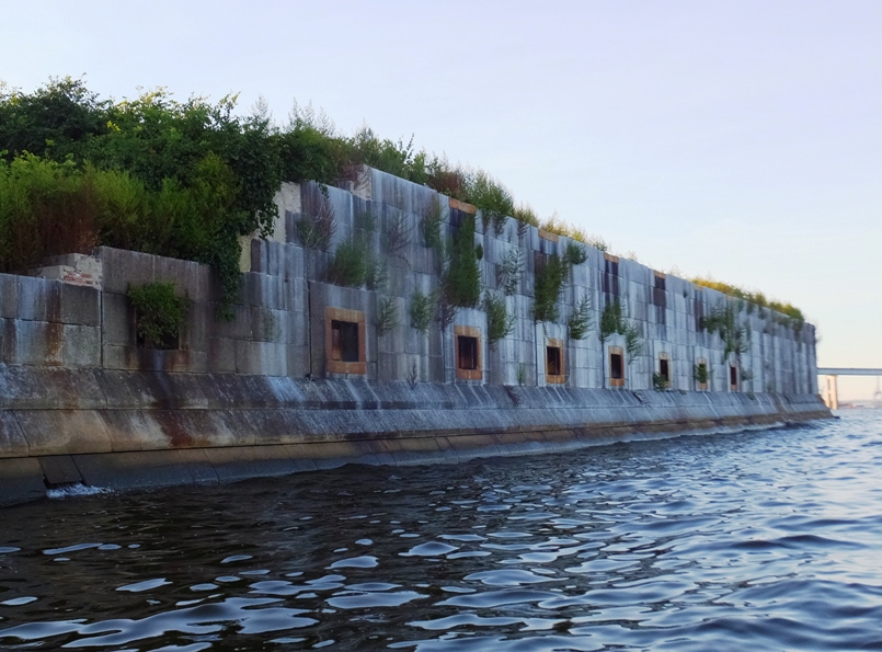
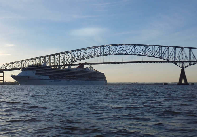
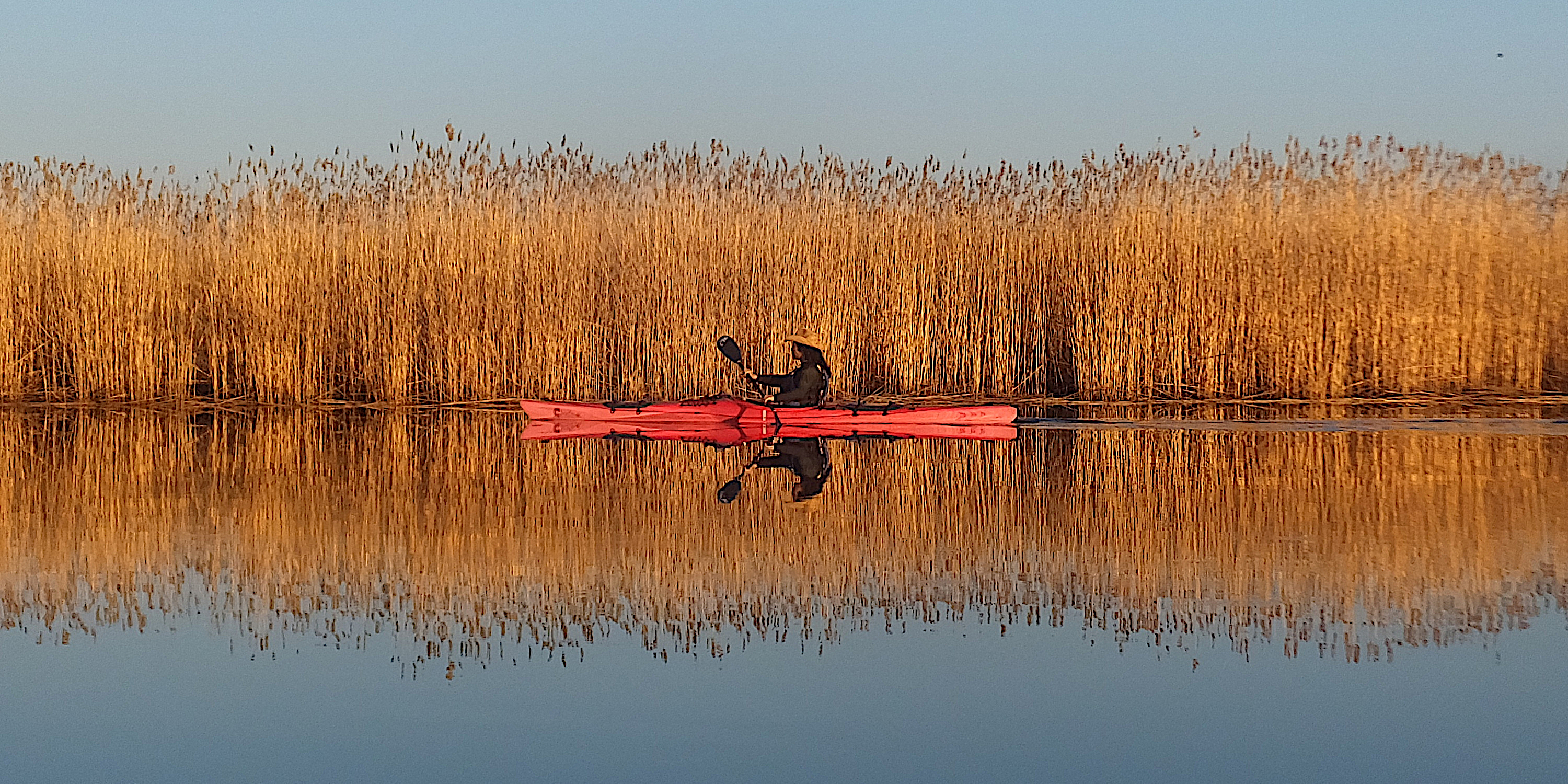