|
This page describes my kayaking and standup paddleboarding adventures in 2015. |

|
This page describes my kayaking and standup paddleboarding adventures in 2015. |
|
From January 17 to 24, Team SNaCk explored south Florida. This included a two days of kayaking, one day of canoeing, and one day of stand up paddleboarding. Florida is my favorite state for being out on the water.
 |
|
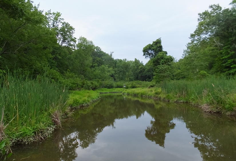
This was my first mid-Atlantic kayak/SUP trip of the year. We had a really cold winter and much of our spring was very windy. Today was a perfect day to be on the water. The maximum wind speed was supposed to be only six mph from the southwest and the high temperature was 64 and mostly sunny. I launched my Yolo Prowler stand up paddleboard (SUP) at 1120 from Foxhole. This put me on the upper section of the Sassafras River, one of my favorites.
Why do I love the Sassafras so much? Primarily, it is the wildlife. I see eagles, heron rookeries, and snakes. I also see lotus flowers in the summer. There is the historic Mount Harman Plantation which is kayak/SUP accessible. Lastly, it is the only place so far that I have seen bryozoans. My last trip to this part of the river was March 23, 2012. Back then, I saw a big heron rookery across from the launch site. Since it was still early in the spring and a lot of the trees didn't have many leaves, I figured I could see that again and possibly other rookeries. The launch area smelled bad. There were a couple dozen dead fish. The water was murky. I crossed the river and followed the shoreline heading downstream (west) in Cecil County. It didn't take long before I saw bald eagles. I ended up seeing about 12 throughout the day. 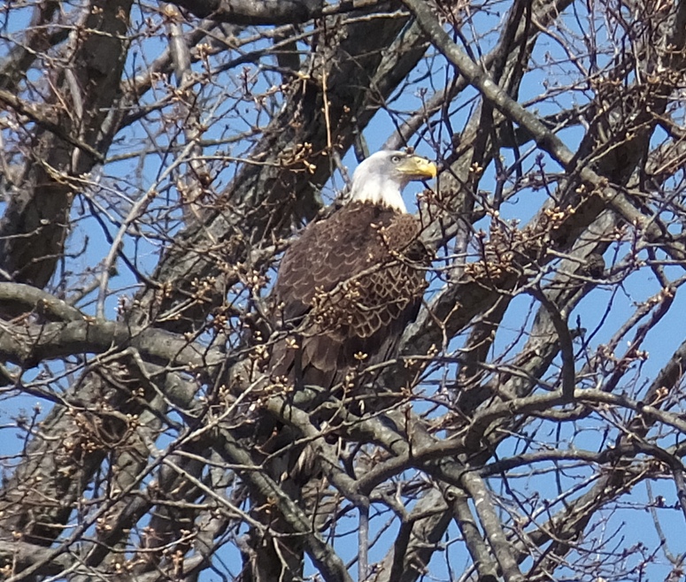
The water seemed unusually shallow, as if a great deal of erosion had taken place. I approached Hen Island. On the north half of the island, I saw a large great blue heron rookery containing about 70 nests. On the northeast side of the island on the shore was an eagle nest. It was tall and narrow, unlike most eagle nests I've seen. 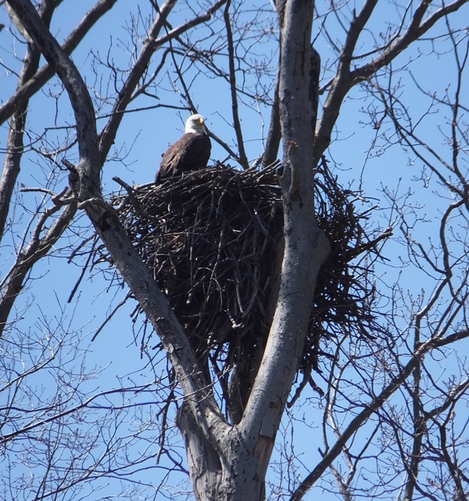
I landed on the southwest side of the island, away from the rookery. On the island, I saw evidence of beaver activity. Some geese were not pleased with my appearance. As I continued walking, I realized why. A goose that was hiding about eight feet away from me flew away, leaving a nest of about six eggs uncovered. Each egg was about 3.5 inches long. I promptly vacated the area. 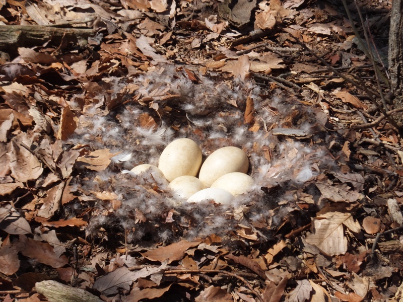
I paddled up a creek north of Hen Island as far as I could, which was not far. Several turtles plopped into the water as I passed. I wore a farmer john wetsuit with a long sleeve Under Armor top underneathe. This kept my temperature just right though I might have been a little hot if I was putting forth more effort. Continuing west, I saw three deer skeletons. One was a six point buck. 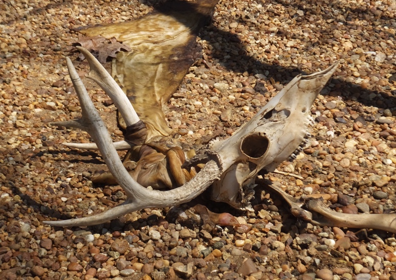
On an unnamed creek less than a half mile east of the Augustine Herman Highway (route 213) bridge on the north side, I found another heron rookery. This one contained about 40 nests. 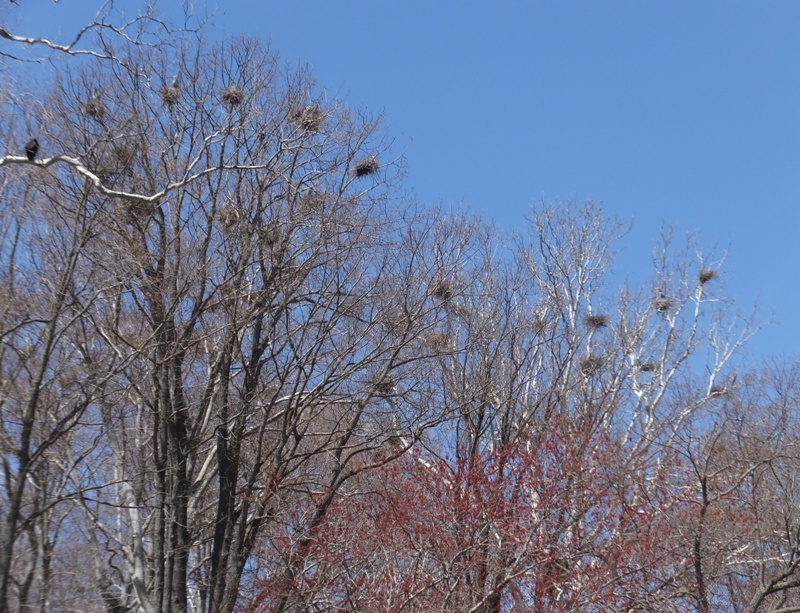
There were also a lot of vultures near the rookery. 
I paddled under the bridge and then crossed back into Kent County. Now I was following along the south side of the river heading east. Things were much different on the south side. The north side was more natural while the south side was developed along the main part of the river. The homes were very nice but not extravagant. Not too big and not too small. All seemed fairly well-maintained. One had a small lighthouse. 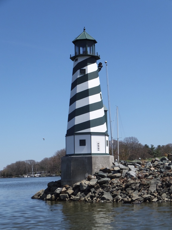
I saw some cypress trees. I assume they were bald cypress though I don't know one cypress breed from another. But these trees did have knees. In my experience, it isn't common to see these types of trees so far north. 
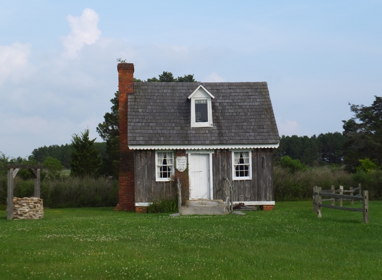
I saw a small tree house that looked like a place one might find an elf or a hobbit. 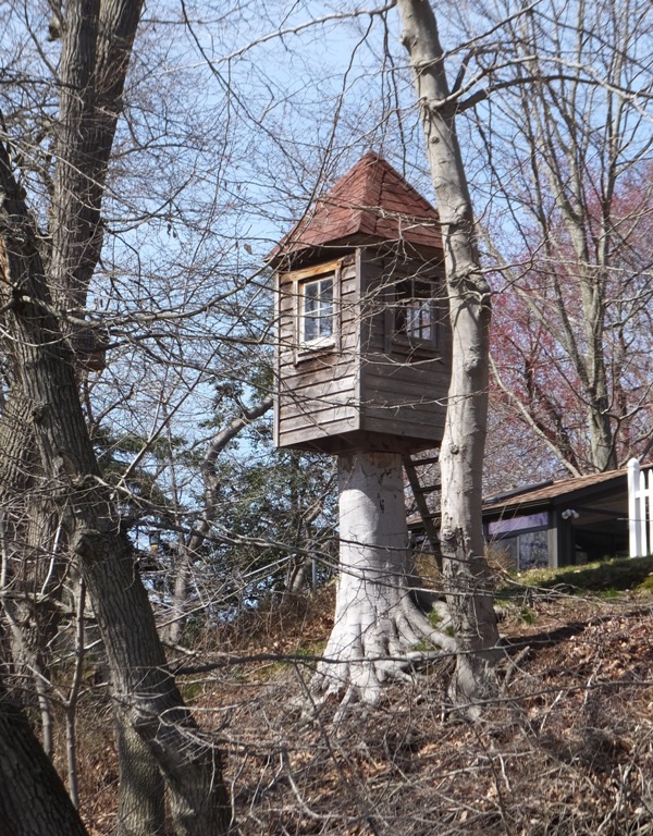
There was a really nice home for sale. It was comprised of stone and glass. It had a pier, a nice yard, and a great view of the water. But when Norma saw the photo I took of it, she thought it was too close to the water and might flood. 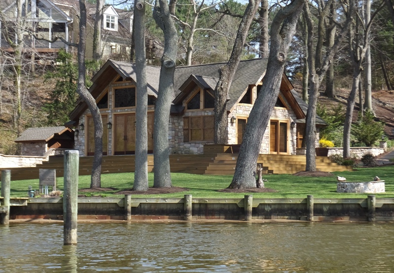
On Swantown Creek, I saw a nun in full habit. She was standing on a pier drinking from a coffee mug. We said hello. I paddled up Jacobs Creek. This was very peaceful. I saw more eagles and beaver activity but still no beavers. A fallen tree meant I had to lie down on my SUP to pass under it. As I paddled along, the creek got very narrow. Can you see the eagle perched in this photo? 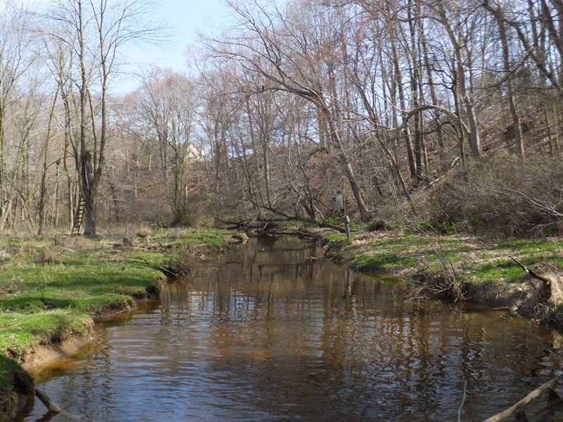
On the return, an eagle sat in a tree and posed for me. I got within 30 feet of it. Then it flew away to a nearby tree. I paddled under the tree, making sure not to make eye contact with the eagle for fear that it might fly off. Then, once I got where I wanted to be (a place with good lighting), I slowly turned around and started taking more photos. As I rounded a turn, I saw a seagull in the water near the shore. It was alone. I approached it and saw that it was injured. It let me get within arm's reach. I think it was too weak to get away. I checked very closely to see if it was trapped in fishing line. Cutting it free would be something I could do to help it. But it was not entangled. If it were a raptor, I could take it someplace and they could try to save it but nobody would want a seagull. I felt very sad for it. 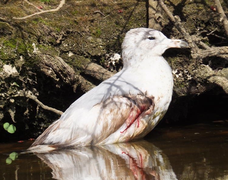
I crossed the river near where I launched and went to the heron rookery I visited back in 2012, across from the Foxhole launch site. I found it, but it had shrunk considerably. Now it looked like there were only 15 nests. I saw a fence nearby that I didn't remember before. Perhaps a field was cleared and the herons felt their space was being invaded. I'm thinking many of the birds that once lived in this rookery moved onto Hen Island. 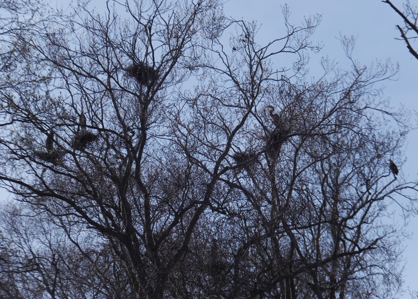
While I saw a lot of wildlife, I can't say that Mother Nature seemed healthy. There were too many dead things, the water was murky, and there was a lot of clumpy, scummy, green stuff growing on the water. I wondered if it was blue green algae, also known as Microcystis aeruginosa or cyanobacteria. I asked a few really smart people I know and got a few different replies. - from Dr. Paul F. - from Catherine W. I spent about 5.5 hours on the water and paddled 16 miles. Many of the places I paddled were shallow so it was hard to get any speed. Still, I had a good day. The weather was great and I saw a lot of wildlife. Seeing three rookeries in a single day is a first for me...along with seeing a nun while paddling. |
|
Having been so successful on April 12, 2015 with my great blue heron rookery hunt on the Sassafras River, I decided to try my luck again but this time at Mason Neck. This peninsula in Virginia is home to a state park and national wildlife refuge that bears the name "Mason Neck."
I had one goal for this trip...to find the large heron rookery I had read about in a Mid-Atlantic Hiking Group trip announcement from 2012. Paddle to the Largest Heron Rookery on the Coast... ...the paddle portion of this adventure takes [you] to the largest Heron Rookery in the states... - from Paddle/Hike Combo! Paddle to the Largest Heron Rookery Plus Mason Neck Hike! I wasn't too confident that this was indeed the largest heron rookery in the states or on the east coast since I could not find other sources that would confirm this. Still, it had to be quite large. I last visited this area on May 27, 2012. I was hoping to see the rookery then, but all the leaves were still on the trees so I saw none. I drove to Mason Neck State Park. The gate was supposed to open at 0800 but didn't open until 0810. At the launch area, there were several other boaters preparing to launch. The beach was covered with snail and clam shells. I was on Belmont Bay with my SUP by 0845. It was sunny with temperatures in the low 60s. It was supposed to get to 80. No need for a wet suit today though I did bring a neoprene top. The maximum wind speed while I was out would get to only five mph. I paddled counterclockwise along the shore. It was often shallow so I couldn't get too close to land. I kept an eye open for rookeries and snakes. Sadly, like last week's trip, I saw no snakes today. In addition to the hundreds of snail shells at the launch area, there were also a multitude floating on the surface of the water. I snatched them out of the water to take home as souvenirs. A few still had an inhabitant so I checked each before putting them in a bag and tossed it back in the water if some critter was using it as a home. These were no ordinary snails. They were Chinese Mystery Snails. Mystery snails are the largest freshwater snails in the region (maximum three inches). They have spiral shells with a door (operculum) used to seal themselves inside. Unlike most freshwater snails, they give birth to live young. The sudden appearance of baby snails surprised aquarists, hence the name mystery snails. - from "Smithsonian Environmental Research Center (SERC) - Chesapeake Bay Snails and Sea Slugs" (broken link as of 2016) For more information, read Washington Post - Urban Jungle - Mystery Snails. Give it a few minutes to load. I rounded Sandy Point as I made by way into Occoquan Bay. Signs on the shoreline told me that I was now paddling next to Mason Neck National Wildlife Refuge. About 2.5 miles from the launch area, I spotted the rookery. It is south of an inland pond (which you might see if you are standing on a SUP) and just north of High Point at 38.618436, -77.202930. Unlike last week where the trees were mostly bare, the trees at Mason Neck were starting to show quite a few leaves so it was hard to get a good view of the rookery. The Mid-Atlantic Hiking Group did this trip in mid-June so I would have been surprised if they had seen anything. As far as I could tell, the rookery was spread out over an area that stretched across about 0.6 mile of shoreline, mostly on the northwest side of High Point. I didn't see a lot of nests but there might have been many further inland that I did not see. Looking at satellite photos, I expect that is the case since inland there are wetlands that cannot be accessed via boat. A trail/road does not lead to this section either...at least not one open to the public. I think it would have been better to see the rookery at least two weeks ago. The sun was behind much of the rookery which helped make the nests visible for identification. Unfortunately, this also made for some less than desireable photos. I was now on the Potomac River. In a small pond, I spotted a pair of wood ducks. Paddling east, I eventually came to the Great Marsh. I tried to explore this area thoroughly, but I was approaching low tide and my fin was dragging in the shallow areas. I got a great close-up view of a muskrat. Unfortunately, I was not fast enough to capture it on film. I saw several turtles, two beaver lodges, and what looked like the start of a dam. I stopped for a snack at one of the lodges, hoping to catch a glimpse of the inhabitant but I did not. There were a couple of bald eagle nests and about six eagles. None were very cooperative in posing for a photo. 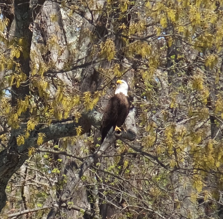
I also saw some red-winged blackbirds. 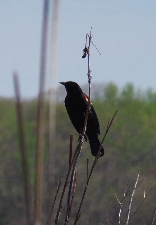
In one shallow area, a snapping turtle swam under my SUP. The shell was about 20 inches long! 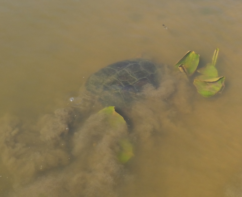
The view below is enhanced to cut through the murky water. You wouldn't see much if it wasn't enhanced. 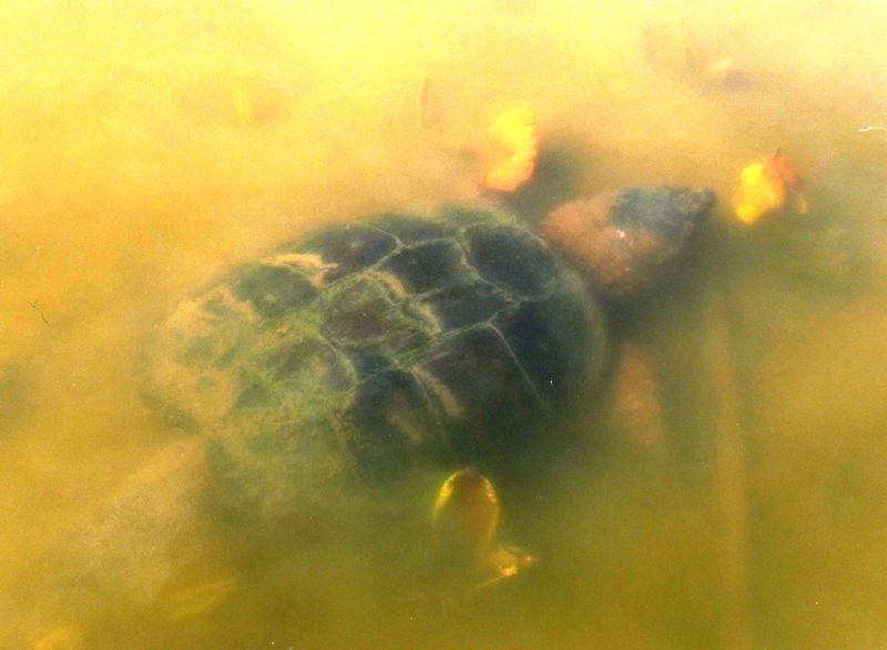
Later, I saw something in the water moving around. It was probably small fish. Then another snapping turtle attacked it. I don't know if it caught it or not. 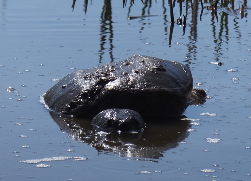
A spatterdock root floated on the surface of the water. 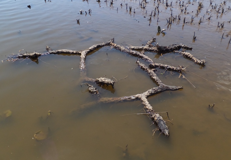
As I paddled past the heron rookery again, I noticed that it was also home to a small egret rookery. Apparently, it isn't rare that the two birds live together. In the midst of the City of Richmond, the James River hosts a unique natural wonder in its Great Blue Heron Rookery located just west of the 14th Street Bridge. Every late winter and early spring, the Rookery provides essential breeding and nesting habitat for approximately 40 Great Blue Herons and a few pairs of Great Egrets. - from "Audubon - Great Blue Heron Rookery Project" (broken link as of 2026) Just to the north of the rookery was another eagle nest. This one with occupant. 
It was now the afternoon and there were quite a few boats on the water. A few were linked up like on the Redneck Yacht Club music video. It reminded me of Dobbins Island in Pasadena during the summer. Back at the launch site, I looked at the pond next to the loading/unloading lot. There were several turtles and some American Toads (shown below) making their calls. These were like the ones that Norma and I saw on April 13, 2014. I would have stuck around longer and taken more photos and maybe an audio recording but the battery on my camera died. 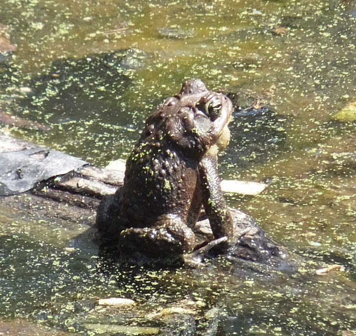
I accomplished my mission...to find the rookery. I also got in 15.5 miles. Like last week, paddling was often slow since I was looking for wildlife and making my way through shallow areas. I also spent a lot of time snatching snail shells out of the water. I was on the water for a little over five hours. The scenery was o.k. The Potomac in that area is too big and by the afternoon, there was more boat traffic than I liked. The drive home was hectic. Northern Virginia and Washington D.C. are terrible places to drive. There was a lot of stop-and-go traffic along with very rude drivers. It took about 90 minutes to get home. By the time I got home, all the peace and serenity that being on the water had given me was gone. |
|
On April 25-26, 2015, I spent the weekend doing some social kayaking on the eastern shore.
|
|
I spent yesterday doing volunteer work for the Marine Corps League followed by a lot of yard work. I figured I deserved a full day to get out on the water. Like Gretchen Wilson says,
I work hard, I play harder. So today was my play day. The forecast called for warm, sunny weather with little wind. After joining Lisa and company for some paddling in Dorchester County on April 25, 2015, I was wanting to go back to that area and do some exploring on my own. I had my sights set on the Little Choptank River and its tributaries. I had never paddled there before. So I loaded up my SUP and headed out. My goal was to launch from Madison and explore Fishing Creek and the upstream section of the Little Choptank River. But a wrong turn made me change my plans so instead I launched at Ragged Point. I had my SUP on the water just after 1000. I paddled north on Brooks Creek, following the shoreline so land was always to my left. The first thing I noticed was how clear the water was. I could often see the bottom. There were lots of jellyfish. This seemed unusual because it was only May. Typically, June 24 is the median time for the jellyfish to arrive. - from Cecil Whig - Jellyfish came early this year to Chesapeake Bay (2012) I also saw a lot of tires in the water. I was hoping to see horseshoe crabs and rays but I did not. Nor did I see any snakes. But I did see a lot of periwinkle snails along the muddy shoreline. I also saw a few clams. Clearly, it was near low tide. 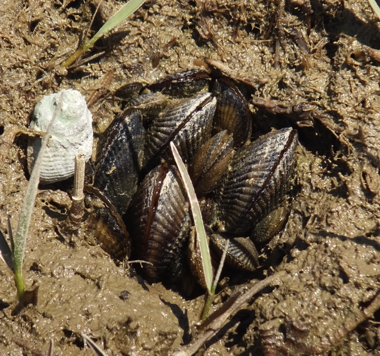
I saw at least four bald eagles throughout the day along with three nests. Can you see the nest? 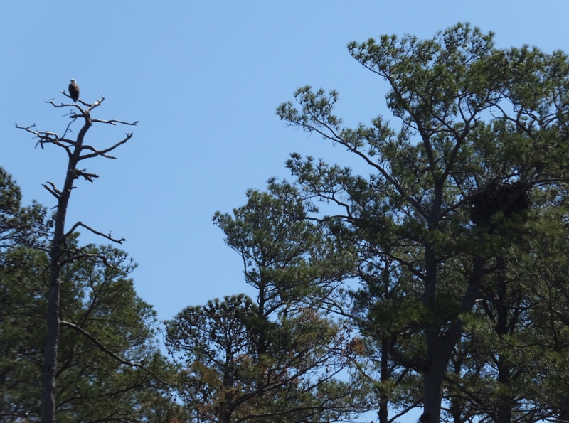
Unlike the place I paddled with Lisa's group, much of this area had trees that came right up to the shoreline. I found it more scenic than monotonous marsh grasses. The west side of Brooks Creek was pretty natural. At Casson Point, I cut east across the mouth of Hudson Creek to Butter Pot Point. I went around and between some islands before heading north (upsteam) on Back Creek which had some rather peaceful sections. 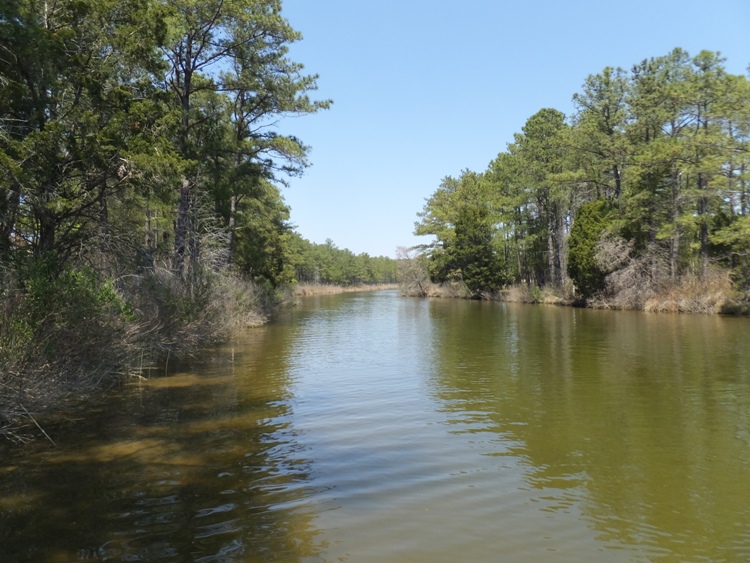
I stopped for a break on Hudson Creek and observed barnacles attached to a tree limb. 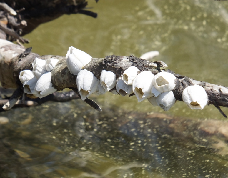
A couple of egrets rested in a tree. 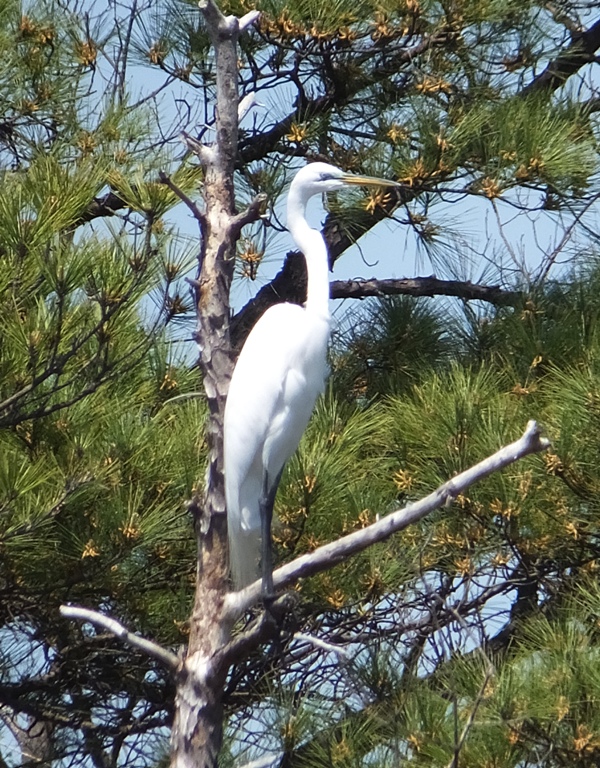
I explored the east side of Hudson Creek and its tributaries, eventually making my way up to a drainage pipe at Ross Neck Road. In this area, I saw what one might think is toxic waste. But as far as I can tell, it is just pollen, appearing as yellow dust. Paddling further upstream, the dust appeared in higher concentration and after awhile, I couldn't see the water through it. 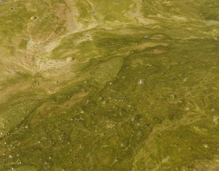
Heading downstream on Hudson Creek, I explored the west side, though not as thoroughly as the east side. It was getting late and I still had a long ways to go. I really wasn't expecting to get so far upstream on the creek or its tributaries. On the Sassafras River (see April 12, 2015), I would have never gotten so far up a narrow section. Out there, the river bottom is much softer and prone to erosion. Much of the area today was still shallow but more like two feet deep closer to shore. To put things simply, I was putting on more mileage than I originally estimated. There were a couple of piles with nests. They were both about four feet tall. On the first was an osprey nest. Once I got within 30 feet, the osprey flew off. I continued to approach. I took out my camera and stretched my arm above my head to photograph what was inside. There were three eggs! 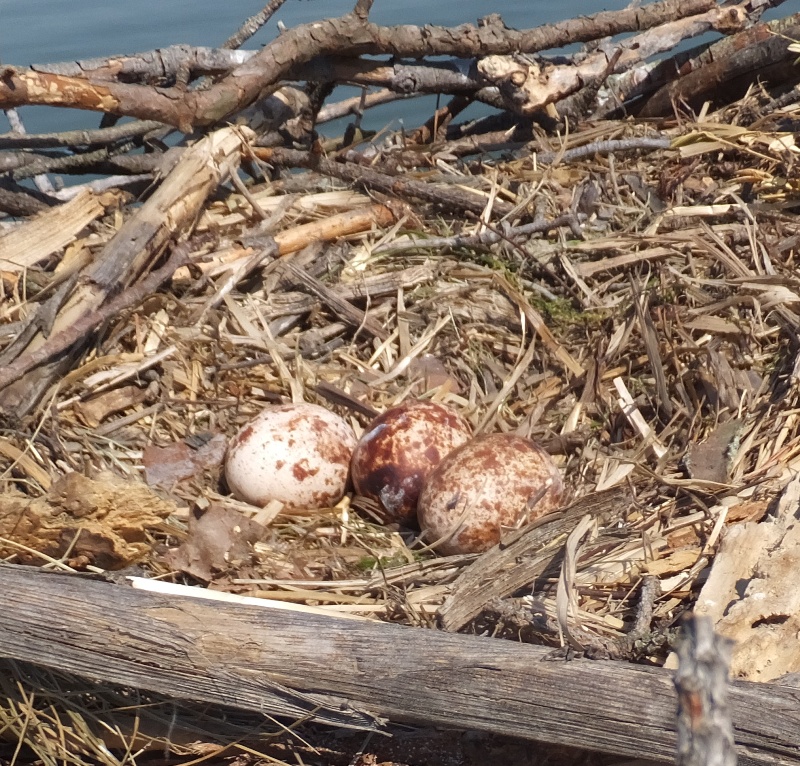
As I paddled away, the osprey returned. Had it been cold or rainy, I would have kept my distance to keep the eggs or offspring from being exposed to the elements. The second nest was also built by ospreys but it was now inhabited by a goose. 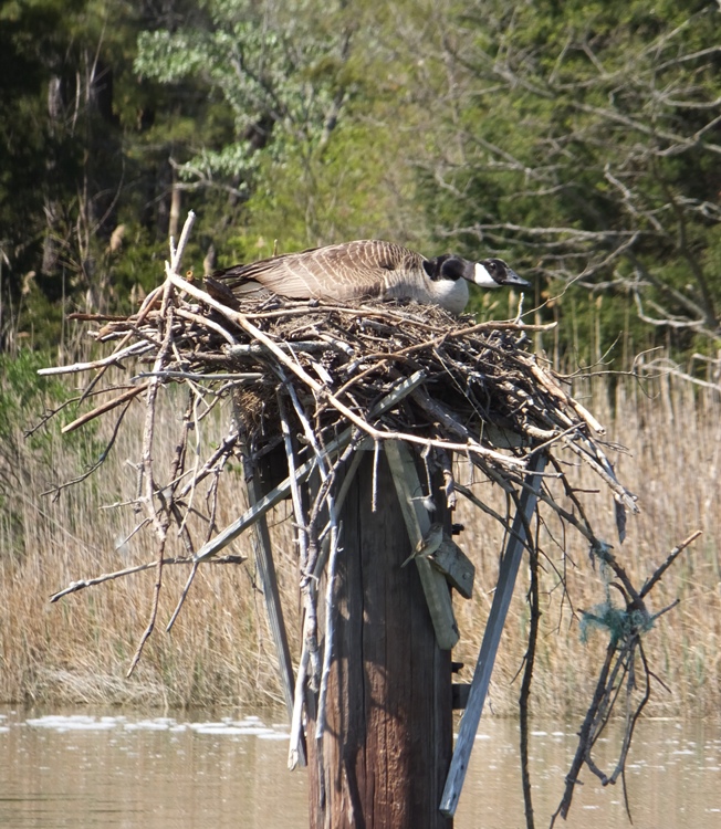
Further downstream, I saw more jellyfish. Throughout the day, I saw hundreds. Most had a bell about the size of a baseball. But one had a bell about five inches across. As far as I could tell, they were all sea nettles. But my friend, Stacy, suggested that they might be lion's mane jellyfish. I think she is correct. I paddled to Ragged Point, the southernmost tip of Ragged Island. Then I made my way north. A red fox saw me and ran away before I could snap a photo. I was thinking I might be able to circumnavigate Ragged Island but as I entered Rioll Cove, I realized this could not be done without a rocky portage. Three white-tailed deer grazed amongst the grasses. Somewhere in or near Fishing Cove, I found a nice, quiet tributary where I could collect my thoughts. 
I worked on my pivot turns. I think I might have something that works. Start with right foot, take four paces back, lean back on the left foot, get the SUP nose out of the water, then turn. Putting my paddle on the deck of the SUP to use as a walking stick seems to help though I know it also slows me down. I also worked on my forward stroke. I am concentrating on shorter, faster strokes and making sure the blade of the paddle is out of the water before it gets behind me. This seems to work pretty good though I have to keep reminding myself to keep up the tempo. I completed 30 miles after eight hours and ten minutes. This includes breaks, snacks, paddling in shallow areas, and taking 130 photos. I was a little tired but certainly not exhausted. This ties the longest SUP trip I have ever done which was on June 22, 2013. I certainly wasn't trying to go fast today or set a record. The route just ended up being longer than I expected. I thought I would feel sore or excessively tired the next day but I did not. I guess I'm doing something right. |
|
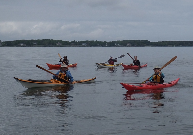
The Kent Island Peer Paddles (KIPPs) are annual events that have been going on for the last ten years. The goal is to develop kayaking skills and stamina by participating in increasingly difficult group kayak trips around Kent Island during the late spring and summer. After these training paddles, kayakers partake in a final test which involves a one day circumnavigation of the island, about 34 miles. I like to compare this event to the Mountain Club of Maryland's 40 mile Hike Across Maryland (HAM).
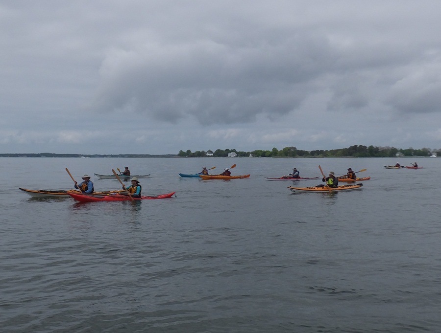
Marshall W. is the organizer and mastermind behind this event. Over the years, he has recruited the help of veteran kayakers to help lead and train less experienced paddlers. I am honored to have particated in the first of these events. I joined Marshall and a small group of kayakers for two of their training paddles. Back then, it was only about a dozen of us. Eventually, I did the circumnavigation...but I decided to do it on my own on September 8, 2006 so I could go at my own pace. Fast forward nine years and here I am today back at Kent Island. On the way out, I stopped by Angler's to get my Queen Anne's County boat launch permit. Then I met the group at Little Creek. I found Marshall and said hello. I couldn't believe how many paddlers were there. Marshall said there were 48. I usually paddle alone so this was quite a shock. A little after 0930, some of the more experience kayakers demonstrated a T-rescue and a heel hook re-entry. By 1040, we launched. I already had my Yolo Prowler stand up paddleboard (SUP) on the water and tied to a pile. It was easier just to drop it into the water from where I parked rather than carry it to the ramp. I helped folks put in and was the last to leave. We assembled not far from the launch area and then did a head count. Since I was standing, I was in a good position to count but there were too many people moving about. Instead, everyone was told to exit the area near a channel marker and one of the leaders near it counted while folks passed. Our huge group paddled south through Crab Alley Bay. I sprinted to the front to get photos. There are a lot of kayak club pictures of the backs of people's heads and I prefer to get their other sides which is usually much more attractive. 1 / 5

Sue B.
2 / 5
Smooth water.
3 / 5
Many Greenland paddles.
4 / 5
Not sunny yet.
5 / 5
Bent shaft paddle.
I saw a few jellyfish...maybe five throughout the day. We made our way out to Bodkin Island which was covered in cormorant nests. The last time I was there was May 25, 2014. The first time was in the summer of 2003. It has changed a lot since then. Back in 2003, there were other birds besides cormorants. There were a lot of nests on the ground. Many had a diameter of about 2.5-3 feet. But what I remember most distinctly from 12 years ago was how thick they were. Oftentimes, they were 1-3 feet thick! I don't remember what kind of birds they were or what they looked like but I do know that unlike today, there was more variety. Their [cormorant's] large colonies could crowd out others using similar habitats, such as black ducks, egrets and herons. Those birds often seek out islands which offer habitat free of human disturbance where they can thrive. "If I'm watching for anything with cormorants, it's competition with other colonial waterbirds," Brinker said. Not only can the sheer number of cormorants push other birds out, their wastes can denude an island, driving other birds off. Vernon Stotts, a retired biologist from the former Maryland Game and Inland Fish Commission, believes cormorants were responsible for driving egrets and black ducks from one of the small remnants of Poplar Island several years ago. - from Bay Journal - Feathered friend or fish-eating foe? (a broken link as of 2020) Here are some photos I scanned in from my 2003 trip to Bodkin Island. My friend Stacy forwarded these photos and my descriptions to a bird expert that works for the Maryland Department of Natural Resources. Once I find out what built the "thick" nests, I'll post it here. I later received word from the expert that these photos from 2003 are just Double Crested Cormorant nests. I was hoping for something more exotic. We circled Bodkin Island. Next, we started a towing exercise. I think everyone was assigned to a group except me so I just joined in with the last group. Renee towed someone for awhile and then I offered to tow Renee. I've never towed anyone from a SUP before. I took my tow rope and set the belt. Then I lassoed it around my bow. I couldn't think of any other way to tow. If I wore the belt, then it would pull me back and my balance on the SUP would be off. I didn't trust tying it to the loop at the stern since I didn't think that would be strong enough to tow. But I did think it would be strong enough to pass the tow rope through to ensure the rope remained centerline with the SUP. Used in this fashion, things worked perfectly. I towed Renee for awhile and then we did in-line towing. Here's some pics by Ben M. I saw a turtle with a 12-inch long shell swimming just below the surface. I did not get towed and I don't know how that would have worked if someone wanted to tow me. Like most surfskis, there is no front carrying handle on my SUP where one can tie a rope. We got a little spread out with the towing drill so our leader, Jim, had us regroup before continuing. 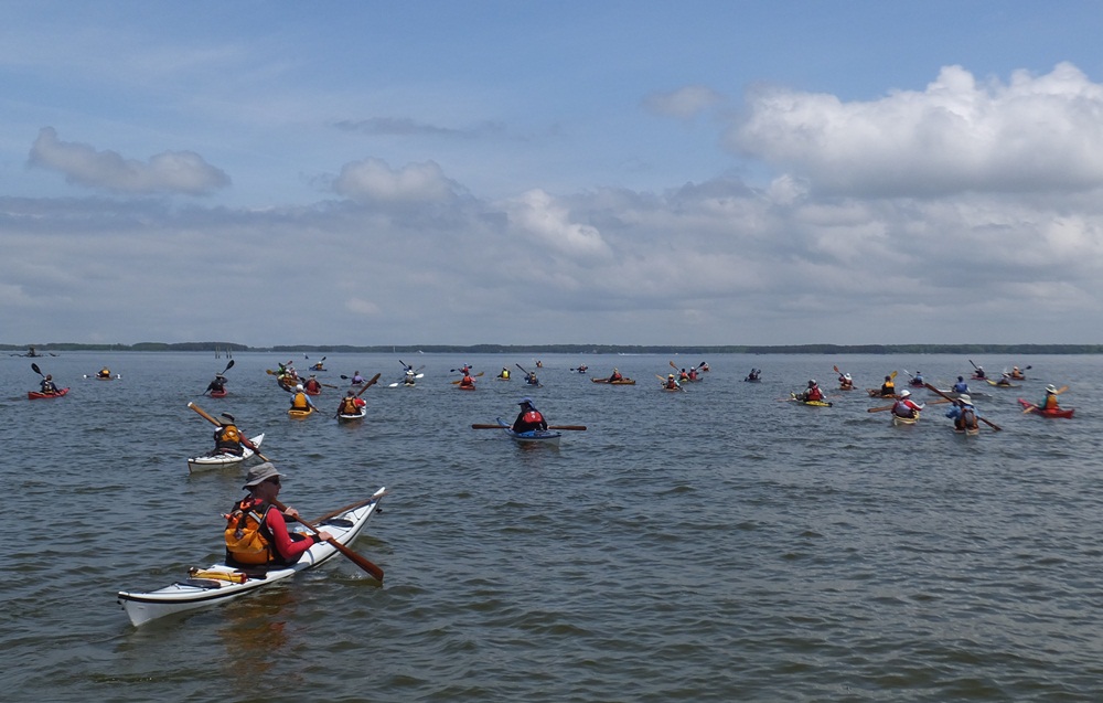
Our next stop was the northeast side of Parson's Island. The last time I was there was June 8, 2014 to look for cownose rays. We stopped for lunch there. In my opinion, the most impressive feat of the day was when Jim had us all cross the channel between Parsons Island and Kent Island. Leading kayakers has been compared to leading cats but Jim did a great job of communicating just how important it was for us to cross as one cohesive unit. He lined us up and we were off at a nice steady pace. Awesome job Jim! Back in Crab Alley Bay, we did a little follow-the-leader. Closer to the take out, we did some skills practice. We got back in our groups and tried a T-rescue and heel hook re-entry. I watched the others go and thought how I would do a rescue from a SUP. Then Renee let me rescue her. I got her kayak on top of my SUP and then turned it over to drain the water. But the SUP is quite low so not much water came out. I just had to lift her kayak a few inches using a little brute force and then the water came rushing. I held onto her kayak and she used the heel hook to get back in. I was thinking that it might also work if I got into the water, held onto my SUP and the kayak to keep them together, and then let her climb up on my SUP to use as a platform for re-entering her boat. The SUP is very easy to get back onto from the water and I think the kayak would be pretty easy to get back in from the SUP. Here's a pic from Ben M. 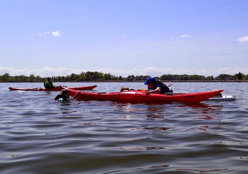
Diana demonstrated a nice roll which she got on her second try. Click the image to start the video. 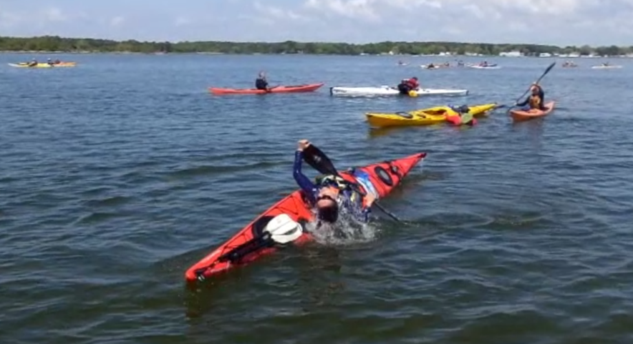
I paddled back to my car, again avoiding the ramp. I just got out in the shallow water and lifted my 29 pound SUP onto the parking lot. I took a few photos and then helped the other paddlers land and get their boats loaded. 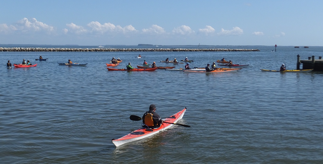
My global positioning system (GPS) said we paddled 10.25 miles. Marshall was still out on the water doing skills practice so I thanked Jim for leading and made a note to thank Marshall via e-mail when I got home. I rushed out, hoping to have enough time to mow when I got home. Much to my disappointment, traffic was backed up. What should have taken 45 minutes turned out to ba a 3.5 hour drive! The truck was carrying wooden pallets. Green says nothing hazardous spilled during the crash, and nothing fell off the bridge. Crews were using a tow truck to clear the tractor-trailer, and the bridge span reopening close to six hours later. - from "Delmarva Now - Tractor-trailer crashes, overturns on Bay Bridge" (broken link as of 2026) After I crossed the bridge, I noticed that traffic heading east was backed up about seven miles. That reminded me of when my friend Stacy swam across the Chesapeake Bay and her son drove across to meet her on the other side. But it turned out traffic was bad and she beat him. I got home and loaded up my tandem kayak for some paddling tomorrow. See my May 10, 2015 blog for that adventure. Some people have asked if I have circumnavigated Kent Island on my SUP. The answer is no, not yet. But there is a good chance I will this year on my own. I've gotta get my money's worth out of the one year Queen Anne's County launch permit, right? I've already done two 30 mile day trips on the SUP so I think I am ready. |
|
After a full day of paddleboarding the previous day on May 9, 2015, I decided to round out my time on the water by getting out on the kayak. The two trips had nothing in common. Yesterday was open water with a lot of people and my SUP. Today was a narrow creek with Norma and my Ocean Kayak Cabo tandem kayak.
The two of us launched from Carrs Wharf. We were on the water at 0810 to take advantage of the high tide (around 1000), which would allow us to explore narrow creeks more easily. The last time I was in that area was July 12, 2014 for some hiking. It was a beautiful, natural place but also one full of deer flies. So I figured that exploring today would be much nicer. I was right. We had no problems with biting insects. We paddled south to Locust Point then west along the shore. It didn't take long before we were paddling next to the Smithsonian Environmental Research Center (SERC). As one might expect, the place was very scenic and peaceful. Here's a view taken somewhere near Boathouse Creek. 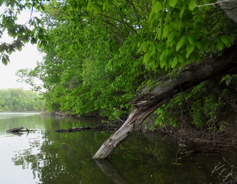
Soon, we found ourselves in Muddy Creek. Norma and I saw a couple of bald eagles. 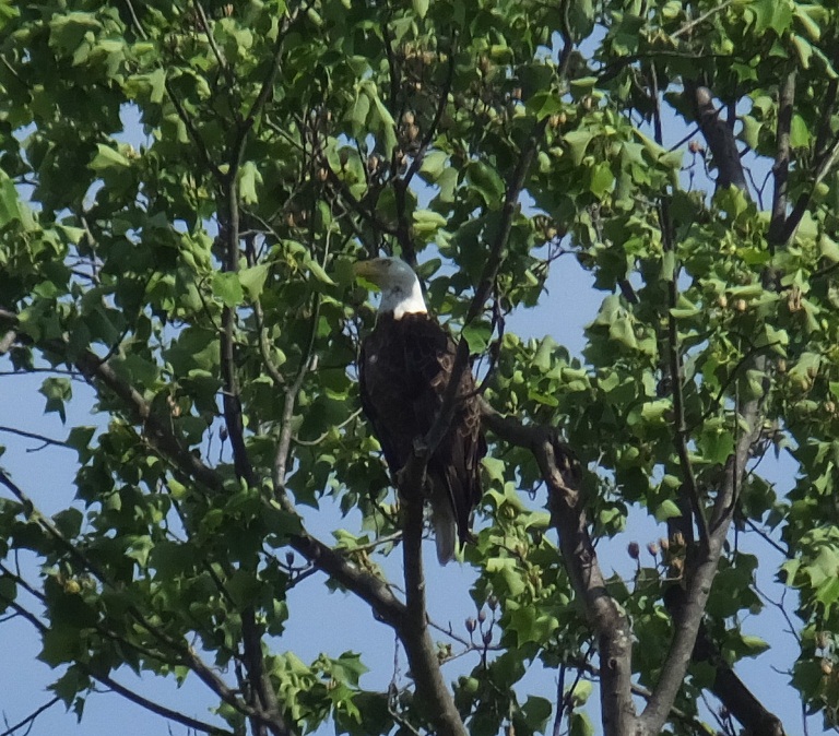
If you plan to paddle this area, please check out the SERC trail map. Note where the fish weir is. We were able to paddle over certain spots of the weir because the boat I brought did not have a skeg or fixed rudder and because it was near high tide. But the best way to get through the weir is to look for SERC sign #10 on the north side of the weir, close to Hog Island. Looking upstream, to the left of this sign (south of it) there is a small opening through which a kayak can easily fit and where there are no underwater obstructions. 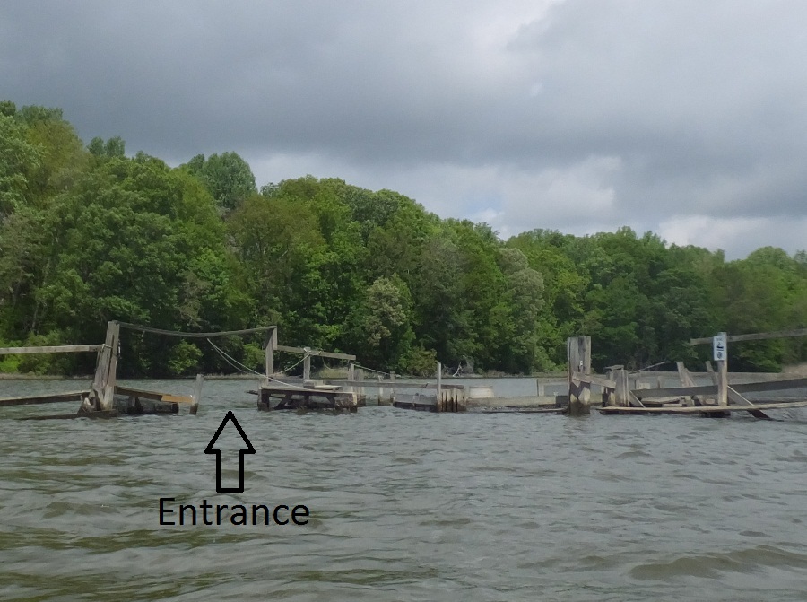
Now we were paddling up the narrow and most scenic section of Muddy Creek. This is not a very long stretch so paddle slowly to savor the moment and enjoy the scenery. From the start of the weir, it is only 0.75 mile to the canoe shed near where the creek splits. We paddled up both sides of the split until it would have been difficult to turn around had we gone further. One can only go about a quarter of a mile upstream from the canoe shed at high tide. A couple of muskrats swam in the distance. On the south split, we found a baby snapping turtle swimming on the surface. We stopped at the canoe shed for lunch. From there, we had a nice view of the north split. 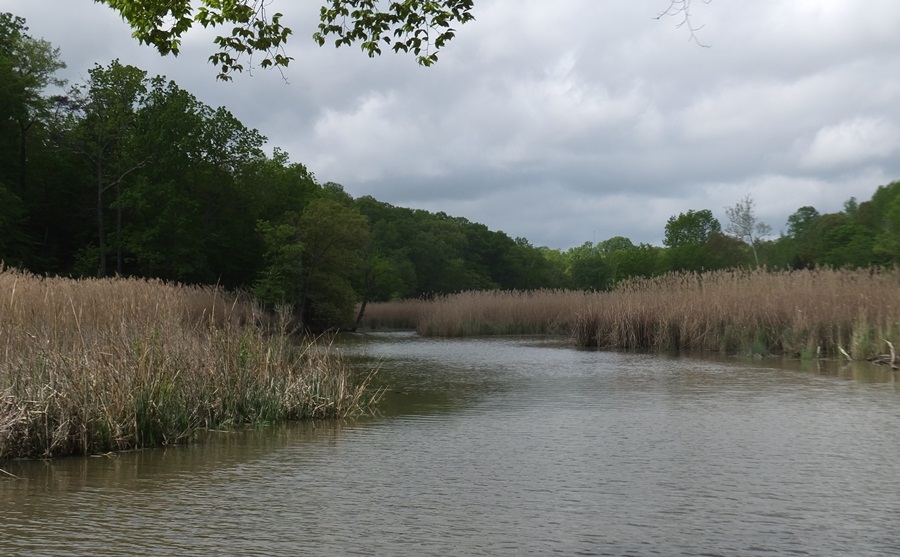
I spotted a red-winged blackbird amongst the grasses. 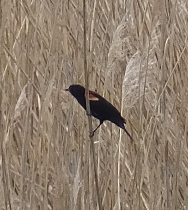
Some large fish (probably carp) were spawning. There was a lot of splashing taking place in the water. Eventually they found their way under the pier where we stopped for lunch. Banging against the pier was enough to scare the bejesus out of me. On the way back, the wind picked up a bit. We explored Fox Creek and then cut across from Contees Wharf to Flat Island and then back to where we started. We got in an easy and scenic 9.25 miles in four hours. If you enjoy being out in nature without driving too far from Annapolis, then I recommend this trip. Rather than head straight home, we stopped in at Historic London Town which was only 5.3 miles away. We were last there during the winter for a really fantastic guided tour. The historic grounds were impressive, but back then, not much was in bloom. Today, that was not the case. Here's a magnolia flower. 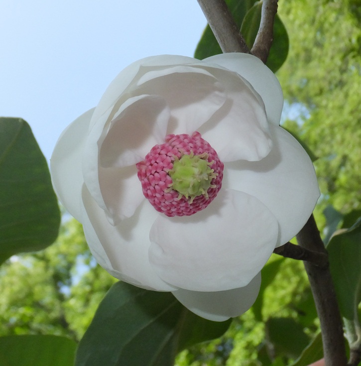
From one of the trails, I had a nice view of the South River, where I have paddled countless times with the Pier 7 Piracy (now the Pirates of Arundell) of the Chesapeake Paddlers Association (CPA). 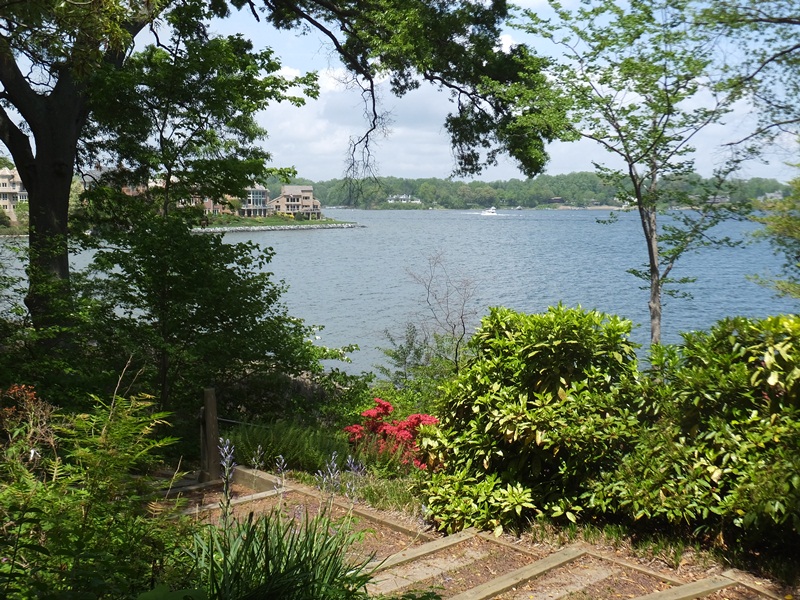
There were many lush ferns and a few interesting insects, though none were biting. Part of the place was being used for a wedding. We were home by mid-afternoon...enough time for me to mow. This is my favorite time of year and there is nothing I would rather do in May than be outdoors...especially in beautiful Maryland! |
|
I spent the morning doing volunteer work, helping organize the Savage Fest sausage sale fundraiser for my Marine Corps League detachment. I got a lot of stuff done and decided to reward myself by spending the rest of the day on the water.
This probably worked for the best since the morning was cool (in the 50s) and the afternoon would be in the 60s and 70s with little wind. Getting a late start meant that I missed the mad rush to the eastern shore. I drove out to Madison in Dorchester County. This is actually where I intended to launch on May 3, 2015. I was on the water by 1500. I paddled north on the east side of Madison Bay. There was something silver sticking out of the water and moving around. Upon closer examination, it turned out to be a needlefish with its nose out of the water. It did this for several minutes until it got tired of me following it around, trying to take its picture. Then it swam off. It did not appear to be injured. I've seen dozens of needlefish in the past but have never seen one exhibit this type of behavior. I don't know what it acted this way. 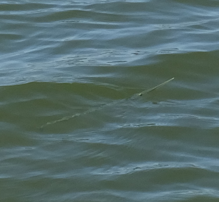
Much of the water was shallow and clear. I could see ripples in the sand at the bottom. 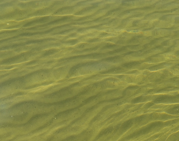
The areas between two and three feet deep seemed like a prime location for seeing rays and skates. Indeed I saw them...48 to be exact, throughout the day. Most were cownose rays though I did see a few skates. At least half of the ones I saw that day were in Madison Bay. Here's a group of three rays swimming like a formation of fighter planes. It really does look like they are flying in the water. A group of four was the most I saw together. 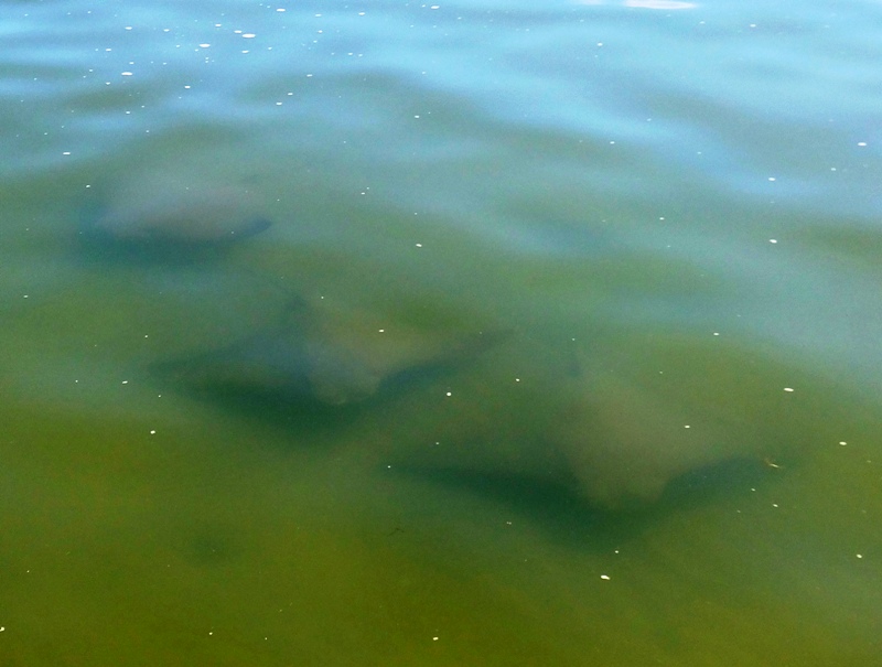
I rounded McKeil Point and then headed east up Fishing Creek. The whole time I kept the shore to my right. I was still seeing quite a few rays/skates. The day was lovely...sunny and not very windy. There were quite a few personal water craft out but they kept their distance from me. Overall, the place was not very crowded for a holiday weekend. I made my way up Church Creek. 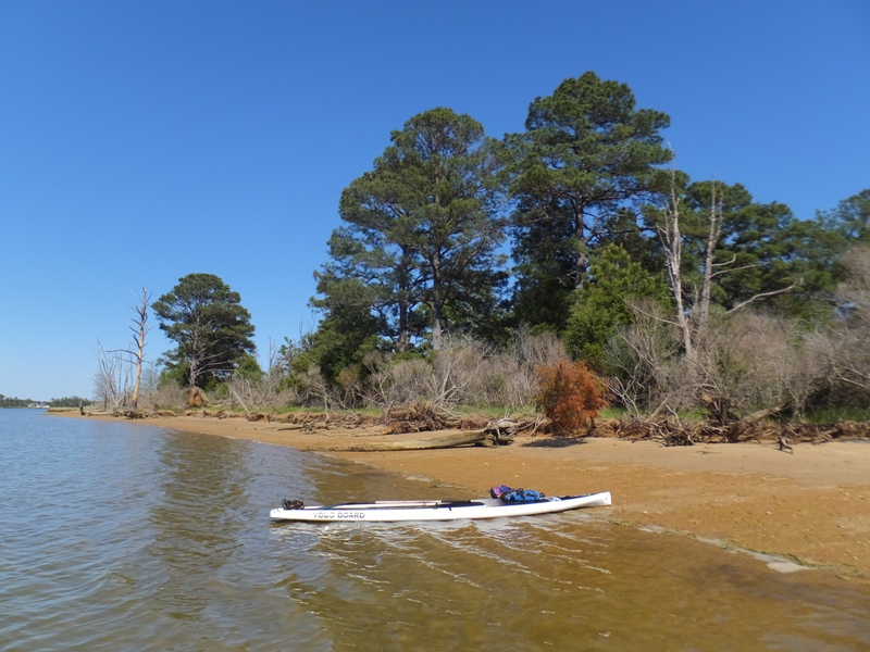
I turned around in the town of Woolford at Taylors Island Road (route 16) just west of Harrisville Road. I would have kept going but I wanted to be back before dark. On the return trip, I explored the opposite side of the water. I counted ten turtles swimming. On the north side of Fishing Creek across from Cherry Point, I saw what I think was an otter or a nutria. At first I thought it was a log because it wasn't moving. As I got closer, I saw a tail that was clearly not a beaver tail. This mammal sat much higher in the water than a muskrat and also looked bigger than a muskrat. I did not see its face. It dove under before I could get a better look. I saw about five kayakers and no other paddleboarders. One kayaker was moving pretty fast in his small boat. He was heading up a small tributary on Fishing Creek. I tried to follow him but it got too shallow for the fin on my SUP. 
I ended up getting in about 18 miles by the time I got back to Madison. I had some time so I then explored some of the east side of Madison Bay, paddling out towards Johns Point. It was deeper and more natural. I finished a little before 2000, having put in a bit more than 20 miles. I stopped in at the Woolford Country Store at 1614 Taylors Island Road (route 16) in Woolford for an Italian sub sandwich before venturing home. Traffic on the way home was a light as it was driving out. |
|
Yesterday and today, my in-laws Jimmy, Joyce, and their daughter visited with their foster child Aalisha. I took Jimmy out for some easy kayaking today.
We launched at Solleys Cove. He was in my Cobra Expedition while I paddled my Prijon Catalina. We kayaked north on Curtis Creek, exploring the shipwrecks in Curtis Bay. I believe the last time I did this trip with another person was May 19, 2013. It was just before lunch, which was nice since low tide was around 1300. I saw a muskrat while we explored a small, unnamed, very natural and shallow cove a little south of Arundel Cove, which we paddled up a little later. I took Jimmy to the wrecks just east of Walnut Point. 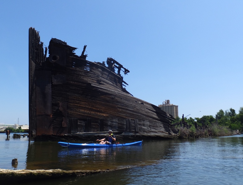
We then saw the wrecks just north of Stahl Point. 
Jimmy and I saw a black-crowned night heron. 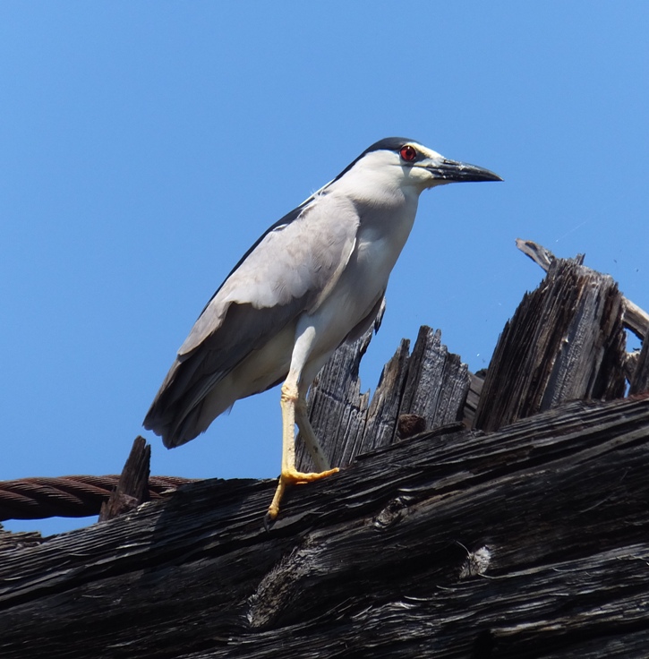
In Solleys Cove, we paddled up as far as we could until it got too shallow to continue (see below). We saw a bald eagle there. 
Jimmy and I finished, having completed 6.7 miles. |
|
I took the day off. I was feeling like a big weight had been lifted from my shoulders a few days prior now that Savage Fest 2015 was over. Norma and I had both spent countless hours preparing for it, her as committee co-chairperson and me as Savage Fest committee member and chairperson for the Howard County Marine Corps League grilled sausage fundraiser at Savage Fest. We both still have work to do on this but there is now considerably less stress and we're prepared to relax a little.
Rather than sit around at home, I decided to do something active. Every year since 2006, I have been doing a physical challenge...something I now call the "Saki Challenge." On September 8, 2006, I did my first challenge which was to circumnavigate Kent Island via kayak. I used my surf ski and did it in six hours and 28 minutes. Today, I decided to do it again using my SUP. I checked the tide and the forecast. It wasn't ideal but it could have been worse. It is rare that it would be ideal. Kent Island can be a rough place to paddle long distances because there is so much open water and unobstructed wind. What might be a light breeze in other places can kick up some waves around the Island. The route I chose was one that I figured was do-able and fairly neutral in terms of the wind and tide. First, I locked up my bicycle at Romancoke Pier. This would be my bail-out point in case I didn't think I could complete the trip. Next, I drove to Matapeake State Park where I launched at 0805. Perhaps I should have started sooner but as I've grown older, I've learned that the Holiday Inn Express commercials are so true...one should "never underestimate the importance of a good night's sleep." I paddled north in the Chesapeake Bay, heading clockwise around the Island. I made it past Love Point (north end), where the low tide was at 0727 and the high tide at 1314. Then I paddled up the Chester River. I had it easy up to Kent Narrows. Prior to that, I was often moving at 5+ mph. Then had to fight the tide to get through the Narrows. I worked really hard and only moved at 3.5 mph. The flood tide was forcing all the water north through the Narrows. If I had to do this again, I would definitely avoid this. At the Narrows, low tide was at 0654 while high tide was after I padded through, at 1208. South of the Narrows, I paddled south through Prospect Bay where I still had to work pretty hard. As I rounded Normans Point, I looked seven miles across Eastern Bay to Long Point. It was so far away, it seemed like I was paddling across an ocean. To make matters worse, the supposed south wind was really southwest so I had a headwind. It wasn't terribly strong but since it was unobstructed beyond the horizon, it kicked up a lot of waves and really slowed me down. I was still moving at a mere 3.5 mph. After Long Point, I had another 2.5 miles to get past Kent Point, the southernmost end of the Island. Here, high tide was at 1118 while low tide was at 1755. So I fought both the wind and the tide for this 7+2.5=9.5 mile stretch. The wind forecast was supposed to have been from the south but I think it started from the southwest and then changed to the south. Forecast speeds were as follows: The whole time, I drank a mix of 50% Gatorade and 50% water. Usually, my triceps start to cramp up around mile 20 but today they did not. Thank you Gatorade! I began paddling north for the final 9.5 mile stretch. Now the wind was stongest and it was to my back. It kicked up waves that allowed me to surf, obtaining a maximum speed of 7.1 mph. But surfing can be tiring, especially after paddling 27 miles. Over the last couple of miles, when the waves were biggest, I tried not to surf, since it just took too much concentration. I almost lost my balance once. I was surfing and then heard a dog barking. I turned to look and saw some women in bikinis on the beach. They looked nice from afar but far from nice. It was enough to break my concentration and then the SUP started to wobble uncontrollably. I quickly lowered my center of gravity to regain control. I finished around 1640. It took eight hours and 34 minutes to complete my 34.75 mile journey. My moving average was about four mph. I was hoping to do it in eight hours or less. Under better weather and tide conditions, I am sure I could have met my goal. I picked up my bike and headed home. I was exhausted but felt fairly recovered by bedtime. I was sore over the next couple of days but nothing terrible. Circumnavigating Kent Island isn't a fun trip. The scenery isn't that great. So why do I do it? Because it is a good challenge. I last did it nine years ago. I don't think I need to do it again any time soon. In fact, that is as far as I would want to paddle in a SUP for a day trip. |
|
My June 10, 2015 trip was rather challenging and more work than fun. So I figured I'd make this trip one that was easy and scenic. Normally, I would have done it on the next weekend day but I was instead going to spend that time working at my sister-in-law's farm. Thus, I worked a short day during the middle of the week and left right after work to go play.
I was planning to paddle the upper section of the Chester River. But things didn't quite work with the weather or the tide. In fact, I was getting totally conflicting wind reports which made me feel uneasy about the trip. So I planned for something where the weather was a little more predictable. Almost every time I head out to the eastern shore, I pass over Skipton Creek. I've seen this on the map but never took the time to explore it. It wasn't as far away as a lot of places I've paddled and I just figured I'd eventually get around to it. Today was that day. I drove on Wye Mills Road (route 662) to my destination. Along the way, I passed Wye Island and Wye Mills. I also saw Wye Mill Pond which drains into Wye East River. I thought to myself that launching from the dam at the pond and doing a one way trip down Wye East River down to Wye Landing might be nice. I could do a bicycle shuttle back to the car if I did it alone. It would certainly be very scenic and natural if it wasn't too much work. Checking out all the historic stuff around there could be great too. I added this to my unwritten "to do" list. I ended up launching at Wye Landing just after 1600, but heading south and then east rather than north on the Wye East River. This put me on Skipton Creek. I followed along the left side. I saw several huge, beautiful homes on gigantic lots. The homes were pretty spread out and set back from the water while numerous trees kept the area from feeling like a waterfront property development. Instead, it felt pretty natural. I suppose that was partly due to the fact that it was a Wednesday and there was nobody on the water except me. I had the whole place to myself. I came to Mill Creek. I paddled upstream (north) on it. The water was a little shallow in many places. Fortunately it was near high tide. I wouldn't recommend paddling around this area if it was not. I was on my SUP but if I were to return, I would bring a kayak since my fin is rather long and likely to hit bottom. Numerous bald eagles flew out from the trees at various times. I can honestly say that I don't think I have ever seen so many eagles in such a great concentration. It seemed like there was rarely a 10 minute period where I didn't see at least one. I'm guessing I saw 10-13 eagles but it is hard to say since multiple sighting are often of the same bird. The further I paddled upstream, the more scenic things got. 1 / 5
Lots of greenage.
2 / 5

Tall trees.
3 / 5
End of the line.
4 / 5

Wood duck box.
5 / 5
Cattails.
I saw a mother wood duck with ten chicks. 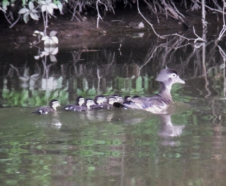
At 38.896774, -76.080662, I found a great blue heron rookery. It wasn't a large one. I only saw about eight herons though there could have been many more hidden amongst the greenery of the trees. What caught my attention were the sounds coming from the trees. Turn up the volume on your speakers and listen to the video I shot below by clicking on the image. 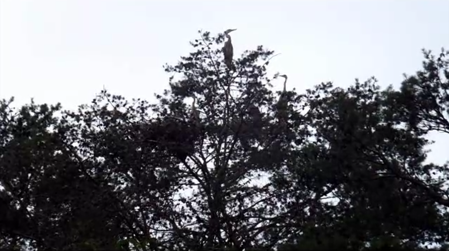
I read about herons at The Cornell Lab of Ornithology - All About Birds - Cornell Herons. The herons that they studied laid eggs in late March and April. They reported that Great Blue Herons usually incubate their eggs for about 26-29 days. Their study indicated that they left the nest in late June or July. If the ones I saw were similar then they should be ready to fly off any day now. Indeed, the young herons I saw were quite large...almost as large as the parents. I've seen documentaries of parent birds feeding their offspring by regurgitating into their mouths but today I got to witness it first hand. Click the image below to start the video. 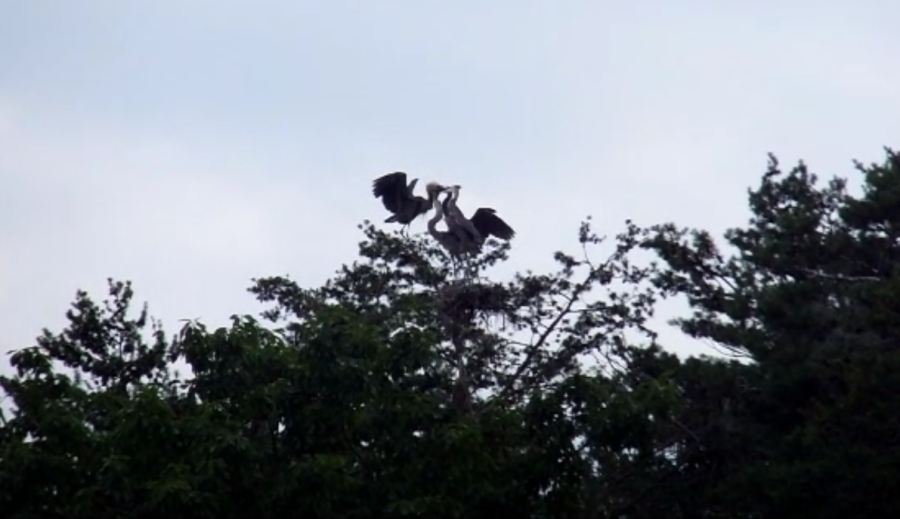
Here's some other images of the feeding. I said good-bye to Mill Creek and continued upstream on Skipton Creek. I passed Skipton Creek Landing. If I were to return to this area, I would continue further up Mill Creek and other narrow tributaries with a saw, being prepared to portage. Of course, I would again aim for high tide. I saw more muskrats today than any other...a total of nine! The later it got, the more I saw. For the one below, I don't know what it was eating...maybe the stalk of something. Muskrats are active throughout the year. Although they may be seen at any time, they are most active at twilight and throughout the night. - from "Washington Department of Fish & Wildlife - Living with Wildlife - Muskrats" (now a broken link) I explored a couple of scenic, narrow tributaries of Skipton Creek. Both took me under highway 50. Under the bridge, I saw a large turtle. Not sure what kind. On one of these waterways, I found what I believe was a cardinal nest with eggs. Downstream on Skipton Creek, I saw greylag and swan geese. The greylag are the four in the front while the swan geese are the two in the back. 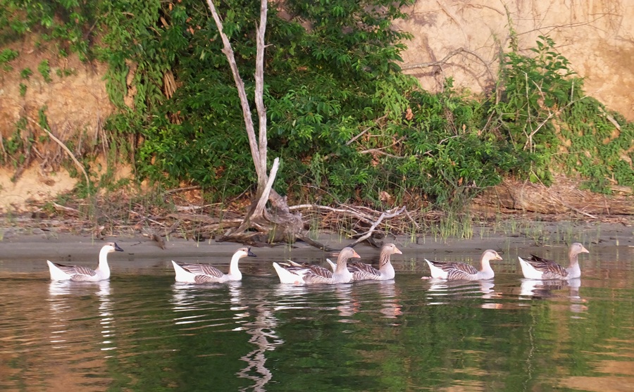
I typically paddle in the morning. This allows me to stay out for a long time. But there are advantages to paddling around dusk. In addition to seeing more muskrats, I can also see raccoons. This was actually one of two that I saw. As the sun began to set, I started making my way back to the launch site. I looked behind and saw what I thought were a whole bunch of black vultures. But looking again, I saw that they had four feet. I paddled closer and realized they were some kind of sheep or goat. When I got home, I looked up this location and found it is Wye Heights Plantation. Reading more, I discovered that these creatures are American Black Welsh Mountain Sheep. I'm guessing I saw about two dozen. The owner is Mr. Tom Wyman, who is President [in 2006] (and Founder) of the American Black Welsh Mountain Sheep Association and longtime resident of Maryland's Eastern Shore -- [he] first introduced the rare Black Welsh Mountain breed to the United States in 1973. - from Shepherd's Notebook - Rare Black Welsh Mountain Sheep This was an excellent trip. Very scenic, natural, and with lots of wildlife. I spent a total of 4.5 hours on the water and paddled 12.9 miles. For four continuous hours of this trip, I never saw anyone. I really like this feeling of seclusion. |
|
Getting out on the water on a busy holiday weekend isn't something I typically enjoy. But I've found that it isn't so bad if you time things just right. Folks want to drive to the eastern shore on Friday afternoon or Saturday morning but they don't like to get up too early so if I leave Saturday morning, I need to get out early. Then they drive back on Sunday afternoon. If I wait until dark on Sunday night, then traffic isn't so bad.
I made my way to the eastern shore on Sunday after finishing some chores. Then, a little after 1500, I launched from Madison. The last time I explored this area was May 23, 2015. Back then, I saw 48 rays but today I saw none. We've been having a lot of rain and the water wasn't so clear. I wonder if they are usually there but we just can't see them unless the clarity is good. I paddled north on the east side of Madison Bay. I crossed the Little Choptank River and then paddled over to Beckwith Creek where I circumnavigated Cherry Island and a couple of smaller islands. Next, I was back on the Little Choptank heading upstream with some help from the tide. I didn't see much wildlife that day. I think I only saw one or two eagles. I saw an oyster farm. 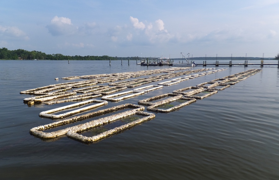
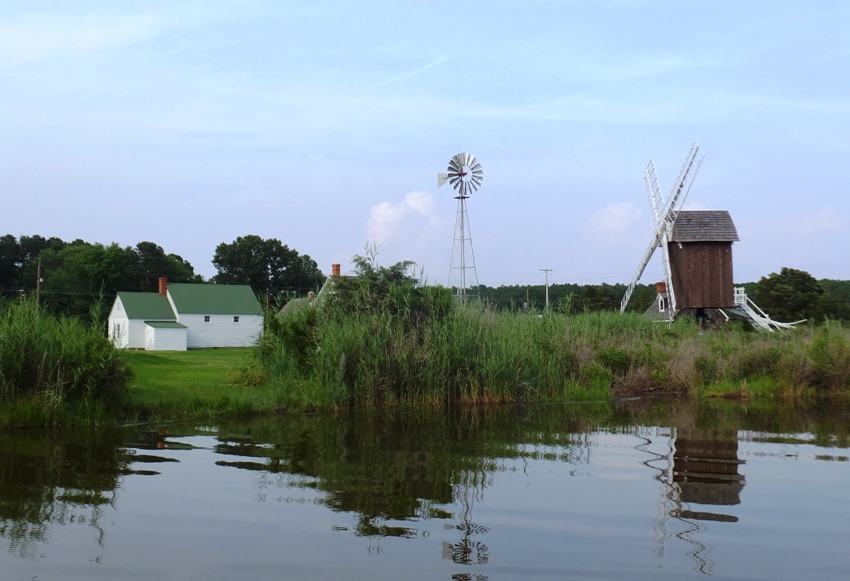
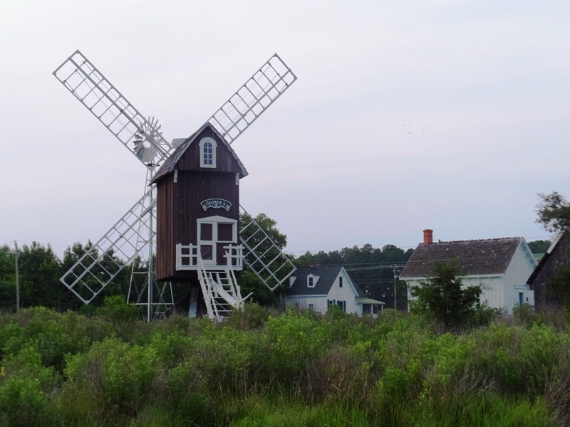
I paddled upstream on Gary Creek. Eventually, I reached my destination, Spocott Windmill. Once a self-contained community, 'Spocott' today has the only existing post windmill for grinding grain in Maryland. Also on the property are a colonial tenant farmhouse and a one-room schoolhouse. Under "fair winds," the mill is still operated from time to time. There has been a succession of windmills at this location dating to the 1700s. A similar working windmill stood near the site until it was knocked down by the blizzard of 1888. This replica, built in 1972 by noted boatbuilder Jim Richardson, contains the original grinding stones and interior steps. - from "Visit Dorchester - Spocott Windmill" (broken link as of 2026) Prior to driving out, I studied satellite photos of the area. There are only two public launch sites in the entire Little Choptank River area. That makes it hard to explore. So I was looking for other places to put in a SUP or kayak. The satellite photos showed a clearing at the water on the windmill property. I thought one might be able to launch there. So I landed. It would be a bit of a carry from the parking lot to this clearing. The place was closed but there was a car in the parking lot. A building near the windmill looked like it might belong to the caretaker. Clothes hung drying on the line. Was this also a private residence? I was under the impression that launching or landing here might not be a good idea. I quickly took a few photos and then headed off. From the water, the view of the windmill and the neighboring buildings was nice. 1 / 5
Clearing on the left.
2 / 5
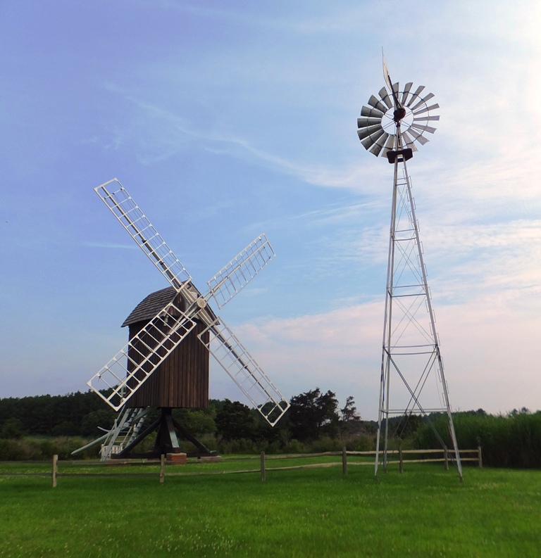
Windmills.
3 / 5
Colonial Tenant House.
4 / 5
Rear of Spocott.
5 / 5
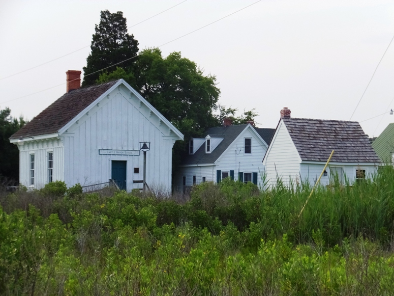
Castle Haven School.
I paddled up Gary Creek a little more. On the east side of the most northern section, it came to a road, right across from Lloyds Volunteer Fire Department, Station 36. There was a drainage ditch here and it looked like there was sufficient room to park alongside the road. It was clear of brush and the ground looked solid. I felt it would be a suitable place to launch and will likely return. The water seemed sufficiently deep but it was also near high tide. Not sure how it would be at low tide. 
By now (about 1800), the water was smooth and I hardly saw anyone else. I paddled downstream and on the south side of the Little Choptank. I didn't get a chance to explore Smith Cove but it looked very natural and undeveloped. I paddled between Town Point and McKeil Point then across Madison Bay. I was enjoying the feeling of solitude, being the only one out on a big body of water. I finished my 20 mile adventure around 2040. As expected, the Sunday night drive home was light. |
|
Norma wanted me to organize a kayak outing for her and the German interns at her office. If it were four or fewer, then we would have been able to just use my boats and two cars but we were planning for five of us which means we had to rent a boat. I made some calls and decided that the most scenic place with boat rental access was Tuckahoe State Park.
The forecast a couple days out called for clear, sunny skies. But the afternoon prior, that changed to 50% chance of rain. Bummer. The night before, Norma's interns, Julia, Jana, and Katharina, came over for dinner and spent the night. That made it easy for us to get an early start. I drove out extra early and picked up my friend Stacy and her Cayuga 130 Old Town kayak. She was having some car issues so she wasn't able to transport her boat on her own. The two of us made our way to the park where we were met by Norma and the interns. I invited three of my male co-workers to join me: Mike B., Mike D., and Wahab. I had no takers so it was just me and five good looking chicks. It rained on the drive out but it stopped by the time we arrived. I think this worked in our favor because it seems like for much of the time, we had the whole place to ourselves. I rented a Pelican Pursuit 100 kayak at the Boat House. They also rent bicycles there. There were several canoes and some kayaks that had seen better days. Most were missing a footwell. The one I picked had a broken hook eyelet which I deemed less important. I launched from the beach right next to the boat house (shown below) and then paddled across the Tuckahoe Lake to the boat ramp to meet up with everyone else. 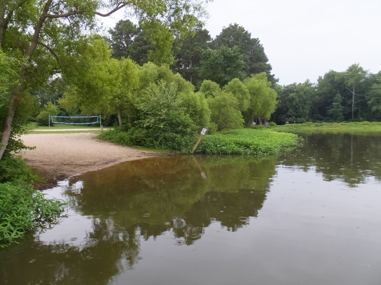
We got the gear unloaded and then I assigned everyone a boat. Julia had the most boating experience of the interns so I put her in the Pelican which required a little more effort than the others to go straight. Jana was in my Prijon Catalina because she is petite and wore a red hat. Katharina wore a blue hat so she got my Cobra Expedition. 
That left Norma and me in the tandem which worked out good because she likes to take photos while I do the work. The last time I did this trip was June 15, 2013. Based on my previous experiences, I promised folks that they would see a plethora of turtles. I would have to eat my words if that was not the case today. The six of us paddled along the north side of the lake heading clockwise. Eventually we found a small opening that we paddled into. Things were looking lush and green. I usually took the lead with Jana or Katharina right behind. The small opening ended up being a dead end so we made our way out and then found the main part of Tuckahoe Creek. We saw three beaver lodges but no beavers. Numerous swamp hibiscii (aka swamp mallows) were in bloom. There were other things in bloom too like buttonbush and lizard's tail. One plant that I saw that I don't remember seeing previously in the area was dodder. Stacy identified several birds and told us about their calls. We paddled upstream on the creek. Unlike the section just below the dam, this area was a bit more open with no downfalls or portages. I'm guessing that has something to do with the fact that it is used so much. On a nice day, the place can be really packed but not this morning. Heading upstream, the only other boats we saw were owned by two fishermen. Julia had the most challenging boat. Stacy eventually swapped boats with her and then I paddled the Pelican on the way back while Julia rode in the tandem with Norma. There were quite a few eastern painted turtles on the logs. As the day warmed up and the sun came out, we saw more. I estimate I saw between 50 and 100 that day! While we saw no beavers, we did see evidence of activity. My term for this is "beaverchew" (see below). Can you see the individual tooth marks? The trunk of this tree was about 14 inches in diameter and the tree stood about 30 feet tall, leaning on another tree. I'm guessing the beaver was hoping to use this to start a dam but gave up when it didn't fall all the way across the creek. 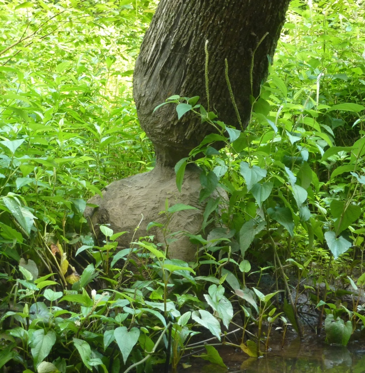
I was having a superfantastic day and so was Norma. 
Eventually, we reached our destination, the park campground loop. Here, we got out, used the campground facilities, and found an open table where we ate lunch. By now, the haze had cleared up and sun was shining brightly so some shade was much appreciated. We paddled back downstream. The current gave us a gentle push and directed us where to go. Without as much need for a leader, I spent more time in the back. 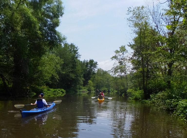
Jana saw a muskrat. Back on the lake, I paddled to the boat house where I returned the Pelican kayak. I was out a half hour longer than expected (I paid for four hours) but I was not penalized. I walked back to the ramp where the rest of the group launched while they paddled across the lake. Norma led the other ladies up the narrow Blackiston Branch for a short distance. This involved kayaking under Crouse Mill Road where there were several swallow nests. There was also a turtle with three nostrils resting on a support beam under the bridge. It didn't look like the other turtles we had seen earlier. I wondered if it was a carnivore and possibly eating the baby swallows. The last time I was there, I saw a different turtle in almost the same location (see June 15, 2013 turtle). A few days later, Stacy identified it as a musk turtle. They are omnivorous (e.g., seeds, insects, snails, tadpoles, algae) and will occasionally scavenge on fish carrion. This species rarely emerges to bask and is most successfully captured with nocturnal trapping techniques. Musk turtles climb surprisingly well and occasionally rest fairly high in trees. - from "Savannah River Ecology Laboratory - Common Musk Turtle (Sternotherus odoratus)" (broken link as of 2026) 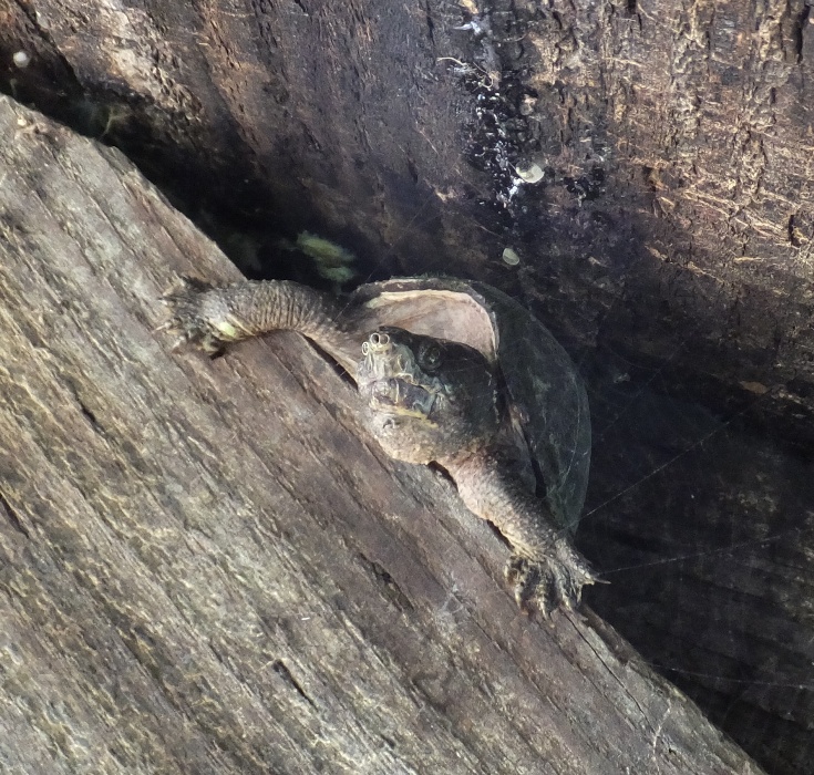
Having completed a very casual five miles, we loaded up the boats and then headed out. Our next stop was Adkins Arboretum. We changed clothes then explored the trails on the shaded east side. We saw paw paw, sassafras, tulip poplar, and hickory trees. Some wild berries were ripe and just asking to be eaten so I obliged. A couple of rabbits ran amok. Next, we drove to the aviary at Tuckahoe State Park. The staff were showing various raptors. These birds were injured and would not survive in the wild. I saw these same raptors earlier this year on March 14, 2015 and April 26, 2015. We were invited into the park office to see a hognose snake, a black snake, and a terrapin. Norma and I drove everyone back to the western shore where we spent the rest of the day in Annapolis. We walked around along the water and the historic section. Then we ate at Chick and Ruth's. The place seemed almost stereotypically American and Marylandish with its huge servings, half pound crab cakes, and six pound milkshake. It was an experience I don't think the interns would get elsewhere. Walking along the water, we saw a couple out on the pier. We walked over and asked the man to take our photo. From left to right are Norma, Julia, Jana, me, Katharina, and Stacy. 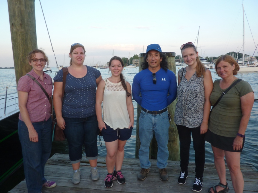
Then this same man asked Norma to take their photo. She took a few. Next, he asked her to take a photo of him proposing to his girlfriend. Norma said, "What, are you serious?!" He pulled out a ring and got down on one knee. Norma was in shock and I had to tell her to take photos. His girlfriend had tears of joy. I assume she said yes through I didn't actually hear her. I regret not having more photos of Stacy on this trip but hopefully she will join us for many other adventures and we will take many pictures of her. |
|
Over the last two weeks, I've been doing some repairs on my Yolo Prowler stand up paddleboard (SUP). I found three cracks and one area that looked like it would be cracking soon. I put a lot of miles on my SUP and I often take it in places that most SUPpers would not go. So it gets its share of abuse. I broke out the fiberglass repair kit and did some work. I'm not particularly good but I think I do a functional job. So today, I was ready to get back out on the water. But where to go?
The previous day, Norma told me about a recent manatee sighting in southern Maryland. On July 15, 2015, the National Aquarium reported the following: The animal was sighted in Saint George Creek, a tributary of the Potomac River near Waldorf, Maryland. While it may seem like an odd occurrence to see these animals in our area, it's actually no coincidence. In the warmer summer months, manatees typically travel up the East Coast from Florida. The Chesapeake Bay is full of sea grasses, choice food for any manatee meal. As temperatures begin to drop in September, these migrating manatees will begin to head back to the warmer waters available along the southern Atlantic coast. - from National Aquarium - Manatee Spotted in the Chesapeake Bay (a broken link as of 2020) While it might sometimes occur, seeing a manatee in the Delmarva area is extremely rare. The most famous manatee to visit our area was Chessie. There was also Ilya. I think I may have tried to look for this one without success. It would have been four days between the initial sighting of this new unnamed manatee and my quest. Would it still be in the area? I did some web searches to see if there were any updates on its location. There were none. So I figured I'd search where it was last seen. I was up at 0500. I drove out to Piney Point Recreation Area and launched at 0740. I was feeling tired, partly from having gotten up so early but also because I spent a significant part of the day yesterday working on constructing a retaining wall in our back yard. But early morning was definitely the best time to be on the water. By mid-afternoon, the temperature would be in the 90s with a heat index of over 100! The water was flat. Wind speed was around three mph. I wouldn't have bothered coming out if that wasn't the case. Under such ideal conditions, I could look across the water and see a telltale nose sticking up above the water. If there was more wind, waves would make such detection very difficult. Hearing the breath of a manatee is another indicator. I paddled upstream on Saint George Creek, keeping the shore to my left. I was in scanning mode so my pace was slow. Osprey are frequently a common sight. But today I saw more than usual. Many of the nests were falling apart, having served their purpose. But the offspring were still not ready to be independent. Many looked to be almost as big as the parents. So on several platforms, I saw three. 
For the first time, I saw an osprey attack a heron. Ospreys and herons weren't the only large birds out. I saw a few egrets and five bald eagles. 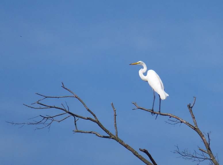
I also saw smaller birds such as about a dozen least terns. The one on the left below is immature. These are similar to the royal terns that Team SNaCk saw on January 20, 2015 in Florida. 
I saw the Piney Point Aquaculture Center. A muskrat swam past me. I found a 14.5-inch long great blue heron feather. I stopped under a tree to eat breakfast and take a nap. The SUP is pretty comfortable for that. My fear is that it will drift into boat traffic while I am asleep and I'll get hit. But I backed it up into an area where the fin dug into the mud, acting as an anchor. So I was safe. I did a pretty thorough exploration of the creek upstream of Saint George Island. I explored its tributaries: Locust Grove Cove, Schoolhouse Branch, and Tarkill Cove. The latter was pretty undeveloped. Then I passed an island off Taylor Point. I expect at low tide it is not an island but instead a peninsula since I had to walk my SUP between it and the Point. 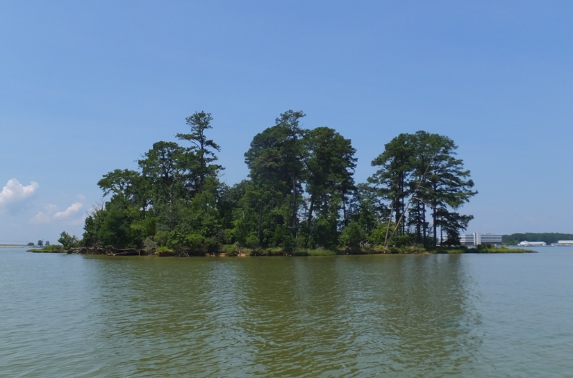
In Taylor Cove, I saw an unusual structure that stood about 35 feet tall. I don't know what it was...perhaps an old radio tower? A bird built a nest behind the disc near the top. 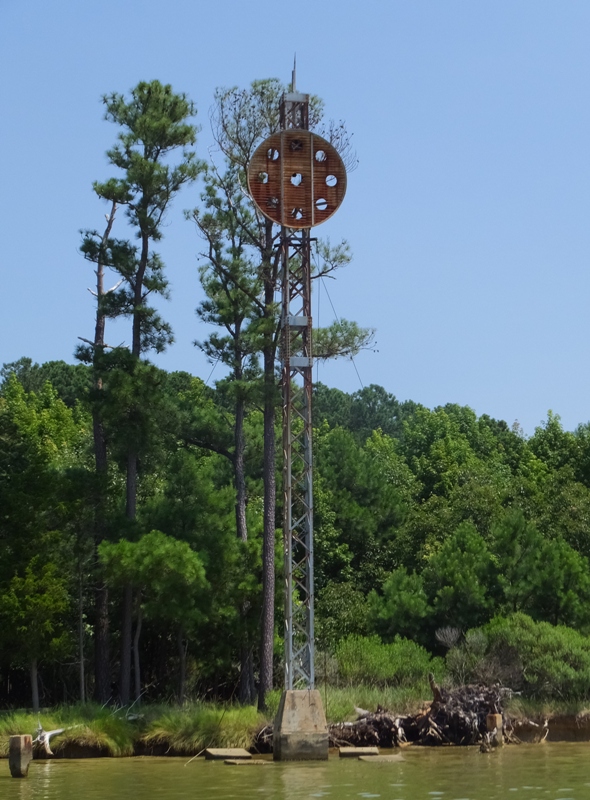
As I neared the end of my journey, I focused my concentration on "sea cow," as if my will could somehow have an affect on the outcome. A few minutes later, I had my wish...but not really. Instead of "sea cow" I got to "see cows" that were grazing along the shore. 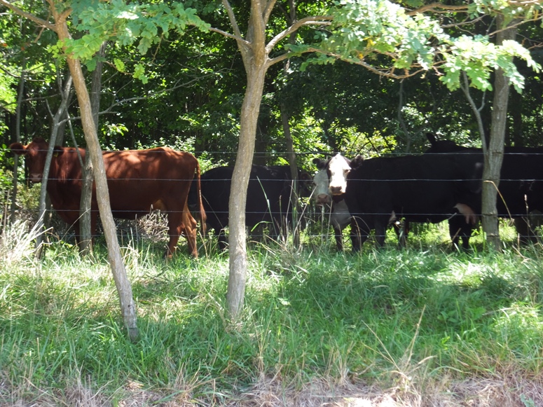
Sadly, I saw no manatee on this trip. I paddled across the creek back to where I started. A lot of boats were making use of the dual ramps and I had to wait awhile before landing. I got in a little over 16 miles over about five hours. It was around 90 degrees when I started up my car around 1300. Driving near Washington D.C., it got up to 98 and then down to 92 when I got home two hours later. The repair work I did on my SUP held up well. |
|
On August 1, 2015, Norma and I went kayaking on the Deschutes River in Oregon. Then on August 3, 2015, I went paddleboarding on the same river.
|
|
Lisa organized a trip that involved launching from Franklin Point State Park. This was rather last minute but I was planning on getting out on the water anyway, and this was a great opportunity to see someplace different.
There aren't many launch sites in Anne Arundel County that I am not familiar with. The reason I didn't know this place is because it is very new. Joining us were Steven, Hank, and Dave L. I saw the latter about ten years ago and we both remembered each other. I scoped out the launch area, which is undeveloped. It is just a wooded shoreline area that drops about a foot into the water. But the ground under the water is reasonably solid and plenty suitable for launching a kayak or SUP as long as it isn't low tide. We unloaded our boats and drove on the gravel road to move our vehicles to the dirt parking lot near the entrance. By about 0945, we were on the water, paddling on a very wide, calm, and sometimes shallow section of Deep Creek. The five of us made our way south as the creek narrowed. 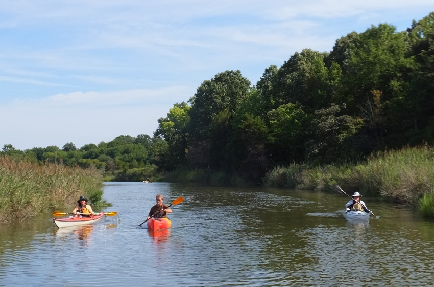
At a split in the creek near what looked like a duck blind converted to a sitting area, we veered left (southeast) to get to the Chesapeake Bay. Had we continued straight, we would have been on Deep Cove Creek. There wasn't much wind, at least in the morning. That is why I brought my SUP. We made our way southwest, ducking under piers. Dave investigated a potential launch site at the west end of Chesapeake Drive near Carvel Street. We found a boat wreck. 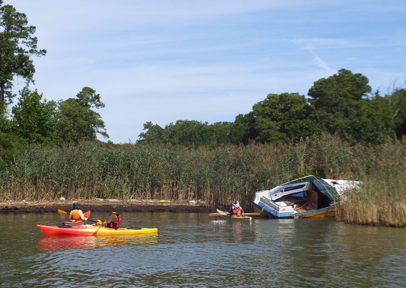
Soon we came to Broadwater Creek which we explored fairly thoroughly, traveling counterclockwise along the shore. It is a calm, peaceful, residential area where the homes are nice but not as mansion-esque as some of the other waterfront houses I've seen in the county. 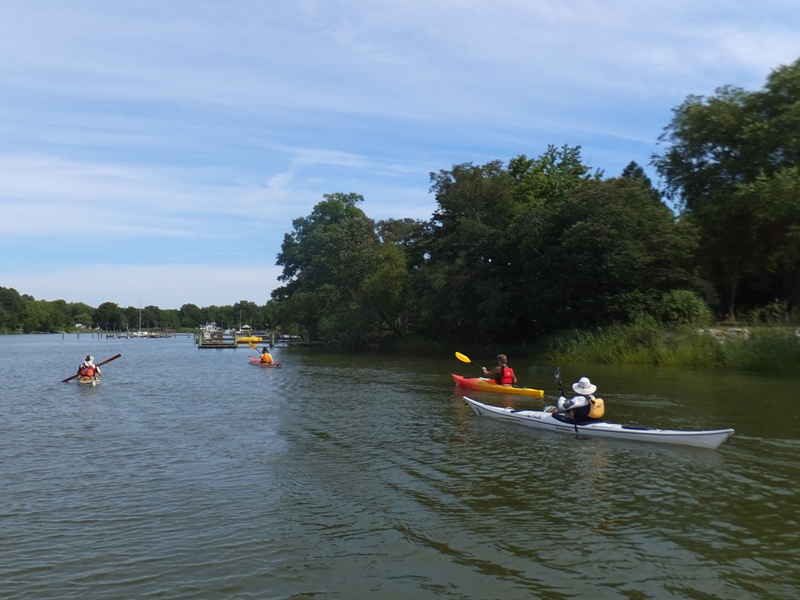
There were the usual ospreys, blue herons, and one green heron. The group checked out a potential launch area where a narrow section of Pasture Cove meets Battee Drive near Broadwater Creek Academy. We continued to explore Pasture Cove. On the west side of Broadwater Creek, we heard crowing. Hank and I went to investigate by paddling up a very narrow creek. Since I was standing, I was able to look over the grasses and see a property with numerous ducks, chickens, and turkeys. 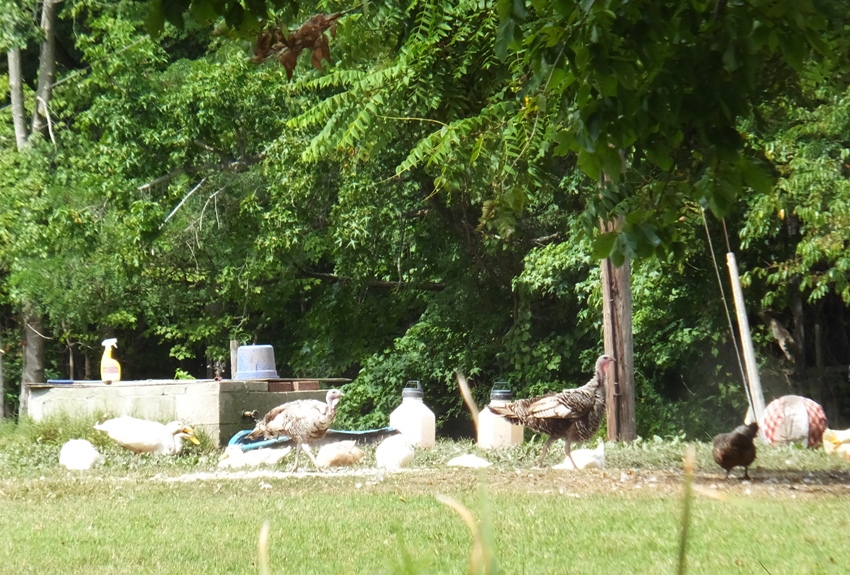
On this same creek, I saw several pink flowers. 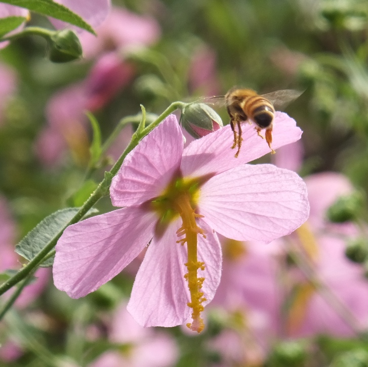
On the south side of Broadwater, I saw a house that used a boat sail as a sun shade. 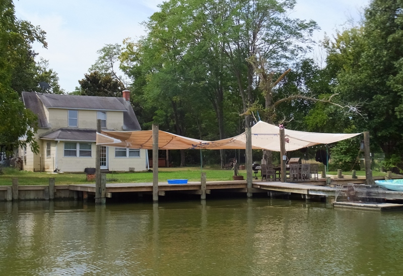
There was also the biggest oak tree I'd ever seen though someone pointed out that the late Wye Oak was even bigger. 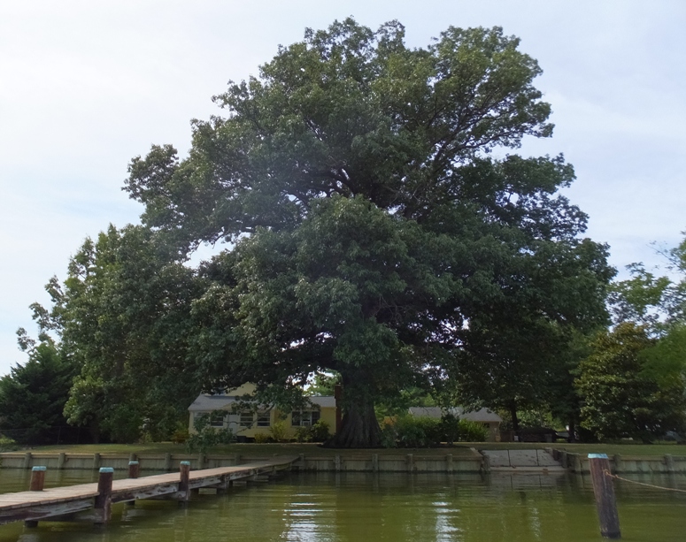
Dave headed back as the rest of us continued south. We passed a band performing some classics. 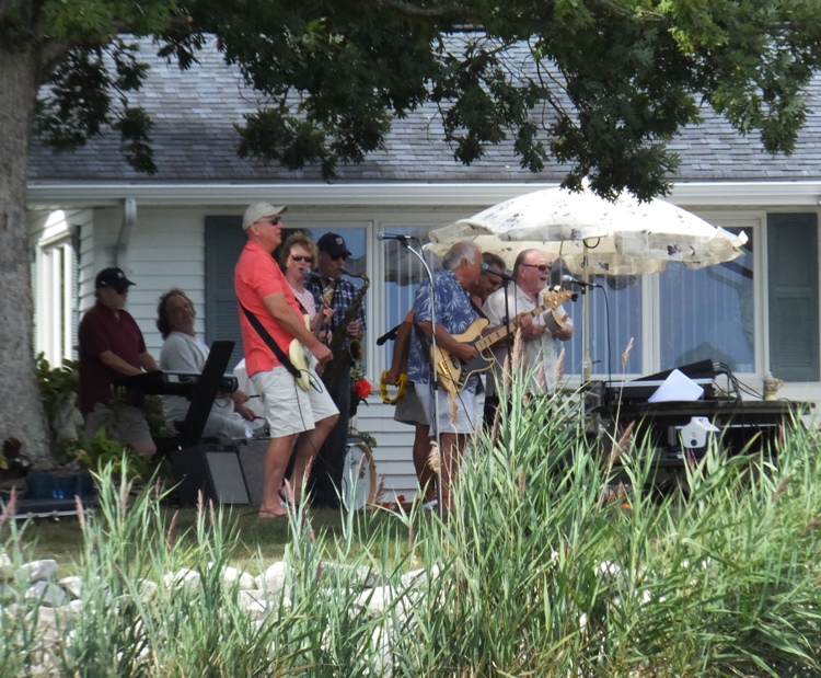
We made a brief stop at an island just off Broadwater Point. 
At this point, I said my farewells. I went around the island and started heading back. The wind picked up a bit and was creating a few waves along with some boat wakes. I decided to take a peek at Deep Cove Creek. I made it to the section where it widened up. I could see that it went a ways further and also got shallow. I vowed to return with a kayak, which would allow me to explore the more shallow sections more efficiently. 
I saw a few needlefish. A 2.5-foot long snake swam in the water. When it saw me, it dove under. I waited until it surfaced and followed it some more until it went under again and I lost it. By the time I finished, I had completed 8.25 miles. I loaded up the SUP and got home in time to join Norma for a get together in our town at someone's house followed by an evening in Baltimore with Carmen. It was a very social day. |
|
I left work early to go paddleboarding on Stoney Creek. Google Maps spells it "Stoney" but Mapquest spells it "Stony". I've seen local businesses spell it either way. I launched from Green Haven Wharf. I try not to go paddling at the same place twice in any given year but this and Broening Park are the exceptions because of their locality and the fact that they make good ten-mile training routes. But today I was not out for training. I decided to explore the creek in great detail and then check out Cox Creek, which I had never seen before.
I paddled counterclockwise along the southeastern shore, leaving no stone unturned. I saw quite a few launch sites but all appeared to be community-owned and not open to the public. It didn't take long before I was at the mouth of the creek at Stony Point (as spelled by Google Maps). I cut across it and paddled northwest. It wasn't particularly windy that day but I was catching the full force of it and its effects out on the Chesapeake Bay. A wall that met the water at a 90 degree angle reflected each wave right back at me, creating a "washing machine" effect. Just before I came to Herbert A. Wagner Generating Station, I turned left (southwest) into Cox Creek. This is a nice place with some waterfront townhomes, a few single family homes with piers, and a good bit of undeveloped land near the power plant. It is very sheltered. I saw an unusually large number of water birds. Not just the usual great blue herons, egrets, and ospreys but also black-crowned night herons and kingfishers. I returned to Stoney Creek and explored the northwest side. Somewhere around Nabbs Creek I met a young boy and his grandmother swimming off their pier. She asked questions about my SUP so I invited them to try it. She didn't but her grandson did. He seemed to enjoy it. I saw about four or five sunken boats including an older one in Back Cove that was about 50 feet long. You can see it at coordinates 39.167549, -76.534721. Though not on par with the wrecks of Curtis Bay (which I last saw on May 31, 2015) or the "Ghost Fleet" of Mallows Bay (that I viewed on June 21, 2014), this particular boat was certainly not insignificant either. At one place near the upstream section of a tributary, I saw a marina with a few houseboats. Two of the wrecks were here. Some of the other boats looked to be in disrepair or just not well-maintained. I thought of the song Redneck Yacht Club. In addition to seeing several birds on Cox Creek, I also saw a pair of mute swans (shown below) and a red-winged blackbird. No eagles. I didn't have my regular camera so I took photos using my new smartphone whose camera is mediocre in comparison. 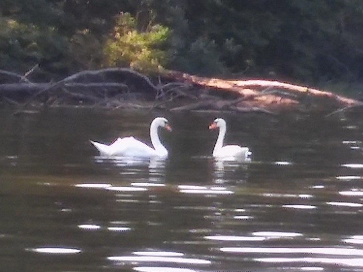
Upstream of where I launched, I saw what I believe to be a Catalpa tree with numerous seed pods hanging off it. It reminded me of propagules on a red mangrove like the ones we saw in Florida. Thanks to Greg W. for helping me identify them. There were about seven kayakers out but no paddleboarders other than me. I finished around 1930 after paddling 20 miles. |
|
After spending some of the summer working on a 2.5-foot high, 30-foot long retaining wall with a five-foot wide staircase, I finally finished on September 16. Norma helped with a bit of the construction.
I had been working a little on the weekends early in the summer but with grass-growing season quickly approaching, I had to get it done soon so the roots would form to help hold the 12 cubic yards of dirt and five tons of gravel in place behind four pallets of fabricated stone. During that last week, I was exhausted and stressed. But now it was time to relax and do what I enjoy. On September 17, I went paddleboarding on the West River, launching from Galesville. The next day, I went roller skating outside in the business park at Annapolis Junction. I had fun but on both days, I felt a little weak. I was hoping to have my strength back for some long distance paddleboarding over the weekend. But where to go? Earlier this year, a 40-45 foot long ship built in the mid-1700s was found on the Nanticoke River under highway 50, near where Norma and I paddled on May 9, 2008. I was hoping to go see the wreck but it was taken to a laboratory in Calvert County for further study. The Nanticoke River area is a place I hadn't seen for a few years. I had the whole weekend to myself if I wanted, so I figured I'd explore that area. My plan was to check out one of its tributaries, Marshyhope Creek. I've only paddled Marshyhope once, back on September 20, 2008. Back then, I launched from Marshyhope Greenway/VFW and kayaked the whole length of the creek south to the mouth and then upstream a bit on the Nanticoke to the take out. I then biked back to my car. Today, I decided I would paddle upstream as far as I could, exploring every nook and cranny along the way. I would then paddle downstream, continuing with a thorough exploration of the area. When I paddled the creek in 2008, I didn't have an opportunity to explore...it was enough just to make it to the take out 20 miles away. I was up at 0600 and arrived at Marshyhope Greenway/VFW at 0830. 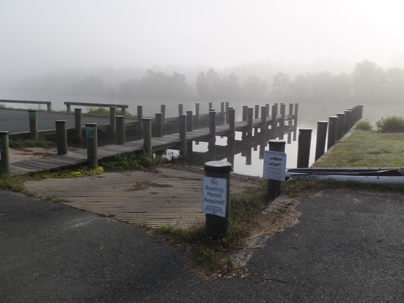
It was foggy and the sun was just starting to break through. Hence, there was a lot of moisture on the spider webs which glistened in the morning light. 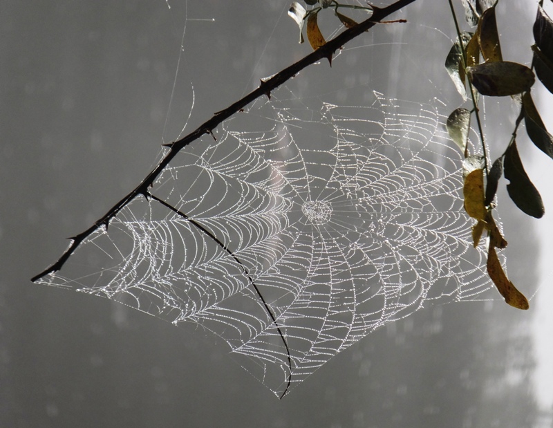
There were a lot of fishermen out (no fisherwomen). I saw one kayaker throughout the whole time I was on the water, though I think he was actually a fisherman with a kayak. I was the only paddleboarder. The town near where I launched is Federalsburg. One thing I like about it is that they have a 2.5-mile gravel trail that runs along the creek from the launch site to Laurel Grove, a section north of town. In addition to Marshyhope Greenway/VFW, there are two other launch sites that I know of. The first is Pocket Park. The second is Federalsburg Recreation Park and Marina. Once I got upstream of Federalsburg, things became quite natural. 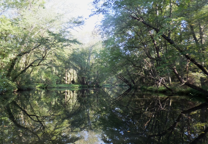
The place reminded me of the Pocomoke River without the cypress trees. The creek didn't follow a linear path. One could meander, come to a dead end, turn around, and continue exploring. It isn't the type of place you want to rush through. Instead, savor the experience. According to my map, I was in the southwest section of the Idylwild Wildlife Management Area. I managed to paddle 2.5 miles upstream before turning back. Returning downstream, I explored a small tributary. I had to lay down to get under a foot bridge which comprised part of the 2.5-mile town trail. I don't think I could have gone under it in a kayak. Unfortunately, the waterway past the bridge didn't amount to much. 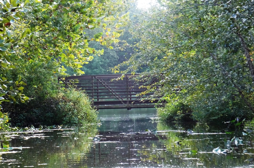
Passing my original launch site, I made my way from Caroline County to Dorchester County. I paddled south, stuck to the right (west) side, and explored everything along the way. I left no stone unturned. With it being near the end of summer, the sun shined low, making well-lit areas extra bright with harsh shadows. There were several tributaries and small islands to explore on the west side of the Marshyhope. I wasn't able to go too far upstream on any of the tributaries. The most memorable thing about the day was how natural everything was. There were a few homes and structures but not many. Marshyhope is a real gem and possibly the best kept kayaking secret in Maryland. I saw about six eagles and ten turtles throughout the day. I also spotted several kingfisher birds. 
But the most remarkable thing I came across was a school of about ten gar. The largest was about three feet long. As I got close, they darted off, stirring up the water. In the past, I've had similar encounters with big fish I couldn't see. I assumed they were carp but perhaps some were gar. 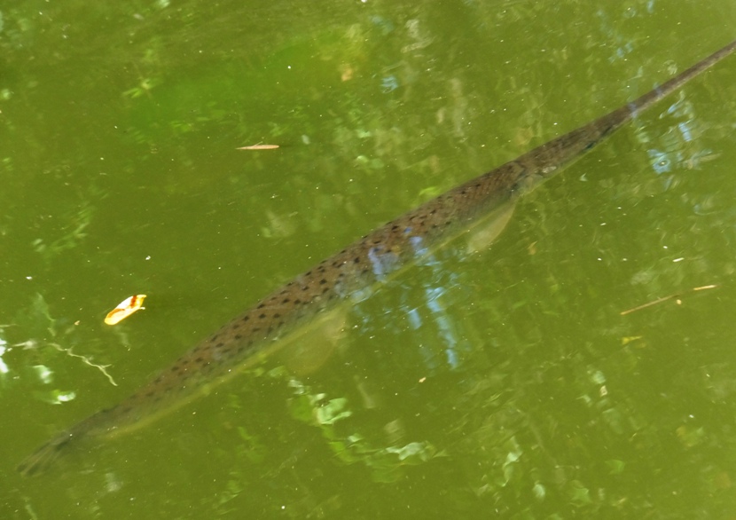
I also saw a few needlefish that day. There were an unusually large number of ducks out. I believe hunting season is near. In one narrow tributary, I viewed the remnants of an old beaver dam that had fallen apart. As the creek widened, acres of spatterdock lined the edges. Boat traffic can be pretty speedy on the main part of the creek though it wasn't frequent. I was hoping to feel more energized than I had in the last few days but I was not. Still feeling rather weak. I decided to turn around at Brown's Landing (shown below), which was 3.5 miles downstream of where I started. 
I'm guessing Brown's Landing and Brown's Wharf resided very near each other. Probably Federalsburg's earliest industry and certainly its most picturesque one was shipbuilding. The surrounding white oak forests supplied all of the necessary building materials. As the water was too shallow for these ships to be launched at Federalsburg, keels were laid at many different points in the southern part of the town. Upon completion, they were conveyed to Brown's Wharf, a landing four miles farther down the river. From there, they were launched, laden, and began their career as bay and river trading vessels. This industry ceased at Federalsburg sometime before the Civil War. River traffic began with Baltimore, as with some other small towns on the Chesapeake. Heavy scows were loaded with goods and pushed down the river by four or five muscular men using long poles. At Brown's Wharf, they were reloaded onto schooners and other sailing vessels and sent up the bay. - from "A Short History of Federalsburg" (broken link as of 2018) I crossed the creek and started heading back. I was fighting the tide but at least I had the wind to my back. Under a tree, I took a 15-minute power nap on my SUP. I put one end of my paddle over a branch and the other end under my leg while I slept which kept me from drifting out into boat traffic. There weren't nearly as many places to explore on the east side of the creek. I saw what looked like an old beaver lodge. 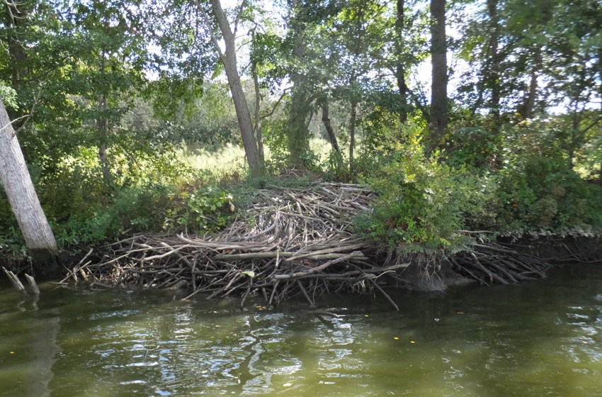
A little south of Davis Millpond Branch, I was expecting to see an opening on the east but did not. I turned out that while my GPS and map showed this body of water connected to the creek, that was not the case. I pulled ashore, then made my way through some briars, got scratched up a bit, and found a large pond. Slighly further north, I saw a pile of rocks on the shore with water shooting out about ten inches high. At first I thought it was a spring but the GPS indicated another large pond just over a berm. I figured water was leaking out. A satellite photo showed this pond to be unusually light green in color. I wondered if it was a quarry. 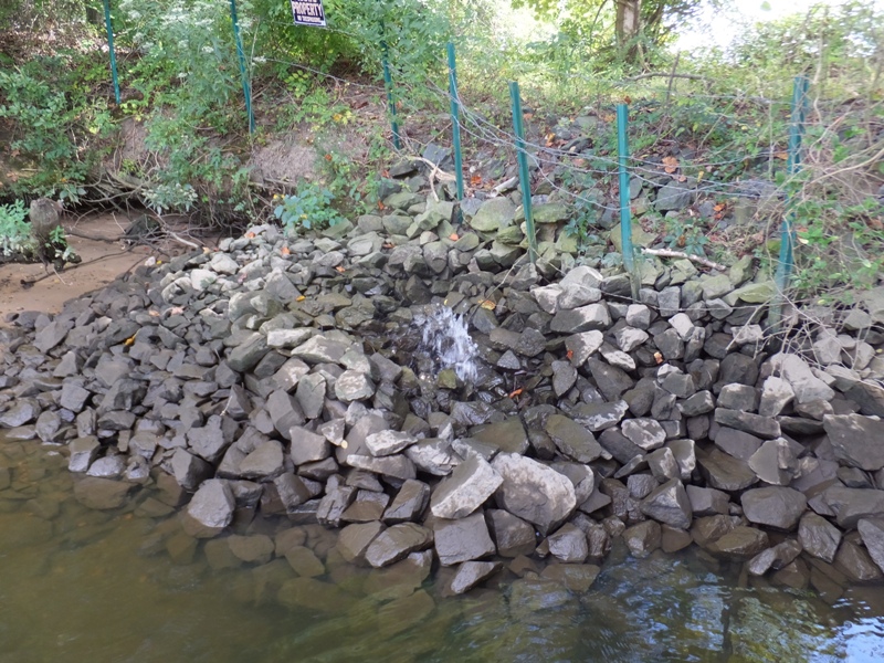
I arrived back at my launch site after being on the water for a little over six hours. I paddled a mere 16.5 miles. I was really taking my time because I was feeling weak, exploring shallow areas, and taking in the scenery. I spent the rest of the day exploring the surrounding area. I scouted for launch sites and explored Federalsburg. I was hoping to find someplace further south of where I launched on Marshyhope. After well over an hour of searching, I came up empty-handed. I did check the bridges but the shoulders were too small near them for parking. It is a shame that in Caroline County there are so many places to access the creek, but as soon as one enters Dorchester County, there is nothing. It is such a beautiful place that begs for exploration. Unlike Ed Gertler, I give this place an "excellent" rating in terms of scenery; he gave it a slightly lower rating. On a power line structure not far from Brown's Landing and just off Palmers Mill Road, I saw an extremely large and well-constructed nest. I'm guessing it was made by an eagle. 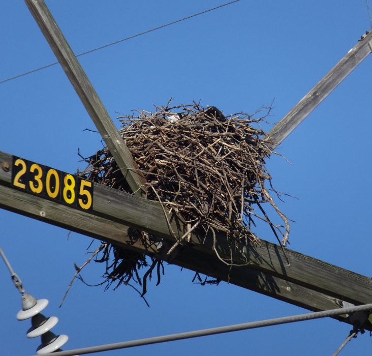
I wondered if opening a waterfront inn/campground/outfitter with a launch site might be a good investment opportunity. There appears to be nothing similar around. If doing so, such a business south of the Harrison Ferry Bridge (Route 392) and north of the Eldorado Road Bridge (Route 14) would be ideal. Kayak shuttle service could be offered along with bicycle rental since the area is flat, scenic, has light traffic, and nice roads. Perhaps this will be my retirement venture. As the sun got low in the sky, I drove across Kent Island, keeping a watch for kayakers that I knew were out at some point during the day. I wondered if they had finished their final Kent Island Peer (or is it Practice?) Paddle (KIPP) of 2015 where they test their skills and endurance by circumnavigating the entire island. Back at home, I studied satellite images to see if there were possible launch sites I might have missed. I only found one potential launch area. It appears to be a culvert near 6428 Palmers Mill Road, Hurlock, MD 21643. This is 4.5 miles downstream from Marshyhope Greenway/VFW and 0.3 mile north of Harrison Ferry Bridge (Route 392). It would be wise to launch/land when it is not low tide. I'll return and check it out another time. |
|
In my September 19, 2015 trip report, I paddled on Upper Marshyhope Creek and then looked for kayak put-ins on the middle portion. I ended this blog with
Back at home, I studied satellite images to see if there were possible launch sites I might have missed. I only found one potential launch area. It appears to be a culvert near 6428 Palmers Mill Road, Hurlock, MD 21643. This is 4.5 miles downstream from Marshyhope Greenway/VFW and 0.3 mile north of Harrison Ferry Bridge (Route 392). It would be wise to launch/land when it is not low tide. I'll return and check it out another time. Today I returned to Marshyhope Creek and checked out the above mentioned culvert, shown below. I believe it is deep and wide enough here to launch and then paddle to Marshyhope. It would be a very rough launch because it is fairly steep down to the water. But the main problem is parking. I was hoping the shoulder would be wide enough to park nearby but it is not. If there is public land along the sides of the culvert, it is not obvious. There is a cemetery nearby but even that doesn't look like one could park there for an extended period of time. Thus, I declare this potential launch site a dud. 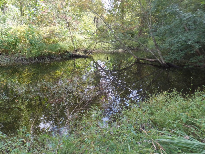
I spent a little time looking at real estate in the area. Back on September 19, I thought of how nice it would be to open a waterfront inn/campground/outfitter with a launch site. I still think something like that could work. I looked at some properties, including a lot for sale on Marshyhope Drive in Marshyhope Village (which I could not find on Redfin) and a place called Buckaroo Ranch on Palmers Mill Road which is selling for $500k. I don't really have any intention to buy until I'm close to retirement...still, I can dream. My backup plan was to drive to Lloyds and then paddle upstream on Lee Creek as far as I could. But that was on the other side of Dorchester County. I started driving east and ended up passing through a little town called Secretary. Here I found the Temple Street launch site (shown below) which gave me access to Warwick River. There I launched. 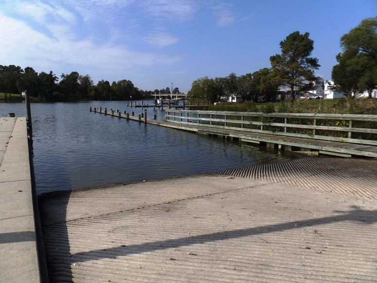
Some grasshoppers watched me as I put my SUP into the water. I launched at 1415, staying on the right side while paddling downstream. I tried to go under Little Warwick Bridge but I had to lie down and take off my PFD belt to do so. Even then, my camera case kept me from going under. I could have rearranged my gear to do it but I felt my limited time was better spent continuing downstream. Afterwards, looking at satellite photos, I think the area on the other side of the bridge could have been very interesting. A kayak would not fit under the bridge unless the paddler totally got out of the boat. I passed by a house that had an interesting sculpture of a raptor at its nest. 
I paddled out into the Choptank River and then headed upstream (north). The wind felt like about seven mph which was much higher than forecast. That section of the Choptank is pretty uninteresting. It is wide and full of monotonous bay grasses. After a couple of hours, the wind died down and the water was like glass. The high temperature was about 72 degrees. There were many schools of fish about. I paddled up Cabin Creek. In one tributary on the south side, I saw an osprey nest that sat unusually low in the water. It had not been occupied recently but there were some fish scales and bones lying in it. Continuing upstream, I saw two Mississippi riverboats near the Suicide Bridge Restaurant. There is a nice little beach area near the restaurant that looks ideal for launching a kayak but I didn't see any mention on their website of launching. Maybe if you eat there, they will let you launch. From Suicide Bridge, I managed to paddle upstream for two miles until I could go no further. I made it a little past the house shown below. 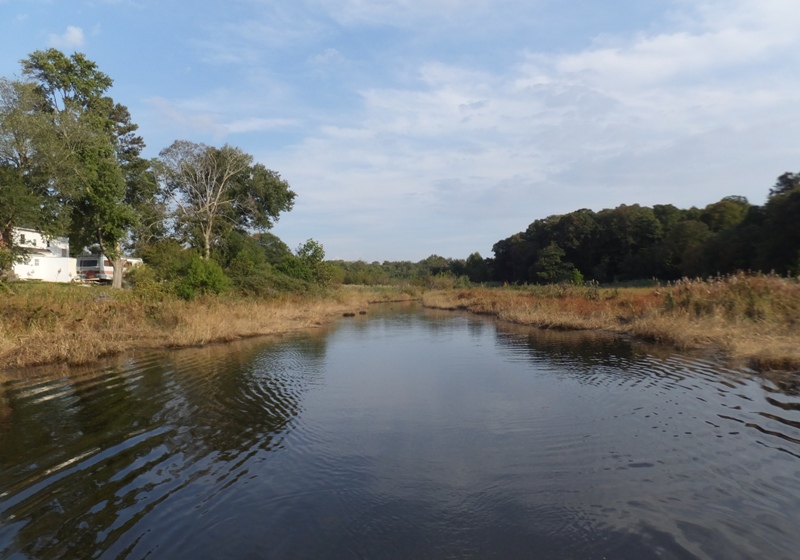
The east half of Cabin Creek is very scenic. I suspect I might have been able to get further upstream than one normally could have. We had gotten quite a bit of rain from the effects of Hurricane Joaquin which brought record floods to the Charleston, South Carolina area. 
Now that it is October, the days are getting short and it gets pretty cold once the sun goes down so I rushed to get back. I saw three eagles and four turtles. Back on Warwick River, I paddled upstream of where I launched. The river got very narrow and natural but it let me paddle one mile south of the boat ramp. I saw a racoon right around sunset. By the time I finished, I paddled 17.5 miles in 4.5 hours. For just about every paddler I know, if you asked them in mid-autumn if they got in as much paddling as they wanted for the year, they will say no. I think I am one of the rare exceptions in that regard. I got in as much as I wanted and am ending the season feeling satisfied. This may not be my last trip of the season but if it is, I'll have no regrets. |
|
This year, I added to my bucket list.
Pictured Rocks, National Lakeshore, Michigan Unlike any other place on Lake Superior, Pictured Rocks offers the opportunity to explore miles of pristine beaches, hike over 100 miles of trails, and experience the serenity of the northern hardwood forest. Sandstone cliffs, beaches, sand dunes, waterfalls, lakes, forest, and shoreline beckon you to visit Pictured Rocks National Lakeshore. Hiking, camping, sightseeing, and four season outdoor opportunities abound. The lakeshore hugs the Lake Superior shoreline for more than 40 miles. Lake Superior is the largest, deepest, coldest, and most pristine of all the Great Lakes. - from National Park Service - Pictured Rocks For more information and photos, see Okefenokee Swamp National Wildlife Refuge In November 2015, I read about this location in my kayak club's newsletter. Greg W. and Dave I. did a kayak camping trip out to the Georgia section. They carried camping gear in their boats and slept in tents pitched on swamp platforms. If you don't want to drive all the way to Florida for kayaking, this would be a great place to paddle. It is an 11 hour drive from the Baltimore/Washington D.C. area. See the Volume 25, Issue X, November/December 2015 issue of the Chesapeake Paddlers Association (CPA) newsletter for more information. Georgia Barrier Islands Also in Georgia is a place Norma read about called the Barrier Islands. I haven't looked into it much but she was intriqued so I'm listing it here. |
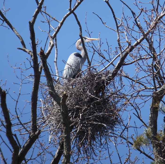
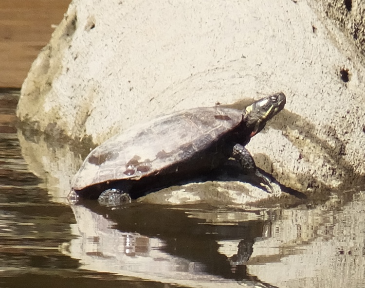
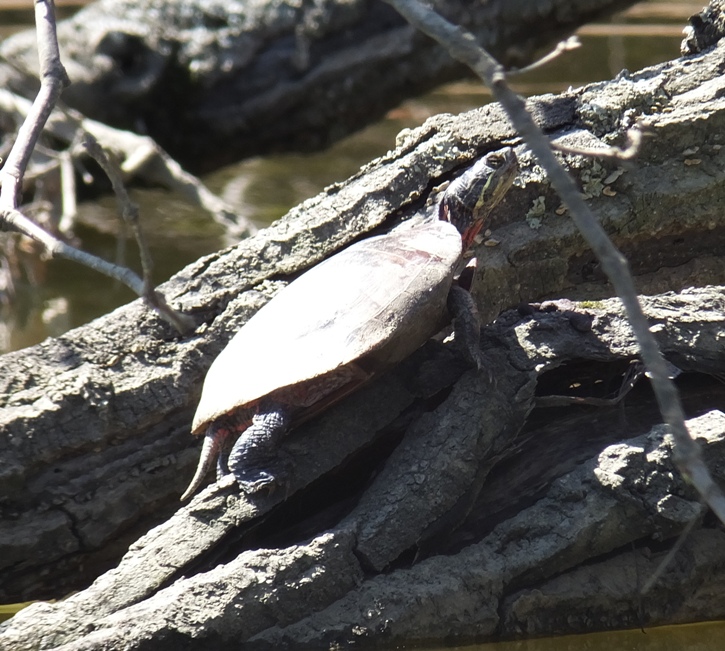
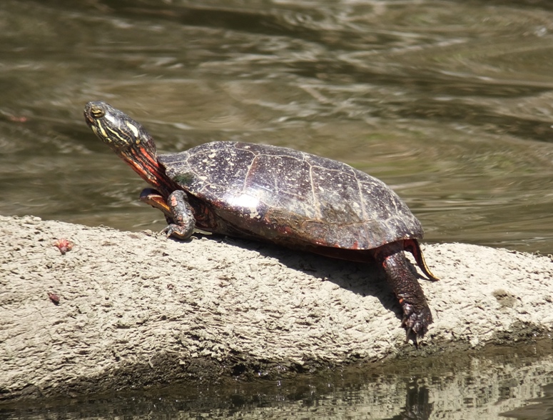
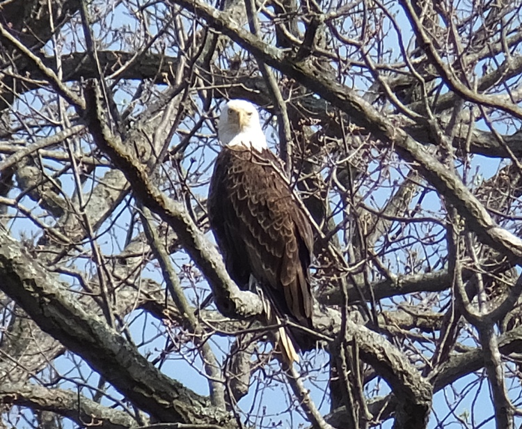
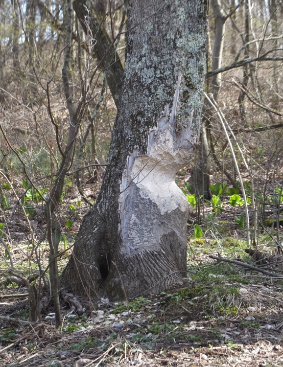
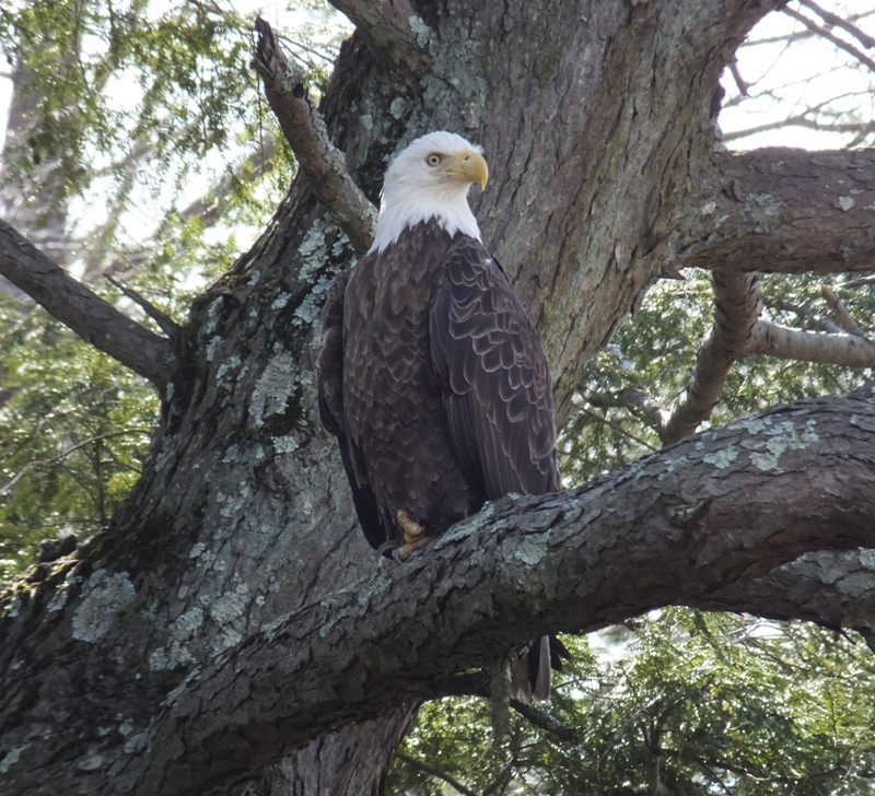
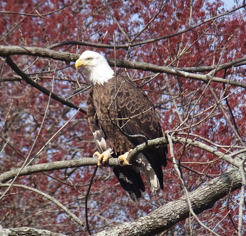
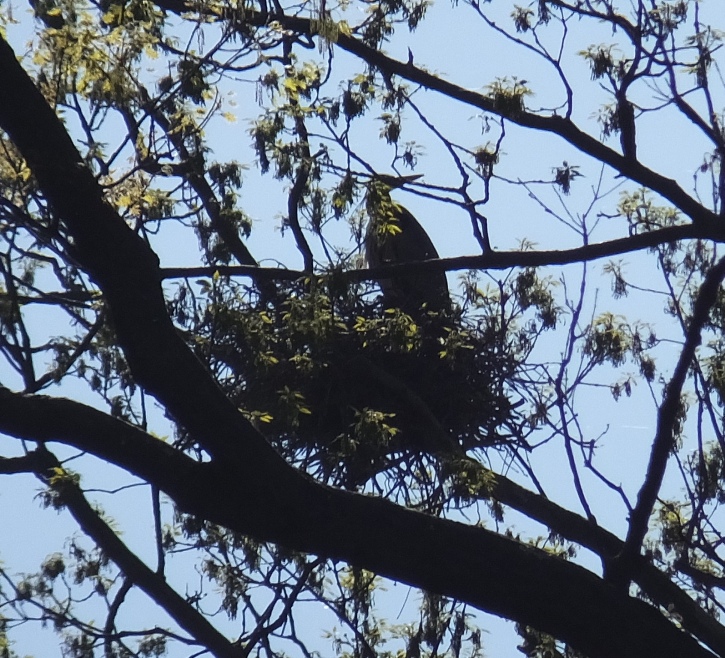
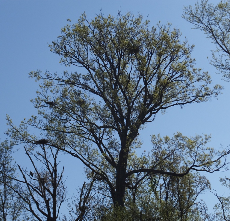
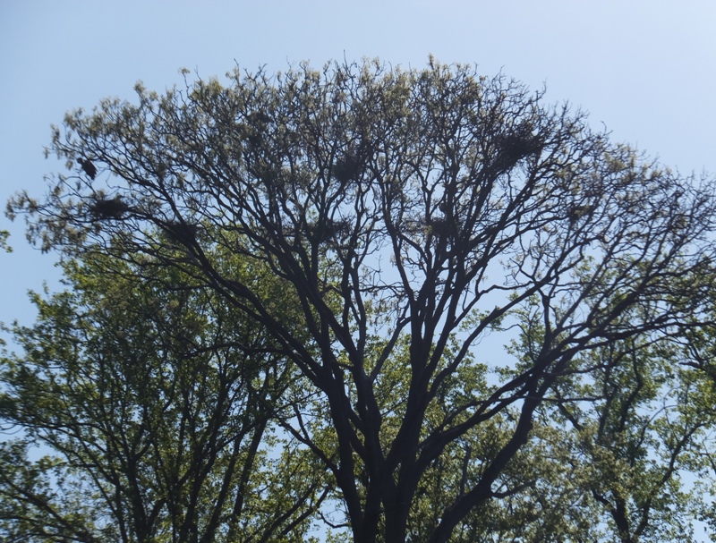
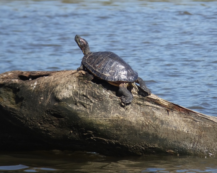
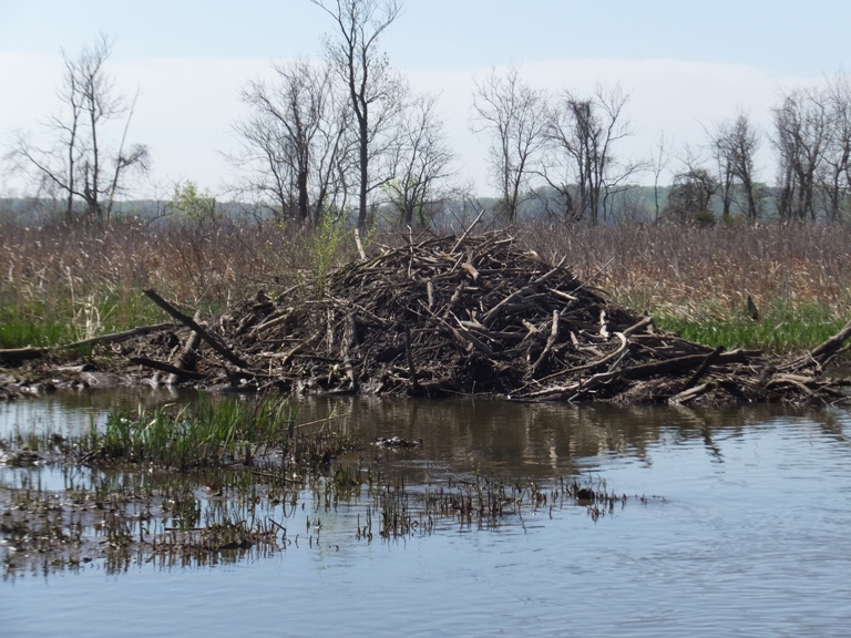
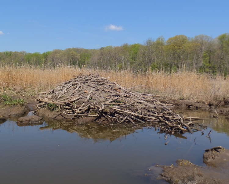
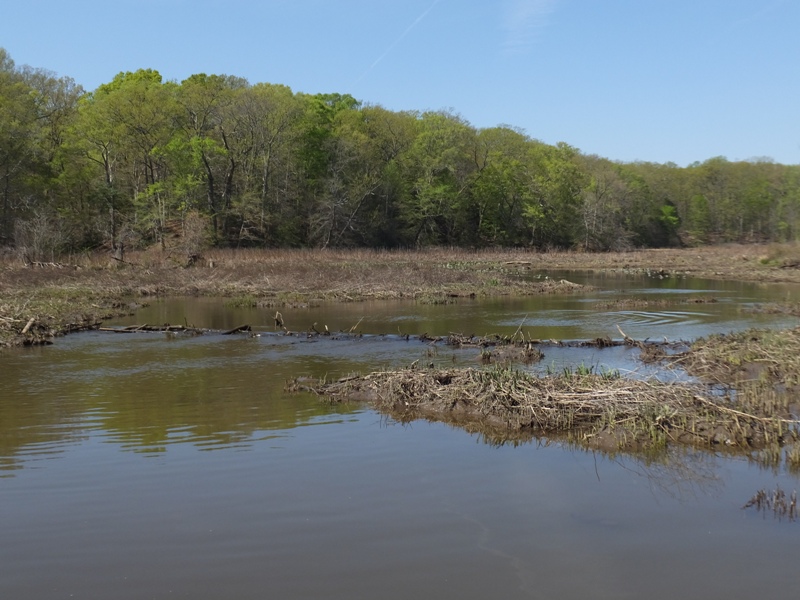

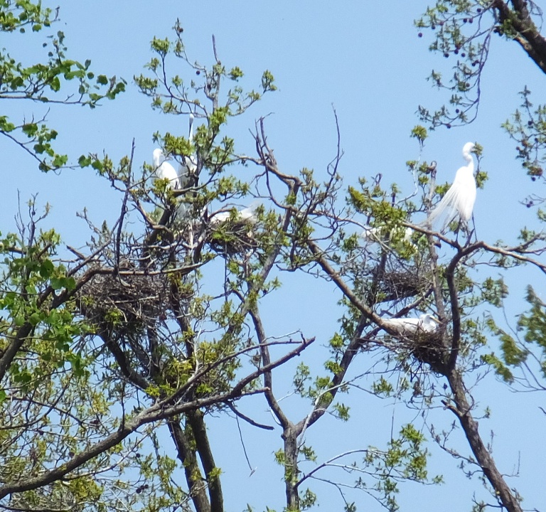
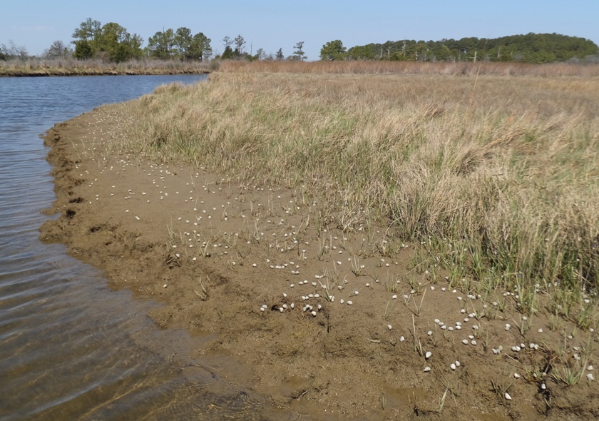
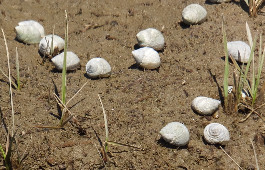

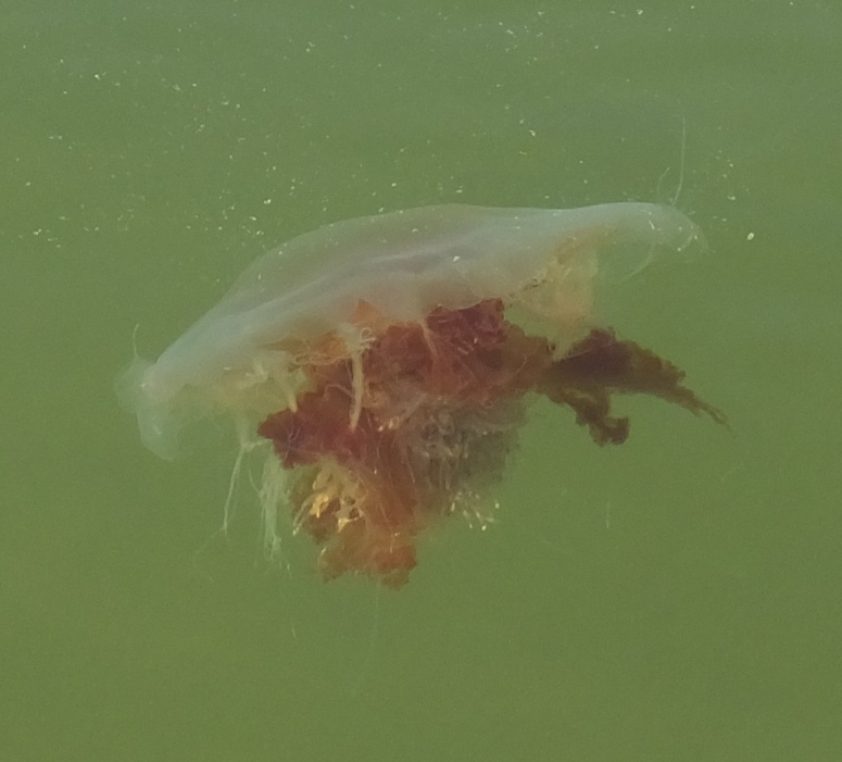
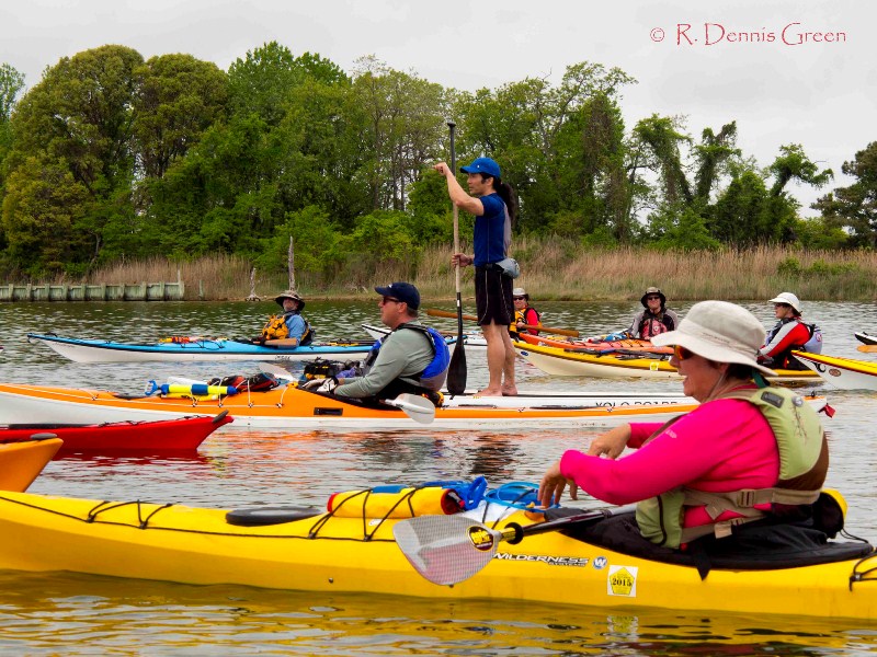
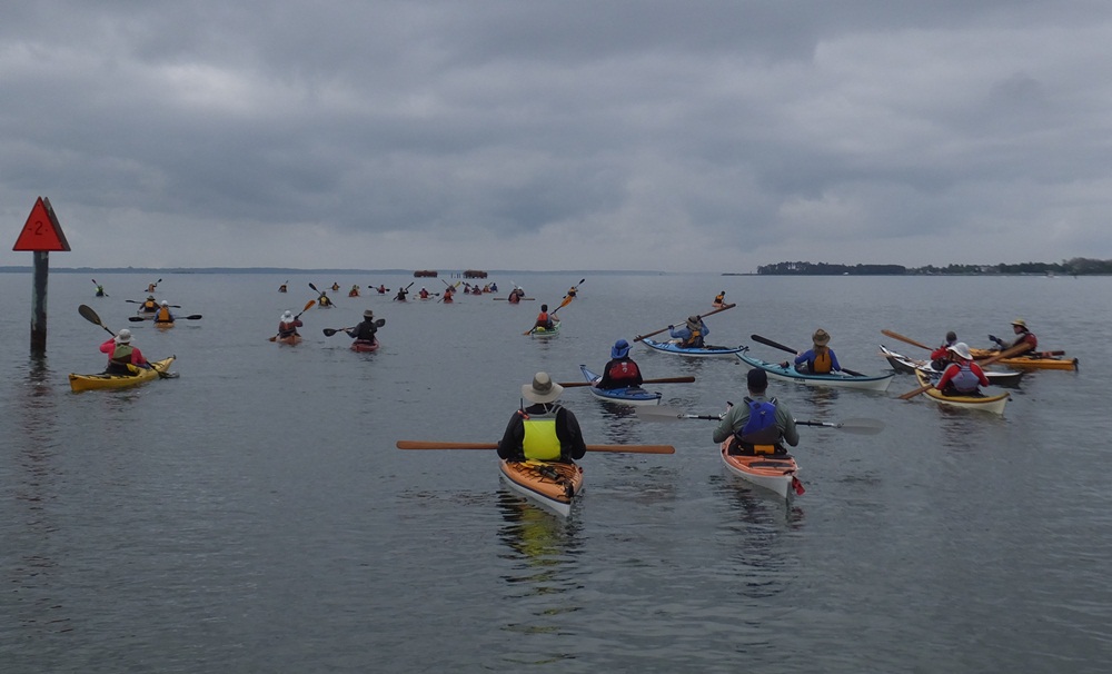
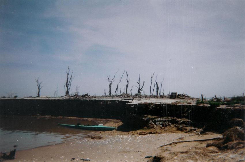

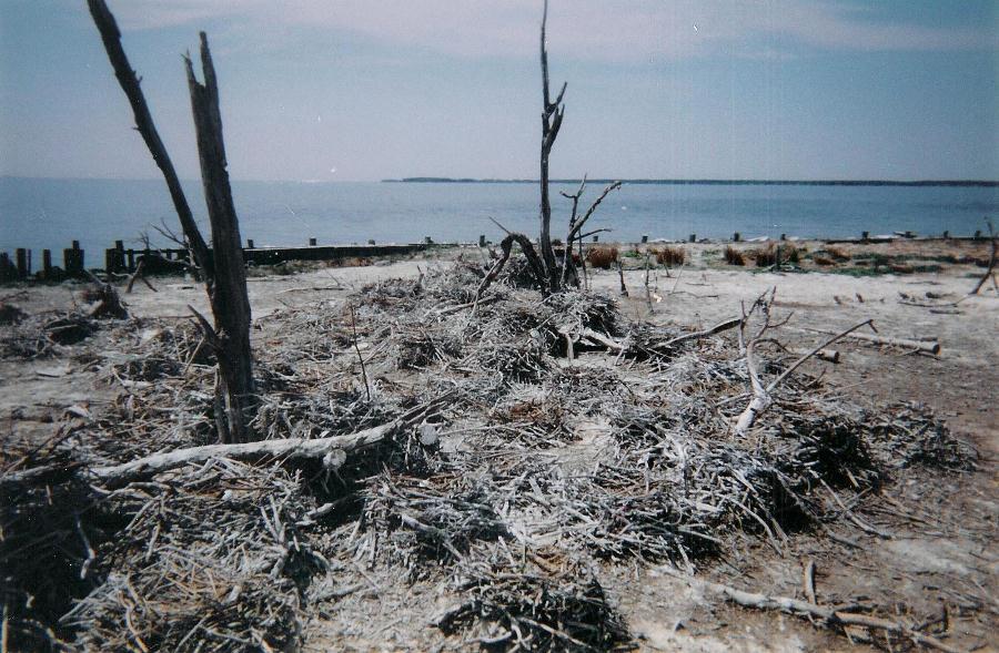
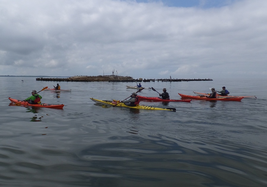
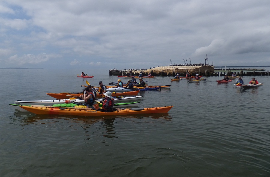
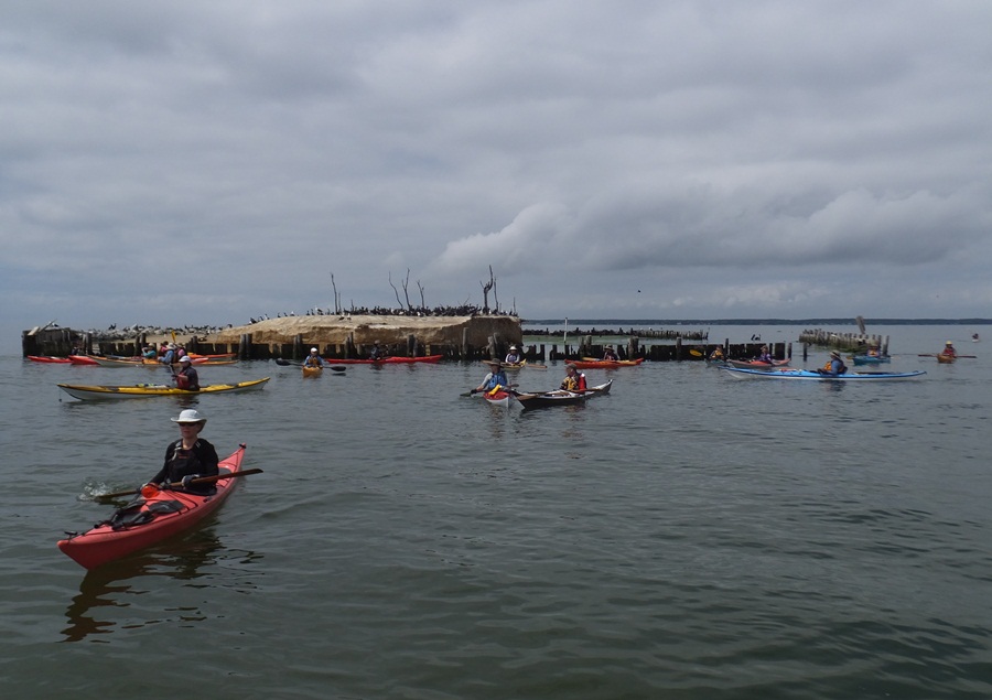
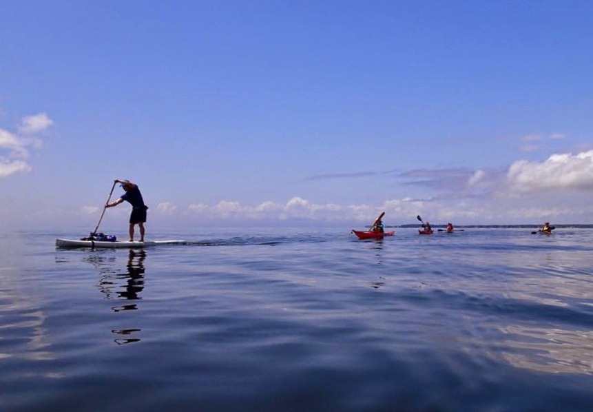
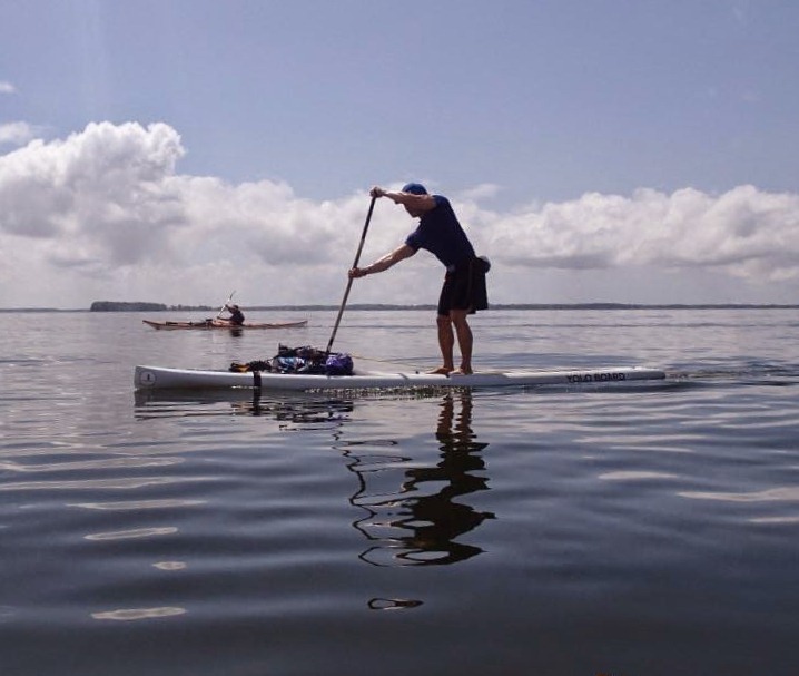
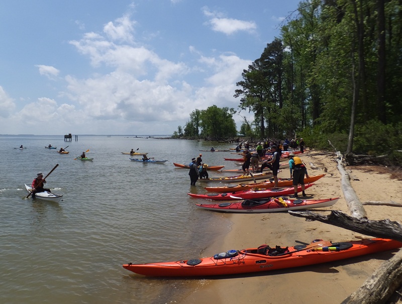
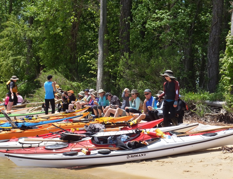
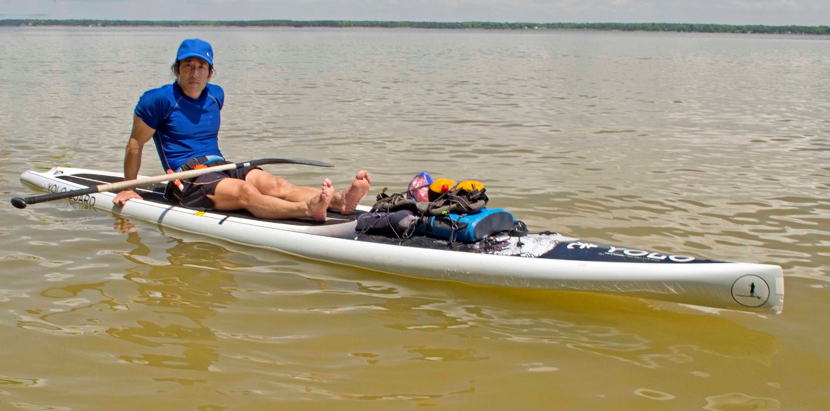
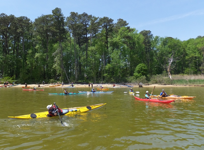
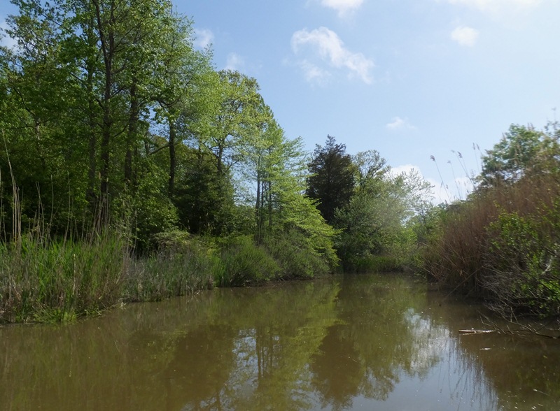
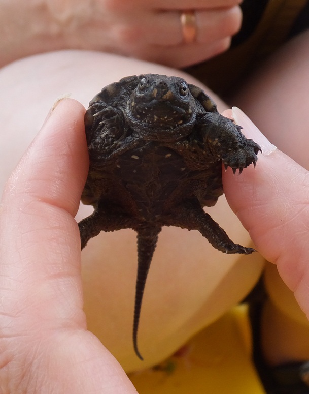
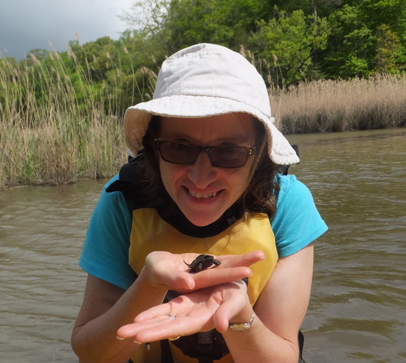
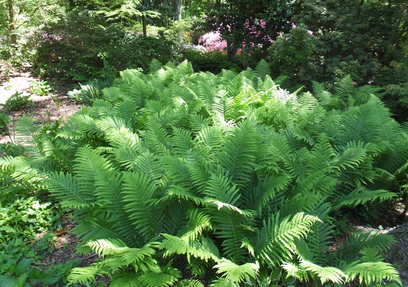
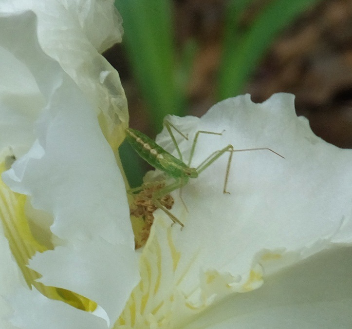
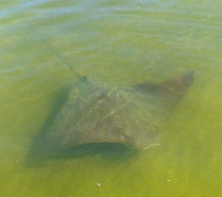
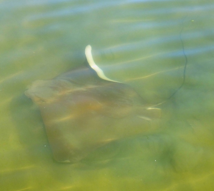
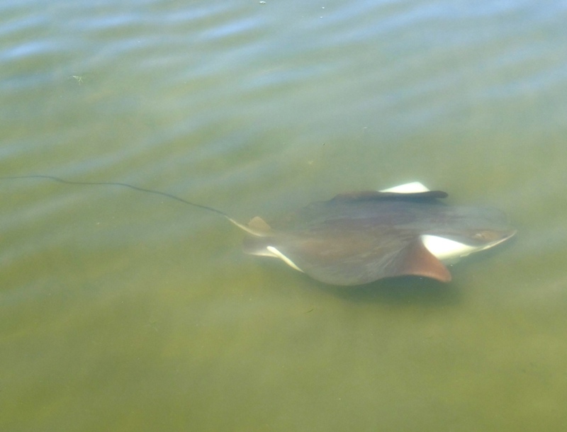
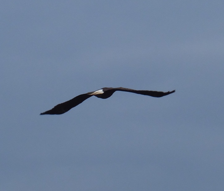
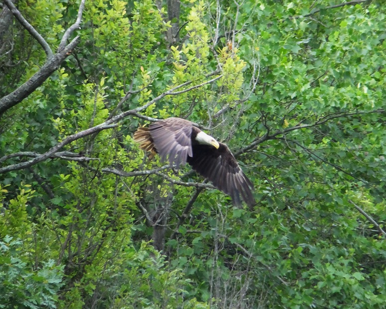
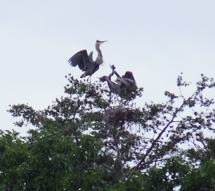
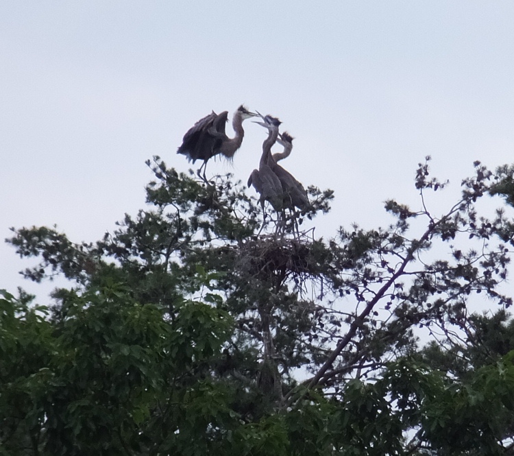
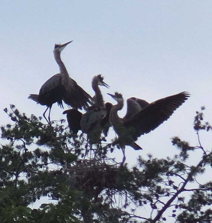
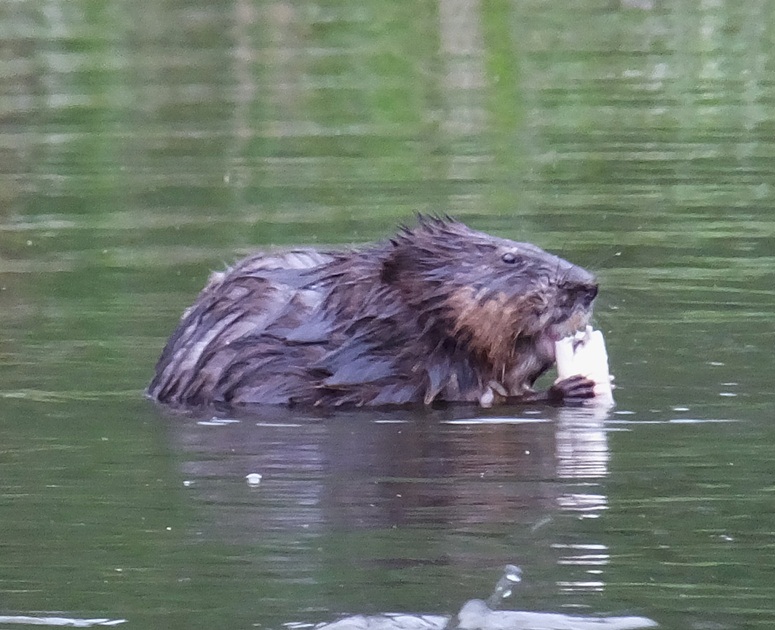
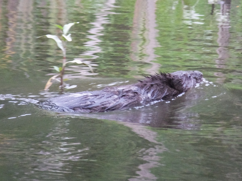

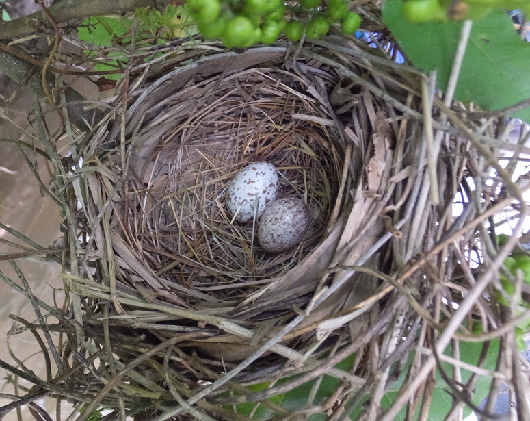

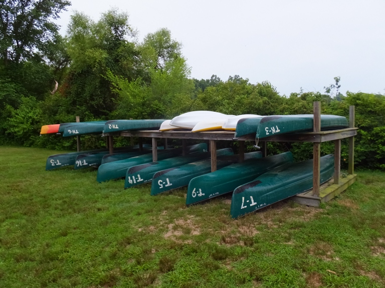
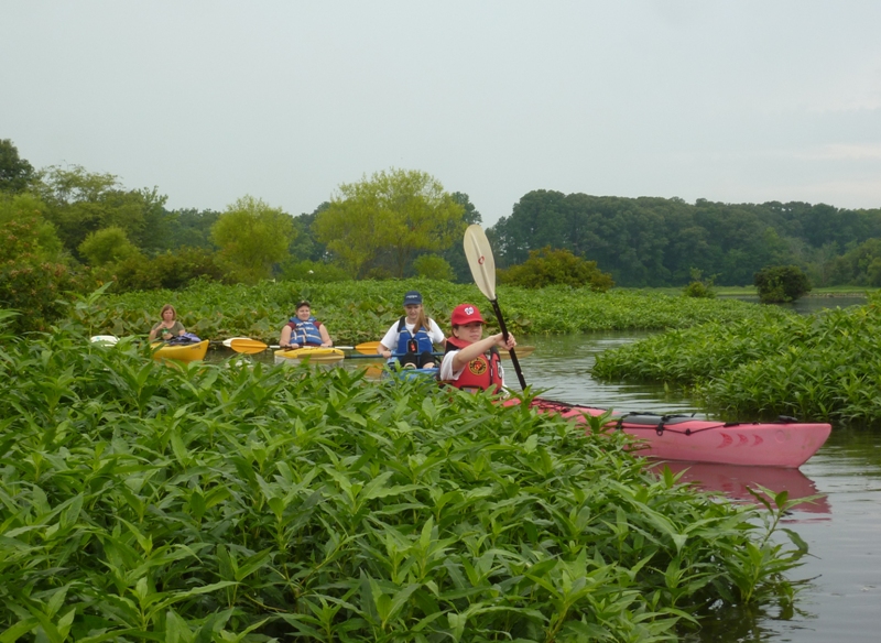
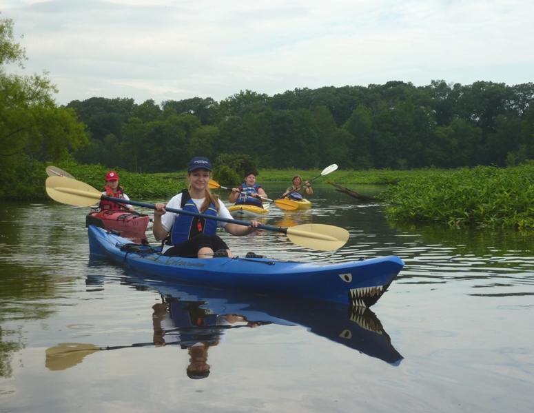
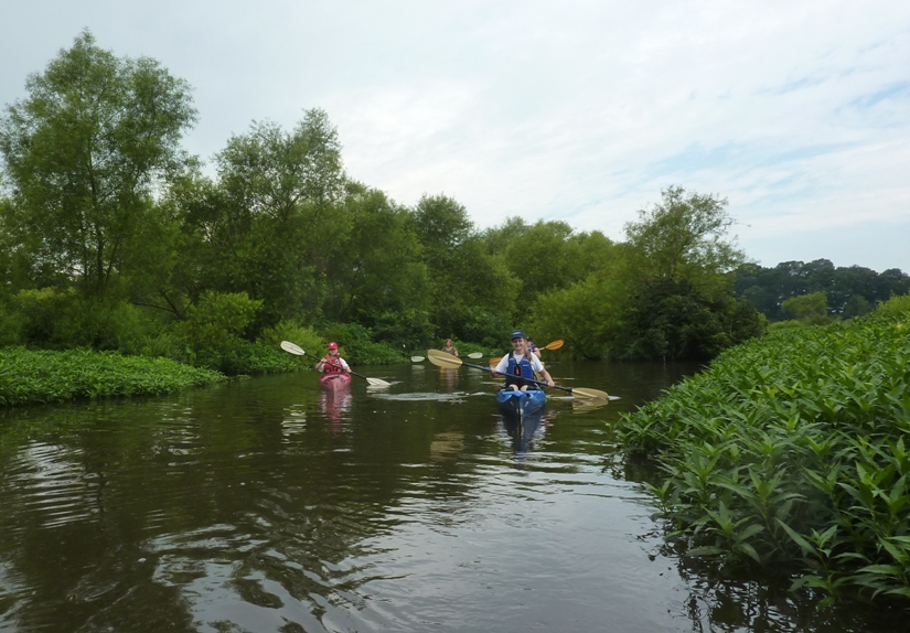

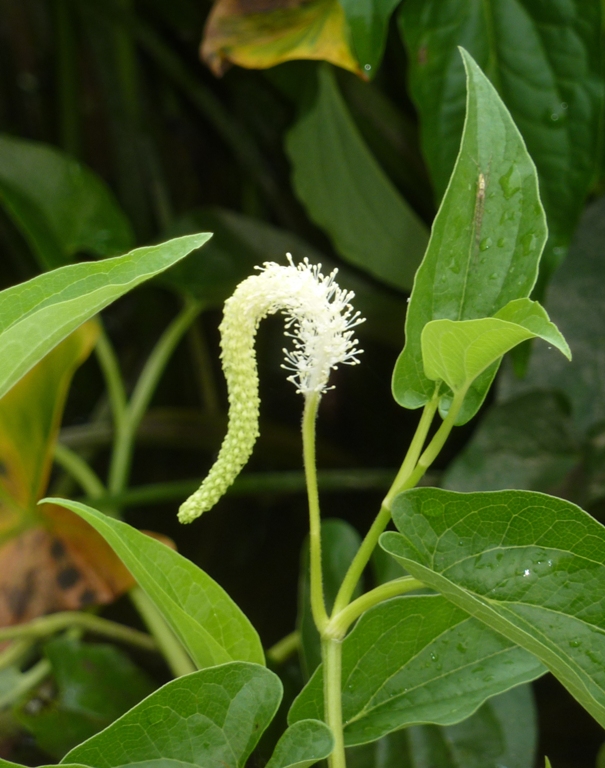
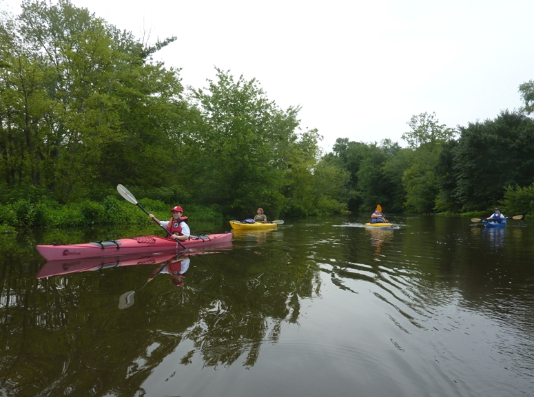
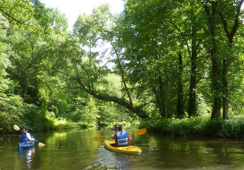
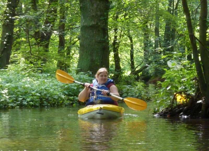
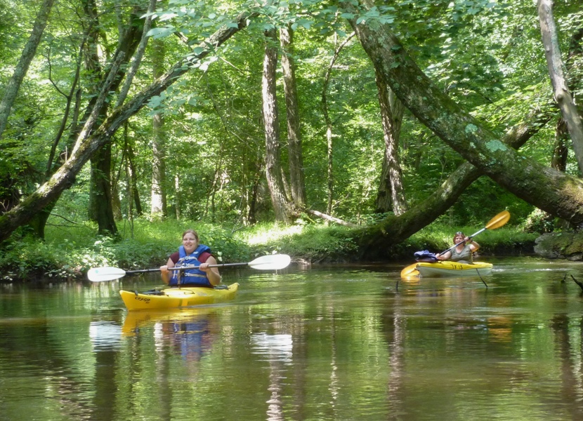
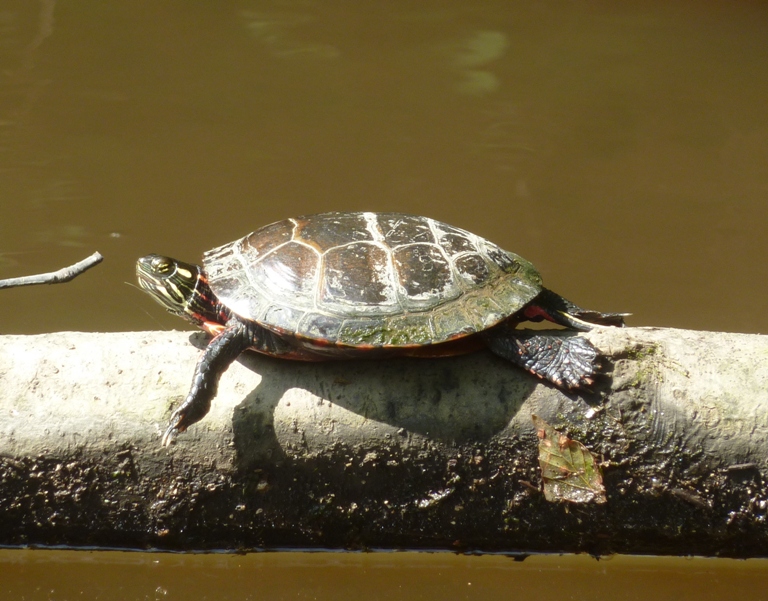
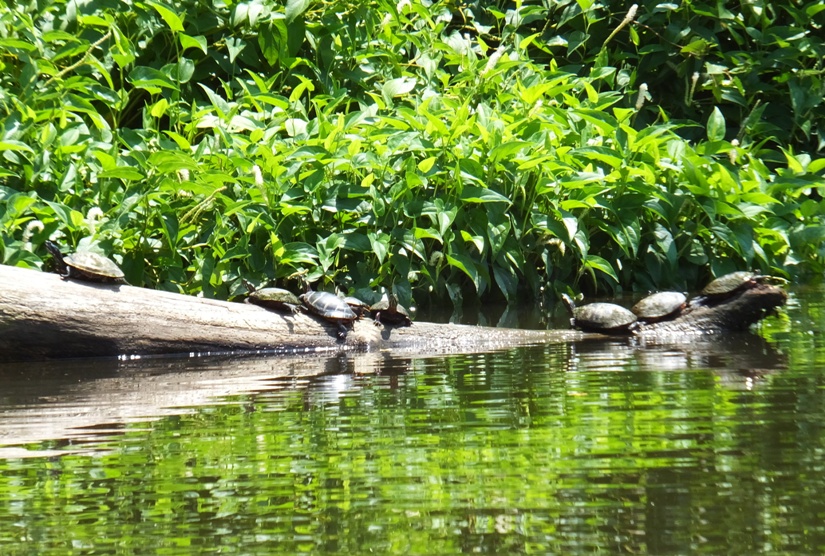
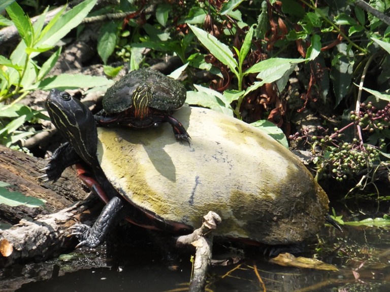
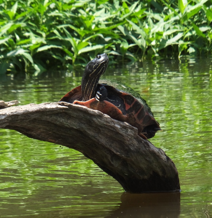
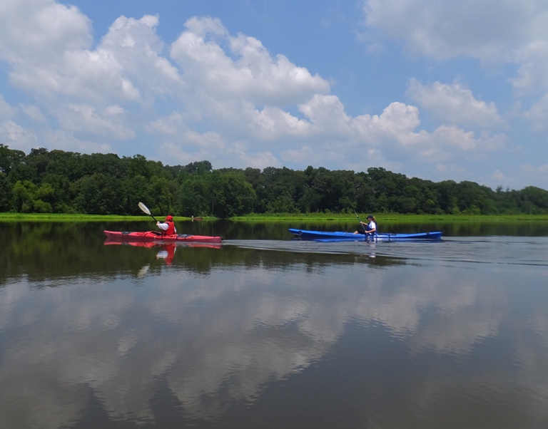


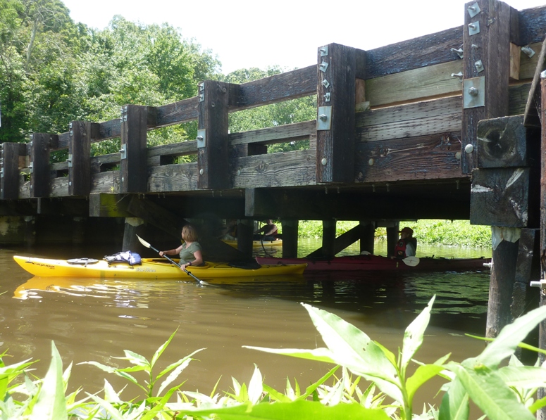
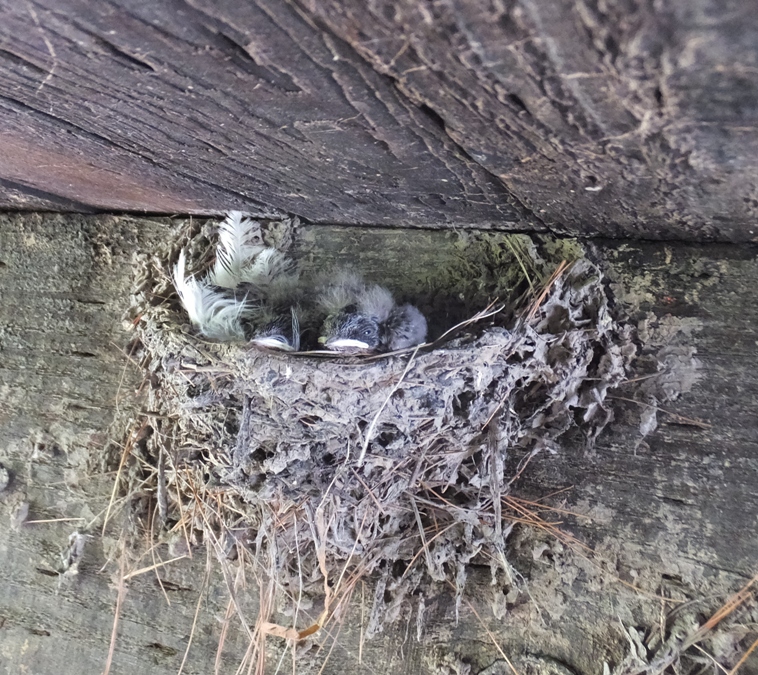
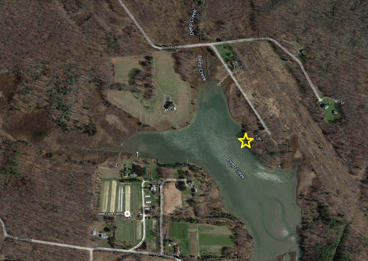
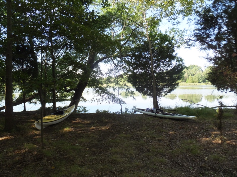
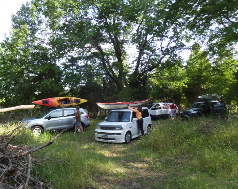
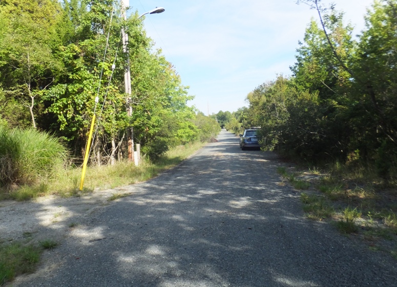
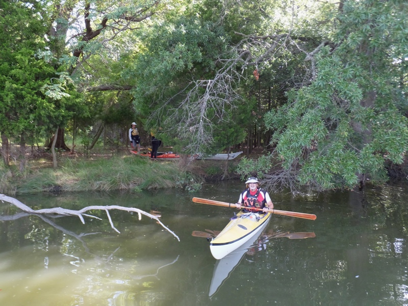
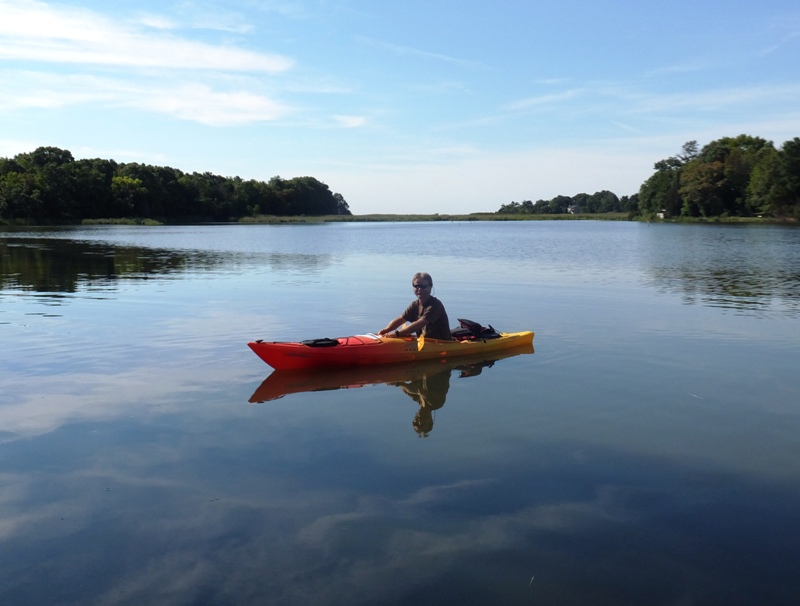
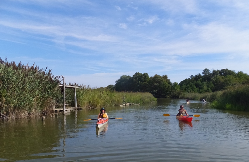
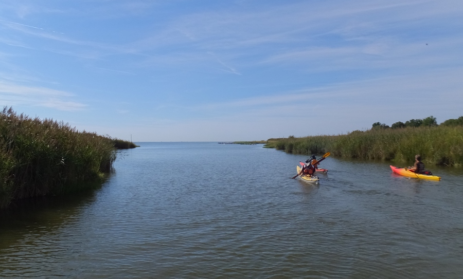
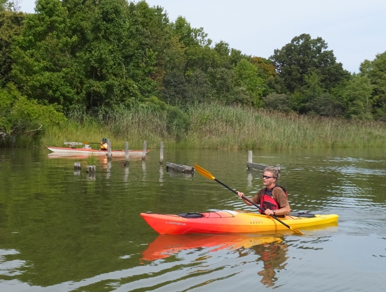
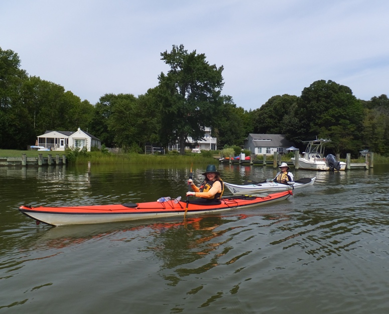
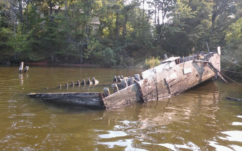
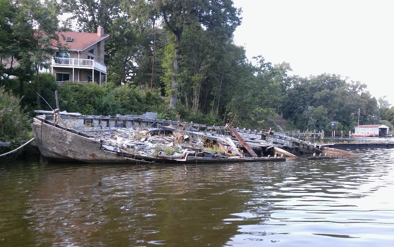
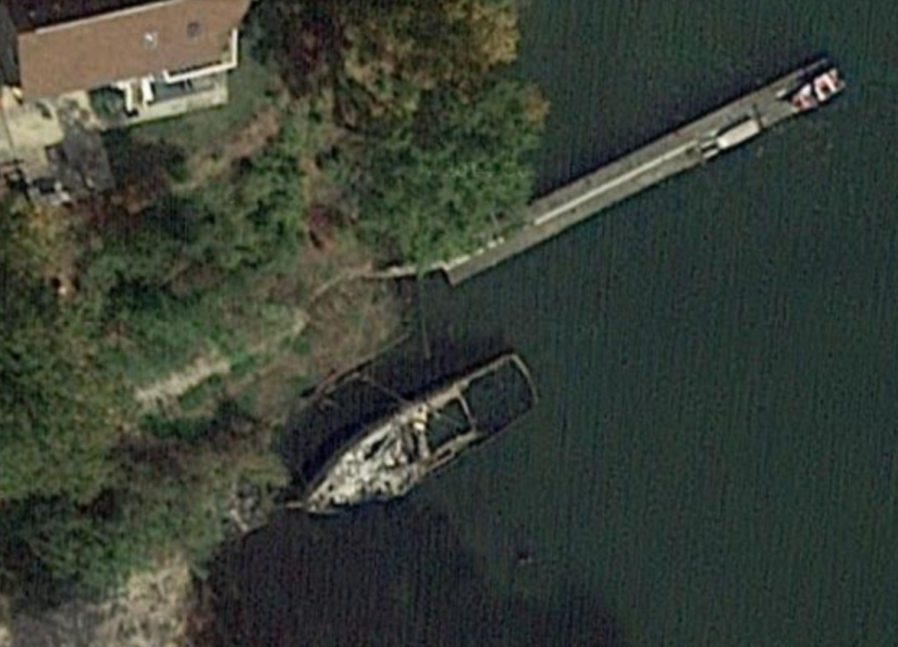
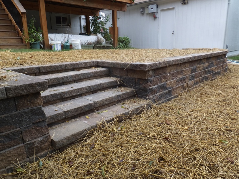
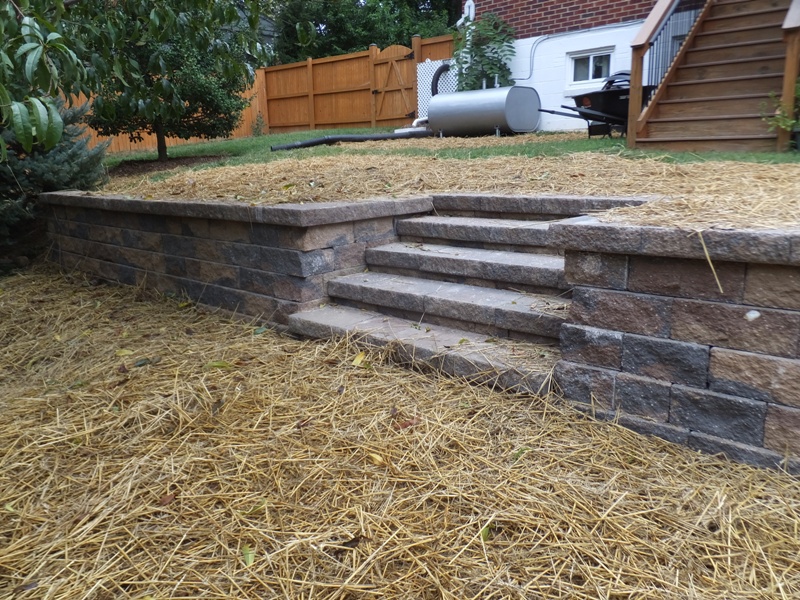

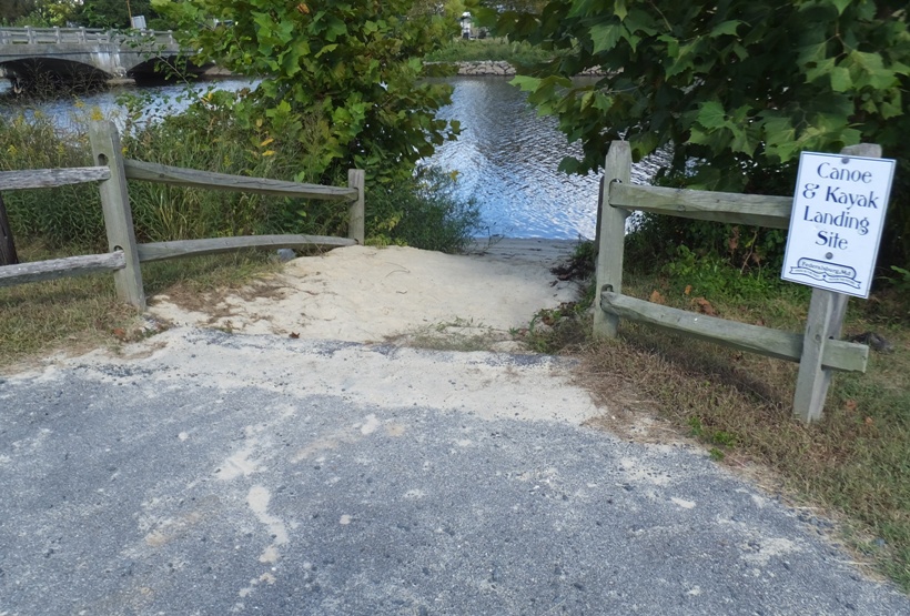
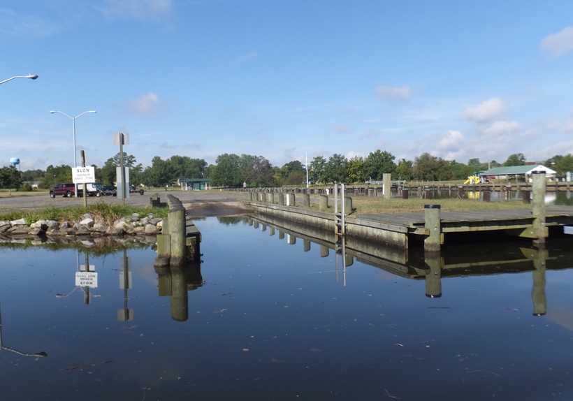
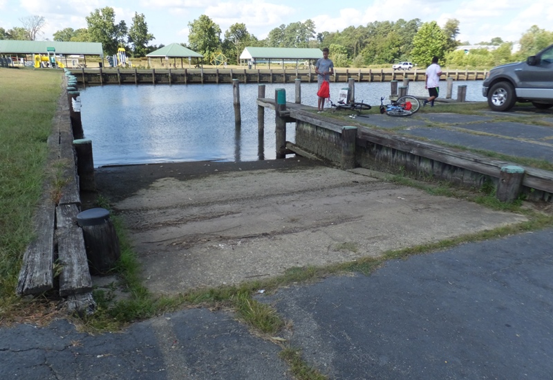


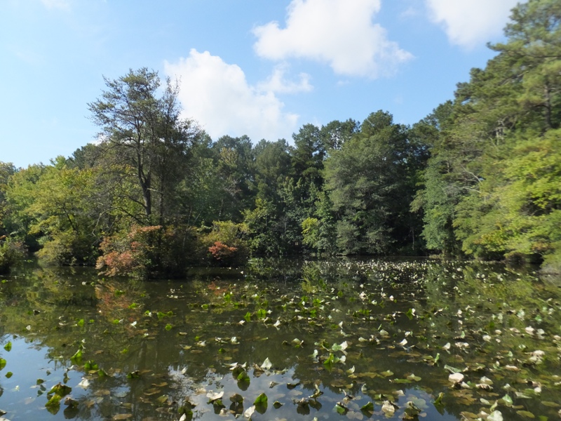

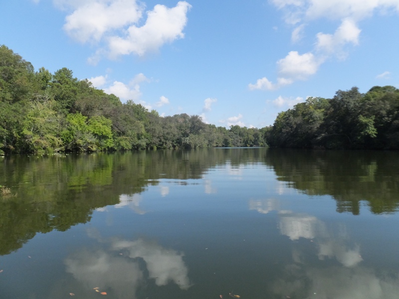
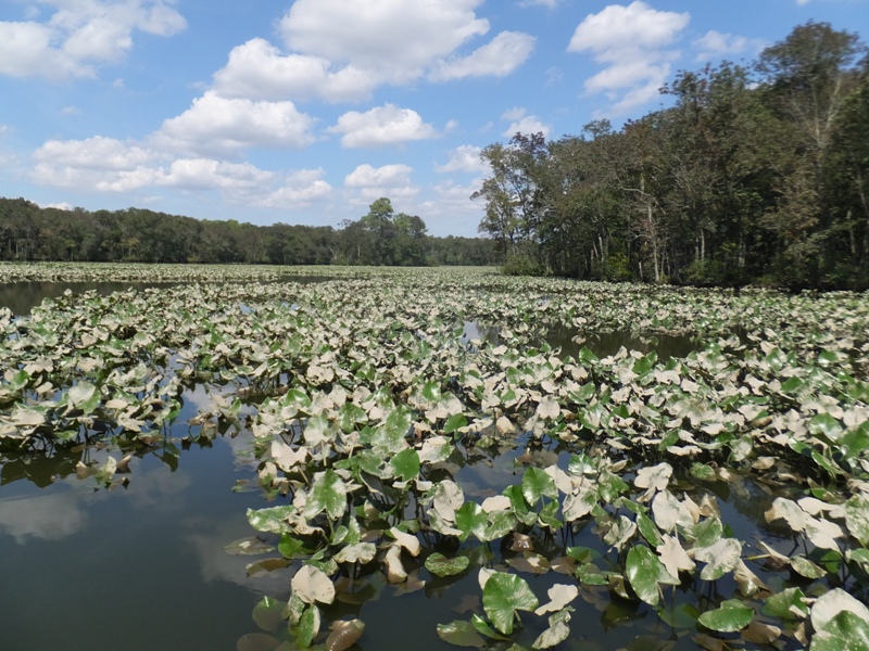
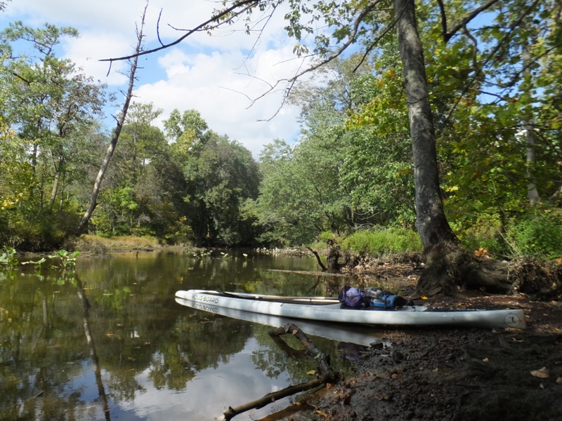
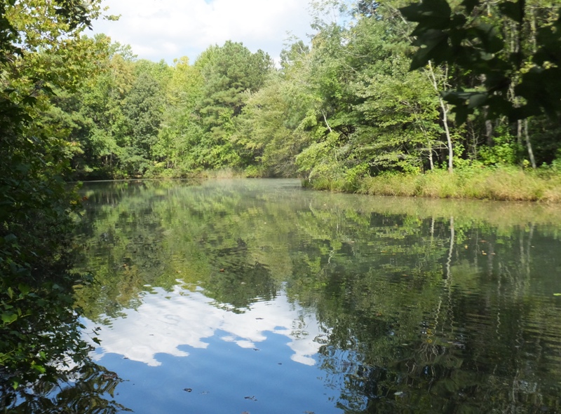
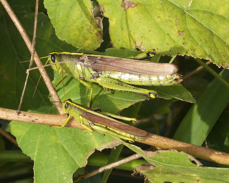
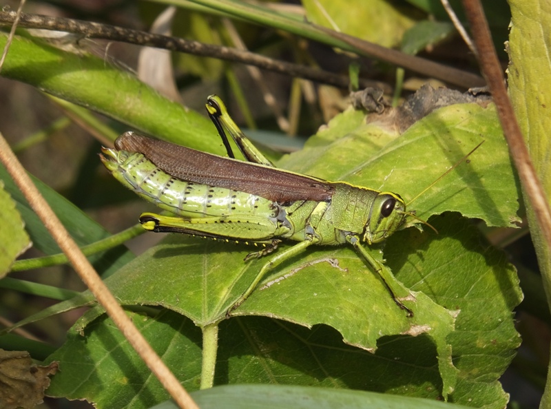
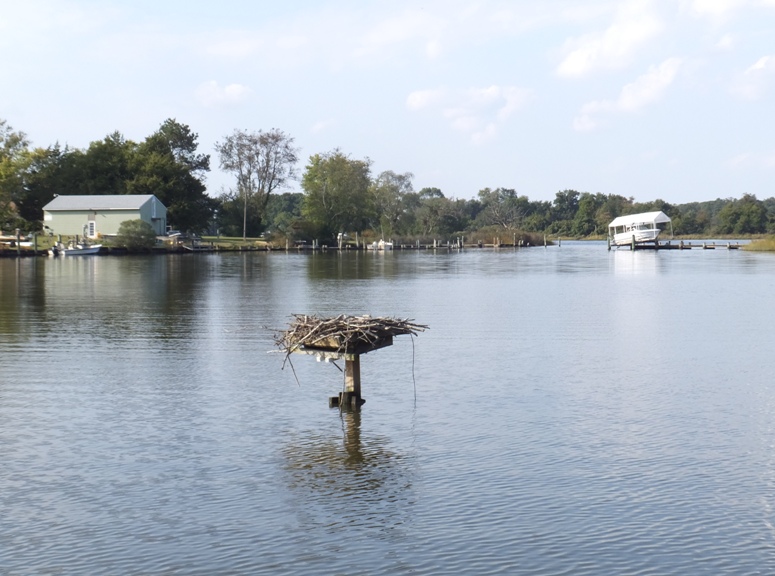
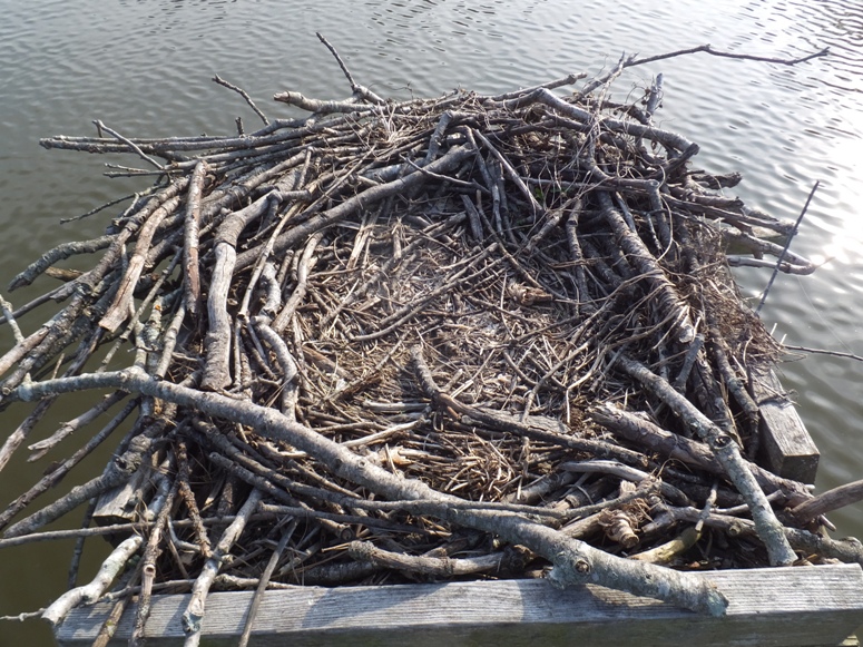

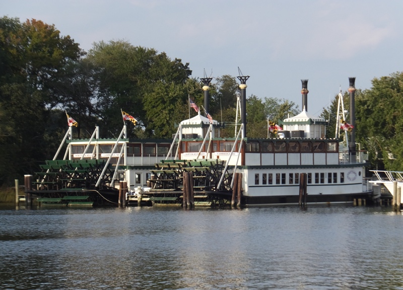
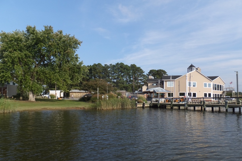
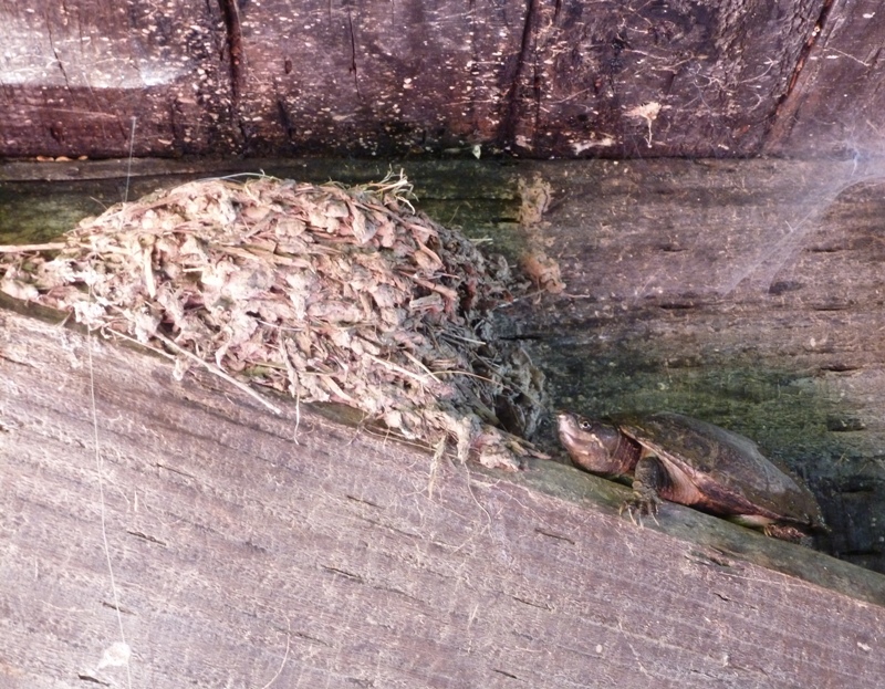