|
This page describes my kayaking and standup paddleboarding adventures in 2025. |

|
This page describes my kayaking and standup paddleboarding adventures in 2025. |
|
I am starting to put together my 2025 paddling wish list. Here is what I have so far:
 |
|
It is extremely unusual for me to start my paddling season so late. In a normal year, I'm on the water in late March or early April. But this year and part of last, I developed some problems with my right foot. I'm not healed but I have found good footwear and insoles to help minimize the pain.
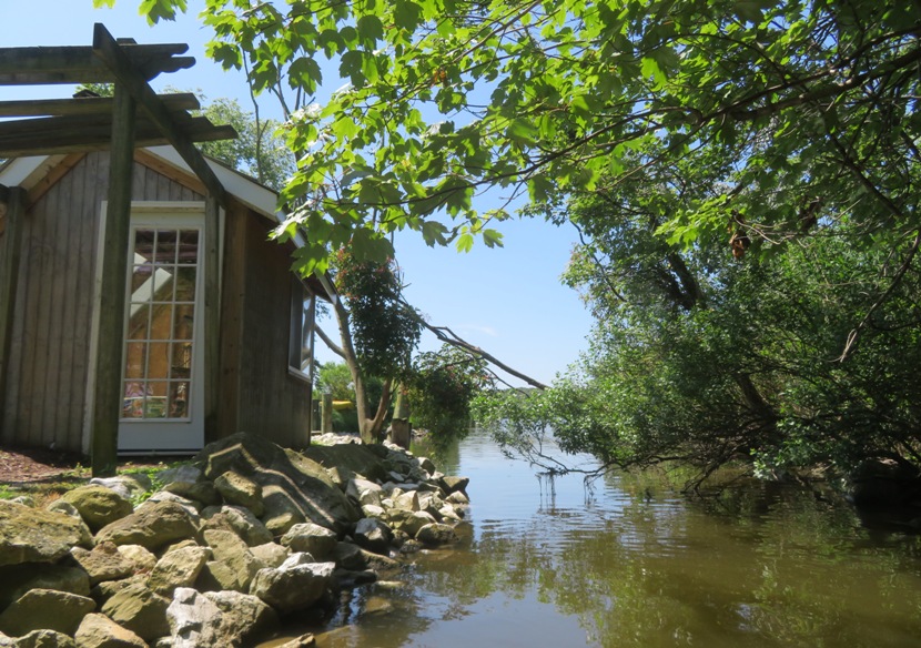
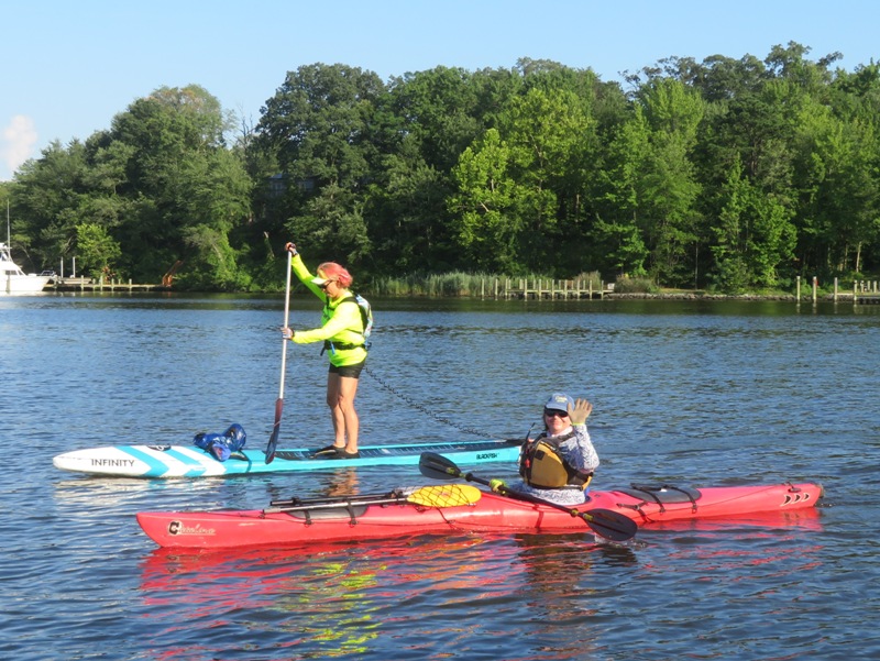
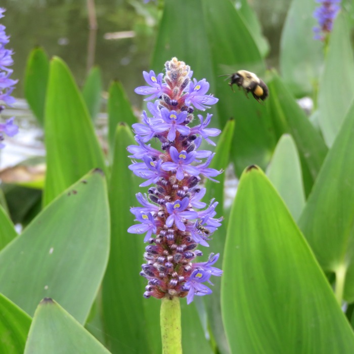
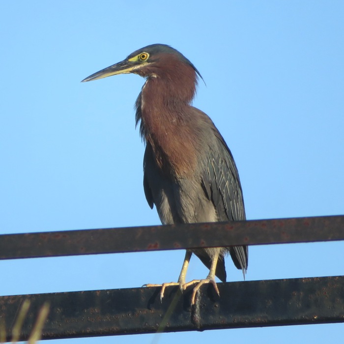
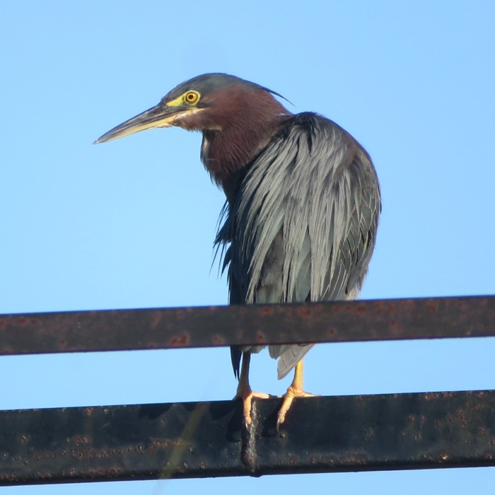
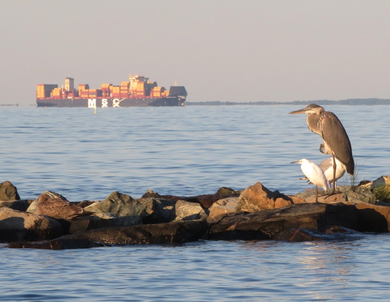
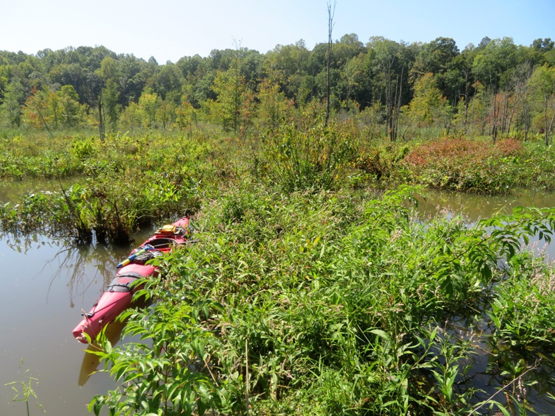
On this day, Norma, Daphne, and I launched from Southwest Area Park to access the "Little" Patapsco River. I call the section upstream of the South Hanover Street Bridge the "Little" Patapsco while everything downstream of it is the "Big" Patapsco. I wasn't sure how long I'd be able to stand comfortably so I didn't want to drive too far away. Norma wanted something scenic and natural so I figured this was as good a spot as any. We took advantage of the flood tide and recent rain to get as far upstream as possible. I mentioned to Norma that I don't typically see much wildlife when paddling in this area. She found that hard to believe. The narrow, tree-lined waterway looked very inviting to wildlife. By the end of the day, I ended up eating my words. Heading upstream, we saw a few muskrats. 
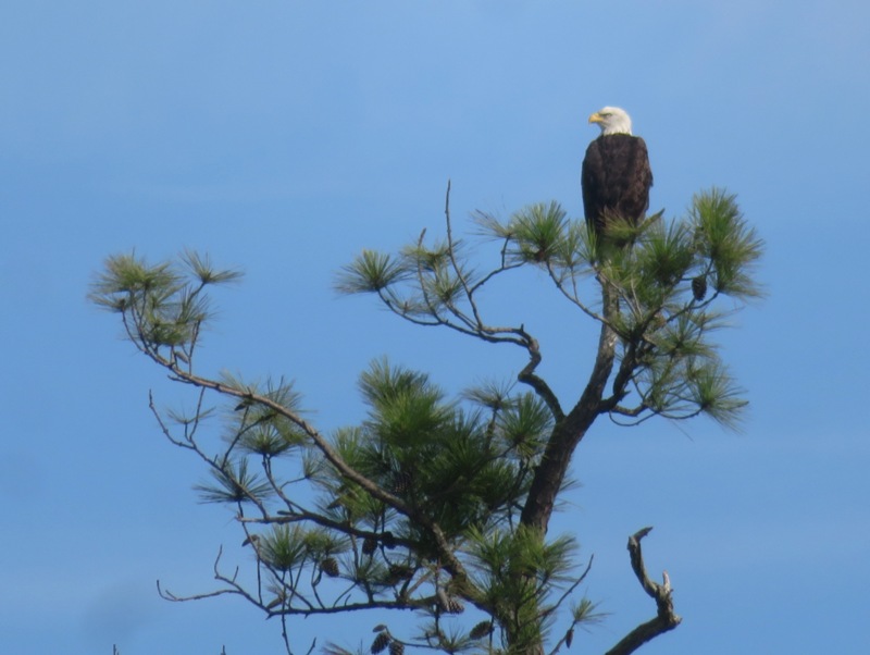
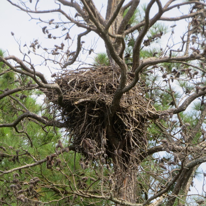
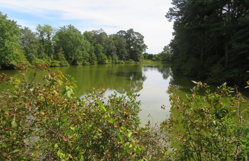
Eventually, the water got too shallow to dig the blades of our paddles deep enough to get an effective stroke. Not being able to get sufficient power meant we couldn't make much progress against the downstream current. So we turned around after getting about 4.5 miles upstream. I went just a tad bit further to check out what I thought might be a beach. I found myself in a space too narrow to turn around. So I backed up. My fin caught a log which caused me to fall backwards, landing on my SUP before rolling into the water. Where was Daphne? She somehow ended up on shore. She didn't appear to be wet...not sure how she managed that. I think I fall off the SUP about once every five years. Shortly after we began heading downstream, I stopped at a small beach on the north side where a tree-blocked stream merged with the river. I went ashore and followed a muddy path that paralleled the stream. Was it paddleable? Maybe with portage. After a short distance (maybe 0.2 mile) it led to a HUGE pond. I'm not sure at what point a pond becomes a lake but if you called it a lake, I wouldn't correct you. This pond/lake does not have a name. Maybe I'll name it if I return to paddle it. I returned to the small beach. From there, I heard a very distinct sound. I instantly knew what it was...juvenile great blue herons! A rookery was near. We paddled to the south side of the Patapsco and went ashore. Then we followed the sound. Click on the image below to play a video that captures what we heard. 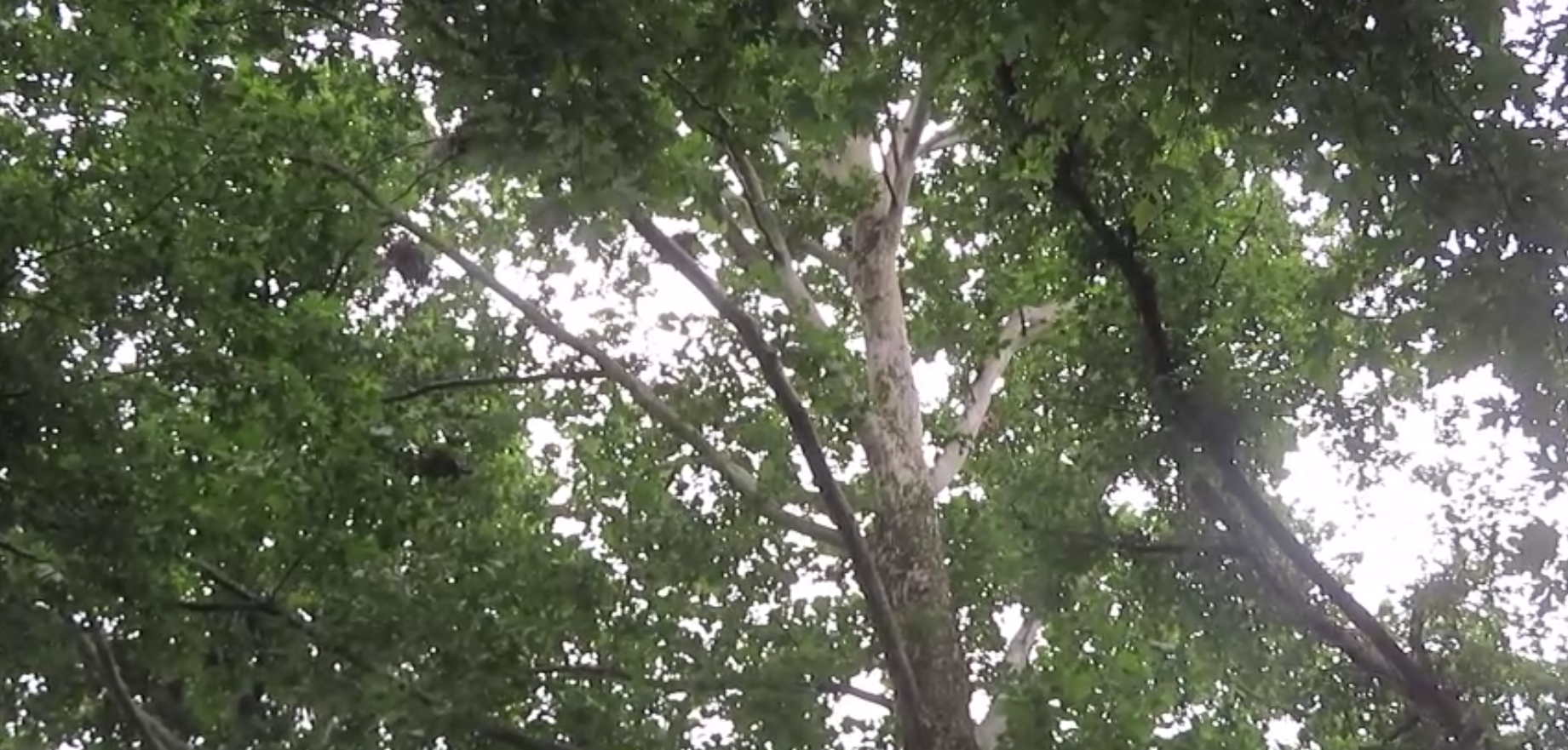
I'm guessing the rookery was comprised of about 20 nests. They were hard to see because of all the leaves. 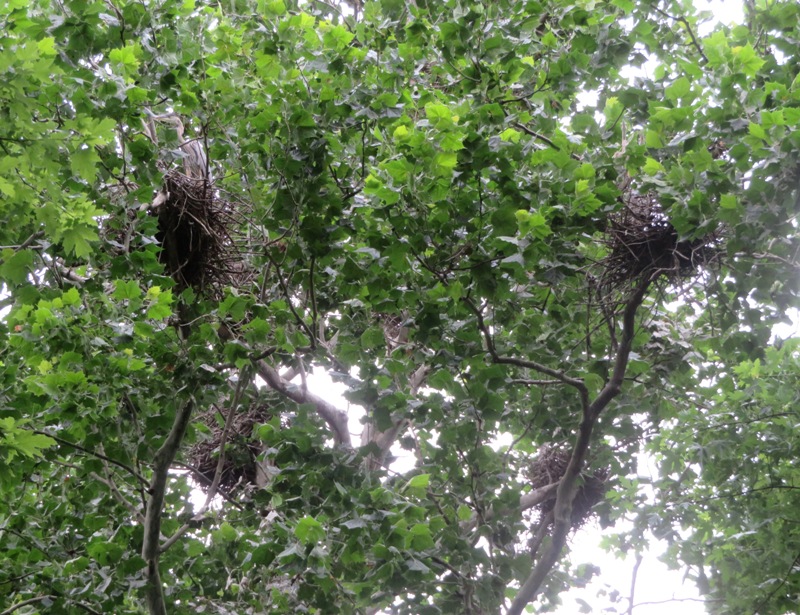
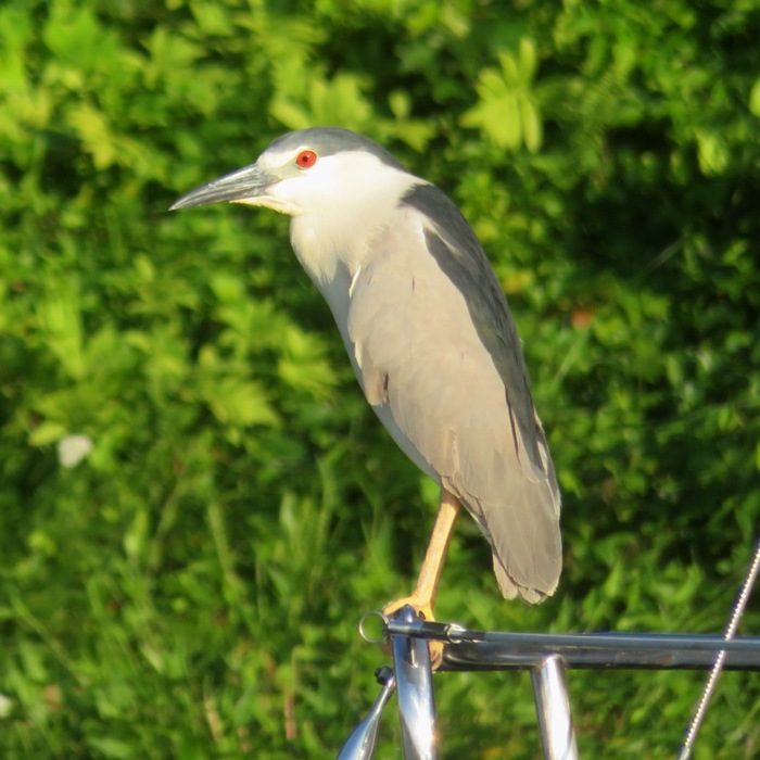
It was really difficult to get a good shot of any of these birds but I did manage to get one. 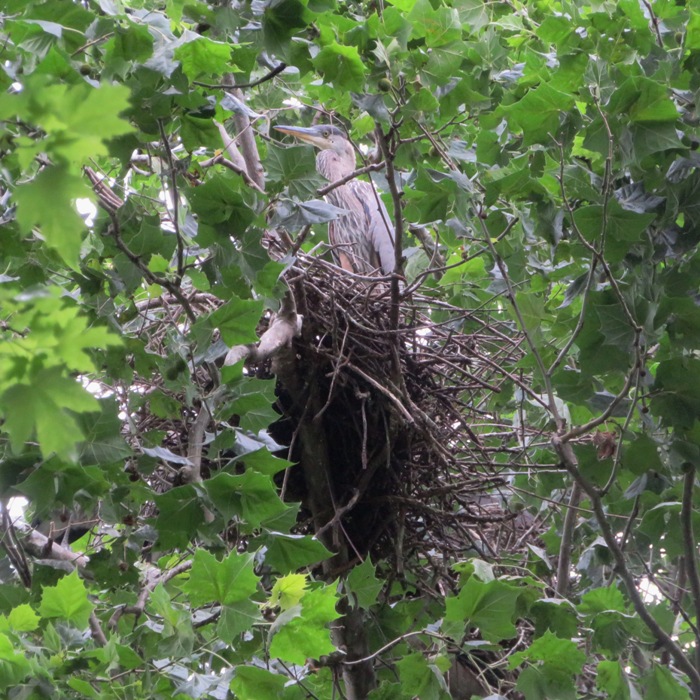
Standing under the nests, I noticed that the undergrowth was covered in bird poop. 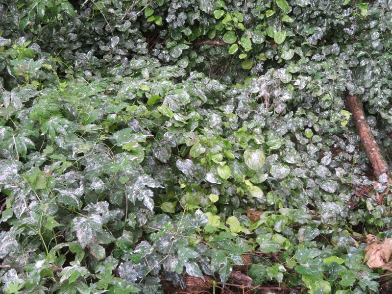
I found a couple dead young birds and the remains of a piece of egg shell. 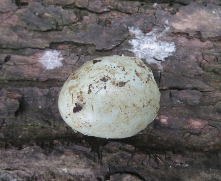
I paddled over to where Norma pulled over and found lots of wood ear mushrooms. 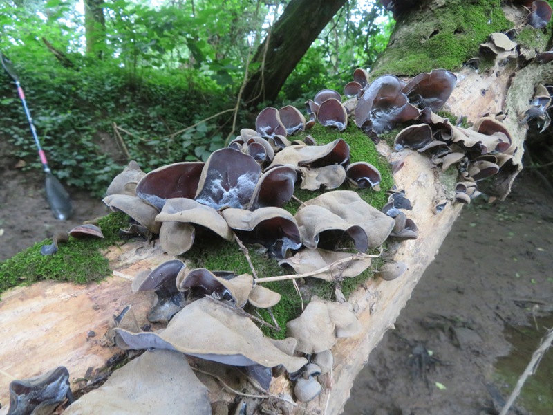
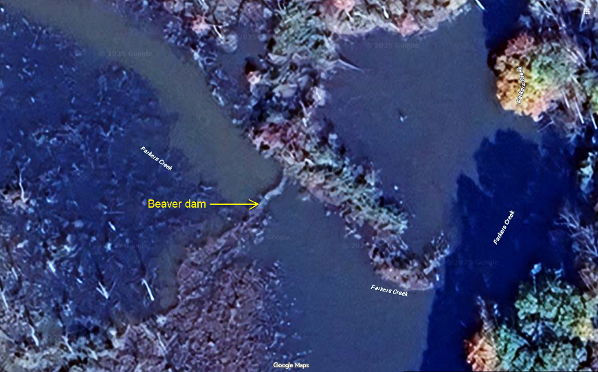
She got a little lost so I went ashore to look for her and instead found a beaver dam. 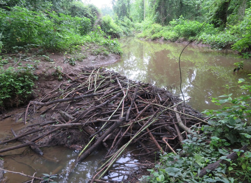
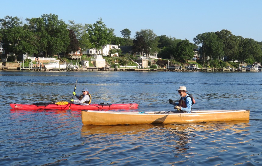
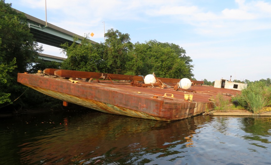
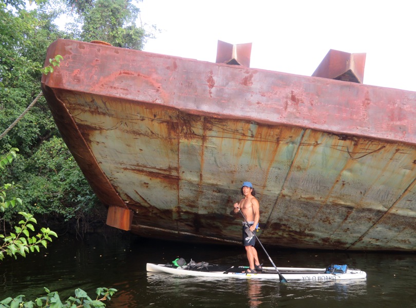
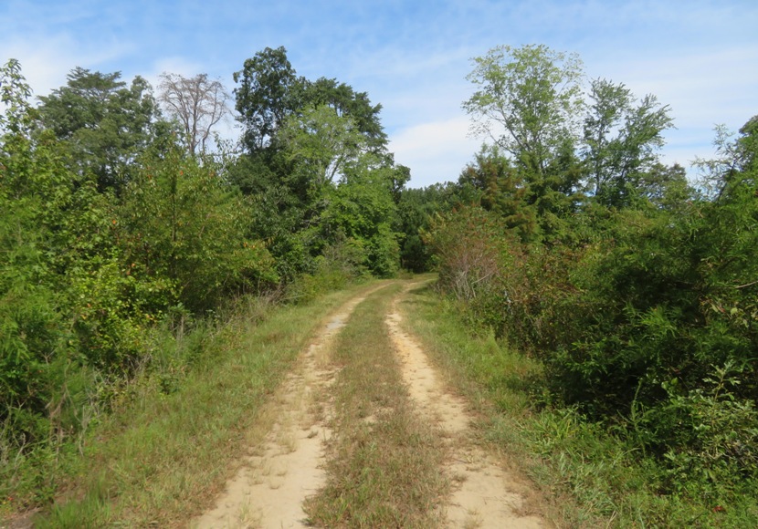
I didn't find Norma when I searched so instead I just waited by her boat and called to her. Eventually she showed up. That is an easy area to get lost but because it is bordered between the river and River Road, you can't get too far. We paddled under several bridges including this train bridge. Notice the concrete footing for a bridge that once stood next to it. Further upstream, we found the steel remains on both sides of the river from what might have been a pedestrian bridge. 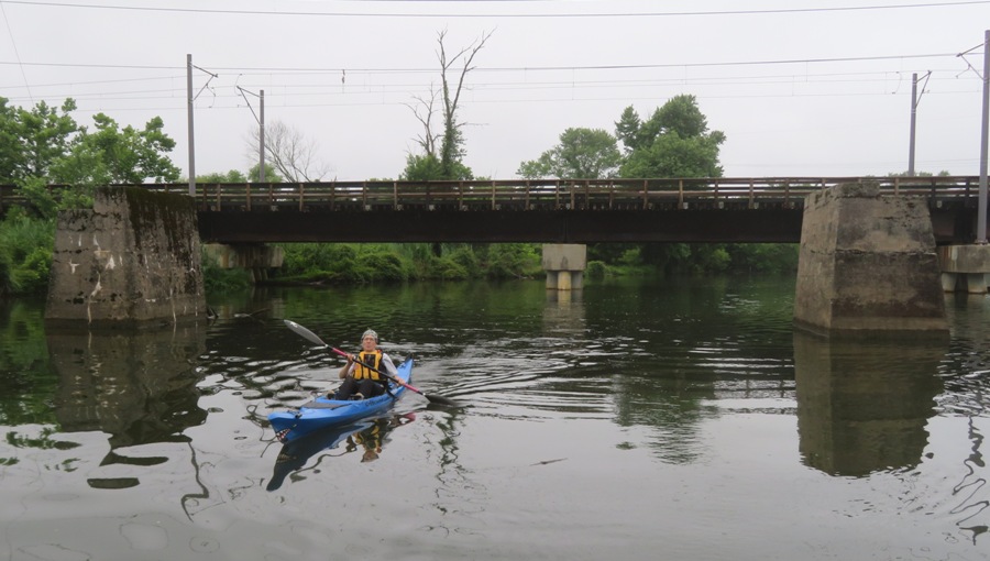
Even though it was mid-June, the air temperature was cool and there was a light rain. So I'm glad I wore my wetsuit. 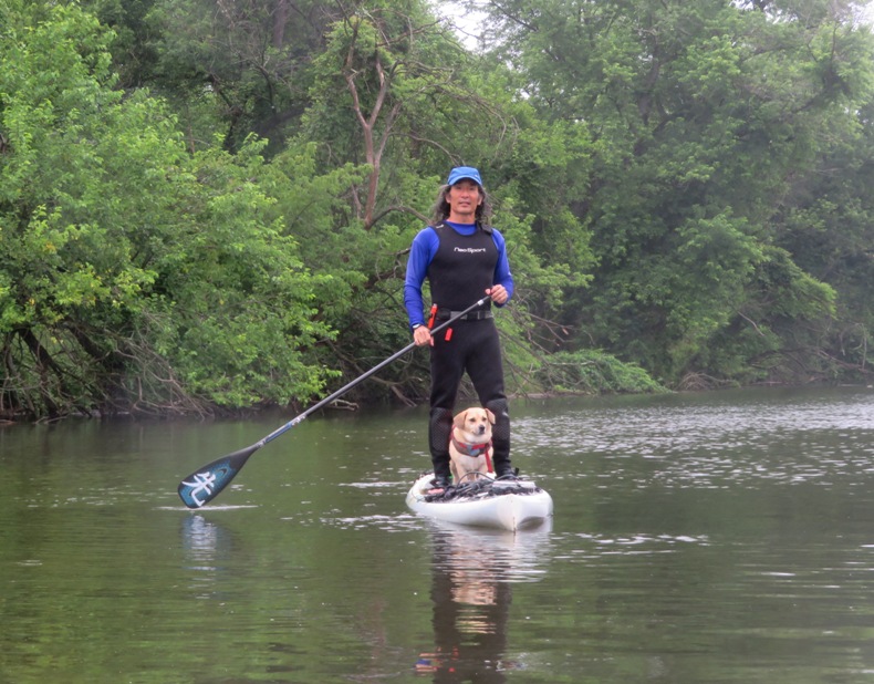
We paddled a total of 9.3 miles. 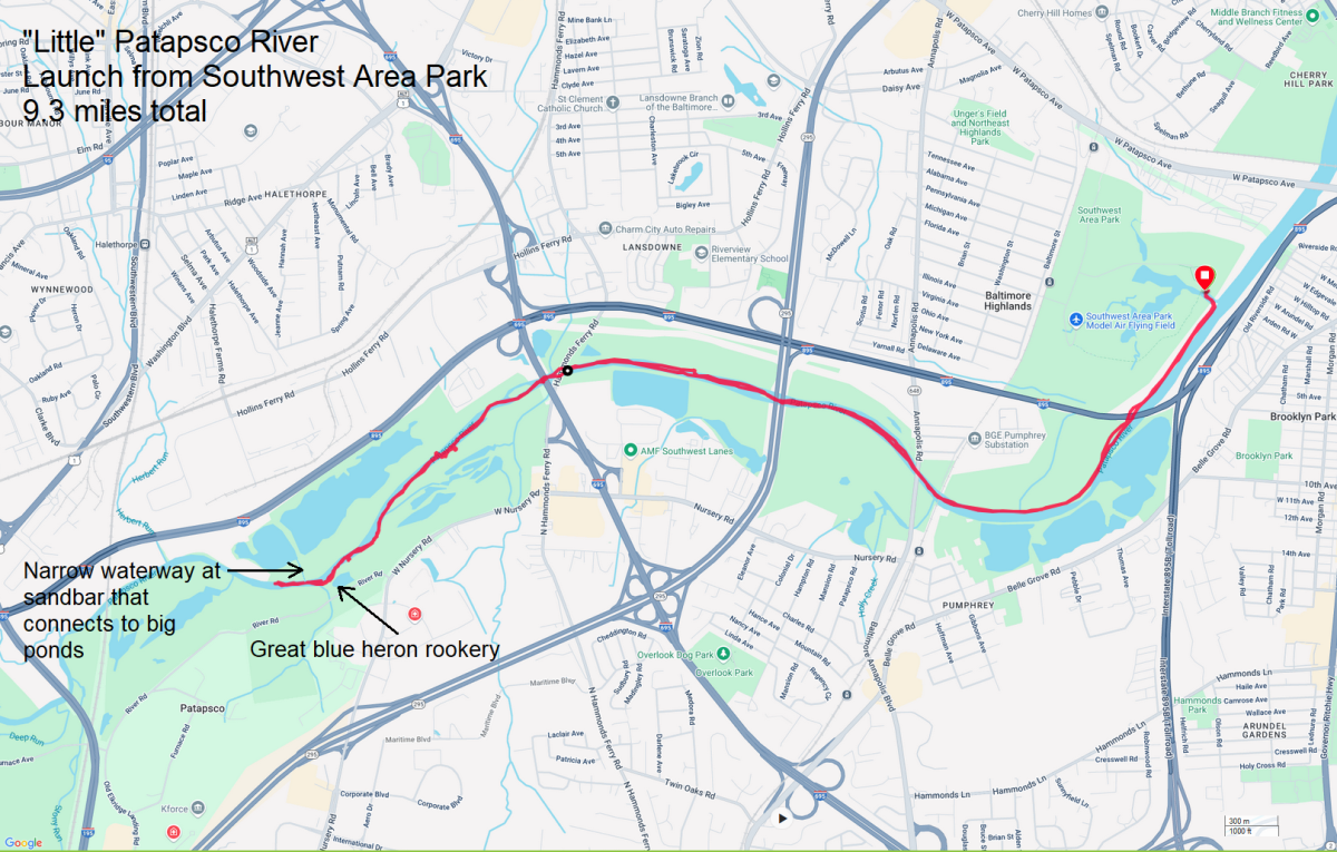
Feeling hungry, we picked up cheesesteak sandwiches at Cheesesteak & Co. in Elkridge. I've eaten lots of cheesesteak sandwiches including one from a popular place in Philly but I can honestly say that this was the best cheesesteak sandwhich I've ever had. |
|
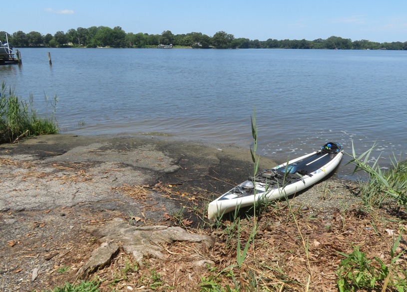
I launched from Fort Smallwood Park. It had been a few years since I'd been there and a couple things had changed.
Instead of my SUP, I brought my Prijon Catalina to test out my new rudder which I installed over the winter. It worked well, though it didn't enable me to turn as sharply as I expected. Maybe it is more of a user issue that I need to figure out. Regardless, I felt it was sufficient to help me maintain better control, especially when encountering beam waves or strong wind. There was supposed to be a fairly strong wind while I was out but I did not encounter it. I kayaked around the north point of the park and then southeast on the Chesapeake Bay. I figured I'd explore the smaller bodies of water along the way. I passed Fort Smallwood which was completed in 1896. It was built to protect Baltimore from perceived Spanish threats during the Spanish-American War era. 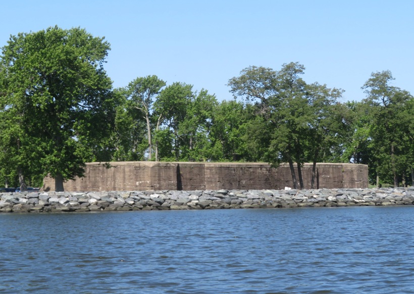
I found a very narrow waterway which I paddled up until I was stopped by Bay Street, which the water flowed under. But I could not fit under the road...there was absolutely no air gap between the road and the water. I was unable to turn around so instead I retracted the rudder by pulling on a rope and backed up. My next stop was a waterway which led to a marina. There was nothing there worth seeing and you have to be cautious about power boats entering or leaving. At the southeasternmost point of my journey, I found a narrow waterway which Dave L. had told me about. I paddled into this waterway to access Boyd Pond which I then explored. It was mostly natural and deep enough for paddling. I spotted a red-winged blackbird. 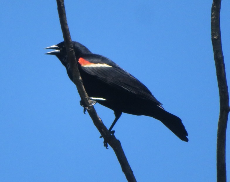
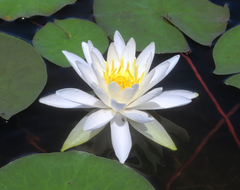
Back out on the Bay, I headed back to Fort Smallwood. Along the way, I found a narrow opening between some grasses on what appeared to be public land. It was about a tenth of a mile stretch between two houses on land that might well be underwater during a very high tide. I portaged across. I ended up at an unnamed pond that had a lot of lily flowers. I am naming this pond "Lily Pond." I was on a time crunch to make it to a doctor's appointment so I rushed back, maintaining good speed. Here is the route I took. I got in 8.9 miles. 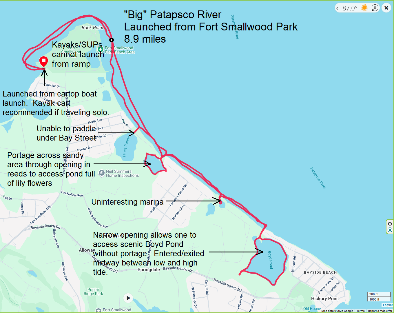
|
|
I joined the WatersEdge Kayak Club for some group car camping at Martinak State Park, and paddling on the local waterways on June 20-22, 2025.
|
|
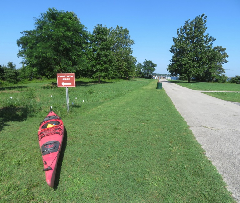
I was up at 0500 and on the water by 0745 with Daphne. We launched from Villa Road Landing. I stumbled onto this place just looking at Google Maps satellite photos.
It had been probably 13 years since I last paddled in this area. A lot can change in that much time. Looking at satellite photos, I thought the narrow upstream portions of these waterways might be interesting. I figured I'd check out Miles River. It was nice being out so early. I paddled upstream, hugging the east side which kept us in the shade. It was very humid and there was very little breeze. I saw lots of bald eagles and a couple of green herons, along with several great blue herons. Here's some other birds I spotted. I paddled past a wood duck box with its roof hinged open. Looking inside, I saw eggs...but not from a wood duck. 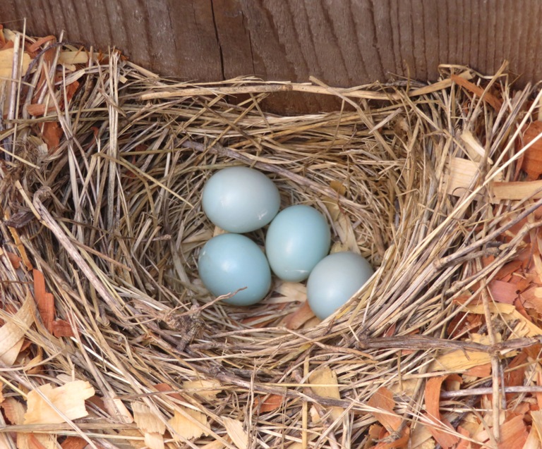
Unfortuntely, the only fish I saw up close were dead. One was a small fish that jumped onto my SUP. By the time I found it, it had perished. The second was a cownose ray. I don't know how it died. 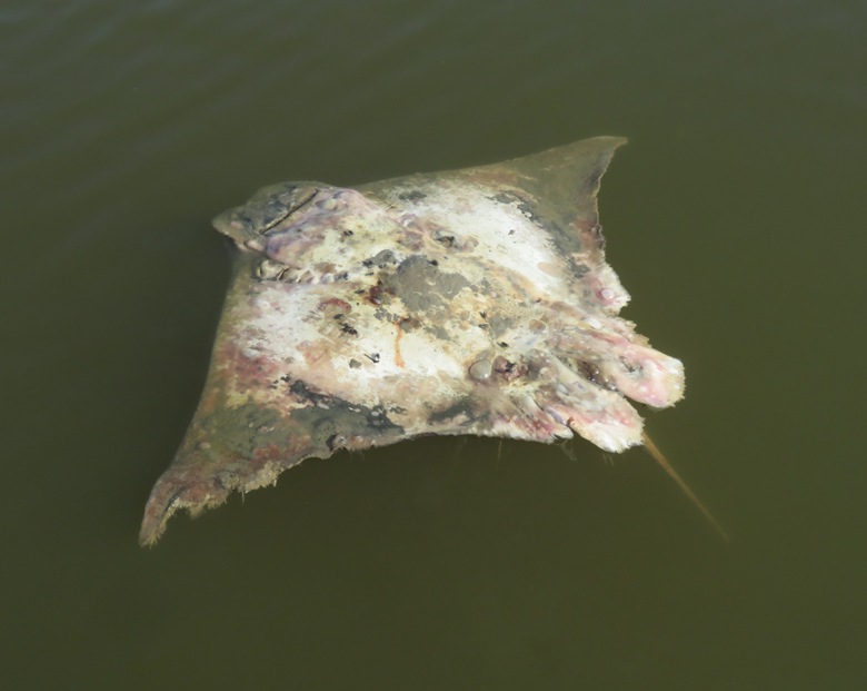
I explored some of the narrower waterways but wasn't able to get far on any of them. 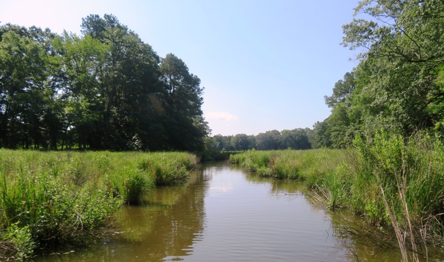
The plan was to go as far upstream on Miles River as possible. But just before it got interesting, we heard gunfire. Daphne felt uneasy and started trembling. Rather than continue, I turned around. I didn't want her to hate paddleboarding. There was another waterway I hoped to explore but there was a small dam and a road that I could not paddle under. But even if I could, I don't know if I would have. The water on the other side of the dam did not look healthy. There was a lot of algae blooms. Talbot County has a lot of residents with money, especially along its waterfront areas. But one mansion had this metallic boat at their pier. AI says: A 78-foot Naval Yachts XPM 78 can cost between $1,490,000 and $5,260,500 USD. 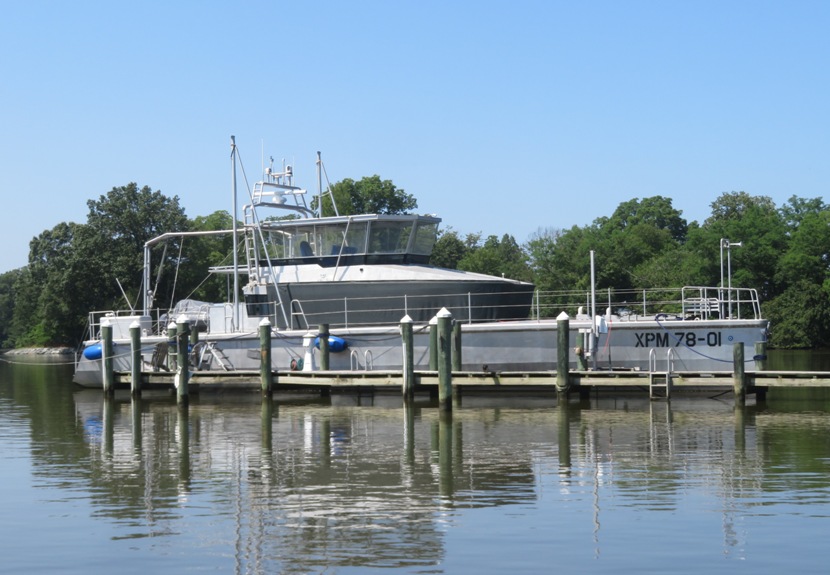
We were out for almost four hours and paddled 12.1 miles. I was feeling unusually slow. The heat index was about 92 degrees when I landed. I think I'm out of paddling shape. 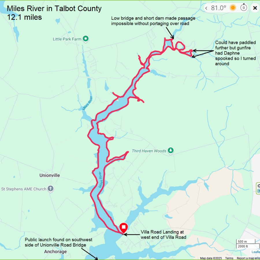
After paddling, I did some scouting. I started by visting Miles River Bridge Landing. I had forgotten that I launched here before. 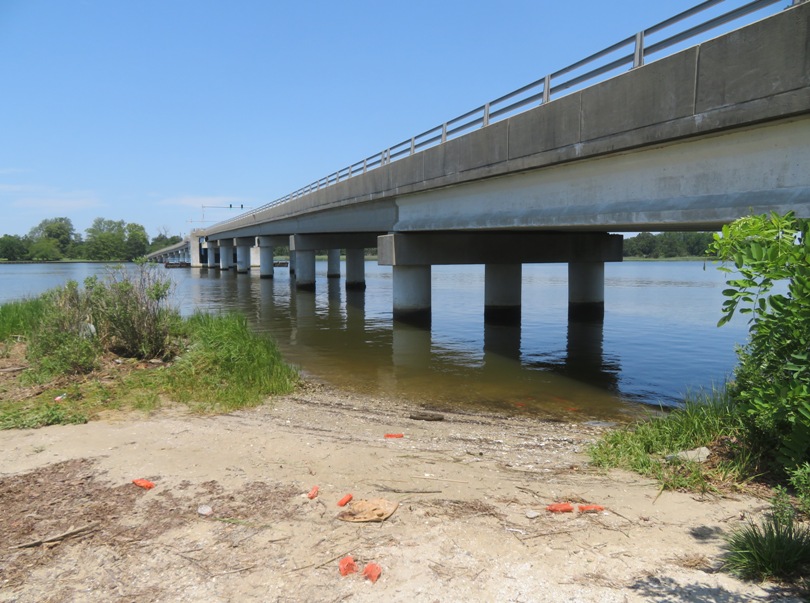
Next, I stopped at Tunis Mills, a place I had never been to. 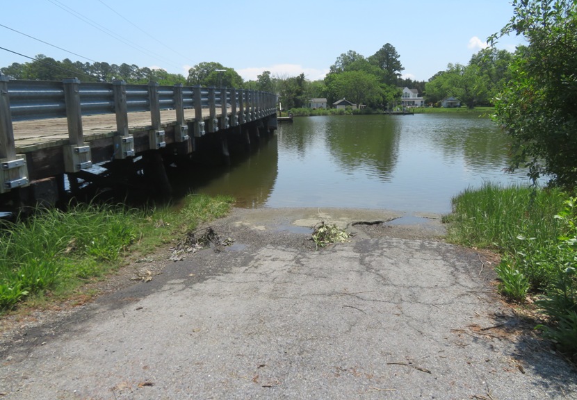
I doubt I will ever launch here. There is no parking. Why would the county purchase land for a launch site if there is no place to park? It took quite awhile to get home, but that's not unusual for a summer Sunday afternoon on the eastern shore. On highway 50, I saw a watermelon truck. I figured he would lose some fruit if he tried driving through Savage which has more than its share of speed bumps. 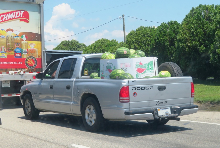
When we were out paddling, I made sure to give Daphne several dunkings to keep her cool. Now that we were home, it was time to give her a bath. |
|
After work, Daphne and I launched from Green Haven Wharf and explored the northwest side of Stoney Creek. I have a co-worker who lives in the area and I thought it would be nice to show her photos of the birds that live near her neighborhood.
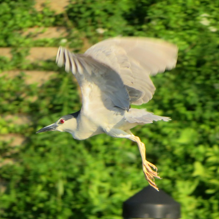
Stoney Creek and Cox Creek on its north side have a lot of black-crowned night herons. I figure there must be a rookery nearby, though I've never found it. I also saw a juvenile black-crowned night heron. I generally find these to be more camera cooperative than the adults. Maybe they stick around because they can't fly as well or perhaps they don't realize that humans are a threat. 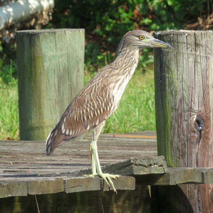
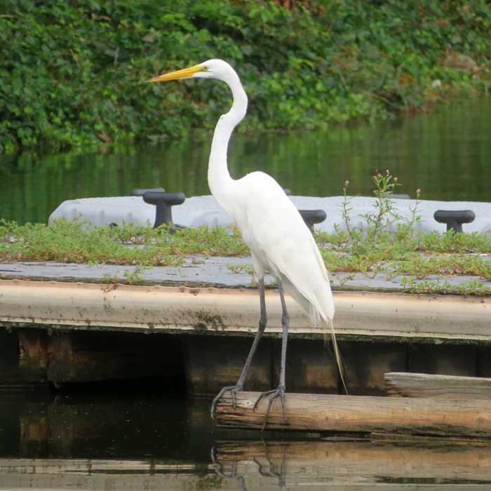
Great egrets are a common sight. 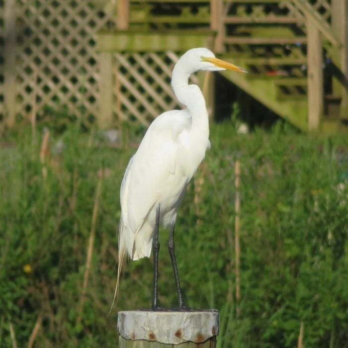
One bird I was not expecting to see was a little blue heron. I've seen a lot more juveniles than adults. This one is mature. I could not get it to cooperate with my camera. 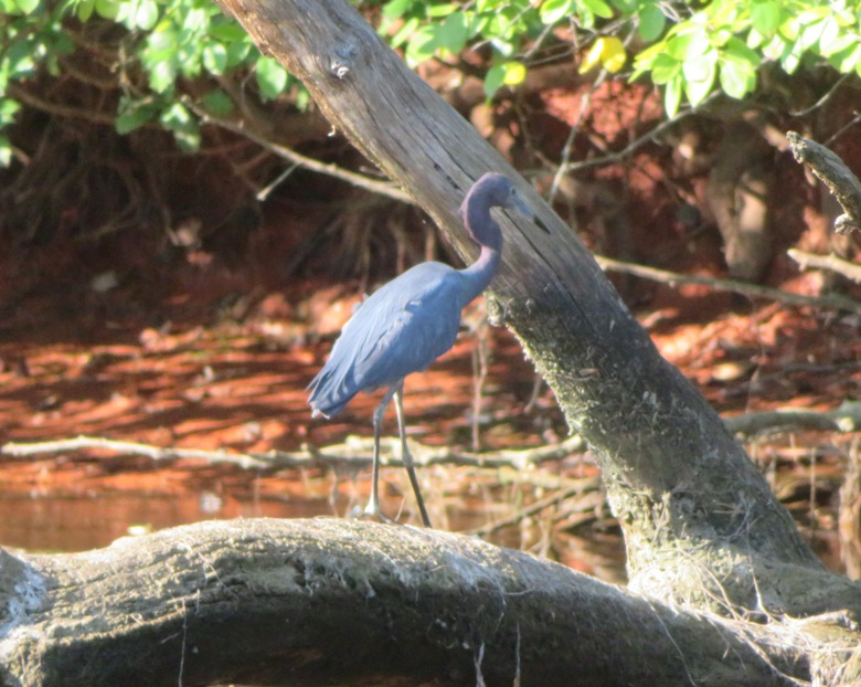
I typically paddle early in the morning, partly because I like to be out when there are fewer people. But being out late has its advantages. In the morning, during the summer I dread the sun being high but in the late afternoon, I look forward to the cooler temperature with the sun being low. It is nice to end the day on a good note. Here is our route. We got in 10.5 miles. 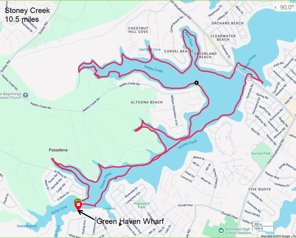
|
|
I was hoping to have six of us plus Daphne on this shark tooth hunting trip but it ended up just being Marla, Daphne, and me.
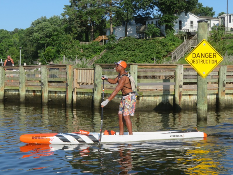
I was up at 0420 and on the road an hour later, arriving at Mallows Bay at 0645 to find Marla all ready to go. We launched at 0700, paddling south on the Potomac River. There were a few reasons why we started so early. Low tide was ~0830. Starting early was also important because the water is more likely to be calm from both the boat traffic and the wind. The temperature would be cooler too. Calm water wasn't just important for paddling...it makes it easier to actually look into the water for fossils. We pulled ashore in the Purse / Nanjemoy Wildlife Management Area (WMA). I tend to stop in places not near trailheads which makes it less likely that we will encounter others looking or shark teeth. But this morning, we had no such luck. Even far from any paths, we saw quite a few others. These were likely hardcore fossil hunters. They beat us to the area and cleared out the easy finds. Here's Marla ready to look for fossils. 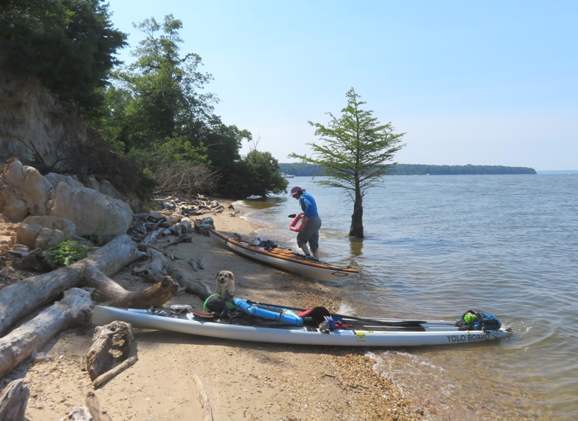
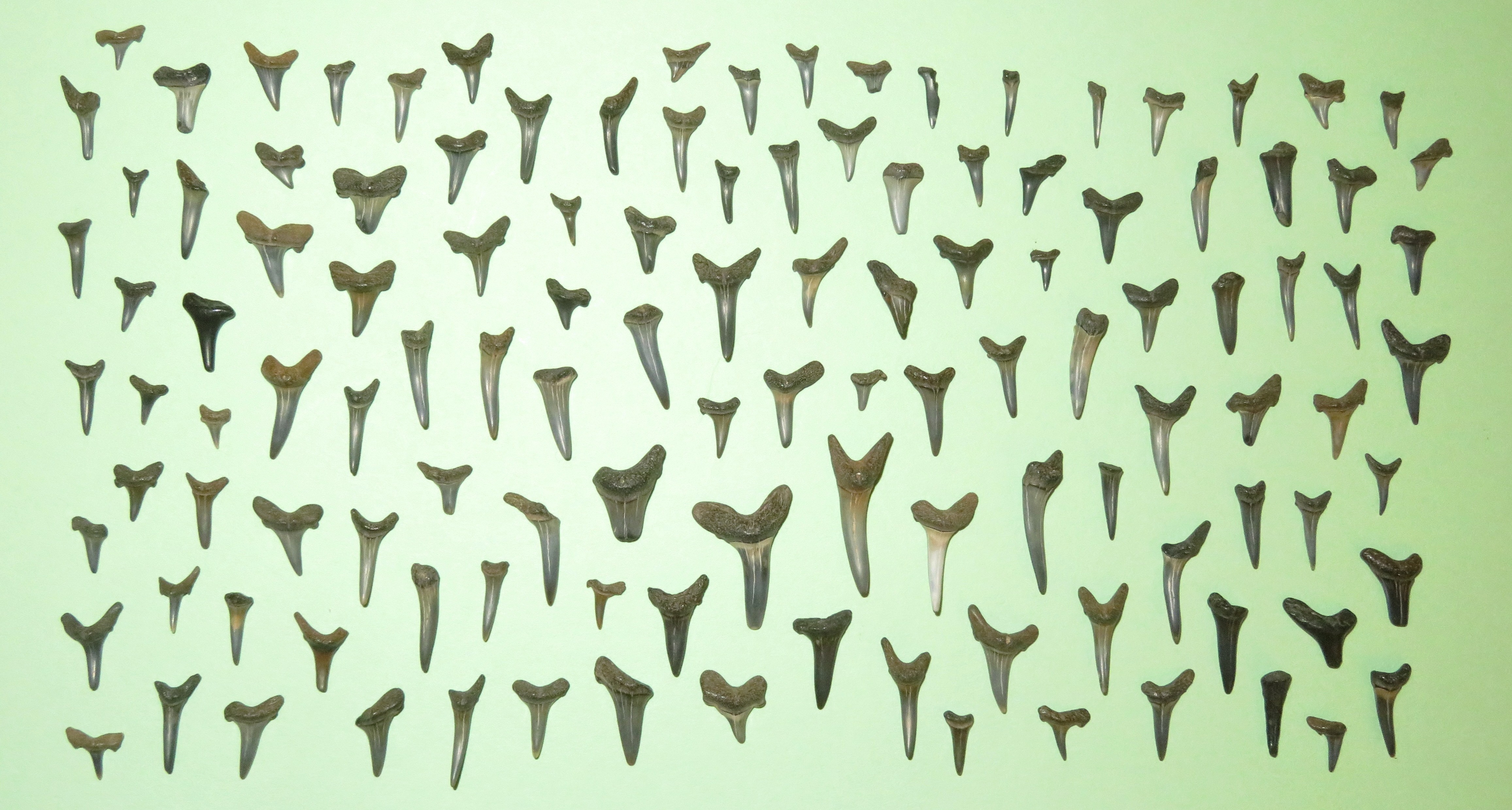
We paddled to three places to search. While we looked, Daphne lied in the shade on the beach. It was a perfect day for her to do so. It wasn't too hot or humid and because the shoreline faced west, Daphne always had plenty of shade. There was some headwind on the return paddle along with lots of boat wakes. I ended up finding 121 shark teeth. See photo at the bottom of the page. Marla found 45, though I think hers were, on the average, bigger than mine. We also found turitella casts, pieces of ray dental palate, and my personal favorite, a piece of fulgurite! I've found similar things in the past but this was the first time I was confident it was a fulgurite because it was hollow. Marla agreed with me. The long thing below is the fulgurite. It looks smoother than a lot but I think that is partially because of the wear and tear of being on the shoreline. 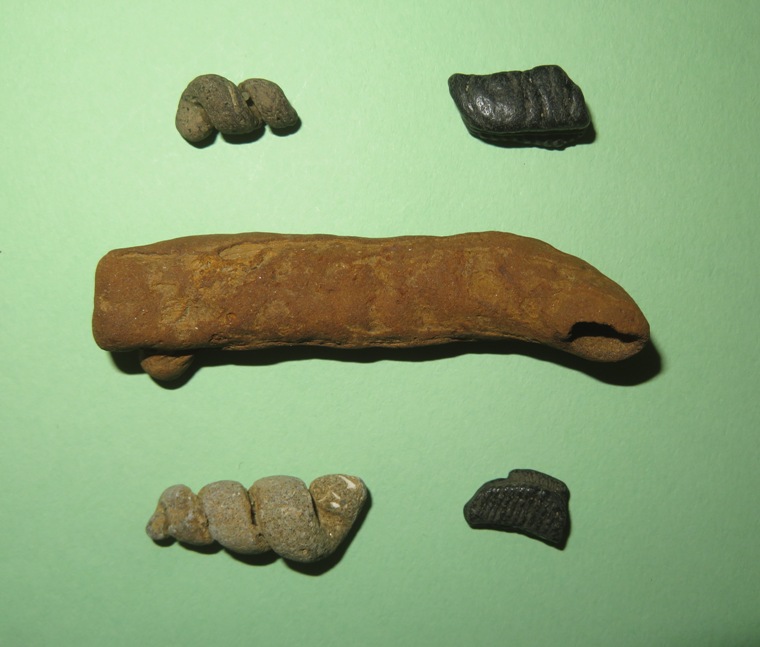
Here are some the best teeth I found that day. Notice there are no serrations. I find teeth with serrations on the Chesapeake Bay side, not on the Potomac. Here in Charles County, the teeth are older and less diverse. 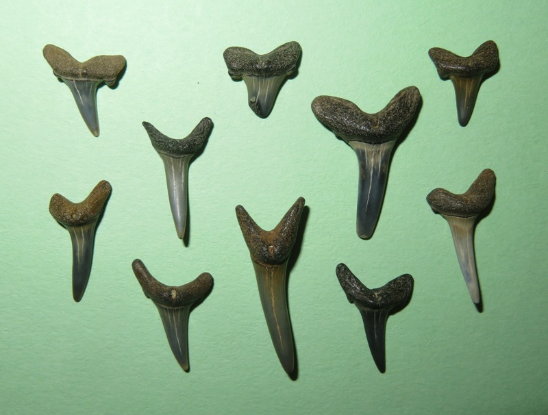
After fossil hunting, I took Daphne for a short walk, maybe a half mile. I found a hole where there had been what I presume were turtle eggs. I don't know if they hatched naturally or if a predator got to them. 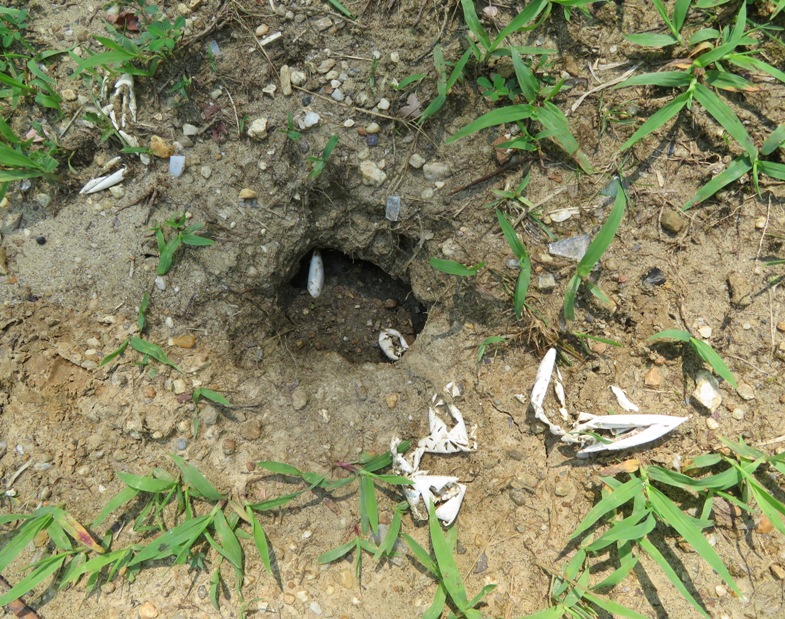
I generally think of Independence Day as being when wineberies are ripe. I found and tasted them. Some were ripe and others could have used a few more days to ripen. But I did not find many, which led me to think that many had already ripened and had been eaten or picked. 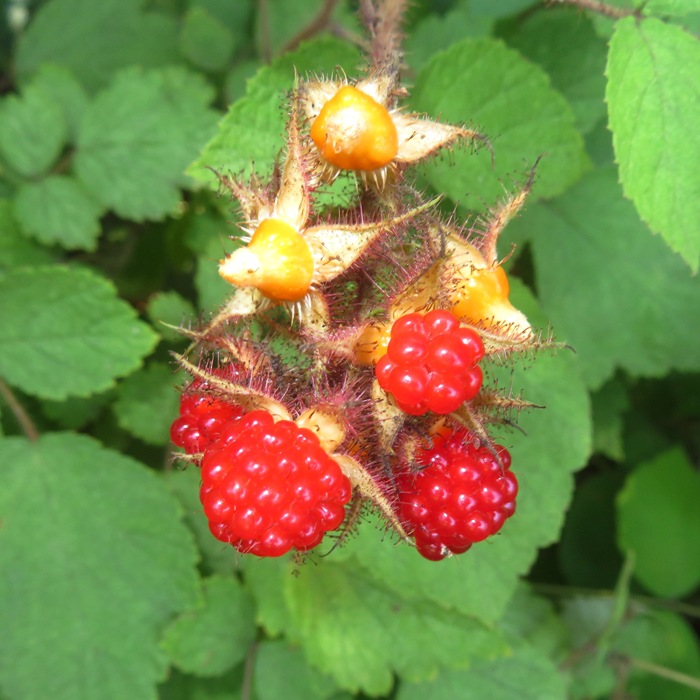
I was reminded of why I hate driving to Charles County. The trip down was fine but heading back north with traffic, I found that if you drive normal speed, you will hit almost every red traffic light on Indian Head Highway (Route 210). |
|
After purchasing recreational passes to use the Rocky Gorge Reservoir (aka T. Howard Duckett Reservoir), Norma, Daphne, and I started from Brown's Bridge and then walked west on a trail that ran mostly parallel to the Patuxent River. We were looking for wineberries and chanterelle mushrooms. In the past, we've found a lot here. But today, the berries were mostly picked over and we didn't find chanterelles. We think the hot weather caused the wineberries to ripen more quickly than normal.
Thinking we could at least have a nice hike, our hopes were shattered the mosquitoes found us. We had sprayed down and I was also wearing a long sleeve shirt and long pants both sprayed with permethrin. But these flying vampires were ready to attack any square inch of clothing or exposed skin that was not treated with repellent. I've spent plenty of time in mosquito-infested places but this was by far the worst I've encountered. Why was it so bad? We did have a lot of rain recently and it was also hot and humid. In past visits, mosquitos were an issue but never this bad. It didn't take long before we raced back to the car. Not willing to give up on our foraging endeavor, we went to Schooley Mill Park and walked the trails there. Mosquitoes were not a problem. Unfortunately, there were almost no wineberries or chanterelles. There clearly had been berries but other foragers or critters beat us to them. In the end, we had just a few wineberries and even fewer blackberries to show for our morning effort. 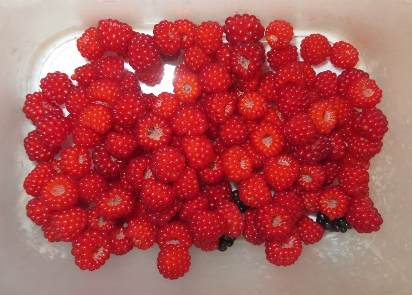
The three of us stopped for lunch at Pepperjack's Subs in Laurel. We rested up at home and then were visited by Teresa and Bob, who tasted what we picked. Then we returned to the reservoir. Making use of our one-day recreational passes, Norma dropped me and my kayak off at the Brown's Bridge ramp while she returned to the trail. This time, she was wearing a mosquito head net. It would have been nice to have Daphne with us but she got in plenty of exercise with us in the morning. I was on my Prijon Catalina because SUPs are not allowed on the reservoir. The following (bulls**t reason) is from the "Watershed Regulations FAQs" website: WSSC Water's watershed regulations prohibit surfboards, stand up paddleboards, windsurfers, or any craft which facilitates frequent body contact with water in the reservoir. This decision comes from the fact that WSSC Water's reservoirs are not lakes with gently sloping sides and flat bottoms, they are deep reservoirs with steep drop-offs and submerged hazards that contribute to the number of accidental drownings that occur on the watershed. The purpose of our reservoirs is to provide a secured source of drinking water for over 600k of our customers, and we are obligated to protect them. It was a good day to paddle. The water level fluctuates quite a bit at the reservoir and today it was high. I was able to get further upstream in certain areas than I had in the past. I passed the remains of an old bridge foundation at the power lines. 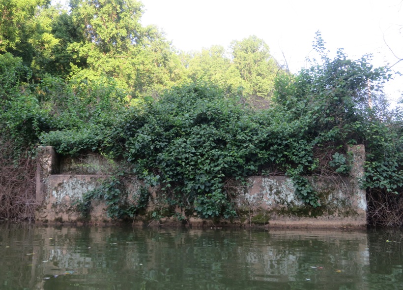
I found Tucker Lane. I might have paddled under it if I was on my SUP but I don't think I would have gotten far. 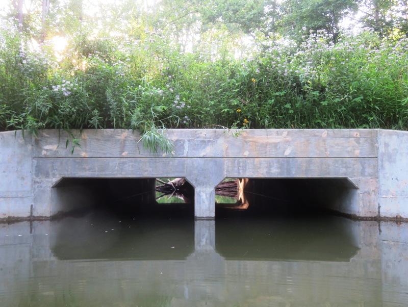
I paddled under Ashton Road (Route 108). 
I pulled over and found a raccoon footprint. 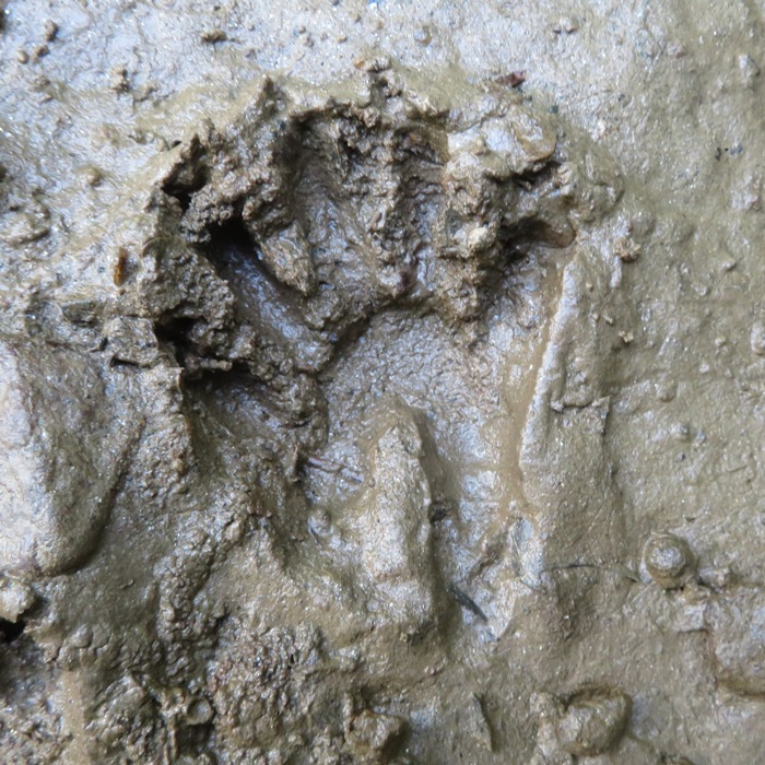
While the reservoir is open and wide, just a short distance upstream from Brown's Bridge on the Patuxent River is narrow, cool, and shaded late in the day. Mosquitoes were not an issue on the water. 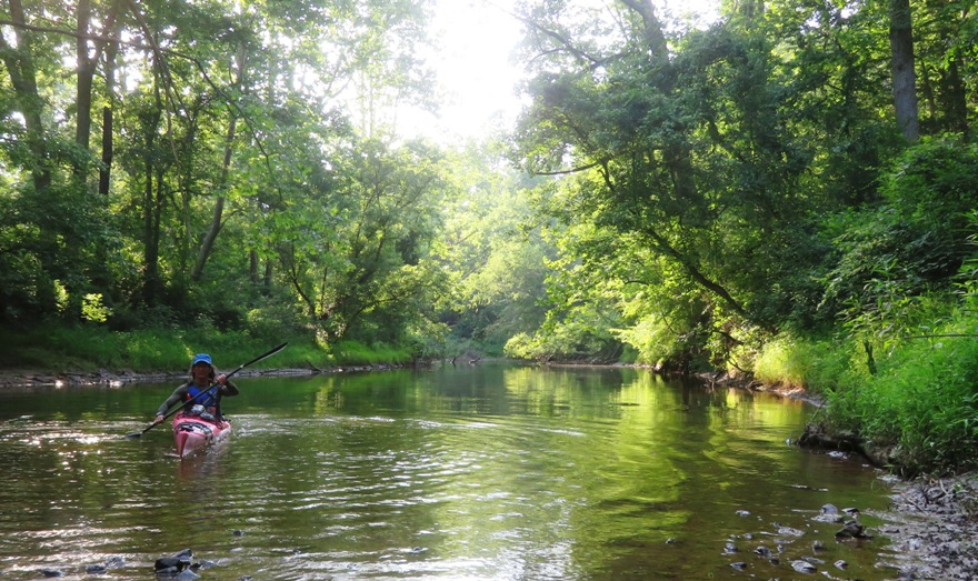
I paddled an easy 5.9 miles. 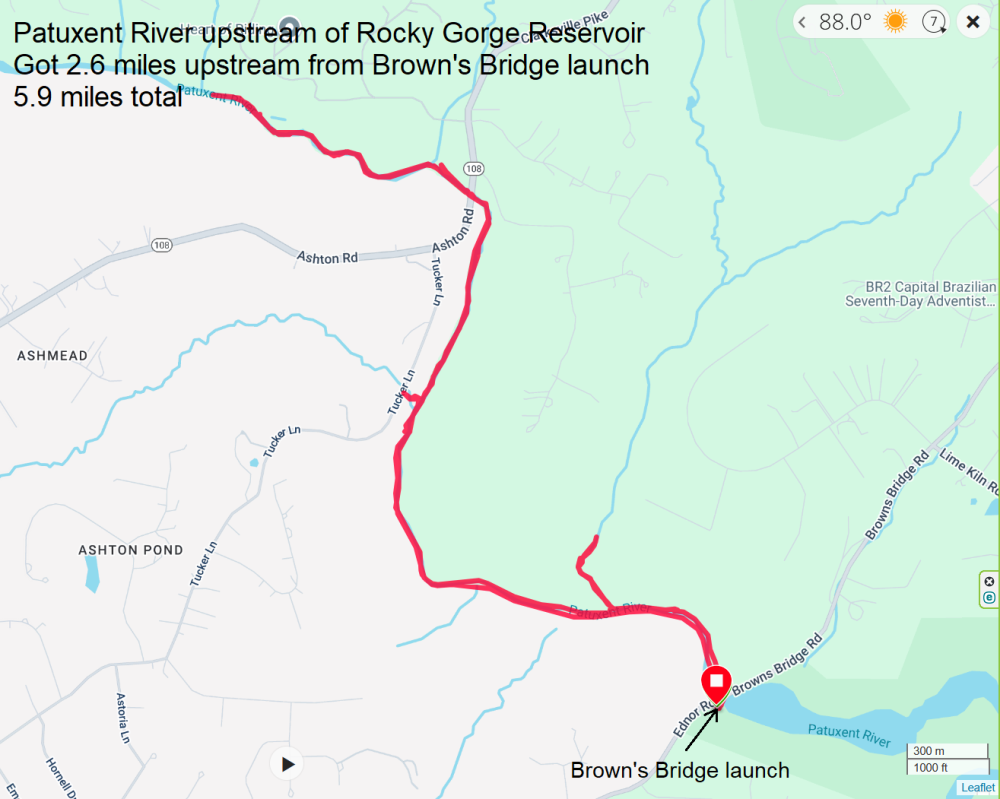
Norma picked me up at the ramp. She didn't find much in terms of wineberries or chanterelle mushrooms. But she said the mosquitoes were still horrendous. The next day, Norma made waffles. I figured out why they have pockets. It is to hold wineberries. 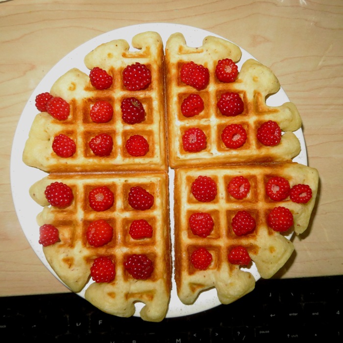
|
|
Daphne and I paddleboarded on the Rhode River, launching from Carrs Wharf. This was the fourth day in a row that I was on the water. Needless to say, it was a good weekend.
Always cognizant of Daphne's well-being, I pulled over at two beaches where I let her sniff and roll around. 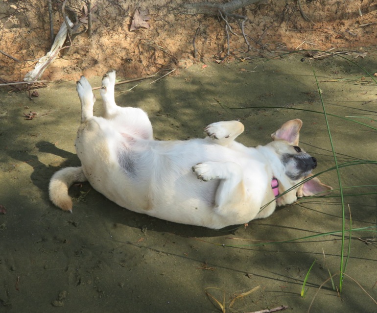
Exploring on shore, I found the burrows of several antlions. These are also known as doodlebugs. I've only seen the larva once in my life, when I was a kid. 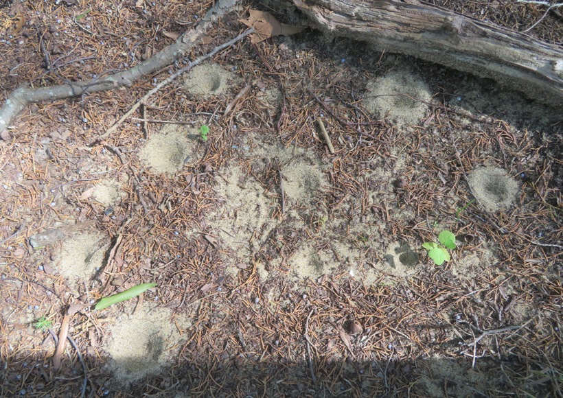
At another beach, I found a dead blue crab. If it could talk, I think it would say, "Welcome to Maryland." 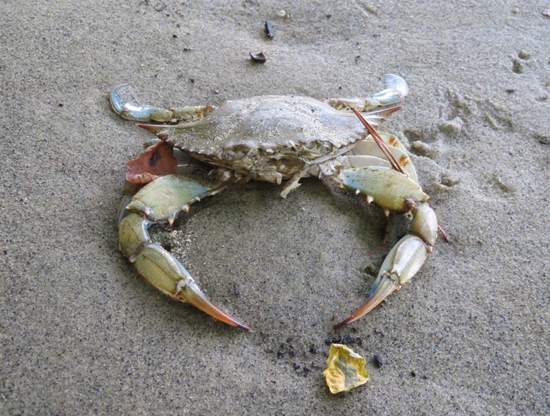
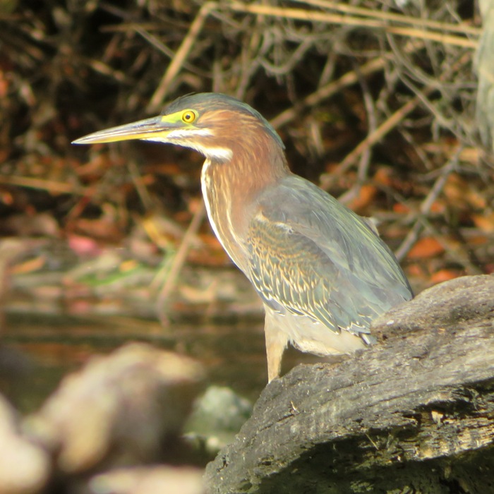
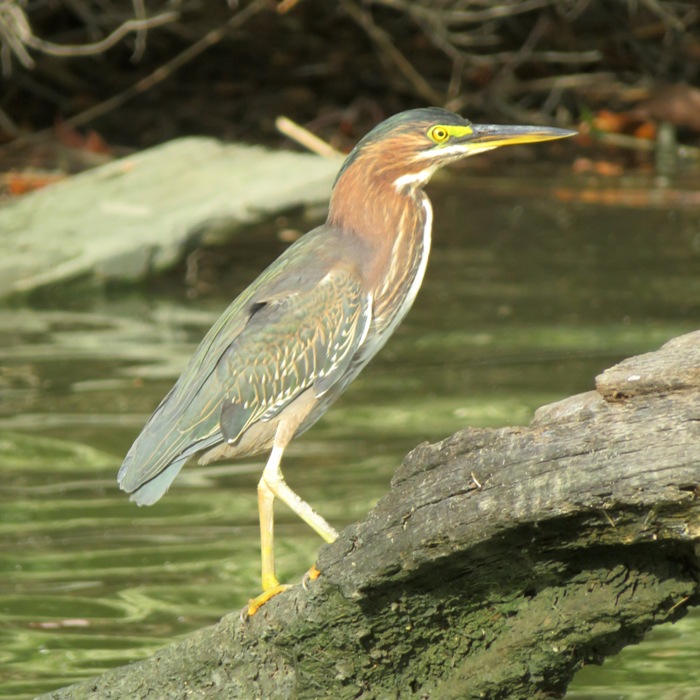
The green heron is my favorite local bird. It has beautiful colors which are really brought out in bright sunlight early or late in the day. They typically don't like to pose, but today, at the Smithsonian Environmental Research Center (SERC), I was fortunate enough to find one that did. 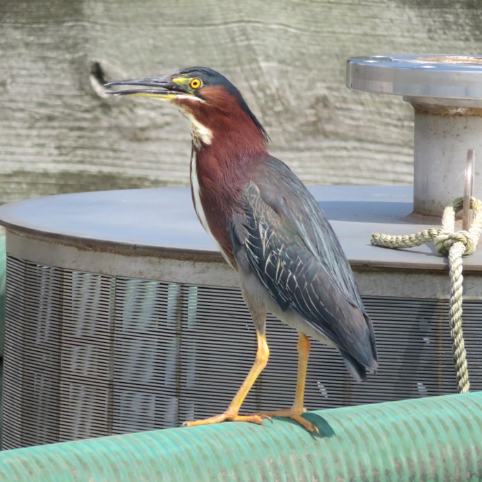
I got in 6.6 miles. 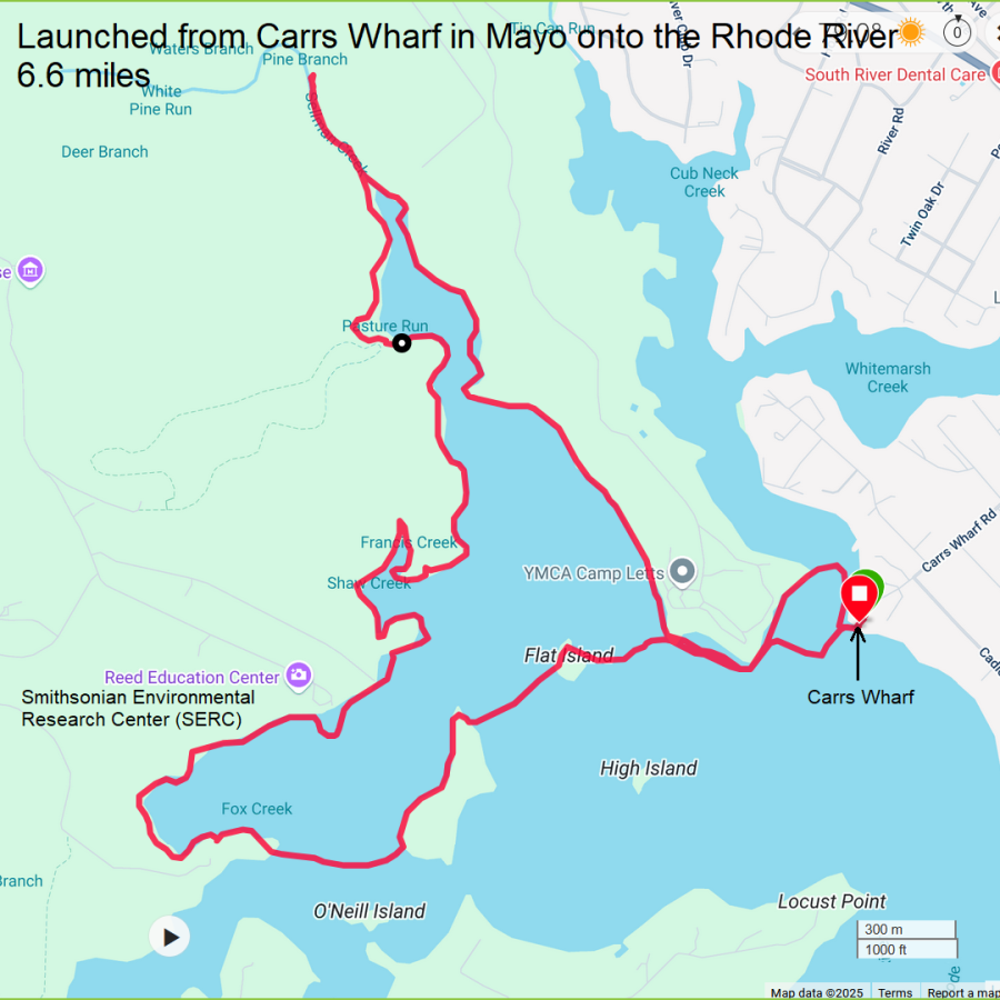
I spotted a black vulture perched on the Carrs Wharf sign. I don't know if it was an indicator of welcome or warning. What do you think? 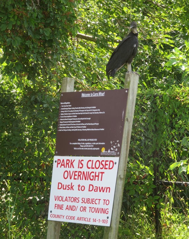
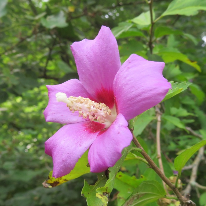
I got home with plenty of time to mow. In our back yard, I stopped to admire our Rose of Sharon (Hibiscus syriacus) flowers at the west end of our property. This one has a pollinator inside. 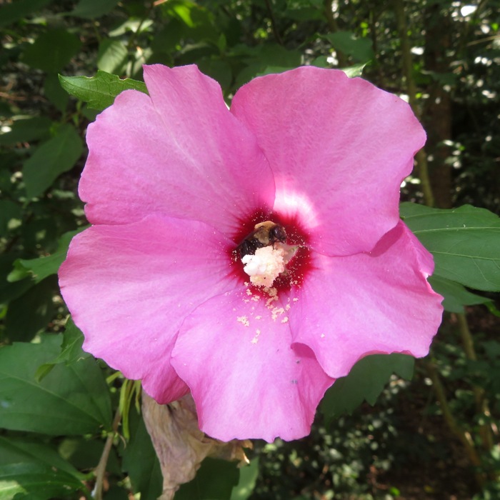
|
|
This weekend, I am dogsitting Mia, who is Daphne's biological sister. I've taken her out paddleboarding with Daphne and really enjoyed having her along. So I jumped at the opportunity to do it again. Shortly after her owner, Richard, dropped her off, I took both Mia and Daphne out to Green Haven Wharf where about ten of us launched onto Stoney Creek.
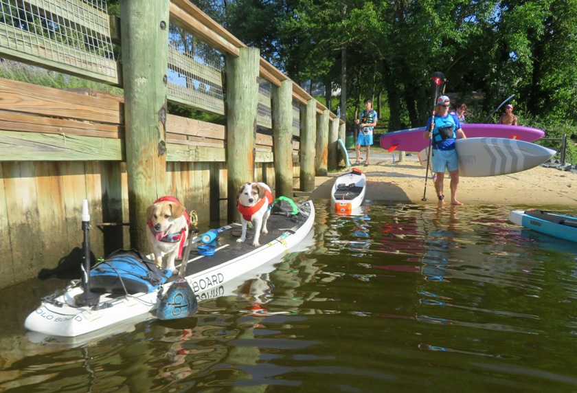
I saw several familiar faces, including Ellison, Lisa, Chip, and James. I also met a new person by the name of Howie. Here's about half of the group. 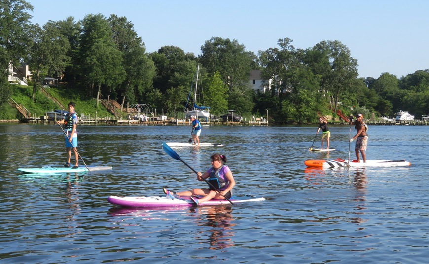
Chip took this shot of me with Mia and Daphne. 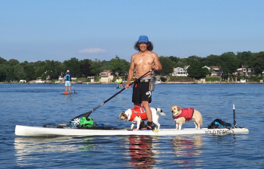
I pulled over briefly in Big Burley Cove at a beach so the girls could dig, sniff, roll around, and pee. 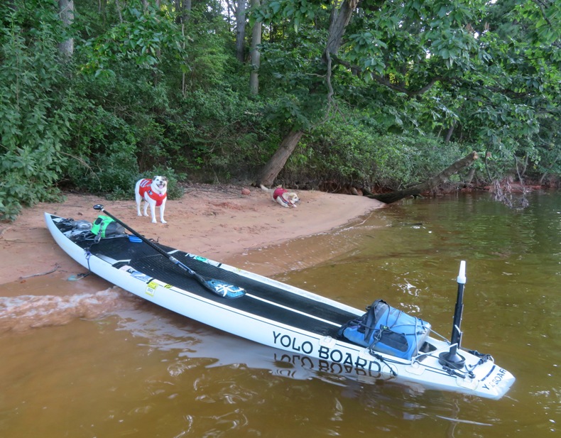
This trip was somewhat similar to my recent trip on July 3 but unlike that trip, in the second half, Mia, Daphne, and I ventured out on our own to explore the south side. I saw two black-crowned night herons but I was unable to capture them on film. I ended up paddling 4.8 miles. Here is my route. 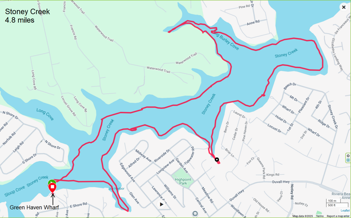
|
|
In World War Two, the Marines fought in the Pacific using a military tactic called island hopping. This forced them to take islands inhabited by the Japanese so that the Marines could eventually make their way to mainland Japan. I'm writing this blog in a fun way to honor my fellow jarheads who participated in this campaign.
Today, I took two devil dogs with me to Saint Michaels for an island hopping trip. Daphne and Mia were the dogs in question. We launched from Back Creek Park / Chew Street Park. Directly across from the launch site, I heard the distant sounds of a great blue heron rookery. But dense foliage prevented me from getting visual confirmation on any nests. A listening post was the best I could do. I did, however, manage to spot this bird. 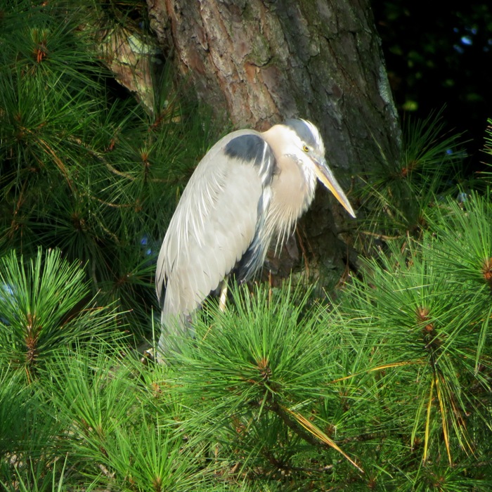
Once I got home, I confirmed the presence of nests via aerial reconnaissance (a satellite photo). 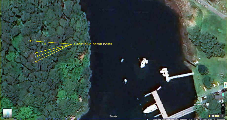
The three of us made our way south on San Domingo Creek to our first amphibious landing at Leoni Island. 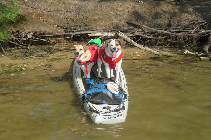
Continuing south to Broad Creek, I scouted for suitable beaches where I could pull my landing craft ashore. Here we are at one such place on Hambleton Island. 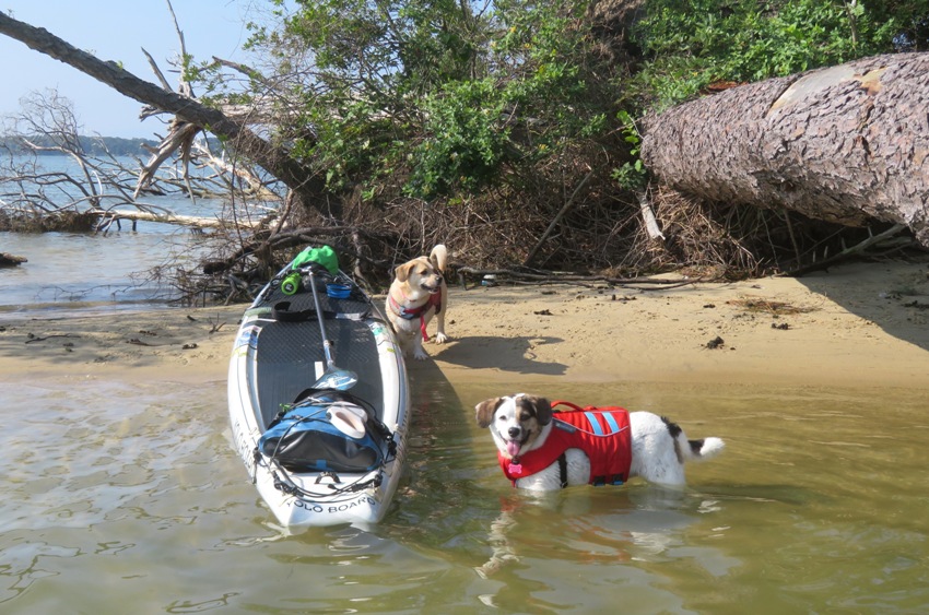
I spent a lot of time wading in the water to get pictures of the girls. In doing so, I got a lot of sea nettle stings. Not exactly Purple Heart worthy. Island hopping our way even further south, we came to two unnamed islands. Little remains on these tiny patches of land which were almost certainly a single island not long ago. 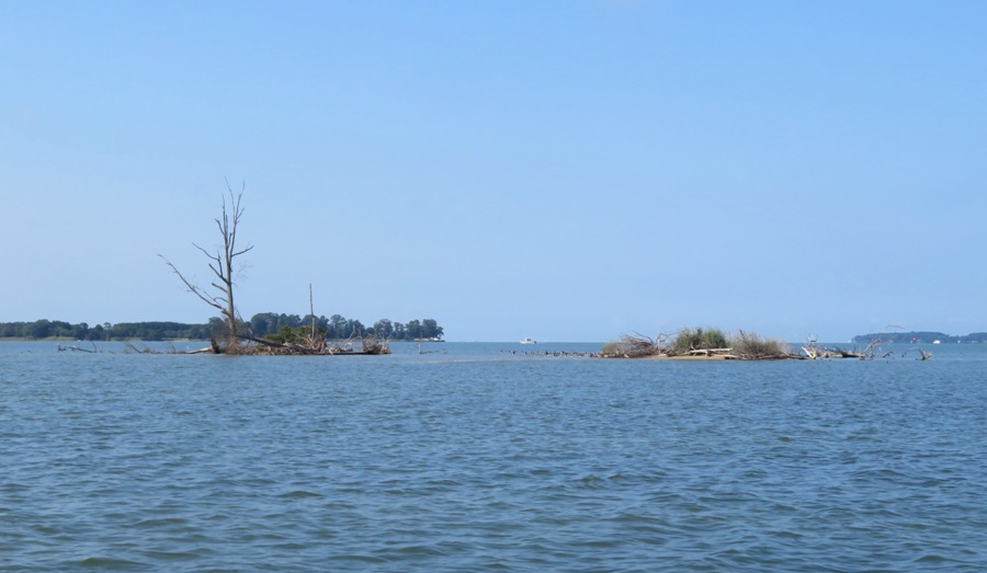
At one of the unnamed islands, I shot (with my camera) a green heron. 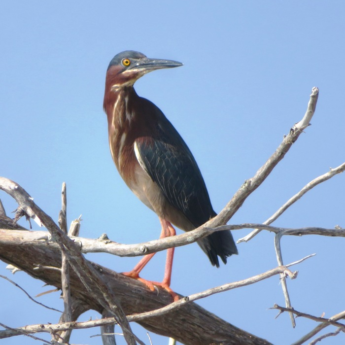
After accomplishing our mission, we returned north. Along the way, we made another stop at Leoni Island on a different beach. 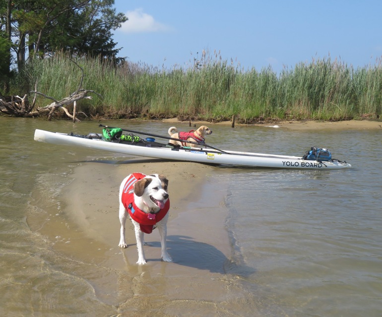
Here I am with Mia and Daphne at Leoni Island. 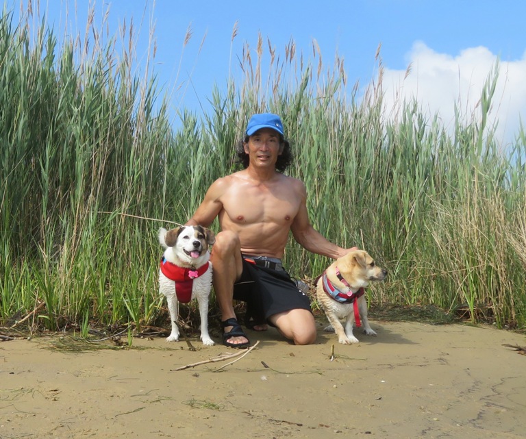
Back in San Domingo Creek, it was easy to take a wrong turn. Fortunately, I had my GPS to keep me on track. One thing I learned is that when returning, take the waterway to the left of the water tower. Near the launch site, someone decided to improvise, adapt, and overcome to grow vegetables in an area where they could maximize their sunlight. 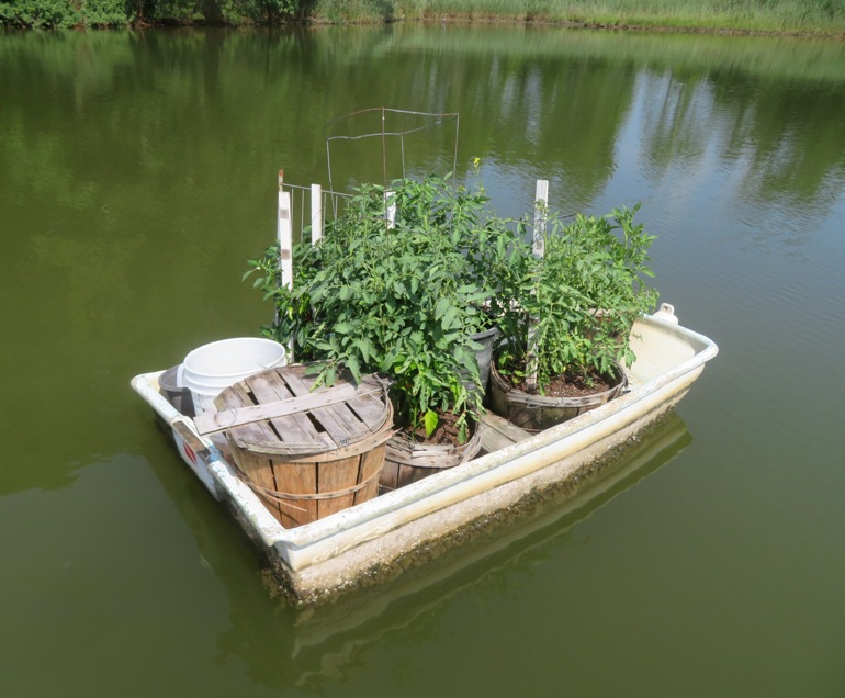
I ended up paddling 6.7 miles. Here is our route. It is similar to "2. San Domingo Creek to Hambleton Island" at St. Michaels Kayaking Tour. 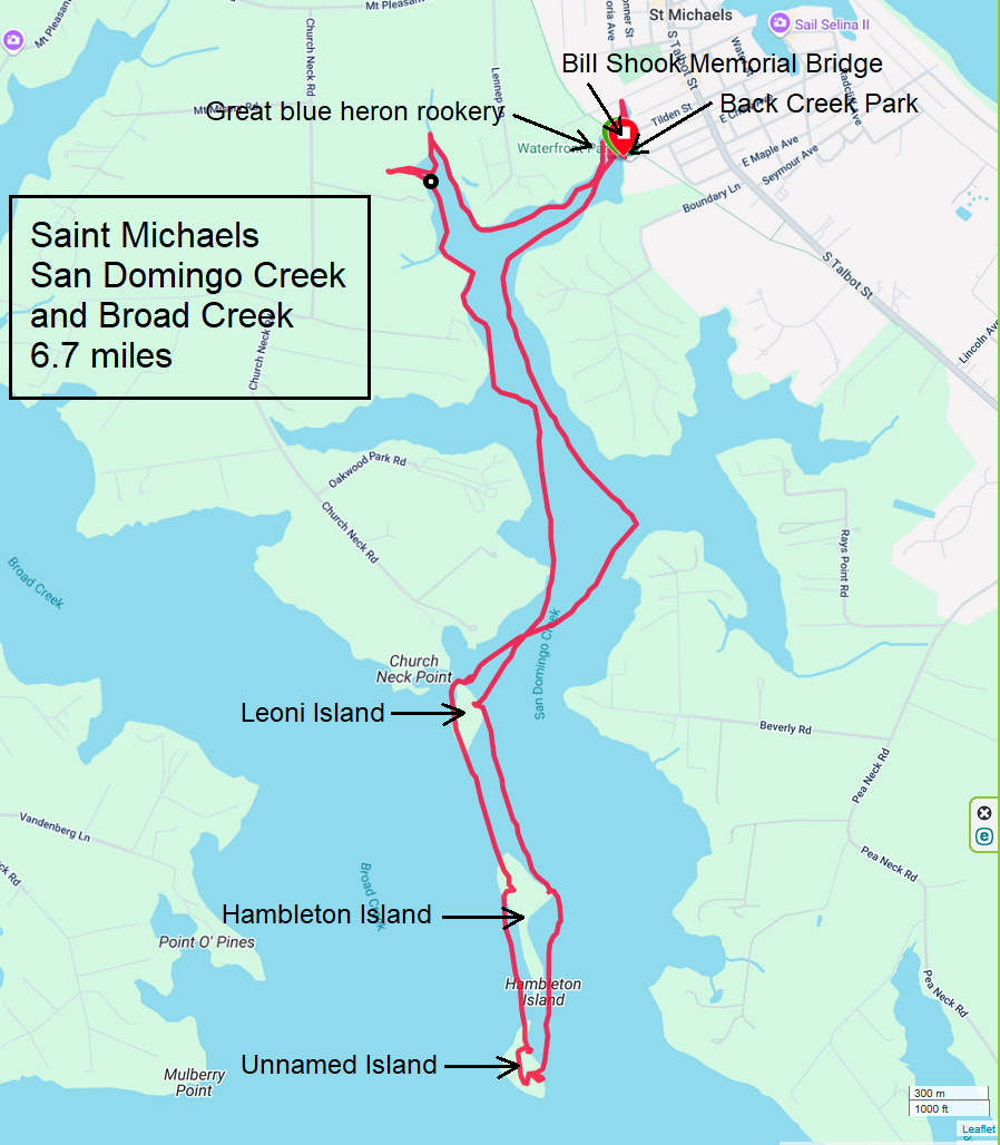
After paddling, I took Mia and Daphne on a death march via the Saint Michaels Nature Trail. Actually it was a casual stroll, only about a mile long. The loose connection to "death" was that we walked through part of Saint Lukes Cemetery. |
|
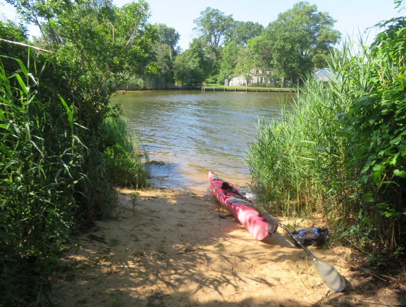
Today was Mia's last day with me before she went back to her family. So I took her and Daphne out to Marley Creek. We launched from Solleys Cove Park at 0700.
It was great being out so early when the wind and water was calm. I saw several birds. I also saw a variety of flowers. This is an area I've paddled often but things were looking different today. It seems the narrow part of the creek flowed a little differently near the big pipe. I also noticed an elevated nesting platform which might be new. I wonder if it is intended for a specific type of bird. 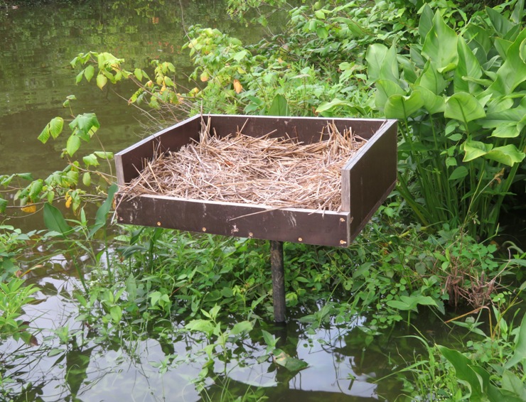
Additionally, I saw a mallard duck nesting tube, also known as a "hen house." These structures are designed to provide a safe and secure nesting site for mallards, helping to increase their breeding success compared to ground nests which are vulnerable to predators, livestock, and disturbance. 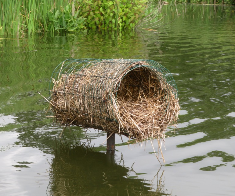
Far upstream on Marley Creek, I saw several blackberries. I ate some and offered Mia and Daphne a taste. They declined. 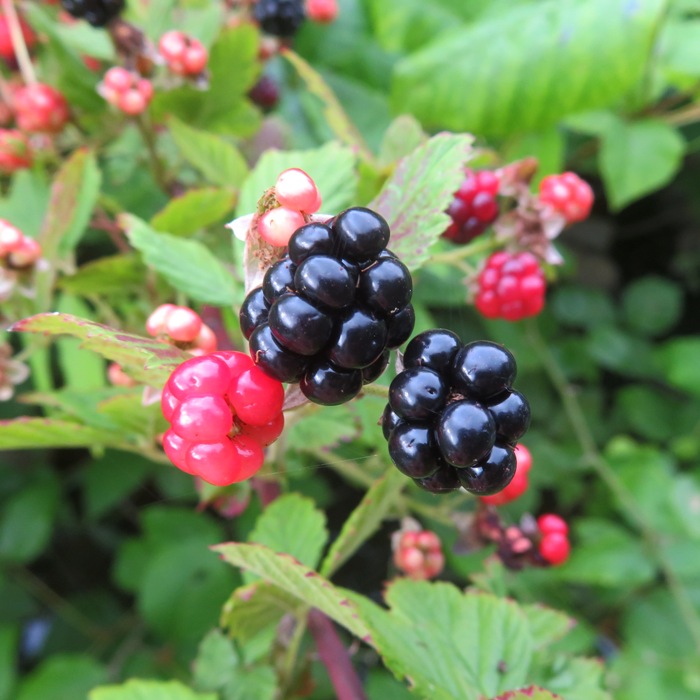
The high tide helped me get very far upstream, where I saw what I initially thought was a large muskrat. But then it slapped its tail on the water, making a loud "smack." At that point, I knew it was a beaver. Nearby on land, I found its lodge. I expect it may eventually build a dam and reshape the layout of the land. Paddling downstream, I spotted a wild persimmon tree. The fruit won't be ripe for a few more months. 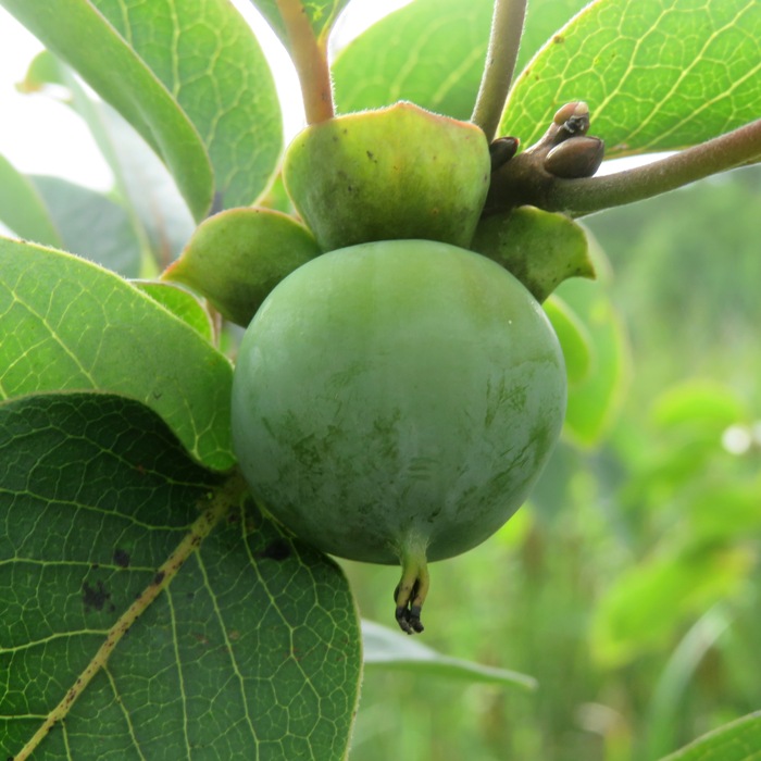
I came across this boat wreck which has evolved into a large plant pot. 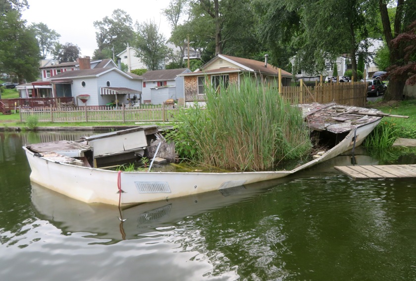
The plan was to stop at sandy beaches to let Mia and Daphne explore. The problem is that it was near high tide, and most of the beaches were underwater. But I did manage to find this tiny patch of sand so they could stretch their legs. 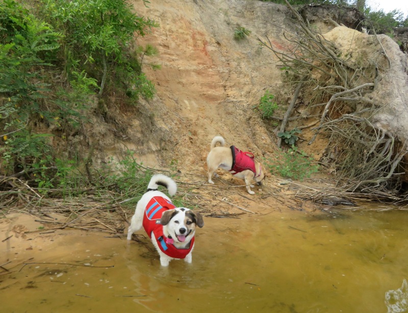
Near the beach, I found a great blue heron rookery. I wan't able to see any nests, but the distinct chatter of the juveniles left no doubt in my mind what was there. We paddleboarded 8.5 miles. 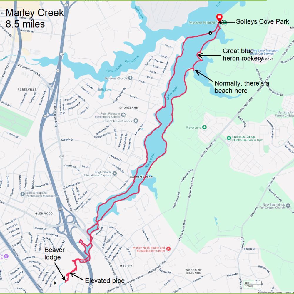
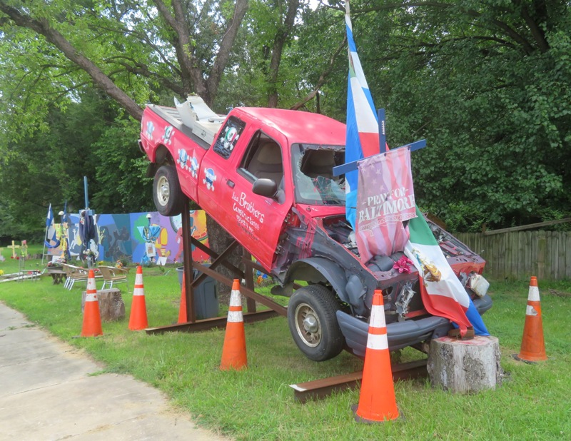
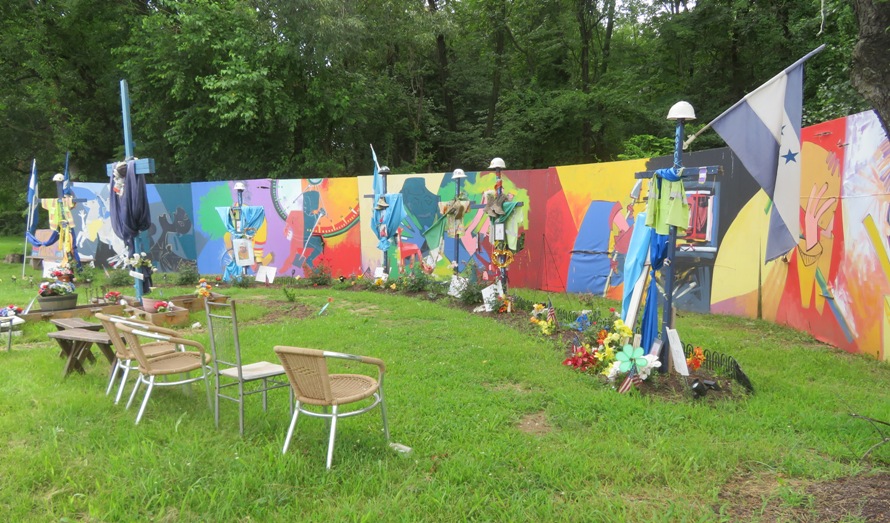
After loading up, we took a drive out to Fort Armistead. Along the way, we saw this mural, built by Roberto Marquez, to honor the six workers who perished in the 2024 Francis Scott Key Bridge disaster. For more information, see The Baltimore Sun - Mural artist shapes pain and grief into shrine to Baltimore bridge workers I hadn't been to Fort Armistead since the bridge fell. Seeing the void of where the bridge once stood was seemed surreal. Walking on the east side, I saw more blackberries than I could shake a stick at. Perhaps I'll return for a foraging adventure. On the way home, it poured. |
|
I joined the WatersEdge Kayak Club for three days of kayaking at Tangier Island on July 18-20, 2025.
|
|
I rarely go paddleboarding without Daphne but I decided to do so this afternoon because she went for a hike with me that morning.
I launched from Solleys Cove Park, paddling north on Curtis Creek. I've been paddling this area more than anyone else I know. Over the years, I've seen a lot of changes...and not just those related to infrastructure. Birds are plentiful in this area, and one bird in particular has really increased in numbers...the black-crowned night heron. It used to be that I never saw them. Now I see several, especially near the shipwrecks. 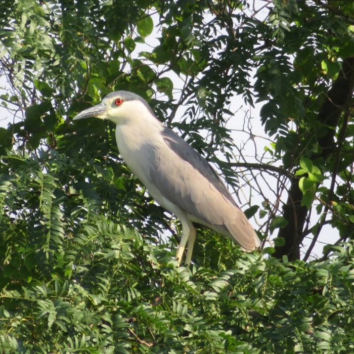
Other birds are quite plentiful too, such as great egrets. Here is one in need of some preening. 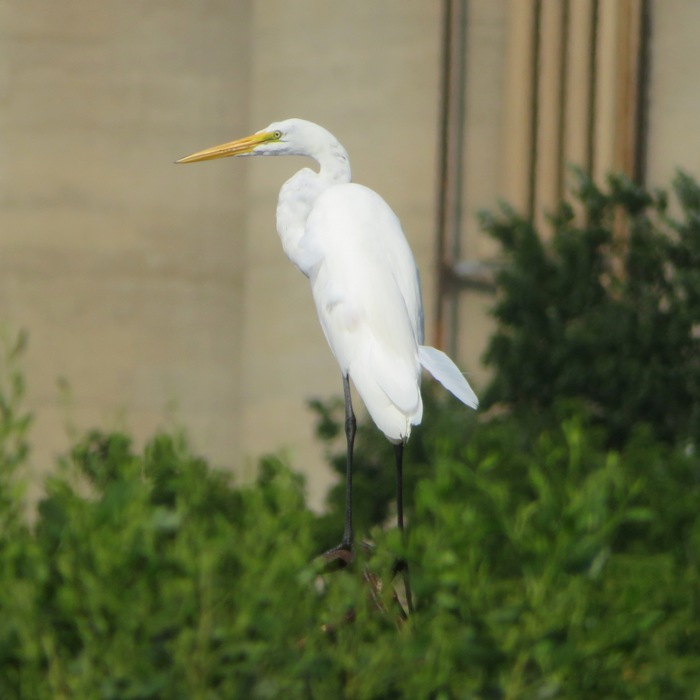
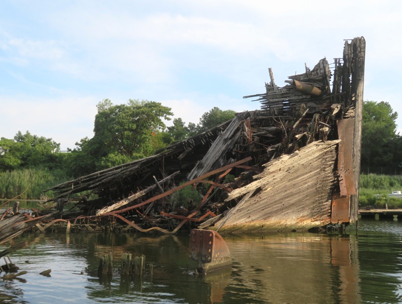
I paddled north into Curtis Bay where I saw the shipwrecks. Here I am near the rudder of one wreck. All the foliage to the right of me is from the ship decaying into an island. Such places attract a lot of waterbirds. 
The decaying boats provide a home to lots of vegetation such as this wild persimmon tree. 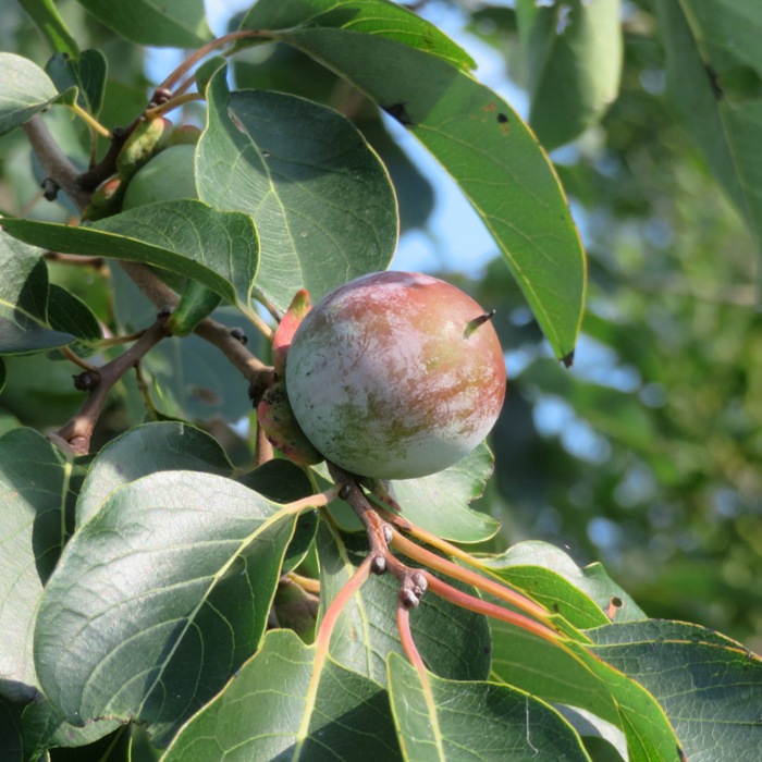
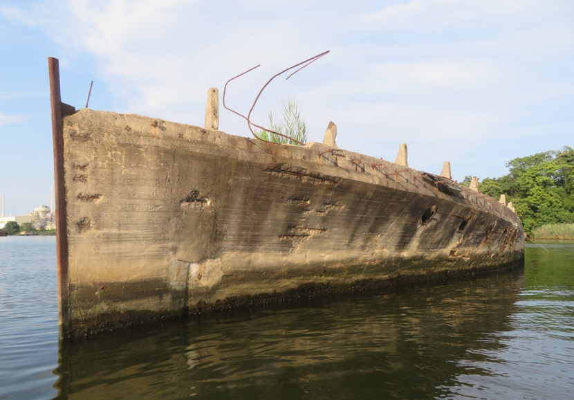
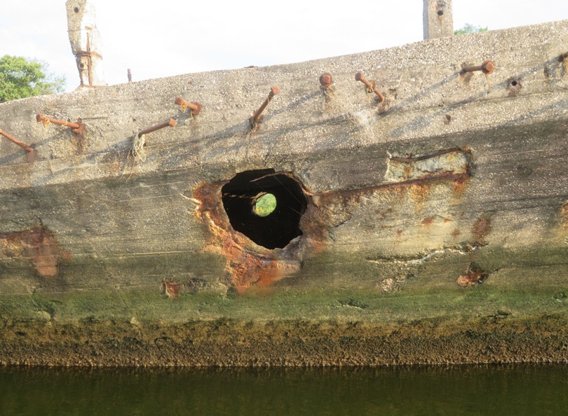
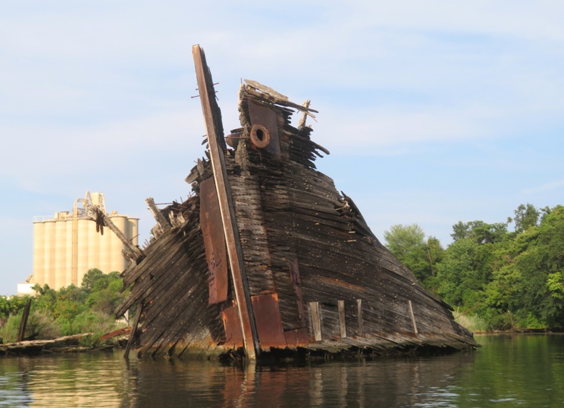
Some of these ships date back to WWI. One is a concrete boat, dating from 1918. Some of these ships stick high out of the water so it isn't necessary to time your visit with the tide. I paddled north past Sledds Point and then east towards Leading Point to another set of shipwrecks. 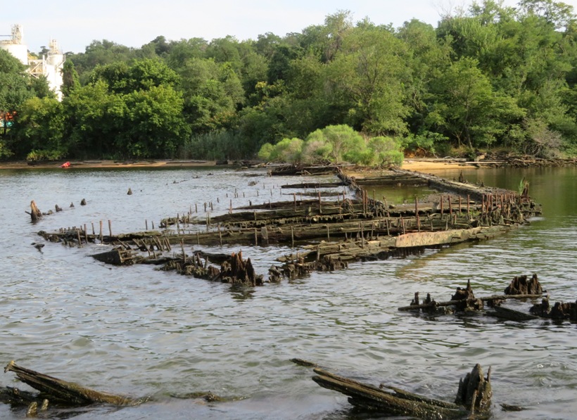
Here's the aft end of a wreck with its propeller still attached. 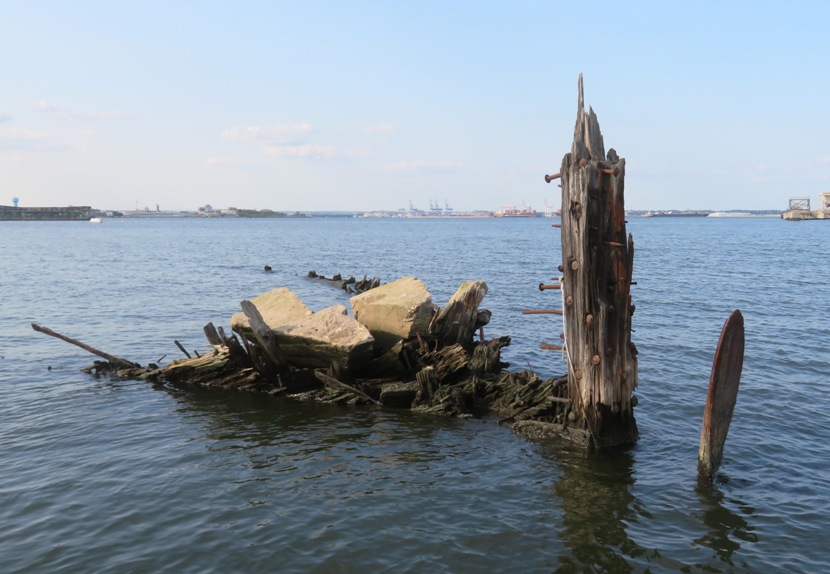
I had a view of where the Francis Scott Key Bridge once stood. In the below pic, one side of the remainder of this bridge can be seen on the far right. 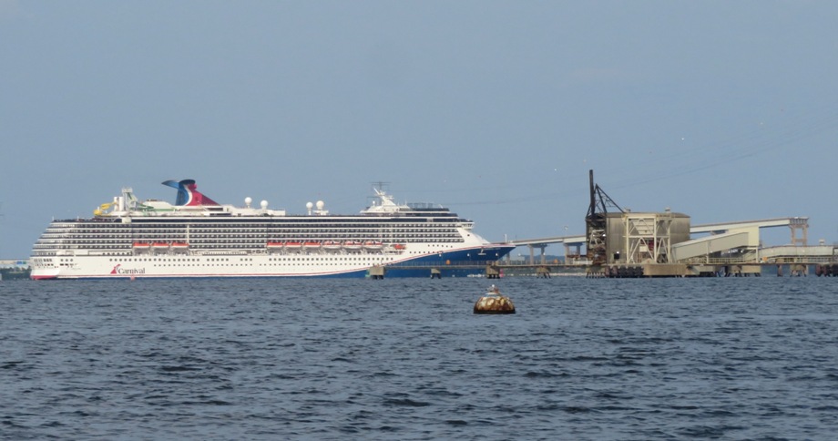
Making my way back, I explored one area just south of Highway 695. Here, I found a steel barge that ran aground. Just north of Stahl Point, I spotted a great blue heron, shipwreck, and swinging train bridge. 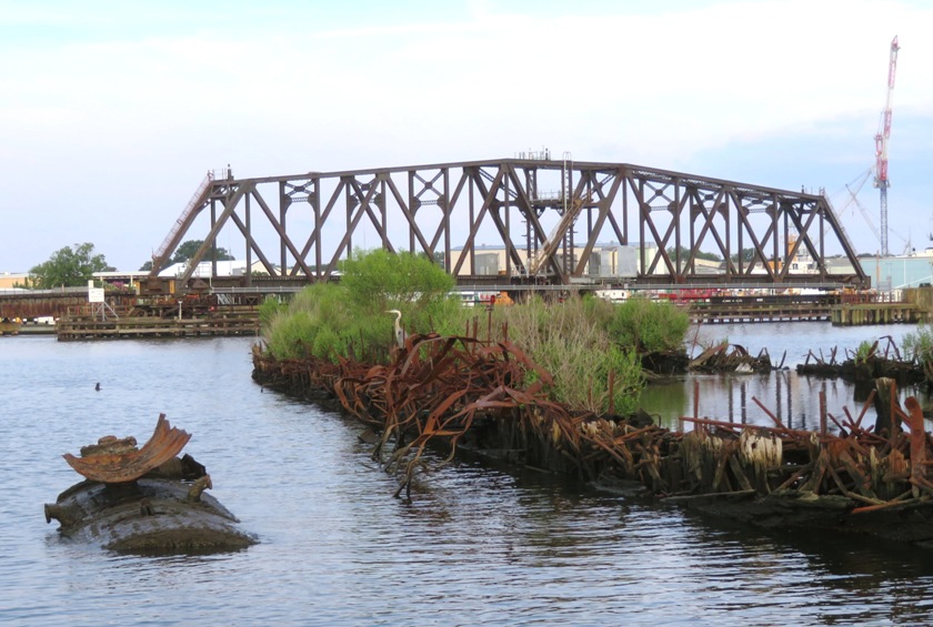
Across from the Coast Guard Yard, I saw these ships. Some are supposedly being decommissioned and sold. 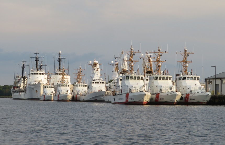
My last big find of the day was this juvenile little blue heron which I spotted near sunset. 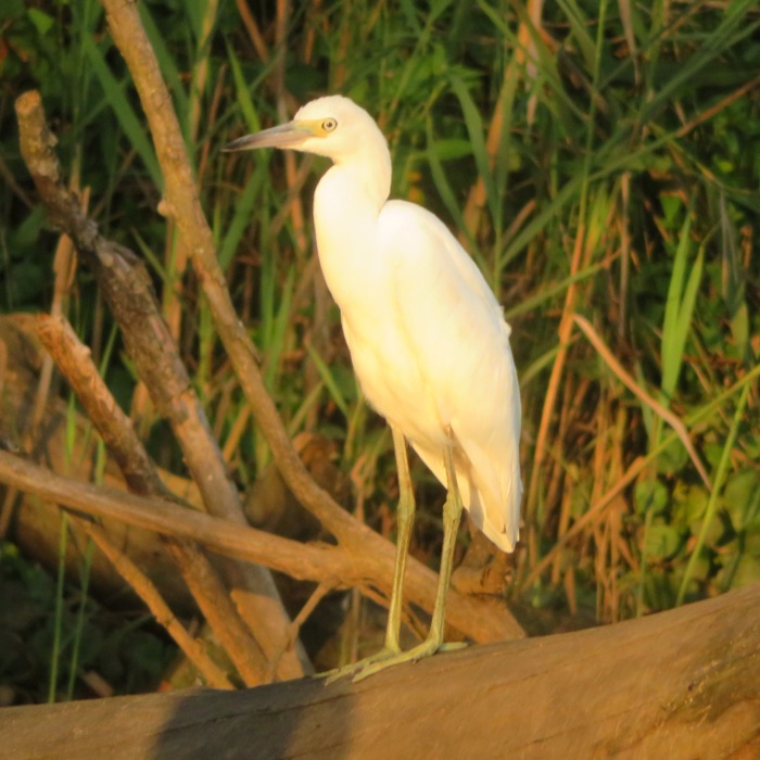
I arrived back at Solleys Cove along with a lot of other people who were enjoying the water. The power boats used the ramp while kayaks and SUPs used the beach. But jet skis were also using the beach. Some of them seemed rather careless, getting extremely close to me on my SUP. I think they were unloading their gear (sometimes fishing equipment) before going to the ramp. Here's a map of my route. 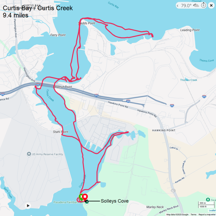
|
|
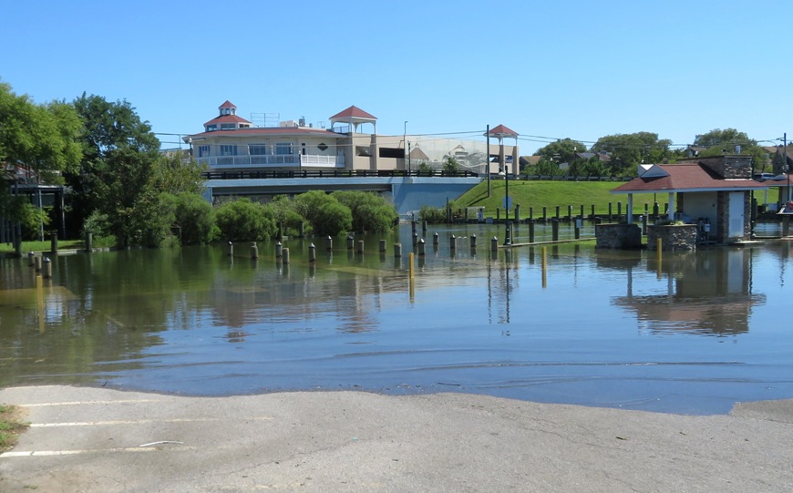
After reviewing some old blogs from 2016, I was reminded how much I enjoyed exploring Fishing Creek. It is a beautiful place but also one that can get rather shallow. So when I read that there was a coastal flood advisory today, I figured it was a good time to visit again. I also timed my trip with the high tide. Upon arriving at Lynwood T. Kellam Memorial Recreation Park / Rod N' Reel Marina West, I noticed that the water completely covered the boat ramp and part of the parking lot.
As I launched, I saw an interesting bird just across from the ramp. I approached and then it flew to another spot. I very carefully kept a safe distance and then crept closer very slowly so as not to scare it. It was very cooperative in posing as it snapped its photo. Once I got home, I determined it was a juvenile yellow-crowned night heron, something I very rarely see. What a great way to start my trip! 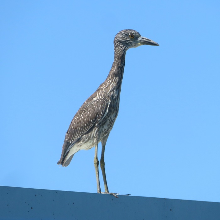
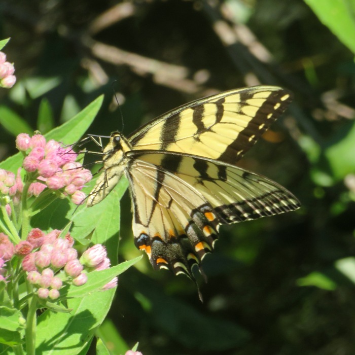
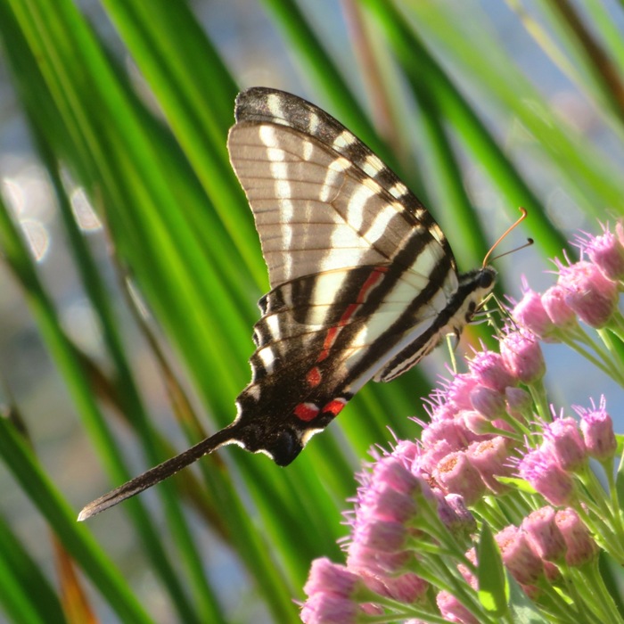
The rising tide combined with the flood waters sent me upstream very quickly, reaching a maximum speed of 5.6 mph without too much effort. It seemed that in no time, I was exploring the most upstream sections of the creek. Daphne was not with me. That meant I could use a technique I developed to portage over low logs. I stood at the back of the SUP as if to do a pivot turn. This lifted the nose of my SUP. Then I paddled towards the log. Depending on the height of the log, my SUP would make it about halfway across. Next, I crawled to the log, stood on it, and pulled the SUP across. Turning my SUP parallel to the log, I stood back on it and continued paddling. This worked amazingly well. I used this "low log SUP portage" at least three times. I spent a significant amount of time exploring just about every nook and cranny in the most upstream paddleable section of the creek. There were plenty of pristine, natural waterways to explore. While I quickly got upstream, I was now taking my time going downstream, visiting every side tributary I could find. In some, I found lots of butterflies. The weather was as perfect as it could be. I attribute this to Hurricane Erin. The worst of it really didn't affect us much in my area, but as it passed, it pulled all humidity with it, leaving clear skies and mild temperatures. 
I saw several green herons. Normally, they fly away once I get close but I found one that did not. This bird spent a tremendous amount of time preening. It took a very long time and a lot of shots to get just a few where it made eye contact with me. I saw someone with a really serious camera on the boardwalk taking a shot of a cormorant posing spread eagle. She had the better camera but on my SUP, I was able to get into a more ideal position for taking the pic. 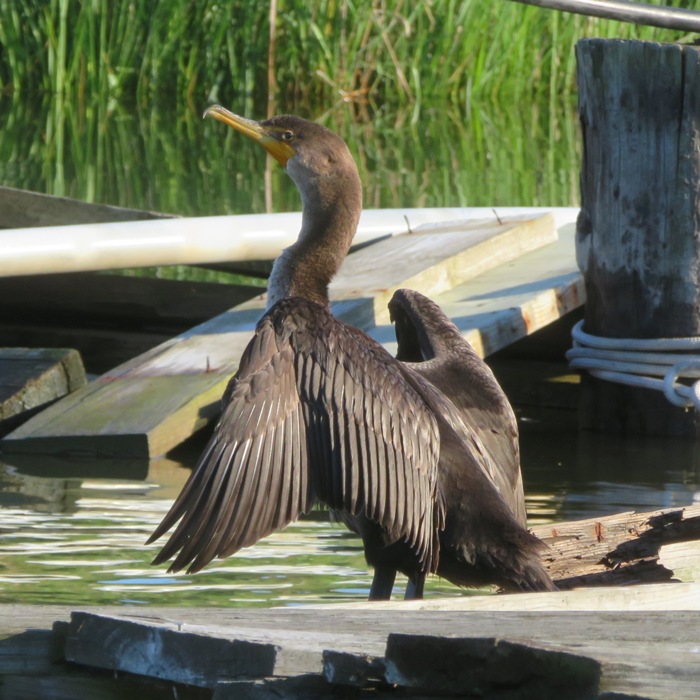
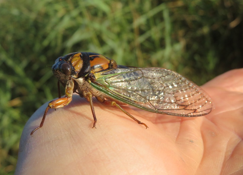
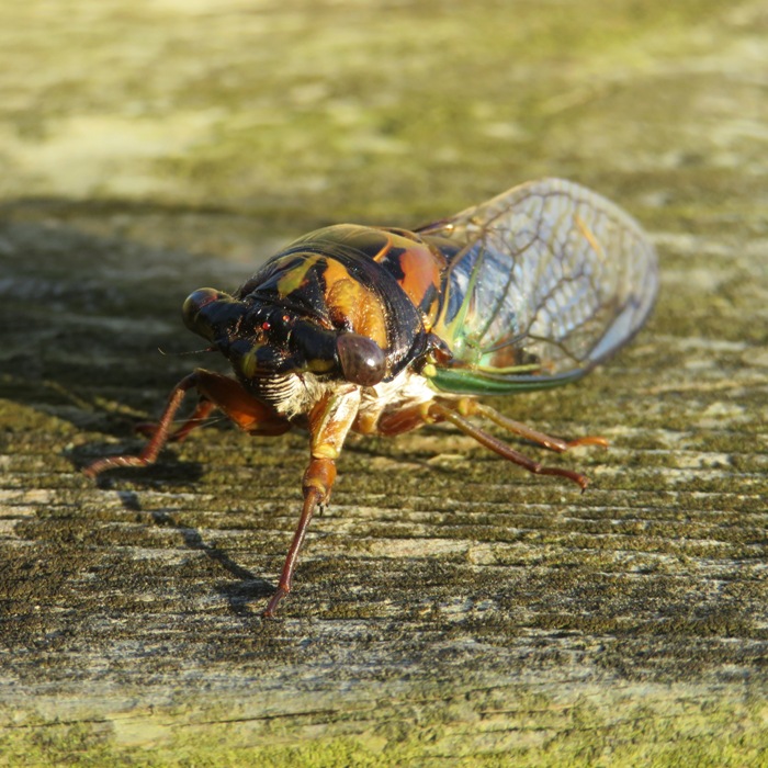
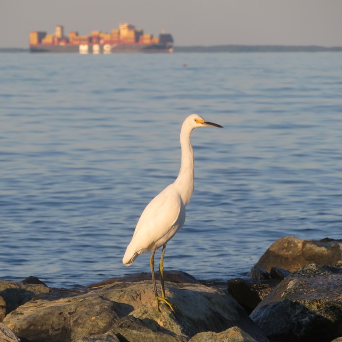
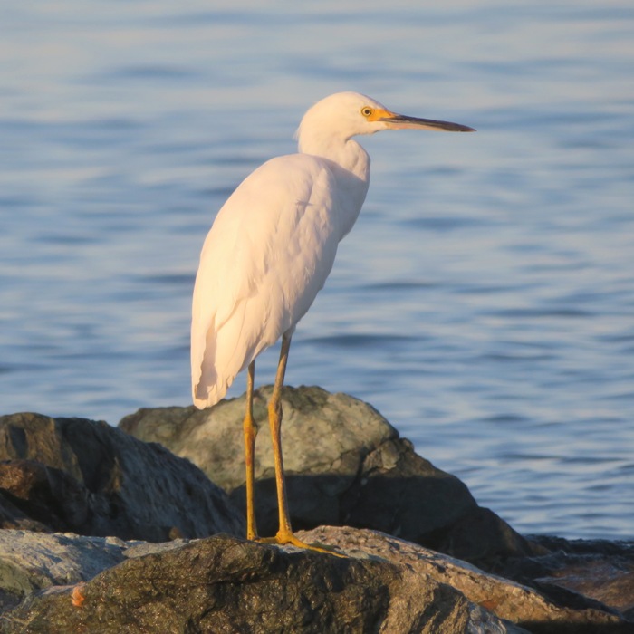
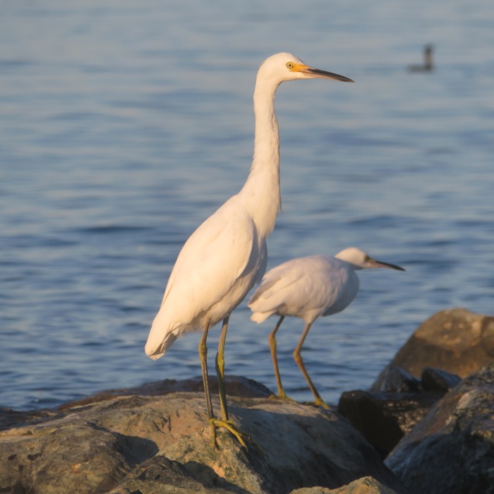
In Lake Moffat, I rescued a dog-day cicada that was stuck upside down on the water. I put it on my SUP to dry out but it kept walking back into the water. I had to rescue it a few more times before I got it to solid, dry land. I could have ended my trip once I got back to the ramp but instead, I chose to venture briefly out into the Chesapeake Bay. The weather and lighting was so nice, I wasn't wanting to leave. There was quite a bit of boat traffic. I had to be particularly careful paddling under Bayside Road. Off in the distance, I could see a cargo ship bearing the words "MSC Ivory Coast." 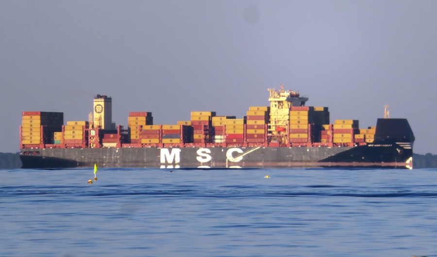
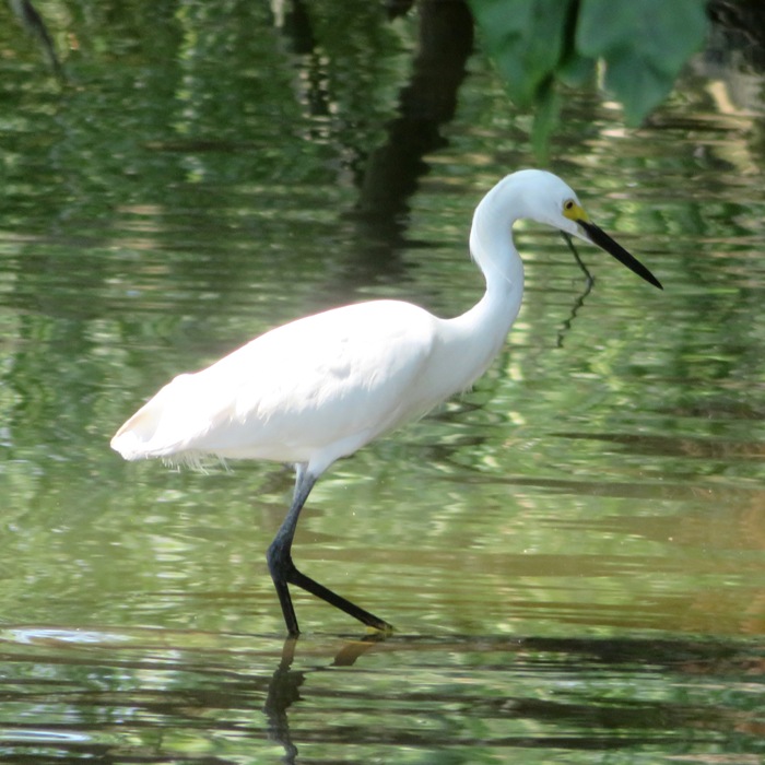
This ship set a nice backdrop for some bird photos. There were several perched on the rip rap near the entrance to Fishing Creek. Here's some more snowy egret pics because you can never have too many. Here's my route. I got in 12.5 miles. 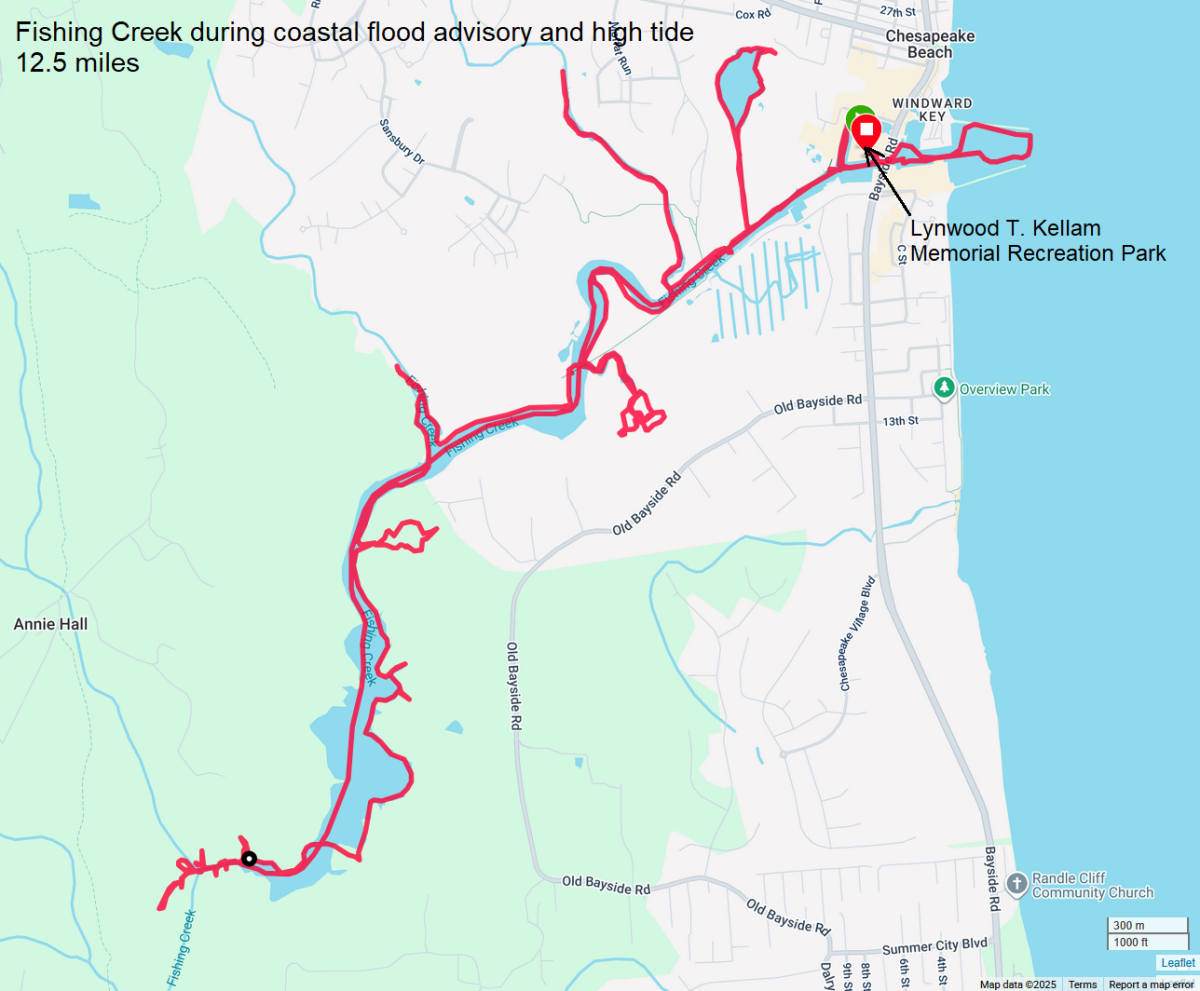
|
|
A lot of kayakers on the western shore of Maryland avoid the eastern shore on a holiday weekend. I, however, tend to believe a day trip on the middle of a three day weekend can work well. Here's my reasoning. On the first day, everyone and their dog is trying to get to the eastern shore. On the third day, those same people are returning. But on the middle day, not so much. So that's when I decided to go.
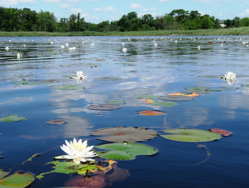
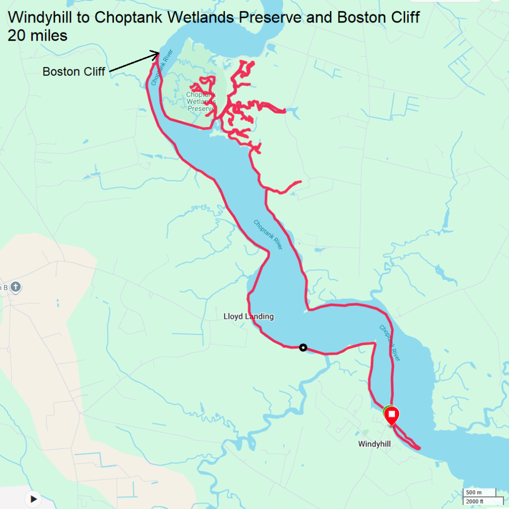
I drove out to Windy Hill Landing and launched on the Choptank River around 0830. NOAA forecast a maximum of six mph winds today for this area. The Choptank in around here is pretty boring, in my opinion. It is very wide and not very scenic. But the tributaries are a different story. I've explored some of them on previous trips but not the ones in or near the Choptank Wetlands Preserve, established in 1978. I paddled upstream when the wind was lowest, riding the flood tide. I timed it so I could explore the shallow areas when the tide was highest. I saw several bald eagles and a nest. There are two main marshes in the Choptank Wetlands Preserve, Kings Creek Marsh and Hog Island Marsh. Hog Island covers 406 acres in Caroline County. It is a stop-over for many species of water birds during migration seasons. In winter northern harrier, wood duck and snipe make their home here, while in spring for red-winged blackbirds, osprey, least bittern, and red-tailed hawks are in abundance. Summer boasts a great variety of flowers, too. - from The Nature Conservancy - Choptank Wetlands, Talbot and Caroline Counties I mention both Kings Creek and the Choptank Wetlands Preserve in Kings Creek - A Water Trail Fit for Royalty, an article I wrote for the Chesapeake Conservancy, back in 2022. Choptank Wetlands has extraordinary ecological value for wintering and nesting waterfowl, spawning fish, sediment control, and nutrient production. The Smithsonian Institution survey ranked this marsh system as one of the most important Chesapeake Bay natural areas. - from The Nature Conservancy - Choptank Wetlands, Talbot and Caroline Counties I was hoping to see some interesting wildlife. I might have caught a split-second view of a least bittern but I can't be certain. Otherwise, I mainly just saw the usual great blue herons and osprey. No egrets, muskrats, snakes, or beavers. I'm not surprised with the latter since there were very few trees. Almost all the vegetation was bay grasses. But I did see a few thousand Virginia saltmarsh mallow flowers and a few swamp hibiscus flowers. All the bay grasses got pretty monotonous. There was one section, however, that had some beautiful trees. The waterway ended at a dirt road where I landed. I ventured up on the road and looked across it. There was more wooded waterway on the other side. Unfortunately, portaging across was not feasible and I didn't know if the road was private or public. I'm guessing the former. Paddling in the marsh was slow because it was shallow. I was frequently hitting mud on the bottom. I was hoping to find a path to the Choptank without having to retrace my steps. I think if I had been more persistent, I would have found it but I was getting a little bored and still had a long way to go. So I returned to near where I entered the marsh. I saw lots of monarchs butterflies flying over open water as if they had someplace important to be. Maybe they were migrating. I made my way to Boston Cliff. This place is known for harboring fossils. The nearby cliffs contain abundant fossils of the circa 10 to 12 million-year-old Miocene Epoch. Mapable geological units are called formations. Each formation has a designated type locality so geologists can visit, study, and compare them. The...Choptank Formation is located here. Geologists and paleontologists from around the world have come here to study this type locality. - from Boston Cliff 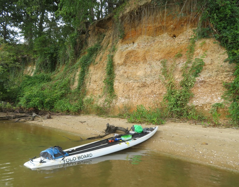
This was at least the third time I'd been here. It is not a good place to find shark teeth but I did find one from a requiem shark. The main species of requiem shark found in the Chesapeake Bay is the sandbar shark. 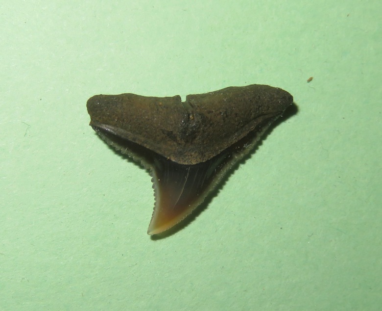
I don't know if this place has a lot of shark teeth. Maybe they are plentiful but just difficult to spot. For me, I tend to look for dark triangles. In Calvert County, that isn't too difficult but here, the beach is littered with broken shells, many forming dark triangles. My eyes just aren't trained to pick out shark teeth from this. 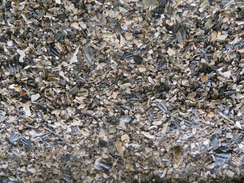
I also found a barnacle attached to a shell. I believe it is a fossil, partly because of the location I found it but also because modern barnacles in this area do not get so large. This one has a base that is 1.3 inches across. In contrast, modern ones don't get larger than an inch. Barnacles vary in size from less than half an inch to one inch in diameter. - from Chesapeake Bay Program - Barnacles 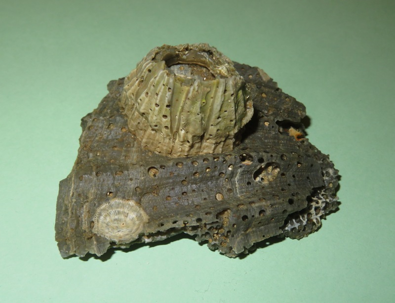
I found some info about barnacle fossils from the Miocene Epoch found just across the Chesapeake Bay. They are likely of the genus Chesaconcavus. Barnacles are most unlikely crustacean arthropods, cousins of shrimp, crabs and lobsters. Most, like these above, cement themselves head-downwards on a hard substrate like a rock or shell (or boat hull), build a carapace around themselves of calcitic plates, and then filter-feed by kicking their filamentous legs in the water above to catch suspended food. They are entirely marine and usually live in shallow water. - from Wooster's Fossils of the Week: Large Miocene barnacles with bioimmurations from Maryland I also found a piece of fossilized ray dental palate. 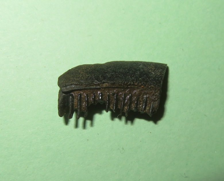
I mentioned that the morning's forecast called for a maxium wind speed of six mph. Boy, were they wrong! The maximum wind speed recorded in Preston, MD today, August 31, 2025, was around 15 mph. This was observed around 3:54 pm, though the overall forecast for the day indicated lower wind speeds, typically between five to ten mph. Fortunately, most of the high winds were to my back. I saw no other paddlers all day. Here's my route. I got in 20 miles. I haven't paddled that far for awhile. As I expected, the drive home wasn't bad. This helps confirm my theory about the middle day of a three day weekend being a good time to visit the eastern shore. Now to test this during summer vacation. |
|
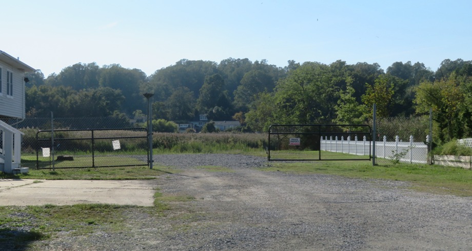
I took the day off from work to go kayaking, launching from Breezy Point Marina. Upon arriving, the front gate was locked and a sign said they didn't open until 0900 but the new owner, Frederick, told me I could enter through the west side gate to use the ramp if the front gate was locked.
I hadn't been there for awhile. I noticed that their restroom now has a sign that says "not for public use." Maybe there is a restroom that the public can use at their store. It used to cost $15 to use the ramp but now it is $10. Frederick said he aims to make the marina more kayak-friendly. This includes having some kayak storage. We had some rain recently. It wasn't much but I noticed that the high tide mark had been unusually high in that there were jellyfish at the parking lot level. It was now near low tide but it didn't seem all that low. It was a sunny, warm day with little wind. I could have brought the SUP but the afternoon wind was supposed to change direction come from the east. Even light wind over such open water could be challenging over a long distance so instead, I brought my Prijon Catalina. I paddled south in the Chesapeake Bay, making numerous stops to look for shark teeth. Near Plum Point, I found a decent number. I wasn't spending a lot of time at any one place. Part of my goal for the day was to scout different locations that I had not been to for a long time. I figured today would be a great day to find teeth because it was before the weekend, it was early in the day, and the recent high water level might have uncovered things. As usual, I made an effort to stop at places that were not so easily accessible from land but also near cliffs, which tend to harbor a lot of fossils. 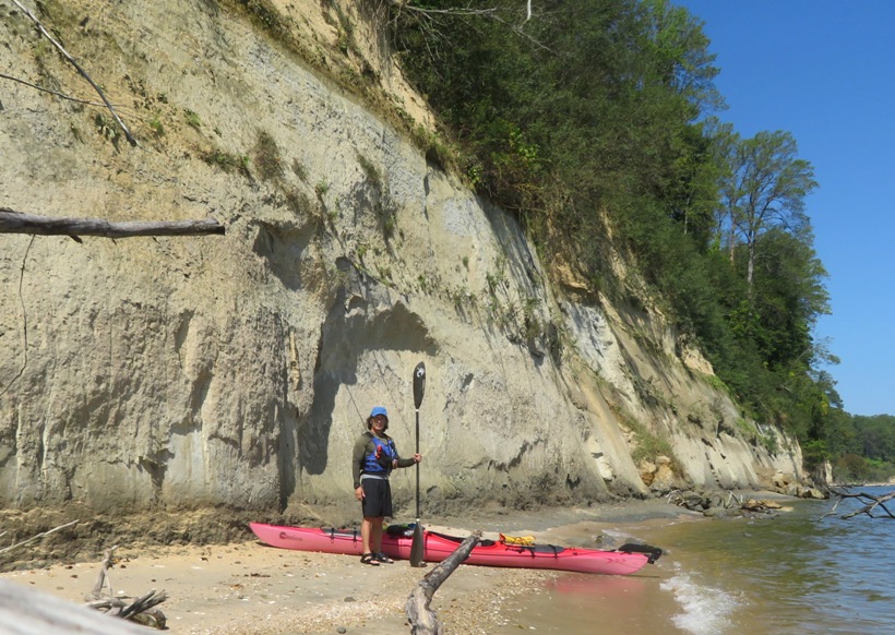
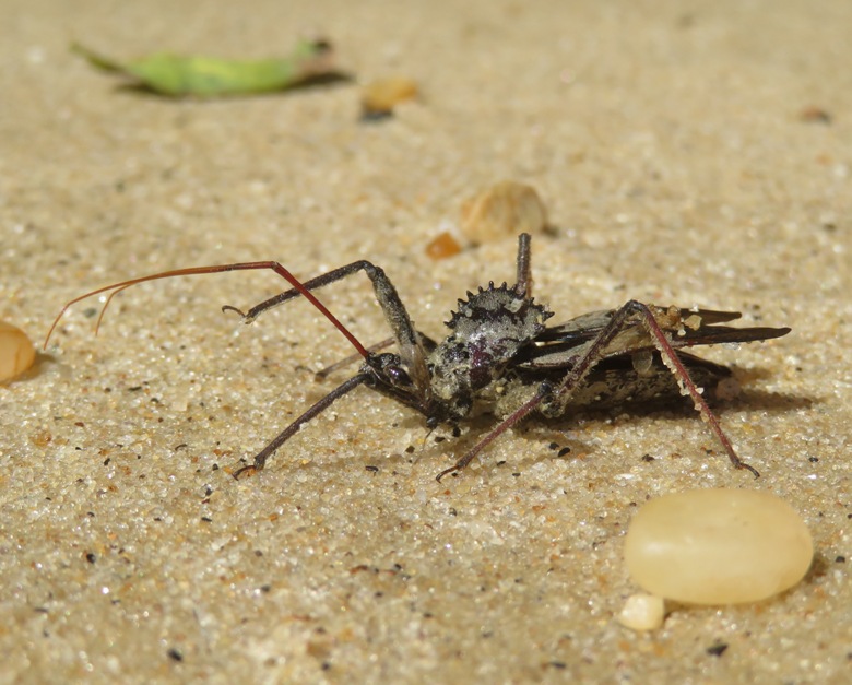
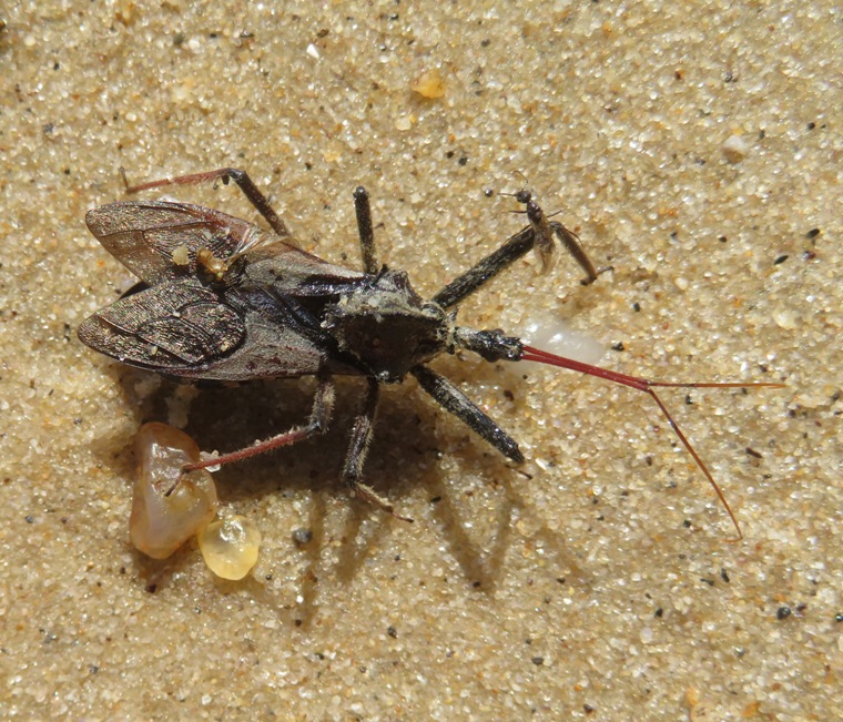
I soon found out that I was being overly optimistic. Almost every time I pulled into a place where I didn't think people would be, they were there. And even though it was early in the day, there were plenty of others who also took the day off from work to look for teeth. I even found another fellow out in his kayak with a sifter...clearly doing what I was up to. Overall, I didn't find a lot of teeth but I found enough. Perhaps the biggest thing when it comes to looking for shark teeth is to be the early bird. I used to think getting to the remote sites was enough but it seems no site is really remote...folks will find a way to get there. At one of my stops, I found a very large insect. I didn't realize what it was until I got home and could see its distinctive profile. It is a wheel bug...one of my favorite insects. I saw a couple of monarch butterflies but wasn't able to get a good shot of them. How far south did I go? My goal was to paddle up Parkers Creek, which I had not been to for awhile. This is a place I got to know well when I wrote Parkers Creek - the Chesapeake Bay in Miniature. Exploring shallow creeks and looking for shark teeth are mutually exclusive events because one requires high tide while the other needs low. But I had all day and was in no rush. So I started my trip shortly after low tide and now it was near high tide. Not surprisingly, as the tide rose, I found fewer teeth. Now I was riding the tide up Parkers Creek. The creek meanders nicely, making one wonder what's around the next turn. It is mostly grasslands with trees in the background. Further upstream, things become more wooded and scenic. 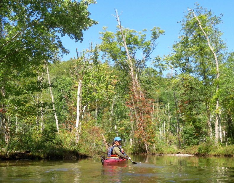
During the day, I saw several osprey, bald eagles, and great blue herons. I also saw a green heron and a couple of belted kingfishers. The only non-avian wildlife I saw outside the water were turtles. 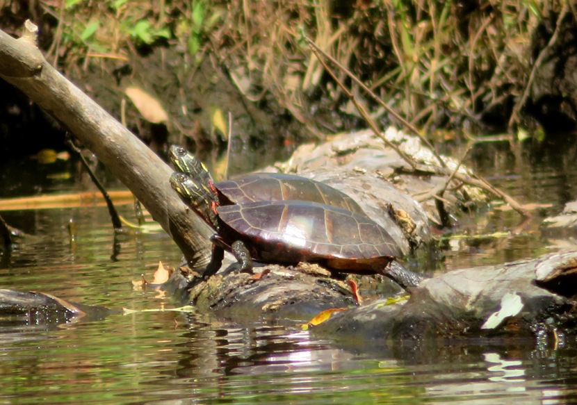
It seems every time I've visited this place, there is a wild persimmon tree bearing lots of fruit just upstream of the wooden raft that hikers use to get across the creek. Today was no different. I was looking for paw paw fruit and found none. But throughout the day, I saw perhaps a hundred persimmons. 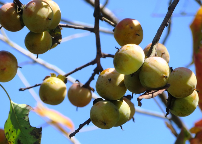
I wasn't able to get as far upstream as I have in the past. An unmaintained beaver dam was easy to paddle over but one slightly upstream of that was a significant work of engineering. I could hear water rushing over it as I approached. I considered portaging but decided that was more work than I was willing to do today. A lot of vegetation was growing on this dam, making it seem more like an isthmus than a dam. Back in the Chesapeake Bay, I paddled north. While I had tidal help in Parkers Creek, the opposite was true in the bay, though it was hardly noticeable. A ray paddled under my kayak. Jellyfish were everywhere. A few times, one would get caught on my paddle. Making my way south in the morning, my right shoulder was hurting a bit because I was using a more aggressive surf ski stroke. But returning north, I didn't reach as much during the catch phase. This slowed me down a bit but it was also easier on my shoulder. That is the main reason I got rid of my S1-A. Near the marina, I explored Plum Point Creek. Frederick said there had been otter sightings so I decided to check for myself. I did not find them but it also wasn't a good time of day to be checking. I ventured out into the bay once more and paddled north for a short distance just to get in additional mileage. By the time I was finished, I paddled 20.3 miles. 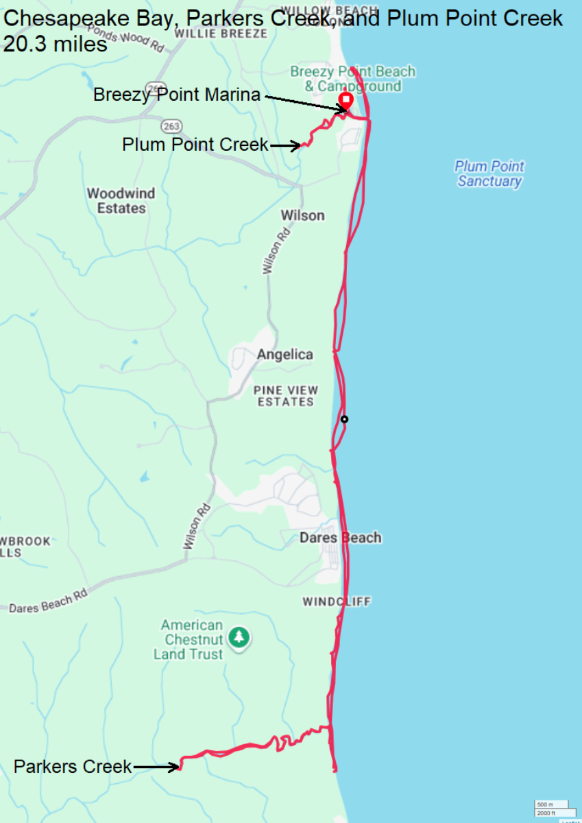
So what did I find? I found 22 shark teeth. Some had some nice serrations. 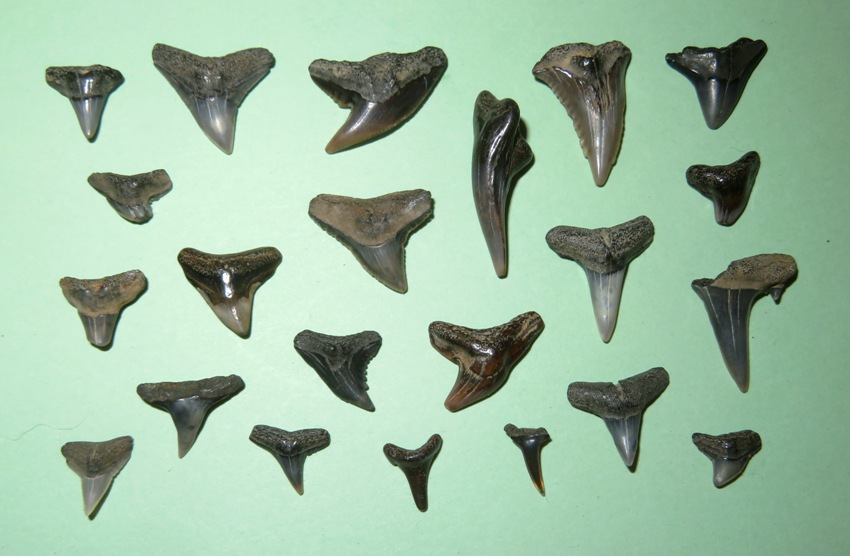
I also found 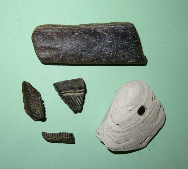
|
|
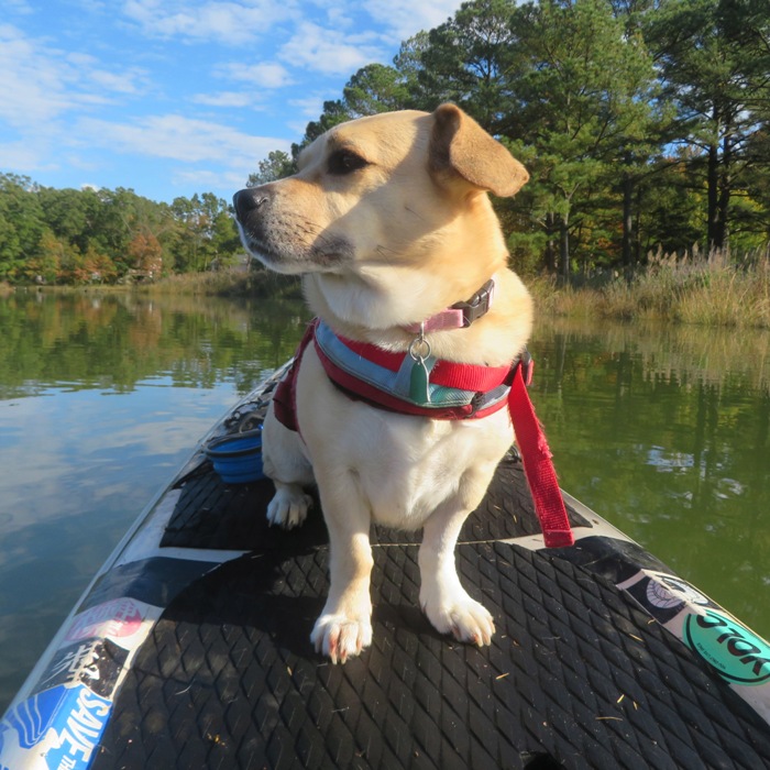
I left work early to take Daphne paddleboarding on the West River. It had been awhile since she's been on the water while she underwent some veterinary examinations, but the last vet gave her the thumbs up for paddleboarding which made me very happy.
We launched from Galesville at 1600. It was warm with a mix of sun and clouds. The first thing I noticed were hundreds of dead or dying spotted lanternflies on the water. I asked Google AI about this. Given the large and expanding spotted lanternfly population in Maryland, it is not surprising to see dead adults near the Chesapeake Bay. These are likely individuals that have been carried by the wind and drowned or desiccated by saltwater. The die-off of adults is a seasonal occurrence, and their eggs, laid in the fall, will be the source of next year's population. I paddled north, into a weak headwind. Just before I came to the mouth of the Rhode River, I started exploring the tributaries just west of it. These are natural and scenic. I pulled over at a beach to let Daphne run around and sniff. I found two dead crabs. Actually, only one was a real crab. The other is a horseshoe crab. Despite their common name, horseshoe crabs are not really crabs (crustaceans), but are more closely related to spiders and scorpions. - from NOAA - Are horseshoe crabs really crabs? 
I made my way up Cheston Creek where I saw something white on the side of a tree. As I approached, I realized it was a lion's mane mushroom. Lion's mane mushrooms are rich in vitamins such as thiamine, riboflavin, and niacin. They are also a good source of essential minerals such as manganese, zinc, and potassium. Lion's mane mushrooms have a flavor that many describe as similar to seafood. - from WebMD - Health Benefits of Lion's Mane Mushrooms 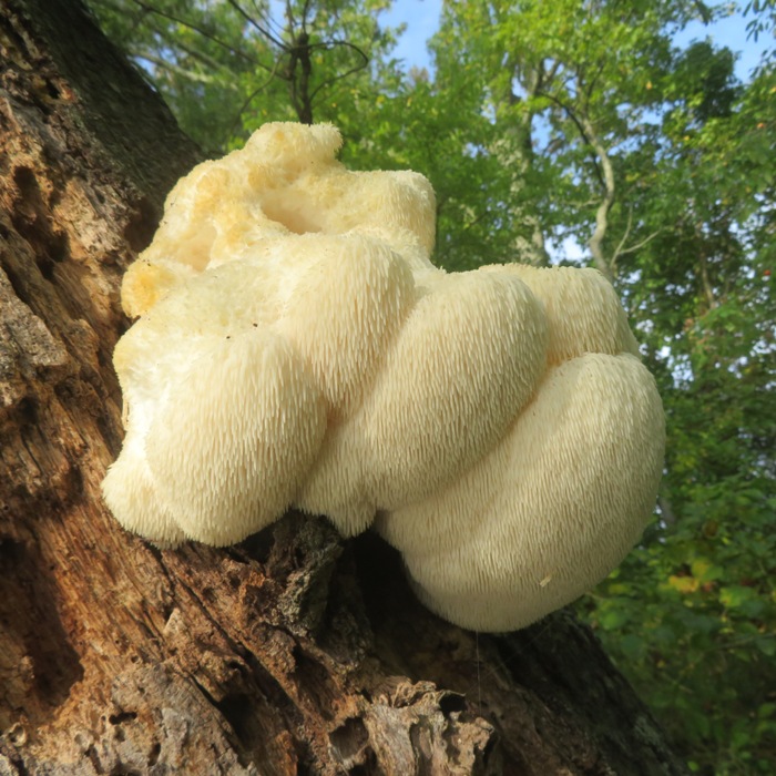
A little further upstream, I came across a green heron that was more cooperative than most in posing for me. After paddling upstream on the creek as far as I could, I pulled over at a beach for a brief rest. 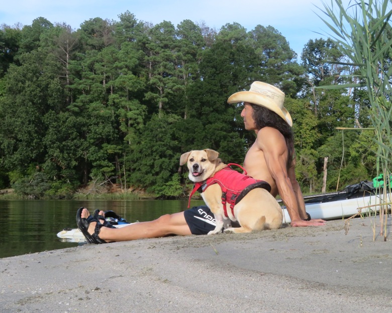
In the waterway just west of Cheston Creek, I found an osage orange tree. 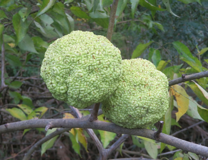
It was a great day to get out. As is always the case at this time of year, I was sad to see it get dark so soon. 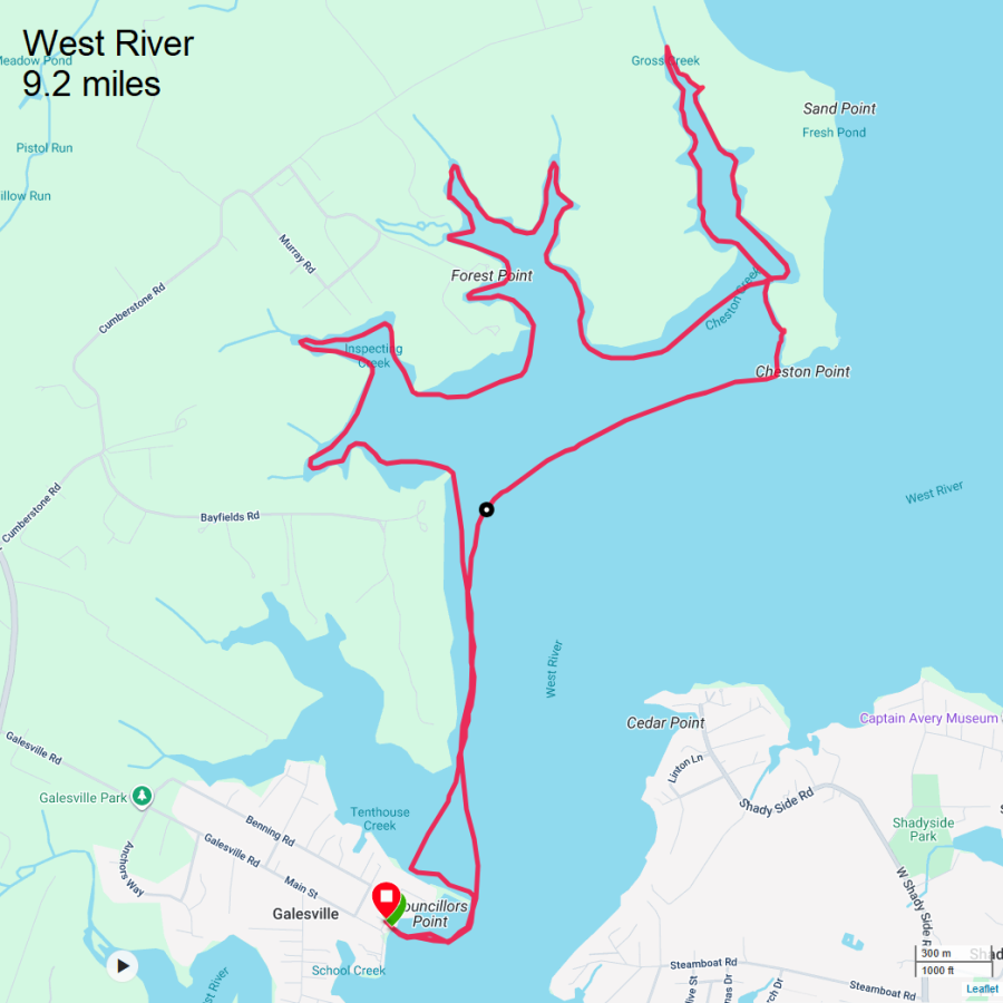
|
|
On October 11, Cousin Steve, Ken, and I paddled on Lake Natoma and got within view of Folsom State Prison.
|
|
Daphne and I launched from Franklin Point State Park. I typically like to paddle here in the summer because there is a really good chance I'll see a snake. I can't believe the year is almost over and I have yet to see a snake in the wild. Unfortunately, the tide never fit my availability during the summer. This is not a good place to be at low tide.
Today was the opposite extreme, in terms of tide. I would be out at high tide during a coastal flood advisory. It was high enough so that the road in was partially flooded and one fellow at the parking lot warned me that the water could get a foot deep on the road. I paddled along the shore. I wanted to explore everything I could in Deep Creek and Deep Cove Creek and see how far I could get upstream. The tide was really working to my advantage. How high was it? Lots of piers were underwater. Here's a photo of where I paddled up a boat ramp onto what would normally have been dry land. The ends of the piers shown here are supposed to be connected to land, not water. 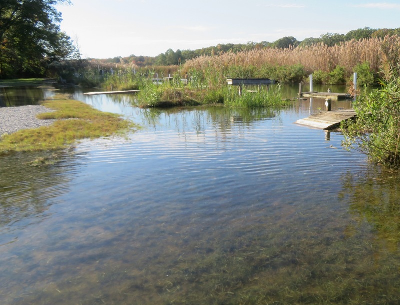
When the sun was out, it was comfortable. When it was not, I was glad to have my wetsuit. For awhile, there was also a 14 mph sustained wind from the southeast. That was not in the forecast. Fortunately, I was fairly sheltered on the creek. Here's some nice views of Daphne when the sun made its appearance. We got really far upstream...maybe further than I've ever gone. Water depth wasn't an issue. What made me turn aroud is that the waterway got too narrow. I paddled back downstream, exploring every nook and cranny that was wider than my SUP is long (14 feet). I saw lots of phragmites. They were introduced to the United States in the 19th century when ships from Eurasia inadvertently carried phragmites seeds in their ballast. Although there is a type of phragmites that is native to the U.S., it is very rare. - from Chesapeake Bay Program - Phragmites 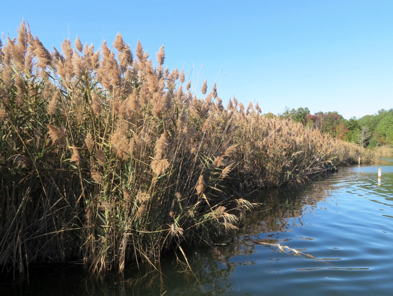
I started heading out towards the Chesapeake Bay but never made it. The wind was too strong and there were lots of whitecaps. I was wanting to pull over at the beach on the south side of the mouth of Deep Creek but it looked to be underwater. I ended up paddling 6.1 miles just by hugging the shoreline of Deep Creek and Deep Cove Creek. Unfortunately, my GPS didn't store the map so I can't show you my route. |
|
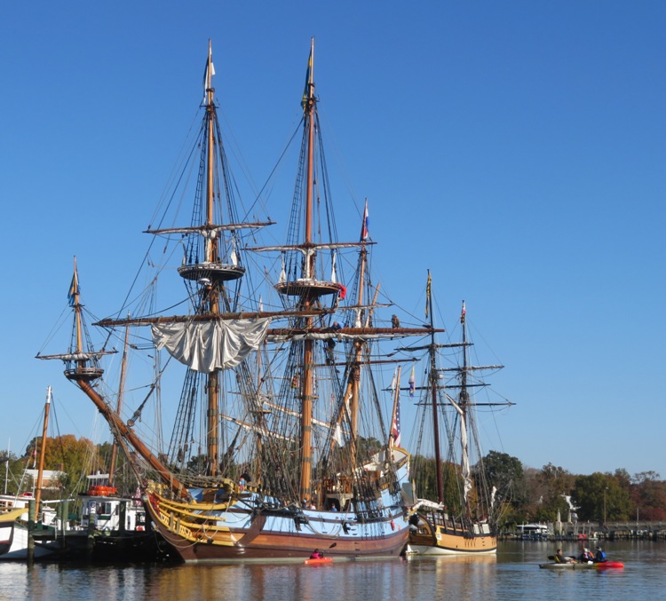
Paddling to see the tall ships at the Sultana Downrigging Festival is typically my last water trip of the year. In that regard, this year was no different. What was different was that Mark, Allison, their daughter, and their dog, April, joined Norma, Daphne, and me to spend a full day in Chestertown.
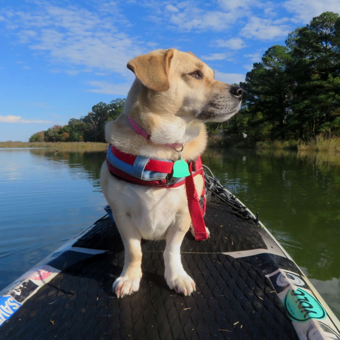
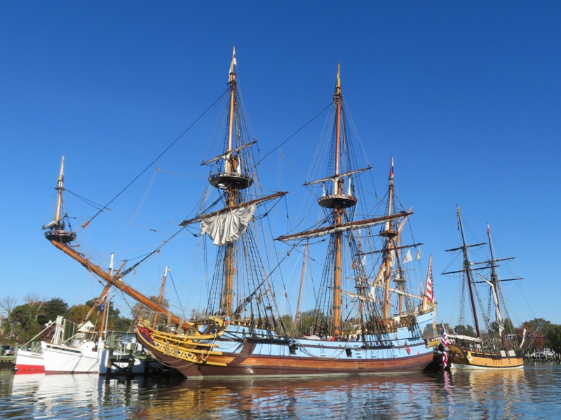
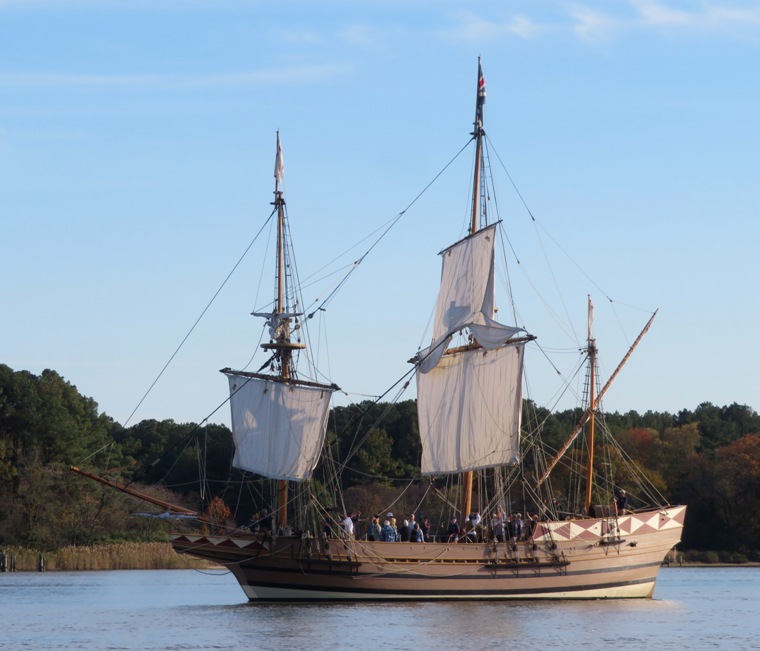
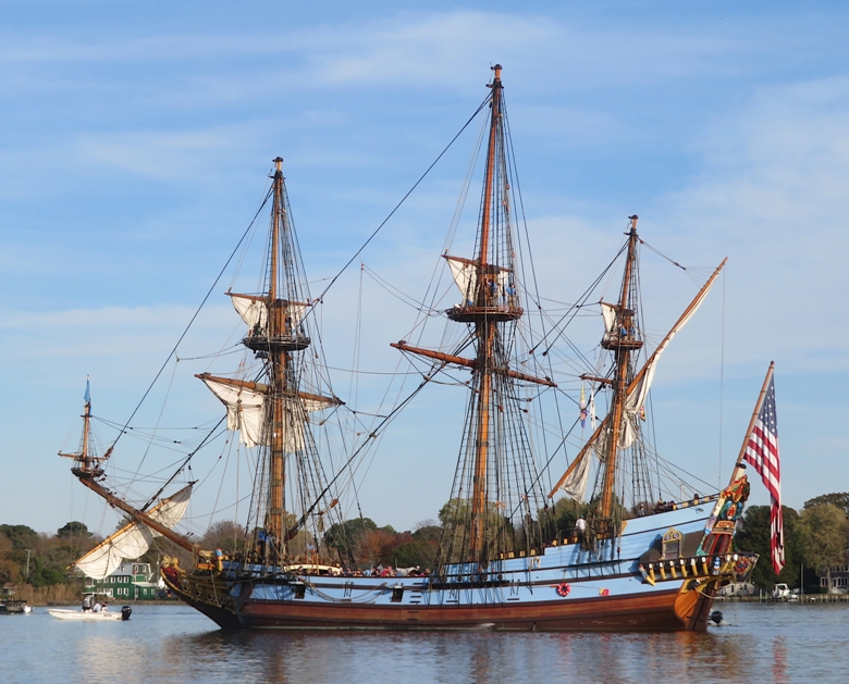
Norma and Allison started the morning with a yoga class while Daphne and I launched at the Truslow/Hodson Boat House. It was a sunny day with very light wind. In contrast, the two days prior had significant wind. I paddled upstream to see the ships along the waterfront. Here's the Kalmar Nyckel and the Sultana. I got a fellow on the pier to take a photo of Daphne and me in front of the Kalmar Nyckel. 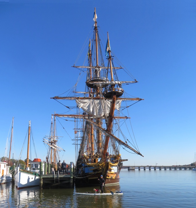
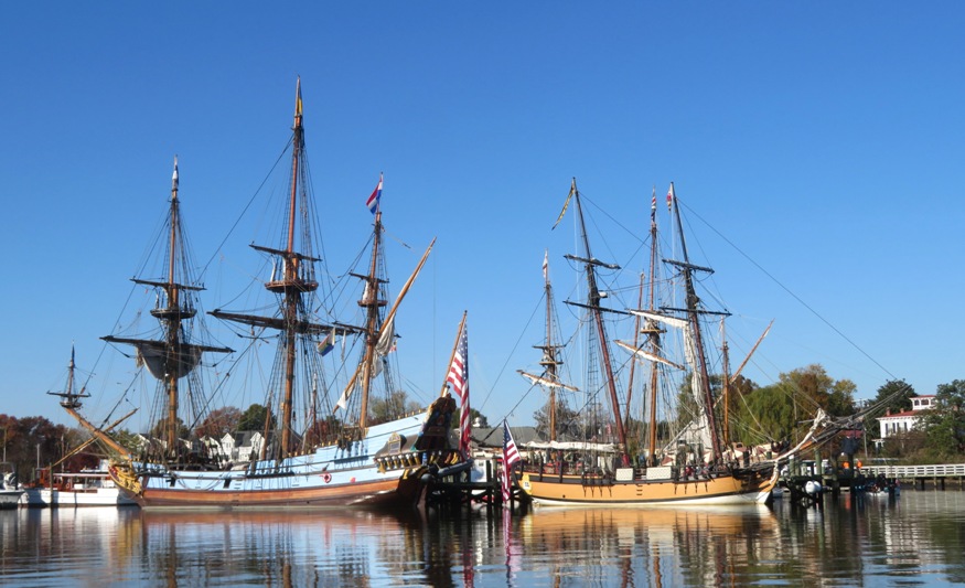
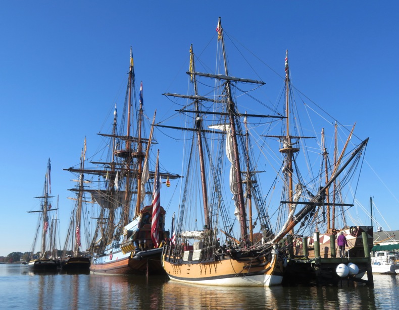
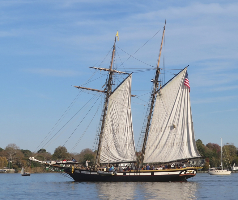
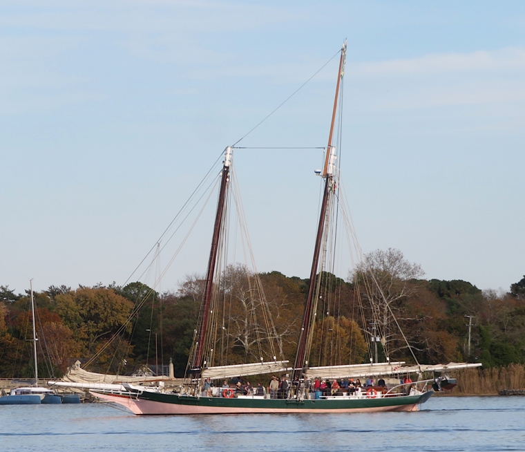
Just downstream of the Kalmar Nyckel and Sultana were the Pride of Baltimore II and the Lynx. 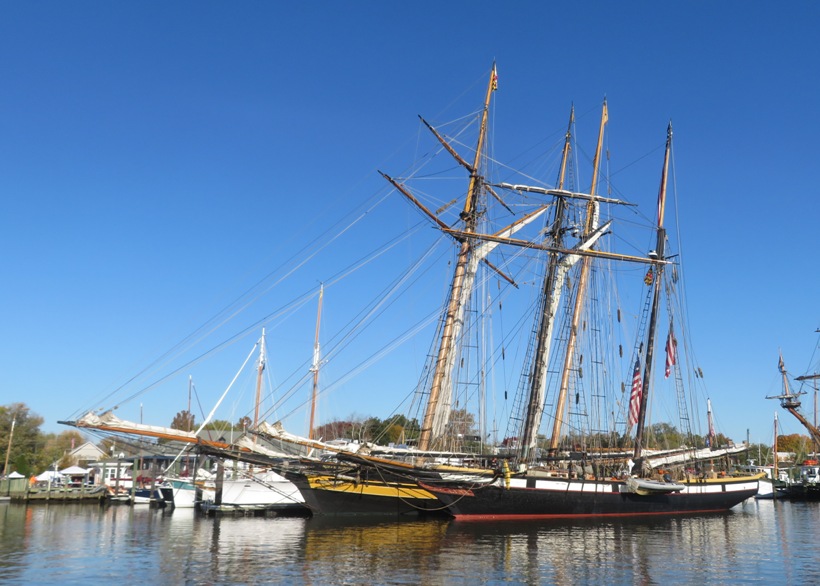
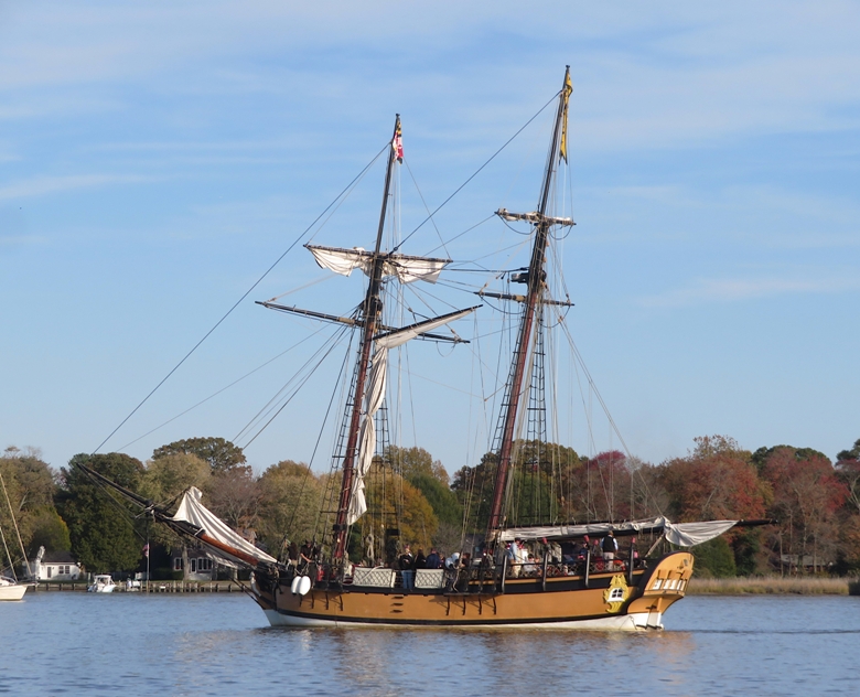
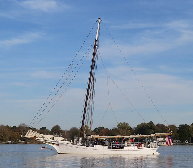
Moored in front of the Pride of Baltimore II and the Lynx were the AJ Meerwald and the Lady Maryland. 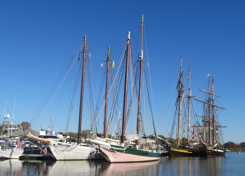
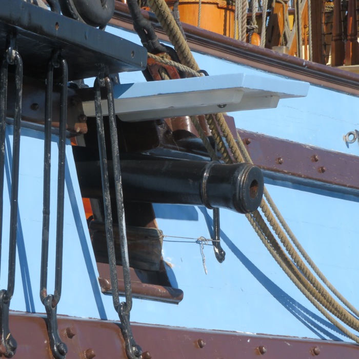
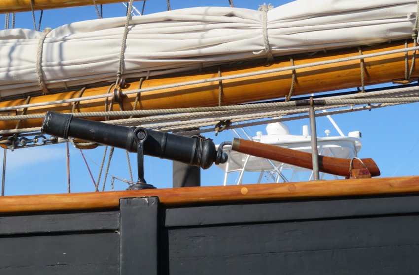
I noticed how many of the ships (in addition to the Sultana) had cannons. Daphne and I saw some cocktail class racing boats. 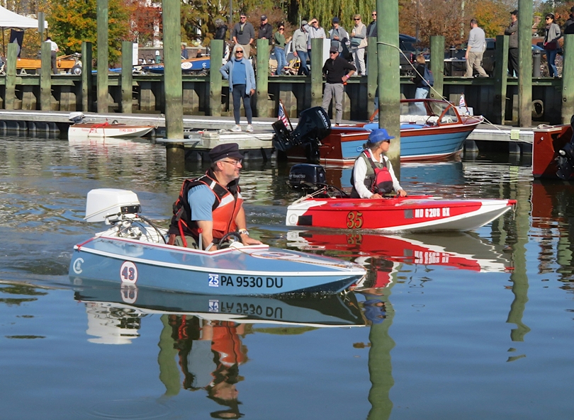
I planned to paddle up Radcliffe Creek but I couldn't even make it to the mouth because the tide was so low. Back on land, we joined the rest of the group to listen to the inaugural public presentation of SULTANA - A Geographic History at Sultana's Holt Center. Mark, Allison, and their daughter did a short cruise on the AJ Meerwald while Norma and I watched over April. Looking at the boats from land, I was curious about the aerodynamic Washington College electric boat. Successful 160-mile World Record completion sets a new bar for electric boat technology and environmentally friendly waterways. The Washington College Electric Boat Team has etched their names into the history books by breaking the world record for the longest distance traveled on a single battery charge by an electric boat without using solar. - from sign at pier 
One of the boats has the same name as my aunt. 
We walked to Wilmer Park to watch the tall ships return. 1 / 8

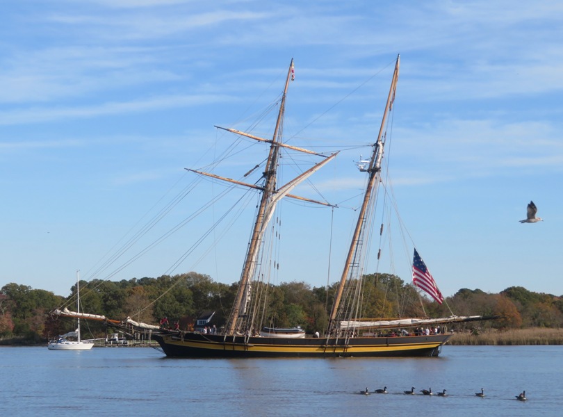
Pride of Baltimore II.
2 / 8
Godspeed.
3 / 8
Lynx.
4 / 8
Sultana.
5 / 8
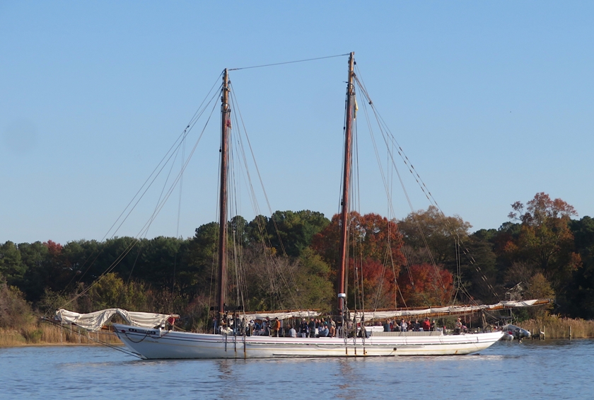
AJ Meerwald.
6 / 8
Kalmar Nyckel.
7 / 8
Lady Maryland.
8 / 8
Sigsbee.
After the AJ Meerwald docked, Mark, Allison, and their daughter joined us. We did a group photo before parting ways. 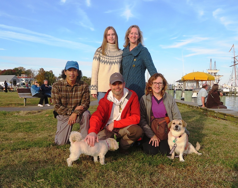
|